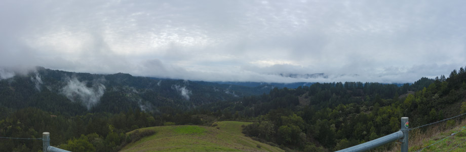
Clouds Over Butano Ridge - 2/2017
Reload page to see different photo.

All web site content except where otherwise noted: ©2026 Bill Bushnell
Background texture courtesy of Iridia's Backgrounds.
Please send comments or questions to the .
Bike Items for Sale - Here's a photo journal of bike parts that I'm trying to clear out of my workshop.
Shipping is $10 or (actual shipping charges + (optional) insurance charges + delivery confirmation fee), whichever is greater. I will try to find cheapest shipping option (e.g. USPS for US Domestic delivery) or will ship according to your carrier of preference.
Some of the parts are new, some are used. If you think my item pricing is off or you're buying multiple items, please make me an offer.
I am selling everything "as is". But, if you buy an item that is dead on arrival, damaged in shipment, or you believe you got a raw deal, please contact me as soon as possible so we can work out a solution. Given the time involved in selling these items I am not making a profit on this and am more interested in seeing components and parts I no longer use but that have remaining useful life to find a home with other bicycle enthusiasts, where they will be used instead of collecting dust in my workshop.
Contact me at the following . It will help if you include the links to photos of the items that interest you. All prices are in US Dollars.
| GPS track: | GPX |
|---|---|
| Bike Ridden: | Power Gold Rush |
| Distance: | 126.6 miles |
| Cumulative climbing: | 11240 feet |
| Total Time: | 8:35:09 |
| Riding Time: | 6:59:07 |
| Avg. Speed (moving): | 18.1 mph |
| Max. Speed: | 29.5 mph |
| Nominal System Voltage: | 48 |
| Battery energy available: | 2800 wh |
| Battery energy consumed: | 2213 wh |
| Net battery energy consumed: | 1291 wh |
| Wh/mi: | 10.2 |
| Battery Amps-Hour Used: | 42.2 |
| Regen Amps-Hour Recovered: | 17.5 |
| Peak Forward Current: | 21.3 Amps |
| Peak Regen Current: | 30.3 Amps |
| Peak Motor Temperature: | 86 C |
| Average Motor Temperature: | 46 C |
Lee Vining to Columbia, October 19, 2023 - From the moment of our rising until our departure from Murphey's Motel was just over two hours. I know from experience that the westbound trip across the Sierra is easier than eastbound because of the net descending along the course. That gave us time to get up, enjoy a leisurely breakfast, and get the bikes out of the hotel room and packed without rushing.
The air was cool when we started, but in the bright sun the air quickly warmed up to comfortable. We started slowly leaving Lee Vining by heading south on US-395, but at the end of town we turned right onto Utility Road and climbed this quiet alternative to CA120 for about 1km before we joined CA120 near the Lee Vining Ranger Station.
I've always enjoyed starting the day with a climb up the east side of Tioga Pass while the air is still cool enough I can continue wearing long sleeves and the traffic light enough not to be too bothersome. Today traffic was a little heavier than I would have liked heading up to the pass, and I wondered if we'd be delayed by a long queue at the eastern entrance to Yosemite.
Zach and I stopped a few times on the way to snap photos, especially near the top of the climb, but when we arrived at the park entrance, the queue was short.
We took the obligatory photo in front of the kiosk before slipping into the queue (with the blessing of the next motorist) to pay our entry fee.
The ranger in the kiosk wouldn't take Zach's cash—only credit card accepted—so I offered to put it on my credit card. The ranger noticed that he and I shared the same first name and middle initial and must have been distracted enough by that observation to forget that we were two bicyclists not one, ringing us up for one $20 entry. After we rode into the park I noticed the discrepancy, but rather than ride back to the kiosk to correct the error I figured they'd get the balance when we exited on the west side.
As we started down the cool west side we enjoyed views of the surrounding mountains. Traffic continued to be heavier than I expected but polite, at least at first. I snapped a photo of the Southeast Buttress of Cathedral Peak in profile, framed between two rows of trees on either side of the road, and wondered if/when I might find myself climbing up that classic route some day.
The road to Parson's Lodge was still open, but the campground, store, and other facilities at the Meadows were closed and already boarded up. The Meadow itself was brown and dry, but the the Tuolumne River held more than a its usual trickle for late October.
We continued through the Meadows then briefly into the Cathedral Creek watershed before heading down toward Tenaya Lake. We climbed across the broad granite slab west of the Lake to a turnout on the other side of the road just before we got to Olmstead Point so that we could enjoy in solitude the view of the domes and other landscape features that we had just passed through. Then we continued a short distance to Olmstead Point where we got to share a hazy view southwest toward Clouds Rest and Half Dome with about a hundred other tourists.
After leaving Olmstead Point we kept moving as much as possible as we had now passed by most of the spots worth stopping at. The day was nearly half over, and we had most of the route ahead of us.
We stopped once near the trailhead for Mount Watkins to investigate an annoying rattling noise that had started up on my bike. I did not find its source. Whenever I do a long ride with Zach always seem to suffer some sort of mechanical issue on my bike. Today was no exception.
As we resumed I could see that I would have surplus energy today, so I increased my downhill cruising speed to 40 kph. Traffic through Yosemite was frequent enough to be annoying and had unfortunately become occasionally dangerous and rude, and I thought I'd rather get this part of the ride over with more quickly. Although the road was smooth and in good condition, no paved shoulder had been constructed over most of its length through the park. Riding faster meant that Zach would also spend less time waiting for me after long descents.
As I neared Crane Flat the speed limit reduced to 25 mph (40kph), but motorists still roared past me as I was holding 25. We turned right and started a rolling descent to the Hodgdon Meadow west entrance of the park.
When we arrived there we stopped for an extended off-bike break to use the toilets and to eat a snack. Then upon exiting the park a sign advised us, "Pass on Through.", so the park never got its extra $20, and it seemed too much of a hassle now to try to remit it, and to be honest, I wasn't motivated. $20 per bicyclist when a car full of tourists is only $35 feels like an overcharge.
CA120 in Tuolumne County has a wider shoulder that would be more usable were it not for the rumble strip. I took the lane on the descent and held 40 kph on the descent, stopping again where Zach had waited at the "Top of the World" vista point. It was here that I discovered the source of my rattling noise: my lower right fairing had cracked completely through. Probably crossing those damned rumbed strips fatigued the material enough for it to break completely through.
I got out of the bike and wrapped the broken end in gaffer's tape securely enough to hold it together and to keep it quiet for the rest of the trip. At least I discovered the source of the rattling sound.
We continued westward over rolling terrain, enjoying for a time a shoulder as wide as a traffic lane, and clean. Then we found ourselves passing through Groveland.
At the west end of town we turned right onto Deer Flat Road and started up over the low ridge before descending to a junction with Wards Ferry Road. But, we didn't get far before encountering a sign warning that Wards Ferry Road was closed.
The sign looked old and unofficial, as if some individual might have put it up to discourage tourists from going that way. I've had plenty of experience with roads impassable to motorists but passable to bicyclists to know that not all "Road Closed" signs mean that the road is truly impassable.
While we discussed what to do, Zach mentioned he had only "two bars" left on his fourth battery. I was surprised he had used so much battery already, but then he can't enjoy any regeneration with his system, so without giving deeper thought I figured that was plausible. Armed with that knowledge and that the short October day was waning I decided we'd return to CA120 and descend to Moccasin and not explore Wards Ferry Road on this trip.
We returned to CA120 and continued down into Big Oak Flat. When we got to Wards Ferry Road, where it intersects with CA120, Zach was riding ahead of me and turned right. I joined him and he remarked that there was no "road closed" sign here, appearing to confirm my suspicion that the sign we had seen on Deer Flat was perhaps out-of-date or misleading. We changed our minds and decided to give it a try.
So we climbed up over the low ridge to the south before plunging steeply down toward the Tuolumne River far below. As we passed where Deer Flat Road intersects Wards Ferry Road we encountered a more official-looking "Road Closed" sign. Sigh. I consulted Google Maps and discovered that the next two miles was shown dotted on the map but beyond that it appeared as normal paved road.
Since Zach was short on battery energy I volunteered to explore to the end of this "closure" to see how passable it was. We had good cell coverage, so I'd call him and report back in 10-15 minutes.
I continued down Wards Ferry Road, encountering nothing worse than bumpy patchwork asphalt with occasional potholes and tree leaves. The road clearly didn't get much traffic these days. When I arrived at the end of what Google Maps showed as the dirt part, the road continued on without interruption as far as I could see.
When I took out my phone to call Zach I saw that I had only "1 bar". I could go further, but then I wouldn't be able to place a call. At this point I had plenty of battery energy but I didn't have enough time to complete a full exploration of the road without either committing us to a late afternoon/early evening adventure or a ride back the long way on CA120 and into Columbia in the dark in addition to a charging stop for Zach, taking even more time.
I called Zach and advised under the circumstances we should return to CA120 and go around the long way, that I didn't have enough time to explore the road and report back and not risk us having to ride in the dark and a stop somewhere for him to charge. If I had known then that Zach was one battery off his count, that he had one more fully-charged battery at is disposal, I would have suggested we explore this together, even if it would have risked an after-dark finish.
He then returned up Wards Ferry Road on minimum power (to save energy) until I caught up with him. He agreed that that was the prudent option.
I didn't catch up to Zach again until near the top of Wards Ferry Road, then we both descended to CA120 and started our descent of the Priest Grade.
Before we started our descent we had just ended an animated discussion on the merits of my recovering maximal energy on the descents, he claiming I didn't need that extra energy today and could afford to go faster without fear of running short and thus decrease the likelihood of our arriving after dark. He had also become annoyed waiting for me at the bottoms of descents then hearing me prompt him to keep moving so we wouldn't arrive too late. I couldn't formulate a reasonable counter-argument. I offered to increase my regeneration and cruising speed, and that seemed to satisfy him for the moment.
I didn't offer the option of our descending the two miles of average 14% Old Priest Grade mainly because I couldn't vouch for the safe operation of other vehicles on that descent. I always smell hot brakes when I pass the bottom of that hill, and as we're on bikes I wouldn't want to be stuck ahead of someone in a motor vehicle whose brakes aren't up to the task, especially at the bottom where there is no runout. The one time I descended in my van my brakes were visibly smoking by the time I got to the stop sign at the bottom, and I promised myself that I wouldn't repeat the experience unless I poked it all the way down in 1st gear. Climbing I had no such fear, but today we were westbound, not eastbound.
"New" Priest Grade was smooth and gradual, descending the same 430 meters in almost three times the distance, and when we started down we enjoyed a nice gap in traffic. I held 45kph. Zach followed and didn't try to scoot past, although I suspect he could have gone faster if he had wanted to.
The descent was as relaxing as it could be, although at the higher speed I didn't feel safe riding one-handed to snap photos of the dramatic scenery of the long drop to Moccasin nor of the steep drop on Old Priest Grade across the canyon. With all the sloughed tire rubber coating the road at the curves I would have descended more cautiously if there had been any moisture on the road.
As we passed the bottom of Old Priest Grade I could smell the odor of hot brakes hanging in the air. We continued coasting downhill past the turn to Moccasin and onto a long, straight section of road with a shoulder wide enough for Zach on his trike to avoid the rumble strip. After several miles we turned right onto Jacksonville Road and started our rolling climb into Jamestown.
A couple miles up from Don Pedro Reservoir Zach stopped to make his last battery swap in front of a pen of noisily bleating sheep. They all ran over to us as if we might have something (food?) for them. But, a couple of sheep dogs kept them from approaching us too closely while keeping a wary eye on us. Not once did they bark.
It was here that Zach discovered he had an extra fully-charged battery, that he had mis-counted the number of swaps today. That made sense to me as I couldn't see how he could have used four full batteries by this point on a mostly-descending course. I wasn't upset with him for unintentionally misleading me earlier about his stored energy status when I decided to call off our exploration of Wards Ferry Road as the Priest Grade descent was almost pleasant under the circumstances, and I wouldn't have ever tried it otherwise. I had ridden Wards Ferry Road in both directions before, so for me that was old ground.
When we got back on the road we continued into Jamestown, crossed CA108, and climbed Jamestown and Shaw Flat Roads into Columbia, suffering slightly more traffic on this narrow shoulder-less road than felt comfortable, but never feeling like the drivers were unduly impatient or dangerous. We arrived back at Marble Quarry RV Park just before sunset.
After packing our bikes in the vans and saying our goodbyes, we both drove home, although I stopped at a Subway shop in Jamestown to eat a dinnertime meal as I would otherwise have driven home hungry only to stuff myself at 2200 and go to sleep with a full tummy. The downside of stopping for a meal was that I had to drive home in the dark. I managed.
| GPS track: | GPX |
|---|---|
| Bike Ridden: | Power Gold Rush |
| Distance: | 123.3 miles |
| Cumulative climbing: | 14490 feet |
| Total Time: | 9:13:16 |
| Riding Time: | 7:31:14 |
| Avg. Speed (moving): | 16.3 mph |
| Max. Speed: | 29.2 mph |
| Nominal System Voltage: | 48 |
| Battery energy available: | 2800 wh |
| Battery energy consumed: | 2908 wh |
| Net battery energy consumed: | 2318 wh |
| Wh/mi: | 18.8 |
| Battery Amps-Hour Used: | 57.3 |
| Regen Amps-Hour Recovered: | 11.5 |
| Peak Forward Current: | 23.6 Amps |
| Peak Regen Current: | 28.6 Amps |
| Peak Motor Temperature: | 115 C |
| Average Motor Temperature: | 49 C |
Columbia to Lee Vining, October 18, 2023 - The week before our trip I had been checking the weather report and the availability of lodging for a potential fall Sierra tour. The forecast of a short heatwave late the following week suggested the perfect opportunity.
We settled on a two-day tour, riding east over Sonora Pass on Day 1, then returning through Yosemite on Day 2. To split the distance we could spend the night in Bridgeport or Lee Vining, but I was more familiar with Lee Vining, having spent the night there several times before while on a tour.
I watched as available motel rooms slowly disappeared in Lee Vining and decided to reserve one at Murpheys Motel for the following Wednesday night. With both of us riding large bikes I would normally prefer we stay in separate rooms so that we have space for our bikes, but we decided to share a room to save on expense. Murphey's room rates have increased about 70-80% since I last stayed there four years ago. If space was tight we'd somehow make it work.
We decided not to spend the night before our tour near the start of our planned route as that would require yet another motel stay plus the loss of a half-day or a long, tedious drive in commute traffic heading east out of the Bay Area the afternoon before. Our plan was to rise early and meet as close to 0700 as possible at Marble Quarry RV Park in Columbia where I had secured an informal reservation for two overnight parking spots.
To get the entire route completed in daylight (while leaving some margin for delays due to breakdowns, wrong turns, road closures, etc.) we had to start early. My preference was to be on the road by 0800.
I arrived at the start at 0706 just after the sky began to get light. I've done the drive to the Gold Country early in the morning during the summer, and then I only drive in the dark on the freeway portions, but this morning it was essentially dark until I arrived in Columbia. I prefer not to drive at night on busy two-lane highways, especially when opposite traffic is heavy with commuters as it was this morning. This was the first time I had done the morning drive completely in the dark, and I enjoyed it less than I expected.
I was in the middle of setting up my bike and packing my panniers when Zach arrived. He had less packing and preparation to do than I, but he was still not quite ready to go by the time I was ready. We finally got moving at 0806, an hour after I had arrived.
Our first climb of the day, the aptly-named Big Hill Road, was still cool as the sun had not yet risen above the ridge to the east. In past years I had done this route in the summertime, starting later in the day and finding the climb warm if not already hot. Today I climbed in longs top and bottom, although by the time I got to the top of the climb I was warm enough to slide my sleeves up my arms to get some cooling effect without stopping to peel layers.
We traversed along the side of a ridge at just over 1000 meters elevation until we descended to a multi-way junction near Belleview School. Both of our GPS devices instructed us to turn left, but having been this way a few times I knew which left-turn to take. Zach did not.
At the time Zach was ahead of me. After I turned left I thought I had seen his light flashing ahead, so I figured he had made the correct turn. I continued on Longeway then Middle Camp Road. I climbed quickly to catch up to Zach, but he continued to elude me. The route through Twain Harte is a little tricky to follow even with the GPS unless you have the actual map on the display to check after each turn.
I finally stopped at the top of a minor rise just past the house with the CA17 sign out front to check Zach's location to make sure he was still on the route—although Zach doesn't like to use real-time trackers we agreed to use life360 to track each other's location while on tour—and I saw that he had turned left on Kewin Mill Road, not Longeway Road. He was only turn instructions but did not have a map on his display. I blamed myself partially for not advising him to do this at least until we were riding on CA108.
I called him on the phone, and after a brief discussion he was back on course. After one more confusing turn near the three-way junction in Brentwood Park we continued on up the hill to Sugarpine where we joined CA108. The rest of the day would feature only two more turns, so we didn't need the GPS except to record our routes. I left mine running because it also gives me a remaining distance and estimated (remaining) time before reaching our destination, the latter of which is useful this time of year since the days are short, and I didn't want to be riding at night on US-395.
We continued up CA108 through Mi-Wuk Village to Sierra Village where Zach stopped to make his first battery swap. I waited with him for most of this but then I took off before he was ready to resume riding. The rest of the day we mostly leap-frogged each other. I usually got ahead on the climbs, and Zach got ahead on the descents since I was trying to get maximal regeneration, and the sweet spot for that is when I'm descending at about 32-36 kph.
Smoke from the downwind Quarry Fire that was being allowed to burn itself out was somewhat annoying over the first half of our trip. Fortunately, I brought a mask with a PM2.5 filter, but it's not as much fun to breathe through it when I'm working hard.
Traffic on our eastbound trip on CA108 was pleasantly light, especially at the narrow stretch below Bald Mountain. We rode past Summit Ranger Station where we get the last flush toilets, and the Strawberry Store where we had no need. East of Strawberry we mostly had the road to ourselves. Although it's a somewhat boring section of highway it's one of my favorites because the asphalt is good and the traffic light to non-existent.
Zach stopped somewhere between Strawberry and Donnell's Vista to do a second battery swap, only catching up to me near the bottom of the descent to Clark Fork Road. Donnell Vista is worth a stop, but with our limited time and tough eastbound route I thought it best to save that for another tour when we're riding westbound and have more time for sight-seeing off-route.
I asked Zach to regroup at the Dardanelle Ranger Station where a water spigot was located in a gap of the fence near the road, but when I got there he had missed it and ridden on. The ranger station was boarded up for the winter, the only thing identifying it was a sign some ways back on the road. This was the water on the route until we got to Lee Vining, and fortunately water was still available. I topped off my bottles that were now empty. I could give Zach some of mine if he ran short.
After I started up the road I found Zach waiting in front of the entrance to the Dardanelle Store. He was not low on water and he thought he'd have enough to finish the ride. The weather today was almost perfect for biking: no wind, moderate temperatures that varied from 16C to 28C, spending most of the time near 23-24C, warm in the sun, cool in the shade. We weren't likely to run short of water today.
We continued up Eureka Valley, stopping for some time at a one-way control just past Dardanelle, then started up the steep climb to the Pass that everyone talks about when a discussion of "riding over Sonora Pass" arises.
I started up first while Zach took photos. I waited for him just above the Rock Window to snap a photo, then we rode mostly together up the next thousand feet until Zach stopped to make his 3rd battery swap.
I rode on and continued up the Golden Staircase, stopping just above the steepest part so that I could snap another photo of him climbing that section. Although I've ridden up this side a few times running my DD hub motor, getting started on the 12+% grade was tough.
The motor had been close to overheating before I stopped. After I stopped the cooling systems in the motor ceased to function, so the temperature rose even faster. As I tried to get going a minute later I could only get about 600 watts into the system, and at the speed I was moving most of that was being converted into heat and not forward motion. Yet, with robust leg power I was able to get moving and stay moving, but I had to work harder than I recall having worked the last time I climbed this section.
It was here when I was working hard that I could feel that I didn't have the "miles" in my legs for this tour. The last long ride I had ridden was the second day of our August tour to South Lake Tahoe and back. Except for a couple of "conditioning" rides in the prior two weeks, I had nearly exclusively been hiking and climbing. My right knee started to hurt a bit after this extreme effort, and the pain persisted until we arrived in Lee Vining.
Finally above the 9000 foot marker the grade eased, and I was able to relax a little bit as the motor temperature decreased and was able to convert more power into motion and less into heat.
We stopped again at the Pass to take the obligatory photo, then started down the east side, stopping a few times to take photos. Zach was ahead of me most of the time on the descent, and I think he enjoyed it on his trike.
After many twists and turns we emerged onto Pickel Meadow near the Marine Mountain Warfare Training Center. I could see Zach ahead, a speck on the road. I increased my speed to catch up, and we regrouped by the time we reached US-395 at Sonora Junction.
US-395 has been repaved at least once since I first rode through the area. During these re-pavings the shoulder had been widened in most spots, but Caltrans ruined these nice shoulders by pressing rumble strips into them. This was especially annoying for Zach who had to manage three tracks instead of one.
We climbed up to Devil's Gate Summit as quickly as we could then Zach took off again and descended at his natural speed down the gradual descent into Bridgeport Valley, stopping at the curve near Robinson Creek to make his 4th and final battery swap. This time I waited with him.
We continued into Bridgeport, but we did not stop. I looked more closely at the Redwood Motel at the west end of town as it was one of the lodging places I had considered if no room could be found in Lee Vining.
South of Bridgeport we lost the shoulder for the longest such section, then again on part of the climb up to Conway Summit. Fortunately, traffic was not too heavy nor impatient. Although large trucks travel US-395 I find that their drivers by and large exercise an extra degree of skill and caution when passing. The worst drivers are the impatient city folk, but the most frightening are tourists towing trailers, especially wide trailers. Fortunately, we did not encounter many of these today.
We stopped several times on our way into Lee Vining: once to photograph some colorful aspens off to the right, again at the summit for the sign, then at the sweeping vista of Mono Lake where Zach seemed more interested in the various stickers on the guardrail that had been put there by tourists from all over the world.
Our last stop was at a one-way control near the bottom of the descent south of Conway Summit. After a rather long wait for northbound traffic to pass, the traffic minder gave us a couple minutes' head-start so that we'd enjoy the road to ourselves for a while.
Since we were still descending Zach got ahead of me again until we were nearly at Murphey's Motel in Lee Vining, our destination for the night. It was on these last few miles that I noticed that while it was still warm in the late afternoon sun, the moment I passed into the shadow of the mountains the air cooled significantly and actually felt chilly.
We arrived just before my target time of 1700 at Murphey's, and that gave us enough time to figure out how to get our bikes into our room, shower, then go to dinner in a civilized manner.
Getting our bikes into the room was easy for me but proved to be a challenge for Zach, a challenge that he met without any physical help from me. At his insistence I only spotted him as he carried his stripped trike sideways through the doorway. Once in the room we had plenty of space for both bikes. We both got our batteries on the chargers.
After showering and changing into clean clothes we walked up the main street to see if the Basin Cafe was open, but it was not, so we returned to Nicely's where we both ate a hearty vegetable lasagne with baked potato and soup or salad. Even with the long day of riding I was full at the end of the meal and had no room for dessert. Besides that I had been eating energy bars and other sweets during the ride. What I craved most at dinner was fat and salt. My facial expression in the photo Zach took of me doesn't do the meal justice. It was good.
After dinner we chatted, checked our battery chargers, and checked email before turning out the lights after which we both got decent sleeps, the first time I can recall getting a decent sleep on my first night out on a tour. I got up a few times in the night to use the toilet and to drink water, but I fell asleep in between. Each time I got up I was surprised to see that it was still many hours before our agreed wake-up time of 0700. When I woke up at 0650 I decided to get up and spare us the sound of my alarm.
| GPS track: | GPX |
|---|---|
| Bike Ridden: | Power Gold Rush |
| Distance: | 109.1 miles |
| Cumulative climbing: | 9030 feet |
| Total Time: | 8:30:56 |
| Riding Time: | 5:41:59 |
| Avg. Speed (moving): | 19.1 mph |
| Max. Speed: | 38.3 mph |
| Nominal System Voltage: | 48 |
| Battery energy available: | 2300 wh |
| Battery energy consumed: | 1876 wh |
| Net battery energy consumed: | 1113 wh |
| Wh/mi: | 10.2 |
| Battery Amps-Hour Used: | 38.5 |
| Regen Amps-Hour Recovered: | 15.6 |
| Peak Forward Current: | 23.0 Amps |
| Peak Regen Current: | -31.1 Amps |
| Peak Motor Temperature: | 96 C |
| Average Motor Temperature: | 46 C |
South Lake Tahoe to Angels Camp, August 9, 2023 - Since we had a somewhat late evening the night before I wasn't interested in getting out of bed until about 0600. Even that felt early, but at this point the rest of the hotel was stirring, and I knew that I wouldn't get any more sleep anyways. Might as well make use of the daylight. I stepped out my door to knock on Zach's to check if he was awake. He was, although he had been dozing. Once awake we prepared our breakfasts and made ready to depart.
Before starting I checked that all of my batteries were at the same voltage, although I hadn't fully-charged them since we would have a big descent early in the ride. I wanted to enjoy regeneration all the way to the bottom if I could, so I only charged to about 90%. With all the flurry of activity the evening before repairing our bikes, eating dinner, and cleaning up, I had forgotten to advise Zach to leave some capacity in one of his batteries.
Shortly after 0800 we departed the Budget Inn at the Heavenly Gondola, "Affordable Luxury". Our route took us toward the shore of Lake Tahoe, but we never actually gazed upon its waters on this trip. Next time I will try to route us along its shore at some point, even if we only enjoy a quick look before heading home.
We zig-zagged past more budget hotels then passed into Nevada before rejoining US50 east of the big casinos.
Our first climb was NV207, Kingsbury Grade, and we both used maximum power on this 1000 foot climb. We stopped at the summit to take some photos before starting the long descent into Carson Valley far below.
I had enough regeneration capacity to hold my speed to 32kph and relax a bit on the descent while I snapped photos. Then below about 6000 feet elevation the batteries ran out of capacity to absorb more energy, and my speed drifted higher. I was still able to regenerate, but no longer at a rate that would hold my desired speed. I maxed out around 62 kph and continued down the hill.
At the bottom of the descent stands a wide park 'n' ride with a bus stop. It was here I realized my front wheel brakes didn't work well, requiring great effort and extra distance to bring the bike to a stop.
Before the tour I injected new grease into my front hub, but I didn't have time to spin out the excess grease that invariably weeps out between the axle and the seals, then runs down the spokes and onto the rim. Greasing a braking surface is not a way to increase brake effectiveness!
Soon Zach pulled up behind me. He seemed agitated and slightly upset, then informed me that his heart rate monitor was showing an abnormally high number and wanted to stop until it returned to normal range. It was then I recalled that last night as we were settling in we compared notes on how much each of us drank during the day. Zach had consumed about two liters of water all day while I drank three.
"Maybe you're a little dehydrated after yesterday's ride", I offered.
Zach took some electrolytes and drank water from his spare bottle while I spent some time cleaning the grease from my front rim and brake pads.
When I was ready to resume, Zach's heart still hadn't calmed down. But, he agreed to start, admitting that sometimes resuming exercise snaps his heart back to normal. And, sure enough, as soon as we started he informed me gleefully that his heart rate was back to normal. I was happy that he was feeling better. Having suffered from Afib until 2008 when I underwent a successful cardiac ablation, I know from experience that it's a great feeling when one's heart returns to beating in normal sinus rhythm, although it is at that moment that stroke risk is highest as any clots that may have formed in the upper chamber of the heart are then flushed into the rest of the circulatory system. So as not to spoil the moment I didn't volunteer that last bit of information.
We agreed to dial up the power and cruise the flat to rolling roads along Carson Valley at maximum speed, 45 kph. We started south on Foothill Boulevard, then Fredericksburg Road. Zach was leading when he missed the turn onto Emigrant Trail, so we ended up riding a few extra miles on CA88. But, traffic was light this morning, and the shoulder was clean and smooth, so neither of us minded being on the busier highway.
We stopped briefly at Woodfords before starting south on CA89 toward Markleeville, having now completed the northern loop on our tour. The remainder of today's route was a re-tracement of our outbound route from yesterday.
As we were climbing the hill toward Turtle Rock Park I noticed that my battery energy level was lower than I expected. Moreover I could see that the dynamic internal resistance of the battery was unexpectedly high. Shortly after we passed through Markleeville Zach parked by the road to do a battery swap. While he was doing that I decided to check my batteries.
I discovered that I had been running most of the morning on only one series string, the other string was still nearly full. I remember while descending about a quarter of the way down the long descent of NV207 into Carson Valley I had noticed a short glitch in the regeneration performance as if the regen brake released for a second, the system cut out completely, then resumed. I suspect this may have occurred when one of the batteries in the problem string shut down due to overvoltage while regenerating, cutting off that string from providing power.
When I connected what I thought was the problem string as the sole source of power, everything worked normally. In fact, I rode all the way from Markleeville to Angels Camp using only that single string and experienced no further glitches. Later when performing some diagnostics on the batteries I could find no abnormal behavior or condition of any battery or cell in any battery. I suspect a BMS glitch, but I cannot duplicate the problem.
As we resumed riding we climbed using maximum or near-maximum power all the way up the east side of Ebbetts Pass where we stopped to chat with another cyclist who had arrived just before us and would be heading back to Markleeville.
Zach led the way on the descent into Hermit Valley. Like yesterday we continued through the valley, crossed the bridge over Mokelumne River and started the steep climb up Pacific Grade Summit.
About half-way up Zach stopped in front of a boarded-up cabin to swap a battery. It was here that I got slightly impatient with his slow-motion method of swapping the battery as mosquitos and biting flies began to land on my arms and legs. This was the only spot on the route where flies were a nuisance.
When we resumed we continued steeply up through the switchbacks, then to the Summit itself. This time we stopped for summit photos before continuing on. Again Zach led the way down to Lake Alpine where again we left the road and took the Lakeshore Path to a similar spot next to the lake where we ate lunch and Zach ate his second tin of sardines.
After starting again we climbed to Mount Reba summit before dropping into Bear Valley. At this point I saw Zach for the last time until I finished the ride. Zach wanted to discharge his fourth battery so it would not be stored fully-charged, and I wanted to see if I could return all the way on the single battery string. That meant Zach would be riding as fast as he could, using maximum power, and I would be holding 32kph to get maximum regeneration on the downhills.
For a while I kept him in occasional sight until somewhere near Tamarack, but then I decided I'd let him ride his ride, and I would ride mine. The descent into Camp Connell from Cottage Springs ought to be enjoyed at least once at higher speed, and this was Zach's first time down this long hill.
I maintained my sedate pace until I got into Arnold at which point I checked life360 to make sure Zach was still ahead of me, that I didn't somehow pass him by broken down by the road or off of it a short distance. When I checked the app showed his last location at Cottage Springs, about 11 miles behind me. I sent him a text message asking him to confirm his location. Just after I sent the message, his location updated to downtown Murphys and moving. So, he was about 7 miles in front of me. All was well.
I continued while increasing my maximum speed to 45 kph so that I would finish not too long after him, keeping him from waiting at the finish unnecessarily. It would also make it easier for me to ride with increasingly heavy traffic heading downhill on this weekday afternoon. Drivers were mostly polite, but there were a few who couldn't abide losing a few seconds behind a bike. I would say drivers in the area are less accustomed to cyclists than Bay Area drivers.
At about 1630 I rolled up the driveway while Zach snapped a photo of me finishing. He had tracked my progress after he finished.
We chatted for several minutes while I packed my things and bike in the van. Zach had already packed most of his things by now. I planned to stop at a Subway or Togo's for some quick food so that I wouldn't have to wait to eat dinner at home at 2000, but Zach planned to drive directly home.
On the road I made pretty good time without having to violate the speed limit as just about every other driver on my tail expected me to do. By the time I reached where I planned to stop for dinner in Lathrop I could see a long queue of cars exiting the freeway and decided I was no longer hungry enough to want to get myself into that mess, so I continued on, enjoying reverse commute traffic through Tracy and Livermore, arriving home at 1940. After unpacking I prepared dinner, showered, then went to bed and slept soundly until the next morning, another trans-Sierra tour completed.
| GPS track: | GPX |
|---|---|
| Bike Ridden: | Power Gold Rush |
| Distance: | 110.2 miles |
| Cumulative climbing: | 13230 feet |
| Total Time: | 8:24:45 |
| Riding Time: | 6:30:35 |
| Avg. Speed (moving): | 16.9 mph |
| Max. Speed: | 24.7 mph |
| Nominal System Voltage: | 48 |
| Battery energy available: | 2300 wh |
| Battery energy consumed: | 2403 wh |
| Net battery energy consumed: | 1851 wh |
| Wh/mi: | 16.8 |
| Battery Amps-Hour Used: | 48.1 |
| Regen Amps-Hour Recovered: | 11.0 |
| Peak Forward Current: | 22.7 Amps |
| Peak Regen Current: | -23.3 Amps |
| Peak Motor Temperature: | 92 C |
| Average Motor Temperature: | 48 C |
Angels Camp to South Lake Tahoe, August 8, 2023 - After riding a number of two- and three-day bike tours that crossed the Sierra Crest over the last several years, I promised my aging parents that I wouldn't do these trips solo again. I had already covered the territory at least once in each direction over the years and didn't feel the need to repeat the routes, at least not on my own.
Although these trips usually went well, they weren't without their problems. A trip in 2016 had me suffering a gradually disintegrating rear wheel. After I broke the third spoke in the Dorrington area I called the hotel in Markleeville to cancel my room, canceled the rest of my trip, returned to the start, and drove home with my tail between my legs.
On another three-day trip in 2017 I picked up a cold virus that set in on the last and longest day of my tour, leaving me sick and exhausted for a week afterward.
Then in 2019 my rear freewheel began intermittently to lose engagement as I rode through Yosemite's west entrance on CA120. Probably a broken pawl, but there was no way I could repair or replace it on the road. On that occasion I decided to continue since I was able to get the freewheel to engage at certain positions, and I calculated that as long as I could make it into Lee Vining that evening using pedal and human power and could charge the batteries overnight, I could afford to suffer a complete failure on the return trip as I had enough battery energy available to get myself "home" without pedaling a stroke. The decision to continue was perhaps unwise, but I was determined not to forfeit my hotel reservation in Lee Vining and to enjoy the benefits of my annual Yosemite Pass that was to expire at the end of the month. I had planned a three-day trip, but I hadn't reserved a hotel room for the second night as I hadn't decided where to stay. With the freewheel problem my decision was easy: I cut the trip short to just an overnight in Lee Vining, returning home through Yosemite the next day and fortunately I suffered no further breakdowns.
With memory of the aforementioned incidents in mind I noticed this morning as I was packing up to leave home that one of my four batteries was still sitting at half-charge even though all four of them had been charging through one-way diodes all night. The other three were fully-charged. Sigh. What could be the problem?
Without debugging the issue I quickly put the half-charged battery on the charger at 8 Amps, and the battery began charging normally. I examined the cell-level state of charge, and all looked normal. It would take about two hours to fully charge the battery, but I could get around 80% in an hour and the hour delay would still allow enough time to complete the planned course for Day One. I contacted Zach to inform him of the situation.
Zach Kaplan and I had been planning a trans-Sierra tour for a couple of years, but something always seemed to get in the way: pandemic, wildfire smoke, weather too hot, weather too wet, too close to other planned trips or events, Zach expecting an important shipment, visit from customer, or not being in possession of quite the right bike for the trip. After some discussion and a little cajoling, Zach and I finally settled on a two-day tour on a course that minimized steep uphill grades as much as possible so that he could ride his HPV Speedmachine with Neodrives rear hub motor and not suffer too often dreaded power rollbacks due to motor or battery overheating. This would be Zach's first overnight tour on an e-bike, and he admitted he was apprehensive that everything would go according to plan. I reassured him that chances were we'd get ourselves back as expected but if something went wrong, then neither of us would be stranded for long as the other would return and perform a rescue. We had each other's backs.
Our plan was for each of us to drive from home and either meet along the way or at the cabin near Angels Camp owned by one of Zach's customers. We had been granted permission to leave our vans there for the two days we would be out on our bikes. With our late departure, we encountered a little more traffic along the way than we would have otherwise, and we'd miss starting out at the lowest elevations in the cool morning air. Fortunately, the weather was not forecast to be hot, merely warm, and with the long evenings of summer we had some slack in the schedule. Today we used some of that slack.
We rode alternately together and separately on our first day, but for the first several miles up Murhpys Grade Road we rode together, climbing into the quaint town of Murphys that reminded me of several other tourist towns in California that attract wine-tasting tourists. Then we started up CA4, first enduring the narrow section uphill from Murphys, then through Avery and Arnold. I pointed out the spot off Golden Torch Drive where I had stopped to assess my rear wheel with its breaking spokes in 2016.
After we passed Camp Connell the shoulder on the roadway widened comfortably while traffic thinned considerably, making for a more mentally relaxing ride. Zach stopped to swap a battery, and I noticed that we'd get several minutes of peace and quiet on the road, followed by a short platoon of autos or trucks.
As we had been riding I noticed another problem developing on my bike. My rear shifting was sticky, especially in the direction of releasing cable tension. I had noticed this problem to a lesser degree over the preceding weeks, but after checking my shift cable--the usual culprit is a fraying cable--I found nothing wrong. At the time I figured the shifter itself was getting worn but not yet ready for replacement. But, today shifting was particularly bad. I discussed this with Zach, and we agreed that I'd examine it again when we got to the hotel, and if the cable was fraying, I could buy Zach's spare cable that he carried with him.
We continued up the long hill past Cabbage Springs, Big Meadow, and Tamarack before dropping into Bear Valley. We did not stop at the resort but continued over Mount Reba summit and down to Lake Alpine. We shifted to the Lakeshore Trail and found a nice spot with a view of the lake while we ate our lunches.
East of Lake Alpine CA4 becomes narrow and steep in places. Zach almost made it all the way to Pacific Grade Summit before his second battery was exhausted.
We didn't stop for a summit photo but continued down the east side into Hermit Valley. Zach got ahead of me as he had no regenerative capacity in his battery after swapping in a fully-charged battery. We continued through Hermit Valley and started the long climb to Ebbetts Pass. We climbed quickly at first, then slowed down as Zach's motor system reduced power to keep the motor temperature from climbing too high.
I noticed as we had been riding today that the air temperature stayed pretty constant, almost always between 26 and 28C as they day wore on and as we climbed. While moving the air felt cool, but when we stopped the air felt warm, especially in the sun.
We stopped for a few minutes at Ebbetts Pass for obligatory summit photos before proceeding down the east side. I let Zach ride on ahead while I held my speed to 32 kph to maximize regeneration. We met up again just before we entered Markleeville, but we didn't stop there. As we climbed out of Markleeville and passed the top of the climb near Turtle Rock Park I felt that the surrounding land looked more like desert than I remember from my first visit to the area in the early 1990s. The burnt trees that stood like dark sentinels on either side of the road lent a wasteland feel to the countryside. Although the forest here was never thick, it still felt like a forest. Today I missed that.
At Woodfords we turned left and started up Carson Canyon on CA88. Traffic was busier, but the shoulder was decently wide most of the way. I noticed that Sorensen's Resort had been renamed Desolation Hotel, with the original name only applied to the cafe.
At Picketts Junction in Hope Valley we turned right and continued north on CA89 toward Luther Pass, although we didn't stop at the summit sign for another photo, there being not much space to stop next to the sign.
As we continued north on CA89 into Meyers Zach got ahead of me again, then on the far side of the broad curve at Big Meadow Creek he came to a stop by the road and appeared to be inspecting something on his bike. He had discovered that his rear fender had been knocked out of position and the stay was rubbing lightly on his rear wheel. The friction fit at the end of the stay allowed him to make an adjustment, but when he looked for his 2.5mm Allen key to tighten it so that it wouldn't get jarred loose again he realized to his horror that he had left his tool kit at home. Fortunately, the fender remained in place until we arrived at the hotel in South Lake Tahoe.
We continued down the hill into Meyers, then turned right onto US50, then shortly onto Pioneer Trail that we took into the Heavenly Village area of South Lake Tahoe, where we had lodging for the night at the Budget Inn at the Heavenly Gondola, "Affordable Luxury".
As I rode up to the office, the Indian family that runs the place spilled out into the parking lot, cameras in hand. They wanted photos of us and our bikes. They had been expecting us. I made the reservation through travlu.com but put in a "modification" to request ground-floor rooms so that we wouldn't have to lug our bikes up and down stairs, and that, we were told, had generated at least a few annoyingly redundant reminder calls from the agency to the hotel. Never before had I enjoyed such a welcoming committee at the end of a day while on tour.
After checking in I set to work debugging my shifting problem. The cable had indeed started to fray at the barrel end inside the shifter, probably due to the extra friction on the system today, so a new cable was in order. While replacing the cable I saw that I had made an installation error when re-mounting my pannier rack months ago. I had placed a strap around the rack and the frame to keep it rigid, but I had erroneously captured the un-housed cable against my frame. This caused extra friction on the cable that was manageable when using a lightweight pannier, but when I was loaded with extra batteries and overnight supplies for a tour, the force on the strap was much increased, leading to the poor shifting I suffered all day today. Now I knew the cause of the poor shifting.
I cut the old cable and pulled it out, but when I tried to put in the new cable I saw that Zach's spare had a cut end with loose strands rather than the easier welded end. I tried a few times to slide it into the shifter (a cheap SRAM MRX 7sp grip shifter for Shimano derailleurs), but each time it would catch and become frayed. It was at this point I expected to have to visit a bike shop the next morning, but I checked with the hotel to see if they had a wire cutter (to cut back the frayed end) and a 2.5mm Allen key so that I could remove and disassemble my grip shifter and thereby thread the cable through the mechanism.
In a stroke of good luck, the hotel had a pair of wire cutters and a small Allen key set that included a 2.5mm key they were willing to loan me to make repairs, so I was able to properly install the new derailleur cable, and Zach got his fender stays tightened, too. Kudos to the Budget Inn hosts! All was now well with our bikes as we walked across the street to the Village to get dinner.
The Village was surprisingly crowded at 1930 on a Tuesday evening when we ordered dinner at Heaven's Little Cafe. The air was still warm, so we ate outside next to the gondola station.
After dinner we returned to our rooms to clean ourselves and to get on with charging our batteries. Because two of my series-connected batteries were not balanced, I set to getting them to within 0.2 volts so that I could wire them in parallel to continue charging them overnight along with the other already-balanced pair for the next day. I didn't want to have any further battery troubles this trip!
Because my rear shifter had been so balky today I found myself more often using my front ring to shift and suffering with pedaling uncomfortably high or low RPM all day. This left my legs feeling sore that night, especially my hamstrings. Before I went to bed I took an ibuprofen and a low dose of melatonin. I slept well for the first four hours but thereafter fitfully which is usual for me on the first night out.
| GPS track: | GPX |
|---|---|
| Bike Ridden: | Power Pursuit F2 |
| Distance: | 178.6 miles |
| Cumulative climbing: | 9755 feet |
| Total Time: | 13:39:22 |
| Riding Time: | 10:11:26 |
| Avg. Speed (moving): | 17.5 mph |
| Max. Speed: | 30.6 mph |
| Nominal System Voltage: | 48 |
| Battery energy available: | 2700 wh |
| Battery energy consumed: | 2729 wh |
| Net battery energy consumed: | 2155 wh |
| Wh/mi: | 12.1 |
| Battery Amps-Hour Used: | 53.3 |
| Regen Amps-Hour Recovered: | 11.2 |
| Peak Forward Current: | 23.0 Amps |
| Peak Regen Current: | -29.0 Amps |
| Peak Motor Temperature: | 92 C |
| Average Motor Temperature: | 37 C |
Mount Hamilton Big Loop North CW, April 23, 2023 - Zach Kaplan and I had planned to do this ride together two weeks prior. I set up a route that would have us both starting and finishing at our respective homes, which would avoid one of us having to travel the night before (or after) the ride.
I created a route that had me passing through Hayward where Zach and I would meet up. My route would head north into Menlo Park before crossing the Dumbarton Bridge, then taking direct roads into Hayward. At the end of the day, I would pass through downtown San Jose while Zach would head north through Fremont, Union City, Hayward, San Leandro, San Lorenzo, a corner of Oakland, and then into Alameda. It would be a long day for both of us.
Highlights: Beautiful weather, favorable winds (most of the day), beautiful green/colorful scenery, malfunctioning tracking app, two angry beasts, and one cranky headlamp that refused to shine where directed.
Our first snafu occurred when my life360 app appeared not to provide Zach with my current location so he could more effectively time his meet-up. As I was getting ready to cross the Dumbarton I received a phone call from him. I stopped and took his call, then after he informed me of the problem I spent some time rebooting my phone and attempting to get the app working to no avail.
As I had been trying to convince Zach to use a tracking app for these occasions, this was not an auspicious demonstration of its utility. Later after I had wifi access during our lunch stop, I was able to re-install the app and get it working properly, but by then we had already decided to abandon the idea of using it again on this ride. Further investigation revealed that my 4G network connection was broken during the first half of my ride--I received no email nor map updates as I progressed along my route--and that problem I can lay at the feet of my carrier. So, the life360 app for whatever its detractors might say was probably not to blame for this snafu.
The first part of my ride enjoyed quiet roads under partially-overcast skies. As I rode through Palo Alto and Menlo Park the sun made an appearance, but as I headed east through Newark, the overcast returned. Closer to the hills along Mission Boulevard the overcast became so heavy that a fine drizzle fell and coated my glasses. I found myself frequently reaching for my handkerchief so that I could wipe my glasses and see properly.
Zach and I had discussed meeting near Foothill Boulevard and C Street in Hayward, but when I arrived there I did not see him. He had downloaded the route, so I did not wait and continued on. I looked for a good spot to pull over to check my text messages in case he sent me an update about his location, and as I was about to do that I saw him turning onto B Street one block ahead of me.
After I caught up to him, we exchanged pleasantries then continued over Dubin Grade where the drizzle came down more thickly on Dublin Canyon Road, then down into Pleasanton where the drizzle quickly reverted to overcast then to sunshine. We took the most direct route through north Pleasanton and Livermore and onto Patterson Pass Road, finding ourselves in the midst of riders on the Primavera Century on the lower half of the climb to the pass.
A steady cold wind was blowing east over Patterson Pass, so we did not stop for long to enjoy the view. When we got to I-580 at the bottom we stopped briefly at the Mobile station rest rooms while I tried in vain to get a working 4G connection (and hence a working life360 app).
As we continued through Tracy I altered our route on the fly to avoid an unpleasant segment of Valpico Road and instead detoured to West Linne Road that I had taken along the southern edge of Tracy on most of my other trips through the area.
We quickly cruised east to Ahern Road and then onto CA33 where we began our cruise south into Patterson, a trip that took us just under an hour, including a brief stop for Zach to swap batteries, while cruising near the maximum legal e-bike speed of 45 kph.
We stopped for lunch at Blue's Cafe. The place still has a funky charm, friendly service, and working WiFi that I recall from my last visit at least five years ago, but the food is not a good value compared to the chains like Togo's or Subway. I like to patronize the "mom and pop" eateries when I can, but if food were my primary criterion I'd look elsewhere.
After lunch we started west toward Del Puerto Canyon Road on Sperry Avenue, hitting almost all of the red lights just as they started the red cycle. Once we got past I-5 traffic thinned out nicely. Zach missed the turn onto Del Puerto Canyon Road itself and continued pedaling enthusiastically up toward Diablo Grande. I've thought of making this detour myself just to discover what is at the end of this road, but Google Maps shows a gated residential community and golf course. The road itself looks decent enough, but I'm not sure it's worth the trouble of exploring it. It does not later connect to Del Puerto Canyon further up-canyon, so it would be an out-and-back trip.
The short-lived cherry orchard at the bottom of Del Puerto Canyon is looking even more dead than it was last year in spite of all the rain. Most of the trees could never survive without irrigation, and those that do, cling to life in the gullies and washes, only to maintain limited greenery and no fruit.
We started with a headwind, but as the canyon closed around the winds died down, and we were able to sustain a decent pace (32 kph) on the gradual climb up through the lower canyon.
As we started into the upper canyon I came upon a rattlesnake stretched out across the uphill lane of the road. I stopped to try to shoo it off to the side. Traffic was very light, yet the chance of the snake being run over at the pace it was moving was high.
After I turned around, two cars sped up the hill, but miraculously the snake was still intact. It had moved to the center of the lane, the autos' tires missing it. I tried to use my extended mini-pump as a poker, but that wasn't long enough for me when Mr. Snake coiled himself and started rattling angrily at me. I looked nearby for a longer stick and found the perfect snake-wrangling tool that kept my hands beyond the creature's striking distance. The stick had a small crook at its end that was perfect for scooping a snake off the road quickly and without risk. I snapped a photo of Mr. Snake on stick before tossing him (and later the stick) down the embankment.
We continued past Frank Raines Park before stopping at Adobe Springs to top off our water supplies. Del Puerto Creek was flowing swiftly over the ford, but the water did not appear to be too high to ride through. Zach didn't want to risk his bike slipping and sending him + bike into the water, so he walked across getting his feet wet. I took a chance and rode through but did not find the ford slippery. Had I fallen into the water I would have been quite unhappy.
Del Puerto Canyon Road climbs gradually through it's short upper canyon before starting its final steep climb to the summit. This last mile is particularly steep at the bottom. At the top Zach's second battery was nearly depleted, but he continued onto the descent toward the junction so he'd get some regeneration. The descent is short, and with the few short uphills before the junction again his battery was depleted.
After I told him that heading south there is mostly descending and only a few short rolling uphills, he again continued and managed to regenerate before running flat as we got to the low point in San Antonio Valley, where the road crosses San Antonio Creek.
We stopped near a gate to a nearby ranch while Zach set to work on swapping his battery. As he started working we encountered our second angry beast. A man's angry voice from inside the ranch at whose gate we had stopped yelled in our direction. We couldn't make out all the words, but the tone was unfriendly, and we gathered that the speaker didn't want us stopped there--"You can't park there!", we managed to hear. We agreed that we were stopped beside the road within the Caltrans/county easement, and that there was nothing illegal about our presence.
I looked in the direction of the speaker who had momentarily turned his attention to throwing an object for his dog to catch. A minute later his hospitality decreased a few notches with, "Banana Boat, get the f___ out of there!", followed a minute after that, "I'll give you five minutes!" We ignored him, not wanting to egg him on or to rile him further.
We were stopped just off the asphalt next to the road as one might anywhere along this road for whatever reason. We were not blocking access to his gate, and there was no traffic through it. We were not even touching his fence or gate. In short we were doing nothing illegal. Perhaps he was irritated that our conversation interrupted his solitude for a few minutes.
The harangue was at once both comedic in its unreasonableness yet unsettling. I have visited this area for many years, perhaps as many as the man had been alive--he looked to be in his 30's--and have ridden my "Banana Boat" bike on most of my visits in the last 20 of those years. I have heard tales of crazy "mountain people" and "survivalists" living in the hills, but expected most of the tales were exaggerations and embellishments added for the re-telling. I have also met some of the people who live in the area on occasions when I stopped for a meal at The Junction Cafe when it was open, finding them decent people. This was the first occasion I had experienced of outright intentional hostility.
I'll admit the passive-aggressive in me wanted to learn what legal consequences the speaker had in mind should we find ourselves waylaid beyond his deadline. It was the possibility of illegal consequences that concerned me.
For better or worse we missed the opportunity to call the angry man's bluff. Zach finished his battery swap with a couple of minutes to spare by my count. We were running late at this point so we saw little to be gained by lingering. As we continued south through San Antonio and Upper San Antonio Valley I confess I checked my mirror more often than usual for the next ten miles in case the angry man might have troubled himself to trouble us further. I had made a mental note of the color and age of the pickup truck I saw parked in front of his house. We had few escape options if worse came to worst.
We stopped briefly again in Upper San Antonio Valley Road to admire the carpet of mostly buttercups covering the meadow. I've noticed that in recent years wildflower displays are mostly yellow while 20 years ago the colors were more varied.
On the final climb to the summit of Mount Hamilton Zach's motor system rolled back power as the motor was starting to overheat. We considered stopping to let it cool, but in my experience unless the stable speed is too slow to maintain balance, it is faster overall to continue at whatever pace the motor system allows than to stop to let it cool before continuing at a faster pace only to have the motor overheat again, forcing a second stop.
We finally arrived at the top of the climb at 1800, but we found the gate across the road to observatory had been closed for the day. cutting off access to the rest rooms. We stopped for a few minutes while I donned my longs top and bottom, then we proceeded to descend into San Jose.
The road down was busier than I would have expected at this late hour. Although we weren't poking on the descent, we were riding slow enough to gain from regeneration. Several cars overtook us. Down at Grandview Restaurant, the place looked packed with cars spilling out onto the side of the road. Then below that several groups of kids in cars were parked to enjoy the sunset. I also saw lots of empties and hoped they'd continue to enjoy the sunset by the road until we could reach the bottom of the hill.
Zach and I parted ways at Berryessa Road and Morrill Avenue with Zach heading north on Morrill while I continued into downtown San Jose, then onto Guadalupe River Trail to return home on the same route I use when returning from The Studio.
Near the north end of SJC I stopped on the empty road (here closed to motor traffic) to adjust my Edelux II headlamp that had annoyingly come out of adjustment several times already today. Since the beam of this lamp is shaped it is critical that its aim be held in proper height for the light to be usable. I was unable to get any adjustment to stay put in the presence of road vibration and will be reworking my mounting to find a more stable attachment for the lamp.
I got onto Central Expressway and zipped the remaining miles home, arriving after 2030 in full darkness, the first time I've ridden a significant distance in the dark in several years. My eyes haven't improved their night vision during the intervening years, and tonight was a reminder of why I prefer to get home by dark these days. But, I got home in one piece.
| GPS track: | GPX |
|---|---|
| Bike Ridden: | Power Gold Rush |
| Distance: | 57.9 miles |
| Cumulative climbing: | 6100 feet |
| Total Time: | 5:06:22 |
| Riding Time: | 4:06:12 |
| Avg. Speed (moving): | 14.1 mph |
| Max. Speed: | 27.0 mph |
| Nominal System Voltage: | 48 |
| Battery energy available: | 1600 wh |
| Battery energy consumed: | 1129 wh |
| Net battery energy consumed: | 770 wh |
| Wh/mi: | 13.3 |
| Battery Amps-Hour Used: | 22.1 |
| Regen Amps-Hour Recovered: | 7.1 |
| Peak Forward Current: | 22.0 Amps |
| Peak Regen Current: | -23.2 Amps |
| Peak Motor Temperature: | 69 C |
| Average Motor Temperature: | 45 C |
Mammoth Grand Tour, June 29, 2022 - Today was the half-way point through our week in the mountains. The first three days we had hiked. They were short hikes but had lots of climbing or difficult terrain. None of us felt like hiking again today.
Since I had brought my bike this week I thought today would be the ideal day to go for a ride. Frank and Stella spared themselves the trouble of bringing bikes, but in exchange for that convenience they were left with fewer choices of activity. They ended up doing some errands in town and taking a short walk around Lake Mary.
Tomorrow promised to be a big day scrambling on the crags of Clark Canyon. Although we had only reserved a half-day with the guide service, Ground Up, we did not know quite what to expect, and we all wanted to be rested and in good form so that we could enjoy whatever outing had been planned for us.
For a number of years I had wanted to ride down toward Bishop and then up CA168 to explore the ends of each road, then touch the Pine Creek Trailhead on my return to Mammoth. Such a ride would require a full day and would leave me drained afterward, even with the help of the assist motor. So, I settled for a Grand Tour of Mammoth, a ride I had done at least once before but hadn't ridden in several years and a route I knew would not leave me exhausted afterward. It seemed fitting to revisit this route.
I started by heading up to Minaret Vista, taking in the views, then descending to Reds Meadow on the west side of the Sierra Crest. On my way down to Reds Meadow I stopped at a spot where I noticed a lone pay phone sitting in the middle of the woods. Such an odd sight and one that I had not noticed before on my many trips down this road. Not only that, but the phone also had its own streetlight. An abandoned building stood some distance away. It looked like it may have been a store or ranger station, but the place was deserted.
The phone appeared to be intact, but there was no dial tone, and I didn't want to blow 50 cents to find out if putting money into the slot connected the phone to the network.
As I continued down to Reds Meadow the temperature increased, and I became sleepy as I descended. Although the road is nice and quiet, especially during the summer when it is closed to day-use auto traffic, one needs to pay attention while descending. A narrow patch runs the length of the downhill lane where a cable had been buried under the road. The re-patching left a lip that can easily catch a wheel. One needs to dodge from one side to the other of the patch as the latter zig-zags across the lane, often occupying the spot where the best line runs.
At Reds Meadow a small crowd of hikers was congregated near the store, and more were arriving and departing. Although I didn't stop to speak with any of them, I supposed that many of them were PCT and JMT through-hikers. They looked the part.
I returned up Minaret Road and continued over the pass at the top, descended past the Mammoth Mountain Main Lodge, then down toward town. But, before I got into town I saw that I had time to extend my tour. I turned left on the Scenic Loop (or northern escape route) and descended to US-395 before returning into town on CA203 where I picked up the Town Loop Trail.
At first I took the branch that went up Main Street, but that ended at a narrow sidewalk near Old Mammoth Road, so I returned to the bottom of town and rode the other way. The southern branch was more interesting, taking a scenic path through desert sage with sweeping views of Sherwin Crest and Mammoth Mountain. Eventually, that trail ended, and I got onto Old Mammoth Road and climbed up to Lake Mary Road, stopping to pay my respects at the White Picket Fence, where the grave of one of the first settlers is preserved to this day.
I continued up the Lakes Basin Trail to Horseshoe Lake where the water level was as low as I have ever seen it, then returned on the road, adding a loop around Lake Mary but not through the Coldwater Creek Campground before returning to the condo, satisfied that I had covered most of the interesting local trails and roads and had gotten some moderate exercise while saving my energy for the next day.
| GPS track: | GPX |
|---|---|
| Bike Ridden: | Power Gold Rush |
| Distance: | 119.6 miles |
| Cumulative climbing: | 11150 feet |
| Total Time: | 8:14:24 |
| Riding Time: | 7:12:09 |
| Avg. Speed (moving): | 16.5 mph |
| Max. Speed: | 28.4 mph |
| Nominal System Voltage: | 48 |
| Battery energy available: | 2400 wh |
| Battery energy consumed: | 2192 wh |
| Net battery energy consumed: | 1232 wh |
| Wh/mi: | 10.3 |
| Battery Amps-Hour Used: | 41.5 |
| Regen Amps-Hour Recovered: | 18.1 |
| Peak Forward Current: | 21.6 Amps |
| Peak Regen Current: | 21.9 Amps |
| Peak Motor Temperature: | 113 C |
| Average Motor Temperature: | 47 C |
| Time spent overheated (>100C): | 9:54 |
South Lake Tahoe to Angels Camp, October 21, 2020 - My second night in a motel room gave me a better sleep than the first. Gone was most of the antiseptic fumigant odor, and by now I was accustomed to the bed and the odd noises one hears in a shared lodging arrangement: appliances cycling on and off, nearby doors closing or slamming, muffled voices, shuffling chairs, footfalls, etc. Given all the noises that keep one awake in a stronge place, I managed to sleep reasonably well without wearing earplugs. I attribute this to the fact that the motel is a block off the main highway, so there is no constant din of passing traffic. I also took 6mg of melatonin, and I found this helped nicely for the first four to six hours, but after that the effect wore off.
Yesterday I slept in to get a beauty sleep after a long, hard first day riding up to South Lake Tahoe. My ride around the lake had been an "easy" day. This morning I awoke early and was ready to go by 0800. As I stepped outside I was happy to have carried my shell and gloves. The sun had not yet risen above the mountains to the east. The air was cold but not freezing.
I started on the direct route into Meyers on Pioneer Trail. I rode this in 1993 and found it a pleasant alternative to taking US-50. This morning despite the early hour traffic was moderately heavy. I seldom had the road to myself. I noticed that most of the vacation houses I passed were empty and wondered what traffic would be like on a busy weekend.
Coldest temperature recorded was at the Trout Creek crossing when I observed 4C on my thermometer. I found that wearing all the layers I had brought kept me just short of feeling chilled as I pedaled lightly, even on the downhill bits to stay warm. When I got to Meyers the sun had risen enough to provide some direct radiant warmth.
I rode past the rotary at the junction for CA89 and US-50 and continued to Upper Truckee Road where I turned left, south. Turning north would take me through another subdivision and eventually to Tahoe Mountain Road that I had descended yesterday near the end of my ride. At first I thought Truckee Road was an odd name for a road far from its namesake town, but then I considered that the river that both flows into and out of Lake Tahoe, the Truckee River, continues upstream of the Lake itself, through the valley I was about to ride through, even though I was many miles from the town.
Long and narrow Christmas Valley south of Meyers was mostly forest and meadow, but after some distance on new asphalt I went through an older neighborhood of houses and ranchettes. Beyond these residences the road deteriorated somewhat but was still easily ridden as it passed stands of colorful aspen and willow then started climbing steeply toward Luther Pass. Halfway up this climb I crossed CA89 and continued on the old road that was now closed to motor traffic, although I was able to ride around the gate.
The old road passes the now closed Luther Campground before rejoining CA89 at the Big Meadow Trailhead. At this point I continued south on CA89 toward Luther Pass. Traffic was light, although occasional hopper trucks passed.
I thought of taking the old road down to CA88 east of Luther Pass, but I could not find the access point near the pass itself. About a mile east of the pass an alternate road exists, but when I got to it I could see that it was at best half dirt, half asphalt, and by now it was too easy to stay on CA89 to Pickett Junction. I also didn't want to get bogged down on a rough road while I was carrying my full touring load.
At CA88 I turned right and started heading west again. Its surface was smooth and clean as I passed many stands of flaming aspens on my way up to Carson Pass. One unwelcome observation was that smoke from the Creek Fire had drifted north during the night and was at times thick enough to smell. I stopped to insert a PM2.5 filter into my mask and rode wearing my mask while I was in smoke. For the next few hours I was on the edge of the smoke. To the south the air was thick and hazy, but to the north air was clear. One can see in some of the photos the smoke boundary.
I stopped briefly at Carson Pass to snap a summit photo before heading down to Caples Lake and beyond. Traffic was light, but punctuated by occasional hopper trucks. As far as I could tell the westbound trucks were empty, and the eastbound were carrying mulch or something similar.
Carson Pass highway stays above 7000 feet elevation for a long distance west of the Crest before descending into the foothills. On this high altitude section the roadway was pleasant to ride. A decent shoulder was provided most of the way, and traffic was light, aside from the aforementioned trucks.
I passed Kirkwood Meadows, stopped again briefly for a photo at the last named summit on my route: Carson Spur, and continued past Silver Lake and along the ridge top, enjoying the sight of lodgepoles and whitebark pines near the road for some distance before starting down into the mostly red fir forest to the west. The descent rolled up and down as the road stayed near the ridge top, but the downhills were longer than the uphills. Unfortunately, the usable shoulder all but disappeared for this segment of the ride, making for somewhat more stress when passed by trucks, of which logging trucks had started to appear, or other large vehicles. At one spot a logging trucker pulled out to pass me as a camper was coming opposite, forcing the latter off the road while the truck pulled uncomfortably close in front of me.
Upon examining a satellite view of the area one can see that the forest surrounding CA88 features a patchwork of clearcuts. Logging is quite active in the area, and the forest near the highway appears to be "well-managed" in that its underbrush had been cleared, leaving only the larger trees
After passing Hams Station and Cook's Station I found myself descending through more thickly-settled areas near Barton, and traffic got heavier while the road still had no shoulder most of the time. By the time I arrived in Pioneer I was happy to be leaving the state highway to make my way south through the foothills and a corner of California that hasn't changed much in the last 70 years.
I turned left onto Defender Grade that ascended steeply but briefly over a low ridge then descended sharply to CA26. CA26 itself continued descending to the crossing of the North Fork Mokelumne River at just over 2000 feet elevation where I observed my highest regeneration figure of the day before climbing into West Point.
After descending to the Middle Fork Mokelumne River I started on Railroad Flat Road and climbed into Wilseyville. Most of the Sierra foothill towns I passed through are located atop ridges and not in valleys (except for ridge top plateaus) or canyons. From Wilseyville I avoided continuing on the new asphalt of the dead-end Blue Mountain Road and made the turn onto rough and bumpy Railroad Flat that was anything but flat as it descended and climbed multiple times and through communities such as Independence, Railroad Flat, Esperanza Valley, and El Rancho Loma Serena.
Near the Esperanza Fire Station I turned left onto Sheep Ranch Road and continued on new asphalt through countryside that reminded me of the arid oak, grass, and coyote bush lands east of Mount Hamilton near home. After I arrived in Sheep Ranch my road surface luck ran out as the road became a quilted patchwork for the final 9 miles into Murphys. To match the rough asphalt the grades became even more severe, descending and climbing in excess of 10%. Meanwhile the temperature had climbed to 30-31C. My motor started getting into the overheating zone, but the temperature rise stopped just short of where the controller rolls back power.
As I passed Fullen Road I was back on familiar roads. One more descent and climb to go before it was all downhill to Angels Camp. I rounded the bend at Mercer Caverns, popped over the summit to the south, and had started descending into Murphys when my phone rang. It was Mom (who had been following me on life360) and had not seen a recent update (because I was out of range of cellular service much of the time) and was calling me to check if I was alright. I stopped at a shady spot off the road to answer her call, trying to explain why I might appear "stuck" on the app in one place, and we enjoyed a lengthy conversation.
After my phone call I continued down into Murphys then turned right onto Main Street that becomes Murphys Grade and descended quickly on new asphalt into Angels Camp without further incident.
Weather started cold, became warm to hot near the end, but was always within my comfort zone. Traffic was a bit heavier than I would have liked on the lower part of CA88, especially truck traffic. Oddly, I saw only one other cyclist near Meyers.
| GPS track: | GPX |
|---|---|
| Bike Ridden: | Power Gold Rush |
| Distance: | 83.8 miles |
| Cumulative climbing: | 5260 feet |
| Total Time: | 6:45:07 |
| Riding Time: | 5:23:07 |
| Avg. Speed (moving): | 15.7 mph |
| Nominal System Voltage: | 48 |
| Battery energy available: | 2400 wh |
| Battery energy consumed: | 1202 wh |
| Net battery energy consumed: | 897 wh |
| Wh/mi: | 10.7 |
| Battery Amps-Hour Used: | 22.3 |
| Regen Amps-Hour Recovered: | 5.9 |
| Peak Motor Temperature: | 54 C |
| Average Motor Temperature: | 34 C |
Lake Tahoe Circuit CCW, October 20, 2020 - After checking into my motel room the prior evening, I opened all the windows to air out the strong odor of the coronavirus fumigant they had used to disinfect my room—another reason to spend two nights in one motel room instead of each night in a different room—I took a shower, put on clean clothes, then walked a few blocks to a nearby food court to order a takeout dinner from California Burger that I then brought back to my room. Unfortunately, the odor was still strong in my room, and now the air outdoors was getting cold. I left the windows open for as long as I could before closing them and turning on the heat for the night. Although I slept on and off for about 10 hours that night, I awoke with a headache that I assume was from the strong odor that lingered in the room.
In the morning I ate less breakfast than usual, but I spent extra time stretching my IT band that was starting to complain in the last miles of yesterday's ride. I had not brought a bulky foam roll, but I spent extra time doing IT band stretches before I departed for the day. I had worked hard yesterday, but today's ride was easy in comparison. I resolved to soft-pedal most of my way around the Lake and to stop often and enjoy the scenery.
The air temperature was still a chilly 10C when I got the bike out the door around 1030. I wore long sleeves top and bottom, but no shell or gloves. The air was chilly but promised to warm rapidly under a clear sky.
Most cyclists will choose to ride around Lake Tahoe in the clockwise direction as this puts the Lake at one's right and means that most turns on the course are right turns not left. I had ridden the loop clockwise in 1993, so I decided to ride it counter-clockwise as I had not ridden it that way before. This meant I'd be starting on the Nevada side of the lake, heading eastbound on US-50 toward Carson City.
Traffic on this section of four-lane mostly undivided US-50 came in platoons. A shoulder came and went. Asphalt was decently clean most of the time, and passing motorists were mostly courteous. Only one truck towing a trailer and one empty logging truck passed within the three-foot buffer. Since the US-50 portion of the ride is not particularly scenic I rode at 20 mph and did not stop for scenery.
Soon I found myself at the junction for NV28 near Spooner Summit. I turned left and started down NV28 toward Incline Village. This two-lane highway was fairly busy, but there was no shoulder much of the time. I kept moving, only slowing for scenery as the road dipped closer to Lake level at Sand Harbor.
I did not realize it at the time, but I should have exited NV28 at Sand Harbor to pick up the Tahoe East Shore Trail that takes a scenic path along the Lake's shore. Some distance north of Sand Harbor I was able to move to the path from the highway. Although the path was quieter and allowed space to stop and take photos, the downside was that other trail users were mostly mask-less, and I would be passing within six feet of many of them. Physical distancing was easier on the road. Pick your poison. I decided to stick with the path for now as it was a smooth, well-graded path with many vista points, while the highway was increasingly busy and narrow.
I continued along the path as far as Lakeshore Drive. Instead of continuing on NV28 or on the path that became a sidewalk along Lakeshore Drive I moved to Lakeshore Drive itself as I rode through Incline Village, passing a number of large vacation homes nestled among established mountain landscaping and a Hyatt Regency. The beaches along Lakeshore Drive have all been closed to the public, open only to nearby property owners or residents of Incline Village.
Once back on NV28 I continued into Crystal Bay, climbing up over the narrow ridge that ends at Stateline Point, past the last casinos in Nevada and back into California, shifting to CA28, then into tiny Brockway, Kings Beach, Tahoe Vista, Carnelian Bay, Ridgewood, Dollar Point, and Lake Forest. By this time I was looking for a place to stop, get off the bike, eat lunch, and take a break from the busy highway. I saw a sign pointing to public access to the lakeshore, so I turned off at Lake Forest and found the public boat launch pier adjacent to the Coast Guard station. The attendant at the kiosk waved me through, and when I arrived at the boat launch I saw that the pier was open and displayed no sign forbidding bicycles on the pier. So I rode out to the railing and enjoyed a nice break on the Lake in the warmth of the sun and calm air. While stopped I ate lunch, stretched, and peeled down to shorts and short sleeves.
Refreshed after my break I returned to CA28 and continued a short distance on the adjacent path into Tahoe City, whereupon I regained the highway as I rode through the downtown area where traffic was relatively heavy.
With the brief moments of unpleasantness of riding US-50 a distant memory I found myself jarred back into the reality of the world and the hardscrabble lives of those who depend on driving from gig to gig for a living.
I turned left onto West Lake Boulevard, then joined the traffic lane to negotiate the rotary at Lake Boulevard. As best I can tell this action prompted one driver of a beaten-up SUV two places behind me to make the effort upon passing me to sit on his horn and scream a string of expletives in my direction out his passenger side window. The only thing I could gather from the tirade is that he thought I should not have joined motor traffic through the rotary. Had I slowed him down at all? No. I waved back at him.
Having biked on the roads for many years I am not new to abuse from motorists, but in the Bay Area I experience it maybe once a year at most, and lately I can't recall the last time someone yelled or even honked at me in anger from a passing motor vehicle.
As I continued south along West Lake Boulevard traffic continued heavily, roughly half tourists in shiny newer cars and half locals in pickups, work trucks, and beaten-up sedans and SUVs. The tourists were mostly courteous and cautious, but the locals had no patience, either passing too close, passing around blind corners (also a couple of tourists too timid to pass when it was safe then got impatient and passed when it wasn't), or passing in the face of oncoming traffic, forcing the latter to pull onto the shoulder or to slow down. I got coal rolled twice by two different diesel pickup trucks. Not in many years had I experienced so much driver impatience, poor judgment, and overall hostility to other road users. And this was all along the western shore of Lake Tahoe. I only mention it because of the extraordinary number of observations of poor driving I witnessed within about a one hour period on this Tuesday afternoon.
When I got to Tahoma I saw a low-speed bike path on my side of the road, and I decided to take it, even if it was bumpy and slow. I just needed a break from traffic and to recover my enjoyment of the ride. After shifting to the path it diverged from the road and entered the forest, becoming less smooth. Then a sign appeared warning that the path was not maintained in winter. Turns out I had just entered Sugar Pine State Park.
I continued for some time on this path that twisted its way among the sugar pines before pausing near General Creek for a nature break. Just as I was finishing up a maintenance cart came up the path behind me, and the two guys in the front jumped out and started asking me questions about my bike and where I had ridden. We talked for some time, and I asked them how far the path continued.
"It crosses the highway then descends to the Meeks Bay Resort. There are some rest rooms down there," one of them added, is if he had perceived what I was up to just before they stopped.
I continued down to the beach at Meeks Bay and took another short break to enjoy the solitude of the resort now closed for the season. As I was about to leave a maintenance guy drove up in another cart, but he paid no attention to me as I circled round to find the exit. The exit was blocked with a chain to keep out drivers, but I easily lifted the chain and rode out underneath it.
Soon I was back on CA89 heading south through Rubicon Bay and up the climb to D.L. Bliss State Park. The highway was getting busy again, but it was also becoming more scenic. The road hugged a steep hillside that rose sharply from the water at the Lake's edge. Higher peaks lay ahead and to my right. I began descending towards Emerald Bay.
I moved to the left-turn lane to exit at Emerald Bay State Park, but I could see the parking lot was full and cars were waiting for a spot. The viewing area was also packed with tourists, so I decided to skip the stop and continued on CA89 past Eagle Creek Trailhead and on up the slope on the south side of Emerald Bay, snapping what photos I could while riding.
After rounding Emerald Bay the highway does something interesting: it descends atop the ridge line, often called a "hogback", where the terrain slopes down on either side of the road, toward Eagle Point. I stopped at a spot to which I could comfortably maneuver off the tarmac to snap a photo of the S-bend near Upper Eagle Point Campground.
When a break appeared in the nearly continuous stream of cars on this part of my ride, I continued down to Cascade Creek and further to Tallac Creek before turning right onto Fallen Leaf Road.
For a couple of years in the early 1970s (and on a couple of long weekends in the 1990s) my parents had taken the whole family to spend time at the Stanford Sierra Camp, my introduction to the Sierras and hiking in the wilderness areas. I was curious to see if any memories would be revived by making a quick swing through the area.
Fallen Leaf Road was rough and pot-holed along the eastern shore of Fallen Leaf Lake. Just past the bridge over Glen Alpine Creek the road was closed off, the camp probably having been closed for the season. Most of the houses I had passed on the way in did not appear to be occupied. I rode west up the hill to the Glen Alpine Trailhead, the end of the paved road, but I did not recognize the area even though I'm sure I had hiked up this road long ago. I did recognize Lily Lake, Cathedral Peak and Mount Tallac that I had hiked up many years ago. But the area felt tame to me in comparison to some of the places I have visited since then. When I was younger my world was smaller. This corner of the outdoors seemed far removed from civilization. But, today I knew it was a short distance from the sprawl that South Lake Tahoe has become.
I snapped a photo of an "invisible" pothole, a dip in the asphalt that one cannot see due to the lack of a sharp edge around the hole, and then on the way down past this very same spot I rode right into it. Fortunately, someone had placed some rocks and pieces of asphalt at the bottom of the hole to reduce its depth.
The sun was already setting behind the Sierra Crest to the west, so I returned up Fallen Leaf Road, turning right at Tahoe Mountain Road to take a more direct route into South Lake Tahoe.
Tahoe Mountain Road climbs through a pretty stand of aspens before topping out in a small housing subdivision that I remember from the time I rode in the area in the early 1990s. The road then descends through an area burned by recent fire before arriving at Lake Tahoe Boulevard, a four-lane highway surrounded by empty fields. The area appears to have been planned for subdivision at one time, plans that have not yet been realized.
I descended east into South Lake Tahoe, and the remainder of the ride took a sour turn. Once I got onto US-50 eastbound traffic became heavy again as I passed one strip mall after another. Although a bike lane had been provided, it was allotted the worst of the road where the asphalt crumbles collected and where recessed sewer access points were in the center of the bike lane every few hundred feet. Heavy traffic, mostly pickup trucks, SUVs, and work trucks each roaring as if racing each other from one red light to the next, begrudged my swerving into the right-hand traffic lane to avoid these obstacles and other road debris. At this point I just wanted to get back to my room to get cleaned up and to eat dinner.
It had been 27 years since I had ridden a bike in South Lake Tahoe. What I recall from then was an experience more like that of riding through the center of Mammoth Lakes, a small resort town in the off-season, not a sprawling suburb featuring strip malls and subdivisions one after another, the roads packed with harried motorists scrambling like squirrels packing away nuts before the onset of winter. I have to wonder if those looking to escape from the pandemic lockdowns in the cities will find here what they seek.
| GPS track: | GPX |
|---|---|
| Bike Ridden: | Power Gold Rush |
| Distance: | 112.4 miles |
| Cumulative climbing: | 13690 feet |
| Total Time: | 7:24:09 |
| Riding Time: | 6:49:11 |
| Avg. Speed (moving): | 16.4 mph |
| Max. Speed: | 25.1 mph |
| Nominal System Voltage: | 48 |
| Battery energy available: | 2400 wh |
| Battery energy consumed: | 2460 wh |
| Net battery energy consumed: | 1911 wh |
| Wh/mi: | 17.0 |
| Battery Amps-Hour Used: | 48.1 |
| Regen Amps-Hour Recovered: | 10.8 |
| Peak Forward Current: | 23.6 Amps |
| Peak Regen Current: | 28.2 Amps |
| Peak Motor Temperature: | 73 C |
| Average Motor Temperature: | 59 C |
Angels Camp to South Lake Tahoe, October 19, 2020 - I had prepared for my three-day Sierras bike tour the week before by going through my packing list and had assembled everything I needed other than food and water. But still sore muscles from hiking the weekend before counseled waiting until my legs were fresh. By the time my legs were feeling ready for three long days on the bike the weekend was upon me and prices for my candidate hotels had jumped from $60/night to $150/night. The cheapskate in me advised waiting until the end of the weekend. Besides that I preferred to enjoy the roads without crowds of tourists.
Long-range weather forecasts showed cold nights but moderate days for the next week, so I had the luxury of time to postpone my plans. In the end I didn't get going until Monday of the following week as it was only the afternoon of the day before that I had secured a safe spot to park my van for the two nights I would be on the road. Thank you Angels Inn in Angels Camp, CA.
I had originally planned this tour to start and finish in Columbia, spending the first night in Gardnerville. But with the COVID-19 pandemic still raging I decided it would be safer (and, as it turned out, cheaper) if I spent two nights in South Lake Tahoe rather than one night each in a different hotel. To do that I would have to get to South Lake Tahoe in one day, and to start in Columbia would increase the risk of coming too close to the range limit of my bike with the batteries I planned to carry. But, moving the start/finish to Angels Camp would shorten the first day's route slightly, enough for me to feel I could comfortably complete the day without fear of running short on the last climb up Kingsbury Grade, just when I was most fatigued. Also, by spending two nights in South Lake Tahoe I could enjoy my ride around the Lake without hauling all of my supplies.
Although I had planned to leave home at 0500 I didn't get out the door until nearly 0530. Fortunately, my drive to Angels Camp was slightly shorter than the drive to Tuolumne or Columbia I had done on prior Sierra tours. I arrived at Angels Inn at 0810 and was on the bike and ready to go a half-hour later. By the time I set off from Angels Inn the air temperature in Murphys was already warm enough (about 20C) for me to start in shorts and short sleeves, and that is how I rode for the remainder of the day.
My route left Angels Camp by Murphys Grade, the lower part of which started over low grassy hills, and the upper part of which climbed gradually alongside Angels Creek. At no point was the road steep or difficult. Aside from a short construction zone near the bottom, the asphalt layer was new all the way into Murphys, and traffic was light. I had no complaints other than the temperature in the darkest part of the canyon dropped to about 16C, which was rather chilly in shorts and short sleeves. I pedaled harder to stay warm.
I rode down Main Street through Murphys past wine tasting rooms, inns, and restaurants whose seating had spilled out onto the narrow street, consuming most of the available curbside parking. The scene reminded me a bit of downtown Saratoga closer to home. Murphys appears to be cultivating a wine-tourism economy.
Soon I found myself at CA4 and onto a familiar part of the route. I climbed quickly through Hathaway Pines, Avery, and Arnold. Monday morning traffic was light, and even where the road narrowed passing traffic was occasional and uniformly courteous.
East of Camp Connell the road widens enough to offer a consistently-wide shoulder and traffic went from light to sparse. It felt like I only saw other cars, usually in small platoons, once every five minutes or so, but when I stopped to enjoy nature I found that the interval was closer to one minute. In fact it seemed like my stopping to enjoy nature would always occasion the passing of traffic in either or both directions.
From the start I had set my assist input power level to 600 watts or less (which translates to about 450-480 watts at the wheel), so I was not climbing much quicker than a strong un-assisted and un-loaded cyclist would have been. This also served to conserve my battery energy as the eastbound route with its net 4000 feet of climbing would require the most energy of the three days. The air was warming to a comfortable temperature in the mid-20s C, the air was still, and the sky was clear blue. I labored under no threat of foul afternoon weather as I might on a summertime tour, so I decided not to rush.
The descent westbound from Bear Valley is a wonderfully long and moderate down-grade that can be enjoyed mostly without pedaling. The ascent requires some effort, even with assist, and takes longer. But the combination of pleasant temperatures and a clean, quiet road was ideal for day-dreaming. I must have lost track of time for I soon found myself passing Tamarack Flat, and then entering Bear Valley itself. I continued up to Lake Alpine, passing the Lodge that was closed for the season. I did not search for a water source as I did not need to top off. The pleasant temperatures on the climb left me with a good supply yet in my bladder and bottles.
At Lake Alpine the road loses its center stripe, but the asphalt is relatively new and smooth all the way over Ebbetts Pass. I continued through the wilderness zone between Lake Alpine and Silver Creek on the east side, stopping only to snap photos of summit signs and to heed the call of nature.
East of Ebbetts Pass I passed many stands of flaming aspen trees. Some trees had already lost some of their leaves, and others held yet many green leaves, so the peak must have been near. If anything remarkable could be said about the day's transit from Angels Camp to South Lake Tahoe it was the beautiful stands of colorful aspens and sierra willow I passed along the way.
The last time I had descended Ebbetts Pass to the east in 2018 was in an afternoon summer thunderstorm under hail up high and cold rain further down. Today I could enjoy the views on the way down and had no need to don any rain gear or to steel myself against an onslaught. The show of colorful aspens continued all the way into Markleeville where I stopped at the General Store for a break and to procure a couple of bananas for my next two breakfasts. The store had none in stock today, but the break off the bike felt good.
I continued north on CA89 along a part of the route I had not ridden since the late 1990s. I decided not to stop at Woodfords Cafe and Store in my banana search but to press east on CA88 and then onto Emigrant Trail, Fredericksburg Road, and Foothill Road, dropping into Carson Valley and the state of Nevada. A light headwind had picked up, but since the terrain was mostly downhill I did not notice the wind until I had reached Foothill Road where the terrain leveled off.
Many of the houses featured Trump political signs, and some properties were decked with a sign at each fence post as well as large banners, including one I had seen at several other properties: a blue and white striped flag flying next to the USA flag. It's clear I was in Trump-land, but Biden/Harris supporters were not entirely invisible. A couple properties featured a modest show of signs, and one property in the center of Markleeville featured a Sanders sign that had been repurposed with a heavy black marker into a Biden sign.
When I turned left onto NV207 to begin my climb up Kingsbury Grade I dialed assist power to 1000 watts (750-800 watts at the wheel) as I could see that my modest power use on the ride thus far had left enough in my battery for me to enjoy a speedy climb over the high ridge to Lake Tahoe. I climbed to Daggett Summit, the final summit of the day, without stopping, passing a few cyclists also making the same climb. One called out asking how much power I was using, but I was too far up the road to reply.
Descending to the west put me immediately into the town of Kingsbury and then Stateline. Traffic was suddenly heavy. I stopped at a convenience store near the bottom of the hill to inquire about bananas, and found a few overpriced at $0.65/ea. But, they were what I was looking for. The mask-less clerk—the only time I encountered anyone indoors not wearing a mask on this trip—stood behind a plexiglass barrier as he rang me up
Back on the bike I continued down the hill to US50 then turned left and rode back into California past all the high-rise casino hotels and shortly found my motel for the night.
| GPS track: | GPX |
|---|---|
| Bike Ridden: | Power Gold Rush |
| Distance: | 107.3 miles |
| Cumulative climbing: | 11000 feet |
| Total Time: | 5:59:55 |
| Riding Time: | 5:29:03 |
| Avg. Speed (moving): | 19.5 mph |
| Max. Speed: | 28.7 mph |
| Nominal System Voltage: | 48 |
| Battery energy available: | 2400 wh |
| Battery energy consumed: | 2155 wh |
| Net battery energy consumed: | 1320 wh |
| Wh/mi: | 12.3 |
| Battery Amps-Hour Used: | 41.4 |
| Regen Amps-Hour Recovered: | 16.1 |
| Peak Forward Current: | 23.5 Amps |
| Peak Regen Current: | 30.3 Amps |
| Peak Motor Temperature: | 88.1 C |
| Average Motor Temperature: | 49.2 C |
Coleville to Columbia, August 14, 2020 - I never sleep well the first night on the road. I should probably restate that by saying I never sleep well the first night in a new place. I remember at the last minute thinking I might bring a melatonin tablet to help me get to sleep. I took it before turning out the light at 2020 the night before, and I remember nothing more until I woke up at 0030 the next morning to pee. Unfortunately, the effect of the melatonin must have worn off. For the rest of the night I tossed and turned, unable to go back into deep sleep. I hadn't even set an alarm, and I was thinking about how early I should rise to be back in Columbia by noon.
At 0415 I decided to get up and get ready to depart around 0600. My first task was to prepare a breakfast of oatmeal whose dry contents I had packed and carried last fall for a three-day trip that got shortened to two days. For some reason I didn't feel hungry, and I struggled to force it down. The mixture tasted too salty. Had I accidentally doubled the salt proportions? I couldn't remember. I had two more spoons full left in the bowl when I quit. One more would have sent me retching. What I had eaten would have to do.
I finished packing, and even though I had eaten some of the food I had brought with me, I had a hard time zipping up my packs. The eastern sky was starting to get light, and I could see that it was overcast. As quietly as I could manage, I wheeled my bike out the door, then rode down to the office to drop my key in the after-hours box. It was just after 0600 when I was back on the road, heading north on US395. Temperature was a cool 16C, cool enough that I started with a long top and shorts.
The highway was quiet. Only a few cars or trucks passed, and the asphalt was clean and smooth (except for the cursed rumble strip). The clouds above were displaying varying shades of red and orange from the sun rising in the east. I set my cruising speed to 27.5 mph.
It wasn't long before I arrived at the junction with CA89 and the start of the east-side climb up Monitor Pass. Without delay I started the climb. The road starts through a short deep canyon holding Slinkard Creek then comes out into Slinkard Valley. Vegetation is that of a high desert with few trees.
After I traversed the final switchback on the climb the sun broke through the clouds and cast a pleasing light on Slinkard Valley below. Far to the south I could also see some of the high peaks in northern Yosemite. Then just before I crossed from Mono to Alpine County I felt the sun for the first time today.
By this point the grade had eased somewhat, although I still had some distance to go yet to the pass itself. But it was not long before I made the final climb into the small grove of aspen trees that mark the location of Monitor Pass, where I stopped for an obligatory summit photo. Temperature was a chilly 13C at the pass, the coldest temperature on the ride. I was happy to be wearing a long upper, but avoided donning long lowers as I knew I'd just be taking them off again at the bottom of the descent.
To the west I could see Silver Peak (10772ft) rising in the distance. I continued across the plateau to the false pass on the western side, then started down. I stopped a couple of times to photograph the distant peaks as the light changed on the land. Seeing the sun rising on the eastern faces of the peaks made it worthwhile to start early.
The road levels off a bit at Sagehen Flat near Heenan Lake about half-way down the descent, then plunges down the canyon carved by Monitor Creek to the East Fork Carson River. At the bottom I turned left onto CA4, not even thinking twice about taking my original planned route that would have added 40 hot miles to my day.
I continued quickly up Silver Creek, past the campground, around the sharp bends on the road hugging a cliff, then up to Ebbetts Pass in step-wise fashion. I stopped briefly at Kinney Reservoir to photograph the reflection of Ebbetts Peak in its water.
After another obligatory summit photo at Ebbetts Pass, I started down into Hermit Valley. The skies were less overcast to the west, but still the air was cool but not cold.
In Hermit Valley I stopped to read a new plaque that had been placed there, then started up the steep climb to Pacific Grade Summit, taking several photos along the way.
As I continued west past Cape Horn, where I could see The Dardanelles from the north, and descended toward Lake Alpine, I encountered my first cyclists riding the other direction.
Although I did not need water, I wanted to top off my supplies to prepare for the heat at lower elevations. The tap at the east end of Lake Alpine had been shut off, and the fountain at the west end parking lot had been dismantled. Water in the lake was low, but I suspected the fountains had been shut off due to the pandemic. I continued into Bear Valley and was able to draw water from a hose bib at the sports goods store next to the fire station.
I then started the long descent from Bear Valley to Dorrington and beyond. For the first several miles the road undulates. Not until one passes Ganns does the road descend in earnest. The grade is such that one can coast comfortably for many miles without braking. I set my limit speed to 27.5 mph so that I could recapture some energy. The descent continued unbroken into Dorrington where the air temperature had risen into the high-20s C.
On the next 17 miles through Arnold, Avery, and Murhpys I kept moving at or near my cruising speed, pausing only a couple of times. Westbound traffic was light, but eastbound traffic consisted of long platoons. Many people were heading into the mountains to enjoy cooler air just as a heat wave was starting in the valley. It was only as I descended through the short canyon above Murphys that the air began to feel truly hot.
I continued through Murphys and toward Angels Camp, leaving CA4 at Parrotts Ferry Road. By now the temperature was in the high 30's C.
Parrotts Ferry Road climbs and descends a few times before plunging to its low point across New Melones Reservoir. I stopped at the far end of the bridge to note the temperature on my thermometer, 38C, the highest temperature on the ride.
At this point there was nothing more to do but climb up to Columbia and my waiting van. I pulled into the 49er RV Park a couple of minutes after noon, and I was happy not to be riding further.
In the end I felt hotter driving my van than I felt on the bike as I was sitting on the sunny side of the van, and the temperatures at lower elevations in the valley were even hotter than they were in the Sierra Foothills. I only felt the slightest relief as I crossed Sunol summit on I680 and descended into Fremont just after 1500.
| GPS track: | GPX |
|---|---|
| Bike Ridden: | Power Gold Rush |
| Distance: | 97.9 miles |
| Cumulative climbing: | 11910 feet |
| Total Time: | 7:33:53 |
| Riding Time: | 5:49:45 |
| Avg. Speed (moving): | 16.7 mph |
| Max. Speed: | 30.9 mph |
| Nominal System Voltage: | 48 |
| Battery energy available: | 2400 wh |
| Battery energy consumed: | 2061 wh |
| Net battery energy consumed: | 1537 wh |
| Wh/mi: | 15.7 |
| Battery Amps-Hour Used: | 40.3 |
| Regen Amps-Hour Recovered: | 10.2 |
| Peak Forward Current: | 22.0 Amps |
| Peak Regen Current: | 23.2 Amps |
| Peak Motor Temperature: | 111.9 C |
| Average Motor Temperature: | 51.0 C |
Columbia to Coleville, August 13, 2020 - The end of the second full week in August turned out to be my best window for enjoying a trans-Sierra bike tour. Weather was forecast to be clear, I managed to clear my recurring obligations that later in the month might be difficult for me to do.
Initially I had three days available, Wednesday 8/12 through Friday 8/14. Unfortunately, due to the COVID-19 pandemic I had trouble making contact with the owners of Marble Quarry RV Park to leave my car parked for a couple of nights, a location I have used a few times before. No one would answer their phone or return messages.
Due to the delay in finding a place to leave the car I ended up riding only two days, on Thursday and Friday, and I found parking at another RV park in Columbia, 49er RV Park. The 49er RV Park was in the same neighborhood as Marble Quarry, so there was no significant change in distance for my planned routes.
Just after I had committed myself to the trip, I learned that the weather forecast had added in a chance of thunderstorms on the afternoon of Friday. I could live with this as usually I am out of the high country by the time any weather builds. My main concern is the first day. But, also in the forecast were extremely high temperatures with a "heat advisory" being issued for Friday afternoon.
Since my planned route was to return west on CA88 then through the foothills along Railroad Flat and Sheep Ranch Roads, lying between 2000 and 3000 feet elevation, I knew that I'd be hitting these short, hot climbs late in the day when temperatures were expected to exceed 38C (100F). Even on an e-bike I'm not keen to be out on a long climbing-intensive ride in that kind of heat.
I decided to go anyways, since I'd already reserved a room at The Meadowcliff Lodge in Coleville. My first day's route would be from Columbia eastward over Sonora Pass, then north to Coleville. I could decide whether to continue the next day on my planned route or to cut it short by riding west over Ebbetts Pass and CA4, a route I've ridden a few times before and knew could be done comfortably even in extreme heat due to it being mostly downhill on the hot sections.
On Thursday I awoke at 0330 and was out the door before 0530 to make the drive east to Columbia, a trip that takes about three hours from home. I was ready to ride before 0900, and the air temperature was already warming noticeably. My on-bike thermometer read 26C, and that's pretty much where it stayed all day on the climb to Sonora Pass, varying only a couple degrees either way.
My route took me east out of Columbia on Big Hill Road, the first big climb of the day up the shoulder of Yankee Hill and through the various communities and subdivisions of Twain Harte. Many of the homes appeared to be unoccupied vacation homes, and traffic was light on Big Hill, Longeway, and Middle Camp Roads. In the town of Sugarpine I connected to CA108 and remained on the state highway the rest of the way over the Sierra Crest.
Traffic on CA108 was light in both directions on this weekday, and I continued east on the smooth asphalt at 20 mph, stopping only for the call of nature a few times. East of Strawberry traffic became infrequent, and I enjoyed the next 20 miles mostly in quiet solitude.
When I reached the water faucet at the shuttered Dardanelle forest service ranger station, I was ready for a short break while I refilled my bladder and bottles. I topped off my water as I knew I would be drinking often as I climbed up the west side of Sonora Pass.
On the steep part of the climb to the pass traffic seemed heavier, although no less courteous. This time I managed to ride without stopping all the way to the pass. Only on the golden staircase near the "elevation 9000 ft" sign did the motor temperature venture briefly into the overheat zone, causing the controller to reduce power about 10%. Although I used maximum power on the steep bits, I dialed it back on the less step sections, giving the motor a chance to cool off before tackling the next steep section.
Half-way up the west side climb a few downhill skateboarders passed me, no doubt enjoying the smooth asphalt that had been laid down last fall.
At the pass as I tried to take a selfie in front of the sign without getting out of the bike, a tourist offered to snap my photo. Before I could remember that I should not share items, I had already handed my camera to the gentleman. Oh well, at least I have the photo.
After snapping a selfie in view of the westbound sign, I started down the east side. At one of the bridges over Sardine Creek, traffic came to a halt at a one-way control due to road construction. As I waited the flagman pointed at me and beckoned. Maybe he'd let me pass through now, I hoped. I rode down to the front of the queue.
"We're going to have to transport you in the truck," he looked at me sharply, pulling up his mask as I drew near.
"Why can't I just follow the cars?", I asked trying to hide any hint of whining. I didn't want to interrupt my ride nor have grubby workmen's hands all over my bike.
"We can wait until my foreman gets here to ask him, but we're not allowed to let bicycles through the construction zone."
"Is the surface grooved, graveled, or oiled? Is there some special hazard?", I pressed further.
"It's our contract with Caltrans. We can't let you ride through," he replied.
A few minutes later the foreman driving the pilot truck arrived. The first thing he said when he jumped out of his truck was, "We'll have to load you in the back of the truck to take you through. We've got equipment all over the road down there, and our contract won't allow a bicyclist to ride through. It's either the truck, or you'll have to turn around." he added with an air that suggested he was not willing to entertain other options.
I couldn't imagine what hazard could exist in the construction zone that would allow passage of a car but not a bike. The bike was a narrower vehicle, so should be able to pass around any extra-wide equipment. The only explanation I could infer was that some bureaucrat somewhere, probably someone who doesn't ride a bicycle at Caltrans or the construction company's insurance carrier, had deemed it dangerous for a bicyclist to pass through, even in a guided queue of cars. My observation of the road surface in the zone and construction activity only confirmed my suspicion.
Turning around was not really an option at this point as I would not have enough battery capacity to climb back up the east side of Sonora Pass and ride the 70 miles back to Columbia without stopping and partially recharging somewhere, and that would make the day too long. Besides that, I would forfeit my $100 room reservation and miss my second day.
"My bike is quite heavy and awkward," I warned in vain.
"Here. The three of us can lift it onto the truck," the foreman offered.
I rode around to the rear of the pilot car, got out of the bike, and before I could warn them about not lifting the bike from the fairing, the foreman and the flagman had their hands all over the frame and other sturdy support members of the bike and hoisted it into the truck bed. I guided the front wheel, but spared myself the heavy lifting. With a bit of maneuvering my bike managed to fit perfectly along the diagonal of the truck's bed, allowing the truck's tailgate to close and lock behind it. That gave me some reassurance that my bike wouldn't slip out onto the road.
I grabbed my camera and took a couple photos. Meanwhile one of the drivers in the queue, likely one near the front who had observed our fussing with my bike, started honking.
"Hey! If you don't want to wait, turn around and go home!", yelled the foreman in the general direction of the honk. He was in no mood to be crossed.
"Go ahead and get into the passenger side," he pointed to his truck. I did as I was told.
He got in and started to turn his truck around to guide the eastbound traffic through the construction zone. I adjusted my mask as a subtle way of suggesting he should wear his, but he was too busy talking to notice. At least the truck's windows were wide open.
"We're widening the road two feet. That'll give more room for bicycles. We also widened parts of 395 over the last year."
I told him I appreciated the extra width but that there were still some narrow parts that were not pleasant to ride. I added that I appreciated the new asphalt on the west side of the pass after he mentioned he had worked on that project last year.
He asked me where I was headed, and other than my answers he talked either non-stop to me or into his radio to warn his workers to move their equipment out of the downhill lane to allow us to pass. He complained that traffic over Sonora Pass was heavier than usual since travelers could not drive through Yosemite on CA120 without holding a Yosemite reservation.
At the bottom of a sharp S-bend in the road near Leavitt Creek, not more than one mile down the hill we came to the end of the construction zone where a shorter queue of westbound cars had accumulated. We quickly got my bike off the truck, and it took me only a moment to check that I hadn't lost anything and to be ready to continue riding. The only thing out of adjustment was that one of the support hooks for right-side under-seat pack had come off the rack. This can be seen in one of the photos. It was trivially easy to place the hook back on the rack.
After the long queue of eastbound cars had been exhausted I followed them downhill, enjoying the road to myself all the way to the USMC Mountain Warfare Training Center. Even then only a few cars passed me.
I turned left onto US395 and enjoyed a nice wide shoulder for some distance. Unfortunately, the wide shoulder did not continue all the way through the canyon. Perhaps the shoulder-widening project is a long-term goal.
I set my cruising speed to 25mph to get through the canyon quickly. Most traffic passed when they could leave ample space, but a few campers/trailers passed a little too closely for comfort.
On some of the narrow sections I took it as a challenge to see if I could ride the narrow, 1-2 foot wide strip of shoulder to the right of the rumble strip when I could see that it was free of debris. Since there was a nice tailwind but no gusting cross-winds I did not find this difficult, although doing so encouraged more close passing by other motorists.
Before long I emerged into Antelope Valley and the town of Walker. I stopped at the General Store to buy a few pieces of fruit for breakfast, then rode over to Walker Burger to enjoy an early dinner of a garden burger, fries, and a 32-oz. root beer on their outdoor patio dining area, tables appropriately spaced. It was not the sort of meal I would prepare for myself at home, but, after a warm day on the bike the salty, deep-fried food and soft drink hit the spot. Temperature was a toasty 31C. Walker Burger was popular at 1530 when I arrived. But, by the time I left the early dinner/late lunch rush had abated.
After my meal I continued northbound on US395 until I reached The Meadowcliff Lodge nestled beneath the imposing Centennial Bluff. The resort's office was already busy helping two other customers, but after a few minutes I got the key to my room, a bag containing the toiletries that are normally left in the room for guests (new COVID-19 requirements), and an explanation of special rules and restrictions due to the pandemic. The woman behind the counter told me that business had been booming during the summer.
I was happy to arrive at a resting spot as the day's heat was starting to get to me. After getting my bike into the room, I cranked up the A/C, "yard-saled" my packs, took a shower, and settled down to relax until the sun set with the intention of getting to sleep shortly thereafter so I could start early the next morning to try to be done with my ride before tomorrow's heat advisory took effect.
| GPS track: | GPX |
|---|---|
| Bike Ridden: | Power Gold Rush |
| Distance: | 133.0 miles |
| Cumulative climbing: | 13010 feet |
| Total Time: | 8:08:50 |
| Riding Time: | 7:17:53 |
| Avg. Speed (moving): | 18.2 mph |
| Max. Speed: | 21.5 mph |
| Nominal System Voltage: | 48 |
| Battery energy available: | 2400 wh |
| Battery energy consumed: | 2372 wh |
| Net battery energy consumed: | 1171 wh |
| Wh/mi: | 8.8 |
| Battery Amps-Hour Used: | 44.9 |
| Regen Amps-Hour Recovered: | 22.8 |
| Peak Forward Current: | 22.5 Amps |
| Peak Regen Current: | 19.1 Amps |
| Peak Motor Temperature: | 81.0 C |
| Average Motor Temperature: | 41.9 C |
Lee Vining to Tuolumne, October 23, 2019 - My plan for a multi-day bike tour had been to ride for three days, making a triangle with points at Tuolumne, Lee Vining, and Coleville. But, the freewheel problem, fatigue after pedaling too hard on the first day, as well as forecast high winds on the last day of a three-day tour along with a PSPS along my return route had me reconsidering.
Although I was confident I could arrive at my planned destination on each day even if I didn't contribute a pedal stroke, I didn't want to test the theory. Air pedaling the bike is tedious and can lead to pulled tendons in the groin area if one is not making a conscious effort to pedal smoothly, and I didn't have enough clothing to stay warm at the cooler moments if I couldn't generate my own heat by pedaling the bike. That assumes the freewheel fails by never engaging.
If the freewheel were to fail by jamming from internal debris while I'm in motion, the chain could get drawn up into the wheel causing a crash or a secondary failure on the bike. I really didn't want to inconvenience friends and family with a rescue should my bike fail completely, nor did I want to be delayed should that occur. The longer I rode the more likely the freewheel could further misbehave.
Lastly, my Yosemite pass was expiring at the end of the month, and I wanted to get my money's worth, having used it now four times, soon to be the fifth.
So, I decided to return to Tuolumne via Yosemite on the second day. If my freewheel's misbehavior grew no worse on the second day I'd take the route past Cherry Lake that I had attempted in 2017 when Cottonwood Road was closed due to a washout the prior winter. At least some of the route through Cherry Valley would cover new ground, and the quiet ride through the national forest was always quiet and beautiful if isolated.
As difficult as the route is when ridden west to east, it is comparatively relaxing when ridden east to west. The major climb of the day up the east side of Tioga Pass is out of the way early. Anyone wishing to ride over Tioga Pass and not sure of their ability would be advised to arrange to ride west on their first attempt.
Under a bright and clear sky I departed Murphey's Motel at 0830. I turned right on Utility Road, passing a few small groves of flaming aspens before turning right again onto CA120.
The first few miles toward Tioga Pass are relatively flat, offering a dramatic view of the Dana Plateau. Then after making a gradual right bend the road tilts up, and one sees most of the rest of the climb ahead on the wall of Lee Vining Canyon.
I dialed in 1000 watts (maximum power) for the climb, discovered my freewheel was still engaging, and pedaled hard on 80% fresh legs.
About halfway up the climb I encountered the only cyclist I would see riding his bike on the road. (I saw many presumed cyclists transporting bikes in/on their cars.) This guy was fully-loaded and had just resuming his climb after taking on water from a roadside spring just below the rockslide area. I thought of stopping to chat or say "Hi.", but I had too much momentum. So, I settled for snapping a couple of photos.
The queue at the Tioga Pass Yosemite entrance station was short, and soon I found myself starting the long gradual descent to the west. I donned my longs but not my shell. The air temperature was again a chilly 11C, but the sun felt warm. When pedaling against the regen brake, I stayed just warm enough to keep me from reaching for my shell.
Near Dana Meadow I saw a coyote cross the road in front of me. Unfortunately, it had disappeared before I could prepare my camera. Not much further down the road a ground squirrel started to cross in front of me by a few feet. It darted back off the road just before I would have run over it.
I continued past Tuolumne Meadows, through the cold dip at Cathedral Creek, and then down to Tenaya Lake where tourists were already staking out spots on the beaches. Along the rest of the way to the Big Oak Flat exit station I stopped only to heed the call of nature.
At the exit station I spent some time off the bike eating a sandwich, refilling my water bladder, and emptying my other bladder.
Upon resuming my ride I continued out of Yosemite and down CA120 to Cherry Lake Road where I turned right, then stopped. I had noted the Summit Ranger Station phone number before I left home so that I could inquire about road conditions out to Cherry Lake and from there into to Tuolumne. I was about to make that phone call when a road crew truck pulled up to the nearby stop sign.
I asked the driver if he knew whether the road was open to Cherry Lake and on to Tuolumne, but I did not get the impression that the driver or any of the other workers in the truck understood me. None spoke English. I think they thought I was asking for a recommendation, not making an inquiry about a road closure. But, I could not be sure that they misunderstood my question.
When they heard I was heading for Tuolumne, they pointed back to CA120 and nodded.
At this point I wished I had just started up Cherry Lake Road without stopping to make inquiries. I doubted that the road was closed. There was no sign warning of a closure. But, I also recalled my ride in 2017 when I rode all 37km out to Cherry Lake before encountering a road sign warning of the closure on Cottonwood Road, forcing me to return to CA120.
After they drove off I called the forest service number and spoke to Sally, who thought the roads were all open, but could not be certain. She asked for my number and told me she'd call me back with a definite answer after checking with the county and the Groveland ranger station.
So, I waited in the shade, watching the minutes tick by. I doubted I'd hear back from Sally before too much time had elapsed. But, I decided I'd give her until 1330 to call me back, then I'd make a decision. I was about to get ready to return via Wards Ferry Road at 1329 when my phone rang.
Sally had done her research and confirmed for me that the roads were all open. Only next week would there be construction near Buchanan Mine Road that might close Cottonwood Road for an interval. Kudos to Sally for getting back to me promptly.
With that I started up Cherry Lake Road, climbing first into the Gravel Range. At the rim of the Tuolumne River Gorge the road traverses around a low hill before arriving at its junction with Mather Road. I had taken Mather Road last year when I was riding a similar route eastbound. I turned left, staying on Cherry Lake Road that continued steeply down into the Canyon.
There was a one-way control near the bottom of the descent, but I could see no construction activity upon the road itself.
After crossing the Tuolumne River at the bottom I continued up the other side of the canyon, then steeply above Cherry Creek, crossing Cherry Creek, then up the Granite Creek drainage, all of which were in the burn zone for the Rim Fire of 2013.
The climb continued for several miles, and I watched the mile numbers painted on the road tick off. The asphalt had been newly resurfaced, making for a pleasant climb in the warm sun and still air.
Somewhere after leaving the Rim Fire burn zone the road leveled off as it contoured through the forest above Cherry Creek, finally arriving at its junction with Cottonwood Road.
I didn't ride the short distance downhill to the right to see the Cherry Lake dam as I had done that in 2017, so I turned left and started up Cottonwood Road, covering some new ground. I had planned to stop at Cherry Valley Campground to check out the availability of water that I had read about elsewhere, but when I got to the turn-off, the road had been gated and the campground closed. I continued on, climbing for some time, then continuing on rolling terrain past Crane Creek before emerging again into the Rim Fire burn zone near Jawbone Creek.
In some ways I enjoyed more the road where it passed through the burn zone. The air was just a little too cold for shorts and short sleeves in the forest, but the warm sun in the open burn zone compensated, making for comfortable riding. Also, the views were better.
I continued past Skunk, Bear, and Reed Creeks before leaving the burn zone for the last time near the Clavey River. Following the bridge over the Clavey River, the road climbs steeply and for longer than expected alongside Cottonwood Creek. It always seemed that the top of the climb was just ahead as I could see no higher terrain against the sky, yet the road found a way to keep climbing.
Eventually I reached the top of the last long climb on the shoulder of Duckwall Mountain. I stopped to tighten my fairing bolts that had started to loosen and rattle, then began the long descent into The Basin and down alongside Basin Creek.
In several spots near Basin Creek aspens and other similar-colored vines were in full color. On the descent a red-tailed hawk glided above me for a while, long enough to give me the impression that it was checking me out.
The climb out of the North Fork Tuolumne River gorge on Buchanan Road was short, and to pull my battery state of charge below 50%, I decided to ride this final climb without pedaling even though my freewheel was still engaging.
Although riding west was the easier direction, the day's temperature varied more, starting at 11C, dipping briefly below 10C, then climbing to a high of 30C. While I used most of a 93% charge riding east, I used about half of a 100% charge riding west over a longer course with less pedaling effort overall.
Soon I was in Tuolumne, and about five minutes later I was back at the Black Oak Hotel.
| GPS track: | GPX |
|---|---|
| Bike Ridden: | Power Gold Rush |
| Distance: | 109.8 miles |
| Cumulative climbing: | 13630 feet |
| Total Time: | 7:44:36 |
| Riding Time: | 7:07:21 |
| Avg. Speed (moving): | 15.4 mph |
| Max. Speed: | 27.5 mph |
| Nominal System Voltage: | 48 |
| Battery energy available: | 2400 wh |
| Battery energy consumed: | 2245 wh |
| Net battery energy consumed: | 1625 wh |
| Wh/mi: | 14.8 |
| Battery Amps-Hour Used: | 44.2 |
| Regen Amps-Hour Recovered: | 12.2 |
| Peak Forward Current: | 26.7 Amps |
| Peak Regen Current: | 18.8 Amps |
| Peak Motor Temperature: | 71.2 C |
| Average Motor Temperature: | 39.2 C |
Tuolumne to Lee Vining, October 22, 2019 - I tried three times to organize a fall Sierras bike tour. The first try was canceled a couple weeks ago when the weather forecast turned cold and likely wet and/or snowy. The second try last week was postponed when SCE planned a PSPS for my overnight city due to windy conditions. Since I must charge the battery overnight to get home, I couldn't plan to stay somewhere the power might be shut off during the night, never mind the minor discomforts associated with visiting a city without electric power.
Like last year I planned to climb to Tioga Pass from the west, and that requires a full day, even on an e-bike. So instead of rising early and driving out to Toulumne in the dark, I stayed the night before at the very nice hotel at the Black Oak Casino Resort and enjoyed a tasty but overpriced dinner and breakfast the next morning in the Black Oak Cafe. If they don't get you at the slots or the tables, they get you at the restaurants. Unfortunately, there was no dinner buffet on Monday evening, so I had to order off the menu.
The casino claims to be smoke-free, but it still smelled of smoke, sometimes not so faintly. Although I saw no one smoking, I did occasionally see people puffing outside near the entrances. Fortunately, the adjoining Cafe was relatively free of tobacco smoke odor.
I awoke a half-hour later than I did last year since my planned route was the shortest approach via Wards Ferry Road. After getting breakfast and packing my overnight gear in the extra space available in my bike's battery bags, I managed to be on the road before 0800. The temperature was a crisp 10C, and since I had to start with some downhill, I dressed warmly.
Starting a long ride with a significant downhill is problematic on an e-bike designed to do most of its (regenerative) braking using the motor. Starting with a full-charge in the battery won't leave any capacity to absorb energy from the descent. But, with the large amount of climbing on the route I needed most of the battery's capacity to get to Tioga Pass from wherever I start.
Even a "95%" charge to 4.10 volts/cell would not leave enough free capacity in the battery for a 600 meter descent. I decided to compromise and charge to 4.06 volts/cell or about 92%. It turns out that this was low enough that in conjunction with energy used on a few short climbs along the way, I could use regenerative braking all the way to the Wards Ferry bridge over the Tuolumne River. Near the bottom of the descent I had to slow to 16 kph to keep the current sufficiently low so as not to push the battery voltage above its limit.
The problem was that by the time I got to the bridge, I had only gained 0.50 Ah more than I started with, even with the 600m descent. That left me with something around a 93% charge to get me to Tioga Pass.
Would it be enough? I had hoped that unlike last year when I discovered I had mis-wired the batteries and effectively reduced their overall capacity, I could enjoy the climb without working too hard to avoid running short of battery energy before I got to the pass.
As I climbed through Yosemite I saw my energy gauge dip ominously near Porcupine Flat. I knew the gauge can be conservative in the 25% SoC region, but it still prompted me to use less power, dialing back to about 400 watts, and to pedal harder for the remainder of the climbs. That left me more fatigued that evening.
Fortunately, I did arrive at Tioga Pass without running the battery flat. I was relieved I didn't have to haul the loaded bike under human power only up the last climb to the pass, where I would be most tired and the altitude highest. I was left with a reinforced impression that the west side approach really is a long tough slog on a bike, E- or otherwise.
My route, the easiest approach to Tioga Pass from Tuolumne, took me south through the town of Tuolumne and down into the deep gorge of the Tuolumne River Canyon where a narrow finger of Don Pedro Reservoir extends to meet the wild river some distance upstream from the graffiti-covered Wards Ferry bridge. Wards Ferry Road is one-lane on both the north and south walls of the gorge. I encountered only a few cars and one fallen tree that had nearly blocked the road on the south wall of Deer Creek canyon. A prescribed burn was being conducted a short distance upstream in the Deer Creek area.
Near the top of the climb I turned left onto Deer Flat Road, then found myself shortly in Groveland. From here I remained on CA120 until a mile from Lee Vining.
Traffic on CA120 was light in the morning but became busier later in the day when I was on narrow Tioga Road through Yosemite. All but one incompetent driver, who was concerned only with not being discomforted by crossing the centerline rumble strip, passed with enough space.
Although motor traffic was with that one exception polite, I found the frequent passing platoons tiresome. I had hoped that riding mid-week would avoid crowds. But, I should not have been surprised that like me, others would want to be out enjoying excellent fall weather in the mountains.
Winds were still to slight and the air temperature warmed to about 20C and remained within a couple degrees of that all day as I climbed through Yosemite. On the east side descent of Tioga Pass I donned my windbreaker but did not feel compelled to pedal against the regen brake to stay warm as I had last year.
Most of the facilities along Tioga Road were closed, and overnight parking along Tioga Road had been forbidden since October 15. But the scenery remains open year-round, and this year as ever it did not disappoint.
In the end the bike's power system worked flawlessly the entire day and did not let me down. The same could not be said for the human-powered side of the drivetrain.
After I crossed into Yosemite I discovered that my freewheel was starting to skip, sometimes missing engagement entirely when pedaling forward. I noted that this occurred after I had stopped and let the bike roll backwards, then tried to pedal forward. If I rolled the bike forward first, then the freewheel would usually but not always engage.
I certainly needed a working human-powered drivetrain to complete the ride east as the battery was insufficient on its own to get me all the way up the west side of Tioga Pass. Starting with a fully-charged battery I figured I could return westbound on battery alone, if necessary, including the eastside climb of Tioga Pass. Since I had already paid for my hotel room in Lee Vining and since the freewheel problem was intermittent, I made the call to continue to Lee Vining in spite of this. If I had been using a mid-drive or crank-drive on my bike, where both motor and human power pass through the rear freewheel, I would have had to cancel the rest of my trip and return immediately. Score one for hub motor drives.
I arrived at Murphey's Motel at 1530, earlier than I had expected. I had time to check into my single-occupancy room where there was just enough free space for me to wheel in my bike, take a hot shower, then walk up the street for a hearty dinner at the Epic Cafe.
On my way back to my room after dinner I ran into a couple who were cyclists and had seen me ride in earlier. They were heading out for dinner at the Epic Cafe. I warned them that the place was busy and that they might have to wait for a table. The sun had just set behind the Sierra Crest a few hours ago, and the air temperature had dropped into the zone where eating outdoors would have been uncomfortable.
That evening I had trouble relaxing, a symptom of having worked out too hard during the day. At about 2030 I took a 5mg melatonin tablet, and I was asleep before 2100, sleeping solidly until 0300 the next morning, whereupon I dozed on and off until 0630. I call that a decent sleep on the first night away from home.
| GPS track: | GPX |
|---|---|
| Bike Ridden: | Power Gold Rush |
| Distance: | 156.5 miles |
| Cumulative climbing: | 16230 feet |
| Total Time: | 10:47:21 |
| Riding Time: | 8:59:56 |
| Avg. Speed (moving): | 17.3 mph |
| Max. Speed: | 21.5 mph |
| Nominal System Voltage: | 48 |
| Battery energy available: | 2800 wh |
| Battery energy consumed: | 2819 wh |
| Net battery energy consumed: | 1581 wh |
| Wh/mi: | 10.1 |
| Battery Amps-Hour Used: | 53.6 |
| Regen Amps-Hour Recovered: | 23.4 |
| Peak Forward Current: | 21.2 Amps |
| Peak Regen Current: | 20.2 Amps |
| Peak Motor Temperature: | 81.6 C |
| Average Motor Temperature: | 46.4 C |
Lee Vining to Columbia, July 16, 2019 - Day Two of this year's trans-Sierra tour had me up around 0530. I got about 4 hours of good sleep and 3 hours of lousy sleep. I thought of trying for another hour of sleep but just doing the calculations in my head woke me up too much to feel I could capture anything approaching a quality sleep at that point. Besides that, today was to be long, and I saw no point in delaying its start.
After getting up I set to heating my breakfast that I had taken the trouble to pack with me and carry from Columbia the day before. At least my pack wouldn't be stuffed as tightly on the second day.
I was carrying four batteries on this trip, two 7s9p and two 7s12p. In each battery pannier I carried one of each size to balance the load, but when wired up I had to run the two smaller batteries in series with each other and the two larger in series with each other, then wire each of those series strings in parallel to the controller for an effective 14s21p battery, or about 2800 Wh altogether.
I charged the system overnight as it had been wired for discharging. This meant I wouldn't get the utmost energy into the batteries as one of the batteries in series would hit top of charge before the other, leaving the other battery slightly below maximum. This was OK as I expected to have more than enough to get me back to Columbia. Although the route was longer than yesterday, the course had about 4000 feet more downhill.
The sun had been up for almost two hours by the time I got back on the road. Because of my short sleep I stopped at the local market to buy a Mountain Dew that I might need later in the day if I got sleepy. While stopped in front of the market with the sun beating down on me I decided to remove my longs as I was already feeling hot, even though my on-bike thermometer read only 15C.
Two years ago I had ridden a similar route starting in smoky air due to the Detwiler Fire that was burning in the Mariposa area. As I climbed toward Tioga Pass I rose above the smoke to see beautiful clear skies. This morning I enjoyed bright clear air from the very bottom of the climb. Traffic was light, and although the road was narrow at some spots on the climb, passing vehicles gave me ample clearance. Water flowed in nearly all streams and rivulets near the road, and much snow covered the ground above about 9000 feet. On fresh legs, fully-charged batteries, and power dialed up to 1000 watts on the main climb up Lee Vining Canyon, it was an enjoyable start for the day.
It did not appear that much work had been done at the Tioga Pass Resort since my last visit to the area last October, and the main building was still closed and under renovation. But, a work crew appeared to be arriving as I passed by.
Soon I was at Tioga Pass. I stopped in the median to take the obligatory photo before slipping into the queue before the entrance kiosk. Although the air was cold and still, the sun was bright and warm. After passing into Yosemite I pulled off the road to put on my longs. I almost felt too warm, but I knew that I had more descending than climbing for the next few hours, and I also expected to ride through some cold pockets of air. As I started the descent past the green Dana Meadow and entered the forest below, I was glad I had put on more clothing.
Riding Tioga Road from east to west is almost too relaxing. The scenery is magnificent, mid-week traffic in the early morning is sparse, and the air is still and clear.
As I descended past the Mono Pass trailhead I observed my coldest temperature of the trip at 10C. I was glad I had donned my longs. I continued through Tuolumne Meadows, enjoying the greenery that I usually don't see in September when I take my annual hiking trip to the area. Water stood in the meadow in several places, yet I saw few people out enjoying this scenery. Perhaps the mosquitos were too aggressive.
The only thing I didn't enjoy were the several stops I had to make for one-way controls due to road construction. Most of these controls were at around 8000-8500 feet elevation, the heart of the mosquito zone for this time of year. With the still air the mosquitos found me after only a few minutes being stopped. I hadn't brought any repellent as I didn't expect to spend much time stopped as I passed through the mosquito zone. I could see that the road crews directing traffic were also busy slapping themselves and brushing off the little vampires.
I hit my first one-way control just before Tenaya Lake, and it was here that I was kept busy slapping mosquitos. Another reason to wear more clothing was that it made the little demons work harder to find a good spot to strike. It was a good reminder why I prefer to take my annual hiking trip in the fall.
Once traffic was allowed to pass, I continued past Tenaya Lake. The nice thing about the one-way controls is that it kept motor traffic moving in dense platoons. Once a platoon passed I'd have 10-15 minutes of the road to myself.
As I made the descent to Crane Flat I could see at one point the distant coast range across the Central Valley. Although I have seen the Sierras from high points on the Coast Range, I had never seen the opposite view, and never during the peak of summer. The haze, smoke, and smog have always been too thick. This year the air has been especially clear, and I was glad there were no significant wildfires fouling the air.
I continued past Crane Flat and descended to the Hodgdon Meadow entrance station where I stopped to eat a sandwich, top off my water supply, and clean a bit of front hub grease that had been expelled onto the spokes past the seals. My front hub has a grease injection port, and I had just injected new grease before my trip. I find it usually takes three to four trips to expel all of the excess grease in these hubs before they stop "bleeding" at the seals.
Shortly after leaving Yosemite I turned right on Evergreen Road and started my trip out to Hetch Hetchy. Evergreen Road was the roughest of the roads I would ride today. One might think there should not be much traffic on this road given its condition, but several cars, a tour bus, and a panel truck passed me between CA120 and Evergreen Lodge.
The Lodge itself, spared from the Rim Fire in an island of greenery surrounded by burnt but recovering desolation, was a bustling hub of activity. A short distance beyond the Lodge Camp Mather was busy during its high season. The place seemed to be popular with families with small children. A few folks were tooling about on bikes.
I turned right onto Hetch Hetchy Road and began the out-and-back portion of my trip to see the valley and its water works. Hetch Hetchy Road is a narrow two-lane road made from older but smooth asphalt built on gentle grades and with comfortable bank angles. Traffic is light enough that a bicyclist can feel he has the road to himself most of the time.
At first the road climbs gently past the Hetch Hetchy entrance station nestled in a dark oasis of fir trees and ferns. Past the entrance station the road continues to climb for a short distance to a high point before descending over a longer distance to O'Shaughnessy Dam. At this point a sweeping view of Poopenaut Valley and the more distant Hetch Hetchy Valley can be seen. Wapama Falls could be seen in the distance dropping at full flow into the reservoir.
The gradual descent continued for a number of miles while the temperature continued to climb. In places the road had been carved into the granite cliff. The road itself and the associated stonework had clearly been made during the WPA years and were designed to last for many years.
The loop road at the end of the out-and-back portion passes by a few residences, the Reservoir, O'Shaughnessy Dam, and then a backpacker's campground. I stopped at the Dam to take a number of photos, including a panorama of O'Shaughnessy Dam. If I had had more time I would have walked across the dam to get a better view of the Reservoir and Kolana Rock. The temperature had risen to a toasty 33C.
After my visit I returned up the road and back to Mather, dialing in 750 watts for the climb, which kept me moving fast enough to enjoy a slight cooling breeze. As I passed through Mather I thought of stopping to top off my water as it would be the last of roadside services until I reached Tuolumne, but I saw that I still had plenty. So I kept moving.
I continued mostly downhill on Mather Road as it hugged the top of the southern rim of the Tuolumne River Canyon. Traffic was light as expected, but I did see a couple of semi-trucks (!) and a convoy of vans associated with Camp Tawonga located off Mather Road near Cherry Lake Road (Forest Route 1N07).
At Cherry Lake Road I turned right and headed steeply down into the depths of the Canyon. This was the steepest road on my route today, and I was happy not to be climbing it in the heat, something I had done in 2017 when I discovered belatedly that the way to Tuolumne was closed. The air temperature at the bridge over the Tuolumne River was 35C.
I continued up the opposite side as the road passed around Joes Point then down again to cross Cherry Creek. Finally the road started to climb in earnest toward Cherry Lake. I continued about half-way up this climb before turning left onto Forest Route 3N01, a two-lane, well-graded road that cuts off several miles that I'd otherwise have to ride all the way out to Cherry Lake before connecting to Cottonwood Road (Forest Route 1N04). I was retracing the opposite of my outbound route from last October.
Nothing much had changed since my last ride on Forest Route 3N01. This road passes through what appears to be the center of the Rim Fire burn area. Much of the land is desolate, only a few burnt sticks of trees continued to stand. Yet, there were also pockets of trees whose upper branches only were singed or completely unburnt.
I made good progress on Forest Route 3N01, and I could see that I had intermittent 3G cell service and once or twice, 4G service, good enough to refresh my online map. Soon I arrived at the stop sign with Cottonwood Road (Forest Route 1N04). I turned left and began the trip toward Tuolumne.
Near Reed Creek Cottonwood Road was closed a couple of years ago due to damage. The road had now been completely repaved through the damage area.
I descended for some distance, leaving the burn zone and entering the forest. At the bridge over Clavey River where a number of cars were parked and people milling about. Although I did not stop to investigate, I suspect by the way some were dressed that they were enjoying a dip in a nearby swimming hole on the River. It was the largest gathering of people I had seen since Mather.
From Clavey River the road climbs in an unrelenting fashion for several miles along Cottonwood Creek before topping out to cooler temperatures on the shoulder of Duckwall Mountain before starting its long descent into The Basin, the watershed of Basin Creek, leading eventually to the North Fork Tuolumne River. On this long descent I set my speed to 20 mph and enjoyed a quiet, scenic and relaxing descent through the forest, barely pedaling a stroke the entire time.
But the fun ends at Old Buchanan Road, the junction that had confused me on last October's trip when traveling in the opposite direction I had turned right at the bridge over the river and soon found myself on a rough dirt road that I did not expect. Today I knew the way home, so I continued straight and up new asphalt to the top of the ridge and into the outskirts of the town of Tuolumne.
I continued left on Carter Street then right on Tuolumne Road and pressed on toward Sonora. As I drew closer to Sonora I began to miss the isolation of the forest roads. Traffic was heavy: mostly pickups, SUVs, and rude or indifferent drivers. Where drivers in Yosemite and in the National Forest were polite and un-rushed, passing with overly-generous clearance, drivers between Tuolumne and Columbia were destination oriented and lizard-brained, cutting around me closely and impatiently then jamming their brakes when they found that traffic or signals prevented further progress. The temperature had also risen again to 33C.
I was ready for a break, so I decided to stop at Frank P's favorite sandwich shop in downtown Sonora for an early dinner and an off-bike break in an air-conditioned space. I brought in my warm Mountain Dew and drank it over ice while I enjoyed my spicy and salty sandwich and some baked potato chips, just what my body craved.
After dinner I returned to the still-busy streets of Sonora, taking the back way on Stewart Street. Rush hour was still in full swing. Unfortunately, some impatient motorists also had the same idea to avoid the bottleneck through downtown. I took back roads as much as I could between Sonora and Columbia, yet I had to ride for some distance on CA49 and Parrotts Ferry Road where motorists again swerved impatiently and closely around me without losing a second of their precious time. Although I wasn't honked at or a recipient of rude gestures, I can't remember the last time I had encountered so many impatient drivers. One might conclude that people who get around by bike in Sonora are those deserving of disrespect.
When I noticed that a good number of them were turning right on Sawmill Flat Road that leads past Columbia Community College, the direction I had intended to take, I continued straight on Parrotts Ferry Road, the only time I deviated from my planned route for the day. It was with some relief that I turned right onto Yankee Hill Road, yet even on this quiet road I was followed by a motorist until I turned right into Marble Quarry RV Park, where my van awaited me.
| GPS track: | GPX |
|---|---|
| Bike Ridden: | Power Gold Rush |
| Distance: | 125.5 miles |
| Cumulative climbing: | 14260 feet |
| Total Time: | 8:19:14 |
| Riding Time: | 7:19:15 |
| Avg. Speed (moving): | 17.1 mph |
| Max. Speed: | 27.2 mph |
| Nominal System Voltage: | 48 |
| Battery energy available: | 2800 wh |
| Battery energy consumed: | 2709 wh |
| Net battery energy consumed: | 2096 wh |
| Wh/mi: | 16.7 |
| Battery Amps-Hour Used: | 52.2 |
| Regen Amps-Hour Recovered: | 11.9 |
| Peak Forward Current: | 22.0 Amps |
| Peak Regen Current: | 27.4 Amps |
| Peak Motor Temperature: | 114.3 C |
| Average Motor Temperature: | 49.9 C |
Columbia to Lee Vining, July 15, 2019 - The window for good weather in the Sierras was open last week when I had planned to start this two-day tour, but an inopportune sinus infection got in the way. Fortunately, the good weather held into the subsequent week, and I was feeling well enough to go then.
I did this tour on the cheap by sleeping in my own bed at home Sunday night, then awakening early to drive up the morning of my first day's ride. This year I parked the car at the Marble Quarry RV Park ($5/night overnight parking) as I've done on several prior occasions. I called ahead to check that they had space and were willing to let me park there overnight. If I had had company or were I riding late in the season I would have headed up to the Sonora area the day before so that an earlier start could be made. But traveling solo during the long days of summer I was comfortable completing the route before sunset if I started as late as 1000.
I arrived at Marble Quarry RV Park at quarter to eight and managed to be packed and ready to go by quarter after. I had managed to stuff everything I needed for my overnight into one pannier, with a few things tucked into extra space inside the battery panniers. But, in hindsight I would have rather carried two half-full panniers than one overstuffed pannier. The zipper on the latter will not last as long with overstuffing.
I started by heading up Yankee Hill Road, then climbing Big Hill Road, the first major climb of the day. Big Hill Road connects Columbia to the Twain Harte area, climbing from the lower elevation foothills to the mid-level hills of mixed oak and conifer. The climb is exposed and is best ridden up before the sun has had too much time to bake the road.
After turning onto Longway, then continuing on Middle Camp I rode on sometimes rough asphalt and occasional steep upgrades through rural subdivisions of what are most likely vacation homes, eventually emerging onto CA108 in Sugarpine. From Sugarpine I remained on CA108 as I crossed the Sierras.
Traffic on CA108 was moderate through Mi-Wuk Village, Long Barn, Cold Springs, and Pinecrest. A number of loaded logging trucks passed opposite, salvaging timber in the area burned by the Donnell Fire last summer.
I stopped at the USFS Summit Ranger Station at Pinecrest Lake Road, but not before overshooting it some distance before I figured I could stop and top off my water and ask about road conditions on the next day's route while making only one stop. I had originally planned to stop at the Strawberry Store for water as I could not be sure the water spigot at the Dardanelle Ranger Station was functioning. It was turned off last October.
One might have thought the entire ranger staff for the Stanislaus National Forest was inside behind the counter—I counted seven uniformed rangers. After being reassured that my planned route was open, I thanked them and resumed my ride.
CA108 between Strawberry and Kennedy Meadow spends most of its time near 6000 feet elevation, with only short gradual climbs or descents. The road surface is only a few years old, although already it is showing some rippling due to too much heavy truck traffic. When I rode it in the opposite direction in 2016 the new asphalt was mirror smooth. Major fire suppression efforts tend to chew up roads faster. In spite of that I still found this section of the ride very relaxing. Traffic was light. I would have a small platoon of motorists pass, then I'd have the road to myself for 5-10 minutes before the next group of autos came by, each of them passing with generous clearance. I almost found myself napping on the bike.
After Donnell Vista the highway descends to the Middle Fork Stanislaus River where it splits, the Clark Fork heading northeast and the Middle Fork continuing east and slightly south toward Sonora Pass.
The nice gradual descent ends at Clark Fork Road. CA108 now rolls up Eureka Valley past Dardanelle as far as Kennedy Meadow. The Dardanelles Resort appears to be open for business using temporary buildings, and the water spigot at the ranger station now has flowing water. Dardanelles is a good place to top off water and/or buy a snack in preparation for climbing the Pass itself and to see one through to Bridgeport as between the two there are no services.
Since I had topped off water in Pinecrest I pressed on and up the west side of Sonora Pass. The going was slow, and I had to pedal with maximal effort to keep the bike moving. But, I made it without stopping other than a brief nature break and a one-way control for road work near Chipmunk Flat. The motor began to overheat near the top of the "Golden Staircase" section of the climb just above the 9000 foot elevation marker. But, it merely rolled back power to about 750 watts to keep the temperature from increasing, and I did not have to stop until I arrived at the Pass.
At Sonora Pass I spoke at some length with a scruffy PCT hiker who was attempting to thumb a ride down to Kennedy Meadow to take a one-day break from the Trail. He had started 100 miles north of the Mexican border and was not planning to hike the entire trail this season, stopping somewhere in Oregon or skipping Oregon to finish the hike in Washington State where he had heard the trail is more scenic. He reported that mosquitos in Yosemite were pretty aggressive. I hadn't noticed any mosquitos on my ride thus far. But I had kept moving most of the time, and at the pass a steady breeze was blowing, keeping them at bay.
After taking a couple photos I started down the east side, glad that I had a robust regenerative brake to hold me to 20 mph while recovering about 4.5 Ah by the time I got to Sonora Junction at US395.
At Sonora Junction another one-way control was holding traffic for construction on US395. After I passed through the control I had the highway (southbound) to myself almost as far as Devils Gate.
This section of US395 has only two lanes and only a narrow shoulder, rather bike un-friendly. So, I was happy to have the lane to myself. When the platoon of autos from the next batch overtook me some drivers were probably in a bad mood having had to wait. A couple passed me closely, and one spitefully sat on the horn as he drove by even though he had plenty of space to pass and was not slowed a bit by my presence. Fortunately, my earplugs dull the effect of this abuse. The truckers were all courteous, passing with as much space as they could spare. And when they couldn't pass in the opposite lane, they slowed down significantly while passing.
From Devil's Gate Summit into Bridgeport US395 has a decent shoulder. During the quiet moments I enjoyed the ride almost as much as I had on the quiet portions of CA108 earlier in the day. I had also been enjoying a light tailwind most of the time since I crossed Sonora Pass
Bridgeport Valley was green and wet. The temperature was a warm 30C, but I did not feel hot as long as I kept moving. South of Bridgeport the shoulder disappeared for some distance in the valley until the highway started up alongside Virginia Creek where a decent shoulder reappeared. Winds were now from the west, but they did not slow me down too much.
After crossing over Conway Summit and descending toward Lee Vining, I was treated to the sweeping view of Mono Lake and the entire Mono Basin ahead. Winds were still light but constantly blowing from the west. The windsock warning truckers of strong side winds was unfurled weakly. Traffic was light and courteous all the way into Lee Vining. On the short section of two-lane road without shoulder nearest Mono Lake I managed to ride through without being overtaken.
Except for the short steep pitches early in the day and climbing over Sonora Pass I pedaled without working too hard, letting the motor do much of the work while getting enough but not too much exercise. I needed to save my legs for the next day. I dialed in 750 watts or less on most of the climbs except for Sonora Pass where I dialed the maximum 1000 watts.
Murpheys Motel have raised their prices since last year. I decided to try their single-occupancy room with a full-size bed for $85 instead of my usual double-occupancy large Queen bedroom for $130 that easily accommodates me and my bike. Although the bed was a bit small for me, I found this single-occupancy room to be just large enough to accommodate my bike while allowing me to move about the room in a cramped fashion. I was fortunate that no one had parked their car parallel to my door when I had to enter or exit the room with my bike. If someone had parked in front of my door I would have had to remove all bags and tilt the bike up on its rear wheel to get it inside.
For dinner I went up the street to Epic Cafe and enjoyed a hearty ginger rice and tofu stir-fry, salad, and peach and blueberry pie topped with homemade whipped cream, a fitting end to a full day.
| GPS track: | GPX |
|---|---|
| Bike Ridden: | Power Gold Rush |
| Distance: | 117.0 miles |
| Cumulative climbing: | 8950 feet |
| Total Time: | 6:56:52 |
| Riding Time: | 6:17:45 |
| Avg. Speed (moving): | 18.5 mph |
| Max. Speed: | 37.6 mph |
| Nominal System Voltage: | 48 |
| Battery energy available: | 2800 wh |
| Battery energy consumed: | 1861 wh |
| Net battery energy consumed: | 1065 wh |
| Wh/mi: | 9.1 |
| Battery Amps-Hour Used: | 55.4 |
| Regen Amps-Hour Recovered: | 14.8 |
| Peak Forward Current: | 20.8 Amps |
| Peak Regen Current: | 21.1 Amps |
Lee Vining to Tuolumne, October 13, 2018 - I slept in later the next morning. I knew the temperature was freezing outside, and I was in no hurry to rush out into that cold air to start my day's ride. I had less distance and climbing to complete and was confident I could finish well before sunset even with a mid-morning start.
I thought of walking up the street to the Epic Cafe again for breakfast, but as I had brought breakfast food with me, I decided to eat in and not go out into the cold air other than to the common room next door with the microwave oven. Eating in would also save time and expense and would save me from carrying breakfast back to Tuolumne on the bike. I did not even consider throwing it out to save a measly few hundred grams.
The batteries had all charged up normally by morning. This time I wired them correctly, connecting the two large batteries in series, the two small in series, then each of these composite batteries in parallel with the other. I probably had enough battery capacity to ride back over Carson Pass, if necessary.
As I was ready to push off out of the motel parking lot, I nudged the throttle lightly and got no response. Hmm. I had experienced this in the past for a variety of reasons, usually due to a high starting voltage tripping an over-voltage error condition in the controller when spinning up an unloaded wheel. I cycled the controller's power as that clears such errors, but I still got no motor response.
I then checked the next most frequent error, the motor phase wires having come disconnected. I reached my hand back and with a sense of relief I could feel two of the phase connectors had come disconnected. While rewiring the batteries I must have inadvertently pulled apart two of the motor phase connectors. If one phase wire disconnects the motor will run roughly and with little torque. But, if two or more disconnect, then there is no response from the motor at all.
I reconnected the wires and all was good. The time was just after 0900, and the air was crystal clear but still cold, about 3-5 C, but the sun was warm. I wore longs but no shell. The only clouds I could see were in the distant south.
As with the prior day's departure from Tuolumne, today's departure from Lee Vining north on US395 had me descending a few hundred feet to the shore of Mono Lake before starting the climb to Conway Summit. It was on this descent that I saw my maximum speed as my battery was too fully-charged to accept a regenerative charge on the downhill.
Since I had overexercised yesterday my plan today was to pedal only with enough effort to keep me warm and to let the motor do most of the work. I would save my hard effort for the climb up the east side of Sonora Pass where I knew the motor would need my help. This plan worked well, and I maintained a cruising speed very close to 20 mph for most of the day. I stopped only for nature breaks or the occasional photo opportunity along the way.
My ride north on US395 passed uneventfully. Traffic was light, and though marred by a rumble strip most of the way, a decently wide shoulder was available for my use. Where the shoulder disappeared or was covered with debris I rode in the right track of the right lane. No motorist took offense at this.
The descent from Conway Summit into Bridgeport Valley became chilly near Willow Springs as the highway passed into shadow. Bridgeport Valley was cold, even in town. I stopped a couple times to take photos of Sawtooth Ridge hovering in the distance, but I did not stop in the town itself. As I climbed north toward Devil's Gate Summit I was happy to see the road construction I encountered in September had completed, leaving fresh asphalt and a generous shoulder. The temperature also warmed about 10 degrees C by Devil's Gate Summit.
I continued down to Sonora Junction on an extended section of highway on old asphalt and no rideable shoulder, then turned left and stopped by the road to peel down to short sleeve uppers and ate a sandwich. It was time to eat something before the climb up Sonora Pass. I continued to wear my longs.
I was pleased to see that the motor did not start to overheat on the first couple of steep climbs up to the pass. But, near the final push to the summit the motor started to overheat, so I stopped for about six minutes at a level spot with a good view of the imposing final climb to let the motor cool to 80C before pressing on. While stopped I watched two Clark's Nutcrackers flying playfully from one tree to another.
On the final push to the summit the motor did start to overheat, cutting back power to about 500 watts before I arrived at the summit sign. At Sonora Pass one is never in any doubt about reaching the pass as either approach from the west or east is steep and sharp. I rested at the pass for another five minutes to allow the motor to cool before starting down the west side. I planned to make liberal use of regenerative braking on the descent.
A convenient side effect of having a motor brake for the descent was that I could set the maximum speed to 20 mph then free a hand to snap photos along the way. There was no need for me to use the friction brakes unless I wanted to come to a full stop.
Precipitation earlier in the week had left more snow on the peaks near Sonora Pass than on those near Tioga Pass. Most of the northern slopes and faces of the ridges and peaks above 10,000 feet had a light covering of snow. Elsewhere aspen trees were in full color, while in a few spots the trees had already dropped many of their leaves.
Although the motor does not get as hot regenerating as powering, it will get hotter if my speed is too low or the downgrade too steep. Some short steep sections pushed the motor temperature over 100C on the upper part of the descent. Fortunately, the descent leveled off for some distance, allowing the motor to cool before starting the lower part of the descent to Eureka Valley. Only on the lowest part of the descent below the Rock Window did the motor start to overheat. I relaxed the speed brake a little to 22.5 mph, and this slowed the increase in temperature but not until it had maxxed out at 126C. I try to keep the motor temperature under 120C as that is the temperature at which the bearing grease starts to break down. But, I figured I was close to the bottom and would only be pushing the temperature over 120C for a short time.
When I got down to Eureka Valley I did not stop to let the motor cool as the motor cooled quickly on its own even though I was still gradually descending through the valley.
Earlier in the summer the Donnell Fire had roared through this valley. Unlike the Rim Fire the Donnell Fire did not leave as much widespread devastation. Some trees had burned, others partially, and some not at all. The fire's destruction had been spotty. The worst affected area appeared to be near Dardanelle's Resort where only the gas pumps could be seen standing. Everything else had been burned to the ground.
On September's trip through the area I was pleased to see that the ranger's cabin near Dardanelle's was standing, as was the nearby hose bib, a place where I had taken on water when climbing the pass in 2015. I stopped at this hose bib to check and was not surprised to discover that the water had been turned off. Perhaps by next season it will be restored.
My ride down CA108 past Donnell Vista and Strawberry continued without much to report. The road is mostly smooth asphalt in the forest, traffic passing in occasional platoons once every several minutes, leaving me to enjoy the road in peace and quiet most of the time. Traffic heading opposite was more frequent.
Once I got past Pinecrest and Cold Springs, traffic heading in my direction became more frequent but never impolite. I was always given at least three feet passing space. As I neared Twain Harte, my left turn onto Tuolumne Road came after the highway widened to four lanes for the second time.
In 2015 I had ridden up Tuolumne Road, and the road surface was much as it was then: alternating smooth and cracked asphalt with occasional potholes to be avoided. It was not long before I arrived back at the Black Oak Resort where my van was waiting.
After changing into street clothes and putting my bike and panniers into the van I felt hungry enough that I decided to eat dinner at the Café instead of trying to drive home and then eat dinner after 2030.
The Café's weekend buffet was $28 with no meatless option available, so I ordered from the menu.
After dinner I drove home and returned to the crowded roads of the Bay Area.
| GPS track: | GPX |
|---|---|
| Bike Ridden: | Power Gold Rush |
| Distance: | 125.7 miles |
| Cumulative climbing: | 17960 feet |
| Total Time: | 8:58:44 |
| Riding Time: | 8:04:44 |
| Avg. Speed (moving): | 15.5 mph |
| Max. Speed: | 30.5 mph |
| Nominal System Voltage: | 48 |
| Battery energy available: | 2400 wh |
| Battery energy consumed: | 2868 wh |
| Net battery energy consumed: | 2099 wh |
| Wh/mi: | 16.7 |
| Battery Amps-Hour Used: | 55.4 |
| Regen Amps-Hour Recovered: | 14.8 |
| Peak Forward Current: | 20.8 Amps |
| Peak Regen Current: | 21.1 Amps |
Tuolumne to Lee Vining, October 12, 2018 - In 2017 I attempted to return to Columbia from Lee Vining by way of Cherry Lake and Cottonwood Road, but I was turned back by a closure due to storm damage during the prior winter. This year I made plans to revisit the area. This time I started from the Black Oak Resort, a casino run by the Mi-Wuk Indians in the town of Tuolumne, planning to ride east over Tioga Pass and to return over Sonora Pass.
Usually I prefer to sleep in my own bed at home then drive out to the Sierra foothills early in the morning, starting my ride around 0900. But, due to the short days in October and the unusually great amount of climbing in the west to east direction of travel on this route, I decided to spend the night before at the Black Oak so that I could get an earlier start and not feel like I'm racing the sun all day. It didn't hurt that the Black Oak Hotel offers a quality lodging experience, probably the best in Tuolumne County, for the price of a modest motel room in the area.
My quiet hotel room was on the first floor at the end of the hall. Although the room was darker than I like—seems most hotel rooms are too dark—I especially liked the broad console that included a microwave and refrigerator. Obviously, the Black Oak hopes I'll drop some coins into one of their slot machines, sashay over to one of their gaming tables, or eat in one of their restaurants. I obliged them by doing the latter.
After checking in I made the short walk over to the casino to take dinner in the Black Oak Café. I was able to enjoy a meatless all-you-can-eat buffet for $10, although that option seems to be at the discretion of one's server. The normal weekday buffet price was $15, which was not unreasonable given the selection available. The casino is said to be smoke-free, but I could smell cigarette smoke in a portion of the casino that I had to walk through to get to the restaurant.
After dinner I retreated to my room to get the battery charge topped off for the big day tomorrow and to get to bed early. Since the hotel, casino, and surrounding grounds are covered by many security cameras I made sure my battery panniers did not have loose wires protruding when I carried them in through the front door, so as not to arouse understandable suspicion.
The next morning I awoke at 0500 and was checked out and ready to depart by 0715. The Hotel had given me verbal permission to leave my van in their parking lot for an extra day, so I left it parked where I had parked it the evening before. By 0715 the sun had not yet risen over the ridge to the east, although morning twilight was bright enough not to feel like I was starting at night.
The Black Oak sits at the edge of the Stanislaus National Forest, and as I started out Buchanan Road, in less than a mile from the Black Oak I felt I was deep in the countryside.
Buchanan Road drops a few hundred feet into a canyon carrying the North Fork Tuolumne River. Since my battery was fully-charged I could not recapture energy from the descent and had to allow my speed to drift higher with occasional use of friction brakes. It was here that I saw my maximum speed of the day.
At the bottom of this descent an unmarked intersection appeared. (I saw only one road sign along my entire route in the area, and only at one spot along Forest Route 1N04 far from an intersection.) I stopped and checked my online map and decided that a right turn over the bridge crossing the river was correct as the road continuing straight ahead appeared on the map to dead-end a few miles up. The road to the right (labeled on some maps as Buchanan Road) climbed a short distance then turned into rough asphalt and then dirt and gravel. This continued for another quarter mile before I began to think I had made an error. I hadn't recalled a long section of rough gravel road on my reconnaissance drive through the area in 2015.
I flagged down a motorist passing in the opposite direction to ask, and he told me that I was taking the long, hard way and it would be easier for me to return to the paved road and turn right (what would have been straight ahead at the prior junction), and that the road "had good pavement all the way to Cherry Lake".
I carefully descended the rough road and turned right on what is labeled on some maps as Fish Hatchery Road. This road had nice, smooth asphalt and almost no traffic.
Fish Hatchery Road continued up the canyon to a similar-looking bridge (perhaps the source of my confused memory of having traversed the route in reverse by car three years ago) over the North Fork Tuolumne River before changing its name to Cottonwood Road where it started to climb alongside Basin Creek. At a spot called "The Basin" the road leaves the creek and begins a long climb through mixed conifer forest to the ridge to the south. (Note: My entire route on this section of the ride, other than my erroneous detour, was on Forest Route 1N04.)
The temperature started at about 8 C and varied as high as 15 C at some of the warmer spots along the way. Until I crested the ridge my ride was mostly in shadow, so the air was cool. But because I was exercising I started to sweat a bit. Just as I thought of stopping to peel off an upper layer, I'd hit a cold pocket and was glad I hadn't.
As I started down the south side of the ridge into the Cottonwood Creek watershed, I found myself in the warm sun more frequently. Soon I started passing parts of the forest burned in the Rim Fire of 2013, a fire that devastated a vast swath of the forest in this area. After I crossed the Clavey River bridge the road entered an area that had been more fully consumed by the fire. Only burnt tree trunks remained, and the land was left more barren and open.
The road began to climb again as it rounded a sharp bend that offered a wider view of the devastation. Just after crossing the Reed Creek Bridge I came to my turn. My original plan was to follow Cottonwood Road all the way to Cherry Lake, but due to the short October days and my first trip by bike through the area I decided to take the "cutoff" route on Forest Route 3N01 that cuts off the portion of the route past Cherry Lake. The paved cutoff route saves about 1000 feet of climbing and about seven miles. Although I had calculated that I ought to have enough battery energy to do the full route option to Cherry Lake itself, I decided to play it safe by taking the shorter option. Due to a battery wiring error that I discovered later, I had made a wise decision not to try for the extra mileage.
I started down un-signed Forest Route 3N01. The road descended a couple hundred feet, then climbed again before descending gradually to Jawbone Creek. Along the way I flagged down another motorist traveling opposite to confirm that the road intersected Cherry Lake Road. Then after a short climb, the road descended again to its junction with Cherry Lake Road, Forest Route 1N07, again un-signed. Fortunately, I recognized the road and surrounding terrain from my trip last summer. I turned right and descended.
Cherry Lake Road descended to a bridge over Cherry Creek, then climbed for a short stretch past Kelly Flat before descending to the crossing of the Middle Fork Tuolumne River near the very spot where water is drawn into the Hetch Hetchy Aqueduct.
On the south side of the bridge the road began the steepest ascent of the day, climbing 1600 feet in 3 miles, or a 10% average grade. It is on this section that I pedaled hardest to maintain speed and to delay the onset of motor overheating. The motor did start to overheat near the top of the climb, but only in the last couple tenths of a mile did the power roll back slightly. On last summer's ride under 36 C heat I endured half the climb at reduced motor power.
I turned left on Mather Road and began a more gradual climb along the ridge marking the southern wall of the Tuolumne River Canyon. The road offered dramatic views into the canyon and eastward toward Hetch Hetchy Valley.
Camp Mather was quiet, and all the buildings had been shuttered closed for the season. I turned right on Evergreen Road and a half-mile later found the Evergreen Lodge bustling with activity. I continued without stopping.
Evergreen Road passes Dimond O Ranch, Ackerson Meadow, Aspen Valley Road and Carlon Trailhead before arriving at CA120 just north of the Big Oak Flat Entrance Station for Yosemite National Park. At the park entrance I purchased an annual pass, then headed for the parking area so I could top off my water supplies and take my only off-bike break of the day. Although I probably carried enough water to see me to Lee Vining on this cool day, I did not expect any services along Tioga Road and wanted to carry a margin of safety with me.
The climb from Hodgdon Meadow to Crane Flat I expected to be the least enjoyable due to traffic heading for the Valley. I was surprised to find traffic fairly light and coming mostly in platoons. At Crane Flat I turned left and started up Tioga Road. Traffic came in less frequent platoons the further east I traveled.
From the crossing of the Tuolumne River I had been in shorts and short sleeves. Temperatures had warmed to the mid-teens C. While it was still too cool to sit around in shorts, working hard on the bike I found I was comfortable in them. As I climbed to White Wolf Road at 8000 feet the temperature continued to drop. I considered stopping to don more clothing but decided that I'd do that once I passed White Wolf where Tioga Road undulates on its way to Tioga Pass.
It was on this climb that I encountered four other cyclists riding from Groveland to Lee Vining for the night. I was pleasantly surprised to see them, the only other cylists I saw along my route the entire day, making a similar journey. I rode alongside and chatted with them for a short while, but when they stopped for a break I continued on.
After stopping to don my longs—I had stopped climbing, and the temperature had dropped to 12 C—I continued down to the crossing of Yosemite Creek then climbed the eastern side of the creek, passed Porcupine Creek Trailhead, May Lake Road, and arrived at Olmstead Point with its view of Half Dome and Clouds Rest. Since the parking area was crowded I did not stop at the point but further along the road itself where an expansive view of Tenaya Lake and the surrounding peaks and domes, marred only by an ugly storage container parked next to the road, could be enjoyed.
I descended to the shore of Tenaya Lake, stopping to take a panorama of the northwest face of Tenaya Peak, then continued climbing toward Tuolumne Meadows. Along this narrow section of Tioga Road one tourist towing a camper trailer passed me with about one foot to spare, although he could have waited a couple of seconds for opposite traffic to pass, thereby leaving him more room to pass safely. This was the only time on my tour I had been passed unsafely.
At Tuolumne Meadows I continued riding, although I snapped several photos along the way.
As I started up the final climb of the day to Tioga Pass I noticed that my remaining battery energy seemed lower than I expected. As I had been pedaling harder than I had intended all day and was already rather weary and looking forward to a hot shower and a meal, I expected to see more energy in the battery by this point. Fortunately, I had enough to get to the Pass. (I later calculated I had less than 4% remaining in the battery at Tioga Pass.)
The temperature had dropped to a sunny 7 C at the pass, and even wearing longs I had not overheated on the climb from Tuolumne Meadows. I donned my windbreaker for the descent, and even while pedaling against regeneration for the first couple thousand feet of the descent I got slightly chilled. But, below about 8000 feet elevation the temperature "warmed" about 6 degrees C.
Lee Vining is less than a mile north of the junction of CA120 and US395, so by 1630 I was at Murpheys Motel. The "No" on the vacancy sign outside was lit. I hoped the motel had not lost my reservation as I did not want to find alternate lodging, especially if it meant riding south to Mammoth. Fortunately, they had no trouble finding my reservation.
After checking in, I showered in the unusual sunken shower in my bathroom, changed, started charging the batteries, then walked up the street to the Epic Cafe for dinner where I enjoyed their rice and vegetables dish finished with a large slice of apple pie and whipped cream.
By the time I walked back to the motel after dinner the temperature had cooled again. But, my room was warm and cozy. I spent some time catching up on email and news, but I turned off the light before 2200 as I was quite tired, more tired than I expected to be. My heart was a little jumpy as it sometimes gets after I exercise too hard, and I was expecting to be awakened sharply in the night from leg cramps. To forestall the latter I drank some electrolytes with large servings of water.
As expected I awoke several times in the night, mostly to eliminate the large servings of water I had drunk the evening before. But while no leg cramps presented themselves, I had trouble returning to sleep.
It was during one of these wakeful episodes that my mind got to thinking about why my battery capacity appeared to be lower than expected, which explained why I was more tired than usual from having pedaled hard all day.
Normally for a tour like this I carry four small (25-volt, 23Ah) batteries altogether, two in each pannier. But due to the large amount of climbing on the eastbound route over Tioga Pass I carried in each pannier one large (25-volt, 31Ah) and one small battery so that the battery weight was evenly distributed on the bike. It was then that I remembered I had connected each pannier's battery, the large and small, in series with the other (as I'd normally do with two small batteries), reducing the effective capacity of my large battery to that of the small. I also realized I was at that very moment charging the entire system at 50 volts as one battery in this erroneous configuration.
With that I turned on the light and jumped out of bed. I checked the charge status and battery voltages. Fortunately, the large and small battery resting voltages were within 0.2 volts of each other, so there was no surge current when connecting them in parallel. I then rewired all of the batteries to continue charging in parallel with each other at 25 volts.
Although I did not expect to need as much battery energy for the return trip, I wanted to start with a full charge in case I ran into strong headwinds or unexpected delays or detours.
After correcting my battery wiring I returned to bed and enjoyed a more restful sleep for the rest of the night.
| GPS track: | GPX |
|---|---|
| Bike Ridden: | Power Pursuit F2 |
| Distance: | 90.6 miles |
| Cumulative climbing: | 8040 feet |
| Total Time: | 7:59:49 |
| Riding Time: | 5:38:33 |
| Avg. Speed (moving): | 16.0 mph |
| Max. Speed: | 23.5 mph |
| Nominal System Voltage: | 48 |
| Battery energy available: | 1525 wh |
| Battery energy consumed: | 1726† wh |
| Wh/mi: | 14.6 |
| Battery Amps-Hour Used: | 34.1 |
| Regen Amps-Hour Recovered: | 8.0 |
| Peak Forward Current: | 22.5 Amps |
| Peak Regen Current: | 18.4 Amps |
Mount Umunhum, September 21, 2017 - I planned my ride to the newly-opened summit as part of a longer loop ride around the south bay area. I had intended to visit the summit only long enough to take photos, then continue with the rest of my ride. I ended up spending almost two hours at the summit in part because I ran into people I knew who were also visiting the summit, so I cut my loop shorter, arriving home just after 1800.
Mid-Peninsula Regional Open Space District (MROSD) took 31 years to open the summit of Mount Umunhum to the public. While the restoration of the summit was nicely done and much appreciated by visitors including this one, it should have been completed many years ago. Many older members of the public who worked to preserve the summit, advocated for public access and to surrounding lands, and who in their younger days wish they could have visited, have since died or grown too old to enjoy the long-delayed access.
Much of the delay was due to MROSD needing additional funds to prepare the summit area for public visitation and to take full public input regarding the restoration plans. But, delay was also due to adjacent landowners who were not supportive of public access to the area.
The adjacent landowners had enjoyed during the intervening years what was essentially a "private" taxpayer-funded security force to keep the public out of the area and off "their" roads. The Air Force kept the curious public out. When the Air Force vacated the summit, many landowners claimed ownership of the access roads, most of which pre-existed the Air Force base and had been used regularly by the public, pressing MROSD's thinly-stretched ranger force into service as a private security force to accomplish the same.
Even late in the restoration process MROSD flush with Measure AA monies chose to undertake eminent domain proceedings to acquire easement rights to the right-of-way of the newly-resurfaced Mount Umunhum Road at a cost of about half a million taxpayer dollars paid to the obstinate landowners rather than to undertake legal proceedings to achieve a court declaration of public access rights based on evidence of prior use (pre-Air Force days), such as had been done for a nearby segment of Summit Road in the late 1990s.
Although MROSD is publicly-funded, it functions legally as a private entity, its decisions only indirectly under public control, so one may understand that MROSD would prefer a legal decision that concludes unambiguously with their sole control of access rights to the roads that cross preserve land rather than one that reverts the roads' status to that of pre-1957, that of a public right-of-way by prescriptive easement, even if the former result is not entirely in the public's interest.
Even today Loma Ridge Road toward Loma Prieta and Santa Cruz County to the southeast and Soda Springs Road to the west are closed off to the public by landowners who have claimed a public resource constructed at taxpayer expense for themselves and by MROSD policy based on the same rationale. The window on taking legal action to declare these roads public based on prior use is closing as witnesses who may have used these roads prior to the Air Force years are now old and many have already died.
During the years MROSD took public input on the summit restoration plans, controversy hinged on what to do with the "Cube" (the bunker that housed the radar equipment and upon which a rotating antenna had been installed). I preferred a choice not under consideration: to refurbish the bunker as a public viewing platform on its roof similar to the museum atop Mount Diablo or the tiny viewing platforms atop Diamondhead on Oahu. I suspect the cost of such refurbishment was too great for the available budget, but I think it can still be done should funds become available.
On the other hand, the Bunker is an ugly box of cracked concrete and rusty metal doors, hastily erected without aesthetic consideration, typical of military construction of the 1950s, that offers nostalgia only for those who worked there or lived and grew up in its shadow. I would not have objected to its being razed.
After I visited the summit I descended, taking time to enjoy the sweeping view of Monterey Bay from along the road before crossing the ridge and starting the main descent to Hicks Road. I was glad to have a regenerative brake to hold my descending speed to a constant 20 mph. At Hicks I turned right and descended Jacques Gulch to Los Alamitos Road. I continued through New Almaden and then south on McKean Road where traffic was annoyingly heavy. I turned left on Bailey Road and crossed the valley floor. While crossing US101 I understood why southbound traffic on McKean Road may have been heavy at 1500 as US101 southbound was already bumper-to-bumper.
I took Malech Road to Metcalf, climbed to the off-road vehicle park, then continued around the backside to San Felipe Road. Then I rode north through east San Jose before my last detour up Marten and Clayton Roads, and down Mount Hamilton Road.
Instead of taking my usual route across northern San Jose I continued north into Milpitas, then picked up the bike path route parallel to CA237 to head back into Sunnyvale.
†Net consumption was (90.6 miles) * (14.6 wh/mi) = 1323 wh.
| GPS track: | GPX |
|---|---|
| Bike Ridden: | Power Gold Rush |
| Distance: | 88.1 miles |
| Cumulative climbing: | 5230 feet |
| Total Time: | 6:38:23 |
| Riding Time: | 5:27:25 |
| Avg. Speed (moving): | 16.1 mph |
| Max. Speed: | 47.4 mph |
| Nominal System Voltage: | 48 |
| Battery energy available: | 2400 wh |
| Battery energy consumed: | 1212 wh |
| Net battery energy consumed: | 1004 |
| Wh/mi: | 11.4 |
| Battery Amps-Hour Used: | 23.7 |
| Regen Amps-Hour Recovered: | 4.1 |
| Peak Forward Current: | 24.3 Amps |
| Peak Regen Current: | 41.5 Amps |
Long Valley Tour, September 12, 2017 - After our adventure on Valentine Peak the day before we were ready for a change of pace.
Ron and Alice, who were staying at the McGee Creek RV Park, had set aside some time for us to get together. We decided that a relaxing bike ride was the sort of recovery activity we needed.
I would ride from the townhouse down to McGee Creek. A half-hour later Frank and Stella would drive with the bikes down to Crowley Lake Drive and US-395 and meet me and Ron (and Alice). Then all five of us would ride out and back on Benton Crossing Road, around the back-side of Crowley Lake.
I started down the town bike path to CA203, then down to US-395 and on to McGee Creek. I met Ron at his campsite, but Alice had already started out on her bike ride. She would meet us as she returned.
As soon as Ron was ready to go we rode west on Crowley Lake Drive and met Frank and Stella setting up their bikes. Then all four of us headed up US-395 to Benton Crossing Road, then we rode east toward Benton.
Several miles from US-395 we encountered Alice returning. We stopped to convene a brief meeting. It was then that Ron decided his heart was acting up too much to continue—he couldn't get his heart rate to climb into the exercise zone. (We both suspected that his Afib was acting up.) So he returned to camp with Alice while Frank, Stella, and I continued east on Benton Crossing Road.
Several miles later Stella decided she had ridden far enough for a recovery ride, so she turned back and returned to the car while Frank and I continued to Waterson Summit.
After taking our summit photos (Frank, Bill) we descended back to Crowley Lake and returned to US-395 and Stella waiting at Crowley Lake Drive.
Feeling like riding a bit more, I rode back toward town, taking the out-and-back to Convict Lake, then continued to Mammoth Scenic Loop (escape route, in case of eruption), climbed the Scenic Loop road, then climbed to Minaret Vista to take in the view of the usual afternoon clouds forming, then descended back into town.
I was going to head straight back to the townhouse for a good soak in the spa when I got a call from Ron Bobb that it was raining "bullfrogs" at McGee Creek. I then returned to the viewspot along the town bike path to see a small but impressive raincloud hanging over McGee Creek to the southeast.
I then returned to the townhouse, soaked my still sore muscles in the spa, then dressed for dinner at the Good Life Cafe, where all five of us would meet.
On our way to dinner I managed to photograph a beautiful double rainbow over the meadow near the townhouse, a fitting end to the day's activity. During dinner rain fell hard outside.
| GPS track: | GPX |
|---|---|
| Bike Ridden: | Power Gold Rush |
| Distance: | 167.4 miles |
| Cumulative climbing: | 16900 feet |
| Total Time: | 12:16:23 |
| Riding Time: | 9:59:33 |
| Avg. Speed (moving): | 16.7 mph |
| Max. Speed: | 22.5 mph |
| Nominal System Voltage: | 48 |
| Battery energy available: | 2400 wh |
| Battery energy consumed: | 3211 wh |
| Net battery energy consumed: | 1925 wh |
| Wh/mi: | 11.5 |
| Battery Amps-Hour Used: | 61.9 |
| Regen Amps-Hour Recovered: | 24.9 |
| Peak Forward Current: | 26.4 Amps |
| Peak Regen Current: | 19.9 Amps |
Lee Vining to Columbia, July 20, 2017 - On the third and final day of my three-day tour of the Sierras I had planned the longest and most difficult segment. I managed to start off around 0700 as a smoky sunrise gradually lit the sleepy town of Lee Vining.
My planned distance was about 148 miles, but I could shorten that to 115 miles if personal or battery energy were not up to completing the planned route.
Fortunately, the smoke cleared as I started up the climb to Tioga Pass. By the time I reached the 8000-foot marker skies above were bright blue.
The Tioga Pass Resort that is a year-round hub of activity east of Yosemite appeared to be closed due to damage to its main building.
I rode with maximum power on the climb and speed limit at 20 mph, although only the power limit was binding over most of the climb. Traffic on CA120 was light, and the Yosemite entrance station at the summit arrived quickly.
In planning my trip I was a little bit worried that my unusual-looking bike might be denied entry into the park on account of not falling neatly into one of the anticipated modes of transportation by a bureaucracy inclined toward a "banned by default unless allowed by specific regulation" mode of thinking. And, when the ranger in the booth appeared to have some difficulty settling on the amount to ring up—"Is that a motorized bike?"—that worry was momentarily revived. But after I volunteered that it was an electric bike, he settled on the bicycle entry fee of $15 instead of the motorcycle entry fee of $30.
On the climb I wore long uppers but shorts below the waist. This was comfortable on the climb, but when I started to descend through Yosemite my body cooled off—the high country temperature was a chilly 10C (50F)—and I started to feel chilled. While I stopped to don my longs mosquitos found me. I managed to get moving just as they were ready to dig in, and hoped I wouldn't have to stop and fix a flat anytime soon. Not expecting to spend much time in mosquito country I hadn't packed repellent for the trip.
I continued through Yosemite, stopping only to snap photos or to take a nature break, all while maintaining my 20mph maximum speed. Traffic was light on Tioga Road, and I noticed that few services were open along the way. The lodge was quiet, the pack station empty of mules and horses, the campground was closed as was the store, and the gas station had been shut down permanently a few years ago. Most activity could be found at the popular Cathedral, and further down the road, Sunrise Trailheads and at Olmstead Point. It felt like early season on Tioga Road, yet it was the middle of July.
Tuolumne Meadows and other spots along the road showed greenery I had not seen in recent dought years. Although I was tempted to stop and admire the lush vegetation, I knew that what made the meadow green also made mosquitos mean, and I did not wish to become a meal.
New asphalt and light traffic on Tioga Road made for a pleasant ride, and I relaxed and enjoyed the trip across the park.
I stopped and got out of the bike at the Big Oak Flat information center, where I topped off my water and ate a small lunch. It was here that I decided I had more than enough battery energy and human energy to complete the longer route option past Cherry Lake. All of the descending through Yosemite had given me a bonus of regenerated energy.
After exiting the park I descended a short distance then turned right on Evergreen Road and descended for another short distance before leveling off in rolling terrain near Ackerson Meadow. The road continued to run in and out of the Rim Fire zone, parts of the land looking particularly desolate and hardly "evergreen". Then I passed a couple of campgrounds before arriving at Evergreen Lodge where the day's activities were well underway with guests milling about, two semi trucks off-loading supplies, and a number of cars parked beside the road.
I continued a short distance beneath the Camp Mather arch and arrived at a T-junction. To the right the road continued to Hetch Hetchy Reservoir, and to the left Mather Road headed west. I turned left.
I had up to this point enjoyed smoke-free passage through Yosemite and beyond, but as I turned left onto Mather Road I entered the smoke zone again. But because the temperature had warmed, most of the smoke had risen or dispersed, it's main effect being to obscure the view and scenery.
Mather Road runs atop the ridge that forms the southern wall of the Tuolumne River Canyon, and in several spots I could see the river running 1500 feet below.
At Cherry Lake Road I turned right and began a steep descent to the North Fork Tuolumne River. On my way down I stopped to chat with a Hetch Hetchy road crew who informed me there were four more spots where the road was under repair and had a gravel surface.
At the bridge over the Tuolumne River the bottom of the canyon was hot, over 35C. I paused only long enough to snap a photo of the substantial volume of water flowing beneath the bridge before continuing up the other side. But the road does not begin its climb in earnest until after it crosses Cherry Creek in a side canyon. Then the road begins a relentless and shade-less climb through a zone charred in the Rim Fire that shows little life four years later. The area appears to be turning into a desert.
The climb tops out as it enters unburned forest, then descends gradually for a few miles before arriving at a T-intersection with Cottonwood Road. To my dismay I noticed that the sign indicating the mileage to Tuolumne had been covered by an ad-hoc sign attached with duct tape, indicating that the road was closed five miles from that point.
I had a decision to make. If I pressed on I might be able to get through on a road that is impassable to auto and truck traffic, as is often the case. Or, I might find that the road is completely washed away at a point that backtracking costs me too much in time, energy, or water. I had no idea why the road was closed. In the end I decided to return to CA120 the way I had come for the following reasons: (1) I was riding alone, and if something happened on the closed section where cell coverage is poor, rescue might be difficult, (2) I had enough provision to make the return trip that would lengthen my ride by about 20 miles and 3000 feet of climbing, and (3) I had no additional information about why the road was closed and whether that suggested foot or bicycle passage might still be physically possible.
After I arrived home, I discovered that a closure 7-miles long had been ordered by the National Forest Service due to last winter's storm damage to the road. Photos on the relevant web site suggested that foot or bicycle passage through the closed area might have been possible, assuming I could get my bike past the gates likely to be locked closed at either end of the closure. I was not happy that notice of the closure had only been posted after committing myself to a lengthy out-and-back and not earlier on my route where I could have been spared the extra distance and climbing.
In any case I decided to descend to the Cherry Dam itself and snap a photo to document my arrival before returning the way I had come. Cottonwood Road would have to wait for another year.
The descent to North Fork Tuolumne River went smoothly, but the climb up the southern wall of the canyon was steeper than the climb up the northern wall. The temperature was about 36C, and my motor temperature shot up into the "red zone" about half-way up the climb, reducing my available power to about 50% and reducing my climbing speed to roughly that of a fit cyclist climbing without assistance and with my level of human effort to match.
At Mather Road I continued west along the ridge for some distance before descending to the south to rejoin CA120 near the bridge over the South Fork Tuolumne River. I continued on CA120 into Buck Meadows, then stopped at the General Store to enjoy a snack break in the shade and to refill my water bladder with some cool water.
After my break I continued west on CA120 toward Groveland, but at the last moment decided to explore Ferretti Road to get off the main highway.
Ferretti Road starts through open forest then as it approaches Groveland it enters an area that might be described as the "suburbs" of Groveland, mostly ranchettes and other rural properties situated on 1 acre or more of land and serves as an access road to the residential development surrounding Pine Mountain Lake. The road eventually returns to CA120 near the center of Groveland.
I turned right, rode through downtown Groveland, then turned right again on Deer Flat Road.
Deer Flat Road was never flat. It first climbed to a summit then descended to a junction with Wards Ferry Road. I turned right and continued down the increasingly narrow road to its heavily-graffitied bridge over a narrow arm of a full Don Pedro Reservoir.
On the climb up the north wall of the canyon my motor again went into the red zone and allowed me only half power on the upper half of the climb.
Although I felt I had reached the northern rim, the road continued to climb relentlessly on crappy patchwork asphalt. I turned left on Old Wards Ferry Road that took me directly into Sonora, but Old Wards Ferry Road had even crappier asphalt. I am pleased to report that nothing broke or came detached from my bike during the abuse.
My arrival into Sonora was abrupt as the road condition suddenly improved where I passed the county jail at the edge of town, crossed CA108, and then passed by a Walmart center. I continued on Mono Way then stopped for dinner at a Subway shop before continuing the final leg through downtown Sonora and up the hill to Columbia and Marble Quarry RV Park.
In spite of my rough experience on Old Wards Ferry Road I continued on the back roads to avoid the main highway as much as possible as the sun was in my eyes and those of overtaking motorists, finishing on Sawmill Flat and Yankee Hill Roads. I was happy to arrive at my waiting van before sundown.
After unpacking and storing my bike, I put down a hot Mountain Dew I had stored in the van to enable a wakeful drive home and arrived there shortly before 2300, a long day complete.
| GPS track: | GPX |
|---|---|
| Bike Ridden: | Power Gold Rush |
| Distance: | 97.1 miles |
| Cumulative climbing: | 8220 feet |
| Total Time: | 6:46:23 |
| Riding Time: | 5:12:10 |
| Avg. Speed (moving): | 18.6 mph |
| Max. Speed: | 25.9 mph |
| Nominal System Voltage: | 48 |
| Battery energy available: | 2400 wh |
| Battery energy consumed: | 1678† wh |
| Wh/mi: | 12.8 |
| Battery Amps-Hour Used: | 31.7 |
| Regen Amps-Hour Recovered: | 8.1 |
| Peak Forward Current: | 23.0 Amps |
| Peak Regen Current: | 19.8 Amps |
Markleeville to Lee Vining, July 19, 2017 - With only slightly more climbing than descending and the shortest distance of the three days, the second day was to be the easy day, a day I could ride slowly or start late. I chose to do both and add some bonus miles.
I found excuses to delay my start as long as I could, until about 0900. Starting late gave the smoke that had settled into town with the cooler nighttime temperatures a chance to lift with the heating of the day, making for easier breathing.
As I rode south on CA89 and began the climb up Monitor Pass, I rose above whatever smoke remained in the canyons. On the climb up to Monitor Pass I passed a few other bike tourists, an older guy riding from Seattle to San Diego who had also lodged at the Creekside the night before, and a couple of bike tourists laden with camping gear.
As I arrived at the summit I realized I would get to Lee Vining well before the normal check-in time if I continued at my current pace. So, I lingered at the summit listening to the birds and the bees and enjoyed the smoke-free air. I also half-hoped the bike tourists I had passed on the climb would arrive, and I could ask them about their trips.
But after 40 minutes I decided to wait no longer. Besides that, an idea popped into my head to add a few extra miles by riding north on US395 to the Nevada state line, just to do it. In combination with my 40-minute pause on Monitor Pass I would now arrive at a more reasonable time in Lee Vining.
As I started down the east side of Monitor Pass I could see that I would be entering a dense pocket of smoke hanging in Antelope Valley. Unfortunately, the smoke neither lifted nor dispersed until I exited the south end of Walker River Canyon some time later. Although this was the worst smoke I experienced on my trip, I did not feel that it affected my breathing too much.
I turned around at the north end of Topaz, a small community at the north end of Topaz Lake. Having crossed into Nevada I would have to cross back into California to continue my trip. That meant passing through an agricultural inspection station where there appeared to be no expectation of travel on foot or by bike.
South of the junction with CA89 near Coleville I encountered a long queue of autos and trucks at a one-way control. As I reached the front of the queue, traffic began to move in my direction. New asphalt on US395 was welcome and as traffic that had been queued behind me eventually caught up to and passed me, I had the road to myself on most of the climb up the Walker River Canyon, a benefit that cannot be underestimated in the narrow canyon with narrow or no shoulder and frequent truck traffic.
As I neared the southern, upper end of Walker River Canyon, the heavy pall of gray smoke suddenly lifted. It was as if someone turned up the color saturation on my vision. Check out these "before" and "after" photos. Air was crystal clear at Sonora Junction, the nearby mountain peaks and their snowfields gleaming brightly against a dark blue sky.
After Sonora Junction I pressed up to Devil's Gate Summit, stopping to photograph an historical placque and the summit sign before starting down into Bridgeport Valley.
On this section of US395 the shoulder disappears in a number of places. In combination with truck traffic, this makes for a somewhat stressful ride. But, visibility on the road was good.
I continued to benefit from the one-lane control near Coleville creating large gaps in traffic, and all of the truckers who passed me did so by moving fully into the opposite lane, creating little wake in their passage. Camper and RV drivers were less considerate, especially those towing trailers, perhaps forgetting that their trailer width was greater than the width of their pickup truck.
Bridgeport Valley was lush and green. Water stood in many places in its fields. Cattle grazed or lay in contentedly in the grass, having eaten their fill.
In contrast the town of Bridgeport, Mono County seat, holds little charm or character. Maybe it's because I've always just driven through and never spent any time there. Gas prices here always give me sticker shock, with prices 33% higher than elsewhere. Today, I had planned to stop at the visitor center indicated a half-mile ahead on the left to refill my water, but I could neither find the place nor any further sign directing me to its location.
As I passed the southern end of town I came upon another one-lane control. This time the entire road was being resurfaced one-half at a time. The southbound lane had been laid, but on the northbound the old asphalt had been grooved and a layer of wet tar sprayed down. I saw the Forest Service ranger station on the left side, but I did not want to ride my bike across wet tar to get there. So I pressed on and hoped I had enough water to get me to Lee Vining. I did.
After the current platoon of traffic had passed me I again had a brand new road to myself for the next 20 minutes—the most recent one-lane control was especially long. The bulk of the next platoon passed me near Bodie Road, just as US395 tilted up toward Conway Summit and gained an extra lane.
At Conway Summit I stopped to snap a photo, then started the long scenic descent to Mono Lake. The high wind warning sock was hanging limp, and near the shore of Mono Lake the road shoulder disappears altogether near an old slide.
I arrived in Lee Vining early in spite of my delays and detours, so I stopped first at the grocery store for some fruit, then at Latte Da Cafe for a blueberry-mango fruit smoothie, an ideal refreshment after a ride through a desert in the mid-day summer sun.
When I arrived at Murphey's the woman behind the counter sighed with relief after I informed her I had a reservation, telling me she had just rented her last room for the night to the prior couple at the counter. She put me in one of the refurbished rooms at the rear of the motel. The room turned out to be ideal as it left plenty of space for my bike. The only thing missing was a microwave oven. But, one was available for guest use in the community ice room on the other side of the parking lot.
For dinner I had planned to visit Nicely's, but decided to try the Epic Cafe at the other end of town adjacent to the Lakeside Lodge and some lovely gardens where guests dined. My main course was tasty but too small to satisfy, so I ordered a slice of seasonal fruit pie with whipped cream. What arrived at my table was the largest slice of pie I can recall ever being served. Unfortunately, I didn't think to take a photo of it. I also liked that it was not over-sweetened.
After dinner I walked back to my room and tried to use the wifi, but there must have been too many guests attempting to do the same thing. I managed to read my email, check a few other services that were not data-intensive, and play a few boards of bridge with the BBO robots, but even that became too slow to be practical. Besides I was getting sleepy, and I had a big day tomorrow. I turned off my light at 2100 and slept fitfully until 0500 the next morning.
†Net consumption was (97.1 miles) * (12.8 wh/mi) = 1243 wh.
| GPS track: | GPX |
|---|---|
| Bike Ridden: | Power Gold Rush |
| Distance: | 86.7 miles |
| Cumulative climbing: | 10790 feet |
| Total Time: | 5:26:48 |
| Riding Time: | 4:45:10 |
| Avg. Speed (moving): | 18.2 mph |
| Max. Speed: | 28.4 mph |
| Nominal System Voltage: | 48 |
| Battery energy available: | 2400 wh |
| Battery energy consumed: | 1957† wh |
| Wh/mi: | 17.3 |
| Battery Amps-Hour Used: | 38.0 |
| Regen Amps-Hour Recovered: | 8.8 |
| Peak Forward Current: | 23.1 Amps |
| Peak Regen Current: | 24.5 Amps |
Columbia to Markleeville, July 18, 2017 - I had initially planned to embark on this tour a week earlier, but sore muscles and feet due to starting my hiking season the prior weekend counseled waiting a week for the soreness to subside.
In exchange for waiting a week I got to enjoy smoke from the Detwiler Fire burning near Mariposa. Although the smoke was a factor every day of the tour, making for poor scenery photos and occasionally thick smoke, I was able to avoid being on the road during the worst conditions.
For this tour I took not only my two large battery bags that were half-filled with heavy batteries carried below the seat, I took an extra pannier that I hung left side behind the seat (but still forward of the rear axle) to carry bulkier items such as a rain shell that I never needed, street pants for restaurant dinners, and lunch food for the three days. I didn't weigh the bike, but I estimate that fully-laden it was around 60kg (132 lbs). Combined with my body weight, the total tipped the scale at over 145kg (320 lbs). I tried to cram everything into the two battery bags as I had done last year for my two-day tour, but I couldn't quite make it work without bursting the zippers on the packs. Fortunately, my lycra sock was old and stretched and could wrap up the bulkier bike for good aerodynamics.
When I called to reserve a parking spot at Marble Quarry RV Park, Joan told me, "We don't do that." When I added that I had parked there last year, and asked if the policy had changed, she allowed the reservation. But, it appears that the parking is intended but seldom used for the storage of extra cars by folks staying at the campground in one of the camp sites. I have only ever seen my own van parked behind their office.
By the time I got on the road the time was already 1030. I knew from last year that I could make the trip to Markleeville and arrive before dinnertime without having to start at the crack of dawn, so I allowed myself some extra sleep that morning. The downside was the higher temperature on the lower parts of the climb.
I could see while I crossed the Parrotts Ferry bridge that New Melones Reservoir was nearly full this year. As I began the climb out of the canyon the air temperature had already crept above 32C. I climbed using maximum power (1000 watts input), and that kept a decent breeze flowing past me most of the time even with the light tailwind present on most of the climb.
For most of the climb I set power to the maximum and limited speed to 20 mph. On uphills speed was limited by power or to 20 mph, and on downhills and flats speed was limited to 20 mph. This allowed me to make good progress, prevented me from wasting energy fighting wind, allowed me to recover a significant portion of my potential energy on the downhills, and gave me the opportunity to lift my gaze from the road to sight-see or snap photos on the downhills.
At several places along the climb up CA4 Caltrans had in place a one-lane control where road repairs were underway. Although the delay at these controls was a nuisance, I realized a benefit beyond the control as auto traffic passed in tightly-bunched platoons at roughly 5-10 minute intervals, leaving me to enjoy the road in solutide during the interludes. That in combination with the already light weekday traffic made for a pleasant climb over the Sierras.
I could see a smoke plume from the Detwiler Fire to the east over much of the climb. By the time I reached Tamarack and Bear Valley, I was squarely beneath but not within the plume. The warmer air of mid-day had the effect of keeping the smoke off the ground, allowing for easier breathing. I could smell smoke, so it wasn't completely absent, but the smoke's presence did not make the climb difficult. As I traveled beyond Lake Alpine I got beyond the main plume where the air was clearer.
Lake Alpine itself looked bland under the smoky skies, but as I climbed past Cape Horn and Pacific Grade Summit, the sky became bluer. Markleeville itself was relatively smoke-free, but I could see beyond that smoke lay in the valleys to the east.
I stopped by the water spigot at the eastern end of Lake Alpine, but what had been shut off yet dripping sufficiently for me to take on water last year, the faucet this year had been completely sealed off. It appears that this is no longer a reliable location to get water. Fortunately, I had enough to get me to Markleeville.
I arrived in Markleeville shortly before 1600. That gave me plenty of time to check into the Creekside Lodge, shower, wash my biking clothes, and relax a bit before heading next door to Wolf Creek Bar and Grill for dinner, where I was pleased to discover that the wifi signal from the adjacent Creekside Lodge managed to find its way through the walls and into the restaurant.
After dinner I visited the general store across the street to buy breakfast fruit for the next day. Then I returned to my room to unwind by watching a movie on Netflix through the good wifi connection.
†Net consumption was (86.7 miles) * (17.3 wh/mi) = 1500 wh.
| GPS track: | GPX |
|---|---|
| Bike Ridden: | Power Pursuit F2 |
| Distance: | 199.9 miles |
| Cumulative climbing: | 18030 feet |
| Total Time: | 15:01:24 |
| Riding Time: | 11:54:53 |
| Avg. Speed (moving): | 16.7 mph |
| Max. Speed: | 40.3 mph |
| Nominal System Voltage: | 48 |
| Battery energy available: | 3124 wh |
| Battery energy consumed: | 3925† wh |
| Wh/mi: | 14.4 |
| Battery Amps-Hour Used: | 75.8 |
| Regen Amps-Hour Recovered: | 20.2 |
| Peak Forward Current: | 22.6 Amps |
| Peak Regen Current: | 21.6 Amps |
Terrible Two, June 17, 2017 - I had reserved a nice Airbnb studio in Sebastopol to rent for the weekend. But, as the event date approached and weather forecasts were predicting temperatures over 38C I was leaning toward canceling as I hadn'tyet had the chance to ride all day in hot weather this season. The first hot weather ride of the season often has me feeling a bit off balance, and I didn't like the idea of attempting what promised to be my most physically-demanding ride of the season on the hottest day of the season.
As the deadline for a full-refund Airbnb cancellation arrived the weather forecast remained stubbornly hot. I canceled my Airbnb.
A couple of days later I rode over to Big Basin on a warm/hot day and afterward I felt in better shape than I'd been in a long time. I regretted that I had canceled my Airbnb. A couple of days later I decided to give the Terrible Two a go, and I submitted my late entry.
My rationale was that I had already set aside the date for this event, I was in good physical condition and apparently well-acclimated to heat. Since I wasn't spending another $270 on the Airbnb I might not feel as much pressure to "get my money's worth" by forcing myself to soldier on to the finish if I wasn't having a good day. The downside was that my Saturday, "pillow to pillow", would run for 24 hours as I would be driving from home to Sebastopol early in the morning and returning home afterward.
I arrived with barely enough time to prepare myself and the bike then roll to the starting area where I could hear but not see Bill Oetinger deliver his starting line speech. I cought something about enforcing stop sign behavior at a couple of spots in Napa County.
"...if we catch you blowing through, you're out!"
He had mentioned to me earlier that he would inform the other riders in the event that I would be on the course, was not competing for Triple Crown or Stage Race credit, and that riders in the event should not draft me, but I missed that part. Later at the lunch stop he told me he forgot to add that to his speech.
Then at exactly 0530 and without further ado, we were off, paced by a car with flashing lights as we traversed the first few miles west of Santa Rosa. I started at the rear of the bunch, then worked my way forward until I was just behind the largest clump of riders as we passed through the center of the city. Then after getting caught by a red light (and recalling Bill's threat of expulsion from the ride for violating traffic signals) I lost the group and found myself riding alone until I started up the climb on Bennett Valley Road.
As has been typical of these mass-start rides, I found myself passing riders on the climbs, then being passed on the descent. On the first descent off the east side of Bennett Valley Road, the downgrade was steep enough that the controller could not recapture all the energy without overcharging my battery. My downhill speed could not be held at 20 mph, creeping up to over 38mph, my highest for the day.
Again on Trinity Road I passed many riders on the climb, and the descent to Dry Creek Road was steep and twisty. This time I could not get enough regenerative braking to negotiate the sharp turns on this rough road, so I used my friction brakes liberally. More energy lost!
The climb on Oakville Grade Road from Dry Creek Road to its summit was short and its descent into Napa Valley steep and broad. Again I set my speed to 25 or 27.5 mph, but the downgrade was steep enough and my battery still at a high state of charge that my regenerative brake again ran out of headroom. But, since the road was safe at higher speed I let my speed drift higher and enjoyed the descent.
In both of these cases I was unable to recover as much energy as I might have had my batteries been at a lower state of charge. Fortunately, this was the last time I ran out of regenerative braking headroom due to high battery state of charge.
The T-intersection of Oakville Grade Road and CA29 was staffed by a course marshall who told me that Napa County required them to make everyone stop at that stop sign as a condition of their permit. This intersection and one later at Silverado Trail were apparently the two stop signs Bill Oetinger had warned riders about during his starting line speech.
I turned left and began a short stretch of CA29. The shoulder was rough and scattered with debris. I weaved a bit to avoid the worst of roughness or debris.
As I was cruising at a moderate 20 mph to conserve energy use I discovered others had caught up to me and followed me for a bit, but my erratic riding to avoid shoulder debris must have discouraged them from drafting.
As a loose bunch we turned right on Rutherford Cross Road. Then after completely stopping at the Silverado Trail stop sign we turned left and began the long trek northward toward Calistoga on the road's clean and ample shoulder.
The other cyclists followed me initially, but as soon as the road dipped downward for a short distance, they passed me while I pushed electrons back into my battery while holding a steady 20 mph.
I stopped at the Calistoga rest stop only long enough to give them my number. My plan was to refill water at the top of Geyser Road so I wouldn't have to carry a full water bladder up the hill. Even though I'm riding an e-bike, I notice the extra weight.
By the time I got to the bottom of the Geyser Road climb the temperature felt hot. I passed many on the climb, and I even saw a few riders descending as I started up the final pitch to the summit. I wasn't too far behind the leaders, but I didn't expect to catch them on this day. With the steep climbing and descending on the course and the heat, I was riding to conserve energy as much as I could. My goal was to finish in daylight and to enjoy the ride.
At the Geyser Road rest stop I got out of the bike for the first time to refill my water bladder and to chat with the volunteers who appeared to outnumber the riders by a substantial ratio.
The descent went without incident, although I had to take care on the two short sections of washboard gravel road that took me by surprise while I was climbing. I also paused to snap some photos at a couple of view spots (one, two).
From the bottom of Geysers Road the course followed CA128 into Geyserville, then north on Geyserville Avenue and Asti Road toward Cloverdale into an oven-hot headwind. I reduced my cruising speed to 17.5 mph and soft-pedaled, letting the motor do most of the work. This kept me from having to breathe hard and become dehydrated.
The left turn onto Theresa Drive and then onto Dutcher Creek Road and away from the headwind didn't come soon enough. After a short climb up Dutcher Creek Road I enjoyed the mild descent to Dry Creek Road, then the short ride up to the lunch stop at a picnic area near the Lake Sonoma Fish Hatchery.
I had up to this point used about half of my battery capacity. Finishing the course would be a challenge using only the energy that remained in the battery. I decided that if I could not charge during lunch I would have to skip Fort Ross Road and take the route through Jenner into Monte Rio. I asked a volunteer about an electrical outlet, but there was none at the picnic site, nor were they running a generator with an available outlet. Someone suggested I try the fish hatchery visitor center not far away.
I rode the short distance to the visitor center and found an outdoor outlet next to the door. After I inquired within whether it would be alright to recharge my bike, I received permission, but the volunteer at the front desk was upset that I hadn't brought a cable and lock.
"Just last week we had a bike stolen."
I tried to reassure her that the typical thief would not likely be interested in my bike, but I sensed that her main concern was that she didn't want to be responsible for watching my bike that would have been parked just outside the main door within easy view of her desk.
After consulting with someone else in a back office, she suggested I wheel my bike into their conference room where it was less-likely to be disturbed.
I thanked her, wheeled my bike inside, plugged in the charger, then walked the short distance across a grassy meadow to the picnic area hosting the ride's lunch stop.
I lingered at lunch for almost 45 minutes so that I'd get enough supplementary charge to feel comfortable finishing the entire course. Altogether, including my search for an electrical outlet, I was stopped for about an hour, and I managed to push exactly six amps-hour into the battery, or about 324 watts-hour.
Upon leaving the visitor center I immediately started up Skaggs Springs Road. The first climb from Lake Sonoma is the most exposed but not the steepest. Unlike most of the roads in Sonoma County, Skaggs Springs Road (later Stewarts Point-Skaggs Springs Road) is in relatively good condition, smooth without potholes or patchwork, and with only occasional motor traffic.
Although the grade was not the steepest on the course, it was steep enough to slow me down to under 10 mph where the motor begins to operate more like a heater and less like a motor. I had to pedal hard to keep my speed high enough to keep from losing too much energy to heat.
The climb up Skaggs Springs Road was not a constant grade. I'd see a steep pitch, followed by a less steep section. The motor's internal temperature would climb into the current rollback zone as I neared the top of each pitch. On a less steep section the motor was able to shed enough heat to cool off enough to do it all over again. But on these steep climbs and descents my motor temperature varied between 85C and 125C.
I paused at the Skaggs Springs water stop near the top of the first climb, but I only chatted briefly with the volunteers before starting down the intermediate descent to the high bridge over Warm Springs Creek. The climb up the western side was a steep pitch that had me slowing to under 6 mph. This time the motor went into temperature rollback that stabilized at about 113C, allowing me about 350 watts of at-the-wheel power.
After struggling to the top of the second climb I arrived at the Las Lomas water stop. Again I stopped only long enough to chat briefly with the volunteers and Eric House before pressing on.
Not far beyond the water stop I felt my front tire go soft. I stopped to replace the tube and discovered that a patch had failed. Later I discovered that the patch had not been centered over what was a rather large tear in the tube. The patch had lifted near its center, the air bubble working its way over course of a year to the periphery of the patch where the patch material was weaker, eventually blowing out.
With a new tube in my front wheel I got back on the road and descended the Wolf Creek drainage to the Wheatfield Fork of the Gualala River. The road followed the river for several more miles. I stopped in a patch of shade at Annapolis Road to take a nature break and eat a snack. A short distance beyond I stopped to snap a photo of the old truss bridge over Haupt Creek. Having ridden this section of Stewarts Point-Skaggs Springs Road in 2009, I knew what lay ahead.
The climb to Stewarts Point Rancheria was the hardest single climb of the day with a sustained grade over 10%, peaking over 20%. I pedaled hard to keep the bike from stalling. My short rest and snack at the bottom of the climb helped get me to the top.
At the Rancheria rest stop I parked the bike, refilled water, and chatted for 20 minutes with some of the volunteers. The rest stop appeared to be ready for a host of cyclists, but only a few were present when I arrived.
Stewarts Point-Skaggs Springs Road wasn't through yet. First came a short steep descent to the Clipper Mill Bridge over the South Fork of the Gualala River (and the San Andreas Rift Zone), then a short climb and descent into Stewarts Point where I was quickly made aware of the ocean's influence on local weather. The cool damp air was refreshing, but the contrast with the hot dry air inland almost hurt. After snapping this photo I put on my long sleeves and headed south along the coast on CA1.
I set my speed at 20 mph and cruised comfortably down the coast past Salt Point State Park, Ocean Cove, Timber Cove, and Fort Ross. Seeing whitecaps on the ocean almost made me feel cold.
At Fort Ross Road I left the coast and started up. The Fort Ross rest stop was a short distance up from CA1. I stopped to graze the snack buffet while chatting with the volunteers. I also removed my long sleeves that suddenly felt too hot. The ocean's influence on the weather was local indeed. Only within a half-mile of the water and a few hundred feet of sea level was the cooling present.
Fort Ross Road is narrow, rough, and steep with sustained grade over 10%. Fortunately it is mostly in the shade. I climbed as quickly as I could. Then after a short traverse atop the ridge the road descends to the South Fork of the Gualala River before a final climb up Turner Canyon where the entrance to Black Mountain Conservation Camp marks the climb's summit. Then the road then descends mostly on rough asphalt into Cazadero.
"Cazadero Highway" gives Sonoma County road maintenance department too much credit, but it is apparently the fastest way by land to get to CA116 and Monte Rio, where I found the last rest stop.
I exited the bike, walked around a bit, grazed the snack bar, chatted with the volunteers and other riders, and put down a Mountain Dew.
After getting back in the bike again, I climbed quickly up Main Street and then Bohemian Highway past Camp Meeker and into Occidental. At Graton Road I turned left and climbed a short distance before enjoying the last longish descent of the day alongside Purrington Creek. As I arrived at the bottom of the descent, the sun was getting ready to set, shining its orange glow on the fields ahead.
I pressed on to the finish on Occidental Road with it's intermittent bike lane, arriving just before sunset to enthusiastic cheers and applause to which I didn't quite feel entitled.
After parking the bike I enjoyed a moderate-sized dinner of lasagna, polenta, and salad. I would have gone back for seconds if I hadn't been planning to drive home that night. A full tummy would have made me too sleepy.
Unfortunately, there was no Mountain Dew at the finish, but I had stashed a can, hot from sitting all day in the van, just in case. That probably kept me awake long enough to arrive home a few minutes before midnight.
Overall the bike behaved well on a hot day over an extremely tough course. The motor only hit the red zone (>120C) once on a steep descent on Stewarts Point-Skaggs Springs Road, and it cooled quickly on the following climb. It did enter the yellow zone several times, but it always found a stable operating point at a lower power level that allowed me to keep moving.
In spite of the bike's good behavior I can see now that I lost a fair bit of energy because the grades were steep. A crank-drive system would generate less heat on the climbs, but the friction brakes would then be taxed to the point of dangerous overheating on the descents. Perhaps a hybrid system, crank drive on the steep climbs, direct-drive hub motor everywhere else, would work best. But, that would add more weight to my machine.
†Net consumption was (199.9 miles) * (14.4 wh/mi) = 2879 wh. Without taking on my supplementary charge at lunch I would not have had enough battery energy to see me to the finish had I remained on the official course. Had I not charged at lunch the battery would have been depleted somewhere on Bohemian Highway.
| GPS track: | GPX |
|---|---|
| Bike Ridden: | Power Pursuit F3 |
| Distance: | 214.7 miles |
| Cumulative climbing: | 14800 feet |
| Total Time: | 14:49:12 |
| Riding Time: | 12:15:52 |
| Avg. Speed (moving): | 17.4 mph |
| Max. Speed: | 42.8 mph |
| Nominal System Voltage: | 48 |
| Battery energy capacity: | 2800 wh |
| Battery energy consumed: | 3170† wh |
| Wh/mi: | 11.0 |
| Battery Amps-Hour Used: | 59.3 |
| Regen Amps-Hour Recovered: | 15.2 |
| Peak Forward Current: | XX.X Amps |
| Peak Regen Current: | 21.8 Amps |
Around the Bay with Tam and Diablo, May 28, 2017 - With the long days and moderate weather forecast for the day, I chose to ride my fourth annual ride around the bay. This time to add some challenge I threw in a climb up Mount Tamalpais in Marin County and Mount Diablo in Contra Costa County, since my loop passes near these peaks.
I briefly entertained the idea that I might include the more distant Mount Hamilton as the third peak, but I ruled that out as the extra 50 miles and 6000 feet of climbing would require a larger battery or a mid-ride charge in excess of an hour and a half. My goal on these rides is not to be riding at night, and as one could argue that I rode the last half-hour "at night", I would definitely not be able to complete the larger loop without several hours of remote mountain road riding under only my own headlight. Then add in a couple of hours of charging during a very leisurely dinner at The Junction, and I'd be arriving home in the wee hours of the following morning.
Marin County is pretty, but its roads have become congested with heavy traffic. Many have fallen into disrepair with potholes and rough asphalt, the recent winter's storms not having helped matters in that regard. Even if I had more battery capacity to waste on hard accelerations and higher "between frequent stop sign" cruising speeds, road conditions made for slow going. I spent almost half the day in Marin County on this ride.
I was ready to go at 0530 but in the fog even the faint glow of sunrise was not yet apparent. I waited until 0600 to get underway.
Skies were overcast and cool, although the sun poked through the clouds in a few spots. As I rode north the fog density increased, reaching its most dense at CA35 and CA1, a freeway-style interchange where visibility is critical for safe passage.
To avoid Bay to Breakers I joined through auto traffic on Crossover Road at Martin Luther King Drive, the only bridge over the race course.
Bicycle traffic near and upon the Golden Gate Bridge was heavy with most cyclists riding the narrow sidewalk as fast as they dared.
I remained on the usual bike route through southern Marin (County) as far as Mill Valley, where I rode up Miller Ave. to the center of town, then up Molino, Birch, Edgewood, and Sequoia Valley to Panoramic Highway. A nearly continuous stream of auto traffic climbed alongside me. Although I climbed quickly, my speed did not satisfy most motorists who found it difficult to pass me on the winding mountain road. More than once I pulled off to let 10-15 cars pass.
When I got to Ridgecrest Boulevard, I saw the reason for the heavy traffic. An event at the Mountain Theater was preparing to get underway. Volunteer parking staff and shuttlebuses were busy collecting people for the event. Once I got past the uppermost parking area near the West Peak, the road was again quiet for the remaining mile to the Mount Tamalpais parking lot.
By the time I descended the production must have gotten underway, and traffic was lighter.
I continued straight down West Ridgecrest Boulevard, stopping several times to snap photos as the road rolled over the browning knobs of grass that lie atop this ridge.
At Fairfax-Bolinas Road I descended to the east. On the descent I found 15 mph to be a comfortable descending speed given the poor condition of the road.
At the bottom of the descent at Alpine Lake I observed my current draw jump to over 250 Amps. Worried that I might have a short circuit somewhere I killed system power, then felt the critical components for evidence of heating. Everything was cool to barely warm. Even the motor itself, subject to the most heating, was within normal temperature range following the long regenerative braking descent.
I re-powered the controller, and everything proceeded normally, although my energy use statistics were corrupted. (The stats above are estimates based on battery charging statistics following the ride.) I had recently updated the computer with an experimental firmware version designed to filter noise from one part of the system, and I assumed that this firmware had introduced a side effect.
My route took me through the town of Fairfax, then up Butterfield Road and Fawn Drive to Mission Pass, crossing into Terra Linda and the Marin bike route that heads north to Novato.
In Novato I found the partially-overgrown CA37 path and started east on CA37.
Several miles west of US-101, traffic thickened and began to slow. A CHP cruiser swerved in front of me and roared ahead up the shoulder. Clearly there was an incident up the road that required urgency.
As I approached the location I could see a car parked on the shoulder, and traffic was moving at a crawl. Most of the autos that had passed me earlier I was now passing on the shoulder.
When I approached the CHP cruiser parked in the shoulder the officer was returning to his vehicle. Before getting into his cruiser he beckoned for traffic to pause, then he drove in front of the stopped traffic to the left lane where two autos ahead were blocking the left lane. They had been in a rear-end collision. Debris was scattered across the road.
As the cruiser, its light-bar off, made its way to the left lane, I started in the shoulder. Suddenly, the cruiser cut unexpectedly back toward the shoulder as I pulled abreast. We both stopped, and the officer gestured angrily at me. I gestured that I didn't understand what he was doing.
As I continued in the shoulder, he barked at me over his loudspeaker, "Pay attention!".
Fortunately, he had bigger fish to fry dealing with the accident blocking half the road.
East of the accident scene traffic was for a time non-existent, then after a while came by in waves. Although I cruised in relative peace, I still watched the road for sharp debris in the shoulder and to avoid the rumble strip. The wind had shifted from a quartering tailwind to a quartering headwind. To save energy I slowed to 22.5 then 20 mph.
Then after touching the rumble strip I suddenly felt a loss of power. Glancing at my instruments I saw it reading 3400 watts. But, by this time I was wise to the problem.
I stopped the bike then killed the power again. Before re-powering I ate a snack and enjoyed one of the traffic-free interludes along the busy road.
Upon powering up the controller, the problem persisted. With over 3000 watts showing on my computer, my power and current limits would be exceeded, and I could get no power from the motor. Uh oh.
I powered down the controller again, then considered that maybe the sense leads on the controller's shunt (where the computer senses current going into the controller) were intermittent. Perhaps the contacts at the connector were not solid. I unplugged and re-plugged the connector closest to the controller, then powered up the controller. Everything operated normally again.
I continued on wondering if I should shorten my ride in case this intermittent problem became a constant problem. I left the question unanswered as I proceeded through Vallejo, across the Zampa bridge, and over the hill on Crockett Boulevard, Cummings Skyway, and Franklin Canyon Road.
From Martinez I continued into Pleasant Hill where I stopped at Togo's in Crescent Plaza for a late lunch. I was ready to rehydrate and to eat some real food.
After lunch I felt good and decided to continue on my planned route at least as far as The Junction halfway up Mount Diablo.
At The Junction I decided to continue to the summit. The earlier problems reading the shunt current caused my calculated energy use to be way off the mark, but fortunately, the computer's battery gauge was voltage-based, and the figure it presented was reasonable and ample: I had plenty of battery energy to complete the climb and to get home before full dark. Yet, time would be tight; any significant delay at this point would push my finishing time firmly into the night.
I got to the summit without incident, but as I parked the bike the computer again read over 3200 watts consumption. I killed the power and exercised the computer's connection to the controller. It was clear that killing power and/or unplugging the shunt from the computer cleared the problem, at least for a while. It was also becoming clear that power consumption or regeneration, especially in combination with vibration, elicited the problem.
I started down from the summit, holding 20 mph most of the way. Then as I proceeded through Danville, San Ramon, and Pleasanton, I rode more quickly. I wanted to get through Niles Canyon before dark. After Niles Canyon the remainder of the route proceeded on decreasingly traveled roads and bike paths that I did not mind riding in the dark, should it come to that.
As I rode the final mile into Sunnyvale's Baylands Park, gnats were thick over the bike trail. I took refuge behind the fairing, but I could hear them striking the top of my helmet.
When I finally rolled up my driveway 20 minutes later I was happy to be home.
The next day I attempted to observe the aforementioned electrical problem on the bench by placing a dummy load of 8 Amps through the shunt and then wiggling/squeezing the wiring to the computer and its connectors. The high amperage reading presented itself when I manipulated the connector closest to the computer (of 2 such connectors) that I had not exercised during the prior day's ride. I unplugged that connector, then re-plugged it, and I was not able again to elicit the spurious current reading. So, I think the main problem was an intermittent connection, but I remain suspicious that the new firmware may render the computer more sensitive to noise on the shunt leads. I will continue to watch for a reappearance of the bug.
†Net consumption was (214.7 miles) * (11.0 wh/mi) = 2362 wh.
| GPS track: | GPX |
|---|---|
| Bike Ridden: | Power Pursuit F3 |
| Distance: | 211.0 miles |
| Cumulative climbing: | 14460 feet |
| Total Time: | 14:50:15 |
| Riding Time: | 11:04:22 |
| Avg. Speed (moving): | 19.0 mph |
| Max. Speed: | 41.3 mph |
| Nominal System Voltage: | 48 |
| Battery energy capacity: | 2800 wh |
| Battery energy consumed: | 3452† wh |
| Wh/mi: | 13.1 |
| Battery Amps-Hour Used: | 66.4 |
| Regen Amps-Hour Recovered: | 13.4 |
| Range extension due to regeneration: | 25.1% |
| Peak Forward Current: | 30.9 Amps |
| Peak Regen Current: | 27.3 Amps |
Central Coast Double, May 13, 2017 - Since April 2000 when I rode for some distance with Brian Stark on the Tierra Bella Century, during which he invited me to ride the Central Coast Double that he organized, I had wanted to take him up on his offer. But a variety of obstacles stood in the way every year until this year.
This year I had no good reason not to give this Double a try. Weather was forecast to be moderate, I had a free weekend, and I and my bike were both up to the task.
Over the weekend I experienced only two unpleasant surprises, both of which were ancillary to the ride itself: (1) Friday afternoon traffic heading south on US101 from San Jose was stop and go all the way to Salinas. How do people put up with that commute every day?! The drive to Paso Robles that should have taken me about three hours took me four and a half. (2) When I arrived at my motel, the Inn on Spring, at about 8:00 P.M. in Paso Robles, the proprietor informed me that my reservation had been canceled because my credit card* had been denied and that my room had already been rented to someone else. He had tried to call me, but got only my voicemail. (Although I heard the phone ring, I didn't recognize the number, and I don't answer the phone while I'm driving.)
I managed to contain my anger as I was unsure whether it should be directed toward the proprietor, my credit card company, or hotels.com. I had no reason to suspect the hotel owner was lying to me. He seemed surprised to see me and apologized profusely, explaining that they frequently have people hold rooms with invalid credit card numbers then never show up. He offered to call his friend who owns another motel in town, to see if they could put me up for the weekend. I expected to take a reaming on price as most hotels/motels in Paso Robles rent for over $200/night. Even the Motel 6 would have run $300 for two nights. Fortunately, they had a room available. Better was that I saved $60 on the exchange.
My new motel, Wine Country Inn, was a modest establishment in the motel style and was located at the far north end of town, about two miles from the ride start location. When I arrived its proprietor showed me my room. It had a narrow door and hallway, and I'd have to sleep in a Queen-sized bed instead of a King-sized bed, but it had a refrigerator and microwave. Although it faced the main street, it had a private entrance behind the office and the owner's living quarters. The room was clean, although the brown carpet showed a few spots and probably hid a number of others. But, when I checked the bottoms of my white-socked feet I saw no darkening, a sign of having walked a dirty carpet. I suspected this unit was the last one they rented as it adjoined the owner's personal living space, and so it didn't get as much use as the other rooms. I was able to roll my bike backward through the door and into my room where I could prepare it for the next day's ride.
That night I slept fitfully as I often do before a big ride with an early start. I got maybe three hours of good sleep.
The next morning my alarm went off at 3:00 A.M. I put it to snooze a couple of times and briefly considered sleeping in and starting late, but I finally got up at 3:15 A.M. I had two hours to eat breakfast, do whatever exercises I could manage in the small room, make final bike preparations, then roll the two miles down to the starting area at the Downtown City Park, where we were due by 5:30 A.M.
When I rolled the bike out of my room I noticed the wind was blowing strongly enough at this early hour to unfurl the large American flag in front of the hotel. As I rolled down Spring Street, a couple of cyclists turned onto Spring in front of me off 24th Street, where most of the chain hotels are located. Cyclists with headlights and flashing taillights were gathering under the gazebo near the park's center. I rolled up and gave the volunteers my number. Then we all waited for another 15 minutes in the cold air before Brian made his speech and got us started.
We rolled up Vine Street to 24th Street, then headed west on Nacimiento Lake Drive. At first I hung back, but as the road went up, I gradually passed most of the other cyclists and soon found myself riding alone in the morning light.
For the next few hours I rode through the undulating terrain in the hills west of Paso Robles, through Adelaida, Chimney Rock, and Lake Nacimiento. Although I wore all of my clothes, I was still slightly chilled, especially at the bottoms of the valleys where the air was undisturbed by the breezes at higher elevations.
The first rest stop along Interlake Road was located at a turn-out that enjoyed both the morning sun and a view of Lake Nacimiento. It was the first time I felt merely cold and not chilled.
I continued on Interlake Road, down a steep hill past Bee Rock and then into Monterey County toward Lockwood, where I passed the leader on the course, Justin Too. I turned left on Jolon Road and continued into a mild headwind at 20 mph to the rest stop at St. Luke's Church in Jolon. It was here that I felt warm enough to remove my windbreaker, yet I continued to wear my long sleeves and pants.
After Jolon I continued into Fort Hunter-Liggett past an empty guard-house and then onto Nacimiento-Fergusson Road. I had last ridden this road in the other direction eight years ago with Ron Bobb when we did our Big Sur/Indians two-day tour.
Nacimiento-Fergusson Road climbs gradually through broad meadows studded with impressive valley oaks before leaving the base and entering Los Padres National Forest where it climbs through twists and turns along the north bank of the Nacimiento River. Then the road crosses the river and begins the main climb to its summit about 900 feet higher.
At the 2700-foot summit I paused to check in with the volunteers and to inquire about weather at the coast, wondering if I should put on my shell for the descent. I didn't.
After a couple of minutes I began my descent. Brian had lectured us not to take risks on the descent due to traffic, gravel, and off-camber corners. He was right. I initially tried to set a speed, but I found that even 17 mph was too fast for many of the sharp corners. Fortunately, traffic was not yet heavy. With CA1 closed both north and south of Nacimiento Road, the only way to get to this part of the coast is on Nacimiento Road.
I stopped a few times to take photos on the descent, and about 1200 feet above the ocean I enjoyed a longer stop to eat a sandwich I had packed and to enjoy the view north along the Big Sur coast.
At the bottom I turned left and found the rest stop with its cheerful volunteers at the next highway turnout. I nibbled on some snacks but decided not to take on any water as the extra weight would only require more energy to haul back up the hill.
The coast was clear and bright, the sun warm, and the wind mild. I wanted to stay longer, but I had a date with a long climb that I wanted to get over. With some reluctance I pressed back the way I had come and began the climb up from the coast.
On the way up I had been warned about a motorhome descending the narrow road. Occasional auto traffic and more cyclists were also descending, but they weren't so dense that extreme caution was indicated. The motorhome was stopped when I encountered it, and Brian's warning of "heavy traffic" on Nacimiento Road seemed overly cautious to me as traffic was lighter than the typical weekend traffic on most mountain roads in the Santa Cruz Mountains.
Justin Too visited the Jolon rest stop only long enough to give his number and so he was ahead of me all the way to the coast and almost back to the summit again where I passed him about a mile from the top on my eastward return.
I slowed at the summit only long enough to give the volunteers my number before commencing the eastern descent to Nacimiento River. After I crossed the bridge at the bottom of the descent and began the long winding course alongside the river I began to see more frequent traffic passing opposite, including one caravan of teenagers, half of whom were hanging out the windows. I was happy to have enjoyed this part of the course relatively traffic-free.
Back at St. Lukes in Jolon the lunch stop had been set up behind the church. Justin rolled in a few minutes behind me, but he didn't linger. I rolled my bike to the outdoor kitchen where I had been told there were electric outlets for me to take on a boost charge. I calculated I would be very close to running out of juice on the Highland Route if I did not get a boost charge at lunch, so I decided to try to get a charge. If I couldn't, then I'd return on the Lowland Route that was 15 miles shorter and had 1500 feet less climbing. Aside from not wishing to risk running flat before the finish, my battery would be happier not to be discharged to within an inch of its life.
The lunch stop captain had roped off the BBQ area and initially wasn't keen on my using an electric outlet.
"If they see you charging, they'll all want to be plugging in their cellphones. We need room to work!"
But, when he understood I was looking to charge my e-bike battery, he went behind the building and found an unused outlet next to the outdoor refrigerator at the edge of their work area that he said I could use if my cord was long enough to reach. It was. I thanked him for letting me charge.
After getting my bike parked and plugged in, I enjoyed a nice sit-down sandwich lunch. As I had been fighting drowsiness all morning, I drank a Mountain Dew with lunch.
It was nice to get off the bike for a while, to reset my body for the second half of the day. The break also gave me an opportunity to chat with some of the cyclists near the front whom I had been leap-frogging all day.
I was able to take on about six amps-hour during the hour-long lunch, or just over 300 watt-hours. This would give me a comfortable margin for me to take the Highland Route on the return.
Upon leaving St. Lukes I turned left onto Jolon Road and started up the broad valley toward the pass leading to King City. The Mountain Dew I drank at lunch had successfully banished my sleepy eyes. After crossing the pass Jolon Road starts down a long grade. I set my speed to 25mph and enjoyed the scenery while I pushed 1000 watts back into the battery.
At the bottom of the hill I turned right onto San Lucas Road, climbed over a low pass, then descended into the upper reach of the Salinas Valley near San Lucas. I saw few cars as I continued on Oasis Road and then up Lockwood-San Lucas Road. Most of the agriculture in the area appears to be for human-consumed food: vineyards and salad baby lettuces especially.
I hadn't ridden far up Lockwood-San Lucas Road when I saw a large gopher snake trying to cross the road in front of me. I avoided running over it, but I stopped and pushed myself backward, then tried to discourage it from the road. The snake was undeterred by my bike and frame pump brushing against its head. It pressed on, then slithered under my seat and out across the rest of the road. I could not dissuade it from crossing to the other side. Fortunately, no auto traffic came by, except for one SAG driver from the opposite direction who probably was concerned about my stopping on the road at a somewhat blind corner while I tried to manage the recalcitrant creature.
The road steepened as I pressed up Espinosa Canyon, but the summit came soon enough, and then I enjoyed the descent down San Lucas Canyon into Lockwood. A rest stop had been set up at Harden Square at Lockwood-Jolon Rd. I enjoyed a cold popsicle before moving on.
At Jolon Road I continued straight onto Interlake Road that I had ridden earlier that morning in the other direction. The Lowland Route went left, but the Highland Route continued straight.
For the first five miles on Interlake Road I enjoyed a nice tailwind, and I decided to make the most of it by allowing my ground speed to increase so that my wind speed was about 25 mph.
I could see a rancher on a gas-powered ATV in my rear view mirror, and I wanted to see how long I could hold him off. I managed to keep him behind me until the road tilted upward and the wind slackened.
He gradually pulled alongside saying,
"You sure are fast on that thing!"
He then asked me something, but I couldn't hear well. I smiled and pointed to my ears while shaking my head.
"Where are you headed?", he yelled more loudly.
"Paso Robles," I replied.
"You're taking the back way!"
He smiled, then continued on ahead.
When I returned to the site of the morning's rest stop on Interlake Road, everyone was gone. I checked my route sheet, and indeed there was no planned rest stop here on the return trip. Fortunately, I did not need provisions.
I continued to Nacimiento Lake Drive, then turned left, descending Sulphur Canyon to San Antonio River.
After crossing a metal grate bridge the road unexpectedly leaves the river, climbing briefly then crossing a broad windswept plateau where I battled the fiercest headwinds of the day before rejoining the Lowland Route at Jolon Road.
I turned right then entered US101, riding the shoulder for a mile before exiting at Bradley.
Sam Beal was manning the Bradley Rest Stop. Sam had moved to Paso Robles a few years ago. He said the roads are nice and empty most of the time, but he misses riding with others. I nibbled on some Fig Newtons, but I felt I had enough provision to see me to the end.
I continued south of Bradley, then turned left onto Hare Canyon Road. Hare Canyon Road makes an undulating climb up a shallow grass-covered canyon. I could see no definite watercourse flowing at the bottom of the canyon, the road appearing to be the lowest point between its gentle walls.
Several miles from the mouth of the canyon the road departs from the bottom and climbs briefly over its eastern wall before descending sharply into Indian Canyon.
I stopped at the bridge over Big Sandy Creek to enjoy for a moment the solitude of the spot. The sun was lowering in the sky, and the light shone brightly on the grass-covered hills. Then I turned right on Indian Canyon Road and enjoyed a long undulating descent toward Paso Robles with the aid of a stiff tailwind.
Near the bottom of Indian Valley Road I encountered the last rest stop. I stopped long enough to check in, but I could smell the barn now, so I pressed on without lingering.
The tailwind persisted, and as I saw I'd have plenty of battery energy, I continued on River Road at the maximum safe speed.
A few miles before Union Street I encountered Justin Too again. I slowed so that Justin could draft if he wished. He followed closely for a short while, but then he fell back. I don't offer much of a draft off my tail, so I wasn't surprised he decided to continue to the finish at his own pace.
A block from the finish I stopped and waited for Justin to have the honor of finishing first among those who rode the Highland Route, then followed in after him.
We took finish line photos, then proceeded to Plymouth Congregational Church where a post-ride dinner had been prepared.
The pasta dinner tasted good, but my body wasn't prepared to eat a big meal quite yet. Long rides suppress my appetite for a while afterward. I ate a small portion, then went back twice more for additional small portions while drinking water and soda, topped off with a scoop of Neapolitan ice cream. These went down well.
After dinner, I began to feel sleepy. The sun was setting, the temperature dropping, and the wind was picking up. I still had to ride two miles back to the motel, and I wanted to do this in the remaining daylight.
As I rode by a temperature sign, it read 57F, and I began to feel chilled again. It felt good to arrive at the motel, get the bike parked inside, and to take a hot shower.
On the Devil Mountain Double two weeks ago I had descended with my speed set to 20 mph or slower. On this ride I descended most hills with my speed at 25 mph where this was safe to do. My informal tests during the intervening two weeks were inconclusive about which speed was more or less efficient.
On a single hill I observed about as much regeneration at the higher speed, which is counter-intuitive. There should be additional loss due to increased air friction at the higher speed and hence less regeneration. But, it is also true that the controller recaptures more energy at higher wheel speed for a given braking force. I know that the sweet spot on most terrain at moderate grades is somewhere around 20-25 mph. A lower speed results in the controller plugging (attempting to drive the motor with a reverse force, consuming battery energy to do so, and heating the motor) part of the time to maintain speed, and a higher speed causes more energy to be lost to air friction.
If I allow my speed to increase on steeper terrain I can maintain highest efficiency. The problem with that strategy is that most hills with steep downgrades are not straight and broad but twisty and technical, like Nacimiento Road, requiring significant slowing to negotiate corners safely.
Unfortunately, the efficient operating envelope for the controller does not always align with road conditions. On a long straight down grade of 5-7% that is safe to travel at 40+ mph I get the most efficient regeneration at 20 mph. On a steep often twisty downgrade of 10+% the controller needs the bike's speed to be held above 25 mph, and this is often not safe to do.
On this ride my range extension was less than I observed on the Devil Mountain Double. This could be due to headwinds present on this ride, my not pedaling quite as hard as I did two weeks ago, or it could be from my descending set speed of 25 mph causing greater aero losses that over a long ride become observable. On the plus side my average speed was slightly higher.
On my next long ride I will try using 22.5 mph as my set speed on downgrades. In the end I may need to vary my set speeds for regeneration depending on road and wind conditions.
*The credit card problem ended up being due to my carelessness. When I made the reservation I had used my computer's auto-fill, accidentally selecting a card that been canceled a year ago but had similar last four numbers as my intended card, a reminder to check carefully the full credit card number when entering it using auto-fill, especially if one frequently opens and closes credit card accounts.
†Net consumption was (211.0 miles) * (13.1 wh/mi) = 2764 wh. So, in theory I had just enough initial battery charge to complete the Highland Route without recharging at lunchtime.
| GPS track: | GPX |
|---|---|
| Bike Ridden: | Power Pursuit F3 |
| Distance: | 198.4 miles |
| Cumulative climbing: | 15460 feet |
| Total Time: | 12:15:37 |
| Riding Time: | 10:47:08 |
| Avg. Speed (moving): | 18.2 mph |
| Max. Speed: | 34.3 mph |
| Nominal System Voltage: | 48 |
| Battery energy capacity: | 2800 wh |
| Battery energy consumed: | 3347† wh |
| Wh/mi: | 12.5 |
| Battery Amps-Hour Used: | 64.6 |
| Regen Amps-Hour Recovered: | 16.8 |
| Range extension due to regeneration: | 35.1% |
| Peak Forward Current: | 24.7 Amps |
| Peak Regen Current: | 28.1 Amps |
Devil Mountain Double, April 29, 2017 - After registering, preparing the night before, waking early, and driving to San Ramon, then setting up the bike in a dark parking lot, my Devil Mountain Double almost ended before it started.
As a final check of the drive system at quarter to six I spun up the rear wheel only to see the controller shut down. Uh, oh.
Last weekend I had discovered that I had programmed my upper voltage cutoff slightly too low for a fully-charged battery, low enough that a fully-charged battery would prevent the controller from functioning.
Since charging a Li-Ion battery to its maximum voltage reduces its cycle life, I typically charge to 90-95% of maximum, and so prior to last weekend's test ride I hadn't actually tested my system when starting from the higher battery voltage. But the length of today's ride suggested that starting with a fully-charged battery would be prudent.
Since I was starting from home last weekend, I quickly repaired the problem by reprogramming the controller for a more liberal upper voltage cutoff. I figured that I must not have saved the changes to the controller's flash memory and that it "forgot" its new programming when I turned the power off.
But this morning I was on the road, and I had left my laptop at home. I thought desperately of a way to bleed off the top-charge voltage. I turned on all the lights full-power, but it would take hours to bleed off the top-charge, too late for me to start the course.
Then I considered that the controller may behave differently with an unloaded motor than with a loaded motor. Perhaps the unloaded motor was sending a sharper back-EMF pulse into the controller, temporarily spiking the battery voltage over the limit.
I put my foot against the rear tire to create a load and gently nudged the throttle. It worked! The controller did not shut down. The changes I made last weekend must have been saved after all.
I quickly finished preparing the bike, then rolled over to the start area in time to catch the preliminary speech. A couple of minutes later some 10-12 of us in the six o'clock start group were off.
At the first few intersections George Pinney paced us in his SAG car, corking the intersection against non-existent cross traffic as we continued through as a group.
As we rolled over hills on Crow Canyon Road the group stuck together. Then through Blackhawk the group began to split up. I followed the leaders until we were into Mt. Diablo State Park, then I continued to the summit at my own pace.
The view from South Gate Road as the sun rose over Danville was spectacular. As I reached the upper end of South Gate Road, the wind began to gust. I had to take care not to get blown off the road. Fortunately, the winds did not strengthen as I climbed higher.
I stopped at the summit rest stop long enough for one of the volunteers to snap my photo, then I began my descent. The air was cold, and I was anxious to get down to calmer air.
My objective today was to finish before dark. That meant that I needed to keep moving and to ride efficiently. The latter meant keeping speed between 20 and 25 mph on the flat and downhill sections to capture most of the energy that would otherwise be scrubbed off as air friction and to climb at maximum power, applying power where it does the most to increase my average speed.
Even if I had no desire to regenerate I doubt I would have descended Mt. Diablo much faster due to the gusting wind that threatened at any moment to blow me off the road. Near the bottom of South Gate Road I stopped to snap a photo of a tom displaying his plumage. By the time I reached the bottom I was ready to start pedaling again.
The course returned to Blackhawk then east on Camino Tassajara and Highland Road, zig-zagging through the fields north of Livermore toward Altamont Pass.
On Highland Road I encountered Derek Stedman, the human-powered leader on the course who had passed me sometime earlier on the Mt. Diablo descent. For the first two-thirds of the ride we rode at roughly the same pace but never together. I would pass him on the uphills, and he would pass me on the downhills while I was regenerating. Although I was not racing, it was hard not to speculate about when I might encounter him again on the road. It became a habit for me to check my rear-view mirror toward the bottom of a descent in time for me to leave room in the lane for his passage. I'd like to think I gave him motivation, perhaps his seeing me in my machine alternately as a "rabbit" or "devil", depending on whether I was ahead or behind. The cycle repeated six or seven more times that day until I stopped for lunch at The Junction as I was returning to Livermore. He must have pressed on as I didn't see him again. I rarely encounter human-powered cyclists who can maintain my usual pace over a long distance.
As I started to climb Altamont Pass near Carroll Road I saw other cyclists riding the opposite direction, one of whom looked remarkably like Jason Perez on an upright bike. If it was, he showed no recognition of my bike, and by the time I figured out who it might have been, I was too far past him for me to call out.
I stopped briefly at the Midway Road rest stop to collect a couple of Clif Bars for the road, then pressed on up to Patterson Pass and back down the west side into Livermore Valley.
Although California had had a drenching this winter, the wildflower season in northern California has been a disappointment. A few splashes of color here and there, but nothing like the bloom witnessed in southern California. Even absent wildflowers, the green hills were a nice change from the year-round brown we had become accustomed to for the last several years.
I stopped at the Mines Road rest stop only long enough to give the volunteers my number. I was feeling good, so I pressed on up Arroyo Mocho, passing a rest stop for another organized ride and encountering Bob Walmsley on the road near the top of the second climb before The Junction. He, John Woodfill, and others were riding the Mount Hamilton Loop "backwards". Bob told me it was the first time he had ridden the loop that direction.
At The Junction I stopped to get another snack for the road then continued on to the summit of Mount Hamilton.
On my way through Upper San Antonio Valley I spied a small group of cyclists riding up Upper San Antonio Valley Road toward Henry Coe State Park. Maybe it was Patrick Herlihy's Monstercross ride. I must have missed seeing them on the road by a few minutes.
At the summit I stopped to enjoy the view north for a short time before returning the way I had come. I stopped again at the check point below the summit to speak with the volunteers to make sure they got my number. They had managed to read my number as I rode by on my way to the summit.
On my way down the backside I encountered Derek nearing the top of the climb and further down, Bob Walmsley, John Woodfill, and others in their group who were climbing.
Derek must not have wasted any time at the summit as he passed me near the cattle grate on the descent.
At Isabel Creek I waved at and snapped a photo of the rest stop, crew, and Derek who had stopped to resupply, but I felt I had enough to get to lunch where I would take a longer pause from exercise and to enjoy my "hundred dollar sandwich", so I pressed on.
Alongside Arroyo Bayo I stopped to snap a photo of a goose family waddling down the middle of the road. Although the road is sparsely traveled, the geese were on the wrong side of a blind corner. I did my best to scare them off the road before I continued.
When I got to The Junction, I rolled up the driveway to the cafe and parked next to one of the 120 VAC outlets on the side of the building. To dispel any range anxiety I had planned to charge the battery for 45 to 60 minutes while I rested and ate lunch. As I unpacked the charger and power cable I saw that I had packed an IEC C13/C14 extension cord, not the proper power cable. There would be no charge today!
Fortunately, I tend to be overly conservative with my energy usage. I was fairly certain I could get back to the start without running out, especially if I allowed myself to skip the detour out to Castro Valley and head straight back to San Ramon from Livermore. But, I wanted to complete the entire route, so I rode conservatively after lunch, coasting and regenerating as much as I could.
It is said that bad luck comes in threes: (1) my scare in thinking the controller would not function at the start, and (2) my having forgotten to pack the correct power cord for the charger. The third was an interval of bloating after lunch, brought on by eating too much, the first long ride of the season in warm weather, body chemistry slightly out of whack, or who knows what. Fortunately, I experienced no heart arrhythmia.
Bloating while riding an upright bike can be downright disabling, but while riding a recumbent it is merely uncomfortable. I managed to keep moving through it all, although I drank extra water, dropped a Nuun tablet into my 16oz bottle of water, and put down a couple tablets of the "pink stuff" I carry with me for such occasions.
By the time I reached the Mines Road rest stop I was feeling better, well enough that I resolved to continue along the course. It helped that my net battery energy usage from Eylar Summit to the bottom of Mines Road was about zero, that I regenerated as much on the descent as I had consumed on the various uphill and level sections.
Traffic through Livermore and Pleasanton was unpleasant, accustomed as I was to the quiet back roads. Prom Night was getting under way at Foothill High School as charter buses and auto traffic full of dressed-up teens were heavy along Foothill Road.
In spite of the noise of nearby I-580 it was a relief to climb uninterrupted on Dublin Canyon Road. I paused at the rest stop near the summit of the climb and chatted briefly with the volunteers, but I took on no provisions. The end of the ride was near, and I could smell the barn.
I pressed on into Castro Valley, and as I descended I managed to put down an energy bar with several large gulps of water. The climb up Crow Canyon and Norris Canyon Roads would have been painful but not impossible had I run short of battery by this point. Fortunately, I had energy to spare, enough that I probably could have spared myself the delay from riding in "eco mode" from The Junction to the bottom of Mines Road.
As I pulled into the Marriott parking lot I saw no one checking in riders at the main entrance, so I rode around to my van to change clothes and put the bike away before finding the check-in station and enjoying a small after-ride supper where I chatted with some of the other finishers, including Tom Mac.
Overall I enjoyed the ride, as much as one can enjoy riding one's bike 200 miles over 12 hours. The unpleasant memories will in time be forgotten. If I ride next year when the route returns to its usual with an additional 3000 feet of climbing I will have to ride conservatively the entire time or I will have to be certain that I bring the correct power cord for my charger!
†Net consumption was (198.4 miles) * (12.5 wh/mi) = 2480 wh.
| GPS track: | GPX |
|---|---|
| Bike Ridden: | Power Pursuit F2 |
| Distance: | 175.8 miles |
| Cumulative climbing: | 13350 feet |
| Total Time: | 11:48:57 |
| Riding Time: | 8:53:28 |
| Avg. Speed (moving): | 19.7 mph |
| Max. Speed: | 38.9 mph |
| Nominal System Voltage: | 48 |
| Battery energy capacity: | 2800 wh |
| Battery energy consumed: | 2625† wh |
| Wh/mi: | 12.3 |
| Battery Amps-Hour Used: | 49.9 |
| Regen Amps-Hour Recovered: | 8.7 |
| Peak Forward Current: | 24.1 Amps |
| Peak Regen Current: | 35.7 Amps |
Knoxville Double Century (Abridged), September 24, 2016 - I had last ridden the Knoxville Double Metric in 2001. At that time I had missed the riding the roads on the northern loop. Today I would make up for that omission.
I hadn't signed up for the ride, and I wasn't even sure I was going to do the ride until I managed to get out of bed at 0300 on the morning of the ride. I had planned to get myself to the start in Vacaville by 0700 and be on the road before 0730. This was about 2 hours after the official start time. Zach was riding the entire route on his electric assist trike, and I planned to meet up with him somewhere along Berryessa Knoxville Road north of the Pope Canyon rest stop.
I carried enough battery capacity to do the entire route, but I wanted to get some sleep the night before, so I decided to cut out the Napa Valley portion of the route, and stick to a simple figure-8 loop by taking the shortest outbound route that got me to the Pope Canyon rest stop. I felt no compulsion to ride exactly 200 miles. 170 or 175 was good enough.
I was on the road shortly after 0700. It wasn't long before I was warm enough to peel down to short sleeves as I was riding through the sleepy bedroom community of Fairfield.
I cruised quickly up Suisun Valley Road and Wooden Valley Road. At CA121 I turned right and headed north instead of turning left toward Napa Valley. I quickly found myself waiting at a one-way control for several minutes.
At CA128 I turned left and cruised north until I reached Turtle Rock Bar & Grill. Just past the Grill I turned right on Berryessa Knoxville Road. About a half hour later I arrived at the Pope Canyon rest stop where I ran into George Pinney, Quack Cyclist, and one of the ride's organizers.
"Have you seen a guy on a low trike come through yet?", I asked.
"Oh, you mean Zach?", George replied.
"Yes."
"Oh, I saw him some distance back, about 45 minutes from here."
While I waited for Zach to arrive, I spoke with George about my bike, his velomobile project, and other related topics.
"Help yourself to any food or water," he offered. "It'll get thrown away if it doesn't get eaten."
I felt a little guilty taking any supplies from the rest stop since I hadn't registered for the ride, so I declined.
When Zach finally arrived he was having trouble with one of his batteries, and I discovered he had hooked up an extension cord backwards. After reversing the cord, everything worked normally.
I was relieved to get back in the bike and to get moving again as I was getting hot standing around in the sun at the shadeless rest stop.
We proceeded over a long bridge crossing Putah Creek and worked our way north along the western shore of Lake Berryessa. Then as the road lost its center stripe, we left the reservoir for good and started a rolling climb alongside Eticuera Creek, crossing it several times at concrete fords. Several groups of hunters in fatigues, rifles slung over their shoulders, stood by the road or walked along it.
This remote section of Berryessa Knoxville Road was as rough as a paved road gets, featuring many rocks and unfilled potholes. Although we both managed to proceed faster than the unassisted cyclists, I found myself concentrating most of the time on picking a clean and smooth line.
As the road started up Knoxville Creek the grade pitched upward and climbed more steeply near the top. Then just before we entered a short tunnel under the McLaughlin Mine the road regained its center stripe. A short distance beyond that we paused at the next rest stop that featured a broad view of the fire-blackened hills to the south and west.
The rest of the day we would be riding through areas that had burned sometime in the last few years. The destruction looked like a war zone in places.
Beyond the rest stop the road rolled up and down. Then after crossing into Lake County the road name changed to Morgan Valley and headed down more often than up.
I used the opportunity put some energy back into my battery by regenerating at a speed between 20 and 30 mph. Faster than that and I would lose too much energy to air friction. Some upright riders and the tandem team zipped past me on the downhill.
Zach was uncertain if he would be riding the "Highland" route through Cobb or the "Lowland" route. I was going to find lunch in Lower Lake while he would get lunch at the official rest stop. He would call me and let me know which route he planned to take after lunch so we could again hook up.
When I got into town I looked in vain for a deli or some place I could pick up a quick lunch that I could keep down while riding my bike another 100 miles. KFC and Long John Silver wasn't what I had in mind.
I circled back through town to the official lunch stop and found George again with whom I inquired about lunch spots in town.
"Just eat here!", he insisted, gesturing toward the picnic area. "We've got plenty of food. Have a burrito!"
At this point I gave in and ate a burrito, V8, potato chips, and refilled my water bladder.
At lunch Zach and I encountered Jason Perez who had just arrived at lunch and had earlier in the season won the recumbent division of this year's Triple Crown Stage Race.
"You can have my burrito," Jason offered. "I'm not eating."
After lunch Zach, Jason and Jason's riding companion, Roy, left a few minutes before me. I encountered them again a short distance up Seigler Canyon Road, but I did not ride with them for long.
As the road pitched up I needed to keep my speed above about 8 mph to keep my motor operating in its efficient zone and not overheating, even with the Hubsinks (hub motor heat sinks) I was beta-testing today. Zach told me later that his motor started to overheat on the climb. My motor got to 95C, not quite to the lower threshold (100C) where my controller starts to roll back current.
We regrouped at CA175 and started south through Loch Lomond, Hobergs, Cobb, and Whispering Pines. Hobergs and Cobb had seen much destruction from the recent forest fires. The cool, dark, pine forest that had stood here upon my last visit to the area appeared to have been clear-cut by fire, leaving the area barren, dusty, and hot. A number of properties were being rebuilt, but many others had "for sale" signs out front.
On the descent into Middletown Jason zipped ahead and even Zach let loose on the smooth straight downhill. I regenerated not so much because I needed to but because I could divert my eyes from the road once in a while to enjoy the scenery by keeping my speed around 25 mph. I don't often ride in the Cobb Mountain area.
After getting through Middletown we started down Butts Canyon Road, stopping for a few minutes at a rest stop near Detert Reservoir, then continued down into the bowels of Butts Canyon.
It was here that my drivetrain momentarily seized, then functioned normally. It was an odd sensation, as if the cranks had much resistance initially, then became easy to spin once I overcame the initial resistance. At first I though perhaps the kickstand was rubbing the tire or the mid-drive was sticking. I stopped the bike to check, but I found nothing amiss. The problem did not recur.
After Zach stopped to swap a battery we pressed on into Pope Valley, then Chiles Valley. As we began the descent into Chiles Canyon, Zach passed a group of upright cyclists, but the descent became technical before I could slip past, so I hung back.
After a short stop at Moore Creek rest stop we continued down to Lake Hennessy, then climbed up Sage Canyon on CA128. It was here I decided that the state highways all had better surface treatment than the county roads. Although I prefer these days to ride during daylight, I decided that if I found myself riding at night I would prefer to be riding the smooth state highways over the rock-strewn, pot-holed county roads of Northern California.
At my suggestion Zach increased his assist level from "2" to "3" so that he could cruise level ground around 25-27 mph. We moved along the straight highway faster after we passed the Turtle Rock Bar & Grill.
At Cardiac Hill I again used full power to climb. At first I regenerated at 25 mph on the descent, but since I had just passed other cyclists near the top of the hill, they were starting to overtake me on the downhill. I stopped regenerating manually, and allowed the bike to coast up to its natural regeneration speed, which for the battery voltage at the time was around 39 mph.
We stopped for a few minutes at the last rest stop before finishing the last 13 miles back to the finish as the sun began to set behind the hills to the west. We arrived at the finish just as it would otherwise have been time to turn on headlights and taillights if they weren't already on.
I met George at the finish again and asked if I could get dinner in exchange for payment, assuming they had enough food. He insisted I eat but refused payment. Thanks, George.
After we had finished dinner Jason and Roy rolled in. They had apparently taken a wrong turn down the dead-end Steele Canyon Road, getting significant bonus miles and climbing.
As we were getting ready to leave dinner and pack up the bikes I learned that Jason had ridden to the start from home and would be riding 60 miles back to Brentwood by bike, then returning the next day for Chuck Bramwell's presentation. I offered to drop him at home so he could get some sleep, and he accepted.
After dropping Jason in Brentwood I continued home, arriving just before midnight, the effect of my one Mountain Dew starting to wear off. It was 0130 before I was in bed with the lights off, a 22.5 hour day.
†Net consumption was (175.8 miles) * (12.3 wh/mi) = 2162 wh.
| GPS track: | GPX |
|---|---|
| Bike Ridden: | Power Gold Rush |
| Distance: | 42.1 miles |
| Cumulative climbing: | 5200 feet |
| Total Time: | 4:01:11 |
| Riding Time: | 2:53:18 |
| Avg. Speed (moving): | 14.6 mph |
| Max. Speed: | 49.1 mph |
| Nominal System Voltage: | 24 |
| Battery energy capacity: | 2400 wh |
| Battery energy consumed: | 782 wh |
| Wh/mi: | 18.6 |
| Battery Amps-Hour Used: | 30.6 |
| Peak Forward Current: | 49.0 Amps |
Mammoth Tour, September 15, 2016 - We enjoyed a leisurely wake-up and late breakfast, but as the morning wore on we felt that today was a good day to take a bike ride. Stella was still feeling not quite well enough to go out and about, but Frank's budding illness had not progressed to the point that he felt similarly.
I floated the idea of riding up to Mosquito Flat to enjoy the new asphalt on Upper Rock Creek Canyon Road, but that meant Frank would need to drive his bike in the car to get closer to the area as the full distance to/from the condo would have been too far for him. After some discussion we decided to stay close to the condo and forego the need for driving a car. We settled on a ride over to Reds Meadow and back.
As I started down the steep hill into town I discovered that I had neglected to bed in my newly-installed brake pads. My front brakes got more than the usual workout.
We detoured to Minaret Vista for the obligatory photo, then descended to Reds Meadow.
I went slowly, alternately dragging and pumping my rear brake to help accelerate the pad bedding-in process. By the time I got to Reds Meadow my rear brakes were working adequately.
In front of the Reds Meadow Resort General Store we ran into Simone Marzonie who was delivering a couple of through-hikers to the trailhead. Simone and her partner, Scottie, run the Mammoth Taxi service and frequently shuttle hikers between trailheads in the eastern Sierra or between Mammoth and points more distant. She said she could even carry me and my bike if I found myself stuck somewhere in the mountains with no other available transport options. After learning the price ($75/hour—the clock starts when a vehicle is dispatched from Mammoth and stops when that vehicle arrives back in Mammoth) and taking her business card, I told her that her service could be a life-saver, but I hoped never to need to call upon it. We all laughed.
After we had climbed back to the kiosk at the pass, Frank decided he'd had enough for the day and would be heading back to the condo. I had a little more in my legs, so I added my full Mammoth Tour that looped into town then back up to shrinking Horseshoe Lake before returning to the condo. This time I rode clockwise around pretty Lake Mary as the afternoon sun dipped to the west.
Near the end of my ride at the top of the steep climb up Davison Road near Canyon Lodge, my motor drive chain popped off its chainring. This had never happened before. Then I noticed my chainrings wobbling. That explained why the motor chain came off. The bike chain has a greater tolerance for error, so it remained engaged. It was clear something had failed at the bottom bracket or in the crank. I suspected the crank freewheel.
Fortunately, I had only one more short hill to climb on my return to the condo. I was able to reset the chain and get a short distance up Mammoth Slopes Road before the chain popped off again. This time I got off and walked the bike up the rest of the short hill.
A post-mortem revealed that the crank freewheel lockring had come unscrewed. I had recently replaced the crank freewheel with a new ACS Crossfire whose lockring had not been welded closed. My previous freewheel lockrings had all been welded to prevent precession from unscrewing the freewheel while in use. I was fortunate not to be far from home when it failed.
Later, I was able to re-tighten the lockring, applying Loctite 271 "red" to the threads. If that doesn't hold, I'll have to get it welded.
| GPS track: | GPX |
|---|---|
| Bike Ridden: | Power Gold Rush |
| Distance: | 127.2 miles |
| Cumulative climbing: | 11270 feet |
| Total Time: | 7:52:41 |
| Riding Time: | 7:08:03 |
| Avg. Speed (moving): | 17.8 mph |
| Max. Speed: | 52.4 mph |
| Nominal System Voltage: | 24 |
| Battery energy capacity: | 2400 wh |
| Battery energy consumed: | 1882 wh |
| Wh/mi: | 14.8 |
| Battery Amps-Hour Used: | 71.8 |
| Peak Current: | 35.4 Amps |
Markleeville to Columbia, August 4, 2016 - Upon rising at 0600 after a reasonably long sleep at the Creekside Lodge in Markleeville I checked on my batteries' state of charge. Seeing that all was well, I continued to prepare my bike for departure.
While filling my bladder from the tub faucet, I could not get cold water to emerge, no matter where I dialed the temperature. I suspect the hotel's hot water recirculating system was back-feeding into the cold or the pipes were run together allowing heat to move from the hot to the cold pipes. The coldest I was able to get was slightly-warmer-than-room-temperature water from the faucet. While this felt fine as a "cold" shower the day before, I would have preferred mountain cold water in my drink bladder.
At 0700 I finished getting dressed and walked next door to Ali's Cafe for breakfast, who was in the process of opening. I ordered two servings (one after the other) of the Horchata Oatmeal, which was the perfect breakfast before a long day on the bike. Ali kindly charged me only half-price for my second helping.
After breakfast I made my final preparations, left the key in my room, and was off at 0800. The first five miles in the shady West Carson River Canyon was the only time I wore my longs. By the time I arrived at Monitor Creek I knew I would be too warm on the climb in all that clothing, so I peeled down for the rest of the day.
The climb up the west side of Monitor Pass is steepest on the segment before Heenan Lake. I tried to maintain about 10 mph, but that would have required too much power, so I settled for 8.5 mph on the steeper parts.
I stopped only when I reached the stone monument marking the summit where I met Chris Larkin who had arrived just before me. Chris was riding his own "Death Ride" and was busy refilling his water bottles from a stash he had left at the summit the day before. Chris took my photo.
A slight breeze was blowing up the slope, so my terminal velocity was only in the mid-40's (mph) on the upper part of the descent, but I did peak into the low-50's on the final run near the bottom. It was fast enough. I wanted to be able to take photos on the way down, and I felt uneasy riding one-handed on a high-speed descent and snapping photos, such as this one, with the other hand.
Up to this point I had enjoyed the road to myself with only a few passing motorists. Once I started south on US395 I would be sharing the road with heavier traffic, including occasional trucks.
As the day before passing traffic left me plenty of space. Maybe it's my unusual bike that encourages the good behavior, or just curiosity momentarily overcoming impatience in the human driver's lizard brain. Whatever the reason, I'll take it.
Centennial Bluff looked as pretty as ever in the morning light as it rose above The Meadowcliff where I had stayed on my 2014 tour.
I slowed a bit as I rode through Walker so that I could check out the motels and eateries. Then I started up the Walker River Canyon.
In 2014 I remember enjoying a mostly fast descent riding northbound late in the day. Today a slight tailwind helped, but I'd have to power uphill to maintain my target 20 mph speed.
Less than an hour passed by the time I crossed the Walker River and climbed a bit further to Sonora Junction. Although the Canyon was pretty, I was happy to be turning onto CA108, a less heavily traveled road.
As I rode south on US395 I had enjoyed a high overcast that had delayed the onslaught of the day's heat. But as I headed west into the full sun, I could now feel it's warmth beating down on me. Still the temperature was a manageable 85F.
I continued past the Marine Mountain Warfare Training Center after which I saw troops in various spots along the road. As I started up the steep switchbacks above Leavitt Meadow four enormous troop carrying trucks roared past me. I saw them later higher up the road.
The east side of Sonora Pass climbs steeply in spots but offers frequent respites from the grueling upgrade of the west side approach. It was at one of these respites that I decided to enjoy my first time-out longer than five minutes where I ate half of a PB&J sandwich that I had planned to eat at the summit. Two servings of Horchata Oatmeal hadn't quite gotten me to the summit of Sonora Pass.
With renewed energy I pressed up to the summit, where I took a selfie in front of the summit sign. Two weary PCT hikers attempting to hitch-hike into Bridgeport appeared disinclined to cross the road to play photographer.
After finishing my first sandwich I started down the west side of Sonora Pass.
It was on this section of road that I was most concerned about having a brake failure of some sort. I'm pleased to report that my brakes survived, although they made (again) a disconcerting rasping noise upon release of the brakes after a long stretch of heavy usage.
I took some photographs (1, 2) on the dramatic descent, but most of the time I was in two-hands-on-the-bars mode.
While I had seen my coolest temperature of the day (75F) at the summit, by the time I reached Eureka Valley at the bottom the temperature was back into the high-80s (F), and it felt hot.
I stopped at the Dardanelle Ranger Station to top off my water bladder. I had drunk more than 2 liters of water since leaving Markleeville and would not have had enough to see me to the end of the day's ride had I been unable to refill. Fortunately, the hydrant was fully functional.
I pressed on alongside the Middle Fork Stanislaus River, then climbed to Donnells Vista where I ate my second sandwich. Having hiked down to the railing to enjoy the best view of Donnells Reservoir, I decided to save time and not to wheel my bike down the circuitous path, contenting myself this time with the limited view from the parking lot.
The next 10 miles of CA108 west of Donnells Vista is pretty but featureless, the road traversing along a evergreen forested ridge most of the way, dipping and rising, but mostly dipping past the communities of Cascade Creek, Cow Creek, Leland Creek, and Bumblebee. Then after quite some time, the road heads down forcefully, rounds a 210-degree bend and heads into Strawberry.
Since I had filled my water at Dardanelle I had no need to stop at the Strawberry store, so I turned off onto Old Strawberry Road, retracing my route from 2014. Old Strawberry Road rejoins CA108 west of Strawberry and Pinecrest.
CA108 continues west through Cold Springs before completely losing its shoulder while traversing below Bald Mountain. It was along this stretch that a polite local towing a horse trailer declined to pass me until the road widened again. Unfortunately, one of the four motorists behind the horse trailer was not so polite at having been delayed by a minute or two.
West of Bald Mountain CA108 divides into four lanes and descends in earnest alongside Sugarpine Creek. At the base of this descent, I passed through Long Barn, Sierra Village, Mi-Wuk Village, and Sugarpine. At the west end of Sugarpine, I left CA108 for good, heading onto Middle Camp Road.
No sooner had I begun to feel relief at having left the increasingly busy main highway I was chased by a large though slightly overweight German shepherd, barking and growling. I barked and growled back at it. Fortunately, it didn't show me its teeth, but next time I pass the spot I'll keep a primed water bottle in one hand.
Middle Camp Road descends about 1300 feet steeply at times along Sullivan Creek through Brentwood Park. The road makes several forks where the correct direction is not obvious. I had to check road signs each time to make sure I went the right way.
At the bottom of this descent its name changes to Longeway before arriving at a T intersection. I turned right and continued on Big Hill Road.
Big Hill Road climbs for some distance before descending then traversing further. After it passes an old Sawmill site, Big Hill Road descends for good into Columbia, arriving at another T intersection with Yankee Hill Road. I turned right again, and a mile later I found myself back at Marble Quarry RV Park where the temperature was a toasty 95F.
After packing my bike and supplies into the van and drinking a Mountain Dew so that I wouldn't nod off during the drive home, I departed, stopping on the way for a quick dinner at the Subway in Jamestown, arriving home at sunset, concluding an enjoyable but challenging—even on an e-bike—trans-Sierra tour.
| GPS track: | GPX |
|---|---|
| Bike Ridden: | Power Gold Rush |
| Distance: | 86.9 miles |
| Cumulative climbing: | 11740 feet |
| Total Time: | 6:08:03 |
| Riding Time: | 5:29:20 |
| Avg. Speed (moving): | 15.8 mph |
| Max. Speed: | 44.4 mph |
| Nominal System Voltage: | 24 |
| Battery energy capacity: | 2400 wh |
| Battery energy consumed: | 1572 wh |
| Wh/mi: | 18.1 |
| Battery Amps-Hour Used: | 59.7 |
| Peak Current: | 28.3 Amps |
Columbia to Markleeville, August 3, 2016 - Two weeks prior I had started this tour, only to have my rear wheel begin to fail at 37 miles out from the start. At the time I decided to abort the tour, overhaul my bike, and try again at the next good opportunity.
That opportunity came two weeks later, when I could escape for a couple of days mid-week, when the weather was forecast to be clear and cooler than the prior week, although it was still quite hot, and I had gotten my bike working to my satisfaction.
As before I rose early and arrived in Columbia around 0830. I had been unable to speak to anyone at the Marble Quarry RV Park about parking my van overnight, so I left a phone message, then after arriving I filled out my paperwork at the "night desk" and left $5 for the overnight parking fee, crossing my fingers that this wouldn't be a problem for the campground host.
As I prepped the bike and my bags for departure, I spoke with a long-term resident, Cynthia, who thought it would be no problem for me to park overnight. She would even speak with the campground staff on my behalf when the office opened later that morning at 1000, after I had departed.
Riding on new brake pads for my TRP Hy/rd disk brakes I started the descent of Parrotts Ferry Road to the high bridge over the Stanislaus River arm of the New Melones Reservoir. The water level was about as it was two weeks earlier, and the temperature was about the same, mid-80s F, and dry. I climbed quickly out of the canyon to the junction with CA4.
I decided to ride with about 400 watts of assist power (about 280 watts to the rear wheel) where I had a decent shoulder on the road, increasing power to 600 watts where I didn't. This put my speed in the low-teens (mph) to mid-teens, without consuming battery energy wastefully. Those speeds also allowed me to enjoy the scenery a bit and not have to watch the road at all times.
As I climbed through Murphys where the temperature rose to 90F and then through Avery, Arnold, and Camp Connell where the temperature dropped a bit to 85F. Traffic was heaviest between Murphys and Arnold where all but two passing motorists left a politely wide buffer space. East of Camp Connell traffic thinned considerably, arriving in sporadic platoons of four or five, then allowing me to enjoy solitude for the next five or six minutes until the next wave arrived.
From Camp Connell to Bear Valley the climb is a bit of a slog, mostly a continuous moderate grade on excellent asphalt. I remember this as a nearly continuous "no brakes" high-speed descent when I rode in the other direction. Scenery was mostly of the trees, but occasionally a view would reveal itself to my right.
I was surprised that the temperature did not drop as I climbed, remaining stubbornly above 83F. Not hot by objective standards, but the increasing dryness as I rode east combined with the altitude left me feeling a bit out of balance. The air had a dusty smell to it as if much time had passed since the last rain.
When I arrived at my favorite water hydrant at the east end of Lake Alpine I discovered that the Forest Service had shut it off. Unfortunately, previously reliable water sources are becoming increasingly unreliable.
Fortunately, the shut-off valved for the hydrant leaked, so upon turning the red handle at the spigot I was able to get a dribbling flow, enough to fill a 20 oz bottle in about five minutes. It was all I needed.
From Lake Alpine to Pacific Grade Summit the road is 1.5 lanes wide. Traffic was occasional and patient.
I stopped at the summit sign to snap a bike photo before heading down into Hermit Valley. My brakes seemed to be working adequately, although after being used hard they continued a metallic rasping for some time afterward. (Later I noted that the outer edge of the inside face of the rotor (Shimano XTR) had eroded, and small metal shavings were caught at the caliper. The "self-adjusting" pads left the outer pad pressing hard against the rotor, creating considerable drag and wearing the brake pads down—after the tour I had less than half the original thickness remaining. Fortunately, I had extra battery energy to overcome this drag.)
I continued through Hermit Valley and started the final push toward Ebbetts Pass. But before I got far I came upon a one-way control established by Caltrans doing road repair. Once we were let through I continued in peace again until I arrived at the Pass.
A day-hiker offered to snap my photo next to the summit sign.
Then I started down toward Markleeville. Although I am somewhat familiar with the road I did not descend fast. Aside from not wishing to be taken by surprise by rocks or gravel on the road, other road traffic, animals, etc. I also wanted to stop for a photo if I thought it worthwhile.
As I descended the temperature rose again to over 90F, sitting at about 92F by the time I arrived at the Creekside Lodge in Markleeville, my lodging for the night.
The innkeeper wasn't in her office, so I went across the street to the Deli to order a late lunch, only to discover that they had just closed (at 1500 on weekdays, 1630 on weekends). So I went to the Wolf Creek Bar next door and spoke with the bartender who rang the innkeeper for me. Returning to the Lodge I met Jeannie who showed me my room and demonstrated how to open the windows and work the ceiling fan, since there was no air conditioning in the lodge.
After a minor struggle to get my bike through the door to my room, I was pleased to discover that the room had enough space for me to park my bike at the foot of the bed without blocking the passage between the door and the bathroom.
My first order of business was to start charging the batteries. I set up the charger to charge at a slow 4-amp rate that would take 15 hours to fully charge the batteries, which would work perfectly. The slow charge rate is easier on the batteries, especially when they're warm, and reduces the likelihood of blowing a fuse or circuit breaker in my room.
I could find no accessible power outlet in my room, but the bathroom outlet was easily found. I had brought my long power cord in case of just such a situation.
After a cool shower I relaxed for another hour and checked email, then went next door to the Wolf Creek Restaurant for an early dinner, a veggie burger with salad and breaded and deep-fried onion rings. The latter was a spur-of-the-moment indulgence. I felt like some salt and fat.
After dinner I walked across the street to look for some fresh fruit, but only lemons were available. I bought a Minute Maid orange juice for dessert.
Shortly after I returned to my room I heard a soft knock on my door. I opened it to see a gentleman who was also staying at the lodge standing upon the threshold. He had been told by Jeannie that another cyclist staying at the Lodge had arrived on a most unusual bike. He wanted to see my bike.
So I gave him a tour, and we talked a bit about riding in the area. Although I don't recall his name, he was from Chico and was accustomed to riding early in the morning then resting during the hottest hours of the day.
That evening after playing bridge against the computer for a half-hour I turned off my light at 2130, and aside from getting up in the night a few times to drink and pee, I slept as well as I can expect on my first night away from home until my alarm went off at 0600 the next morning.
| GPS track: | GPX |
|---|---|
| Bike Ridden: | Power Pursuit F3 |
| Distance: | 179.3 miles |
| Cumulative climbing: | 8850 feet |
| Total Time: | 12:27:50 |
| Riding Time: | 10:22:44 |
| Avg. Speed (moving): | 17.2 mph |
| Max. Speed: | 35.9 mph |
| Nominal System Voltage: | 48 |
| Battery energy capacity: | 2800 wh |
| Battery energy consumed: | 2206† wh |
| Wh/mi: | 10.4 |
| Battery Amps-Hour Used: | 41.3 |
| Regen Amps-Hour Recovered: | 6.5 |
| Peak Forward Current: | 23.6 Amps |
| Peak Regen Current: | 28.0 Amps |
Around the Bay, May 15, 2016 - My third and probably final long bike ride this spring is one that generated some interest after I rode it and blogged about it last year. A couple of friends had expressed interest in joining me, but one friend had bike problems, and the other was out of town. So, I ended up riding alone.
Since I had ridden the loop CW in 2015, I rode it CCW this year. Having ridden it in both directions, I find I don't have a preference. Each direction has its advantages and disadvantages.
Riding CW is perhaps slightly easier overall with less climbing, and "enjoys" the Petaluma River Bridge crossing, where there is no shoulder and poor pavement, in the faster downhill direction. Headwinds are a wash either way. In theory temperature extremes would be greater riding CW.
I started out under a heavy overcast with occasional blue patches. My trip across northern San Jose was on mostly empty roads, as was my ride north on Calaveras Road. As I ducked in and out of each ravine by the Calaveras Reservoir, I noticed damp patches on the road. The air smelled of ozone as is typical after a brief summer shower. Only a couple of motorcycles passed in my direction, and I saw only a few cyclists out at this early hour.
As I continued into Sunol and then north on Foothill Blvd. traffic thickened slightly. Most of the traffic appeared to be motorists driving their bikes to the trailhead for Pleasanton Ridge Regional Park.
Pressing north into Dublin and Pleasanton I encountered more cyclists and traffic, although the riding was still pleasant in spite of the multi-lane road in Dublin designed for high auto speeds.
In Danville the downtown area was asleep but for a couple of breakfast places with long queues of hungry diners. I started to see more groups of cyclist riding south and played leap-frog with a couple of cyclists riding north on Danville Blvd.
Although I haven't been regularly riding in the area since I lived in Berkeley in the mid-1990s I still know the main biking routes as if I were on autopilot. I had neglected to bring a map, but it turns out I didn't need one. After turning left on Hillgrade/Crest, then Tice Valley Blvd. and Olympic Blvd. I climbed up Pleasant Hill Rd. to Reliez Valley Road and headed up and down the sharp hill into Pleasant Hill and on into Martinez on Alhambra Valley and Alhambra Roads. It was all so familiar, except for the new subdivision under construction in what used to be a large field at Reliez Valley Road and Alhambra Valley Road.
The Carquinez Scenic Drive veers off the street grid at an oblique angle at the end of an old residential neighborhood in the hills immediately west of downtown Martinez, and somehow I "guessed" the correct turns to get there without backtracking. The autopilot was still working.
Since the Scenic Drive had been closed and the middle portion converted to a bike/hike trail, the county or state had apparently not budgeted to maintain the approach to the eastern trailhead. Pavement was rough and cracked. In one spot the road appeared to be sliding into the abyss with little other than a temporary patch job to fill the cracks.
The George Miller Trail is worth suffering the minor discomfort of the approach. I stopped at a few spots along the way to snap photos of the Benicia Bridge and of fellow cyclists, Rinne and Jeff, who had stopped to enjoy the view.
At the Trail's western terminus I continued on the Scenic Drive, passing quaint Port Costa, and arriving in Crockett, the last city on my tour through Contra Costa County.
The crossing of the Zampa Bridge went smoothly on the broad and uncrowded walkway. As I descended into Vallejo on Sonoma Blvd. I passed a group of riders wearing GPC jerseys riding in the opposite direction.
The last two years I had taken the Mare Island Causeway across the Napa River, but this year I looked for a way over the Napa River on CA37, as I had done in 1995 upon my first exploration of the area.
As in 1995 I continued north on Wilson Ave. past a row of well-kept houses and under CA37. But, when I got to the on-ramp for CA37 I was met with a "Bicycles Prohibited" sign. There was no such sign in 1995. I recalled then feeling a touch of vertigo on my upright bike riding the shoulder of the westbound side of this high bridge beside a railing that rose no higher than my waist.
I backtracked to the eastbound on-ramp to CA37 and noticed a sidewalk on the edge of the on-ramp. I looked over my shoulder up at the bridge and could see what looked like a walkway on the south side. Perhaps there still was a way across this bridge. There were no signs directing travelers, bicyclists or pedestrians, to proceed on this sidewalk, but I was game for a short exploratory adventure.
I started up the sidewalk that quickly became overgrown with weeds and ice plant nearly to the curb. But, it did lead to the walkway. The walkway was narrow and would not have allowed enough space for me to turn the bike around in-place if I had found the way blocked. Yet I continued.
The narrow walkway crossed the bridge, but its western end terminated without fanfare in the weeds, literally. But, it was clear I could press through the tall grass on a narrow use trail and gain the shoulder of the eastbound on-ramp from Railroad Ave. on Mare Island. After riding a couple hundred yards up this shoulder against the flow of traffic, I crossed the on-ramp and took the Walnut Ave. bridge over to the north side of CA37 where I could gain legal access to the westbound lanes.
Traffic was heavy westbound on CA37 where two lanes reduce to one. Motorists with nothing better to do while stopped in traffic but watch me ride my "banana bike" on the walkway earlier I now passed.
The shoulder shared the same style rumble strip with the eastbound CA152 in Merced County, but there was no asphalt lip at the fog line, and the area to the right of the rumble strip was mostly clean. I cruised at about 23-25 mph, not wanting to be passing stopped traffic at such a speed that would make an evasive maneuver difficult should some motorist decide suddenly to pull off the roadway in front of me. Wind was a left-quartering tailwind when auto traffic wasn't blocking it.
As CA37 veered toward the southwest west of Sears Point the winds became right-quartering headwinds. I reduced my speed to 20-21 mph so that I wasn't burning too much energy to fight the wind.
A traffic signal at Lakeville Highway serves to gate traffic into platoons to the west of the signal, providing the benefit of a window for slower bicycle traffic to cross the Petaluma River Bridge where there is no shoulder for about a quarter-mile. This crossing is especially difficult for a bicyclist because traveling westbound the road climbs 50-60 feet to the apex of the bridge.
As I approached the eastern foot of this bridge, I noticed a large gap in traffic behind me, so I applied full power to climb the bridge quickly. I regained the ample shoulder on the west side just as the lead vehicles in the next platoon arrived.
One more narrow bridge over Novato Creek remained between me and the rest of my Marin County segment, but this one was easy enough for me to get through without taking extraordinary measures.
At Hanna Ranch Road I exited CA37, then took the hidden bike path just past the railroad crossing onto Bel Marin Keys, and then across US101 to my lunch stop in the Pacheco Plaza.
After a relaxing luncheon I proceeded south on Marin County Bike Route 5, and then Route 28 that crosses Mission Pass between Terra Linda and Fairfax. The last time I went this way I remained on Route 5 through Marin County.
Instead of taking the tedious bike route and its many stop signs through San Anselmo, Ross, and Kentfield, I rode the right lane of Sir Francis Drake Blvd. that was moving at a speed I could match. I switched back to the bike route through Larkspur, Corte Madera, and Mill Valley as the southern section of the bike route has fewer stop signs, and Sir Francis Drake Blvd. becomes a less direct route south.
As I rode south I saw progressively more bicyclists. By the time I got to Sausalito, the roads and sidewalks were thick with tourists. Some on rental bikes had miscalculated their fitness for climbing the hills and were reduced to pushing their bikes.
I took the scenic way to the Golden Gate Bridge through Fort Baker, then climbed to the northern approach and rode across, struggling mightily to keep from being blown over as I rounded the southern tower where cross-winds are most treacherous.
The area around the south end of the bridge was most crowded, but as I continued south into the Presidio and the Outer Richmond, traffic became lighter.
On this trip I crossed over to Clement St. on 30th Ave. I was hoping to avoid an unnecessary climb past the Palace of the Legion of Honor, but my alternative did not feel any easier overall.
I rode out to the Cliff House, then started my long trip south along Ocean Beach and the Great Highway.
Organizers of the annual Bay to Breakers event were still cleaning up their finish line area. But, by this time the winds had picked up and were blowing strongly off the ocean, strong enough to blow sand onto the roadway and into the air. South of Sloat Blvd. enough sand was covering the road that traffic was jammed while trying to pass on the clearest piece of pavement. I pressed in with traffic and was glad I could keep my feet out to the side for stability while I used the motor to propel me forward through the sand drifts. A motorcyclist stopped beside the road appeared to be assessing damage to his bike after being blown over or losing control in the sand. I was happy to get through the area without mishap, and for the next 10 minutes I worked on washing/blowing sand out of my mouth, sinuses, eyes, and lap. The bike's fairing served as a welcome but incomplete shield from the sandblasting.
Temperatures had been comfortable in San Francisco, but as I rode south and climbed on Skyline Blvd. I rose into the fog. The winds remained strong, but the absence of sunshine dropped the temperature. The coldest part of my ride was through Pacifica to Hillsborough, where I finally broke out into the sun again.
Further south I found myself on roads I ride frequently. I took one of my usual routes home, arriving home about twelve and a half hours after I started, the ride taking longer than last week's due to the slower overall average speed and the greater portion of suburban riding with frequent traffic signals and traffic.
In spite of my slower average speed, I enjoyed this ride as much as the others, perhaps more as it included a greater variety of roads and neighborhoods around the Bay Area.
†Net consumption was (179.3 miles) * (10.4 wh/mi) = 1865 wh.
| GPS track: | GPX |
|---|---|
| Bike Ridden: | Power Pursuit F3 |
| Distance: | 200.2 miles |
| Cumulative climbing: | 10390 feet |
| Total Time: | 12:02:15 |
| Riding Time: | 10:14:23 |
| Avg. Speed (moving): | 19.5 mph |
| Max. Speed: | 39.4 mph |
| Nominal System Voltage: | 48 |
| Battery energy capacity: | 2800 wh |
| Battery energy consumed: | 2737† wh |
| Wh/mi: | 11.3 |
| Battery Amps-Hour Used: | 52.7 |
| Regen Amps-Hour Recovered: | 9.3 |
| Peak Forward Current: | 23.7 Amps |
| Peak Regen Current: | 29.9 Amps |
Mount Hamilton Big Loop South CCW, May 8, 2016 - The day before had seen rain and showers. While the weather forecast predicted little chance of precipitation along my route, the chance was not zero, and it was highest at the furthest points from home. As it turned out the furthest points from home were also the warmest and sunniest.
I descended the driveway cut in the curb and glided out onto the street under gloomy skies. My route took me south to Saratoga, as if I might be heading over to Santa Cruz or Boulder Creek. It felt strange for me to be starting a trip into the Central Valley by heading toward the coast. Traffic through the city was light but frequent enough to trip most of the traffic lights to red along my route, the lights set to trip "on [instant] demand", as in the instant someone on a cross street demands a green signal, the light turns red on the arterial.
As I worked my way southeast through Los Gatos, south San Jose, and on past the reservoirs, traffic did not increase. Aside from a few small bunches of motorcyclists, and a bicyclist here or there, I saw no one. Perhaps the overcast skies encouraged people to linger in bed longer than usual. The ride was quite peaceful all the way to the utmost end of Santa Teresa Blvd. and Castro Valley Road when I connected to US101 for a brief transfer to CA25. Even on CA25, traffic was light, although it came in dense bunches, four or five motorists, all but one tailgating the one in front.
I saw blue skies as I worked my way east on Shore Road, but the clouds closed in again as I started east on CA156 and CA152.
At the CA156/152 junction, bicyclists are directed to a path that bypasses the CA152 connector. I wouldn't have seen this path had it not been for the sign directing me to a patch of overgrowth beside the road. The path did not appear to see much use and even less maintenance.
CA152 itself was pleasant to ride upon. Traffic was light, and the shoulder was wide and clean. I cruised up Pacheco Creek Valley past Casa de Fruita at about 23 mph with the aid of a slight tail breeze. When the main climb to Pacheco Pass started I applied full power to keep the motor operating in its efficient zone.
I glided slowly over the broad pass and started down toward Santa Nella and the San Luis Reservoir.
Where Santa Clara County had maintained an excellent shoulder for biking, Merced County appears to have given it no thought whatsoever. Although the aerial view map shows no disappearing shoulder eastbound as occurs westbound, it does not reveal some important details. The right-most portion on smooth asphalt was littered with debris, mostly truck treads, rocks, gravel, and other broken auto parts. The center of the shoulder featured a 3-foot wide rumble strip, and the left-most and cleanest portion of the shoulder featured a sharp lip, a resurfacing of the travel lanes having stopped a few inches to the right of the white line.
For a while I rode on the rumble strip where the asphalt was cleaner. At higher speed the vibration was manageable. But, I finally gave up on that and moved abruptly into the traffic lane (after checking that it was clear, of course). Traffic was light, and everyone had space to move into the fast lane to pass me. Truckers, I noticed were especially courteous about moving over well in advance. It probably didn't hurt that I turned my rear light on full flash mode.
I did not make any special effort to maximize my energy recapture on this part and allowed the bike to coast up to the speed of natural regeneration, about 40 mph. I figured the sooner I got off this highway the better.
At the CA33 Santa Nella exit I pulled to the side and took a short break. The sun had made an appearance, and it was time to peel off a layer of clothing.
As I resumed my trip northbound on CA33, the poor biking accommodation continued. CA33 is a two-lane highway without shoulder. To make matters worse, the surface is broken and pot-holed, especially the right side of the lane.
Once I got north of Santa Nella road conditions improved. Traffic was less dense, and the road surface became smooth. That trend continued all the way to Patterson as I cruised 26-28 mph into a mild northeast quartering headwind.
As I gazed to the northwest toward the area through which I would be riding, I could see dark clouds hovering over the hills. Surely, the weather would be worst at the highest point on Mount Hamilton. I considered alternate plans should the weather deteriorate. The alternate routes were (a) to continue north on CA33 after Patterson and return through Tracy and Livermore as I had done the prior week, or (b) to ride to The Junction then return home through Livermore as I might on the usual Mount Hamilton Loop. I would in any case stop for lunch in Patterson, then check the weather report and assess conditions.
After lunch I decided to stick to the original plan, and leave open option (b). I didn't want to ride the same route I had a week earlier, and although it was cloudy in the hills, it was not raining in most spots. If the rain was only light or showery I might even press on.
As I climbed Del Puerto Canyon Road, the sun disappeared, but the temperature remained warm and muggy. Hardly a breath of air moved. Ground squirrels chirped, squealing warnings at my approach as they darted heedlessly across the road in front of me, so close I could not see them below the fairing. Traffic was light. Between Diablo Grande and Frank Raines Regional Park, only a few motorcyclists passed in my direction of travel.
Not much was happening at Frank Raines, either at the park itself or at the off-roaders campground. Most of the campers were packing up and preparing to leave. It was a quiet day in this corner of the countryside.
The Junction Cafe was open, although only a few customers were parked out front. As I had no need to stop I pressed on. A longer visit to check out the recent changes (new owner and remodeling) would have to wait for another time.
The cloud cover through San Antonio Valley and the terrain beyond made the riding pleasant if slightly muggy. I stopped for a longer break just past the summit on Seeboy Ridge where I could just see the lookout tower atop Copernicus Peak. I removed my earplugs and listened to the sounds of nature. Without a breath of air moving I could hear birds, insects, and other sounds clearly from all around.
One mockingbird was engaged in an elaborate routine, while finches chirped, jays scolded, and insects buzzed. Somewhere down the road ahead turkeys gobbled. The sound of tires scraping the rough asphalt could also be heard from a distance, and it was some time between when I could hear the approach of an automobile and when it passed my location.
After my short break I descended to Isabel Creek then began the last, longest, and most difficult climb of the day up the east side of Copernicus Peak. No view could be enjoyed at the summit surrounded by clouds, but conditions were dry if cool.
I got out of the bike at the post office and discovered that my kickstand mounting threads had stripped out. Fortunately, the kickstand had not fallen off the bike while I was in motion. And, I was happy not to suffer a flat tire or other mechanical on the entire ride that would have made repair difficult without a working kickstand.
I knew I had enough battery energy left to get me home without taking special care to maximize energy recapture on the descent, yet I decided to descend efficiently anyways. By keeping my descending speed around 20mph I reduce the potential energy that gets converted into heat due to air friction, converting it instead into battery energy, and I still make reasonable progress. At 20mph or less I can take my eyes off the road occasionally and look around. So, while it isn't as much of a thrill as descending fast, it is less stressful and more efficient.
At Alum Rock Avenue I continued home on one of my usual return routes, arriving home about 12 hours after I had started.
This year's ride I found less tiring than last year's in the opposite direction. I suspect I had more favorable winds this year than last with the cloud cover keeping the winds calm.
†Net consumption was (200.2 miles) * (11.3 wh/mi) = 2262 wh.
| GPS track: | GPX |
|---|---|
| Bike Ridden: | Power Pursuit F3 |
| Distance: | 167.8 miles |
| Cumulative climbing: | 9550 feet |
| Total Time: | 10:48:24 |
| Riding Time: | 9:16:20 |
| Avg. Speed (moving): | 16.2 mph |
| Max. Speed: | 38.8 mph |
| Nominal System Voltage: | 48 |
| Battery energy capacity: | 2800 wh |
| Battery energy consumed: | 2325 wh |
| Wh/mi: | 11.3 |
| Battery Amps-Hour Used: | 43.6 |
| Battery Amps-Hour Regenerated: | 8.1 |
| Peak Forward Current: | 19.1 Amps |
| Peak Regen Current: | 27.9 Amps |
| Min. Voltage: | 49.2 |
| Motor energy to rear wheel: | 1744 wh |
Mount Hamilton Big Loop North, May 1, 2016 - Weariness and a desire to get an extra hour of sleep had me leaving home about an hour later than I had originally planned. In spite of this I was still on-track to finish by dinner time, so I was not overly concerned.
I took the usual route across north San Jose to Mount Hamilton Road, then climbed to the summit. I did not see many cyclists out on this comfortable and crystal clear Sunday morning, but I did encounter Patrick Herlihy and Company on the final climb to the summit as they were on their way to Henry Coe's back door.
I stopped briefly at the summit before heading down the east side. I stopped again a short distance from the top to snap a panorama shot of the Sierras shining white through the clear air. Clouds were already forming over the Sierras, and the day would promise to bring violent weather later in the afternoon.
I rode with an eye toward conserving energy without going so slow that I risked being out past nightfall. On climbs my goal was to stay between 15 and 25 kph where my rear hub motor operated efficiently, and on long descents between 25 and 40 kph where I could maximize energy recapture. Where I had headwinds I kept the speed under 35 kph.
On the west side climb I stopped to debug an intermittent speedometer sensor. After resuming everything worked fine all the way into Patterson, but after lunch the speedometer reading was fixed at zero and no jiggling of wires or exercising of connectors would restore the readout.
On the long descent of Del Puerto Canyon, a steady breeze blew in my face. The downhill lessened the effect, and in a few places gravity was able to overcome the resistance and still allow me to move 30-35 kph without my adding additional power.
Aside from stopping for lunch, my goal in Patterson was to find a good charging location that I might use on a future ride. After relaxing at the local Togo's Sandwich shop I searched the 2-year-old strip mall for exterior outlets and found none. Not even in the nearby plaza were any to be found.
I then rode across the street to the Subway sandwich shop where I've stopped on prior visits and could not find any exterior outlets in its building. The only outlet I found was one unused outlet next to a Coke vending machine at the SaveMart, some distance from the Subway shop. It was near a small bike rack.
Once my quest for an outlet was complete I continued east on Sperry Ave. then started my northbound trip on CA33 to Tracy, a straight shot on glass-smooth asphalt with only a few forced stops.
Winds were blowing lightly from the east-southeast, not as strong as the usual northwest wind, but it made for a relatively quiet and efficient journey. Traffic was moderate between Patterson and Westley, but north of Westley traffic was sparse. All motorists but one passed leaving ample space.
When I got to Linne Road, I turned left and scooted across the southern side of Tracy to Corral Hollow Rd. Traffic was moderate as far as I-580 but thinned out after that.
On the final mile of the climb to the summit I went under a cumulus cloud that provided convenient shade for this otherwise hot, exposed climb.
The descent into Livermore went quickly, the usual wind blowing from the west absent. I stopped at the little league ball park at Concannon and South Livermore Ave. to add some water. Someone had conveniently left a spigot key on the spigot, saving me the trouble of filling a bladder from the drinking fountain.
I crossed Livermore on Concannon, then took Holmes and Vallecitos Roads to CA84 that I rode over Pigeon Pass. Again, winds were mild at most, although they were more often than not in my face at this point.
Calaveras Road took me south through Sunol Valley then around the folds of the back side of Mission Peak. The late afternoon, early evening light shined brightly on the west-facing slopes opposite the valley while leaving the east-facing slope in shadow.
After making the final plunge into Milpitas I rode my usual route home, closing the loop with my outbound route at Montague Expressway and Trade Zone Blvd.
| GPS track: | GPX |
|---|---|
| Bike Ridden: | Power Pursuit F3 |
| Distance: | 101.5 miles |
| Cumulative climbing: | 4860 feet |
| Total Time: | 4:22:32 |
| Riding Time: | 3:25:42 |
| Avg. Speed (moving): | 29.5 mph |
| Max. Speed: | 38.1 mph |
| Nominal System Voltage: | 48 |
| Battery energy capacity: | 2000 wh |
| Battery energy consumed: | 1974 wh |
| Wh/mi: | 19.1 |
| Battery Amps-Hour Used: | 38.8 |
| Battery Amps-Hour Regenerated: | 0.8 |
| Peak Forward Current: | 25.3 Amps |
| Peak Regen Current: | 22.3 Amps |
| Min. Voltage: | 46.6 |
| Motor energy to rear wheel: | 1480 wh |
| Link to: | Results |
Low-Key MegaMonster Enduro, February 6, 2016 - This year's MegaMonster Enduro promised to offer excellent weather, a promise that was kept.
I arrived in Paicines just before 0700 as the mists over Tres Pinos Creek were receding. Here I met Hui Chen and Sonia Plageman who had stepped forward to help out today, saving the 100-mile route, which would be too hard to support without their help. Between the 100-mile and 100-kilometer routes we had over 120 riders on the road.
I helped out at check-in, although Hui and Sonia did the bulk of the work. I was somewhat disappointed when I learned that for the first time in several years I would be the only e-biker to be on the road today.
After everyone had started, I lumbered over to the starting line. At the word, "Go!", I went.
This year for the first time I was running a direct-drive (DD) hub motor driven by an ASI BAC2000 Field Oriented Controller that informal testing had shown to offer increased efficiency over a typical trapezoidal-wave controller. I knew that the rolling course had no steep climbs and would be close to ideal for an efficient DD hub motor. Yet, I did not expect to challenge my personal best time that I had set the prior year.
I tried to take photos of everyone on the course, but a few issues conspired to make this difficult:
At the turnaround I stopped and chatted with Kevin for a few minutes, then ate a snack while I enjoyed the warmth of the sun and watched others scurry around quickly to replenish their supplies before commencing their return journeys.
On the inbound leg not far from the turnaround I came upon Tim Clark who waved and held up a wheel as I approached.
I considered waving back and gliding past at speed, but then I remembered that I wasn't out to set a personal best today. I had in any case spent too long at the turnaround to seriously consider that I still had a chance to do that. And, I recall that at various times in the past I had been stranded by the road for a number of hours awaiting rescue after I had exhausted my supply of patches and tubes, or after I had broken critical parts of my frame, rendering the bike un-rideable. So, I pulled over and stopped to see what was keeping him by the road.
Poor Tim had twice gone through a patch of goat head thorns that had put several punctures into two tubes. He was out of fresh tubes—I couldn't resupply him with those as my wheels are a different size. He also needed to borrow tire levers and a pump as he had consumed all of his two CO2 cartridges. I could help him with those, although I forgot to ask him what he did to render his tire levers unusable.
After struggling with several instant patches that failed to plug all of the leaks, we begged a patch kit and shortly after that a fresh tube off of another participant.
The fresh tube did the trick, and soon Tim was back on the road heading toward the turnaround. I resumed my ride northward, some 43 minutes after I had stopped.
I stopped briefly at Bitterwater, then continued on at a brisk pace, arriving in Paicines around 1400.
Other than stopping to help Tim and the good weather, the ride was unremarkable. But, later I discovered that had I not stopped to help Tim and had I spent half as long or less time at the turnaround I would have set a personal best.
Comparing the stats above with those of my ride one year ago when I was using my mid-drive, I can see that the efficiency of the DD hub motor driven by the ASI controller was about the same as that of the mid-drive motor driven by an Infineon controller over this rolling course of moderate grades. My average speed was slightly higher this year (29.5 mph vs 29.3 mph) but so was my net energy consumption rate (19.1 wh/mi vs. 18.8 wh/mi).
Overall it was a good day to be on the bike.
| GPS track: | GPX |
|---|---|
| Bike Ridden: | Power Gold Rush |
| Distance: | 54.6 miles |
| Cumulative climbing: | 3510 feet |
| Total Time: | 4:10:13 |
| Riding Time: | 3:22:16 |
| Avg. Speed (moving): | 16.2 mph |
| Max. Speed: | 44.1 mph |
| Nominal System Voltage: | 24 |
| Battery energy capacity: | 1200 wh |
| Battery energy consumed: | 785 wh |
| Wh/mi: | 14.4 |
| Battery Amps-Hour Used: | 30.1 |
| Peak Current: | 37 Amps |
| Min. Voltage: | 23.5 |
| Motor energy to rear wheel: | 549 wh |
Crowley Lake Tour, September 24, 2015 - After yesterday's adventure that had been longer than planned, we decided not to hike today. Stella wanted to do some shopping and to relax while Frank, who had started the week feeling as if he was not in as good condition this year as last, wanted to go riding. He suggested some variation of Crowley Lake Drive, perhaps with a side trip on McGee Creek and Owens Gorge Roads.
But Stella wanted the car, and Frank didn't want to ride from the condo as that would add a significant climb at the end of the ride, and we all wanted to be well-rested for our big hike of the week the next day.
I invited Frank to use my van, and I could meet him at his starting point on Crowley Lake Drive. This plan worked well.
I departed the condo while Frank was loading his bike and gear into the van. By the time I got down to US-395, I saw the van go by. I continued on at a brisk but not breakneck pace as I knew Frank would need to get his gear assembled before he could ride.
Frank was still getting ready to ride when I arrived at the spot where he had parked, near Crowley Lake Drive and US-395, where I found him fighting to get into his jersey that he admitted was a little too snug for him.
We set off on Crowley Lake Drive, passing the remains of the first ski resort in the area, then turned right onto McGee Creek Road.
McGee Creek Road climbs deceptively steeply in the first mile up the slopes of Long Valley. The road feels steep, yet doesn't look steep.
The road levels off and rounds a bend that offers a sweeping view of Long Valley and Crowley Lake below.
We pressed on past a spartan forest service campground and found ourselves shortly at the end of the pavement where we could glimpse up canyon a view of Mount Baldwin and its ridge.
In 2007 Ron Bobb and I had continued onto the dirt part, riding as far as the McGee Creek trailhead, but today Frank and I had other plans.
We turned around and descended back to Crowley Lake Drive and turned right. We continued through Hilton Creek and over a low hill past Tom's Place where we found a small traffic jam due to construction on Rock Creek Canyon Road.
We managed to get past the construction by indicating to the traffic monitor that we were turning left to cross US-395 and get to Owens Gorge Road.
Owens Gorge Road took us past a small residential community where dwellings are perched or nestled among steep hills of pumice. The road climbed initially, then descended to Crowley Lake at its dam. We crossed the dam and climbed the opposite side of the gorge before turning around at the end of the pavement.
As we rode back across the dam I caught a whiff of sulphur fumes. The Devil must have been nearby.
We climbed out of the Gorge, rode back past Tom's Place where the same folks sitting 'round the cracker barrel on our outbound trip were still there, and continued back to the northern end of Crowley Lake Drive, this time with the aid of a nice tailwind. Frank got way ahead of me while I stopped to take photos.
I started back to Mammoth a minute before Frank, so it wasn't long before I saw him passing me in the van. I continued back into Mammoth at higher speed, taking the old highway into town and Forest Trail around the center of town.
| GPS track: | GPX |
|---|---|
| Bike Ridden: | Power Gold Rush |
| Distance: | 42.3 miles |
| Cumulative climbing: | 4680 feet |
| Total Time: | 4:50:29 |
| Riding Time: | 3:29:13 |
| Avg. Speed (moving): | 12.1 mph |
| Max. Speed: | 48.1 mph |
| Nominal System Voltage: | 24 |
| Battery energy capacity: | 1200 wh |
| Battery energy consumed: | 638 wh |
| Wh/mi: | 15.1 |
| Battery Amps-Hour Used: | 24.2 |
| Peak Current: | 38 Amps |
| Min. Voltage: | 23.9 |
| Motor energy to rear wheel: | 447 wh |
Mammoth Tour, September 22, 2015 - After hiking for two days we decided to go biking today.
Stella hadn't yet ridden over to Reds Meadow, so we decided to ride there first. If we still had energy, we'd extend the tour up through Old Mammoth to Lake Mary Road, and optionally out to Horseshoe Lake and around Lake Mary. Nice thing about this ride is that we didn't need to drive anywhere in the car to do it, and there were good bail-out options for cutting the ride short.
Weather was clear and breezy, a contrast from the day before when the air was still and hazy. We enjoyed a razor sharp view of the Minarets and the Ritter Range from Minaret Vista.
The descent to Reds Meadow is much the same as the last time. The road is narrow and in places bumpy, and even though it was late in the season we still encountered a surprising number of cars, trucks, and campers along the way.
We stopped for a while at the general store before returning up the hill again.
When we returned to the top of the hill Stella decided she'd had enough for the day and returned to the condo, while Frank and I continued down the hill into town and beyond to Old Mammoth.
Old Mammoth Road is a nice quiet climb, once you get past the condos and developments. The road steepens considerably and loses its centerline in the last mile before it reaches Lake Mary Road a short distance uphill from Twin Lakes.
When we reached Lake Mary Road Frank decided to head back to the condo, while I continued up to Horseshoe Lake and then back the long way around Lake Mary before returning to the condo.
| GPS track: | GPX |
|---|---|
| Bike Ridden: | Power Gold Rush |
| Distance: | 134.5 miles |
| Cumulative climbing: | 7740 feet |
| Total Time: | 12:06:22 |
| Riding Time: | 8:19:29 |
| Avg. Speed (moving): | 16.2 mph |
| Max. Speed: | 48.0 mph |
| Nominal System Voltage: | 24 |
| Battery energy capacity: | 1800 wh |
| Battery energy consumed: | 1600 wh |
| Wh/mi: | 11.9 |
| Battery Amps-Hour Used: | 62 |
| Peak Current: | 47 Amps |
Davenport July 11, 2015 - Zach sent me a reminder about this ride about a month ago, and I put it on my calendar. But, I didn't click the RSVP button on the Meetup site until the night before.
Since I hadn't ridden during the week before I decided I'd try to make up for the lost miles by riding to the start of this ride from home on my own rather than fire up the van to haul me and my bike to Half Moon Bay. I left home after 0700 and rode by the quickest bicycling route to Half Moon Bay, arriving at Seymour Street at 0912, where I found Dave Mesa, Neal Oren, Russell, and Christine Moruza already preparing their bikes. Although traffic was heavy on the climb up CA92 from Crystal Springs, I got lucky on the descent and enjoyed a nice gap in traffic from the summit all the way to the traffic signal at CA1 in Half Moon Bay.
After we (Bill, Zach, Michi, Russell, Neal, and Christine) were ready to go, we set off south on CA1. Fog had cleared early, leaving clear skies and warm temperatures that felt warmer than the mid-70s F on the climbs due to the light tailwinds we enjoyed early in the day.
We rode south to Stage Road, then descended Stage Road into San Gregorio. While we regrouped at CA1 and Stage Road, we watched many cyclists who wore numbers and appeared to be on an organized ride, pedaling in the opposite direction. Tim Clark (who lives in Moss Beach) also drove by in the opposite direction, although I didn't get a chance to ask him if he was supporting that ride or just happened to be in the area.
We continued into San Gregorio, stopping for several minutes at the Store where we met Mark Van Nuys and Tim Dolan who were joining our route in San Gregorio. We then continued over the two hills into Pescadero where we met Carol, who was joining our ride. We pressed south onto Cloverdale and Gazos Creek Roads, returning to CA1 at Gazos Creek Beach.
We turned left and enjoyed a stronger tailwind into Davenport. We encountered several other groups of cyclists riding south, some faster, some slower. Zach found the draft offered by three upright cyclists too easy to resist. And, Russell decided to have fun and hammered most of the way into Davenport. I managed to catch him on the climb out of Waddell Beach, but on the flat portions he was moving in the low-30s (mph), and I made little progress closing the gap.
We passed several fruit stands as we neared Davenport, and as I was getting hungry, I stopped at the last such stand just outside of town and bought a couple baskets of cherries, the fruit most likely to survive the trip and not turn to pulp in my handlebar bag. The delay was just long enough to allow the others to catch up by the time we reached the Davenport Cafe for lunch.
As I expected lunch took just over an hour from ordering to departing. The break was welcome and gave us a chance to converse without yelling over the wind or the din of passing traffic. While the service was friendly, if unable to accommodate a pancake order a few minutes past the service deadline for breakfast, and the quantity of food welcome, the quality of the food was not up to a standard suggested by the menu prices. My artichoke burrito was bland, the salsa that looked like a small cup of flavored oil was watery and bland, and my fruit smoothie contained too much cream and syrup, only the essence of green banana suggesting that it might be a fruit beverage. I snacked on a few fresh cherries after lunch.
As we were making ready to return north again, Neal Oren, who had crashed at the infamous railroad crossing just north of town, chose to remain in Davenport while Dave Mesa would ride back to Half Moon Bay, then return in the van for Neal and his bike. I took a closer look at Neal's fork and discovered it was cracked just below the crown race. Neal hadn't noticed, so it is just as well that he opted not to ride back to Half Moon Bay. Fork failures can suddenly dump an unlucky rider onto the road at the most inconvenient moment.
Our route started on Cement Plant Road out of Davenport where the second of two rough railroad crossings caught Tim Dolan's wheel, sending him to the ground. Fortunately, we was moving only a few miles per hour, so only his pride was bruised.
We continued our tour of Davenport by taking the busy side road to the Landing. Then we crossed CA1 and took Swanton Road up its valley, enjoying a respite from wind and traffic, before climbing over the ridge and descending again to CA1.
We stopped again at the gas station next to the CA1 Brewery where the proprietor seemed unhappy to have so many cyclists visit and use his restroom facilities.
We continued north on CA1. I rode the detour on Pigeon Point Road while the others stayed on the main highway.
At Bean Hollow Road we regrouped. Carol didn't wish to return to Pescadero alone and traffic was heavy on CA1, so Russell suggested we head over Bean Hollow Road and then Stage Road to San Gregorio. But, time was advancing, and I still had to ride all the way home. Tim and Mark were going to stay on CA1 as Mark was complaining of leg cramps, and he was willing to endure more miles of traffic in exchange for gentler hills. I decided to join Tim and Mark for a while as I didn't want to be out after dark, and CA1 is much quicker than the inland routes.
Tim, Mark, and I regrouped for the last time just south of Pescadero Beach where we enjoyed an unusually clear view of the coast to the north and of Point Reyes that appeared as an island in the ocean.
After this regroup, I bid farewell and continued north to CA84 at a faster pace, then headed east on CA84, Pescadero Road, Alpine Road, and descended Page Mill and Moody Roads before arriving home. I almost got T-boned by a driver exiting a parking lot a split second before I almost got head-ended by a driver making an illegal U-turn in downtown Sunnyvale. Seems the last few miles from home are always the most hazardous! Fortunately, there was no crash or contact in either incident. I'd like to think that my barricade-paint fairing and/or daytime headlight helped. At this point I was too tired to make a scene, although I certainly felt entitled to do so, and I continued home without further incident.
| GPS track: | GPX |
|---|---|
| Bike Ridden: | Power Gold Rush |
| Distance: | 63.9 miles |
| Cumulative climbing: | 5110 feet |
| Total Time: | 11:08:42 |
| Riding Time: | 4:22:38 |
| Avg. Speed (moving): | 14.6 mph |
| Max. Speed: | 45.5 mph |
| Nominal System Voltage: | 24 |
| Battery energy capacity: | 1200 wh |
| Battery energy consumed: | 700 wh |
| Wh/mi: | 11.0 |
| Battery Amps-Hour Used: | 26.3 |
| Peak Current: | 42 Amps |
Jobst Brandt Memorial Celebration, June 20, 2015 - A long-planned celebration of life for the late Jobst Brandt who passed away earlier this year on the Fifth of May (and about whom I wrote recently in this blog entry), the day's main event was held off Skyline Blvd. near Russian Ridge at the home of a long-time friend of Jobst, Tom Ritchey, who graciously opened his home and grounds as host for some 100 party guests. Ray Hosler volunteered to organize a ride from Jobst's house in Palo Alto to the event, a ride that I might hazard speculation was the first and last "Jobst Ride" on which an e-recumbent rider was present.
I left home early in the morning and rode via the shortest route to Jobst's house. Since traffic early on a Saturday morning was light I rode the faster Alma Street most of the way through Palo Alto instead of taking the Bryant Street Bike Boulevard, arriving at Jobst's house shortly before 0800 where a number of cyclists and supporters had already gathered.
As I suspected the 0800 "start time" was set to allow sufficient time for socializing and photo-taking prior to departure, as the ride itself would not take longer than two hours, even with a slow traversal of dirt Alpine Road.
As we started off I did a couple of sweeps ahead of the group to catch photos of everyone while we were still riding mostly together. But, as we started up Alpine Road through Portola Valley, the group got strung out, the leaders not to be seen again until later at the Celebration.
If I had been thinking of photography on the ride I would have set my camera for a shutter speed shorter than 1/1000 second to capture crisper images of everyone, but in hindsight, the photos turned out acceptably if seen as the snapshots they are. Although longer shutter speeds resulted in more discarded photos, appropriately-blurred objects in motion lent some sense of speed to those photos whose subjects were otherwise in focus and had usable exposure. Regarding the latter, I shot in RAW mode and compensated in post-processing.
Panorama shots of groups of people are always troublesome. Unless instructed to remain stationary for the multiple shots necessary to construct the tiles, people tend to move between the capture times of each shot, causing stitching algorithms to dismember or duplicate people or portions thereof. Even turning one's head between shots can cause a "Picasso Effect" as the head from one shot is stitched at an impossible orientation to the body from another. Panoramas from the event took the most time to edit, and I ended up tossing many of them from the final mix after I had struggled with them.
Not everyone rode up dirt Alpine Road. Some took Page Mill while others took Old La Honda. And still others, the fastest on the ride, arrived the top of the climb with enough time remaining to add a loop down west Alpine and back up the hill through La Honda before arriving at the event.
I hadn't ridden down dirt Alpine in several years, and I hadn't ridden up dirt Alpine in twice again as many years. On my last trip down I found the old county road so overgrown that it resembled a use trail in places, especially through The Bypass (of the washout from the mid-1980s). Dirt Alpine was one of Jobst's favorite routes to Skyline Blvd. On his own initiative he used to clear brush and culverts on dirt Alpine Road. He was doing just that when I first met him in person back in 1992. Although the road today is passable, it resembles more a mountain bike single track.
My challenge was to ride up the dirt portion without getting off my bike. I am pleased to report that I managed to do that, although I did have to put my feet down a few times while climbing The Bypass. I had the most trouble at the exit around the gate at Page Mill Road where the sudden change of slope caused my under-seat rack to strike the ground. I had to lift the bike to get past this part. But, technically this was outside the gate and was paved, so was not on "dirt Alpine".
After pausing at the Russian Ridge Vista Point along Skyline Blvd. to enjoy the view as I was running a little early, I found the correct address for the Celebration. A temporary sign with the single word, "Jobst", and a small bunch of balloons marked the correct driveway off Skyline Blvd. After parking my bike, changing my shoes, and donning my sun hat I joined the festivities.
For the next hour and a half I spoke with Frank Paysen, Stella Hackell, John Serafin, Jeanie Barnett, Chalo Colina, Bill Preucel, Alison Chaiken, Adrian Brandt, Jim Westby, Jack Newlin, Brian Strom, Piaw Na, Marc Brandt, Richard Mlynarik, and a few others whose names I forgot.
I couldn't help but notice when standing still that the large rear deck that stood about 6-7 feet above a storage area vibrated and swayed slightly to the movement and weight of about 60 guests bearing down on its timbers. Although the recent balcony collapse in Berkeley was on my mind, I took some comfort that although the wood was weathered, the deck appeared to be solidly-built and its wood completely exposed, leaving little opportunity for dry rot (really, “wet rot”) to take hold.
Happy Hour continued until Olaf Brandt announced that lunch was ready to be served, and we gradually made our way down the stairs to the luncheon buffet. After filling my plate I found a seat at the table with Alison Chaiken, Piaw Na, Keith Bontrager, and Don Pardo and Chalo Colina, with whom I had dined the evening before. Live music played under a canopy on the deck of the nearby pool.
As we finished our luncheon Olaf then Adrian took the mic and after each giving his own personal tribute declared the start of an "open mic" session for anyone who wanted to tell a Jobst story or how Jobst touched their lives. I photographed each speaker, although I was unable to identify all of them.
Half-way through these tributes, we broke for dessert, then returned to hear more tributes and stories. Then shortly before 1600 with the supply of speakers exhausted the mic was turned off, and guests began to break into small conversations or make their way home.
All in all it was a day well-spent to celebrate the life of Jobst Brandt.
| GPS track: | GPX |
|---|---|
| Bike Ridden: | Power Pursuit F3 |
| Distance: | 103.3 miles |
| Cumulative climbing: | 8270 feet |
| Total Time: | 10:38:40 |
| Riding Time: | 7:53:11 |
| Avg. Speed (moving): | 13.1 mph |
| Max. Speed: | 43.9 mph |
| Nominal System Voltage: | 48 |
| Battery energy capacity: | 1600 wh |
| Battery energy consumed: | 1385 wh |
| Wh/mi: | 11.8 |
| Battery Amps-Hour Used: | 26.6 |
| Regenerated Amps-Hour: | 3.1 |
| Peak Current: | 21.5 Amps |
| Peak Regen Current: | 14.1 Amps |
Sequoia Workers Ride, June 6, 2015 - I rode the long route on the Sequoia Century Workers Ride. Zach Kaplan joined me after I obtained permission for him to join us. Weather was pleasant all day: slightly cool at the coast and in the canyons with patchy fog near Half Moon Bay, but warm when the wind died and on the eastern side of Skyline. Short sleeves could be worn most of the time.
I rode with a direct-drive hub motor that struggled mightily on Redwood Gulch and some of the other steep grades, requiring me to pedal harder where the motor's torque dropped off as my speed dropped below 6 mph. Although few will believe me, I worked hard on today's ride. But, I made it up all of the hills. Zach was riding without his e-assist, so I did my best to ride with him as much as possible. And that meant climbing hills more slowly than usual.
At Shoup Park at the start of the ride Judy Defranco checked us in and offered us some slices of nut bread. We then proceeded up Stevens Canyon, Redwood Gulch, and CA9 before stopping at the Saratoga Gap Fire Station where a full spread of snacks and drinks were laid out for our choosing. As I had eaten a substantial breakfast and didn't want to fill up on snacks before lunch at our next stop, I only nibbled, sampling a few of the snacks.
We then descended Skyline and Alpine Road into La Honda for lunch, where Judy had reserved the rear patio behind the restaurant in La Honda. We enjoyed a full lunch spread.
After lunch Zach, Thomas Maslen, and I headed west on CA84 toward San Gregorio, passing several Pescadero Road Race pelotons riding in the opposite direction and Randall Braun, who was out showing his colors.
Somewhere along CA84 we lost Thomas Maslen, but Zach and I continued up Stage Road at a moderate pace and continued through the rest of the course taking only short necessary breaks over the remainder of the route, as there was no formal support at the remaining rest stops, until we returned to Shoup Park.
Weather at the coast alternated between cool in the wind to warm in the protected areas without wind. It was one of those days that was a little too cool for shorts and short sleeves, but too warm for longs. I opted to be slightly cool some of the time.
Overall we enjoyed our day on the local roads.
| GPS track: | GPX |
|---|---|
| Bike Ridden: | Power Pursuit F3 |
| Distance: | 125.7 miles |
| Cumulative climbing: | 8490 feet |
| Total Time: | 11:18:24 |
| Riding Time: | 8:56:15 |
| Avg. Speed (moving): | 14.0 mph |
| Max. Speed: | 41.7 mph |
| Nominal System Voltage: | 48 |
| Battery energy capacity: | 1600 wh |
| Battery energy consumed: | 1630† wh |
| Wh/mi: | 11.2 |
| Battery Amps-Hour Used: | 31.3 |
| Regenerated Amps-Hour: | 4.3 |
| Peak Current: | 24.1 Amps |
| Peak Regen Current: | 15.2 Amps |
Mount Hamilton Loop CCW, May 24, 2015 - This was Frank and Stella's penultimate ride of the season. They started in Sunol while I started from home. Frank and Stella rode Calaveras Road together, then Frank continued up Felter Road and down Sierra Road while Stella took the direct path across east San Jose to the base of Mount Hamilton Road. Meanwhile I rode further south through San Jose to the base of Quimby Road before climbing into the hills. The plan was for us to meet up somewhere on the climb to Lick Observatory at the summit of Mount Hamilton.
As I left home I rode at a moderate pace, using minimal motor power. I was carrying little extra battery capacity today, and I wanted it to last until I got home. Traffic was somewhat heavier than I expected for a Sunday morning, but the holiday weekend probably explained the increased traffic. Frank, Stella, and I could monitor our locations using Life360, and I could see that they were emerging from the cellphone dead zone on Calaveras Road as I started south on Capitol Ave.
The weather today was perfect, slightly cool in the morning warming to warm and slightly muggy at mid-day when we were east of Mount Hamilton, then cooling again by evening. I was feeling good, so I pressed on south to Quimby Road instead of climbing the more gradual Mount Hamilton Road from Alum Rock Ave. I hadn't climbed Quimby in a few years, and it was overdue for a visit.
Climbing Quimby would be work for me since I was riding with the direct-drive hub motor that has reduced efficiency when climbing steep hills, and Quimby is steep. To make progress up the hill I'd have to pedal hard.
Halfway up Quimby I noticed that Stella's location was moving across downtown San Jose. I quickly stopped to text Frank to see if Stella had quit the ride early and was going directly home and to inquire if Frank was planning to continue in Stella's absence.
Frank quickly replied that her location was false. Probably the location of a cell tower, I figured.
I continued up Quimby, passing the sharp hairpin bend where race leader on the road, Toms Skujins, (and a few others) took a spill while descending Quimby during Stage Three of this year's Tour of California.
Finally, after much effort, I arrived at the sharp pass at the top of Quimby Road. I stopped to check everyone's location: Stella was just ahead on the second climb through Grant Ranch Park, and Frank was just starting from Alum Rock Avenue. I continued down the east side of Quimby slowly, regen braking engaged.
Climbing at low power (about 280 watts from the battery or about 200 watts to the rear wheel plus my pedaling) I slowly caught up to Stella near the top of Grant Ranch Park where she had stopped to take a short break. We rode together for a short distance, but since I was regenerating on the descents, she got ahead of me on the descent to Smith Creek. We did not meet up again until mid-way up the last and longest climb to the summit.
We leapfrogged some support vehicles for the Mount Hamilton Road Race that had passed through earlier that morning, and we were passed by a few women racers who must have started at a different time from the men or had suffered mechanicals near the start. I spoke with one of the SAG drivers who informed me that most of the racers had already ridden through.
After Stella and I arrived at the summit we waited for about 15 minutes until I could see a figure that looked like Frank's winding slowly up the road below. After Frank arrived at the summit, we took some group photos (1, 2), ate snacks, used the restrooms, and stretched. Then we began our descent of the east side of the mountain.
Stella and Frank descended ahead of me while I slowly made my way down the mountain. I descended so slowly while passing one of the aid stations for the road race that a staffer asked if I was all right. I yelled back that I was regenerating‡, and he seemed to understand what that meant.
Near the top of Arroyo Bayo I caught up to Stella and Frank. We stopped at China Grade Summit for a snack and stretch and to remove our longs.
A broad patch of cumulus clouds had gathered overhead. The air was warm and muggy. If the clouds had been thicker or more widespread I might have thought we'd get wet at some point. But, the clouds didn't grow, and the overcast sky kept the temperature from rising uncomfortably high.
We pressed down into Upper San Antonio Valley then climbed into and through lower San Antonio Valley, stopping at The Junction Cafe for water. Neither Frank nor Stella wanted to stop for a meal, and although I wouldn't have minded eating some real food, the time was about 1430. I would have had trouble arriving home before dark if we had. So, we continued northward on Mines Road after our short break.
The first climb north of The Junction rises gradually alongside Sweetwater Creek and gains 560 feet, the second climbs out of Blackbird Canyon at a slightly steeper grade with 300 feet gained. We finally arrived at Eylar Summit (2881ft) after which we enjoyed many miles of descent, spiced with a few short uphill bumps to keep our legs from becoming stiff.
As we worked our way north of Fourteenmile House the road leveled off for several miles as Arroyo Mocho dropped deeper into its canyon. The usual headwind also picked up strength, making this "downhill" feel like a slight climb. But, eventually Mines Road dropped again and more forcefully to its low point where it crosses Arroyo Mocho for the last time before connecting to Del Valle Road.
After stopping at the ball park at Concannon and South Livermore Ave. to refill water and use restrooms, we took the direct route west through Livermore on Concannon, Holmes, and Vineyard. Then we continued through Pleasanton without stopping, arriving in Sunol just before 1800. Stella and Frank looked happy to be done with their ride. I still had further to go, and as I wanted to arrive home before dark, I didn't linger to socialize for too long while they loaded their bikes into the truck.
Fog was blowing in through Niles Canyon and sweeping over the shoulder of Mission Peak, and I put on my long top.
Since I was riding alone and could see that I easily had enough battery capacity to make it home, I rode faster and used more motor. Calaveras Road is pretty in the early morning and evening with the orange glow of sunlight casting long shadows on the land. I appreciated it as much as I could while taking the turns on Calaveras as fast as I dared. Fortunately, traffic was light.
After dropping into Milpitas I rode the quickest if not the shortest route home, arriving at about 1930.
I had worked harder on this ride than usual. If I had ridden alone I would have ridden faster using more motor power, but when I ride with others I use less motor power and about the same or slightly more leg power. The main difference is that I'm riding for longer at a slower average speed. Today's ride took almost as much time as my 200-mile Mount Hamilton Big South Loop two weeks ago.
†Total watt-hours used was greater than the nominal capacity because about 220 watt-hours were recovered by regen braking. Net consumption was (125.7 miles) * (11.2 wh/mi) = 1410 wh.
‡When regenerating energy recovery is greatest when speed is slow enough that little energy is lost to aerodynamic friction yet fast enough that the rectified back-EMF sees minimal loss in the controller. In practice this occurs at speeds between 10 and 20 mph (15 and 30 kph).
| GPS track: | GPX |
|---|---|
| Bike Ridden: | Power Gold Rush |
| Distance: | 103.7 miles |
| Cumulative climbing: | 9170 feet |
| Total Time: | 10:10:10 |
| Riding Time: | 7:56:33 |
| Avg. Speed (moving): | 13.0 mph |
| Max. Speed: | 47.3 mph |
| Nominal System Voltage: | 24 |
| Battery energy capacity: | 1800 wh |
| Battery energy consumed: | 1255 wh |
| Wh/mi: | 13.0 |
| Battery Amps-Hour Used: | 47.7 |
| Peak Current: | 30.9 Amps |
Coastal Loop, May 17, 2015 - With Stella and Frank I rode a variation on the classic coastal loop from the south bay to the coast and back. The only remarkable aspect of the day was the unusually cool weather, never rising above 20C, and getting as low as 9C at the top of Tunitas Creek Road. Grass was tall and green along the roads, and wildflowers were abundant. We are lucky to live near such a variety of roads pleasant for biking.
| GPS track: | GPX |
|---|---|
| Bike Ridden: | Power Pursuit F3 |
| Distance: | 201.0 miles |
| Cumulative climbing: | 10120 feet |
| Total Time: | 12:41:57 |
| Riding Time: | 10:44:39 |
| Avg. Speed (moving): | 18.7 mph |
| Max. Speed: | 39.7 mph |
| Nominal System Voltage: | 48 |
| Battery energy capacity: | 2800 wh |
| Battery energy consumed: | 2880† wh |
| Wh/mi: | 13.2 |
| Battery Amps-Hour Used: | 55.5 |
| Regen Amps-Hour Recovered: | 4.2 |
| Peak Forward Current: | 21.9 Amps |
| Peak Regen Current: | 11.6 Amps |
Mount Hamilton Big Loop South CW, May 10, 2015 - Today's ride was to be one step harder than last week's. I had seen the potential of this loop on the map and decided that the combination of weather and my conditioning made today a good day to give it a try. I was also looking forward to a route that had less urban and stop 'n' go riding and more high speed cruising.
I left home at 0605 under a heavy overcast. The roads were quiet, and the traffic lights mostly green as I crossed Santa Clara and the northern part of San Jose. The parking area alongside Alum Rock Road at Mount Hamilton Road was empty and quiet as I made the right turn onto Mount Hamilton Road and started the climb.
I passed one cyclist stopped by the road less than a mile up, and I encountered one cyclist descending on the last climb to the summit. I saw no other cyclists on the Mountain.
As I crossed to the east side of Masters Ridge I rose into the fog, then descended in fog across Halls Valley. The fog wasn't cold, but it was thick enough to condense on my glasses, requiring me to wipe them frequently.
As I neared the top of the second climb I reached the top of the fog layer. The filtered sunlight cast pleasing beams of light through the mist. As I descended to Smith Creek, I left the fog for good. The third and final climb up the mountain was more enjoyable in the warm sun.
I was surprised to see not a soul at the top of the mountain. The time was 0830, well after sunrise, the temperature was warm, not a breath of wind, yet no one was about. Even the rest rooms were locked. I rode around the observatory building, then stopped near the flag pole to admire the view west of the Bay Area peaks rising from a massive sea of fog covering the valleys below.
I paused only long enough to allow the direct drive hub motor I was running to cool a bit before starting down San Antonio Valley Road where regen braking would heat it again.
I stopped briefly to snap a photo toward the southeast of the fog sea having worked its way up to Pacheco Pass and into the inner canyons of Henry Coe State Park. Then I resumed the descent.
At the cattle grate about 60% of the way down I stopped again, this time for 15 minutes to allow the motor to cool. Regen braking gets it hot, and I was more diligent this time to keep the motor temperature below 140C. On my last trip down the backside of Hamilton when I pressed on to the bottom without stopping, the motor got to 154C.
When I arrived at the base of the last descent, the low point on the back side of the mountain, I stopped to remove my longs, both top and bottom as the temperature had warmed. I then continued at a moderate pace along Arroyo Bayo, over China Grade Summit, then down into Upper San Antonio Valley where the grass had gone brown. Near the apex of the curve that sends me northward through the valley I passed an older cyclist going the other direction.
As I was riding through San Antonio Valley I came upon a cattle round-up. Cattle were being moved on the road in my direction of travel from one field to another. A ruckus of noisy mooing and bellowing could be heard from the herd, and on the road splats of fresh loose cow-patties would need to be avoided. I was delayed about 15 minutes, not long enough to significantly inconvenience my plan.
At The Junction I turned right on Del Puerto Canyon Road. Del Puerto Canyon Road descends, then climbs gradually at first, then steeper near Beauregard Summit at the Stanislaus County line.
The descent off the east side is steep for a mile. On my way down I noticed a goldfinch sitting next to the road. I thought it might be injured, but when I approached it took off.
I continued down into Del Puerto Canyon, passing through the narrow upper canyon, then the somewhat broader middle canyon, and finally exiting into a broad valley, the other end of which was bordered by a fruit tree orchard.
Somewhere around Frank Raines Regional Park a headwind picked up strength and prevailed all the way into Patterson. This was not a good development as I had anticipated no wind or tailwind on this section. Because of the headwind I rode more slowly than I had planned, using only as much motor power as I needed to maintain a cruising speed in the low-20 mph range, and I pedaled briskly.
I arrived in Patterson shortly before noon but almost six hours since I left home. I was hoping to be further along by this time and to stop for lunch in Santa Nella. But I had been riding in a relaxed manner so far today, stopping for views, photos, motor-coolings, and cattle round-ups. It had been a very nice ride thus far with very little traffic, so I had little reason to complain. Most of the traffic I had encountered between Frank Raines and Patterson.
Since I was hungry now, I thought it best to eat now and worry later about getting hungry later. So, I stopped at the same Subway shop I had visited two weeks earlier. This time I ordered a foot-long, with the idea that I'd eat half now and half later. I ate it all now.
While I digested lunch I called mom to wish her happy Mothers' Day, then I started east on Sperry Ave. After setting my rear flasher to "aggressive mode" I began the journey south on CA33 where the highway seemed to go straight forever.
Again the wind was not as I expected. A quartering headwind, blowing from the east or east-southeast slowed my progress. I found myself cruising about 25-26 mph when I could feel the wind opposing me and about 29-30 mph when the wind disappeared. I had planned on cruising in the low-30's with a nice tailwind while drawing 350 watts from the battery. Yet, I was happy to have brought the Pursuit with the hard sides as it slips through wind with less resistance than the Gold Rush with the lycra sock. On the downside, the hard-sided bike gets blown around more in wind gusts. But, here the wind was mostly gentle and not gusting. Still, it was giving me no help.
My trip south on CA33 took me through several small towns: Crows Landing, Newman, Gustine, and Santa Nella. Each town came upon the horizon and required breaking pace just often enough to be a welcome diversion from the tedium of riding flat and straight. Traffic was light near Patterson, but south of Gustine traffic became heavier and was worst between Santa Nella and CA152. The quality of the road surface was inversely proportional to the observed traffic load. Although the road was over most of its length narrow and without rideable shoulder, motorists all passed politely, leaving wide clearance.
At this point my route turned toward home, west on CA152. CA152 lies on the main driving route between the South Bay and southern California and as such it sees much traffic. I chose to ride my route on Sunday because fewer trucks take to the roads on Sundays, and I worried about being blown around by passing trucks. What I didn't expect were manic motorists, especially SUV drivers, their cars packed with people and other distractions, speeding, tailgating, veering into the shoulder, and a couple of times, passing too closely. The few truckers who were on the road must have understood what turbulent wind can do to a vehicle with high surface area to mass ratio as most moved completely into the next lane before passing me. Those who didn't or couldn't, passed me slowly.
Headwinds on CA152 I expected. I set my rear flasher to "obnoxious mode" and set my speed to about 20 mph to make decent progress without wasting energy and to make the bike easier to control when the wind gusted. At first the shoulder was decently wide and clean. But, on the climbs, the shoulder disappeared to make room for a third lane, presumably for laden trucks. This occurred for about 1 mile on the climb up to San Luis Reservoir and for the 3-mile climb from the Reservoir to Pacheco Pass.
Riding in the third lane was not as unpleasant as I thought it would be. Asphalt was smoother and cleaner, and most motorists did not try to pass me in the same lane, moving completely to the adjacent lane. When I rode on the shoulder, I was granted no such accommodation.
On the segment of highway that circled around the north side of San Luis Reservoir the shoulder narrowed and contained more debris. To make matters worse, a rumble strip had been pressed into the asphalt. This left me sometimes with less than a foot of usable shoulder width. I hoped none of this debris would give me a flat tire as it would be unpleasant to fix it while I was stuck on this narrow shoulder, or worse, prevented by a guardrail from moving off the road.
To minimize my exposure to traffic I rode hard on the climbs when I was riding in the third lane. When I finally crested Pacheco Pass my legs felt spent. Fortunately, the Santa Clara County side of the pass has a nice, wide, mostly clean shoulder with no rumble strip. I rested and let gravity pull me 1000 feet down to the crossing of Pacheco Creek and did some regen braking on the steeper part of the descent.
Cruising down Pacheco Creek Valley past Casa de Fruita and the 152/156 split took longer than I expected. A combination of headwinds and spent legs didn't help.
At the split I took CA156 toward Hollister instead of continuing on shorter CA152 into Gilroy because the latter road was, according to Google Street View, intermittently under construction in such a way that there was only one lane in each direction and no shoulder for significant lengths. The Hollister detour on CA156, Fairview, Shore, Frazier Lake, Bloomfield, and Bolsa Roads, only added a couple of miles and was less stressful, although due to wind, was no less noisy.
On Frazier Lake Road I encountered my most difficult winds that almost pushed me off the road a couple of times. The wind was broadside and gusting, the worst kind. I was able to make decent speed, low-20s mph, but I had to ride in the middle of the lane to leave room to maneuver each time I got hit with a gust. Most of the way I was tilted left toward the wind, like a sailboat on a windy day on the bay. Overtaking motorists seemed to understand, passing me fully in the opposite lane.
Things settled down when I got into Gilroy. I stopped for my second out-of-bike break at Chitactac-Adams County Park west of Gilroy at Watsonville Road and Burchell Road to eat a snack and refill my water. It felt good to get up and walk around a bit, but I could tell I was getting fatigued and sleepy. Riding in wind is always mentally fatiguing, and today I had more headwinds than I wanted.
Now that I was on familiar roads I wasted no time getting home. At this point I could smell the barn and was looking forward to a meal, a shower, and sleep (in that order). I knew that I'd have enough battery energy to get home. I took a route similar to the return route of the Winter Solstice Double Century alongside the reservoirs. At first I had a slight tailwind, but as I started north on Uvas Road, the wind switched to a headwind off and on. The temperature also cooled significantly.
By the time I got home the temperature felt cold, especially after I got out of the bike.
Compared to last weekend's ride, today's ride was harder, and I felt more fatigued. I suspect less favorable winds accounted for most of the difference in how I felt, even if today's route was 32 miles longer.
†Total watt-hours used was greater than the nominal capacity because about 230 watt-hours were recovered by regen braking. Net consumption was (201 miles) * (13.2 wh/mi) = 2653 wh.
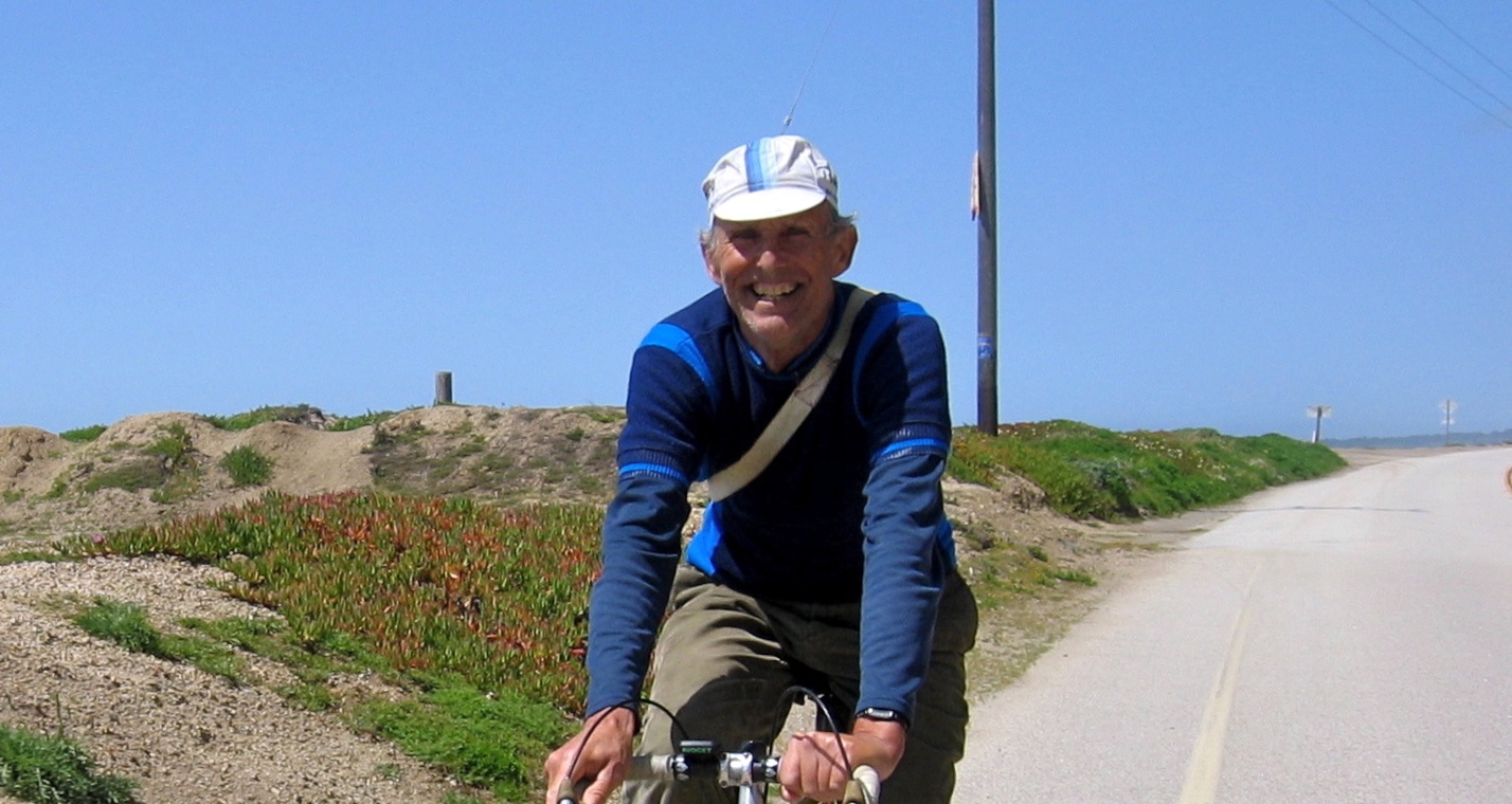
Jobst Brandt enjoys one of his favorite local rides down the coast on CA1 near Waddell State Beach, April 9, 2005.
Jobst Brandt, R.I.P., January 14, 1935 - May 5, 2015 - I met Jobst in early 1992 not long after I discovered the Usenet forum, rec.bicycles, and began participating in a discussion on Favorite Bay Area Roads. I had a couple of years earlier started getting back into longer distance bicycling for recreation and transportation after a 10-year hiatus following my initial car-driving years while in college.
In my younger years my dad and I had hiked many places in the Santa Cruz Mountains east of Skyline and a few places west, and we had even ridden our bikes in a few, but so much of it I had not yet explored. Jobst was a fount of knowledge of all areas worth visiting in these mountains, especially those that were suitable for biking.
As one can see from the exchange in the thread above, Jobst spoke his mind in a direct fashion that did not always sit well with others. He rarely left unchallenged bullshit or opinion stated as fact, especially if posted under a pseudonym, a practice he disliked. Yet, since he was usually correct on the technical points, one couldn't simply dismiss him. One of his brothers remarked, "Jobst could never operate with superficial understandings." It was a quality that was either maddening or endearing, depending on whether you were emotionally invested in prevailing in an argument with him, or whether you were a virtual onlooker.
After our initial exchange, we communicated by email where he imparted more of his knowledge and history of the area and of biking in general. It was on his advice that I undertook to explore on my road/touring bike all bike-able roads in the Santa Cruz Mountains.
He invited me on his Sunday rides, and I invited him to join me and my friends as we explored all of these interesting places. But, for some reason we rarely managed to hook up and ride together. I suppose initially I was intimidated by the distances he and his friends rode—I hadn't yet ridden 100 miles on my bike at that time—and he never seemed to be available to join our group that I suspected he thought would be too slow and tedious for him—Jobst liked to keep moving while biking, and back then we stopped often to regroup, chat, eat a sit-down meal, or stare at our navels.
Later I came to realize that we both wanted to call the shots, to set the pace, the agenda, and the route, in short, to lead the proceedings. I doubt we would have been compatible long-term riding partners without one of us giving up the control to which we were each accustomed. So, we settled into a pattern where we'd discuss a road or route ahead of time online, then I'd discover it for myself on my own terms and write up my observations. He never missed an opportunity to point out additional facts or to critique, even writing style or grammar.
I learned from him much about bicycle mechanics, how parts fail, and how to build a strong wheel. From him I learned to look up from the road once in a while and take note of my surroundings, to appreciate the beauty, find the oddities, and understand the patterns in nature. One obscure observation was that each false summit along Skyline Blvd. between CA9 and Castle Rock Summit occurs at exact mile intervals on the mile according to the mileage paddles.
In 1998 a great discussion erupted on the Usenet group, rec.bicycles.misc. "Bents Selling Like Hotcakes!!", screamed the provocative subject. A that time I rode my upright bike on a daily commute that had me fighting a strong afternoon wind for 9 miles to get home. To make matters worse, my blood sugar was typically low at the time, and I always felt I was on the verge of bonking. I sought a solution that didn't have me driving a car every day to work or lugging my bike onto Caltrain for only three stops, a process that took 50% longer overall than riding the distance headwind or no. I had been considering buying a recumbent to ameliorate the Great Headwind Problem, and this discussion drew me in.
It was no surprise that Jobst came down on the anti-recumbent side of the discussion. Although I deeply respected his opinions and analysis on most topics, I felt that in this case he was extrapolating from observation alone, advancing a position that boiled down to, "I wouldn't want to ride one, so why should anyone else?"
"The man doth protest too much," or so I thought. Yet, I learned a great deal from this discussion and from other related discussions that were subsequently spawned, and in the end after doing more research I got a faired recumbent for my commute.
My rebellious, contrarian side wanted to prove Jobst wrong on the viability of riding a faired recumbent as a substitute for an upright bike on the very roads he enjoyed. So, I started riding my faired recumbent everywhere. We argued online about recumbent riding and "recumbentists", but in the end I think he came to see that my choice worked for me, even if he had no interest in trying it himself. Since then I have been riding mostly recumbent, and I have Jobst to thank for unwittingly prompting me in the first place.
As time went by and in spite of my primary mode of bicycling we maintained our online friendship and we both continued to ride in the Santa Cruz Mountains, though rarely together, exchanging from time to time news about places that had changed: a bridge out here, a road closure or re-opening there, or the loss of a landmark such as the Swiss cottage on Page Mill Road, between Altamont Road and Foothills Park, a charmed structure perched on the outside of an off-camber corner that managed never to suffer being plowed into by an errant motorist. "Philistines!", Jobst exclaimed in dismay, when he learned that a new owner of the property had razed it.
In 2006 and 2007 when I started dabbling in bicycle "witchcraft", electrifying my recumbent bikes, I did not tell Jobst. I figured that would be a bridge too far from orthodoxy for him to cross. Yet in some way he can take some credit for my experimentations.
In Fall of 2003 I was diagnosed with atrial fibrillation (Afib), an episodic heart rhythm malfunction that curtailed my ability to exercise. At first I ignored the occasional symptoms, and they had little effect on my ability to ride. But by 2006 and 2007 the condition had progressed to the point I could no longer ignore my condition. I was forced to reduce exercise or cut back severely on the frequency and length of my bike rides. My Afib was causing me to "gray out" occasionally while riding, forcing me to pull over beside the road and put my head between my legs to avoid passing out completely.
Jobst had given up bike racing long ago, telling me that over the years the sport had been twisted into a contest of genetic endowment, doping, and marketing of dubious equipment—several times he undiplomatically remarked that the best technical minds had long ago turned to other fields, that there wasn't much in bicycling that hadn't been tried by a previous generation, that bicycles were a mature technology. He rode for the pure enjoyment of the activity and disapproved of contests, goals, or competition, taking me to task a few times when I introduced this slant into my narratives. "We don't need no steenkin' merit badges!", he would tell me.
He would have taken a dim view of web sites like Strava that emphasize contest and competition with others, although I believe he may have appreciated the benefit of social networking. His philosophy was to ride for the pure enjoyment of seeing the world from a bike saddle and occasionally sharing with others his experiences. If biking became an endurance contest or a tale of hardship overcome, he didn't want to participate or hear about it.
It was with his philosophy in mind that I sought a way that allowed me to maintain a relatively large circle of biking territory while reducing physical stress on my body, to keep the activity fun and enjoyable without negatively affecting my health. It helped that I was also interested and competent at mixing electronics and bikes.
When I was dealing with Afib, he told me about his mitral valve replacement surgery and lamented his noticeably reduced aerobic capacity following surgery. He felt that his reduced capacity was caused by being on the heart-lung machine for too long, although I suspected arrhythmia such as Afib that is often a follow-on side-effect from heart surgery. It was one of the few times he complained about his health, probably because it so directly affected his ability to ride bike.
We both explored old maps of railroad rights of way in the Sierras east of Sonora, exchanging ideas of where the alignments might have been. I suggested we spend a couple days exploring some of these old roads, but he expressed no interest in making a special trip for that purpose.
He told me about his house remodeling, the inevitable delays and discoveries of extra needed work, the difficulty of living as a long-term guest in someone else's home while his house was under construction, and how he wished he had remodeled it many years earlier, wondering how he put up with his old house's problems for so long.
Then sometime in 2010 I heard no more from him. Later I learned that he had had a couple of minor crashes from which he quickly recovered. And, once he returned home so late from an all-day ride that he had descended Page Mill Road in the dark without a light, something that would be difficult for a rider with young eyes let alone those of a septuagenarian. I suspect it was his familiarity with the descent, the help of moonlight, and sheer luck in not encountering anything unexpected on the road that brought him home safely that night.
Then in January 2011 I received news that Jobst had suffered a more serious crash. This time he had started early on a foggy January morning to ride his usual coastal loop to Santa Cruz and back and had crashed while descending Sand Hill Road at Whiskey Hill. I visited him a few times when he was in hospital and several more times while he was under home care. Although the "old Jobst" shone through at times, it was clear he had suffered permanent injury that had changed his personality. He was no longer able to use his computer, so we enjoyed only personal visits.
The highest moment post-crash came when he sat me down to look over a coffee table book on Sierra railroads. He had remembered our discussions several years prior. And, prompted by his son, Adrian, Jobst gazed with curiosity upon my electrified recumbent without offering so much as a frown, although the version he saw that evening had at least one serious flaw that the old Jobst would have noticed (and that I have since corrected).
A low moment came at my last visit during a party given at his house in his honor, when he had trouble recognizing some of his friends, even after being reminded repeatedly. He seemed to believe alternately that either strangers were in his house or that he was at a party of people he didn't know and wanted to be taken home. The gathering upset him.
Not hearing of any more gatherings at his house I suspected his health had declined to the point that social activity was seen as counter-productive. I heard little until this past week when his family sent out notice that Jobst was no longer eating.
Ride bike! Then rest in peace, old friend, rest in peace.
See also blog entries by Ray Hosler, Tom Ritchey, Mike Jacoubowsky,and Piaw Na.
| GPS track: | GPX |
|---|---|
| Bike Ridden: | Power Pursuit F3 |
| Distance: | 168.6 miles |
| Cumulative climbing: | 5820 feet |
| Total Time: | 11:50:14 |
| Riding Time: | 9:27:21 |
| Avg. Speed (moving): | 17.8 mph |
| Max. Speed: | 40.6 mph |
| Nominal System Voltage: | 48 |
| Battery energy capacity: | 2800 wh |
| Battery energy consumed: | 2087 wh |
| Wh/mi: | 12.1 |
| Battery Amps-Hour Used: | 39.8 |
| Regen Amps-Hour Recovered: | 1.0 |
| Peak Forward Current: | 22.0 Amps |
| Peak Regen Current: | 12.9 Amps |
Nine Counties Ride Around the Bay, May 3, 2015 - After last week's big loop ride over Mount Hamilton, I was prepared for this week's ride. Last year I rode a similar though slightly longer loop in the opposite direction. This year I started by riding north on El Camino Real instead of taking Skyline Blvd. and its inconvenient detour in San Mateo to avoid the construction at the Crystal Springs Dam. I'd be starting early enough in the morning that traffic ought to be light.
I also wanted to explore an inland crossing from southern Marin into northern Marin County. I had last ridden over the Fawn Drive-Manuel Freitas bike path connector sometime back in the mid-1990s, but my memory of that trip was hazy, and I had apparently not taken any photos nor written any notes.
My third divergence from last year's route was to explore the new George Miller Trail along the Carquinez Strait.
I wanted to leave home at 0600, but as usual I couldn't get myself ready to shove off until a bit later. As I started I noticed with some annoyance that regen braking was not functioning, yet on my mid-week ride regen braking was functioning. Fortunately, my route was flat enough today that regen braking would not be required to complete the route with the available energy.
As I headed north on Evelyn Ave. an unusually long northbound Caltrain consist was pulling into the Sunnyvale station, honking its horn far more than necessary given that no one was about. For the next 10 miles I managed to stay with this train as it rumbled north, stopping for an extra-long time at each station. Since my route ran parallel to the tracks on Central Expressway and Alma Street, the train would close the crossing gates at cross streets, leaving Central/Alma with a green signal. I made good time.
In Palo Alto I shifted to El Camino Real and proceeded north through San Mateo County. At first I enjoyed sun, but as I crossed into Redwood City I went under a fog layer. Traffic lights were too often red with the crossing signal tripped by some ghost pedestrian. I ended up spending quite a bit of time stopped for non-existent cross traffic while watching countdown mark the full 30 to 0 seconds. In spite of these minor frustrations I found riding El Camino early on a weekend morning an interesting experience as it let me see the center of each city on the route north. Traffic was sparse, and few drivers were in a rush. Particularly notable was the strong devil's food cake frosting aroma wafting through the air in Millbrae.
On this cool day I enjoyed patches of sunshine in unexpected locations such as Burlingame through Colma. By the time I got to Daly City the fog closed in for good.
I took a route through San Francisco that I hadn't ridden before: Lake Merced and Sunset Blvd. as far as Golden Gate Park. From there I took the most direct route to the Golden Gate Bridge. I saw a few cyclists in Golden Gate Park, but as I drew nearer to the Bridge I saw many more cyclists. The path onto and over the bridge was almost a steady stream.
Marin County was pretty but crowded as usual. Cyclists on what is effectively the single bicycling route from SF to Fairfax were almost as thick as they were on the Bridge. To add to a cyclist's frustration the route north through the towns of Mill Valley, Corte Madera, Larkspur, Kentfield, Ross, and San Anselmo is Death by a Thousand Stop Signs. No sooner would I regain cruising speed than another stop sign at some insignificant cross street would appear. Although I saw no policemen lying in wait, I also saw no cyclist blow through any of these stop signs. In fact, most unclipped and tapped a shoe perfunctorily on the road before continuing.
From Corte Madera through Larkspur I found myself pacing another cyclist. He seemed to be out for a quick morning workout. Near Magnolia and Bon Aire the driver of an SUV got too close to this cyclist. Angry gestures followed by shouted words between driver and cyclist ensued. They stopped in the middle of the road briefly. I hadn't seen behavior on the part of either that could have been construed as more than carelessness or incompetence, and besides that I didn't want to get between two hot tempers. Yet the only way I could continue was to pass between them as they shouted at each other over my head.
I understand how the cyclist might have felt. In the past, especially when I had more of life's stresses pressing on me, I could explode at a driver for passing too closely or honking rudely. After it was all over, I always regretted throwing such a public tantrum, for letting my animal side lash out with yelling, cursing and rude gestures. It always left me in a sour mood for the remainder of my ride, even if upon later reflection I concluded that the hurled invective had been justified.
Somewhere in Marin County I observed my USB power supply for my phone not charging the phone's battery, that the phone had been running on battery power from the start and would have to continue to do so until I got home. I turned off the display that I usually keep active. I would still probably run short. (I discovered later that I had forgotten that the USB power supply has an independent connection to the main power bus, and I had forgotten to reconnect it after doing maintenance on the bike. User error!)
Due to the cool weather I had been wearing all of my clothes into San Anselmo. The sun was out as I started up Butterfield to Fawn Drive, and as I started up the steep climb to the trail that crosses Terra Linda Ridge into San Rafael, I quickly got warm.
Northern Marin County feels different from Southern. The suburbs are more standardized, the housing construction post-WW2, the vegetation more sparse, and the neighborhoods less twee. I also saw many fewer cyclists.
Last year when I rode this loop counter-clockwise, I was unable to find the bike path between Hanna Ranch Road and Bel Marin Keys and ended up riding through the freeway interchange to Novato Blvd.
This year I did my homework and found the path. Mid-way along it crosses railroad tracks under construction. This was the only spot I had to get out of the bike and walk it through the ballast rock. It was here I encountered two other cyclists riding the opposite direction who stopped to ask me about my bike. I gave them a brief tour.
CA37 isn't pretty, and in some spots where the bridges are narrow, it isn't fun. But, after all the traffic and stop and go in Marin, it was a relief to cruise on an open road for a number of miles.
Except for the narrow crossing of the Petaluma River Bridge where I had help from a nice downgrade, I kept my speed below 30 mph (48 kph), cruising usually in the mid-20s (40 kph). The shoulder was nice through most of Sonoma County, but on the second half of the trip to Vallejo I had to deal with a wide rumble strip and less clean asphalt.
The northern corner of Mare Island that my route visits hasn't changed at all in the last year. Dilapidated buildings in a state of partial dismantlement remain standing like warnings of a dystopian future. One residential apartment building looked particularly corpse-like, it's doors and windows staring vacantly at passers-by.
Most of the activity in Vallejo appears to occur near the Ferry Terminal. The rest of the town I could see along Sonoma Blvd. had a depressed look. In between vacant fields littered with trash stood liquor stores and mini marts. A few pedestrians shuffled dejectedly along the verge of the road. Gentrification has yet to reach this corner of the Bay Area.
Unlike the Golden Gate Bridge, the path over the Zampa Bridge into Contra Costa County was nearly devoid of people. I had the path to myself over most of its length, which was probably a good thing because a gusty cross-wind was blowing from the west, and when one hit the bike I got pushed a foot to the left.
I was now on the Grizzly Peak Century route as I rode through Crockett and continued onto the Carquinez Scenic Drive, but by this time, early afternoon, all of the riders would have gone through the area. There was no evidence of an event having occurred at the community center, and I saw no other cyclists in the area.
The eastern half of the Scenic Drive is now part of the East Bay Regional Park District, the highlight of which is the George Miller Trail that had recently opened. Gone was the old asphalt with its painted graffiti. Also gone was the washout that had taken most of the road, leaving only a narrow dirt footpath. In its place was a nice 1.5-lane paved trail. Aside from a few pedestrians I felt like I had the place to myself.
It was along this section that I discovered that my regen switch had come disconnected from my controller. After I connected it, regen worked normally. The second user error. I scolded myself for not checking for the obvious earlier in the ride.
At the eastern end of the Scenic Drive the road climbs a short hill past the Alhambra Cemetery before depositing one into a neighborhood of Martinez. I made my way to Berrellessa Street and then onto Alhambra Avenue, passing the John Muir House near CA4.
I continued on Alhambra Avenue and Pleasant Hill Road, where gusting wind had blown up some allergen that gave me a coughing fit, then zig-zagged through Pleasant Hill and crossed Walnut Creek on Civic Drive and South Broadway, eventually to head south along I-680 on Danville Blvd.
Few traffic lights, a nice bike lane, copious shade for hot summer days, and clean asphalt make Danville Blvd. a nice cycling road for cruising, although one still needs to observe activity at residential driveways.
It was near Alamo that I saw a cyclist on a low-racer recumbent riding the opposite direction. It was Michael Cvetich. I hadn't seen him in years. I stopped while he turned around. We both then rode into Danville where we stopped at Jersey Mike's Deli for a late lunch. I needed to eat some real food, and this was a good opportunity to catch up with Michael since it's much easier to converse when seated at a table than while riding.
While we were at lunch, a small earthquake slammed and rattled the building. It was a "magnitude 3.6" centered in Concord.
After lunch I continued south and toward home on Foothill Blvd., passing through San Ramon, Dublin, Pleasanton, and Sunol. I continued south on Calaveras Road where my phone battery died.
Calaveras Road is pretty in the morning or in the evening as the sun is low in the sky. Aside from a few motorists I had the road to myself. I didn't see one cyclist riding either way over the entire length of the road.
After dropping into Milpitas I rode home quickly on the direct route, arriving home at quarter past six.
| GPS track: | GPX |
|---|---|
| Bike Ridden: | Power Pursuit F3 |
| Distance: | 165.5 miles |
| Cumulative climbing: | 9690 feet |
| Total Time: | 10:38:37 |
| Riding Time: | 9:14:51 |
| Avg. Speed (moving): | 17.8 mph |
| Max. Speed: | 43.0 mph |
| Nominal System Voltage: | 48 |
| Battery energy capacity: | 2800 wh |
| Battery energy consumed: | 2388 wh |
| Wh/mi: | 13.3 |
| Battery Amps-Hour Used: | 46.1 |
| Regen Amps-Hour Recovered: | 3.6 |
| Peak Forward Current: | 21.7 Amps |
| Peak Regen Current: | 11.0 Amps |
Mount Hamilton Big Loop (clockwise), April 26, 2015 - The prior weekend I suffered a bout of influenza (in spite of my having gotten a flu shot last fall). To make up for not riding that weekend, I settled on the Big Loop. Weather would be pleasant, neither too cool nor too warm, and winds, if present, would help push me south on CA33. Frank and Stella rode the Primavera Century the same day, and I thought I'd try to meet up with them along Calaveras Road, where our routes overlapped.
I left home at 0720 and got lucky with traffic lights until I reached Trimble and Zanker, where the traffic signal favors Zanker when there is no traffic as on a Sunday morning. Even so, I continued to get lucky green lights at most of the rest of the signalled intersections.
As I rode up Calaveras I joined groups of other cyclists riding the Primavera. The rest stop at Ed Levin Park was busy. I thought of stopping to look for Frank or Stella, but I figured they could just as easily be further up the road. When I left home they were near Warm Springs and Warren, so it was likely they were further along the course. (It turns out that they were, indeed, somewhere in that throng of cyclists at Ed Levin.)
As I started up the Calaveras Wall I could feel my direct-drive (DD) hub motor laboring mightily. I pedaled harder to compensate.
On the Power Pursuit I've been running a DD hub motor to experience the change in operating characteristics over my usual geared mid-drive motor. The DD motor is quieter and gives me a nice drag brake on the descents that puts energy back into my batteries. The downside is that the DD motor has about half the torque of my mid-drive motor, making climbs up grades over 7% difficult. The DD motor is about 5% less efficient overall, and about 10-15% less efficient on a typical hilly route in a straight comparison, when not accounting for regenerative braking.
Today's course has a few steep climbs, but many miles of gradual climbs or flat riding, ideal terrain for a DD hub motor. On flat terrain I figure the DD hub motor has the same or perhaps slightly better efficiency than my mid-drive motor, due mainly to the absence of gears that consume a small amount of energy in the mid-drive.
My course was nearly the same as last year's that I rode with the mid-drive on the bike. Last year I used slightly less energy overall (13.0 wh/mi) and rode at a higher average speed (18.6 mph).
For the next 10 miles I rode amongst some of the early Primavera starters as we twisted and turned our way, diving into and out of several ravines, alongside Calaveras Reservoir. At the north end of Calaveras Road I entered I-680 and continued onto CA84 toward Livermore. Today I took Holmes and Concannon across Livermore rather than the scenic but circuitous bike path around the south side of the valley.
When I got to South Livermore Ave. I could see that I was back on the Primavera course. One rider with a route sheet who may have been the first to start was zipping along on the bike path.
As I continued east on Tesla Road I came upon evidence of another bicycling event, this time a bike race. I didn't stop to inquire, but it appeared to be a clockwise circuit that included Cross, Tesla, and Greenville roads. I saw two cyclists riding opposite who looked fatigued but were riding hard.
Continuing on Tesla Road I saw no more cyclists for a long time. A number of pickup trucks and trailers loaded down with dirt bikes, heading for the Carnegie Off-Road Recreation Area passed me.
Tesla Road changes its name to Corral Hollow Road at its summit. I stopped briefly to snap a photo of the view east. A steady breeze was blowing east over the pass, typical in fair weather.
As I had been having trouble getting the regen braking to engage early on the ride, I descended the steep downgrade slowly, capturing as much energy as I could to make up for missing some regen opportunities earlier. After I reached the bottom I coasted down the gradual grade past Carnegie, a stiff tailwind being sufficient for me to attain 25 mph.
As the road bent north to head into Tracy, I no longer enjoyed a tailwind but a quartering headwind. Still, the downward slope of the road allowed me to use gravity to fight the wind. As I turned right onto Linne Road the quartering headwind became a quartering tailwind, and several miles later as I turned right again onto CA33, I enjoyed a straight tailwind, cruising at 33 mph with only modest effort into Patterson, interrupted by only a couple of stop signs on the way. It was nice to cruise at high speed and not have my ears blasted by wind noise.
I swung through the Circle at the center of town so that I could stop at the drinking fountain in front of City Hall and top off my water. I then continued to Sperry Ave. and stopped for a 45-minute lunch at the Subway sandwich shop.
After lunch I headed up Sperry Ave. and after crossing under I-5, turned right onto Del Puerto Canyon Road., where I shared the next 16 miles of road with a few motorists and motorcyclists and one lone bicyclist riding the opposite direction.
Traffic was light to moderate as some sort of motocross event was being conducted on a ranch a couple of miles east of Frank Raines Regional Park. In no instance on the entire ride did I experience rude motor traffic. Most motorists passed fully in the opposite lane (where visibility allowed), or waited until it was safe to do so. Beyond Frank Raines Park traffic thinned out considerably. Only a few small groups of motorcyclists continued further.
I turned left onto San Antonio Valley Road, bypassing the Junction Cafe. I had no reason to stop.
While the hills had been solidly brown near Patterson, patches of green could be seen in San Antonio Valley, usually in the shady spots under trees. California poppies were in full bloom, as were purple and white lupine. A few swaths of indian paintbrush in the drier areas completed the wildflower scene.
The climb up the backside of Mount Hamilton would be a struggle for the DD hub motor. I expected to stop somewhere on the final climb to let the motor cool.
As I climbed the motor temperature entered the critical range (>130C) at the cattle grate about halfway up. I stopped for about 15 minutes to let the motor cool while I ate a snack. The cattle grate is at the bottom of the steepest part of the climb, and I wanted to start up this section with a cooler motor. I waited until it had cooled to 75C.
Upon resuming I managed to get beyond the spring near mile marker 3 before the motor entered the critical range again. This time I pressed on as the grade slackens above this point. I've programmed my controller to roll back power as temperature increases, to the point of shutting down when the temperature exceeds 140C. I discovered that the power rolled back to 500 watts (135C) but went no lower on the rest of the climb. The motor had reached a temperature equilibrium. This left me pushing hard to make up for the reduction. But, I was tired of stopping and waiting, and I figured I'd get home faster if I just kept moving, albeit at the slower pace of about 5-6 mph instead of 9-10 mph.
I rode up to the Observatory, making an obligatory circuit around the building before resting before the railing near the flagpole. The view was hazy and indistinct in the late afternoon sun. I did not remain at the summit for long.
The descent on mostly new asphalt, a pleasant change from the old bumpy road with subsidence potholes. Still I did not descend as fast as I might have so that I could regenerate. This caused a slight problem at the bottom of the first descent as the regeneration had heated up the motor to 155C, and I could get no power for the climb out of Smith Creek. Again instead of stopping to wait for the motor to cool, I set the desired power level (about 300 watts), then pedaled the bike without power up the first rise. By the time I got to the second rise the motor had cooled enough to allow some power to be drawn. I was getting a workout!
The rest of the descent went without incident. The second and third downgrades are less steep, so I used less regen, letting gravity pull me most of the way down to Alum Rock Ave.
I took the southern route home through San Jose on Maybury, Taylor, and Coleman. In Santa Clara on Monroe Ave. I discovered large piles of old household effects dumped in the bike lane. At first I figured a garbage strike or mass evictions. Since I hadn't heard of the former, and the latter seemed improbable, I considered that it was probably an "extra dump day", the one or two days a year when the local garbage collection service allows residents to place large or awkward discards at the curb for convenient pickup.
I arrived home at 1800, my legs feeling like they had gotten a strenuous workout.
| GPS track: | GPX |
|---|---|
| Bike Ridden: | Power Pursuit F3 |
| Distance: | 112.2 miles |
| Cumulative climbing: | 4850 feet |
| Total Time: | 9:06:40 |
| Riding Time: | 7:22:06 |
| Avg. Speed (moving): | 15.2 mph |
| Max. Speed: | 42.8 mph |
| Nominal System Voltage: | 48 |
| Battery energy capacity: | 1600 wh |
| Battery energy consumed: | 1208 wh |
| Wh/mi: | 10.0 |
| Battery Amps-Hour Used: | 22.9 |
| Regen Amps-Hour Recovered: | 1.6 |
| Peak Forward Current: | 21.3 Amps |
| Peak Regen Current: | 23.0 Amps |
Patterson Pass, April 4, 2015 - Frank and Stella started their ride in Milpitas near Calaveras and Piedmont while I was returning from my local farmer's market, after which I rode over to Milpitas and through Fremont and Niles Canyon to meet them in Sunol.
When I arrived at Calaveras Road and I-680, Frank and Stella were waiting for me, only having arrived a minute ago. We had perfect timing!
We continued together onto I-680 then onto CA-84 and over Pigeon Pass into Livermore. After a break at Sycamore Park we continued on the south route through Holdener Park in the low hills south of Livermore. At Tesla and Mines Roads we continued east, then took the left onto Cross Road.
Half way up Cross Road the bungee cord in my seat back snapped. Frank helped hold the knots while I tied off the broken cords to hold for the rest of the ride so that I'd have a seat back to lean against.
At Patterson Pass Road we turned right and climbed steeply to Patterson Pass where we stopped to admire the sweeping view east. The dark green grass has become lighter, and patches of brown are starting to appear on the hills.
On the eastern descent Frank and Stella took advantage of the brisk tailwind to enjoy a high-speed descent. I decided not to waste my potential energy to the wind but to recover energy for my battery. We regrouped near the power substation at Midway Road before taking Midway Road to Altamont Pass Road.
The climb up Altamont Pass is barely a climb, but the headwind was strong. Frank leaned down onto his aerobars and took point while I followed, and Stella sought the most wind-sheltered position behind my bike.
At the summit we enjoyed a "pedaling descent" into Livermore, given the headwinds and the downslope that barely registers as such.
Our ride through the center of Livermore was marked by the search for a convenient water spout. After stopping at two municipal parks and finding the water shut off, we pressed on into Pleasanton where Stella decided to stop as we got into town at the Circle K to replenish her supplies. We stopped again at Pleasanton Ridge to use the rest rooms and to top off water before our long trip south on Calaveras Road.
As we started south through Sunol Valley the weather changed sharply for the cooler. High hazy clouds drifted overhead, and the temperature dropped 10° F. By the time we reached the high point on Calaveras Road I stopped to put on all my clothing for the remaining trip home.
The ride was mentally tiring due to the lengthy urban sections and headwinds, but we all enjoyed ourselves.
| GPS track: | GPX |
|---|---|
| Bike Ridden: | Power Gold Rush |
| Distance: | 101.5 miles |
| Cumulative climbing: | 3870 feet |
| Total Time: | 8:32:30 |
| Riding Time: | 7:07:27 |
| Avg. Speed (moving): | 14.2 mph |
| Max. Speed: | 43.9 mph |
| Nominal System Voltage: | 24 |
| Battery energy capacity: | 1800 wh |
| Battery energy consumed: | 902 wh |
| Wh/mi: | 8.9 |
| Battery Amps-Hour Used: | 33.7 |
| Peak Current: | 30.1 Amps |
The Reservoirs and Uvas Park, March 22, 2015 - I began by riding to Frank and Stella's house. From there Stella and I rode to Los Gatos, while Frank drove himself and his bike to our meeting spot there. After some indecision we decided to postpone our planned ride over the hills to Santa Cruz since the hills looked socked in with clouds and drizzle. Instead we rode east through Almaden and took a route around the reservoirs of Santa Clara Valley, exploring a few out-and-back routes into the hills, and in the process giving us enough exposure to the wet weather we otherwise avoided by postponing our Santa Cruz ride.
We returned north over Sycamore Hill, Oak Glen, and then Willow Springs to Santa Teresa (Hale) that we rode north into San Jose, enjoying a quartering tailwind most of the way. At Camden Stella turned right and rode directly home while Frank and I rode back to Los Gatos. After parting company with Frank, I rode directly home, encountering headwinds only on the last few miles home on Monroe/Reed/Evelyn.
| GPS track: | GPX |
|---|---|
| Bike Ridden: | Power Gold Rush |
| Distance: | 129.8 miles |
| Cumulative climbing: | 6360 feet |
| Total Time: | 11:57:13 |
| Riding Time: | 7:50:18 |
| Avg. Speed (moving): | 16.5 mph |
| Max. Speed: | 44.7 mph |
| Nominal System Voltage: | 48 |
| Battery energy capacity: | 2400 wh |
| Battery energy consumed: | 1667.2 wh |
| Wh/mi: | 12.0 |
| Battery Amps-Hour Used: | 31.4 |
| Regen Amps-Hour: | 2.0 |
| Peak Current: | 21.1 Amps |
| Peak Regen Current: | 12.0 Amps |
Lake Del Valle and Mendenhall Road, March 14, 2015 - Today's ride was an unusual affair. My plan was to ride almost 40 miles to join the Bay Area Recumbent Cyclists (BARC) for a ride in the Livermore area, then ride home afterward. On that ride I'd meet Zach Kaplan who would transfer to me some of the bike parts I had ordered from him. I'd carry these bike parts home on the bike, or at least I'd try. One of the parts was a 559 rim. So, I was combining commerce with pleasure.
I left home at 0720, when it was just light enough in the sky for me to feel safe riding without a headlamp. I took the fastest route to Calaveras Road, gaining the top of The Wall on Calaveras about 45 minutes after sunrise. The orange glow of sunrise and the green grass on the hills were beautiful. I thought of stopping to snap more photos, but I was on a deadline. It always seems that I'm in a rush to be somewhere when the best photo opportunities present themselves.
I saw few cyclists on Calaveras Road: a handful climbing the lower section and continuing onto Felter Road, a few stopped at the construction entrance for the dam, and a few more riding the opposite direction.
At I-680, I took the on-ramp toward Livermore and continued onto CA84 over Pigeon Pass. Traffic was light, but in spite of that some drivers were impatient, especially at the short narrow spot where the shoulder disappears, where the driver of a van passed closely, then proceeded to tailgate the vehicle ahead of him.
After descending Pigeon Pass I continued onto Isabel Ave., arriving at Jack London Blvd. and our meeting spot for the BARC ride at 0925, five minutes early, and about 20 minutes before I expected to arrive. At 0930 everyone was present except for Zach, who did eventually arrive at about 0945.
We finally started the BARC ride by touring through a suburb, then onto the Arroyo Mocho Bike Trail that cuts a diagonal through Livermore's Parkway and Robertson Parks. We emerged from the creek bed at Concannon Road, but we remained on the popular bike path until we arrived at Tesla and Mines Road.
At Mines Road we turned south and began the gradual climb up the broad lower valley of Arroyo Mocho. We stopped twice, once while Zach fixed a flat tire, and again to regroup before starting the climb over Cedar Mountain Ridge on Del Valle Road with the company of unusually heavy traffic. After regrouping at the top of the ridge and enjoying a sweeping view of Arroyo Valle, we began the steeper descent to Lake Del Valle.
At the entrance kiosk we turned right and rode to the end of the road at the marina where we took an extended break.
On our way out of the park we rode a path closer to the lake shore. Folks were cleaning up equipment for a running event that had finished.
We regrouped again at the top of the climb before taking an out-and-back road I had never before ridden: Mendenhall Road.
Mendenhall Road climbs atop Cedar Mountain Ridge for the first mile, then traverses at an easier grade on the northeast slope of the ridge. Magnificent views into Arroyo Mocho (1, 2) and Arroyo Valle (1, 2) were seen, as well as views back toward Livermore and Mount Diablo (1, 2).
Zach and I had stopped several times to snap photos, so we were among the last of our group to arrive at the end of the road before the gate of Walker Ranch, almost three miles from Del Valle Road.
A couple of medium-sized dogs barked within the main gate of the ranch, but even though the gate was open, the dogs did not approach us.
While Zach and I watched the dogs I noticed the automatic gate to the main grouping of ranch buildings that had stood open when we arrived began to swing closed of its own accord. It was apparent we were being surveilled by someone within who, wishing to make clear that we were unwelcome, had remotely commanded the gate to close.
"Do you think I can go down to the gate and then turn around?", asked Zach.
"Go ahead. But, I think someone is watching us."
Zach rode down the short slope toward the gate, then turned around, where I snapped his photo. While I did this a white figure emerged from one of the ranch buildings behind the fence and walked swiftly down the hill toward us.
"Didn't you see the sign back there?", a spry old woman hollered crossly as she strode towards us. "It was as big as you!", she pointed an accusing finger at Zach reclined on his trike.
The old woman cut the figure of one who might have walked out of the 19th century, of someone who had lived and worked many years enduring physical hardship, one who had no qualms about shooing us out of her neighborhood. Even though her ire was directed at us, she reminded me in an endearing way of a neighborhood fixture from my childhood, The General.
The General lived next door to our family in the late 1960s and 1970s and spent many of his retirement days sitting in his den watching the world go by and other such activity as occurred on our quiet suburban street. When I was young and uninhibited he got after me several times when he espied me traipsing across his front lawn of dichondra. "Don't walk on the dichondra!", he'd thunder out his window. He eventually erected a fortification (fence) to thwart my shortcut. He also had no patience with neighborhood visitors who had the temerity to park or linger in front of his house.
Once a hapless tradesman's truck had stalled in front of his house. The General, ever the good watch dog, stormed out and started his routine. We could hear him bellowing and see him pointing authoritatively up and down the street. But, it was no use. The truck would neither start nor move on The General's command.
As if to amplify The General's age and gruff demeanor, my parents often warned me and my sister when as young credulous children we fussed loudly (threw tantrums) such that the neighbors might hear, "Quiet down, or The General will come over with his sword!"
"We thought the sign was to keep off the land at the side of the road.", replied Zach.
"Where exactly does the public road end and your property begin; where is the actual boundary?", I asked, hoping for some clarity.
"You're not supposed to go past the last cattle grate back there.", she pointed back down the road, adding with an air of authority, "A judge lives here!".
"Then why is there an end of road sign right there?", I asked, pointing to the county road sign a few feet away from us.
"So! Is that cover supposed to keep you warm?", she asked, changing the subject as we turned around and prepared to return down the road.
"If the weather is cool, but it's mostly for aerodynamics, to get me through the air more easily.", I replied, hoping to soften her mood further.
At that point I almost asked if I could take her photo, but I thought she would have become suspicious and refuse. Still, in hindsight I wish now that I had pressed my luck.
We returned down Mendenhall Road, stopping a couple more times to snap photos of the view into Livermore.
After a brief regroup and after Neal placed a boot in his tire that he had just noticed was down to the cords, we started down Del Valle Road and Mines Road into Livermore. We regrouped again at Tesla Road and took the bike path south of town through Holdener Park and a corner of Sycamore Park before being guided back to our starting point by Russell on a convoluted route through a newer subdivision that only a Livermore native could recall without error.
While Neal, Dave M., and Frank wanted to get home, Russell, Dave, Zach, and I decided to eat a late lunch at "84 Teriyaki", the only eating establishment that was serving food at that hour in the small strip mall.
At the end of our meal the time was 1600, and I figured I had just enough time to get home before dark.
Zach and I bid goodbye to the others, then after assuring ourselves that my bike parts were securely strapped to my bike, we headed west on Jack London Blvd. into Pleasanton, riding quickly. We then continued up Dublin Canyon Road, still moving at a brisk clip.
At Palomares Road Zach and I split up, Zach heading into Castro Valley and on up Redwood Road, down 35th into Oakland and then toward home in Alameda, and I heading south on Palomares Road.
I continued to ride quickly over Palomares, then down half of Niles Canyon into Niles where crowds were attending an antique auto show. I didn't linger.
At Decoto Road I turned left and then right on Paseo Padre that I rode out to Marshlands Road.
After crossing the Dumbarton Bridge I took the Bay Trail mostly through Palo Alto and Mountain View, and then Stevens Creek Trail to Evelyn. The evening was warm and humid, yet I was surprised that even at 1900 many people were still riding and walking on the trail as darkness closed in.
I arrived home at 1920, just as it was getting too dark to be out without a headlamp.
| GPS track: | GPX |
|---|---|
| Bike Ridden: | Power Gold Rush |
| Distance: | 120.8 miles |
| Cumulative climbing: | 8730 feet |
| Total Time: | 8:26:41 |
| Riding Time: | 7:40:24 |
| Avg. Speed (moving): | 15.7 mph |
| Max. Speed: | 38.2 mph |
| Nominal System Voltage: | 48 |
| Battery energy capacity: | 2400 wh |
| Battery energy consumed: | 1802 wh |
| Wh/mi: | 13.1 |
| Battery Amps-Hour Used: | 34.1 |
| Regen Amps-Hour: | 4.2 |
| Peak Current: | 18.7 Amps |
| Peak Regen Current: | 9.2 Amps |
| Peak Internal Motor Temperature: | 140°C |
Mount Hamilton Loop CCW, February 21, 2015 - After sitting passively on my bike, riding the same loop five times at almost 400 km, I was ready to head out and just ride without trying too much to test things. I chose the Mount Hamilton loop because I hadn't ridden it since last year and because I hoped the rains from two weeks ago might have encouraged some greenery and wildflower growth.
I saw plenty of greenery, although the grass was shorter than I expected. In many spots the grass was as short as a putting green, and brown earth was still visible in the sparse patches. On the other hand many of the lakes and small reservoirs along the creeks were full or nearly full.
I couldn't complain about the weather: cool in the morning becoming warm mid-day, then cooling again by the time I arrived home. Temperature varied between 15C and 25C, with little or no wind. It couldn't have been a nicer day to be on the bike.
I rode again with the Nine Continents M3006RC direct-drive hub motor so that I might get better acquainted with it. I rode at a moderate pace all day, including downhills, where I tried to capture as much energy through regeneration as possible.
The direct-drive hub motor feels different on the bike from my through-gears motor. Torque and acceleration are mild, especially from a stop. I climbed the western side of Mount Hamilton with its easier 5-6% grades at about 10-12 mph, using typically about 500 watts of motor power to keep my speed from dropping below 10 mph where motor efficiency begins to drop significantly.
The Nine Continents motor is quiet but not silent. It growls a bit at very low speed and whines softly at higher speed. None of this is as annoying as it may sound from my description. The only time the motor makes objectionable noise is between 13 and 14 mph (22 kph) under power where a resonance in the motor shell causes a moderately loud rasping sound. I may in the future look for ways to eliminate these remaining noises.
On the climb I noticed the motor temperature climb slowly, starting at 35C at the bottom and rising to 95C by the time I reached the summit.
I took my longest break at the summit to enjoy the view and to allow the motor some time to cool before I started the steep east side descent, 2000 feet (600m) at 8% average grade.
From the top of the climb down to Isabel Creek I held down the regen button. My speed never exceeded 20mph, spending most of its time around 15mph. I descended slowly, even by the standards of a typical "white-knuckler". But, I captured a full 2 Amps-hour, and when I got to the bottom the motor temperature was 140C.
Based on my speed and the amount of energy I recaptured in regen, I conclude that the motor's efficiency as a generator is only about 1/4 its efficiency as a motor. That explains the modest power that is pushed into the battery during regen (about 300-450 watts), and the heat buildup in the motor itself. The controller remains relatively cool. The energy has to go somewhere, and it goes mostly into heating the motor.
As long as the motor temperature doesn't get too high (>150C), this may be preferable to heating a rim where such heating leads to tire blow-off. But, the thermal rollback feature of the CycleAnalyst V3 (CAV3) only works when using the motor as a motor, not a generator. So, one must keep an eye on motor temperature during extended regen sessions.
Because I was descending slowly and had not started earlier in the morning, and because I had forgotten to take my headlight battery, I skipped stopping at The Junction Cafe for a sit-down lunch mid-way around the loop as I usually do.
I was surprised I did not see more cyclists on the road. I saw a few climbing Mount Hamilton from the west, and a few more climbing from Livermore, but no more than 20 altogether on the 70 miles between San Jose and Livermore.
While riding between Livermore and Sunol over Pigeon Pass I detoured onto the old highway to see if that might be a nicer route than taking the main road with its freeway-speed traffic. It wasn't. The old highway asphalt has been torn up or covered with moderately large gravel or ballast rock. In addition the lane is rutted from poor drainage in a few places. It's clear that the old route is no longer being maintained as a viable alternative. I probably won't ride that way again if only to avoid cutting the side walls of my tires.
I was pleased to capture 12.3% of my energy through regen braking (at a cost of having a lower average speed), my net energy use of 13.1 wh/mi was noticeably worse than past trips around this loop in either direction, where my energy use varied between 8.0 and 11.3 wh/mi, typically around 10.0 wh/mi. Although I did not do a controlled experiment this time, my legs felt afterward as if they had worked just as hard as they had on those prior outings.
Although I was trying to get away from testing stuff on this ride, I couldn't help but notice the effectiveness of Cat-Ears. These furry strips attach to one's bicycle helmet strap in front of but not over each ear as seen in this photo and are designed to reduce wind noise. Based on the principle that the fur in and on a cat's ear reduces wind noise to make a cat's hearing more effective, these furry strips reduce but do not eliminate noise from wind passing over a cyclist's ear. I can now hear all the noises my bicycle makes while riding (which is sometimes good), and I can hear other noises around me when riding at speed on an otherwise quiet road. Although I haven't used them yet on a social ride, I expect that they will make conversation with others much easier. They will not reduce the noise of loud Harley exhaust pipes nor the loud rushing of automobile tires on tarmac. But, that annoying and fatiguing noise from the wind is greatly reduced, an especially welcome effect after riding for many miles. I endorse Cat-Ears wholeheartedly.
Other than my extended break on the Summit and taking brief stops to tend to calls of nature, I kept moving, arriving home at 1720, just before sunset.
| GPS track: | GPX |
|---|---|
| Bike Ridden: | Power Pursuit F3 |
| Distance: | 101.4 miles |
| Cumulative climbing: | 4850 feet |
| Total Time: | 3:36:02 |
| Riding Time: | 3:27:21 |
| Avg. Speed (moving): | 29.3 mph |
| Max. Speed: | 49.6 mph |
| Nominal System Voltage: | 24 |
| Battery energy capacity: | 2000 wh |
| Battery energy consumed: | 1910 wh |
| Wh/mi: | 18.8 |
| Battery Amps-Hour Used: | 75.4 |
| Peak Current: | 46.4 Amps |
| Link to: | Results |
Low-Key MegaMonster Enduro, February 7, 2015 - During the week before the event the weather forecast predicted a wet weekend. I was disappointed because I had planned to ride this year and wanted to try to set a personal best time on the course. That would be unlikely if the roads were wet or the winds gusty.
Recalling an occasion in 2012 when gusty winds blew me off the road into gravel, resulting in a spill that left me with a broken fibula, I have since been a bit wind-shy, especially in situations where traction is less than ideal.
The event coordinator, Kevin Winterfield, checked the course by driving it both directions, reporting dry roads and pleasant temperatures the day before the event. This news was promising, since it had been pouring rain all day in the Bay Area.
It's important to remember that Paicines, though not far from San Jose, is in Central California and is quite far south. Weather that is forecast to strike the Bay Area may not reach Paicines or points south.
On Saturday morning I left home at 0530 and started the drive to Paicines. I brought my bike and would decide whether to ride after seeing conditions for myself.
Rain fell intermittently and heavily at times from south of Morgan Hill until just north of Hollister. When I got to Paicines shortly after 0700 the roads were damp but not wet. Kevin and Cathy were waiting expectantly in front of the closed General Store.
66 had pre-registered, and of those fewer than half appeared. To make up for the shortfall we saw quite a few check-ins who hadn't pre-registered. In the end we had about 50 overall.
While Cathy and Stella worked the check-in table and Dan and Kevin the starting line, I made myself useful by standing around and idly snapping photos of riders and teams starting.
Edward Lyen, the only other hybrid-electric entrant, arrived at the check-in. He had emailed me the night before, showing me his bike that he had just then finished setting up for riding in the hybrid-electric class. I scolded him mildly for not giving himself time to stress-test it before the event. With a newly and hastily assembled bike, there is always at least one component that fails, malfunctions, or at the very least needs adjustment. Unfortunately, my fears were prescient.
I hadn't heard from Edward in the last year, nor had I seen him post recently on the Endless Sphere forums. He was riding a carbon fiber road bike with a tiny controller driving an RC motor connected by pulleys to a friction wheel pressed against the rear tire. The motor runs at about 15 volts, and his battery was probably a 4sNp, where N is a number between 40 and 50 (for a 2 kwh battery), although the battery didn't look large enough to hold a full 2 kwh. He was going for a lightweight and simple drivetrain.
As the morning wore on the sun occasionally poked out from behind the clouds and the south wind picked up strength. We could see dark clouds to the north but only mixed clouds and sun to the south. Someone mentioned a shower would pass through the area at 1000, and looking north and west one might have agreed that was a reasonable forecast. Yet, looking to the south the sky looked friendlier, and that was from where the wind blew.
As the last of the participants started off, I changed into biking clothes and readied my bike for the round-trip.
In 2011 I had ridden the course in 3 hours 45 minutes. My goal today was to beat that time and possibly to finish in less than 3 hours and 30 minutes. In 2011 I carried about 1400 watt-hours of battery and used 1320 watt-hours. Today I had the full 2000 watt-hours allowed, so I figured that my goal was reasonable. I secretly thought I might achieve it while pedaling with less effort than in 2011.
A couple of issues were working against me. Today the winds were stronger than they were in 2011. As experienced cyclists know, riding an out and back course in constant wind is always harder the stronger the wind. The headwind hurts you more than the tailwind helps, not to mention cross-winds.
My bike is somewhat less aerodynamic than it was then. Over the years I have had to modify the bike or my position on it following a frame failure and subsequent repair and reinforcement or to allow for more comfort. These modifications invariably increased aerodynamic drag, usually because the fairing needed to be expanded to accommodate the modification. In this case I had raised my seat a few inches and raised the handlebars and fairing height to match. That increased my frontal area slightly.
Before the event I printed out a "cheat sheet" that gave me a target energy consumption rate in watt-hours per mile (wh/mi) at various points along the course. The sheet's numbers assumed no net wind. In most years I'd find myself with an energy surplus at the turnaround, only to see it quickly evaporate and threaten to become a deficit before the finish. With the strong south wind, my consumption rate would ideally be higher than the target so that by the time I reached the turnaround I would have less than half the energy remaining.
But, this plan could be derailed if the wind changed direction before I returned to the finish. If that happened I might run the battery flat before I reached the finish (which means pedaling a heavy bike over a few low hills and into a headwind, an experience Zach Kaplan enjoyed in 2012), or I'd have to reduce speed and lose time. Another problem was one of estimating how much energy deficit I could afford to run on the southbound leg with a headwind while still leaving enough on the northbound leg with a tailwind. The ideal is to use up all available energy as I cross the finish line, but in practice it's hard to hit that point.
Another variable in all of this is my own pedaling effort. There's nothing like competition, even if it's just me and a clock, to give me the incentive to push as hard as I can. I figure I might manage somewhere around 170-180 watts on average, but I hadn't tested myself on a long event recently. And, I no longer have a power meter that measures human effort.
I decided to go hard on the southbound leg and adjust as needed along the way. It is always best to gain time by first applying maximum power on the climbs, then if there's surplus energy to ride faster and fight the wind on flatter terrain. There is more climbing southbound, and I had about 600 watt-hours more energy on-board than in 2011. I figured I could afford to go hard early and not run short.
For the first ten miles I ran at or near maximum power. In spite of the wind I made good time, cruising around 28mph. At that speed into a headwind, the bike gets buffeted a bit and can be an armful, especially in a cross-wind. I rode near the center of the lane and kept both hands on the handlebars except when snapping a few photos.
Taking one-handed photos from a moving bike isn't ideal, but it's the best I can do when I'm multi-tasking. Before starting the ride I put the camera in shutter priority mode with a shutter speed of 1/640 second. Later I used a shorter shutter speed, and I think these photos looked better. But I had trouble viewing the display on my camera while riding to confirm what it was at the time or if I might have misadjusted some other setting. As for the results, some photos turned out better than others.
I saw no other cyclists on the course until I encountered Edward standing over his bike, facing downhill, on the Willow Creek Grade. He did not look happy.
I yelled out, "You're going the wrong way!"
He pointed to his motor, and I caught the word, "failed". I said I was sorry before I was out of earshot.
Edward rode back to the start under his own power (and with the aid of a strong tailwind), but he decided not to wait for another two hours for me to return so that we could discuss in person what went wrong. I learned later that the sandpaper on the pressure roller had saturated from the wet road and had torn through, leaving the bare aluminum roller to slip on the wet tire. Edward told me later that he had gotten very little sleep the night before and that he was feeling sleepy and with a sore back, and that was the main reason he turned back. When the road and his tire dried, the aluminum roller had enough traction.
As I passed my first checkpoint I noticed that I was consuming battery energy at a rate of 27.5 wh/mi, and my target was 23.5 wh/mi. I was already in deficit!
I continued to use full power on the climbs, but on the descents I eased off the throttle. On the flatter parts I dialed in about 600 watts. Did I make the right decision? Could I have gained a minute or two on my overall time by pressing on as before, regardless of consumption, then make up the difference on the final ten miles with a tailwind?
By the next checkpoint my deficit had come down slightly. I was at 26.5 wh/mi.
I rolled up to the Bitterwater rest stop, but I didn't get off the bike or linger long enough for more than the briefest exchange of information with Lane Parker. I'm sure the 4H girls had many questions about my bike, but before they could ask them, I was off. There was no time credit for a social call.
As I flew down Bitterwater Valley I conserved energy, using between 300 and 400 watts most of the time. The terrain was mostly downhill with a slight headwind. The road curves were tight enough in a couple places that I would have wanted to tap the brakes had I been moving faster. A light rain began to fall.
Speaking of brakes, the MegaMonster course requires the least use of brakes on any 100-mile ride I can recall. Aside from the check points and the turnaround, there are only a couple of spots, (1) southbound on CA25 at Coalinga Road and (2) northbound at a sharp right-hand bend at the bottom of the descent into Bear Valley, where one might reasonably wish to touch a brake, and then only when the road is wet.
As I pressed south into Peachtree Valley I saw more cyclists, Paul McKenzie and Sarah Schroer enjoying their ride, Alexander Komlik hard at work on his way to break 5 hours, and several teams, some of whom were riding socially rather than with a goal of minimizing time or energy use.
My 3 wh/mi deficit held until the turnaround at CA198, and I was beginning to worry that maybe I had run a bit too hot over the first half of the course, especially if the wind changed direction.
I gave Kevin my number, and took a quick nature break. While stopped I noticed that my ears rang from the constant wind noise, even while wearing earplugs.
I then made a U-turn at CA198 before returning northbound.
"See you at the finish," I told Kevin.
As I began rolling northbound I felt the difference between headwind and tailwind in no uncertain terms. My ride was quieter, I rolled faster, and I used less power. The miles rolled by quickly. Even the climb up Bitterwater Valley felt quick and at the same time relaxingly quiet, as if an invisible hand was pushing me. More importantly my energy deficit was coming down.
Again I paused at Bitterwater opposite the school and yelled out my number, but I did not linger.
By the time I passed CA146 at Pinnacles I had reached my target energy consumption rate of 20.5 wh/mi. I knew I had a tailwind all the way back, so I rode the remainder of the course with maximum power. Even so, my consumption rate continued to drop.
The descent down the Willow Creek Grade is the only other spot I touched the brakes, this time because of speed, gusty wind, and my memory of the incident in 2012. In spite of that I still reached my maximum speed for the day on this descent.
Maximum power on my bike is set to 1000 watts from the battery, which is about 750 watts at the rear wheel. If I add back in my pedaling at maximal effort, that's about 1000 watts at the rear wheel, but for a longer time period I probably get a bit less out of my legs, so maybe 900 watts at the wheel.
I also set a 35mph maximum speed limit, mainly to prevent me from wasting too much energy fighting wind. But, today with a strong tailwind, my bike wanted to go faster, but the motor cut out when I got to 35mph. So, I cruised at or near 35mph on most of the last 10 miles. In the end it probably wouldn't have saved much time to go faster because the motor is geared to spin out at about 35mph in neutral wind. It would have helped maybe to 36 or 37mph on a day like today with a strong tailwind.
When I got to the finish I had a small surplus of energy. I could have ridden harder and used up that remaining 90 watt-hours. Hard to say how many minutes of time this might have been worth. Probably no more than a few minutes. The faster one rides the harder fought is that marginal minute to gain.
I'd like to get to the point where I don't think I can improve my time so that I can then socialize more and ignore the clock. I felt a little guilty about not being a good event host by not stopping to chat with Edward after his motor failure, with Carola Berger after her hub failure, with Lane and the 4H'ers at Bitterwater, and with others along the course.
| GPS track: | GPX |
|---|---|
| Bike Ridden: | Power Gold Rush |
| Distance: | 56.2 miles |
| Cumulative climbing: | 4850 feet |
| Total Time: | 4:06:02 |
| Riding Time: | 3:22:47 |
| Avg. Speed (moving): | 16.6 mph |
| Max. Speed: | 45.9 mph |
| Nominal System Voltage: | 48 |
| Battery energy capacity: | 1200 wh |
| Battery energy consumed: | 899 wh |
| Wh/mi: | 14.8 |
| Battery Amps-Hour Used: | 17.3 |
| Regenerated Amps-Hour: | 1.4 |
| Peak Current: | 20.9 Amps |
| Peak Regenerated Current: | 80.8 Amps |
Nine Continents Direct-Drive Hub Motor, February 4, 2015 - Most e-bikers start into the activity by installing a hub motor on their bike. When I started I went straight to a mid-drive, mainly due to the hilly terrain in which I often ride. But, I had always planned to try a hub motor when I could find one of reasonable quality at a decent price and when I had the time to experiment with it. This winter things came together for me to explore the use of a direct-drive hub motor.
I chose a direct-drive hub motor so that I could have a pleasing answer for the many times I am asked about regenerative (regen) braking. None of my mid-drive bikes has regen braking due to the design of their drivetrains, and I could always see the slight disappointment register on the faces of questioners when I explained why this was so. Aside from that I want to see for myself how much energy can be recovered using regen braking on a reasonably hilly ride, especially a loop ride that I have ridden many times and have statistics from other occasions with which to compare.
One of the problems with hub motors is that they are "one gear" systems. It's important to choose a motor that gives a satisfying top speed while not getting too bogged down on the hills one expects to climb. Since this was my first foray into using a hub motor, I decided after playing around with the Grin e-bike simulator to go with the relatively inexpensive Nine Continents M3006RC direct-drive motor in the standard winding.
I chose the M3006RC because it has the lowest passive drag (resistance when spinning it unpowered) of any of the offered direct-drive hub motors for the power capability and because it uses a Shimano-compatible free-hub to allow installation of a standard 9-speed cassette instead of a thread-on freewheel, one of the first on the market to offer this. Although most DD hub motors have reasonably good efficiency these days, the M3006RC's curve was a smidgen better than the others. In addition, Grin has added a thermistor inside this motor, compatible with their Cycle Analyst. The thermistor allows the user to monitor the motor temperature and to allow the Cycle Analyst to perform automatic throttle-back as the temperature rises past a preset threshold.
According to the simulation, the standard winding would give me a top speed with a 48-volt power supply in the low-30's (mph) on flat ground, matching the top-end performance of my mid-drive systems and would maintain reasonably good if not usable efficiency up to about an 8% grade, enough to get me up most hills in the area. The Crystalyte Crown motor would do a little better on steeper hills, but I felt that its slightly better hill-climbing ability was not worth more than double the price and other trade-offs.
As I started off I noticed that with my 12-FET Infineon based (a.k.a. Xie Chang) controller the motor cogs or growls a bit from a stop, but as the bike picks up speed over 10 mph, the motor quiets down to a low buzzing or ringing that becomes less noticeable at faster speeds. Still, it's not completely silent as it might be when using a sine-wave controller. But the noise is not nearly as audible as is the gearbox on my crank-drive or the sprocket and chain on my mid-drive.
At the base of Old La Honda Road, a popular climb in my area of 1300 feet (400 meters) at 7-8% grade, I set my power level to 400 watts as I usually do, and proceeded up the hill. I noticed immediately that my speed felt slower than with my mid-drive in an optimal gear. I was working harder than usual to maintain my usual speed. I could feel a mild vibration/growl from the motor, and I also noticed the motor temperature gradually increasing. My speed was 6-8mph, where it was 7-9 mph with the mid-drive. It was clear that to get the highest efficiency I would need to climb at a faster speed that kept the motor operating higher on the efficiency curve.
On my second and longer climb, Alpine Road, a climb of 1900 feet (600 meters) at 7-8% grade, I dialed the power up to 750 watts and climbed faster. This time the motor sounded happier and quieter. The motor temperature also increased as I climbed, but not as quickly as on Old La Honda Road.
My conclusion is that this direct-drive hub motor can be used in the hills, but efficiency falls off when speed falls below about 10-12 mph. If I can hear or feel the motor growling, the efficiency is reduced.
What about regen braking?
I set up my controller to use its highest level of regen braking when its e-brake circuit is closed. I could apply the regen brake intermittently to get reduced braking effect, as needed. Although this highest regen level feels strong, it is unlikely on any but the slickest of roads to lock up my rear wheel due to the weight over the rear wheel on my bike, roughly 2/3 of my total weight. Since I already have my e-brake levers wired through the Cycle Analyst, I wired up an unused horn button (momentary SPST switch, normally open) on my handlebars to close the controller's e-brake circuit when I wanted to apply the regen brake.
I used the regen brake where I would otherwise have used the friction brake to trim my speed. I noticed after a while that the controller limited regen power to about 450 watts, although it felt like quite a bit more power was being dissipated at times, given the force of the deceleration. The increasing motor temperature when using the regen brake confirmed this, although at times it was hard to tell as the motor temperature reading was intermittent† during my ride.
Regen braking on my relatively aerodynamic bike (CdA = 0.26) seemed to strike the best balance between forward progress and energy recovery at around 20-25 mph. I might have captured more energy while descending at speeds slower than 20 mph, but regen power declined somewhat, and I began to feel as if I was creeping down the hills. The pleasure of the descent was already being curtailed by keeping my descending speed below 25mph, although it could be argued that restricting oneself thus improves safety. At higher speed I shed my energy to the air through greater aerodynamic losses, leaving less for regen braking to recover.
In the end I was able to recover about 8% of my energy through regen braking. But, I don't think it was quite enough to compensate for energy lost while climbing hills with the motor working out of it's peak efficiency zone.
As I see it now, the main advantage of the direct-drive hub motor is its quieter operation and the simplicity of the drive-train. While energy recovered with regen braking doesn't quite make up for losses elsewhere over the course of a hilly ride, I didn't use my brakes as much on the steep descents, saving my brake pads. And, had I still been using rim brakes on my rear wheel, the regen brake would have greatly reduced the likelihood of rim heating leading to tire blow off.
The disadvantages of the hub motor are slightly lower efficiency overall on hilly terrain, slightly more weight than a functionally similar mid-drive with the latter's additional hardware (gearboxes, clutches, extra chains and sprockets), the requirement for torque arms at the dropouts to prevent axle spinout and to prevent bending a dropout not designed for a hub motor, and additional inconvenience when servicing a flat tire along with the requirement to carry an 18mm wrench to loosen and tighten the axle bolts.
An ideal hilly course for a direct-drive hub motor might be one with gradual uphills and steep downhills, the converse of what might work best with a properly-geared mid-drive system and friction brakes: steep uphills and gradual downhills. Those who like to descend fast probably won't be happy with the amount of regenerated energy they are able to capture since they already use their brakes sparingly and lose most of their energy to aero drag, but white-knuckle (slow) descenders should be happier with the amount of energy they can recover.
Despite this mixed review, I plan to ride more with this hub motor and to arrive eventually at a fuller assessment of its qualities.
†I was unable to get solid temperature readings on this ride because my thermistor circuit in the motor appeared to be intermittently shorting out.
| GPS track: | GPX |
|---|---|
| Bike Ridden: | Power Gold Rush |
| Distance: | 113.8 miles |
| Cumulative climbing: | 6860 feet |
| Total Time: | 7:40:18 |
| Riding Time: | 6:34:04 |
| Avg. Speed (moving): | 17.3 mph |
| Max. Speed: | 47.9 mph |
| Nominal System Voltage: | 24 |
| Battery energy capacity: | 1800 wh |
| Battery energy consumed: | 1207 wh |
| Wh/mi: | 10.6 |
| Battery Amps-Hour Used: | 45.7 |
| Peak Current: | 31.9 Amps |
| Motor energy to rear wheel: | 845 wh |
| Human energy to rear wheel: | 598 wh |
| Total energy delivered: | 1443 wh |
Santa Cruz, January 28, 2015 - Frank wanted to do a training ride to prepare for the upcoming MegaMonster event in February. This was to be the last such training ride, and he wanted to ride the same distance and climbing as the event. I suggested the coastal loop to Santa Cruz via the route that minimizes climbing. He was game but apprehensive about riding it alone as there were no bailouts and it would have been his longest solo ride in many years. So, I offered to accompany him for most of the way.
Frank started in Los Gatos while I started from home. The plan was for us to meet up somewhere between Menlo Park and San Gregorio. Although I rode with my self-imposed speed and power limits†, I did not stop except for traffic signals.
At one intersection, Cuesta and Springer, a four-way stop, I observed a Google self-driving car, probably one of many that I've seen traversing the city streets of Mountain View over the last several years. Traffic had saturated all directions. The car was behaving as if an older, cautious driver were at the wheel. It waited through several cycles before what appeared to be a sufficiently long time gap since the last car to pass through the intersection. What the computer seemed to have difficulty doing was to signal its intention by sticking its nose into the intersection to assert its intent to proceed when other drivers were doing the same.
I checked life360 every half-hour or so, and Frank was always about 20 minutes ahead of me. Shortly after I left home he was on Junipero Serra Blvd., and as I started up the climb on CA84 he was at Skylonda. Then about a mile from San Gregorio I received a text message stating that he was in Skylonda. Had I missed seeing his bike? I could not believe he would have been delayed for so long in Skylonda.
I pressed on to the San Gregorio Store where I saw Frank's bicycle parked at the bike rack. My phone had been malfunctioning all morning, not updating my location, not even updating the displayed system time but once every ten minutes, and apparently not relaying text messages to me in a timely fashion.
Once we were together we proceeded south along the coast. Weather was clear and warm; air was hazy almost dusty. The usual northwest wind was weak. We would not get much help today.
We alternated leading but we did not draft each other. Frank wanted the pure training effect of riding solo, so I led at some distance ahead or followed a respectable distance behind.
Later I asked him whether he preferred me to ride ahead or behind, and his preference was unclear, although he did state that when I was ahead he had an occasional tendency to pace himself off my pace which could be alternately too fast or too slow. Even though I can dial in a specific assist power level on my bike and can make finer adjustments by pedaling harder or softer myself, this does not easily match a constant power level for an upright bicycle rider, being generally too slow on uphills and too fast on flatter or downhill terrain.
Traffic on CA1 was light as far as Davenport then became slightly heavier on the last few miles into Santa Cruz.
We proceeded through town, getting slightly off route when I failed to continue straight onto Lincoln from Walnut. We quickly regained the route through downtown, then headed east on Soquel Drive to Soquel-San Jose Road.
We stopped for a water and toilet break at Anna Jean Cummings Park in Soquel before continuing.
The high point on Soquel-San Jose Road is only slightly higher than Skylonda, and the climb about as gradual as the climb up CA84 from Woodside or La Honda. But, what makes the descent on this road fun makes the climb slightly tedious. Heavy traffic can be irritating, but today traffic was light.
Frank started strongly after our rest stop, but as we started the main climb I could see that Frank's energy was flagging. I led most of the way on the climb. Although the grade was consistent, I would reduce my power as Frank started to fall back, hoping that he might close the gap. But, Frank seemed happy merely to match my new slower speed. No longer would he energetically pass me if slowed too much.
We stopped at the Summit Store for a short break. Frank admitted that he was getting tired and was starting to feel the buzz of fatigue after riding for many kilometers, a feeling that I know all too well. Fortunately, most of the climbing was finished, and all that remained were a few miles on Summit Road and the descent into Los Gatos.
This time Frank followed me down CA17 into Los Gatos, avoiding the Creek Trail. We were a few seconds too fast to catch a gap in traffic to make the left-hand exit onto Santa Cruz Ave. into downtown Los Gatos, so we instead continued flying with a stiff traffic-induced tailwind to the CA9 exit.
After Frank returned to his car near CA9 and Daves, I continued into Saratoga, then onto Sunnyvale-Saratoga Road, arriving home with plenty of daylight to spare.
†20 mph and 400 watts when using the assist.
| GPS track: | GPX |
|---|---|
| Bike Ridden: | Power Pursuit F3 |
| Distance: | 93.3 miles |
| Cumulative climbing: | 6200 feet |
| Total Time: | 6:24:31 |
| Riding Time: | 5:38:41 |
| Avg. Speed (moving): | 16.5 mph |
| Max. Speed: | 42.6 mph |
| Nominal System Voltage: | 24 |
| Battery energy capacity: | 1600 wh |
| Battery energy consumed: | 1090 wh |
| Wh/mi: | 11.7 |
| Battery Amps-Hour Used: | 41.7 |
| Peak Current: | 32.7 Amps |
| Motor energy to rear wheel: | 763 wh |
| Human energy to rear wheel: | 534 wh |
| Total energy delivered: | 1297 wh |
Devil's Slide, January 25, 2015 - I left home not having a firm idea of where I was going to ride today. I had considered riding over to the coast and then south to Santa Cruz or perhaps riding a loop through Bonny Doon in reverse of what I had ridden the week before. But, since weather was forecast to be sunny and warm at the coast I chose to head north and visit Devil's Slide, my second visit since the coast side trail had opened last spring.
Apparently everyone else with access to a car had the same idea. The major roads were clogged with traffic, especially CA1 through Pacifica.
I spent some time enjoying the warm weather and views at Devil's Slide before continuing south through Montara, Moss Beach, El Granada, and Half Moon Bay.
I continued beyond Half Moon Bay, taking Lobitos Cutoff to Tunitas Creek Road before climbing back over the hill.
I saw many cyclists out on the road, especially on Canada Road and later on CA1 and Tunitas Creek Road. On Canada Road I played leap-frog with a guy furiously pedaling a very nice-looking fixed-gear bike, my self-imposed power and speed limits matching his average speed, although he would gain on the slight hills and I would gain on the descents. Later on CA1 I leap-frogged a couple of times another cyclist heading south.
On Lobitos Cutoff Road I stopped to watch three horses gallop playfully in their field, chasing each other from one end to the other. Usually I observe horses, especially those whose backs are swayed from carrying overweight humans, standing dejectedly in their paddocks. These horses looked healthy and happy. The dominant one even approached me after noticing I had stopped to observe.
Lately I have been using a Magura Venti 203mm disk brake rotor with metallic pads in a BB7 caliper. This combination would cause horrible screeching with other rotors, but with the Venti, the worst is a mild ringing. And, the brakes work well enough to lock the wheel should I squeeze the lever so hard. I notice that with the Venti rotor, the pads are always pressing fully on the perimeter of the rotor and not on the arms or off the edge of the rotor as I observe with most other brake rotors. Also the Venti is about 0.3mm thicker than Shimano rotors.
| GPS track: | GPX |
|---|---|
| Bike Ridden: | Power Gold Rush |
| Distance: | 106.0 miles |
| Cumulative climbing: | 5150 feet |
| Total Time: | 8:31:41 |
| Riding Time: | 6:37:32 |
| Avg. Speed (moving): | 15.9 mph |
| Max. Speed: | 45.9 mph |
| Nominal System Voltage: | 24 |
| Battery energy capacity: | 1800 wh |
| Battery energy consumed: | 1184 wh |
| Wh/mi: | 11.1 |
| Battery Amps-Hour Used: | 44.5 |
| Peak Current: | 30.0 Amps |
| Motor energy to rear wheel: | 828 wh |
| Human energy to rear wheel: | 500 wh |
| Total energy delivered: | 1328 wh |
Gilroy and Corralitos, January 20, 2015 - In the prior week Frank had asked me advice about a route from San Jose to Gilroy and back that he wanted to ride in preparation of the MegaMonster ride in early February. In the end I rode with him, in part because I needed to buy some metric offset wrenches that were only available at the Gilroy Harbor Freight store.
I left home just after 0830 and rode through town to Frank's house near downtown San Jose. Frank had planned a route that took the CA87 bike path as far as was practical, and getting on and off the path required some intimate knowledge of obscure side streets.
As we started down the path I observed one young hawk sitting atop a lamp post on the path. I stopped to photograph it, but as I drew closer to get a better shot, it flew off. We passed the Tamien station and the daytime "parking lot" for the Ace Train. More trash than I am accustomed to seeing on multi-use paths littered the side of the trail, most of it on the freeway side.
At Curtner we had to get back on city streets again and made one wrong turn in the process, but soon we were back on course. We finally left the path at Hillsdale and made our way over to Monterey Highway at Capitol Expressway. From here our route became simpler.
Frank went down on his aerobars in time trial mode, and I followed behind. It turns out that my speed limit of 20mph matched closely Frank's preferred cruising speed most of the way south to Gilroy.
We stopped at Metcalf Park to use the rest rooms, and I stopped again to photograph a dead pheasant lying in the bike lane while Frank continued. We regrouped in Morgan Hill.
When we got to California Avenue in San Martin, our routes diverged. Frank went west to Santa Teresa Blvd. while I continued south on Monterey.
When I got to 10th Street in Gilroy I turned left and pressed through heavy traffic to the Harbor Freight store where I found only 1 set of the wrenches where there had been 5 sets in stock the day before.
Pleased that I had not made a wasted detour, I resumed my ride, getting back on course as quickly as I could.
I checked life360.com, and it showed me that I was 25 minutes behind Frank. I figured I should be able to catch up to him before the top of Mount Madonna Road or by Corralitos at the latest.
As I climbed on the dirt part of Mount Madonna Road I could see a couple of road bike tire tracks, one straight and one wobbly. I figured the wobbly track was Frank's uphill track, and the other was some other cyclist's who had descended. At the very least I knew that I hadn't passed him already.
When I got to the top of Mount Madonna Road I got a text message from Frank stating that he was starting up Hazel Dell. So, he was yet about 7-10 minutes ahead of me.
I descended the west side of Mount Madonna Road quickly and continued up Hazel Dell, but I did not catch Frank until mid-way down the descent of Browns Valley Road, just as the road breaks out of the redwoods and onto the agricultural plain. We rode together into Corralitos, where we stopped for our longest break.
Traffic on the lower part of Eureka Canyon was heavier than I expected, but as we climbed higher, traffic thinned considerably. This time of year the sun is low in the sky, even near mid-day, casting a pleasing light through the trees that can only be enjoyed on summer evenings or early mornings.
At Four Corners, the top of Eureka Canyon and Highland Way, I stopped while Frank continued down the rough descent ahead. The only other cyclist we saw that day (who bore a resemblance to Ben Jacques-Maynes) was just arriving at the top from the other direction.
We continued on Highland Way, Summit Road, and Old Santa Cruz Highway. Most of the traffic was now flowing opposite. Sometimes I was ahead, but usually I let Frank lead. I either took a longer roadside break and played catch-up, or I followed at a distance.
At CA17 and Alma Bridge Road we split up for good, Frank taking the Los Gatos Creek Trail most of the way home, and I taking CA17 into Los Gatos--a gap in traffic opened at just the right time to take the left-hand exit into downtown--and then proceeding on one of my usual routes, arriving home at 1708, just as it was getting dark enough to need a light.
| GPS track: | GPX |
|---|---|
| Bike Ridden: | Power Gold Rush |
| Distance: | 77.7 miles |
| Cumulative climbing: | 5590 feet |
| Total Time: | 6:44:32 |
| Riding Time: | 4:41:19 |
| Avg. Speed (moving): | 16.5 mph |
| Max. Speed: | 49.6 mph |
| Nominal System Voltage: | 24 |
| Battery energy capacity: | 1800 wh |
| Battery energy consumed: | 934 wh |
| Wh/mi: | 12.0 |
| Battery Amps-Hour Used: | 35.1 |
| Peak Current: | 36.1 Amps |
| Motor energy to rear wheel: | 654 wh |
| Human energy to rear wheel: | 443 wh |
| Total energy delivered: | 1097 wh |
Capitola, January 3, 2015 - Laura (sister) had a GroupOn for Dharma's in Capitola that was about to expire, so we arranged to meet there for a late lunch.
Along CA9 just outside Los Gatos I caught a glimpse of what appeared to be a small bird sitting on the white shoulder line. I stopped and backed up to get a closer look. It was a bird!
I figured it was either stunned from flying into a car or ill, so I scooped it up--it was so light!--and deposited it at the side of the road where it could recover without being flattened by passing traffic.
On my way up Old Santa Cruz Highway I ran into Alexander Komlik who was driving SAG for his wife Nina, who was riding to Watsonville.
I arrived at Dharma's at 1330, and shortly afterward Laura, Michael, and the dogs arrived. Laura, Michael and I went in and ordered lunch while the dogs remained in the car. At 1500 after a hearty meal, and after allowing a proper dog-greeting with the dogs, we went our separate ways.
I rode west through town and returned north via Branciforte, Granite Creek, Glenwood, and Mountain Charlie, one of my favorite routes home from Santa Cruz. The warm glow of sunset on the hills near Mountain Charlie Road was pretty.
As I crossed to the north side of the ridge, the sun disappeared, and it got cold! I was glad I had donned two socks on each foot, but my hands were still cold. Fortunately, the descent into Los Gatos did not take long.
I managed to get past Saratoga before nightfall closed in, and I was home before 1800.
| GPS track: | GPX |
|---|---|
| Bike Ridden: | Power Gold Rush |
| Distance: | 79.2 miles |
| Cumulative climbing: | 6360 feet |
| Total Time: | 5:10:29 |
| Riding Time: | 4:49:25 |
| Avg. Speed (moving): | 16.4 mph |
| Max. Speed: | 45.3 mph |
| Nominal System Voltage: | 24 |
| Battery energy capacity: | 1200 wh |
| Battery energy consumed: | 925 wh |
| Wh/mi: | 11.7 |
| Battery Amps-Hour Used: | 35.7 |
| Peak Current: | 33.2 Amps |
| Motor energy to rear wheel: | 648 wh |
| Human energy to rear wheel: | 544 wh |
| Total energy delivered: | 1192 wh |
Pescadero, January 1, 2015 - Due to the recent cold snap in the bay area, I left home in the middle of the day, after temperatures had warmed a bit. Even so, I felt cold for the first several miles, only felling warmer as my route ascended into the hills. In spite of this I find that I feel warmer overall when I'm out riding than when I'm sitting at my desk, unless I crank up the heat while I'm at my desk.
Lately, I have been riding with my power capped at 400 watts (in†) and speed under power limited to 20 mph. I find this encourages me to keep moving, uses battery energy more efficiently, and gives me some additional exercise. Even though I'm getting help from the motor where I need it most on the climbs, the outing feels more like a bike ride and less like a moped or slow motorcycle ride.
Temperatures were cold in the shady canyons that see little sun this time of year. There was even some frost on the ground along Moody Road. Temperatures at the coast were more comfortable, approaching 60 F.
The golden glow of sunset on the green hills made for a pretty background as I climbed Alpine Road.
The descent of Page Mill and Moody Roads was so cold that my fingers and feet were numb by the time I got to the bottom.
I stopped only as nature demanded, so I was able to get home not long after sunset.
†...which translates to about 280-300 watts of power at the rear wheel, added to my pedaling effort. My total weight (bike + body) ranges from 110 - 135 kg.
| GPS track: | GPX |
|---|---|
| Bike Ridden: | Power Gold Rush |
| Distance: | 137.0 miles |
| Cumulative climbing: | 4780 feet |
| Total Time: | 9:17:16 |
| Riding Time: | 8:18:18 |
| Avg. Speed (moving): | 16.5 mph |
| Max. Speed: | 48.2 mph |
| Nominal System Voltage: | 24 |
| Battery energy capacity: | 2400 wh |
| Battery energy consumed: | 1577 wh |
| Wh/mi: | 11.5 |
| Battery Amps-Hour Used: | 59.8 |
| Peak Current: | 44.0 Amps |
| Motor energy to rear wheel: | 1104 wh |
| Human energy to rear wheel: | 466 wh |
| Total energy delivered: | 1570 wh |
Winter Solstice, December 21, 2014 - Years ago the Winter Solstice Double Century (WSDC) had been held on the weekend closest to the winter solstice. In recent years, the ride has kept its name but the date has shifted, most often into January when the usual suspects' schedules are less busy. This year Jim Kern sent out an email to ride on the Solstice itself a slightly modified route starting and ending at El Toro Brewery in Morgan Hill instead of Christmas Hill Park in Gilroy or Ken Holloway's house in San Jose. It was a good compromise as it allowed us to start at the comfortable hour of 0800 and finish just after sunset, with subsequent dinner near at hand.
Starting from Morgan Hill (not including myself) were Tim Woudenberg, Jim Kern, and Roland Bevan. All three of them were on "high racers", Carbents or Bacchettas. I rode my Gold Rush. Tim called me "CalTrain" on account of my high-visibility striping on my front fairing. Our plan was to ride south on a route that took us past Christmas Hill Park in case anyone else showed up starting from there, then on the usual WSDC route to Pinnacles and back.
Not more than a few blocks from the start my speedometer failed. The signal from the pickup was intermittent. I stopped to debug it while the others continued ahead. After struggling with it for a few minutes, it was clear I would not get it working on the road, so I used my backup speedometer, the GPS (that also occasionally fails), for the rest of the ride†.
We cruised at 20-22 mph most of the way south on Santa Teresa Blvd. then regrouped briefly at Christmas Hill Park before continuing on. Not long after we left Christmas Hill Park Roland stopped to adjust his bike, while Tim and Jim disappeared ahead. We didn't see them again until shortly before we reached Paicines.
We got a few sprinkles and misted glasses, but otherwise the roads were dry, fortunately. Many of the farm roads were covered with dried mud, and a wet day would have meant riding on mud-slicked roads.
Roland and I cruised at a relaxed pace of 19-20 mph on the flat roads, slowing as needed when climbing Santa Ana Valley Road. A heavy fog hung overhead, but since our route stayed in the valleys, we did not get wet or misty. Unlike my last visit to the area, I saw green grass everywhere. The recent rains had changed the look of the land.
After Roland and I caught up to Jim and Tim we pedaled on to Paicines where we stopped for water and a snack. At this point Roland and Jim decided to cut short their ride and take Old Airline and Cienega Roads north while I and Tim, who was in remarkably good off-season condition, pressed south to Pinnacles with the aid of a slight tailwind.
I tried to offer Tim whatever draft he could find off my tail, but most of the time he chose not to ride close to my tail but several bike lengths back. I think my being a pacing target on the road ahead was what he wanted more than a draft. Only a few times he caught up and started to nose past me, issuing the comment, "Pace is much too comfy," after which I increased speed only to see him drift back again.
We stopped briefly at the Pinnacles Visitor Center before starting back, climbing up Bear Valley toward a low and heavy cloud ceiling that lay just above our highest altitude at the Bear Valley Fire Station.
On our way up Bear Valley I noticed that an Aeromotor windmill that had been turning lazily not more than an hour earlier was now spinning fast, indicating a stiff headwind for us. Still we managed a respectable pace until we turned off onto Old Airline Road.
Cienega Road offers a wind-sheltered route north at the expense of a few short hills. Traffic at the southern end of the road was nonexistent, but after we passed the motorcycle park, traffic was frequent, almost all of it pickup trucks with dirt bikes in the rear bed.
As we emerged onto the plains around Hollister we were again exposed to the wind. This time Tim spent more time in my sweet spot to avoid the worst of the wind. We made good time heading north on CA25 and Frazier Lake Road, and enjoyed the tailwind on Shore Road as we made the traversal.
We discussed whether we should return the same way we came or to take a more direct route north on Monterey Highway. We decided to return on our outbound route.
As we crested the top of Santa Teresa Blvd. I snapped a photo of the heavy fog bank that looked like a roll cloud coming off the mountains.
When we got to Watsonville Road I suggested we return to Morgan Hill by the back door on Sunnyside, West Edmundson, and De Witt, that had us then drop down West Main Street and back to our cars just before "full off" dark. In hindsight I might have taken our original route back as these back roads have no shoulder and were crowded with more traffic than I expected. We arrived at El Toro about one hour after Jim and Roland had returned.
Overall the ride went well, and I felt worked. Had I been riding alone I would have ridden faster and spent less time on the road. But, it was fun to ride with others for a change.
†After the ride I could find no apparent reason for the intermittent connection. I could find no fault in the wire. Perhaps the high humidity and the wheel magnet clearing the pickup by a generous 5-6mm, barely within range, led to the intermittence. I moved the pickup closer to the magnet. The speedometer worked fine on the next ride.
| GPS track: | GPX |
|---|---|
| Bike Ridden: | Power Gold Rush |
| Distance: | 123.0 miles |
| Cumulative climbing: | 7190 feet |
| Total Time: | 6:36:12 |
| Riding Time: | 6:05:12 |
| Avg. Speed (moving): | 20.1 mph |
| Max. Speed: | 53.2 mph |
| Nominal System Voltage: | 24 |
| Battery energy capacity: | 1800 wh |
| Battery energy consumed: | 1620 wh |
| Wh/mi: | 13.2 |
| Battery Amps-Hour Used: | 63.4 |
| Peak Current: | 42.2 Amps |
| Motor energy to rear wheel: | 1134 wh |
| Human energy to rear wheel: | 542 wh |
| Total energy delivered: | 1676 wh |
Tailwinds from Santa Cruz, December 14, 2014 - The day promised to be dry with a slight chance of a passing shower and wind from the southeast. This would be a good day to ride my Santa Cruz coastal loop clockwise, riding north along the coast with the aid of a tailwind. I was not disappointed.
I rode from home over to Santa Cruz via the quickest route. Daylight was limited, and even though I have a head and tail light I aimed to be home by 1700, preferably earlier. I also didn't want to be slowed down by poor road conditions due to the recent storms on some of the back roads. I rode at moderate assist power levels, 400 watts on the climbs, less on the rolling and flat parts.
Traffic seemed slightly lighter than usual for a Sunday, especially on CA1, where I felt like I had the road to myself between the infrequent platoons.
After I got through Santa Cruz, I left my assist power at 400 watts. This was sufficient to cruise in the high-20/low-30 mph range much of the way north on CA1. The usual coastal wind had reversed and was now helping. I saw a number of cyclists riding south who appeared to be working hard against the wind.
Interesting and varied clouds filled the sky as I rode north. A small intermittent creek flowing off the ridge near Waddell Beach made for a pretty waterfall that was, unfortunately, partly obscured by the retaining fence along the highway. The combination of greenery from the recent rains, interesting clouds, and roiling sea reminded a bit of Hawaii. Only the temperature was too cool. But, I wasn't complaining.
My original plan had been to duck inland at Gazos Creek Road and return via Pescadero, Alpine, and Page Mill Roads, but traffic on the coast was surprisingly light, and the wind favorable. I had plenty of battery left, so I pressed on. It was too much fun. CA84 was my second "bail-out" option, but as I passed the junction I decided then that I'd continue all the way to Half Moon Bay before turning toward home.
My ride over CA92 was nothing special. Ride fast in traffic for the first 4 miles, then get over the ridge and down to Canada Road without delay. Once I got onto Canada Road I went into slow mode—it was Bicycle Sunday—and took it easy the rest of the way home, arriving a half hour before dark.
| GPS track: | GPX |
|---|---|
| Bike Ridden: | Power Gold Rush |
| Distance: | 72.9 miles |
| Cumulative climbing: | 5420 feet |
| Total Time: | 4:55:10 |
| Riding Time: | 4:33:01 |
| Avg. Speed (moving): | 16.0 mph |
| Max. Speed: | 41.7 mph |
| Nominal System Voltage: | 24 |
| Battery energy capacity: | 1200 wh |
| Battery energy consumed: | 861 wh |
| Wh/mi: | 11.8 |
| Battery Amps-Hour Used: | 33.3 |
| Peak Current: | 31.9 Amps |
| Motor energy to rear wheel: | 603 wh |
| Human energy to rear wheel: | 472 wh |
| Total energy delivered: | 1075 wh |
Clouds and Rain, December 1, 2014 - During a break between storms I took the afternoon off to go riding. My goal was to get some exercise, maybe see some interesting clouds, and to stay out of the rain showers. I satisfied the first two of those goals, but failed the third.
I had intended to climb Page Mill Road, then head north on Skyline to CA92 before looping back toward home. When I got to the Foothills Park entrance I could see rain obscuring Windy Hill and decided that riding along Skyline Blvd. would offer few views in exchange for a good soaking. So I headed down Page Mill and took the low land route through Portola Valley and Woodside, then north on CA92 to do a small loop in San Mateo before heading south again.
I wasn't able to avoid the rain, getting caught in a couple of showers. Even though I forgot to bring my rain shell, I did not chill in the warm rain wearing a short-sleeve wool jersey.
It was on my trip south that I observed the parting of the clouds as the main band of showers I had been caught in earlier, began to move away from the Santa Cruz Mountains and head across the Bay.
When I got to the base of Old La Honda Road I saw that I'd have just enough time to climb to Skyline, head south to the Russian Ridge Vista Point where I stopped to enjoy the contrast of light and dark at the edge of the cloud band, then head down Page Mill and get home before dark. Everything was dripping wet but in a good way. It was nice to see a wet forest after many months of uncharacteristically dry weather.
I got home at about 1700 just as it was getting uncomfortably dark. The bike needs a good cleaning, but it was worth the trouble.
| GPS track: | GPX |
|---|---|
| Bike Ridden: | Power Gold Rush |
| Distance: | 93.1 miles |
| Cumulative climbing: | 5520 feet |
| Total Time: | 6:12:14 |
| Riding Time: | 4:30:29 |
| Avg. Speed (moving): | 20.5 mph |
| Max. Speed: | 51.3 mph |
| Nominal System Voltage: | 24 |
| Battery energy capacity: | 2400 wh |
| Battery energy consumed: | 1277 wh |
| Wh/mi: | 13.8 |
| Battery Amps-Hour Used: | 48.1 |
| Peak Current: | 33.8 Amps |
| Motor energy to rear wheel: | 894 wh |
| Human energy to rear wheel: | 325 wh |
| Total energy delivered: | 1219 wh |
Pizza Century, November 9, 2014 - According to my records I hadn't ridden the Pizza Century since 2009, but this year the event was held on Sunday, I wasn't too pooped from riding the day before, and the weather was expected to be nice.
I arrived at Phil Plath's in Half Moon Bay about a half hour before the appointed start time. I was early, but that gave me time to chat with Phil and others who began to arrive. It appeared that we wouldn't be starting until closer to 0900. I didn't mind as we had plenty of time to complete the route before dark, and in any event I had head and tail lights.
A couple of days before I had talked Zach Kaplan into riding his e-Scorpion trike, advising that he would have enough battery capacity to complete the ride as long as he rode at a moderate assist level.
Zach and I rode together on the way down. I had limited my bike to 750 watts (in) and a maximum speed of 20mph when assisted as a means of conserving energy. Zach brought his charger with him and planned to partially recharge his battery during lunch. We'd ride with my self-imposed restrictions on the southbound leg, then see what battery capacity we had before deciding if we'd have more fun on the return leg.
Weather was pea-soup/fog-on-the-deck for the first ten miles, thick enough to condense on my glasses. By the time we got to Pescadero the fog had lifted somewhat, and after we rounded Pigeon Point we broke out into the sun for the rest of our southbound trip.
While 20mph felt slow on the flat parts, we were able to make up time on the uphills. On the downhills we coasted as fast as gravity allowed. Overall we made good progress, overtaking most of the others on the route that day by the time we got to Santa Cruz, although I don't doubt that we would not have overtaken the go-fast guys had they been hammering. It was a good pace for relaxed riding and sight-seeing.
While we paused on the bluff over Waddell Beach, Chris Cooper on his Carbon Aero whizzed by. After we got started again, we passed him on the climb south of Waddell Creek. For the rest of the trip into Santa Cruz we could see Chris gaining on us gradually on the flat and downhill parts, then falling back on the uphills.
A few miles outside of Santa Cruz we overtook Dana Lieberman and Jim Kern who both looked pleased to be out riding their bikes on this fine day.
At Upper Crust Pizza (West Side) we ran into Steve Purcell who was out riding his own brevet-style ride without assist. He was not returning up CA1 but would be continuing to Corralitos before heading home.
After splitting with Zach a cheese-less gluten-free pizza that was quite a bit less filling than I expected, we began our return trip. Since Zach was able to restore about 30% capacity of his first battery, he decided to have more fun on the return trip. I told him it was his turn to set the pace, to ride as fast as he wanted. I'd follow behind. At times he got well ahead of me.
Of the un-assisted riders, Greg Thomas on his carbon fiber Quest was able to match our pace on the flat or downhill sections. We leap-frogged with Greg a few times. On our final encounter Zach helped while Greg worked to free a chain jammed between his chainrings.
After we all arrived back at Phil's we enjoyed Happy Hour on his driveway, then around 1700 we headed over to Spanishtown Mexican Restaurant for a hearty dinner.
| GPS track: | GPX |
|---|---|
| Bike Ridden: | Power Gold Rush |
| Distance: | 95.3 miles |
| Cumulative climbing: | 8400 feet |
| Total Time: | 6:25:03 |
| Riding Time: | 4:38:29 |
| Avg. Speed (moving): | 20.5 mph |
| Max. Speed: | 54.2 mph |
| Nominal System Voltage: | 24 |
| Battery energy capacity: | 2400 wh |
| Battery energy consumed: | 1974 wh |
| Wh/mi: | 20.7 |
| Battery Amps-Hour Used: | 77.2 |
| Peak Current: | 42.0 Amps |
| Min. Voltage: | 23.5 |
| Motor energy to rear wheel: | 1382 wh |
| Human energy to rear wheel: | 244 wh |
| Total energy delivered: | 1626 wh |
| Strava: | Mammoth to Lee Vining |
| Strava: | Tioga Pass |
| Strava: | Lee Vining to Mammoth |
| Strava: | Minaret Summit |
Tioga Pass and Minaret Vista, September 17, 2014 - We worked out the same arrangement today as we had yesterday: I would ride out to the base of Tioga Pass and meet Frank and Stella on the way up the climb. They would drive the boring bits in the car. The only difference was that we would all leave the condo at about the same time. Yesterday they had given me a head start, and I ended up waiting for them while they prepared their bikes. Although Lee Vining was further than the southern June Lake Junction, we figured it would work just as well for me to meet them on the climb.
Frank and Stella parked at the Lee Vining Ranger Station at the top of the first climb up from US395. Stella would start her ride up the pass from here, but as Frank wanted to get full credit for the climb he rode down Utility Road into Lee Vining then returned up CA120 from US395. It was while he was riding this short loop that I arrived at the base of Tioga Road and ended up getting ahead of him.
After coasting CA203 through downtown Mammoth and getting all green traffic lights I turned left and headed north on US395. Like yesterday's ride I treated this portion of my ride as something to be done quickly. Today I had not been given a head-start by Frank, and I fully expected to see both of them well on their way up the climb. I rode at or near maximum speed that still allowed me to pedal easily, letting my stoker do most of the work. The pleasant mild tailwind made for a quiet 35mph.
When I got to CA120 I started up the first part of the climb at a more relaxed pace, wanting to savor the experience. As I rode past the ranger station I could see Frank's car in the parking lot, but Frank and Stella were nowhere nearby.
I continued on the mostly level warm-up part of the climb and saw no other cyclists. I did not see any cyclists until I was on the lower part of the climb and could make out a small cyclist ahead. As I drew closer I could see that it was Stella. Another cyclist was a short distance ahead of her. “That must be Frank,” I thought.
I passed her and took her photo and that of the next cyclist who I thought at first was Frank. Later after speaking with this cyclist I learned that he had flown out from Virginia the day before and would be leading an Adventure Cycling bicycle tour in the area over the next week. Today he was getting in a warm-up ride and adjusting to the altitude.
Since I hadn't slowed long enough to have a conversation with Stella, I assumed that Frank was ahead of her, so I pressed on so that I might catch him before he reached the top. I passed a couple more cyclists, but still no Frank. I thought that Frank must have been feeling really strong that day or was making a serious effort to place well on the Strava ranking.
Finally I stopped at a turnout next to the Green Bridge and radioed down to Stella to ask about Frank. She told me then that he had just passed her, and at that moment I figured out why I hadn't seen him on the road.
While I waited until they both reached the Green Bridge, I enjoyed being entertained by a chipmunk who had evidently learned how to elicit a treat. Although I was sorely tempted to give him or her a nibble of an energy bar, the only food I had, I firmly resisted that temptation. After Frank and Stella passed I resumed my climb and rode with Frank up to the pass, where we both waited for Stella.
We took each others' photos in front of the Yosemite gate (Frank, Bill, Frank and Stella) and then began our descent. I rode ahead as I would proceed straight back to Mammoth and meet the two of them at Forest Trail and Minaret Road for a climb up to Minaret Vista.
My descent went well, and the wind was mostly a tailwind, but occasional gusts counseled moderating my descent speed. I allowed my speed to creep into the mid-40's, but the rest of the time I kept it in the mid-30's. Having descended Tioga Pass on my upright bike many years ago under windy conditions I knew that one moment could be calm, and the next a gale-force gust could blow me into the weeds or worse.
As Frank had done earlier I descended Utility Road into Lee Vining before heading south on US395.
My ride south toward Mammoth enjoyed a mammoth-sized headwind. Probably not more than 15mph with gusts to 25, but it felt like a gale compared to the morning's trip north. I would use much more battery energy to ride south, and my average speed would be lower.
As US395 began climbing to the southern June Lake Junction I passed another cyclist who appeared to be struggling into the wind. I slowed and offered him my draft, but he declined. He did mention that he had planned to take CA158 but discovered the road was closed due to the fire.
I stopped just south of the southern June Lake Junction to photograph smoke from the small wildfire that had erupted near the June Mountain Ski Resort, the wildfire that had closed CA158. Just then Frank and Stella whizzed by in their car. My radio crackled with Stella's voice asking if I was OK. I replied that I was and that I'd see them again in Mammoth.
I pressed on up the hill to Deadman Summit, then coasted for the first time in a while down past Crestview, taking the right-hand lane on the highway to give myself more options should I get pushed laterally by the wind that was still gusting.
As I made the turn onto CA203 to head into Mammoth the headwind seemed to change direction and follow me as I climbed into town.
I got to The Village, called Frank and Stella by radio, and got a reply that they had stopped at the condo but were on their way down to meet me in a few minutes. After some length they arrived, and the three of us proceeded up Minaret Road.
When we got to the ski resort Stella decided she had had enough riding. We took a group photo under The Mammoth, then Frank and I continued up to Minaret Vista while Stella returned to the condo.
After enjoying a short break at the vista point, Frank and I returned down CA203, enjoying the smooth curves on the descent.
On the last climb up Mammoth Slopes Drive, Frank made an attempt to beat the best Strava time on the segment. He had a little encouragement from a motorist on his tail, but after he uploaded his track to the website he discovered that he had only achieved fourth place.
As I was loading my bike into the van I discovered that I had melted the inboard adjustment dial on my rear disk brake, probably while dragging it most of the way down Tioga Pass.
| GPS track: | GPX |
|---|---|
| Bike Ridden: | Power Gold Rush |
| Distance: | 87.4 miles |
| Cumulative climbing: | 6910 feet |
| Total Time: | 5:46:35 |
| Riding Time: | 4:44:24 |
| Avg. Speed (moving): | 18.4 mph |
| Max. Speed: | 55.3 mph |
| Nominal System Voltage: | 24 |
| Battery energy capacity: | 2400 wh |
| Battery energy consumed: | 1361 wh |
| Wh/mi: | 15.6 |
| Battery Amps-Hour Used: | 51.5 |
| Peak Current: | 40.4 Amps |
| Min. Voltage: | 24.4 |
| Motor energy to rear wheel: | 952 wh |
| Human energy to rear wheel: | 325 wh |
| Total energy delivered: | 1277 wh |
June Lake Loop and Minaret Summit, September 16, 2014 - On our third full day in the mountains we decided it was time to have an "easy" day by getting out on the bike. The June Lake Loop offers scenery without a huge amount of climbing and fits the requirement.
Our plan was for me to ride from the condo out to the June Lake Junction and meet Frank and Stella who would drive their bikes to that location. All three of us would ride from one end of CA158 to the other and back again, then I would ride back to Mammoth.
Since I was essentially commuting I rode near maximum pace on the run from Mammoth out to June Lake, making no attempt to hold back my speed on the hills.
Frank and Stella passed me at Deadman Summit, but when I met them at their parking spot, they were still preparing their bikes.
After some delay we got under way. We stopped briefly at the June Lake Slot Machine at Oh! Ridge. In 2005 when Zach, Ron, and I came this way, a rickety wooden tower stood at one end of the parking lot from which I took a photo of them. I was not surprised to see the tower gone, only its foundation remaining. That thing did not inspire my confidence to bear our weight even in 2005.
We continued on CA158 through the quaint town of June Lake that had the hint of a resort feel without the development, commercialism, and size of Mammoth Lakes to the south.
Our route then began a long descent alongside Reversed Creek, past June Mountain Ski Resort, through groves of aspen, and finally alongside Silver Lake. The wind was at our backs, and it felt good to spin the pedals, go fast, and not have to work hard.
We continued alongside Rush Creek through more open scrub lands and one aspen grove before climbing up above the shore of Grant Lake, the northernmost and largest lake on the Loop. Grant Lake was lying depressingly low in its basin. A wide dry plain stretched across its upper end.
As we crested the pass north of Grant Lake we began a sharp descent into the desert plain and to US395. We all recorded speeds in the mid-40's (mph) before stopping at the Mono Craters viewpoint where Stella waited while Frank and I completed the Loop by riding down to US395 before returning in the opposite direction.
On our ride back we became aware of the wind that had been at our backs on the outbound trip. Yet as we rode alongside Grant Lake Stella got inspired to ride off the front. After we regrouped on the gradual climb to Silver Lake Stella started to flag. As we passed the Rush Creek Trailhead again, Stella gave notice that she wanted to stop for a rest. I picked a spot in front of the Silver Lake General Store.
At this point Stella decided she had had enough riding for a rest day and wanted to save her energy for tomorrow's activity. She decided to wait near the store or on the shore of Silver Lake while Frank and I returned to the car. Frank would drive back to collect her while I rode back to Mammoth.
Frank and I continued up Reversed Creek opposite our outbound route until we drew even with the June Mountain Ski Resort, where we turned left onto Northside Drive. Northside Drive would take us around the north side of June Lake and would avoid going through town a second time.
Traffic was light on Northside Drive, and the road itself climbed and descended more than CA158 would have, yet it was an interesting alternative. We rejoined CA158 at Oh! Ridge, where the rickety old tower stood. From there it was a short run back to the car.
After Frank started back to collect Stella, I got on US395 and zipped back to Mammoth, returning up the Scenic Loop to Minaret Road. Instead of heading directly back to the condo I climbed up past Mammoth Mountain Ski Resort to Minaret Vista to stop for the view of The Minarets. Then I descended back into town on the marvelously smooth asphalt surface that allowed curves to be taken near the limit of traction, although the gusty winds at the time suggested I leave some margin for error.
As I yet had more legs left, I did not return directly to the condo. At Lake Mary Road I turned right and zipped up to Horseshoe Lake to check its status where I discovered that the lake was almost dry. On my way down the hill I detoured the scenic way around Lake Mary before descending to Davison that I climbed up to Canyon Lodge before heading back to the condo nearby.
Overall it was a good day on the bike. Lots of scenery, some fun downhills, comfortable temperatures, and not too much exercise—I only contributed about one-quarter of the total energy. I wouldn't need a rest day tomorrow.
| GPS track: | GPX |
|---|---|
| Bike Ridden: | Power Gold Rush |
| Distance: | 82.4 miles |
| Cumulative climbing: | 7070 feet |
| Total Time: | 9:44:19 |
| Riding Time: | 5:34:02 |
| Avg. Speed (moving): | 14.9 mph |
| Max. Speed: | 51.0 mph |
| Nominal System Voltage: | 24 |
| Battery energy capacity: | 1800 wh |
| Battery energy consumed: | 1064 wh |
| Wh/mi: | 12.9 |
| Battery Amps-Hour Used: | 40.0 |
| Peak Current: | 32.8 Amps |
| Motor energy to rear wheel: | 745 wh |
| Human energy to rear wheel: | 570 wh |
| Total energy delivered: | 1315 wh |
Bicycle Traffic School, August 28, 2014 - The letter from Santa Cruz County Superior Court gave me a few choices: I could post bail, $196, and request a court date, or I could plead "guilty" or "no contest" and request a payment plan, community service, or bike safety school. I called the court to request a Trial by Written Declaration, which was granted. The idea was to plead "not guilty" and hope the citing officer doesn't submit evidence, leading to a dismissal. After a finding of "guilty" in a Trial by Declaration one can request a Trial de Nuovo, an in-court trial before a judge, and then hope the officer doesn't show, leading again to dismissal. Each of these steps requires an increasing commitment of time. I knew that I would not win my case on the facts.
By now you're probably wondering what was my offense. CVC 22450(a), "Failure to stop at posted stop sign". Where? Hames Road and Freedom Blvd.
It was an unlucky confluence of events. I was riding with Ron Bobb, who was ahead of me at the time. We were both descending Hames Road westbound, approaching the intersection with Freedom Blvd. Ron blew through the stop and onto Freedom Blvd., I suspect, as he usually does. I slowed slightly to look over my left shoulder to check for conflicts, but otherwise treated the Stop as a Yield. Ron and I were both riding socked Gold Rushes at the time, bikes that tend to draw attention when ridden singly. Two of them together constituted a parade and couldn't be missed. This time we drew the attention of a Santa Cruz County Sheriff's deputy who just happened to be driving opposite to our direction of travel on Freedom Blvd. It was no Stop Sign Sting.
Upon seeing the opportunity for a twofer, the deputy pulled a U-turn on Freedom and caught up to us at Day Valley Road, where Ron had stopped to take a quick break. When the deputy asked us if there was a reason we had blown through the stop sign, Ron impertinently asked the deputy, "Do you ride bikes much?" Probably didn't help our case. I answered that I was looking for conflicting traffic, hoping to score a bonus point that might incline the deputy to issue a warning. Of course, I knew there was a stop sign at that intersection even if I didn't see it on this occasion. Neither of us admitted guilt.
The deputy recounted our behavior, noting that I had at least slowed down to look. But, that didn't get me out of a citation.
Ron paid his fine after his courtesy notice came in the mail. I considered fighting it through court procedure and hope for some luck. After doing some research, I learned I had about a 30% of succeeding with that strategy in a busy county, probably worse odds in Santa Cruz County where the courts are not backlogged--I was always able to get through to a live court clerk within a couple of minutes of when I called--and law enforcement officers are not working as much overtime.
While I had initially dismissed the idea of attending traffic school, I learned that in Santa Cruz County, the fine is suspended if one attends Bicycle Traffic School, unlike Traffic School for a motor vehicle moving violation. The cost to attend Bicycle Traffic School is $35, and the time commitment is one two-hour class held at the Santa Cruz County government center on Emeline Drive.
So, I could try to fight the ticket through court procedure (i.e. requesting extensions, submitting motions as late as possible, serving discovery with the county DA and hope the request is ignored, and possibly spend one or more days at the courthouse, etc.) and still have only 30% chance of dismissal (expected loss: 0.7 * 196 = $137) at best. Or, I could attend Bicycle Traffic School for $35 and spend only 2 hours of my time. After further thought I considered that I could ride my bike from home to Bicycle Traffic School and bring some pleasure to my punishment.
The choice was clear. I submitted a request to the Court to attend Bicycle Traffic School. The request was granted.
Santa Cruz County Bicycle Traffic School is an in-class presentation by an LCI and discussion that covers the typical topics: rights and responsibilities, advice on street riding behavior (lane positioning, signaling, etc.), and information on resources for bicyclists in Santa Cruz County. The tone was positive and while most of the material was not new to me, I'm sure much of it was new to some of my classmates, some of whom were new to urban biking having had their licenses suspended. Most had been cited for stop sign or red light violations, a couple for riding on the downtown sidewalk, and one for riding the wrong way. The two hours went by quickly.
I left home shortly before 1400 and started my ride to Santa Cruz, taking a somewhat indirect route to avoid what appeared to be an early start to the afternoon commute over the hill. Traffic on Summit Road and Soquel-San Jose Road was heavy, and I altered my route on the fly to avoid traffic.
As I was running early I took Schulties Road and Redwood Lodge Road to avoid a nearly continuous stream of traffic on Summit Road. I got lucky descending the fun part of Soquel-San Jose Road, having the road to myself, topping out at about 45 mph coasting, neither overtaking traffic nor being overtaken, until I got close to Casalegno's. I turned right on Laurel Glen and climbed to Rodeo Gulch Road that I descended into town. Even Laurel Glen had much traffic traveling opposite.
I made a short detour to eat a quick dinner before taking Soquel Drive into Santa Cruz and then to class.
By the time class finished at 2000 nightfall was nearly complete. I took one of my usual routes home, stopping a number of times on the climb up Mountain Charlie Road to snap some night photos. On my way down Old Santa Cruz Highway I noticed that one of my tires was developing a lump.
At the bottom of the descent my front wheel fell into a rather deep crack in the road, a crack that appears to have widened since the last time I rode by this spot as the road surface slides or subsides into a dry Lexington Reservoir. I lost control for a moment, but managed to keep the bike upright. But, I could feel the front tire bottom out on the edge of the crevasse as it climbed out, and the rim momentarily rode on asphalt for a short distance. I stopped to roll back and photograph the offending crack, as wide and deep as any gap at a railroad crossing, only this one was in line with the road and right where a bicyclist might be riding. I recall this particular hazard from my daytime visits, but I didn't have it foremost on my mind on this occasion. Had it been daylight I could have avoided it by maneuvering myself early to the left of the lane, but at night my range of visibility was reduced.
I pressed on past Lexington School, but just beyond I noticed my front tire going flat. Pinch flat, no doubt. I stopped to repair the flat and noticed that the rim had a nice dent in the side wall and the tire now had two large patches of tread peeling away. Maybe that ticket was going to cost me the full $196 after all.
I continued down into Los Gatos, opting for the Creek Trail instead of the fast descent down The Chute on CA17, given the condition of my tires. Fortunately, I got home without further trouble or delay, although shortly before midnight was much later than I had planned. My ride home was more of an adventure than I had expected, but not quite rising to the level of "epic".
Post-mortem: Rear tire was bulging. I've had several Kenda Kwest tires that start to bulge (ply separation) after about 3000 miles. This tire was no exception. Front tire had about 3500 miles and was now too damaged to continue to use safely. The new large rubber divots peeling away from the cords revealed that the outer layer of cords was also cut. Time to replace that tire, too. The rim suffered a dent on one wall at one location and a sharp-edged gouges on the hook distributed around the entire circumference of the rim, probably from riding directly on asphalt for a short distance. I was able to straighten the dent with a large crescent wrench and to file smooth the sharp-edged gouges. The only way to tell visually that the rim wall isn't perfectly flat is to observe the reflection of a bright object in its polished surface. A couple of tiny ripples can be seen, but no large excursions. I will wait and see how it brakes before concluding that it, too, needs replacement. I'm hoping I can still use it for a while.
| GPS track: | GPX |
|---|---|
| Bike Ridden: | Power Pursuit F3 |
| Distance: | 52.3 miles |
| Cumulative climbing: | 4610 feet |
| Total Time: | 3:19:20 |
| Riding Time: | 3:00:35 |
| Avg. Speed (moving): | 17.7 mph |
| Max. Speed: | 46.1 mph |
| Nominal System Voltage: | 24 |
| Battery energy capacity: | 1600 wh |
| Battery energy consumed: | 964 wh |
| Wh/mi: | 18.5 |
| Battery Amps-Hour Used: | 36.8 |
| Peak Current: | 35.3 Amps |
| Motor energy to rear wheel: | 704 wh |
| Human energy to rear wheel: | 0 wh |
| Total energy delivered: | 704 wh |
| GPS track: | GPX |
|---|---|
| Bike Ridden: | Power Gold Rush |
| Distance: | 52.3 miles |
| Cumulative climbing: | 4720 feet |
| Total Time: | 3:19:28 |
| Riding Time: | 3:05:42 |
| Avg. Speed (moving): | 17.0 mph |
| Max. Speed: | 48.1 mph |
| Nominal System Voltage: | 24 |
| Battery energy capacity: | 1800 wh |
| Battery energy consumed: | 1032 wh |
| Wh/mi: | 19.7 |
| Battery Amps-Hour Used: | 39.4 |
| Peak Current: | 31.4 Amps |
| Motor energy to rear wheel: | 753 wh |
| Human energy to rear wheel: | 0 wh |
| Total energy delivered: | 753 wh |
Effortless Rides, August 2014 - As I make my annual shift from riding to hiking my muscles and joints often experience aches and pains. Aside from having sore calves after doing a hike with lots of climbing after a long period of not hiking at all, I occasionally get right knee pain.
Recently while my right knee was bothering me slightly I still wanted to get out on the bike rather than stay at home and sulk. An idea struck me that I hadn't really tested my hybrid-electric bikes by riding them as low-powered scooters over an entire ride of non-trivial length. I decided to perform an informal experiment.
I chose a loop route to La Honda and back that I had ridden many times that offered a mix of climbing and flatter terrain, although the climbing density was still fairly high at about 90 feet/mile. I rode this route twice on each of my two hybrid-electric bikes at roughly the same time of day when weather was consistently pleasant on two different August afternoons.
Both bikes would be limited to power input of 750 watts (yielding about 550 watts at the rear wheel, given electrical and drivetrain energy losses) and would allow motor power to be applied only when speed was at or below 20 mph. These restrictions kept both bikes within the common definition of a "low-speed electric bicycle" in the United States and would give me a baseline energy consumption rate when using 100% motor power. When using motor power I would ride both bikes with "full-on" throttle, conditions permitting.
My first trial was on the Power Pursuit with the hard side panels, a slightly more aerodynamic bike that yielded a slightly lower consumption figure and higher average speed than the Power Gold Rush that I rode second. See the tables for the complete stats. I have always assumed that my Pursuit was about 10% more efficient than my Gold Rush, and while the energy figures show a 7% difference, the average speed is also less on the Gold Rush, suggesting that the energy use on the Gold Rush would be greater if the average speed were as high as it was on the Pursuit.
I learned several things from this experiment:
While I don't plan to make "no work" rides a habit, I was pleasantly surprised that I could still enjoy an outing on the bike, perhaps get a little isometric exercise by soft-pedaling, and not feel guilty about it.
| GPS track: | GPX |
|---|---|
| Bike Ridden: | Power Gold Rush |
| Distance: | 55.1 miles |
| Cumulative climbing: | 3250 feet |
| Total Time: | 8:01:56 |
| Riding Time: | 4:41:14 |
| Avg. Speed (moving): | 11.7 mph |
| Max. Speed: | 39.4 mph |
| Nominal System Voltage: | 24 |
| Battery energy capacity: | 1200 wh |
| Battery energy consumed: | 434 wh |
| Wh/mi: | 7.8 |
| Battery Amps-Hour Used: | 15.7 |
| Peak Current: | 22.4 Amps |
| Motor energy to rear wheel: | 304 wh |
| Human energy to rear wheel: | 449 wh |
| Total energy delivered: | 753 wh |
Panoche Inn, July 2, 2014 - Ron Bobb and I rode from Paicines, CA out to the Panoche Inn for lunch, then returned to Paicines on the same road. We met Ron's friends, Gordon and Sue, several miles east of Paicines and again for lunch at the Panoche Inn. Gordon and Sue had ridden to the Inn on their motorcycles.
Weather was in the high-70s F when we started in Paicines, then warmed to a toasty 102 F by the time we reached Panoche Inn. On our return ride, the temperature cooled to 71 F by the time we arrived in Paicines shortly after 1800. We had anticipated cooler weather with the forecast of stronger on-shore winds. While the winds were present, we discovered that the air warmed as it pushed over Panoche Pass and down into Panoche Valley.
We had two mechanical incidents. Ron's rear derailleur cable came loose from its stop, and upon our departure from Panoche Inn I discovered a front flat tire on my bike. That tube had a leaky valve stem, and the first replacement tube also had a leaky valve stem. Fortunately, I carry two spare tubes for each wheel, and that third (and last) tube held air.
Everything looked dry. Even the buckeye trees are turning color as in early fall. The meadow grass looked like close-cropped brown astro-turf from a distance.
| GPS track: | GPX |
|---|---|
| Bike Ridden: | Power Pursuit F3 |
| Distance: | 103.0 miles |
| Cumulative climbing: | 9140 feet |
| Total Time: | 9:20:12 |
| Riding Time: | 6:17:14 |
| Avg. Speed (moving): | 16.3 mph |
| Max. Speed: | 50.0 mph |
| Nominal System Voltage: | 24 |
| Battery energy capacity: | 1600 wh |
| Battery energy consumed: | 1290 wh |
| Wh/mi: | 12.5 |
| Battery Amps-Hour Used: | 49.5 |
| Peak Current: | 43.6 Amps |
| Motor energy to rear wheel: | 903 wh |
| Human energy to rear wheel: | 705 wh |
| Total energy delivered: | 1603 wh |
Sequoia Century Worker's Ride, June 7, 2014 -
Sequoia Century Worker's Picnic, June 8, 2014 - I rode the Sequoia Century Worker's Ride and attended the picnic the next day at Rengstorff Park. I rode alone over most of the course, riding only in a group on segments where I could provide a consistent wind break for others.
The route was altered slightly from the official route due to our not wanting to interfere with the Pescadero Road Race, so we did not go through Pescadero. Then at the end of the day, I skipped the loop up Elena Road and took Purisima Road instead. But, I got 100 miles by starting and finishing my ride at home, and I got plenty of climbing.
Weather was cool in the canyons but never cold, warm on the ridge tops and comfortable at the coast in the afternoon where fog hung at the shoreline. It was a good day to be on the bike.
| GPS track: | GPX |
|---|---|
| Bike Ridden: | Power Gold Rush |
| Distance: | 111.4 miles |
| Cumulative climbing: | 11370 feet |
| Total Time: | 7:57:33 |
| Riding Time: | 6:13:47 |
| Avg. Speed (moving): | 17.8 mph |
| Max. Speed: | 52.4 mph |
| Nominal System Voltage: | 24 |
| Battery energy capacity: | 1800 wh |
| Battery energy consumed: | 1500 wh |
| Wh/mi: | 13.5 |
| Battery Amps-Hour Used: | 57.4 |
| Peak Current: | 38.1 Amps |
| Motor energy to rear wheel: | 1050 wh |
| Human energy to rear wheel: | 695 wh |
| Total energy delivered: | 1745 wh |
Monitor Pass, Ebbetts Pass, and Pacific Grade Summit, May 26, 2014 - After a fitful but physically restful night's sleep, I awoke just after 0600 as sunlight was streaming through a crack in the blackout curtains. My legs felt like they could ride another hundred hilly miles at somewhat reduced effort from yesterday. I resolved not to push myself quite as hard as I had the day before. The room was cold as the nighttime temperature had dipped into the 40s F. Without wasting time but without feeling rushed, I went through my morning preparations, breakfast, stretches, and re-packing my panniers. I was out the door just after 0800.
Weather was warm and clear. Not a cloud could be seen in the sky today.
The first several miles of today's ride had me continuing north on US-395 toward the Nevada state line. Again most motor traffic on the highway was heading southbound. The highway offered a nice view over the north end of Antelope Valley as it rolled generally downhill, dipping to about 5000 feet above sea level before rising slightly to the junction with CA89.
It was here that my legs would endure their first test on the most difficult climb of the day, the east side of Monitor Pass.
CA89 climbs at first through a narrow canyon formed from the outflow of Slinkard Valley, then continues climbing the ridge ahead in open terrain. I stopped several times to enjoy the expansive view of Slinkard Valley, Antelope Valley, and the Sierra Crest, and to snap photos. I stopped again at Monitor Pass for the obligatory summit photo and a once again on the west side descent to snap more photos.
My descent of the west side was not as fast as I had enjoyed previously mainly on account of a significant headwind blowing from the west and up the canyon on the lower descent alongside Monitor Creek, where speeds are usually fastest.
When I got to the CA4 junction I turned left and started up toward Ebbetts Pass.
The climb up Ebbetts Pass starts with a slowly rising meander alongside the East Fork Carson River that was flowing nicely. At Wolf Creek Road CA4 turns toward the west, loses its center stripe, and pitches up slightly as it climbs alongside Silver Creek. It was along this section that I encountered the first recreational cyclists I had seen in the last two days. Several small groups were either climbing or descending the road. I learned that most were staying in the Woodfords or Markleeville area.
The climb begins in earnest just before passing the Silver Creek Campground and climbs several long switchbacks. Unlike Monitor Pass east, the climb up Ebbetts Pass east is a varied affair. As the road rises it enters a region of classic Sierra granite and lodgepole pine. Although the climb has about the same vertical feet gained as Monitor Pass East, the variation of the terrain and views help make the climb seem shorter and less tedious.
After passing Kinney Reservoir I found myself at the Pass in short order. One of the cyclists who had been riding hard on the climb took my photo in front of the summit sign while he waited for the rest of his group to arrive. They were planning to ride down to Hermit Valley before returning over Ebbetts Pass.
The descent into Hermit Valley and the North Fork Mokelumne River enjoys a reasonably even grade and good sight lines. The downside is the occasional tree root pushing up the road in a number of spots. These root "heaves" are hard to see in the speckled shadows. I stopped a couple of times on the descent to take photos, one looking west down the valley and across to the opposite ridge.
The road doesn't spend much time in Hermit Valley. After crossing the River it climbs steeply to Pacific Valley and then up a series of short, steep switchbacks to Pacific Grade Summit. In spite of the steepness this was the easiest of the major climbs today.
At Mosquito Lake I stopped for more photos. I neither saw nor felt any mosquitos but did see a surprising amount of snow on the ground along the southern, shady shore of the lake. Maybe it was a bit too early in the season for mosquitos.
West of Mosquito Lake the road contours along the slope to Cape Horn, where a nice view across the Carson Iceberg Wilderness of the nearby peaks and the distinctive Dardanelles can be enjoyed.
West of Cape Horn the road plunges to Lake Alpine where I saw many tourists enjoying a sunny Memorial Day holiday at the lake. One man and his daughter had driven up from Oakdale where "...it was 98 degrees yesterday!"
I topped off my water bladder at the faucet adjacent to a pit toilet. The faucet was labeled "Hydrant Sanitary", I suppose, to reassure those who might think drawing water from a spigot located near a pit toilet to be an unappealing proposition.
I continued westward, stopping to take two photos of Lake Alpine, one without and one with a polarizing filter, rode past the Lake Alpine Inn and up over a low pass and down into Bear Valley. At the pass the road regained its center stripe and considerable width.
The next 40 miles I expected traffic to be somewhat heavier as it would be the last afternoon of a holiday weekend and tourists would be on their way home. I was pleasantly surprised to have this substantial highway largely to myself for the next 30 miles, as far as Arnold.
Aside from a few minor up-grades, CA4 descends comfortably for miles at a time, one of the longest almost-continuous descents I can recall enjoying. Terminal velocity was about 40mph, which was comfortable on my fully-loaded bike. I'd get an occasional cross/head wind, but with the wide road, nothing strong enough to spook me into dragging my brake to control my speed, except at a few curves where the wind was gusting unpredictably. Along this stretch I saw one cyclist climbing the other direction and wondered if I might wish to ride this loop someday in the opposite direction.
The road narrowed again through Calaveras Big Trees, but the surface was smooth and the curves banked, allowing progress at speed.
The fun ended as I entered Arnold. Traffic was getting heavy and passed me in long bumper-to-bumper platoons of cars and pickups loaded with camping/picnicking gear and passengers. Through town the highway had a nice shoulder, but as I descended to Murphys the shoulder disappeared. Fortunately, most motorists did not complain when I moved into the lane moving at a speed slightly slower than motor traffic. West of Murphys traffic thickened further into a nearly continuous line of cars heading home from vacation. I slotted in behind one such platoon and rode quickly to my turn onto Parrots Ferry Road. When I made the turn I was glad to be off CA4.
Parrots Ferry Road rolls over moderate hills before plunging to its low point at a high bridge over New Melones Reservoir. This was the low point on my loop.
On the opposite side of the bridge I felt the heat for the first time. Temperature was 96F and I was moving slowly now, climbing the hill into Columbia.
I detoured around the restored old town in Columbia, but I decided not to ride my bike past the sign that read "Horse Drawn Carriages Only" to get closer to the buildings, and I didn't really want to get out of my bike and walk.
The ride from Columbia to Sonora was quick. I passed through downtown Sonora, passed by the Inns of California Sonora, where I could see that my van was still in the parking lot, and continued on to the Subway Sandwich shop I had seen on my way out the day before, where I ate a late lunch.
After lunch I returned to the hotel, put the bike in the van, checked into my room, got cleaned up, and ate another sandwich I had brought from home. I considered checking out early and driving home, but that meant joining all the other tourists on the highways heading back to the Bay Area. Aside from that I noticed that I was feeling a bit tipsy when I went out to get something from the van, that driving as fatigued as I was was probably not the best idea.
In hindsight, I probably would have driven home that evening, especially if I could avoid paying for another night in the hotel. A couple of Mountain Dew's would've set me right for several hours. But, I felt I had to stay at least one night before I could ask them if I could leave my van in their lot for an extra day. Traffic on Tuesday late morning (1030) was still bumper-to-bumper at Altamont Pass—how does anyone put up with that?—, and although the hotel room had a shower that had no flow restrictor and a comfy bed, the room had no ventilation, smelled of anti-smoke cleaning solution, and the complimentary breakfast the next morning was barely adequate.
| GPS track: | GPX |
|---|---|
| Bike Ridden: | Power Gold Rush |
| Distance: | 102.6 miles |
| Cumulative climbing: | 11480 feet |
| Total Time: | 8:09:45 |
| Riding Time: | 6:42:01 |
| Avg. Speed (moving): | 15.3 mph |
| Max. Speed: | 49.2 mph |
| Nominal System Voltage: | 24 |
| Battery energy capacity: | 1800 wh |
| Battery energy consumed: | 1491 wh |
| Wh/mi: | 14.5 |
| Battery Amps-Hour Used: | 56.5 |
| Peak Current: | 31.7 Amps |
| Motor energy to rear wheel: | 1044 wh |
| Human energy to rear wheel: | 874 wh |
| Total energy delivered: | 1918 wh |
Sonora Pass, May 25, 2014 - Weather promised to be excellent, neither too warm nor too cold, and without precipitation. Moreover, I had just last week ridden the Davis Double and felt in better shape than I had in years. Although it was a holiday weekend, I believed I could avoid the worst of the holiday traffic by shifting my schedule slightly and enjoy light traffic on my route by riding on Sunday and Monday, returning home on Tuesday late morning. The iron was hot, and this weekend was a good moment to strike it.
I awoke from my bed at home at 0300 to make my final preparations and was out the door and on the drive to Sonora shortly after 0500. I arrived in Sonora before 0800. After parking my van in the parking lot of Inns of California Sonora and confirming this with the on-duty manager, I was on the road a half-hour later.
I decided to take a peek at Tuolumne City and to avoid the busiest section of CA108 between Sonora and Confidence. Tuolumne Road headed east over rolling but mostly climbing terrain before dropping into Tuolumne.
If I had had cellphone data connectivity I could have consulted an online map and discovered that the old downtown was a few blocks off my route to the right. But I had no data at all in the Sierras until I came within sight of US-395, so I was flying blind, and the old Krebs map I had brought as a backup lacked detail in this area. Not wishing to delay my transit over the Pass I snapped a photo of the plaque and the Catholic church, turned left on Carter Street, and headed for the Pass. Downtown Tuolumne would have to wait for another trip.
Shortly after I joined Tuolumne Road North I passed the enormous Mi-Wuk Indian casino complex with its six-level parking structure. I don't like casinos, but when indian tribes were granted permission to operate casinos on their reservations I couldn't help but think that was a bit of poetic justice: a century later the indians would fleece the descendants of the white settlers who drove them onto reservations and attempted to stamp out their culture.
I had devised a route to delay my entrance onto CA108 for as long as possible by taking a series of back roads. But, while climbing Tuolumne Road North I wasn't paying attention and missed the first junction with Cedar Springs Road. When I hit the second junction I turned right and when the road veered south again I thought I was in error as I had recalled my route continuing north on Cedar Springs. Had I taken the first junction I would have continued north. And, had I continued south from the northern junction of Cedar Springs that I was on I would have found Confidence Road. But, without a detailed map I lacked the confidence to explore further, so I turned around and returned to Tuolumne Road North.
A short distance later I found Little John and Robin Hood and thought that they might go through, but these roads went nowhere, so again I turned around. At this point I was just guessing, so I decided to join CA108 and not spend more time backtracking or exploring as I had yet many miles to go.
As it turns out Tuolumne Road North joins CA108 only a half-mile downhill from Confidence Road in Twain Harte. I continued climbing through Sugar Pine, Mi-Wuk Village, Sierra Village, Long Barn, and Cold Springs. Then I hit my last detour of the day off the main highways: Old Strawberry Road.
I descended the bumpy road and discovered that one of my pannier hooks had come off the rack. I checked the other hooks, but while I was checking the left pannier I carelessly stuck my fingers into my rear wheel spokes. The result could have been much worse. I cursed my carelessness and stupidity. I've never done that before, and I hope I never do that again.
After the initial smarting pain wore off, I continued down the hill to the old bridge over the South Fork Stanislaus River, where I asked a passerby to take a photo of me on the bridge.
Just beyond the bridge I came to the site of the old Strawberry Flat House. Then I climbed back up the other side of the canyon to CA108.
Between Strawberry and the Donnell Reservoir Vista the highway rolls along a tree-covered ridge without views or description, each curve looking like the last. Traffic came in platoons, and although there was little usable shoulder to ride upon most of the time, motorists were uniformly courteous, passing only when visibility allowed moving completely into the opposite lane.
I stopped briefly at the parking area for the Vista, but I decided not to venture down the trail to the railing as I often do when driving this route in a car.
After returning to CA108 I began a 500-foot descent into the Middle Fork Stanislaus River Canyon, a descent that ended at Clark Fork Road. I continued to the right.
The road proceeded over lumpy terrain for the next several miles past campgrounds and picnic areas: Boulder Flat, Brightman Flat, Dardanelle, Jack Hazard, Pigeon Flat, Eureka Valley, Douglas, and Baker. I stopped to top off my water bottles at the Brightman Ranger Station.
Proceeding onward I shortly reached the base of the steep climb to the pass just past the turn off for Kennedy Meadows. After shifting into my small ring that I almost never use for a paved climb I started up.
The road climbs quickly, but I moved slowly, about 5-6 mph. It felt hot, although when I checked my thermometer it read only 83F. The wind was rising up-canyon at my speed.
Even though I have an assist motor on the bike I kept the power level low. I did not want to go so fast that I might not wish to stop for a good photo spot, I wanted to conserve battery energy, and I wanted to ride as if I might have the company of an unassisted cyclist.
I stopped at a popular turnout just past the Rock Window for the first such opportunity. Then several more times I paused briefly to take photos, stopping long enough to get out of my bike for the first time when I reached Sonora Pass, where another tourist snapped my obligatory photo in front of the sign at the Pass.
Air temperature at the Pass was cool, in the 60s F, but not quite cold enough for me to don more clothing given that I continue on before chilling too much.
The east side descent starts with a steep drop to Sardine Creek, then a short uphill followed by a sharp right bend. If the drop is taken at full speed, full brakes must be used on the short uphill to avoid the unfortunate scenario of being unable to make the right bend while staying in the downhill lane. The rest of the eastern descent is similar: straight sections followed by sharp bends or chicanes, and a few up-grades. The uppermost of the two long switchbacks above Leavitt Meadow make for a good photo spot (1, 2) where one can see the distant snow-capped Sweetwater Mountains, Leavitt Meadow, and the road snaking down the hillside below.
Soon I was passing the Leavitt Pack Station. At this point the road climbs a bit before dropping into Pickel Meadow and passing the US Marine Corp Mountain Warfare Training Center. No one appeared to be about today, but in past years I had always seen troops nearby, presumably training in the high altitude terrain.
The highway leaves the West Walker River just before it reaches US-395 at Sonora Junction. At the junction I turned left and began a long scenic descent through Walker River Canyon at a pleasing speed that varied from 25 to 40 mph in spite of the slight headwind. The river to my right was flowing swiftly in spite of the light snowfall year in the mountains. It was nice to be descending to the end of the ride. The highway at this point varied from wide shoulder with rumble strip to no shoulder. I did not want to be on a no-shoulder section when the next truck came through in my direction. Fortunately, I saw little traffic going my way. Most traffic seemed to be heading south, including several trucks, Class A motorhomes, and motor coaches.
Before long I was out of the canyon and entering Walker. I stopped at the Walker General Store to buy some fruit for dinner and breakfast the next morning as there were no stores near The Meadowcliff where I was staying, three miles north of Walker, and I had brought food for all of my meals.
The Meadowcliff, presumably named as it sits at the base of Centennial Bluff and adjacent to a nice pasture, offers an RV park and lodge. I was staying one night in a room at the lodge, and I found my room clean, spacious, and comfortably equipped, and even had a nice view through the large sliding patio door. Best of all I was able to open windows on either side to get a cross-breeze. No stuffy motel room smell! The only downside is that the on-site restaurant is only open for breakfast and early lunch but not dinner. Although it took extra space in my packs, I brought my own dinner, breakfast, and on-bike food. The management could not tell me the day before I arrived whether the restaurant would be open for breakfast on the day of my departure.
The room was quiet, but I had worked too hard on the bike the day before and found myself over-stimulated when it came time for me to sleep. I slept fitfully.
| GPS track: | GPX |
|---|---|
| Bike Ridden: | Power Gold Rush |
| Distance: | 207.4 miles |
| Cumulative climbing: | 8400 feet |
| Total Time: | 13:34:25 |
| Riding Time: | 10:29:04 |
| Avg. Speed (moving): | 19.7 mph |
| Max. Speed: | 55.4 mph |
| Nominal System Voltage: | 24 |
| Battery energy capacity: | 4000 wh |
| Battery energy consumed: | 2684 wh |
| Wh/mi: | 12.9 |
| Battery Amps-Hour Used: | 100.0 |
| Peak Current: | 40.3 Amps |
| Motor energy to rear wheel: | 1879 wh |
| Human energy to rear wheel: | 1241 wh |
| Total energy delivered: | 3120 wh |
Davis Double Century, May 17, 2014 - I had mixed memories from riding double centuries (200 miles) earlier in life. Most of the memories were of complete and utter exhaustion, followed by several days of 10-hour sleeps, aches and pains in various parts of my body that took at least a week to go away, and occasionally upset tummy. So, it was with some trepidation that I committed to ride the Davis Double this year, my rookie year†.
I did not sleep well the night before. Perhaps I ate something that disagreed with me, or perhaps I was having a mild thyroid storm of the sort that sent me to the emergency room in the 1980s when the doctors were baffled by my symptoms, inclined to believe either that I had some serious malfunction in my gut or that it was “all in my head”. Fortunately, at the time they were inclined to believe the latter, and I avoided exploratory surgery but not another slightly invasive procedure that is best discussed some other time.
During the night I had similar if milder symptoms, crampy gut, feeling hot and feverish, strong palpitations, with anxious thoughts racing through my brain, and an inability to sleep soundly. These episodes tend to occur during hot weather, and the anticipatory stress of the event could have helped things along. It was not an auspicious start to a long day on the bike.
But, when my alarm went off I got up and started my morning routine. I was tired but the activity got my mind off whatever anxious thoughts had been racing through my head the night before. Somehow I managed to eat some breakfast, although not as much as I usually eat before a long ride. I would need to start eating earlier in the ride than usual and to dose my nutrition throughout the day to avoid the bonk. At the very least I was determined to start the Double and get my money's worth on this trip, avoiding a tedious day in a cramped motel room.
Zach Kaplan and I had carpooled and shared a room. He got up later but had done more preparation the night before, so he was out the door 45 minutes ahead of me. I took longer than I would have liked to get out the door, having a couple of false starts before I finally got my act together and was on the road.
We both missed the access to the bike path to downtown (that we later observed was at the on-ramp for I-80 westbound off Mace Blvd.) and took 2nd Street instead, a route that might have been quicker than the bike path as it put us immediately on the north side of the railroad tracks and deposits us at the east end of the downtown street grid. In any case, there was no traffic to deal with at 0530.
I rode through a quiet downtown, quite a contrast from the bustle of activity the evening before. I continued to 3rd and B Street and turned right, starting the course at about 0540. I noticed that a few other stragglers had started onto the course a minute ahead of me. I could see their blinking tail lights in the distance. As soon as I was able I would try to catch up to them so that I would not get lost in the maze of turns through the valley at the beginning of the route.
As I rode north on Sycamore I finally caught up to the group and followed them for a while until I realized that all of the turns were staffed by someone with a large orange flag indicating the correct way.
I moved to take the lead, and for the next several miles I offered my tail to allow the others to draft me at about 20 mph.
After we turned left onto Road 24 the three fell back and I continued at a slightly faster pace, eventually catching up to Scott McKinney who drafted me until we met up with a large group at the I-505 overpass. At this point I hung behind the group and followed them as far as the Farnham Ranch rest stop, where they stopped. Not yet needing a break I continued on.
After I turned onto Road 25 I stopped to peel off my longs. The weather this morning was cool and slightly overcast, but not cold. Nevertheless I felt more comfortable initially wearing all longs. Now that I was warmed up these could come off. As I started up again I felt slightly chilled, but not cool enough to want to put the longs back on. Surely, it would warm up as soon as the sun broke through these clouds.
I turned right on Road 89. On the first part of the ride I was cruising at about 20 mph, but now that I was on the open road not riding with other riders I cruised at 28-30 mph until I entered Winters.
I turned right and headed up CA128 toward the hills. A strong cold headwind was blowing downslope. I started passing more riders on the road, then several large groups of riders on the climb up to Monticello Dam. It was here that the bulk of the riders appeared to be. A dense stream of cyclists could be seen on the road for some distance ahead in several spots.
On the climb up Cardiac Hill I encountered Lane Parker and Jim Kern, and a couple other guys riding recumbents (1, 2).
Descending Cardiac Hill I took more care than usual as I was carrying a greater load of batteries so that I could be certain I had enough to see me to the finish. The bike was not handling well when it hit dips in the road, especially on curves. It felt like I was being hit with a side-gust of wind.
I stopped briefly at the Capell Valley Fire Station to nibble at the snack table and to snap a photo of the rest stop and its activity. A couple of miles down the road I stopped again to debug the handling problem. It was then I discovered that in my rush to get started I had neglected to fasten the bottom strap of the left pannier to the rack, allowing the heavy pannier bag (~30lbs) to swing on the rack. This explained the poor handling when hitting bumps or dips in the road. After the pannier was fastened the bike handled as well as could be expected when carrying a 60-lb load on its racks.
I pressed northwest on the outbound course through Capell Valley, Chiles Valley, and Pope Valley. The road through these valleys saw an increasingly rough surface with occasional hidden potholes. Cyclists were repairing flat tires at several spots. I rode at a moderate speed, taking care to avoid the worst of it, and occasionally I stopped to snap a photo.
I stopped at the Pope Valley Rest Stop to nibble some more and to pick up a few packaged fig newtons for the road. I continued on after a few minutes of stretching. It felt good to get off the bike briefly to stretch and to reset the muscles, but I did not hang around the rest stops for long.
Perhaps it has been too long since I rode an organized bicycling event, but it felt to me at these early rest stops that the mood was unexpectedly grim and determined. Few words were spoken among the riders, and although rest stop staff were pleasant and even cheerful, riders did not appear to be in a festive mood. An undercurrent of mild destination anxiety floated in the air, that we had to keep moving. This was understandable given that we all still had 2/3 of the course to complete, but it felt oddly stressful to me.
I was feeling better than I felt upon rising, but my slightly crampy gut was still twinging occasionally. Fortunately, I had some appetite, and I seemed to be tolerating food. I didn't want to dip into the Hammergel until the second half of the ride, after I had eaten lunch. The weather was now warm enough for me to feel comfortable removing my long sleeves.
At this point the course continued northeast past the turnoff for Ink Grade and past Hubcap City that seemed less extensive than I had remembered from the last time I was here in 1997 on the Tour of Napa Valley. Once we passed Aetna Hot Springs I was on roads I had never ridden.
We continued up Butts Canyon Road into terrain that was drier than Pope Valley. This area looked like the lands in the rain shadow of Mount Hamilton, barren iron-rich soil, creosote bush, blue pine, and far from civilization. Then as we crested the climb and descended toward Middletown, glossy-white plastic fencing bordering alternating pasture and vineyard appeared on both sides of the road. We shortly passed the grand entrance to Langtry Estate on the right and broad Detert Reservoir on the left. Then not long after we entered Middletown where I stopped at the Rest Stop to nibble again.
Here I saw Zach on the road for the first time. He was getting ready to leave, so I snapped his photo quickly.
Again, I limited my time at this rest stop. I suppose I appeared just as grim and on a mission as everyone else this morning, and it was probably a good habit to acquire so I wouldn't waste time lingering.
Big Canyon Road starts with a steep climb, then a gradual descent on a dusty but well-graded dirt/gravel road. For the next four miles we would be on this dirt road, the worst part of which was the dust stirred up with the passing of the few motor vehicles that came through while I was on this section. I rode carefully, not because the bike was handling poorly, but because I didn't want to stress the bike more than necessary given its load. Besides that I didn't want to miss a photo opportunity by riding too fast.
When the road became paved again I increased my speed as I followed the winding road up Big Canyon. Then the road began to climb out of the Canyon. I encountered Zach again near the Big Canyon Rest Stop. We both pressed on, although I stopped several times between the Rest Stop and the summit to snap photos. This was the one of the few places where the route offered a dramatic view down upon surrounding terrain.
Once over the summit I descended next to an old airstrip to a T-junction with Siegler Canyon Road. I turned right and began a pleasant descent into Lower Lake, a descent that was at just the right downgrade to encourage coasting without braking or pedaling, the curves tight but nicely banked.
Once I got into Lower Lake I continued directly to the lunch stop at the local high school. Here I met up again with Zach who had also just arrived, and we ate lunch at a picnic table with only one bench under the shade of a large tree.
I spent the longest time off the bike at lunch, somewhere between 30 and 40 minutes, although I didn't measure it exactly. My digestive system was gradually recovering. While I didn't eat a huge meal, I did eat enough to maintain my energy. It felt like the right amount of time for an extended break.
The route after lunch headed north on CA53 through Clear Lake (the town) on a wide highway bordered by fields and slopes covered with wildflowers, mostly California poppies and blue and purple lupine. An electronic highway sign warned drivers of a biking event on the road ahead.
At CA20 our route turned right and we began heading back in the general direction of Davis. First up was a short hill followed by a fast plunge to Cache Creek with the aid of a stiff tailwind. Here I saw my fastest speed of the day, and that included dragging my rear brake to keep my speed from getting out of hand in the gusty wind.
The highway doesn't spend much time along Cache Creek. A look at the map suggests that continuing the highway along Cache Creek would have required a highway with a lower speed limit or the building of tunnels to avoid the tight meanders of the canyon, not to mention disturbing the canyon's natural features.
CA20 climbs Grizzly Canyon alongside Grizzly Creek, a climb that has earned the nickname "Resurrection". The Resurrection Rest Stop is near the summit of this climb, but I pressed on without stopping, over the summit and down the second shorter descent into Harley Gulch, this time with a slight headwind. The highway then climbs to a low summit across the Colusa County line before plunging again more steeply down Lynch Canyon to Bear Creek, again with a neutral to slight headwind.
At the bottom of the descent the route turned south on CA16 and began the long rolling descent alongside Bear Creek and Cache Creek, passing through the lower end of Cache Creek Canyon. Here I passed several small groups of cyclists most of whom appeared to be having fun now that they had crested the majority of the climbs and were on their way home.
As I descended deeper into the canyon I passed various facilities for Cache Creek Regional Park. A sign of the multi-year drought we've had in California, the creek itself contained water but had very little flow. It would not be difficult to find a place to walk or hop across with dry feet.
After emerging from the bottom of Cache Creek Canyon I found myself in the comparatively broad and long Capay Valley. By now the temperature was hot, mid-90s F, and although I had been mostly descending and not working hard, it was likely I was drinking water at an increasing rate.
Somewhere between Ramsey and Guinda my 3-liter bladder ran dry. I had underestimated my requirements when I skipped the Resurrection Rest Stop. Fortunately, the Guinda Rest Stop was only a couple of miles further down the road. I stopped to eat more fig bars—fig bars seemed to hit the spot for me today—and to refill my water.
As I got back on the road I maintained a high cruising speed, passing “Winners” Way at the Cache Creek Casino, an enormous complex that looked out of place so far from a metropolitan center or a freeway.
We had been instructed to ride single file between the casino and our next turn and encouraged to make all haste to pass this area before nightfall. As I rode east I noticed with some relief that most of the traffic was passing in the opposite direction.
The remaining miles into Davis went quickly. I skipped the next two rest stops at Farnham Ranch and Plainfield Fire Station, the latter on Road 95 where a fierce headwind was blowing.
Just after Farnham Ranch I picked up my last and strongest drafter who was all business and seemed keen to the finish quickly. At first I kept the speed moderate, about 21-22 mph, but it was clear he had more in the tank. He was jumping to lead after each turn. So, the next time I found myself in front I gradually increased speed to 30 mph, and in the wind shadow of my bike he managed to hang on for a few miles. But, then suddenly at one point he was back in the distance, having dropped off. I slowed to allow him to catch back on, but he declined the invitation, so I resumed my ride to the finish.
In spite of my poor sleep and upset tummy in the morning, I finished well. To be sure, I was tired and hungry at the end. The pasta and beans tasted good. After eating two dinners at the finish line I rode back to the motel, got cleaned up, then turned on the TV to see what I might find while I waited for Zach to return. Whatever I found on the TV must not have been interesting because I found myself nodding off. I turned off the TV, put my head down on the pillow, and promptly fell asleep just after 2000.
When Zach returned to the motel he said I was sound asleep with the windows wide open while kids outside were running around, banging on doors, and making a racket. I did not awaken until 0600 the next morning.
I took more photos of riders, but the ones seen in the online album are the best of the bunch. I discovered that when I take photos one-handed while riding I frequently mis-adjust the dial that sets shutter speed or mode in the direction of slower shutter speeds. This resulted in a number of blurry photos.
†Yet this year is likely to be my last year. A few days after the event I received an email from the ride organizers expressing consternation that I had discovered a loophole in the ride rules—there was no prohibition of a cyclist riding an e-bike—and was told that the rules would likely be amended in 2015 to disallow e-bikes. "We never imagined anyone would use a motor." Although the ride is informally timed and is officially not a race, these times are taken more seriously than the event literature would have a newcomer believe. I had been reported by another cyclist whom I had passed on an uphill while grinning. Apparently, I wasn't suffering enough!
| GPS track: | GPX |
|---|---|
| Bike Ridden: | Power Gold Rush |
| Distance: | 28.2 miles |
| Cumulative climbing: | 3370 feet |
| Total Time: | 3:10:59 |
| Riding Time: | 2:03:45 |
| Avg. Speed (moving): | 13.6 mph |
| Max. Speed: | 35.3 mph |
| Nominal System Voltage: | 24 |
| Battery energy capacity: | 1200 wh |
| Battery energy consumed: | 329 wh |
| Wh/mi: | 11.7 |
| Battery Amps-Hour Used: | 12.4 |
| Peak Current: | 32.2 Amps |
| Motor energy to rear wheel: | 231 wh |
| Human energy to rear wheel: | 263 wh |
| Total energy delivered: | 494 wh |
Tour of California Stage 3, May 13, 2014 - I headed over to Danville, meeting Zach Kaplan at East Dublin/Pleasanton BART, to do a short ride up Mount Diablo as far as we could, then return down the mountain again to find a shady spot to stop and watch the race go by. About the only excitement was being allowed to continue up the road by the officials as we arrived at the bottom of South Gate Road at 1400, the hour at which the road would be closed to additional traffic. We made it under the wire, so to speak.
I rode ahead of Zach on the climb at his urging, although we both made it to the point at which they were not allowing bicyclists to continue. I rode down to an unoccupied spot I had noticed on the way up on a steep section of road below Juniper Campground. I was able to get a few good photos from this location.
Zach was not quite able to get back down Summit Road to where I was stopped due to the arrival of the race. But, after the broom wagon went by, he proceeded down, and then we both joined the mad dash to the bottom.
| GPS track: | GPX |
|---|---|
| Bike Ridden: | Power Gold Rush |
| Distance: | 176.3 miles |
| Cumulative climbing: | 8040 feet |
| Total Time: | 12:13:56 |
| Riding Time: | 9:46:53 |
| Avg. Speed (moving): | 18.0 mph |
| Max. Speed: | 53.8 mph |
| Nominal System Voltage: | 24 |
| Battery energy capacity: | 2800 wh |
| Battery energy consumed: | 2359 wh |
| Wh/mi: | 13.4 |
| Battery Amps-Hour Used: | 89.8 |
| Peak Current: | 43.1 Amps |
| Motor energy to rear wheel: | 1652 wh |
| Human energy to rear wheel: | 1202 wh |
| Total energy delivered: | 2854 wh |
Around The Bay, May 3, 2014 - For a while I've thought to ride a loop around San Francisco and San Pablo Bays without being shuttled across any bridge or through any tube. I have ridden most of it at one time or another over the last 22 years, but a few segments are new to me, mostly in Marin County, where new bike paths have been constructed since my prior visits.
I started early under overcast skies. The day promised to be cool to warm and breezy.
After riding through sleepy Milpitas I climbed up Calaveras Road into fog that was hugging the ground at the top of The Wall. The fog lifted some as I traversed the ridges and canyons west of Calaveras Reservoir. Then after I descended into Sunol the sun finally came out for the rest of the day.
I saw only one cyclist on Calaveras Road, but as I rode north on Foothill Blvd. and San Ramon Valley Road I saw more and more. Several large groups rode by in the opposite direction, and I encountered a number of small groups and individuals heading north as well.
Then, on Danville Blvd. somewhere north of Stone Valley Road the driver of an SUV who apparently didn't know how to use his right-side mirror, right-hooked me. I was prepared, but I did have to execute an emergency braking maneuver. At the time I had two fast roadies on my tail, and this made matters tricky. At first I thought the driver was going to wait for us to pass before turning right, but just in case, I stopped pedaling and touched the brakes lightly as a signal in case my followers were in "heads-down" mode. If I had been alone I probably would have played it safe and braked harder. A moment later came the right hook. I was too busy braking with both hands and skidding my front wheel to yell out or snap a photo of the offender. Fortunately, the two roadies had their heads up, saw trouble coming, and were ready to take evasive action. They did the yelling, not at me, but at the driver of the SUV. Only nerves were frayed this time. The driver continued on oblivious.
After that excitement I turned left on Hillgrade and made my way through the southwest corner of Walnut Creek and over to Pleasant Hill, reaching my fastest speed of the day descending Taylor Expressway to Withers Road.
I stopped along Reliez Valley Road to enjoy the morning sun on Alhambra Valley near Briones Park. Then I proceeded into Martinez, making it as far as the rusty BNSF trestle before I started a long gradual climb up Franklin Canyon Road to Cummings Skyway. I stopped several times along Cummings Skyway to enjoy the view as it had been over 20 years since I had last ridden there.
On the north side descent I experienced some confusion at Crockett Blvd. The bike route continued on Cummings—it had been closed to bikes 20 years ago. I was heading for Vallejo but by bike, not car. So I consulted my maps before deciding to head down Crockett Blvd. The ride through town would be more interesting and slightly shorter than the ride on San Pablo Road, but either way would have gotten me there.
On my trip over the Zampa Bridge I encountered one other cyclist and four pedestrians. It was nice having the path mostly to myself.
Once in Vallejo I continued down Sonoma Blvd. and Curtola Parkway to the waterfront, passing the Ferry Terminal before heading over the Mare Island Causeway. On my last trip west from Vallejo I had taken the CA37 bridge over the Napa River and found the railing on the north side to be uncomfortably low given the height above the water.
I headed north on Railroad Avenue, passing a number of abandoned, dilapidated buildings, then joined the traffic heading west on CA37.
This part reminded me of riding north on CA25 from Hollister. Flat, two-lane highway with a center wall, heavy traffic, and a stiff headwind. Although I kept my speed in the low-20s (mph), I was glad I had help on this part.
What made CA37 worse than CA25 was the wide rumble strip, about twice as wide as usual, leaving me to ride on the right side of the shoulder that contained occasional weeds and other debris. This segment had my full attention.
As I neared Marin County, CA37 became less bicycle-friendly. The Petaluma River Bridge at Black Point is a tall 4-lane affair with no shoulder. Fortunately, traffic at Sears Point (CA121) was being gated by a traffic light, so I waited until the current platoon of vehicles had passed, then I used maximum power (both leg and motor) to get over the bridge before the next platoon arrived.
One more narrow bridge over Novato Creek required a similar approach, but this bridge was shorter in all ways and was easier to slip across between platoons.
My last obstacle to overcome on CA37 was at Hanna Ranch Road. A sign directed bicycles off the highway here, but once I was off the highway I could not find any way out other than to return east on CA37, which I wasn't about to do. I saw no "bike route" signs or any other indication other than the return loops to CA37 east and west and the dead-end Hanna Ranch Road with its "Not A Through Street" signs, two of them on either side of the road, as if for emphasis. I had come through here in 1995 and recalled taking a path or trail beneath the CA37/US101 interchange, but now my memory was failing me. I looked in vain for a path on the other side of the railroad tracks below the tangle of concrete above, but I saw only weeds. I even tried to bring up Google Maps on my phone to plot me a bike route out of there, but I was instead directed to head west on CA37 and onto Novato Blvd., in defiance of the posted signs.
If I had explored the Not A Through Street of Hanna Ranch Road I would have soon discovered the path I had taken years ago heading left just west of the railroad tracks. But, today I was getting cranky with the delay and the misleading signage or lack thereof. So, I returned to CA37 and headed west to Novato Blvd., picking a moment to thread the overpasses when again there was a break in traffic.
I soon found myself at the northern end of a posted bike route from Novato into downtown San Rafael. This route starts with a path alongside US101, then exits into a hotel parking lot. After winding around a small business district I was on Ignacio Blvd. and then on Alameda del Prado. My memory was returning as I had ridden here about four or five years ago while traveling in the other direction.
Then it was onto another bike path past the old Marin Independent Journal building that appeared to be falling into disrepair, the brick facade crumbling brick by brick.
At Miller Creek Road I headed west then south on Las Gallinas and Los Ranchitos before getting back on a bike path that took me into downtown San Rafael, dumping me at Fourth and Hetherton. Again I turned to my maps to find the best way south.
Getting through Marin alternated between relaxing and frustrating, the relaxing parts on the bike paths, the frustrating parts on the streets between the bike paths. The bike routes appeared to be set up for bicyclists traveling between cities but not through cities. I could find no signs directing me from the San Rafael bike path to the start of the path to Larkspur. I knew it must cross Anderson Drive, so I forded through heavy traffic around the Transit Center and turned onto Anderson Drive and in the process heard a sharp Fwump-tick-tick-tick sound coming from my rear tire as I made the turn.
I stopped to check the rear tire, and discovered a nail sticking out of it.
After replacing the tube I continued down Anderson Drive and shortly encountered the path to Larkspur.
I recall reading about the grand opening of this path a number of years ago that refurbished an old railroad tunnel to ease the way through the ridge separating San Rafael from the Larkspur Ferry Terminal. This was my first trip through the slightly claustrophobic confines of the bike path tunnel.
With my most recent trip to this area fresher in my mind, I crossed Sir Francis Drake (SFD) Blvd., zigged through the Ferry Terminal parking lot, and got onto the sidewalk on the south side of SFD Blvd. Then I found the path to the US101 bridge over Corte Madera Creek. A sign instructs bicyclists to walk, but that would render difficult the task of passing opposing traffic on this narrow path. As it happens I did pass another opposite cyclist, a pack-laden tourist, at the apex of the bridge, and we both had just enough space to pass each other slowly and carefully while mounted.
I continued through Corte Madera and onto the Mill Valley Bike Path where I stopped to refill my almost-empty bladder. I had seen almost no cyclists as far south as Corte Madera, but from Mill Valley south I saw many recreational cyclists.
I continued into Sausalito among increasing clumps of cyclists and tourists, both on foot and upon rental bikes. Sausalito was pretty as usual but was crawling with cops hiding behind parked cars, just waiting to nab an unwary cyclist or motorist not complying with stop sign or crosswalk rules.
As I approached the Golden Gate Bridge humanity reached the peak of its density that did not begin to abate until after I had ridden well south of the Bridge.
I was slow on the Bridge itself due mainly to heavy crowds and a stiff crosswind that wanted to blow me into the path of oncoming traffic, especially at the circulation of the bridge towers. I stopped once at a pull-out to take a photo. The in-camera panorama stitcher does a good job editing out traffic and sidewalk crowds.
My traversal of eastern Marin County had taken far longer than I expected. Route-finding, traffic, frequent stop signs, gusty crosswinds, and a flat tire each took their toll. From San Francisco southward the route was more straightforward, and as I passed south of the City increasingly enjoying the prevailing northwest tailwind, I was able to cover ground more quickly.
I have to admit it was nice to get back onto Cañada Road, home territory, as it were, and have some room to cruise without worrying about squirrelly tourists at close quarters. Although San Francisco, Sausalito, and Marin are picturesque and worth a visit every so often, I'm afraid I'm spoiled riding the relatively quieter roads of the south Peninsula, south, and east bay.
| GPS track: | GPX |
|---|---|
| Bike Ridden: | Power Gold Rush |
| Distance: | 80.6 miles |
| Cumulative climbing: | 7680 feet |
| Total Time: | 7:35:27 |
| Riding Time: | 5:40:33 |
| Avg. Speed (moving): | 14.2 mph |
| Max. Speed: | 44.6 mph |
| Nominal System Voltage: | 24 |
| Battery energy capacity: | 1600 wh |
| Battery energy consumed: | 863 wh |
| Wh/mi: | 10.7 |
| Battery Amps-Hour Used: | 32.5 |
| Peak Current: | 31.6 Amps |
| Motor energy to rear wheel: | 604 wh |
| Human energy to rear wheel: | 666 wh |
| Total energy delivered: | 1270 wh |
Pescadero, April 29, 2014 - Frank Paysen met me at my house and from there we rode one of my usual routes west toward the Santa Cruz Mountains, to begin a classic coastal route. We left mid-morning, and already the temperature was warm enough to start in shorts and short-sleeves, the first time this year. In fact, temperatures on the entire ride were warm enough to remain in shorts and short sleeves, even at the coast or in the deepest redwood dell.
I've discovered that the best time to ride in the local hills is mid-day on a weekday. Weekends are busy with tourists, and early mornings and late afternoons busy with commuters in certain directions (toward the valley in the morning, and into the hills in the afternoon). But one has the roads to oneself mid-day during the week. And so it was today. We saw very little traffic once we left the urban areas. While the temperatures varied from comfortable to warm, winds were absent except near the coast.
We stopped for less than a half-hour at Archengeli's in Pescadero to share a couple of bakery items, then proceeded to the coast at Pescadero Beach. We rode north on CA1, stopping briefly at San Gregorio Beach, then turned onto Tunitas Creek Road and stopped again at The Bike Hut.
I hadn't stopped at The Bike Hut in over a year, maybe longer, mainly because usually I need neither the break nor the provisions. But today was warm and not uncomfortable to sit on the bench outside under the sun. I nibbled some chocolate-covered sunflower seeds while I chatted with "Matt" who owns a framing business in Sunnyvale and who was also resting at The Bike Hut on this fine day.
After climbing Tunitas Creek Road we descended Kings Mountain Road into Woodside, then rode around the Portola Valley Loop before reintroducing ourselves to heavy traffic on Arastradero Road. We continued into Los Altos Hills, then took Purisima and the O'Keefe Path from Robleda to O'Keefe alongside I-280 before taking usual roads back to my place.
Today I rode with the bike's assist system limited to 750 watts power input and 20mph maximum assisted speed, and I found that the speed limit, in particular, acted as a leash of sorts, preventing me from getting too far ahead of (or too far behind) Frank on the flatter parts of the course and kept me working harder than usual.
| GPS track: | GPX |
|---|---|
| Bike Ridden: | Power Pursuit F3 |
| Distance: | 164.8 miles |
| Cumulative climbing: | 9880 feet |
| Total Time: | 11:04:23 |
| Riding Time: | 8:51:02 |
| Avg. Speed (moving): | 18.6 mph |
| Max. Speed: | 43.0 mph |
| Nominal System Voltage: | 24 |
| Battery energy capacity: | 2800 wh |
| Battery energy consumed: | 2143 wh |
| Wh/mi: | 13.0 |
| Battery Amps-Hour Used: | 82.1 |
| Peak Current: | 41.9 Amps |
| Motor energy to rear wheel: | 1500 wh |
| Human energy to rear wheel: | 910 wh |
| Total energy delivered: | 2410 wh |
Patterson, April 20, 2014 - This weekend's ride was the next step in my conditioning myself (and taking advantage of my new batteries) for longer rides. Today's was a loop I had always wanted to ride from home but until now lacked the battery capacity to finish (and before I started riding hybrid-style, lacked sufficient desire to punish my body). I had last ridden to Patterson starting and ending in Livermore in 1993, but today's route followed more closely my ride in 1992.
Some areas haven't changed much in 22 years (Tesla Road, south Tracy, CA33), but Patterson has quadrupled in size with new developments, strip malls, widened roads (although inconsistently), and increased traffic, at least in town.
The first quarter of my ride was on roads I had recently ridden, but as I passed the turn-off for Mines Road and continued straight on Tesla Road, I began covering territory I hadn't visited in many years.
I stopped part way up the climb on Tesla Road to reboot my phone when I noticed that the GPS had stopped recording. The climb to the pass is not steep but felt longer than I remember. At the top I continued down Corral Hollow Road on the east side without stopping, the descent technical for the first mile and a half, then abruptly flattening out alongside the Carnegie Off-Road Park. The typical wind was blowing consistently, and gave me a nice push most of the way, although the wind shifted to a side wind blowing from the left for part of the trip down the canyon.
I continued toward Tracy, turning right on Linne Road that would skirt the southern edge of town and avoid most of the in-town traffic. At Bird Road my GPS died again. This time I deleted a few suspect Apps from my phone and rebooted. The GPS functioned properly for the rest of the day. I hope I've gotten rid of the problem.
I turned right on Ahern Road (CA33) and began a fast uninterrupted trip south to Patterson. It seemed appropriate to cruise at 33mph on CA33, but the road was not entirely flat. At one point it rose ever so slightly, but enough for my speed to drop to 31mph. At first I thought I had lost my nice tailwind, but upon hitting the complementary downslope I saw my speed touch 35mph.
I had thought I might encounter much traffic on CA33. On my 1992 trip we saw more traffic. If traffic had been unpleasant I would have detoured east a couple of miles to Kasson and River Roads, but this morning traffic was light. I counted 25 motor vehicles passing in my direction the entire distance, and most of them passed me as I neared Patterson.
Once I got to Patterson I rode around the central circle looking for a place to top off my water. I thought of stopping at the public restroom in the central park, but I was dissuaded by a group of sketchy-looking characters hanging about. At the side of City Hall a drinking fountain stood. On the bench nearby "Ray" was seated eating a sandwich. I stopped here and chatted with him while he looked over my bike.
I had planned to stop at Blues Cafe, but the establishment was closed for Easter Sunday. So, I rode down to Sperry and headed west toward the strip malls in the new part of town.
I found Togo's (also closed for the day), then a Subway Sandwich inside the windowless Walmart. Fortunately, it was just inside the front door, so I didn't have to wander through the enormous building. Unfortunately, I could not watch my bike while I was seated inside, so I ordered "to go" and walked outside to eat.
Neither benches nor curbs of any kind were near the front door of this Walmart. Even the small pedestals on the exterior walls were sloped at an uncomfortable angle as if to discourage sitting. The only outdoor activity appeared to be parking and walking to and from one's car and the store's front door. Feeling like a pigeon considering a structure upon which spikes had been installed to discourage perching I walked around to the side of the store and found a spot with a curb where I could rest undisturbed while I ate lunch.
After lunch I began my long trip home, heading west on Sperry Ave., passing more developments and an Amazon fulfillment center some distance from the road to the north. The last time I had ridden here Sperry was a rough two-lane road leading from town to I-5. Now it is four lanes that unexpectedly narrow to what appears to be the old two-lane road just before I-5. Looks like the city was unable to get the developer to foot the bill to widen the road all the way to I-5, forcing most traffic in and out of town onto a short two-lane stretch that crosses both the Delta Mendota and California Aquaducts.
Although this past winter season saw much lower than normal rainfall, the hills west of Patterson still showed green. In June 1993 I had snapped a photo from almost the same spot.
At a couple spots along the lower portion of the canyon, groups of cars could be seen stopped by the road. If I looked down toward the creek I could see large groups, extended families, perhaps, enjoying an Easter Sunday picnic by Del Puerto Creek that was more often than not narrow enough to be leapt across.
Further up the canyon I passed Frank Raines Regional Park that was filled with many large group picnics. On past trips up this way I would stop at the park and refill water, but today I had enough so I continued past without stopping.
Above Frank Raines Park the vegetation changed. More blue pines and chaparral, less grass, and fewer oaks. Soon the back side of Red Mountain came into view. Red Mountain is the mountain that stands at the head of Mines Road. Not much further I arrived at the abrupt start of the steep climb to the county line at Beauregard Summit.
I passed a few splashes of color beside the road on the descent to The Junction.
At The Junction I did not stop at the cafe as I had already eaten lunch and was doing fine for water. I turned left and south on San Antonio Valley Road, stopping in Lower San Antonio Valley to photograph the most colorful of the wildflower displays I had seen this year.
As the road bent west again I climbed over China Grade Summit, descended alongside Arroyo Bayo, and then started up the climb to Copernicus Peak, cresting just before 1600, three and a half hours after I had left Patterson.
I did not stop at the Observatory, having visited many times before.
On the descent I had the road to myself, but the bike felt heavy and sluggish in the curves. I was carrying more batteries than usual, and there was an occasional gust of wind, so I figured heavy bike plus wind was the cause.
Earlier on Del Puerto Canyon Road I had stopped to check my rear tire when it provided a bit too much floatation over the cattle grates but had found the tire hard, so I did not worry about it. But, I couldn't get the thought of a soft tire out of my mind. If it was going flat, the squishiness and side-slop in the corners would get worse with time, right? But there was no change to the feel. And, I didn't want to lose my momentum and my having the road to myself by stopping to inspect the tire. If it was going flat, I'd know soon enough.
Finally at Alum Rock Ave. I stopped and felt the tire. Hard. But, it deflected too much when I sat on the bike. So, I got off, took out my pump, and checked the pressure. 30psi.
OK, it had lost air, and the sluggish handling in the corners probably was largely on account of the soft tire. But how had it lost air? I had pumped it to 85psi the night before. Maybe some kid at the Walmart had let some air out while I was inside the Subway ordering my sandwich. I was hoping it wasn't a bad patch as that would reflect on my competence. Since the leak appeared to be slow, I decided to add air now and investigate later. I was almost home.
I got home in good shape just before 1800 and removed the rear tube to check for a leak, and I found a leak and the cut in the tube and tire, as if a shard of glass had gone in and out. The puncture was quite large, so I was surprised the tire held any air. The leak behaved like a leaky patch that would allow air to escape above a certain pressure but would be airtight at lower pressure. I regretted not investigating and repairing the flat on the road so that I could enjoy the descent of Mt. Hamilton, the longest technical descent in the bay area, but I felt better knowing that it was a true puncture not incompetent patchwork that caused the leak.
| GPS track: | GPX |
|---|---|
| Bike Ridden: | Power Pursuit F3 |
| Distance: | 92.8 miles |
| Cumulative climbing: | 5750 feet |
| Total Time: | 6:12:48 |
| Riding Time: | 4:57:46 |
| Avg. Speed (moving): | 18.6 mph |
| Max. Speed: | 50.6 mph |
| Nominal System Voltage: | 24 |
| Battery energy capacity: | 1600 wh |
| Battery energy consumed: | 1053 wh |
| Wh/mi: | 11.3 |
| Battery Amps-Hour Used: | 39.5 |
| Peak Current: | 42.9 Amps |
| Motor energy to rear wheel: | 737 wh |
| Human energy to rear wheel: | 564 wh |
| Total energy delivered: | 1301 wh |
Devil's Slide, April 16, 2014 - The day was forecast to be warm and clear with light breezes at the coast, an ideal day to head north to explore the new recreational trail at Devil's Slide.
I rode quickly on a direct route to Montara, a route that had me taking CA92 over the mountains, a short and easy climb followed by a quick but short descent into Half Moon Bay. Traffic was heavy going over the hill, but it moved at a speed at which I could keep up and not have impatient motorists try to pass me on the relatively flat but narrow road into town.
I rode north on CA1 from Half Moon Bay into a constant moderate headwind, maintaining a cruising speed in the low-20's (mph). As the highway narrowed north of Montara State Beach traffic lightened considerably, I was able to get most of the way to the traffic signal for the southern end of the Devil's Slide Trail before the southern tunnel portals without having motorists breathing down my neck. I waited through one cycle before I concluded that the left turn signal into the parking lot did not respond to my bicycle. Perhaps Caltrans do not expect cyclists to arrive at the trailhead by bicycle.
I continued on the new trail that was the old highway along the dramatic right-of-way perched on crumbly cliffs overlooking the Pacific Ocean below. I rode over the high point and down to the northern parking area before returning south to stop at all of the view spots.
At the highest of these viewpoints I chatted at some length with Larry Carr from Ross (Marin County) and his daughter, Lorrie, visiting from Orange County. They were both out enjoying the new trail on a nice day.
After I reached the southern trailhead again I turned left onto CA1 and rode north through the tunnel and then down into Pacifica before heading up Sharp Park Road and turning toward home on Skyline Blvd. and other familiar roads.
| GPS track: | GPX |
|---|---|
| Bike Ridden: | Power Pursuit F3 |
| Distance: | 117.3 miles |
| Cumulative climbing: | 5500 feet |
| Total Time: | 7:19:28 |
| Riding Time: | 5:59:41 |
| Avg. Speed (moving): | 19.5 mph |
| Max. Speed: | 46.0 mph |
| Nominal System Voltage: | 24 |
| Battery energy capacity: | 1600 wh |
| Battery energy consumed: | 1300 wh |
| Wh/mi: | 11.1 |
| Battery Amps-Hour Used: | 49.8 |
| Peak Current: | 46.1 Amps |
| Motor energy to rear wheel: | 910 wh |
| Human energy to rear wheel: | 668 wh |
| Total energy delivered: | 1578 wh |
Aromas, April 13, 2014 - It took me a while to settle on a route for the day. I would be riding the PowerPursuit that I had recently reassembled with under-seat battery mounts, and I was eager to test out the rig. I finally decided to head south toward Gilroy and a bit beyond before returning home, a route that would provide me with the opportunity to get used to longer distance and longer pulls between stops. I also felt like riding in warmer rather than cooler weather. I'd head to the coast after the fog had time to burn off.
Stops were hard to avoid for the first 12 miles as I rode through downtown San Jose, where every other block was a red light with a long wait, and then on Almaden Expressway where the traffic lights were not cutting me any slack. Moreover, my GPS quit on me a few times and had to be restarted. Finally, I got out on McKean Road and was able to get into a groove as I flew past the reservoirs.
Once I got past Gilroy I continued south on US-101 as far as CA129. Instead of taking CA129 through Chittenden Gap I detoured into San Benito and Monterey Counties on some back roads in the hills near Aromas: Brown, Cannon, Anzar, and Carr. I had recently corresponded with Joe Biondo, a fellow e-bike builder, who told me he lived on Cannon Road and operated a small nursery. I thought of stopping at the only nursery I saw along the way, but aside from not having set up an appointment I didn't have time for a visit if I wanted to maintain a high likelihood of arriving home before dark. I wasn't equipped with a headlight today.
After descending the hill down past Driscoll's on San Juan Road I crossed the Pajaro Valley on Murphy Crossing, CA129, Carlton, and Lakeview before skirting the edge of Watsonville on Holohan Road before heading toward home on Freedom Blvd.
Since Laura wasn't in Santa Cruz this weekend and was unavailable for a visit, I decided to avoid Santa Cruz and instead rode through Corralitos and up Eureka Canyon Road. A few miles up the road from Corralitos I stopped to repair a rear tire that had been punctured by a nasty piece of sharp metal that was difficult to remove without tools.
Eureka Canyon Road is a quiet, pretty climb alongside Corralitos Creek and higher, but the road surface hasn't improved much in the last few years, full of bumps, potholes, cracks, and crumbly bits. It was a good test of my battery box latches to see if they would hold under harsh vibration. They did.
I continued on Highland Way, pausing only once at Mt. Bache Road to heed the call of nature before continuing on Summit Road and then down Old Santa Cruz Highway and onto CA17 where traffic ran slightly above capacity. Traffic was moving slowly through the Chute, but this was OK as it makes for a less stressful merging onto the highway at the bottom of the Chute and allows for the left-hand exit into downtown Los Gatos.
From Los Gatos I continued home on one of the usual routes.
| GPS track: | GPX |
|---|---|
| Bike Ridden: | Power Gold Rush |
| Distance: | 78.6 miles |
| Cumulative climbing: | 7900 feet |
| Total Time: | 6:39:28 |
| Riding Time: | 5:28:12 |
| Avg. Speed (moving): | 14.3 mph |
| Max. Speed: | 45.9 mph |
| Nominal System Voltage: | 24 |
| Battery energy capacity: | 1200 wh |
| Battery energy consumed: | 1055 wh |
| Wh/mi: | 13.4 |
| Battery Amps-Hour Used: | 40.8 |
| Peak Current: | 43.1 Amps |
| Motor energy to rear wheel: | 739 wh |
| Human energy to rear wheel: | 662 wh |
| Total energy delivered: | 1401 wh |
South Butano and Old Haul Roads, April 9, 2014 - I got started shortly after noon, on the late side for a ride this long and with so much of its distance (about 20 miles) on dirt roads. I fully expected to be finishing in the dark.
My departure had been delayed by my needing to take care of desk work in the morning and upon my discovering a dead Cycle Lumenator headlamp on my bike. Fortunately, I have a second head unit that I was able to install quickly. But the discovery was unsettling as I did not want my second light to fail suddenly on me on a dark country road.
I rode with all deliberate speed south to Saratoga then up CA9, barely pausing at the stop sign at CA35 before heading down to CA236 and into Big Basin. At China Grade Road I turned right and began a steep climb up to the high point on the ridge that probably would be a named peak given its prominence in the greater region, standing as it does at the apex of ridge lines heading east, south, west, and north, if it weren't for the fact that its summit at 2359ft is forested and nondescript and easy to miss when riding along China Grade Road.
I continued onto the dirt road, following signs for BSA Camp Cutter, continued past Johansen Road descending to the left. Then, just as the road began descending toward Camp Cutter, I veered left onto a faint fire road marked by a small sign that read "South Butano". It was here that I encountered the only other human activity. A Ben Lomond Fire Company truck was slowly climbing the hill in the opposite direction.
Recent rains had left drainage ditches down the middle or edges of the road, but there was little dust and only a few muddy parts. Only once did I pass standing water.
Since my last visit to this road in 2012 I could see that someone had been working to clear brush. Perhaps that explained why the Ben Lomond fire crews were seen so far from home. The road could function as a fire break today, but on my last trip in 2012 it was overgrown with Scotch Broom in many places.
I continued past the turn-off for Olmo Trail and soon I was out of the forest crossing the abandoned airstrip. After a short forested climb I began a long gradual descent on mostly smooth crushed sandstone as the road continued west along the ridge. After the road plunged again into the trees the temperature dropped about 10 degrees F. I stopped to put on another layer.
The last mile down to Cloverdale Road is the roughest, the two dual tracks being rutted enough to be stream beds. I rode on the mound at the center of the road.
Once back on Cloverdale Road I headed north into a stiff cold headwind, then east on Pescadero Road. The old Loma Mar Store appears to be closed again. I remember stopping for lunch and outdoor entertainment here years ago.
I turned right on Wurr Road that passes along the southern edge of Memorial Park, then turned right on Old Haul Road.
I saw no one the entire time I was on Old Haul, and again I had the place to myself in Portola State Park where the park HQ building was dark and shuttered. A few campers occupied the campground, but I saw no people about. The rangers' residences appear to be abandoned, although a faint hum could be heard emanating from one of the cabins.
I rode quickly uphill from Portola State Park, stopping only once at the top of Alpine before descending Page Mill and Moody Roads and heading directly home, arriving comfortably before darkness. And, my headlight was still lit.
| GPS track: | GPX |
|---|---|
| Bike Ridden: | Power Gold Rush |
| Distance: | 62.7 miles |
| Cumulative climbing: | 10140 feet |
| Total Time: | 6:36:11 |
| Riding Time: | 5:04:37 |
| Avg. Speed (moving): | 12.3 mph |
| Max. Speed: | 54.0 mph |
| Nominal System Voltage: | 24 |
| Battery energy capacity: | 1800 wh |
| Battery energy consumed: | 1182.3 wh |
| Wh/mi: | 18.7 |
| Battery Amps-Hour Used: | 45.1 |
| Peak Current: | 43.1 Amps |
| Motor energy to rear wheel: | 828 wh |
| Human energy to rear wheel: | 827 wh |
| Total energy delivered: | 1655 wh |
| Link to: | Nifty Ten Fifty Web Page |
Nifty Ten Fifty, April 6, 2014 - I managed to talk Zach Kaplan into joining me on the Nifty Ten Fifty this year, riding his new electric-assist HP Velotechnik Scorpion fs26 s-pedalec.
I left home at 0645 and arrived at Cerrito Vista Park in El Cerrito about an hour and five minutes later, with enough time to chit-chat with others, take a few photos, and set the bike up without being rushed. While I was setting up Zach arrived at the start, having ridden without the motor from home in Alameda.
Our first climb up Moeser Lane starts the ride with a bang, or rather with an "Ugh!". Some riders were seen tacking across the road.
Almost as difficult as the physical challenge of this ride is the route-finding challenge, especially on the first few trips up and down the hill in El Cerrito and later in Oakland, where streets are narrow and in many cases unmarked, and where turns come quickly in succession. I found myself holding the route sheet in my hand much of the time.
Zach's electric trike uses an efficient direct-drive rear hub motor that is all but silent compared to the whirring of my crank-drive motor and has very little drag when spun unpowered, allowing him to pedal for extended periods using no motor power. It is able to partially-recharge the battery (regenerative braking) on descents, provided descending speed is kept below about 28mph.
But, Zach discovered while climbing at a low assist power level on the early climbs to increase his likelihood of not exhausting both batteries before finishing the ride, that the motor is happiest when kept at speeds above about 10 mph. He climbed faster on the second half of the ride, having a better idea of his energy usage. In the end he was able to finish the ride on the roughly 1kwh of battery capacity he carried with him, swapping batteries once at the refreshment stop at the Island picnic area in Tilden Park.
Zach suffered one major mechanical that almost ended his ride. Not far from the summit of Lomas Cantadas his chain over-shifted and wedged itself between the cassette and the hub motor. After struggling with it for a half-hour we managed to free it, reconnect the chain, and continue the ride without further mechanicals or misfortune.
Since we were running behind we skipped the stop at Peet's and pressed on up Claremont and Grizzly Peak, to the summit of Vollmer Peak where we could just make out the faint white snow line atop the Sierra Crest through the Central Valley haze.
After we returned to Cerrito Vista Park, Zach rode home while I took a short nap in the van before heading over to Lanesplitter Pizza in Berkeley where I was unable to find the post-ride pizza group†. As I was hungry I decided to stay and order a Vegan Calzone rather than drive home on an empty stomach. What arrived at my table was an enormous half-crescent of pizza dough stuffed with veggies and vegan cheese that extended beyond the boundaries of the plate. The waitress brought unbidden a take-out tray along with my order. Much to my surprise I managed to clean my plate just as I began to feel full. Probably the vegan cheese was not as filling as mozzarella would have been.
†It turns out the group was in the rear garden, and although I went out there to look for them, I did not recognize anyone, especially since they were in street clothes.
| GPS track: | GPX |
|---|---|
| Bike Ridden: | Power Gold Rush |
| Distance: | 87.2 miles |
| Cumulative climbing: | 3530 feet |
| Total Time: | 7:04:10 |
| Riding Time: | 4:51:26 |
| Avg. Speed (moving): | 17.9 mph |
| Max. Speed: | 51.5 mph |
| Nominal System Voltage: | 24 |
| Battery energy capacity: | 1600 wh |
| Battery energy consumed: | 1000 wh |
| Wh/mi: | 11.3 |
| Battery Amps-Hour Used: | 39.2 |
| Peak Current: | 39.3 Amps |
| Motor energy to rear wheel: | 700 wh |
| Human energy to rear wheel: | 582 wh |
| Total energy delivered: | 1282 wh |
Coyote Hills with BARC, March 30, 2014 - This morning at the last minute I decided to join the Zach Kaplan and the BARC (Bay Area Recumbent Cyclists) ride on the Alameda Creek Trail and around the Coyote Hills.
I left home just after 1000 and rode via the fastest route to Menlo Park up Central Expressway and Alma, then Willow Road and over the Dumbarton Bridge to the trail leading over the bridge above the toll plaza and onto the Apay and Bay Trails around the Coyote Hills. I got to the Alameda Creek Trail about one hour after I left home. I called Zach, and he informed me that he was not far away, having made gradual progress from Niles Canyon toward the bay.
I started riding upstream, but it was not long before I encountered Zach and one other rider ahead of the rest of the group. I turned around and followed them back toward the bay.
After regrouping we all continued out to the end of the levee where Alameda Creek joins San Francisco Bay, where we took a short break. A dirt trail that continues on the levee beyond the end of the paved trail reconnects with Coyote Hills or the eastern end of the Dumbarton Bridge. I made a mental note to explore these options sometime when the top of the levee has seen many weeks of warm dry weather.
We returned up the paved trail, then rode a circuit around the Coyote Hills, reversing my route from the morning. When we got back to the Alameda Creek Trail we turned right and pressed upstream on the trail.
At the Isherwood bridge we stopped to regroup before some of the riders left the group. While we were waiting Gary Suplick happened by on his new Mango velomobile. We all gathered around to gawk at it.
After we arrived at the eastern trailhead at the mouth of Niles Canyon, Zach and I split off from the group, Zach returning to BART and home, and I heading up Niles Canyon to complete a longer loop home via Calaveras, Felter, and Sierra Roads.
I rode quickly through Niles Canyon but slower on Calaveras, Felter, and Sierra, stopping a few times to snap photos of the green landscape and the interesting cumulus and nimbus clouds hovering overhead.
When I got to the top of Sierra Road it was clear that a large raincloud was dumping moisture over south San Jose. Fortunately, the wind was blowing the weather away from my location. Even so, I didn't linger long.
After descending Sierra as quickly as seemed prudent with debris having recently been washed onto the road in several spots, I returned home across San Jose via the south route on Maybury and Taylor, passing through San Jose just north of downtown. This slower route was more congested with more frequent traffic signals, but it was an interesting alternative from my usual fast route across north San Jose on Montague and Trimble. I arrived home shortly before 1800.
| GPS track: | GPX |
|---|---|
| Bike Ridden: | Power Gold Rush |
| Distance: | 120.0 miles |
| Cumulative climbing: | 8870 feet |
| Total Time: | 8:42:54 |
| Riding Time: | 6:53:25 |
| Avg. Speed (moving): | 17.4 mph |
| Max. Speed: | 43.0 mph |
| Nominal System Voltage: | 24 |
| Battery energy capacity: | 1600 wh |
| Battery energy consumed: | 1358 wh |
| Wh/mi: | 11.3 |
| Battery Amps-Hour Used: | 52.1 |
| Peak Current: | 43.5 Amps |
| Motor energy to rear wheel: | 951 wh |
| Human energy to rear wheel: | 905 wh |
| Total energy delivered: | 1856 wh |
Mount Hamilton Loop Clockwise, March 23, 2014 - I had hoped to get an early start, but I discovered before leaving home that only one of my two batteries had fully charged in the night. I quickly wired three chargers in parallel to charge the second battery quickly. This took about an hour.
So, I set off on my usual route across north San Jose on Central, Trimble, Montague, and then through Milpitas to Calaveras Road.
On Calaveras Road I saw few cyclists going my way, and only a few more riding the other way until I was riding north through Sunol Valley, when I saw a large group riding the other way.
I entered I-680 at Calaveras Road and got on CA84 to ride over Pigeon Pass instead of riding through Pleasanton. On my way over the pass I made a mental note to ride someday the old two-lane highway that is now closed to traffic but runs parallel to the new highway. Gates at both ends appear to be passable by someone on foot or bike.
In Livermore I stopped at the ball field at Wente Avenue and South Livermore Avenue to top off my water. As I stepped into the rest room at the ball park I discovered a sink running into a clogged drain that was about to overflow. I quickly shut off the water, but I wondered why someone would have left the water running to cause a flood in the rest room, not to speak of the wasted water during a drought.
As I pressed on up Mines Road, motor traffic was heavy heading up over the hill to Lake Del Valle. On Mines Road the main traffic were motorcycles, an occasional pickup truck, and several small groups of cyclists riding the opposite direction. The air was clear and warm and the hills green yet sparsely-covered with new grass.
I continued up over Eylar Summit with the aid of a slight tailwind, then down through Blackbird Valley and over the second ridge before coasting quickly down to The Junction Cafe for a sit-down lunch.
The cafe appears to be under new ownership or management. They were just coming off a power outage but were able to grill a veggie burger, an unusual patty made from what appeared to be potato or flour and diced mushroom and/or eggplant. I ate lunch with a couple, Sean and Sherrie, who were building up their mileage for a charity ride they were planning to do later in the year. They had ridden from Livermore.
After lunch I pressed on into San Antonio Valley and Upper San Antonio Valley before climbing over parched China Grade Summit, then along nearly dry Arroyo Bayo before starting up the big climb of the day to Copernicus Peak, broken only by the short descent to Isabel Creek just over one mile into the climb.
Near the top of the climb I came across a CHP cruiser and CDF truck, yet no one was about. As I rounded a couple more bends I looked back on that section of road and saw why. Apparently, a motorcyclist traveling uphill did not make the curve and flew off the road and down the embankment. The wrecked motorcycle was lying 30 feet below the road edge next to an old oak tree. The CHP officer and CDF guy had been down at the wreck. The motorcyclist was nowhere, probably taken to hospital.
I did not climb to the summit of Mount Hamilton, but continued down the west side, stopping only to don an additional layer of clothing. I then rode home along my usual route.
I rode the entire day using torque pedal assist, where motor power is added in proportion to my pedaling effort. The only time I did not run the motor was on significant down-grades where cruising speed was over 25 mph. But, the assist level was moderate at most, to enhance the conditioning effect. By the time I got home my legs had had enough.
| GPS track: | GPX |
|---|---|
| Bike Ridden: | Power Gold Rush |
| Distance: | 93.7 miles |
| Cumulative climbing: | 8740 feet |
| Total Time: | 8:57:06 |
| Riding Time: | 5:42:04 |
| Avg. Speed (moving): | 16.8 mph |
| Max. Speed: | 45.8 mph |
| Nominal System Voltage: | 24 |
| Battery energy capacity: | 1600 wh |
| Battery energy consumed: | 1140 wh |
| Wh/mi: | 12.2 |
| Battery Amps-Hour Used: | 43.6 |
| Peak Current: | 43.4 Amps |
| Min. Voltage: | 23.4 |
| Motor energy to rear wheel: | 798 wh |
| Human energy to rear wheel: | 733 wh |
| Total energy delivered: | 1531 wh |
Visiting Luke At Zero, March 20, 2014 - I started from home and rode quickly to Saratoga, then up CA9 and down the south side into the San Lorenzo Valley. I had given myself only just enough time to get from home to Scotts Valley via CA9, so I rode without delay.
By the time I got to Ben Lomond I saw that I had enough time to take the longer but quieter route over Quail Hollow Road into Felton rather than stay on CA9 that was increasingly crowded with impatient traffic. I arrived at Zero Motorcycles in Scotts Valley a few minutes after noon.
After meeting Luke "LiveForPhysics" Workman, he changed into his biking gear—wearing just enough to be legal—and got his bike. His front hub motor was still not working, and his two other work colleagues who were to join us had pressing obligations in the office, so the two of us set off. I dialed my assist level back so that I could match Luke's speed on the climbs.
We rode up Glenwood and Mountain Charlie, stopping a few times to take photos, enjoy the view, or chat about his work—as much as he could divulge—, bikes, e-bikes, hydration, nutrition, and life philosophy. At the top of Mountain Charlie Road I showed Luke a fun little climb up Riva Ridge Road. We looped back to Mountain Charlie Road via Summit Road and began the bumpy descent. Some parts of Mountain Charlie are due for a resurfacing.
We rode straight back to Zero where I met some of Luke's colleagues including Patrick ("methods") whom I first met at the Maker Faire last May.
As I was preparing to leave for home Rando Pikner of Stigo came by to demonstrate his folding e-scooter, a personal transportation device that could be quite handy for someone commuting by bus or train. I took a short spin around the parking lot and was reminded when I briefly broke rear wheel traction that small wheels result in greater torque. That little scooter has plenty of oomph, perhaps too much.
I left Zero at 1630 and returned up Mountain Charlie, this time via Bean Creek Road. I then proceeded down the north side of Mountain Charlie to Old Santa Cruz Highway and thence into Los Gatos via The Chute, where I got a lucky break in traffic and took the Santa Cruz Ave. exit.
From there it was a quick ride into the wind mostly against commute traffic as I rode north on Quito and Lawrence, arriving home just before 1800.
| GPS track: | GPX |
|---|---|
| Bike Ridden: | Power Gold Rush |
| Distance: | 69.6 miles |
| Cumulative climbing: | 6770 feet |
| Total Time: | 4:56:05 |
| Riding Time: | 4:06:36 |
| Avg. Speed (moving): | 16.9 mph |
| Max. Speed: | 46.9 mph |
| Nominal System Voltage: | 24 |
| Battery energy capacity: | 1200 wh |
| Battery energy consumed: | 856 wh |
| Wh/mi: | 12.3 |
| Battery Amps-Hour Used: | 33.2 |
| Peak Current: | 41.9 Amps |
| Min. Voltage: | 23.3 |
| Motor energy to rear wheel: | 599 wh |
| Human energy to rear wheel: | 592 wh |
| Total energy delivered: | 1191 wh |
Big Basin, March 11, 2014 - For today's ride I switched over to the Gold Rush that I hadn't ridden in a while. The Gold Rush employs a fabric fairing with a hard nose, is somewhat less aerodynamic, but is easier to handle in windy conditions. Today was windy. My Gold Rush also uses a torque-reading bottom bracket that allows me to monitor my own (human) performance more closely, and since I had set up the assist to be proportional to pedaling torque, I would get immediate feedback from the bike when I worked harder or slacked off.
As I climbed up Redwood Gulch and continued up CA9 to Saratoga Gap I noticed that I was slacking off my effort more often that I expected. My legs felt tired, and I couldn't maintain the 150-200 watt effort for the entire climb. My legs hurt. A mile from top I couldn't take any more and switched the assist mode to PAS (fixed motor power).
Riding the Pursuit with its assist mode that added fixed (instead of proportional) motor power when the cranks turned had lulled me into practicing lazy pedaling technique. I knew that I wouldn't enjoy riding the Butano loop I had planned, so I decided to take a slightly shorter route and make the best of the training opportunity.
After switching back to "torque assist" mode I descended toward Boulder Creek, taking a bit more care than usual due to the wind gusting over the ridge. I continued onto CA236 and climbed up along the ridge separating the San Lorenzo River and Pescadero Creek watersheds.
On my descent into Big Basin I took North Escape Road, stopping several times to take photos. At the bottom of the descent a tree had fallen across the road, but I was able to find a way around without getting out of the bike.
Once I got to the Park HQ I turned right and continued through Big Basin toward Boulder Creek. As I passed the Boulder Creek Country Club I briefly considered climbing Jamison Creek Road, then descending Alba or Felton-Empire before making my final climb over to Los Gatos or Saratoga, but I remembered my legs from earlier and decided it would be best not to overdo it.
From Boulder Creek I climbed Bear Creek Road. Bear Creek Road is the most popular route over to San Jose from Boulder Creek and is often busy with impatient motorists driving too fast and not happy to encounter bicyclists on the road where there the shoulder often disappears. Weekdays mid-day are not too busy on Bear Creek Road.
Again I considered turning left at Skyline Blvd. and heading over Castle Rock to CA9 before descending into Saratoga, but by this time I was tired. So I pressed on down Bear Creek Road toward CA17. I thought I was making pretty good time—a little too good at one point where my front wheel slipped on some gravel—but near the bottom I got held up by a one-lane control where road crews were clearing debris from the side of the road.
I continued onto CA17 into Los Gatos, unable to take the Santa Cruz Ave. exit due to traffic, and again opting to take the CA9 eastbound exit instead of the usual cloverleaf westbound exit when I saw a long line of motorists entering the freeway.
After stopping to collect some contact lenses at For Eyes in San Jose I continued home while observing gradually-thickening traffic, especially opposite my direction.
| GPS track: | GPX |
|---|---|
| Bike Ridden: | Power Pursuit F3 |
| Distance: | 83.0 miles |
| Cumulative climbing: | 1970 feet |
| Total Time: | 8:05:03 |
| Riding Time: | 5:26:38 |
| Avg. Speed (moving): | 15.2 mph |
| Max. Speed: | 48.3 mph |
| Nominal System Voltage: | 24 |
| Battery energy capacity: | 1200 wh |
| Battery energy consumed: | 711 wh |
| Wh/mi: | 8.6 |
| Battery Amps-Hour Used: | 26.4 |
| Peak Current: | 42.1 Amps |
| Min. Voltage: | 23.8 |
| Motor energy to rear wheel: | 498 wh |
| Human energy to rear wheel: | 371 wh |
| Total energy delivered: | 869 wh |
Bay and Creek Trails and Calaveras Road, March 8, 2014 - When Lisa Antonino announced she was planning a Bikeaholics ride for today, I considered that the weather was forecast to be nicer on Saturday than Sunday and that I hadn't ridden with this group in many years. I'd have to get up early enough to get to Peet's in Menlo Park before 0800, and I'd have to skip the nearby farmer's market that I usually visit every Saturday and instead visit Mountain View's farmer's market on Sunday morning.
I was out the door at 0715 and on the road shortly afterward. I rode quickly on the most direct route to Menlo Park: Eveyln Avenue and Central Expressway/Alma Street. Traffic was light, and I rode moderately fast but not at maximum speed. I had good luck with the traffic signals, getting green lights most of the time.
When I arrived at Peet's (at University and Santa Cruz Ave.) Lisa Antonino, Tom Lawrence, and Ken Straub were enjoying their continental breakfast al fresco. As I pulled my bike onto the sidewalk, a dog waiting nearby while its owner was visiting Peet's got spooked at my bike that to a dog must have smelled human but looked like something entirely unknown and vaguely threatening.
We started off by heading northeast through Menlo Park, taking the bicycle/pedestrian bridge over US-101 between Willow and Marsh Roads. We then zig-zagged through east Menlo Park to Willow and Bayfront Expressway, then started on the bike path alongside.
After we got to the other side of the bridge we turned left onto Apay Trail, crossed the bridge over the toll plaza and then toured around the western side of the Coyote Hills. We continued onto the Alameda Creek Trail and rode as far as Old Canyon Road, dodging a fair number of pedestrians along the way. At this point we got onto CA84 and headed up Niles Canyon, riding quickly to minimize our exposure to traffic on this road.
We stopped briefly in Sunol before continuing on Calaveras Road, stopping three times to regroup before Lisa led us to a Vietnamese noodle shop that was still in its grand opening phase for a hearty lunch.
After lunch Tom led us through Milpitas to Dixon Landing Road and onto Coyote Creek Trail and other trails and minor roads to Alviso.
We continued home on the Bay Trail behind Moffett Field and then crossed US-101 on the Permanente Creek Bridge, an example of how a bicycle/pedestrian bridge should be built, inline with the direction of travel to minimize distance traveled, with the exception of obstacle courses at each end and the glaring omission of a crossing or curb cut across Charleston Road on its northern approach.
At Middlefield Road we split up to head home, Tom and Lisa heading north, and Ken and I heading south.
MegaMonster Enduro, February 8, 2014 - After being ill over most of the three weeks since I had ridden the Winter Solstice “110” and having a lingering cough I decided not to ride the event this year. But, I was still able to help out. So, at 0530 I left home and drove an hour and a half in the rain/drizzle, certain I would be spending the day in similar conditions, to Paicines to meet Kevin Winterfield and the other volunteers.
The first significant rain in over a year had decided to visit the Bay Area on MegaMonster Weekend. While rain was steady and significant the further north one went, rain had so far only dampened the roads south of Hollister. We saw less than half the usual number of riders show up. Weather reports were not promising earlier in the week, but the night before Kevin scouted the course and discovered dry roads and a forecast of clouds and 20% chance of precipitation. Precipitation occurred at times but was light and sporadic, not enough to keep a hardy cyclist off the road. Moreover, temperatures were not too cold at about 60F at the peak of the day.
After photographing most of the starters, Christine Holmes and I drove my van south along the course, ready to help a cyclist in need. We had no customers, leaving me little to do other than to drive and snap photos of riders along the way.
We stopped at the Bitterwater checkpoint to visit with Lane Parker and some local families that had come by to help out and see what all the fuss was about.
We continued on to CA198 where Kevin was waiting at the turnaround point. After visiting with Kevin we drove back to Paicines, stopping briefly at Bitterwater again.
On the course the wind was mostly blowing from the south, not the usual direction. But, later in the day, the wind changed direction on the northernmost ten miles, becoming a headwind for most cyclists on their return leg just when they were most fatigued.
I was pleasantly surprised to see a hybrid-electric bike entry this year from Paul Daniel, Brammo Motorcycles’ chief battery engineer.
Paul’s ebike was a converted cross-bike. His battery was made up of rejected or test cells of what I can assume is the latest battery technology from his work at Brammo, constituting a 2 kwh battery in four 500 wh modules. One module was mounted to the handlebars, one mounted to the bicycle frame, and two attached to a rear rack clamped to the seat post. The weight distribution of the battery resulted in some “interesting” handling of the bike at times. With a single 500wh battery mounted to the frame, the bike has better road manners, I am told.
The power system was a 750-watt Bafang 8FUN crank-drive motor and reduction that served him well. Paul finished the 100-mile course in 3:52, the fastest time of the day and the second-fastest time in the hybrid-electric division in any year by less than 7 minutes. He consumed 1872 watt-hours with an average motor power of 482 watts.
In 2011 on my faired long-wheelbase recumbent I completed the course in 3:45:20 at an average motor power of 352 watts. The 130-watt difference in average power illustrates the advantage of aerodynamics, even with my bike+body weight being about 100 lbs greater than Paul’s.
Joining Paul on a non-functional electric bike was Luke “LiveForPhysics” Workman. Luke, chief battery engineer at Brammo's competition, Zero Motorcycles, had planned to ride a tall Lemond road bike with a Bafang geared front hub motor and a single battery pack mounted behind his seat. Unfortunately, Luke’s motor malfunctioned late the prior night while testing it—I see that the custom of testing and assembling the night before a big event is common in the e-bike world—with not enough time to debug before the event. He discovered afterward that his front brake rotor was cutting into the motor’s Hall sensor wires.
Yet he is due at least as much credit for “suffering” as Paul as he rode his bike unassisted (without battery) on the 100-km course, having started too late to ride the full 100 miles.
The last riders finished the course at 1715 and seemed happy to have completed the event on a day with sub-optimal weather.
After enjoying mostly dry weather under a varying sky, I drove home through rain most of the way. Even though I didn’t ride this year, I was just as weary by the time I slipped into bed, falling asleep before 2100.
| GPS track: | GPX |
|---|---|
| Bike Ridden: | Power Pursuit F3 |
| Distance: | 111.5 miles |
| Cumulative climbing: | 4220 feet |
| Total Time: | 7:07:03 |
| Riding Time: | 5:56:38 |
| Avg. Speed (moving): | 18.7 mph |
| Max. Speed: | 51.6 mph |
| Nominal System Voltage: | 24 |
| Battery energy capacity: | 1325 wh |
| Battery energy consumed: | 1129 wh |
| Wh/mi: | 10.1 |
| Battery Amps-Hour Used: | 44.2 |
| Peak Current: | 41.2 Amps |
| Min. Voltage: | 23.1 |
| Motor energy to rear wheel: | 790 wh |
| Human energy to rear wheel: | 605 wh |
| Total energy delivered: | 1395 wh |
Winter Solstice '110', January 18, 2014 - My body must have an internal clock. When I awoke at 0343, my alarm was set to go off two minutes later. I had slept well but not long enough, and I wanted to go back to sleep. But, I knew that the day would be a good day to ride and temperatures would be comfortable if not warm, so I continued my morning routine, then headed down to Gilroy's Christmas Hill Park, the starting location for the Winter "Solstice" "Century" (held this year a month late due to scheduling conflicts and 110 miles long).
After a couple of false starts and having to return to the start to retrieve some forgotten item, I was off. I wore all clothes initially, but as soon as I was south of town I warmed up enough to take off my windbreaker and long sleeve top.
While I was busy changing by the road Jim Kern and a couple other double-century riders, Peter Morrissey and Vidas Placiakis, rode by. Jim was on his Bacchetta Carbon Aero and had found a good draft behind the other two upright cyclists. As soon as I had packed up my stuff I took off in pursuit.
My goal today was to ride at a moderate pace, using motor power most of the time so that my human effort was never excessive. I spent a couple of minutes closing the gap to Jim and the others by adding about 180 watts of motor power to my own effort. When I caught up to them I dialed back the motor power to about 100 watts. This was about the right amount to stay in contact on flat ground.
The four of us continued down Bolsa Road, then turned left on Bloomfield and right on Frazier Lake Road as we crossed the county line and continued through dry and fallow farm lands between Gilroy and Hollister.
Although I got ahead of the group a few times to snap photos, most of the time I hung back at the rear adjusting motor power instead of human power to maintain contact. Peter and Vidas seemed happy to set the pace up front.
We stopped for a short break when we got to the bottom of the first climb up Santa Ana Valley Road. Later on Quien Sabe Road I stopped by the road to deal with a messy energy bar wrapper, and the others got ahead of me. I caught up again on CA25 near Paicines, but a few miles later I stopped again to mend a rear tire puncture. A small piece of glass appeared to be the culprit. It was here that I noticed that the temperature had climbed into the high 70s F, and I was getting warm just standing by the road.
I peeled off my remaining extra layers and resumed my southward journey on CA25. Since I was playing catch-up I dialed the motor power up to about 450-500 watts and cruised up the road at about 24mph. I did not catch Peter and Vidas until the Pinnacles Junction, and did not see Jim until the lunch stop.
Lane Parker single-handedly supported the ride and had a generous lunch spread including Subway sandwiches and other sweet and salty snacks. In exchange for lunch we each got our mug shots taken.
I ate two six-inch veggie sandwiches and was back on the road again within a half-hour.
On the climb north on CA25 out of Bear Valley I passed Peter and Vidas and was told that Jim was fifteen minutes ahead. I set the assist at 150-180 watts of motor power and figured I'd catch Jim if or when I caught him.
Although it was fun to cruise quickly down the "new" Airline Highway part of CA25, it was a relief to turn left onto Old Airline Highway and leave the fast traffic behind. Most of the traffic was still heading south to Pinnacles, but the park itself was more crowded than I had ever seen it on a winter weekend. Old Airline Highway was rough and full of potholes, but I was still able to move along quickly.
Not long before I got to Cienega Road I could see another cyclist ahead who appeared to be pedaling feet first. It was Jim. I almost caught up to him at the top of the first climb on Cienega Road, but he got ahead again when I stopped for a quick relief break.
For the next several miles I could see him ahead but only made slow progress catching up. It was almost as if he pushed a little harder when he saw me begin to overtake. Yet I did not give in to the temptation to use more motor power. Then not far from the school on Cienega Road I finally caught up.
We rode together the rest of the way, sociably on the climbs, traffic permitting, he in front on the descents, as he likes to pedal with constant effort up to 35 mph while I prefer to let gravity do the work, and I on the flat parts into and across the head and cross winds.
We arrived back at Christmas Hill Park two minutes before 1500.
I was pleasantly fatigued at the end, but on the drive home I fought drowsiness. My sleep deficit from the early-morning wake-up was catching up with me.
NTS Works 2x4 e-Cargo Bike, January 15, 2014 - After our ride to Seaside, Ron Bobb and I visited NTS Works where CEO Neal Saiki and his wife Lisa were showing off their new electric-assist "2x4" cargo bike to friends and potential investors.
The bike is unusual in several ways:
I observed a slight shimmy at certain speeds with a full load on the bike, although for me this shimmy was well damped and never felt uncontrolled. Not surprisingly the bike resisted sudden steering attempts at speed with a full load up front. Aside from feeling a bit cramped in the cockpit and occasionally striking the kickstand with my toes—the bike is sized for a smaller rider, I found that it rode surprisingly well.
The motor is a geared Bafang "8FUN" run at 36 volts limited to 350 watts. The three settings on the handlebar control appear to set the speed at which constant motor power is cut off (low, med, high), not how much motor power is added. E.g. At low speed switching from "low" to "high" does not increase the motor torque. The cranks are fitted with a PAS ring and pickup so that motor power is only applied when pedals are turning.
The SunCycle model of the bike includes a cargo hood atop which is installed a solar panel that is said to produce about 60 watts under full sun.
A couple of concerns I have are the long-term reliability of the complex steering system, how long the pivots will run without play, and the two different tire sizes. This latter point is not obvious to the casual observer as the front wheel is hidden by the cargo bed. The front wheel size ISO 507 is not common. I wonder if the use of the more common ISO 406 front wheel had been considered, thereby allowing a deeper cargo bed and a wider selection and availability of front tires.
The bike itself is built from aluminum. Welds are clean and even. I was impressed by the design of the battery that allows the user or dealer to service it by separating the cells from the battery for shipment, if needed. Designing a compact, energy-dense and reliable battery to power an e-bike is not a trivial problem.
Neal and Lisa seem to have done their homework and designed a good system for a cargo e-assist bike. They also have several patents pending on their bike and battery design, have studied the market and believe that the time is right for adoption of the concept in certain sectors, mainly delivery and cargo shipment in congested urban areas and/or where green transportation alternatives are enthusiastically embraced.
| GPS track: | GPX |
|---|---|
| Bike Ridden: | Power Gold Rush |
| Distance: | 53.3 miles |
| Cumulative climbing: | 940 feet |
| Total Time: | 4:56:14 |
| Riding Time: | 3:48:52 |
| Avg. Speed (moving): | 14.0 mph |
| Max. Speed: | 36.1 mph |
| Nominal System Voltage: | 24 |
| Battery energy capacity: | 900 wh |
| Battery energy consumed: | 366 wh |
| Wh/mi: | 6.9 |
| Battery Amps-Hour Used: | 14.3 |
| Peak Current: | 43.4 Amps |
| Min. Voltage: | 23.7 |
| Motor energy to rear wheel: | 256 wh |
| Human energy to rear wheel: | 344 wh |
| Total energy delivered: | 600 wh |
Seaside, January 15, 2014 - Ron Bobb and I rode from his place in Watsonville south to Seaside and back.
The weather was warm already, and I stripped down to shorts and short-sleeves, the first time I had started a ride like that since August or September. Later during the day the temperature rose to about 85F, warm even for summer in this area.
On the southbound trip we rode the scenic way down Elkhorn Road and then to Castroville before picking up the bike path that would take us through Marina and the Fort Ord Dunes on the way to Seaside.
We rode south on the Fort Ord path and returned on the CA1 path. When we got to Nashua Road we continued over CA1 onto Molera Road and then after a short stop where Ron massaged his foot and removed his leg-warmers, to CA1 that we took past Moss Landing.
After we crossed Elkhorn Slough my front tire punctured rather noisily and suddenly. At first I thought something had gotten in my wheel, but as I slowed I could see my front tire nearly flat.
I pulled off the highway and repaired the tire and replaced the tube. By the look of the rubber that had been peeled off the tire, it looks like I ran over a piece of glass or sharp metal object. Fortunately, the hole in the tire casing was small, and there was no bulge after I reinflated the tire. So, I think with the boot installed it will hold for a while.
Ron Bobb had continued on ahead, and so I found myself with an opportunity to open the throttle to catch up to him. I caught him on Salinas Road just beyond CA1.
We rode back through Pajaro and Watsonville, arriving at Ron's place after 1500.
| GPS track: | GPX |
|---|---|
| Bike Ridden: | Power Gold Rush |
| Distance: | 36.4 miles |
| Cumulative climbing: | 3580 feet |
| Total Time: | 2:35:37 |
| Riding Time: | 2:11:50 |
| Avg. Speed (moving): | 16.5 mph |
| Max. Speed: | 36.9 mph |
| Nominal System Voltage: | 24 |
| Battery energy capacity: | 900 wh |
| Battery energy consumed: | 588 wh |
| Wh/mi: | 16.2 |
| Battery Amps-Hour Used: | 23.4 |
| Peak Current: | 42.8 Amps |
| Min. Voltage: | 23.3 |
| Motor energy to rear wheel: | 411 wh |
| Human energy to rear wheel: | 258 wh |
| Total energy delivered: | 669 wh |
Black Mountain, January 8, 2014 - After a busy morning, I managed to get out for a quick mid-afternoon ride. I had planned longer routes and an earlier departure but had to settle for the climb over Black Mountain since I didn't have enough daylight for anything more ambitious.
I rode quickly to the edge of the city, then headed south on Stevens Canyon Road. Since I wasn't riding far today I used the motor liberally (as can be seen from the "wh/mi" figure above), although I did take care not to ride so fast that I would upset the popular Strava segment rankings.
On my way up Montebello I explored Peacock Lane but found the Swiss Creek Lane gate shut, so I continued up Montebello. At the Montebello gate I continued to the summit of Black Mountain where I did not sit long as it was a cool 48F and I was dripping with perspiration from the climb.
On my way down to Page Mill Road I rode through the Backpacker's Camp and then down the Bella Vista Trail. Bella Vista Trail appears to have received lots of use this season. I hoped (vainly) that the light rain last night had washed away some of the dust.
The trail itself was more rutted and undulating than I recall from my last visit. It was as if someone had recut the trail to include more whoop-de-doos and "carved" corners, where the bicycle tire tracks have ridden up on the embankment in the corners.
When I got to Page Mill Road I turned right and descended to Altamont Road, then through Los Altos Hills and eventually to home.
| GPS track: | GPX |
|---|---|
| Bike Ridden: | Power Pursuit F3 |
| Distance: | 92.6 miles |
| Cumulative climbing: | 5110 feet |
| Total Time: | 6:15:44 |
| Riding Time: | 5:09:29 |
| Avg. Speed (moving): | 17.2 mph |
| Max. Speed: | 45.4 mph |
| Nominal System Voltage: | 24 |
| Battery energy capacity: | 1100 wh |
| Battery energy consumed: | 1012.5 wh |
| Wh/mi: | 11 |
| Battery Amps-Hour Used: | 40.3 |
| Peak Current: | 43.3 Amps |
| Min. Voltage: | 20.7 |
| Motor energy to rear wheel: | 709 wh |
| Human energy to rear wheel: | 555 wh |
| Total energy delivered: | 1264 wh |
Henry Coe State Park, January 5, 2014 - My last visit to Henry Coe State Park in 2012 was for a long hike through the western region of the park. My last ride up to the park HQ was in April 2009, so it had been a while since I had ridden up East Dunne Ave.
I started my outing by taking the direct route through downtown San Jose. I rode the first six to seven miles under human power only, until I felt sufficiently warmed up to off-load some of the effort.
My quick calculation suggested I should be able to do the ride with only the main batteries. But, that assumed I wouldn't mind using human power on most of the flat stuff and that I was using new batteries. My batteries are older, retaining about 93% of their original capacity, and I knew my legs wouldn't be happy plugging away for the first two hours of the ride down to Morgan Hill.
So, I packed a spare battery. This would give me some headroom to have some fun and cruise in the mid- to high-20's (mph) on the flat stuff.
I got to downtown Morgan Hill at 12:30 then proceeded up East Dunne Ave., arriving at the Coe Park HQ an hour later. The climb was as I expected: the hills dry and Anderson Reservoir low, so low that the bridge was over dry land.
Once I got past Anderson Reservoir and started up the main climb traffic was light. Only a few cars passed me on the climb. At the park HQ I rode down to the campground and rested for about half an hour to enjoy the view and to eat a snack.
As I was getting ready to head home a guy on a motorcycle arrived and wanted to check out my bike. So we chatted for about 15 minutes.
I stopped a few times on the way down to snap some shots of the view. The descent was tricky on account of the rough surface, cracked and potholed in a number of spots. The final plunge into Morgan Hill is rougher than it looks and had a couple of invisible heaves that almost launched me into the air.
Once down into Morgan Hill I headed over to Hale and Santa Teresa Blvd., then cruised north to Bailey Road that I took over to McKean. I then proceeded home on the usual route for the Reservoirs ride through Almaden, Los Gatos, and Saratoga.
My battery reserves were getting low as I climbed Kennedy Road, and I was happy to get through downtown Los Gatos with power available.
I continued home at a good clip on Saratoga-Sunnyvale Road, arriving shortly before 1700 and the onset of darkness.
| GPS track: | GPX |
|---|---|
| Bike Ridden: | Power Gold Rush |
| Distance: | 68.2 miles |
| Cumulative climbing: | 5000 feet |
| Total Time: | 7:18:17 |
| Riding Time: | 4:11:50 |
| Avg. Speed (moving): | 16.2 mph |
| Max. Speed: | 41 mph |
| Nominal System Voltage: | 24 |
| Battery energy capacity: | 1100 wh |
| Battery energy consumed: | 810.7 wh |
| Wh/mi: | 11.9 |
| Battery Amps-Hour Used: | 32.2 |
| Peak Current: | 43.8 Amps |
| Min. Voltage: | 23.5 |
| Motor energy to rear wheel: | 568 wh |
| Human energy to rear wheel: | 508 wh |
| Total energy delivered: | 1076 wh |
Mount Hamilton on New Years Day, January 1, 2014 - I rode the usual way through north San Jose to Penitencia Creek Road. Instead of taking Toyon and McKee to Alum Rock Road I continued up Penitencia Creek Road into Alum Rock Park and then climbed Crothers Road, that although it is closed to motor vehicles due to roadbed subsidence, it is still easily passable by bike.
When I got to Mt. Hamilton Road I turned left and started the long climb to the summit. At this point I did not notice that my GPS had stopped recording. I only discovered the omission after I arrived at the summit.
The temperature inversion boundary was at about 1200 feet, and the air smelled fresher and breathing was easier as I climbed above it. The temperature climbed from the 50s to the 60s F, and with the sun shining, the air felt warm.
I expected to see more cyclists on the road. I passed several small groups, but at the summit most of the tourists appeared to have arrived by car or motorbike. On my descent I saw more cyclists climbing. Maybe they got a late start after a long night of revelry.
I climbed using about half the motor power that I used on the recent Low-Key Hill Climb on Thanksgiving Day, and my legs noticed the increased work.
After spending an hour at the summit relaxing near the Jeanne Meadows Bench I started down.
On a whim I descended a side road to cut off the long switchback near the top of the mountain. This steep road was essentially a driveway that serviced a few houses down the northwest side of the mountain. Sand and gravel had been applied to the surface to improve traction in icy conditions (but not in warm, dry conditions). I rode carefully. At the bottom I arrived at a closed gate. Fortunately, I was able to ride around it without stopping. Then, I was again on Mt. Hamilton Road.
I descended into San Jose and took my usual return route with the exception that I continued on Montague to San Tomas Expressway into Santa Clara before heading west on Monroe to return home.
| GPS track: | GPX |
|---|---|
| Bike Ridden: | Power Pursuit F3 |
| Distance: | 75.8 miles |
| Cumulative climbing: | 3340 feet |
| Total Time: | 5:04:29 |
| Riding Time: | 4:35:09 |
| Avg. Speed (moving): | 16.5 mph |
| Max. Speed: | 47.1 mph |
| Nominal System Voltage: | 24 |
| Battery energy capacity: | 950 wh |
| Battery energy consumed: | 822 wh |
| Wh/mi: | 10.8 |
| Battery Amps-Hour Used: | 32.2 |
| Peak Current: | 42.9 Amps |
| Min. Voltage: | 22.3 |
| Motor energy to rear wheel: | 576 wh |
| Human energy to rear wheel: | 416 wh |
| Human energy to rear wheel (est.): | 416 wh |
| Total energy delivered: | 992 wh |
Sierra Road and Coyote Hills, December 25, 2013 - It had been a while since I had ridden east to Sierra or Calaveras Roads. I wanted to get home earlier than usual due to family obligations, so I settled on a counter-clockwise loop that had me riding up Sierra Road and out the Alameda Creek Trail to Coyote Hills where I hadn't ridden in many years, then home across the Dumbarton Bridge and along the bay trails. A long ride but with not too much climbing. I'd be able to use a little motor power on the flat parts without risking running short of battery energy.
As I climbed Sierra Road I could see the low inversion layer that was trapping the dirty air over San Jose and the south bay. Everything is brown and dry in the hills as they wait for seasonal rains that have yet to materialize.
Calaveras Reservoir was low but not as low as I expected. Work on the new Dam seemed to be grinding along slowly—scheduled to finish in 2017—, but all was quiet today. I saw few motorists and cyclists on the road's twists and turns.
Niles Canyon is a dramatic cleft in the east bay hills that allows Alameda Creek to flow out into San Francisco Bay. CA84 is the only road through, and in places where the shoulder disappears I am forced into the main traffic lane. Motorists were mostly polite, although a few impatient souls who might have been trying to avoid crossing the center rumble strip could have left me another foot of clearance when they passed.
At the mouth of the Canyon I turned left onto Old Canyon Road, then right onto Alameda Creek Trail. The Creek Trail is a pleasant if indirect route between Niles Canyon and Dumbarton Bridge. While there is neither motor traffic nor intersections with city streets—the trail dives under the bridges crossing the Creek—, the trail is popular with other cyclists, walkers, children learning to ride a bike, dog-walkers, and other motley travelers. I passed them carefully, although more than a few were surprised by my bike.
Usually when I take the Creek Trail I return to city streets at Ardenwood Blvd. but today I continued all the way to Coyote Hills where I continued on the Bayview Trail around the bay side of the hills.
At Meadowlark Trail I thought I might try to climb to the summit of South Red Hill, but I found the road blocked by high fence and gate short of the summit. I then returned to the unpaved Apay Way and continued south to Don Edwards, exiting the trail at Marshlands Road whereupon I continued across the Dumbarton Bridge.
On the west side of the Dumbarton Bridge I zig-zagged through East Palo Alto to the Bay Trail and then rode south through Palo Alto and Mountain View. Everyone seemed to be out on the trails at Shoreline Park.
At Stevens Creek I headed south on Stevens Creek Trail, exiting at Middlefield Road so that I could avoid the tricky hairpin turns at the Central Expressway bridge on a crowded trail.
| GPS track: | GPX |
|---|---|
| Bike Ridden: | Power Gold Rush |
| Distance: | 67.4 miles |
| Cumulative climbing: | 5380 feet |
| Total Time: | 6:39:40 |
| Riding Time: | 3:31:47 |
| Avg. Speed (moving): | 19.1 mph |
| Max. Speed: | 41.8 mph |
| Nominal System Voltage: | 24 |
| Battery energy capacity: | 1170 wh |
| Battery energy consumed: | 1063 wh |
| Wh/mi: | 15.8 |
| Battery Amps-Hour Used: | 44.9 |
| Peak Current: | 44.1 Amps |
| Min. Voltage: | 11.3 |
| Motor energy to rear wheel: | 2678 wh |
| Human energy to rear wheel: | 417 wh |
| Total energy delivered: | 3095 wh |
| Link to: | Strava (prelude) |
| Link to: | Strava (Mount Hamilton hill climb) |
| Link to: | Strava (postlude) |
| Link to: | LKHC: Mount Hamilton Results |
LKHC: Mount Hamilton, November 28, 2013 - With the forecast for wet weather on Thanksgiving Day I had planned not to ride this event. I did not expect to best my time from last year as I would be using the same power limits on the bike (1000 watts from the battery, 750 watts at the rear wheel from the motor, or about 1000 watts at the rear wheel, motor+me), and I assessed my physical conditioning as being suboptimal as I had been hiking more this past season. Even if I matched last year's time my score would be a discard in the overall accounting (although given the thin team Low-Key turnout this year, it would probably help the team score). But, as the weather forecast became progressively drier as the day approached, I decided to give it another go.
I was wary of wet weather because the Mount Hamilton climb has a lower average grade, allowing for faster speeds. With a hard upper motor power limit on the bike, the main objective is to maintain that power limit as much as possible. Assuming I ride as hard as I can sustain for an hour or a bit less, the road conditions are the only remaining constraint.
In past years other cyclists climbing the road have slowed me down, so a few years ago I installed a horn on the bike. Not a rude horn to be heard through a closed car window, but a "beep-beep" moped-style horn. This year I did not have to reduce speed when I passed groups of cyclists on the road.
Other road conditions include debris of which there was surprisingly little for this time of year. Clean roads can probably be attributed to the lack of rainfall we've had so far this season.
The lay of the road itself is the last challenge. At 51-52 minutes the climb is almost as technically-challenging as the descent and requires similar skills. I needed to get through the corners losing as little speed as possible. This meant using the entire lane at times and "straightening" the corners as much as I could. There are a few sharp corners that I could not take at speed, but I was able to get through most of them without slowing. Good pavement most of the way helped, too.
This is my third year taking photos on the prow of the mountain, the last curve before the parking lot at the Observatory. From this location I enjoy a good view down the road of approaching cyclists, and I am given several opportunities to get a good photo as the light is usually good here, unlike the extreme back-lit conditions at the finish line itself. I could do without the faded cross-hatched paint scheme on the retaining wall that forms the backdrop of most of my shots, and the occasional waft of sewer gas from the nearby sanitary sewer was slightly unpleasant.
Altogether I took 1178 shots and ended up using about 12.5% of them, using shutter speeds of 1/125 - 1/200 second on most of them. When photographing cyclists in motion, I find that 1/160 - 1/200 of a second works well. It gives enough background blur while allowing for a sharply-focused subject most of the time. Although slower shutter speeds can make for a more dramatic shot if one gets a cooperative subject and maintains a steady camera arm, usually one gets too much motion blur due to tracking error or from motion that is not in the primary direction of the cyclists' travel, e.g. bouncing, pedaling, swaying, etc. I did experience some upper back fatigue after about an hour taking these photos, and I believe this made my tracking a little less steady on some of the later shots.
I captured a shot of everyone listed in the results except for the last three ladies. A few riders came in the middle of bunches, and I had a harder time capturing good images of them.
| GPS track: | GPX |
|---|---|
| Bike Ridden: | Power Gold Rush |
| Distance: | 27.7 miles |
| Cumulative climbing: | 3680 feet |
| Total Time: | 4:02:25 |
| Riding Time: | 2:07:15 |
| Avg. Speed (moving): | 13.1 mph |
| Max. Speed: | 55.2 mph |
| Nominal System Voltage: | 24 |
| Battery energy capacity: | 425 wh |
| Battery energy consumed: | 403 wh |
| Wh/mi: | 14.5 |
| Battery Amps-Hour Used: | 14.4 |
| Peak Current: | 46.5 Amps |
| Min. Voltage: | 21.2 |
| Motor energy to rear wheel: | 282 wh |
| Human energy to rear wheel: | 206 wh |
| Total energy delivered: | 486 wh |
| Link to: | Strava (prelude) |
| Link to: | Strava (Lomas Cantadas hill climb) |
| Link to: | Strava (Vollmer Peak and interlude) |
| Link to: | Strava (Marin hill climb) |
| Link to: | Strava (postlude) |
| Link to: | LKHC: Lomas Cantadas Results |
| Link to: | LKHC: Marin Results |
LKHC: Lomas Cantadas and Marin, November 16, 2013 - After I arrived in Orinda I checked-in with the volunteer staff at the park near Orinda Village and then proceeded to start a warm-up ride before the hill climb. Usually I ride for about an hour before a hill climb, but today I had only about a half-hour to spare.
I rode up Miner and Lombardy all the way to Dalewood, Sundown, and Happy Valley Road. By the time I got to the top of Sundown Lane under human power only I was sweating profusely. After waiting a few minutes to cool down I turned around and rode back down the hill to Camino Pablo then a short distance to the bottom of El Toyonal.
When I checked in I had obtained permission to time myself and start about 10 minutes early so that I could recover and get set up to photograph finishers at the top. As the start area began to get congested I waited for a decent gap in traffic, then took off up the hill.
The climb went about as well as I expected it to go. The brief technical descent on El Toyonal about half-way up didn't do anything to help my score since I can't ride that part any faster than someone on an un-assisted bike. I would have preferred taking Alta Vista.
At the top of the climb I continued out to the stopsign at Grizzly Peak Blvd. just to be sure I completed the entire road. I wasn't sure where the finish line was as the volunteer staff had not yet arrived.
I rode back to the top of the climb next to a narrow turnout and parked the bike. This would be a good spot to photograph finishers, and it had a nice view to the southeast. Just as I had settled on a spot to stand or sit, Cara and Sandra arrived. They pulled into the turnout and began unloading the car.
Cara bore the bad news that the top was further back down the hill "just past the trees". Since there were several trees by the road I walked my bike back down the road following the ladies until we got to the proper spot near the change of asphalt color.
They quickly got out their stopwatches and I snapped the Stopwatch Photo. Just after we did that, the first riders appeared around the bend down the road. The show was about to begin.
Lomas Cantadas is the shortest climb of the series this year. Short climbs make for bunched or nearly bunched finishes, and that makes catching everyone's number and photographing each finisher difficult.
If I've got two or three riders in close succession, I'll track the lead rider until he's even with me, then I'll aim quickly at the following rider. The problem is that it's difficult to track accurately the second rider after "back-aiming". I don't have as much time to "lock on" and snap the shutter before they're out of view. So, this set more often features riders' less flattering sides.
Quality varies more than in past weeks for a couple of reasons:
The best photo for each rider is shown in the album.
After everyone finished I rode up to the refreshment area and ate one of Sandra's tasty ginger brownies. Then, I rode up to Vollmer Peak to catch a glimpse of the hazy view before riding down Grizzly Peak Blvd. where I ran into Dan, the Two Pauls, and others having just finished their climb up Marin.
I rode down Marin to the Circle, stopped at an island to pull off my long sleeves, then circled 'round and started the climb. I managed to get through the intersections without more than a perfunctory pause at the stopsigns.
Marin up to Euclid is steep. Above Euclid it's painful, even with assistance. I was working at my maximum, even if the duration of my effort was shorter than for unassisted cyclists.
When I arrived at the top only the Two Pauls were still there. While we chatted Jeff Shute and two runners not doing the Low-Key event arrived after finishing their climb.
After saying our goodbyes I rode back up Grizzly Peak Blvd. to South Park Drive, then descended to Wildcat Canyon Road.
Although South Park Drive is closed to autos this time of year, a descending cyclist still needs to watch for pedestrians, wildlife, and debris on the road, especially the latter. Pine needles and some branches large enough to foul a wheel lay in the downhill lane.
When I lived in Berkeley I frequently finished my rides by descending South Park Drive, then cruising down Wildcat Canyon and Spruce back to my apartment. This reminded me of those days, and I wonder now how I managed never to crash on this descent. Maybe the road was in better shape then. I noticed at the bottom of the straight steep run where maximum speed is achieved that the road is dipped and cracked. It would be easy for a tucked cyclist to lose control here. The consequences would be severe.
| GPS track: | GPX |
|---|---|
| Bike Ridden: | Power Gold Rush |
| Distance: | 25.4 miles |
| Cumulative climbing: | 2260 feet |
| Total Time: | 3:12:38 |
| Riding Time: | 1:31:20 |
| Avg. Speed (moving): | 16.7 mph |
| Max. Speed: | 54.6 mph |
| Nominal System Voltage: | 24 |
| Battery energy capacity: | 425 wh |
| Battery energy consumed: | 256 wh |
| Wh/mi: | 10.1 |
| Battery Amps-Hour Used: | 10.7 |
| Peak Current: | 45.3 Amps |
| Min. Voltage: | 21.7 |
| Motor energy to rear wheel: | 179 wh |
| Human energy to rear wheel: | 189 wh |
| Total energy delivered: | 368 wh |
| Link to: | Strava (warm-up ride) |
| Link to: | Strava (hill climb) |
| Link to: | Strava (warm-down ride) |
| Link to: | Low-Key Hill Climb Results |
LKHC: Patterson Pass East, November 9, 2013 - Frank Paysen and I carpooled from the south bay and parked some distance from the start of this climb so that we'd get a good warm-up and save a bit of energy in the process. We parked in front of the motorcycle park near Altamont Pass Road and Greenville Road at the far northeast corner of Livermore.
We had hardly ridden a mile when my GPS stopped tracking. While I stopped to reset the device, Frank had ridden on ahead out of earshot. I told him earlier not to wait for me unless he wanted to, that I'd be riding to the start of the climb under human power, and I'd be pokey going up the easy climbs to Altamont Pass. So I didn't mind that he had disappeared up the road.
As I continued over the pass (the true Altamont Pass, btw) and passed the Summit Garage, I noticed that the wind was in my face. This is a typical clear and dry weather winter condition when high pressure sits over the interior of the state. I pressed on down the eastern side of the pass, pedaling more than I expected.
At Midway Road I turned right and began the rolling climb up to the transmission lines that mark the summit of this short road joining Altamont Pass Road and Patterson Pass Road. Along the way I began to see other Low-Key climbers out for a warm-up ride. After a swift descent to the power distribution/aggregation center at Patterson Pass Road I arrived at the registration area for the climb at exactly 0930, when I had planned to arrive. I was on schedule.
I took a few photos at the start area, including the stopwatch photo and ran into Gino Cetani who just happened to be riding in the area after not visiting the area for many years.
The break between warm-up and climb was just enough for me to recover from the earlier effort. Rich Brown started me off ahead of the rest of the groups just before 1000. I had wanted to arrive at the top with time to recover and get set up for taking photos.
The only tricky spot was the first 90-degree turn. By the time I reached it I was going over 30 mph. I slowed slightly because it looked off-camber and the asphalt rippled as if other motorists had taken the turn fast enough to warp the road when it was hot.
After that I realized quickly that I should have started in my big ring (60t). I wasn't able to get full power and was spinning out in the middle ring (48t). It might have made 10 seconds difference in the end, so I didn't worry too much about it. If I shifted now I might throw the chain and lose more than 10 seconds. The downside of going 30 mph on the flat stuff is that when the road pitched upward I felt like I was crawling, even if I was still going 20 mph.
It had been about 10 years since I had ridden up the east side of Patterson Pass. I had recalled the long gradual climb for the first mile, the false summit, the short rollers, and then the last wall to the Pass. What I hadn't remembered was that there were two false summits. When I got to the top of the first one I knew I wasn't at the last false summit and that I needed to have some reserve for the final push. When that push came I gave it about 98%. After I finished I could hardly speak for a minute.
Patterson Pass ought to be a good spot for photographing cyclists on the climb. The top of the pass is sharp, the view down the road good, and the background views of the windmill-studded hills expansive. I couldn't complain too much about the lighting today, although a bit more diffusion wouldn't have hurt. With the incipient drought at hand not even a stitch of greenery was to be seen, the only color being the cyclists' bikes and jerseys.
I staked out a spot at the finishing line on the eastbound side of the road. From here I could get cyclists just before they crossed the line with the dramatic windmill backdrop. The light would be mostly behind me and slightly to the right. I remained standing so that I could get this view. I used less exposure compensation because the background this week was well-lit; the camera's light meter averaging algorithm wouldn't be fooled as easily.
As the first few finishers came through I discovered a few problems:
The first two issues I quickly corrected the moment I had a gap in the sequence of finishers. Although I can understand wanting to hit the line as quickly as possible once it comes into view, I hadn't anticipated that riders would be willing to take the risk on the blind curve at the top. Unfortunately, there was no bright yellow centerline on Patterson Pass Road to keep riders in the photo zone as they crossed the finish. Each week has a few surprises and a learning curve.
After the last finishers arrived, Frank and I proceeded down the west side of the pass. The descent off the west side was fast and relatively straight. We turned right on Flynn Road and climbed back up to the crest before crossing the bridge over I-580 and descending to Altamont Pass Road and then to the van parked across from the now noisy motorcycle park.
| GPS track: | GPX |
|---|---|
| Bike Ridden: | Power Gold Rush |
| Distance: | 42.8 miles |
| Cumulative climbing: | 3640 feet |
| Total Time: | 5:38:50 |
| Riding Time: | 2:48:31 |
| Avg. Speed (moving): | 15.2 mph |
| Max. Speed: | 43.0 mph |
| Nominal System Voltage: | 24 |
| Battery energy capacity: | 425 wh |
| Battery energy consumed: | 424 wh |
| Wh/mi: | 9.9 |
| Battery Amps-Hour Used: | 18.1 |
| Peak Current: | 46.6 Amps |
| Min. Voltage: | 21.2 |
| Motor energy to rear wheel: | 297 wh |
| Human energy to rear wheel: | 371 wh |
| Total energy delivered: | 668 wh |
| Link to: | Strava (warm-up ride) |
| Link to: | Strava (hill climb) |
| Link to: | Strava (cool-down ride) |
| Link to: | Low-Key Hill Climb Results |
LKHC: Black Road and Castle Rock Summit, November 2, 2013 - I left home just as the sun was rising through the mists. The temperature was a chilly 46F compared to the nighttime lows of 70-72F I had recently enjoyed on Kaua'i.
I started riding at a pace that would get me warm, about 200-250 watts at the crank. About 20 minutes into the ride I dialed back the effort to about 150 watts at cruising, enough to keep me warm but not enough to wear me out. This was good for about 12-14 mph southbound on Lawrence Expressway that rises gradually to the south where eighty-plus pounds of bike and batteries can be felt even on slight up-grades.
I was able to avoid using the motor until I got to the steep dirt part of the Los Gatos Creek Trail. While I did not use the motor on the paved section on the dam itself I did use it a again on the dirt trail fronting CA17 between Alma Bridge Road and Bear Creek Road to help with control when making the sharp turn onto the spur that leads to Bear Creek Road.
When I got to the starting area for the time trial up Black Road and Skyline Blvd. I had pulled about one amp-hour from the battery.
I arrived at the bottom of Black Road for Team Brown Zone's time trial with about forty minutes to spare, enough time to recover without cooling down too much. My start time was at 1000, the first on the course. I had requested this time so that I could rest a bit before setting up for taking photos of finishers at the summit.
The climb itself went smoothly. While I had forgotten to pin the midpoint of my bodysock before the start, I managed to ping it while on the go before I reached the faster segment along Skyline Blvd. so that I'd have a bit better streamlining with less flapping of the fabric along its lower free edge when moving at higher speed.
On the climb I consumed 15.5 amp-hours of battery, about 3.5 more than I expected, although my finishing time was a bit better than I expected.
As the battery drains, the voltage sags, and in order to maintain the watt limit (1000) the controller draws more current from the battery. I had first started using these batteries in 2008, and they are now almost six years old. They still have most of their capacity but are starting to show their age by sagging a bit earlier during discharge than they did when they were new.
With the exception of Bohlman Road, all Low-Key finishes this year are away from the sun, which means that to photograph finishers so that their faces are visible, one must aim the camera into or at best across the sun. Today I chose a spot on the southwest side of the road so that the sun would be shining from the side. I picked a spot sufficiently away from the fog line to avoid being mowed down by a motorist drifting from the lane. The disadvantage of this position is that I wouldn't have a view in the background, and traffic on the road could get in the way at times.
A few things I noticed about this set of action shots that I should keep in mind for future events:
After the time trial ended I continued home via CA9, Redwood Gulch, and Stevens Canyon.
| GPS track: | GPX |
|---|---|
| Bike Ridden: | Power Gold Rush |
| Distance: | 35.8 miles |
| Cumulative climbing: | 3750 feet |
| Total Time: | 4:59:19 |
| Riding Time: | 2:53:44 |
| Avg. Speed (moving): | 12.3 mph |
| Max. Speed: | 31.2 mph |
| Nominal System Voltage: | 24 |
| Battery energy capacity: | 425 wh |
| Battery energy consumed: | 394 wh |
| Wh/mi: | 11.0 |
| Battery Amps-Hour Used: | 16.4 |
| Peak Current: | 44.6 Amps |
| Min. Voltage: | 22.0 |
| Motor energy to rear wheel: | 276 wh |
| Human energy to rear wheel: | 356 wh |
| Total energy delivered: | 632 wh |
| Link to: | Strava (warm-up ride) |
| Link to: | Strava (hill climb) |
| Link to: | Strava (cool-down ride) |
| Link to: | Low-Key Hill Climb Results |
LKHC: Bohlman Road, October 19, 2013 - Again I rode from home to the start of this week's climb up Bohlman, Norton, Kittridge, Quickert, On Orbit, and Bohlman, and I arrived fully warmed up (but not worn out), the ride from home taking me about 50 minutes without using the motor.
We all bunched up at Sixth and Oak streets in front of the Cemetary entrance for a few minutes until James rolled up in his car. After only the slightest delay, he started and honked the horn, marking the start of the clock.
It takes me about 10 seconds from a dead stop to get the power delivery, speed, and grade matched so that I'm getting maximum power to the rear wheel.
During this acceleration time Luca Schwarzbauer sprinted ahead of the group and pulled even with me for a moment. If he could maintain that pace I might have trouble arriving at the top with enough time to take his finish line photo. For whatever reason he arrived neither at the finish nor at the time split at the top of On Orbit Lane, and none of us ever saw him again.
For me the climb went without incident. I did my best to maintain about 1000 watts (from the battery) at a cadence that allowed me to put out my maximum power for the duration. I exercised some caution at the corners with gravel, in particular, the sharp right bend about 0.6mi from the finish where I could still see some gravel in the lane. I did not expect to finish 18% faster than I did in 2009.
Finish line photos presented a new challenge. My best view of the riders and their faces was from a greater distance than for the last two weeks. They would also be riding faster. Should I zoom the lens or keep it fully wide so that I could get photos of riders at the line where the effect of speed would be greatest?
In the end I compromised and zoomed the lens partially, then cropped the photo if needed. If the shot was sharp, a cropped shot would still look good at roughly one-half resolution. I tended to favor shots where the rider's face was visible without too much cropping but would use a side photo if necessary. The background of a photo from the side was somewhat distracting (but occasionally interesting) with the telephone pole and volunteers rather than a distant view or plain background. A few lucky riders got more than one good shot.
But this created another problem. I had been using 1/200 or 1/250 second exposure at full wide angle. With the lens zoomed I'd need to use a faster shutter to compensate for my error tracking the motion of the cyclist and still get a high percentage of sharp photos. But how much faster should the shutter be? Too fast and the effect of speed is minimized resulting in a bland photo, but too slow and my yield of photos with a sharp subject would decline significantly.
Since I was feeling more confident in my ability to track the rider's motion this week I decided to use the same shutter speeds as last week, around 1/250 second. This worked reasonably well most of the time, but I did get more out-of-focus shots, sometimes due to my tracking error, but more this week due to what was clearly the camera's tracking focus error, the camera focusing at the wrong distance.
In a few cases none of a rider's photos was presentable. If you can't find your photo in the album, and you really want to see whatever I took of you, please email me privately.
After the hill climb was finished I rode down the dirt road toward Montevina Road. On the way I decided that I'd rather explore Aquino Trail than to go down Montevina and deal with the stress of descending CA17 or the crowded Los Gatos Creek Trail and its hazards.
I wanted to explore Serenity Trail and Loma Vista Trail (in that order), neither of which I had ridden or hiked, but I wasn't sure I'd have enough juice left in my battery to do that and get home without running short.
I first rode down Serenity Trail to Lexington Overlook, which is really just a parking area at the base of a transmission tower. I could see across the Los Gatos Creek Canyon to the tower near Priest Rock Trail where Frank Paysen and I had rested on our hike in September. But, overall the view is better from further up on Aquino Trail.
After riding back up Serenity Trail I decided I still had enough margin to backtrack uphill to Loma Vista Trail and to explore its extent before heading down for good.
Loma Vista Trail does not appear to be traveled much. I saw no tire or foot tracks. It descends somewhat steeply to a gate that appears to have been erected for the purpose of preventing the passage of man or beast rather than merely to mark an administrative boundary. I turned around and climbed back up to Aquino Trail, then headed downhill for good, taking Sheldon Road and a few other residential streets in Los Gatos down to CA9, after which I headed home.
| GPS track: | GPX |
|---|---|
| Bike Ridden: | Power Gold Rush |
| Distance: | 35.8 miles |
| Cumulative climbing: | 2880 feet |
| Total Time: | 4:42:09 |
| Riding Time: | 2:33:47 |
| Avg. Speed (moving): | 13.8 mph |
| Max. Speed: | 35.2 mph |
| Nominal System Voltage: | 24 |
| Battery energy capacity: | 425 wh |
| Battery energy consumed: | 330 wh |
| Wh/mi: | 9.3 |
| Battery Amps-Hour Used: | 13.8 |
| Peak Current: | 45.2 Amps |
| Min. Voltage: | 21.9 |
| Motor energy to rear wheel: | 231 wh |
| Human energy to rear wheel: | 329 wh |
| Total energy delivered: | 560 wh |
| Link to: | Strava (warm-up ride) |
| Link to: | Strava (hill climb) |
| Link to: | Strava (cool-down ride) |
| Link to: | Low-Key Hill Climb Results |
LKHC: Montevina Road, October 12, 2013 - As I left home under a damp fog, I wondered if it had been the right decision to ride to the start of this ride from home. The distance would be over 15 miles (18, as it turned out), with a fair amount of climbing, although most of it gradual. Perhaps it would be too long a warm-up.
It took me a half-hour of riding before I broke a sweat. At that point I was comfortably warm, but I was tired. My legs could still feel the ride I did two days prior, and I was feeling a bit drowsy.
For the first half-hour I maintained about 220-250 watts, but after I warmed up I resolved to keep power under 200 watts, preferably closer to 150. There was no need to rush; I had plenty of time.
At Lark and Winchester I met up briefly with a couple of other hill climb riders (Todd S. and ?) on their way to the start, but we split up when I turned right on University, and they took the Los Gatos Creek Trail.
In order to conserve battery energy I refrained from using the motor until I got to the steep part of the Los Gatos Creek Trail near the dam. Here and again on the dirt path between CA17 and Lexington Reservoir I used the motor, mainly to aid in control and traction. By the time I arrived at the check-in at Black and Montevina Roads I had used 1.3 Ah altogether, or about 32 watt-hours.
As on last week's climb up Montebello I ran the assist in "torque" mode, where motor power is added in proportion to pedaling effort. It turns out that in practice this isn't much different than just pegging the throttle. In both cases the 1000 watt maximum power constraint is binding. On a hill climb power -> speed, so the objective is to keep power at high as possible no matter the control mode.
Where this isn't practical is at the hairpin corners. On the first two I slowed and checked for descending traffic. On the next two hairpins I tried to maintain speed but had the amazing luck of running into descending traffic in the corner, traffic that I saw just before committing myself to a line that I had hoped would allow me use of the full road.
For me the main challenge on this climb was to get through the obstacle course at the gate without losing too much time. I was familiar with the high log barrier and the steepness of the terrain on either side of the gate. After some thought I decided I'd lose the least time by staying in the bike and walking over the barrier with the bike between my legs. My legs are just long enough that I could do this and still have the bike's wheels clear the logs. Getting out of the bike and carrying it cyclocross-style would entail additional delay, unpinning then re-pinning the sock and requiring twice the width to pass through the barrier.
When I arrived at the gate I was a bit winded as the climb steepens considerably just prior to the gate. I paused and took a couple of breaths before I got up and proceeded over the barrier. Once I got to the other side I was able to get started again without downshifting to a lower gear. Whew! No embarrassing stumbles or pratfalls, and no banging my shins on the logs!
It's on loose dirt where having a motor proves to be somewhat advantageous. The motor can apply "constant" torque rather than the uneven torque of human pedaling. So, using motor power I can get more power into forward motion and none into skidding or spinning my wheel.
The climb up the dirt road went easily, except for the left turn at the Aquinas Trail junction where I had to veer into the weeds at the left turn due to lack of traction in the deep dust on the trail.
After the climb I descended next week's hill climb route and discovered that Bohlman and On Orbit have both received a fresh coating of tar and gravel. The road is clean enough in most places to bolster one's confidence to descend quickly. But, there are a few spots hiding loose gravel. I briefly lost front wheel traction at one spot in a corner near the top. Riders will need to be warned next week.
Most of the photos in the set were taken at the finish line. I tried to capture each of the finishers, but I did miss a few.
I used a CPL-UV (circular polarizer + ultraviolet) filter for the finish line photos to reduce glare. The main downside to using a filter is that at certain angles to the sun, the reflection of the lens off the inside of the filter can be seen. Fortunately, this reflection does not occur over the subject and is only visible in some of the photos. Still, it's one of those flaws that I find irritating once I notice it.
This week I experimented with a slightly longer shutter speed (1/200th second) in some of the "pan and shoot" photos. As I get better at this I'll work my way down to longer shutter speeds so that the directional background blur is more pronounced, enhancing the speed effect. But, the priority is always to make sure that the subject is in focus. And that's easier to achieve with a short shutter speed.
Focus mode was set to "continuous" and "center", except that the presence of faces (if discovered) override. This mode seems to work well when the subject is in motion and focal distances change quickly. Aside from cropping and minor tweaks here and there, these photos are all JPEGs straight out of the camera.
| GPS track: | GPX |
|---|---|
| Bike Ridden: | Power Gold Rush |
| Distance: | 31.8 miles |
| Cumulative climbing: | 3080 feet |
| Total Time: | 4:47:58 |
| Riding Time: | 2:07:21 |
| Avg. Speed (moving): | 14.9 mph |
| Max. Speed: | 37.4 mph |
| Nominal System Voltage: | 24 |
| Battery energy capacity: | 425 wh |
| Battery energy consumed: | 343 wh |
| Wh/mi: | 10.8 |
| Battery Amps-Hour Used: | 14.2 |
| Peak Current: | 44.6 Amps |
| Min. Voltage: | 22.1 |
| Motor energy to rear wheel: | 240 wh |
| Human energy to rear wheel: | 273 wh |
| Total energy delivered: | 513 wh |
| Link to: | Strava (warm-up ride) |
| Link to: | Strava (hill climb) |
| Link to: | Strava (cool-down ride) |
| Link to: | Low-Key Hill Climb Results |
LKHC: Montebello Road, October 5, 2013 - As I rode from home to Stevens Canyon Road under my own power I couldn't help but notice how heavy all 80+ lbs of my bike felt. And that was with a reduced battery complement, about half my usual capacity. I didn't want to carry too much extra battery up the hill, but I also didn't want to consume any of its capacity getting to the start. Although it was a bit of a grunt on the few short uphill pitches, the human-power only warm-up felt just about the right overall.
The bike is mostly unchanged from last year. Same motor, controller, and batteries, batteries that are now over 5 years old but still running strongly if with slightly reduced capacity. What is new is a Thun torque-reading bottom bracket that in combination with a CycleAnalyst (version 3) computer allows me to run in "torque assist" mode and to read human power and energy directly rather than by inference when I used a PowerTap rear hub or Strava's calculated energy figures.
Torque assist mode adds motor power in proportion to my pedaling effort (based on power) and also frees me from having to manage a throttle. It improves the rideability and convenience. But, over a long ride I do notice that overall efficiency is reduced from manual throttle control since motor power is applied at times when it does little good, such as when I soft-pedal on downhills.
Last year I usually pegged the throttle and kept the bike geared so that motor power was bumping up against the 1000 watt limit, which produces about 1 hp at the rear wheel in addition to my pedaling effort. This year I tried to do much the same thing, although I was about half a minute slower overall. This is about what I expected, perhaps slightly better than I expected.
In straight throttle mode motor power complements pedaling effort. If pedaling slacks off, the bike slows slightly, but applied motor power increases as the load on the motor increases. In torque-assist mode motor power amplifies pedaling effort. Slacking off pedaling effort causes the motor power to be reduced, resulting in a significant drop in total applied power. So, a rider wishing to ride as fast as possible has incentive to pedal as hard as possible and not to slack off.
As the climb got underway I could see a rider on a red bike with straight handlebars pulling ahead of the bunch. Uh, oh, it must be another e-biker! At first I thought that it might be an Optibike, but when the rider arrived at the top I could see that it was a Specialized Turbo. Unfortunately, I didn't get a chance at the finish to speak with Rich Karlgaard about his bike or to examine it closely. I hope he shows up on another Low-Key Hill Climb this year.
My goal was not to beat last year's time but to make it to the top without any mechanical mishaps with a sufficient time margin to set up for taking finish line photos. To that end I think I got at least one photo of everyone, although I thank the other photographers for getting shots of the riders I missed.
After the climb I rode over the summit of Black Mountain and down to Page Mill Road where I ran into Alison Chaiken and friends who just happened to be stopped in front of the gate on their way down Page Mill Road. After chit-chatting for a few minutes I continued down Page Mill and Moody and headed home where I had a pile of house chores that needed doing.
| GPS track: | GPX |
|---|---|
| Bike Ridden: | Power Gold Rush |
| Distance: | 50.1 miles |
| Cumulative climbing: | 4710 feet |
| Total Time: | 3:32:34 |
| Riding Time: | 3:01:36 |
| Avg. Speed (moving): | 16.5 mph |
| Max. Speed: | 46.4 mph |
| Nominal System Voltage: | 24 |
| Battery energy capacity: | 900 wh |
| Battery energy consumed: | 655 wh |
| Wh/mi: | 13.0 |
| Battery Amps-Hour Used: | 25.7 |
| Peak Current: | 40.9 Amps |
| Min. Voltage: | 23.8 |
| Motor energy to rear wheel: | 458 wh |
| Human energy to rear wheel: | 325 wh |
| Human energy to rear wheel (est.): | wh |
| Total energy delivered: | 784 wh |
Stevens Canyon, September 20, 2013 - This afternoon I felt recovered enough from a week of hiking in the mountains to venture out for a short ride in the local hills. With a weak weather front moving through the area, the air had a charged feel, and the clouds looked interesting, although not interesting enough to photograph.
I headed away from home on one of my usual routes, then headed up into the hills through Los Altos Hills and Page Mill Road. On my way up Page Mill Road I could see precipitation falling on my planned route north on Skyline in the Skylonda and Kings Mountain area. Not wanting to ride on slick roads during and after a first rain of the season, I turned left at Skyline Blvd. and rode south to CA9.
At CA9 I ate a snack, then descended to Pierce Road. I took Pierce/Mt. Eden and a couple other minor roads to get to Stevens Canyon Road. I rode up Stevens Canyon until the road turned into a trail, then returned down the canyon and continued home.
I spent some time taking photos in the canyon. Standing pools of water in Stevens Creek offered interesting reflections, and I noticed that the big leaf maples were turning and dropping their leaves early this year. But, I did not linger very long at each stop as I was promptly attacked by mosquitos at each stop alongside the creek.
| GPS track: | GPX |
|---|---|
| Bike Ridden: | Power Gold Rush |
| Distance: | 29.9 miles |
| Cumulative climbing: | 3760 feet |
| Total Time: | 3:36:57 |
| Riding Time: | 2:18:12 |
| Avg. Speed (moving): | 13.0 mph |
| Max. Speed: | 49.3 mph |
| Nominal System Voltage: | 24 |
| Battery energy capacity: | 900 wh |
| Battery energy consumed: | 488 wh |
| Wh/mi: | 16.3 |
| Battery Amps-Hour Used: | 19.0 |
| Peak Current: | 42.3 Amps |
| Min. Voltage: | 23.7 |
| Motor energy to rear wheel: | 342 wh |
| Human energy to rear wheel: | 153 wh |
| Human energy to rear wheel (est.): | wh |
| Total energy delivered: | 495 wh |
Reds Meadow, September 12, 2013 - If I bring my bike to the mountains, at least one day is a riding day. Today I wanted to give my legs a rest from hiking, and Frank wanted to give his bike a try. I suggested we ride over to Reds Meadow and back. If we got back and felt it wasn't enough there were ways to extend the ride.
We left the condo late morning and climbed past the ski resort and on to Minaret Vista where we stopped to enjoy the view before pressing on down to Reds Meadow.
The descent is scenic and somewhat technical in places. Light traffic makes the experience more enjoyable, but light traffic is not zero traffic. Occasionally a car would pop out around a corner, requiring us to leave some room for uphill traffic.
The descent from Agnew Meadows to Reds Meadow is less consistently downhill. An occasional upgrade or level stretch is encountered. At Reds Meadow the final push is uphill, then down slightly into the resort where we stopped in front of the store for a break.

While Frank rewatered himself and fussed with his GPS device, I went into the store to inquire about trail conditions in the Iceberg Lake and Cecile Lake area where we had planned to hike sometime in the next couple days. In particular, I inquired whether we'd need to carry microspikes to cross safely the semi-permanent snowfield above Iceberg Lake.
Our return trip up the hill went without incident. We stopped a couple times for photos.
Descending back into town is fun. The road is broad and smooth, and the traffic light in mid-September. I reached almost 50mph at one point.
On the final climb up Forest Trail I snapped a photo of the house with the spiral roof. Since we were staying at the Mammoth Ski and Racquet Club, the final stretch is the steep climb up Mammoth Slopes Road into the complex.
| GPS track: | GPX |
|---|---|
| Bike Ridden: | Power Gold Rush |
| Distance: | 56.8 miles |
| Cumulative climbing: | 4980 feet |
| Total Time: | 3:46:35 |
| Riding Time: | 3:30:16/td> |
| Avg. Speed (moving): | 16.2 mph |
| Max. Speed: | 45.6 mph |
| Nominal System Voltage: | 24 |
| Battery energy capacity: | 900 wh |
| Battery energy consumed: | 762 wh |
| Wh/mi: | 13.4 |
| Battery Amps-Hour Used: | 29.8 |
| Peak Current: | 41.4 Amps |
| Min. Voltage: | 23.6 |
| Motor energy to rear wheel: | 534 wh |
| Human energy to rear wheel: | 303 wh |
| Human energy to rear wheel (est.): | wh |
| Total energy delivered: | 837 wh |
La Honda, September 8, 2013 - I rode from home to La Honda via Old La Honda Road and CA84. I returned via Alpine and Page Mill Roads. Weather was warm to hot, although I felt comfortable most of the time.
Aside from getting some exercise and enjoying a few hours riding on country roads, I was testing further some features of the PAS system I had installed on this bike. In particular I was playing around with the start/stop threshold cadence above which power would be applied, and below which it would shut off. I discovered that this threshold also operates as the threshold for the display of RPM on the dashboard. After trying 20, 30, and 40 RPM, I decided that 30RPM was a good compromise between being high enough to reduce the number of "surging" events, where the motor would apply power unbidden, and the lowest conceivable RPM that I might find myself pedaling where I want the motor active.
Part of the problem is that the Thun BB sensor gives a sometimes jumpy RPM reading, and if the Thun registers an RPM below the stop threshold, then motor power is cut momentarily. When soft-pedaling really slowly, e.g. below 30 RPM, the Thun might register an occasional spike to 45 RPM, causing an unwanted surge of applied power. Looks like 30 RPM is the best I can do.
I also tested an alternate motor that on the bench I had tested as not quite as efficient overall as my usual motor on this bike. The "M2" motor efficiency is around 76% instead of M1's 80%, about 5% worse overall. 13.4 wh/mi is the highest I've seen on this bike over terrain with similar climbing density and average speed. I'll keep M2 as a spare motor, but I swapped M1 back in after I got home.
It's interesting that these motors that look otherwise identical: same steel bobbin, same gauge windings and winding pattern, can have such different efficiencies. Perhaps they represent two extremes of manufacturing tolerance. My M4 motor that I run on my Pursuit is of the same design, and its efficiency is somewhere in between the efficiency of these two. See this page for more information, and click through to the curves for M1, M2, and M4 motors.
| GPS track: | GPX |
|---|---|
| Bike Ridden: | Power Pursuit F2 |
| Distance: | 83.6 miles |
| Cumulative climbing: | 6270 feet |
| Total Time: | 5:54:05 |
| Riding Time: | 4:49:39 |
| Avg. Speed (moving): | 17.3 mph |
| Max. Speed: | 46.8 mph |
| Nominal System Voltage: | 24 |
| Battery energy capacity: | 950 wh |
| Battery energy consumed: | 949 wh |
| Wh/mi: | 11.4 |
| Battery Amps-Hour Used: | 37.4 |
| Peak Current: | 44.5 Amps |
| Min. Voltage: | 21.5 |
| Motor energy to rear wheel: | 664 wh |
| Human energy to rear wheel: | 574 wh |
| Human energy to rear wheel (est.): | wh |
| Total energy delivered: | 1238 wh |
Half Moon Bay, September 1, 2013 - I rode from home out to El Monte Road, then climbed El Monte, Moody, and Page Mill Roads to Skyline Blvd, where I spoke briefly with a Dutch cyclist heading to Pescadero who asked if I was Dutch, no doubt on account of my riding the Pursuit today with its hard shell fairing.
After consulting recently online with other users of the CycleAnalyst Version 3 I made a few parameter changes to see if I could improve the performance of the Pedal Assist (PAS) modes. Unfortunately, I found most of the changes made performance worse. At best some of the changes had no effect. So, I continued my ride using whatever mode seemed most suitable for the terrain and my mood.
The thought of surprising Frank and Stella on their ride occurred to me, so I checked their current location. They on Stevens Canyon Road, about an hour from Saratoga Gap, and I didn't want to wait around that long. So with that information and the further thought that they probably didn't want me swooping in on their ride, I continued on Alpine Road, descending over the new tar patches carefully.
At CA84 I turned left and rode out to San Gregorio into a stiff headwind. CA84 was busy with traffic, although it was not good beach weather. I had seen from the top of Alpine that low fog hung at the coast, although it was sunny a mile inland.
I turned right on Stage Road and climbed up to Skyline, then descended again to Tunitas Creek Road where I turned right. From here I rode the inland route to Half Moon Bay: Tunitas Creek Road, Lobitos Road, Verde Road, Purisima Road, and Higgins-Purisima Road.
When I got to CA1 I turned right on the main highway, skipping the ride down Main "Lollypop Lane" Street with its stopsigns every block or two.
At CA92 I turned right and after taking a short nature break just past the Hilltop Mobile Home Park at the edge of town, I rode quickly with traffic up CA92 as far as the bridge over Pilarcitos Creek where the highway splits into two lanes of travel up the grade.
I continued quickly, but slower than traffic at this point. One horsepower plus one human power is good for about 19 mph on the uphill. I crossed the summit without stopping and continued down the east side.
Halfway down to Crystal Springs Reservoir traffic came to a crawl. I managed to slip past most of it by lane-splitting, carefully. Sometimes on the left, other times on the right I passed, depending on where I could find a wider patch of road.
Once on Canada Road I relaxed a little bit and enjoyed the lenticular clouds that we don't often see in the Bay Area, although I always get a little tense when I pass the spot where the Devil's Gust of Wind pushed me into the gravel last year, resulting in a broken fibula during the resulting crash.
Two Highway Patrol cruisers were parked next to the stopsign at Jefferson and Canada. Usually the sheriff patrols this stopsign.
I continued through Woodside, then climbed over Sand Hill on my way to Junipero Serra Blvd. and one of my usual routes home.
| GPS track: | GPX |
|---|---|
| Bike Ridden: | Power Gold Rush |
| Distance: | 72.0 miles |
| Cumulative climbing: | 7020 feet |
| Total Time: | 4:57:10 |
| Riding Time: | 4:26:24 |
| Avg. Speed (moving): | 16.2 mph |
| Max. Speed: | 47.9 mph |
| Nominal System Voltage: | 24 |
| Battery energy capacity: | 900 wh |
| Battery energy consumed: | 915.7 wh |
| Wh/mi: | 12.7 |
| Battery Amps-Hour Used: | 36.1 |
| Peak Current: | 44.0 Amps |
| Min. Voltage: | 21.9 |
| Motor energy to rear wheel: | 641 wh |
| Human energy to rear wheel: | 497 wh |
| Human energy to rear wheel (est.): | wh |
| Total energy delivered: | 1138 wh |
Ben Lomond and Zayante, August 30, 2013 - Although I only took one photo on my ride today, it was at the most beautiful spot along Upper Zayante Road where the single lane climbs through a dark forest beneath a long, moss-covered sandstone cliff. The rest of the time I kept moving and concentrated on enjoying my ride.
Today I wanted to test the "AutoPAS" function on the Gold Rush. This is a throttle-free mode that adds motor power when crank rotation is detected. The amount of power added, adjusted by a dial on my handlebar (the Aux Pot), can be set between zero and 1000 watts (input). I tested the same function on the Pursuit on my previous ride.
For the first couple of miles I pedaled without adding any motor power. I feel this is a good way to warm up and lets me know how hard (or easy) it is to pedal my bike without any help. No matter where I ride from home the terrain is flat to slightly inclined. Heading south on Sunnyvale Ave. and continuing on Saratoga-Sunnyvale Road is slightly uphill, enough to notice on a 100 lb bike.
South of Fremont Avenue I dialed in about 140 watts of pedal assist, about 100 watts at the rear wheel. This was enough to keep me cruising at 20mph between lights, a speed that resulted in a nice breeze on this warm day.
As I approached Saratoga I dialed up the assist to about 200 watts as the inclines got steeper. As I started up CA9 from Saratoga I left the assist level at 200 watts until I got past the bridge at Sanborn Road, then I dialed up the assist to just under 500 watts, and that got me moving at a reasonable pace up the hill.
After crossing Skyline I began the long cruise down to Boulder Creek. As usual on weekdays during the middle of the day, CA9 south of Skyline is pretty quiet, and only a few cars passed me, most of them within a mile of Boulder Creek.
The tight road south of Boulder Creek to Ben Lomond was more crowded, but traffic was not impatient or rude as it can sometimes be on a weekend.
When I got to Ben Lomond I turned left on Glen Arbor and rode through a residential neighborhood as far as Quail Hollow Road. I turned left and began the climb up to its summit.
Just before I reached the top of the hill I noticed that the motor was running a bit roughly. A quick check of throttle mode showed smooth motor operation. So, I thought it might be the power limiting algorithm which is almost always in effect when running in AutoPAS mode. I stopped and reduced the power limit gain. But, upon resuming my climb I observed no change in behavior. The motor was still running slightly roughly.
I returned to throttle-only mode, and the roughness was still present. I felt the motor. It was warm, a little warmer than I would have expected given that I hadn't been running it too hard recently. But, the ambient temperature was about 90F, so maybe this was normal.
I felt the controller. The controller was warm to hot, warmer than it should have been putting out less than 500 watts, even at partial throttle where these controllers lose some efficiency. The roughness felt like the roughness I noticed on older versions of these controllers when run at moderate power and low to half throttle. It sounded and felt like the hardware current limit of the controller was being hit, as the motor exhibited a rapid RPM variance, as if I were wiggling the throttle about the set point.
Moreover, the problem seemed to be heat-related. When I stopped by the road for a few minutes and let the motor and controller cool off, the roughness was gone upon resuming, only to return later as the hardware got warm.
A few years ago I experienced a similar heat-related behavior change that was due to a cracked circuit board trace that made contact when the motor temperature was above a certain point.
I'm suspicious of the Hall sensors in the particular motor I am using. This was the first such motor I had modified and installed my own Hall sensors, a set of non-latching Allegro 3044s. (I now use Honeywell SS41's.) It's possible that vibration from use has created small breaks in the insulation of the Hall sensor leads, leading to intermittent shorts. Or perhaps a connection somewhere has broken yet still makes contact at certain temperatures. I will have to do some bench testing to track this one down.
With the prospect of hardware failure on my mind I decided to return home via the shortest route. I continued up Zayante and noticed that the roughness was no longer present even though the motor and controller were both quite warm from the climb.
At Bear Creek Road I decided to try to get to CA9 and descend into Saratoga rather than descend the treacherous eastern side of Bear Creek Road to CA17. My battery capacity was a bit lower than I would have liked, but I made it over Castle Rock Summit with about 3Ah left in the tank. The rest of the trip home was mostly downhill.
I had planned to descend Redwood Gulch Road, but when I got to the turn-off I had a clear road in front of me and a head of steam that I was reluctant to burn away into my brake pads, so I continued down CA9.
It turns out I got home with about 0.15 Ah left in the batteries, about as close to running out as I've ever come, aside from the few times I actually did run out.
| GPS track: | GPX |
|---|---|
| Bike Ridden: | Power Pursuit F2 |
| Distance: | 74.6 miles |
| Cumulative climbing: | 6100 feet |
| Total Time: | 4:51:30 |
| Riding Time: | 4:12:20 |
| Avg. Speed (moving): | 17.5 mph |
| Max. Speed: | 48.8 mph |
| Nominal System Voltage: | 24 |
| Battery energy capacity: | 950 wh |
| Battery energy consumed: | 839.4 wh |
| Wh/mi: | 11.4 |
| Battery Amps-Hour Used: | 32.5 |
| Peak Current: | 44.3 Amps |
| Min. Voltage: | 23.1 |
| Motor energy to rear wheel: | 588 wh |
| Human energy to rear wheel: | 507 wh |
| Human energy to rear wheel (est.): | wh |
| Total energy delivered: | 1095 wh |
San Gregorio, August 25, 2013 - I brought my camera along, but I took no photos. I just felt like riding today. Plus I was testing my newly-reassembled Pursuit that had been lying in pieces on my workbench for the last month while the frame that had cracked at the bottom bracket was being repaired and modified.
Being tested today was the Pedal Assist (PAS) mode that I had just enabled on this bike. On the Gold Rush I had added a Thun torque-measuring bottom bracket and had tested the torque-assist option, "TorqPAS", but on the Pursuit I could not use the Thun because I need an extra long bottom bracket spindle on the right side so that the drivetrain clears the battery boxes. I did have space to add a PAS magnet wheel and sensor, and adding this hardware gave me the convenience of throttle-free operation.
The PAS option ("AutoPAS") adds X watts of motor input power when the cranks are turning. (X is between 0 and 1000 watts input, or up to about 1hp output, adjustable by a dial on my dashboard.) I thought this might be too coarse and abrupt to have power suddenly added when I pedal, and indeed, at times I did turn down the amount of assist so that I could, for example, pedal lightly when approaching a traffic light or when descending a hill. There is no point in wasting motor power in these situations.
I also tried a clever hack called "AutoTorqPAS" that adds the same range of motor power when pedaling with the additional feature of scaling the added power with cadence. I found the effect interesting as it tended to add more power as I pedaled faster, situations where I might want additional power. Unfortunately, I didn't find it as useful as I had hoped because the application of power is delayed too much. It took at least two full crank revolutions for power to be applied, whereas with AutoPAS, power was applied after one or less crank revolution. Also, the scaling of power with RPM exhibited highly-damped behavior and was delayed by several seconds, making this feature unhelpful for "panic pedaling" situations where I want immediate power, such as when increasing power when pulling out of a sweeping corner—my ability to use counter-steer is limited in these situations. For that the throttle needs to be used. (The throttle overrides AutoPAS power.) Perhaps this mode needs a user-adjustable gain parameter.
On both bikes using the PAS has some advantages: (1) throttle-free application of power, one less control for me to manage while riding, and (2) with the torque sensor the ability to adjust assist power through pedaling effort. Riding in TorqPAS mode makes for a good workout since motor power scales with pedaling effort. There is a strong incentive to keep up the pace and not to slack off, since going fast is usually fun.
But, I also like to ride in a mode where applied motor power complements pedaling effort instead of amplifying it. This allows me, for example, to stop pedaling briefly when I shoot a photo so that body movement is reduced. It also means that I can do a fixed amount of work over varying terrain, using more human power on flatter terrain, and more motor power on steeper inclines.
Lastly, I think throttle-only operation makes for slightly more efficient use of battery energy. In any of the PAS modes motor power is used when I could easily do without it on flat or downhill terrain where I'm pedaling lightly. Again I can dial back the amount of assist to avoid this needless use of motor power, but doing so is slightly inconvenient since I'd need to adjust this frequently as the terrain changes.
Overall I like the AutoPAS mode the best. Response to pedaling and to cessation of pedaling was quick. With the dashboard potentiometer I can adjust the amount of motor power that is added, and as a backup I can still use the throttle when needed. I might prefer the TorqPAS or AutoTorqPAS mode better if I could adjust it to be more responsive to pedaling state and cadence.
Oh, aside from stopping a few times on Old La Honda Road to adjust CycleAnalyst parameters and to re-align my motor mount after the chain got thrown, the ride went smoothly. Weather was cool to warm. The coast was clear except within a mile of the ocean where fog was thick and drizzly. I saw a large number of other cyclists on the road but no one that I recognized, which is a bit unusual.
| GPS track: | GPX |
|---|---|
| Bike Ridden: | Power Gold Rush |
| Distance: | 79.7 miles |
| Cumulative climbing: | 6480 feet |
| Total Time: | 6:23:32 |
| Riding Time: | 5:03:09 |
| Avg. Speed (moving): | 15.7 mph |
| Max. Speed: | 42.5 mph |
| Nominal System Voltage: | 24 |
| Battery energy capacity: | 900 wh |
| Battery energy consumed: | 849.9 wh |
| Wh/mi: | 10.6 |
| Battery Amps-Hour Used: | 33.1 |
| Peak Current: | 44.6 Amps |
| Min. Voltage: | 22.5 |
| Motor energy to rear wheel: | 595 wh |
| Human energy to rear wheel: | 554 wh |
| Human energy to rear wheel (est.): | wh |
| Total energy delivered: | 1149 wh |
Pescadero, August 17, 2013 - I left home mid-morning under cloudy skies and headed out to El Monte Road and Moody Road that I climbed up to Page Mill Road and then to Skyline Blvd. On the way up I saw Jim Kern descending quickly near Moody Road as I almost got in his way while making the left turn onto Page Mill Road.
At Skyline Blvd. I continued straight on Alpine Road and then descended. The county had resurfaced patches of the downhill lane with a fine asphalt with high tar content. I did not have confidence in its ability to grip my tires on the corners, so I descended carefully, choosing occasionally to stop and take pictures of the interesting tropical clouds that were passing over the area. The lower half of the descent had not been worked on, so I continued with more confidence.
At Pescadero Road I turned left and climbed over Haskins Hill. Several large groups of cyclists were riding the other direction. The last few miles into Pescadero was into a stiff headwind.
Pescadero was bustling with activity. Drivers were parking outside of town along Pescadero Road as parking was scarce in town. I made my way to Archangeli Market where, much to my surprise, the deli had no queue. I ate lunch in the quiet picnic area at the rear of the store where another cyclist and I discussed our routes for the day: we were riding almost the same route in the opposite direction.
Stage Road north of Pescadero becomes rough and dusty following some resurfacing that the county is doing. I hope this is only the prep layer and not the finished product. It's hardly better than a graded dirt road.
I had planned to return up Tunitas Creek Road, but I wasn't feeling as energetic today as I was on Wednesday, so I turned right on CA84 and took the "easy" way back over the mountains. It had been a while since I had ridden CA84 all the way from San Gregorio to Woodside. I usually take Old La Honda Road when I go this way.
Once I got down into Woodside I took one of my usual routes through Portola Valley and Los Altos Hills, and headed home.
| GPS track: | GPX |
|---|---|
| Bike Ridden: | Power Gold Rush |
| Distance: | 80.8 miles |
| Cumulative climbing: | 8020 feet |
| Total Time: | 5:19:48 |
| Riding Time: | 5:01:56 |
| Avg. Speed (moving): | 16.4 mph |
| Max. Speed: | 48.7 mph |
| Nominal System Voltage: | 24 |
| Battery energy capacity: | 900 wh |
| Battery energy consumed: | 924.6 wh |
| Wh/mi: | 11.6 |
| Battery Amps-Hour Used: | 36.4 |
| Peak Current: | 41.7 Amps |
| Min. Voltage: | 22.0 |
| Motor energy to rear wheel: | 647 wh |
| Human energy to rear wheel: | 556 wh |
| Human energy to rear wheel (est.): | 1388 kJ (386 wh) |
| Total energy delivered: | 1203 wh |
Ben Lomond, August 14, 2013 - I left home late morning with the vague idea that I'd ride a loop over to Boulder Creek and back. I'd be continuing to test and fine-tune the pedal-assist system (PAS) for good behavior, but this time I'd be riding at various speeds, generally faster than most non-assisted cyclists.
For the first several miles out to Monte Vista and up Stevens Canyon I set the assist factor to about 1.5 : 1, motor power applied at 1.5 times human power. This gave enough assist to be noticeable but still required me to work hard myself.
Normally the first 5-10 miles of a ride from home I pedal under human power only, then start using the throttle when I hit the steep stuff. With the PAS, the motor would amplify my own pedaling at all times. Of course, I could turn this off by dialing down the assist factor, but I thought it might be interesting to see if my energy use was different using PAS for the entire ride instead of no assist for the first several miles, then throttle as usual on the hills.
When I hit the bottom of Redwood Gulch I dropped into the granny ring and slowly ground my way up the steep grade. I was not used to climbing at 4.5 mph. At this speed the flies all wanted to gather on my face.
I continued up CA9 to Saratoga Gap. I could really feel my legs working. With the PAS there is no slacking off and letting the motor make up the difference. Less pedaling means less motor, and that means I slow down a lot. More pedaling means more motor, and I speed up a lot, too. So to keep the fun quotient high, there is an incentive to pedal, and to pedal hard.
I crossed Skyline Blvd. and continued down toward Boulder Creek. When I tried to shift into my big ring I noticed that my front derailleur was misadjusted and couldn't shift the chain onto the big ring. I stopped and adjusted the limit screw, loosing in it slightly (and tightening the limit screw on the small ring). I had forgotten to adjust the limits when I shifted the bottom bracket to the right by 2mm.
On the way down CA9 I had the road to myself all the way to a one-way control below Waterman Gap where Caltrans were doing some sort of repair at the sharp hairpin bend near the bottom of the descent.
After clearing the construction zone I pressed on down to Boulder Creek, enjoying my assisted workout as I rolled down the quiet highway.
At Boulder Creek I noticed I had consumed about 13.5Ah (out of 36) and decided I had enough to return up Zayante Road instead of Bear Creek Road.
I continued down into Ben Lomond, turning left onto Glen Arbor Road and left again on Quail Hollow Road. I turned left yet again on Zayante Road and continued through the small residential community along the creek.
At the last minute I veered right across a metal bridge and climbed up Fern Ridge Road that continued as Lower Hutchinson Road, winding its way up through a cool redwood forest before breaking into a sunnier area of oaks with occasional clumps of redwoods. I passed a number of residences on the narrow one lane road. A couple cars passed me in the opposite direction, and shortly after I started up Upper Hutchinson Road one car overtook me.
Upper Hutchinson climbs steeply up to a stop sign at Riva Ridge. Along the way I enjoyed a dramatic view of the canyon between Hutchinson and Mountain Charlie Road to the east.
At Summit Road I turned left and continued on Bear Creek and Skyline Blvd. as far as Page Mill Road, descending the latter to Moody Road and then Moody to El Monte, and the usual roads home.
I knew I was cutting it close on battery capacity. I actually used a bit more than I thought I had available before the battery shut down a little less than 2 miles from home. My legs were done for the day, but they managed to get me home without complaining too much.
Overall it was a good ride, excellent weather—shorts and short sleeves all the way, and I enjoyed riding with the PAS. What a workout!
My only complaint with the system is that the motor kicks in only after I pedal about half a revolution, and it continues for another second or two after I stop pedaling. This makes shifting gears tricky as I'm accustomed to easing up on pedaling effort when I shift, but with the PAS the motor continues during this period. I need to wait a little longer before shifting to avoid shifting under load. Over the next few rides, I'll see if I can shorten this delay and lag without adding other side effects to the system behavior.
| GPS track: | GPX |
|---|---|
| Bike Ridden: | Power Gold Rush |
| Distance: | 58.9 miles |
| Cumulative climbing: | 1970 feet |
| Total Time: | 6:03:44 |
| Riding Time: | 4:16:00 |
| Avg. Speed (moving): | 13.8 mph |
| Max. Speed: | 43.1 mph |
| Nominal System Voltage: | 24 |
| Battery energy capacity: | 900 wh |
| Battery energy consumed: | 527.5 wh |
| Wh/mi: | 8.9 |
| Battery Amps-Hour Used: | 20.2 |
| Peak Current: | 40.4 Amps |
| Min. Voltage: | 23.7 |
| Motor energy to rear wheel (est.): | 1329 kJ (369 wh) |
| Human energy to rear wheel (calculated): | 1281 kJ (356 wh) |
| Human energy to rear wheel (est.): | 1388 kJ (386 wh) |
| Total energy delivered (est.): | 2610 kJ (725 wh) |
San Juan and Salinas, August 6, 2013 - I met Ron Bobb at the Easy Racers factory in Watsonville, and we rode a loop around the central Monterey Bay area. Unfortunately, I discovered a dead camera battery at the start of the ride, so I was unable to take photos.
Today's ride was my first test of the torque-assist feature of the new CycleAnalyst V3 (Prelim6) and the torque-measuring Thun X-Cell RT bottom bracket. I spent some time tuning the system with my bike on a trainer, but there's nothing like an on-road test to work out the remaining kinks. My installation includes a "auxiliary potentiometer" that allows me to continuously vary the degree of assist, from zero to 8x (according to the CA setup screen).
We started off by looping around the north and east of Watsonville, then headed out to Aromas on CA129, Murphy Crossing, and San Juan Road. After climbing Carr Ave. we descended Anzar Road to the Earthbound Farms plant and then into San Juan Bautista for a snack break at Vertigo Cafe on 4th Street.
Following our break we rode up over San Juan Grade into northern Salinas. Weather was moderate and breezy, but traffic was heavier than I would have expected on a weekday afternoon on the old, bumpy road that crosses the northwest shoulder of the Gabilan Range. We stopped for several minutes at the top to enjoy the view of Monterey Bay and Salinas Valley. Mt. Toro on the other side of the valley was obscured by a layer of fog that had blown in off the water of Monterey Bay.
We descended into Salinas and continued north on Boronda and San Jon Roads through the rolling fields of artichokes and other leafy green vegetables. At CA183 we turned north, enjoying a strong, sweet whiff of strawberries as trucks passed carrying a harvest to market. I noticed a nearby fruit stand was asking $1 for 7 avocados. We continued through Castroville onto CA1, exiting at Salinas Road to take the official bike route through Watsonville and to the end of the ride.
The torque-assist mode on my Gold Rush with a mid-drive works reasonably well when I ride with others. It's easy to match their speed by simply varying my pedaling effort. I started off with torque averaging set to "8" but I found "16" smoothed out the applied motor power and resulted in less surging if my pedal strokes were lumpy. I also discovered that at least for my installation that uses a 24-volt supply, the assist factor level was off by a factor of two: the 8x max assist level looked more like a 4x max assist level. E.g. Human watts input of 100 resulted in motor watts input of 400, roughly.
I still get some delay when I start from a stop, and for getting going quickly, blipping the throttle works best. But, once I'm moving torque-assist mode works well. Once in a while when coasting to a stop, the motor surges briefly. This doesn't occur every time I coast to a stop, only about 10% of the time, but it is annoying and slightly alarming when it happens. I will try to tweak the gain parameters on the CA to see if I can get rid of all surging when coasting.
One other problem is that the torque sensor in the Thun is not as precise an instrument as the torque sensor in my old PowerTap hub. It needs to be zeroed at least once at the start of every ride, and possibly several times throughout the ride. It also reads +- 1-2 Nm when the cranks are sitting still, depending on the orientation of the cranks. This could be 10-15 watts either side of zero, reducing measurement accuracy to about 10% or more. The PowerTap was claimed accurate to within 1.5%.
This was neither a difficult nor particularly long ride, and traffic was heavier than ideal. But, the weather was nice, and it was good to see and ride with Ron Bobb again. It had been over a year since our last ride together.
| GPS track: | GPX |
|---|---|
| Bike Ridden: | Power Pursuit F2 |
| Distance: | 99.5 miles |
| Cumulative climbing: | 5630 feet |
| Total Time: | 7:39:20 |
| Riding Time: | 5:55:32 |
| Avg. Speed (moving): | 17.0 mph |
| Max. Speed: | 47.6 mph |
| Nominal System Voltage: | 24 |
| Battery energy capacity: | 1375 wh |
| Battery energy consumed: | 1032.4 wh |
| Wh/mi: | 10.4 |
| Battery Amps-Hour Used: | 40.5 |
| Peak Current: | 43.3 Amps |
| Min. Voltage: | 23.0 |
| Motor energy to rear wheel (estimated): | 2602 kJ (723) |
| Human energy to rear wheel (calculated): | 1755 kJ (488 wh) |
| Human energy to rear wheel (est.): | 1388 kJ (386 wh) |
| Total energy delivered (est.): | 3990 kJ (1108 wh) |
Casserly and Corralitos, July 28, 2013 - With the forecast of cool weather I decided to ride south through San Jose and down by "the reservoirs" on McKean, Uvas, and Watsonville Roads. I had first thought of riding into Santa Cruz, but when plans to meet up with others didn't work out, I returned up Eureka Canyon Road, Highland Way, and Summit Road, descending into town through Los Gatos.
My ride south on McKean and Uvas Roads was into an unexpected headwind, so I kept my cruising speed below 20 mph when under power. Temperatures were in the 70s F.
Along the reservoirs I met up with Mark, product director at Specialized, who had apparently been trying to catch my tail for a few miles. He rides a Specialized Turbo (e-assist model) when he's not out on his road bike, as he was today, riding at a recovery pace from a harder ride yesterday. He suggested I bring my bike by the Specialized HQ sometime when I'm in the area.
The ride up CA152 into Mt. Madonna County Park is as beautiful as ever. But, traffic on CA152 came in dense platoons of impatient motorists. At one spot a minivan driver directly behind me exercised the appropriate amount of caution, waiting until he could see no oncoming traffic around the next bend, and eliciting impatient honks from some of the drivers behind. When I could see 10-15 cars behind him, I pulled off onto one of many turnouts. Seems that even having to wait 30-60 seconds is asking too much patience of many drivers.
The western descent of CA152 is mostly through a cleared hillside. The road is rough in places, and since it was also a bit breezy I did not descend quickly. Even so, only two cars overtook me before I got to Carlton, where I turned right.
I continued through the fields of Watsonville, then stopped at the Casserly Store for lunch. I had first thought to stop in Corralitos, but I was hungry now, and I hadn't stopped at the Casserly Store in many years.
John, the proprietor, has operated the store for 15 years. I bought a sandwich, drink, ripe banana, and a few cookies. After lunch I gave him a tour of my bike and he showed me his vegetable garden behind the store.
After lunch I rode up Mt. Madonna Road to Hazel Dell, then over the hill to Browns Valley. Hazel Dell Road was as quiet and beautiful as ever, as was Browns Valley.
I stopped in Corralitos only long enough to snap a photo of the town "square" (actually a small triangle), then continued up Eureka Canyon Road where I discovered that one of my mid-drive freewheels was making some ominous grinding noises under load, suggesting that it was nearing the end of its life.
Near the top of Eureka Canyon Road I made a brief appearance on TV.
I descended Highland Way carefully. The speckled shade of the trees did a good job masking potholes in the road, and I find as I get older I have a harder time seeing road hazards in such conditions. As I passed the trailhead for the Soquel Demonstration Forest, a group of mountain bikers were getting ready to head out on a late afternoon ride.
After I passed the junction with Soquel-San Jose Road, traffic became heavy and nearly continuous. Unfortunately, half of this heavy traffic turned right on Old Santa Cruz Highway instead of heading to CA17. This made for a busy descent, but I was able to maintain the speed of traffic all the way down and didn't have any rude drivers tailgating me.
When I got to Alma Fire Station I could see why traffic on Old Santa Cruz Highway was heavier than normal: CA17 was bumper-to-bumper. When traffic on CA17 is thus, it makes descending through The Chute into Los Gatos less stressful, and it makes easier taking the left exit onto Santa Cruz Ave. Downtown Los Gatos was crawling with traffic and tourists, too. Everyone was out enjoying the nice weather.
| GPS track: | GPX |
|---|---|
| Bike Ridden: | Power Pursuit F2 |
| Distance: | 69.7 miles |
| Cumulative climbing: | 5100 feet |
| Total Time: | 3:58:19 |
| Riding Time: | 3:44:03 |
| Avg. Speed (moving): | 18.6 mph |
| Max. Speed: | 52.0 mph |
| Nominal System Voltage: | 24 |
| Battery energy capacity: | 950 wh |
| Battery energy consumed: | 801 wh |
| Wh/mi: | 11.5 |
| Battery Amps-Hour Used: | 31.2 |
| Peak Current: | 42.7 Amps |
| Min. Voltage: | 23.2 |
| Motor energy to rear wheel (estimated): | 2017 kJ (560 wh) |
| Human energy to rear wheel (calculated): | 1755 kJ (488 wh) |
| Human energy to rear wheel (est.): | 1590 kJ (442 wh) |
| Total energy delivered (est.): | 3607 kJ (1002 wh) |
Skyline Blvd., July 25, 2013 - I headed out from home mid-afternoon intending to ride up Kings Mountain Road, then head north to Skyline Blvd. to CA92 before returning home on Canada Road, The Loop, and other usual roads. When I got to Los Altos I decided to head up Burke, Robleda, Elena, Taafe, and Altamont. At that point I decided to climb Page Mill Road to Skyline, then head north from there.
At the high point on Page Mill Road I passed a guy sitting in a ditch by the road looking a bit wasted. I asked if he was OK, and he said, "Yes," but then quickly asked if I had any water. Fortunately, I did. Having been caught short enough times to conclude that it was better to carry the extra weight than to run short on a hot day, I now carry too much water on my rides. I pulled up to him and handed him my spare bottle that I usually use to rinse my bike after I heed the call of nature or as a spare should I run out of water in my bladder. The water in it was good as I had filled it from my RO system at home.
He was heading down the hill, so I mentioned he could find water at the Foothills Park entrance. I forgot to mention the drinking fountain a short distance past the Montebello whoop-de-doo the right side of the road. Perhaps he found it.
I continued to Skyline and then north without pausing.
Somewhere on the descent to CA84 I hit 52mph which must a record for me as I can't recall ever getting over 50. Preferring to let gravity do all the work, I don't pedal the fast straight descents on Skyline. The conditions must have been just right.
With the clear warm conditions I was expecting little or no wind on the northern descent to CA92. Unfortunately, there were gusty breezes, and more than once these had me fighting with the bike to keep it tracking through the corners. I don't like leaning the bike over hard in gusty wind as it's easier for the wind to lift the bike if it hits just right and with enough force. And, if it lifts the front end, even for a moment, I go down. The most hazardous are gusty quartering headwinds. With the new tight-fitting lycra cockpit sock, the bike builds up speed faster on the downhills, and I was on the brakes most of the way.
When I get down to the traffic light at Skyline Blvd. and CA92 I usually breathe a sigh of relief. Today was no different. The hard part was over. From there it was just a relaxing spin home on familiar roads.
By the time I got to Alpine Road and I-280 traffic was heavy heading toward the freeway where the southbound lanes were bumper-to-bumper. On Junipero Serra Road traffic was so heavy that it was backed up from Campus Drive to Page Mill Road.
| GPS track: | GPX |
|---|---|
| Bike Ridden: | Power Pursuit F2 |
| Distance: | 76.0 miles |
| Cumulative climbing: | 5690 feet |
| Total Time: | 7:11:11 |
| Riding Time: | 4:43:57 |
| Avg. Speed (moving): | 15.7 mph |
| Max. Speed: | 58.6 mph |
| Nominal System Voltage: | 24 |
| Battery energy capacity: | 950 wh |
| Battery energy consumed: | 858 wh |
| Wh/mi: | 11.3 |
| Battery Amps-Hour Used: | 33.5 |
| Peak Current: | 43.3 Amps |
| Min. Voltage: | 22.9 |
| Motor energy to rear wheel (estimated): | 2194 kJ (609 wh) |
| Human energy to rear wheel (calculated): | 1755 kJ (488 wh) |
| Human energy to rear wheel (est.): | 1775 kJ (493 wh) |
| Total energy delivered (est.): | 3969 kJ (1103 wh) |
San Gregorio, July 21, 2013 - I headed out from home mid-morning intending to ride a loop to San Gregorio via Old La Honda Road and CA84, and then return over Tunitas Creek Road and Kings Mountain Road. And, surprisingly, that is exactly what I did. Usually I change the route on a whim once I get going, but this time I stuck to my original plan.
While I was stopped at the faces in the rock on the west side of Old La Honda I noticed (via Life360.com) that Stella and Frank were heading over Arastradero Road. I wondered if it might be possible to intercept them, but I didn't want to go back down the hill to do that. Maybe on the return trip.
This is the first time I've ridden my Pursuit since I replaced the cockpit sock with new, tight-fitting lycra. Aside from stiffening up the steering a bit, this is the closest thing I can get to a hard shell. A new, tight sock makes a big difference in aerodynamic efficiency. I noticed this as my speed settled in the low-40s (mph) while I descended Sand Hill Road toward Whiskey Hill Road, and later on CA84 below west Old La Honda Road, and at the coast on CA1 near Tunitas Creek where I came close to 60mph.
Aside from my stop at the rock faces I kept moving while I was on the coast side of Skyline Blvd. The air was comfortable as long as I was exercising but would have been a tad chilly for sitting around.
I stopped a few times along Tunitas Creek Road, mostly to experiment with camera exposures on some difficult lighting situations (1, and 2), but I ended up stopping for over an hour at the top of Tunitas Creek Road.
My original idea was to get some practice taking panning shots of traffic as it passed by on Skyline Blvd., testing out different shutter speeds to see what looked best. It looks like a higher shutter speed rendered the subject more reliably sharp, but a low shutter speed looked better if I could muster my best skills to track the moving subject accurately.
But, before I could do that several other cyclists approached me to ask about my bike. And then Brian Cox came by, and we had a long chat about where we'd been riding lately and lamenting the fact that Jobst Brandt suffering from memory loss, now only seems to recognize people who figured into his memory of more than 25 years ago.
Just before I was to set off down Kings Mountain Road, "Bob", with whom I had talked shortly after I arrived at Skyline, came back up Tunitas Creek Road. He had ridden all the way down to Lobitos Creek Road and back up the hill again, standing all the way after his seat bolt broke, separating his saddle from its seat post.
It looks like the bolt had for a while been cracked most of the way through, given the corrosion visible on the break surface. All but a thin edge had been broken, probably before he left home. He said the seat "just broke off" while he was riding along, adding that his legs were tired from standing all the way up Tunitas Creek Road.
I photographed his broken bolt, and then headed down the hill and headed home. Before I got home I passed a woman riding a bakfiets with a child in the carrier. I know that a number of these have been sold in the south bay area, but this was the first time I had seen one on the road.
| GPS track: | GPX |
|---|---|
| Bike Ridden: | Power Gold Rush |
| Distance: | 83.0 miles |
| Cumulative climbing: | 7860 feet |
| Total Time: | 7:41:07 |
| Riding Time: | 6:02:37 |
| Avg. Speed (moving): | 13.7 mph |
| Max. Speed: | 44.7 mph |
| Nominal System Voltage: | 24 |
| Battery energy capacity: | 900 wh |
| Battery energy consumed: | 908 wh |
| Wh/mi: | 10.9 |
| Battery Amps-Hour Used: | 36.0 |
| Peak Current: | 65.3 Amps |
| Min. Voltage: | 21.7 |
| Motor energy to rear wheel (estimated): | 2354 kJ (654 wh) |
| Human energy to rear wheel (calculated): | 1755 kJ (488 wh) |
| Human energy to rear wheel (est.): | 2450 kJ (681 wh) |
| Total energy delivered (est.): | 4804 kJ (1334 wh) |
Santa Cruz via Laurel, July 14, 2013 - I rode from home to Santa Cruz, taking a route through Los Gatos and up Old Santa Cruz Highway.
Instead of turning left on Summit Road and heading directly down Soquel-San Jose Road, I continued straight on Old Santa Cruz Highway and detoured down Schulties Road that ends at the small community of Laurel.
Schulties starts off with good pavement that gets rougher and more deteriorated as one descends. In places the asphalt is completely gone, leaving dirt and gravel. But, as one approaches Laurel, the pavement becomes more consistent again. It's easy to tell what parts of the road receive the most traffic.
From Laurel I climbed up to Soquel-San Jose Road on Redwood Lodge Road.
My route through Santa Cruz took Soquel Drive and then back roads, including a short section against a one-way directive, through a neighborhood north of CA1 between Dominican Hospital and De Laveaga Road.
My return route took me north on Glen Canyon Road, Bean Creek Road, and Mountain Charlie Road.
Instead of heading down Mountain Charlie and Old Santa Cruz Highway, returning as I had come earlier in the day, I had enough energy to ride over Castle Rock Summit and down CA9 and Redwood Gulch.
Overall it was a good ride on some of my favorite roads in the mountains.
| GPS track: | GPX |
|---|---|
| Bike Ridden: | Power Gold Rush |
| Distance: | 61.0 miles |
| Cumulative climbing: | 7530 feet |
| Total Time: | 5:17:42 |
| Riding Time: | 4:27:28 |
| Avg. Speed (moving): | 13.5 mph |
| Max. Speed: | 43.8 mph |
| Nominal System Voltage: | 24 |
| Battery energy capacity: | 900 wh |
| Battery energy consumed: | 893 wh |
| Wh/mi: | 14.8 |
| Battery Amps-Hour Used: | 35.5 |
| Peak Current: | 67.4 Amps |
| Min. Voltage: | 22.4 |
| Motor energy to rear wheel (estimated): | 2315 kJ (643 wh) |
| Human energy to rear wheel (calculated): | 1755 kJ (488 wh) |
| Human energy to rear wheel (est.): | 1589 kJ (441 wh) |
| Total energy delivered (est.): | 3904 kJ (1084 wh) |
Lake Ranch, July 10, 2013 - I left home after lunch for an afternoon ride. It had been two weeks since I had gotten out on the bike to exercise meaningfully.
I headed south toward Stevens Canyon with the vague idea that I'd climb to Skyline Blvd. and head north, making up the route as I went.
Only having lived in the Bay Area for many years could someone get so spoiled that riding the roads in the Santa Cruz Mountains becomes tedious. Yet, such were my thoughts of riding the "same old, same old".
And so, after I had climbed and descended Mt. Eden Road and climbed and descended Pierce Road, I considered climbing Bohlman Road without any embellishments. As I climbed Bohlman Road I remembered one road I had not explored: McGill. Better yet, I had learned that there was a way through to Lake Ranch Reservoir from McGill (and from there to Black Road, Sanborn Road, or Montevina Road). My enthusiasm rallied at the prospect of exploring something new.
When I got to McGill I descended it until I reached a driveway. I pressed down a short distance before passing a rough trail heading left at an acute angle. Was this a through trail? I'd soon find out.
As the neighborhood dogs had picked up my scent or sound and started barking and baying I continued down this rough trail, hoping I wouldn't have to climb it after finding the way blocked further down. At times the trail closed in on both sides, and occasionally on three sides. Soon I emerged at the base of a PG&E transmission tower where a broader dirt road continued.
I knew I was near Lake Ranch Reservoir, so I turned right and headed that way. I explored both ends of the reservoir, satisfied I had seen everything interesting to see, before I turned around and rode back along the rough PG&E road past several transmission towers, before I came out on Sherrys Way leading to Montevina Road.
The PG&E road was often rough, overgrown, and sometimes rocky. My bike made it through without incident, although my progress was slow, not least because I stopped to take photos.
Once I got to Montevina Road I rode down to Black Road, then up again to Skyline Blvd. before heading north over Castle Rock Summit on "same old, same old" Skyline Blvd. and down to Page Mill Road and Moody Road, after which I continued home.
| GPS track: | GPX |
|---|---|
| Bike Ridden: | Power Gold Rush |
| Distance: | 64.8 miles |
| Cumulative climbing: | 5200 feet |
| Total Time: | 5:23:58 |
| Riding Time: | 3:56:04 |
| Avg. Speed (moving): | 16.4 mph |
| Max. Speed: | 45.6 mph |
| Nominal System Voltage: | 24 |
| Battery energy capacity: | 900 wh |
| Battery energy consumed: | 710 wh |
| Wh/mi: | 10.9 |
| Battery Amps-Hour Used: | 27.9 |
| Peak Current: | 59.3 Amps |
| Min. Voltage: | 23.2 |
| Motor energy to rear wheel (estimated): | 1839 kJ (511 wh) |
| Human energy to rear wheel (calculated): | 1755 kJ (488 wh) |
| Human energy to rear wheel (est.): | 1610 kJ (447 wh) |
| Total energy delivered (est.): | 3449 kJ (958 wh) |
Skyline Blvd., June 25, 2013 - Frank asked me to follow him on Latitude while he was out riding and asked if I wanted to join him, but I couldn't get away from my desk for a couple of hours. But, when I did head out for my ride I decided to try to intercept him along the way.
I could see that he was climbing Bohlman Road. If he came down Montevina he would almost surely return by the Los Gatos Creek Trail.
I got to the top of the Lenihan Dam when Frank's icon showed he was near the bottom of Montevina Road. I decided to wait for a few minutes while I watched two fishermen cast lines into the reservoir under an interesting sky of puffy white clouds.
When I checked Frank's progress I could see he was taking the long way around the reservoir past Aldercroft Heights. I decided I had time to wait the extra 15-20 minutes, so I slowly rode up Alma Bridge Road to a spot where I could see him approach on the other side of a finger of the reservoir.
Before long Frank came into view. He stopped and chatted for a few minutes before we went our separate ways: he down the trail, and I out to CA17 where I had planned to ride the wrong way on the shoulder to the Bear Creek Road overpass but discovered that the adjacent trail was now dry and mud-free and made for an easy, less stressful passage.
When I got to the bridge I decided to climb Bear Creek Road instead of Black Road. Normally I would not go this way on a bike as Bear Creek Road is steep and narrow, and most local traffic between Boulder Creek and San Jose uses this road. But, it was mid-day on a weekday. The morning commute had finished, and the evening commute had not yet started. Traffic was light.
When I got to Summit Road I continued a short distance to Skyline Blvd. and turned right. I continued up Skyline Blvd., stopping in several spots to photograph the unusually clear view due to the atypical tropical weather we were having, warm and humid without a hint of fog or smog.
I was still experimenting with exposure bracketing +-4.0EV and using a circular polarizing (CPL) filter on the camera lens. I found that the photos I took in the shade or under trees looked better when bracketed, but the distant landscape photos looked better un-bracketed, the bracketed photos looking too flat and artificial with uninteresting foreground features highlighted too much. Nevertheless, when I had something interesting in the foreground, I decided that the bracketed shots looked better.
In almost all cases I preferred the use of the polarizing filter, although the preference was slight. Where the CPL filter gave the greatest improvement was in preserving the warmer color balance of distant telephoto images that otherwise take on a distinctly bluish tint.
I descended from Skyline Blvd. on CA84 toward Woodside, a descent route that is popular with cyclists who climb Old La Honda Road but that I tend to avoid due to heavy, impatient traffic.
In the 1970s and 1980s most cyclists could out-descend motorists, but newer cars grip the curves much better than the old boats of those days, and drivers typically descend as fast or faster than cyclists, even fast descenders. Since speeds are close between cars and bicyclists, passing is more difficult, leading to impatient drivers (since the Natural Hierarchy declares that motorists are never to be delayed behind bicyclists).
From Woodside I rode home through Menlo Park, Stanford, and Los Altos on one of my usual routes.
| GPS track: | GPX |
|---|---|
| Bike Ridden: | Power Gold Rush |
| Distance: | 69.8 miles |
| Cumulative climbing: | 6370 feet |
| Total Time: | 5:29:09 |
| Riding Time: | 4:58:54 |
| Avg. Speed (moving): | 14.1 mph |
| Max. Speed: | 44.2 mph |
| Nominal System Voltage: | 24 |
| Battery energy capacity: | 900 wh |
| Battery energy consumed: | 747 wh |
| Wh/mi: | 10.7 |
| Battery Amps-Hour Used: | 29.4 |
| Peak Current: | 68.2 Amps |
| Min. Voltage: | 23 |
| Motor energy to rear wheel (estimated): | 1937 kJ (538 wh) |
| Human energy to rear wheel (calculated): | 1755 kJ (488 wh) |
| Human energy to rear wheel (est.): | 2122 kJ (589 wh) |
| Total energy delivered (est.): | 4059 kJ (1128 wh) |
Old Haul Road, June 22, 2013 - I shot a few forest scenes along the Old Haul Road while experimenting with different degrees of exposure bracketing when taking forest shots. HDR=N, where "HDR" = "High Dynamic Range", and N is the number of f-stops on either side of mean exposure that is merged into the end result. Which N do you like best?
Sequoia Worker's Picnic, June 9, 2013 - Here are a few photos I took at the Sequoia Worker's Picnic at Rengstorff Park in Mountain View.
| GPS track: | GPX |
|---|---|
| Bike Ridden: | Power Pursuit F2 |
| Distance: | 108.9 miles |
| Cumulative climbing: | 10510 feet |
| Total Time: | 9:27:24 |
| Riding Time: | 7:15:16 |
| Avg. Speed (moving): | 15.0 mph |
| Max. Speed: | 48.9 mph |
| Nominal System Voltage: | 24 |
| Battery energy capacity: | 1375 wh |
| Battery energy consumed: | 1310 wh |
| Wh/mi: | 12.0 |
| Battery Amps-Hour Used: | 52.5 |
| Peak Current: | 32.6 Amps |
| Min. Voltage: | 20.1 |
| Motor energy to rear wheel (estimated): | 3207 kJ (891 wh) |
| Human energy to rear wheel (calculated): | 1755 kJ (488 wh) |
| Human energy to rear wheel (est.): | 3376 kJ (938 wh) |
| Total energy delivered (est.): | 6583 kJ (1829 wh) |
Sequoia Worker's Ride, 100-mile, June 8, 2013 - This morning I got up as the sun was starting to lighten the eastern sky and headed out the door shortly after 0700 to meet the group riding the 100-mile route on the supported Sequoia Worker's Ride, conducted on behalf of those who volunteered to work at the Sequoia Century the week before.
Just as I turned left onto Foothill Expressway from Homestead Road, I ran into part of the group (Paul Melville, Steve Chapel, and a few others) who had left behind the main group. We climbed up to Skyline Blvd., but at the summit I continued down the other side after a brief pause by the side of the road.
Although I did not know it at the time, the others had detoured to the parking area where a refreshment table had been set up by the support crew.
I cruised down CA9. Traffic was light—I encountered no one going my direction, and only a few cars going uphill. The air temperature transitioned from warm and stifling to slightly damp and cool just before I reached the stop sign at Waterman Gap. I briefly considered riding down China Grade and up CA9, but I decided to stick to the official route as that would increase my likelihood of having company on the ride.
For the last week I had been using a smaller motor on my bike. On rides with shorter climbs this substitution had worked well, but on the longer climbs to Skyline, especially the steep climb up Redwood Gulch, I noticed the motor getting hot, almost too hot to touch. My larger motors would have gotten only slightly warm on the same climb.
Excess heat generation is undesireable as it suggests reduced efficiency: energy being converted into heat, not forward motion. Excess heat can also result in motor failure. I sprayed a bit of water on the motor, but it did not cool down much as I climbed CA9 from Redwood Gulch to Skyline.
It was with this in mind that I considered descending China Grade instead of climbing it. But, I thought, the climb up China Grade is shorter than Redwood Gulch plus CA9, so I figured I'd be OK. I was. But, the motor did get hot again.
Steve Prothero and the rest of the 100-milers were regrouping at Park Street and CA9, and I joined them there. We rode up West Park Avenue, connecting with CA236 on Ridge Drive instead of the usual Oak Avenue. We continued up CA236 and then onto China Grade Road.
Aside from testing a smaller motor on my bike I was also getting practice using my new camera. To that end I tried different camera settings and strategies for taking photos of other cyclists. Lighting was difficult as we rode mostly in shade with sprinkles of full sun.
On my second passing of Saratoga Gap I missed the rest stop and continued north on Skyline Blvd., wondering why I didn't see any others from our group on the road.
At Alpine Road I turned left and continued down into La Honda, arriving at the spot reserved for lunch at about 1230 where I met Paul Wendt who was helping support the lunch stop.
After a leisurely lunch and visiting with Randall Braun I pressed on to the coast on CA84. Auto traffic was heavier than usual, probably due to beach-bound traffic on this warm day.
On the climb up Stage Road I stopped to photograph San Gregorio Valley twice, with and without a polarizing and UV filter. Can you tell which photo was taken through the filters, and which one looks better, 1 or 2?
On my ride up Tunitas Creek Road I ran into and rode with the Prothero's group up to Skyline, where I took a group photo and had some fun with the watercolor effect.
While ascending Tunitas Creek Road the air remained cool and slightly damp. This changed quickly to hot and dry as I descended Kings Mountain Road. But, Woodside was not as hot as I expected. Already a slightly cool breeze was blowing in a few places. As I rode down Sand Hill Road I could feel that the short heat wave had broken.
I pressed on home, taking the official route into Foothill College, then heading directly home via Cuesta and Evelyn, arriving with not much battery energy remaining.
Overall it was a good ride. I find I enjoy riding in hot weather more than when I was younger. No stopping to put on or remove clothes, and taking a long lunch break doesn't stiffen the muscles the way it would on a cold day. Of course, it doesn't hurt to have a motor to help keep my speed and apparent wind up on the climbs.
| GPS track: | GPX |
|---|---|
| Bike Ridden: | Power Pursuit F2 |
| Distance: | 124.6 miles |
| Cumulative climbing: | 8550 feet |
| Total Time: | 9:51:21 |
| Riding Time: | 8:25:27 |
| Avg. Speed (moving): | 14.8 mph |
| Max. Speed: | 45.0 mph |
| Nominal System Voltage: | 24 |
| Battery energy capacity: | 1375 wh |
| Battery energy consumed: | 1242 wh |
| Wh/mi: | 9.8 |
| Battery Amps-Hour Used: | 48.8 |
| Peak Current: | 25.5 Amps |
| Min. Voltage: | 22.4 |
| Motor energy to rear wheel (estimated): | 3130 kJ (869 wh) |
| Human energy to rear wheel (calculated): | 1755 kJ (488 wh) |
| Human energy to rear wheel (est.): | 3120 kJ (867 wh) |
| Total energy delivered (est.): | 6250 kJ (1736 wh) |
Mount Hamilton Loop Counter-Clockwise, May 26, 2013 - I was hoping to get an early start for this ride, but other tasks that needed doing and a sky that looked dark and wet in the direction of The Mountain persuaded me to take my time getting ready. It wasn't until just after 1000 that I left home and began my ride.
I rode across north San Jose on my usual route. On this trip I decided to ride up through Alum Rock Park alongside Penitencia Creek past several old railroad bridge abutments, erected about 100 years ago when the park was a major tourist destination, and climbed out of the park on the closed-to-autos Alum Rock Road before continuing my climb up closed-to-autos Crothers Road and then to Mount Hamilton Road.
The rains earlier in the morning had left an aroma in the air similar to that of wet straw. It had also left the air unusually clean for this time of year. Along the way I had sharp views of downtown San Jose and the Santa Cruz Mountains beyond. Even the tall buildings in downtown San Francisco were etched on the horizon.
On my climb I saw few cyclists ascending, but I did see a number descending in the opposite direction. Then I passed a "2km to go" sign for Mt. Hamilton Classic road race that had started earlier in the morning. That also explained the empty bottles I saw tossed by the road just east of the Isabel Creek bridge.
Not only did I see few cyclists climbing the mountain, I saw few motorists as well. I'm not complaining. It was nice to have the road mostly to myself on such a beautiful day.
When I got to the summit I stopped to take a few panoramas since the air was clear. The clouds also made the sky more interesting than usual.
On my way east on San Antonio Valley Road I discovered an open gate leading to the US Forest Service lookout tower on Copernicus Peak, so I rode through and up the steep road. I had not gone up this road since sometime in the late 1980s, the last time I found the gate open. Back then the tower was staffed during fire season, and when my cycling companion and I hiked up to the base of the tower, the person in the tower must have heard our voices and called over the railing to invite us up to enjoy the view. I wish now that I could find the negatives of the photos I took on that visit.
The road only goes about half way to the tower itself that is perched on the rather pointy summit of Copernicus Peak. A steep footpath leads from the small parking area adjacent to some storage sheds up to the lookout tower. I did not climb to the tower on this visit.
Before I descended to Isabel Creek I decreased my rear disk brake pad clearance so that I wouldn't bottom out my levers before I reached the bottom. Turns out this was a good idea. When I stopped to check the adjustment at the bottom, I could easily bottom out my rear brake lever and had to adjust the pads another couple of clicks. These disk brakes (Avid BB7) aren't quite up to the job on my bike.
I passed the Arnold Ranch and up Arroyo Bayo to the top of China Grade before plunging down into Upper San Antonio Valley and then north into San Antonio Valley where wildflowers were few and far-between.
When I arrived at The Junction for lunch the place was nearly empty. The table next to the window where I usually sit so I can keep an eye on my bike was occupied by a family, a couple was at one end of the counter, and a motorcyclist, who was talking the ear off the owner about RO water treatment systems, was sitting at the other end.
After I ordered a couple of cyclists riding tandem arrived, having ridden from Sunnyvale and were riding the same loop I was in the clockwise direction. They had left home at 0830 and by their own admission were riding slowly, not planning to arrive home until sometime after dark.
We parted company, and I continued my ride north on Mines Road, climbing past Ruthie's Trash and Treasures to the first summit where the landowner had cleared his land of all vegetation other than a few large manzanitas. That must have been hard work!
From a short distance below the top of the second climb, Eylar Summit (2900ft), I could see the less imposing east sides of Mt. Day and Black Mountain perched on an inaccessible ridge mid-way between Mines Road and San Jose.
The descent north from Eylar Summit down Arroyo Mocho took me swiftly through some high meadows, then through a twisty narrow canyon, across the county line into Alameda County, and then through some broader meadows alternating with twisty narrow bits before leveling off into a stiff headwind north of Fourteenmile House (that is closer to Mile 13 as painted on the road).
I think I prefer to do this loop clockwise due to the tailwinds pushing me up Arroyo Mocho. The winds are stronger late in the day, so today I got the full dose. I avoided using my motor on most of this section, but a more consistent grade would allow gravity to work against the wind without requiring me to waste energy braking on the steep down-pitches.
I rode through Livermore without stopping, continued onto Railroad Ave. and Stanley Blvd. and then rode through Pleasanton without pause. When I got to Sunol I turned left and let the tailwind push me up under the I-680 overpass and then south on Calaveras Road.
The day was getting old as I started the climb up to Calaveras Reservoir. The shallow light angle made for a bright warm glow on the hills opposite while keeping my route in shadow the entire time. This time I got a good view of the imposing west sides of Black Mountain and Mt. Day
When I got to the descent into Milpitas the sun was preparing to set over San Francisco Bay. I descended quickly then continued home on my usual route, using the motor to cruise in the high-20s (mph) between traffic lights. I arrived home shortly before 2000.
| GPS track: | GPX |
|---|---|
| Bike Ridden: | Power Gold Rush |
| Distance: | 53.9 miles |
| Cumulative climbing: | 1920 feet |
| Total Time: | 10:57:15 |
| Riding Time: | 3:13:46 |
| Avg. Speed (moving): | 16.7 mph |
| Max. Speed: | 43.5 mph |
| Nominal System Voltage: | 24 |
| Battery energy capacity: | 900 wh |
| Battery energy consumed: | 508 wh |
| Wh/mi: | 9.4 |
| Battery Amps-Hour Used: | 19.9 |
| Peak Current: | 64.7 Amps |
| Min. Voltage: | 23.6 |
| Motor energy to rear wheel (estimated): | 1317 kJ (366 wh) |
| Human energy to rear wheel (calculated): | 1755 kJ (488 wh) |
| Human energy to rear wheel (est.): | 1192 kJ (331 wh) |
| Total energy delivered (est.): | 2509 kJ (810 wh) |
Maker Faire, May 19, 2013 - I got a late start, leaving home after 1100. Earlier in the morning I had called the Whole Foods Markets in the area and found the San Mateo store had "plenty of adult tickets" available at $28. (Price at the door was $35.)
So, I headed north on the foothills route that took me up Canada Road to the Ralston Avenue bike path where I saw Will von Kaenel and a few other cyclists riding in the other direction. Maybe they were returning from San Francisco to see the start of the last stage of the Tour of California.
I climbed up the bike path then descended Polhemus to De Anza where staying on city streets I climbed and descended more than I thought I ought to have before I found myself on Hillsdale Avenue near El Camino Real, sitting in the midst of thick traffic waiting for a series of closely-spaced traffic lights whose signals were not synchronized.
I continued to Saratoga Drive where I turned left and found the Whole Foods Market that had been built with its front facing a courtyard parking lot surrounded by other commercial establishments. Every parking space appeared to be occupied, but that didn't prevent drivers from cruising the lot looking for a spot.
The place had a claustrophobic feel. Everyone seemed to be driving around in "mini" SUVs that looked like personal tanks. One guy walking by asked me if my covering was for aerodynamics. I told him it was, thinking that might start an educated conversation. He replied that it looked like a condom. I said nothing, but I felt like replying, "Does it occur to you that I might have heard that before?"
I found a place near a window to park my bike before going inside and learning that Whole Foods had sold the last "adult" ticket. I was peeved, especially since I asked that morning if I could buy one then. Turns out they had only 250 tickets, and they sold out within a half hour.
I got back on the bike and rode back to Saratoga Drive, following signs for Bike Valet parking. I almost gave up on the idea of going in as I don't much care for thrusting myself into a large horde of people pressed together on a hot day and paying for the experience. And, my mood had already darkened after the Whole Foods detour. But, since I had taken the trouble to come this far I might as well queue up and pay my $35 to see what all the fuss was about.
The Maker Faire allows exhibitors to show off their skills making things and to meet other like-minded folks, part Burning Man with fire-belching metalwork and kinetic sculpture parade, various artwork and whimsy, electronics and software, and among these an occasional practical exhibit.
I didn't see much that interested me near the entrance, so I made my way gradually around the lot to the bikes area where I found some folks who contribute regularly to the electric vehicle Endless-Sphere forum.
I ended up chatting with Patrick (methods) who lives in the Santa Cruz Mountains and as a hobby and side-business tests, designs and sells ebike and emotorcycle hardware. I also chatted at some length with Justin (justin_le) Lemire-Elmore, maker of the ubiquitous Cycle Analyst ebike computer and other neat ebike gadgets and accessories that he sells through his shop, Grin Technologies, in Vancouver, B.C. Luke (liveforphysics) was showing off two of his builds that represent extremes of ebiking (1, 2).
Edward (lyen) Lyen, maker of customized ebike motor controllers and other ebike accessories, happened by while I was there, and after taking a bunch of group photos, the two of us proceeded to explore the rest of the Faire before returning to the ebike area.
After giving Justin a tour of my bike that was parked outside the Faire in the Bike Valet area and after saying goodbye to Edward and Justin, I rode home on a more direct route, but not before trying unsuccessfully to exit the old Bay Meadows development without using the crowded Saratoga Drive.
Once I got away from the heavy traffic on its way to US-101, I found my way over to Old County Road where I had the road to myself most of the time and could cruise at about 30 mph alongside the railroad tracks south through Belmont and San Carlos. I ran into trouble in Redwood City where I missed the bike route sign directing me off Old County Road before I got to Whipple Avenue. I ended up making an illegal U-turn to avoid being dumped onto El Camino Real. Again, in downtown Redwood City, roadwork almost blocked my progress at the Redwood City Caltrain station.
My ride south on Middlefield Road went smoothly. I've noticed that Sunday evenings are quiet times on most streets and roads. Drivers seem less stressed, too.
I stopped at my folks house in Palo Alto for dinner, then afterward continued my trip south on Middlefield Road all the way into Sunnyvale, arriving home just before 2200.
| GPS track: | GPX |
|---|---|
| Bike Ridden: | Power Gold Rush |
| Distance: | 54.4 miles |
| Cumulative climbing: | 4800 feet |
| Total Time: | 6:11:58 |
| Riding Time: | 3:30:43 |
| Avg. Speed (moving): | 15.5 mph |
| Max. Speed: | 43.1 mph |
| Nominal System Voltage: | 24 |
| Battery energy capacity: | 900 wh |
| Battery energy consumed: | 673 wh |
| Wh/mi: | 12.5 |
| Battery Amps-Hour Used: | 26.6 |
| Peak Current: | 58.6 Amps |
| Min. Voltage: | 23.3 |
| Motor energy to rear wheel (estimated): | 1744 kJ (484 wh) |
| Human energy to rear wheel (calculated): | 1755 kJ (488 wh) |
| Human energy to rear wheel (est.): | 1172 kJ (326 wh) |
| Total energy delivered (est.): | 2916 kJ (810 wh) |
Tour of California Stage 7: Mt. Diablo, May 18, 2013 - Today's race spectating had me doing something I try to avoid when spectating a stage of the Tour of California: driving my van most of the distance from home. Of course, I brought my bike, too.
What I forgot to bring were my biking shoes, an error that would not have occurred had I ridden from home (which I considered doing as I had done that last year). I decided I needed help this year as I'm not in quite as good shape as I was last year, my batteries don't have as much capacity a year later, and I didn't want to have a 15-hour day of riding plus spectating.
After I realized I didn't have my SPD shoes I briefly considered driving home to get them and then returning, but the thought of an extra two hours of driving did not appeal. Besides that I had a motor on the bike. I estimated I could almost motor all of what I planned to do without pedaling a stroke and still have enough battery capacity. No, I decided to ride and spectate in my tennies. If it became too difficult or painful, I would stop and watch the race go by from where I was. I would consider this a learning experience.
I headed east on Camino Tassajara along with other cyclists, then up Highland Way to the base of Morgan Territory Road. My original plan was to climb to the KOM on Morgan Territory, but under the circumstances I decided to climb only as far as the steepest bit about halfway up.
It turns out this was a good place to watch the race. The riders would be climbing slowest here, and they could be seen for some time after passing as they and their support vehicles snaked their way up the mountain above. We could also watch Antler Guy chase the racers up the hill.
After the broom wagon went by we all descended back to Highland Way and then rode back into Danville.
Along the way I picked up a few others who followed my tail. At one point we overtook a small group of women riders. One of the guys behind me yelled out, "Hey, get the f*** out of the way!", when it was clear the ladies weren't interested in letting us pass.
I was a bit embarrassed by my erstwhile riding companion's rude interjection, but how could I explain while riding along at 25-30 mph? On the downhill past Collier Canyon Road we had enough space on the road to get by across the line, but the ladies were having none of it. Without a word they passed us back after the road leveled off and didn't look back.
It was too nice a day to turn this into a grudge match, and I didn't really want to get mixed up in a fast paceline with strangers. We all had plenty of time to get to the slopes of Diablo before the race arrived, so I let a gap open. The guys behind me thanked me for the pull, came around, and drafted the ladies and others who had glommed on by this point.
Riding in tennis shoes on SPD pedals wasn't so bad with the help of a motor. I could feel the ball of my foot getting hot, but I still had some miles left in my feet, so I decided to press on up Diablo and see how far I got.
On the way up Blackhawk Road I came across Franz Kelsch and his wife who thanked me for suggesting Diablo Vista Park as a staging location. Later I ran into Dan Connelly who was riding down just as I was starting up.
As I started up South Gate Road and passed groups of spectators waiting alongside, I got the usual cheers-turned-to-jeers greeting. Bearing in mind the unwanted attention I had received the day before at the San Jose time trial, I climbed slightly faster than most of the other cylists climbing up the road but not so much faster that I would be a danger to others or to appear too obviously to be on a motorized bike.
I apparently climbed slowly enough that Dan Connelly caught up to me near the South Gate entrance station. We rode together for the next couple of miles where we saw Carl Nielson on duty beside the road near Buckeye Camp. Shortly afterward Dan stopped to talk with someone, and I continued up past The Junction and onto Summit Road.
Crowds by the road increased in density as I climbed. I saw Chris Phipps waiting with his teammates by the road, and elsewhere I heard my name called out a few times (to which I waved), but I couldn't identify who was calling out. A short distance below Devil's Elbow the road had been closed to all but those on foot. Bike Valet parking was available, but I decided to head back down the mountain until I found an uncrowded spot to park the bike where I could see down the mountain and watch the race go by. My feet were hurting by this time, and I needed to get off the pedals.
Dan Connelly came along shortly afterward and stopped. Then a short time later James Porter and Ron Brunner came along and decided to set up camp.
While we waited expectantly for the race to arrive, we watched folks towing kids in trailers, on a long-bike, on a triplet, and we saw Big Hair Guy, and Chicken Guy, who looked hot in his costume.
We were all a bit disappointed that Diablo wasn't a deciding climb for the race as had been envisioned. Perhaps the grade wasn't steep enough to create the gaps needed for an attack to upset the GC, or maybe Tejay van Garderen (current leader) was just too far ahead for an attack to be effective. The pack was strung out, but the leader on the mountain at our viewspot was only 10 or 20 seconds ahead of the chase group.
Before the broom wagon went by a number of spectators and racers who had finished began descending. I felt sorry for the last guy as he was many minutes behind the "autobus" and might be eliminated on time, and he appeared to have crashed earlier.
I descended after the broom wagon passed. Descending the mountain with riders of varying ability was hazardous. I tried to go with the flow, but the flow was invariably too fast for some, and too slow for others. Some descenders passed in the opposite lane while others rode their brakes as if they had never descended a mountain road.
When I got to the bottom of South Gate Road an ambulance was starting up, sirens blaring. With that many cyclists on the mountain one or two are bound to have a spill.
| GPS track: | GPX |
|---|---|
| Bike Ridden: | Power Pursuit F2 |
| Distance: | 69.1 miles |
| Cumulative climbing: | 2650 feet |
| Total Time: | 6:04:55 |
| Riding Time: | 3:49:52 |
| Avg. Speed (moving): | 18.0 mph |
| Max. Speed: | 49.3 mph |
| Nominal System Voltage: | 24 |
| Battery energy capacity: | 950 wh |
| Battery energy consumed: | 870 wh |
| Wh/mi: | 13.6 |
| Battery Amps-Hour Used: | 34.4 |
| Peak Current: | 42.1 Amps |
| Min. Voltage: | 22.7 |
| Motor energy to rear wheel (estimated): | 2256 kJ (627 wh) |
| Human energy to rear wheel (calculated): | 1755 kJ (488 wh) |
| Human energy to rear wheel (est.): | 1002 kJ (278 wh) |
| Total energy delivered (est.): | 3258 kJ (905 wh) |
Tour of California Stage 6: San Jose Time Trial, May 17, 2013 - I left home late morning and rode south through downtown San Jose, the first time I had ridden this way mid-day on a weekday. I thought I'd run into impatient traffic, but it turns out traffic was no worse than on a weekend. More pedestrians were out, and there were too many red lights (as usual), but the trip went as smoothly as on a weekend.
Soon I was cruising south on Monterey Highway. I turned left at Metcalf Road, passed the road closure signs and began climbing the grade to the top.
I had thought of camping out near the bottom of the climb, but I arrived early enough to ride the road first, always fun to do when it's closed to autos.
It's also fun to be cheered by spectators who have nothing better to do than watch the guy on the funny bike go by. But, as I passed the cheers turned to jeers after they heard tell-tale noises from my bike.
As I climbed I could see that there would not have been enough space beside the road for me to park the bike, and as I didn't want to get "trapped" on the road for the duration of the event, I pressed on to the top, pausing briefly to see if there was any better viewing from the finishing area. There wasn't.
After running into Tim Clark who looked a bit more flushed than usual I asked a volunteer if I could get down the road, and he said that it had already been closed at the bottom. So, I pressed on down the east side of Metcalf and continued down San Felipe Road, making the loop on Farnsworth, Silver Creek Parkway, Hellyer, and Silicon Valley Parkway back to Monterey Highway where I hooked up with a small group of cyclists who were heading back to the starting area. We'd miss seeing the first starters, but that would be no great loss.
As we turned left onto Monterey Highway a red Tour of California van squealed around to the right of us and turned left from the right lane. Its driver who bore a striking resemblance to Bob Roll smiled sheepishly and waved at us out the window as he executed his maneuver.
When we got to the overpass at Bailey Road we turned left and crossed over to the finishing area, staying the in the right-most lane with the official vehicles returning to the start.
More than once I was yelled at by different traffic nazis to get out of the way of non-existent cars, ride on the right side of the road (after I had moved to the left of a row of cones to get out of the way), to cross the coned-off intersection at Bailey and Santa Teresa in the crosswalk (even if riding), and that I couldn't be on the road amongst everyone else walking or riding nearby. I guess the size and visibility of my bike has its downside.
Not finding any suitable place to watch the race near the start house, I returned back along Bailey and found a good spot at the base of the overpass where the shoulder widens and where no one else had set up camp. It was here that I could park perpendicular to the direction of travel (and into the gusty wind) and watch the race go by.
After the race leader went by I returned to the starting area to watch him cross the finish line on the Jumbo-tron, then headed up Bailey Road to McKean and rode quickly home as I had other obligations that evening.
| GPS track: | GPX |
|---|---|
| Bike Ridden: | Power Gold Rush |
| Distance: | 61.3 miles |
| Cumulative climbing: | 140 feet |
| Total Time: | 6:00:13 |
| Riding Time: | 4:32:30 |
| Avg. Speed (moving): | 13.5 mph |
| Max. Speed: | 26.7 mph |
| Nominal System Voltage: | 24 |
| Battery energy capacity: | 900 wh |
| Battery energy consumed: | 416 wh |
| Wh/mi: | 6.8 |
| Battery Amps-Hour Used: | 16.1 |
| Peak Current: | 62.5 Amps |
| Min. Voltage: | 23.6 |
| Motor energy to rear wheel (estimated): | 1078 kJ (300 wh) |
| Human energy to rear wheel (calculated): | 1755 kJ (488 wh) |
| Human energy to rear wheel (est.): | 943 kJ (262 wh) |
| Total energy delivered (est.): | 2021 kJ (561 wh) |
Guadalupe River and Bay Trail, May 14, 2013 - Frank Paysen and I rode from downtown San Jose north on the Guadalupe River Trail to the Bay Trail. We then rode the Bay Trail clockwise around the bay, riding as far as Ravenswood Open Space in East Palo Alto before retracing our path. I returned home via the San Tomas Aquinas Creek Trail.
I started from the southernmost end of the current trail beneath CA87 and I280 at a nondescript wall. Both of us then rode north through downtown, passing along the flood plain of the River that was now flowing low enough to be crossed on foot without getting wet feet.
The trail crossed the river three times on surface streets, and I found this somewhat irritating as it interrupted the pace we were maintaining on the trail, making travel less efficient. The Lower Guadalupe River Trail north of US-101 ran uninterrupted until it reached Gold Street in Alviso.
We turned left on Gold Street then right on Gold Street Connector before picking up the Bay Trail. Frank had explored the trails earlier and knew which trails to take when there was a choice. A wrong choice could send us around a levee network in the bay, adding several miles to the trip and leave us right back where we started.
Stella Hackell and I found a trail behind Moffett Field in 1999 that at that time offered clear passage (open gates), although today the official route is shorter and crosses closer to the northern end of Moffet Field's runways.
Shortly after we crossed into Sunnyvale we turned right and headed north where the trail turned to dirt. The Bay Trail would be on dirt most of the rest of the way north to East Palo Alto, becoming paved again only through Shoreline Park in Mountain View.
Riding as far north as we could without resorting to city streets left us on a slightly overgrown trail that ended at an observation deck at the edge of the bay near the western side of the burned Dumbarton railroad trestle. We turned around and on our way back explored the trail out to Cooley Landing.
Our ride south was much windier than our ride north. As we passed the airport we watched a Cessna take off, appearing to rise vertically from the end of the runway, so strong was the headwind. Although the wind as blowing from the northwest, our path sometimes took us across its direction. A couple of times I was worried my traction on the dirt and gravel trail would be insufficient to keep me heading in the right direction if a stronger gust blew.
As I had intended to get moderate exercise, I found myself using the motor most of the time at a low power level, usually about 100-150 watts (in), or 70-110 watts to the wheel. I contributed some power, but mostly my goal was to spin to keep the legs working without pushing hard. This also made it easier to keep up with Frank who seemed to be out to get a hard workout. A few times he disappeared some distance ahead, especially if I stopped to water the plants or to photograph wildlife.
My trip south on the San Tomas Aquinas Creek Trail was interrupted near Tasman Drive where construction of the new 49ers stadium had closed a section of the trail. Once I regained the trail my trip south proceeded smoothly, although I noticed that many people wearing employee badges were out walking abreast.
| GPS track: | GPX |
|---|---|
| Bike Ridden: | Power Pursuit F2 |
| Distance: | 99.1 miles |
| Cumulative climbing: | 7690 feet |
| Total Time: | 7:45:20 |
| Riding Time: | 6:32:23 |
| Avg. Speed (moving): | 15.1 mph |
| Max. Speed: | 41.2 mph |
| Nominal System Voltage: | 24 |
| Battery energy capacity: | 950 wh |
| Battery energy consumed: | 904 wh |
| Wh/mi: | 9.1 |
| Battery Amps-Hour Used: | 35.5 |
| Peak Current: | 46.2 Amps |
| Min. Voltage: | 21.9 |
| Motor energy to rear wheel (estimated): | 2343 kJ (651 wh) |
| Human energy to rear wheel (calculated): | 1755 kJ (488 wh) |
| Human energy to rear wheel (est.): | 2851 kJ (792 wh) |
| Total energy delivered (est.): | 5194 kJ (1443 wh) |
Devil's Slide, May 7, 2013 - I left from home late morning with the vague idea to visit the new tunnels constructed to route CA1 away from Devil's Slide. To get there I decided to ride north on Alameda de las Pulgas as far as I could, partly because I haven't ridden all the way north on Alameda in many years and because I wanted to avoid the unnecessary climbing in connection with getting past the closed bridge over Crystal Springs Dam.
I noticed that as I rode north the houses along Alameda were more often wood siding than stucco. Not sure why this struck me, but it seems that stucco siding is more popular in the south bay than on the Peninsula.
My memory of this route is poor, indeed, as in the end I'm not sure if I save myself any effort as north of San Carlos Alameda de las Pulgas either climbs or descends, with few level parts.
At Crystal Springs Road I turned left and wound my way up through Hillsborough on Hayne Road. Once I got to Skyline Blvd. I took the usual route north alongside I-280 and occasionally upon I-280 until I reached Sharp Park Road.
I stopped halfway down Sharp Park Road to take in the view of Pacifica that today was clear of fog.
I headed south on CA1, pausing in Pacifica's southernmost neighborhood to explore the Point San Pedro area. The old road out to Shelter Cove, a misnomer given how vulnerable this area is to storm damage, was closed and impassable to all but those willing to hazard a scramble along the edge of the sea. Current access to the cottages at Shelter Cove is down a precarious stairway from the top of the ridge. From this point I enjoyed a nice sweeping view north and back toward Pacifica State Beach.
After my short detour I headed south on CA1, climbing the hill out of San Pedro Valley. When I got to the spot where the new highway diverges from the old, I could see that it would not be possible to explore the old highway alignment due to ongoing construction. Perhaps on a weekend one can get through, but today the place was crawling with workmen.
My original idea had been to pass southbound through the tunnel, then return northbound, then head south again along the old alignment. That would have to wait for another day.
The southbound tunnel is built at a slight downgrade—I'd guess around 2-3%, so I coasted through and continued south, stopping a couple of times to enjoy the scenery (1, 2) and to watch a small pod of California gray whales (1, 2) slowly make their way north past Gray Whale Cove State Beach.
I hadn't really decided how to get home, but I felt energetic enough to take a route more scenic than the quick climb over CA92 and south on Canada Road. I pressed south on CA1, leaving the coast at Stage Road where a wisp of fog was touching the coast.
I headed up CA84 toward La Honda, but at Pescadero Road I turned right and continued up Alpine Road and down Page Mill Road, making a short detour up Rhus Ridge Road and through the development at the old Vidovich Quarry before descending Magdalena Road that was brief but enjoyable—I cannot recall having descended before, and then making my way home.
| GPS track: | GPX |
|---|---|
| Bike Ridden: | Power Pursuit F2 |
| Distance: | 104.7 miles |
| Cumulative climbing: | 8750 feet |
| Total Time: | 9:20:13 |
| Riding Time: | 6:26:12 |
| Avg. Speed (moving): | 16.3 mph |
| Max. Speed: | 58.6 mph |
| Nominal System Voltage: | 24 |
| Battery energy capacity: | 950 wh |
| Battery energy consumed: | 1105 wh |
| Wh/mi: | 10.6 |
| Battery Amps-Hour Used: | 43.0 |
| Peak Current: | 43.5 Amps |
| Min. Voltage: | 23.3 |
| Motor energy to rear wheel (estimated): | 2863 kJ (795 wh) |
| Human energy to rear wheel (calculated): | 1755 kJ (488 wh) |
| Human energy to rear wheel (est.): | 2813 kJ (781 wh) |
| Total energy delivered (est.): | 5676 kJ (1577 wh) |
Santa Cruz, April 28, 2013 - I rode from home to Santa Cruz to hang out with Laura and Michael and the dogs while they were relaxing at Laura's house in Santa Cruz.
While I have often ridden to the coast and arrived in Santa Cruz via CA1, today I took a slightly less indirect route that had me climbing CA9 then heading south on Skyline Blvd., Bear Creek Rd., and Summit Road, then descending Soquel-San Jose Road.
When I got into town I stopped at D'Anna's Deli for a take-out sandwich to eat at Laura's. I had also brought a compact 7 Amp charger so that I could top off my charge while I was stopped.
By the time I had arrived at Laura's I had used about 16 Amp-hours, and since I was only planning to be at Laura's for two hours at most, I would not be able to top off the battery, but I'd get about 90%. If I were to plan a shorter stop or to use more battery energy I would do better to bring my 15 Amp charger, even though it is bulkier and heavier than my 7 Amp charger.
Although Michael was sure he had seen an outlet near the water heater closet in front of the house, I found none. In fact, there were no outlets visible outside her house at all. Fortunately, there was an outlet inside the house not far from the front door, and my cord was just long enough to reach between it and my bike parked outside.
Since I had a nearly full battery for the return trip I decided to head out to Corralitos via Trout Gulch, Valencia, Day, and Hames Roads, and then take the remote route up Eureka Canyon Road and Highland Way.
Sunset came early to the forest at the bottoms of the canyons, casting deep shadows across my path. Although the temperatures were cool, they were never so cold that I felt like stopping to put on another layer.
I toyed with the idea of continuing on Summit and Skyline as far as Page Mill, but as I drew closer to CA17 where traffic thickened I decided my ride would be long enough if I returned home on the direct path. If I kept moving I ought to be able to get home just before darkness closed in. To make up for my slightly "shortened" route, I took Melody Lane and then the route around the east side of Lexington Reservoir on Alma Bridge Road.
I had planned to take the Los Gatos Creek Trail from the top of Lenihan Dam but when I glanced over to CA17 I could see traffic moving slowly down through The Chute. So, I took CA17 into Los Gatos, crossing lanes of slow-moving traffic to reach the Santa Cruz Avenue exit.
I arrived home at about 2000 and felt I had ridden far enough for the day.
| GPS track: | GPX |
|---|---|
| Bike Ridden: | Power Pursuit F2 |
| Distance: | 71.8 miles |
| Cumulative climbing: | 6100 feet |
| Total Time: | 4:18:41 |
| Riding Time: | 3:55:13 |
| Avg. Speed (moving): | 18.3 mph |
| Max. Speed: | 49.5 mph |
| Nominal System Voltage: | 24 |
| Battery energy capacity: | 950 wh |
| Battery energy consumed: | 831.7 wh |
| Wh/mi: | 11.6 |
| Battery Amps-Hour Used: | 32.6 |
| Peak Current: | 44.9 Amps |
| Min. Voltage: | 23.1 |
| Motor energy to rear wheel (estimated): | 2156 kJ (599 wh) |
| Human energy to rear wheel (calculated): | 1755 kJ (488 wh) |
| Human energy to rear wheel (est.): | 1603 kJ (445 wh) |
| Total energy delivered (est.): | 3759 kJ (1044 wh) |
| Link to: | Strava |
Classic Coast Loop, April 22, 2013 - I quickly rode a classic loop to the coast and back, climbing over Old La Honda Road and CA84 to San Gregorio, and returning on Stage Road, Tunitas Creek Road, and Kings Mountain Road. Weather was warm on the east side, comfortably cool on the coast side.
I saw few cyclists out on a Monday afternoon, but I did run into a young rattlesnake that was stretched across the right-side tire track on Old La Honda Road just downhill from The Faces in the rock. I stopped to move it off the road.
| GPS track: | GPX |
|---|---|
| Bike Ridden: | Power Gold Rush |
| Distance: | 55.7 miles |
| Cumulative climbing: | 4600 feet |
| Total Time: | 3:50:03 |
| Riding Time: | 3:29:14 |
| Avg. Speed (moving): | 15.9 mph |
| Max. Speed: | 46.2 mph |
| Nominal System Voltage: | 24 |
| Battery energy capacity: | 900 wh |
| Battery energy consumed: | 697 wh |
| Wh/mi: | 12.5 |
| Battery Amps-Hour Used: | 27.8 |
| Peak Current: | 63.2 Amps |
| Min. Voltage: | 22.8 |
| Motor energy to rear wheel (estimated): | 1807 kJ (502 wh) |
| Human energy to rear wheel (calculated): | 1755 kJ (488 wh) |
| Human energy to rear wheel (est.): | 1302 kJ (362 wh) |
| Total energy delivered (est.): | 3109 kJ (864 wh) |
Skyline Boulevard Loop, April 17, 2013 - Today I took the afternoon off to enjoy the outdoors again. My route was generally a loop up Page Mill, south on Skyline, and down Bear Creek Road and CA17 into Los Gatos. A few twists included a slightly different route than usual through Los Altos and Los Altos Hills (with a short exploration of La Loma). On the inbound leg I stopped by my optometrist's office to collect my new eyeglasses.
I hadn't been down Bear Creek Road in a while, and I had forgotten what a crappy descent this is. The road is steep and heavily-traveled by the locals, especially those traveling from or to Boulder Creek and the upper San Lorenzo Valley. Most drivers took care to stay on their side of the yellow line, but a few drove atop the line. Uphill traffic was heavy. I would not be leaning over the line on the curves today! The road is poorly banked and coated with a fine layer of tire rubber from motorists drifting around the corners. Near the top several rough patches of asphalt still clung to the road. The only good thing about the descent is that it is over with quickly.
Descending The Chute (CA17) into Los Gatos was an armful today as the wind was fierce, mostly from the front. I took the lane early to avoid getting blown off the road as my speed down the hill from the dam increased. Traffic on CA17 northbound at 1630 was light, but not light enough for me to slide over to the Main Street exit.
Weather was in the low-70s F in the valley, cooling ten degrees on Skyline. I saw more cyclists than I expected on Page Mill Road and Skyline Blvd., including what was likely the Hills 'R' Us ride returning north on Skyline when I was heading south. Once I got south of Saratoga Gap I saw no other cyclists until I got back down into the valley.
| GPS track: | GPX |
|---|---|
| Bike Ridden: | Power Gold Rush |
| Distance: | 55.1 miles |
| Cumulative climbing: | 5030 feet |
| Total Time: | 3:30:31 |
| Riding Time: | 3:14:29 |
| Avg. Speed (moving): | 16.9 mph |
| Max. Speed: | 46.3 mph |
| Nominal System Voltage: | 24 |
| Battery energy capacity: | 900 wh |
| Battery energy consumed: | 643 wh |
| Wh/mi: | 11.7 |
| Battery Amps-Hour Used: | 25.4 |
| Peak Current: | 66.1 Amps |
| Min. Voltage: | 23.4 |
| Motor energy to rear wheel (estimated): | 1665 kJ (463 wh) |
| Human energy to rear wheel (calculated): | 1755 kJ (488 wh) |
| Human energy to rear wheel (est.): | 1330 kJ (369 wh) |
| Total energy delivered (est.): | 2995 kJ (832 wh) |
| Link to: | Strava |
La Honda, April 10, 2013 - What a day for a bike ride! Today was the first day of the year I wore shorts and short sleeves for the entire ride. Temps were in the mid-80s F when I left home, peaked at about 90F as I rode past Sharon Heights, and dipped to the mid-70s F in La Honda.
I saw a few cyclists out enjoying the afternoon, but not as many as I expected. Motor traffic was heavy until I got past I-280. I had Old La Honda Road to myself, and on my descent down CA84 into La Honda I saw no motor vehicles going my direction
I continued up Pescadero Road and Alpine Road without pausing. Again I had the road to myself. When I got to the top of Page Mill Road I saw more cyclists out enjoying a late afternoon/early evening ride up to Skyline. I continued down to Arastradero Road, then took the back roads through Los Altos Hills followed by one of my usual routes home. Overall it was a good ride with the best weather yet this year.
| GPS track: | GPX |
|---|---|
| Bike Ridden: | Power Gold Rush |
| Distance: | 63.5 miles |
| Cumulative climbing: | 9930 feet |
| Total Time: | 6:37:53 |
| Riding Time: | 5:09:18 |
| Avg. Speed (moving): | 12.3 mph |
| Max. Speed: | 46.9 mph |
| Nominal System Voltage: | 24 |
| Battery energy capacity: | 1300 wh |
| Battery energy consumed: | 1247 wh |
| Wh/mi: | 19.6 |
| Battery Amps-Hour Used: | 50.1 |
| Peak Current: | 58.9 Amps |
| Min. Voltage: | 22.7 |
| Motor energy to rear wheel (estimated): | 3232 kJ (898 wh) |
| Human energy to rear wheel (calculated): | 1755 kJ (488 wh) |
| Human energy to rear wheel (est.): | 1749 kJ (486 wh) |
| Total energy delivered (est.): | 4981 kJ (1707 wh) |
Nifty Ten Fifty, April 7, 2013 - I left home at 0640, leaving plenty of time to arrive in El Cerrito, find parking, and set up the bike in an unhurried fashion. Somewhere near Marina Ave. in San Leandro, northbound traffic on I-880 came to a complete stop for about 20 minutes. I turned off the engine until I could see the trucks some distance ahead begin to move.
People in their cars got out and tried to get a look at why traffic was stopped. Then, just as mysteriously traffic began to move again. Further up the highway I saw no debris on the road, no officials conducting investigations, and no firemen mopping up accident scenes.
Was it one of those impromptu "side shows" taking place on the freeway we have been hearing about recently? 0700 on a Sunday seemed an unlikely time. I looked for tell-tale donuts in the lanes but saw none. Hmm.
I finally arrived at Cerrito Vista Park with about 20 minutes to spare, not enough time for me to put my bike together. The "B" group I had intended to ride with, or rather to follow most of the way was gathering. I stopped to listen to Paul McKenzie's pre-ride announcement then went back to my assembly task after the group left.
As it happens I rode alone most of the day, behind the "B" group initially, then with them only between the 3rd and 4th climbs, the traverse to the base of El Toyonal.
The first climb up Moeser Lane went quickly. I rode the early climbs faster than I had intended as I was trying to catch up to the "B" group and also because I had made a couple of false turns on the early part of the route through El Cerrito and Kensington, stopping at one point to ask a dog-walker at Kensington Park the best way to get to Highland Blvd., and had to backtrack to stay on route.
The biggest challenge of the day was staying on route. Even though I had ridden most of these roads in the mid-1990s when I was at UCB, I couldn't remember all the names of the streets nor how exactly they were connected. An instruction to turn right onto Upton Lane (a public stairway) left me wondering why there was no mention of any trials segments on the course. Also, the landmarks looked different in places, especially in areas burned in the 1991 fire.
My bike made it up Marin Ave. in the middle ring, just. I was hitting my maximum power draw at the 45A current limit (24.1 volts) on the steepest pitches while I was pedaling as hard as I could. It was fortunate that the Marin climb was early in the ride when my battery and legs were fresh.
The "B" group was waiting at the top of the climb. I followed them up Grizzly Peak Blvd. then down Shasta and Wildcat Canyon Roads. Somehow I got ahead of them when I took the official route that veered off of El Toyonal onto Loma Vista and later onto Alta Vista.
After saying, "Hi.", to Bill Dunn who was waiting at the top of Lomas Cantadas, I decided to ride on as I was cooling off enough that I'd want to put on more clothing for the descent if I waited longer and then have to peel down again before the next climb.
I pressed on down Grizzly Peak Blvd., suspecting that I was riding on the same asphalt I rode in the early 1990s, now patched and broken from years of deferred maintenance. I descended carefully. The descent from Grizzly Peak Blvd. down to Euclid on Senior, Avenida, Parnassus, Buena Vista, et al was as I recall, although the road surface was even harsher. Some streets appeared to be returning to dirt. I was most disappointed with Buena Vista that was smooth as glass in 1995, now all cracked and sagging.
A short tour of the central UCB campus later found me climbing past Memorial Stadium and up Strawberry Canyon. Again I saw Bill Dunn and further up the road, Alison Chaiken, who was just starting the steep part of Centennial Drive near the Botanical Gardens.
The loop through Tilden Park went quickly, although the road was crowded with dense auto traffic. At the top of Canon Drive, I turned left and returned up Wildcat Canyon Road, stopping briefly at the Island Picnic area for a snack and a chat with Bill Dunn and Alison Chaiken. Just before I stopped the "B" group passed going the other way, and just after I stopped the "A" group arrived, then decided to keep moving and pedal 'round the Canon Drive loop first.
I didn't want to wait for the "B" group to catch up now, so I pressed on to South Park Drive and climbed back into the fog. The Oakland-bound descent of Grizzly Peak Blvd. in the fog left my glasses covered with beads of water. The road was also rough, although I recall it had always been bumpy with frost-heave like joints even 20 years ago.
I continued onto Skyline Blvd., stopping to admire a wild turkey tom in full display standing by the side of the road, and cruised leisurely down to the four-way intersection with Pinehurst and Shephard Canyon Roads. I turned right and dropped down Shephard Canyon, allowing myself to coast un-braked once I hit the bottom of the canyon where the road straightens out, allowing high speed with a bigger margin of safety provided no one pops out of a driveway or a side-street.
The first stop sign at the bottom of the descent is at Snake Road, although one wouldn't know that without foreknowledge as the street sign is missing. I turned right and climbed Snake Road's even grade back to Skyline Blvd.
At the second junction with Elverton Drive I turned left, then right onto Thornwood that descends the side of a canyon away from any residences. I doubted I had ridden Thornwood before or I would have recalled this detail.
At Sobrante Road I turned right and continued down Thornhill Drive to Mountain Blvd. where I turned right again. This part of the route was familiar as part of my old "after school" route. I recalled that I often rode this with my old friend, Bruce King, who used to join me when he could leave work early.
My old route went left on Fernwood and continued on Duncan rather than to climb the short pitch on Mountain to get to Broadway Terrace. It was the latter on which I would turn right and begin a long climb back to Skyline Blvd.
The route sheet had more waypoints than necessary on this section as the road was well-signed all the way. But, better to have too many waypoints than not enough.
At Skyline Blvd. I turned left and began a long gradual descent to Tunnel Road, then down Tunnel Road to Hiller that rose in frightful aspect from its intersection with Tunnel Road.
Hiller was not quite as steep as it looked, and not as long as Centennial or Marin. What followed was a circuitous route through the Hiller Highlands, an area that burned almost completely in 1991. Only a few houses looked older than 20 years. The newer houses had a sturdy if industrial look about them. Stucco exterior and tile roofs were the norm, and windows and garage doors were framed with metal. Front doors were the only things made of wood.
My last ride was through a denuded neighborhood. Twenty years later new houses had been built and landscaping had grown thickly and high enough to soften their edges. I descended Drury, Amito, Gravatt, and Alvarado back to Tunnel Road a couple blocks up from The Claremont (hotel).
At the start we were advised to regroup at the Peet's on Domingo. I rode around the block and ran into Carl Nielson who had apparently become separated from his group before the last climb. Not satisfied to have missed a climb, he rode back up Tunnel Road to complete the Hiller Highlands loop on his own while I rode over to the Peet's to take a break. I figured I'd wait to see if a group formed for the final climb of the day.
Not too much later the Elite group rolled by. Most of them chose to press on without a break. Then the "A" group arrived and stopped.
After Peet's we started up Claremont Ave. then continued up Grizzly Peak Blvd. now mostly in the clear sun of the afternoon. A breeze had kicked up. The path around the gate marking the road to the summit of Vollmer Peak had been conveniently paved but could not quite be ridden at speed. The road itself was in decent shape with the usual eucalyptus duff on one corner and a short stretch of mud in another spot that contributed to most of the dirt collected on my bike from the entire ride.
The final push to the summit is probably the single steepest section of pavement of the day.
I waited at the summit for others to show, and they arrived one by one, and on their faces expressions of pain and relief. We took group photos (1, and 2), and then I took a few more on the way down from the summit where a sweeping view to the east can be enjoyed.
I returned to El Cerrito by way of South Park Drive—couldn't resist what had been in my more reckless days the fastest descent in the Bay Area at about twice the posted speed limit. Unfortunately, traffic on the road today precluded any possibility of reliving that memory, and it is probably just as well.
After I returned to the start, packed up the bike, and changed clothes, I met Paul McKenzie and Bill Dunn at Paul's house whereafter we met Gaston Macmillan and enjoyed well-deserved pizza dinner in Berkeley at Lanesplitter Pizza, who hold a liberal bike parking policy of allowing customers to bring their bikes through the restaurant to park in the rear garden area away from the street.
Thanks to Paul McKenzie and his able assistants (Bill Dunn and Gaston Macmillan) for putting on a good show today.
| GPS track: | GPX |
|---|---|
| Bike Ridden: | Power Pursuit |
| Distance: | 122.0 miles |
| Cumulative climbing: | 8730 feet |
| Total Time: | 9:28:33 |
| Riding Time: | 8:01:50 |
| Avg. Speed (moving): | 15.1 mph |
| Max. Speed: | 47.5 mph |
| Nominal System Voltage: | 24 |
| Battery energy capacity: | 1375 wh |
| Battery energy consumed: | 1225 wh |
| Wh/mi: | 10.0 |
| Battery Amps-Hour Used: | 48.4 |
| Peak Current: | 45.6 Amps |
| Min. Voltage: | 22.9 |
| Max. power to rear wheel (PowerTap): | 1287 watts |
| Avg. power to rear wheel (PowerTap): | 250 watts |
| Total energy to rear wheel (PowerTap): | 3619 kJ (1005 wh) |
| Motor energy to rear wheel (estimated): | 3174 kJ (882 wh) |
| Human energy to rear wheel (calculated): | 1755 kJ (488 wh) |
| Human energy to rear wheel (est.): | 2972 kJ (826 wh) |
| Total energy delivered (est.): | 6146 kJ (1707 wh) |
Mount Hamilton Clockwise, March 24, 2013 - I left home shortly after 0900 and headed east on Central Expressway and across north San Jose. I rode without using the motor, pushing all 113 lbs of bike and extra batteries over the overpasses, under the underpasses, and up the gradual incline of the land as far as Piedmont and Calaveras Roads.
At Calaveras Road I decided to give my legs a rest, relatively speaking, and dialed up the assist level to get me up the hill. Up to this point I hadn't seen any other cyclists out on the roads, but I ran into a number of them while climbing Calaveras Road. A large group were gathered in the shade at the top of the climb.
I continued on, zig-zagging my way into and out of furrows in the hillside as I gradually made my way northward.
Somewhere near the dam holding back Calaveras Reservoir I was overtaken by Alexander Komlik who was out to explore Geary Road in Sunol Regional Park. Wind and proximity made conversation difficult, but at first I thought he was planning to climb Welch Creek Road.
As I was riding at a moderate pace, wishing neither to squander my battery in the early stages of a long ride nor to lose control of my overweighted bike on the sharp twists of the road, I told Alexander not to let me hold him up, and he rode on ahead, although I caught up to him again as he was slowing to turn right onto Geary Road.
I continued north on Calaveras Road and then turned left to get onto I-680 northbound that took me to CA84 toward to Livermore. When I ride the Mount Hamilton Loop clockwise, I prefer to climb over Pigeon Pass on CA84 than to ride through Pleasanton on either Stanley or Vineyard. Only one short section of road eastbound is missing a generous shoulder.
In Livermore I took Holmes to Concannon and then got onto the parallel bike path that took me along South Livermore Ave. to Tesla Road. At Mines Road I turned right and started the long ride south.
Again without using the motor I rode as far as the bridge over Arroyo Mocho at the base of the first climb. It's interesting how I experience more enjoyment when I apply moderate effort plus motor power on a steep climb at 8-9 mph compared to the tedium of plodding up a gradual incline exerting the same or what feels like more effort under my power alone at 11-12 mph. I really need to get some higher-capacity batteries for these long rides so that the assist system carries its own weight more often.
I saw a few cyclists riding the other direction, but not until I was nearly upon Eylar Summit at the head of Arroyo Mocho did I pass cyclists traveling in my direction.
I stopped at The Junction Cafe and tried out their new-on-the-menu Vegan (Boca) Burger, a pleasant alternative to a cheese sandwich for those of us who eschew greasy meat fare while exercising.
After fielding the usual questions from others about my bike, I departed The Junction, heading south.
For the entire trip between The Junction and the summit of Mt. Hamilton I saw no other cyclists. In fact, I saw little traffic altogether. Just a few cars went by in each direction, no more than 10 or 15 altogether for the entire two hours. My only company were the ground squirrels that in spite of light rainfall this year yielding a thin crop of new foliage, appeared to have reproduced in sufficient numbers to keep a healthy population of raptors and other predators fat and happy.
Riding this loop clockwise one hits the main climb late in the day. Leaving the hardest climb for last can be hard on the legs unless one uses an assist, but that climb is often in the shade of the mountain. Such was the case today, and from the shady road I was often able to steal a view through the trees of the land far below bathed in late-afternoon sunset hues.
When I arrived at the top of the climb beneath Copernicus Peak I continued along the ridge and detoured to the summit of Mt. Hamilton to enjoy the hazy view for a few minutes while I ate a snack.
The trip down the west side of Mt. Hamilton went about as expected. The upper part of the descent was bumpy, with gravel frequently in the corners. Fortunately, traffic was light. I had no one overtake me from the rear all the way to Alum Rock Ave., which made for a less stressful descent.
Some parts of the road have received new pavement: nearly the entire length of the lower descent and the lower half of the upper descent. The middle descent is still rough, relatively speaking, having received a recent "tar and gravel" job.
At Alum Rock Road I saw that a sidewalk had been constructed on the north side next to the golf course.
I continued down the road to McKee, then took the usual roads back through east and north San Jose, and eventually home.
| GPS track: | GPX |
|---|---|
| Bike Ridden: | Power Pursuit |
| Distance: | 114.0 miles |
| Cumulative climbing: | 8970 feet |
| Total Time: | 9:53:42 |
| Riding Time: | 7:08:04 |
| Avg. Speed (moving): | 15.9 mph |
| Max. Speed: | 44.7 mph |
| Nominal System Voltage: | 24 |
| Battery energy capacity: | 1375 wh |
| Battery energy consumed: | 1145 wh |
| Wh/mi: | 9.9 |
| Battery Amps-Hour Used: | 45.0 |
| Peak Current: | 44.6 Amps |
| Min. Voltage: | 22.9 |
| Max. power to rear wheel (PowerTap): | 1287 watts |
| Avg. power to rear wheel (PowerTap): | 250 watts |
| Total energy to rear wheel (PowerTap): | 3619 kJ (1005 wh) |
| Motor energy to rear wheel (estimated): | 2967 kJ (824 wh) |
| Human energy to rear wheel (calculated): | 1755 kJ (488 wh) |
| Human energy to rear wheel (est.): | 3078 kJ (855 wh) |
| Total energy delivered (est.): | 6045 kJ (1679 wh) |
Santa Cruz, March 17, 2013 - Today my plan was to ride to Santa Cruz by way of a big loop. This meant invariably arriving in Santa Cruz on CA1 and getting to CA1 by one of several different routes.
Because I'm still riding with a rim brake on the rear of my hard-fairing bike, and I wanted to take that bike, I rode over Old La Honda, then down CA84 where I can coast without using the brake too much.
Since I hadn't taken Pescadero Road west since my last ride to Santa Cruz I decided to hazard the descent of the west side of Haskins Hill. Temperatures were cool, and I was able to get to the bottom without overheating the rim.
I detoured on Wurr Road, riding it east to west, and then continued west on Pescadero Road, passing the re-opened Loma Mar Store, under new ownership. I made a mental note to stop in there sometime soon, perhaps after riding a loop including South Butano Road or Gazos Creek Road through Big Basin. The place looks as if it has seen a minor facelift with clean new window trim. Someone (the owner, perhaps) was out on the road blowing off the redwood duff.
I passed the flagpole in Pescadero, but I didn't detour or stop in town. I continued west and turned left on Bean Hollow Road and climbed up past the landfill, under the Monterey pines, and down again to CA1 near Bean Hollow Beach.
From there I took CA1 south, cruising in the low-20 mph range. A stiff tailwind was blowing, but I was more in the mood to enjoy the scenery and not to ride too fast, unless gravity was doing all of the work. Riding fast requires more mental effort to pay attention to small details lest they become big problems. Because the wind wasn't always blowing from 6 o'clock, I had to stay alert to occasional gusts that pushed me around a bit.
As I neared Swanton Road I decided I'd detour off the main highway as I hadn't been that way recently, not since 2007 had I ridden north to south.
Just as I was about to get back on CA1 I got a call from Laura who complained that my Latitude location hadn't changed in 40 minutes. I told her that I probably didn't have good network connectivity and that I would arrive at the Saturn Cafe in Santa Cruz at about 1330.
As our conversation ended I turned left onto CA1 and continued without delay, setting the power throttle to 600 watts (in), and cruising around 28 mph, although speed varied over the rolling hills.
I got into town earlier than I expected and arrived at Saturn Cafe a couple of minutes early, finding a spot in the ample bicycle parking area near the exit door, and under a watchful security camera. I could see that Laura was on her way but would be a few minutes late.
Back in the early 1990s I often stopped for lunch at Saturn Cafe after riding to Santa Cruz when the cafe was located on Mission Street. I remember eating a hearty lunch then relaxing on the old sagging easy chairs at the back of the restaurant, enjoying the darkened interior.
The new cafe in downtown Santa Cruz (at Laurel and Pacific) was much lighter due to the lighter paint scheme and the floor to ceiling windows. Aside from the greater light, the decor was similar: planets still hung from the ceiling, and tables were old jewelry display cases filled with ticket stubs and other memorabilia. The place still had a funky feel.
The menu had changed, although the food was still vegetarian with optional vegan dishes available. Laura and Michael had the California Burger, while I had the Peanut Royale that was just a bit too much food for me. Michael and I both had milkshakes—I had the almost-vegan version. (Chocolate chips weren't vegan.) I don't often find myself unable to finish a dish after I've been riding, but today for some reason I wasn't as hungry as usual.
After a couple of hours of relaxation and good conversation we left our seats. I walked with Laura and Michael out to their car where the dogs were let out to relieve themselves, but not before giving me a full greeting.
We said our goodbyes, and I proceeded up Branciforte and Granite Creek Roads, continuing up Glenwood and Mountain Charlie Roads.
I had sort of hoped to find my water bottle that I had dropped somewhere on Mountain Charlie Road a few weeks ago, but I suspect it had long since been collected by someone else.
Mountain Charlie Road needs a new surface. Broken patches, potholes, gravel, and dirt are encountered frequently. Even so, the climb is my favorite climb from Santa Cruz due to the low traffic and interesting topography. The road follows a route atop a ridge descending from the main ridge, offering views alternately of the west and east sides and occasionally passing directly atop the ridge.
I continued down the north side of Summit Road on the usual Mountain Charlie Road and Old Santa Cruz Highway. Instead of going all the way to Bear Creek Road and down CA17 I veered right onto Aldercroft Heights Road and took the back way around the reservoir on Alma Bridge Road and descended the Los Gatos Creek Trail.
On the point of safety, I think it's a wash. The creek trail is steep and loose in places. Pedestrians and other traffic are potential hazards, and even with the slower pace overall on the trail, a mishap seems more likely to occur. On CA17 the whole experience passes quickly. A mishap is unlikely, but should one occur, the outcome would invariably be grave.
From Los Gatos I took one of my usual routes home, arriving just after 1800.
| GPS track: | GPX |
|---|---|
| Bike Ridden: | Power Pursuit |
| Distance: | 94.2 miles |
| Cumulative climbing: | 8180 feet |
| Total Time: | 7:50:43 |
| Riding Time: | 6:14:26 |
| Avg. Speed (moving): | 15.1 mph |
| Max. Speed: | 48.0 mph |
| Nominal System Voltage: | 24 |
| Battery energy capacity: | 1000 wh |
| Battery energy consumed: | 934.1 wh |
| Wh/mi: | 9.9 |
| Battery Amps-Hour Used: | 36.7 |
| Peak Current: | 46.5 Amps |
| Min. Voltage: | 21.6 |
| Max. power to rear wheel (PowerTap): | 1287 watts |
| Avg. power to rear wheel (PowerTap): | 250 watts |
| Total energy to rear wheel (PowerTap): | 3619 kJ (1005 wh) |
| Motor energy to rear wheel (estimated): | 2421 kJ (673 wh) |
| Human energy to rear wheel (calculated): | 1755 kJ (488 wh) |
| Human energy to rear wheel (est.): | 2921 kJ (811 wh) |
| Total energy delivered (est.): | 5342 kJ (1484 wh) |
Pescadero, March 10, 2013 - I tried to get up early on the first day of Daylight Savings Time, where the night before we had all set our clocks ahead an hour, giving us an extra hour of daylight at the end of the day (and an hour less at the beginning of the day). I only managed to get on the road after 1000, but it felt like 0900.
On my way up Page Mill Road I saw Cheryl Prothero descending. A couple of minutes later I was not too surprised to see Steve Prothero descending. They must have managed to get themselves up early and were the only two bike people I recognized on the road today with my new "eagle eyes" lens prescription.
Further up Page Mill Road I stopped to photograph a group of scruffy looking deer sniffing near someone's garbage cans.
My intention today was to get to Pescadero for lunch, then return by a different route. Significant constraints were that I did not want to descend a road that would have me dragging a brake most of the way, heating the rim and blowing off my tire, or as has been occurring lately, heating the tire bead enough that the tire slides around the rim, tearing off the valve stem. That ruled out descending Alpine Road, CA9, Page Mill Road, and Kings Mountain Road.
So, my route would take me north on Skyline to Old La Honda (west), then down CA84 to San Gregorio. I would then take Stage Road to Pescadero.
After eating an enormous sandwich that I purchased at the Archangeli deli—only buy a full sandwich on a "Dutch Crunch Roll" if you want a big meal or can split with someone—I climbed up Pescadero Road, detouring on Wurr Road as I hadn't been that way in a while.
Half way down the shady side of Haskins Hill I got stuck behind traffic, and I worried that I might heat my rims too much. Fortunately, I made it to the bottom without incident.
I climbed Alpine Road, stopped briefly to photograph the view of Peters Creek Canyon and again to note the license plate number of a vanity pickup truck driven by a careless, impatient youth that passed me too closely. I saw only one other cyclist the entire way. A guy was climbing quickly, and we leap-frogged each other a couple of times after I stopped.
At Skyline I headed north again, this time stopping at the Russian Ridge Overlook where the light of late afternoon made for a better photograph of distant sights than the light of mid-day on my earlier pass of the same spot.
At Old La Honda I veered off Skyline and descended to the northeast. You might think that Old La Honda would be a "forbidden" road, based on my rule above. I think I have less problem with rim heating descending Old La Honda because I tend to use my front brake more as there are places where I slow down to a crawl—a few very blind corners where the road is barely wide enough for a truck, for example.
I then continued through Portola Valley and then coasted down Alpine Road as I usually do, without pedaling, all the way to the stopsign at I-280. I then took usual roads home.
It was a beautiful day for a ride with perfect weather, and not too windy.
| GPS track: | GPX |
|---|---|
| Bike Ridden: | Power Gold Rush |
| Distance: | 74.5 miles |
| Cumulative climbing: | 7700 feet |
| Total Time: | 6:31:00 |
| Riding Time: | 5:28:28 |
| Avg. Speed (moving): | 13.1 mph |
| Max. Speed: | 43.8 mph |
| Nominal System Voltage: | 24 |
| Battery energy capacity: | 900 wh |
| Battery energy consumed: | 857.5 wh |
| Wh/mi: | 11.7 |
| Battery Amps-Hour Used: | 34.1 |
| Peak Current: | 62.8 Amps |
| Min. Voltage: | 21.5 |
| Max. power to rear wheel (PowerTap): | 1287 watts |
| Avg. power to rear wheel (PowerTap): | 250 watts |
| Total energy to rear wheel (PowerTap): | 3619 kJ (1005 wh) |
| Motor energy to rear wheel (estimated): | 2223 kJ (618 wh) |
| Human energy to rear wheel (calculated): | 1755 kJ (488 wh) |
| Human energy to rear wheel (est.): | 2342 kJ (651 wh) |
| Total energy delivered (est.): | 4565 kJ (1268 wh) |
Little Basin and Bloom Grade, March 4, 2013 - While preparing for today's ride I debated with myself whether I should take an extra battery for an additional 210wh capacity or avoid carrying the extra weight. I went over in my mind where I was planning to go.
There was the possibility I'd have to backtrack while I explored Bloom Grade. I also didn't feel particularly energetic today. If I rode with my usual 900wh I'd be cutting it close by the time I got home, but it should be OK if I didn't have to backtrack up a climb. In the end I decided to carry the extra battery, but as it turns out I didn't need it.
Normally I try not to use the motor at all for the first 10% of the ride. This is usually not difficult as the first 10% gets me across the flat suburbs before the roads head up into the hills. Today since I was carrying an extra battery I decided to use the motor to get me started from stop signs and lights, then cruise under my own power. This was easier on my knees.
I left home under foggy skies. As I rode south through Cupertino the sun emerged from behind the clouds. By the time I got to Saratoga I had used a couple of Amps-hour, not too much.
On the climb up CA9 to Saratoga Gap I dialed in about 350-500 watts, a moderate amount of assist.
Traffic on CA9 was light. I almost had the road to myself, so seldom did a car pass going in my direction.
At one of the large 180-deg. curves a flatbed truck carried a minivan that appeared to have rolled onto its side. The metal and framing were all wrinkled and bent out of shape and the windows blown out. The vehicle would almost surely be a total loss.
About a mile further up the road I could see the tell-tale sign of a car having been pulled over the edge of the embankment. The disturbance in the earth looked fresh.
When I got to Saratoga Gap I paused briefly to put on my long sleeves for the descent. Another cyclist dressed in a Garmin-Cervélo kit was climbing from Boulder Creek and said, "Hey Bill!", as he passed. I said, "Hi.", but I didn't recognize the rider. I thought it might be Adrien Costa, whom I had seen a couple weeks earlier out this way, but he didn't look like Adrien. I need to get a new eyeglass prescription.
I continued south on CA9 down to Waterman Gap. While I saw a few cars climbing the other way, I encountered no one going in my direction. The absence of traffic made for a stress-free descent. I coasted all the way down, even over the short bump before the final plunge to Waterman Gap.
At CA236 I continued straight toward Big Basin. This section is beautiful, but I always find myself zoning out and day-dreaming along here. The curves on the road all look similar, and there are few notable landmarks. Before long I reached the high point and began to descend into Big Basin.
I didn't go far before I encounted an older guy riding an overloaded bike in the same direction. I slowed and pulled alongside to say, "Hello." He asked me if this was the way to Redwood City. I told him Redwood City was back the way he had come and then gave him directions. He said some woman told him to go this way to get to Redwood City.
"Only if you don't mind lots of climbing and dirt roads," I replied.
He asked me if I would sell him a "health bar", but I gave him a Clif bar from my stash. He would need it for the climb from Waterman Gap to Saratoga Gap.
After we parted ways I felt slightly guilty that I didn't give him two bars.
I descended into Big Basin by taking the North Escape Road down alongside Opal Creek. The Escape Road was as I remembered, covered with redwood duff. I saw no one until I got to the park HQ, and then only a few cars were parked nearby. The store was closed.
I pressed on toward Boulder Creek on CA236 and climbed up out of Big Basin.
At Little Basin Road I turned right and continued along the route I had taken three weeks earlier. This time I continued past the entrance to Little Basin and descended an un-trodden dirt road.
I had last come this far in 1992 when I climbed up to Eagle Rock. Today I continued past the turnoff for Eagle Rock. According to the map Little Basin Road continues alongside Scott Creek for some distance and appears to serve a few residences in the canyon. There was no sign that any resident used this road regularly to access their property. The map also shows a connection to the top of Empire Grade Road near the Lockheed Facility. Unfortunately, the map shows no connection to the coast. My plan was to go as far as I reasonably could, then return the same way.
Little Basin Road continued for a short distance before fording a stream. Not far beyond I reached a substantial gate that appeared to be relatively new, surprising in light of the road appearing to be little used. There was no easy way past the gate, although if I had been determined I could have squeezed past the left post after removing my packs. But, I didn't have time or inclination for that today.
I turned around and headed back up Little Basin Road.
When I got to the top of Bloom Grade I turned right and began descending past the barricades. I wondered why Santa Cruz County barricades had been placed there.
Whenever I explore a new road from its summit, there is always the risk that I'll have to return by climbing back out. It was this risk that led me to carry the extra battery today. A couple of times I thought I'd need to return up Bloom Grade, but I did manage to find a route through to the bottom.
The upper part of the road is well-maintained, at least as far as number 505. From there the road becomes a rough, rutted, sometimes steep trail overgrown by Scotch Broom. I continued down.
Surprisingly I saw no bicycle tire tracks, mountain bike or otherwise. But, I did occasionally see a wide knobby tread pattern that looked like it might have been made by a dirt bike or ATV. Probably dirt bike as I only saw one such track.
Lower down the road widened and became plausibly drive-able. After I passed a couple of driveways the road became well-graded dirt, and not much lower the road became paved. I made a wrong turn down Pond View Drive and had to backtrack, Fortunately, there weren't too many wrong turns I could make. But today the odds weren't with me as I managed to explore a couple cul-de-sacs.
I paused in front of the house at the uppermost end of the subdivision surrounding the Boulder Creek Country Club. A guy coming out of the house asked me if I had come down Bloom Grade. At first I though I was going to get a lecture about riding through a "private neighborhood". But, he then told me the guy who lives up the hill (505) hassles people who try to travel up and down Bloom Grade. We talked for a few minutes more. He had lived there "since 1968" and had enjoyed taking the old roads in the area. But, it was clear he was not fond of his neighbor up the hill.
After one more wrong turn—not all roads leading down went through—I finally found my way out of the maze of streets to CA236 in front of the country club. From here I cruised down into Boulder Creek.
My plan was to take Bear Creek Road, then CA17 into Los Gatos, just as I would if I were driving. As I passed the turnoff for Bear Creek Road I decided that since I had ridden up that way three weeks ago, today I'd take CA9, then Redwood Gulch and Stevens Canyon Road.
Just before I reached Sempervirens Overlook I passed again the guy on the overloaded bike. I stopped briefly—there was no safe turnout—to chat and to give him another "health bar" from my stash. He seemed happy to get it.
My trip down CA9 and Redwood Gulch went without incident, and I arrived home just after 1800.
| GPS track: | GPX |
|---|---|
| Bike Ridden: | Power Pursuit |
| Distance: | 63.6 miles |
| Cumulative climbing: | 3430 feet |
| Total Time: | 4:43:58 |
| Riding Time: | 3:40:35 |
| Avg. Speed (moving): | 17.3 mph |
| Max. Speed: | 45.4 mph |
| Nominal System Voltage: | 24 |
| Battery energy capacity: | 950 wh |
| Battery energy consumed: | 656.6 wh |
| Wh/mi: | 10.3 |
| Battery Amps-Hour Used: | 25.6 |
| Peak Current: | 48 Amps |
| Min. Voltage: | 23.7 |
| Max. power to rear wheel (PowerTap): | 1287 watts |
| Avg. power to rear wheel (PowerTap): | 250 watts |
| Total energy to rear wheel (PowerTap): | 3619 kJ (1005 wh) |
| Motor energy to rear wheel (estimated): | 1702 kJ (473 wh) |
| Human energy to rear wheel (calculated): | 1755 kJ (488 wh) |
| Human energy to rear wheel (est.): | 1229 kJ (341 wh) |
| Total energy delivered (est.): | 2931 kJ (814 wh) |
Redwood City via CA92, February 28, 2013 - My mid-week ride this week took me back along many of the same roads from last week.
I rode from home to Woodside, heading for Kings Mountain Road. After passing Robert's Market I decided at the last minute to turn right on Albion then to Manuella rather than take CA84 to Kings Mountain Road. Then again at Greer Road I turned right and took the back way through Huddart Park.
This latter detour I had planned ahead of time as I wanted to take a bumpy road to see if it would cause my headlight to flicker.
On my last Santa Cruz ride I had discovered that the power connection on my headlight was being intermittently broken, causing the light to return to the "on" state in maximum brightness mode, the default state. Since then I had swapped the headlight with the same model on my other bike to see if the problem was in my wiring or in the headlamp itself. Since I experienced no power loss from road vibration with this lamp, I'm thinking now that there is a loose connection in my other lamp, perhaps a cold solder joint.
Fortunately, the gate for the service road at the bottom of Huddart Park was open, so I didn't have to stop and lift the bike over the large stone next to the gate. I rode up through the park, then turned right on Kings Mountain Road and pressed on up the hill at a pace brisk enough to generate four "Uh oh..." notifications on Strava. (If this occurs on a popular segment I now convert the ride to a Workout. But I don't like doing this because I usually have to go through and manually create all the interesting segments myself, and that is a lot of extra work.)
At Skyline Blvd. I turned right and continued over the top of Kings Mountain before heading down to CA92. The gusty breeze that I felt at home before starting my ride seemed to have settled down to an occasional movement of air, making the descent easier than I expected. But, this descent is always a bit stressful for me when I ride my hard-sided fairing bike as the wind crossing the ridge, especially at the pass where CA92 runs, can be strong.
At the bottom of the descent I continued across the division between Upper and Lower Crystal Springs, up the hill on the other side and then onto Canada Road.
Between the Water Temple and Edgewood Road I passed a guy on a Titanium Bacchetta Aero just as he was passing a guy on a time-trial bike. Would have made for a good photo. Later while I was stopped along the road near Jefferson the guy on the Bacchetta stopped to chat—a couple minutes later the guy on the time trial bike roared by. Then just as I was getting ready to resume riding, Dick Robinson came by, and we chatted for a bit.
Last week I had descended into Redwood City on CA84 (Woodside Road). Today I took Jefferson Ave. all the way down to Middlefield Road. I much preferred this route to Woodside Road, the latter having more traffic and being much less relaxing.
After I dropped off the e-bike parts at Chris Rothe's shop on Bay Road, I continued home on the same route I had taken last week. The sun set on me a little earlier today, but to make up for that the air was warmer and softer.
| GPS track: | GPX |
|---|---|
| Bike Ridden: | Power Pursuit |
| Distance: | 117.0 miles |
| Cumulative climbing: | 7910 feet |
| Total Time: | 9:13:03 |
| Riding Time: | 6:57:41 |
| Avg. Speed (moving): | 16.8 mph |
| Max. Speed: | 47.7 mph |
| Nominal System Voltage: | 24 |
| Battery energy capacity: | 1300 wh |
| Battery energy consumed: | 1187 wh |
| Wh/mi: | 10.1 |
| Battery Amps-Hour Used: | 47.0 |
| Peak Current: | 45 Amps |
| Min. Voltage: | 22.7 |
| Max. power to rear wheel (PowerTap): | 1287 watts |
| Avg. power to rear wheel (PowerTap): | 250 watts |
| Total energy to rear wheel (PowerTap): | 3619 kJ (1005 wh) |
| Motor energy to rear wheel (estimated): | 3076 kJ (854 wh) |
| Human energy to rear wheel (calculated): | 1755 kJ (488 wh) |
| Human energy to rear wheel (est.): | 2901 kJ (806 wh) |
| Total energy delivered (est.): | 5977 kJ (1660 wh) |
Santa Cruz via Pescadero, February 24, 2013 - I tried to leave early, but I just couldn't get myself to move fast enough to get out the door by 0900 as I had intended. The plan was to ride from home to Santa Cruz and meet my sister, Laura, for lunch at Dharma's at 1p. She had an appointment that would end at 1p and another that would start at 2p, so the window was going to be tight.
For some reason I thought I could get myself to Santa Cruz in 4 hours by way of the "long route", heading to the San Mateo County coast and then south on CA1. Turns out this takes about five hours at quasi-biking pace. I might be able to do it in 4 hours (about 70 miles with 5000 feet of climbing) if I use a much heavier thumb on the throttle.
At 1130 I found myself in front of Pescadero High School and decided that I wasn't going to get to Santa Cruz (the east side) by 1300, so I sent her an email to that effect.
The first 9 miles of riding was under human power only. I had the bike loaded with batteries for the long trip, so it was heavy and slow. This put me in a "slow" mood. I didn't feel like pedaling hard. And, with the clear crisp weather with a light breeze from the west, I decided to enjoy the ride rather than give myself a case of get-there-itis. The journey was to be the goal.
The climb over Old La Honda and Pescadero Roads went smoothly. Traffic was light, including bicycle traffic. Usually I see more cyclists out on a Sunday, but today I only saw a few small groups and individuals.
On the climb up Old La Honda Road I set the cruise control to a constant power of 400 watts assist. This is power drawn from the battery. About 72% of that gets to the rear wheel. Added to what I can contribute, about 160 watts, and the assembly had about 450 watts getting to the road, good for about 9-10 mph on this climb, which is good for a time around 22-23 minutes.
Near the bottom I was passed by a cyclist. Another cyclist latched on for a while. I found it interesting that as the road steepened the other cyclist caught up to me more easily, but as it leveled off, he dropped back.
This makes sense, if you think about it. My bike is being driven with constant power, but it weighs more than a single cyclist. It's also more aerodynamic, although at speeds under 15mph, aerodynamics don't play a large roll. So, when the grade increased, my speed relative to the other cyclist was slower. I am assuming, of course, that the other cyclist is also riding with constant power.
But when he did manage to ride on my tail I could hear him breathing heavily and knew that he was over his threshold and would most likely not be able to maintain the pace for the entire climb. And, he did eventually drop back. Meanwhile, about 1/3 mile from the top I saw the first cyclist descending the other direction.
I continued down Old La Honda to the west and then down CA84 to Pescadero Road. As I climbed over Haskins Hill and down the other side into the Pescadero Creek watershed I was pleasantly surprised not to see any other traffic going in my direction for many miles. I had the road to myself.
Down through the dark, cold redwood groves of Loma Mar I went and then out into the coastal plain where small farms and ranchettes had been built over the years.
I decided to stay inland as long as possible on this trip, so I turned south on Cloverdale Road and didn't reach CA1, the coast highway, until Gazos Creek Road.
My ride south seemed to go slower than usual. There was wind, but I had a hard time identifying its direction. Often it felt like a crosswind blowing off the ocean, but occasionally it felt like a quartering headwind. The grass by the side of the road told an equally-confusing tale. Sometimes it would indicate a stiff tailwind, other times, a stiff headwind.
I continued south without stopping until I got a few miles outside of Santa Cruz to take a photo.
Since I wasn't going to meet Laura for lunch I stopped at the Subway sandwich shop on the west side of town to take a lunch break.
After lunch I rode to Laura's. When I arrived she was in the driveway speaking with a neighbor. Where were the dogs? I was expecting a smothering greeting, but the dogs were nowhere to be seen. She had left them in Menlo Park this weekend as her day was busy.
We visited for an hour before she went to take a low-tide walk on the beach, and I started my trip home.
The time was 1540 and I knew it would take me about 3 hours to make the trip home via Bean Creek Road and Mountain Charlie Road, my favorite route when returning home from Santa Cruz.
Near the bottom of Bean Creek Road I was briefly chased by an overweight dog whose will to chase was greater than its ability.
Then, somewhere on Mountain Charlie Road I lost a water bottle. I recall hearing something slap to the ground, looked back, but saw nothing, so I didn't investigate.
Unfortunately, Mountain Charlie Road is falling apart. Much like Eureka Canyon Road from last weekend, it seems that the county is relaxing its maintenance schedule for its rural roads. Potholes, gravel, minor washouts and collapses are all managed with minimal intervention. I can probably blame the rough road for my lost water bottle.
I can also blame the rough road for discovering that my headlight (Cycle Lumenator) power connection is intermittent, again. The headlight defaults to maximum brightness upon power-up, and when the power connection is intermittent, it comes back on at maximum brightness, even if I had been running at minimum brightness before the brief power loss. This was slightly annoying as I thought I had solved this problem last year.
At Summit Road I continued down Mountain Charlie Road to Old Santa Cruz Highway, and then down to CA17 that I took through The Chute to CA9 in Los Gatos. As I rode through Los Gatos and Saratoga, the twilight deepened, and as I rode north into Cupertino the sky went to full "off" dark.
| GPS track: | GPX |
|---|---|
| Bike Ridden: | Power Pursuit |
| Distance: | 76.3 miles |
| Cumulative climbing: | 5270 feet |
| Total Time: | 6:51:10 |
| Riding Time: | 4:48:25 |
| Avg. Speed (moving): | 15.8 mph |
| Max. Speed: | 43.9 mph |
| Nominal System Voltage: | 24 |
| Battery energy capacity: | 950 wh |
| Battery energy consumed: | 741.8 wh |
| Wh/mi: | 9.7 |
| Battery Amps-Hour Used: | 29.1 |
| Peak Current: | 37.6 Amps |
| Min. Voltage: | 23.8 |
| Max. power to rear wheel (PowerTap): | 1287 watts |
| Avg. power to rear wheel (PowerTap): | 250 watts |
| Total energy to rear wheel (PowerTap): | 3619 kJ (1005 wh) |
| Motor energy to rear wheel (estimated): | 1923 kJ (534 wh) |
| Human energy to rear wheel (calculated): | 1755 kJ (488 wh) |
| Human energy to rear wheel (est.): | 1834 kJ (509 wh) |
| Total energy delivered (est.): | 3757 kJ (1044 wh) |
Redwood City via San Gregorio, February 21, 2013 - My mid-week ride too me out to San Gregorio via Old La Honda and CA84 and back over Tunitas Creek Road and Kings Mountain Road. Temps were comfortable in short sleeves while I was in sunny areas, but the shady spots in the hills were chilly. Wind was blowing strongly from the northwest at the coast and in exposed areas elsewhere. I rode without stopping except as necessary.
When I got into Woodside I continued down CA84 into Redwood City. The most direct north-south route through town, Woodside Road is not a pleasant biking road. To keep up with traffic I was heavy on the throttle.
At Bay Road I turned right and stopped for about an hour to visit with Chris Rothe, fellow e-biker and machinist. He gave me a tour of his shop where his main business is precision machining and fabrication. One line of business is the fabrication of heart catheters used in the treatment for atrial fibrillation. He showed me one catheter that is designed to house a miniature camera that allows its operator an interior view of the heart.
Chris's side business, Kranked Kustoms, is building custom installations of the E-go kit onto high-end mountain bikes. He showed me some of his bikes and the work he has been doing. It turns out the E-go kit uses the same basic motor and gearbox from Headline Motor that Cyclone uses, although E-go puts their own heatsink on the motor and uses a Kelly controller.
After visiting with Chris I continued down Bay Road, then Marsh Road before finding the Bay Trail in East Palo Alto and riding home along the bay as the sun set.
| GPS track: | GPX |
|---|---|
| Bike Ridden: | Power Gold Rush |
| Distance: | 70.5 miles |
| Cumulative climbing: | 6210 feet |
| Total Time: | 4:54:22 |
| Riding Time: | 4:44:04 |
| Avg. Speed (moving): | 14.8mph |
| Max. Speed: | 53.5 mph |
| Nominal System Voltage: | 24 |
| Battery energy capacity: | 900 wh |
| Battery energy consumed: | 748.1 wh |
| Wh/mi: | 10.6 |
| Battery Amps-Hour Used: | 29.6 |
| Peak Current: | 70.3 Amps |
| Min. Voltage: | 21.9 |
| Max. power to rear wheel (PowerTap): | 1287 watts |
| Avg. power to rear wheel (PowerTap): | 250 watts |
| Total energy to rear wheel (PowerTap): | 3619 kJ (1005 wh) |
| Motor energy to rear wheel (estimated): | 1939 kJ (539 wh) |
| Human energy to rear wheel (calculated): | 1755 kJ (488 wh) |
| Human energy to rear wheel (est.): | 2130 kJ (592 wh) |
| Total energy delivered (est.): | 4069 kJ (1130 wh) |
Ess to Santa Cruz, February 16, 2013 - After setting up a family dinner at Dharma's in Capitola and Dad agreeing to drive my van from home to Santa Cruz, I set out for a one-way ride to Santa Cruz.
Since I didn't have to save energy for the return trip, I chose a somewhat indirect route that had me heading through Los Altos Hills to Page Mill Road, then south on Skyline, Summit, and Highland Way before dropping into Corralitos before heading into Capitola and eastern Santa Cruz near Pleasure Point. The route ended up resembling a large ess (S), hence the title.
On my way up Page Mill Road I was passed by many cars filled with passengers. And, as I passed the parking areas for the open space preserves I could see that they lots were mostly full.
Later as I passed Castle Rock State Park I could see that its small lot was full and the roadside parking was so crowded that small traffic jams developed on Skyline Blvd. as people waited for others to vacate their parking spaces, much as motorists do on a crowded city street. Fortunately, once I got past the park traffic thinned considerably.
I pressed on down Skyline to Bear Creek Rd. then onto Summit Rd. As I neared CA17 traffic got thicker and remained so as I continued east on Summit Rd. Once I got past the Summit Store, traffic began to thin, but things only really quieted down after I got onto Highland Way and began the zig-zaging route high above Soquel Creek.
Highland Way has always been a rough road, lying as it does upon unstable ground over the San Andreas Fault. Minor slides have consumed half the road in a few places, but Highland Way was not in worse shape than usual for this time of year.
The same could not be said for Eureka Canyon Rd. The upper part has always been rough, but ten years ago the middle and lower parts used to be smooth and fast. Now they are almost as rough as the upper part. The road has settled and cracked in many places. It's not the presence of patches, but that the road has seen too much heavy traffic since its last refurbishing. I suspect much of this traffic passed in connection with the Summit Fire several years ago. To compound the problem, the county has less budget these days to maintain rural roads.
About a mile above Rider Road a mud-spattered car driven by a local dissatisfied with my pace passed on a curve, wheels spinning and sliding, almost losing control before roaring off ahead.
At Corralitos I turned right on Hames Road and continued into Santa Cruz on Day Valley, Valencia, and Soquel Drive, getting caught up briefly in traffic going through the touristy part of Capitola before arriving at Laura's place and being given a Full Greeting by her dogs, Kumba and Jack.
| GPS track: | GPX |
|---|---|
| Bike Ridden: | Power Pursuit |
| Distance: | 90.3 miles |
| Cumulative climbing: | 8500 feet |
| Total Time: | 6:36:41 |
| Riding Time: | 5:55:03 |
| Avg. Speed (moving): | 15.2 mph |
| Max. Speed: | 46.1 mph |
| Nominal System Voltage: | 24 |
| Battery energy capacity: | 1000 wh |
| Battery energy consumed: | 937.1 wh |
| Wh/mi: | 10.3 |
| Battery Amps-Hour Used: | 37.0 |
| Peak Current: | 45.1 Amps |
| Min. Voltage: | 21.7 |
| Max. power to rear wheel (PowerTap): | 1287 watts |
| Avg. power to rear wheel (PowerTap): | 250 watts |
| Total energy to rear wheel (PowerTap): | 3619 kJ (1005 wh) |
| Motor energy to rear wheel (estimated): | 2429 kJ (675 wh) |
| Human energy to rear wheel (calculated): | 2760 kJ (767 wh) |
| Human energy to rear wheel (est.): | 1533 kJ (426 wh) |
| Total energy delivered (est.): | 5189 kJ (1441 wh) |
Big and Little Basins, February 13, 2013 - I left home around mid-day and headed out for a ride. I had a vague notion that I would ride to Big Basin and back as I hadn't been there in a while, but I hadn't worked out the exact route. Weather was cool to warm, clear, and calm.
I headed south on Hollenbeck and Stelling, rejoining Saratoga-Sunnyvale Road at Prospect, avoiding the traffic through the center of Cupertino.
I started up CA9 under human only power for the first mile or so, but I decided quickly that I had conserved enough of the battery. I dialed in about 300 watts of assist. That is 300 watts into the controller, which corresponds to a little over 200 watts of mechanical power to the road, in addition to my own human contribution.
I climbed at about 8.5-9 mph, a pace slow enough to be relaxing yet fast enough that I felt I was making reasonable progress.
As I was passing Redwood Gulch Road I caught a glimpse in my mirror of another cyclist some distance behind. I didn't recognize him at that distance, but I figured he must have been riding hard and/or been a strong cyclist. I don't often get overtaken on climbs.
At first I held my pace, but as the other cyclist drew closer I increased my speed. I didn't want to be too easily overtaken. At 400 watts (in) the other cyclist seemed to be closing, though more slowly and with greater effort. I could see him stand and throw the bike around more and straighten the curves in the road. At 500 watts (in) he fell back.
So I settled on about 400 watts (in) which seemed to keep the gap constant, but as I passed the 1-mile mark I reduced power slightly and let him catch me before the top as I was curious who it was.
After he latched onto my tail I recognized him: Adrien Costa. He told me I made a good target. He was planning to head north and then do a bunch more riding and climbing.
After we parted ways I continued across Skyline Blvd. and descended CA9 to Waterman Gap, then pressed on up CA236 and then down into Big Basin itself. I stopped a few times to try to capture in photos the scale of the redwood trees growing near the highway.
On my way out of Big Basin I thought I'd explore Little Basin. Little Basin Road joins CA236 at the pass between Big Basin and Boulder Creek. The road is paved, but it's narrow and rough in spots.
Little Basin used to be a Hewlett-Packard picnic and camping area, but recently the land and facilities have been annexed to Big Basin State Park. I took a few photos of the meadow and the announcement board, then returned to Little Basin Road.
I was going to continue at least as far as Eagle Rock Road, but Little Basin Road past Little Basin turns quickly to dirt, and I wasn't riding my dirt-friendly bike. The last time I had ridden it was in 1992, so today's visit seemed more like an exploration.
I returned to CA236, but not without stopping to examine the top of Bloom Grade Road. The county had placed barricades at the top of this dirt road, suggesting that the way might be blocked. According to the map Bloom Grade Road connects with West Hilton Road that runs into CA236 at the Boulder Creek Country Club. I will have to explore this road some day.
Once I got back onto CA236 I coasted quickly down into Boulder Creek. Without stopping (except at the CA236/CA9 intersection) I continued up Bear Creek Road. Traffic was heavy in the other direction, but in my direction traffic was light to non-existent.
At Skyline Blvd. I turned left and continued up over Castle Rock summit and then pressed on to Page Mill Road. Traffic was light on Skyline Blvd. in my direction of travel but moderate in the opposite direction.
Again traffic was moderate going up Page Mill Road, but very light descending. Only when I got down to Arastradero Road did I find myself in the midst of heavy traffic.
The rest of my ride home was uneventful, although I tried, with mixed success, to pick routes that minimized traffic to try to maintain the feel of the rest of the ride. Overall it was a good ride.
| GPS track: | GPX |
|---|---|
| Bike Ridden: | Power Gold Rush |
| Distance: | 101.6 miles |
| Cumulative climbing: | 5220 feet |
| Total Time: | 4:27:35 |
| Riding Time: | 4:19:27 |
| Avg. Speed (moving): | 23.5mph |
| Max. Speed: | 43.5 mph |
| Nominal System Voltage: | 24 |
| Battery energy capacity: | 1340 wh |
| Battery energy consumed: | 1301.2 wh |
| Wh/mi: | 12.8 |
| Battery Amps-Hour Used: | 52.5 |
| Peak Current: | 54.1 Amps |
| Min. Voltage: | 21.7 |
| Max. power to rear wheel (PowerTap): | 1287 watts |
| Avg. power to rear wheel (PowerTap): | 250 watts |
| Total energy to rear wheel (PowerTap): | 3619 kJ (1005 wh) |
| Motor energy to rear wheel (estimated): | 3420 kJ (950 wh) |
| Human energy to rear wheel (calculated): | 1755 kJ (488 wh) |
| Human energy to rear wheel (est.): | 1533 kJ (426 wh) |
| Total energy delivered (est.): | 5175 kJ (1438 wh) |
Low-Key Mega-Monster Enduro, February 9, 2013 - After eating an early breakfast I left home at 0530 I was on the road for about 15 minutes before my gas warning light came on. I know from experience that I have a tad less than three gallons in the tank when that light comes on, which is about sixty miles of range, even though that pessimistic forecast would only come to fruition under the harshest driving conditions: uphill, headwind, heavy load, and cold weather. The drive was flat, but the temperature was cold. But, if the engine were not running efficiently, I'd be running on fumes by the time I arrived in Hollister where I had planned to stop for gas at the Hollister Safeway, where gas was cheapest in the area.
When I got into Gilroy I decided to pay seven cents per gallon more to avoid the risk of running out, becoming stranded for some time and being unable to help out at the start and possibly miss riding the event altogether.
In the end I arrived a few minutes past 0700 at Paicines, where Kevin and Cathy had been waiting. No one else had arrived yet. Even the sun was hiding behind the hills to the east. The store was closed, so we set up registration at the picnic table in front of the store.
Somehow we got everyone checked in reasonably quickly over the next two hours. In spite of the flurry of activity at check-in my bare fingers went numb and dry, making it hard to leaf through the papers. Kevin seemed to be doing alright wearing gloves, but I find gloved fingers make for difficult paperwork. Too bad the front of the store did not face east, the better to meet the warmth of the rising sun.
After the registration queue disappeared and was unlikely to reappear I readied my bike for the ride, taking time to eat an energy bar as it had been several hours since I had forced down breakfast.
At about 0950 I was heading south on CA25.
In past years I rode my Power Pursuit with semi-hard side panels. This year I rode my Power Gold Rush with wraparound lycra sock. The Gold Rush is easier to transport and its road manners nicer, but it is less aerodynamic than the Pursuit.
Last year Zach Kaplan rode my Power Gold Rush and finished in just under 4 hours despite running out of battery power about 9 miles from the finish. My goal was to finish in under 4 hours and not to run the battery flat.
Zach and I have about the same power output, but he has a 35-40 lb (17kg) weight advantage. To help overcome that difference I wore my aero helmet, and I replaced my rear tire with a Ritchey Tom Slick that has lower rolling resistance than the Kenda Kwest that was on the bike when Zach rode it.
Another factor working against me was battery age. I was running the same battery Zach had on the bike when he ran it flat, but a year of aging had occurred since then. Capacity will have been reduced about 2% simply due to the passage of time. Additional discharge/charge cycles will have decreased its capacity further.
Fortunately, I had recently tested the battery capacity, so I had a pretty good idea how much I had available, unlike Zach who did not have the benefit of a working odometer and who was working under the assumption of greater battery energy than was available.
It was with this new capacity figure that I constructed a "cheat sheet" that gave the moving average discharge rate in watt-hours per mile at various points along the course. If I checked that the wh/mi was at the calculated figure, I should, in theory, be using energy as efficiently as possible. In theory.
On the southbound run I noticed that I was running below target, even though my average speed was high enough to give me a sub 4-hour finish time. This did not seem quite right to me, as I knew that a sub 4-hour finish would be a real push for me.
What my cheat sheet does not consider are headwinds. I also discovered that the factor that accounts for climbing on the course was off a bit.
While weight is significant on a moderately hilly course such as the MegaMonster, aerodynamics are more so, especially as my cruising speed increases. I was giving too much weight to weight in my adjustment factor and not enough to aerodynamics.
So, that had me using more energy on the generally more uphill southbound run with the idea that I'd need less to get back "down" the hill. Energy use should have been less on the southbound leg to account for headwinds and human fatigue. By the time I got to the turnaround I had used more than half the battery, and I knew from experience that the return leg is always harder.
So while these thoughts were running through my head I attempted to photograph everyone I passed on the course. Many photographs did not work out, usually due to the typical problems: camera motion, poor exposure, out-of-focus, and poor framing leading to too many photos of my helmet, or riders chopped in two or decapitated. I can't remember the last time I had so many images left on the virtual cutting room floor. Only the images with adequate technical quality or some other unique or redeeming feature made it into the album.
At one point my phone rang. It was Edward Lyen who left a voicemail reporting that his battery had caught fire, forcing him to shorten his ride and return from Bitterwater School. Out of the 2000 watt-hours he started with he had just enough to return to the start. I did not pick up the call as it is difficult for me to talk and ride—the speakerphone picks up too much noise, and I was now on the clock.
As I started my northbound trip I realized I needed to have a lighter finger on the throttle lever, and I'd need to check frequently my wh/mi figure. If I was over the target I would need to cut back power.
Fortunately, the wind was not too strong in Peachtree Valley, and as I started to climb up Bitterwater Valley I actually had a tailwind. Still, I felt as if I was losing time that I would not have had to lose had I motored more conservatively on the southbound leg.
When I arrived at Bitterwater School, Lane and the kids were there to greet me. I pulled off the road across from the school and was about to relieve myself in the weeds by the road as usual, when I was suddenly aware that the kids were all looking at me on my "cool" bike. So I thought better of doing something "un-cool" and continued on to a more isolated spot.
The last quarter of the ride went smoothly if slower than I had hoped. When I got down to the straight part of Airline Highway I reconsidered that I might have padded my factors of safety and underestimated my battery capacity slightly given the degree to which battery voltage was sagging under load, so I allowed myself to open the throttle a bit more and have some fun on the last few miles. But, my time was already past 4 hours. A sub 4-hour goal on the Power Gold Rush would have to wait until next year.
| GPS track: | GPX |
|---|---|
| Bike Ridden: | Power Gold Rush |
| Distance: | 88.3 miles |
| Cumulative climbing: | 7160 feet |
| Total Time: | 5:57:22 |
| Riding Time: | 5:27:03 |
| Avg. Speed (moving): | 16.2mph |
| Max. Speed: | 49.7 mph |
| Nominal System Voltage: | 24 |
| Battery energy capacity: | 980 wh |
| Battery energy consumed: | 919 wh |
| Wh/mi: | 10.4 |
| Battery Amps-Hour Used: | 36.4 |
| Peak Current: | 49.5 Amps |
| Min. Voltage: | 21.5 |
| Max. power to rear wheel (PowerTap): | 1287 watts |
| Avg. power to rear wheel (PowerTap): | 250 watts |
| Total energy to rear wheel (PowerTap): | 3619 kJ (1005 wh) |
| Motor energy to rear wheel (estimated): | 2381 kJ (661 wh) |
| Human energy to rear wheel (calculated): | 2303 kJ (640 wh) |
| Human energy to rear wheel (est.): | 1533 kJ (426 wh) |
| Total energy delivered (est.): | 4684 kJ (1301 wh) |
Superbowl Ride to Half Moon Bay, February 3, 2013 - I got started on my weekend ride later than I had intended. For some reason it took me a while to get out of the house. There was always one more thing that needed to be finished before I could feel good about leaving for the rest of the day.
I headed south toward Stevens Canyon. I had a vague idea in my head that I wanted to climb Redwood Gulch Road and descend Alpine Road to La Honda. From there I hadn't quite figured out what to do.
But as I rode I considered that the Superbowl (American football) game held this afternoon into the evening would draw most to their couches, and, more importantly, off the roads, at least until the end of the game.
Anyone standing within earshot of a television or radio in the last week would have been subjected to a torrent of publicity and advertising in connection with this game. When it was announced last Saturday that the local team was "on its way" to New Orleans, I thought, "Good, the game is tomorrow, and then it'll be over."
But, no. The game was a week from tomorrow.
So, all last week we all had to endure ceaseless "news" about and news conferences by players and coaches of both teams. The cynic in me suspects that this is all by design, to build up excitement and anticipation, the better to encourage us to purchase a new flat screen television or souvenir items.
On the latter point I actually did buy last week a souvenir bleacher seat cushion emblazoned with the local team's logo that I cut to fit the shape of my slightly saggy recumbent seat, and I am pleased to report that on its maiden voyage today that cushion left my butt feeling as fresh as can be expected after sitting on my working glutes for upwards of six hours.
Well, I wasn't going to let such a portentous occasion go to waste. My plan was to enjoy my favorite biking roads free of the usual weekend traffic. Since the game continued into the evening, I would be riding the last couple of hours in the dark. That was OK, as I have a good headlight and tail light.
In any case I wanted to be home by 2000 as that was when the game was scheduled to end. I didn't want to be out while drunk revelers were making their way home.
Drivers and other cyclists I encountered seemed in a special hurry early in the ride, before the game started. At Stevens Canyon Road and Redwood Gulch Road I passed a group of cyclists who were packing up their car after their ride. One of them called out my name. I waved back, but I didn't recognize who it was in the gloom. "It's two-forty-five!", he yelled after me as I pressed up Redwood Gulch.
At CA9 I made a sweeping U-turn and continued up to Saratoga Gap, where I veered right onto Skyline Blvd and continued north, stopping and getting off the bike briefly when I thought I felt a cyclical vibration coming from the front-end of the bike.
Such a feeling is often caused by a bulging tire getting ready to burst, but when I spun the front wheel I observed nothing ominous. Sometimes a vibration like that can be waves or "moguls" in the asphalt caused by heavy traffic. I notice this when descending CA9 into Saratoga and in my van on US-101 northbound through Sunnyvale and Mountain View near Rengstorff.
I continued onto Alpine Road, turned left, climbed a short distance to its summit, and descended. I saw a few cyclists ascending.
When I got to CA84 I decided I'd head to the coast and then ride north. Since I had climbed Tunitas Creek Road recently, I planned to ride into Half Moon Bay and then return over CA92 in lighter-than-usual traffic.
That plan worked well. In San Gregorio I climbed Stage Road to CA1, then rode north on CA1 all the way to CA92. A slight wind was blowing out of the northwest, but the air was relatively calm, calm enough to allow smoke and other haze to hang over the canyons to the east.
Even with light traffic, the lower part of the climb out of Half Moon Bay is best ridden at maximum speed as there is no shoulder most of the way. It didn't take me long to reach the summit and to descend the east side to Canada Road.
As I rode south on Canada Road I saw a few cyclists riding south and a couple riding north. All but one had flashing white headlamps that I found slightly annoying. A solid white headlamp is just as visible on an otherwise empty road.
By the time I got to Woodside it was almost "full off" dark. I took the long way through Portola Valley, then Los Altos Hills. My goal was to climb to the top of Mora Hill and to enjoy the view of the city lights.
At the end of Mora Drive I turned off my tail light and put my headlight on "low". Had a moon been in the sky or had I time to acquire night vision I could have done without any light. Some degree of stealth was required as the preserve is closed after sunset, and I didn't want to attract attention.
After enjoying the view and getting slightly cold while sitting atop the hill I turned around and descended Mora Drive instead of taking my usual route through Rancho San Antonio to St. Joseph Ave. That route runs right through the heart of Rancho San Antonio and its maintenance yard and is most likely to be crawling with park rangers finishing up for the evening.
As I got home at 1945 I could hear some of my rowdier neighbors setting off firecrackers. The game was over.
| GPS track: | GPX |
|---|---|
| Bike Ridden: | Power Gold Rush |
| Distance: | 71.4 miles |
| Cumulative climbing: | 7370 feet |
| Total Time: | 5:52:58 |
| Riding Time: | 5:15:38 |
| Avg. Speed (moving): | 13.5mph |
| Max. Speed: | 47.0 mph |
| Nominal System Voltage: | 48 |
| Battery energy capacity: | 900 wh |
| Battery energy consumed: | 787.48 wh |
| Wh/mi: | 11.0 |
| Battery Amps-Hour Used: | 15.8 |
| Peak Current: | 36.1 Amps |
| Min. Voltage: | 43.1 |
| Max. power to rear wheel (PowerTap): | 1287 watts |
| Avg. power to rear wheel (PowerTap): | 250 watts |
| Total energy to rear wheel (PowerTap): | 3619 kJ (1005 wh) |
| Motor energy to rear wheel (estimated): | 1985 kJ (551 wh) |
| Human energy to rear wheel (calculated): | 2364 kJ (657 wh) |
| Human energy to rear wheel (est.): | 1533 kJ (426 wh) |
| Total energy delivered (est.): | 4348 kJ (1208 wh) |
San Gregorio via Black Mountain, January 30, 2013 - With the promise of warm, dry weather and clear skies I decided to take the afternoon off and go riding.
I started by heading down Foothill Blvd. and Stevens Canyon Road that might better be called "Gravel Truck Highway" on weekdays as most of the traffic are gravel trucks going to and from the quarries in the area.
After I turned right on Montebello Road that was all left behind as I climbed higher. I rode slowly on the climb so that I could take my eyes off the road and enjoy the scenery but also because I was still running at 48 volts, and I was suspicious that my system was not as efficient overall at 48 volts as it is at 24 volts.
On this point I am nearly certain. My motor system tests that I conducted some time ago showed that running a higher system voltage with a lower throttle setting was less efficient than running a lower system voltage with a higher throttle setting. Motor controller losses are greater at lower throttle setting. So, designing for highest efficiency would have one running at or near full-throttle most of the time. And, my legs are telling me after the ride that I worked hard today.
I continued past the gate and on up the broken pavement past the relay station on the southern peak. The last mile before reaching the summit of Black Mountain rolls along the ridge top and includes one last steep push to the summit of Black Mountain.
I stopped to enjoy the view (and to check my email) before continuing down Montebello Road on the north side of the mountain.
After passing the road from the backpacker's camp I veered left onto the Bella Vista Trail, deciding at the last moment that I hadn't ridden that way in a while and that the trail looked to be in excellent condition. I was not disappointed.
The trail twists and turns around the folds of the hill at a gentle grade, running most of the time just off the ridge top. A sweeping view lies to the left. A few whoop-de-doos and a couple of tight but well-banked corners later I found myself deposited on the Canyon Trail a few tenths of a mile from Page Mill Road.
At Page Mill I turned left and climbed up to Skyline Blvd. and then onto Alpine Road that I rode all the way down into La Honda. At CA84 I turned left and rode out to San Gregorio where smoke from a brush burn had filled the air. As I worried about whether I had enough battery to complete my loop I refrained from using the motor on the few up-grades as I cruised out toward the coast, and this had me working harder than usual.
On my way up Stage Road I passed the only other cyclist I saw west of Skyline Blvd. The fellow was riding what appeared to be an old Vision R40 or one of its derivatives. He told me that he rode rain or shine, and his mud-spattered bike looked like it had seen all weather.
At CA1 I descended to Tunitas Creek then turned right and climbed toward Skyline Blvd.
At the last moment I decided to turn right on Star Hill Road just as two cars were descending. Good thing I looked before winding up for the 180-degree turn that I can just accomplish without stopping if the entire road is clear.
At the top of Star Hill I turned left on Swett and climbed past Kings Mountain Elementary School to Skyline Blvd. I turned left and descended to Kings Mountain Road and down to the bottom without pausing.
After passing through Woodside I returned home on usual roads, joining rush-hour traffic that contrasted with the light- or no- traffic roads on the coast side.
| GPS track: | GPX |
|---|---|
| Bike Ridden: | Power Pursuit |
| Distance: | 88.7 miles |
| Cumulative climbing: | 2660 feet |
| Total Time: | 4:56:27 |
| Riding Time: | 4:36:03 |
| Avg. Speed (moving): | 19.2mph |
| Max. Speed: | 41.3 mph |
| Nominal System Voltage: | 24 |
| Battery energy capacity: | 1000 wh |
| Battery energy consumed: | 748.7 wh |
| Wh/mi: | 8.4 |
| Battery Amps-Hour Used: | 29.7 |
| Peak Current: | 43.7 Amps |
| Min. Voltage: | 22.9 |
| Max. power to rear wheel (PowerTap): | 1287 watts |
| Avg. power to rear wheel (PowerTap): | 250 watts |
| Total energy to rear wheel (PowerTap): | 3619 kJ (1005 wh) |
| Motor energy to rear wheel (estimated): | 1940 kJ (539 wh) |
| Human energy to rear wheel (calculated): | 1655 kJ (460 wh) |
| Human energy to rear wheel (est.): | 1533 kJ (426 wh) |
| Total energy delivered (est.): | 3596 kJ (999 wh) |
Gilroy and The Reservoirs, January 27, 2013 - I left home for an afternoon ride south to Gilroy. I hadn't been this way in a while, and I figured today would be a good day with the clear air and countryside green from the rains.
I rode south through San Jose, dealing with traffic lights that always seemed to turn red just as I began to think I could get through them at the last moment. After I passed out of the subdivisions at the southern reach of San Jose I turned on the motor for the first time, drawing about 130 watts and cruising in the mid-20's (mph) on the slight incline, but with a slight tailwind.
On the long segment between Metcalf and Bailey Roads I put together in my mind a route that would form an interesting loop of roads. I thought of continuing on Monterey Highway into Morgan Hill as it's a nice, uninterrupted cruise south of Bailey Road, but my desire to cover roads I hadn't ridden recently encouraged me to exit Monterey Highway at Bailey and shift over to Santa Teresa.
I saw the greatest numbers of other cyclists on Oak Glen Road: a few near Chesbro Reservoir, a couple of parties stopped by the road to fix a flat, and one group of six or seven near Edmundson going the other way.
Instead of climbing over the hill on Sycamore Road I turned left and descended past Machado School into the southern end of Morgan Hill at Sunnyside Ave. I turned right, crossed Watsonville Road, and continued south with the wind on Santa Teresa Blvd. until I reached CA152.
What had been a quiet ride south with the wind became a noisy, blustery affair once I turned toward home and into the wind. I chose to ride north past the reservoirs and in the hills to avoid being fully-exposed, but there was no escape.
My cruising speed dropped, and my power usage increased to around 400 watts. I could have used more power and ridden faster, but the trip would have been noisier and the gusts would have pushed me around more. 22mph struck the right balance between exciting and relaxing.
On my entire ride north from CA152 until Calero Reservoir I saw no other cyclists. Then I saw a few riding south and just before I reached Harry Road I encountered a couple riding in my direction.
As I got closer to develped areas traffic increased and seemed to take on an impatient attitude. Autos passed with a little less room than I would have liked, and when they couldn't pass they tailgated me.
When I was riding through Los Gatos I saw Pat Parseghian standing beside the road near Kennedy and Englewood. I actually called out to her by name, unusual for me because I most often am out of earshot by the time my brain has done the see -> parse -> speak processing. After zipping across CA17 on CA9 I rode home via Quito and Lawrence Expressway, the latter into a noisy headwind.
| GPS track: | GPX |
|---|---|
| Bike Ridden: | Power Gold Rush |
| Distance: | 38.7 miles |
| Cumulative climbing: | 2200 feet |
| Total Time: | 2:38:21 |
| Riding Time: | 2:17:37 |
| Avg. Speed (moving): | 16.8mph |
| Max. Speed: | 41.3 mph |
| Nominal System Voltage: | 48 |
| Battery energy capacity: | 900 wh |
| Battery energy consumed: | 420.4 wh |
| Wh/mi: | 10.8 |
| Battery Amps-Hour Used: | 8.3 |
| Peak Current: | 32.7 Amps |
| Min. Voltage: | 47.4 |
| Max. power to rear wheel (PowerTap): | 1287 watts |
| Avg. power to rear wheel (PowerTap): | 250 watts |
| Total energy to rear wheel (PowerTap): | 3619 kJ (1005 wh) |
| Motor energy to rear wheel (estimated): | 1060 kJ (294 wh) |
| Human energy to rear wheel (calculated): | 739 kJ (205 wh) |
| Human energy to rear wheel (est.): | 1533 kJ (426 wh) |
| Total energy delivered (est.): | 1799 kJ (500 wh) |
The Loop, January 25, 2013 - When the sun came out this afternoon I couldn't let the day end without getting out for some exercise in the soft humid air following a couple of days of rain and drizzle. I didn't have much time so I set my goal on just riding The Loop and then returning home via a more interesting route.
My ride out to Woodside went past the gas line replacement project on Junipero Serra Blvd. where the asphalt over the finished construction couldn't have been bumpier. I hope the road crews go over the surface again and smooth it out before they redraw the bike lane lines. The current asphalt is so bumpy that it's dangerous and uncomfortable to try to ride faster than 10 mph.
I rode The Loop counter-clockwise, having a hard time motivating myself to push hard—humid air does that to me. I turned toward home on Arastradero Road, then climbed Page Mill Road to Via Ventana and took a variety of back roads through Los Altos Hills, ending atop Mora Hill where I stopped to enjoy the sweeping view and to snap a photo before I descended through Rancho San Antonio and headed for home.
| GPS track: | GPX |
|---|---|
| Bike Ridden: | Power Pursuit |
| Distance: | 74.3 miles |
| Cumulative climbing: | 6250 feet |
| Total Time: | 5:10:05 |
| Riding Time: | 4:25:58 |
| Avg. Speed (moving): | 16.6 mph |
| Max. Speed: | 47.3 mph |
| Nominal System Voltage: | 24 |
| Battery energy capacity: | 1000 wh |
| Battery energy consumed: | 836 wh |
| Wh/mi: | 11.3 |
| Battery Amps-Hour Used: | 33.7 |
| Peak Current: | 55.0 Amps |
| Min. Voltage: | 22.7 |
| Max. power to rear wheel (PowerTap): | 1287 watts |
| Avg. power to rear wheel (PowerTap): | 250 watts |
| Total energy to rear wheel (PowerTap): | 3619 kJ (1005 wh) |
| Motor energy to rear wheel (estimated): | 2107 kJ (585 wh) |
| Human energy to rear wheel (calculated): | 1906 kJ (529 wh) |
| Human energy to rear wheel (est.): | 1533 kJ (426 wh) |
| Total energy delivered (est.): | 4013 kJ (1115 wh) |
Skyline Blvd., January 21, 2013 - I took no photos on this ride, finding nothing worth taking the trouble to photograph. Scenery was pleasant, but the air was still hazy, smoggy, and stagnant, muting colors.
Aside from enjoying a nice winter day out of doors I rode for the first time with Version 3 of the Cycle Analyst. My objective was to adjust the gain parameters, power limits, and other parameters as I saw fit based on riding the bike.
I used about 50% more energy than usual climbing Page Mill Road as I was testing behavior of the throttle limits I had set (50 Amps and 1000 watts). That meant I was hitting and occasionally exceeding 1000 watts into the motor to see how the feedback circuit worked to limit me to that power. Would the circuit oscillate annoyingly or would it overshoot too much? Setting the gain factor appropriately would minimize both unpleasant side effects.
When I arrived at the top of Page Mill Road I briefly considered heading to San Gregorio but in the end I decided to stick to my original plan and head north on Skyline Blvd. to CA92.
This first road test of the CAV3 (beta21) revealed a few bugs. Somewhere around the middle of the ride I observed that I had regenerated about 2.1 Amp-hours. Since I have a geared mid-drive, this would be impossible. I can regenerate maybe 100 mAh if I walk the bike backwards quickly, but any more than that is tedious to do. Besides I would have remembered "running" the bike backwards, and on this ride I happen to know that I never got out of the bike.
Later during my ride I started to notice other strange behavior from the Cycle Analyst. One was an instantaneous power reading that fluctuated too much between 200 and 650 watts given a constant throttle and little change in terrain. I stopped and adjusted the sampling rate from "5" to "6"—I'm not sure what these numbers scale to—and that seemed to keep the power figure from jumping around too much, but in hindsight I wonder if this was necessary as the power reading had only just before started to fluctuate.
Then toward the end of the ride I noticed that the Ah displayed was 0.67Ah. The last time I had glanced at the figure it was about 31.3 Ah. I suspect that the stored Ah had been reset or overwritten to zero somewhere around 32 Ah. Oddly, the watt-hours displayed was reasonable, but the wh/mi figure was too low, as if its calculation did not depend on the stored watt-hours and distance that were both showing reasonable figures. The instantaneous battery health display was showing reasonable figures, as was the battery SOC (State Of Charge) indicator on the first screen.
Finally, at the end of my ride the Ah displayed on the first and second screen showed "1.04", but in the trip regen statistics screen, it showed "3.4" forward Ah. I suspect something is randomly overwriting the wrong parts of memory—maybe when Ah rolls past "32", or perhaps a susceptibility to EMI. Tomorrow I will try testing on the bench using a dummy load to see if I can find a pattern to the errors.
Other than that the ride went smoothly and without incident. Weather was cool to warm, traffic not too heavy, and I suffered no other mechanical issues or problems with the bike.
| GPS track: | GPX |
|---|---|
| Bike Ridden: | Power Gold Rush |
| Distance: | 76.9 miles |
| Cumulative climbing: | 6100 feet |
| Total Time: | 6:33:47 |
| Riding Time: | 5:16:04 |
| Avg. Speed (moving): | 14.6 mph |
| Max. Speed: | 44.9 mph |
| Nominal System Voltage: | 48 |
| Battery energy capacity: | 864 wh |
| Battery energy consumed: | 789.2 wh |
| Wh/mi: | 10.2 |
| Battery Amps-Hour Used: | 15.77 |
| Peak Current: | 31.0 Amps |
| Min. Voltage: | 44.2 |
| Max. power to rear wheel (PowerTap): | 1287 watts |
| Avg. power to rear wheel (PowerTap): | 250 watts |
| Total energy to rear wheel (PowerTap): | 3619 kJ (1005 wh) |
| Motor energy to rear wheel (estimated): | 2004 kJ (557 wh) |
| Human energy to rear wheel (calculated): | 2189 kJ (608 wh) |
| Human energy to rear wheel (est.): | 1533 kJ (426 wh) |
| Total energy delivered (est.): | 4193 kJ (1165 wh) |
Pulgas Water Temple LDT Ride, January 19, 2013 - I rode from home to Gunn High School in Palo Alto where riders were gathering for the LDT ride to the Pulgas Water Temple. I planned to ride the "E" ride, but I was open to improvising.
Lisa Antonino and a few of the old Bikeaholics were also there, planning to go as far as the top of Kings Mountain Road before veering off on an alternate route that had yet to be determined.
I started off between the "E" group and the "D" group, riding slowly at a sociable pace that didn't seem to put me near other cyclists, except Tom Lawrence who drew alongside occasionally.
I've found that if I try to ride with a group of several or more cyclists, the pace does not make efficient use of my pedal or motor power.
I tend to maintain a more constant speed over varying terrain whereas most road cyclists ride fast on the level parts and slow significantly on the uphills. If that were all, I could manage. But, I find that groups tend to accelerate unpredictably in a way that has me using the throttle or the brake too often. Efficient riding minimizes use of the brakes!
So, I spent most of my time riding off the back or the front of the group, whichever group I was nominally riding with at the time.
Today I was also road testing a motor controller modification. Specifically, I had added solder to the controller's shunt, reducing its resistance to 0.834 mOhms from the roughly 1.2 mOhms I was using on Tuesday.
Last Tuesday I had noticed the motor running roughly at low throttle, moderately high loads and figured that peak currents were hitting some controller limit. By lowering the shunt resistance the controller allowed itself to draw more current, the result being a smoother-running motor. In fact, now I find the performance acceptable at all reasonable throttle settings when supplied at 48 volts nominal. This means that when a decision needs to be made I can consider replacement batteries of 24, 36 or 48 volts (nominal) and not worry about performance or rideability. Still, if I tried hard enough I could get the motor to run roughly. But this was only at an impractical cadence of about 20 RPM.
0.834 mOhms also happens to be just high enough that I can calibrate the Cycle Analyst to operate in the "low" range for low-powered vehicles where wattage is expressed in "watts" not "kilowatts". And, it is approximately one-third the resistance of the stock shunt, so when I reprogram the current limits I can enter a number into the programming interface equal to one-third the actual desired limit.
Although I had decided to follow the "E" group I improvised by riding the northern loop through San Mateo counter-clockwise, climbing Tartan Trail instead of descending it as the rest of the riders did. I wanted to climb Tartan Trail as this would be a good test of the controller at high load and low throttle setting.
But, for the rest of the ride I shadowed the group as we climbed up Polhemus, then Hallmark/Crestview and the tour through the Emerald Hills, where I decided to go off the front as I wanted to ride a bit faster than I had earlier.
At Jefferson and Canada Road I ran into Mark Holdum and Eric ? on his trike, and I gave both of them a mini-tour of my motor drive. While we were talking, the "E" group came and went. In fact, I didn't see the group again as I was too far behind them at this point. I figured most of them were heading home.
I rode through Woodside and Portola Valley as I had done in the morning, although I coasted down Alpine Road, then turned right and headed south all the way to Homestead Road. Somewhere near Foothill and Page Mill I ran into Bryn Dole, and he managed to find a usable wind shadow behind my oversized head/helmet all the way to Magdalena Road—we got lucky with the traffic lights.
| GPS track: | GPX |
|---|---|
| Bike Ridden: | Power Gold Rush |
| Distance: | 44.1 miles |
| Cumulative climbing: | 3750 feet |
| Total Time: | 3:19:32 |
| Riding Time: | 3:02:36 |
| Avg. Speed (moving): | 14.5 mph |
| Max. Speed: | 42.9 mph |
| Nominal System Voltage: | 48 |
| Battery energy capacity: | 864 wh |
| Battery energy consumed: | 437.6 wh |
| Wh/mi: | 9.9 |
| Battery Amps-Hour Used: | 8.73 |
| Peak Current: | 36.6 Amps |
| Min. Voltage: | 26.5 |
| Max. power to rear wheel (PowerTap): | 1287 watts |
| Avg. power to rear wheel (PowerTap): | 250 watts |
| Total energy to rear wheel (PowerTap): | 3619 kJ (1005 wh) |
| Motor energy to rear wheel (estimated): | 1103 kJ (306 wh) |
| Human energy to rear wheel (calculated): | 1324 kJ (368 wh) |
| Human energy to rear wheel (est.): | 1533 kJ (426 wh) |
| Total energy delivered (est.): | 2427 kJ (674 wh) |
Page Mill Loop, January 16, 2013 - I rode from home up into Los Altos Hills, making my way eventually to Page Mill Road by way of Moody Road. I climbed up to Skyline where I noticed that the temperature was much warmer in the sun than in the shade. I had a harder time getting a good breath of air, probably from all the smog in the air hanging over the Bay Area.
When I got to Skyline I turned right and continued up to the Russian Ridge Overlook where I had an excellent view of the heavy brown smog hanging over the Bay Area. I had not seen it look so dirty since the late 1980s when many smoke-belchers were still on the road.
I continued north on Skyline Blvd. and descended Old La Honda Road where I found myself behind a train of three other cars all the way down to Portola Road. At the bottom I turned left and rode over Sand Hill, then took one of my usual ways home.
I rode with four batteries wired to give me roughly 48 volts and 18 Amps-Hour. I was testing my motor controller (Infineon, Lyen-MK2, 12FET) and motor (BMC "600-watt" scooter style) to see how well it worked using a 48-volt nominal supply.
The system was rideable, and the efficiency was decent, although I suspect it was not quite as efficient as my running the system at 24 volts nominal where it's not as easy to draw peak power from the system.
I noticed that the motor ran slightly roughly at low RPM under load. I had noticed this on the bench, although I did not think the roughness would be too noticeable on the road. Nothing like a road test to work out the last few bugs. Looks like I still need to add some material to the controller's shunt to reduce its resistance and to increase the peak allowable current that the controller draws.
I also noticed that the cruise control behaved much more like a constant-speed cruise control at 48 volts than at 24 volts nominal. As the terrain inclined, my speed remained fairly constant, but motor power increased significantly, sometimes increasing from 250 watts to 900 watts as the road tilted up. This allowed me to dial in a fixed cadence and maintain it with little variation over rolling terrain. The downside, though, was that I tended to use more energy when I let the motor keep speed constant as the grade increased. Although the motor can draw 900 watts (and put out about 70% of that), my body is only comfortable maintaining about 150-200 watts out. So, when the motor works hard, most of the bike's power is coming from the motor.
Another negative was that upon initiating throttle, the bike tended to surge. This probably puts more stress on the drivetrain, the one-way roller clutch, in particular. Surging can probably be eliminated by running the throttle through the latest CycleAnalyst that allows one to soften the "ramp" of a throttle increase, so I'm not too worried about this, yet.
Overall, this was a successful test. The bike was at least rideable at 48 volts, something I could not say before I reduced the controller's shunt resistance by 40% from stock. I'll try reducing the controller's shunt resistance further, then test the system again. I hope I can get smooth operation even at low throttle setting and high load without breaking something or releasing "magic smoke" from the controller. We'll see.
| GPS track: | GPX |
|---|---|
| Bike Ridden: | Power Gold Rush |
| Distance: | 60.9 miles |
| Cumulative climbing: | 3120 feet |
| Total Time: | 5:11:09 |
| Riding Time: | 4:12:53 |
| Avg. Speed (moving): | 14.4 mph |
| Max. Speed: | 47.4 mph |
| Nominal System Voltage: | 24 |
| Battery energy capacity: | 900 wh |
| Battery energy consumed: | 403.3 wh |
| Wh/mi: | 6.6 |
| Battery Amps-Hour Used: | 15.7 |
| Peak Current: | 55 Amps |
| Min. Voltage: | 23.3 |
| Max. power to rear wheel (PowerTap): | 1287 watts |
| Avg. power to rear wheel (PowerTap): | 250 watts |
| Total energy to rear wheel (PowerTap): | 3619 kJ (1005 wh) |
| Motor energy to rear wheel (estimated): | 1045 kJ (290 wh) |
| Human energy to rear wheel (calculated): | 1730 kJ (481 wh) |
| Human energy to rear wheel (est.): | 1533 kJ (426 wh) |
| Total energy delivered (est.): | 2775 kJ (771 wh) |
Shoreline LDT E-Ride, January 5, 2013 - I rode under heavy skies from home to Gunn High School in Palo Alto, where the Western Wheelers' first Long Distance Training ride of the season was assembling. Rain was forecast to arrive mid-afternoon, but I was hoping that it would hold off until after I got home. Fortunately, it did.
Several routes through the local hills were offered. I chose the longest route of just over 50 miles that climbed through Los Altos Hills before heading north to Emerald Hills above Redwood City, then returning past Gunn and over to Shoreline Park for lunch.
The "E" group was larger than I had expected, considering I saw no other names on the sign-in sheet when I signed it. I followed behind the group at a discreet distance as long as possible until the sharp downhill on Altamont Road at Natoma gave me an irresistable sling-shot past the group on the subsequent rise.
At Altamont and Page Mill Cheryl Prothero decided to lead all who would follow up Page Mill Road "before the rain came". I and "Francie" stuck to the official route.
We descended Page Mill Road to Arastradero Road, then to Alpine Road, where we turned right and headed downhill.
Just past the stopsign at I-280 we were overtaken by a large peloton that turned right on Junipero Serra Blvd. Someone yelled, "Hi, Bill!" from the group, but I couldn't tell who it was. We continued on Santa Cruz Avenue then turned left onto Sand Hill Road.
Just past I-280 and Sand Hill Road we met up with James Porter, who just happened to be waiting for the "E" group on the LDT ride. We told him that Cheryl had led a mutiny at Page Mill Road, leaving us the only remaining riders on the official "E" route.
The three of us continued over Sand Hill, then right on Whiskey Hill Road into Woodside, and then north on Canada Road to Edgewood Road.
At Edgewood we turned right and climbed over the hill at I-280, then plunged down into Redwood City where I saw my fastest speed of the day. At Cordilleras we turned right and rode through Emerald Hills.
James volunteered the idea of riding up to the Cross at the top of the hill, something that was not on the official route. We all agreed to make this small addition to the ride, even though it would put us further behind the other groups at lunch.
On our way back to Gunn Francie turned off in Menlo Park to head home, and James turned right on Page Mill Road to "do some more climbing". I pressed on to Shoreline Park, arriving just as the other groups were leaving. As I had enough food with me I ate a couple bars and turned around to join the "C" group who were heading back down the Stevens Creek Multi-Use Path.
I hadn't ridden the path from Shoreline Park all the way to its current southern terminus at Sleeper Ave. in Mountain View since the bridge had been built over Moffet Blvd. In fact, I don't think I had ever ridden over that bridge before. I like it.
It's too bad the bridge over Central Expressway had not been constructed with straight approaches like the Moffet bridge. The sharp turns are difficult for me to do on a long wheelbase bike. I can just make the turn without stopping if I use the entire width of the path.
I left the ride at Sleeper Ave. and took the bridge over CA85 to Heatherstone and zig-zagged my way home on city streets.
I notice that my battery energy use was less (on a per-mile basis) than usual. I attribute that to my riding with others, which meant mostly that I didn't climb the hills too fast.
I don't often ride with others these days, and it was fun and good practice to adapt my pacing to that of other cyclists.
| GPS track: | GPX |
|---|---|
| Bike Ridden: | Power Gold Rush |
| Distance: | 85.5 miles |
| Cumulative climbing: | 6240 feet |
| Total Time: | 6:05:05 |
| Riding Time: | 5:34:52 |
| Avg. Speed (moving): | 15.3 mph |
| Max. Speed: | 45.4 mph |
| Nominal System Voltage: | 24 |
| Battery energy capacity: | 900 wh |
| Battery energy consumed: | 745.8 wh |
| Wh/mi: | 8.7 |
| Battery Amps-Hour Used: | 29.6 |
| Peak Current: | 57 Amps |
| Min. Voltage: | 22.5 |
| Max. power to rear wheel (PowerTap): | 1287 watts |
| Avg. power to rear wheel (PowerTap): | 250 watts |
| Total energy to rear wheel (PowerTap): | 3619 kJ (1005 wh) |
| Motor energy to rear wheel (estimated): | 1933 kJ (537 wh) |
| Human energy to rear wheel (calculated): | 2087 kJ (580 wh) |
| Human energy to rear wheel (est.): | 1533 kJ (426 wh) |
| Total energy delivered (est.): | 4020 kJ (1117 wh) |
Santa Cruz, January 1, 2013 - I left home at about the same time as I had two days before on my ride north on Skyline Blvd. Today I planned to ride to Santa Cruz and back on one of the shorter routes from home to that fair city. My plan was to meet my sister, Laura, for lunch at Dharma's sometime around 1400, although I had not received confirmation that she was available.
My route to Los Gatos was different than on Sunday's ride. Today I took San Tomas Expressway to Winchester, then onto the Los Gatos Creek Trail where everyone was out walking.
I know that when I ride the trail I should not be in a hurry. But, I saw other cylists who seemed to be in a rush, most of them going the other way. If I'm in a rush to get somewhere quickly I take the major streets. It's no wonder there are trail conflicts.
When the trail turned to dirt at Forbes Mill I noticed that the muddy spots had hardened and weren't as sticky as they had been on Sunday.
I continued alongside the creek, up the steep, loose section, then onto the face of Lenihan Dam. As I had done on Sunday I turned right on Alma Bridge Road and rode to CA17. But, this time instead of taking the horribly muddy trail between the highway and the reservoir, I rode the wrong way down the shoulder of the northbound side of CA17. There was plenty of space except for one short section where the right-most lane consumes all of the tarmac and a few poorly-located drainage grates must be negotiated.
When I arrived at Bear Creek Road I felt that this had been a piece of cake compared to the trail. Even so, I'll probably take the trail during the dry season.
From the overpass I continued up Old Santa Cruz Highway past Alma Fire Station and Lexington School. I have descended this way many times, but this is the first time I can recall having ridden in the southbound direction on this section.
My ride up Old Santa Cruz Highway was at a moderate pace and I caught myself day-dreaming and feeling a bit drowsy at times. I wondered if I should stick to my plan to go to Santa Cruz or to scale back my plans.
At Summit Road I turned left. As I passed the Summit Store I briefly considered stopping for lunch there as I was just starting to feel hungry.
Laura had called earlier and would not be available for lunch. I would be feasting solo on my $20 GroupOn at Dharma's, probably buying an extra few wrapped baked goods to carry home afterward as it wouldn't do to stuff myself and then ride another 40 miles after eating.
I ate an energy bar and pressed on.
The ride down Soquel-San Jose Road went swiftly as usual, although I slowed a bit more at the curves so as not to lean the bike too much. The road was damp, and I could not be sure I would not suddenly come upon a patch of mud or other slick spot, and there were a few.
Once I got out of the forest the weather was balmy with temperatures around 60F. I continued straight into Soquel and then to Dharma's that I discovered was closed for the holiday. It was a good thing that I carried enough energy bars today.
I was slightly relieved that Dharma's was closed as I would now be able to share my GroupOn with someone else on another occasion and not be encouraged to dine like a gourmand to get my money's worth.
I resolved to make a quick stop at a Subway or Togo's as I rode into Santa Cruz. Surely I'd find one open.
But, as I rode down Capitola, 17th, then Soquel Drive I found neither.
My return route was to have been Branciforte, Glen Canyon, then Bean Creek, Glenwood, and Mountain Charlie Road. I knew there was a Togo's on Ocean Street, but then I'd have to back-track to get to Branciforte.
When I arrived at the Ocean Street Togo's I found it closed.
A new plan popped into my head. I could continue up Ocean Street, then turn left on Graham Hill Road and ride into Felton. Surely I'd find something by then. I could then return up Zayante and down Bear Creek Road to the overpass I had visited earlier in the day.
I climbed up Graham Hill Road then descended swiftly and somewhat frighteningly into Felton. The road is marked "ICY" more than once, and the asphalt despite having been scored to improve traction appeared likely to make good on that threat. I took no chances today, although the air temperature was about 20 degrees F too warm for ice, the road here is always damp and shady in the winter.
As I rode through Felton I saw no sandwich shop. I could go out of my way to the deli at the New Leaf Market, but I decided I didn't want to ride out of my way, and I was now thinking that stopping and eating would mean riding in the dark at the end of the ride. Arriving home before dark or at least getting out of the mountains by dark and before the air got really cold was starting to appeal to me. At this point I decided to keep moving and to subsist on energy bars for the rest of the day. I'd prepare a real meal once I got home.
Another advantage of not stopping was that I now had enough time to take CA9 all the way back into Saratoga and avoid overlapping with my outbound route. If all went well I should get home at just about 1700.
I turned right onto CA9 and proceeded through Felton, Ben Lomond, Brookdale, and Boulder Creek. I stopped briefly in a patch of warm sun in front of Rainbows End to take a short break as I had been riding continuously since I left home. I didn't get off the bike, but I ate another energy bar, and I gave my phone time to connect to the nearby WiFi signal and download my email—I pay extra for 3G connectivity.
North of Boulder Creek traffic thinned out considerably. The broad and smooth highway was actually enjoyable to ride upon, yet I saw no other cyclists until I encountered one bearded cycle tourist laden with multiple packs riding in the other direction. Aside from a few cyclists I saw in Santa Cruz, this was the first cyclist I had seen since I had left the Los Gatos Creek Trail.
I pressed up to Waterman Gap and then continued the final long segment to Saratoga Gap that always seems to take longer than it ought.
Half-way up the final climb I stopped to chat with a group of cycle tourists who were resting and enjoying a snack in a small patch of sunshine. They had ridden from San Francisco down the coast and had been camping in Big Basin where it must have been as cold as a freezer during the night. They said they had been warm enough with a fire. They were heading back over the hill to catch Caltrain at Sunnyvale. I mentioned that's where I was headed since I live less than a mile from the Caltrain station, and that they were on the correct route.
After wishing them a safe ride over the hill I continued up to Saratoga Gap where I stopped to don another layer of clothing.
The descent of CA9 into Saratoga was cold and damp, like the descent of Soquel-San Jose Road had been.
Half-way down the hill a closely-spaced platoon of sports cars being driven fast suddenly appeared on my tail. I will note that the speed limit here is 30 mph, and I was already going 40.
When the leader of the platoon felt he had just enough space he roared and squealed past, and the others followed immediately as if they could not bear to be separated front bumper from rear by more than 20 feet, even though the followers were passing on a blind corner as the group had progressed further down the road to a poor passing spot. It is a good thing no one else was going the other way at that moment. When I see people driving like that on open roads I think that the price of fuel is not yet too dear.
The rest of my ride home passed without incident. I got lucky at most of the traffic lights on Sunnyvale-Saratoga Road. Traffic was light, although heavier than I expected it to be on a holiday evening. I arrived home just before 1700.
| GPS track: | GPX |
|---|---|
| Bike Ridden: | Power Gold Rush |
| Distance: | 86.1 miles |
| Cumulative climbing: | 7640 feet |
| Total Time: | 6:08:14 |
| Riding Time: | 5:38:10 |
| Avg. Speed (moving): | 15.2 mph |
| Max. Speed: | 42.9 mph |
| Nominal System Voltage: | 24 |
| Battery energy capacity: | 900 wh |
| Battery energy consumed: | 797.4 wh |
| Wh/mi: | 9.2 |
| Battery Amps-Hour Used: | 31.9 |
| Peak Current: | 55 Amps |
| Min. Voltage: | 21.7 |
| Max. power to rear wheel (PowerTap): | 1287 watts |
| Avg. power to rear wheel (PowerTap): | 250 watts |
| Total energy to rear wheel (PowerTap): | 3619 kJ (1005 wh) |
| Motor energy to rear wheel (estimated): | 2067 kJ (574 wh) |
| Human energy to rear wheel (calculated): | 2749 kJ (764 wh) |
| Human energy to rear wheel (est.): | 1533 kJ (426 wh) |
| Total energy delivered (est.): | 4816 kJ (1338 wh) |
Skyline Blvd. and Thompson Road, December 30, 2012 - I left home late morning and headed south on Sunnyvale-Saratoga Road, then took CA9 into Los Gatos. I did not use the motor until I got to the steep part of the Los Gatos Creek Trail.
My plan was to take Black Road to Skyline Blvd., then ride north until I used up my allotment of battery energy, until I got pooped, or until I ran out of time. In any case I as planning to ride no further than CA92.
To get to Black Road I had usually ridden around Lexington Reservoir on Alma Bridge Road, Aldercroft Heights Road, and Old Santa Cruz Highway. Today I wanted to explore a route I had not ridden before: a trail between Lexington Reservoir and CA17 that allows one to head south from the dam without riding the wrong way in the shoulder of CA17.
In hindsight I should have ridden carefully and slowly in the shoulder of the highway as the trail was a mudbath, something I should have realized given the heavy rain we had had in the area over the last month. I probably used as much battery juice to get through the mud as I would have used riding the long way around the reservoir. Had I done the latter I would have saved myself an hour of bike clean-up at the end of the ride, too.
Riding through the slippery mud would have been impossible without the motor, pedaling forces imparting high peak torque to the rear wheel, breaking traction with each pedal stroke. Using the motor I was able to apply low continuous torque and make some progress, although at some of the slight rises I had push 600-700 watts into the motor to keep moving.
I was glad to emerge from the muddy trail at the Bear Creek Road overpass. As I proceeded out onto pavement my front wheel, encased in mud, slipped briefly on the tarmac before rubber contact could be made.
I proceeded on Montevina Road to Black Road that I climbed as far as Thompson Road.
Thompson Road is one of those out-and-back mountain cul-de-sacs that I seldom ride as they don't go through. But, since I had never before ridden it, I decided at the last moment that today would be the day to explore it.
Thompson climbs steeply for a half-mile before leveling off and meandering through a dense redwood forest. Thompson then climbs steeply again before reaching a clearing in the middle of what appears to be an old farm that was divided into different properties.
As the actual terminus of the county road is not marked I continued up what appeared to be the most likely lane until I reached a fork that looked like two driveways.
I turned around and proceeded back down to Black Road, turned left on Black Road, and then left again on Gist Road. Gist is short, but it has the highest switchback-density of any road in the Bay Area: nine switchbacks over its 1.2 mile length.
The top of Gist Road is Skyline Blvd. I turned right, or rather bore right, and began my long trek north on Skyline Blvd.
I saw my lowest temperature of the day, 39F, as I crossed the highpoint at the Castle Rock summit (3100 feet elevation). Up to that point I was comfortable, but as I began the descent and stopped pedaling I felt how cold the air was.
I could count on two fingers the number of cyclists I saw between Lenihan Dam and Page Mill Road. Even as I rode north on Skyline Blvd. I encountered only a few other cyclists. It was not until I started south on Canada Road that I saw other cyclists.
Temperatures had been in the 40s F from home to Los Gatos and had not increased with the progressing day as I rode into the shady canyons and climbed higher in elevation. By the time I had descended to Canada Road the air temperature was 53F, and it felt balmy.
I rode home on one of my usual routes through Woodside, Portola Valley, and Los Altos Hills. Along the way I encountered a few fast cyclists, two of whom latched onto my tail, and one of whom passed me back after I had passed him earlier.
I don't mind playing target "rabbit" for someone out getting a workout on their bike. If they do happen to latch onto my tail and I'm aware that they're there, I will play nice and not do anything sudden. But, depending on my mood I might play, too.
Speeding up slightly, especially on an incline, when I see someone in my rear view trying furiously to catch me is typical. Most cyclists see what looks like a heavy recumbent with pannier bags lumbering up the road ahead, and unless they know who I am and what I ride, they are often frustrated when try to catch me. If the catch is made and we do happen to speak, they seem especially satisfied to learn that the big heavy 'bent has a motor.
| GPS track: | GPX |
|---|---|
| Bike Ridden: | Power Gold Rush |
| Distance: | 90 miles |
| Cumulative climbing: | 7100 feet |
| Total Time: | 6:55:47 |
| Riding Time: | 6:01:45 |
| Avg. Speed (moving): | 14.8 mph |
| Max. Speed: | 44.0 mph |
| Nominal System Voltage: | 24 |
| Battery energy capacity: | 900 wh |
| Battery energy consumed: | 837 wh |
| Wh/mi: | 9.8 |
| Battery Amps-Hour Used: | 33.3 |
| Peak Current: | 56 Amps |
| Min. Voltage: | 21.8 |
| Max. power to rear wheel (PowerTap): | 1287 watts |
| Avg. power to rear wheel (PowerTap): | 250 watts |
| Total energy to rear wheel (PowerTap): | 3619 kJ (1005 wh) |
| Motor energy to rear wheel (estimated): | 2168 kJ (602 wh) |
| Human energy to rear wheel (calculated): | 2604 kJ (723 wh) |
| Human energy to rear wheel (est.): | 1533 kJ (426 wh) |
| Total energy delivered (est.): | 4772 kJ (1326 wh) |
Half Moon Bay, December 24, 2012 - I left home late morning and rode into Portola Valley, detouring briefly to the StarOne Credit Union ATM on Hanover Street in Palo Alto.
As I rode up Old Page Mill Road I could see that mud, water, and debris on the road would be a constant companion. All creeks, gutters, ditches, and rivulets flowed. It was a pleasant sight and sound.
I rode without using the motor until I got to the climbs on Arastradero Road, where I used the motor sparingly. After turning left on Alpine Road I pressed up to Portola Road, where I saw three sheriff's deputies going the other way each roll the stop sign, one after another, in a manner that would have earned them citations if they had been on bikes. I wished I had taken a movie of that. They seemed to be in a rush, although there were no flashing lights. Fortunately, they paid me no heed as I slowly rolled the stop sign when I turned right.
I climbed Old La Honda Road and continued down the west side without stopping. I paused at The Faces to put on more clothing for the cold descent through La Honda. I descended CA84 a little more cautiously than usual. The road was damp most of the way and wet with running water in a few places. The road was covered with a thin layer of saturated mud at the site of the old slide and on several curves heading into La Honda. I rode in the cleaner right-hand auto tire track most of the time.
My original plan had been to ride to San Gregorio then turn south on Stage Road and loop through Pescadero. But, on the rolling descent to San Gregorio I considered that I hadn't been to Half Moon Bay recently, and I had ridden through Pescadero on the last two rides. So I decided to head north instead. I'd take in most of the climbs between San Gregorio and Half Moon Bay and return over the hill on CA92 if I was tired, running low on battery, or running late, or Tunitas Creek Road if not.
Mud and water streamed across the Lobitos Cutoff, Verde Road, and Purisima Road, and Purisima Creek was flowing swiftly and deeply. At the base of Lobitos Creek Road a "Road Closed" sign had been erected. I pressed on and figured I could probably squeeze by unless the road was completely gone.
Shortly I encounted a guy in a pickup truck driving the other way. I flagged him down and asked him what the road was like and if I could get through. He said mud was all over the road but that I should have no trouble getting through.
As I climbed higher up Irish Ridge on Lobitos Creek Road I could see another cyclist dressed in canary yellow ahead moving quickly. I did not try to catch up as I wasn't in a mood to ride fast with all the debris on the road.
When I got down to Tunitas Creek Road I continued uphill. I could see the other cyclist still ahead, his yellow jersey clearly visible amongst the dark redwood trunks.
It took me a while to catch him, and then only when I got to the steepest part of the climb. Alec was climbing about 8.5 mph and wanted to use me as a training target. I obliged.
For a while he followed, but at one point he decided to jump ahead. I think he was more motivated by the "devil behind" than the "rabbit ahead". On the rest of the climb I shadowed him up the hill.
Recalling the occasion I descended Kings Mountain Road with a bit too much enthusiasm in the fall of 2006, I descended today with an abundance of caution. I didn't want to encounter mud or debris suddenly as I swooped around a corner.
From the bottom of Kings Mountain Road I returned home, riding the last five miles in the dark.
At about three miles from home my rear tire went flat. It took me a while to figure out that the tube was being pinned in the tire by the nail that had caused the flat, the nail entering at the tread and exiting at the side-wall.
Now that I had discovered the cause of the flat, I had to pull the nail out. The thin end of the crescent wrench on my CoolTool functioned as an able nail-puller, and soon I had a new tube in the tire and was back on the road.
| GPS track: | GPX |
|---|---|
| Bike Ridden: | Power Gold Rush |
| Distance: | 79.0 miles |
| Cumulative climbing: | 6530 feet |
| Total Time: | 5:51:49 |
| Riding Time: | 5:20:01 |
| Avg. Speed (moving): | 14.8 mph |
| Max. Speed: | 41.4 mph |
| Nominal System Voltage: | 24 |
| Battery energy capacity: | 900 wh |
| Battery energy consumed: | 761.1 wh |
| Wh/mi: | 9.6 |
| Battery Amps-Hour Used: | 30.3 |
| Peak Current: | 57 Amps |
| Min. Voltage: | 21.9 |
| Max. power to rear wheel (PowerTap): | 1287 watts |
| Avg. power to rear wheel (PowerTap): | 250 watts |
| Total energy to rear wheel (PowerTap): | 3619 kJ (1005 wh) |
| Motor energy to rear wheel (estimated): | 1973 kJ (548 wh) |
| Human energy to rear wheel (calculated): | 2551 kJ (709 wh) |
| Human energy to rear wheel (est.): | 1533 kJ (426 wh) |
| Total energy delivered (est.): | 4524 kJ (1257 wh) |
Pescadero, December 19, 2012 - I left from home later than I had planned. With the cold morning I found it hard to get started, and I wanted to linger in the warm indoors.
But, I finally got going some time after 1100. I rode through Sunnyvale and Los Altos on a route I hadn't taken before, then made my way up to Page Mill Road and up to Skyline and down Alpine Road on the other side.
Temperatures were cold in the sun, in the high-40s, but dropped to the high-30s once I got into the shady canyons. The coldest section must have been near the Heritage Grove along Alpine Creek where I could see un-melted frost beside the road. I could not wrap my lips around the mouthpiece of my drink tube.
While climbing Haskins Hill I put on my long gloves and did not remove them until I emerged from the redwoods a few miles outside of Pescadero.
Near Phipps Ranch I saw a hawk sitting on the ground in the sun. I stopped and took its photo, but I dared not cross the road to get closer. I suspect it would have flown off if I had.
I continued through town, skipping the Bakery. I was running late, and as it was I'd make it home just before dark.
I rode up Stage Road slowly until I got to the main part of the climb then engaged the motor. I stopped a couple times to enjoy the crystal clear air and view of the ocean a mile to my west. The bluffs and radar station at Pillar Point were etched on the horizon.
At CA84 I turned right and began the ride home. Since it was a cold day I figured that CA84 and Old La Honda would be warmer and less shady than Tunitas Creek Road.
I rode without stopping until I reached The Faces on Old La Honda. I stopped there for a few minutes, taking a photo of the sun reflecting off the ocean. But it only took a few minutes' rest for me to begin to feel chilled. I put on an additional layer of clothing before I continued the short distance to Skyline Blvd.
At Skyline I crossed and descended Old La Honda Road. The road was in good condition with little debris or other hazards. From the bottom of Old La Honda Road I took Sand Hill Road, Junipero Serra, and Foothill Expressway to Fremont Road and then home.
| GPS track: | GPX |
|---|---|
| Bike Ridden: | Power Gold Rush |
| Distance: | 66.0 miles |
| Cumulative climbing: | 4300 feet |
| Total Time: | 4:31:37 |
| Riding Time: | 4:05:55 |
| Avg. Speed (moving): | 16.0 mph |
| Max. Speed: | 49.7 mph |
| Nominal System Voltage: | 24 |
| Battery energy capacity: | 900 wh |
| Battery energy consumed: | 645.9 wh |
| Wh/mi: | 9.8 |
| Battery Amps-Hour Used: | 25.8 |
| Peak Current: | 56 Amps |
| Min. Voltage: | 23.1 |
| Max. power to rear wheel (PowerTap): | 1287 watts |
| Avg. power to rear wheel (PowerTap): | 250 watts |
| Total energy to rear wheel (PowerTap): | 3619 kJ (1005 wh) |
| Motor energy to rear wheel (estimated): | 1674 kJ (465 wh) |
| Human energy to rear wheel (calculated): | 1550 kJ (431 wh) |
| Human energy to rear wheel (est.): | 1533 kJ (426 wh) |
| Total energy delivered (est.): | 3224 kJ (896 wh) |
| Link to: | Strava |
Misty San Mateo, December 16, 2012 - I rode from home north to Woodside on one my usual routes. My plan had been to ride north on Canada Road to CA92, then ascend to Skyline Blvd. and head south to Page Mill Road, but today the hills were hiding behind a heavy layer of clouds that were dropping fine mist even on Canada Road. I scratched that idea and fell back to what I had done on Monday earlier in the week, to ride a loop through San Mateo on Polhemus and Bunker Hill, reversing the direction I had ridden on Monday by climbing the bike path to Polhemus Road and climbing Bunker Hill Road.
As I returned south on Canada Road I detoured up over Edgewood Road and returned to Canada Road through Emerald Hills.
I seemed to run into sheriff's deputies at all of the stop signs. The first occasion was at CA84 and Canada Rd. where I was turning right. He was just getting back into his cruiser in front Robert's Market and was watching me intently as I stopped before making the right turn, even though I usually would glide through this one at a deferentially slow speed.
Then again at Jefferson and Canada after my detour through Emerald Hills. Here I was already stopped waiting for cross traffic when one pulled up behind me. Then later at Glenwood and Canada I noticed at the last moment that a cruiser was hiding on Glenwood out of view, perhaps the same guy I had seen at Jefferson.
I continued south on Mountain Home Road, took Portola Road to Alpine Road, and rode over Arastradero Road into Los Altos Hills. As I rode through Portola Valley mist stopped falling from the sky, and I was spared having to wipe my glasses every minute. At one point the sun even poked through the clouds, and that felt very nice and warm.
My goal was to take a short break at the top of Mora Hill, but I didn't want to repeat the same route I had ridden on Monday. So, I took Arastradero to Purisima and Elena instead of Page Mill and Altamont, and Berkshire, Loyola, and Sunhills instead of Loyola, Rolly, and Kenbar.
I stopped to enjoy the view from Mora Hill for a few minutes while the sun poked out of the clouds for a few minutes, but when the sun went behind the clouds again, I got chilled and then continued home on a slightly different route from usual.
| GPS track: | GPX |
|---|---|
| Bike Ridden: | Power Gold Rush |
| Distance: | 66.4 miles |
| Cumulative climbing: | 4000 feet |
| Total Time: | 4:15:03 |
| Riding Time: | 3:58:13 |
| Avg. Speed (moving): | 16.7 mph |
| Max. Speed: | 43.2 mph |
| Nominal System Voltage: | 24 |
| Battery energy capacity: | 900 wh |
| Battery energy consumed: | 637.4 wh |
| Wh/mi: | 9.6 |
| Battery Amps-Hour Used: | 25.2 |
| Peak Current: | 55 Amps |
| Min. Voltage: | 23.3 |
| Max. power to rear wheel (PowerTap): | 1287 watts |
| Avg. power to rear wheel (PowerTap): | 250 watts |
| Total energy to rear wheel (PowerTap): | 3619 kJ (1005 wh) |
| Motor energy to rear wheel (estimated): | 1653 kJ (459 wh) |
| Human energy to rear wheel (calculated): | 1528 kJ (424 wh) |
| Human energy to rear wheel (est.): | 1533 kJ (426 wh) |
| Total energy delivered (est.): | 3181 kJ (884 wh) |
Foggy San Mateo, December 11, 2012 - I rode from home to Canada Road. I was planning to ride up CA92 to Skyline Blvd. (CA35) then head south along the ridge to Page Mill Road before descending toward home, but heavy fog on the ridge persuaded me otherwise.
I rode a small loop north of Canada Road then returned along an indirect route through Woodside, Portola Valley, and Los Altos Hills, stopping briefly at the summit of Mora Hill where the once blue sky was now completely overcast.
| GPS track: | GPX |
|---|---|
| Bike Ridden: | Power Pursuit |
| Distance: | 112.9 miles |
| Cumulative climbing: | 3850 feet |
| Total Time: | 6:50:19 |
| Riding Time: | 5:39:53 |
| Avg. Speed (moving): | 19.9 mph |
| Max. Speed: | 48.7 mph |
| Nominal System Voltage: | 24 |
| Battery energy capacity: | 1370 wh |
| Battery energy consumed: | 1127 wh |
| Wh/mi: | 10.0 |
| Battery Amps-Hour Used: | 45.4 |
| Peak Current: | 60 Amps |
| Min. Voltage: | 19.6 |
| Max. power to rear wheel (PowerTap): | 1287 watts |
| Avg. power to rear wheel (PowerTap): | 250 watts |
| Total energy to rear wheel (PowerTap): | 3619 kJ (1005 wh) |
| Motor energy to rear wheel (estimated): | 2922 kJ (812 wh) |
| Human energy to rear wheel (calculated): | 2083 kJ (579 wh) |
| Human energy to rear wheel (est.): | 1533 kJ (426 wh) |
| Total energy delivered (est.): | 5005 kJ (1390 wh) |
Winter Solstice Century, December 8, 2012 - When I awakened I checked the time and discovered that my alarm, a "sunrise clock", so-called because it includes a lamp whose brightness is gradually increased starting a half-hour before its alarm sounds, had sounded 40 minutes after the time I had set.
I went through my morning preparations as quickly as possible, but I was unable to get out of the door before 0700. I arrived at Christmas Hill Park a little before 0800 and found the parking area nearly full, mostly cyclists whom I presumed were doing the Winter Solstice ride to Pinnacles. I had only seen 44 names on the list Deborah Lefferts had sent earlier in the week, but the crowd was at least twice that size. Publicity had been good.
As I was assembling my bike I learned that the group assembling to ride was not the Bikeaholics ride that I've ridden most years since 1998, and that this group scheduled to leave an hour later would be trying to ride as one group on the road. The Bikeaholics group had left earlier, riding as usual in small groups.
I was ready to ride just as the big group started, so I decided to tag along at the end for the first 15 miles or so. I figured I might benefit from their draft and delay using the motor until I hit the first hills. Also, it might be safer to ride in a big group with a couple of follow cars on the foggy roads at the beginning.
At one point the group got separated at the traffic signal at Shore Road and CA156. It was then that I observed that trying to keep a large peloton together was difficult. There simply wasn't enough space on the road for that many cyclists to pull off and wait out of traffic. Fortunately, traffic was light, and although a few motorists may have been delayed for a few minutes, no one expressed hostility.
As we broke out of the fog on Fairview Road I decided to pass the group and to continue on to Pinnacles at my own pace. Everyone was riding mostly two-abreast on the right side of the lane, leaving me enough room to pass without crossing the center line.
While it's fun to ride for a while with a large group, there are hazards associated with riding in close quarters with others. I found that the rear of the group where I had been riding did not maintain anything close to a constant speed, like the hind end of a centipede, slowing and accelerating in an annoying fashion. I wasted almost as much energy as I was saving by sheltering in the group's draft, and it would be tiring to ride like that for 100 miles.
Once I got past the group I soon turned left on Santa Ana Valley Road. On the first climb up Santa Ana Valley Road I could see the group behind me about 1/4-mile, but when I stopped at the top of the second climb, the steep rise just past John Smith Road, and looked back I could not see the group at all. Perhaps they all stopped near the top of the first climb to shed a layer of clothing.
I continued down from the low hill, crossing a narrow section of the valley where the road runs along its western side. Here I saw a tarantula crossing the road. He must be late this year as most male tarantulas roam earlier in the fall. Mindful that a large group of cyclists would be passing this way shortly I guided him gently off the road.
I continued on, climbing over Quien Sabe Road to Tres Pinos and then headed south on CA25 past Bolado Park, Paicines, up arrow-straight Airline Highway, and then past Willow Creek and up the climb into Bear Valley. On the way I passed occasional small groups of cyclists who were riding at their own pace.
At the CA146 turn-off into Pinnacles someone at the property that displays the anti-immigrant signs on CA25 just past CA146 was burning a large pile of debris. The fire generated enough smoke that I first thought I was looking at the aftermath of a house fire.
I spent about an hour at the lunch stop in front of the Pinnacles Visitors Center enjoying the lunch spread Dave Hoag and Deb Lefferts had procured. Then I walked over to the nearby campground to see how Bill Preucel and fellow Velo Palo Verde rider were faring at their lunch stop.
When I got ready to leave the peloton was just starting its return trip. Like earlier that morning I ended up following them for the first ten miles of the return trip. But, I rode further behind the group than I had in the morning. This allowed me to see clearly who had eaten too much lunch and had to drop off the back. I could see that the peloton was climbing at a good clip as they were spread out in a narrow line.
I gave them and their support vehicles a bit more space near the Bear Valley Fire Station before descending to Willow Creek, and then caught back up again just before CA25 crossed the San Benito River. After one gradual uphill curve, the highway would be straight for a few miles, and I could then safely pass in the opposite lane.
This time the peloton was moving at about 27 mph, the wind was blowing a bit, although not too hard. I did not take photos but concentrated on getting past quickly with both hands on the handlebars. It would not do for an errant gust of wind to blow me into the group.
I turned left on Old Airline Highway, happy not to be riding in a tight group as the frequent cracks and potholes in the road kept me busy finding a clean path, and I needed space to do this. At Cienega Road I turned left again and began the rolling climbs past DeRose Winery and Hollister Hills Off-Road Park, passing a number of folks on the Bikeaholics ride including 200-milers Jim Kern, Tim Woudenberg, and upright cyclist, Chris, who seemed to be enjoying the day.
The descent into Hollister is the only technical descent on the ride. It's short, but the road, seeing much fast traffic passing to and from the off-road park, is bumpy and cracked with invisible tar and gravel moguls, some of which are mostly tar.
At Union Road I turned left. As in recent years the shoulder alternated from clean asphalt to deep gravel or mud, both dried and wet. I rode in the lane most of the time.
At CA156 I turned right and rode over a corner of the Flint Hills northwest of Hollister before descending to the traffic signal at CA25. While I waited for the light to change I heard a chorus of clicking cleats and brake levers behind me. The peloton had caught up.
We turned left and as I accelerated from the light one rider from the peloton jumped forward and clung to my tail, finding a sufficient draft to be worth his while. I could see that Joe had gone down earlier in the day, and I figured that maybe he'd take his chances following me on my strange bike than to ride amidst the unpredictability of a large group.
We managed to hold 22-23 mph into a nearly direct headwind of about 5-10 mph. When I could see that he was the only one following me, I tested him by upshifting to 26 mph, but after a minute or two that proved to be too fast, and Joe was off the back. After that we settled on a more relaxing 20-21 mph into the headwind for the remainder of our ride north and about 25-26 mph across the wind on the short section of Shore Road.
We arrived back at Christmas Hill Park at about 1500, a few minutes before the peloton or what was left of it rolled in.
The ride went well for me. A bit damp and foggy and the start, but once the sun came out, the weather was balmy, better than it had been for many previous Winter Solstice Century rides.
| GPS track: | GPX |
|---|---|
| Bike Ridden: | Power Gold Rush |
| Distance: | 78.3 miles |
| Cumulative climbing: | 7310 feet |
| Total Time: | 6:40:27 |
| Riding Time: | 5:59:34 |
| Avg. Speed (moving): | 13.0 mph |
| Max. Speed: | 38 mph |
| Nominal System Voltage: | 24 |
| Battery energy capacity: | 900 wh |
| Battery energy consumed: | 787.8 wh |
| Wh/mi: | 10.0 |
| Battery Amps-Hour Used: | 31.2 |
| Peak Current: | 55 Amps |
| Min. Voltage: | 22.3 |
| Max. power to rear wheel (PowerTap): | 1287 watts |
| Avg. power to rear wheel (PowerTap): | 250 watts |
| Total energy to rear wheel (PowerTap): | 3619 kJ (1005 wh) |
| Motor energy to rear wheel (estimated): | 2070 kJ (575 wh) |
| Human energy to rear wheel (calculated): | 2325 kJ (646 wh) |
| Human energy to rear wheel (est.): | 1533 kJ (426 wh) |
| Total energy delivered (est.): | 4395 kJ (1221 wh) |
Pescadero Dirty Roads, December 3, 2012 - After a week of wind and rain I took the day off to go riding. My route took me from home up along the foothills, through Woodside, up Kings Mountain Road, down Tunitas Creek Road, then south along the coast to Pescadero and then home again.
I would have continued riding on CA1 instead of taking Stage Road if I hadn't seen a sign warning that Pescadero Road was closed. Usually Pescadero Road closes where Butano Creek floods the road at Bean Hollow Road. In spite of this I stopped at the San Gregorio General Store to inquire, in case the closure had occurred upstream.
The woman behind the counter hadn't heard of any special closure other than the usual flooding at Butano Creek. I decided to take my chances that I could get through uphill from Pescadero.
Stage Road and roads in the open, not under trees, were generally clean, dry, and free from debris. But, under the redwoods or in the canyons roads were covered with leaves, duff, or mud. I did not ride as fast as usual.
In fact my slow pace became apparent to me as I returned home, arriving just before darkness closed in, about an hour later than I had planned. I also used less battery energy at the slower pace, which should be no surprise since at the slower pace I had more time to contribute my limited 150-200 watts of human power on the climbs, thereby drawing less from the battery to achieve a higher speed.
Overall it was a nice ride. The day started sunny. As I got to the coast a pale overcast came over, and as I returned over Alpine and Page Mill a high fog had formed over the hills. Temperature was downright cold when descending Tunitas Creek Road, and I was happy to break out into the open near the Bike Hut. But, for the rest of the ride the temperature was cool but comfortable provided I kept moving.
I saw a few cyclists on the roads but none at the usual spots in San Gregorio or Pescadero.
| GPS track: | GPX |
|---|---|
| Bike Ridden: | Power Gold Rush |
| Distance: | 66.9 miles |
| Cumulative climbing: | 5730 feet |
| Total Time: | 6:29:04 |
| Riding Time: | 3:30:32 |
| Avg. Speed (moving): | 19.0 mph |
| Max. Speed: | 40.4 mph |
| Nominal System Voltage: | 24 |
| Battery energy capacity: | 1100 wh |
| Battery energy consumed: | 963 wh |
| Wh/mi: | 14.4 |
| Battery Amps-Hour Used: | 40.2 |
| Peak Current: | 66 Amps |
| Min. Voltage: | 21.3 |
| Max. power to rear wheel (PowerTap): | 1287 watts |
| Avg. power to rear wheel (PowerTap): | 250 watts |
| Total energy to rear wheel (PowerTap): | 3619 kJ (1005 wh) |
| Motor energy to rear wheel (estimated): | 2427 kJ (674 wh) |
| Human energy to rear wheel (calculated): | 1609 kJ (447 wh) |
| Human energy to rear wheel (est.): | 1533 kJ (426 wh) |
| Total energy delivered (est.): | 3699 kJ (1028 wh) |
| Link to: | Results |
LKHC: Mount Hamilton, November 22, 2012 - I left home in Sunnyvale shortly before 0800 and rode the flat route over to the start of the annual Thanksgiving Day Low-Key Hill Climb up Mount Hamilton, using pedal power only until I got to the steeper uphill on McKee Road and then Alum Rock Road.
In past years I carried 1000 watt-hours of battery, using somewhere around 600 watt-hours for the actual Hill Climb, leaving 200 watt-hours or so for the ride home afterward (including the two short uphills on the descent from the mountain) with some margin to avoid an overly-deep discharge.
Today I brought batteries that six years ago when new could hold 1000 watt-hours but have declined with age to about 900 watt-hours. This time I carried an extra 230 watt-hour battery (that I had shuttled to the summit) so that I could ride home without working either myself or the batteries too hard. In the end I used about 700 watt-hours for the hill climb, more than in the past because I'm using a controller that can maintain maximum allowed power (1000 watts in, 750 watts out) and the bike I was riding is less aerodynamic than the bike I had ridden in the last few years.
We assembled for the climb along the broad shoulder of Alum Rock Road immediately downhill from Mount Hamilton Road. Kevin Winterfield gave his usual speech at the start, although I'm not sure people at the back of the queue could hear it. Then he got into his car and we enjoyed a brief but tense promenade around the corner onto Mt. Hamilton Road before Kevin honked his horn and started the clock. Howard Kveck was waiting on the road just ahead and managed to get moving just before being overtaken by Kevin and the group.
I started moderately fast and could see that some of the faster riders in the lead group were marking my tail. I gradually ramped up the power to the maximum, and I was soon alone on the road.
I kept the throttle at maximum most of the time, either breaking cruise or downshifting at some of the sharp corners. Since I didn't have tens of kilowatts of power at my disposal to use on the straightaways as a motorcycle would, I knew that I would have to keep as much speed as I could through the corners and to pedal as hard as I could for the hour that the climb would take to finish.
The first of the three sub-climbs, the climb over Masters Ridge, was mostly in the sun. The road was dry, so I did not lose too much speed on the corners. But, when the road went to the shady east side of Masters Ridge, the road became damp. Some corners were covered with fallen maple leaves. On these corners I slowed down more than I might have otherwise had the road been dry, especially on the downhill segment where one corner in particular has seen many crashes.
The rest of the climb was similar. I overtook small groups of cyclists sporadically, but none covered the entire lane, prevented me from passing, or encouraged me to violate the yellow center line. Only a couple of times was it necessary to sound my horn, although I still did so before most passes as a courtesy and because I installed it on the bike, I might as well use it.
On the middle climb and for some distance on either side the road has been treated to a recent tar & gravel application. The roughness improved traction, although I was still cautious as I would not have wanted to slip on this stuff. When new tar & gravel has pretty good traction, but as it wears, the gravel tends to get pushed out of the tar, leaving only tar that can be slick as snot when wet.
The upper climb was mostly new asphalt and was quite nice to ride. Just after the surface changed to the new asphalt I felt like my rear tire might be going soft, accustomed as I had become to the surface roughness that I could feel through my seat.
My arrival at the observatory parking lot seemed to come as a surprise for some, but I'm glad someone was able to record my time in spite of my neglecting to shout out my number. My goal had been to arrive in under an hour, something I was not quite able to accomplish on the Kennedy Trail climb the weekend before. The Hamilton climb felt less stressful on my body as my heart rhythm later that evening was not as jumpy with as many skipped/extra beats as it had been after the Kennedy Trail climb.
I did not wear an HRM on this climb—it receives too much interference from the motor controller—so I have no objective way of knowing if I had maintained the same level of effort although I felt as if I had. Assuming I had, then the only differences from Kennedy are that Hamilton was ten minutes shorter, and my body position on Hamilton was recumbent instead of upright.
750 watts of assist is a good limit for the hybrid-electric bikes in these events. Even with this power allowance, much of this climb is mentally more like a descent where the main concern is maintaining good line and speed through the corners without taking excessive risk. Looking at my segment times for the climb and later the descent, I can see that my climbing time was only about 7 minutes longer than my descending time.
After the climb I spent the next hour and a half at the corner below the observatory parking lot snapping photos of riders finishing, and the bulk of the photos I took on this occasion are from this spot. The weather this year was much nicer than it was in 2011 or 2010. In 2011 I stood at the same spot in a driving cold mist for almost as long, and in 2010 snow lined the road and parking area at the top with temperatures to match. The only minor detraction was the occasional whiff of sewer gas wafting from an access vault on the observatory's sanitary sewer line that runs nearby.
I descended after most of the crowds had left the summit. The descent was remarkable in that it was the first time I can recall descending from the summit and neither being impeded nor overtaken by any other vehicle from the summit all the way to Alum Rock Road. I felt like I had the road to myself.
As I started my ride home from the base of the climb I followed Daryl and Laura Spano and a friend up Piedmont Road until I turned left on Cropley and then made my way across north San Jose and Santa Clara.
| GPS track: | GPX |
|---|---|
| Bike Ridden: | Power Gold Rush |
| Distance: | 61.2 miles |
| Cumulative climbing: | 6410 feet |
| Total Time: | 4:25:39 |
| Riding Time: | 4:03:21 |
| Avg. Speed (moving): | 15.0 mph |
| Max. Speed: | 55.2 mph |
| Nominal System Voltage: | 24 |
| Battery energy capacity: | 900 wh |
| Battery energy consumed: | 859.5 wh |
| Wh/mi: | 14.0 |
| Battery Amps-Hour Used: | 34.7 |
| Peak Current: | 58 Amps |
| Min. Voltage: | 21.3 |
| Max. power to rear wheel (PowerTap): | 1287 watts |
| Avg. power to rear wheel (PowerTap): | 250 watts |
| Total energy to rear wheel (PowerTap): | 3619 kJ (1005 wh) |
| Motor energy to rear wheel (estimated): | 2166 kJ (602 wh) |
| Human energy to rear wheel (calculated): | 1609 kJ (447 wh) |
| Human energy to rear wheel (est.): | 1533 kJ (426 wh) |
| Total energy delivered (est.): | 3699 kJ (1028 wh) |
Connelly's Climbs, November 14, 2012 - Dan Connelly, the impresario of the Low-Key Hill Climb series, recently posted an interesting sequence of non-trivial climbs in Portola Valley and Woodside that never touches Skyline Blvd., but that when ridden altogether in one go make for a interesting challenge.
Dan's idea is to include this sequence of climbs, or something similar, in the 2013 season. The timing would be handled by GPS and Strava. As usual, only the climbs would be timed, but participants in the challenge would have to ride the climbs in sequence. A time allowance would be made between the top of one climb to the bottom of the next such that these intermezzi could be completed in a safe, unhurried fashion, but not so generous as to allow a lengthy recovery.
I won't clutter my write-up by detailing the route turn-by-turn. As the route doubles back on itself in many places, especially on Golden Oak Road, please see the Strava link in the sidebar to see exactly where it goes. (Pull the cursor along the route profile and watch the icon on the route map.)
I added a few climbs that Dan had discussed but ruled out due to narrow roads: Wayside Road, Santa Maria Road, and Hayfields Road, because while reading the discussion I realized I had never ridden them before. I included Patrol Road after Summit Springs Road in Woodside as these climbs make a good pair, although Dan had only advanced Summit Springs as a candidate. Finally, I decided at the last second to ride up and down Bear Gulch Road (east) as far as the gate since I hadn't ridden that way in many years.
I agree that the three out-and-back climbs off Portola Road, Wayside, Santa Maria, and Hayfields, are too narrow and thickly settled to be good candidates for sending a hundred or more cyclists in a short space of time, although they are nice, short, steep climbs. I do think Patrol Road ought to be considered if one goes through the trouble of riding out to Summit Springs that is some distance from the other climbs that are all less than a mile apart from each other.
For this ride I maintained a moderately fast pace with minimal stopping. No Strava KOMs were harmed.
| Bike Ridden: | Power Gold Rush |
|---|---|
| Distance: | 79.7 miles |
| Cumulative climbing: | 7840 feet |
| Total Time: | 7:19:54 |
| Riding Time: | 5:17:47 |
| Avg. Speed (moving): | 15.0 mph |
| Max. Speed: | 43.9 mph |
| Nominal System Voltage: | 24 |
| Battery energy capacity: | 1370 wh |
| Battery energy consumed: | 1102 wh |
| Wh/mi: | 13.8 |
| Battery Amps-Hour Used: | 45.8 |
| Peak Current: | 67 Amps |
| Min. Voltage: | 21.4 |
| Max. power to rear wheel (PowerTap): | 1287 watts |
| Avg. power to rear wheel (PowerTap): | 250 watts |
| Total energy to rear wheel (PowerTap): | 3619 kJ (1005 wh) |
| Motor energy to rear wheel (estimated): | 2777 kJ (771 wh) |
| Human energy to rear wheel (calculated): | 1609 kJ (447 wh) |
| Human energy to rear wheel (est.): | 1917 kJ (533 wh) |
| Total energy delivered (est.): | 4694 kJ (1304 wh) |
| Link to Strava: | Warm-up ride |
| Link to Strava: | Hill Climb |
| Link to Strava: | Post-climb ride |
| Link to: | Results |
LKHC: Soda Springs Road, November 10, 2012 - I left home a little before 0800 and rode the direct route to Los Gatos: south on Lawrence Expressway and Quito, then CA9 into town. Then onto the bike path up to Lexington Reservoir and Alma Bridge Road to the sign-in area at the Miller Point picnic area.
A large crowd had already gathered, and many had to park their cars along the road. The air was cool, but the sun felt warm when it wasn't obscured by clouds. Someone mentioned that the temperature had been below freezing at the top of Soda Springs that morning.
After signing in and taking a few photos of the start area I pulled the big batteries off the bike and put them in Howard's car. No need to carry more weight than necessary on the climb. Then I rode over to the bottom of Soda Springs Road, so that I could get there without having to use any battery energy trying to keep up with the promenade.
After a short speech by Barry, the climb coordinator, we were off to the sound of Howard's car horn. The first hazard I encountered was a compact car descending quickly at one of the early sharp corners. I slowed so that I would stay well on my side of the road. The car braked suddenly. After I passed I could see that the driver had decided to wait out the passing of the bunch that was close on my tail.
The next hazard was another curve sharp enough to require easing up on the power. But, as the climb progressed I managed to get around most of the curves by downshifting rather than throttling back. Sight lines were also longer, and I used the entire road where I could do so safely.
In addition to the car near the bottom of the climb, I encountered two descending vehicles in addition to the compact car near the bottom. The first was an SUV that made a rasping noise that I could hear well before it came into view around a curve. The second was a jacked-up pickup truck with wide tires. The driver of the latter seemed surprised to see me as he jerked to the right. Fortunately, there was enough room on the road for me to slip past.
The rest of the climb was somewhat a blur. I recall passing three or four people stopped by the road, some of them taking photos. I also remember the feeling that the climb seemed to go on and on. I had remembered the four sharp curves, the last of which was at Weaver Road. From there it was one long push to the gate at the top.
When I saw the "200 Yards" sign I gave one final push. Then the finish area came into view.
After the climb I retrieved my battery panniers from Howard's car and descended Soda Springs. The air was still cold, and I was glad I was bundled up. Even so, I was happy to reach the bottom. I kept moving by continuing on Alma Bridge Road toward Aldercroft Heights, and I did not warm up until I was on the climb to Holy City.
On the way I ran into the three juniors who bested their elders on the hill climb. They had stopped at Old Santa Cruz Highway and Idylwild to repair a flat and disclosed that they were riding up Loma Prieta. I gave them some information about the road before moving on.
It had been a while since I climbed to the summit of Loma Prieta, so I couldn't be sure of today's status. One used to be able to climb up to the antenna farm on the north side of the summit, just outside of the big fence that encircles the actual summit, but now that area may be gated off. More than eleven years ago I took a group of recumbent riders up there.
After I stopped a short distance later near Chemeketa Park to peel off some clothing—I was finally losing my chill from the descent—I ran into Andrea Ivan. She was riding a loop up to Summit Road before heading back to her car near Lenihan Dam.
We rode together off and on until I veered off onto Madrone Drive and headed up through Redwood Estates. At Summit Road I turned right and continued past Upper Zayante Road and then onto Bear Creek Road. I turned right at Skyline Blvd. and headed north, not quite sure where I would cut my loop short and descend back into the valley. At the very least I would continue as far as Saratoga Gap.
The road past Castle Rock was in good condition with smooth asphalt, having been repaved not too many seasons ago. The big leaf maples had dropped most of their leaves, and this created a warm visual effect along the road on an otherwise cold day.
As I continued north toward Page Mill Road I encountered the new tar & gravel job at the San Mateo County line. The new surface is a low-budget way to preserve a road through the next several seasons by sealing the cracks with tar and providing good traction atop the tar with embedded gravel. The problem is that the process relies on normal road traffic to finish the embedding process. Until that occurs loose gravel can be a hazard on the road, especially for single-track vehicles. The other problem with tar & gravel is that it creates a harsh surface for biking.
Fortunately, I did not find too many places where loose gravel created a hazard, and the surface was not unbearably rough, though I would have preferred a smoother surface. Still, I stuck to riding in the right tire track most of the way.
When I got to Old La Honda Road I turned right and descended into Portola Valley and then took back roads through Los Altos Hills before heading home.
| GPS track: | GPX |
|---|---|
| Bike Ridden: | Power Pursuit |
| Distance: | 71.1 miles |
| Cumulative climbing: | 5270 feet |
| Total Time: | 6:27:07 |
| Riding Time: | 4:04:00 |
| Avg. Speed (moving): | 17.4 mph |
| Max. Speed: | 46.0 mph |
| Nominal System Voltage: | 24 |
| Battery energy capacity: | 1000 wh |
| Battery energy consumed: | 798 wh |
| Wh/mi: | 11.2 |
| Battery Amps-Hour Used: | 32.8 |
| Peak Current: | 55 Amps |
| Min. Voltage: | 22.3 |
| Max. power to rear wheel (PowerTap): | 1287 watts |
| Avg. power to rear wheel (PowerTap): | 250 watts |
| Total energy to rear wheel (PowerTap): | 3619 kJ (1005 wh) |
| Motor energy to rear wheel (estimated): | 2010 kJ (558 wh) |
| Human energy to rear wheel (calculated): | 1609 kJ (447 wh) |
| Human energy to rear wheel (est.): | 1350 kJ (375 wh) |
| Total energy delivered (est.): | 2395 kJ (665 wh) |
| Link to Strava: | Warm-up ride |
| Link to Strava: | Hill Climb |
| Link to Strava: | Post-climb ride |
| Link to: | Results |
| Split 1 | |
| Distance: | 8.5 miles |
|---|---|
| Cumulative climbing: | 440 feet |
| Time: | 16:28 |
| Avg. Speed: | 31.1 mph |
| Max. Speed: | 40.5 mph |
| Avg. Power: | 720 watts |
| Max. Power: | 1287 watts |
| Total energy to rear wheel (PowerTap): | 711 kJ |
| Split 2 | |
| Distance: | 6.6 miles |
|---|---|
| Cumulative climbing: | 1970 feet |
| Time: | 21:30 |
| Avg. Speed: | 18.5 mph |
| Max. Speed: | 31.9 mph |
| Avg. Power: | 800 watts |
| Max. Power: | 1163 watts |
| Total energy to rear wheel (PowerTap): | 1050 kJ |
LKHC: CA84 and West Alpine Road, November 3, 2012 - Getting up and leaving the house early to ride over the hill to San Gregorio took some will power. The outside air was cold and my body had become accustomed to the balmy breezes of Hawai'i over the prior week. Fortunately, Dan had graciously allowed me a late start after everyone else so that I could leave home after sunrise.
Once I got going, the chill left my extremities, and I began to feel comfortable.
Since the ride to the time trial doubled as a warm-up ride I rode on mostly human power, calling upon a low level of motor power on a few of the short, steep uphills and on the climb up Old La Honda Road. I wanted to preserve as much battery capacity as possible for the timed part of today's ride so that I would experience minimal voltage sag over the course.
A number of times, most notably on the descent of CA84 into La Honda, I thought my rear tire was going flat. The day before I had swapped out my usual rear wheel for my PowerTap wheel. On the PowerTap wheel I ran a Ritchey Tom Slick, a lightweight 559 tire that feels like riding on a cushion of air. My usual rear tire is a durable if rough-riding Kenda Kwest. The Ritchey has lower rolling resistance, but the Kenda gets fewer flats.
I was unaccustomed to the soft ride of the Ritchey, mistaking it for a softening tire more than once. When I stopped to check the tire, it felt as hard as a rock. So, I continued on.
Somewhere west of Driscoll Ranch I started seeing the time trial going the other direction. First the tandems, then the ladies. As I approached San Gregorio I saw the men.
I arrived in San Gregorio at 10:25, almost an hour before I was to start and about 2.5 hours after I left home.
After preparing my bike for the event, replacing my headlight with an electric horn, I decided to make myself useful by snapping some starting line photos, many of which turned out better than I had expected given the harsh lighting conditions, although some that didn't make it into the online album were dreadful.
Once everyone was off, Pat and Patt cleaned up the tables, and Dan got ready to ride up to the finish. But, before he started he gave me his stopwatch, telling me to go ahead and self-start at 1120.
At 1115 I rolled out to what was the starting point, and at 11:19:50 I stuffed the stopwatch on its long lanyard into the front of my jersey so that it wouldn't swing about while I was riding. I counted down the last ten seconds then took off.
Just as I started Patt's Webcor van drew alongside and accelerated slowly. I tried to keep pace, but once I got up to cruising speed, the van accelerated into the distance.
I soon discovered that my maximum geared speed did not require maximum allowed power. I had surrendered some time, maybe 30 seconds altogether by gearing the bike too low for the flat section.
In a few other spots I would surrender some seconds, mainly at some of the corners, the first of which was the turn onto Pescadero Road, then several more on Alpine Road.
Dan must have been riding briskly as I did not catch him until the rollers west of Driscoll Ranch at about the same point I had seen the tandems earlier in the morning.
At Pescadero Road I expected to see someone taking numbers for a time split, but no one was there. I registered a lap on the PowerTap. Perhaps they quit their post, thinking everyone had come through. I was about 15 minutes behind the next to last starter.
At Alpine Road I saw a small crowd watching me as I prepared to continue straight (logical left turn) from Pescadero Road. I yelled out my number in case they were the Low-Key team—they were—and registered another lap on the PowerTap.
On the narrow section of Alpine Road I was happy not to encounter any other cyclists. Passing would have been risky on the one-lane parts. Even riding at full speed felt dangerous should a car or truck suddenly appear going the other direction. I slowed slightly where I could not see far enough ahead.
From the bridge over Alpine Creek the time trial felt more like a usual hill climb, varying only where the grade reversed briefly at the wonderful view point of the Peters Creek watershed that I did not have time to enjoy, and at the stop sign about half-way up.
I passed four or five of the men near the top of the climb, fewer than the 14 that Dan predicted. This was fine with me. Although none of the passings resulted in delay, there is always the risk of delay. So, the fewer passes the better.
I rolled across the top, stopping briefly at the turnout just beyond, then I continued down to Skyline Blvd. for refreshments.
On my way home I was delayed at El Camino Real and Sunnyvale Avenue where police had cordoned off the intersection investigating what looked like a car vs. bicyclist or pedestrian accident.
| GPS track: | GPX |
|---|---|
| Bike Ridden: | Power Gold Rush |
| Distance: | 48.1 miles |
| Cumulative climbing: | 3320 feet |
| Total Time: | 5:00:28 |
| Riding Time: | 3:00:58 |
| Avg. Speed (moving): | 15.9 mph |
| Max. Speed: | 49.8 mph |
| Nominal System Voltage: | 24 |
| Battery energy capacity: | 450 wh |
| Battery energy consumed: | 403 wh |
| Wh/mi: | 8.4 |
| Battery Amps-Hour Used: | 16.8 |
| Max. Current: | ? Amps |
| Min. Voltage: | 21.7 |
| Max. power to rear wheel (PowerTap): | ? watts |
| Avg. power to rear wheel (PowerTap): | ? watts |
| Total energy to rear wheel (PowerTap): | ? kJ (? wh) |
| Motor energy to rear wheel (estimated): | 1045 kJ (290 wh) |
| Human energy to rear wheel (calculated): | ? kJ (? wh) |
| Human energy to rear wheel (estimated): | 1350 kJ (375 wh) |
| Total energy delivered (est.): | 2395 kJ (665 wh) |
| Link to Strava: | Warm-up ride |
| Link to Strava: | Hill Climb |
| Link to Strava: | Post-climb ride |
| Link to: | Results |
LKHC: Morgan Territory, October 20, 2012 - This was an interesting climb. The weather was overcast at the bottom, turning to fog on the ground mid-climb all the way until just before the finish where the road broke out into the sun. The thick, damp fog on the climb obscured the road ahead, making it difficult to judge where the next steep up-pitch might come and how much further one had to ride before arriving at the top. The climb seemed to go longer than I expected. I also used more battery energy than I expected, about 235 watt-hours.
Mark King followed me on the lower part on his motorcycle, giving me use of the full lane or road when the centerline disappeared and visibility allowed—thanks, Mark. I also saw Cara and one or two cars descending. But, otherwise the road was quiet.
After I got to the top I had time to dress warmly and to find a good spot to snap photos of riders crossing the finish line.
After the event disbanded Greg Smith and I continued down the north side of Morgan Territory Road where we saw many cyclists riding the other direction, some of them Low-Key'ers who had ridden the Morgan Territory climb earlier. We descended to Marsh Creek Road where we met up with Barry Burr, Andrea Ivan, and Rich Hill.
Andrea and Rich decided to turn around and climb back up Morgan Territory Road. Greg and I had planned ride a loop out to Vasco Road and return to Livermore where we had parked our cars earlier in the morning. Barry decided to join us.
So we rode east on Marsh Creek Road. Traffic was moderate and came in waves. Even though the road was narrow and had little or no shoulder, most drivers were patient and passed safely.
We made good time on Marsh Creek Road, generally descending with a slight tailwind. We continued onto Camino Diablo where traffic became so sporadic that it was only an occasional nuisance.
We took a short break at the traffic light at Vasco Road before starting the Vasco Road segment into Livermore.
I had not ridden Vasco Road since 1995. Since then it had been rebuilt to avoid the new Los Vaqueros Reservoir. The new road has a wider shoulder marred by a rumble strip. Unfortunately, the new Vasco Road climbs higher through the windmill-studded hills before descending to Livermore.
Initially we had a slight tailwind, but this changed to a strong headwind that always had a frontal component. The 5-6% grade seemed more like 7-8% with the headwind, and we did not make as good time as we thought we would. Vasco Road is Vallecitos Road on steroids.
By the time we returned to our cars in Livermore we felt we had ridden far enough, even though our total for the day was just under 50 miles.
| GPS track: | GPX |
|---|---|
| Bike Ridden: | Power Gold Rush |
| Distance: | 3.3 miles |
| Cumulative climbing: | 1700 feet |
| Total Time: | 28:54 |
| Riding Time: | 13:49 |
| Avg. Speed (moving): | 14.5 mph |
| Max. Speed: | 27.6 mph |
| Nominal System Voltage: | 24 |
| Battery energy capacity: | 450 wh |
| Battery energy consumed: | 201 wh |
| Wh/mi: | 61 |
| Battery Amps-Hour Used: | 8.5 |
| Max. Current: | ? Amps |
| Min. Voltage: | ? |
| Max. power to rear wheel (PowerTap): | ? watts |
| Avg. power to rear wheel (PowerTap): | ? watts |
| Total energy to rear wheel (PowerTap): | ? kJ (? wh) |
| Motor energy to rear wheel (estimated): | 2103 kJ (584 wh) |
| Human energy to rear wheel (calculated): | ? kJ (? wh) |
| Human energy to rear wheel (estimated): | 2652 kJ (737 wh) |
| Total energy delivered (est.): | 621 kJ (172.5 wh) |
| Link to: | Results |
LKHC: Quimby, October 13, 2012 - These are photos from the Low-Key Hill Climb event on Quimby Road.
At Murillo Road, Quimby descends slightly for a couple tenths of a mile before starting the main climb. At the sound of the horn we started, but the bike felt a little sluggish off the line. I wasn't leaving the front of the bunch behind as quickly as I thought I should. When I hit the hill I didn't see 900 watts (in) on the meter until my cadence dropped uncomfortably low. It was then that I realized I still had my throttle range limited to 85%, a setting I use when I'm riding in a more relaxed fashion at lower assist power levels or when trying to conserve energy. I flipped the switch over to the 115% setting, and I suddenly had maximum motor power at a cadence that allowed me to apply maximum pedaling power, around 100-110 RPM. This also ran the motor more efficiently at high power.
About two-thirds of the way to the summit Quimby Road traverses the hillside high above a small valley where one can look down and see a straight section of road below. I thought of trying to get a photo looking down, but I could see that the human-powered riders hadn't quite reached the section of road that I could see below, and, being on the inside lane, I didn't have a clear shot without riding on the wrong side of the road.
As I was tucking the camera away, I came upon an unexpected sharp 180-degree turn. I panicked and braked. This killed motor power just as I was leaning into the turn and climbing. Like an airplane going into a stall I felt myself tipping out of control toward the ground. Fortunately, at the last moment I managed to hit the throttle with my thumb and power out of the lean, but not before clumsily running off the road and then back onto the road. Only my pride and perhaps a second or two were lost. Surprises like this are what I get for not having climbed Quimby since the Low-Keys did it in 1998. I last descended it in 2007.
| GPS track: | GPX |
|---|---|
| Bike Ridden: | Power Gold Rush |
| Distance: | 5.6 miles |
| Cumulative climbing: | 2040 feet |
| Total Time: | 23:02 |
| Riding Time: | 19:38 |
| Avg. Speed (moving): | 17.1 mph |
| Max. Speed: | 30.7 mph |
| Nominal System Voltage: | 24 |
| Battery energy capacity: | 450 wh |
| Battery energy consumed: | 268 wh |
| Wh/mi: | 48 |
| Battery Amps-Hour Used: | 11.4 |
| Max. Current: | ? Amps |
| Min. Voltage: | ? |
| Max. power to rear wheel (PowerTap): | ? watts |
| Avg. power to rear wheel (PowerTap): | ? watts |
| Total energy to rear wheel (PowerTap): | ? kJ (? wh) |
| Motor energy to rear wheel (estimated): | 2103 kJ (584 wh) |
| Human energy to rear wheel (calculated): | ? kJ (? wh) |
| Human energy to rear wheel (estimated): | 2652 kJ (737 wh) |
| Total energy delivered (est.): | 636 kJ (177 wh) |
| Link to: | Results |
LKHC: Montebello, October 6, 2012 - These are photos from the Low-Key Hill Climb event on Montebello Road.
In 2010 I ran a different motor at 48 volts, capable of putting out about 1.5hp, but also prone to overheating. Since that motor was designed for 24-volt operation and was connected through my cranks, running at 48 volts spun the cranks way too fast for me to keep up, about 180 RPM. So, the ride became literally that. I sat there, steering the bike and spraying water on the motor can every once in a while to keep it from shutting down.
That year my time had been under 20 minutes. I was too lazy to check the exact figure this morning, but I was confident that this year with the "1 horsepower" rule in place (750 watts out or 1000 watts in), I would not beat my 2010 time.
What I hadn't counted on was that I could run this year's motor at 1hp while turning the cranks at a speed (100-110 RPM) where my pedaling could contribute significantly to forward motion. I was also using a slightly more efficient motor and controller. And, I had fine-tuned my strategy to keep my power level near the limit for the duration of the climb.
In the end I was able to shave 45 seconds off my 2010 time. Pedaling makes a difference.
| GPS track: | GPX |
|---|---|
| Bike Ridden: | Power Gold Rush |
| Distance: | 39.6 miles |
| Cumulative climbing: | 4580 feet |
| Total Time: | 2:44:50 |
| Riding Time: | 2:13:04 |
| Avg. Speed (moving): | 17.8 mph |
| Max. Speed: | 48.6 mph |
| Nominal System Voltage: | 24 |
| Battery energy capacity: | 900 wh |
| Battery energy consumed: | 647.99 wh |
| Wh/mi: | 16.4 |
| Battery Amps-Hour Used: | 25.9 |
| Max. Current: | 55.3 Amps |
| Min. Voltage: | 23.4 |
| Max. power to rear wheel (PowerTap): | ? watts |
| Avg. power to rear wheel (PowerTap): | ? watts |
| Total energy to rear wheel (PowerTap): | ? kJ (? wh) |
| Total energy from motor (calculated): | 1680 kJ (467 wh) |
| Total energy from human (calculated): | 839 kJ (233 wh) |
| Total energy from human (Polar HRM est.): | 1223 kJ (340 wh) |
Minaret Road and Horseshoe Lake, September 19, 2012 - Frank and Stella took the day off to do some shopping and to prepare for our climb up Mt. Conness the next day. I spent most of the day indoors on the computer, but when afternoon rolled around I decided I had to get out for at least a few hours to enjoy the beautiful day. So, I got out and did my usual Mammoth area ride up past the ski resort to Minaret Vista, then down the west side to Reds Meadow, then back up the same way.
After that excursion I had a bit more in the tank, so I took the new and finished Lakes Basin Bike Path up alongside Lake Mary Road and continued all the way to Horseshoe Lake where I was disappointed to see that the lake had almost disappeared. I returned to the condo by taking Lake Mary Road instead of the bike path so that I could go fast down the hill. Then I turned onto Davison Road and rode up past the Canyon Lodge on my way back to the condo.
| GPS track: | GPX |
|---|---|
| Bike Ridden: | Power Gold Rush |
| Distance: | 80.7 miles |
| Cumulative climbing: | 7390 feet |
| Total Time: | 6:09:23 |
| Riding Time: | 5:28:45 |
| Avg. Speed (moving): | 14.7 mph |
| Max. Speed: | 45.9 mph |
| Nominal System Voltage: | 24 |
| Battery energy capacity: | 900 wh |
| Battery energy consumed: | 800 wh |
| Wh/mi: | 9.9 |
| Battery Amps-Hour Used: | 31.5 |
| Max. Current: | 62 Amps |
| Min. Voltage: | 22.5 |
| Max. power to rear wheel (PowerTap): | ? watts |
| Avg. power to rear wheel (PowerTap): | ? watts |
| Total energy to rear wheel (PowerTap): | ? kJ (? wh) |
| Motor energy to rear wheel (estimated): | 2103 kJ (584 wh) |
| Human energy to rear wheel (calculated): | ? kJ (? wh) |
| Human energy to rear wheel (estimated): | 2652 kJ (737 wh) |
| Total energy to rear wheel (estimated): | 4755 kJ (1321 wh) |
Classic Coast Loop, August 8, 2012 - I rode from home out one of my usual routes to Los Altos, then climbed Burke, Robleda, Elena, Taafe, and Altamont Roads to Page Mill Road. Then I climbed Page Mill Road to Skyline and continued on Alpine Road over the top of the ridge and down to Pescadero Road.
Just past the junction with Camp Pomponio Road I noticed that my chainrings were spinning. (Note that my cranks are attached to my chainrings by a freewheel, so even if the bike is in "fixie mode", my cranks are not forced around.) I stopped briefly to check if the bike was O.K. I thought for a moment that the chain had become wedged behind the cassette. I don't like surprises when I'm descending. The freewheel seemed to be working properly, and as I continued down the hill, the chain and chainrings were motionless.
At the bottom of the hill I turned left on Pescadero Road and climbed up over Haskins Hill and down toward Memorial Park, enjoying peaceful roads empty of traffic. Somewhere on Pescadero Road before I reached Butano Cutoff I noticed that my chainrings were spinning again. I pressed my foot against the rings in an attempt to stop them, but this time I could not stop them without wearing a groove in my shoes. Unfortunately, pressing my foot against the rings got the motor chain tensioner out of adjustment, and the chain would skip if I applied power from the motor. So I had to stop to readjust it when I got to Butano Cutoff Road. The freehub really appeared to be jammed this time†. This freehub on a Shimano XT rear hub has only about 4000 miles on it.
When I got to Pescadero I turned right onto North Road just past Phipps Ranch, then right again on Stage Road and rode Stage Road through San Gregorio past the store and up to CA1. I resolved to enjoy the rest of my ride, even if my bike was behaving strangely. At CA1 I turned right and descended to Tunitas Creek Road. I turned right and climbed through a redwood forest enjoying the slanted rays of the late afternoon sun through the trees.
At Skyline I crossed over to Kings Mountain Road and descended into Woodside, then took Mountain Home Road and Sand Hill Road back into the press of rush-hour traffic on Junipero Serra Blvd. and Foothill Expressway on my way home.
The ride was unremarkable except for the freezing of my rear freehub. Because I have freewheeling cranks I was not physically inconvenienced by having to ride my bike fixie-style, but it is a bit unnerving to have the chainrings spinning while I'm coasting, knowing that if the chain were to get thrown or jammed it could cause the rear wheel to lock up and probably cause a crash.
†Later I discovered after removing the cassette that a long, tough blade of dried grass had gotten itself wedged between the freehub/cassette and axle, effectively jamming it. I must have picked it up on one of my recent off-road rides. After I removed the grass, the freehub spun normally in the free-spinning direction.
| GPS track: | GPX |
|---|---|
| Bike Ridden: | Power Gold Rush |
| Distance: | 94.1 miles |
| Cumulative climbing: | 8020 feet |
| Total Time: | 9:06:39 |
| Riding Time: | 7:35:20 |
| Avg. Speed (moving): | 12.4 mph |
| Max. Speed: | 46.7 mph |
| Nominal System Voltage: | 24 |
| Battery energy capacity: | 900 wh |
| Battery energy consumed: | 749 wh |
| Wh/mi: | 7.9 |
| Battery Amps-Hour Used: | 29.3 |
| Max. Current: | 60 Amps |
| Min. Voltage: | 22.9 |
| Max. power to rear wheel (PowerTap): | ? watts |
| Avg. power to rear wheel (PowerTap): | ? watts |
| Total energy to rear wheel (PowerTap): | ? kJ (? wh) |
| Motor energy to rear wheel (estimated): | 1970 kJ (547 wh) |
| Human energy to rear wheel (calculated): | ? kJ (? wh) |
| Human energy to rear wheel (estimated): | 3468 kJ (963 wh) |
| Total energy to rear wheel (estimated): | 5438 kJ (1511 wh) |
Corralitos via Summit South and Buzzard Lagoon, August 1, 2012 - I left home at a rather late hour and headed in the direction of Los Gatos. My general plan for the day was to head to Corralitos by way of Loma Prieta Way, Summit Road south, and Mt. Madonna Road, and to return by way of Buzzard Lagoon Road and Highland Way.
It had been many years since I had ridden either Summit Road south or Buzzard Lagoon, the two longest roads open to general traffic in Santa Cruz County that are still mostly unpaved.
I rode south on San Tomas Expressway, then on Los Gatos Blvd., picking up the Los Gatos Creek Trail at Forbes' Mill, then circling around Lexington Reservoir and climbing Old Santa Cruz Highway.
On my way up Old Santa Cruz Highway I saw several cyclists climbing and descending between Idylwild and Holy City. One was practicing his interval training.
At Summit Road I turned left and rode mostly downhill, sharing the narrow two-lane road with frequent traffic.
Just before I reached the Summit Store I turned left on Loma Prieta Way and begin my climb up the shoulder of Loma Prieta (3791ft).
Loma Prieta Way climbs directly up Summit Ridge for a few miles until the ridge ascends more abruptly. At this point signs warn that the road is not maintained by the county.
The road begins to zig-zag up the slope of the ridge, leaving the cover of trees and entering chaparral-covered hillsides. Views open up to the south and west.
At a high point the road turns to dirt and begins a gradual descent through similar terrain. At one point the road narrows, becoming overgrown with Scotch Broom, and giving the impression of not seeing much traffic. Then, it steeply descends a rutted lane before it arrives at Mt. Bache Road.
At Mt. Bache Road I kept left on Loma Prieta Way and resumed climbing past a few houses and ranchettes. The road descended briefly then resumed climbing more steeply without break until it reached a pass that offered a view of Loma Prieta itself and Summit Ridge to the south.
I continued on to the junction of Loma Prieta Way and Summit Road, where I kept to the right to begin my long undulating ride south.
Since my last ride here I noticed that the 2009 fire in the area burned many of the few remaining trees growing in the area. Additionally I could see that the road was seeing more traffic. Tire-cutting ballast rock had been distributed thinly on the dusty surface, and while some of the more treacherous sections had been paved, the asphalt layer contained many large potholes. Other sections of the road were washboarded from too many speeding vehicles spinning or locking wheels. Dirt roads open to motor vehicle traffic often suffer from these conditions.
Although I could see evidence of development on either side of the road, much of it recent, I did not see much traffic on the road. This was probably because I rode through on the middle of a weekday. As a pickup truck filled with day laborers drove by in the opposite direction it's driver gave me a wave.
The temperature along Summit Road south was the hottest of the day at about 90-95F. There was little shade from which to take shelter from the hot midday sun.
I stopped several times to take photos: at Ormsby Trail, where a loose dog had planted itself in the middle of the road and began barking at me, in front of the building that used to be a fire station, in view of the 1800-foot tall antenna tower that is visible from all over the south bay and Monterey Bay area, and at the junction with Croy Ridge Road. The latter I explored only as far as the first gate.
As I descended from the Croy Ridge junction the road entered the shade of the first redwood trees I had seen since Loma Prieta Way, and I noticed the temperature decline significantly and the humidity increase. Even a small grove of redwoods can moderate the weather.
At the southern gate I noticed that signs prohibiting travel on the road still stood in spite of a July 2000 CA State Appeals Court decision upholding a lower court's decision finding that the road was a public easement, concluding a period of litigation in the late 1990s between various interested parties.
Shortly below the lower gate I was back on asphalt where riding felt like floating compared to the washboard and ballast rock of the dirt road. I proceeded over a few rollers then down a long, straight descent to the junction with Mt. Madonna Road.
I turned right and descended quickly to Hazel Dell Road. It felt good to ride fast for a change. At Hazel Dell Road I proceeded to climb to its high point then descend through the forested valley on the other side on Browns Valley Road. These two valleys lying along the San Andreas Fault never reach a ridge at their highest ends but merely rise only so far before falling again into a different watershed. A casual observer might wonder how the creek contained within reversed its flow.
When I got to Corralitos I stopped at the market for a sandwich and took an extended break at the small picnic area nearby.
After eating my late lunch I resumed my ride by heading north on Eureka Canyon Road. A few miles from Corralitos I turned left on Rider Road and ascended a cool redwood-filled canyon for a short distance before turning right on Buzzard Lagoon Road.
A sign at the junction warned that the road was closed, but the fine print suggested that this closure was effective only during the wet season. Why this might be so became apparent later.
I climbed steeply for a mile and a half on asphalt roadway before it turned to dirt without decreasing its steepness. Just before the road became dirt I came upon a rafter of wild turkeys who were not interested in posing for a photograph.
The dirt part of Buzzard Lagoon Road was initially well-graded as it climbed above the forest enough to afford one a view south toward Watsonville and Santa Cruz. But, once I got past the last residence that looked to be permanently occupied, the road became overgrown in parts with Scotch Broom and in many places became deeply-rutted. Only high-clearance vehicles would have been happy.
The road continued to climb steeply through a mixed redwood and madrone forest in a remote corner of Forest of Nisene Marks State Park until it reached a gated junction with another road that according to the map leads to Buzzard Lagoon itself.
I continued on. The road itself became less rutted, although I believe this was because little motor vehicle traffic gets this far, and traffic from the upper end has no reason to descend Buzzard Lagoon Road.
A short distance before the junction with the Aptos Creek Fire Road Buzzard Lagoon Road descends slightly, then more steeply after the junction. As I was descending to Four Corners I came upon a group of mountain bikers spread out all over the road as they climbed in the opposite direction.
I stopped briefly at Four Corners (Buzzard Lagoon, Eureka Canyon, Ormsby Trail, and Highland Way) before heading toward home on Highland Way.
I coasted the initial descent almost down to the parking area for the Soquel Demonstration Forest, then began the climb up past the old slides where I noticed that the road is beginning to give way near one of the old slides. Highland Way runs along an unstable hillside in the San Andreas Rift Zone. As far as I can remember the road has been sliding out in one or more places during wet years. I'm sure maintenance costs are significant.
After the short, fast descent to the Summit Center I decided to press on rather than to stop. The hour was late, and I calculated I could ride home in daylight if I kept moving.
As I rode west on Summit Road I was happy to see that most of the traffic was flowing the other direction. On Old Santa Cruz Highway I coasted the entire way except for the short up-grade at Idylwild Road and the longer up-grade in front of Lexington School. I stopped near the Alma Fire Station to shoot a panorama of the Sierra Azul bathed in the light of sunset.
The final descent took me down CA17 into Los Gatos where a gap in traffic allowed me to make a lucky exit onto Santa Cruz Ave. An outdoor concert was in progress at the Town Plaza Park, but at this point I was looking forward to getting home.
I returned home up Saratoga-Los Gatos Blvd. then Quito Road and Lawrence Expressway, avoiding the frequent traffic lights and driveways on Saratoga-Sunnyvale Road through Cupertino.
| GPS track: | GPX |
|---|---|
| Bike Ridden: | Power Pursuit |
| Distance: | 91.6 miles |
| Cumulative climbing: | 5500 feet |
| Total Time: | 5:51:09 |
| Riding Time: | 5:22:21 |
| Avg. Speed (moving): | 17.0 mph |
| Max. Speed: | 48.5 mph |
| Nominal System Voltage: | 24 |
| Battery energy capacity: | 1000 wh |
| Battery energy consumed: | 863 wh |
| Wh/mi: | 9.4 |
| Battery Amps-Hour Used: | 34.5 |
| Max. Current: | 70 Amps |
| Min. Voltage: | 22.2 |
| Max. power to rear wheel (PowerTap): | ? watts |
| Avg. power to rear wheel (PowerTap): | ? watts |
| Total energy to rear wheel (PowerTap): | ? kJ (? wh) |
| Motor energy to rear wheel (estimated): | 2238 kJ (622 wh) |
| Human energy to rear wheel (calculated): | ? kJ (? wh) |
| Human energy to rear wheel (estimated): | 2100 kJ (583 wh) |
| Total energy to rear wheel (estimated): | 4338 kJ (1205 wh) |
Half Moon Bay, July 22, 2012 - I rode from home via the usual roads to Old La Honda Road, climbed Old La Honda, descended the west side, stopping at my usual view spot across from the faces in the rock, then continued into La Honda and beyond to San Gregorio. I used assist on the short climbs, but mostly pedaled only or coasted. I did not stop at the store but turned right on Stage Road and climbed up to CA1, then descended to Tunitas Creek Road.
I took the inland route to Half Moon Bay, which meant climbing over a few low ridges between Tunitas and Lobitos Creeks, between Lobitos and Purisima Creeks, and between Purisima Creek and Leon Arroyo. The fog was hanging at the coast, but no more than a mile inland the sun was shining warmly. Even at the coast the air was warm enough in the fog that I felt no need to don more clothing.
When I got to Half Moon Bay I turned right on Main Street and rode through the downtown tourist area without stopping for more than a few stop signs.
At CA92 I turned right and took the short, fast route back over the hill, using full assist mode. I was able to keep up with traffic, a steady stream of it, moving at about 33-35 mph. As there is no shoulder on this part of CA92 I made full use of the lane.
The most exciting part of the day was climbing the grade from the Pilarcitos Creek bridge to Skyline as fast as I could while auto traffic was creeping along. It's always a bit risky to be passing traffic on the right shoulder, but that was the only unobstructed part of the roadway. Even then, an occasional car would pull partly onto the shoulder for one reason or another, and I had to slow down to pass carefully in the remaining gap.
Traffic starting moving a bit more quickly, about as fast as I was climbing, after the two ascending lanes merged to one lane. But on the descent to Canada Road traffic did not accelerate.
About a half-mile from the top I came upon the probable cause of the traffic back-up: a car and a motorcycle were parked by the road on the uphill side as were two CHP cruisers. Once I got past the police activity, downhill traffic speed increased to the usual "heavy traffic on CA92" speed, but I could see that the uphill traffic was creeping along. I would not wish to commute regularly over this section of CA92.
When I got to Canada Road things quieted down significantly. A few cyclists were out, but the road was remarkably free of traffic compared to CA92.
I continued through Woodside and Portola Valley before coasting down Alpine Road from Portola to I-280 without pedaling (or motoring). Minimum speed was 21.2mph about a 0.2 miles past the Shell station in Ladera.
My remaining trip home took Junipero Serra Blvd. and Foothill Expressway, the same way I had ridden out earlier in the day.
As I neared home I decided at the last moment to try out the new Stevens Creek Trail bike bridge over CA85 between Mountain View and Sunnyvale at Sleeper Ave. I always try to take a new road or two on each ride, and if I can't do that I try to take a route I haven't ridden in a while. This keeps things interesting, delaying the onset of burnout and boredom.
The bridge is an impressive piece of construction, complete with a couple acres of newly-landscaped park beneath the PG&E right-of-way, and decorative bridge stone-work. All of the photos I took on this ride were at or near the bridge.
After descending the eastern approach I zig-zagged my way through Mountain View and Sunnyvale to get home.
| GPS track: | GPX |
|---|---|
| Bike Ridden: | Power Gold Rush |
| Distance: | 21.1 miles |
| Cumulative climbing: | 100 feet |
| Total Time: | 5:04:25 |
| Riding Time: | 0:57:46 |
| Avg. Speed (moving): | 21.8 mph |
| Max. Speed: | 36.3 mph |
| Nominal System Voltage: | 24 |
| Battery energy capacity: | 900 wh |
| Battery energy consumed: | 333 wh |
| Wh/mi: | 15.9 |
| Battery Amps-Hour Used: | 13.3 |
| Max. Current: | 59 Amps |
| Min. Voltage: | 23.2 |
| Max. power to rear wheel (PowerTap): | ? watts |
| Avg. power to rear wheel (PowerTap): | ? watts |
| Total energy to rear wheel (PowerTap): | ? kJ (? wh) |
| Motor energy to rear wheel (estimated): | 863 kJ (240 wh) |
| Human energy to rear wheel (calculated): | ? kJ (? wh) |
| Human energy to rear wheel (estimated): | 243 kJ (68 wh) |
| Total energy to rear wheel (estimated): | 1106 kJ (307 wh) |
Dinner with Jobst and Friends, July 20, 2012 - I rode from home to Jobst's place to meet him and a bunch of his friends who had organized an informal pizza and potluck dinner at his place. We recounted old adventures and spent a couple of hours viewing photos of bike rides and other adventures from long ago.
| GPS track: | GPX |
|---|---|
| Bike Ridden: | Power Gold Rush |
| Distance: | 93.0 miles |
| Cumulative climbing: | 9720 feet |
| Total Time: | 7:44:37 |
| Riding Time: | 6:40:57 |
| Avg. Speed (moving): | 13.9 mph |
| Max. Speed: | 47.0 mph |
| Nominal System Voltage: | 24 |
| Battery energy capacity: | 900 wh |
| Battery energy consumed: | 883 wh |
| Wh/mi: | 9.5 |
| Battery Amps-Hour Used: | 35.1 |
| Max. Current: | 60 Amps |
| Min. Voltage: | 22.4 |
| Max. power to rear wheel (PowerTap): | ? watts |
| Avg. power to rear wheel (PowerTap): | ? watts |
| Total energy to rear wheel (PowerTap): | ? kJ (? wh) |
| Motor energy to rear wheel (estimated): | 2290 kJ (636 wh) |
| Human energy to rear wheel (calculated): | ? kJ (? wh) |
| Human energy to rear wheel (estimated): | 3444 kJ (957 wh) |
| Total energy to rear wheel (estimated): | 5734 kJ (1593 wh) |
Big Figure Eight, July 15, 2012 - I set out from home at a leisurely hour on Sunday morning, riding south on Saratoga-Sunnyvale Road under human power only, as usual, at the start of a long ride. As I started the climb up CA9 I was feeling more energetic than usual and continued on human power up to the one-way control at the Bonjetti Creek Bridge near Sanborn Road.
I was surprised that I had not been passed by any other cyclists on my ride up to Saratoga, and only three cyclists passed me on CA9 before I called upon my stoker. As the main climb got under way I switched throttle control to economy mode, dialed in about 250 watts of assist and continued this way up to Saratoga Gap.
After stopping briefly at Skyline Blvd. I continued down the west side toward Boulder Creek, enjoying the relatively warm air on the descent. No need for longs.
In Boulder Creek I turned right on West Park Drive that runs parallel to CA236 for the first two miles. At Oak Street I turned left and rejoined CA236. I continued another couple miles up to Jamison Creek Road where I turned left and climbed with more assist although still running in economy mode.
At the summit of Jamison Creek Road I encountered a group of familiar cyclists who were in the process of regrouping before descending the way I had arrived. After a few minutes I pressed down Empire Grade toward its end at the Lockheed facility.
I had last ridden this way in 2005, so I was overdue for another visit. The broad valley at the head of Big Creek at 2200 feet elevation is unusual for the Santa Cruz Mountains. Most valleys are lower in elevation and are not as broad. Topographically the area reminded me more of the Sierra Foothills or of some places in the Diablo Range.
I stopped to take a few photos of Eagle Peak and its barely visible NFS lookout tower now abandoned. In 1988 a friend and I had ridden our bikes up Eagle Rock to visit the tower. Now forest fires are detected by satellite, so there is no need for staffing these remote lookout towers.
I continued up Empire Grade Road to its abrupt end at the gate of the Lockheed facility. There I met a guy driving out the adjacent gate for Bertoli Drive. We talked a bit about living in the area and the activity at the Lockheed facility.
But there wasn't much more to see, so I turned around and headed back past the Locatelli Ranch and its broad valley, back up the hill to Jamison Creek Road and beyond past the CDF training center and state minimum security prison (at which no activity could be seen from the road) on Ben Lomond Mountain and down to Alba Road.
I had last descended Alba Road in 1988, and I recall the road surface being very rough. That day I stopped a few times on the way down to let my brakes cool. Today I was able to do the entire descent in one go, arriving at the bottom without blowing off a tire.
After riding through Ben Lomond I continued up Glen Arbor Road, then Quail Hollow Road, climbing up through a dry desert-like landscape of sandstone, pine, and manzanita, quite different from the dark forest I had just descended on Alba Road.
At Zayante Road I turned left and pressed on past the turn-off for Lompico, one area in the Santa Cruz Mountains I have never visited.
I decided to stop at the Zayante Market and Deli as I hadn't gotten out of the bike since home, and I was ready for an extended break. I ordered a sandwich, eating it outside in the parking lot. The place could use a few chairs or tables.
After lunch I resumed my trip through Zayante and alongside Zayante Creek. Just before Zayante Road starts its first long climb I veered right, crossing a metal bridge, and climbed Fern Ridge Road.
It had been many years since I had ridden this way, and my memory of the roads had faded. As I started the climb I recalled the steep upward pitches, followed by shallow up-grades.
At Lower Hutchinson Road I kept to the left and rode down and through a couple of creek drainages before resuming the climb on this mostly one-lane road that reminded me of Mountain Charlie Road on the next ridge to the east.
It was not long before I arrived at a major junction of three roads: Hutchinson, Bell, and Lower Hutchinson. From here I continued up Hutchinson where the road widened, although the steepness of the grade did not relent.
After Hutchinson reached the ridge, it undulated, down then up, a couple of times before commencing a hot steep climb in the sun. To make up for the steepness, the view opened up to the east of Mountain Charlie Ridge and back toward Santa Cruz.
Only one car passed me on the climb of Fern Ridge Road, none on Lower Hutchinson, and a few I saw driving down while I was climbing the upper reach of Hutchinson Road, about as much traffic as I've seen on Mountain Charlie Road.
It was not long before I arrived at the stop sign at Riva Ridge Road where I have ridden more recently. I continued on Hutchinson to Summit Road, turned left and pressed north along Skyline Ridge.
At Bear Creek Road I turned left and flipping my throttle into normal mode, I rode quickly so that I could enjoy the gap in the usual rush of traffic one experiences on Bear Creek Rd.
At Skyline Blvd I turned right and resumed riding at a more relaxed pace for a while, using "economy" throttle mode when needed on the climbs.
At Black Road Skyline Blvd. opened up to a two-lane highway with good surface, so I rode more quickly, though still in "economy" throttle mode.
As I crossed the Castle Rock Summit I stopped pedaling and throttling altogether and coasted all the way down to Saratoga Gap, except for having to pedal at the first intermediate uphill. (On a hot day when riding my more aerodynamic bike I can avoid pedaling and powering the entire distance.)
I continued north past Saratoga Gap, still in economy mode, although as my battery was starting to get weak economy mode was becoming increasingly stingy. I had to work harder on the intermediate up-grades to maintain speed.
At Page Mill Rd. I turned right and began my descent to Alpine Road, the short ascent to Montebello Open Space parking area, the steep drop across San Andreas, then down the rest of Page Mill Road.
Half-way down the steep bit below Shotgun Bend I caught up to a pickup truck whose driver was descending cautiously. At each turn I was hoping he would let me by, but he appeared to be lost in conversation with his passenger. Other cars started to catch up, and we formed a caravan.
At Altamont Road I had had enough, so I turned right and descended to Moody, El Monte, and then home.
| GPS track: | GPX |
|---|---|
| Bike Ridden: | Power Gold Rush |
| Distance: | 53.6 miles |
| Cumulative climbing: | 4860 feet |
| Total Time: | 4:20:59 |
| Riding Time: | 3:39:12 |
| Avg. Speed (moving): | 14.6 mph |
| Max. Speed: | 54.1 mph |
| Nominal System Voltage: | 24 |
| Battery energy capacity: | 900 wh |
| Battery energy consumed: | 610 wh |
| Wh/mi: | 11.4 |
| Battery Amps-Hour Used: | 24.1 |
| Max. Current: | 55.6 Amps |
| Min. Voltage: | 23.5 |
| Max. power to rear wheel (PowerTap): | ? watts |
| Avg. power to rear wheel (PowerTap): | ? watts |
| Total energy to rear wheel (PowerTap): | ? kJ (? wh) |
| Motor energy to rear wheel (estimated): | 1582 kJ (439 wh) |
| Human energy to rear wheel (calculated): | ? kJ (? wh) |
| Human energy to rear wheel (estimated): | 1606 kJ (446 wh) |
| Total energy to rear wheel (estimated): | 3188 kJ (886 wh) |
Stevens Canyon, Grizzly Flat, and Los Trancos Woods, July 12, 2012 - I set out mid-afternoon for this mid-week ride not really having much of a plan of where to go. I started with the idea of the typical route of up Page Mill Road, perhaps down to La Honda, then back home through Woodside and Portola Valley.
But, as I rode west on Fremont Road I thought about climbing up Stevens Canyon and Redwood Gulch, then skipping the dip to La Honda but instead heading straight for OLH or CA84, then adding a loop into Los Trancos Woods, since I hadn't ridden there in a while.
That plan stuck in my head until I got into Stevens Canyon past Mt. Eden Road, when I considered that I hadn't ridden up the canyon to the end of the paved road in a while.
So, at Redwood Gulch I continued straight up the canyon, crossing Stevens Creek several times before arriving at the gate. After carrying my bike over the barrier I continued up the still-paved road until it petered out to dirt and gravel. I was getting sucked in...
I paused briefly to take a photo of the spot where the Canyon Road becomes the Canyon Trail, a spot I had ridden to but not beyond in years past. The last time I had ventured up the trail was in 2005.
"Oh, what the hell," I thought. I'd come all the way up to this point, it was a nice day, I had plenty of daylight, and no one else seemed to be on the trails. At this point I didn't really want to descend back to Redwood Gulch, then climb again from there. I pressed on.
The Canyon Trail narrows and steepens as it crosses an old slide that closed the trail for a few years back in the 1990s.
I rounded the slide and continued on, descending to the first crossing of Stevens Creek. In case you're wondering, I did walk the bike across the creek, but the water was low enough I was able to keep my feet dry.
After surmounting a couple of root-bound steep sections the trail returned to a pleasant singletrack for the next half-mile or so, climbing high above the creek on its northeast side. It was good that no other trail users were about; it would have been difficult to pass anyone along this stretch.
The trail descended again to a junction with the Table Mountain Trail where I had hiked earlier this summer. Upstream from this junction the trail widened to a road, climbed past an out-of-place-looking Palo Alto City Limit sign to a junction with the Grizzly Flat Trail.
On my hike in the other direction I had made a mental note to try this trail on my bike sometime. The trickiest part was the connection between the Canyon Trail and the southwest side of Stevens Creek. The connector trail was narrow with sharp, hairpin turns as it descended to Stevens Creek, my second crossing for the day.
Again I was able to get across without getting the insides of my shoes wet.
When I was on the other side I stopped to adjust my front brake pads that were rubbing the rim before climbing the remaining singletrack to the Grizzly Flat Trail that is wide enough to be a road.
Compared to the Canyon Trail and the creek crossings, Grizzly Flat Trail was a piece of cake. The climb was never too steep or loose, so I just selected a low gear and climbed slowly, enjoying the solitude of the forest.
At the junction with the south Grizzly Flat Trail I selected the north trail. On my earlier hike I had taken the south trail and found it steep in places, mainly because it climbs and descends rather than keeping an even grade the entire way. The north trail is more suitable for biking.
It wasn't long before I arrived at the Grizzly Flat Trailhead on Skyline Blvd. I was not surprised to see no cars parked: I hadn't seen a soul since Redwood Gulch and Stevens Canyon Roads. Maybe the weather was too warm. It had been in the upper 80s in the shade and the low 90s in the sun, even deep in the canyon.
I got back on the road and headed north on Skyline Blvd., stopping only once above Old La Honda Road to heed the call of nature.
I decided to descend Old La Honda Road (east). The new asphalt has made this a more pleasant descent, and I find the road overall more relaxing than CA84 with its harried commuter and work-truck traffic. For better or worse I quickly found myself behind a driver who seemed to be looking for an address but never finding it. For worse because I would have descended a little faster on my own, for better because the car ran interference for me against oncoming traffic, and it wasn't going too horribly slow, although its driver could have exhibited more skill in the corners. I was surprised when one, then two other cyclists out for a ride had also caught up to our small caravan. I see I'm not the only cyclist who likes descending Old La Honda Road on its eastern side.
At Portola Road I rode uphill to Willowbrook, then Alpine Road, ascending the latter as far as Joaquin. I paused on Alpine Road at one point to photograph a fawn walking toward me down the road. It bolted as soon as my camera made a whirring noise. Unfortunately, the photos are too blurry to post.
I climbed Joaquin, then Old Spanish Trail and Vista Verde to the top of the cul-de-sac before descending Vista Verda to Los Trancos Woods Road. Normally I would take Ramona, but I hadn't ridden the narrow road through the Woods in a while.
The descent below Ramona I coasted as usual without pedaling all the way to Alpine Road, reaching my maximum speed of the day at the bottom of the "ski jump".
At Alpine Road I headed home on the backroads: Arastradero, Purisima, Robleda, etc. Traffic was bumper-to-bumper southbound on I-280, and drivers were looking for alternates. I encountered heavier than normal traffic even on these backroads, making the last few miles home a bit less pleasant than usual.
| GPS track: | GPX |
|---|---|
| Bike Ridden: | Power Gold Rush |
| Distance: | 95.0 miles |
| Cumulative climbing: | 4900 feet |
| Total Time: | 8:53:59 |
| Riding Time: | 5:21:01 |
| Avg. Speed (moving): | 17.7 mph |
| Max. Speed: | 49.8 mph |
| Nominal System Voltage: | 24 |
| Battery energy capacity: | 1100 wh |
| Battery energy consumed: | 987 wh |
| Wh/mi: | 10.4 |
| Battery Amps-Hour Used: | 39.3 |
| Max. Current: | 64.3 Amps |
| Min. Voltage: | 22.2 |
| Max. power to rear wheel (PowerTap): | ? watts |
| Avg. power to rear wheel (PowerTap): | ? watts |
| Total energy to rear wheel (PowerTap): | ? kJ (? wh) |
| Motor energy to rear wheel (estimated): | 2557 kJ (710 wh) |
| Human energy to rear wheel (calculated): | ? kJ (? wh) |
| Human energy to rear wheel (estimated): | 1949 kJ (541 wh) |
| Total energy to rear wheel (estimated): | 4506 kJ (1252 wh) |
Coastal Century Cruise, July 8, 2012 - I drove me and my bike to Half Moon Bay to join the Coast Century Cruise, an informal group ride organized by a group from BentRiderOnLine: Alan, John, Rod, Dave, and Pierre. Later at Pescadero Beach we would be joined by Paul and Roland.
We started from Main Street across from the fire station at the south end of the old town at about 0915. The route was simple: we would ride south, stopping for lunch at Upper Crust Pizza at the west end of Santa Cruz, then return the same way.
Some of the group planned to meet us at Pescadero Beach and save themselves 30 of the 95 miles round-trip from Half Moon Bay.
Zach was late arriving at the start, so I volunteered to wait for him, then keep him company at least as far as the regroup at Pescadero Beach.
Weather was foggy and drizzly at the start. Temperature was 57F. All of us were on short-wheelbase high-racers, except for Pierre on his VK2, John on his tail-boxed VK2, and me on my faired and socked Power Gold Rush.
Zach started off at a good clip, legs spinning like a sewing machine, and I was forced to use my motor to catch up and keep up. Even so, I used the motor only enough to stay with him and avoided using it on the level and downhill parts.
I discovered that Zach could stay comfortably in my slight draft if I kept motor input power in the 200-250 watt range (which means about 120-170 watts at the rear wheel), in addition to my pedaling. If the power was lower, then he would catch up and freewheel or pass, and if higher I'd pull away.
The voltage-based cruise control that I'm using is a proxy for a speed-based cruise control. As the grade and the load on the motor varies the controller attempts to keep the apparent voltage (speed†) constant. But human riders can only put out so much power continuously, so to ride with them I need to be adjusting the cruise control setting or shifting gears as the grade changes. These adjustments are quantum, so the effect on followers is one of "push-pull", depending on whether I'm going a little too slowly or a little too fast. I know how to set up a current (and hence, power) throttle, but I don't think my cruise control can run in set-current mode.
We made good time to Pescadero Beach, averaging 20.6 mph; the rest of the group had arrived just ahead of us.
When we resumed our trek south, I found myself behind the group much of the way. The typical summer tailwind was picking up speed. Tailwinds are a great equalizer, allowing people of different ability and bike configuration to ride together, and this part of our ride south went pleasantly, especially after the sun emerged from behind a heavy fog bank near Franklin Point.
We all arrived in Santa Cruz within about six or seven minutes of each other.
For the next hour we relaxed in the breezy interior of Upper Crust Pizza and enjoyed our luncheons. An hour later, full of pizza, we set off on our return trip.
Right from the start, it was clear we were in for a long haul into a wind even stronger than it was in the morning. The difference in speeds southbound vs. northbound can be seen in the speed profile. The group had gotten ahead of me, and I pedaled the first couple of miles of flat highway without the motor at about 12 mph.
At the first hill I turned on the motor and set the cruise control and geared for about 250 watts on a slight upgrade. This allowed me to catch up gradually to the group just north of Bonny Doon Road.
After I passed by the group Zach and Roland jumped on my tail and we continued to Swanton Berry Farm where I suggested we stop for a dessert (where bicyclists get a 10% discount). Roland was fine with the idea, but Zach was still working on his pizza, and no one else seemed intererested in stopping so early on our return ride to Half Moon Bay. So, we resumed riding past Scott Creek Beach, up the long hill, past Greyhound Rock, Waddell Beach, Año Nuevo, and stopped for a break from the wind at the convenience store at Gazos Creek.
The next segment of the ride was a mostly flat run up to Pescadero Beach where we bid goodbye to Roland who was going straight home. Pierre took advantage of Paul's vanpool van. On his southbound run earlier in the day John only got as far as Pigeon Point before a loose cassette lockring forced him to effect a temporary repair and then return to Half Moon Bay. They planned to meet the rest of us at the Half Moon Bay Coffee Company for a well-deserved post-ride meal.
Soon those of us riding back to Half Moon Bay started the final leg north. At the top of first climb out of Pescadero I got ahead of the group and figured they would do fine on their own. I got the idea to have some fun testing the "full power" "boost" or "turbo" mode of my controller on the hills. This mode is only useful to extend the top power end of the controller's operating envelope, maintaining high power at high RPM.
At first I did not want to use this mode as I had destroyed a cruise control when I was testing it on the bench at 36 volts. But, since my bikes operate at 24 volts I felt that I could run this way occasionally when I needed a power boost at high RPM.
In any case the boost mode seems to give a noticeable kick at 24 volts, less at 36 volts, and almost no kick at 48 volts. At the latter voltage the e-bike rides more like a low-powered motorcycle or scooter, rendering a boost mode redundant.
My bench tests revealed that the boost mode also offers a slight efficiency gain, but only when high power (e.g. >500 watts) is drawn. Of course high power usage burns up the watt-hours faster than low-power, so even though efficiency is greater, the battery is drained faster, especially on this occasion as I was riding into a stiff headwind.
In boost mode I was able to cruise the last flat open section of highway into Half Moon Bay at 35 mph (my self-imposed speed limit) with moderate pedaling. With the headwind that required a power draw of about 1000-1100 watts.
I arrived at the Half Moon Bay Coffee Company not too long after Pierre, Paul, and John had arrived. Fifteen minutes later Zach rolled in, then the others individually arrived. Unfortunately, Alan had to return directly home due to a family emergency.
Overall, it was a fun ride with a good group.
†A cruise control that sets effective voltage does not quite maintain speed as motor load increases because phase current limits exist. Where the phase current limit is not binding, a voltage cruise control will maintain speed.
| GPS track: | GPX |
|---|---|
| Bike Ridden: | Power Gold Rush |
| Distance: | 80.0 miles |
| Cumulative climbing: | 7810 feet |
| Total Time: | 8:47:28 |
| Riding Time: | 7:28:17 |
| Avg. Speed (moving): | 10.8 mph |
| Max. Speed: | 48.6 mph |
| Nominal System Voltage: | 24 |
| Battery energy capacity: | 900 wh |
| Battery energy consumed: | 653 wh |
| Wh/mi: | 8.1 |
| Battery Amps-Hour Used: | 25.3 |
| Max. Current: | 53.8 Amps |
| Min. Voltage: | 23.4 |
| Max. power to rear wheel (PowerTap): | ? watts |
| Avg. power to rear wheel (PowerTap): | ? watts |
| Total energy to rear wheel (PowerTap): | ? kJ (? wh) |
| Motor energy to rear wheel (estimated): | 1692 kJ (470 wh) |
| Human energy to rear wheel (calculated): | ? kJ (? wh) |
| Human energy to rear wheel (estimated): | 3536 kJ (982 wh) |
| Total energy to rear wheel (estimated): | 5228 kJ (1452 wh) |
Old Haul, Gazos Creek, and Johansen Roads, July 1, 2012 - Again I got started late, 1045, and rode one of my usual routes from home to Moody Road, pedaling slowly under my own power for the first hour until I got to the steep climb. My objective for the day was to ride more at an un-assisted bike pace and little more than fast hiking pace on the dirt roads, using the motor only to relieve me of some of the effort.
I was also "breaking in" a CoolMax "Shorty" headsweat that was just a little too small for comfort. By the time I stopped to remove it at the base of the steep Moody climb I had a splitting muscle tension headache from having my head in a "vise" and was not sure that I would continue riding. Laundering these stretches them out enough not to fit too tightly the next time around. Only a few minutes after I took it off my headache was gone and did not return.
I climbed up Moody and Page Mill slowly and continued down Alpine Road, then Portola State Park Road. Fog hung over the hills, but the air was warm underneath. By the time I had started down Old Haul Road intermittent sunshine poked through occasionally.
On my way to the Hoffman Creek Trailhead I passed one family hiking, a couple of mountain bikers riding the other way, and a couple of rangers working on clearing a drainage ditch.
When I got to Hoffman Creek I turned left on Wurr Road and rode around the south side of Memorial Park, joining Pescadero Road in Loma Mar near the store. I continued west on Pescadero Road where I saw a couple groups of cyclists riding the other way who recognized me. I only recognized David Coale. At Butano Cutoff I turned left, then left again at Cloverdale Road.
I rode south on Cloverdale Road past Butano State Park and over the short pass into the Gazos Creek watershed. I turned left on Gazos Creek Road and began my climb to Sandy Point.
It had been several years since I had ridden up Gazos Creek Road, and I had forgotten how pretty this road is.
When I got to the gate marking the end of the pavement I was disappointed to see that it was locked shut. The walk-through gap is too narrow for me to fit my bike, so I had to take off the heavy parts and lift it over.
While I was putting things back together a guy on a cross bike came down Gazos Creek Road. I asked him about the road condition, and he said only that it was steep. It was his first time riding in the area. He had ridden a loop from Pescadero up South Butano Fire Road and back down Gazos Creek Road by way of Big Basin and was the only other cyclist I had seen since Pescadero Road and the only cyclist I'd see that day until I got to Saratoga Gap.
Once I got back on the road and started climbing through the narrow part of the canyon it was clear that the road through the upper canyon had taken a beating. The ballast rock that had been put down several years ago was mostly gone. Large ruts made picking a reasonable path difficult but not impossible.
Just before I got to Sandy Point I stopped to watch a young doe standing on the road ahead. Unusual for a deer, it began to approach me. I took many photos as it took halting steps toward me, ears pricked forward. When it was clear it would approach no further, about 50 feet distant, and I had taken all my photos, I started the motor at a low growl, and all of a sudden it took off into the bushes, almost stumbling in its panic.
When I got to Sandy Point I began to see why Gazos Creek Road was so beaten up in the upper canyon: the Markegard's inholding has furthered its development.
Not only do we have a full-gauge track segment complete with boxcar and caboose—no locomotive, alas—but the latest project appears to be an enormous treehouse suspended some 25 feet above the ground, supported by four adjacent redwood trees. The trunk of one of them appears to pass directly through the structure. I hope they've taken into account that redwood trees are not static pillars. I have no doubt that building codes are being ignored, yet I am curious to see how the treehouse fares over the years, assuming it is allowed to continue. Perhaps someday the compound will be added to Big Basin State Park as a fee-generating attraction, like Sarah Winchester's old house.
Two men working on the treehouse stopped their hootin' and hollerin' long enough to watch me ride by. I, too, gave them something to look at. After I had had my fill of the treehouse, I proceeded to climb up Berry Creek Ridge on Johansen Road.
I had last descended Johansen Road in 2005 and last ascended it in 1992. My memory of the descent was that the road was covered with debris and looked like it hadn't been maintained and that the descent was fairly steep and unbroken. The debris part was somewhat true this time, but the climb occurred in fits and starts with a few short intermediate descents thrown in that I had forgotten.
The road climbs the ridge through a young forest with a few old growth redwoods that had been allowed to stand when the area was logged. Near the top the ridge breaks out into a few clear areas, the last of which appeared to have burned within the last five to ten years. The clear areas afforded nice views to the south of Ben Lomond Mountain. Eagle Rock could just be spotted.
On the last mile of the climb the road turned northward and rose through a dark forest to meet the extension of China Grade Road.
China Grade Road was as bumpy as ever. Although the worst of the potholes had been patched, the asphalt still hid invisible heaves and a couple spots of gravel on the fast lines through the corners. I paused part-way down to admire the view of the fog blowing in over Big Basin, and again when I got a clear shot of Pine Mountain and Hihn Hammond Hill.
Once I got on CA236 I pressed on, trying to stay just ahead of the fog where the sun kept things warm enough that I didn't need to wear any additional clothing. I continued straight on CA9 and ascended at a moderate pace to Saratoga Gap, the fog overtaking me as I climbed. But, I was amazed to see that the fog did not advance across Skyline Blvd. as if forbidden to cross the county line. The sky toward Saratoga was clear blue.
I descended into Saratoga and then rode directly home, where luck had me hitting more red than green traffic lights.
| GPS track: | GPX |
|---|---|
| Bike Ridden: | Power Gold Rush |
| Distance: | 93.3 miles |
| Cumulative climbing: | 7660 feet |
| Total Time: | 6:59:19 |
| Riding Time: | 5:49:32 |
| Avg. Speed (moving): | 16.0 mph |
| Max. Speed: | 45.1 mph |
| Nominal System Voltage: | 24 |
| Battery energy capacity: | 900 wh |
| Battery energy consumed: | 912 wh |
| Wh/mi: | 9.8 |
| Battery Amps-Hour Used: | 36.2 |
| Max. Current: | 53.4 Amps |
| Min. Voltage: | 20.4 |
| Max. power to rear wheel (PowerTap): | ? watts |
| Avg. power to rear wheel (PowerTap): | ? watts |
| Total energy to rear wheel (PowerTap): | ? kJ (? wh) |
| Total energy to rear wheel (estimated): | 5169 kJ (1436 wh) |
| Motor energy to rear wheel (estimated): | 2363 kJ (656 wh) |
| Human energy to rear wheel (calculated): | ? kJ (? wh) |
| Human energy to rear wheel (estimated): | 2806 kJ (779 wh) |
Pescadero Loop and Allen Road, June 27, 2012 - I intended to ride the Western Wheeler's Wednesday Hills 'R' Us ride that starts at Shoup Park. So, I arrived at Shoup Park just before 1000 and waited while no one showed up.
It had been a while since I had ridden with this group, and although I had checked the route the night before, I was now not sure if perhaps the start of this ride had been moved for some reason. I turned on 3G networking on my phone and checked the web page. The start location was correct, but the time had been moved to 0900!
I immediately got on the bike and proceeded along the route at a speed that I figured would be a bit faster than the group yet would not be too wasteful of battery energy. The riders in the group are usually pretty fast, but groups on hilly rides with regroups are always as slow as the slowest rider. There would be regroups at various places along the way, and if I kept moving I could catch them.
I rode up Page Mill Road at a brisk pace, then paused only long enough to see that it was safe to cross Skyline Blvd. I continued on Alpine Road, down to Pescadero Road, then up over Haskins Hill and down alongside Pescadero Creek. A few miles outside of Pescadero I ran into two riders on the Hills 'R' Us ride, and we paced into Pescadero for lunch. Today most of the group that had started omitted the loop to Pescadero and returned up CA84 after descending Alpine Road. The loss was theirs as weather was beautiful at the coast: no fog.
After lunch I resumed riding later than the others, again playing catch-up over Stage Road and part way up CA84 toward La Honda. I caught the group again near Driscoll Ranch, and we paced each other up to Old La Honda Road, regrouping briefly at Skyline Blvd.
The route took us north on Skyline Blvd., and I decided to leave the group at Skylonda and continue up to Kings Mountain Road.
While I was climbing Skyline Blvd. north of Skylonda I considered that I hadn't ridden Allen Road in many years. Allen Road is an out-and-back road off Bear Gulch Road west of Skyline Blvd. that terminates at La Honda Open Space Preserve.
The last time I had ridden that way, the preserve was open to bikes. Not any longer. Yet, I sneaked in past the gate far enough to get a view of the ocean to the south and west. There are better views further on inside the preserve, but I didn't want to get caught riding my bike there.
So, I turned around and returned up Allen Road, Bear Gulch Road, and continued north on Skyline Blvd. to Kings Mountain Road that I descended without delay. From Woodside I took one of my usual routes home.
At about 2.5 miles from home my battery system shut down. I had intentionally exhausted the battery. While I have tested the battery on the bench I wanted to see what my capacity was when I was using it on the bike. Turns out the capacity is about the same as when I tested it. The battery is about six years old, which is on the older side for a lithium battery. It has about 90% of its original capacity, so it is still usable, but I need to be a little more careful to watch my consumption now so that I don't unintentionally exhaust it on a ride.
I've been thinking about replacing the battery, but I keep hoping that battery technology will make quantum improvements before I really must replace it. I can get a similar "turn-key" battery with only about 20-25% greater energy density than I could six years ago for about the same price. That's disappointing.
| GPS track: | GPX |
|---|---|
| Bike Ridden: | Power Pursuit |
| Distance: | 55.2 miles |
| Cumulative climbing: | 4810 feet |
| Total Time: | 4:05:46 |
| Riding Time: | 3:18:47 |
| Avg. Speed (moving): | 16.6 mph |
| Max. Speed: | 44.4 mph |
| Nominal System Voltage: | 24 |
| Battery energy capacity: | 1000 wh |
| Battery energy consumed: | 731.8 wh |
| Wh/mi: | 13.3 |
| Battery Amps-Hour Used: | 29.5 |
| Max. Current: | 71.4 Amps |
| Min. Voltage: | 22.7 |
| Max. power to rear wheel (PowerTap): | ? watts |
| Avg. power to rear wheel (PowerTap): | ? watts |
| Total energy to rear wheel (PowerTap): | ? kJ (? wh) |
| Total energy to rear wheel (estimated): | 2857 kJ (794 wh) |
| Motor energy to rear wheel (estimated): | 1897 kJ (527 wh) |
| Human energy to rear wheel (calculated): | ? kJ (? wh) |
| Human energy to rear wheel (estimated): | 960 kJ (267 wh) |
La Honda, June 21, 2012 - My intention was not to ride hard or long but to spin easily on the bike and have some fun, calling upon my stoker liberally.
I left home after I ate lunch and headed through Los Altos and Portola Valley to Old La Honda Road, climbed over Skyline Blvd. and coasted down into the town of La Honda. The weather was comfortable but blustery in Portola Valley. As I climbed Old La Honda I rode up and under a mid-level layer of overcast (fog). As is usual when riding into or under a fog layer, the wind calmed.
The west side of Old La Honda was damp from fog drip under the redwoods. My glasses misted slightly. But, as I broke from the trees the air dried out somewhat.
Road crews have been busy putting down fresh tar patches over the old potholes and rough asphalt. Some of the tar patches had not been rolled adequately, leaving bits of gravel to spray the insides of my fenders as I rode by.
When I got to CA84 I descended into La Honda. The temperature was cold. If the foliage hadn't been so lush I might have thought it was winter.
I turned left on Pescadero Road and continued up Alpine Road, admiring the large redwoods at Heritage Grove as I rode by.
About half way up Alpine Road, one-half mile before reaching Portola State Park Road, I turned right on Camp Pomponio Road, a road that descends an intermediate ridge between Tarwater and Evans Creeks to the old San Mateo County jail deep in the forest near Pescadero Creek at the center of Pescadero Creek County Park.
The jail has been closed for many years, so the road serves primarily as an access to the Tarwater Trailhead in Pescadero Creek County Park.
County road crews have ignored the many potholes, pits, heaves, loose rock, and rough asphalt on this road that sees little use. While descending one must take care to avoid the worst of them. To make up for that, the views (1, 2) one can enjoy while pausing on the descent are spectacular.
Soon I was at the Tarwater Trailhead. Since I found the second gate closed—it is always locked closed now that the jail is no longer in use—I decided to turn around and return to Alpine Road. This gate does not have a convenient walk/ride-around, requiring me to hoist my bike over the gate, and on the bike I was riding that would have been difficult/impossible for me to do.
I returned up the hill as quickly as the road surface allowed and then resumed my climb up Alpine Road, seeing the only cyclist I would encounter the entire time I was west of Skyline Blvd. resting at the dirt siding at Portola State Park Road. I continued up to Skyline and immediately pressed down Page Mill Road.
The descent was going well until I hit the steep part just downhill from Shotgun Bend, where I heard a tell-tale fss-fss-fss! from my rear wheel.
I pulled to the side at the only spot that wasn't tilted to fix my rear flat. Turns out the valve stem failed. The tube had several patches already, so it's possible the stem had been "exercised" too much over its life, weakening the seal around its base. But, since I know I'm careful not to yank sideways on stems when I'm using a pump, I suspect a faulty or especially weak seal. The tube was a Trek/Bontrager.
After fixing my flat I continued down Page Mill with slightly greater caution—one flat tire increases the chance of another soon afterward—fortunately none occurred. I continued straight onto Moody Road and then home into increasingly heavy traffic without further incident.
| GPS track: | GPX |
|---|---|
| Bike Ridden: | Power Gold Rush |
| Distance: | 86.1 miles |
| Cumulative climbing: | 8220 feet |
| Total Time: | 9:27:49 |
| Riding Time: | 7:48:23 |
| Avg. Speed (moving): | 11.0 mph |
| Max. Speed: | 45.6 mph |
| Nominal System Voltage: | 24 |
| Battery energy capacity: | 900 wh |
| Battery energy consumed: | 878 wh |
| Wh/mi: | 10.2 |
| Battery Amps-Hour Used: | 34.7 |
| Max. Current: | 37 Amps |
| Min. Voltage: | 22.7 |
| Max. power to rear wheel (PowerTap): | ? watts |
| Avg. power to rear wheel (PowerTap): | ? watts |
| Total energy to rear wheel (PowerTap): | ? kJ (? wh) |
| Total energy to rear wheel (estimated): | 5105 kJ (1418 wh) |
| Motor energy to rear wheel (estimated): | 2275 kJ (632 wh) |
| Human energy to rear wheel (calculated): | ? kJ (? wh) |
| Human energy to rear wheel (estimated): | 2830 kJ (786 wh) |
South Butano, Old Haul, Borel Hill, east Alpine, June 16, 2012 - I left home on the late side as I usually like to visit the nearby farmers market on Saturday morning, and that usually precludes an early start.
My route took me up Stevens Canyon where the temperature was already 95F. Deeper in the shady canyon temperatures cooled somewhat but were still hot.
I rode slowly under human power only until I got to the base of Redwood Gulch where I set the cruise control for about 400 watts for the climb.
At CA9 I headed uphill toward Saratoga Gap. Just as I was getting started on the climb I saw Bill Preucel heading downhill, although it took me too long to associate the face with the name. I didn't recognize his jersey. I waved.
As I climbed CA9 I saw other cyclists descending in small clumps. I did not linger at Skyline Blvd. but continued down to Waterman Gap.
Before this ride I swapped wheels, installing a wheel with crossed spoke lacing and a fatter tire, more appropriate for the dirt roads I was planning to ride. The fatter tire on the front made the bike a better mannered in the corners.
I coasted all but a couple of uphill spots on this descent, getting up to around 45mph maximum. At Waterman gap I continued on CA236 through the redwoods and up the ridge that joins with China Grade Road.
The woods were warm, but the sunny areas were hot, especially on the climb up China Grade Road.
At the end of China Grade Road, marked by a large sandstone pillar, the pavement disappears, leaving a dusty dirt road. Most of the traffic on this road is headed to or from Camp Cutter (BSA), but fortunately, I saw no motor traffic while I was on it.
The first junction reached is with Johansen Road heading down to the left to Sandy Point. I kept right, still heading toward Camp Cutter. But less than a mile later the road begins to descend the north side of the ridge. A faint road that almost looks abandoned veers left into the trees. This is South Butano Fire Road. I noticed that someone had recently put up a sign marking the turn.
South Butano Fire Road or South Butano Road descends the ridge west from China Grade, staying on or near the ridge top on its long journey to Cloverdale Road near Butano State Park.
The first few miles of the descent from China Grade are on a poorly-maintained fire trail. Steep in a few places, overgrown in a few others, and occasionally rutted from erosion.
This is one of the few areas one can get many miles from the nearest internal combustion engine (ICE). But, as I was descending I heard the unmistakable rat-tat-tat of a small, poorly-muffled ICE, and it was getting closer!
Shortly a 4-wheel ORV came around the curve. Looked like a dad and young son. Then came another ORV with two boys. They weren't going terribly fast, and we waved at each other, but their presence was unexpected as I usually see few people on the road, and then only mountain bikers.
I continued down the road crossing into Butano State Park, past a low spot on the ridge where a couple of old growth trees had not been felled, then up the short climb to the abandoned airstrip.
I explored the south end of the airstrip that drops off quite steeply before the forest closes in, then rode back up to the north end. The strip itself is not very long. Only a few tenths of a mile, at most. And, it would be unusable today due to the encroaching trees on either side and in a few places in the middle. The airstrip was used during logging days by the lumber barons inspecting their holdings.
I rested under the only tree casting usable shade near the trail crossing while I ate a snack and chatted with another biker who had ridden up from the west and wanted to know what the road was like further up. Dad and the boys on the ORVs came by the other way while we chatted. I was happier seeing them go by then than having them overtake me while I'm on the road.
After a few minutes we went our own ways, he eastward to Olmo Trail, and I westward to Cloverdale Road. The descent from the airstrip is one of the nicest descents on a dirt road, especially considering that the road traverses a ridgetop. The grade is a nice, gradual 5-7% most of the way, becoming less steep as it re-enters the cooler forest a few miles from its western end. The road surface is crushed sandstone that is only too deep for comfort in a few spots that are easy to avoid.
Near the bottom the road becomes a rutted dual-track with rather deep ruts in a few places. Years ago when cattle were run in the area the road surface was pock-marked with dried mud cattle hoof imprints, making for bumpy riding. Now the hazard is dried mud trenches, whether from erosion or knobby tire use, I'm not sure. Periodically the center and sides of the road were splashed with Birdsfoot trefoil.
Once out on Cloverdale Road I headed north with the aid of a light tailwind to Butano Cutoff Road and Pescadero Road. I stopped for a snack break at the Loma Mar Store. Something salty, potato chips, hit the spot.
I continued on Wurr Road, a short residential road that parallels Pescadero Road on the south side of Memorial Park. Wurr Road took me to the Hoffman Flat trailhead of Old Haul Road.
I figured since the bike was already covered with dust I'd take another dirt road on my way home. Distance and climbing would be similar to climbing over Haskins Hill and west Alpine Road.
I rode Old Haul Road all the way to its bitter end at the southeast gate bordering Redtree Properties, who have in the past made clear their dislike of bicyclists using their roads.
On my way east I overtook a few groups of hikers, most of them near Hoffman Flat, including what looked like a ranger driving a golf cart-like vehicle carrying someone with crutches going the other way.
Closer to the southeast end I overtook a large group of hikers who insisted on my stopping so they could take my photo. I obliged them.
After inspecting the southeast gate I returned to the access road into Portola State Park, descended past the abandoned ranger's residences, rode across the new Bailey bridge, and up to the Park HQ building, where I filled up on water at the fountain out front.
As I planned to take a few more dirt roads and wanted to have time to do that I pressed on up Portola State Park Road and Alpine Road a little faster than my current average speed so that I could get home before dark.
At the top of Alpine Road I turned left and entered Russian Ridge Open Space Preserve and climbed the road to the ridge trail, aiming for the summit of Borel Hill, not quite the highest point on my ride at 2572ft. (Saratoga Gap is a few feet higher.)
After enjoying the view and eating another snack I descended the ridge trail to Skyline Blvd. then took Clouds Rest to the Meadow Trail through Coal Creek Open Space Preserve, eventually meeting up with Alpine Road, the dirt part.
Alpine Road is hardly a road now, mostly overgrown, and washed out in a few places. At best it's a wide trail. Aside from a fallen tree on the bypass trail, Alpine Road is about as passable as it was the last time I had taken it several years ago. I see that the ballast rock that had been freshly laid down on the lower section of road on my last trip has now been mostly pressed into the dirt, although some was still loose on top.
When I got to the paved part I coasted down the rest of the way, enjoying the shade along Corte Madera Creek. After the stopsign at Portola Road I coasted as I usually do all the way to I-280, dropping down to a minimum of about 20mph just past Ladera before stopping at the stopsign at I-280.
My route home from there took the usual roads, and I finished not long before 2000.
| Bike Ridden: | Power Pursuit |
|---|---|
| Distance: | 18.7 miles |
| Cumulative climbing: | 70 feet |
| Total Time: | 6:39:36 |
| Riding Time: | 1:02:07 |
| Avg. Speed (moving): | 18.1 mph |
| Max. Speed: | 35.9 mph |
Visit to Palo Alto, June 10, 2012 - I rode from home to Palo Alto to attend the Sequoia Century Worker's Picnic at Mitchell Park, and to visit friends and family. This was primarily a transportation ride in lieu of driving an automobile. I rode easily, spinning the pedals lightly and without guilt let the motor do most of the work.
On my trip home after dark I felt more comfortable cruising at 25mph on an unlit Central Expressway, even though I have a good light on the front. Fate confirmed that the speed was right as I hit all green lights without breaking cruise.
| GPS track: | GPX |
|---|---|
| Bike Ridden: | Power Gold Rush |
| Distance: | 128.6 miles |
| Cumulative climbing: | 11050 feet |
| Total Time: | 11:01:59 |
| Riding Time: | 8:32:59 |
| Avg. Speed (moving): | 15.0 mph |
| Max. Speed: | 46.7 mph |
| Nominal System Voltage: | 24 |
| Battery energy capacity: | 1370 wh |
| Battery energy consumed: | 1329 wh |
| Wh/mi: | 10.3 |
| Battery Amps-Hour Used: | 53.2 |
| Max. Current: | 57 Amps |
| Min. Voltage: | 22.1 |
| Max. power to rear wheel (PowerTap): | ? watts |
| Avg. power to rear wheel (PowerTap): | ? watts |
| Total energy to rear wheel (PowerTap): | ? kJ (? wh) |
| Total energy to rear wheel (estimated): | 7430 kJ (2064 wh) |
| Motor energy to rear wheel (estimated): | 3445 kJ (957 wh) |
| Human energy to rear wheel (calculated): | ? kJ (? wh) |
| Human energy to rear wheel (estimated): | 3985 kJ (1107 wh) |
Sequoia Century 200k Route, June 9, 2012 - Instead of riding extra city miles to Gunn High School for the official start, I started from home and rode directly to Saratoga and up CA9 to Skyline, joining the official route where CA9 meets Redwood Gulch Road.
I rode as far as Sanborn Road before I used the motor, which meant I was riding slowly for the first 11 miles. On the climb up to Skyline I dialed in about 300 watts of assistance, which means I was getting about 220 watts of motor power at the rear wheel plus 130-150 watts of me to haul my 300 lbs of bike and body up the hill. Climbing speed was 7-7.5 mph. A few cyclists passed me on the climb. As I had a long day ahead, I didn't take the bait.
As I didn't need refreshment and was running a little behind schedule I continued south on CA9 toward Boulder Creek. Shortly after I started the descent I was overtaken by a go-fast bunch that included Bill Preucel. I let them go ahead as I didn't want to work hard on the descent, but gravity allowed me to catch up and pass a few of them when the downgrade steepened.
Soon we were all bunched behind the cautious driver of a Corolla who couldn't bring himself to pull aside to let the group by. Given where the driver applied his brakes it almost seemed as if he intended to slow us down.
At the short up-grade before Waterman Gap I managed to squeeze by the group, and on the down-grade before the stopsign the Corolla driver finally found a nice wide paved turnout that he liked.
I pressed ahead of the Corolla down CA9 after the stopsign, taking care at the decreasing-radius hairpin right-hand curve, then enjoyed the rollers down into Boulder Creek where the go-fast group caught up to me again near Redwood School before they stopped for a break at Rainbow's End. They were planning to return up Bear Creek Road to Skyline Blvd. From Boulder Creek I rode in the other direction up West Park Drive as far as I could, then rejoined CA236.
I noticed that my phone had downloaded email somewhere along the ride. I turn off 3G networking to save batteries, so perhaps Rainbow's End has an open WiFi network. I must have been stopped just long enough to connect and download.
While climbing CA236 I found myself reading (but not replying to) my email messages. The shade of the trees prevented glare on the screen, traffic was light, and I was climbing slowly enough to make this activity not unsafe.
At China Grade Road I turned right and proceeded slowly up the easy part, stopping a couple of times as I tried to capture the mood of the place in a photo. After I crossed the bridge over Boulder Creek, I kicked in the motor, this time for around 400 watts, or about 300 watts to the rear wheel.
On my way up to CA236 I overtook Steve Prothero and Linda Vanderhule. We rode together until we reached the top of CA236 and started the descent to Waterman Gap. At Waterman Gap I continued up CA9 at a moderately fast pace, overtaking a few more riders on the Sequoia Worker's Ride: Martha Landis and Angeline Tan, Gene Kiernan, Mike Harding, Rao Loka, and Thomas Maslen. Near the top of the climb to Skyline Blvd. I saw Clark Foy riding the other way, and I wondered what climbs he might have on his agenda. Turns out his agenda was enjoyment of the ride and not speed.
After relaxing for a while and munching cookies at the amply supplied rest stop, I continued north on CA35 to Alpine Road, then descended Alpine Road into La Honda where lunch was set up next to the market.
I ate too much food and had to lollygag for an extra 20 minutes before resuming my ride to San Gregorio where the wind was blowing fiercely into my face.
I turned left on Stage Road, the wind at my back for most of the trip to Pescadero. The road was lined in many places with the invasive Birdsfoot trefoil as if someone had sprinkled the seeds out of a passing car window. Nearer to Pescadero I saw Thomas Maslen and a few others riding northbound.
At Pescadero Road I turned right and then left on Bean Hollow Road, climbing the hill past the local landfill and the Bay City Flower Co. before descending down to CA1 near Bean Hollow State Beach. The strong wind blowing off the ocean was almost chilly enough for me to want to put on another layer.
I turned right and began my ride north into the wind. I rode slowly to conserve battery energy and because I did not want the gusty wind to blow me off the road.
At CA84 I turned right. At Stage Road I turned left where a sheriff's deputy had pulled over a motorcyclist.
The descent to Tunitas Creek was probably as slow as I've ever experienced into the headwind, and when I turned right onto Tunitas Creek Road I was happy to be off the coast highway and onto a quieter road. I saw only one other cyclist on the entire climb.
I started the climb at 1620 and figured that if the rest stop at the top of Tunitas Creek Road was being staffed, it would only be until 1700. So, I used moderate motor power for the entire climb, reaching the top at about 1700 where David Kamp had just packed everything up and was ready to leave when I arrived.
I ate a few more cookies and downed a couple of V8's before starting down Kings Mountain Road and heading home. When I got home I had only 40 watt-hours left in the tank. The climbing and the wind had taken its toll. It was good that I didn't try to ride too fast.
| GPS track: | GPX |
|---|---|
| Link to: | Strava |
| Distance: | 83.2 miles |
| Cumulative climbing: | 7580 feet |
| Total Time: | 6:57:39 |
| Driving Time: | 3:07:17 |
| Avg. Speed (moving): | 26.7 mph |
| Max. Speed: | 55 mph |
Sequoia Century SAG, June 3, 2012 - I drove SAG on the Sequoia Century and managed to take a few photos while I was at the rest stops on my route or while driving.
My route took me from SAG HQ out to La Honda via the most direct path, then out to The Bike Hut on Tunitas Creek Road and back to La Honda before heading up Tunitas Creek Road, backtracking once part-way back down, then forward again to the finish.
I helped a couple of people by the road with my floor pump and by supplying them with water. Later I SAGged one person from The Bike Hut to the top of Tunitas Creek Road, and a couple from the top of Tunitas Creek Road back to the finish.
| GPS track: | GPX |
|---|---|
| Bike Ridden: | Power Gold Rush |
| Distance: | 78.7 miles |
| Cumulative climbing: | 7480 feet |
| Total Time: | 4:45:01 |
| Riding Time: | 4:25:26 |
| Avg. Speed (moving): | 17.7 mph |
| Max. Speed: | 46.7 mph |
| Nominal System Voltage: | 24 |
| Battery energy capacity: | 900 wh |
| Battery energy consumed: | 859 wh |
| Wh/mi: | 10.9 |
| Battery Amps-Hour Used: | 34.5 |
| Max. Current: | 57 Amps |
| Min. Voltage: | 22 |
| Max. power to rear wheel (PowerTap): | ? watts |
| Avg. power to rear wheel (PowerTap): | ? watts |
| Total energy to rear wheel (PowerTap): | ? kJ (? wh) |
| Total energy to rear wheel (estimated): | 3972 kJ (1103 wh) |
| Motor energy to rear wheel (estimated): | 2226 kJ (618 wh) |
| Human energy to rear wheel (calculated): | ? kJ (? wh) |
| Human energy to rear wheel (estimated): | 1746 kJ (485 wh) |
San Gregorio, June 2, 2012 - I wasn't able to get out for a ride until later in the afternoon. Because of my SAG duties for the Sequoia Century the next day, I had only today to get in a good ride.
After I left home I got all the way to Sand Hill Road and Saga Lane before I used the motor. Usually I try to ride the first 10% or until I get to the first big hill under pedal power only.
The weather was warm on the bay side of the hills, but as I climbed Kings Mountain Road the air cooled. I saw a group of cyclists who looked familiar at Tripp Road, but I didn't stop to chat. I set the cruise control to max throttle, but geared the bike so that I was spinning a comfortable 90 RPM. This drew about 500-600 watts from the battery, and was probably good for a little more than that at the rear wheel, taking into account efficiency losses in the motor that are more than made up for by my pedaling.
When I got to Skyline Blvd. I put on my long sleeves and continued down Tunitas Creek Road, veering off onto Lobitos Creek Road when a moment before I hadn't recalled riding east to west on it in a long time. I stopped along here to photograph the abundant yellow lupine bushes by the road, and to watch a fawn venture out onto the road.
From Lobitos I took Lobitos Cutoff Road back to Tunitas Creek Road, then continued past the Bike Hut to CA1. I then headed south and up into the fog, then down Stage Road to CA84. I decided not to go to Pescadero as the fog was cold and damp and nearly at ground level.
As I turned my sights eastward again I could see sunshine warming the land not too far off. For the first several miles from the coast a robust tailwind pushed me along, so I didn't need to use the motor too much.
When I got to La Honda I turned right onto Pescadero Road and continued on Alpine Road. On my way up Alpine Road near Camp Pomponio Road I passed someone who bore a striking resemblance to Tom Ritchey. I didn't get a good look, but I did manage to say, "Hi!" to the him, the only other cyclist I saw on Alpine Road.
I pressed on to Skyline Blvd. without stopping, then rode south to CA9 and down into Saratoga and then home. Somewhere along Saratoga-Sunnyvale Road someone on the sidewalk called out my name, but I when I looked, I couldn't see who it was. I was already too far down the road.
It was a good ride and workout. My legs are tired. Probably all the spinning. I rode fast, partly because I started late, but also because it was cool most of the time, and I wanted to keep warm without putting on and taking off clothing.
| GPS track: | GPX |
|---|---|
| Bike Ridden: | Power Gold Rush |
| Distance: | 93.3 miles |
| Cumulative climbing: | 6300 feet |
| Total Time: | 7:11:51 |
| Riding Time: | 5:55:30 |
| Avg. Speed (moving): | 15.7 mph |
| Max. Speed: | 40.4 mph |
| Nominal System Voltage: | 24 |
| Battery energy capacity: | 900 wh |
| Battery energy consumed: | 827 wh |
| Wh/mi: | 8.9 |
| Battery Amps-Hour Used: | 33 |
| Max. Current: | 62 Amps |
| Min. Voltage: | ? |
| Max. power to rear wheel (PowerTap): | ? watts |
| Avg. power to rear wheel (PowerTap): | ? watts |
| Total energy to rear wheel (PowerTap): | ? kJ (? wh) |
| Motor energy to rear wheel: | 2144 kJ (596 wh) |
| Human energy to rear wheel (calculated): | ? kJ (? wh) |
| Human energy to rear wheel (estimated): | 2002 kJ (556 wh) |
Mount Umunhum and the Reservoirs, May 28, 2012 - After spending the last week indoors suffering with the flu I managed to get out on the last day of Memorial Day weekend. My goal was to head south around The Reservoirs since I hadn't been that way in a while, but I had no definite plan. I didn't want to get chilled, so I decided not to go to the coast, choosing instead one of the warmest areas I could ride to from home.
I rode south on Saratoga-Sunnyvale Road toward Saratoga, continuing at CA9 toward Los Gatos. I hadn't used the motor by the time I got to the short uphill after crossing CA17, but when I pressed the throttle I got an anemic response from the motor.
In the future, even if I plan to ride the first 10-15 miles without using the motor I should at least check that it works properly before I hit the first steep uphill.
After turning left onto Los Gatos Blvd. and right onto Kennedy Road, I pulled over to debug the system. Wires all seemed to be connected, the battery was connected directly and not through the soft-start resistor, speedometer was working correctly. I had power at low speed but the motor quit at higher speed. What could be the problem?
I thought about it for a few minutes and was almost out of ideas when I remembered the speed limit switch. It was set to "1", which limited the throttle to something like 35%. I checked, and it was in position "1". After flipping it to "3" everything worked normally. Whew!
I continued up Kennedy Road, down to Shannon, then at Hicks I paused for a moment. I could turn left and take the suburban route through Almaden to McKean Road or I could take the harder but more interesting route over Hicks that avoided city traffic. I chose the latter.
Hicks Road climbs in fits and starts alongside Guadalupe Creek, making a steep pitch up to the dam holding back Guadalupe Reservoir, and again for a longer distance as it climbs steeply to the top of Jacques Ridge.
I stopped at the junction with Mt. Umunhum Road and again considered that I hadn't been up this way in a while, and, well, here I was, might as well continue up as far as I can. What was to be a convalescing ride was starting with quite a bit of climbing.
I had hardly started up Mt. Umunhum Road when I saw a guy riding a unicycle down the hill. One doesn't see that every day.
I continued up the road. Signs warned of truck traffic, probably connected to the cleanup and refurbishment of the summit area that has been waiting for almost 30 years for public access—(It's about time!)
I saw a few cyclists and hikers on the road. A few cars passed me on the way up, and I saw them parked by the road before the gate at the half-way point.
I squeezed through the bypass and continued up the road that was in poorer shape than the lower section. Large potholes were left unfilled, frost heaves had become ridges in places, and rocks and gravel were a frequent sight.
Eventually, I got to the ridge and could see the view down to Santa Cruz and points south and west. But, not much further I arrived at a gate whose owner had taken pains to keep out the curious with many unwelcoming signs, Klieg lights, a video camera, and other fortifications.
I decided to turn back at this point and on the downhill to test my new front tire (Schwalbe Stelvio 28-406) to see if I could get the rim hot enough to blow it off. The weather was comfortably in the low-70's, but even so I got the rim hotter than 150C. Yet, the tire did not blow. I was impressed.
I continued down the south side of Hicks Road to Almaden Reservoir. At the bottom I met up with a couple who were out riding and who lived in the area and rode frequently. We talked for a while about the roads and various routes into the mountains. After our chat they began their climb up Hicks Road and I continued down through New Almaden.
I turned right on McKean Road and headed southeast with the help of a nice tailwind that I knew I would be fighting on the return trip. I rode using minimal motor, which means I only used it on the climbs, and then only after slowing down.
At Oak Glen I turned left and rode around Chesbro Reservoir, then through the ranchettes of Morgan Hill. At Sycamore Road I turned right and climbed over the ridge and down to Watsonville Road.
At Watsonville Road I turned right, then again right on Uvas Road and started my long trip home.
Memories of my first ride in the area were on my mind: hot temperatures, strong headwind, running out of water. I feathered the throttle as I rode along Uvas Reservoir. The headwind wasn't too strong yet, but I didn't want to run short today as I was starting to get tired, the climb up the mountain earlier had drained my reserves.
I started using the motor more as I climbed the short hills north of Uvas Reservoir. By the time I got back to Calero Reservoir the wind was howling, but I fought back with a heavier thumb on the throttle.
On Almaden Expressway and Camden Road I was no longer conserving battery energy. Up and over the Camden Hill, up and over Shannon Road. By the time I got back to Los Gatos I knew I'd have energy to spare before I got home, so I rode as quickly as prudence allowed, up CA9 to Quito, then Quito down to Lawrence Expressway and north to Reed and eventually home.
| GPS track: | GPX |
|---|---|
| Bike Ridden: | Power Pursuit |
| Distance: | 155.0 miles |
| Cumulative climbing: | 8090 feet |
| Total Time: | 13:00:35 |
| Riding Time: | 9:41:04 |
| Avg. Speed (moving): | 16.0 mph |
| Max. Speed: | 41.1 mph |
| Nominal System Voltage: | 24 |
| Battery energy capacity: | 1450 wh |
| Battery energy consumed: | 1306 wh |
| Wh/mi: | 8.4 |
| Battery Amps-Hour Used: | 53.2 |
| Max. Current: | 69 Amps |
| Min. Voltage: | 21.7 |
| Max. power to rear wheel (PowerTap): | ? watts |
| Avg. power to rear wheel (PowerTap): | ? watts |
| Total energy to rear wheel (PowerTap): | ? kJ (? wh) |
| Motor energy to rear wheel: | 3386 kJ (941 wh) |
| Human energy to rear wheel (calculated): | ? kJ (? wh) |
| Human energy to rear wheel (estimated): | ? kJ (? wh) |
| Link to: | Strava, Part 1 |
| Link to: | Strava, Part 2 |
| Link to: | Strava, Part 3 |
Mount Tamalpais, May 19, 2012 - After running into "Bill" on Mt. Diablo last weekend and hearing his plan to ride the Triple Threat in June, all three of Mt. Hamilton, Mt Diablo, and Mt. Tamalpais in one day, using public transportation to get between the bases of the climbs, I thought I'd try something in a similar spirit. This would also fill out my "heat map" of the bay area, showing areas I usually ride. I'd give myself a day for each climb, but I'd do each of them from home.
So, with that goal in mind I set out on the longest ride of the three yet the least lofty of the three summits.
I left early in the morning so that I could take advantage of light traffic on the most direct and least-hilly route into San Francisco: El Camino Real, then Bayshore Blvd. and Third Street. My goal was to pedal under my own power until I reached SF. That should leave me enough in the tank for the major climbs and to have some left for the hillier trip home.
It had been a long time since I'd ridden my bike to or through San Francisco. Riding up El Camino Real allowed me to ride through the old part of each city on the Peninsula, and to see each town from a pace and perspective different from that seen from the freeway.
As I rode northward the cities seemed more preserved in the sense that new development and in-fill had not occurred on the same scale as for cities to the south. E.g. Downtown San Bruno on San Mateo Avenue looked much as it did 30 years ago.
I hit my first "major" hill on Airport Blvd. climbing over the shoulder of San Bruno Mountain into Brisbane. The second hill up to Guadalupe Parkway took similar effort. I knew I had one more hill to surmount where Bayshore Blvd. crosses US-101. I finally gave in and used the motor for the first time on the last block of this steeper hill, even though the adjacent light-rail tracks suggested that the grade could not be too severe.
I descended into The Bayview and continued on past India Basin, arriving at the Third Street Bridge near AT&T Ballpark where early arriving fans were already queued at the O'Doul Gate to enter the stadium for the day's game.
I turned right on King Street and proceeded to The Embarcadero, taking the perimeter route around the northeast of the city, past the Ferry Building, the Aquatic Park Bathhouse Building, Fort Mason, Marina Blvd. and Crissy Field, to the south end of the Golden Gate Bridge.
Not having ridden recently through San Francisco I had forgotten about the crowds and some cyclists' appalling disregard for traffic signals. While I stopped and waited with traffic at each red light, cyclists who looked to be out for their workout blasted past, swerving around pedestrians with the right-of-way and other obstacles in their path.
Perhaps I have been spoiled living in the south bay where reasonably uncrowded cycling roads can be found in any direction, where extending common road courtesy to others does not impinge on one's riding enjoyment. Yet if I lived in the city perhaps I might find myself impatient when faced with the prospect of "idiots" getting in my way on one of the few reasonable routes to the countryside.
My goal was to get through the city safely and at a speed that would allow me to play sight-seeing tourist, so I did not mind stopping as required. I didn't want a mishap to mar the day.
So, I thought I had seen it all by the time I got to the Golden Gate Bridge. It was an ominous sign that the bike path to the west walkway was gated off and closed. When I got to the plaza in front of the visitors center, it was clear that everyone would be sharing the east walkway, bikes and peds alike. This wound be fun.
The day was sunny, cool, and slightly breezy. Tourists were on rental bikes and on foot crossing the bridge. Mixed in were the weekend warriors on their way to Marin County for their ride.
To my surprise the tourists on bikes were the most careful and courteous. Tourists on foot less so, often walking two or three abreast, allowing only enough space for one bicyclist to pass on the inside. Still I did not feel it necessary to call out and startle them, waiting until opposite bicycle traffic had cleared before passing.
The rudest again were the weekend warriors who pushed past anyone as soon as a momentary opening was found, swerving around pedestrians and cycle tourists alike. Yet through all of this collisions were avoided, even though at times I was sure I would brush bars with someone riding the other way.
At the north end of the path tourist traffic at the vista point still had to be avoided, but once I was out onto Alexander Drive, I could enjoy an open road again.
I descended into Sausalito, through the thick part of town, up over the Bridgeway hump and down to the Mill Valley bike path. But, before I could reach the path I felt my rear tire go soft.
As I had been moving since I left home, getting out of the bike and walking around was a welcome change, so I did not mind the delay. A convenient park bench made the work more comfortable.
After the flat repair I continued on the bike path alongside Richardson Bay. At Blithedale Road I turned left, then right on Camino Alto and climbed the low ridge over to Corte Madera.
On the twisty descent into Corte Madera I imagined that my rear felt squishy again, yet I could still feel road bumps. But, as I neared Larkspur I could no longer mistake the squishy rear end feeling of a tire slowly losing air, again! So, I pulled over to work on it, my frustration rising slightly with the additional unwanted delay.
When I had flatted on CA17 last Monday I ran my fingers along the inside of the tire to check for sharps still embedded in the rubber. But, I had neglected to remove the substantial shard of glass that was completely loose inside the tire and was plainly visible if I had taken the time to look.
Under the circumstances and location (shoulder of CA17) of that flat repair I could forgive myself for not being as thorough then. What was less forgiveable was not noticing the glass still rolling around inside the tire before I inserted a new tube in Sausalito.
I dumped the glass out where it wouldn't puncture another tire, put in a new tube and was about to be on my way when one of several people to walk past, stopped to ask about my bike.
Bernard Catalinotto had been a cartographer for Thomas Brothers before Google, Garmin, Trimble, and others put them out of business. His new business, MyMapbook, offers local free printed maps of various communities, paid for by advertising. The maps were good quality, and in the style of the Thomas Brothers map books. He gave me a copy of the Southern Marin Community Map Book he happened to be carrying with him.
He asked me how I liked riding in Marin, and I told him it was very scenic but also very crowded as there was really only one route through southern Marin from the bridge, so everyone out riding a bike from SF is on that route. That that one route is also shared most of the way with local traffic on local streets with frequent traffic signals makes the going somewhat tedious. I can see why regular weekend warriors might ignore some of the lesser stopsigns. The sheriff's stopsign patrols must have easy pickings in Marin County.
I finally got moving again, passed through Larkspur, Kentfield, Ross, San Anselmo, and Fairfax. Once I got through Fairfax I tried to make up for some lost time, climbing up to Pine Mountain Summit without further delay, dilly-dallying, or lollygagging.
I slowed a bit on the twists and turns around Alpine Lake, stopping to take some photos near the dam, then pressed up the main ridge to Ridgecrest Road. I did not see as many cyclists out as I expected. The day was perfect cycling weather: sunny and warm with a hint of cool dampness.
At Ridgecrest I headed southeast on the ridge, the mostly-uphill direction, stopping at a small turnout near the top to enjoy the view down to Stinson Beach and Bolinas Lagoon. The photos were washed out and hazy, so I didn't use them in the album.
At Pan Toll Road I kept to the ridge and continued up over the shoulder of the west summit and through the dips to the East Peak Parking Area where I stopped for a break. I made a mental note to look for available 120-volt outlets for plugging in a charger, but I found none. There was a Coke machine in front of the snack bar, and I suppose there must have been an outlet behind it, but it would have been difficult to reach. There were no outlets in the men's room.
Shortly after 1500 I began my ride down the mountain. My next goal was to descend to the main square in Mill Valley and eat a late lunch/early dinner. Bernard recommended the Depot Cafe on the main square. The food was good, but hungry cyclists would do well to bring a $20 bill with them.
A musical band was just cleaning up after performance in the square. I asked one of their techs where they were getting power, and he showed me the two junction boxes in the planters. This would be nice to know in case I make the trip again with fewer batteries and wish to charge up before returning.
Although I brought a charger with me on this trip, the longest I have ridden on my hybrid e-bikes, I did not use it. Setting it up would have taken extra time, and I would have gotten only about 6 Ah while I was stopped for lunch unless I had decided to wait longer for the sake of charging.
AC outlets are not too common on the exterior of most public buildings. I had done well to "bank" my energy on the first 35 miles of the ride that was not too hilly.
After I finished lunch I continued down Miller Ave., onto the bike path into Sausalito, through the crowded downtown, onto Alexander Drive, and up to the Bridge.
The east walkway was even more crowded now than it was in the morning. And, I also had more gusty wind to deal with. I rode more slowly and was happy to exit the walkway on the south side.
My trip home would take the western route around San Francisco. I continued down Lincoln Blvd. but instead of continuing through Seacliff toward Lands End I headed south on 25th Ave. and into Golden Gate Park.
At one point I misread a sign that I thought said MLK Drive was closed to traffic. Turns out it would be closed the next day for Bay-to-Breakers, but by then I had already committed myself and didn't want to backtrack to JFK Drive.
I exited Golden Gate Park to Lincoln Way and went downhill toward the ocean. The Great Highway was closed, but I was able to ride under the barrier without getting off the bike and enjoyed a quiet road, like Bicycle Sunday on Canada Road, as far as Sloat Blvd.
I continued south on Skyline Blvd. through Daly City, past the little boxes on the hillside where the San Andreas makes its southernmost contact with the Pacific Ocean.
I continued south and up the long climb to CA1, through the interchange that looks scarier than it is, traffic is usually light on a weekend, and on south through San Bruno, Hillsborough, and San Mateo. At Crystal Springs Road I had to detour down the hill to Polhemus then the Ralston Ave. bike path over I-280 and down to Canada Road.
I then pressed home on familiar roads, arriving home near sunset at quarter past eight o'clock, with what is likely to be my longest ride of the year "in the bag".
| GPS track: | GPX |
|---|---|
| Bike Ridden: | Power Pursuit |
| Distance: | 112.3 miles |
| Cumulative climbing: | 9700 feet |
| Total Time: | 8:48:39 |
| Riding Time: | 6:35:25 |
| Avg. Speed (moving): | 16.5 mph |
| Max. Speed: | 42 mph |
| Nominal System Voltage: | 24 |
| Battery energy capacity: | 1450 wh |
| Battery energy consumed: | 1323 wh |
| Wh/mi: | 12.1 |
| Battery Amps-Hour Used: | 55.5 |
| Max. Current: | 64 Amps |
| Min. Voltage: | 17.8 |
| Max. power to rear wheel (PowerTap): | ? watts |
| Avg. power to rear wheel (PowerTap): | ? watts |
| Total energy to rear wheel (PowerTap): | ? kJ (? wh) |
| Motor energy to rear wheel: | 3429 kJ (953 wh) |
| Human energy to rear wheel (calculated): | ? kJ (? wh) |
| Human energy to rear wheel (estimated): | 3778 kJ (1049 wh) |
Tour of California, Stage Two, May 14, 2012 - My plan was to ride over to the coast and join the route for Stage 2 of the Tour of California somewhere near Pescadero about an hour before the race caravan was scheduled to pass. That plan worked out well.
On the climb up Page Mill Road I had almost turned back when my controller started shutting down without explanation. I managed to get it working again, but it shut off a couple more times. I checked the wiring and connectors and resolved to turn around (to avoid getting stranded on the wrong side of a hill) if it acted up once more before I reached the high point on west Alpine Road. Everything continued to work, so I pressed on down the west side.
I had no further controller problems for a long time, so I assumed that cleared whatever error existed before. But, later on CA1 I had another power loss, and again after a descent while I was not using the motor. These were all nuisances, although in the back of my head I was worried that the malfunction might be a sign of imminent permanent failure, leaving me to climb a long hill un-aided, something I had already done this year and did not want to do again.
While I descended west Alpine Road I saw a few cyclists ascending—I rarely see other cyclists out west of Skyline Blvd. during the week. I continued without pause up Haskins Hill on Pescadero Road and down the west side, past Pescadero itself, then south on Bean Hollow Road, reaching CA1 just before noon, about an hour before the arrival of the race caravan.
I continued south on CA1 into an atypical headwind past Pigeon Point, Anu Nuevo, Waddell State Beach, and Davenport. I kept my speed to 20 mph, worrying at first that I might not reach my planned spectating spot before the race but then remembering that if I had to suffer headwinds, so did the racers. The slower pace meant that I ended up doing more work, too, since my pedaling contribution is generally independent of speed.
More cyclists were out riding along the coast than usual, and a few had set up base camp along the highway, complete with deck chairs and refreshments.
At Bonny Doon Road the CHP (highway patrol) had blocked northbound travel on CA1. The race caravan could not have been too far behind. I turned left and started up the climb. Spectators gathered in turnouts by the road. Some of them cheered me on. A few yelled words of encouragement. Children pointed and stared as children are wont to do—"It's a banana bike!" Some spectators after hearing suspicious noises from my bike as I rode by, expressed dismay at my having undeservedly received their encouragement moments earlier. Fortunately, I was out of brickbat range by then.
A few spectators who had ridden to see the race, found me an attractive target. Others had brought children by bike and trailer.
After crossing the KOM on Empire Grade Road I descended toward Alba Road and then pressed on up over the top of Ben Lomond Mountain past the state Conservation Camp, then down again to Jamison Creek Road.
Jamison Creek Road is still bumpy and hazardous. Some of the potholes have been patched with what looks like tar with loose gravel on top. I took it easy on the upper descent, noting that some spectators had set themselves up in the "runaway cyclist zone".
At the fire station at the bottom of Jamison Creek Road a small crowd had gathered in anticipation of the race's arrival. I turned right and began the gradual descent into Boulder Creek without worrying about overtaking auto traffic.
In Boulder Creek a large crowd had gathered at the intersection of CA236 and CA9. While riding the race course ahead of the race had a disadvantage of being somewhat hurried—I couldn't afford to stop for an extended break if I wanted to stay ahead of the race, it did give me an open road as the course was closed to all but residential traffic and spectators on foot or bike. Drivers in a hurry had found other routes. I also observed that many residents and families had taken the day off work to set up camps at the ends of their driveways to enjoy the spectacle.
At Bear Creek Road I turned right and began a gradual climb alongside Bear Creek. After crossing Bear Creek for the last time the road began the main climb. This was one of the few occasions I could do this climb without worrying about impatient overtaking traffic. Bear Creek Road is the main commute route between Boulder Creek and the south bay area and on a weekday is usually busy.
As I heaved myself up to the Bear Creek KOM the crowd beside and on the road thickened—I slowed down to crawl under the banner then continued on. My destination was a local maximum on Summit Road below Wozniak's llamas, where I found just enough room to park my machine out of the way.
I had about ten minutes to get out of the bike (for the first time that day) and get my camera ready before the first of several CHP motorcycle brigades came roaring by. Twenty minutes later the race leaders came by. Less than an hour later, the broom wagon passed, and that was all. Those of us spectating at that point said our goodbyes, and we went our separate ways.
I continued south on Summit Road, stopped at a small park at the top of Redwood Estates to get some water, then descended the steep and narrow way through Redwood Estates, taking Madrone Road down to Old Santa Cruz Highway after crossing under CA17. I had never before taken the continuation of Madrone below CA17. I turned left on Old Santa Cruz Highway, then descended CA17 into Los Gatos.
Just after I passed The Cats I heard a suspicious "pfss-pfss-pfss" sound reflecting off the barrier sidewall. Sounded like my rear tire losing air. I slowed down and managed to stop before losing all lateral control in the rear. This was my first flat tire in many miles. And what an inconvenient location!
The shoulder was eight feet wide, at least, but it still felt narrow with cars and trucks whizzing past at 55+ mph. I was happy to be wearing earplugs. I thought briefly of walking the bike across the two lanes and up the Santa Cruz Ave. exit so that I could make repairs in relative peace and quiet, but decided against that because my bike is heavy and awkward to walk with quickly—I could only see about 4 seconds up the road, so I could only assume a break afforded me that much time to cross. A flat tire would only make walking it slower. There was some danger by lingering in the shoulder but much less, I felt, than trying to make a dash with a heavy bike with a flat tire across lanes of traffic. I left my tail light on and visible from the rear while I worked on the wheel, replacing the tube after checking that the inside of the tire was free from whatever caused the original puncture.
Once I got everything back together again, I did decide to motor across the lanes and onto Santa Cruz Ave. once I saw a break in traffic. That could be done well within 4 seconds.
The last challenge to overcome was the ride home from Los Gatos, up CA9 to Saratoga then north on Saratoga-Sunnyvale Road into a headwind, rush-hour traffic, and past a couple of fender-benders blocking traffic.
Having not quite recovered from my long ride on Saturday, I was ready to be home, showered, fed, and rested.
| GPS track: | GPX |
|---|---|
| Bike Ridden: | Power Pursuit |
| Distance: | 141.2 miles |
| Cumulative climbing: | 8100 feet |
| Total Time: | 10:51:08 |
| Riding Time: | 8:42:47 |
| Avg. Speed (moving): | 16.0 mph |
| Max. Speed: | 43.1 mph |
| Nominal System Voltage: | 24 |
| Battery energy capacity: | 1450 wh |
| Battery energy consumed: | 1320.2 wh |
| Wh/mi: | 9.4 |
| Battery Amps-Hour Used: | 52.9 |
| Max. Current: | 74 Amps |
| Min. Voltage: | 21.9 |
| Max. power to rear wheel (PowerTap): | ? watts |
| Avg. power to rear wheel (PowerTap): | ? watts |
| Total energy to rear wheel (PowerTap): | ? kJ (? wh) |
| Motor energy to rear wheel: | 3422 kJ (951 wh) |
| Human energy to rear wheel (calculated): | ? kJ (? wh) |
| Human energy to rear wheel (estimated): | 3896 kJ (1082 wh) |
Mount Diablo from Home, May 12, 2012 - Earlier in the week I had been talking with Steve Prothero about riding from home to Mt. Diablo, climbing the mountain, and returning home, all by bike. We both concluded that such a ride would include too much urban and suburban riding to be much fun. But, the idea took hold in my head. I had ridden similar routes twenty years ago before all of the Tri-Valley cities became contiguous. Would such a ride be as bearable now as it was then?
I had intended to get an early start, perhaps as early as 0600, but even though I rose from slumber at 0500 I did not get started until shortly after 0800. Still, this was earlier than my usual 0930 or 1000 start.
My hope was to meet up with the Western Wheelers LDT ride up Mount Diablo. As it turns out I did not arrive at the starting area for that ride until after 1100. At best I might see a few descending as I climbed.
My route took me across northern San Jose on the usual Central Expressway -> Trimble Road -> Montague Expressway. On Trimble Road I met up with Daryl Spano who was riding to the start of a group ride in Fremont. We rode together as far as the base of the Calaveras climb, and I got to show him a route that avoids the I-680 on/off ramps and minimizes distance and climbing, not that he would worry about such details, but of which I am acutely aware when I pedal without assistance my fully-loaded machine.
On the climb up Calaveras Road I dialed in the cruise control to about 300 watts that yields about 220 watts at the wheel plus my own pedaling, about 150 watts. This gives me a climbing speed that is a little faster than most cyclists who ride without competitive spirit.
Many cyclists were out enjoying the warm weather on Calaveras Road, including one large group going the other way.
In Sunol I turned north toward Pleasanton and rode through downtown Pleasanton. My study of the map the day before revealed that the optimal (shortest) route to Mount Diablo took Hopyard to Dougherty Road. According to the map Hopyard became Division Road near downtown. I rode up Main Street but saw no "Division". I knew that if I reached Valley Blvd., I had gone too far and that I should turn left on Valley, which I did. (When I got home I saw that "Division Road" changes names yet again to "St. Mary's Road" before connecting with Main Street, but I had not zoomed the map enough to see that detail.)
After pedaling what seemed longer than it ought to have been along Valley Blvd., I reached Hopyard Road, turned right, and continued north across I-580 and onto Dougherty Road.
It had been many years since I had ridden Dougherty Road. The last time I had come this way Dougherty was a two-lane country road, but now the entire way was lined with new subdivisions. Lax lending practices of the previous 10 years had fueled a manic building boom, converting open ranchland into sprawling, auto-centric, cookie-cutter subdivisions, a massive misallocation of wealth given the increasing price of transportation energy. Even the alignment of the old Dougherty Road had been changed, the new road, a broad four-lane affair with landscaped center strip and manicured lawns on either side, being routed in an arc to the east before rejoining the old alignment just south of Crow Canyon Road. Fortunately traffic was not heavy, and the road shoulder/bike lane was sufficiently wide.
At Mt. Diablo Scenic Blvd. I turned right and began the long climb up the mountain. I saw many cyclists on Mount Diablo, more than anywhere else on my ride. Some were riding slowly, others quickly, and still others alternated unpredictably between fast and slow.
I relaxed at the summit for about half and hour. Like an interesting dog at the end of a leash, my bike is a conversation starter. Without fail the first question most people ask is if it charges the battery while I ride or coast down hill. (Neither.) I then explain why: I don't have enough leg to charge the battery and move the bike forward, and regenerative braking nets only 10-15% return, at best, but requires extra hardware that makes carrying 10-15% more battery the more practical solution. The second-most frequently asked question is how fast does it go. The answer to that is a small research project for the reader.
I asked a guy, also named "Bill", if he could take a photo of me and my bike as I don't get too many opportunities, other than the usual distorted self-portraits. Bill had taken BART from San Francisco to Walnut Creek before starting his ride. He was getting ready to ride the Triple Threat in June and has not yet ridden up Mt. Hamilton. He should have a treat as it looks like they will be climbing Mt. Hamilton at sunrise.
I had noticed that as I climbed Diablo the temperature did not seem to cool, as I would have expected given the elevation rise. As I descended I noticed that the temperature increased from the low-80's F to about 90F by the time I got to the bottom in Walnut Creek.
My route took me to Ygnacio Valley Road, over the hill past John Muir Medical Center and down into the central business district. I turned left onto Civic Drive and again onto California Blvd. It was lunchtime, so I stopped at Genova's Deli, a popular local lunch place.
My original plan was to to head south from Walnut Creek through Amador Valley through Danville, San Ramon, Dublin, Pleasanton, and Sunol, then west through Niles Canyon to the Dumbarton Bridge. But, I felt like I had a little bit more in my legs, so I headed west on Olympic Blvd. into Lafayette, then south to Moraga. I did not take the bike trail along the old railroad right of way as I wanted to ride faster than would be prudent on the trail and because the trail has many inconvenient blind street crossings.
So at Reliez Station Road I turned left and climbed the short steep hill with lots of traffic, trying my best not to cause too much of a delay. At St. Marys Road I turned left and zipped up the busy, shoulder-less road into Moraga.
From Moraga I continued on Canyon Road to Pinehurst Road. I had been toying with the idea of taking Palomares Road later, but an alternate plan emerged: Instead of turning left onto Pinehurst Road and riding directly to Redwood Road, I would turn right onto Pinehurst, ride up the canyon to Skyline Blvd. Then turn left on Skyline and catch Redwood Road at the top of the ridge. The latter idea had more appeal because I had ridden Palomares Road just last fall, hadn't ridden along Skyline Blvd. in Oakland in a long while, temperatures would be cooler, there were better views along Skyline Blvd., and the descent of Redwood Road is one of those rare descents in the bay area that satisfies without pedaling or braking.
At the southern junction with Pinehurst Road I pressed south without stopping, climbed back up past the Chabot Regional Park entrance, and then down again into Castro Valley.
The next hour of riding was the least pleasant of the day. Once I got through Castro Valley, I turned left onto Foothill Blvd. and again left onto Mission Blvd. Traffic was heavy and impatient, travel lanes narrow due to construction, and the road surface was rough and dirty. A generous shoulder would occasionally be offered on Mission Blvd. only to be denied by parked cars often enough to render it useless. To add insult to injury drivers begrudged my using the right lane to avoid the hazard of popping into and out of the shoulder. No accommodation for bicyclists seems to have been made through all of Hayward and South Hayward. At Decoto Road I turned right and headed straight for the Dumbarton Bridge.
At I-880, my route took me on a bike path that was so root-bound that I had to ride slowly to avoid losing control. The bike path ends at the access road to Ardenwood Farm. I turned left and rode over CA84 only to find a closed gate blocking my way. The only ways through were two narrow openings along the sidewalk. I had to lift the bike up the high curb onto the sidewalk to continue.
Once through the gate I turned right onto Jarvis Avenue and continued toward the bridge, passing the Don Edwards Wildlife Center. On Marshlands Road I came upon a family of Canada Geese, mom, dad, and five goslings. They appeared to be trapped on the one side by the fence separating Marshlands from CA84 and on the other by a temporary fence that appears to have been installed on the edge of a project to dredge the salt ponds. I thought of trying to shoo them back toward Don Edwards, but realized that anything I might do could make things worse, like having the geese try to escape my help by flying over the fence and onto the freeway.
The wind was blowing fiercely on the Bridge, especially when a truck or bus came the other way, but I made it across without getting blown into the sidewalls.
I continued on the bike path to Willow Road across from the new Facebook campus, turned left onto Willow Road, crossed US-101, and then turned left onto Middlefield Road.
I thought of stopping to visit Jobst, but decided I was too tired at this point to be a good visitor, and I wanted to get home quickly. I took Middlefield Road all the way to Mary, then I finished on Evelyn Avenue, arriving home just before 1900.
| GPS track: | GPX |
|---|---|
| Bike Ridden: | Power Pursuit |
| Distance: | 125.2 miles |
| Cumulative climbing: | 8000 feet |
| Total Time: | 9:32:14 |
| Riding Time: | 7:55:25 |
| Avg. Speed (moving): | 15.8 mph |
| Max. Speed: | 37.8 mph |
| Nominal System Voltage: | 24 |
| Battery energy capacity: | 1450 wh |
| Battery energy consumed: | 1179 wh |
| Wh/mi: | 9.4 |
| Battery Amps-Hour Used: | 47.4 |
| Max. Current: | 66 Amps |
| Min. Voltage: | 22.4 |
| Max. power to rear wheel (PowerTap): | ? watts |
| Avg. power to rear wheel (PowerTap): | ? watts |
| Total energy to rear wheel (PowerTap): | ? kJ (? wh) |
| Motor energy to rear wheel: | 3055 kJ (849 wh) |
| Human energy to rear wheel (calculated): | ? kJ (? wh) |
| Human energy to rear wheel (estimated): | 2855 kJ (793 wh) |
Mount Hamilton Loop Clockwise, May 6, 2012 - I left home around 0900, rode across northern San Jose and into Milpitas. At Calaveras Road I headed east and up into the hills, using my motor for the first time. I rode past Ed Levin Park, up the Calaveras "Wall", and then the zig-zags above Calaveras Reservoir.
I saw relatively few cyclists given that it was a fine Sunday to enjoy a ride. In Sunol I turned right on Pleasanton-Sunol Road and caught up to a threesome wearing "Berkeley" jerseys who were moving at a good clip.
I didn't really want to pass them as then I'd feel obligated to stay ahead. I was trying to ride moderately so that I didn't need to use the motor much. So, I hung back at a polite distance, but close enough that I might poach a small volume of disturbed air that would make my effort into the slight headwind just a bit easier.
We parted ways at Castlewood Road where they turned left, but I continued right and up under I-680 and into Pleasanton. At Vineyard Road I turned right. It had been many years since I had taken Vineyard Road between Livermore and Pleasanton, and even longer since I had ridden it in the direction I was going today.
Although it is longer than CA84 over Pigeon Pass, Vineyard Road avoids the climbing and heavy traffic of the former. And, on this day the winds were much less on Vineyard than the usual gale blowing through Pigeon Pass. My usual avoid-84 route is on Stanley Blvd., but Stanley has been under construction and without a shoulder for the last two years, making that road more stressful than usual.
When I got into Livermore I took Concannon Drive from the west side of town at Isabel Ave. to the east side at South Livermore Ave. It seemed to take me a long time to cross the town. Either Livermore has expanded greatly in the last few years, the west to east traversal is slightly uphill (which it is, slightly), or I was just tired of riding and needed a break.
At South Livermore Ave., I stopped at the ballpark restrooms to top off my water and to take a short break. When I arrived I expected to have access only to the drinking fountain on the outside of the building as the parking lot was empty. But, I was happy to find the restroom door unlocked. Perhaps they had been unlocked in anticipation of a ballgame later in the afternoon.
After my short break I started south on South Livermore Ave., taking the bike path at the side of the road. At Mines Road I turned right and rode slowly under human power only until I got to the bottom of the first major climb.
I saw little traffic and few cyclists on Mines Road. I felt like I had the road to myself most of the time.
While the grass was still remarkably green, wildflowers were few and far between.
I came upon the aftermath of a crash between a motorcycle and a pickup truck. It looked as if the motorycycle had taken a right turn too fast and had struck the side of a pickup truck going the other way.
I came upon a squirrel that had just been hit by a car seconds before. I could see it twitching helplessly on the road. I turned around to see if there was anything I could do to help, but when I drew near, its spasms stilled, and I could see that the squirrel was beyond help. I only hope the poor creature didn't suffer too much.
On the descent to The Junction I almost ran over a young rattlesnake as it was trying to slither across the road. Fortunately, I missed it. I turned around to see if I could get close enough to take a good photo. By the time I drew alongside it had almost slithered off the road. It coiled up angrily, but then changed its mind and made a dash for the relative shelter of the road embankment.
At The Junction I ate lunch with four cyclists who had ridden up from Livermore and were returning that same way afterward. They asked about the road up Mt. Hamilton and about my bike.
I discovered that my camera would not take any photos until I had downloaded and deleted from my memory card all photos leading up to and including "DSCF9999". As I did not want to delete the photos I had taken thus far, I took no more on the entire ride.
After lunch I felt slightly bloated, so I rode slowly. But, when I got to the bottom of the climb up Copernicus Peak (the backside of Mt. Hamilton), I was ready to work harder. I noticed I had extra battery energy, so I rode the climb fast, the only time on the ride that I rode hard.
I spent 10 minutes at the Observatory before I started down. The views were hazy—I had seen better on previous visits, and while the temperature at the summit was a comfortable cool I did not want to chill before I started the descent.
About 1/2-mile from the summit I felt my front tire going "bump-bump-bump" with each revolution. Either something was stuck on the tire, or a lump had developed. My prior tire had just recently gotten lumpy before I discarded it.
This tire had been on my Gold Rush for a couple of years, inflated to 70 psi under easier service. Prior to this ride I had moved the tire to my Pursuit and had inflated it to 90 psi. The Pursuit has more weight over the front wheel. That was apparently too much for this old tire that had seen 5800 miles (9300km).
The cords appeared to be separating, and a tear in the rubber had developed, exposing the outer layer of cords, which could be seen fraying. The tire could fail spectacularly at any moment.
I reduced the pressure to about 70-75psi and resolved to keep my speed on the descent below 20mph. It had been many years since I had descended Mt. Hamilton this slowly, but it would be better for me to get myself home without crashing than to have too much fun on the descent. A sudden loss of front-end control on the Pursuit would almost certainly cause a crash.
Half-way down the "bump-bump-bump" got worse, so I stopped and deflated the tire more, to about 50psi. I was now in the zone where handling was compromised and pinch-flats could have occurred.
Fortunately, I made it down to Alum Rock Ave. and then all the way home across San Jose without further incident.
Aside from the problems with my camera and my front tire, the ride was a success. I felt good all day, no aches or pains. Just a good kind of tired at the end.
| GPS track: | GPX |
|---|---|
| Bike Ridden: | Power Pursuit |
| Distance: | 126.0 miles |
| Cumulative climbing: | 7700 feet |
| Total Time: | 10:47:35 |
| Riding Time: | 8:32:05 |
| Avg. Speed (moving): | 14.7 mph |
| Max. Speed: | 52.4 mph |
| Nominal System Voltage: | 24 |
| Battery energy capacity: | 1450 wh |
| Battery energy consumed: | 1080.0 wh |
| Wh/mi: | 8.5 |
| Battery Amps-Hour Used: | 42.7 |
| Max. Current: | ? Amps |
| Min. Voltage: | 22.5 |
| Max. power to rear wheel (PowerTap): | ? watts |
| Avg. power to rear wheel (PowerTap): | ? watts |
| Total energy to rear wheel (PowerTap): | ? kJ (? wh) |
| Motor energy to rear wheel: | 2799 kJ (778 wh) |
| Human energy to rear wheel (calculated): | ? kJ (? wh) |
| Human energy to rear wheel (estimated): | 2546 kJ (707 wh) |
Santa Cruz Big Loop with Zach, April 29, 2012 - After signing up for the Devil Mountain Double Century (DMD) the week before but having not ridden 100 miles under his own power in one go since the prior year, Zach got cold feet and changed his mind. To help him ease his decision I suggested he come down to my place and ride with me a big loop to Santa Cruz and back. It would be a consolation ride.
We got started at 1100, quite late considering the distance we had planned. We headed out west on Evelyn Ave., rode through Mountain View, Los Altos, and made our way to the base of Old La Honda Road, where we met up with Bob Heath from Minnesota, who was visiting his sons who lived locally.
Bob had ridden PBP (Paris-Brest-Paris) a few times (but not the same year Zach rode PBP), and he had an Easy Racers Gold Rush at home in Minnesota and was interested in talking recumbents with Zach as we climbed Old La Honda Road.
After crossing Skyline Blvd. we stopped at the sunny spot on Old La Honda Road to take in the view, to decide if we'd aim for the coast immediately, or take an inland route as far south as we could on account of fog at the coast. The coast was foggy, so we took CA84 to Pescadero Road, then Cloverdale Road to Gazos Creek Road.
By the time we got to CA1, the fog had burned off, and a stiff tailwind helped push us the rest of the way into Santa Cruz.
We stopped once at Waddell State Beach to watch the kite-surfers but otherwise enjoyed an unbroken ride to Swift Street, where we detoured to West Cliff Drive, taking the slower, scenic route along the coast through Santa Cruz.
We had aimed to stop for a leisurely lunch at Dharma's Restaurant in Capitola, but as it was 1630 by the time we arrived, we considered it an early dinner.
After enjoying our refreshment we started home. But, instead of taking the slow, scenic route, we returned on Capitola Road and Soquel Drive to Branciforte Road. We rode Branciforte Road to Granite Creek Road, that we climbed over the hill into Scotts Valley.
As the evening wore on traffic lightened considerably. We only saw a few cars on Glenwood Road, and even fewer on Mountain Charlie Road.
At the top of Mountain Charlie Road I let Zach choose between the shorter, busier, quicker route home through Los Gatos, or the quieter, longer, but more scenic route home over Castle Rock Summit on Skyline Blvd. We both had enough light for either route, so Zach chose the longer, more scenic route.
We started with a short, mean little climb up Riva Ridge Road, followed by a rolling climb up Summit Road, Bear Creek Road, and Skyline Blvd.
We did not see any wildlife, probably on account of my very noisy motor chain drive. I discovered later that the motor chain was dry, a link binding each time the chain went around. The noise my bike was making was a sacrilege breaking the calm silence of nature at the end of the day.
Once over the summit we coasted down to Saratoga Gap, then down into Saratoga, stopping only once at the one-way control.
Zach missed the left turn onto Saratoga-Sunnyvale Road, so I had to chase him down Saratoga Road a short distance. I also discovered that my phone (and GPS) battery had died just before I reached the bottom of CA9.
We continued on Saratoga Road, then turned left on Herriman Road to return to the planned route north on Saratoga-Sunnyvale Road. We reached my house at about 2230 and promptly set to preparing a second dinner.
| GPS track: | GPX |
|---|---|
| Bike Ridden: | Power Pursuit |
| Distance: | 20.9 miles |
| Cumulative climbing: | 100 feet |
| Total Time: | 1:10:56 |
| Riding Time: | 0:54:47 |
| Avg. Speed (moving): | 23.3 mph |
| Max. Speed: | 37.6 mph |
| Nominal System Voltage: | 24 |
| Battery energy capacity: | 1000 wh |
| Battery energy consumed: | 292.0 wh |
| Wh/mi: | 14 |
| Battery Amps-Hour Used: | 11.6 |
| Max. Current: | ? Amps |
| Min. Voltage: | 23.3 |
| Max. power to rear wheel (PowerTap): | ? watts |
| Avg. power to rear wheel (PowerTap): | ? watts |
| Total energy to rear wheel (PowerTap): | ? kJ (? wh) |
| Motor energy to rear wheel: | 757 kJ (210 wh) |
| Human energy to rear wheel (calculated): | ? kJ (? wh) |
| Human energy to rear wheel (estimated): | 993 kJ (276 wh) |
Lunch Party at Jobst's, April 21, 2012 - This was more "transportation cycling" in lieu of driving the car. It was a warm/hot day, and as I was wearing street clothes I resolved not to pedal very hard on this trip. Yet, I still arrived dripping with sweat. Fortunately, no one seemed to mind or to notice. I carried a mixed salad with separate oil and vinegar dressing and seasoning. Someone else brought salad that was too much for the assembled people, so I ended up carrying my salad, dressing, and seasoning back home again afterward. None of the containers leaked.
| GPS track: | GPX |
|---|---|
| Bike Ridden: | Power Pursuit |
| Distance: | 52.7 miles |
| Cumulative climbing: | 3720 feet |
| Total Time: | 2:52:49 |
| Riding Time: | 2:29:10 |
| Avg. Speed (moving): | 21.1 mph |
| Max. Speed: | 49.9 mph |
| Nominal System Voltage: | 24 |
| Battery energy capacity: | 1000 wh |
| Battery energy consumed: | 715.4 wh |
| Wh/mi: | 13.6 |
| Battery Amps-Hour Used: | 28.8 |
| Max. Current: | 65 Amps |
| Min. Voltage: | 22.9 |
| Max. power to rear wheel (PowerTap): | ? watts |
| Avg. power to rear wheel (PowerTap): | ? watts |
| Total energy to rear wheel (PowerTap): | ? kJ (? wh) |
| Motor energy to rear wheel: | 1854 kJ (515 wh) |
| Human energy to rear wheel (calculated): | ? kJ (? wh) |
| Human energy to rear wheel (estimated): | 993 kJ (276 wh) |
Redwood Gulch and Skyline, April 18, 2012 - I left home at 1515 and rode out toward Foothill Expressway with the intention of heading in the direction of Stevens Canyon. The day was sunny and warm, just warm enough for short sleeves.
As this was my mid-week ride, my intention was not to ride hard or long as I did on Sunday but to spin easily to relieve stiffness in my muscles and joints that I get when I sit all day at my desk. I rode most of the time making liberal use of my stoker, as can be seen from the relatively high wh/mi figure and the division of energy where I produced only about one-third of the work. One-half is typical. In fact, I could probably label this ride as a “lead thumb” ride. After uploading to Strava I can see that I could have used a little less thumb and perhaps a bit more leg.
As usual I coasted most of the downhills, worked hardest on the steepest uphills, and the rest of the time worked hard enough to stay warm in short sleeves and to keep my heart rate in the aerobic zone but not enough to leave me gasping and dripping with sweat. It was a short workout with moderate distance and relatively high speed. I had fun.
My route took me up Stevens Canyon Road and Redwood Gulch Road. I turned right onto CA9 and continued up to Saratoga Gap without pause, stopping only for a couple of minutes at the local summit north of Saratoga Gap on Skyline Blvd. to heed the call of nature and to put on my long sleeves. I then rode north to CA84 and descended into Woodside, again without stopping until I got to Portola Road and Mountain Home Road. I then took Sand Hill Road, Junipero Serra Blvd., Foothill Expressway, Homestead Road, then Sunnyvale-Saratoga Road home.
I took no photos on this ride. Nothing extraordinary was seen, although I do recall that the Forget-Me-Nots (Myosotis sylvatica) were thick by the road on Skyline Blvd. just north of Old La Honda Road, but I did not want to lose momentum to stop and photograph them.
The only fly in the ointment on this ride was that I somehow lost a new sweat/skull cap I was trying. I have for years used sweat bands, but with age and thinning hair I feel it's time for me to switch over to something that provides me some sun protection on the top of my head. The vent holes in a bike helmet let some sun through.
So, when Nashbar ran a recent sale on these things, I bought a bunch of different sweat caps. I believe I lost this one when I stopped to put on or take off my long sleeves. It would have been the same color, black, and easy to miss if it popped off then. If I hadn't lost it I would probably have returned it for a refund (after washing it, of course) as it did not fit me well, binding too tightly on my oversized head and with the black long sleeve shirt I was wearing gave me a monastic appearance. I should have taken a photo. Oh well.
| GPS track: | GPX |
|---|---|
| Bike Ridden: | Power Pursuit |
| Distance: | 123.5 miles |
| Cumulative climbing: | 8000 feet |
| Total Time: | 9:55:55 |
| Riding Time: | 7:50:47 |
| Avg. Speed (moving): | 15.7 mph |
| Max. Speed: | 46.6 mph |
| Nominal System Voltage: | 24 |
| Battery energy capacity: | 1460 wh |
| Battery energy consumed: | 1256 wh |
| Wh/mi: | 10.1 |
| Battery Amps-Hour Used: | 50.9 |
| Max. Current: | 62 Amps |
| Min. Voltage: | 20.5 |
| Max. power to rear wheel (PowerTap): | ? watts |
| Avg. power to rear wheel (PowerTap): | ? watts |
| Total energy to rear wheel (PowerTap): | ? kJ (? wh) |
| Motor energy to rear wheel: | 3255 kJ (904 wh) |
| Human energy to rear wheel (calculated): | ? kJ (? wh) |
| Human energy to rear wheel (estimated): | 2676 kJ (743 wh) |
Mount Hamilton Counter-Clockwise, April 15, 2012 - After a week of rain we were due for a sunny weekend. I decided to head out to Mount Hamilton as I had not been that way yet this year, and I thought I might be able to spot some wildflowers popping up in the meadows along the way.
I left home at 0915 and rode across north San Jose under human power, reaching the base of the main climb just over an hour later. A few cyclists were standing at the parking area at Alum Rock Ave. and Mt. Hamilton Road and looked as if they might be preparing for a ride. But the parking area was almost empty, suggesting that not many cyclists had the same idea of climbing the mountain today.
I rode at a moderate pace, dialed in about 250-300 watts of motor power, and enjoyed a mostly solitary ride up the first climb. I saw a few cyclists descending and a couple of pedestrians walking up the road, but I encountered little traffic otherwise.
On the middle climb I passed a few cyclists, some of whom were riding almost as fast as I was. It took me a while to catch them.
One of them remarked to me that I was "cheating" by using an electric motor. I answered, "Only if I'm racing.", which reminded me to consider that I was now posting my rides on Strava.
Half of the rides I have posted to Strava have already been flagged, which means that the results are not included in the time rankings for each ride segment, and I had received a couple of complaints from other Strava users. So, today I tried to be good, to ride moderately, not to trump anyone's KOM and with any luck to keep myself off the first page of any results listing. My goal was not to see this ride flagged.
Most of the way up the final climb I could see another cyclist ahead who managed to stay ahead of my me, opening a gap when he observed I had closed some distance. It was clear he was trying to maintain a gap. In keeping with the spirit of today's ride I hung back, relaxing my effort on the pedals slightly when I noticed the gap closing. But, about 3/4 of the way to the summit, his pace slackened just enough that it was difficult not to overtake him.
Ben works as a mechanic at Slough's Bike Shoppe in San Jose, and was riding with three friends that I had passed earlier. They were planning to ride the loop through Livermore as part of a training program to prepare for the Davis Double Century.
As we rounded the last few bends in the road we encountered not-too-old snow in the shady spots on the northern slope of the mountain. At the summit a surprisingly substantial pile of the white stuff was concentrated at the railing.
I took a short break at the summit, taking on some additional water, but I did not linger too long. While the sun was warm, the air was chilly.
I started down from the summit, rode across the ridge to Copernicus Peak, but before I started the descent to Isabel Creek, I checked my GPS and discovered that once again it had stopped functioning, the third time on this ride! These GPS-enabled phones are still quite buggy.
After rebooting my phone and clearing the "Aiding Data", I started up the tracking program again and plunged down the back side of Mt. Hamilton.
On my way to The Junction I stopped a few more times to take photos. Wildflowers in the main valleys were non-existent. Only cattle were grazing in Upper San Antonio Valley, and the grass in the meadows looked short as if not much rain had fallen.
When I got to The Junction Cafe I ordered lunch. While I was waiting for lunch, Ben and his friends (Mike, Alex, and Dave) arrived. They were not planning to stop for lunch, but they must have thought better of it: eating a regular meal instead of scarfing energy bars and sucking Gu for the rest of the day.
I left The Junction while the others were still eating lunch and enjoying their break from the saddle. I continued north slowly, climbing over the ridge into Blackbird Valley, then over Eylar Summit.
I began the descent by coasting for several miles, but then a long line of motorcycles came past right near the county line where I like to use the entire road to straighten the curves and get enough speed on the dip to carry me up the next hill past the county line.
Just as I got to that point, the motorcycles that had all passed me suddenly stopped next to a pickup towing a horse trailer. There was plenty of room to get by. Why did they stop? I'll never know, except I lost all of my momentum in the traffic jam.
After everything was sorted out I continued in relative peace for the next 5-10 miles, stopping a couple of times to photograph the best wildflower display I was to encounter on the ride.
While I was stopped testing some roadside kitty litter, Ben came by and asked if I was O.K. Shortly after I resumed another cyclist overtook me, an older guy who was pedaling up a storm. I continued somewhat faster, thinking that my moderation may be excessive.
Ben's friend, Dave, overtook me. I picked up the pace again, and Dave tried to find the sweet spot in my draft. He told me later that I didn't offer much break from the wind. It was windy, as usual, on this section of Mines Road in the afternoon.
Just past Fourteenmile House we passed the older guy, and I could see Ben a couple turns ahead on the road. The headwind must have been taking its toll as this section of the "descent" is actually level and into a headwind.
The three of us continued for the next mile, but then they decided to slow down before the final plunge into Livermore. I saw them again for the last time when we arrived at Del Valle Road.
When I got into Livermore I stopped at the ball park to use the restroom and get a drink of water. My route through Livermore took me downtown to Railroad Ave., then west on Railroad and Stanley Blvd. into Pleasanton.
I was not happy to see that Stanley Blvd. still does not have a shoulder in either direction. A bike path was visible on the south side of the road, but I would have had to cross Stanley twice to use it and deal with a few cross-streets. Later I noticed that the path did not continue all the way into Pleasanton.
I pressed on through Pleasanton and onto Pleasanton-Sunol Road, turned left onto CA84, crossed under I-680, and headed south on Calaveras Road.
A large sign warned that Calaveras Road was closed, but I recall reading on our local bike club forum that SFWD was opening the gates on weekends, that the road was only closed during the week while construction on the Calaveras Dam was in progress.
Still, I did not want to have to back-track through Niles Canyon should I find my way blocked even though I had enough battery reserve to handle such a detour. I counted cyclists and autos going the other way and tried to ascertain by simple examination if they had ridden from Milpitas.
When I got to Geary Road, I saw that the gate on Calaveras Road was indeed open. I continued up the climb on a quiet road. Most auto traffic was going to/from Sunol Regional Wilderness or were PG&E work crews, no doubt happy to be working Sunday afternoon for overtime.
Calaveras Road is prettiest in the mornings and evenings, when the light is low in the sky. The meadows looked especially green, and the young leaves on the big leaf maples growing near the streams glowed against the early evening sky. I stopped several more times as good photo opportunities presented themselves.
When I got down into Milpitas I took my usual route home, arriving at 1910.
| GPS track: | GPX |
|---|---|
| Bike Ridden: | Power Pursuit |
| Distance: | 114.0 miles |
| Cumulative climbing: | 5920 feet |
| Total Time: | 8:06:02 |
| Riding Time: | 5:36:53 |
| Avg. Speed (moving): | 20.3 mph |
| Max. Speed: | 52.1 mph |
| Nominal System Voltage: | 24 |
| Battery energy capacity: | 1460 wh |
| Battery energy consumed: | 1208 wh |
| Wh/mi: | 10.6 |
| Battery Amps-Hour Used: | 49.5 |
| Max. Current: | 64.2 Amps |
| Min. Voltage: | 18.2 |
| Max. power to rear wheel (PowerTap): | ? watts |
| Avg. power to rear wheel (PowerTap): | ? watts |
| Total energy to rear wheel (PowerTap): | ? kJ (? wh) |
| Motor energy to rear wheel: | 3132 kJ (870 wh) |
| Human energy to rear wheel (calculated): | ? kJ (? wh) |
| Human energy to rear wheel (estimated): | 3098 kJ (861 wh) |
| Link to: | Strava |
Big Loop to Santa Cruz, April 7, 2012 - I left home at about 0945 and rode up El Camino, Juniper Serra Blvd., and Alameda de las Pulgas to CA84 in Redwood City. While stopped at the light I noticed that my GPS wasn't working, so I rebooted my phone and started a new ride segment. I had ridden thus far without using the motor.
As I started up CA84 I started to use the motor more. But I only went heavy on the throttle after I passed Portola Road and began the main climb to Skyline, where my primary goal was to minimize the number of motor vehicles passing me in the narrow lane.
As I descended the other side I coasted the upper, gradual part. The road was quiet on this section. I didn't have motorists trying to pass me until just after I passed Old La Honda Road as the descent steepened.
I continued through La Honda and pressed on to San Gregorio, not stopping until I reached CA1. I rode quickly but I spared the throttle as much as I could while maintaining a brisk clip.
I stopped for a break at CA1, then began the longest, unbroken segment of riding: no stopping until I reached Western Drive in Santa Cruz.
The day was magnificent. A slight northwest breeze blew off the ocean, but the air was clear, if a bit hazy. No fog, and the sun was warm. I was somewhat surprised to see few cyclists on the coast on such a beautiful day.
When I got to Santa Cruz I had planned to meet Laura and Michael at Vivas for lunch, but she had an important work-related conference call at 1300. Our new meeting time was 1400, so I detoured to West Cliff Drive and hung out for a while at Lighthouse Point and watched the surfers on the swells to the east and listened to the sea lions on the rock to the west.
At ten minutes before 1400 I resumed my ride up West Cliff Drive toward the Boardwalk. I then rode through downtown Santa Cruz and arrived at Vivas five minutes late, but still Laura and Michael were later. I was hungry, so I went in and ordered.
By the time Laura and Michael arrived I had worked my way through half of the veggie specialty plate. All three of us enjoyed lunch and lingered for a while afterward to chat.
After lunch I began my trip home on one of my favorite routes. I rode slowly up Branciforte Road, then quickly up Glen Canyon Road. When I got to Scotts Valley I took Bean Creek Road, almost slipping on some sand in a sharp corner on the downhill section.
My route then took me down Glenwood Road to Mountain Charlie Road that could really use refurbishing like Old La Honda Road received recently on its eastern side.
After a very bumpy ascent to Summit Road I continued down the northern side of Mountain Charlie Road to Old Santa Cruz Highway that I took down to Bear Creek Road.
I then got onto CA17 (Highway 17) and descended into Los Gatos, exiting at CA9. At the bottom of the narrows some idiot in a pickup truck towing a wide tractor trailer layed on the horn as he passed me, after I had moved out of the lane and into the shoulder, no doubt disapproving of my claiming the lane for that short section where the shoulder disappears.
At the CA9 exit, traffic had come to a stop. I thought I could squeeze through traffic but realized at the last moment that space between the cars was too small, so I stopped quickly. As I put my right foot down it slipped on the oily asphalt on the ramp and almost slipped out from under me. If it had I would have tilted over onto the roadway which would have been most embarrassing, and would possibly have busted a fairing mount.
After I took the cloverleaf I continued west on Saratoga-Los Gatos Road ("southbound CA9") and decided at the last minute to take Quito and Lawrence Expressway instead of CA9 and Saratoga-Sunnyvale Road.
I used to prefer Saratoga-Sunnyvale Road, but lately I have been indifferent. So, I take whichever route I've done least recently. Quito and Lawrence have less cross-traffic, but the descent of Quito is slightly more technical, and a few on/off ramps on Lawrence can be tricky if there's heavy traffic.
I got home just before 1800 and felt like I had ridden enough for the day.
| GPS track: | GPX |
|---|---|
| Bike Ridden: | Power Pursuit |
| Distance: | 51.7 miles |
| Cumulative climbing: | 3290 feet |
| Total Time: | 3:10:50 |
| Riding Time: | 2:49:34 |
| Avg. Speed (moving): | 18.3 mph |
| Max. Speed: | 47.7 mph |
| Nominal System Voltage: | 24 |
| Battery energy capacity: | 1000 wh |
| Battery energy consumed: | 570 wh |
| Wh/mi: | 11.0 |
| Battery Amps-Hour Used: | 28 |
| Max. Current: | 69.6 Amps |
| Min. Voltage: | 22.6 |
| Max. power to rear wheel (PowerTap): | ? watts |
| Avg. power to rear wheel (PowerTap): | ? watts |
| Total energy to rear wheel (PowerTap): | ? kJ (? wh) |
| Motor energy to rear wheel: | 1477 kJ (410 wh) |
| Human energy to rear wheel (calculated): | ? kJ (? wh) |
| Human energy to rear wheel (estimated): | 1165 kJ (324 wh) |
| Link to: | Strava |
Old La Honda and Kings, April 4, 2012 - As I was out of town for a long weekend and unable to get much exercise, I was ready to get out for a few hours of biking.
I left home just after 1500 and rode out toward Foothill Expressway, turning west on Arastradero Road. I climbed up Arastradero and Alpine Road, then descended gradually to Old La Honda Road. After climbing Old La Honda I continued north on Skyline as far as Kings Mountain Road that I then descended. My route home took me on Tripp Road, CA84, Portola Road, and Sand Hill Road. I saw very few cyclists on the road this afternoon in spite of the nice weather. I then rode south on Junipero Serra Blvd. and Foothill Expressway where I became a rabbit for a few greyhounds commuting home. I turned off on Fremont Road and Sunnyvale-Saratoga Road and headed home.
The afternoon was windy, clear, and cool. I got blown around a few times, but none of the gusts endured long enough to be safety hazard.
I took no photos on this ride. Nothing extraordinary was seen. But, it felt good to get out and ride after a short time off.
| GPS track: | GPX |
|---|---|
| Bike Ridden: | Power Pursuit |
| Distance: | 55.6 miles |
| Cumulative climbing: | 4330 feet |
| Total Time: | 3:42:47 |
| Riding Time: | 3:12:34 |
| Avg. Speed (moving): | 17.3 mph |
| Max. Speed: | 42.3 mph |
| Nominal System Voltage: | 24 |
| Battery energy capacity: | 1000 wh |
| Battery energy consumed: | 671 wh |
| Wh/mi: | 12.1 |
| Battery Amps-Hour Used: | 27.2 |
| Max. Current: | 66.6 Amps |
| Min. Voltage: | 22.7 |
| Max. power to rear wheel (PowerTap): | ? watts |
| Avg. power to rear wheel (PowerTap): | ? watts |
| Total energy to rear wheel (PowerTap): | ? kJ (? wh) |
| Motor energy to rear wheel: | 1740 kJ (483 wh) |
| Human energy to rear wheel (calculated): | ? kJ (? wh) |
| Human energy to rear wheel (estimated): | 1139 kJ (316 wh) |
| Link to: | Strava |
Skyline Loop, March 26, 2012 - I left home and rode west toward Woodside, then up Kings Mountain Road, then south on Skyline Blvd., stopping a few times to enjoy the views and the interesting between-storm clouds. I then descended Page Mill Road, taking Altamont Road to Moody Road, then the backroads through Los Altos Hills into Rancho San Antonio, where I stopped at the top of Mora Hill to enjoy the views of the south bay and the interesting roll cloud over the mountains. I then went home through Rancho San Antonio.
The roads were mostly dry, but the weather was cool and windy, especially along Skyline Blvd. I did not ride particularly fast except on a couple of hills, mainly due to the gusty wind and greater than usual debris on the roads.
| GPS track: | GPX |
|---|---|
| Bike Ridden: | Power Pursuit |
| Distance: | 69.3 miles |
| Cumulative climbing: | 5070 feet |
| Total Time: | 5:16:44 |
| Riding Time: | 4:03:32 |
| Avg. Speed (moving): | 17.0 mph |
| Max. Speed: | 49.1 mph |
| Nominal System Voltage: | 24 |
| Battery energy capacity: | 1000 wh |
| Battery energy consumed: | 773 wh |
| Wh/mi: | 11.1 |
| Battery Amps-Hour Used: | 30.8 |
| Max. Current: | 66.7 Amps |
| Min. Voltage: | 22.8 |
| Max. power to rear wheel (PowerTap): | ? watts |
| Avg. power to rear wheel (PowerTap): | ? watts |
| Total energy to rear wheel (PowerTap): | ? kJ (? wh) |
| Motor energy to rear wheel: | 2004 kJ (557 wh) |
| Human energy to rear wheel (calculated): | ? kJ (? wh) |
| Human energy to rear wheel (estimated): | 1611 kJ (447 wh) |
| Link to: | Strava |
Ride with Frank, March 21, 2012 - I was sitting at my computer finishing some work when Frank Paysen sent me an instant message asking if I wanted to join him on a bike ride. I hadn't planned to ride until Friday, but the weather was nice, and I couldn't resist.
The plan was to meet at Forbes Mill in Los Gatos at 1115. I got out the door at about 1030, and with some assistance I was able to arrive at the Mill only a few minutes late.
We continued up the trail, then proceeded around Lexington Reservoir on Alma Bridge Road. The air had a clean, fresh feel, and the cumulous clouds were etched sharply against a blue sky.
On the way up Aldercroft Heights Road, I ran into John Kastel "Death Valley John". I stopped and chatted with John for a while as Frank pressed on up Old Santa Cruz Highway. We regrouped in Holy City and continued up to Mountain Charlie Road, then on up to Summit Road.
We crossed the bridge over CA17 and rode north as far as Black Road. At this point Frank had planned to return to Bear Creek Road, and didn't seem too interested in pressing on to CA9 and descending into Saratoga.
I was feeling good, so I continued north over Castle Rock summit. I thought first of descending CA9 but decided to continue on to Page Mill Road. At Page Mill Road I decided again to stay on Skyline Blvd. The air was clear, and the views on Skyline north of Page Mill Road would be good both to the east and to the west.
I stopped at the Russian Ridge Vista Point and again at the Spring Ridge Trailhead before descending Old La Honda Road.
Once in Portola Valley, I took the Portola Road to Alpine Road and then Arastradero Road into Los Altos Hills, taking back roads through Los Altos Hills and Los Altos on my way home.
My GPS receiver malfunctioned twice on this ride, once on Summit Road and on the southern end of Skyline Blvd. until Black Road, and again from Portola Valley until I got home. Fortunately I was able to piece together some data from Google Latitude, but these data are too coarse to follow a twisting road.
| GPS track: | GPX |
|---|---|
| Bike Ridden: | Power Pursuit |
| Distance: | 58.0 miles |
| Cumulative climbing: | 1890 feet |
| Total Time: | 3:11:56 |
| Riding Time: | 2:41:46 |
| Avg. Speed (moving): | 21.5 mph |
| Max. Speed: | 45.4 mph |
| Nominal System Voltage: | 24 |
| Battery energy capacity: | 1000 wh |
| Battery energy consumed: | 565.72 wh |
| Wh/mi: | 9.8 |
| Battery Amps-Hour Used: | 22.8 |
| Max. Current: | 72 Amps |
| Min. Voltage: | 22.8 |
| Max. power to rear wheel (PowerTap): | ? watts |
| Avg. power to rear wheel (PowerTap): | ? watts |
| Total energy to rear wheel (PowerTap): | ? kJ (? wh) |
| Motor energy to rear wheel: | 1466 kJ (407 wh) |
| Human energy to rear wheel (calculated): | ? kJ (? wh) |
| Human energy to rear wheel (estimated): | ? kJ (? wh) |
| Link to: | Strava |
The Extended Loop, March 19, 2012 - Or The Loop with two long ears. After being cooped up all last week and weekend due to rainy weather—I did get out for a short walk the day before—I was ready to get out and ride.
Since I started late in the day I kept the route fairly simple, not going to Skyline Blvd. and including all of the classic Loop with extensions up Canada Road to the north, and a ride to and from home to the south.
Aside from getting out and exercising on a nice afternoon, I had a demon to face on Canada Road. In particular, the Wind Demon that blew me off the road in January, just before the last uphill before reaching CA92 when northbound. I'm pleased to report that I managed to stare down my demon as I rode past The Spot.
I rode quickly on certain sections that featured gradual uphill where the I enjoyed freedom from cross-traffic and other hazards. On most of the downhills I tended to let gravity do most of the work, and on the level parts I usually used my motor to accelerate, then pedaled to maintain speed.
| GPS track: | GPX |
|---|---|
| Bike Ridden: | Power Pursuit |
| Distance: | 95.5 miles |
| Cumulative climbing: | 7900 feet |
| Total Time: | 7:00:00 |
| Riding Time: | 5:40:26 |
| Avg. Speed (moving): | 16.7 mph |
| Max. Speed: | 49.5 mph |
| Nominal System Voltage: | 24 |
| Battery energy capacity: | 1000 wh |
| Battery energy consumed: | 979.88 wh |
| Wh/mi: | 10.1 |
| Battery Amps-Hour Used: | 39.4 |
| Max. Current: | 65 Amps |
| Min. Voltage: | 20.3 |
| Max. power to rear wheel (PowerTap): | ? watts |
| Avg. power to rear wheel (PowerTap): | ? watts |
| Total energy to rear wheel (PowerTap): | ? kJ (? wh) |
| Motor energy to rear wheel: | 2540 kJ (706 wh) |
| Human energy to rear wheel (calculated): | ? kJ (? wh) |
| Human energy to rear wheel (estimated): | 2038 kJ (566 wh) |
| Link to: | Strava |
Grand Loop to Pescadero and Back, March 12, 2012 - Although I had not quite recovered from my unassisted climb up west Alpine Road on Friday, I chose to go riding again the day before a week of rainy weather.
Some preliminary investigation of the battery that failed on my last ride seemed to indicate that the battery had partially depleted at the start. The display showing state of charge is connected to both batteries that are wired in series and shows the state of charge of the most-charged battery, not the average or the minimum of the two, thereby misleading me into thinking I had more capacity at the start than I did.
The question of why one of my batteries had self-discharged is still open, but I suspect that the internal BMS is not going to sleep when the battery is idle and is draining the battery at a low but significant rate, enough to get the two batteries out of balance with respect to each other.
This time I made sure that both batteries had been topped off individually and that I had started with a full charge in both batteries. But, in case my diagnostic skills had overlooked the true cause of Friday's malfunction, I carried a spare 9Ah battery pack with me, an extra 8 pounds of dead-weight that turns out I never needed. If my main system failed, this small battery would be enough to get me home over the hill from the coast, saving me from a "lithium-iron pig" climb.
My route took me through Los Altos Hills, where I saw a jackrabbit running through a nearby field, and up Page Mill Road. I continued across Skyline and climbed a short distance to the high point on Alpine Road. I stopped to put on more clothing and took stock of the weather at the coast. Overcast but no rain in sight.
I pressed down the hill that I had climbed on Friday. At the bottom I continued on Pescadero Road over Haskins Hill and did not stop again until I reached the Archangeli Market and Deli in Pescadero, where I stopped for about 45 minutes for lunch. While I was there the overcast parted letting the warm sun through.
After lunch I headed north on Stage Road, climbing over the two bumps, then climbing a third north of San Gregorio. The air was cool and humid, and the wind from the south. The roads were quiet. I had seen only a few cyclists on the roads so far, and auto traffic was light.
I coasted down to Tunitas Creek, turning right on Tunitas Creek Road, where I continued up the climb to Skyline without pausing at the Bike Hut.
I saw a few more cyclists on the climb up Tunitas Creek Road, more than half of them women cyclists, either alone or in pairs. One was coming down the hill. It was also one of those days that I seemed to encounter cyclists I'd seen before on the road that day.
At Skyline Blvd. I turned left and took the rollers over Kings Mountain before coasting cautiously down to CA92. Winds were gusting, and my last encounter with a rogue wind gust was in recent memory.
At CA92 I kept right and coasted down to Crystal Springs and Canada Road. Again, on Canada Road I rode with some care past the site of last January's blow-over. Once I was through the gusty areas I felt more relaxed.
My route home meandered through Woodside and Portola Valley, taking the back-side of The Loop. As usual, I coasted down Alpine Road from Portola Road to I-280, dropping to a minimum of 23.5 mph north of Ladera before coming to a stop at the stop sign. I then continued home on Junipero Serra Blvd. and Foothill Expressway, playing rabbit to a cyclist who was probably commuting home and found my speed just enough of a challenge to want to hang on.
On Fremont Road in Los Altos and Sunnyvale, within the last five miles of home I had three close-calls with traffic, all of them connected with motorists passing through, merging into, or deviating from lines of stop-and-go traffic. I was arriving home during the commute rush, and my mind was still enjoying quiet open roads at the coast.
| GPS track: | GPX |
|---|---|
| Bike Ridden: | Power Pursuit |
| Distance: | 51.9 miles |
| Cumulative climbing: | 4570 feet |
| Total Time: | 4:33 |
| Riding Time: | 3:52:25 |
| Avg. Speed (moving): | 13.4 mph |
| Max. Speed: | 46.4 mph |
| Nominal System Voltage: | 24 |
| Battery energy capacity: | 1000 wh |
| Battery energy consumed: | 313.72 wh |
| Wh/mi: | 6.0 |
| Battery Amps-Hour Used: | 12.89 |
| Max. Current: | 65 Amps |
| Min. Voltage: | ? |
| Max. power to rear wheel (PowerTap): | ? watts |
| Avg. power to rear wheel (PowerTap): | ? watts |
| Total energy to rear wheel (PowerTap): | ? kJ (? wh) |
| Motor energy to rear wheel: | 813 kJ (226 wh) |
| Human energy to rear wheel (calculated): | ? kJ (? wh) |
| Human energy to rear wheel (estimated): | 2159 kJ (600 wh) |
| Link to: | Strava |
La Honda, March 9, 2012 - I got a somewhat late start on what was to be a short to moderate-length ride to La Honda and back. My route took me from home up Evelyn Ave. to Mountain View, then to Los Altos and north on Foothill Expressway and Junipero Serra Blvd. to Sand Hill Road.
I continued over Sand Hill to Portola Road and then climbed Old La Honda. I didn't stop until I got to my favorite view spot with a view of the back side of Windy Hill in one direction and the Pacific Ocean in the other.
After speaking briefly with a couple other cyclists out for an afternoon ride I continued down Old La Honda Road to CA84, then continued down the hill into the redwoods of La Honda. I did not stop in La Honda but passed through town and turned left on Pescadero Road.
Half-way to Alpine Road a schoolbus had stopped with flashing lights. At the same moment a grossly overweight and unruly dog came running into the road, followed by two children who appeared to be attempting to catch it. The dog, evading their grasping hands, would have none of it. Schoolbus, waiting cars, and children all watched the scene play out, the dog darting this way then that way across the road, until the dog could be subdued.
Following this brief diversion I pressed on up Alpine Road. I thought briefly of riding to Pescadero. I did have lights, but I decided against it as my plan had been to keep this ride short so I had some legs left for the weekend. I also thought Friday evening would not be the best night to ride on dark mountain roads.
As I began the climb up the first switchback I encountered a rafter of turkeys, the wild kind. I have always thought wild turkeys had an elegance and grace, their large feathers sturdy and unruffled, their motions smooth and measured, mindful of conserving energy, to take flight only if and when necessary. I tried to take photos, but none of them turned out. I was moving too fast, the turkeys were moving, and the light was poor.
It's a good thing I decided not to go into Pescadero. As I was climbing Alpine Road, just past the entrance to the Alpine Ranch, my motor system died. A short investigation revealed that the battery was not supplying voltage. I suspected the temperamental battery management system (BMS) had shut itself off. It had been acting up for the last several weeks, displaying a spurious error code but still working normally. Well, now it had made good on its threat and shut itself down. What an inconvenient spot!
Past experience has shown that applying a charge through the BMS might reset it. I got off the bike and attempted to run it backwards. No effect. (After I got home I discovered that I had started my ride with only a 30% charge in half of the cells, even though the charge indicator had shown full.)
After muttering a few choice words I manually shifted to my smaller front chainring and proceeded to pedal under human power only up the rest of the climb, another 1400 feet.
The last time I had to pedal my lithium-iron pig up a long hill was on a climb up Fremont Peak back in 2007. Back then I could have turned around at any point and coasted back to the start. This time the mountain lay between me and home.
My pace was slow, but I was able to do it, often using my lowest gear to get up the steepest bits. It's nice to know I can pedal this thing without help, if necessary. But, the effort was more than I had been accustomed to for the last two months. When I got home I could feel every muscle in my legs, buttocks, and back had been worked.
After I got to the top of Alpine Road I continued down Page Mill Road and Moody Road, taking the shortest route home, and the route with the fewest up-grades. I arrived home just as the streets were getting too dark to ride upon without good lights.
| GPS track: | GPX |
|---|---|
| Bike Ridden: | Power Gold Rush |
| Distance: | 91.5 miles |
| Cumulative climbing: | 6150 feet |
| Total Time: | 9:33:49 |
| Riding Time: | 6:06:13 |
| Avg. Speed (moving): | 14.9 mph |
| Max. Speed: | 48.6 mph |
| Nominal System Voltage: | 24 |
| Battery energy capacity: | 900 wh |
| Battery energy consumed: | 833.48 wh |
| Wh/mi: | 9.1 |
| Battery Amps-Hour Used: | 33.138 |
| Max. Current: | 64 Amps |
| Min. Voltage: | 22.0 |
| Max. power to rear wheel (PowerTap): | ? watts |
| Avg. power to rear wheel (PowerTap): | ? watts |
| Total energy to rear wheel (PowerTap): | ? kJ (? wh) |
| Motor energy to rear wheel: | 2220 kJ (617 wh) |
| Human energy to rear wheel (calculated): | ? kJ (? wh) |
| Human energy to rear wheel (estimated): | 2975 kJ (826 wh) |
| Link to: | Strava |
Santa Cruz, March 4, 2012 - I had been awaiting this day with some anticipation as it would be eight weeks and a day since I had broken my leg. The doc had said no biking on the road for eight full weeks (although a trainer was O.K. after four weeks). It also turns out that I had a GroupOn expiring in a few days that I had bought some time ago for Dharma's Restaurant in Capitola, and I wanted to get my money's worth.
So, I planned to meet my sister, Laura, for lunch at Dharma's. Since I hadn't ridden longer than a tedious hour on a stationary trainer in the last eight weeks, I doubted I would have enough stamina for the full coastal loop. So, I decided to take a direct route from Sunnyvale to Santa Cruz, passing through Los Gatos, up Old Santa Cruz Highway, and down Soquel-San Jose Road. My route home would depend on how I felt.
During my time off the bike I had decided to acquaint myself with the capabilities of a modern "smart phone", including its GPS tracking features. In addition to being my re-introduction to road riding after a long layoff, this ride was the first that I tracked with a GPS device, in this case a Motorola Droid3 Android-based computer, that happens to include a built-in telephone.
Most of the ride was tracked properly. But after I paused the program when I stopped to take a phone call at Old Santa Cruz Highway and Summit Roads, I resumed recording, saw no toggle action on the screen and hit the button again. But, the action was delayed and two taps were interpreted, causing the program to resume, then promptly to pause again after I put the Droid3 away in my pack, so I did not discover the error until I got to Santa Cruz.
My route took me from home south on San Tomas Expressway, then Winchester Blvd. into Los Gatos where I caught the Los Gatos Creek Trail. I rode under pedal power only until I got to the steep bits on the Creek Trail.
The Los Gatos Creek Trail was crowded. Many people were out walking dogs, jogging, biking, and enjoying the warm sunny day.
When I got to the top of Lenihan Dam I continued around the east side of Lexington Reservoir on Alma Bridge Road, then took Aldercroft Heights Road and Old Santa Cruz Highway to Summit Road. I rode at a moderate pace, stopping only once near Idylwild Road to photograph the underside of some trees that were growing in a thin layer of soil overhanging a road cut.
At Summit Road I turned left and continued to Soquel-San Jose Road and commenced what is one of the better descents in the Santa Cruz Mountains. It's not particularly steep, nor of particularly great height, but it seems to go on and on. The road is also smooth and well-banked. My terminal velocity was close to the maximum comfortable speed–I only touched the brakes a few times before crossing Hester Creek at the bottom.
I continued into Soquel and Capitola, running into heavy traffic near the quaint town center of Capitola. I continued along the cliffs and rode to Pleasure Point where I met my sister. She walked/jogged, and I rode alongside as we made our way over to Dharma's to enjoy our feast of a lunch.
After feasting, resting, and chatting for a couple of hours, we finally got up and went our separate ways. Although my tummy was still a bit full, I was otherwise feeling great, so I decided to return home by a different route.
I rode through Santa Cruz, then zig-zagged up Emeline, Plymouth, and El Rancho, and La Madrona. Then I cut over on Sims Road to Graham Hill Road. I hadn't ridden on Graham Hill Road in many years, and my memory of it was lots of traffic. Traffic on Graham Hill Road came in platoons of closely-spaced cars, but between platoons I had the lane to myself.
I thought of cutting through Henry Cowell Redwoods on the Pipeline Road, but decided against the extra distance. So, I continued up Graham Hill Road that climbed gradually to a summit before plunging quickly down into Felton.
I turned right on Zayante Road and pressed on up to Summit Road. Traffic on Zayante Road was somewhat heavy until I passed the turn-off for Lompico. Then things quieted down considerably. I saw only two cars going the opposite direction while I was on the intermediate descent near the bottom of Upper Zayante Road.
As I climbed up Zayante Creek from the dark, damp redwoods near the bottom to the live oaks closer to the ridge top, I noticed how quiet the forest had become. I recalled my trip home from Santa Cruz on New Year's Day when I had reached the top near sunset. The sunset was later now than it was then, but the land felt the same, quiet and relaxed, as if repairing from being trodden by human activity. I like riding at this time of day when I have the road to myself.
When I got to Summit Road I turned left, then again at Bear Creek Road. I had time and energy to go past Castle Rock, and this southern part of Skyline Blvd. is one of my favorite roads.
I stopped to photograph the setting sun on the trunks of a stand of madrone trees, and again to catch the sunset over Favre Ridge. Then a third time I stopped a mile above Saratoga Gap to catch the orange glow of sunset fade to the cobalt blue of twilight over Big Basin.
I continued down to Saratoga Gap, then plunged down into darkness toward Saratoga. Fortunately, I have a good light on the front of my bike, so I could take the descent almost as fast as I would during daylight.
Once I got to Saratoga I turned left on Saratoga-Sunnyvale Road and pressed on home without delay, arriving just before 1930.
| Course Map: | Strava Map |
|---|---|
| Bike Zach Rode: | Power Gold Rush |
| Distance: | 100.97 miles |
| Cumulative climbing: | 5220 feet |
| Total Time: | 3:58:00 |
| Riding Time: | 3:58:00 |
| Avg. Speed (moving): | 25.37 mph |
| Max. Speed: | 41.3 mph |
| Nominal System Voltage: | 24 |
| Battery energy capacity: | 1368.9 wh |
| Battery energy consumed: | 1368.9 wh |
| Wh/mi: | 13.6 |
| Battery Amps-Hour Used: | 55.838 |
| Max. Current: | 70 Amps |
| Min. Voltage: | ? |
| Max. power to rear wheel (PowerTap): | ? watts |
| Avg. power to rear wheel (PowerTap): | ? watts |
| Total energy to rear wheel (PowerTap): | ? kJ (? wh) |
| Total energy from motor (estimated): | 3647 kJ (1013 wh) |
| Human energy to rear wheel (estimated): | ? kJ (? wh) |
| Human energy to rear wheel (Polar HRM estimate): | 2192 kJ (609 wh) |
| Link to: | MegaMonster Website |
| Link to: | Results |
| Link to: | Edward Lyen's report on Endless-Sphere |
| Link to: | Edward Lyen's video (over 3 hours) |
| Link to: | Will Wagoner's report on Endless-Sphere |
| Link to: | Mark King's blog entry |
Low-Key MegaMonster Enduro, February 11, 2012 - Since I was still recovering from a broken fibula in my left leg, I was unable to ride the event this year. But, five weeks into my recovery my left leg was strong enough to stand and to walk upon, and I felt no pain when pressing the clutch pedal in my van. My doctor had cleared me to ease back into normal activity, although biking was to be done only on the trainer until the end of February. So, I volunteered to drive SAG for the event. I also ended up taking a bunch of photos, too.
Not wanting to waste the opportunity to get one of my bikes out on the road, I asked my friend, Zach Kaplan, if he would be interested in entering the event and riding my Power Gold Rush. I felt comfortable putting my bike in Zach's hands as he has many years of experience riding recumbents in all conditions. He had tried riding my Gold Rush on a few other occasions, but he had complained in the past of having sore glutes after riding my bike—he usually rides a more laid-back recumbent. So, I did not expect him to accept my offer, or if he did, that he would think better of it the day before the event.
To my surprise he accepted and he rode.
During my time off riding I made a few changes to the bike: (1) I replaced the Headline controller with a Lyen Mark II 12FET controller using IRFB3077 FETs for highest efficiency at system voltages under 60 volts, (2) I added ebrake levers so that the motor power would cease when either brake was applied, and (3) I added a proper cruise control that operates much like that in an automobile. I had made all of these changes and tested them on the bench to make sure major problems would be avoided, but Zach still ran into a couple bugs that, fortunately, were not showstoppers.
The first problem was apparent right from the start: the speedometer/odometer did not work. This meant that the cheat-sheet I had printed out for Zach telling him what his energy usage should be at various points along the course, could not be used. As it turns out the controller was sending a speed signal to the speedometer that was conflicting with the pickup I had on the front wheel. This controller-fed speed signal is intended for use with hub motors where some division of the commutation frequency could be used in lieu of a signal sent from a pickup at the wheel. Fortunately, the watt-hour meter still worked, and I had written on the cheat-sheet the total watt-hours for the course that he should target. He would have to ration his energy manually.
The second problem was that my battery could no longer put out the energy that I thought it could. I had estimated 1450 watt-hours, but Zach managed to squeeze 1368 watt-hours before the BMS on the battery cut off power for good. Zach had to pedal the last nine miles under his own power. Fortunately, the course is mostly downhill at that point, although there were a few short rises that could be surmounted only after Zach shifted into a very low gear. If Zach had a little more experience with hybrid-electric bikes he might have recognized the noticeable voltage sag under load of the battery as must have occurred during the last couple hundred watt-hours of discharge and might have altered his game plan slightly (i.e. slow down a little bit) before it was too late, so that the battery could help all the way to the finish.
In spite of these errors, and in spite of the less-than ideal weather, Zach managed to finish in just under four hours, which was his goal at the start. If he had had that extra 80 watt-hours of energy he might have been able to beat my time from last year of 3:45.
Zach spent Friday night at my place so that we could get an early start the next day. We were both up by 0415 and were on the road by 0535, heading south to Paicines, CA under on and off rain showers.
When we arrived in front of the General Store, Kevin Winterfield, Howard Kveck, Lane Parker (and Dixie and Jack), Russell Stevens, Dan Connelly, and a few other volunteers or riders were already there.
Zach unrolled his sleeping bag in the rear of my van and tried to get his beauty sleep while I stood around taking photos, meeting the other hybrid bikers (Edward Lyen and Will Wagoner), velomobilists (Peter Borenstadt and Greg Thomas), and lone recumbent rider, Mark King. I also got good practice retelling the tale of my left leg.
At 0930 Zach got set up on the bike, and by 1000 he was off, the last starter on the course. Shortly afterward I closed up the van and commenced my SAG duties on CA25.
The first MegaMonster cyclist I saw on the road was Zach, but he was already about 6 miles from Paicines, nearly to the end of Airline Highway portion. I paced him for a minute at about 25 mph on the gradual incline. I wondered if he might have been pushing a little too fast, but then I remembered that he's lighter than I am by about 40 lbs.
After taking a few photos I continued on, passing Peter Borenstadt pedaling his Mango Sport up the Bear Valley Grade and other cyclists in Bear Valley itself. The rain came on and off. Never heavy, but enough to make anyone wet who had the good luck to be riding in it all day.
The wet weather made for interesting scenery, especially the clouds that don't photograph well when exposure is set for objects on the ground. The air was clean and the diffuse light made it easy to take photos without harsh shadows.
I tried to photograph every cyclist I passed, once from behind, and once from the side, and occasionally from the front through the right-side mirror. The side photos required that I move completely into the opposite lane, so this could only be done when I had long sight-lines showing empty road ahead.
While the clouds made for good light, the raindrops on the windows were a nuisance. I had to take most of the photos through the window glass.
After San Benito Lateral on the climb up into Dry Lake Valley I saw Greg Thomas on his Carbon Quest. He seemed to be moving right along, and quite a bit ahead of Peter Borenstadt on his Mango, in spite of Peter having started earlier. I know Peter is a strong rider, so he must have been having an off day.
A short time later I encountered Will Wagoner on his Green Cruiser with Bafang rear geared hub motor. Will seemed to be enjoying himself, even though it looked like he could have used a rain slicker or shell.
On the short climb out of Topo Valley into Rabbit Valley I caught up to Team Clark who were tearing up the road at a blistering pace and had nearly caught up to Team Honey Badger who had started a number of minutes earlier.
I stopped briefly at Bitterwater School where Lane was distributing refreshments, and a bunch of riders, most of them riding the 100k course, were resting.
Zach caught up to me here. As my bike rounded the bend above the school I could hear the fairing amplifying the road noise. I looked up. Someone called out, "Bill!". Then someone else said, "He's right there [pointing at me standing by the van]." "Then who's that?", came the reply. There were a few furrowed brows.
Zach slowed down to give his number, but he didn't stop. After a few minutes, I pressed on in the van, riding only slightly faster than most of the cyclists on the road.
As I rounded a bend where the road descends to Lonoak, I saw a cyclist standing in a muddy ditch examining his rear wheel. It was Jim Langley.
Jim was the third rider on Team Honey Badger. His rear wheel had suffered a blowout that almost sent him down. There was no way he could repair the tubular tire on the road, so into the van he and his bike went. His teammates could continue without him.
Further down the highway in Peachtree Valley we stopped again for another cyclist who was standing unhappily by the road holding a wheel. It was Clark Foy, one of the Clarks on Team Clark. Tim Clark had ridden on, but their team effort was over, which was too bad, as they were on track to finish in record time.
Clark's wheel was also a tubular that had flatted. No way to repair, and no replacement available. Into and onto the van he and his bike went.
The three of us continued down to the CA198 turnaround where we stopped for about 10-15 minutes to visit with Kevin Winterfield, who was staffing the turnaround stop, and to see other cyclists come through, including the bulk of Team Sisters and Misters of No Mercy.
As we were about to leave Tim Clark considered the long ride back into a likely headwind and opted to ride in the van, too. There would be no credit either way, having ridden as a team for most of the first half, as solo the second half, he was un-categorizable.
Shortly after we started north again, we encountered a cheerful-looking Will Wagoner, perhaps enjoying the drier conditions at the south end of the course. Shortly afterward we passed Edward Lyen who looked decidedly less cheery, if more determined than Will to finish on his own.
Five miles north of the turnaround we encountered the tandem ridden by Brian Lucido and Janet Wagner stopped by the road. They had almost finished repairing their flat tire, but needed a pump. I offered my floor pump.
Soon they were on the road, but perhaps Tim thought better of bouncing along in a cramped van for the next couple of hours, so he got out. His plan was to "suck the tandem's rear wheel" (ride in their substantial wake) to avoid working as hard to fight the wind.
By the time we arrived back at Bitterwater the rain appeared to have settled in for a long soak. Poor Lane was trying to find shelter under a pine tree, but everything was soaked, the table, the refreshments, even his clipboard and the ink on the pages. Even the dogs had retired into the car.
The drive north from Bitterwater was mostly wet, only drying out as we came back onto Airline Highway, about eight miles from the finish.
Jim was happy to see his Team Honey Badger still going strong on the closing stretch of the course. They would finish in 4:37, a human-only-power course record.
When we arrived at the finish, I got debriefed by Zach about his ride, what went right, and of course, what didn't. We also saw Randall Braun and his partner who had just been passing through the area, noticed a bike event occurring, and stopped to check it out. He was scouting a possible route over Panoche Pass for the Sierra to the Sea Tour for this summer.
After rearranging all the junk in the van, I put away the bike. Then Zach and I went to order some burritos in the store. We sat with Greg Thomas and chatted about how his ride went.
It was some time later that Edward Lyen pulled into the finish area. He looked tired, but he managed to smile. It had been a tough ride for him. The weather made his ride not only less pleasant but dangerous. His rear end was sore, and he told us how he almost crashed a couple of times when his wheels skidded on the slick road. The 20-lb battery pannier cantilevered off the rear didn't help matters. (I think Edward's bike is too small for him.) Then his GoPro mount broke. Yet, he finished on his own. He deserves credit for hanging in and finishing in decent form and for keeping the rubber side down, if not always connected with the road.
The three of us (I, Zach, and Edward) went back into the store where Edward bought a late lunch and we talked about how his ride went and about what's new in the world of ebikes.
| Bike Ridden: | Power Pursuit |
|---|---|
| Distance: | 48 miles |
| Cumulative climbing: | 1550 feet |
| Total Time: | 9:35:00 |
| Riding Time: | 6:42:06 |
| Avg. Speed (moving): | 17.5 mph |
| Max. Speed: | 47.3 mph |
| Nominal System Voltage: | 24 |
| Battery energy capacity: | 1460 wh |
| Battery energy consumed: | 1173.4 wh |
| Wh/mi: | 9.9 |
| Battery Amps-Hour Used: | 47.1 |
| Max. Current: | 83 Amps |
| Min. Voltage: | ? |
| Max. power to rear wheel (PowerTap): | ? watts |
| Avg. power to rear wheel (PowerTap): | ? watts |
| Total energy to rear wheel (PowerTap): | ? kJ (? wh) |
| Total energy from motor (estimated): | 3041 kJ (845 wh) |
| Human energy to rear wheel (estimated): | ? kJ (? wh) |
| Human energy to rear wheel (Polar HRM estimate): | 2192 kJ (609 wh) |
Aborted Ride to San Francisco, January 7, 2012 - I left home at the late hour of 1000 to ride to San Francisco to pick up some electric bike parts from Edward Lyen.
I rode without using the motor the first 16 miles or so until I got to the first uphill on Woodside Road heading into Woodside, and even then used the motor only enough to keep pace with other cyclists out riding. I was thinking of returning home by a longer route around the periphery of the city, perhaps even through Pacifica, arriving home after dark, and I wanted to make sure I had plenty of juice left in the battery for the second half of the ride.
I turned right on Canada Road and continued north to CA92, but I never made it that far. As I was starting to climb the last rise before arriving at CA92 I was pushed from 10 o'clock by a strong gust of wind. I compensated, then straightened, as I had done hundreds of times before when riding a faired bike in the wind. The gust abated for a split second then came a second gust with my name on it, stronger and longer duration than the first that like an invisible hand pushed me off the road into a dirt and gravel shoulder. I didn't have enough traction in the gravel and dirt to maintain the compensating lean, so down I went.
Damage to the bike was minimal: a few more wrinkles in the left side panel that had been damaged several years ago when I slid out on a slick Kings Mountain Road. The fairing kept my skin intact, but I fell on my left leg. I had thought to put down my left foot to help keep me upright, but I had misjudged my speed and traction. I was moving too fast and leaning too far. Leg suck, it is often called. Next time keep feet in pedals!
After the crash I called Edward to cancel our meeting. I then returned home under motor power only, something I don't do often. Even while wearing all of my clothes (except on the hottest of days) I get chilled sitting idly on the bike while riding it this way. My left leg could still move and bear some weight, but the fairing mount on the left side had broken, causing interference between my left foot and the mount. I decided it would be better to rest my left leg in any case until I could properly assess the damage.
My ride home was not the most cheerful affair—I wasn't in a good mood, but I kept running into people I knew. Everyone seemed to be out biking, but I did my best not to be crabby with anyone.
Thanks to the fairing I neither lost skin nor drew blood. But, the unseen damage was more severe. I could tell that I had pulled a bunch of tendons in my lower left leg and that I'd be sore for a few days at least. What I didn't discover for another 24 hours was that I had fractured my fibula near its head where two tendons attach, pulling away two small chunks of bone, cracked the head of the fibula, and sprained my lateral collateral ligament. The good news is that I probably won't need surgery or a cast, and I can still put weight on the leg as long as I'm careful not to twist or bend it under load. The bad news is that I'll be off my bike and for the most part, my feet for the next six to eight weeks.
| Bike Ridden: | Power Pursuit |
|---|---|
| Distance: | 117.7 miles |
| Cumulative climbing: | 6490 feet |
| Total Time: | 9:35:00 |
| Riding Time: | 6:42:06 |
| Avg. Speed (moving): | 17.5 mph |
| Max. Speed: | 47.3 mph |
| Nominal System Voltage: | 24 |
| Battery energy capacity: | 1460 wh |
| Battery energy consumed: | 1173.4 wh |
| Wh/mi: | 9.9 |
| Battery Amps-Hour Used: | 47.1 |
| Max. Current: | 83 Amps |
| Min. Voltage: | ? |
| Max. power to rear wheel (PowerTap): | ? watts |
| Avg. power to rear wheel (PowerTap): | ? watts |
| Total energy to rear wheel (PowerTap): | ? kJ (? wh) |
| Total energy from motor (estimated): | 3041 kJ (845 wh) |
| Human energy to rear wheel (estimated): | ? kJ (? wh) |
| Human energy to rear wheel (Polar HRM estimate): | 2192 kJ (609 wh) |
Santa Cruz Loop, January 1, 2012 - I left home at the comfortable hour of 0935 on a long New Year's Day tour that I planned to ride to Santa Cruz and back via the coast.
My route took me up Foothill Expressway and Junipero Serra Road to Sand Hill Road. In spite of the unseasonably warm, sunny weather I saw few other cyclists on the road. In fact, the roads were rather empty.
I rode up over Sand Hill and then continued on Portola Road, turning right on Old La Honda Road. On my way up Old La Honda Road I ran into the first cyclists going my direction. I continued past Skyline Blvd. and stopped as I usually do at the sunny viewspot about 3/4-mile west of Skyline Blvd. to take a quick break.
When I started again I continued down to CA84, then down into La Honda, turning left on Pescadero Road. I took Pescadero Road to Butano Cutoff Road and Cloverdale Road, then south to Gazos Creek Road and west to CA1. At this point I went south on CA1 without pause, passing several groups of cyclists and encountering increasing traffic. I stopped only after I got to Santa Cruz when I tried to answer my ringing phone.
Shortly before 1400 I arrived at Laura and Michael's place, but no one was home. Laura had left Kumba in the house with the front window cracked open but hadn't left any of the doors open. Kumba wanted to give me his usual greeting but he couldn't get out, and I couldn't get in. This didn't please him. He made such a fuss, barking, howling, and whining all at once, that the neighbors came over to check on him.
After spending a couple of hours resting and relaxing, I finally began my trip home. I intentionally left late so that I would have the opportunity to test my new Cycle Lumenator headlight on dark roads.
My route home took me back through the east side of Santa Cruz, then up Branciforte Road to Granite Creek Road and into Scotts Valley. I continued up Glenwood Road, where I saw the sun set and then on up Mountain Charlie Road where darkness finally closed in. It felt like a cool summer evening.
The Cycle Lumenator has three brightness settings adjusted by a remote switch that I mounted on my handlebar a few feet from the lamp itself. The lowest setting draws about 100 milliwatts and is so dim as to be useful only as a "to be seen" light or possibly as a work light when stopped. The middle setting, 2 watts, works well as a low beam when climbing slowly or as a daytime running light. The high setting draws 10 watts and is just bright enough that I feel comfortable riding at normal daytime speed on all but the most winding roads. The beam pattern is nicely broad for winding roads—I seldom felt the need for an aim-able head-mounted lamp—but gets a bit washed out by automobile headlights in the city.
Because this light is designed to run off of an e-bike battery, battery capacity is not an issue. Even at 10 watts, running the light all night would draw only 1/10 my typical capacity. My thoughts of an ideal light would have a "low" setting equivalent to the "2 watt" setting of the Cycle Lumenator, a "lowbeam" setting of a bright 10-15 watts with a sharply-defined lowbeam cut-off at the top of the left side of the beam so as not to blind on-coming road users, and a "highbeam" setting of maybe 20-30 watts that gives a similarly wide beam pattern of the Cycle Lumenator but with less light thrown up and slightly more light thrown overall. Such a light would probably require two lamps, one of them dedicated to the "lowbeam" function with the sharp cutoff.
At first I was a little disappointed in the Cycle Lumenator, But, after stopping a few times on Mountain Charlie Road to aim the light properly, I found it adequate to the task of illuminating the rough, winding mountain road without slowing me down too much.
After crossing Summit Road and CA17 I continued down Mountain Charlie Road and Old Santa Cruz Highway. My descending speed was only slightly slower and more cautious—usually in the corners—than during daylight.
Instead of pressing down Old Santa Cruz Highway to the Bear Creek Road overcrossing at CA17 I turned right on Aldercroft Heights Road and took the long way around the east side of Lexington Reservoir. The road was quiet. I saw only one automobile and one cyclist. Riding quiet country roads at night is a peaceful experience, an experience that puts one closer to nature.
At the Los Gatos Creek Trail I turned right and headed down the face of the dam and continued on the dirt and gravel trail as far as Forbes Mill. I saw no other trail users the entire way. After crossing a couple of bridges I exited the trail at Miles Avenue and then took University Avenue and CA9 to Quito Road and Lawrence Expressway on my way home.
| Bike Ridden: | Power Pursuit |
|---|---|
| Distance: | 109.0 miles |
| Cumulative climbing: | 3800 feet |
| Total Time: | 6:37:05 |
| Riding Time: | 5:18:41 |
| Avg. Speed (moving): | 20.5 mph |
| Max. Speed: | 48.8 mph |
| Nominal System Voltage: | 24 |
| Battery energy capacity: | 1460 wh |
| Battery energy consumed: | 986.5 wh |
| Wh/mi: | 9.0 |
| Battery Amps-Hour Used: | 39.3 |
| Max. Current: | 61 Amps |
| Min. Voltage: | 22.3 |
| Max. power to rear wheel (PowerTap): | ? watts |
| Avg. power to rear wheel (PowerTap): | ? watts |
| Total energy to rear wheel (PowerTap): | ? kJ (? wh) |
| Total energy from motor (estimated): | 3341 kJ (928 wh) |
| Human energy to rear wheel (estimated): | ? kJ (? wh) |
| Human energy to rear wheel (Polar HRM estimate): | 2192 kJ (609 wh) |
Winter Solstice Century, December 17, 2011 - Estimates of the temperature at Christmas Hill Park at 0700 varied from 28 to 32 F. Some of us enjoyed snacks provided by David and Deborah Hoag, while others caught up with friends and acquaintances. We all tried to stay warm under a clear sky. The sun had still not risen on the park. At 0730 David climbed into the cab of his pickup truck and delivered a pre-ride announcement. At its conclusion the first of the Century riders departed the parking lot.
Only four riders had started 2.5 hours earlier at Ken Holloway's house in San Jose to do the Double, 200 miles on one of the shortest days of the year. As I had heard that Tim Woudenberg and Jim Kern were two of the Double riders, I lingered at the start for them to arrive. It might be my only chance to see them on the course, and if I left with the bulk of the Century riders I'd soon find myself ahead of everyone riding alone. I was not planning to carry 50 lbs of battery without converting some of that stored energy into forward motion.
I started with Tim, Jim, Tom Mac, and John Pugliese (the Double riders), and Jon Degenhardt. As I was trying to stay warm I rode initially under pedal power only. I managed a pace of 17-19 mph, and this was enough for me to gradually warm up, yet not too slow for the others. We stopped somewhere near Bloomfield and Frazier Lake Roads to water the weeds and to peel clothing. Tom and Jon continued on.
I waited at the north end of Frazier Lake Road for the others, but I did not see them for several minutes, and I was getting chilly now that I had peeled some clothing off, so I decided to press on sans moteur. I figured they'd catch up to me eventually.
Just as I reached the stopsign at the south end of Frazier Lake Road at Shore Road, Tim, Jim, and John caught up to me. After we turned onto Shore Road to head east, Tim barked, "Let's liven it up!"
I started with a pace of 23-25 mph, but that proved to be a little too fast for the others, so I pulled it down to 21-22 mph, and that was just right. I could only tell the pace was too fast when the others fell off my tail, so there was a bit of trial and error required.
After we turned left on Santa Ana Valley Road we stopped to peel more clothing. While the air was still cool, the sun was warm, and the day promised to be a good day for cycling.
We proceeded up into Santa Ana Valley, then turned right on the unmarked Quien Sabe Road and climbed over some low hills to Tres Pinos and CA25. At CA25 we turned left and started the long ride to the lunch stop at a siding near Pinnacles National Monument.
I started to get ahead of Jim and Tim at this point, and it was clear that we wanted to ride at different speeds. At Paicines I saw Tim stop at the store, so I pressed on, setting the cruise control for a speed of 23-25 mph on the straight part of Airline Highway (CA25).
As I passed other cyclists I practiced pointing the camera backward and shooting. I have discovered that my bike serves as a good photographer's prop to get people to smile as I ride by. Not everyone was amused, but I think it helped more often than not.
I rode without stopping for the next 20 miles, arriving at the lunch stop at 1115. The spread was welcome and unexpected. I expected a few snacks and water but not sandwiches.
I lingered at the lunch stop until most everyone had started back. The air was warm here, and I felt like lying down for a nap. But I knew I still had 3 hours of riding to get back to Gilroy, and the air would not stay warm for long.
As in years past the return route had us riding north on CA25 only as far as Old Airline Road. Here we would turn left and begin a northward journey along the tortured San Andreas Rift Zone on Cienega Road. At first I saw no other cyclists and wondered if the route had changed. But, then I saw a SAG truck go by, and shortly afterward encountered a number of cyclists on this section. Most of them were stopped in front of DeRose Vineyards. I pressed on over the hill past the motorcycle park and then rode over the last hill into Hollister.
At Union Road I turned left. At several points piles of gravel had collected on the shoulder of the road. This gravel was deeper than it looked. The first patch I rode through had my rear end fish-tail slightly. After that I avoided these patches.
At CA156 I turned right. This part wasn't much fun. The highway had been resurfaced, but the resurfacing had excluded the shoulder. Was this due to limited highway funds? Not only was there a lip that needed to be avoided, there was also a rumble strip. The shoulder on the old asphalt to the right of the lip was not always clean. What's worse is that I had to mount this lip several times, the first time to take the left lane to stay on CA156, and again to prepare to turn left on CA25.
CA25 had been worked on recently, and the asphalt was smooth and clean. Perhaps drivers are too busy minding their driving to throw glass out the window onto the shoulder, or maybe they haven't had the chance to trash it yet. The shoulder was smooth, clean, and capacious, and except for the rumble strip, it was a pleasure to ride on.
The official route had us turning right on Shore Road, but as I was enjoying CA25 I continued on to Bolsa Road. I opted to risk running afoul of the oblique railroad crossing rather than to deal with fast motor traffic on a shoulder-less Shore Road and Frazier Lake Road. I didn't need the extra miles of the official route.
At Bolsa Road I turned right and returned to Gilroy, arriving at Christmas Hill Park at 1445. Another wonderful late-season ride was completed.
| Bike Ridden: | Power Gold Rush |
|---|---|
| Distance: | 49.3 miles |
| Cumulative climbing: | 3500 feet |
| Total Time: | 7:20:00 |
| Riding Time: | 4:13:19 |
| Avg. Speed (moving): | 11.66 mph |
| Max. Speed: | 38.0 mph |
| Nominal System Voltage: | 24 |
| Battery energy capacity: | 1000 wh |
| Battery energy consumed: | 638.3 wh |
| Wh/mi: | 12.1 |
| Battery Amps-Hour Used: | 25.14 |
| Max. Current: | 87.4 Amps |
| Min. Voltage: | 20 |
| Max. power to rear wheel (PowerTap): | ? watts |
| Avg. power to rear wheel (PowerTap): | ? watts |
| Total energy to rear wheel (PowerTap): | ? kJ (? wh) |
| Total energy from motor (estimated): | 2162 kJ (601 wh) |
| Human energy to rear wheel (estimated): | ? kJ (? wh) |
| Human energy to rear wheel (Polar HRM estimate): | 2192 kJ (609 wh) |
Black Mountain, December 14, 2011 - I rode with the Western Wheelers' Hills 'R' Us group. We started by riding a tour through Los Altos Hills, including a short out-and-back climb I had never before done, Olive Tree Lane. We then proceeded to climb Montebello Road.
After we regrouped at the summit I split off from the group and rode the Waterwheel Creek Trail and continued up Montebello Road over the summit of Black Mountain before descending Page Mill Road and returning home.
| Bike Ridden: | Power Pursuit |
|---|---|
| Distance: | 88.3 miles |
| Cumulative climbing: | 6060 feet |
| Total Time: | 7:14:35 |
| Riding Time: | 5:26:55 |
| Avg. Speed (moving): | 16.2 mph |
| Max. Speed: | 45.5 mph |
| Nominal System Voltage: | 24 |
| Battery energy capacity: | 1000 wh |
| Battery energy consumed: | 744.2 wh |
| Wh/mi: | 8.4 |
| Battery Amps-Hour Used: | 29.6 |
| Max. Current: | 76.4 Amps |
| Min. Voltage: | 22.0 |
| Max. power to rear wheel (PowerTap): | ? watts |
| Avg. power to rear wheel (PowerTap): | ? watts |
| Total energy to rear wheel (PowerTap): | ? kJ (? wh) |
| Total energy from motor (estimated): | 2521 kJ (700 wh) |
| Human energy to rear wheel (estimated): | ? kJ (? wh) |
| Human energy to rear wheel (Polar HRM estimate): | 2192 kJ (609 wh) |
Half Moon Bay, December 10, 2011 - Today I got up early to join the Western Wheelers ride to Half Moon Bay. I had a hard time leaving the warmth of the house, so I ended up wearing two sets of longs, two long uppers, windbreaker, long gloves, and cap. On the ride to the start at Gunn High School I ended up taking most of this off after I warmed up. Fortunately, I had plenty of space in my tailbox to carry the extra clothes.
Our route took us up Arastradero Road into Portola Valley. As I was still in my warm-up phase I avoided using the motor, so pedaling 90+ lbs of bike up some of the inclines put me behind the group over most of this initial section.
When I turned onto Old La Honda Road, I set the cruise control on a moderate setting and ended up catching most of the group on the way up. I didn't wait at the top but continued on to the viewpoint next to the faces in the rock, where I knew I could feel the warmth of the sun.
Soon the group came down the west side of Old La Honda Road. I followed after everyone had passed, stopping briefly to check on Dave Coale, who had stopped to fix a flat tire. When I got to CA84, most of the group had pressed on, and those who had waited started down into La Honda with me.
Gravity took over on the first couple miles of the descent, pulling me ahead of the others. A sudden onset of "ice cream headache" from the cold air in the redwood canyons had me continuing through La Honda without stopping or slowing. I eventually saw a large group of cyclists ahead on the road, but it took me a while to catch up.
After I caught the main group I offered them the sharp end of my tailbox and what little draft I produced. We continued at a good clip to the store in San Gregorio, where we took a short snack break.
After San Gregorio we climbed Stage Road to the north then descended CA1 to Tunitas Creek and continued into Half Moon Bay, stopping at La-Di-Da for a "coffee" break that extended to a lunch break.
After lunch we took Higgins-Purisima Road over the ridge to Purisima Creek Road, then Verde Road and Lobitos Creek Road. On this section I found myself running in front of the group, although I tried not to get too far ahead, to stay just within sight.
We then climbed Tunitas Creek Road to Skyline, descended Kings Mountain Road into Woodside, and stopped at Robert's Market for water and a regroup where I entertained questions about my bike from passers-by.
Our route then took us on Woodside Road to Whiskey Hill Road, Sand Hill Road, Junipero Serra Blvd. and Foothill Expressway. Along this section members of the group started to peel off toward home.
At Foothill and Magdalena I encountered some guy on a noisy smoke-belcher motor-assist bike. I had passed him earlier when he pulled off to the side due to what appeared to be a mechanical problem. How fast could it go? I was curious to see.
When the light turned green I went into Full Rabbit Mode, full-throttle, top gear, and as much pedal as I could muster. I knew he would not be able to resist the "challenge", and it would give me some idea of the bike's capability.
The obnoxious little smoke-belcher actually had pep, considering it was neither faired nor was its rider pedaling. I was managing about 32mph, and he was receding slowly in my rearview mirror. If I had not been pedaling we probably would have been matched for speed.
At Fremont Road, I exited and headed for home. I could hear the loud rat-tat-tat passing under the overpass.
Salinas, December 6, 2011 - Ron Bobb and I rode over to Salinas and explored some of the farm roads.
| Bike Ridden: | Power Pursuit |
|---|---|
| Distance: | 82.2 miles |
| Cumulative climbing: | 6090 feet |
| Total Time: | 5:42:41 |
| Riding Time: | 5:06:08 |
| Avg. Speed (moving): | 16.1 mph |
| Max. Speed: | 42.9 mph |
| Nominal System Voltage: | 24 |
| Battery energy capacity: | 1000 wh |
| Battery energy consumed: | 819.8 wh |
| Wh/mi: | 10.0 |
| Battery Amps-Hour Used: | 32.68 |
| Max. Current: | 65.5 Amps |
| Min. Voltage: | 22.4 |
| Max. power to rear wheel (PowerTap): | ? watts |
| Avg. power to rear wheel (PowerTap): | ? watts |
| Total energy to rear wheel (PowerTap): | ? kJ (? wh) |
| Total energy from motor (estimated): | 2777 kJ (771 wh) |
| Human energy to rear wheel (estimated): | ? kJ (? wh) |
| Human energy to rear wheel (Polar HRM estimate): | 1598 kJ (444 wh) |
San Gregorio and Pescadero, December 3, 2011 - I left home shortly after 1000 on a day that promised to be a great day for a bike ride to the coast: clear, breezy, and neither warm nor cool.
I rode south on Sunnyvale Avenue, then on Sunnyvale-Saratoga Road to Fremont Road that I took to Foothill Expressway. I got to Page Mill Road through Los Altos Hills on Burke, Robleda, Elena, Taafe, and Altamont Roads. I then took Page Mill Road up to Skyline and continued down Alpine Road into La Honda.
Wind from the last couple of days had blown much debris onto the road, especially in areas under trees. I descended carefully to avoid debris and the possibility of a stick getting stuck in my spokes.
It was warm on the sunny parts of the climb up Page Mill Road, but the shady parts were cool, and before I began the descent down Alpine Road I stopped to put my long sleeves back on. I was comfortable for the rest of the day in long sleeves. It wasn't too warm today.
My route took me west on CA84 to San Gregorio. I turned left on Stage Road, stopping near the top of the first climb to enjoy the view of the Pacific Ocean that appeared remarkably blue under the clear sky. The radome, bluff, and breakers at Pillar Point could clearly be seen in the distance. On most days a thick layer of fog hangs at the coast.
As I wasn't hungry I continued through Pescadero without stopping and found myself leap-frogging a group from the Stanford Cycling Team who had ridden out to Pescadero for the day and were on their way home.
We were going at roughly the same pace, but they went faster on the flat stuff, and I faster on the uphills, mainly because I used the motor more on the uphills. As it looked like they were practicing riding in a double echelon I followed them from a discreet distance until we started up Haskins Hill. They were planning to ride back up Alpine Road, and I was planning to take CA84 and Old La Honda, so after Haskins Hill I did not see them again.
My trip home up CA84 and Old La Honda went mostly without incident. On the way down Old La Honda (east side) I was passed by a cyclist who I thought was taking the blind corners imprudently fast, considering the opposing traffic. I followed this cyclist from a safe distance (slowing on the corners, and catching up on the straightaways) and almost witnessed a head-on collision with an old pickup just downhill from Summit Lane, whose driver abruptly put his right wheels into the ditch when this cyclist passed. The cab of the pickup truck must have witnessed an outburst of a few choice words.
At the bottom of Old La Honda Road I turned left and took Sand Hill Road, Junipero Serra, and Foothill Expressway, following the same route home that I had ridden out in the morning, stopping briefly for groceries at Trader Joe's.
| Bill | Zach | |
|---|---|---|
| Bike Ridden: | Power Pursuit F2 | Power Gold Rush |
| Distance (miles): | 98.7 | 98.7 |
| Cumulative climbing (feet): | 6840 | 6840 |
| Total Time: | 7:00:05 | 7:00:05 |
| Total weight: | 135 kg | 112 kg |
| Riding Time: | 5:48:00 | 5:49:41 |
| Avg. Speed (moving): | 17.0 mph | 16.8 mph |
| Max. Speed: | 49.9 mph | 45.7 mph |
| Nominal System Voltage: | 24 | 24 |
| Battery energy capacity: | 1000 wh | 1000 wh |
| Battery energy consumed: | 933.1 wh | 888.4 wh |
| Wh/mi: | 9.4 | 9.0 |
| Battery Amps-Hour Used: | 37.345 | 35.446 |
| Max. Current: | 66.05 Amps | 94.24 Amps |
| Min. Voltage: | 22.0 | 19.0 |
| Max. power to rear wheel (PowerTap): | ? watts | ? watts |
| Avg. power to rear wheel (PowerTap): | ? watts | ? watts |
| Total energy to rear wheel (PowerTap): | ? kJ (? wh) | ? kJ (? wh) |
| Motor energy to rear wheel (estimated): | 3161 kJ (878 wh) | 3009 kJ (836 wh) |
| Human energy to rear wheel (estimated): | ? kJ (? wh) | ? kJ (? wh) |
| Human energy to rear wheel (Polar HRM estimate): | ? kJ (? wh) | ? kJ (? wh) |
Zach Rides to Pescadero, November 27, 2011 - Zach Kaplan found the time to come down from Berkeley/Alameda for a visit and a ride on the latest version of my Power Gold Rush. We rode a Grand Loop to the Coast and back. Weather was sunny and mild at the coast and on the ridges, cold and damp in the redwood canyons, and foggy and cold in the bay area.
We started out in a cold tule fog, riding west on Evelyn Ave., then zig-zagged through Mountain View, picking up Foothill Expressway at El Monte Road. We continued north on Foothill Expressway then Junipero Serra Blvd. and Santa Cruz Ave. until we turned left on Sand Hill Road.
Zach ran into one of his customers on Portola Road near the base of Old La Honda Road. We climbed Old La Honda Road and descended west Old La Honda Road, stopping for a few minutes at the sunny spot with a view to the west next to the faces carved into the sandstone.
We coasted down into La Honda, then climbed over Haskins Hill and descended into Pescadero. Traffic was unusually light for a Sunday.
We stopped for about 35 minutes in Pescadero for a lunch/snack at Archangeli's Market before pressing up Stage Road, past the San Gregorio General Store, and joining CA1 at the top of a fast descent to Tunitas Creek.
We turned right and passed the free-range rooster at the Bar None Ranch before stopping for a minute at The Bike Hut. We then continued into the redwoods up Tunitas Creek Road
Zach jumped ahead on the steep part. He's 40 lbs lighter than I am, so he could afford to climb faster without using more energy. In fact, I think he still used less energy than I did at my slower speed.
When we got to Skyline Blvd. we turned left and rode over Kings Mountain before enjoying the long and fast descent to CA92, and slowing only briefly to merge with eastbound traffic, we continued straight down the hill to Crystal Springs Reservoir.
We then shot down Canada Road, continued on Mountain Home Road, took Portola Road through Portola Valley, and descended Alpine Road to I-280 without adding any power (pedal or motor). My minimum speed on this section was 24.5mph just north of Ladera, and Zach's was about 17mph. Weight does have its advantages sometimes.
Once we got to Junipero Serra Blvd. we returned to my house the same way we had left, arriving home at 1650, just as darkness was closing in.
Unfortunately, Zach hasn't been riding his Gold Rush recently, so his muscles and body aren't adapted to the relatively upright riding position. While he can get the proper leg extension and visibility over the fairing on my bike, he did suffer recumbent butt and sore lower back muscles. Maybe I can entice him to try some of the Low-Key Hill Climbs next year, which would each be shorter but more intense efforts than our long ride today.
LKHC: Mount Hamilton, November 24, 2011 - The last of the 2011 Low-Key Hill Climbs was a climb from San Jose up Mt. Hamilton. I took a few candid group photos at the meeting area at Alum Rock Road and Mount Hamilton Road, but most of the photos were taken from the final curve on the access road to Lick Observatory.
While it wasn't raining, the blowing mist was almost as wet and certainly as cold. The camera lens got covered in condensation a few times. I managed to get photos of most of the finishers, but I quit early due to numb fingers unable to operate my camera and one rider needing a ride down the mountain after crashing and injuring himself on the way up.
| Bike Ridden: | Power Gold Rush |
|---|---|
| Distance: | 96.2 miles |
| Cumulative climbing: | 7010 feet |
| Total Time: | 8:12:51 |
| Riding Time: | 5:45:43 |
| Avg. Speed (moving): | 16.7 mph |
| Max. Speed: | 44.1 mph |
| Nominal System Voltage: | 24 |
| Battery energy capacity: | 1460 wh |
| Battery energy consumed: | 1127.2 wh |
| Wh/mi: | 11.6 |
| Battery Amps-Hour Used: | 45.93 |
| Max. Current: | 88.3 Amps |
| Min. Voltage: | 15.0 |
| Max. power to rear wheel (PowerTap): | ? watts |
| Avg. power to rear wheel (PowerTap): | ? watts |
| Total energy to rear wheel (PowerTap): | ? kJ (? wh) |
| Total energy from motor (estimated): | 3818 kJ (1061 wh) |
| Human energy to rear wheel (estimated): | ? kJ (? wh) |
| Human energy to rear wheel (Polar HRM estimate): | ? kJ (? wh) |
LKHC: Kings Mountain Road, November 19, 2011 - These are photos taken at the Low-Key Hill Climb event on Kings Mountain Road and on the ride I did afterward down the coast (into a steady south wind) and back over Pescadero Road and Alpine Road
After the hill climb I rode down Tunitas Creek Road, passing a number of cyclists riding uphill, including a few large groups.
When I got to CA1 I headed south. I had brought extra battery capacity with me, and I didn't want to haul around the extra weight for nothing! My plan was to ride as far as I felt like riding. At a minimum I would turn inland at San Gregorio and head home, but when I got there I decided to press on. Weather coast-side was comfortable, although a gentle but steady south wind slowed my progress some. I thought briefly of riding to Santa Cruz and then back home through Los Gatos, but after working out the timing, I figured I'd get home around 6p if I did that, and I didn't have a light on my bike.
I ended up riding south past Pigeon Point to Gazos Creek Road. I rode up Gazos Creek Road to Cloverdale Road, then north to Butano Cutoff Road and Pescadero Road. I encountered little traffic the entire way.
I admired the changing color of the big leaf maples along Pescadero Creek and Alpine Creek, and on the climb up Alpine Road I stopped at the panoramic viewpoint to enjoy the scenery. I could see the solid stratus clouds approaching from the northwest, and before I reached the top of Alpine Road the blue sky had been replaced by a brooding cloud layer.
On the descent down Page Mill Road I took Moody Road and arrived home at 1610.
| Bike Ridden: | Power Gold Rush |
|---|---|
| Distance: | 55 miles |
| Cumulative climbing: | 4000 feet |
| Total Time: | ? |
| Riding Time: | ? |
| Avg. Speed (moving): | ? mph |
| Max. Speed: | ? mph |
| Nominal System Voltage: | ? |
| Battery energy capacity: | ? wh |
| Battery energy consumed: | ? wh |
| Wh/mi: | ? |
| Battery Amps-Hour Used: | ? |
| Max. Current: | ? Amps |
| Min. Voltage: | ? |
| Max. power to rear wheel (PowerTap): | ? watts |
| Avg. power to rear wheel (PowerTap): | ? watts |
| Total energy to rear wheel (PowerTap): | ? kJ (? wh) |
| Total energy from motor (estimated): | ? kJ (? wh) |
| Total energy from human (estimated): | ? kJ (? wh) |
| Total energy from human (Polar HRM estimate): | 1729 kJ (480 wh) |
LKHC: Highway 9, November 12, 2011 - The photos in this album are mostly individual shots of riders arriving at the finish line with a few crowd panoramas thrown in. After the event was over Dan Connelly and I rode north on Skyline Blvd. and descended Page Mill Road.
| Bike Ridden: | Power Gold Rush |
|---|---|
| Distance: | 54 miles |
| Cumulative climbing: | 3300 feet |
| Total Time: | ? |
| Riding Time: | ? |
| Avg. Speed (moving): | ? mph |
| Max. Speed: | ? mph |
| Nominal System Voltage: | ? |
| Battery energy capacity: | ? wh |
| Battery energy consumed: | ? wh |
| Wh/mi: | ? |
| Battery Amps-Hour Used: | ? |
| Max. Current: | ? Amps |
| Min. Voltage: | ? |
| Max. power to rear wheel (PowerTap): | ? watts |
| Avg. power to rear wheel (PowerTap): | ? watts |
| Total energy to rear wheel (PowerTap): | ? kJ (? wh) |
| Total energy from motor (estimated): | ? kJ (? wh) |
| Total energy from human (estimated): | ? kJ (? wh) |
| Total energy from human (Polar HRM estimate): | 1729 kJ (480 wh) |
Wooden Valley, November 5, 2011 - I started at Pleasants Valley Road and Foothill Road just west of Vacaville, CA and headed south on Pleasants Valley Road. My route took me through the northwestern suburbs of Fairfield, past Manka's Corner, and then up Gordon Valley Road, past several vineyards before descending Gordon Valley Cross Road along Suisun Creek to Wooden Valley Road. I rode quickly, cruising between 23 and 28 mph, so that I could finish before the heavy rain started.
Wooden Valley Road looked as if it had been resurfaced recently. I hadn't been on as nice an asphalt surface since, well, the improbably new and wide upper section of Gates Canyon Road earlier in the day.
As I started up Wooden Valley Road the sides of the valley closed in and formed a narrow slot canyon. Traffic was light, so I was able to enjoy the smooth road without hugging the shoulder alongside the guardrail.
I passed into an oak and maple forest. The maples were turning. It was along this section of the route that I felt the first sprinkles followed by on and off light rain. As the surrounding mountains were still clearly visible I knew that it would be sprinkles for a while yet.
Wooden Valley School went by on my right. I remember stopping here at a rest stop on the Foxy Fall Century in 1997.
When I got to CA121 I turned right, toward Lake Berryessa. I could not recall how far I had to go, nor how much climbing I would have to do, before I got to CA128. But, the climbing seemed to go on longer than I thought it ought.
Before long the road descended for a while, then climbed again. Just as I was to begin my final descent to CA128, I saw Janet Martinez and Friends riding the other way on what was approximately the same route. Bill Preucel had told me earlier that he would be riding this loop counter-clockwise with Janet and others. I did not join them as I had also planned to ride up Mt. Vaca and down Gates Canyon Road and after all that sight-seeing I would be too far behind them to catch up, even riding at maximum speed. They were riding fast.
Just after I passed Janet's group I found myself on CA128 heading east toward Winters. CA128 started with an imperceptible climb along the upper reach of Moss Creek to a low pass at 927 feet before beginning a gradual descent along Wragg Creek that leads eventually to Lake Berryessa. Shortly after the transition from Moss to Wragg Creek watersheds I stopped pedaling and coasted down the gradual decline.
At about the same time I felt something stinging my forearm. I thought that maybe it was a burr caught in my sleeve, but the sting smarted too much. I didn't want to stop and lose momentum and check, but eventually the thought of something crawling around under my clothing with the potential to inflict painful bites brought me to a stop near the bottom of the descent.
I shook out my clothes and found nothing, but when I examined my arm I saw two small red marks close together. Spider bite! I shook my clothes out again, this time more vigorously. Nothing fell out. It was starting to rain. I took a photo of the damage, put my clothes on, and continued.
Later, after I examined the red mark on my arm I concluded that whatever it was hadn't injected poison—there was no swelling or redness surrounding the bite. But, bite it must have been. Two small chunks of skin had been ripped from my arm. There was no bleeding. The bites hadn't been deep enough. "Horsefly!", I thought, and a hungry one at that. But, I hadn't seen any horseflies that day. So, what could it have been? And why two bites close together?
I pressed on up the climb of "Cardiac Hill" or its back side. The precipitation was starting to "connect the dots" on the road. I passed a few slicker-clad cyclists on the road as I climbed up the grade. On the descent through Markley Canyon I kept my speed under 30 mph since newly-wet roads are especially slick.
I stopped at Monticello Dam and took a few photos. On other occasions that I had been past this point it seemed that I had been on some ride or another where sight-seeing off the bike was not encouraged by the structure of the event. Either I was being timed or I was riding with others who didn't want to stop. The narrow canyon, Hell's Gate, must have seemed like an unusually sharp defile separating Rocky Ridge to the north from Blue Ridge to the south before the dam was built.
I continued east on CA128 down to Putah Creek that flowed from Monticello Dam, passed a few campgrounds, and at Pleasants Valley Road I turned right and cruised quickly back to my van at Foothill Road. Lying in the rainshadow of Mt. Vaca, the rain had not started there yet, but by evening it would be coming down hard.
| Bike Ridden: | Power Gold Rush |
|---|---|
| Distance: | 20 miles |
| Cumulative climbing: | 2720 feet |
| Total Time: | ? |
| Riding Time: | ? |
| Avg. Speed (moving): | ? mph |
| Max. Speed: | ? mph |
| Nominal System Voltage: | ? |
| Battery energy capacity: | ? wh |
| Battery energy consumed: | ? wh |
| Wh/mi: | ? |
| Battery Amps-Hour Used: | ? |
| Max. Current: | ? Amps |
| Min. Voltage: | ? |
| Max. power to rear wheel (PowerTap): | ? watts |
| Avg. power to rear wheel (PowerTap): | ? watts |
| Total energy to rear wheel (PowerTap): | ? kJ (? wh) |
| Total energy from motor (estimated): | ? kJ (? wh) |
| Total energy from human (estimated): | ? kJ (? wh) |
| Total energy from human (Polar HRM estimate): | 1729 kJ (480 wh) |
LKHC: Mix Canyon Road (and Blue Ridge Road and Gates Canyon Road), November 5, 2011 - After an early wake-up and 100-minute drive from home to Vacaville, I arrived at Pleasants Valley Road and Foothill Road on the outskirts of town to register for the Low-Key Hill Climb up Mix Canyon Road.
As a warm-up I rode north on Pleasants Valley Road a ways, then retraced my route and arrived at the bottom of Mix Canyon Road with just enough time to shed extra layers before Barry Burr, the climb coordinator, had us all lining up behind a make-shift start line drawn across the road—I hope it was chalk—for a brief speech, at the conclusion of which it was decided after some grumbling that I should start one second ahead of the group to reduce the likelihood of interfering with the other riders.
Soon Howard Kveck sounded his car horn, and we were off to the races. I'm happy to report that I caused no interference. For the first 1/2-mile I managed to stay not too far behind Howard's car, though not close enough to benefit from any draft. I was hoping he saw me and would drive a little faster so that I wouldn't catch him. But, when the road pitched up more steeply I saw Howard for the last time until I reached the top.
The climb is still a bit of a blur for me. I only managed to take one unremarkable photo about halfway up. The lower part of Mix Canyon Road starts with short, steep climbs, followed by more gradual sections alongside Ulatis Creek and an occasional short descent. But a little past the half-way point the road begins a relentless climb with grades in excess of 12%. One-half mile before the top lies an unbroken 1/4-mile climb of 20%. I was pleased that I did not require a gear lower than a 44/30, although if I had no assistance I would gladly have accepted as low a gear as would fit on my bike.
This being the only Low-Key Hill Climb I had never previously ridden, I had neither an image in my mind of the road nor a feel for its difficulty. On the second brief downhill from the start I surrendered a couple of seconds by holding an outside line through the semi-blind curve rather than take the shortest path, and on the steep part closer to the top I did not push as hard as I had on Sierra Road as I was not quite sure how far I was from the finish.
After lingering at the top to photograph most of the finishers just before they crossed the line, I proceeded southward on Blue Ridge Road over the summit of Mt. Vaca (2819ft), that in spite of an unwelcoming sign at the top of Mix Canyon Road, is, according to SummitPost, open to public use by prescriptive easement.
Blue Ridge Road is paved for the first 100 yards, but after rounding a corner it becomes a well-graded dirt road covered with ballast rock most of the way. This ballast rock is good for drainage, but makes riding a bike difficult, especially uphill. A couple of times the rock was so deep that I fishtailed. Having the option of using motor power helped on the steep uphill sections as I could keep the wheel driven with constant torque rather than uneven pedal force.
After a short intermediate descent and climb the road traversed just below the summit of Mt. Vaca. I continued past the summit and took the short road leading up the south side of the summit. When I got to the top I found the fence surrounding the main tower unlocked, so I went in and examined the substantial tower on the summit.
After examining the tower I continued down Blue Ridge Road. The views were better from places along the road as the view from the summit itself was blocked by chapparal, fences, and buildings.
The incoming storm front pushed a moderately high layer of stratus and lenticular clouds over the area, yet the wind was not strong along the ridge. Occasionally the sun would peek through the clouds and provide some welcome warmth.
Views from the ridge include the southern end of Sacramento Valley, Mt. Diablo and Suisun Bay, nearby Twin Sisters, Mt. Tamalpais, and even Sutro Tower and the Golden Gate Bridge between the Twin Sisters were barely visible in the distance. To the west Lake Curry could be seen below, and Wooden Valley, where I would ride later in the day, could be seen further west. To the north some of the higher peaks of the coastal range north of San Francisco Bay could be seen: Geyser Peak, Mount Saint Helena, and Cobb Mountain. Unfortunately, the air was too hazy to see the Sierras.
I was glad to be riding down and not up Blue Ridge Road. The road descends steeply in places and is paved where it is steepest. No doubt this was done because a dirt road would have been impassable in wet weather (and impassable in dry weather with a two-wheel drive vehicle).
Before long I found myself at the top of Gates Canyon Road. The change in road surface was remarkable: rough ballast rock to new, smooth asphalt. It looked like someone had built an impossibly steep freeway up to the ridge.
I thought my speculation might be confirmed when I passed what appeared to be a wide area a short distance below the top, but after some thought I decided that it was probably a truck turnaround.
A little further down I started passing a smaller group of Low-Key Hill Climbers who were riding the extra-credit "Diabolical Duo Strava Challenge" up Gates Canyon Road I stopped to take photos of them when I had enough time to get my camera ready.
At the bottom end of the steep part the nice, smooth (but steep) asphalt disappeared and turned to dirt. At first this was not so bad as the dirt was well-packed, but near the bottom of the dirt section, it looks like someone had dumped a load of fresh soil on the road without running a roller or grader over it. I fishtailed a bit when riding through and was happy not to have encountered this while riding uphill while on the clock or in the rain.
I passed more Diabolical Duo riders until nearly the bottom. But, as I got closer to Pleasants Valley Road I let the brakes go and enjoyed the descent more fully. At Pleasants Valley Road I turned right and rode the short distance back to my van to swap batteries and to prepare to ride the Wooden Valley loop as the rain appeared to be holding off.
| Bike Ridden: | Power Gold Rush |
|---|---|
| Distance: | 91.9 miles |
| Cumulative climbing: | 4810 feet |
| Total Time: | 8:22:36 |
| Riding Time: | 5:21:14 |
| Avg. Speed (moving): | 17.16 mph |
| Max. Speed: | 59.6 mph (61 mph on CycleAnalyst) |
| Nominal System Voltage: | 24 |
| Battery energy capacity: | ? wh |
| Battery energy consumed: | 888.8 wh |
| Wh/mi: | 9.7 |
| Battery Amps-Hour Used: | 35.6 |
| Max. Current: | 83.8 Amps |
| Min. Voltage: | ? |
| Max. power to rear wheel (PowerTap): | ? watts |
| Avg. power to rear wheel (PowerTap): | ? watts |
| Total energy to rear wheel (PowerTap): | ? kJ (? wh) |
| Total energy from motor (estimated): | 3011 kJ (836 wh) |
| Total energy from human (estimated): | ? kJ (? wh) |
| Total energy from human (Polar HRM estimate): | 1729 kJ (480 wh) |
LKHC: Palomares Road (and there and back), October 29, 2011 - Today's Low-Key Hill Climb was the southern climb of Palomares Road from Niles Canyon near Fremont, CA. It was close enough to home (two hours) that I could ride to the start as a warm-up, mostly without using the motor.
I left home near downtown Sunnyvale at 0740 in time to enjoy the glorious and welcome sunrise at my back. After cruising between 14 and 18 mph (15.5mph average) I arrived somewhat fatigued at the assembly area at Vallejo Mills Historical Park near Mission Blvd. and CA84 at 0940 to sign-in and get the bike ready for the climb, namely to remove the large batteries and panniers that I carry for long range, and the extra water bottles and clothing, bringing the bike from a hefty 50kg down to a lighter 30kg for the climb. The extra stuff I put in the trunk of Howard's car, that he would drive to the top.
We would be timed in small groups, and the first group got underway at 1010, pedaling at an easy 18mph (then 15mph) up Niles Canyon to the start of the climb. When we got to the base of Palomares we waited again for several minutes—the second group was already waiting down at the highway—while our numbers were recorded before we were given the countdown to Go!
The going part didn't take long. Tracy Colwell was off the front for the first 200 yards as I was slow on the throttle. On this occasion it might have been interesting to play rabbit and hang off the front of the group to watch and photograph the tactics play out as the climb was too gradual to break up this group of the strongest climbers. But, in the end I felt it was more important to set my best time and not to run the risk of interfering.
The initial half-mile of the Palomares climb is gradual, steepening only through the narrow passages of the canyon. I had initially overestimated the steepness and found myself running out of top gear until I shifted into the big ring for the first time in this series.
Since the objective is to minimize elapsed time, I kept the motor system on full-throttle, geared to draw maximum power (about 1050 watts, 750 watts to the wheel), where possible and safe to do. On the human side, I pushed as hard as I could on the steepest parts, and eased up a bit on the flatter stuff, allowing myself to recover slightly between efforts and to use the motor more to maintain speed and to provide smoother power delivery while cutting through some of the tighter corners.
After I arrived at the top, I lingered to photograph individual finishers in the later groups.
After the last of the climbers had finished and folks had gone their separate ways, I continued down the frighteningly fast north side toward Castro Valley, coasting most of the way down to Palo Verde Road. At Palo Verde Road I turned right and climbed up Dublin Canyon and coasted down into Pleasanton, stopping for lunch, initially at a Togo's, but while waiting in line I decided to try the Gourmet Burritos next door that was nearly empty.
After a hearty and spicy "Thai Fresh" burrito I continued south on Foothill Road, then shifted over to Pleasanton-Sunol Road on Castlewood Road. At Paloma Way I turned left, passed under I-680, and continued south on Calaveras Road.
Calaveras Road was remarkably free of traffic on this warm, sunny Saturday afternoon. I saw only a few cyclists and about as many motor vehicles from Geary Road to Felter Road.
At Felter Road I turned left and climbed to the top of Sierra Road. On the way I passed one cyclist who was climbing at a good clip for someone with a sprinter's build. Although I was not motoring at high intensity, it took me a while to catch and pass him.
Near the top of Sierra Road I stopped to photograph a wake of vultures feeding on some roadkill, hazy smog hanging over San Jose that reminded me of summer days from the 1980s, and a cow that unlike other cows in the same pen did not move away from the fence when I approached.
I started down Sierra Road at a quick pace, or so I thought. About 1/3 of the way down, near the sharp left turn at a nice viewspot next to the road under a small grove of eucalyptus I was passed by the fast climber I had passed earlier on the climb up Felter Road.
This guy seemed to know the road. Given that he didn't carry much else on his bike, I suspect he lived nearby and rode this road frequently, more frequently than my once or twice a year.
I don't often get passed on descents, so I tend to take notice when I do. Sometimes it is instructive (and often easier) to follow a faster descender. Let them pick the best lines through the curves, although doing so requires a certain amount of trust in the person one is following, an assumption that one's bike handles in a similar manner, and in this case a willingness to fly blindly around the curves.
It was on these two latter points that I made some observations of my descending style. I followed him initially around the next few curves, but I hated flying blind. I had an easier time doing that several years ago when I was on beta-blockers, but I now have a healthy fear response. I've also had too many close calls, unexpected obstacles in the road (gravel, stopped traffic, deer, etc.), when flying blindly around corners.
On the handling part I needed mentally to calculate the required lean angle that gets me through the curve without going too widely or tightly, then to induce that lean angle or something close to it with the correct amount of countersteer upon entering the curve. To adjust the line while in the curve I found that countersteer is too coarse a method, so I used the rear brake to make fine adjustments to the lean angle.
In an analogous fashion to the way a spoked wheel achieves its strength through pre-tensioned spokes, I observed that in order to retain the ability to make subtle adjustments of my line through a curve, to tighten or to widen a curve without using countersteer, I needed to have some application of the brake all the way through the curve, some pre-force on the brake. That would give me flexibility to reduce braking force to widen the curve or to increase braking force to tighten the curve as needed. But, maintaining some significant braking force through the turns limited my speed, that while still fast by most people's standards, still wasn't fast enough to keep up with this guy leading ahead of me.
Since I have a motor on the bike I might have been able to apply motor power in place of reducing brake force where speed was lower than about 30mph, the speed above which the motor is topped out, and as long as the throttle can be modulated smoothly.
One might think that the lower center of gravity of my bike would make possible faster changes to lean angle, to get through twisty curves faster. But, the greater mass of the bike (about 50kg in this case) along with the longer wheelbase and the greater time required for the natural self-righting feedback to occur, makes it harder to control rotational acceleration in the Z-axis. So, if I induce a quick lean, it's hard to stop advancing that lean. There's overshoot. This must be taken into account when inducing the initial lean. An overshoot could lead to a low-side crash, especially if one tries to counter-steer out of it.
But, all was not lost. When I got to the end of the twisty stuff, to the top of the final "ski jump" descent down to Piedmont. I could see the other guy a few blocks ahead, so I released my brakes, touching 60 mph before coming to a controlled stop at the traffic light just behind him.
The rest of my ride home across north San Jose and Santa Clara went without further incident, analysis, observation, or discovery.
| Bike Ridden: | Power Pursuit F2 |
|---|---|
| Distance: | 89.4 miles |
| Cumulative climbing: | 7590 feet |
| Total Time: | 7:00:59 |
| Riding Time: | 5:41:36 |
| Avg. Speed (moving): | 15.7 mph |
| Max. Speed: | ? mph |
| Nominal System Voltage: | 24 |
| Battery energy capacity: | 1024 wh |
| Battery energy consumed: | 861.0 wh |
| Wh/mi: | 9.6 |
| Battery Amps-Hour Used: | 34.3 |
| Max. Current: | 64.7 Amps |
| Min. Voltage: | 22.5 |
| Max. power to rear wheel (PowerTap): | ? watts |
| Avg. power to rear wheel (PowerTap): | ? watts |
| Total energy to rear wheel (PowerTap): | ? kJ (? wh) |
| Total energy from motor (estimated): | 2916 kJ (810 wh) |
| Total energy from human (estimated): | ? kJ (? wh) |
| Total energy from human (Polar HRM estimate): | 1729 kJ (480 wh) |
Ben Lomond, October 26, 2011 - I rode over to Los Altos to join the Wednesday Hills 'R' Us ride. The group was smaller today than it was the last time I joined the ride sometime last summer.
We started south on Foothill Expressway and continued on Foothill Blvd. and Stevens Canyon Road. As I was riding as much as I could without using the motor on this part, I found myself gradually falling behind the group until we regrouped at the rest rooms just past Mt. Eden Road.
I stopped to use the facility just as the group left, and again I was bringing up the rear. I didn't really mind this too much as everyone was riding his (and her) own pace. I only started using the motor at the bottom of Redwood Gulch Road just after I stopped to photograph a large rock island rooster strutting in the middle of the road. I started to pass members of the group about two miles from the top, and then waited at Skyline while those I had passed on the way up arrived.
After we regrouped I continued down CA9 to Boulder Creek while the group went south on Skyline Blvd. I would meet them a few hours later, as it turned out, at this exact same spot.
As I arrived in Boulder Creek my tire pump fell off my right chainstay. The mounting bracket had broken. A kind passer-by picked it up and brought it to me.
As I left Boulder Creek I came upon a guy riding a bike down the road with a small dog tucked inside his backpack. The dog did not see me at first, but once he did, he stared intently. Dogs and small children tend to do that when they see the Banana Bike.
I was happy to get off CA9 in Ben Lomond—traffic is frequently impatient through the San Lorenzo Valley. I rode Glen Arbor Road to Quail Hollow Road that climbs over a short hill and down to Zayante Road. I turned left on Zayante Road and climbed back up to Summit Road, stopping to take a couple photos. I turned left at Summit Road, left on Bear Creek Road, and right on Skyline Blvd.
At Gist Road I descended the nine switchbacks to Black Road. To check if I was in front or behind the group, I attempted to call Dave Fitch in the Hills 'R' Us group, but I only got his voicemail. I looked at my watch and figured that if they were behind me they would probably head down into Los Gatos rather than over Castle Rock Summit. So, I pressed on without delay.
I finally did catch the group again at Saratoga Gap. At this point most of them descended CA9, while I continued with a smaller contingent north on Skyline Blvd. to Page Mill Road that we descended back into Los Altos.
LKHC: Bohlman-Norton-Kittridge-Quickert-On Orbit-Bohlman (and the scenic way home), October 22, 2011 - Under clear skies and perfect climbing temperatures, the Low-Key Hill Climbers assembled themselves at Saratoga Elementary School for a climb up through a neighborhood of Saratoga that climbs one of the steepest sequence of roads in the Bay Area. These are photos, mostly groups of people waiting around, from before the climb, after the climb, and a few extras I took on my ride home by an indirect route: down Montevina, up Black and Gist, then Skyline Blvd. to Saratoga Gap, then back again to Old Santa Cruz Hwy, Alma Bridge Road, and Los Gatos Creek Trail.
LKHC: Page Mill Road (and the scenic way home), October 15, 2011 - These are mostly candid people photos from the Low-Key Hill Climb ride up Page Mill Road. The second half of the album are photos from my scenic ride home over Castle Rock Ridge, down through Redwood Estates, up Montevina Road, down Bohlman-On Orbit-Quikert-Kittridge-Norton (checking out next week's climb route in reverse), and then along Stevens Canyon Road.
| Bike Ridden: | Power Gold Rush |
|---|---|
| Distance: | 102 miles |
| Cumulative climbing: | 5470 feet |
| Total Time: | 7:58:51 |
| Riding Time: | 5:50:36 |
| Avg. Speed (moving): | 17.37 mph |
| Max. Speed: | 51.7 mph |
| Nominal System Voltage: | 24 |
| Battery energy capacity: | 1500 wh |
| Battery energy consumed: | 1214.1 wh |
| Wh/mi: | 12.0 |
| Battery Amps-Hour Used: | 49.064 |
| Max. Current: | 95.45 Amps |
| Min. Voltage: | 22.3 |
| Max. power to rear wheel (PowerTap): | ? watts |
| Avg. power to rear wheel (PowerTap): | ? watts |
| Total energy to rear wheel (PowerTap): | ? kJ (? wh) |
| Total energy from motor (estimated): | 2878 kJ (800 wh) |
| Total energy from human (estimated): | ? kJ (? wh) |
| Total energy from human (Polar HRM estimate): | 1774 kJ (493 wh) |
LKHC: Sierra Road (plus there and back), October 8, 2011 - These are mostly candid people photos from the Low-Key Hill Climb ride up Sierra Road, where I wish I had had the presence of mind to shoot photos behind me on the first half-mile of the climb. I also included a few photos from my long ride home, made longer when I (along with a few other cyclists and motorists) discovered that Niles Canyon was closed to all traffic until 1500.
Rather than return up Calaveras Road, I went north to Pleasanton in an unsuccessful search for a quick lunch stop. I finally stopped at a Subway in Castro Valley. After lunch I returned up Palomares Road, checking out the road conditions on the southern end in preparation of the LKHC in three weeks—the road looked in good condition to me. Since it was after 1500 I continued through Niles Canyon, the Alameda Creek Trail, Decoto Road, and then across the Dumbarton Bridge and home through Palo Alto and Mountain View.
| Bike Ridden: | Power Gold Rush |
|---|---|
| Distance: | 87 miles |
| Cumulative climbing: | 7000 feet |
| Total Time: | 6:45:29 |
| Riding Time: | 5:47:59 |
| Avg. Speed (moving): | 15.04 mph |
| Max. Speed: | 51.8 mph |
| Nominal System Voltage: | 24 |
| Battery energy capacity: | 1024 wh |
| Battery energy consumed: | 925.53 wh |
| Wh/mi: | 10.6 |
| Battery Amps-Hour Used: | 36.606 |
| Max. Current: | 81.54 Amps |
| Min. Voltage: | 20 |
| Max. power to rear wheel (PowerTap): | ? watts |
| Avg. power to rear wheel (PowerTap): | ? watts |
| Total energy to rear wheel (PowerTap): | ? kJ (? wh) |
| Total energy from motor (calculated): | 3070 kJ (853 wh) |
| Total energy from human (calculated): | ? kJ (? wh) |
| Total energy from human (Polar HRM est.): | 1223 kJ (340 wh) |
Mammoth Area Ride, September 22, 2011 - David took the day off to rest after two days of hiking, but I had energy to get out of the condo and enjoy the good weather, so I headed out toward Tom's Place with the idea that I would climb up to Mosquito Flat on Upper Rock Creek Canyon Rd. and then return.
I was able to communicate with David on our FRS radios as far as Mt. Morrison Rd. and US395, about 10 miles from the condo as the crow flies, and with good line-of-sight reception. I continued down to Crowley Lake, staying on US395 past McGee and Hilton Creeks, through Little Round Valley, and finally to Tom's Place, where I turned right and began the long climb.
I rode up Upper Rock Creek Canyon to the Mosquito Flat (Little Lakes Valley) trailhead, spoke with a few people curious about my bike and where I was riding, and then returned down the hill again, cruising at about 45-48 mph on the straightaways into a gentle headwind as I descended. I didn't use the brakes too often until I got to the twisty parts in the canyon near the bottom.
When I got back to Tom's Place I returned west on Crowley Lake Drive to McGee Creek and then rejoined US395. I was still feeling energetic, so I continued north on US395 to Deadman Summit before turning around. I briefly entertained the idea of riding the scenic June Lake Loop, but my energy level wasn't high enough (battery or body).
I climbed back into town on the north escape road, euphemistically called "Mammoth Scenic Loop", where the only scenery is a dense lodgepole forest. When I got back into town, instead of returning directly to the condo, I rode back down to the Forest Service office to inquire about a missing bridge over the San Joaquin River on the trail to Garnet Lake we had tried to hike two days earlier. Then I toured through town on one of the bike path/cross-country ski routes that ended near Sherwin Creek Rd. and Old Mammoth Rd. I then climbed back to the condo on Minaret Road.
| Bike Ridden: | Power Gold Rush |
|---|---|
| Distance: | 46 miles |
| Cumulative climbing: | 5900 feet |
| Total Time: | 6:00 |
| Riding Time: | 4:32:23 |
| Avg. Speed (moving): | 10.18 mph |
| Max. Speed: | 44.4 mph |
| Nominal System Voltage: | 24 |
| Battery energy capacity: | 1024 wh |
| Battery energy consumed: | 754.84 wh |
| Wh/mi: | 16.4 |
| Battery Amps-Hour Used: | 29.639 |
| Max. Current: | 87.47 Amps |
| Min. Voltage: | 15 |
| Max. power to rear wheel (PowerTap): | ? watts |
| Avg. power to rear wheel (PowerTap): | ? watts |
| Total energy to rear wheel (PowerTap): | ? kJ (? wh) |
| Total energy from motor (calculated): | 2504 kJ (696 wh) |
| Total energy from human (calculated): | ? kJ (? wh) |
| Total energy from human (Polar HRM est.): | ? kJ (? wh) |
Mammoth Tour and San Joaquin Ridge, September 19, 2011 - David wanted to spend the day relaxing and reading, so I went out and did my usual Mammoth Tour (Mammoth town to Red's Meadow Resort and back, then up to Horseshoe Lake and back).
I started by coasting downhill to The Village from the condo, then climbed Minaret Rd. Unfortunately, road crews were busy resurfacing the road, so the uphill lane was grooved in preparation for a new coat of asphalt. At the north escape road (a.k.a. Mammoth Scenic Loop) road crews had blocked the uphill lane and were permitting traffic only on the downhill side, one direction at a time. I waited with a line of cars for several minutes before we were allowed through.
When we started to go I started up in the grooved uphill lane to let the motor vehicles past, but when the grooved pavement became oiled, I jumped up on the new asphalt and gave it full throttle so that I wouldn't run afoul the downhill traffic on the next cycle.
It didn't take long to get up to the base lodge of the Mammoth Mountain Ski Area. I continued past the dormant operations--even the gondola was idle, the carriages having been taken off their cable--and pressed on to Minaret Summit at a slower pace.
At the pass I turned right and made my usual visit to the vista point that always has a nice view of the Ritter Range bathed in morning light.
After taking my usual photos I headed down Minaret Road toward Red's Meadow. I descended quickly, trying to coast over the few uphill segments as much as I could and to pedal as little as possible. The air was cool but not cold.
Soon I found myself at Red's Meadow proper, and shortly afterward at Red's Meadow Resort, where I spoke with the guy who runs the store there.
He told me that the horses had recently been transported over to their wintering corral in Bishop, and the Resort itself would be closing down by the end of September, as usual.
"The road isn't plowed, so after the first big snowstorm the only way out is snowshoes, skis or snowmobile."
I asked if a caretaker stays over the winter.
"Up until a few years ago we had a guy who stayed in that cabin over there." he pointed to an older cabin with a pitched roof, "Two or three times in the winter he'd ski over Mammoth Pass, and people from Mammoth would snowmobile down the road. But, the last few years no one is here in winter. It's a pretty tough life to be snowed in for several months."
I said my goodbyes, "Until next year," and proceeded to climb back up to Minaret Summit, stopping a few times on the way to take more photos.
When I reached the summit again, I got the bright idea to ride up San Joaquin Ridge. The road is open to "off-road vehicles", so I figure a hybrid recumbent would be allowed, if unanticipated. I figure I am probably the first (and perhaps the last) to make the journey on such a bike.
The first part of the road was fairly firm but had large whoop-de-doos (if ridden at high speed). Then the road started to climb steeply. Sharp rocks appeared in the surface, and I had to choose my line carefully not to bottom out some part of my bike. If I hadn't had a motor to help keep the rear wheel torque even, I might have had to walk some of this.
Mid-way up the road surface was firmly-packed, straight, and not too steep. I had no trouble riding. But, near the top, the road became very steep and sandy, and even with the motor I could only spin the rear wheel in the sand. I was not using knobbies, just road semi-slicks.
I got off and pushed the bike (with help from the motor) up this steepest section before getting back on the bike and continuing the climb to the end of the road above Deadman Pass.
The views were magnificent, as expected. Unexpected, though magnificent in its own way, was the rapidly changing weather. I had enough time to take a set of panorama photos (1, 2, 3) and to make a quick radio call to Frank in San Jose (KJ6PZV) through the CARLA linked repeater in Hawthorne, Nevada, that I could hit with good signal quality on "low" power (1 watt).
Then I headed back down the road. As I descended I was amazed at the speed with which the clouds over the ridge had built up. By the time I was halfway down the ridge to the paved road, the clouds looked angry, indeed.
Without delay I headed back down to the ski resort and back into town as far as The Village. At Lake Mary Road, the weather didn't seem to be imminently threatening, so I decided to venture up the new Lakes Bike Path that parallels Lake Mary Road all the way to Horseshoe Lake.
Normally I don't like bike paths because every side-road and driveway requires at least a yield in practice (a stop, officially). But, I was in the mood now to take my time and enjoy the scenery. Besides this bike path was brand new this year, clearly constructed to high standards (though not for high speed) through rocky soil and at great expense, and I hadn't ridden it yet.
The path disappears at Twin Lakes. I assume this is only temporary as work crews appeared to be building this last section. The temporary detour went toward the Twin Lakes Campground and past the Tamarack Lodge. I took the road until I saw a bike path heading off alongside the lower Twin Lake.
At first I took the path until it ended at the campground entrance. I turned around and found myself at a road junction in front of the Twin Lakes store. A path continued into the forest on the other side, and I began climbing switchbacks up to Lake Mary Road again. This part of the path was the steepest.
After the path reached Lake Mary Road it continued alongside, passing a nice Scenic Overlook (only accessible from the path) where I could see big clouds building over Mammoth Mountain, rode past the pack station, around the bend past Lake Mary, and on up to Horseshoe Lake.
At Horseshoe Lake I stopped and chatted with an older couple from southern California who were vacationing. They took my photo. I took a few more.
Then I started down the bike path. I had thought of taking the road as it would have been faster, and the weather did seem to be closing in around the area, although so far I managed to keep myself in the sunny pockets, while dark clouds surrounded me above the mountains and ridges. My luck would not hold.
I left the path at Davison and Lake Mary Road, climbed up the steep and straight Davison Road, past the Canyon Lodge. As I rode through the acres of parking before the Lodge, less than a mile before home, the rain came down hard. By the time I pulled into the driveway for the condo I might as well have been out in it all day.
Rather than duck inside immediately, I rode around the complex, found a working hose, and proceeded to wash the pumice dust off my bike--the rain wasn't getting all of it, and then dry off the bike in the garage with a towel.
Sun Valley - Elkhorn, August 21, 2010 - After riding up Trail Creek Road I took the long way back to Ketchum by way of Sun Valley and Elkhorn. I rode mostly the paved bike path that would probably irritate many bicycle commuters, but it was a nice way to tool along slowly and enjoy the scenery, as long as I was attentive at intersections and road crossings.
| Bike Ridden: | Power Gold Rush |
|---|---|
| Distance: | 40 miles |
| Cumulative climbing: | 3000 feet |
| Total Time: | 4:00 |
| Riding Time: | 3:06:45 |
| Avg. Speed (moving): | 13.01 mph |
| Max. Speed: | 40.7 mph |
| Nominal System Voltage: | 24 |
| Battery energy capacity: | 1024 wh |
| Battery energy consumed: | 461.73 wh |
| Wh/mi: | 11.4 |
| Battery Amps-Hour Used: | 17.92 |
| Max. Current: | 83.92 Amps |
| Min. Voltage: | 19.6 |
| Max. power to rear wheel (PowerTap): | ? watts |
| Avg. power to rear wheel (PowerTap): | ? watts |
| Total energy to rear wheel (PowerTap): | ? kJ (? wh) |
| Total energy from motor (calculated): | 1164 kJ (323 wh) |
| Total energy from human (calculated): | ? kJ (? wh) |
| Total energy from human (Polar HRM est.): | ? kJ (? wh) |
Trail Creek Road, August 21, 2010 - My main ride of the day was to climb up Trail Creek Road as far as seemed prudent.
Trail Creek Road starts as Sun Valley Road and continues past Sun Valley up the initially broad canyon that narrows considerably as the road begins its climb up to Trail Creek Pass (7894ft). About 1/2-mile after the road begins its long climb, its surface transitions to well-graded dirt.
I hadn't planned to ride dirt roads on this trip, but this road was just starting to get pretty, so I pressed on. Fortunately, there wasn't too much traffic, although when motorists passed me they stirred up a cloud of dust.
I was able to enjoy nice views down into the canyon as the road climbed further. The climb ends at a wooded pass where there is no view.
I did not continue down the other side as the day was getting late, and I knew that I had ridden the scenic part already, so I turned around and went back toward Sun Valley.
Warm Springs Road, August 21, 2010 - I got a late start on a shorter day of biking. I first took a ride up to the end of the pavement on Warm Springs Road. Someday I'll have to explore the quiet dirt road further upstream. Looks like there's a hot spring 6.5 miles in.
| Bike Ridden: | Power Gold Rush |
|---|---|
| Distance: | 77 miles |
| Cumulative climbing: | 5500 feet |
| Total Time: | 5:48:51 |
| Riding Time: | 5:10:07 |
| Avg. Speed (moving): | 14.83 mph |
| Max. Speed: | 45.4 mph |
| Nominal System Voltage: | 24 |
| Battery energy capacity: | 1024 wh |
| Battery energy consumed: | 707.11 wh |
| Wh/mi: | 9.3 |
| Battery Amps-Hour Used: | 27.557 |
| Max. Current: | 82.91 Amps |
| Min. Voltage: | 15.2 |
| Max. power to rear wheel (PowerTap): | ? watts |
| Avg. power to rear wheel (PowerTap): | ? watts |
| Total energy to rear wheel (PowerTap): | ? kJ (1629 wh) |
| Total energy from motor (calculated): | 1782 kJ (495 wh) |
| Total energy from human (calculated): | ? kJ (? wh) |
| Total energy from human (Polar HRM est.): | ? kJ (? wh) |
Galena Summit, August 19, 2010 - I took most of the day to explore ID75 over Galena Summit as far as the Smiley Creek Lodge. I enjoyed beautiful views of the mountains north of Ketchum and around the headwaters of the Salmon River.
On the way up to Galena Summit I saw a few cyclists, including one older guy on a Bacchetta Giro (I think) at the Galena Lodge. While I was stopped at the Alexander Ross turnout I met a couple of cycle tourists descending from the pass who stopped to check out the big yellow bike-thing. One of them took my photo.
After crossing Galena Summit I stopped at the Church Overlook to admire the view of the Salmon River Valley and the Sawtooth Mountains in the distance. I continued down into the Salmon River Valley as far as Smiley Creek as I didn't have enough time or energy to ride all the way to Stanley and back.
The return trip covered the same road until I got into Ketchum, where I stayed on the main highway into town and stopped by the supermarket to pick up a few groceries before heading back to Michael's condo.
One remarkable aspect of the ride included the longest coasting I can recall having enjoyed. From Galena Summit eastward I coasted without pedaling (or motoring) for about 15 miles, sometimes slowing to about 10mph, but never stopping. I had to pedal on a slight uphill after passing Cathedral Pines, but then I was able to coast again for another 10 miles, although more slowly and tediously, slowing sometimes to 6mph. When I got close to town I grew tired of coasting at walking pace and decided to ride normally the rest of the way in.
| Bike Ridden: | Power Gold Rush |
|---|---|
| Distance: | 77 miles |
| Cumulative climbing: | 6000 feet |
| Total Time: | 7:30:42 |
| Riding Time: | 5:40:23 |
| Avg. Speed (moving): | 13.51 mph |
| Max. Speed: | 44.8 mph |
| Nominal System Voltage: | 24 |
| Battery energy capacity: | 1264 wh |
| Battery energy consumed: | 873.43 wh |
| Wh/mi: | 11.4 |
| Battery Amps-Hour Used: | 34.624 |
| Max. Current: | 84.36 Amps |
| Min. Voltage: | 22.2 |
| Max. power to rear wheel (PowerTap): | 1078 watts |
| Avg. power to rear wheel (PowerTap): | 203 watts |
| Total energy to rear wheel (PowerTap): | 5863 kJ (1629 wh) |
| Total energy from motor (estimated): | 2201 kJ (611 wh) |
| Total energy from human (estimated): | 1870 kJ (519 wh) |
| Total energy from human (Polar HRM estimate): | 1870 kJ (519 wh) |
Hills 'R' Us Goes to Big Basin, August 3, 2011 - Our route took us from Shoup Park in Los Altos south on Foothill Expressway, up Stevens Canyon, Redwood Gulch (where I stopped to photograph some blooming Hyacinth Bean, then up CA9 (where I witnessed my second out-of-control single-auto crash in less than a month), and over to Boulder Creek where we stopped to buy lunch at the New Leaf market. We continued up West Park and CA236 into Big Basin where we enjoyed an extended stop for lunch. After lunch we rode up CA236 and CA9, then returned the way we had come.
| Bike Ridden: | Power Gold Rush |
|---|---|
| Distance: | 81 miles |
| Cumulative climbing: | 6000 feet |
| Total Time: | 7:40:59 |
| Riding Time: | 5:07:31 |
| Avg. Speed (moving): | 15.78 mph |
| Max. Speed: | 46.8 mph |
| Nominal System Voltage: | 24 |
| Battery energy capacity: | 1024 wh |
| Battery energy consumed: | 1015.5 wh |
| Wh/mi: | 12.6 |
| Battery Amps-Hour Used: | 40.384 |
| Max. Current: | 82.98 Amps |
| Min. Voltage: | 22.5 |
| Max. power to rear wheel (PowerTap): | 1078 watts |
| Avg. power to rear wheel (PowerTap): | 203 watts |
| Total energy to rear wheel (PowerTap): | 5863 kJ (1629 wh) |
| Total energy from motor (estimated): | 2559 kJ (711 wh) |
| Total energy from human (estimated): | 1204 kJ (344 wh) |
| Total energy from human (Polar HRM estimate): | 1650 kJ (458 wh) |
Hills 'R' Us Goes to Pescadero, July 20, 2011 - This Wednesday Hills 'R' Us ride took advantage of the clear, warm weather and went to Pescadero for lunch, going by way of Page Mill, Alpine, and Pescadero Roads, returning by Stage Road, CA84, and Old La Honda Road.
We climbed at our own pace but regrouped to fight the headwind on Pescadero Road and pacelined up CA84 as far as La Honda before hills and mechanicals broke the group. We started with 14 riders but dwindled gradually through the day to only four near the end.
| Bike Ridden: | Power Gold Rush |
|---|---|
| Distance: | 68.6 miles |
| Cumulative climbing: | 6310 feet |
| Total Time: | 7:23:43 |
| Riding Time: | 4:33:08 |
| Avg. Speed (moving): | 15.07 mph |
| Max. Speed: | 46.4 mph |
| Nominal System Voltage: | 24 |
| Battery energy capacity: | 1024 wh |
| Battery energy consumed: | 847.66 wh |
| Wh/mi: | 12.4 |
| Battery Amps-Hour Used: | 33.587 |
| Max. Current: | 81.8 Amps |
| Min. Voltage: | ? |
| Max. power to rear wheel (PowerTap): | 1078 watts |
| Avg. power to rear wheel (PowerTap): | 203 watts |
| Total energy to rear wheel (PowerTap): | 5863 kJ (1629 wh) |
| Total energy from motor (estimated): | 2167 kJ (602 wh) |
| Total energy from human (estimated): | 1204 kJ (344 wh) |
| Total energy from human (Polar HRM estimate): | 1204 kJ (344 wh) |
Field Day, June 25, 2011 - I decided to visit four ARRL (American Radio Relay League) Field Day encampments at various spots around the South Bay Area. I had taken (and passed) my Technician Class license exam two days earlier, had heard about the nationwide Field Day event, and decided to see what the fuss was all about. But, as it was my usual day for a bike ride I determined to get to all of the sites by bike.
My first stop was at the SARA site at a CDF storage area atop a lesser peak about one mile southeast of Saratoga Gap (elev. 2930ft).
I then rode north on Skyline, then down Alpine Road into La Honda and visited the SC4ARC site at La Honda Gardens.
After learning about SC4ARC I rode up CA84, Old La Honda Road, and Skyline Blvd. to Page Mill and Moody Roads, then backroads through Los Altos Hills to the WVARA site atop Mora (Water Tank) Hill in Rancho San Antonio Open Space.
My last stop was at the FARS site on the large field inside the Maryknoll Seminary grounds.
On my way through Rancho San Antonio Sunday afternoon foot-traffic was heaviest (though at the time enjoyed a brief break from hikers), I saw a plump rattlesnake making its way from one side to the other. As I approached the rattler, he stopped and turned. We both stared each other down for several seconds before he turned away and began quickly slithering off to the other side of the road.
| Bike Ridden: | Power Pursuit F2 |
|---|---|
| Distance: | 102.7 miles |
| Cumulative climbing: | 6580 feet |
| Total Time: | 7:54:24 |
| Riding Time: | 6:52:26 |
| Avg. Speed (moving): | 14.9 mph |
| Max. Speed: | 42.0 mph |
| Nominal System Voltage: | 24 |
| Battery energy capacity: | 1024 wh |
| Battery energy consumed: | 811.53 wh |
| Wh/mi: | 7.9 |
| Battery Amps-Hour Used: | 31.822 |
| Max. Current: | 77.5 Amps |
| Min. Voltage: | 22.9 |
| Max. power to rear wheel (PowerTap): | 1078 watts |
| Avg. power to rear wheel (PowerTap): | 203 watts |
| Total energy to rear wheel (PowerTap): | 5863 kJ (1629 wh) |
| Total energy from motor (estimated): | 2103 kJ (584 wh) |
| Total energy from human (estimated): | 2319 kJ (644 wh) |
| Total energy from human (Polar HRM estimate): | 2344 kJ (651 wh) |
Mt. Madonna, June 19, 2011 - I left home at 0945 and headed through Santa Clara, San Jose, Campbell, and Los Gatos. I then picked up the Los Gatos Creek Trail and headed up Los Gatos Creek to Lexington Reservoir. The trail was busy.
At the top of the Dam I took Alma Bridge Road around to the backside of the reservoir, then Aldercroft Heights Road to Old Santa Cruz Highway that I took up to Summit Road. So far the air was cool in the shade and warm in the sun.
I turned left on Summit Road and headed southeast past the Store—no need to stop yet—and onto Highland Way where I startled and "chased" a doe and her fawn down the road.
Multiple slides on Highland Way appear to have been arrested using black vinyl tarps. The location of a major road repair from several years ago saw another huge mudslide cover the road. This mud had all been pushed out of the way, creating tall berms on the downhill side of the road and leaving only one lane of travel. But, it was enough to get through.
The roadside parking at the Soquel Demonstration Forest was busy with mountain bikers either coming or going. I continued on up to "Four Corners" (Ormsby, Highland, Eureka Canyon, and Buzzard Lagoon Roads).
While I rested at the top a group of three road bikers caught up to me. Time hasn't done these roads any good, and not much maintenance has been performed. Numerous small potholes and rocks were on the final climb up Highland Way. I decided to follow the roadies down Eureka Canyon as they seemed to know the road, or at least to know the current condition of the road.
When we got down to Corralitos we went our separate ways. I paused for a few minutes to consider stopping for a sandwich at the Corralitos Market and Sausage Company, but opted instead to eat a couple of energy bars and to press on.
I continued on Browns Valley and Hazel Dell. Again I was into the cool redwoods for the next half hour.
At Mt. Madonna Road I turned left and started up the short but steep climb to the summit. Mt. Madonna Road (west) reminds me of Old La Honda Road, but the former is shorter and steeper. The steepest part of the climb is the first 2/3. The upper 1/3 mostly through redwoods is much less steep.
At the junction of Mt. Madonna, Summit, and Pole Line Roads I chatted briefly with a couple of cyclists who had come up the east side of Mt. Madonna Road and reported that, in spite of the road closure sign, the road was bumpy but preferable to taking CA152, the only other reasonable alternative.
I ventured down the east side. The dirt road could use grading as deep pits had formed in its surface over the last season. Initially the road descends through thick stands of redwood and is slightly muddy in spots from the moisture collected when fog blows through. The dampness did have one nice side-effect: no dust.
About 1.5 miles from the top the road surface becomes paved and the grade steepens. Near the bottom, I passed a one-lane control past a slide-out under an inadequate repair, probably the reason for the closure sign.
When I got to Redwood Retreat Road at the bottom I turned left and explored Redwood Retreat Road to its end. I had never ridden that way before. I wasn't missing too much. The road continues up the valley for another mile past some vineyards that are trying to attract tourist traffic.
I returned down Redwood Retreat Road to Watsonville Road and turned left. I made my only out-of-bike stop at the Chitactac-Adams roadside park to top off my water bladder at the drinking fountain. The temperature was noticeably warmer here than in Corralitos.
Once back on the road I pressed on up Watsonville Road to Sycamore Road, over the hump, then left on Oak Glen Road past Chesbro Reservoir. When I got to Uvas Road I turned right on Uvas Road, continued on McKean Road past Cinnabar Hills and Calero Reservoir.
Almaden Valley was downright hot, and I was at this point getting tired. So, I started pedaling less forcefully and used the motor more. I continued north on Almaden Expressway, then Camden Ave. over the hill, then Hicks, Shannon, and Kennedy over another hill into Los Gatos, stopping briefly to photograph a convenient example of Farewell to Spring (Clarkia rubicunda) I then took CA9 to Saratoga and Sunnyvale-Saratoga Road home.
Overall it was a good ride on roads I hadn't ridden in several years, one of them never before. I felt tired at the end, but it was a good kind of tired.
Sequoia Worker's Events, June, 2011 - This is an album of photos from the Sequoia Worker's Ride and Picnic the next day. Most of the photos were taken at the picnic.
Short Loop to Skyline, June 2, 2011 - I managed to squeeze in a short afternoon loop up Old La Honda Road to Skyline and down Page Mill Road before the arrival of gloomy wet weather for the next few days. End of day light and clouds made for some interesting photographs.
After I got most of the way down Page Mill Road I tried out the new Matadero Creek Multi-Use Trail from Deer Hill Road down to Foothill Expressway. The trail is nice, but the unprotected crossing of Coyote Hill Road and its turn lanes make it less safe than taking the shoulder of the expressway.
Tour of California, Stage 4, May 18, 2011 - It was a picturesque day in air cleared by the departing stormy weather to witness this spectacle on Sierra Road for the finish of Stage 4 of the 2011 Tour of California.
I rode from home to the top, or almost. The race organizers weren't letting spectators across the official finish line at the top. After riding as far as I could I turned around and picked a spot by the road with some friends from my bike local bike club that looked as if it might afford a good view of the race as it went by.
After the race passed I rode down Sierra Road rather than attempt to get through the finishing area, and then I rode home.
| Bike Ridden: | Power Gold Rush |
|---|---|
| Distance: | 89.6 miles |
| Cumulative climbing: | 3700 feet |
| Total Time: | 9:56:42 |
| Riding Time: | 6:40:03 |
| Avg. Speed (moving): | 13.4 mph |
| Max. Speed: | 42.3 mph |
| Nominal System Voltage: | 24 |
| Battery energy capacity: | 1024 wh |
| Battery energy consumed: | 642.2 wh |
| Wh/mi: | 7.2 |
| Battery Amps-Hour Used: | 25.394 |
| Max. Current: | 82.8 Amps |
| Min. Voltage: | ? |
| Max. power to rear wheel (PowerTap): | 1078 watts |
| Avg. power to rear wheel (PowerTap): | 203 watts |
| Total energy to rear wheel (PowerTap): | 5863 kJ (1629 wh) |
| Total energy from motor (estimated): | 1572 kJ (437 wh) |
| Total energy from human (estimated): | 3165 kJ (879 wh) |
| Total energy from human (Polar HRM estimate): | 2020 kJ (561 wh) |
Half Moon Bay Trails, May 7, 2011 - I hadn't ridden a loop around the Bay since 2005 when Randall Hull and I rode a similar loop. The loop I was planning for today was a bit different. After having a discussion a few months ago with Richard Mlynarik about the trails above the Pillar Point Bluffs and the Half Moon Bay Coastal Trail, I decided to head out that way and explore these trails for myself.
I emailed Richard at the last minute in case he wanted meet up in Daly City to show me the way, but I did not hear from him. So, I printed out some aerial views from Google Maps and left home around 0930, heading southeast directly away from Daly City, as if I were riding up Mt. Hamilton as I was last week.
My route took me the usual and shortest way by time through north San Jose, then north through Milpitas, Warm Springs, and Fremont, where I stopped briefly at Central Park for a break, then on a short distance to Fremont BART station. I rode the entire distance from home (22 miles) on human power only.
I had been carrying around an old BART ticket with some credit that I wanted to use up—I hardly ever take BART these days. And riding a heavy e-bike doesn't make it easy.
Getting into the station wasn't hard, but my long, heavy bike didn't fit into the elevator (It will fit into the elevators at the newer BART stations.), so I had to lug it up the stairs. No bikes are allowed on escalators, which would have been the easiest way to get up to the platform. I waited until there was a pause in pedestrian traffic as I needed to use the full width of the stairway when climbing, then I started up.
I had done this once before at Rockridge BART several years ago, and I remember thinking at the time that I was relieved that the platform wasn't higher above street level, but since then I must have lost some upper body strength, or perhaps these stairs were narrower or longer. I got halfway up the final flight, six steps from the platform, and I couldn't lift the bike another step. My muscles were shot, and I could tell I had probably pulled every muscle in my arms and back getting myself this far. I couldn't go up, and I couldn't go down. My biking shoes with their narrow, slippery soles weren't helping matters either.
I pride myself on being able to move my bikes as needed through awkward spaces, into and out of motor vehicles, through turnstiles, over low gates, curbs, doing "cable-car" turnarounds, and whatnot. But this time, not in the privacy of my back yard nor before some obscure gate on a quiet road in the middle of nowhere, but in a busy BART station in full view of curious onlookers, I was defeated by six lousy steps.
A fellow traveler took pity on me and offered to help. With the extra help I was on the platform in a few seconds, and I found my way to the Daly City-bound train where I took a seat by the door.
Next time I'm alone and have to carry the bike up the stairs, I'll I have to take two trips, one for the bike, the other for the battery bags. The only potential problem with this plan is causing general alarm by leaving for a few minutes unattended at one end of the stairway or the other two black bags with wires coming out of them.
The BART trip was uneventful, yet I noticed that the trip under the bay had gotten noisier. Back in the 1970s trains used to scoot under the bay at 80+ mph with less noise. Why so noisy now? I wondered what the A-weighted noise was. I could hardly hear myself think. Next time I'll wear my earplugs.
As the train approached Daly City I thought briefly of switching to an SFO-bound train if it could be done on the same platform, so that I could use the capacious elevator at the newer Colma Station. But in the end I decided that walking the bike down the stairs would be easier than going up, and easier than switching trains and going out of my way to avoid going down a stairway. Gravity would make the job easier, although I would have to take care at the landings not to bottom-out the frame on the leading step edge.
Once I worked my way slowly, step by step, down to street level, I got out of the station without trouble and headed west on John Daly Blvd. to Skyline Blvd.
My route took me up Skyline Blvd. to Westridge where I turned right, then left again and continued on Skyline Drive parallel to the expressway. Skyline Drive climbed to the high point in Daly City, past all of the Little Boxes on the hillside (and directly atop the San Andreas Fault where it crosses the coastline), before plunging steeply down into Pacifica.
I rode past the infamous apartments on Esplanade Ave. that are in the slow process of being reclaimed by the sea. My route then took me down Palmetto, through downtown Pacifica, then around the Sharp Park Golf Course, past the Moose Lodge, and onto CA1 southbound.
Traffic was fast and heavy, and the shoulder was narrow. I exited CA1 near an unlikely location for a Taco Bell at Pacifica Beach. I got onto a short bike path that soon looped across CA1 before the latter began its ascent to Devil's Slide.
I had originally planned to ride CA1 all the way over Devil's Slide, but the inviting path intrigued me, so I decided to follow it further. It went as far as San Pedro Terrace Road. At that point I decided I had enough time to take the scenic route over San Pedro Mountain Road, so I continued on Rosita, Adobe, and Higgins Road, then around the gate and onto San Pedro Mountain Road.
I was happy to see that the road was in no worse shape than I remember the last time I had taken it a number of years ago, although there are a few places near the bottom where small slides had covered parts of the road and would have been sloppy when wet, Scotch Broom and poison oak were encroaching on both sides, and at a couple of spots a recent washout had taken out a chunk of the road.
After crossing the summit at the saddle between Montara Mountain and San Pedro Mountain, the road descends gradually on mostly good surface, punctuated by an occasional rideable singletrack. This section was better than I recall from years ago. I remember having to dismount and portage across one such section. Not this time.
When I got to the North Peak Trail junction I thought of climbing to the summit of Montara Mountain, but thought better of it since I might not have time to complete my planned exploration of the coast-side trails, the mountain would be in the fog—I was already at the ceiling, and I had ridden up Montara Mountain before, so I felt no compulsion to do so now.
I continued down San Pedro Mountain Road, stopping to photograph a jackrabbit who stood still long enough for me to get a good photo but then darted off into the bushes.
At the North Peak Trail junction I descended steeply to the left and plunged directly down to McNee Ranch rather than remaining on the circuitous San Pedro Mountain Road. I had not ridden down this trail, but with the exception of small dry rivulets crossing at an angle, the trail was otherwise clean, if steep.
After I got down to CA1 I resumed my southward journey, then turned right onto Cypress Ave. in Moss Beach. I rode past the Moss Beach Distillery, now a restaurant with an interesting history, then rode two short blocks on Ocean Blvd. that have slid halfway into the ocean, the asphalt having stretched and deformed over the shifting and eroding sand underneath. Lifting my bike up the tall step at the top of the first hill was a minor effort, but a cinch compared to lugging it up the stairway at the Fremont BART station.
At the southern end of Moss Beach I continued onto the Jean Lauer Trail at Pillar Point Bluff. Actually a small network of trails, these trails runs roughly along the top of the bluffs north of Pillar Point, exiting the area at West Point Ave. near the Air Force radar station. Along the way I enjoyed the views of the dramatic crumbling western face of the bluff.
I exited Princeton by the Sea on Capistrano Road, returning to CA1 for a short distance south to Coronado St. where I exited right and picked up the northern end of the Half Moon Bay Coastal Trail.
I continued south on the Coastal Trail through a neighborhood where I saw a man on a horse, then past several public beaches. Having not actually ever been to the beach at Half Moon Bay I was surprised that very little development stands adjacent to the shore. Most of Half Moon Bay is separated from the beaches by a 1/4-mile buffer zone. It is through this buffer zone that the Coastal Trail runs.
I continued lazily on the trail. There was no point in rushing as many other trail users were about, and I wanted to enjoy this section.
When I got to the southern end of the paved trail, south of Poplar St. the trail crossed a bridge made from a railroad flat car, then turned abruptly to dirt. I was now inside the Wavecrest property.
My next goal was to get through to The Ritz, as in Carlton, that could be seen hovering like a mirage in the distance atop Miramontes Point a mile and a quarter away. Richard had warned that this area had canyons that had to be got past, and that it might be difficult on my bike. Time and distance would be greater than line of sight suggested.
Most of these canyons were small and only required a short detour. But, near the southern end of the Wavecrest property a deep canyon required an extra mile of riding to circumnavigate. This detour could all be ridden and other than the expenditure of time was a trivial obstacle compared to the horrible stairs at the Fremont BART station.
I exited Wavecrest at Redondo Beach Road. Yet, the trail continued at the south end of Thorne Ave. The quality of the trail and the ad-hoc opening in the cyclone fence belied what lay beyond, neatly manicured greens and hedges surrounding The Ritz, its paths, and its adjoining golf course.
It was apparent that the hotel was not interested in attracting the public to this section of trail, but it was also clear to me that one of the conditions of development of this prime piece of real estate had to have been the retention of a public easement to the Coastal Trail through The Ritz property. I have no doubt that given a choice management would have closed it off to keep out the non-paying riff-raff.
I continued on the trail past gardeners and hotel workers humming about in NEVs, past a wedding ceremony seconds from its ultimate moment (and none too soon by the look of the bare-shouldered bridesmaids), past the white-haired, ruddy-faced vacationers sipping sherry while lounging on reclined deck chairs, and through throngs of tourists, many speaking foreign languages, strolling the trail. It was as if a resort had been transported in a moment from the balmy shores of Ka'anapali to some inhospitable clime, yet life continued as if its guests had not noticed that the weather had changed.
I pressed on up the hill past the amphitheater formed by the north and west wings of the main building and continued around the south side of the hotel, across Canada Verde Creek and south on the still-paved-with-concrete trail. The trail continued up to the summit of a taller bluff at the end of the golf course and then ended abruptly.
There was a road that led into the golf course upon which pedestrians were forbidden—didn't say anything about bicycles, but it appeared to loop back the way I had come. A fence blocked further progress south, although if I had been desperate I could have lifted my bike over and continued, except there didn't appear to be much of a trail on the other side, and I wasn't desperate. At any rate I would not have to backtrack too far to get to CA1.
I rode back down the hill and across Canada Verde Creek, then turned right and exited the hotel grounds to Miramontes Point Road that took me directly to CA1 where I saw an old and rare Vixen 21td motorhome.
If I had carried more food with me I might have pressed south on CA1 and then returned over the mountains on scenic Tunitas Creek Road, but I needed to eat. If I went back into town to get food I would not have enough daylight to take the scenic route. I decided eating was more important than scenery. Besides, the mountains would be in the clouds anyway. Not much to see.
So, I returned north on CA1 to Half Moon Bay and stopped for a late quick lunch (or early dinner) at the Subway shop before pressing over CA92 to Crystal Springs and home the usual route on Canada Road et. al. I had used my electric assist only sparingly until this point, so I had plenty in reserve to run at or near maximum power on the climb up CA92.
On my way down Canada Road I ran into the remnants of Mike Harding's hard ride from Woodside to Sausalito and back. Their day had been cold and windy, especially the crossings of the Golden Gate Bridge, and most especially, I was told, when circling the bridge towers. They were finishing later than expected, well into the dinner hour.
At Robert's in Woodside I bid the small group (Mike, Dave Fitch, and Christine Nguyen) goodbye and continued home, arriving at 1920.
| Bike Ridden: | Power Pursuit F2 |
|---|---|
| Distance: | 116.5 miles |
| Cumulative climbing: | 10720 feet |
| Total Time: | 14:00:00 |
| Riding Time: | 8:33:42 |
| Avg. Speed (moving): | 13.6 mph |
| Max. Speed: | 42.7 mph |
| Nominal System Voltage: | 24 |
| Battery energy capacity: | 1450 wh |
| Battery energy consumed: | 1280.1 wh |
| Wh/mi: | 11.0 |
| Battery Amps-Hour Used: | 51.133 |
| Max. Current: | 64.45 Amps |
| Min. Voltage: | 23.0 |
| Max. power to rear wheel (PowerTap): | 1078 watts |
| Avg. power to rear wheel (PowerTap): | 203 watts |
| Total energy to rear wheel (PowerTap): | 5863 kJ (1629 wh) |
| Total energy from motor (estimated): | 3318 kJ (922 wh) |
| Total energy from human (estimated): | 3165 kJ (879 wh) |
| Total energy from human (Polar HRM estimate): | 3352 kJ (931 wh) |
Mt. Hamilton Twice, April 30, 2011 - Having missed the early registration cutoff date for the Mt. Hamilton Challenge1 by one day I decided to plan my own ride over Mt. Hamilton. Some time back I had discussed with Zach Kaplan meeting up with him and Willie Hunt on Zach's Double Vision tandem riding the DMD. We had tentatively settled on a plan where I would encounter them from the opposite direction, then turn around and ride with them for a few miles before turning around again and continuing on my route.
I observed that I had already ridden the loop once in each direction this year, so I could allow for some creativity on my third trip over the Mountain. I decided to start on the Mt. Hamilton Challenge route, but leave home later, after getting a full beauty sleep. I'd ride over to The Junction, enjoy an unhurried lunch, and then wait for Zach and Willie to arrive at their lunch stop at The Junction Cafe, then join them on the second half of their ride as far as I could. It would be an out-and-back ride to The Junction, passing over Mt. Hamilton twice.
My ride through north San Jose went without incident, although I did not have good luck with the red lights. More traffic than usual was out on the road, with minor street cross-traffic arriving just enough to trip the lights on the arterials to red before I could get through, and always when I had a good head of steam.
In spite of some gusty crosswinds I got to Alum Rock Ave. and Mt. Hamilton Road under my own power, then started up the first climb, setting the cruise control so that the motor drew roughly 300 watts on average (~220 watts of that got to the wheel; my contribution was about 150 watts). This was good for about 9-9.5 mph on the up grades and consumed 500 watt-hours to get to Lick Observatory at the summit.
The hillsides were still green, but they were starting to turn brown in patches. It had been a cool spring, but a week of hot weather will see much of the green turn to brown. The north wind that was crossing my path across San Jose was mostly a tailwind on this leg of the ride. On the way up I made a mental note of gravel and rocks at the inside corners, tar ripples from speeding motorists, and "invisible potholes", pits in the road formed by unbroken asphalt deforming and sinking into voids in the road bed.
On the way up I saw a few cyclists I knew descending: Tom Lawrence, who turned around to pace me for a hundred yards, curious to see how fast I was going, and at the post office at the summit, Terry Morse, who was doing his own ride up the mountain with a friend.
The summit was chilly and breezy, although the small lobby of the Post Office was relatively warm. I only remained long enough to get some water, eat a snack, and stretch out a bit.
The backside descent, technically a descent from Copernicus Peak, the easternmost peak on the Mt. Hamilton ridge, is steeper than the front-side. I rode with some care, dragging the rear brake most of the way. After I got to the bottom I could see that my rear rim got to 143C maximum temperature, hotter than the last time I descended, in spite of the cooler weather (about 5C cooler). The only difference was that I was using a different wheel with a slightly lower-profile and slightly lower mass than I used the last time. No blowoff today, although I was using a brand new tight-fitting Kenda Kwest tire at 75psi.
As I crossed the small valley at Isabel Creek I could see the DMD crew setting up their rest stop, although I doubted the lead bunch would be through anytime soon.
I continued up over Seeboy Ridge, then down to Arroyo Bayo, past the Arnold Ranch, and on up to China Grade Summit. Before I got to the summit my cell phone rang. Never thought I'd get reception out here—Verizon must've installed a repeater on Copernicus Peak. It was Zach telling me he was in Livermore and was a few hours from lunch at The Junction.
I was in no danger of eating a rushed lunch, so I slowed down and took in the sights and scents. After I crossed the cattle grate at the China Grade Summit I saw the lead bunch from the DMD followed by a SAG vehicle going the other way. The SAG driver leaned out his window and yelled at me, "Zach would be proud!" I wondered if he knew I was planning to meet Zach in a couple of hours (or if he knew that I, too, had a stoker aboard).
I continued down into Upper San Antonio Valley, stopping a few times to take photos. The flowers were still out, but it looked as if they were past their peak, broad as it was this year. Never saw much red or blue compared to last year's show. Mostly buttercups, some broadly-scattered white flower, and occasional poppies and lupines.
I pedaled against a strengthening headwind on the rolling terrain north to The Junction. Cyclists heading south became more frequent. I recognized Ernesto Montenero, then Mark Homrighausen from the GPC. As one bunch (David Vrane and Lisa Emerich?) went by, someone yelled my name. Must be the bike.
I got to The Junction in time to see the peak of the "first-half group" on the DMD at their lunch stop in the picnic area. These are the guys who are trying to finish with a respectably low time and don't want to lose time lollygagging at the rest stops. They're mostly business. The other side of the parking lot was filled with motorcycles, mostly Harleys. A few SAG vehicles were parked in front. Inside the place must be packed, yet I wanted to eat lunch, so I went in.
To my surprise there was no queue at the ordering counter. "Cheese sandwich?", asked the girl behind the counter. She remembered me from my prior visits. After I got my sandwich I went outside to find a quiet bench to sit on.
While I was eating lunch I spoke briefly with Mark Abrahams of GPC and Brian Chun of ACTC. I sensed that both were acutely aware of a ticking clock, that small talk wasn't part of the plan. After I had finished lunch Tim Woudenberg breezed in on his Bacchetta Ti-Aero—he seemed to be enjoying his day—and breezed out a full 23 minutes later.
For the next hour I waited for Zach and Willie while trying to keep myself on the warm side of chilled, in gusty breezes just a tad cool for comfort. An old timer, part American Indian, who grew up near Porterville, CA and later in the San Antone Valley, as he called it, walked up and asked me about Tim Woudenberg's bike while Tim was off getting lunch. "How do you ride that thing?", he asked pointing at it. He told me tales that in the old days The Junction was the local watering hole, open all the time, and how every year they'd hold a community BBQ at The Junction. Then when former cab-driver, Mike, leased the place some 20 years ago and started charging money for the BBQ, the locals didn't visit as much except on Mike's day off when he left the place in the hands of his more agreeable assistant. Cranky old Mike had a scowl for all of his visitors, except, apparently, for the ladies when their men visited the restroom.
I walked over to one of the radio operators for the DMD to ask if there was any mention of a recumbent tandem on Mines Road when suddenly Zach and Willie pulled up. They took only 15 minutes to resupply themselves, which was quick for the motley cyclists in the "second-half group" that were relaxing at the picnic tables.
I told them to go. I would follow in a few minutes. But the tailwind was swift, and I didn't catch them until they were nearly on the climb out of Upper San Antonio Valley.
For the next two hours I leap-frogged Zach and Willie. I tried going their pace, but the equivalent voltage resolution of my cruise control is poor at moderate power levels and low speed (<6mph) with my current gearing. I'd either have to run on motor only and draw the batteries down faster than I wanted, or I'd have to pedal harder than I wanted. If I tried to hold an in-between setting the motor heaved uncomfortably and in all likelihood, inefficiently.
To make up for not being able to ride alongside and chat, I took advantage of the situation to practice my photography. I'd ride ahead on the road and look for good photo spots, places that afforded an interesting background. The light is pleasant in the late afternoon as long as you don't need to take photos into the sun. This meant that I'd get good exposure of their faces most of the time, since we were heading in a generally western direction.
We stopped for a few minutes at the DMD rest stop at Isabel Creek then started up the long climb to Copernicus Peak (4360ft). An advantage of climbing this late in the day is that the climb is mostly in the shade, the sun having set behind the Mountain.
When we got to the top of the climb we continued west on the ridge a short distance past Copernicus Peak and stopped briefly where Willie finally decided to put on some clothes for the descent although he still left his feet bare, claiming that his sandals sheltered his feet from the wind.
We bypassed the actual summit of the mountain—I had already been there earlier, so I felt no loss. I let Zach and Willie go in front after warning Zach to take it easy on the rough road. I also thought I might get some good photos of them on the way down, but only a few were worth presenting. Camera shake is harder to prevent, not to mention the issue of having only one hand on the handlebars for what is a technical descent.
While we were stopped at the Crothers Road DMD rest stop, the host offered me some snacks, even though I wasn't officially on the ride. I had planned to head home after reaching the bottom as I didn't have enough food with me to continue on the DMD route up Sierra Road. But, with the additional food and water I was able to continue for another few hours.
Zach and Willie took off ahead of me. I decided to continue down Crothers Road through the closed section across the slide. On the way I found a nice spot to snap a photo of the sunset over San Francisco Bay. I was maybe too late to get the ideal photo, but the light was sufficient to get a nice effect.
I continued down into San Jose on Alum Rock Ave., McKee, Toyon, Penitencia Creek, and Piedmont. A guy in a pickup truck almost pulled out of a driveway in front of me. I was about to yell something, but I quickly realized that it was getting quite dark now, and I hadn't yet turned on my headlight.
I turned right onto Sierra Road. I saw no rear blinkies on the long initial climb, so I wondered if Zach and Willie had found new sets of legs. As I drew closer to the sharp turn at the top of the first climb I could see them waiting on the side road. I don't know if they were stopped for their own reason or if they were waiting for me, and I neglected to ask.
I got my headlight working and continued up Sierra Road, again leap-frogging the tandem. I stopped a few times, exercising the time-exposure capability of my point-n-shoot camera for shots of the city lights below, with mixed results. I got a few interesting photos of the city lights and a "ghost rider" effect when Zach and Willie came by.
I also used the opportunity to adjust my headlight bracket that was not aimed ideally. The light also had a tendency to jump out of adjustment if I hit a hard bump on the road. I'd need to fix the latter problem after I got home. I don't usually ride this bike at night.
Riding in the dark on country roads was an interesting experience. Traffic was lighter and I felt more at one with nature. Whether due to sensory deprivation from reduced eyesight or the still air after dusk, the scents of grasses and other plants struck my olfactory organs strongly. Cattle were lowing loudly in a pasture halfway up the climb. Time passed faster. The hour that it took us to reach the "Pet the Goat" rest stop at the top went by quickly.
At the top I chatted for a few minutes with Ken Holloway and Mike Aberg, who were working the rest stop. Mike and I recalled our favorite high school physics instructor, Andrea Erzberger, who died of cancer last year.
Nighttime exposures were taken at one to three seconds shutterspeed. I usually did O.K. using the bike as a "bi-pod", but the people had difficulty standing still for that long. Turns out the best shots were with my headlight on and with the flash, in short, using as much light as possible with the flash freezing the motion.
After 15 minutes we pressed on down Felter Road. I let Zach and Willie go in front this time because of their superior headlight. At Calaveras Road I bid them goodbye as they made the right turn up the "Calaveras Wall" and on to their next rest stop in Sunol.
I pressed on down Calaveras Canyon (Arroyo de los Coches) into some cold temps (low-40F) that, fortunately, warmed when I left the mountains and arrived in the suburbs. I then took the quickest route home across north San Jose and Santa Clara, arriving home at 2245.
1The Mt. Hamilton Challenge is the best value around for an organized ride. $15 signs you up. The catch is you have to bring your own food. But, they provide water and SAG.
| Bike Ridden: | Power Gold Rush |
|---|---|
| Distance: | 97.8 miles |
| Cumulative climbing: | 3400 feet |
| Total Time: | 7:31:09 |
| Riding Time: | 6:34:35 |
| Avg. Speed (moving): | 14.9 mph |
| Max. Speed: | 37.3 mph |
| Nominal System Voltage: | 24 |
| Battery energy capacity: | 1024 wh |
| Battery energy consumed: | 801.8 wh |
| Wh/mi: | 8.1 |
| Battery Amps-Hour Used: | 31.57 |
| Max. Current: | 98.1 Amps |
| Min. Voltage: | 23.6 |
| Max. power to rear wheel (PowerTap): | ? watts |
| Avg. power to rear wheel (PowerTap): | ? watts |
| Total energy to rear wheel (PowerTap): | ? kJ (? wh) |
| Total energy from motor (estimated): | 1905 kJ (529 wh) |
| Total energy from human (estimated): | ? kJ (? wh) |
| Total energy from human (Polar HRM estimate): | ? kJ (? wh) |
Coyote Creek Trail, April 24, 2011 - This Easter Sunday morning started off with dark gray skies. The air temperature felt warm; it felt like rain. But, except for a short period of sprinkles earlier in the week, it hadn't rained all week.
I hadn't been riding my Gold Rush recently as I'd been developing a new hybrid drivetrain for it. Today I decided would be a good day to get out and test it on a long ride, one that would not have me on the wrong side of a steep hill should I experience a failure.
I looked at the hills both west and east of the south bay and decided this day might be a good day to stay low if I wanted to see more than mist and fog (and to stay dry). At the very least I'd have interesting clouds to watch as I navigated the urban and suburban sprawl.
I set off for downtown San Jose, or rather, southeast San Jose, where I would join the northern end of the southern reach of the Coyote Creek Trail at Tully Road. The quickest way to the start of the trail was directly through downtown San Jose.
After navigating around Cesar Chavez Plaza, playing leapfrog several times with the VTA #68 bus, and dealing with the narrow, dirty bike lane on Tully Road I bid goodbye to roads and motor traffic and for the next two hours enjoyed a slow, relaxed, and peaceful, if at times soporific, ride south to Morgan Hill.
When riding a trail through a linear park such as a creek trail, one often forgets how close to the city one is. My first reminder that I was on an urban trail was when passing a substantial homeless encampment beneath and near the Capitol Expressway bridge over Coyote Creek.
The next point of interest was the velodrome at Hellyer Park. I could see someone circling the track, but there were no cheering fans in the bleachers, nor officials keeping score. Perhaps someone was practicing. The storage shed was open.
The trail hugs the creek through Hellyer Park, passing out the south end of the park under US101. The next several miles of trail pass though thick forest and grassland, although from time to time I could make out through the trees and overgrown shrubbery shapes of buildings occupied by light industry. Evidence of rainfall lingered on the trail, but the sun had come out. Overcome with sleepiness I felt like taking a nap in the warmth and humidity. Still I pedaled on lazily.
The trail passes again under US101 and emerges at the southernmost subdivision of San Jose wedged between Monterey Highway and Coyote Creek. Extended families were enjoying a Sunday gathering in the local city park. Children were everywhere.
I pressed on to Metcalf Road. The last time I had been here was a few years ago when the Low-Key Hill Climbs visited the climb up to the motorcycle park two miles to the east.
From Metcalf the Coyote Creek Trail presses on southward, using old or side road easements, zigging this way then that, almost always out of sight of other roads, almost never out of earshot of US101, but always relaxing. No impatient traffic to bully one into riding faster "to keep up", although one or two faster cyclists out "training" on the path whizzed by me. I was too sleepy to care.
After a short climb part way up a knoll I stopped at the Eucalyptus Grove where a few picnic tables stood under the trees. Here I discovered that my front brake shoe had been rubbing, so I took a break from riding to adjust it.
If that was the only mechanical issue of the day, I would be happy. As I hadn't climbed anything more challenging than an overpass I had not yet used the motor drive. Testing that would come later.
After starting south again I passed through a large field below the Eucalyptus Grove, then past a small airfield where people were flying aerobatic RC (radio-controlled) airplanes. I continued on, passing under US101 again.
A half-mile later I was enjoying the trail so much that I failed to negotiate a sharp left turn, barreling straight into a picnic area whose occupants had been screened by the high grass beside the trail. I wasn't completely without my wits as some prankster had moved the sign indicating the proper direction of the trail. I apologized to the picnickers, and as they must have been amused rather than annoyed at my error, they wished me a happy Easter.
Once back on the trail I continued for another half-mile before I reached its southern terminus at Morningstar Drive in Morgan Hill.
After I got back on regular roads I continued east on Malaguerra and Cochrane Roads, climbed up past the dam for Anderson Reservoir, then turned right on East Main St. and crossed the valley to the other side of Morgan Hill.
I turned left on DeWitt, left again on Edmundson, then right on Sunnyside, then continued on Santa Teresa Blvd. By the time I got to Gilroy, the clouds began to close in again. I turned right on CA152 and headed toward Hecker Pass. The clouds were dark ahead of me, and I could feel an occasional spit.
Someone smoking a cigar passed me. The odor was detectable hanging in the air for the next mile. The humidity heightens one's sense of smell.
Normally when riding this way I turn right on Burchell Road to get off the main highway, but I decided to press on to Watsonville Road as I hadn't gone that way in many years.
I turned right on Watsonville Road. After leaving CA152 and climbing the short hill to the north the weather lightened noticeably. The clouds were obviously blowing through Hecker Pass, the lowest point on the ridge for many miles in either direction. To the north the ridge gains altitude quickly, rising to almost 4000 feet at Loma Prieta, and blocking most of the wet weather that blows off the Pacific Ocean.
After taking a short break at Chitactac-Adams Park I pressed on up Watsonville Road, adding motor power now to my pedal power and making much better time. I turned left at Uvas Road and climbed up to the reservoir, then around its back side and on up past the countryside that lies upstream.
Then I descended to Oak Glen Road followed by a gradual ascent alongside Llagas Creek to McKean Road. Then over another hill and a descent past the Cinnabar Hills Golf Club, then past the more open countryside near and north of Calero Reservoir before I reached Harry Road.
I turned left on Harry and left again on Almaden Road. I still needed to climb one steep hill, and for testing maximum rim temperature, to descend a steep hill. Hicks Road would do nicely.
Every telephone pole in New Almaden flew an American flag. Must be an Easter tradition. Looked like the Fourth of July.
I continued up past the Hacienda trailhead for Almaden Quicksilver County Park, onto Alamitos Road, along which there is no parking, past Almaden Reservoir, and then turned right up Hicks Road.
I pedaled the first and easier half of the climb, but since I wanted to test the drivetrain I stopped pedaling and let the motor haul my lazy ass up the steeper half of the climb. Everything worked without a hiccup.
At the top of Hicks I continued over the pass and down the north side without pausing except once to take a photo of the sharp left turn in front of a drop-off above Los Capitancillos Creek. One really gets a feel for how quickly one can stop on a steep downgrade (and how well one's brakes work) by actually braking and coming to a stop on a steep downgrade. This descent is a "two-brake" descent, which means both hands are on the handlebars. No free hands for snapping on-the-go photos here.
The bottom of the descent must be handled with care. The sharp right turn over the bridge that crosses Guadalupe Creek is slightly off-camber, and it takes longer to slow down due to the steep downgrade. I stopped at the dam containing Almaden Reservoir to peek at the maximum front rim temperature. (Rear brake is disc.) I was surprised to see that all of my temperature indicators had blackened, the highest reading being 104C. I'll have to repeat the experiment with a higher temperature strip next time.
I continued down Hicks Road, and turned left on Shannon Road. I ran into a couple of Western Wheelers friends, riding with them to the top of Shannon, then plunged down into Los Gatos.
At Los Gatos Blvd. I turned right and then returned home on Lark, Winchester, San Tomas Expressway, and various minor arterials.
| Bike Ridden: | Power Pursuit F2 |
|---|---|
| Distance: | 127.9 miles |
| Cumulative climbing: | 7560 feet |
| Total Time: | 10:20:26 |
| Riding Time: | 8:00:40 |
| Avg. Speed (moving): | 15.9 mph |
| Max. Speed: | 45.5 mph |
| Nominal System Voltage: | 24 |
| Battery energy capacity: | 1450 wh |
| Battery energy consumed: | 1026.6 wh |
| Wh/mi: | 8.0 |
| Battery Amps-Hour Used: | 40.740 |
| Max. Current: | 71.89 Amps |
| Min. Voltage: | 23.0 |
| Max. power to rear wheel (PowerTap): | 1078 watts |
| Avg. power to rear wheel (PowerTap): | 203 watts |
| Total energy to rear wheel (PowerTap): | 5863 kJ (1629 wh) |
| Total energy from motor (estimated): | 2698 kJ (749 wh) |
| Total energy from human (estimated): | 3165 kJ (879 wh) |
| Total energy from human (Polar HRM estimate): | 3352 kJ (931 wh) |
Mt. Hamilton Loop, April 16, 2011 - I left home just after 0730 and headed over to Central Expressway, then east on Central Expressway to its end at De La Cruz Blvd. where I turned left. Taking the middle lane (the right-most through lane) I continued over US-101 on Trimble Road and then continued on Montague Expressway to Trade Zone Blvd. Traffic was light on the freeway overpasses, and the overcast skies kept temperatures cool.
At Capitol Ave. I turned right and continued southeast to Penitencia Creek Road, where I turned left, taking care when crossing the light rail tracks that run down the center of Capitol. From Penitencia Creek Road I turned right on Toyon, left on McKee, then left again on Alum Rock Ave., turning right a half-mile later on Mt. Hamilton Road. Having ridden this far under my own power I asked my stoker to start helping out.
This time of year is the best time to ride in the Diablo Range. Temperatures are mild, days are long, wildflowers are appearing, and everything is green and fragrant. On the west side of the mountains the grasses are long and full of moisture, everything in bloom giving off pungent odors. On the east and drier sides of the ridges the vegetation is decidedly more desert-like. The strongest odors reminded me a little of the smell of heatsink paste.
Pressing up Mt. Hamilton Road I quicky rose into the fog. Shortly after crossing the ridge to its east side I began to see lighter sky. The sun peeked out briefly as I crossed over the high point on the first climb, but as I descended into Halls Valley I skirted the edge of a long finger of fog that had blown up Penitencia Creek and into Halls Valley and that showed no sign of burning back quickly.
Crossing the bottom of the valley near the main entrance to Grant Ranch Park I passed from somewhat clear skies back into the finger of fog, though it was not long before I had risen out of it again. Two-thirds of the way to the summit of the middle climb I stopped to take some photos of Halls Valley below, warm and verdant in the morning sun. At the top of the middle climb where the road crosses the ridge one can see the Lick Observatory Domes 1900 feet higher atop Mt. Hamilton.
The last climb is the longest. From Smith Creek to the summit is about 2100 feet, and usually it seems to go on forever. Today, with the green countryside warming in the sun and the interesting fog poking into the folds of the land below, I didn't notice the length of the climb as much as usual. At the top I detoured to the summit to enjoy the view for a while.
After my visit to the summit I descended a little way past mile marker "1" on San Antonio Valley Road to take a panorama off the eastern side. Visible in the unusually clear air across the vast expanse of the Central Valley was the snow-covered Sierra Crest.
The descent to Isabel Creek averages about 9% grade, but parts are steeper. The steepest section is just above the cattle grate that must be crossed on a curve about 1.5 miles up from the bottom.
This part of San Antonio Valley Road has never been smooth, having been given the "tar and gravel" treatment several times. That and drivers who take the corners too fast on hot days, have created areas, mostly in corners, where gravel was pushed aside, leaving only slick tar and ripples in the road surface.
Although the road was dry I descended cautiously. I also wanted to see how hot my rear rim got when descending 2000 feet of steep grade while dragging the rear brake the entire while.
Just after I crossed Isabel Creek at the bottom I came upon a jackrabbit scampering along the road. He didn't seem terribly alarmed by my presence. Usually they dart off into the bushes never to be seen again.
I climbed the short rise that separates Isabel Creek from Arroyo Bayo, then descended to the Arroyo. From here the road climbs gradually through the driest climate on the loop—in the rain shadow directly east of Mt. Hamilton, and a couple of times steeply, past the Arnold Ranch, and to China Grade Summit before dropping again into Upper San Antonio Valley. This area more than any other reminds me of the high desert climate found more often in southern California or the Great Basin.
I stopped a few times in both Upper San Antonio Valley and San Antonio Valley (two distinct valleys) to photograph the wildflower displays. They were more abundant today than they were two weeks ago, the last time I came through the area, although still, I felt that they had not yet peaked.
I stopped for lunch at The Junction Cafe. The place was busy inside. Mostly motorcyclists, but bicyclists were well represented. The family that runs the place were busy taking orders and preparing sandwiches.
While I was eating, I saw Janet Martinez and her team pulling in for lunch. They were riding a similar loop but had been behind me by about 10-15 minutes in San Jose, so I missed them on the climb and at the top of the mountain by only a few minutes.
The ride into Livermore is long but not arduous. There are three climbs from The Junction, the first is the short climb past the fire station immediately to the north of the Cafe, the second and longest starts in the Mines area and climbs for about 1.5 miles alongside Sweetwater Creek, crossing the ridge into Blackbird Valley where there follows a short descent to Colorado Creek. The last climb to Eylar Summit is shorter and enjoys a nice view of endless mountains and valleys to the west.
Eylar Summit arrives as a cut in the ridge, followed by an initially swift and sweeping descent that I was able to enjoy for several miles courtesy of gravity. Along the way I gradually overtook a couple of cyclists, one of whom managed to find refuge from the usual headwind by riding in the lee of my fairing. She managed to stick with me until a few miles from the bottom.
After arriving in Livermore I stopped for about 15 minutes at the Little League ballpark at Concannon and S. Livermore Ave. The place was crowded, but the ball games were just wrapping up. More importantly, the rest rooms were open.
After refreshing myself I continued south and east on Concannon Blvd., turned left on Holmes, and pressed on up over Pigeon Pass on CA84. The east side of Pigeon Pass is the only spot on a road from which one can see San Antonio Reservoir (SFWD) shimmering like a mirage in an otherwise barren landscape in the low hills off to the south.
Cyclists taking this route find themselves near I-680 riding on a freeway for about half a mile. Traveling west a cyclist discovers that the shoulder is cracked, broken, and nearly unrideable with weeds growing in the concrete seams. I found it safer to ride in the right lane. Fortunately, traffic was light, and motorists seemed to understand by moving into the left lane. But, I wouldn't want to go this way during the morning commute hour.
I continued on CA84 by exiting the freeway at Scotty's corner and turning right to go through Sunol and Niles Canyon. Niles Canyon is another of those potentially-unpleasant riding roads for which no reasonable alternative exists for bicyclists. Several spots along the gradual descent through the canyon have no shoulder, and traffic can be rude and impatient. Fortunately, on a weekend traffic is light, and I had no unpleasant encounters.
When I got to the mouth of Niles Canyon I backtracked up Old Canyon Road, crossing Alameda Creek, and then promptly turned right onto Alameda Creek Trail. After riding on roads with fast traffic I was in the mood for a more relaxing ride through Fremont and Newark.
Alameda Creek Trail is not the fastest way through town, but it is probably the most pleasant. The trail sits atop the southern levee alongside Alameda Creek and is essentially flat, though it descends imperceptibly as it approaches San Francisco Bay. The only climbing occurs when the trail dives below bridges that cross the creek. The main hazards are encountering opposing traffic at the dips under the bridges and encountering unpredictable children or dogs on the trail.
I stopped at the two inflatable dams, the first of which appeared as a great distended garden slug, having earlier feasted on the weeds in the creek bed, taking its repose across the flow of the Creek.
I exited the Trail at Ardenwood Blvd. where I continued to Paseo Padre Parkway, and then to Marshlands Road and across the Dumbarton Bridge into a fierce headwind. I stopped at the top of the bridge to admire the unusually clear view where the tall buildings in downtown San Jose stood etched on the horizon. At the same time I found unnerving that the bridge vibrated substantially as traffic passed in the lanes nearby, especially with truck traffic.
When I got to the other side of the bridge I continued to Willow Road and then into Menlo Park. I stopped in downtown Palo Alto to visit Jobst Brandt who is still recovering from a bike crash last January but who was ailing today from a respiratory virus. As I could tell Jobst wasn't in the mood to visit and as I wasn't keen on acquiring whatever ailed him, I didn't stay long, bidding him and his caretaker, Eileen, goodbye after 20 minutes. I continued back to Sunnyvale on the Ellen Fletcher (Bryant Street) Bicycle Boulevard, Alma St., and Central Expressway, arriving home a half-hour later.
| Bike Ridden: | Power Pursuit F2 |
|---|---|
| Distance: | 116.9 miles |
| Cumulative climbing: | 6520 feet |
| Total Time: | 11:04:35 |
| Riding Time: | 7:04:55 |
| Avg. Speed (moving): | 16.5 mph |
| Max. Speed: | 49.2 mph |
| Nominal System Voltage: | 24 |
| Battery energy capacity: | 1450 wh |
| Battery energy consumed: | 962.95 wh |
| Wh/mi: | 8.2 |
| Battery Amps-Hour Used: | 38.380 |
| Max. Current: | 65.78 Amps |
| Min. Voltage: | 22.9 |
| Max. power to rear wheel (PowerTap): | 1053 watts |
| Avg. power to rear wheel (PowerTap): | 199 watts |
| Total energy to rear wheel (PowerTap): | 5065 kJ (1407 wh) |
| Total energy from motor (estimated): | 2461 kJ (684 wh) |
| Total energy from human (estimated): | 2604 kJ (723 wh) |
| Total energy from human (Polar HRM estimate): | 2453 kJ (690 wh) |
Santa Cruz, April 10, 2011 - After spending a Saturday at home cleaning house and working in the yard I got to bed early and up the next morning early and was on the road by 0730. Today I shouldn't have any daylight anxiety. I could ride slowly and enjoy the sights, have a nice relaxing lunch in Santa Cruz, and then get home in plenty of time before dark.
My plan was to ride to Santa Cruz via the coastal route and return along the CA17 corridor. My route took me west on Evelyn Ave., through Mountain View and Los Altos, and out to Foothill Expressway and Junipero Serra Blvd. to Sand Hill Road. As is usual I try to ride the first 10% or 10 miles (whichever is greater) of my planned route under my own power. When I go this way I usually make it as far as Saga Lane before I call down to the engine room. This morning I was more energetic than usual and made it as far as halfway to the top of Sand Hill west of I-280 before I became impatient.
I coasted down to Whiskey Hill Road, powered up the other side, and shortly thereafter found myself at the bottom of Old La Honda Road. I set the cruise control on "low" such that in combination with human power I averaged about 9.5 mph up the climb. Fifteen years ago I was able (just) to climb slightly faster than that on human power alone, albeit on a lighter bike.
At the top of Old La Honda I stopped to check for a cell phone signal. I was going to call my sister, Laura, to meet her for lunch in Santa Cruz. But, I only got a weak signal of one bar. I continued down the west side of Old La Honda and stopped at the open section directly opposite the faces in the rock where I often like to stop to enjoy the view in the warm sun. Here I got five bars.
After setting up a lunch rendezvous at her house I continued down the hill, stopping to photograph the recently washed out repair that looked as if the rest of the road could slide away at any moment.
I got no more than 30 feet from the slide when I felt my rear tire go soft. I pulled over and wondered if today would be one of those days when I get a bunch of flats. I never get debris-caused puncture flats any more. Either blowoffs, blowouts, leaky patches, torn or bent valves, pinch flats, or tubes abraiding on the sharp spoke recess where the rim tape slides aside. This flat was of the latter variety.
While I was fixing the flat several groups of cyclists went by. One of them could be heard loudly observing that my bike "looked like a canoe!" I've been called many things by passers by, some amusing and whimsical, some rude, but "a canoe" was a first. While I was stopped I observed that bikers' loud conversations can be heard distinctly from a long distance away.
After fixing the flat I continued to CA84 and then pressed on into La Honda. My tire felt slightly soft on the corners, but when I stopped at the top of the first uphill on Pescadero Road a quick pinch suggested it was still as hard as when I pumped it up. Maybe I was getting paranoid.
I continued on up Pescadero Road and over the top of Haskins Hill. I descended more cautiously than usual. The road was mostly clear of debris, but I couldn't shake the feeling that my rear tire was too soft. The descent went well, but as I was coming out of the last corner at the bottom of the west side of the descent near some residences, I felt the tire go soft suddenly and noiselessly (or maybe it just got soft enough to be unmistakably flat). The bike felt like it wanted to crab, the rear tire offering no sideways stability. Fortunately, I had finished the twisty stuff, but I was still moving pretty fast. I steered into the direction that the rear of the bike wanted to go and used my front brake to bring myself to a controlled stop with the rubber side down.
Curses. It was going to be one of those days. I pulled out the tube. At first I thought that the patch I had put on the tube after last week's pinch flat had leaked. Disgusted with myself, I threw that tube into the rear of the bike and pulled out a brand new tube. I carry at least two spare rear tubes these days. I also removed the tire completely and reseated the rim tape, portions of which had become folded over itself, preventing all of the spoke holes from being completely covered.
(After I got home I inspected the tube with what I thought was a leaky patch and found that the other pinch of the pinch flat I got last weekend did, in fact, cause a puncture. Or, at least it nearly punctured the tube last weekend, and my short ride on it today was enough to tear the weakened rubber, fortunately, just as I had finished descending Haskins Hill. I had reason to be paranoid, but I now felt better about my patching abilities.)
I inflated the new tube and was on my way with minimal delay. When got out to Pescadero High School I stopped again to check the tire. Still hard as a rock. I decided I would try not to think about softening tires for the rest of the day. I called Laura to tell her I would be a little later than planned and then started south on Cloverdale.
Runners with numbers were running up the left side of the road where I would normally ride, so I rode in the lane. I learned later that this was the Artichoke 10k and Half-Marathon out of Pescadero. It was a nice day to be outdoors, whether on running shoes or on wheels.
I passed the last of the runners by the time I got to Butano State Park. Here Cloverdale narrows to 1.5 lanes without a centerline and climbs over a low pass before descending to Gazos Creek Road. Another two miles on Gazos Creek Road and I found myself at CA1. I turned left and began a fast trip non-stop into Santa Cruz with the aid of a strong tailwind.
When I got into Santa Cruz I continued on Mission to Bay, then took Bay St. down to West Cliff Drive before heading through downtown, across the Laurel Street bridge and then over to East Cliff Drive. I met Laura at home first, then we met again at Dharma's in Capitola where we enjoyed an extended lunch. If I had ended my ride there I might have ordered one of the hearty specials, but since I still had to get over the hill, filling my tummy to the popping point now would have made for an unpleasant ride. One seldom goes away hungry after eating at Dharma's.
After lunch I returned on Capitola Road into Santa Cruz, then on Soquel Drive and Water Street to Market St. and up Emeline and under CA1 to North Plymouth St.
Last week I had read Ray Hosler's blog posting about the shortest and safest route from San Jose to Santa Cruz and back. I had been this way before but not recently, and I had usually taken a different combination of roads when I returned home through Scotts Valley and Los Gatos. So, today I decided to try Ray's Way.
The first segment of Ray's Way was to take El Rancho (actually starts as North Plymouth) that runs along the east side of CA17. The freeway is nearby, but it is not too noisy. At any rate, I couldn't hear it when I was wearing my ear plugs, except when a noisy vehicle went by.
El Rancho Road climbs peacefully under a canopy of trees and passes through a small gathering of residences called, Beulah Park, a community one would not even notice when roaring through on the nearby freeway.
The north end of El Rancho Road is a cul-de-sac, but just before this dead-end there's a connection to Mt. Hermon Road. I took the latter and rode into Scotts Valley, turning right on Scotts Valley Blvd.
Normally I would take a left at the first light onto Bean Creek Road, but today I continued through Scotts Valley on the main drag. It has been at least fifteen years since I had ridden this section. The road was in better shape than I recall from years ago, and on a Sunday afternoon traffic was light. So must be the case load for the local constabulary as they could be seen biding their time lying in wait for speeders along this broad boulevard.
I turned left on Glenwood Drive and continued past the local high school, checking for waiting policemen at each of the unnecessary stop signs along the way.
Glenwood Drive climbs over a low point on the ridge and then descends to Bean Creek. Still damp remnants of a mud slide covered parts of the road just south of the junction of Mountain Charlie Road.
Mountain Charlie Road is my favorite climb on the way from Santa Cruz to home. It's narrow, almost no motor traffic, and due to the varying grade, terrain, and scenery, the climb is interesting in a way that Old San Jose Road could never be.
I remember in early 1994 Mountain Charlie Road was in such bad shape that I thought the county might be letting it return to dirt. I'm afraid to report that the road is in nearly as bad shape now as it was then. If there's one good thing about having a number of residences on this road, it's that one presumes they'll light a fire under the county roads department to keep the road maintained. Unlike west Old La Honda the danger here is not that the road will slide, though it has done that in the past, but that the surface is increasingly broken and rough, like the last 100 meters at the top of east Old La Honda Road. I also happen to know that on occasion Mountain Charlie Road suffers the indignity of cut-through traffic when CA17 is backed up south of the summit.
At the top of Mountain Charlie Road I continued down Summit Road, across CA17 and then continued on the north side of Mountain Charlie Road down to Old Santa Cruz Hwy that I rode down to Bear Creek Road.
Last week on Ray's blog I had enjoyed a lively exchange over what is the shortest and safest route from Los Gatos to Santa Cruz and back. I suggested that continuing on CA17 north past Alma Bridge Road and avoiding the Los Gatos Creek Trail altogether was certainly faster, though not necessarily safer. (Not to reopen old arguments, but the Trail has its own hazards, steep grades, loose surfaces, walkers, joggers, dogs, and a mile of unfenced trail adjacent to a deep concrete creek channel. Certainly less stressful to ride, but I wonder what injuries have occurred on the upper segment of the Trail.)
I thought of taking my usual route down CA17 into Los Gatos, but then I thought of three reasons to take the Trail: (1) I noticed that Lexington Reservoir was full and may still be flowing over the spillway; I wanted to see that, (2) I wanted to continue on Ray's Way into Los Gatos so that I could experience the gestalt of his route, and (3) I was still a wee bit paranoid about my dodgy rear wheel. It would be no fun to flat while running The Rapids, so to speak.
I turned right on Alma Bridge Road and went out to the edge of the spillway. Yes, water was still flowing over. Not a torrent, but more than a trickle.
I continued over to the Los Gatos Creek Trailhead and started down the dam. I stopped on the bridge where Ray took his photo and snapped a shot of the water rushing down the spillway channel. I then continued down the trail. Except for the steep, loose section the Trail wasn't so horrible to ride. I had ridden up it not long ago, just not down it in many years. I continued under Main Street, past Forbes' Mill and then over the bridge across CA17 and twice across the creek before exiting the trail at Miles Avenue.
I then rode up to University Ave. and then took CA9 into Saratoga and then Saratoga-Sunnyvale Road to home, arriving at 1835.
| Bike Ridden: | Power Pursuit F2 |
|---|---|
| Distance: | 124.2 miles |
| Cumulative climbing: | 8470 feet |
| Total Time: | 9:02:35 |
| Riding Time: | 7:25:50 |
| Avg. Speed (moving): | 16.7 mph |
| Max. Speed: | 40 mph |
| Nominal System Voltage: | 24 |
| Battery energy capacity: | 1450 wh |
| Battery energy consumed: | 1165.0 wh |
| Wh/mi: | 9.4 |
| Battery Amps-Hour Used: | 46.635 |
| Max. Current: | 70.57 Amps |
| Min. Voltage: | 22.4 |
| Max. power to rear wheel (PowerTap): | ? watts |
| Avg. power to rear wheel (PowerTap): | ? watts |
| Total energy to rear wheel (PowerTap): | ? kJ (? wh) |
| Total energy from motor: | 3062 kJ (851 wh) |
| Total energy from human (estimated): | ? kJ (? wh) |
| Total energy from human (Polar HRM estimate): | 2906 kJ (807 wh) |
Mt. Hamilton Clockwise, April 3, 2011 - With all of the options bicyclists living in the south bay area have for interesting rides, two loops stand out as classics for the all-day venture: (1) a ride to the San Mateo County coast, then south on CA1 to Santa Cruz and a return trip over the mountains, and (2) the "Mt. Hamilton Loop" in either direction. Generally, (1) is best ridden on a warm day, and (2) on a cool day. I find myself riding variations on these loops several times each season.
I had intended to join Mike Mysza and his group on Saturday, the day before, on the Mt. Hamilton Loop "in reverse" or "clockwise", as I prefer to call it, but I couldn't rouse myself from slumber early enough to make the start. Moreover, the cold, overcast skies did not invite. The next day the temperatures were still cool, but the sun was out. I didn't want to miss the opportunity while the weather was ideal.
I left home at the civilized hour of 0935 and headed off across the industrial sprawl of north Santa Clara, north San Jose, and Milpitas before arriving at Piedmont Road, the foot of the mountains of the Diablo Range.
My usual route would have taken me directly up Calaveras Road, but Mike's ride had taken Old Calaveras Road. Since I hadn't ridden up Old Calaveras recently, I decided to detour to the north and climb its short wall.
Old Calaveras Road climbs steeply over a low ridge before descending 200 feet into Ed Levin Park, where it rejoins Calaveras Road. I continued up Calaveras Road, up its wall and over the ridge to within sight of Calaveras Reservoir that is still about 20 feet below its spillway. Ground squirrels were active in the fields and across the road as were many red-tailed hawks, soaring over the fields, searching for an easy meal. On my way northward I saw Steve Schmidt riding the other direction with a small group.
Since Caltrans had widened and realigned CA84 over Pigeon Pass I have in recent years taken I-680 to CA84 directly into Livermore, saving a few miles at the expense of some extra climbing. But, Mike's ride had gone through Pleasanton, so I pressed on to Pleasanton-Sunol Road and then north into Pleasanton.
I don't know what route Mike's ride took through Pleasanton, but I suspect it was Vineyard Road and not the direct route to Livermore on Stanley Blvd., where the ample shoulder was under construction and coned or walled off for the entire distance. Fortunately, traffic was light enough (and polite enough) to move into the left lane when passing me.
I continued through Livermore, passing the Flag Pole at the center of town before heading south on South Livermore Ave. I stopped as I usually do at the Little League Ball Park at Concannon Blvd. where the drinking fountains have running water. On Saturdays the rest rooms are open since games are playing, but on Sunday the rest rooms were locked. (When riding through the south side of town on Concannon Blvd., one still passes by this facility.)
After taking a short break I continued south on South Livermore Ave. that becomes Tesla Road when it curves due east. At the next traffic light I turned right on Mines Rd
Mines Road climbs gradually beside Arroyo Mocho for a few miles before going left as the straight road becomes Del Valle Road that climbs steeply over the northern end of Cedar Mountain Ridge and down again to Del Valle Reservoir and Recreation Area. Fortunately, most of the traffic is headed to Del Valle and not up Mines Road.
Shortly after the fork Mines Road begins a steep climb of about 2 miles before leveling off and becoming a rolling, gradual climb high above Arroyo Mocho, visible occasionally in the canyon below to the right.
The road climbs 500 feet over the next several miles, although the altitude gain cannot always be felt due to the usual strong tailwinds blowing up-canyon along this section. Cyclists riding in the other direction find themselves working harder than expected to descend the same 500 feet.
Near the site of Fourteenmile House, Mines Road comes even again with Arroyo Mocho before resuming its long gradual climb up to Eylar Summit. Along the way the road passes through picturesque meadows and under jagged rock outcroppings. It is still probably a week or two too early to see abundant wildflower displays, but some meadows, especially the largest meadow near the large turnout, exhibited satisfying splashes of color.
After cresting Eylar Summit (2880ft) I descended through the large S curve to Colorado Creek, named appropriately for the red soil in the region. The descent is followed by a short climb and a longer descent alongside Sweetwater Creek.
It was on this descent that I had the misfortune of running over a loose Stimsonite pavement marker, somehow flipping it up so that my rear wheel ran over it edge-on, giving me a pinch flat, my first pinch flat in many years. After fixing my flat I continued my descent to The Junction, where I paused at the Cafe for a quick lunch.
The Cafe appeared to be run by the same folks I saw last year. Although I was the only bicyclist there at the time, several groups of motorcyclists were parked out front. After lunch I pressed on, mostly downhill through San Antonio Valley and Upper San Antonio Valley that in spite of its name is actually lower in elevation.
Wildflower displays were spotty. A few pale poppies were out and an occasional spread of California Buttercups. Given all of the rain we've had in March, this year should offer a good display over the next several weeks if ranchers can keep their cattle from treading on the fields.
When riding south it always seems too soon that the road veers out of the valley and begins the first of three climbs, each increasingly longer (China Grade, Seeboy Ridge, and Copernicus Peak) back to San Jose.
Halfway up the climb to Copernicus Peak I passed a guy I had seen earlier on the northern section of Mines Road. He must have kept riding while I stopped for lunch. He was looking tired, but he had only 2 miles to go to the top of the climb. Since I was not pressed for time I stopped at Lick Observatory to use the restroom and to enjoy the late afternoon view.
The descent down the "front" side of Mt. Hamilton is long and somewhat tedious. The road is mostly well-sealed, certainly better than west Old La Honda Road that is determined to slide out and break up this season. But the combination of subsidence pockets beneath the road surface that leave pits and dips in the roadway not easily seen and ridges of asphalt created by too-fast traffic and hard braking and cornering make for a bumpy descent. I call the former invisible potholes, not as hard on the bike as real potholes, but still uncomfortable and potentially dangerous when ridden over without preparation. Yet, in spite of all the recent rain I did not find more than the usual amount of sand, dried mud, rocks, and gravel around some of the turns.
I was getting tired by the time I got down into San Jose and did not spend extra time or effort while retracing my route through the heavier traffic in the industrial sprawl of north San Jose. I arrived home at 1840.
| Bike Ridden: | Power Pursuit F2 |
|---|---|
| Distance: | 78.07 miles |
| Cumulative climbing: | 6330 feet |
| Total Time: | 7:01:51 |
| Riding Time: | 5:08:41 |
| Avg. Speed (moving): | 15.1 mph |
| Max. Speed: | ? mph |
| Nominal System Voltage: | 24 |
| Battery energy capacity: | 1024 wh |
| Battery energy consumed: | 741.16 wh |
| Wh/mi: | 9.5 |
| Battery Amps-Hour Used: | 29.176 |
| Max. Current: | 73.70 Amps |
| Min. Voltage: | 23.0 |
| Max. power to rear wheel (PowerTap): | ? watts |
| Avg. power to rear wheel (PowerTap): | ? watts |
| Total energy to rear wheel (PowerTap): | ? kJ (? wh) |
| Total energy from motor: | 1948 kJ (541 wh) |
| Total energy from human (estimated): | ? kJ (? wh) |
| Total energy from human (Polar HRM estimate): | 1856 kJ (516 wh) |
Pescadero, March 30, 2011 - Hills 'R' Us left on time from Shoup Park, so I had to play catch-up. This time as usual my stoker did no work for the first 10-15 miles (or until the first significant up-grade), so I wasn't going faster than the group until I got to Old La Honda Road, where I finally caught up.
We continued down the west side of Old La Honda Road where I observed that the road is transforming itself into a dirt road in several places, and the recently-repaired section (where I actually saw the road crews working recently) has slid out again. We then continued on to La Honda for a quick stop at the market before pressing on to San Gregorio, while trying with mixed success to maintain an orderly paceline. We turned left on Stage Road and continued over the two short hills into Pescadero for a longer lunch break at Archangeli Market. The picnic area behind the store was warm and pleasant on this, the first warm day of spring.
Either because I ate slowly or because my sandwich was unusually large, I found myself finishing alone after everyone else had resumed the second half of the ride up Pescadero Road. I finally finished, though I wished for a slightly longer break to digest lunch. Normally I would allow my stoker to rest on most of the gradual climb up Pescadero Road, but to forestall a case of side-stitches I called for some assistance on this rolling climb up to Memorial Park, where I caught up to the rear of the group.
At Alpine Road we turned right and continued up along Alpine Creek through the Heritage Grove and regrouped at Portola State Park Road. Even though I had not worked as hard as most of the others by this point, I felt like taking a nap in the balmy air. After a short break we pressed up the upper section of the climb. By this point the group had become too split up to regroup as one, and at Page Mill Road those of us present went home our separate ways.
| Bike Ridden: | Power Pursuit F2 |
|---|---|
| Distance: | 101.2 miles |
| Cumulative climbing: | 6590 feet |
| Total Time: | 7:13:49 |
| Riding Time: | 6:20:38 |
| Avg. Speed (moving): | 15.9 mph |
| Max. Speed: | 50.3 mph |
| Nominal System Voltage: | 24 |
| Battery energy capacity: | 1024 wh |
| Battery energy consumed: | 907.9 wh |
| Wh/mi: | 8.9 |
| Battery Amps-Hour Used: | 36.370 |
| Max. Current: | 65.80 Amps |
| Min. Voltage: | 22.6 |
| Total energy from motor: | 2419 kJ (672 wh) |
| Total energy from human (Polar HRM estimate): | 2324 kJ (646 wh) |
Pillar Point, March 17, 2011 - I rode from home up Page Mill Rd, down west Alpine Road and then out to San Gregorio. I then rode north on Stage Road and CA1, detouring onto Purisima Creek and Higgins-Purisima Roads before heading through Half Moon Bay and northward to Pillar Point.
When I got to Pillar Point I found a full parking lot, two TV camera crews and an overhead KTVU helicopter. No one was surfing at Mavericks—the tide was out, but a small gathering of people were huddled on the beach. I later learned that a surfer (Sion Milosky) had died in the surf the day before.
While I was watching the mild surf, another recumbent rider, Grant, came riding up on his BikeE. Grant, 84, lives in Half Moon Bay and rides out to Pillar Point regularly.
I returned to Half Moon Bay and then rode up CA92, the least-pleasant part of my ride. At Skyline Blvd. I turned southward and continued up to Kings Mountain where it seemed every turnout or driveway featured a live security guard or policeman. I wondered what was going on, but I didn't stop to ask.
I turned left on Kings Mountain Road and descended into Woodside, then rode through Portola Valley and home on Junipero Serra Blvd. and Foothill Expressway.
| Bike Ridden: | Power Gold Rush |
|---|---|
| Distance: | 85 miles |
| Cumulative climbing: | 7300 feet |
Big Basin, March 12, 2011 - I rode with Mark Yelencich and friends, Glen and Jerome, through Big Basin and back, riding Redwood Gulch, CA9, CA236, North Escape Road, Bear Creek Road, Skyline Blvd., and Page Mill Road.
Pacelining to San Gregorio, March 9, 2011 - Here are a few photos I took while the group on today's ride was trying to stay on my tail from La Honda to San Gregorio. We started out together, but eventually the group peeled off. The problem is that I can only see the guy behind me hanging on, and so I assume incorrectly that the rest are, too.
| Bike Ridden: | Power Gold Rush |
|---|---|
| Distance: | 105.9 miles |
| Cumulative climbing: | 7400 feet |
| Total Time: | 7:03:32 |
| Riding Time: | 6:05:59 |
| Avg. Speed (moving): | 17.36 mph |
| Max. Speed: | 48.0 mph |
| Nominal System Voltage: | 24 |
| Battery energy capacity: | 1484 wh |
| Battery energy consumed: | 1230.0 wh |
| Wh/mi: | 11.6 |
| Battery Amps-Hour Used: | 49.329 |
| Max. Current: | 58.73 Amps |
| Min. Voltage: | 23.3 |
| Total energy from motor: | 3100 kJ (861 wh) |
| Total energy from human (Polar HRM estimate): | 2947 kJ (819 wh) |
To Bonny Doon and Back, March 4, 2011 - Since the coming weekend's weather is threatening to be less than ideal, I decided to do my weekend ride today (Friday) as today's weather promised to be the best for the next few days.
I left home at 0940 and headed out of Sunnyvale on Evelyn Ave, then through Mountain View and Los Altos to El Monte and Foothill Expressway before heading north to Page Mill Road, then Arastradero, Alpine, and Portola before climbing up Old La Honda Road. A few cyclists were out, but once I crossed Skyline Blvd. and headed down Old La Honda (west) and CA84, I saw no more cyclists until I got near Ano Nuevo, and few cyclists for the remainder of my ride.
I rode CA84 out to CA1 and then headed south. I took a few photos on the way down the coast, but the light was not ideal for photography. The sky was a milky white, typical of pre-storm ice clouds. Colors were dull and bland, yet shadows were still harsh. Worst of both worlds.
The construction zone near Pescadero Road featured a crane whose boom looked almost as long as the top of the hill north of Pescadero Beach is high.
After the construction zone motor vehicles passed in platoons about 6-7 minutes apart, making riding out of the debris and in the traffic lane easier for much of the remaining journey south. I only needed to ride the shoulder while the platoons were passing.
I pressed on past Davenport and turned left on Bonny Doon Road, then turned right on Martin Road and stopped at Karl Abbe's shop (Zzip Designs) to speak with him about getting a replacement fairing. Unfortunately, Karl had just gone down the hill to Davenport to get his mail—we probably passed each other on the road—but was expected to be back in about 15 minutes. I waited in the warm sun and ate a few energy bars in lieu of lunch in Davenport and watched a young doe quietly chew some weeds in a nearby field. After half an hour I decided Karl must have found other business to attend, and I had to get moving if I wanted to get home at a reasonable hour (with a reasonable safety margin in case of trouble). But, I was not annoyed as Karl was not expecting me. Stopping made for a nice change of pace.
I continued up Martin Road, through the burn area in the Bonny Doon Preserve. Then I descended Ice Cream Grade across Laguna Creek and back up to Empire Grade, then down Felton-Empire Grade into Felton. I crossed CA9 and then turned left on E. Zayante Road. Traffic was heavy on the lower part of E. Zayante as far as the turnoff for Lompico. I took some comfort in the thought that these motorists making my ride less pleasant were paying an increasingly high price for the privilege of doing so.
Above Lompico and the small residences of Zayante, traffic became almost non-existent, and I had a peaceful climb up to Summit Road While I rode through Zayante I noticed the occasional smell of rotten eggs, similar to the smell of a natural gas, but slightly different. Was it propane? Maybe someone had a leaky tank. But I was getting a strong whiff of it at several points along the way. I also noticed the same smell up in Bonny Doon, especially at the bottoms of canyons, which makes me suspect leaky propane tanks. I wonder if people's tanks and piping developed leaks during the recent cold weather.
On the intermediate downhill on Upper Zayante Road I encountered the hazard of a damp, slick metal grate that had been placed over a road repair at the apex of a turn. I only saw this at the last moment and had only enough time to straighten my turn and head across the road—no opposite traffic, to avoid slipping while in the turn.
When I got to the top of Zayante Road I turned left on Summit then right on Bear Creek, descending swiftly to CA17 that I took me directly into downtown Los Gatos—I got a lucky break in traffic to catch the left-hand exit. The alternative and usual exit is at CA9, but the Saratoga-bound exit can be tricky if there is traffic entering CA17 northbound as the merge is very short.
From Los Gatos I headed toward Saratoga, then veered right on Quito and continued on Lawrence Expressway. As I neared home it seemed like I had only a few minutes earlier been climbing Zayante, so quick was the descent out of the mountains on Bear Creek and CA17. No wonder the locals like that commute route.
| Bike Ridden: | Power Gold Rush |
|---|---|
| Distance: | 84 miles |
| Cumulative climbing: | 7500 feet |
| Total Time: | 6:47:25 |
| Riding Time: | 6:14:16 |
| Avg. Speed (moving): | 13.41 mph |
| Max. Speed: | 44.4 mph |
| Nominal System Voltage: | 24 |
| Battery energy capacity: | 1024 wh |
| Battery energy consumed: | 897.96 wh |
| Wh/mi: | 10.7 |
| Battery Amps-Hour Used: | 35.620 |
| Max. Current: | 56.66 Amps |
| Min. Voltage: | 23.0 |
| Total energy from motor: | 2262 kJ (628 wh) |
| Total energy from human (Polar HRM estimate): | 2324 kJ (646 wh) |
Soda Springs Road and Weaver Road, February 28, 2011 - It had been too long since I had ridden south and up into the mountains through Los Gatos and past Lexington Reservoir, so I began my ride by heading south on Lawrence Expressway, slightly uphill and into a weak headwind. Riding on a county expressway might not sound like fun, but it's really not so bad as the expressway allows for safe, efficient travel with a minimum of stops and intersections, and it helped that I got lucky with a long sequence of green lights.
I continued south on Quito Road, then CA9 into Los Gatos. I turned right on University then left on Miles Ave to the Los Gatos Creek Trail. I decided to pick up the Los Gatos Creek Trail earlier than the usual connection at Main Street so that I could pass by the Forbes Mill on Los Gatos Creek (now a museum) on my way into the mountains.
I could see that the creek was flowing swiftly from the recent rains. Water was standing in puddles or running across the trail in many places, but the trail was not muddy.
After I climbed up the dam face I continued left on Alma Bridge Road. As I passed Soda Springs Road I paused, recalling the last time I rode up that road was more than ten years ago. So, I decided to head up the long climb (>2400 feet) to its end.
Soda Springs Road climbs for almost six miles up a nearly unbroken grade of approximately 8%. Unfortunately, the road climbs a mountainside with northern exposure, mostly through groves of bay and live oak, and the views are obscured. I passed many residences, more than I recall the last time I rode this road back in the mid-1990s. One residence near the top even had a small astronomical observatory dome. The road surface was in reasonably good shape, having been chip-sealed sometime in the last year.
As I passed Weaver Road (not a through road) I made a mental note to explore it on my way down Soda Springs Road. The end of Soda Springs Road approaches with little warning or fanfare, only a sign 500 feet from the end, and the gate at the top has more threatening signs than it did in the 1990s. A small but thick patch of dirty snow stood next to the gate.
I returned back to Weaver Road and turned left. I had never before ridden Weaver Road, and I couldn't remember how far it went. But, I determined to find out.
As soon as I started down Weaver Road the view to the west and south opened up magnificently. If not for the taller vegetation Soda Springs Road would enjoy a similar view. I continued down Weaver Road for just over a mile (and a descent of 400 feet) until I reached a gate and what looked like someone's driveway at the bottom.
Imagine having to commute up this road and down most of Soda Springs Road (and Alma Bridge Road) every day as some of these residents must do. I then thought of the rapidly increasing price of gas. No thanks. But like a good dessert that's better when it isn't eaten breakfast, lunch, and dinner, the countryside and magnificent views are best enjoyed occasasionally as a treat.
I returned up Weaver Road and then continued down Soda Springs Road to Alma Bridge Road. I turned left, but was stopped by a road crew clearing debris from next to the road. Less than a minute later and I was waved through.
I continued up Aldercroft Heights Road and Old Santa Cruz Highway. At Holy City I turned right and climbed steeply up under CA17 and through Redwood Estates. At Summit Road I turned right and headed north to Bear Creek Road and Skyline Blvd.
I continued on Skyline over the Castle Rock Summit, where I found a few remaining patches of dirty snow by the road. The temperature was a cool 47F at the high point on Skyline Blvd. (3100ft). I continued on Skyline Blvd. to Old La Honda Road where I turned right and descended into Woodside.
My route home from the base of Old La Honda Road was Portola to Sand Hill Road and then Junipero Serra Blvd., Foothill Expressway and back into Sunnyvale on Fremont Ave. I arrived home just after 1700.
| Bike Ridden: | Power Gold Rush |
|---|---|
| Distance: | 96.1 miles |
| Cumulative climbing: | 7310 feet |
| Total Time: | 7:48 |
| Riding Time: | 6:49:36 |
| Avg. Speed (moving): | 14.1 mph |
| Max. Speed: | 47.1 mph |
| Nominal System Voltage: | 24 |
| Battery energy capacity: | 1254 wh |
| Battery energy consumed: | 1015.4 wh |
| Wh/mi: | 10.6 |
| Battery Amps-Hour Used: | 40.504 |
| Max. Current: | 92 Amps |
| Min. Voltage: | 22.2 |
| Total energy from motor: | 2559 kJ (711 wh) |
| Total energy from human (Polar HRM estimate): | 1883 kJ (523 wh) |
Snow and Sand, February 20, 2011 - The entire preceeding week had been stormy, cold, and wet. After last week's wonderful weather on the MegaMonster Enduro ride at the end of our summer in winter, we got Winter II with a vengeance. With snow on the local hills and low-pressure systems that hung over the area for a day or more dumping continuous rain, I was ready by Sunday to get out and ride.
The day broke clear and bright. By the time I got my act together and was out the door at 0930, a few puffy clouds had started to form over the hills. I headed out from home on one of my routes to Foothill Expressway and El Monte Road. I took El Monte Road toward the hills, using only pedal power until I reached the hairpin turn that marks the start of the steep section of Moody Road. From that point I set the cruise control (constant voltage into the motor) and climbed at a slow to moderate pace, enjoying the fresh air and the sound of water running in every channel near the road.
A short distance uphill from Moody and Page Mill Roads I slowly gained on an older guy who was climbing at a good clip. He managed to stay with me until we got into the steep stuff below Shotgun Bend. As I drew near to Montebello Open Space patches of snow appeared next to the road, elevation about 2000 feet. The biggest patches were barely thick enough to cover the ground, and any snow that was lying in the sun was melting fast. Temperature was 40F.
As I continued up Alpine Road to its summit west of Skyline Blvd. I saw a few more snow patches, but none as large was what I saw on Page Mill Road. The old guy I saw on Page Mill caught up to me along this section. He must not have wasted any time. We both stopped at the summit of Alpine Road to put on more clothing before the long, cold descent. I stopped again once at the open, flat area with a view to photograph clouds over the Pescadero Creek watershed. I saw many cyclists climbing the other direction. They must start early in the morning to be on the return trip by late morning.
By the time I reached Pescadero Road my fingers were aching from the cold, even though they are relatively sheltered behind the fairing. Temperature was 39F behind the fairing. I continued up Pescadero Road and down the other side, exercising some caution on the curves as I did not know if the road would be clear of storm debris. The road under the redwoods was still slick, but elsewhere it was only damp or dry.
I continued out to Pescadero, past the town, then turned left at the fire station and up Bean Hollow Road. I took Bean Hollow Road out past the landfill and the artichoke fields and then descended again to CA1 near Bean Hollow Beach. I turned left on CA1 and headed south, detouring out to Pigeon Point to see the surf and one large red-tail hawk and a smaller falcon hunting (separately) for their meals, before I reached Gazos Creek Beach House where I bought a drink to go with lunch I had packed.
I backtracked a bit to Gazos Creek Beach to enjoy the view of the ocean while I ate lunch. After lunch I returned to Gazos Creek Road and started the ride toward home. My route followed Gazos Creek Road to Cloverdale Road and then into Pescadero itself before taking Stage Road north to San Gregorio and again to CA1.
On Cloverdale Road I met up with a prosperous looking couple on a tandem who had had some sort of mechanical mishap while climbing the short steep wall on the south end of Cloverdale Road. They re-started going downhill then did a U-turn and followed me up the hill. On the way down the gradual north side past Butano State Park they passed me. It is fortunate for them that I was behind them at that point as less than a minute later a black object came flying off of their bike, landing on the road in front of me. I stopped and picked it up. It was a cell phone. They told me earlier that they were headed to San Gregorio, so I followed them but not too closely. They were riding fast, and I was more in the mood to enjoy the scenery. We connected again in Pescadero when they turned into the Archangeli Store, where I returned their phone to them.
On my way out of Pescadero I ran into Patrick Goebel and Bob ?. While we were riding together a spoke on Bob's front wheel broke at the nipple. Never seen a break there before, nor on a front wheel. His front wheel has 24 spokes, so he had to stop and make an adjustment to keep his brake from rubbing. Good thing he didn't break the spoke on a descent!
After I passed through San Gregorio I didn't see another cyclist on the road until after I had climbed Tunitas Creek Road and descended part way down Kings Mountain Road. I passed a couple of small snow patches near the top of the former, and did my best to avoid slick wet patches and debris on the latter, so again I descended carefully, yet I still managed to catch up to a motorist who was exercising even more caution. I was also testing a new rear disc brake to see how it would hold up under the abuse of being dragged most of the way down the hill. The brake worked fine, although the rotor was hot enough to boil water when I got to the bottom of the hill, and I noticed that my brake lever was starting to bottom out during hard braking. Did my pads wear that much in one ride? (After I got home I also saw that my rotor, an Avid BB7 203mm, had warped slightly, but bending it back to true with a crescent wrench was not difficult.)
The trip home from Woodside went without incident. I took Whiskey Hill Road to Sand Hill Road, stopping to examine the large traffic island onto which Jobst Brandt came to grief a month ago when he was heading to the coast on one of his long rides. I turned right on Santa Cruz Ave. then left on Junipero Serra Blvd., continued on Foothill Expressway, and proceeded home on a different route than my outgoing route, arriving home at 1715, shortly before sunset.
| Bike Ridden: | Power Pursuit F2 |
|---|---|
| Distance: | 100.7 miles |
| Cumulative climbing: | 5220 feet |
| Total Time: | 3:45:20 |
| Riding Time: | 3:41:02 |
| Avg. Speed (moving): | 27.3 mph |
| Avg. Speed (overall): | 27.16 mph |
| Max. Speed: | 51.4 mph |
| Nominal System Voltage: | 24 |
| Battery energy capacity: | 1484 wh |
| Battery energy consumed: | 1323.3 wh |
| Wh/mi: | 13.1 |
| Battery Amps-Hour Used: | 53.670 |
| Max. Current: | 59.44 Amps |
| Min. Voltage: | 22.5 |
| Max. power to rear wheel: | 937 watts |
| Avg. power to rear wheel: | 419 watts |
| Total energy to rear wheel: | 5585 kJ (1551 wh) |
| Total energy from motor: | 3478 kJ (966 wh) |
| Total energy from human: | 2107 kJ (585 wh) |
Low-Key MegaMonster Enduro, February 12, 2011 - I did a little bit of everything on this ride: helped out a bit at the start and finish, rode the 100-mile course, and took photos along the way, trying to get at least one photo of everyone. It was also nice to work again with the Low-Key cast of characters before Low-Key goes into hibernation for the cycling season until the 2011 Hill Climb series.
At the start I met Edward Lyen, fellow hybrid e-biker from San Francisco and importer of the Infineon controller. Ilia Brouk, also of San Francisco (ebikessf.com), had pre-registered but was unable to ride due to illness. Maybe next year.
The morning started cool but not cold as last year, and things warmed up quickly by the time I shoved off from the start line at 0942. Last year I had used a smaller motor on my rig that ended up having problems near the most distant point on the course, not because it was too small but because a circuit trace on the Hall sensor board broke and would only make good contact when the motor was hot. Finding a fix that would get me 50 miles back to the start wasted about 20 minutes of my time on the road.
This year I was using a MAC-BMC motor (similar to Powerpack) with Hall sensors tuned for the Infineon controller. The MAC-BMC motor is a bigger motor than the 24-volt Transmagnetics motor I used in 2010, and its efficiency is slightly greater.
The bike was loaded with 1.45 kwh of batteries, although I did not intend to use all of the stored energy. Batteries don't like to be drained to zero, so my goal was to use about 90-95% of my stored energy (a pair of Valence RT batteries and a pair of smaller batteries I built up from Headway LiFePO4 cells). Normally I'd aim to use not more than 80%, but for a timed event I'm willing to push the batteries a bit.
Before the event I had printed up a cue sheet showing what I estimated to be a reasonable wh/mi consumption rate at various waypoints along the course for an end usage of 1000 watt-hours, 1250 watt-hours, and 1450 watt-hours. I was aiming for a total usage of 1250 watt-hours or maybe a bit more. By looking at my consumption rate periodically I would know if my thumb on the throttle was too light or too heavy and could adjust accordingly.
The first ten miles of the course are on a mostly straight highway ("Airline Highway", as it is called) that is slightly uphill more often than downhill when heading from north to south. Also, unexpectedly this morning, I noticed a light headwind blowing from south to north. This headwind gave me some worry that I would need to consume more energy on the first half of the out and back course, leaving too little battery energy to complete the return trip. When I wasn't snapping photos of other riders on the course I did my best to hunker down behind the fairing as much as possible and kept the output power (measured by a PowerTap hub) in the 400-500 watt range.
The Infineon controller I was using from Grin Technologies Ltd. has a convenient cruise control feature such that I hold one throttle position for about 8 seconds, and the controller will maintain that throttle setting. To minimize losses in the controller I set the throttle to maximum and used my gearing to vary the load and hence the power demanded for a given speed.
Unlike last year's event, this year there was no adventure to report. I had no mechanical problems. No flats, no human problems aside from the usual fatigue toward the end. I did have one minor, though extremely annoying problem that I was able to resolve without stopping. I opened a packet of Gu and made the mistake of holding it about the middle with one hand while I put the plastic stub I tore off into a jersey pocket. I realized my error when I noticed my fingers covered with gel, as well as my Grip shifter. I used half a bottle of water to rinse my hand and shifter. Fortunately, the gel dissolves easily in water. No soap needed.
Last year I had spent several minutes at the Bitterwater checkpoint to adjust my bike as I had not got it quite adjusted to my body, having built it up the night before from a bare frame. This year I kept my stops to a minimum, about 4 minutes altogether for three stops. The clock keeps ticking at the checkpoints.
On the first half of a ride like this or of any ride, for that matter, I try to use less motor and more pedaling. The idea is that it is better to have juice left in the battery at the end than to pedal the last part of the course with no juice in the battery.
When I got to the turnaround point I had used slightly less than half the battery capacity, so I knew I could press harder on the return trip. There is more descending on the return trip, but there is also the risk of stronger afternoon north to south headwinds on the last ten miles. The morning headwind was somewhat comforting in that respect. Perhaps the afternoon headwind would not blow. Well, the afternoon headwind did blow, but only in the last five miles.
Wind direction has a significant effect on power requirement. When moving 35 mph with the light tailwind I was pulling about 100-200 watts into the motor (in addition to my pedaling), but with the stronger headwind I was pulling 500-700 watts to maintain the same speed.
Overall I had a fine ride. Weather was just about perfect with temperature in the low- to mid-70F range (22-23C). No wind would have been best, but that condition only occurs during heat waves.
Here is a link to the page for MegaMonster 2011 results, overall and split times, for all participants.
Here is a link to the MegaMonster 2011 general information page.
| Bike Ridden: | Power Pursuit F2 |
|---|---|
| Distance: | 100.4 miles |
| Cumulative climbing: | 7450 feet |
| Total Time: | 6:48:11 |
| Riding Time: | 6:08:11 |
| Avg. Speed (moving): | 16.3 mph |
| Max. Speed: | 49.1 mph |
| Nominal System Voltage: | 24 |
| Battery energy capacity: | 1024 wh |
| Battery energy consumed: | 920.7 wh |
| Wh/mi: | 9.2 |
| Battery Amps-Hour Used: | 36.481 |
| Max. Current: | 70.02 Amps |
| Min. Voltage: | 22.4 |
| Max. power to rear wheel: | 1125 watts |
| Avg. power to rear wheel: | 212 watts |
| Total energy to rear wheel: | 4675 kJ (1299 wh) |
| Total energy from motor: | 2385 kJ (663 wh) |
| Total energy from human: | 2290 kJ (636 wh) |
Sunday Ride, February 6, 2011 - I rode a zig-zagging route from home to the coast and back, visiting Page Mill Road, Pescadero Road, Stage Road, Tunitas Creek Road and Skyline Blvd. (among others).
| Bike Ridden: | Power Gold Rush |
|---|---|
| Distance: | 47 miles |
| Cumulative climbing: | 3200 feet |
WW LDT Ride: Seascape, February 5, 2011 - I joined the Western Wheelers ride out of Seascape near Aptos. Our route, the "D" Route, took us through the back streets of Aptos, through Seacliff State Beach, then over to Corralitos along Valencia, Cox, Day, and Hames Roads. After a brief stop at Corralitos we continued on Browns Valley, Hazel Dell, Mt. Madonna, and Casserly Roads, stopping at Gizdich Ranch for lunch and pie. After lunch we returned to Seascape through Freedom and Larkin Valley Road.
| Bike Ridden: | Power Gold Rush |
|---|---|
| Distance: | 98.1 miles |
| Cumulative climbing: | 5000 feet |
| Total Time: | 8:15 |
| Riding Time: | 6:06:04 |
| Avg. Speed (moving): | 16.07 mph |
| Max. Speed: | 45.1 mph |
| Nominal System Voltage: | 24 |
| Battery energy capacity: | 1024 wh |
| Battery energy consumed: | 755.51 wh |
| Wh/mi: | 7.7 |
| Battery Amps-Hour Used: | 29.804 |
| Max. Current: | 71 Amps |
| Min. Voltage: | 23.8 |
| Total energy from motor: | 1904 kJ (529 wh) |
GPC Ride: Suisun City, January 29, 2011 - I joined Zach Kaplan and the Grizzly Peak Cyclists (led by Mark Abrahams) at Spruce St. and Grizzly Peak Blvd. in Berkeley at 0800 for a round-trip ride to Suisun City. I had not been out this way since I had ridden a loop through Rio Vista with Richard Mlynarik back in 1995.
Our outbound route took us on the Grizzly Peak Century northern loop as far as Crockett where we crossed the Zampa Bridge to Vallejo. We then rode through neighborhoods of Vallejo before riding Lake Herman Road across the low hills to Benicia. At Lopes Road we turned north to Cordelia and then rode east to Suisun City. After taking a short detour to see the Suisun City waterfront we stopped for lunch at Taqueria Tepa.
Those of us not taking Amtrak back to Berkeley began our return trip at 1300, retracing our route to Cordelia into an increasingly heavy mist, enough to wet the road, the railroad track crossings, and our glasses, but not to soak our skin. By the time we reached the Benicia Bridge it was clear that the rain expected by evening had arrived earlier than forecast.
We took Shell Ave. through the hills of residential Martinez, then Estudillo and Alhambra Way before heading out of town on Alhambra Valley Road and returning to the Berkeley area. After climbing Pig Farm Hill I left the group and took The Bears (Bear Creek Road) back to Wildcat Canyon Road instead of the flatter but more circuitous Alhambra Valley Road, Castro Ranch Road and Camino Pablo Ave. The rain/mist continued on and off for the duration of my trip, being heaviest near the summits of the climbs on Bear Creek Road and Wildcat Canyon Road and absent on most of the climb up Wildcat Canyon Road.
| Bike Ridden: | Power Pursuit F2 |
|---|---|
| Distance: | 109 miles |
| Cumulative climbing: | 6000 feet |
Santa Cruz, January 22, 2011 - I rode a quick loop from Sunnyvale to Santa Cruz and back. Up Old La Honda, down CA84, south CA1, return on Glen Canyon, Bean Creek, Mountain Charlie, and Old Santa Cruz Hwy.
| Bike Ridden: | Power Gold Rush |
|---|---|
| Distance: | 87.9 miles |
| Cumulative climbing: | 5000 feet |
| Total Time: | 7:03:11 |
| Riding Time: | 5:53:16 |
| Avg. Speed (moving): | 14.93 mph |
| Max. Speed: | 48.2 mph |
| Nominal System Voltage: | 24 |
| Battery energy capacity: | 1024 wh |
| Battery energy consumed: | 672.04 wh |
| Wh/mi: | 7.6 |
| Battery Amps-Hour Used: | 26.375 |
| Max. Current: | 69.6 Amps |
| Min. Voltage: | 23.6 |
| Total energy to rear wheel: | 4137 kJ (1149 wh) |
| Total energy from motor: | 1695 kJ (471 wh) |
| Total energy from human: | 2442 kJ (678 wh) |
GPC Second Saturday Ride, January 8, 2011 - I joined Zach Kaplan for the Grizzly Peak Cyclists Second Saturday ride from Orinda BART, through Contra Costa County and south to Sunol, returning on Palomares and Redwood Roads. The day was cold and foggy. We didn't see the sun. The temperature started at 39F and rose to a balmy 48F before falling again, accompanied by renewed drizzle on the last ten miles.
| Bike Ridden: | Power Gold Rush |
|---|---|
| Distance: | 38 miles |
| Cumulative climbing: | 2500 feet |
Zach Rides the Hybrid Gold Rush, December 4, 2010 - I loaned Zach Kaplan my hybrid Gold Rush, and the two of us rode a short ride through the local hills, stopping near the end to enjoy the view at the Rancho San Antonio viewpoint.
Low-Key Hillclimb: Mount Hamilton, November 25, 2010 - Photos from the Low-Key Hill Climb up Mt. Hamilton on a cold Thanksgiving Day.
| Bike Ridden: | Power Gold Rush |
|---|---|
| Distance: | 71 miles |
| Cumulative climbing: | 6300 feet |
Native Sons, Star Hill, and Bear Gulch (west) Roads, November 17, 2010 - Today I joined the Western Wheelers Wednesday Hills 'R' Us ride. Our route took us up Kings Mountain Road, then down Tunitas Creek Road to Star Hill Road where we descended and climbed Star Hill and Native Sons Roads.
Somehow I got ahead of the group on the climb up Kings Mountain Road. They may have stopped at rest rooms in Huddart Park that were not visible from the road. In any case since I was ahead of the group I decided to do the "hat trick" and add the descent and climb of Bear Gulch Road (west) before rejoining them in Skylonda where they would stop for lunch. This all worked out, and we rode mostly as a group from Skylonda home.
| Bike Ridden: | Power Gold Rush |
|---|---|
| Distance: | 70 miles |
| Cumulative climbing: | 5500 feet |
Gazos Creek Road, November 13, 2010 - After the Low-Key Hillclimb up Bonny Doon and Pine Flat Roads I rode over to Big Basin State Park and then rode Gazos Creek Road to the coast, then returned to Santa Cruz south on CA1 as the sun was getting low in the sky.
Low-Key Hillclimb: Bonny Doon/Pine Flat, November 13, 2010 - Photos from the Low-Key event on Bonny Doon and Pine Flat Roads
Low-Key Hillclimb: Welch Creek Road, November 6, 2010 - Photos from the Low-Key event on Welch Creek Road.
Old Haul Road, October 16, 2010 - Photos taken in Portola State Park, at the new Bailey bridge over Pescadero Creek, and on Old Haul Road.
Low-Key Hillclimb: Portola State Park, October 16, 2010 - Photos taken on the way to, before, during, and after the Low-Key Hill Climb from Portola State Park to the summit of Alpine Road.
Low-Key Hillclimb: OLH, October 9, 2010 - One panorama taken at the gathering area before the ride, and one photo taken on the post-ride ride.
Low-Key Hillclimb: Montebello, October 2, 2010 - Photos taken at the start, promenade, finish, and cool-down ride.
| Bike Ridden: | Power Gold Rush |
|---|---|
| Distance: | 45 miles |
| Cumulative climbing: | 5300 feet |
Mammoth Full Tour, September 15, 2010 - No one wanted to hike today, so I went out on the bike and did what I call the "full" tour of the Mammoth Lakes area, a tour that gives me 45 miles of interesting roads without touching US-395.
The route goes from town up past the ski resort, over Minaret Summit and down to Reds Meadow, then back again into town as far as Old Mammoth Rd. Then one takes Old Mammoth Rd. up to Lake Mary Rd. and then out to Horseshoe Lake, Lake George, Lake Mary, out to the Duck Pass Trailhead, then back along the east shore of Lake Mary, and down Lake Mary Rd. into town again. Since I rode at the end of the day, the low angle of the sun enhanced the scenery.
| Bike Ridden: | Power Pursuit F2 |
|---|---|
| Distance: | 100 miles |
| Cumulative climbing: | 6800 feet |
Aptos, August, 2010 - I rode from home to Santa Cruz via Los Gatos and Corralitos, stopping at Zameen in Aptos for lunch with Laura and Michael. I returned on Rodeo Gulch, Mtn. Charlie, Redwoods Estates, and CA17.
| Bike Ridden: | Power Pursuit F2 |
|---|---|
| Distance: | 111 miles |
| Cumulative climbing: | 9200 feet |
Davenport, July, 2010 - I joined Mike Mysza's "E" ride to Davenport. We started from Gunn High School, rode up Page Mill Road and continued into Pescadero on Alpine and Pescadero Roads. We then turned south on Bean Hollow Road and CA1, stopping in Davenport for lunch. Our return trip took us on Bonny Doon Road, Pine Flat Road, Empire Grade Road, Jamison Creek Road, and CA9. From Saratoga Gap we took separate routes home.
Pomponio Creek Road, July, 2010 - On my way from Pescadero to San Gregorio on Stage Road I decided at the last minute to explore a road I had never ridden before, Pomponio Creek Road. I had ridden by its intersection with Stage Road many times, but since I was always trying to carry my momentum through the spot where Stage Road dips down to Pomponio Creek, I never took the trouble to slow down and detour up Pomponio Creek Road. As you can see from the photos, the scenery isn't extraordinary. In fact, it's just like that of Stage Road except that it is flatter as it travels up a valley past a few ranches alongside Pomponio Creek.
Mt. Umunhum Road, July, 2010 - I rode the Western Wheelers "Hills-R-Us" ride that included a climb up Mt. Umunhum Road.
| Bike Ridden: | Power Pursuit F2 |
|---|---|
| Distance: | 48 miles |
| Cumulative climbing: | 3300 feet |
Ridgecrest Road, June, 2010 - I rode from the south end of the Golden Gate Bridge to Mill Valley, up Montford, Molino, Edgewood, Sequoia Valley, Panoramic Highway, and Pan-Toll Road to Ridgecrest. I then rode northwest down Ridgecrest then turned right on Fairfax-Bolinas Road and descended into Fairfax where I stopped for several hours at a memorial gathering for master bike mechanic, Conrad Oho. After the memorial I returned to the Golden Gate Bridge on the standard bike route through eastern Marin County.
HPV Races at Hellyer Velodrome, June, 2010 - I rode from home to Hellyer Park Velodrome in San Jose, CA to spectate at the HPV Races. There are a few equipment photos, but most are of the race events.
OHPV ePower Challenge, May, 2010 - David (my dad) and I travelled to Portland, Oregon over Memorial Day weekend so that I could participate in OHPV's (Oregon Human Powered Vehicles) ePower Challenge at the Portland International Raceway. The main events of the day included looking at the different e-bikes, talking with their builders, and participating in a couple of races. Dad took most of the photos and videos.
OHPV Human Power Challenge Road Race, May, 2010 - These are photos from the Human Power Challenge road race at PIR (Portland International Raceway).
OHPV Human Power Challenge Obstacle Race, May, 2010 - These are photos from the Human Power Challenge obstacle race at PIR (Portland International Raceway).
Left Coast Velomobile Gathering, May, 2010 - These are photos of various velomobiles at PIR (Portland International Raceway) and on a short group ride out to Kelly Point Park where the Willamette and Columbia Rivers converge.
Tour of California, Stage 4, May, 2010 - I rode from home in Sunnyvale across the valley to east San Jose and climbed Sierra Road to the summit, where I gave an unplanned interview to Neil Browne of Versus TV.
Following the interview I rode 1/4 mile down the hill to find a spot to watch the race go by. The race went by. I returned home by climbing again to the summit and descending Felter, Calaveras, and Old Calaveras Roads.
The incoming front that we could see to the northwest during the race was approaching quickly, and I got sprinkled on a little bit before I got home.
| Bike Ridden: | Power Pursuit F2 |
|---|---|
| Distance: | 87 miles |
| Cumulative climbing: | 5500 feet |
Tour of California, Stage 3, May, 2010 - Starting in Santa Cruz I rode north on CA1 to The Bike Hut on Tunitas Creek Road The coast highway was remarkably free of traffic, and the passage of the recent weather front had left the air with a clean scent—in a few spots I sniffed what bore a strong resemblance to cooked Basmati rice—and the sky filled with interesting clouds.
After hanging around The Bike Hut to watch the race go by, I returned south on CA1 and rode up Bonny Doon Road as far as Smith Grade Road to take in the spectacle. As I had an hour wait on Bonny Doon Road I see now that I would have had enough time to ride further up Tunitas Creek Road to watch and still have time to get down to Bonny Doon Road before the road was closed for the race.
After the race went by on Bonny Doon Road, I quickly took Smith Grade Road to Empire Grade Road to watch what remained of the race go by there. Then, I followed the race convoy back into Santa Cruz. It was a quick trip into town with the race route held clear for several minutes after the last of the convoy went through.
| Bike Ridden: | Power Gold Rush |
|---|---|
| Distance: | 71 miles |
| Cumulative climbing: | 8000 feet |
Kings Ridge Loop, May, 2010 - I rode most of the way with the Western Wheelers on a ride from Duncans Mills, through Cazadero to King Ridge Road. The loop continued north on Tin Barn Road to Stewarts Point Road.
After lunch at the Stewart's Point Store we rode south on CA1, then climbed Kruse Ranch Road to Seaview Road. At Timber Cove Road I diverged from the Wheelers' route, and descended to the coast, continued south on CA1, then climbed inland on Fort Ross Road and continued back to Cazadero, then returned to Duncans Mills on slightly different roads than I rode outbound in the morning.
| Bike Ridden: | Power Pursuit F2 |
|---|---|
| Distance: | 128 miles |
| Cumulative climbing: | 8100 feet |
Mt. Hamilton Loop Clockwise, May, 2010 - I rode the Mt. Hamilton loop from home in the clockwise direction: started by riding to Milpitas, then Calaveras Road to CA84 over Pigeon Pass to Livermore. After a short stop at the little league ball park I rode south to Mines Road and on into the mountains, stopping at the Junction Cafe for lunch.
After lunch I took a short detour east to Beauregard Summit on the road to Patterson in search of wildflowers, but I saw few that way. I retraced my path back to The Junction, then rode south through San Antonio Valley where the wildflowers were still out, but obscured partially by tall grass. I did see a nice display of poppies on a hillside just west of China Grade summit.
| Bike Ridden: | Power Pursuit F2 |
|---|---|
| Distance: | 125 miles |
| Cumulative climbing: | 7800 feet |
Mt. Hamilton Challenge, April, 2010 - I entered and rode the event conducted by Pedalera. This year's wildflower display rivaled that of 2005.
| Bike Ridden: | Power Gold Rush |
|---|---|
| Distance: | 55 miles |
| Cumulative climbing: | 3600 feet |
Panoche, April, 2010 - Ron Bobb and I took a half-day ride from Paicines out to the Panoche Inn for lunch, then rode back the same way afterward.
| Bike Ridden: | Power Gold Rush |
|---|---|
| Distance: | 85 miles |
| Cumulative climbing: | 5000 feet |
Northern Marin County, April, 2010 - For this Western Wheelers club ride we started as a group behind the Marin County Civic Center in San Rafael and headed north alongside US-101 to Ignacio, then took suburban roads through Novato and on to Stafford Lake.
After Stafford Lake we split up into different routes. Mike Schnieders and I rode the "E" route. We continued on to Pt. Reyes-Petaluma Road, then Hicks Valley Road to Marshall-Petaluma Road. We then turned north on CA1 and rode to Tomales where we stopped for lunch.
After lunch we returned to San Rafael on Tomales-Petaluma, Spring Hill, Chileno Valley, Wilson Hill, Pt. Reyes-Petaluma, Nicasio Valley, and Lucas Valley Roads.
| Bike Ridden: | Power Gold Rush |
|---|---|
| Distance: | 80 miles |
| Cumulative climbing: | 6700 feet |
Northern Contra Costa County, April, 2010 - I rode the "E" ride with other Western Wheelers, Mike Harding, Mike Schnieders, and Bob Pemberton. We did most of the official route with two exceptions:
1) We cut off a few miles and a few hundred feet of climbing by picking up El Toyonal at its junction with Wildcat Canyon Road.
2) We stopped for lunch in Crockett, CA at a nice deli/cafe on Pomona St. instead of waiting until we reached Moraga.
| Bike Ridden: | Power Gold Rush |
|---|---|
| Distance: | 84.6 miles |
| Cumulative climbing: | 5600 feet |
| Total Time: | 7:22:25 |
| Riding Time: | 5:13:58 |
| Avg. Speed (moving): | 16.15 mph |
| Max. Speed: | 43.8 mph |
| Nominal System Voltage: | 24 |
| Battery energy capacity: | 1024 wh |
| Battery energy consumed: | 691.58 wh |
| Wh/mi: | 8.1 |
| Battery Amps-Hour Used: | 26.846 |
| Max. Current: | 34.04 Amps |
| Min. Voltage: | 19.6 |
| Max. power to rear wheel: | 846 watts |
| Avg. power to rear wheel: | 210 watts |
| Total energy to rear wheel: | 3962 kJ (1101 wh) |
| Total energy from motor: | 1743 kJ (484 wh) |
| Total energy from human: | 2219 kJ (616 wh) |
The Geysers, March 27, 2010 - I had to get up early for this ride and make the long drive from Sunnyvale to Geyserville. I arrived at the Geyserville Elementary School shortly after 900, and took a short nap in the car since I was early.
Three of us, Todd, Mike, and myself, on the "E" ride started at 1000 and headed north out of town on Geyserville Ave. and Canyon Road. Our route took us north to Cloverdale by way of Dry Creek and Dutcher Creek Roads. From Cloverdale we headed north to the mouth of Big Sulphur Creek Canyon and onto Geysers Road.
For the next 15 miles we climbed gradually up the canyon. To the left we could see the geothermal wells and power plants at various level spots on the ridge. We stopped at the viewpoint and plaque about 700 feet off the main road to get a better view.
Then we climbed up the ridge to the south to the highpoint on the route of Mercuryville (2703ft). From Mercuryville the road heads steeply down to Little Sulphur Creek before climbing again over the shoulder of Black Mountain, and then making a final fast plunge to Alexander Valley below. We then took Red Winery Road and stopped at the Jimtown Store for lunch.
After lunch we rode south on Alexander Valley Road to Healdsburg Ave., then south through downtown Healdsburg. We missed the turn on Mill St. to get to Westside Road and ended up going down Old Redwood Highway, then onto Eastside Road before getting back on route at Trenton-Healdsburg Road.
We zig-zagged our way through the low hills near the Sonoma County Airport before crossing US-101 on Shiloh Road. We stopped for a quick break at the mini-mart before starting our trip back to Geyserville on hillier-than-expected Chalk Hill Road and CA128, where the shoulder was nonexistent, but traffic was remarkably courteous.
We arrived back in Geyserville at 1715 where we saw a large group of cyclists outfitted for all weather and darkness going the other way. Maybe they were riding the SF Randonneurs 400k brevet.
| Bike Ridden: | Power Pursuit F2 |
|---|---|
| Distance: | 100.7 miles |
| Cumulative climbing: | 5220 feet |
| Total Time: | 4:20:06 |
| Riding Time: | 4:05:57 |
| Avg. Speed (moving): | 24.8 mph |
| Max. Speed: | 48.8 mph |
| Nominal System Voltage: | 24 |
| Battery energy capacity: | 1484 wh |
| Battery energy consumed: | 1188.1 wh |
| Wh/mi: | 11.6 |
| Battery Amps-Hour Used: | 46.756 |
| Max. Current: | 34.0 Amps |
| Min. Voltage: | 24.1 |
| Max. power to rear wheel: | 999 watts |
| Avg. power to rear wheel: | 258 watts |
| Total energy from motor: | 3080 kJ (856 wh) |
MegaMonster Enduro, February 13, 2010 - Starting in Paicines on CA25 about 13 miles south of Hollister, the route took us south 51 miles to CA198 and then back again the reverse direction.
As we were timed, most of us rode as fast as we could for the duration. Results can be seen here. Most of the photos are of other riders on the course.
My report for the Yahoo Group, power-assist, can be read here.
| Bike Ridden: | Power Pursuit |
|---|---|
| Distance: | 112 miles |
| Cumulative climbing: | 4400 feet |
Winter Solstice Century, January, 2010 - A rather large group started at Christmas Hill Park in Gilroy, rode through the fields south of Gilroy, around the east side of Hollister, then south on CA25 to a turnaround spot just past Pinnacles. The return trip went around the west side of Hollister on the way back to Gilroy. Most of the photos are of other cyclists on the ride.
Devil's Slide, January, 2010 - I rode over to Half Moon Bay, then north on CA1 past Devil's Slide to Pacifica before heading home on Sharp Park Road, Skyline Blvd., and a brief detour onto Sawyer Camp Trail.
Countryview Drive, December, 2009 - Countryview Drive climbs steeply off McKean Road up a spur ridge off Coyote Peak in the Santa Teresa Hills. The development started in the 1990s, but not as many view lots sold and were built upon as had been anticipated. No houses were built more than about halfway up the hill. The roads are all smooth and recently constructed, but the cracks are starting to show weeds.
Low-Key Hillclimbs, October/November, 2009 - A motley collection of photos of the 2009 season of Low-Key Hillclimbs, with an emphasis on photos of me riding my bikes, courtesy of course photographers, Christine Holmes, Dan Talayco, Josh Hadley, Adam Tow, Phil Dubach, and Stephen Fong.
| Bike Ridden: | Power Pursuit |
|---|---|
| Distance: | 94 miles |
| Cumulative climbing: | 3890 feet |
Pizza Century, November 22, 2009 - We met at Phil Plath's residence in Half Moon Bay, rode down the coast to Upper Crust Pizza in Santa Cruz, then returned the same way. Weather was overcast but not too cold. We experienced some drizzle, mostly at the higher points on the northern half of the route.
Morgan Territory Road, November 14, 2009 - After the Mt. Diablo Hillclimb, I rode down Southgate Road, through Blackhawk, and east on Camino Tassajara and Highland Way before turning north on Morgan Territory Road, riding it south to north. Near the summit I passed a couple other parties who had done the hillclimb earlier in the day and were riding north to south, to finish later in the dark. But we didn't stop to chat.
| Bike Ridden: | Power Gold Rush |
|---|---|
| Distance: | 81 miles |
| Cumulative climbing: | 8000 feet |
| Total Time: | 9:52 |
| Riding Time: | 6:51 |
| Avg. Speed (moving): | 11.8 mph |
| Max. Speed: | 43.3 mph |
| Nominal System Voltage: | 24 |
| Battery energy capacity: | 1000 wh |
| Battery energy consumed: | 721 wh |
| Wh/mi: | 8.9 |
| Battery Amps-Hour Used: | 27.9 |
| Max. Current: | ? Amps |
| Min. Voltage: | ? |
| Max. power to rear wheel (PowerTap): | 718 watts |
| Avg. power to rear wheel (PowerTap): | 165 watts |
| Total energy to rear wheel (PowerTap): | 4069 kJ (1130 wh) |
| Total energy from motor (estimated): | 1817 kJ (505 wh) |
| Total energy from human (estimated): | 2252 kJ (626 wh) |
| Human energy to rear wheel (estimated): | ? kJ (? wh) |
| Human energy to rear wheel (Polar HRM estimate): | ? kJ (? wh) |
Big Sur - Indians Tour, October 31, 2009 - When poring over maps of remote mountainous areas in my state (California) I had for some time been intrigued by the thin squiggly line that cut through the heart of the Santa Lucia Mountains, the thin line being Indians Road. I made a mental note to myself that I would have to try traveling it some day.
Some years later I read reports on Usenet of Jobst Brandt having gone that way, but it was not until this year that I had managed to give it a try.
Fellow biker and riding partner, Ron Bobb, had driven it in a car over thirty years ago when it was open for motor vehicle travel and seemed interested in revisiting the area.
We aimed originally for a weekend in May. But, our schedules didn’t match for any weekend that month. We postponed to the cooler weather of late September. Late September came, but a family emergency intervened for Ron. I briefly considered going alone but changed my mind the day before I was to go when a weather check revealed peak afternoon temperatures at Fort Hunter-Liggett of 116F! In hindsight I'm glad the weather was hot that week and that I did not attempt the tour alone.
We rescheduled for October 31/November 1. If health and weather held we would go. And we went.
I left home in Sunnyvale at 0530 and drove at a moderate pace to Carmel. Tule fog hung over the freeway south of San Jose and again along CA156 near Seaside, but by the time I reached our rendezvous at The Crossroads shopping center in Carmel, the air was clear and cool. We would only see fog hanging off the shoreline for the rest of the trip.
Detail Map: Carmel to Big Sur
After unloading bikes, changing clothes, and making final preparations, we headed south on CA1 past Carmel River State Beach, and Point Lobos. Before long we were through the Carmel Highlands and heading south into more sparsely populated regions.
We crossed several large, old concrete bridges at Malpaso, Soberanes, Granite, Garrapata, Doud, Palo Colorado, Rocky, and Bixby Creeks. The last of these was the largest and most magnificent. We stopped for several photos, although the light on the bridge was not good due to the angle of the morning sun.
South of Bixby Creek the highway climbs for the first time in earnest from 200 to 600 feet elevation near Hurricane Point before dropping gradually down the flanks of steep hills to the Little Sur River at sea level. Our ride down the coastal highway continued much in this fashion for the remainder of our ride on the coast.
As we neared Point Sur, the coast flattened out to grassland, reminding me a bit of the landscape near Point Reyes to the north. The island of Point Sur could be seen rising at the other end of this enclosed grassland range. A detour out to the lighthouse would be interesting, but unfortunately, the road to access the point is only open to guided tours.
South of Point Sur, CA1 makes its only significant diversion away from the coast by heading up the Big Sur River Valley. As we rode up this valley I was reminded of many similar valleys elsewhere along the California coast where redwoods and big leaf maples grow in the cool shade. The main difference is that this far south redwoods grow only in the cool, damp valley bottoms, and not more than a few hundred feet up the steep slopes or on the ridges, as they do closer to San Francisco or north.
We stopped for a break at the store in Big Sur before beginning the climb up the south end of the valley, a climb that passes Pfeiffer Big Sur State Park before turning to climb up Post Creek to the summit at 1000 feet elev. On the way up the climb I managed to snap a photo of a vulture sunning itself with wings partially extended at the top of a pole. At first I thought it was a doll that someone had put there to fool the tourists. It was so still until its head moved.
Detail Map: South of Big Sur
Upon crossing the summit, we could see the Pacific Ocean far below. We continued down the well-graded but curvy highway, stopping often for photos of the dramatic coastline or to let platoons of autos carrying other tourists by. I noted that many of the tourist cars that passed us would pass us several times throughout the day. They were driving then stopping to sight-see, while we managed a mostly continuous pace on bikes.
The ocean was always on our right usually 200 feet or more below, the air clear, wind light to none, and the temperature, just right.
Near Vicente Creek we passed through a one-way control where road crews were working on cleaning up an old slide.
Detail Map: Lucia
We eventually reached the small community of Lucia where we stopped at the only store in town. The ladies who run this store are sharp enough to know that they’re the only game in town and can charge what the market will bear. e.g. $2.75 for an 8 oz. Martinelli apple juice in a plastic bottle. Unfortunately, we had reached their store near lunchtime, and it was a good time for a break. Besides that we were on tour, so I didn’t mind (too much) being overcharged for small comforts.
While there we met a hardy couple from Germany who were riding the Pacific Coast from Alaska to Tierra del Fuego. They rode heavily laden bikes that appeared to be up to the task. We talked briefly, sharing our plans. They had free-camped somewhere up the road the night before.
After our break Ron continued on ahead of me while I stayed back to do some stretching. South of Lucia CA1 passed through another construction zone before curving to the south again. I met up with Ron immediately after crossing Kirk Creek at the junction with Nacimiento-Ferguson Road.
Up to this point we had ridden just over 50 miles and 4000 feet of climbing.
After another short break we started up Nacimiento-Ferguson (N-F) Road, climbing steeply up the bare hillside. A sign warned us we were entering a burn area and not to travel off the road. Nacimiento-Ferguson Road would take us away from the coast, over the crest of the Santa Lucia Mountains, and down into Fort Hunter-Liggett.
Nacimiento-Ferguson Road climbs steeply from 160 feet elev. to the crest at 2760 feet elev. passing alternately across grassy slopes and cool canyons. The range of redwood trees extends only as far south as this part of the Santa Lucias, and then the trees only grow tucked into the canyons on mostly north-facing slopes.
What makes the Santa Lucias different from the Santa Cruz Mountains or the Coast Range north of San Francisco is that the hills are nearly completely void of trees. That much of the area had burned in fires in recent years only made the land feel more barren and denuded. Yet, even after the fires, life could spring forth in unexpected ways, and the big storm that came through in the middle of October had already coaxed a few green shoots of grass to color the land.
We finally reached the summit and were disappointed not to see any sign to photograph to mark our achievement. The dirt Central Coast Ridge Road crosses, and to the north is the trailhead for Cone Peak, and to the south are Chalk Peak and Plaskett Ridge.
Ron, who had ridden down the east side of Nacimiento-Ferguson Road several times before warned me of gravel and rocks on the inside corners. I let him descend first, and I followed slowly, only catching up when he stopped to point out a tarantula crossing the road.
Ron had tried to move the tarantula off the road from whence it came, but it would not be deterred from its original course, and that was to cross the road. So, I found a handy sheet of 8.5x11 sheet of paper in my bag, managed to coax the small beast onto the paper, and carried its considerable weight across the road where I set it down less gently than I ought to have as it crawled quickly (for a tarantula) up the sheet of paper toward my hand.
We continued down the road alongside the Nacimiento River. The surrounding land reminded me of riding in the east bay hills. We passed a Nacimiento Campground where I noticed a water faucet near the registration kiosk just off the road.
Detail Map: Fort Hunter-Liggett
Further on, the road left the riverside, climbing over a short hill before dropping down again and shortly afterward reaching the back gate of Fort Hunter-Liggett. The fort is open for public travel on the roads, but to get in one must show valid photo ID.
After passing through the gate we continued, descending gradually into a more open landscape of grassland and oak, typical of central and northern California in the low-altitude inland regions. The unnamed valley we were riding down, and later, Stony Valley, one ridge to the northeast we later crossed, reminded me of several inland valleys closer to home.
After one final climb we found ourselves crossing the San Antonio River over a metal grate bridge, then making a beeline for what I recognized as The Hacienda, our lodging for the night.
As we pulled up to the parking area in front of The Hacienda three other bicyclists (the only other cyclists we had seen since Lucia) came the other way asking how to get to King City. I pointed down the valley toward Mission Road, adding that I hoped they had lights, as it would be dark before they reached King City. I forgot to ask them how they got into Hunter-Liggett, but I assume they came the same way we did earlier in the day and had visited Mission San Antonio, a detour we would have to postpone for another trip.
The Hacienda, designed by Julia Morgan, was built in the late-1920's, as W.R. Hearst's (of Hearst Castle fame) lodge for use of his ranch staff and guests.
Today the building is run as a hotel with four tower rooms, several "cowboy" rooms w/shared bath in the rear, and three ground-floor garden rooms, of which one was ours for the night.
Making reservations took some persistence, as there appears to be only one part-time staff person available to answer the phone. When I had made reservations earlier that week, I had to call twice before I managed to get a return call.
The ample-sized garden room offered for a reasonable $70/night (compared to anything else along our route) was large enough for two of our long bikes and still allowed room for dining and moving about. Although the bath was small and the showerhead hung too low for me, it was adequate.
What The Hacienda might lack in the charm of its faded luxury it makes up for by location. Situated on a small hill at the north end of the settled area of Hunter-Liggett, the rear promenade offers a sweeping view of the San Antonio River valley. And, The Hacienda sits almost exactly at the mileage mid-point of our tour.
It appears, though, that there aren't enough visitors to The Hacienda to keep a full-time kitchen staff on-hand. There is no lunch or dinner service and only a continental breakfast offered—and even then, no staff are around to monitor it. Dining opportunities are limited on the fort. There is apparently a BBQ cafe at the nearby bowling alley that we did not try. The bar was open in the evening, and the one staff person there was willing to grab a small stack of bowls, plates, and cutlery for us to use in our room for dinner that we had packed. Fortunately, the management have provided an ample table and both refrigerator and microwave, so a hot dinner could be prepared and eaten in relative comfort.
Ron brought an expensive backpackers' (Mountain House) dried rice & bean dish, and I brought a dried cup of split pea soup (McDougall's), a pre-frozen 1-lb. margarine tub containing my own preparation of salted rice and vegetables that was thawed but still barely cool, and crackers and fruit bars. I had brought more food than necessary as my taste can be fickle after a long bike ride. I also could not be certain that we could get through on Indians Road the next day and wanted to have enough food should we be delayed an extra day.
That night being Halloween was the occasion for much partying in the bar. Since we were tired we managed to sleep through most of it. But when I awoke close to midnight and could still hear the party continuing in full throat, I got up and grabbed my earplugs.
The next morning we both awoke at 0600 PDT. Breakfast was to be available starting 0700, but that would be 0800 by our watches—we decided not to switch to Standard Time until after our ride, and we wanted to get an early start. Fortunately, I had brought some breakfast food, too, so we had something to eat before setting out. In any case, eating our own food would lighten our load slightly.
Again Ron was packed and ready to go before me, and since I wanted to do some stretching, he set off ahead of me. By the time I followed him the dining room had opened for breakfast, so I stopped by to pick up a bagel for the road.
| Bike Ridden: | Power Gold Rush |
|---|---|
| Distance: | 81 miles |
| Cumulative climbing: | 7000 feet |
| Total Time: | 13:12 |
| Riding Time: | 8:09 |
| Avg. Speed (moving): | 9.9 mph |
| Max. Speed: | 36.1 mph |
| Nominal System Voltage: | 24 |
| Battery energy capacity: | 1000 wh |
| Battery energy consumed: | 592 wh |
| Wh/mi: | 7.3 |
| Battery Amps-Hour Used: | 22.8 |
| Max. Current: | ? Amps |
| Min. Voltage: | ? |
| Max. power to rear wheel (PowerTap): | 1004 watts |
| Avg. power to rear wheel (PowerTap): | 130 watts |
| Total energy to rear wheel (PowerTap): | 3500 kJ (972 wh) |
| Total energy from motor (estimated): | 1491 kJ (414 wh) |
| Total energy from human (estimated): | 2009 kJ (558 wh) |
| Human energy to rear wheel (estimated): | ? kJ (? wh) |
| Human energy to rear wheel (Polar HRM estimate): | ? kJ (? wh) |
Big Sur - Indians Tour, November 1, 2009 - The road from The Hacienda leads directly down the hill to Del Venturi Road that would take us to the northwestern exit of Hunter-Liggett and into the heart of the Santa Lucia Mountains.
The first obstacle I encountered was the ford across the substantially flowing San Antonio River. The ford was long, shallow, and paved so that it could be ridden without my getting wet if I rode through slowly but not too slowly.
After crossing the river Del Venturi Road curves back to the northwest and begins a long gradual climb up an unnamed valley that reaches a high point, then descends in the same gradual fashion to the north. Along the way I saw coyotes, hawks, and many quail. I saw no deer, but I did see one bow hunter a few hundred yards off the road.
At about 7 miles from The Hacienda I crossed the San Antonio River at another ford. This one was about the same depth but shorter than the first crossing. I noticed that the nearby banks were covered in mud. The big storm of two weeks prior must have let loose a torrent in the mountains.
From here the maps say Milpitas Road, but the local signs still call it Del Venturi Road. In any case I continued up the gradually climbing road, pausing to ready my camera for a covey of quail on the road ahead who wouldn't let me get close enough before they scurried off nervously.
At Rattlesnake Creek I passed a small outbuilding that must mark the location of the northern gate of Fort Hunter-Liggett, now unmanned, as the Army anticipates no visitors entering from that direction that hadn't already passed through one of the fort's other gates. I stopped to read the notices on the board at the entrance to Los Padres National Forest in case there were any new advisories about the area. There were none.
When I had called the King City office of the US Forest Service to inquire about Indians Road I was told that the road had closed to motor traffic 10 years ago due to a big slide but that hikers, bikers, and horseback riders could still travel it. The only official closure was of the Escondido Campground near the southern end of Indians Road that had been closed after the Indians Fire last year and had not yet been rehabilitated for use. I was told there had been no recent reports from visitors and that our trip would be the first through the area since the big October storm.
Detail Map: Indians Road
Inside Hunter-Liggett the roads were smooth and clean, but beyond the road deteriorated to rough tar and gravel and occasional patchwork. To make up for that various interesting topographical features began to present themselves.
After passing The Indians (ranch) Del Venturi Road enters a narrow canyon that climbs the center of an exposed uplift of sandstone upon which lie various knobs, boulders, and other unusual shapes. It reminded me a bit of Tioga Road through Yosemite but that the rock was sandstone, not granite.
The top of this climb marked my crossing from the San Antonio River watershed into the Arroyo Seco watershed. After a brief descent, the road passed a group of buildings (Indians Station ranger station) and then turned to smooth dirt.
Perhaps it is a good thing that we did not stop at the ranger station to seek advice, as I am sure in hindsight that any ranger would have dissuaded us from continuing after he or she had seen our bikes and packs. In any event Ron hadn't stopped and was presumably on the road ahead, just ahead as it turned out. Less than a quarter-mile later I found myself at a gate where Ron was waiting for me.
"How long have you been waiting?" I asked.
"I just got here."
"Where's Indians Road?" I asked thinking that the current road continued as Indians Road.
"This is it." He pointed to the right past the gate to a muddy ford where water was flowing, the concrete underneath being completely covered by fine silt. "I rode right by it at first. That road doesn't go through," he said pointing to the road we had been on, Del Venturi Road.
I looked around and saw evidence that the water had recently been several feet high through the ford. Probably a good thing we didn't come last weekend.
We both looked at the water and the road beyond. We had come 18 miles from The Hacienda. An advisory sign at the ford indicated another 18 miles of twisty road. This was not an auspicious start. We could still turn back and finish the tour today by riding through King City, although doing so would make for a long day and would not satisfy my curiosity and sense of adventure.
We looked up the road. It looked to be in passable shape, although we could only see a hundred yards beyond the ford.
I could tell Ron was not enthused by the idea of a cold wade through the creek, and I suspect that if a third person had been with us who felt similarly, a vote might have resulted in withdrawal. But I could tell that Ron's sense of adventure had not completely evaporated, that he was not ready to give up so soon. Besides, the day was still young.
"Let's give it a try," I finally prodded.
We decided it would be best to walk our bikes barefoot through the ford, then rinse and dry our feet on the other side before putting on dry socks and dry shoes. This wouldn't be too hard to do. It was unlikely anything injuriously sharp would be found in the mud.
Once we'd made up our mind to continue, getting across the ford was merely a minor discomfort and cost us some time. If that was the worst of it, the next 18 miles should pass quickly.
After the ford the road was at first easy to travel, being mostly smooth with occasional dust patches and rocks that we managed to avoid. For a while we rode next to Arroyo Seco, but after a mile the road climbed up out of the canyon onto drier terrain, passed some large boulders, and allowed for a wider view.
We eventually arrived at Escondido Campground, closed to camping since the Indians Fire in 2008 had burned through the area damaging the campsites and some of the trees in the campground. In this area, the fire must have been spotty as few of the trees had burned, although a sign warned that some of the trees and branches were unstable and could collapse at any moment.
After a short break we started the climb up to the first and southernmost summit on Indians Road. At the first hairpin turn we saw the water tank for the campground off the road up a short hill. After checking our water supply I decided to scramble up the hill to the water tank to see if we could get water from it. Since there was no electric service in the area, I assumed that the tank was filled by gravity from a nearby spring. The hill below the water tank was covered with green grass, and the surrounding ground was moist.
I found the auxiliary check valve at the base of the tank and discovered that it turned with little effort despite the valve handle being covered in scale (CaCO3). There was just enough space below the pipe to hold a water bottle. I filled up one of my bottles and one of Ron's. Aside from the delay the only penalty I suffered was about a hundred burrs in my socks and shoes afterward. Biking shoes aren't ideal for cross-country scrambling.
Fully watered we pressed on around another gate, and up into more open terrain. The views were getting better, but it was also clear we were entering a zone that had burned more thoroughly in the 2008 fire.
By the time we crossed the saddle on the ridge marking the southern summit of Indians Road. I knew that most of the climbing on Indians Road was behind us. What followed was to be rolling terrain for the next several miles, then a nice, long, gradual descent to the Arroyo Seco campground at the northern terminus.
And, for the next few miles, our expectations were met. The road continued on a twisty path following the contours between 2700 and 3000 feet elevation, then a long straight section across a high plateau called Hanging Valley, followed by more twists and turns without gaining or losing much altitude. The road was in mostly good condition. No other tracks or footprints were visible, and the unbroken light/medium dash textured road surface suggested that no one had traveled the road since the hard rain of the October storm.
Then, after coming around one of these curves we saw The Slide.
It wasn't much longer than 100 feet, but it offered no use trail or even good foot holds. We discussed turning back, but by this point we had already come about halfway along Indians Road. We would not be able to finish the tour today if we turned back.
Ron and I made an exploratory hike across the slide. The ground was not saturated, and the larger rocks were stable, although some smaller and medium sized boulders moved under foot. This must have been The Slide from the 1990s that the forest service office warned me about when I called to inquire about road conditions the week before. I thought that it should be possible to get all of our stuff from one side to the other, but it would take time. Two of us would have to move each bike, and we'd have to make several trips to bring bags, water bottles, etc. separately.
It was not without some hesitation and discussion that we decided to press on. In any case it was the only option if we wanted to finish the tour today. Even so, it was looking increasingly likely that we'd be finishing in the dark, even if all went well from here on. If we were to be stuck out an extra day, it would feel better to have the excuse that we got stuck in the wilderness. We had plenty of water and food in our packs, and at my last-minute suggestion Ron and I had both brought headlights. Bivouacking on the road, should it come to that, would surely be uncomfortable but not life threatening.
An hour later found us past the slide. We both found the portage more strenuous than we expected. I had scraped my right shin and busted a left shoe buckle*. For the latter I effected a repair with a supply of gaffers tape I carry in my tool bag. I could tell I had pulled muscles in my back and right arm, although I would not feel the full soreness for another day.
As a precaution I topped off one of my empty bottles at the spring (Jackhammer Spring) flowing out of the hillside at the north end of the slide. It was difficult to get debris-free water from the small shallow pool, but it would take too long to let the water drip naturally into a bottle.
The next few miles were difficult. The road was in considerably poorer condition. We passed many rocks fall, over which some we were forced to carry the bikes. In other places vegetation had already begun to reclaim the road surface, forcing us to bushwhack. The going was slow. We were both wondering how much worse it could get and if many more surprises might in the end thwart our progress. The specter of getting stuck out on the road at night began to appear more than a remote possibility. But the magnificent view to the west was always with us and made our hard path easier.
At one point we passed a recent fire ring, the first sign of human passage since we had crossed the muddy ford at the start of our adventure. We also saw two knobby tire tracks occasionally visible where the ground had been soft, and Ron picked up a dropped water bottle that still had water in it. These small signs of civilization having apparently been brought in from the northern end gave us some comfort that the way forward would offer us passage.
Not long after we made these discoveries the road began its long descent. The tall ridge to our right descended and met the road at a large sweeping curve, offering us an unobstructed view to the northeast. A road sign indicated 6 miles to Arroyo Seco. We were now more than halfway to the northern end.
Shortly after the break in the ridge we came upon another slide. This one was shorter, maybe 20 feet, composed of mostly dried mud on top of the road rather than a washout like the southern slide had been. Ron was able to walk his bike over the use trail, but he came back to help me get my more heavily laden bike across. Unlike the larger, southern slide, the trail over this one featured a 10-15 foot cliff on the downhill side, and the slope below was steep, offering a direct view of Arroyo Seco far below and looked as if it might be difficult to regain the road should one slip and fall.
North of the last slide the road improved again to what we had seen south of the southern slide. The roadbed was in good condition, drainage culverts were open, and although we came upon more rock fall than one would expect on a maintained dirt road, the rocks were smaller and sparser than before. It was also nice to let gravity do most of the work, allowing us to enjoy the view while we coasted down the many turns and curves at a relatively consistent 6-7% downgrade.
The last obstacle we came across was a burnt madrone tree that had fallen onto the road. Fortunately it fell into pieces on the road, so it was not too heavy to heave one of its larger branches over the edge to open a path.
At three miles from the northern end, we passed the junction with the Marble Peak Trail, and just downhill from this junction we saw three hikers returning to Arroyo Seco, the first people since we had left Hunter-Liggett that morning. Just downhill from the hikers we crossed a bridge over Santa Lucia Creek, followed by a moderately-long uphill of about 200 feet vertical before making the final gradual descent through a narrowing of the canyon and around the base of a cliff before arriving at the paved road above the Arroyo Seco campground (near BM 945). Indians Road had spanked us but had not defeated us.
We stopped here to refill water and to use the toilets as we still had a long way to go. The faucet produced rusty, brown water that tasted bad, but there were no signs indicating it wasn't potable.
At this point it was clear we would be riding for at least a couple of hours in the dark. Fortunately, the moon would be full, and we had brought lights. But, we'd make better time in daylight. Our immediate goal was to reach the top of Carmel Valley Road before needing to use lights.
We continued downhill out of the Arroyo Seco campground and down Arroyo Seco Road, passing a few ranches and houses built on the river floodplain. Several miles later we reached the southern end of Carmel Valley Road where we turned left.
Detail Map: Carmel Valley Road (south)
The first several miles of Carmel Valley Road climb 850 feet gradually in rolling fashion up Piney Creek, then Paloma Creek. Traffic was heavier than I expected given the hour of the day, a motor vehicle passing roughly once every 30 to 60 seconds.
The grade steepened a couple of miles before the summit at 2390 feet. At one of the last turnouts before the summit we decided to stop and turn on our lights as it was getting too dark to see rocks or potholes on the road surface, and the moon had not yet risen high enough to provide good light. Motor traffic passed too frequently for our eyes to acquire the sensitivity to function in the diminished light. (We had been using taillights.)
At the summit we stopped to put on more clothes. The descent along Finch Creek was cold. Since I had the brighter headlight I led. But, since even a bright headlight is no substitute for the sun, I kept my speed under 25 mph, 15-20mph most of the time. We stopped again to let traffic pass at the top of Conejo Grade, where the road passes from the Finch Creek watershed to the Conejo Creek watershed. While stopped we could hear coyotes yipping and yapping on the other side of the valley.
We rode through a pleasant valley that connects several watersheds that feed into Conejo Creek, up over a short bump after passing Cachagua Road then down the steep Ardilla Grade and along Tularcitos Creek. As the road flattened out we saw increasing signs of civilization in the form of increasing traffic going the opposite direction.
Detail Map: Carmel Valley Village
Soon we entered Carmel Valley Village. We briefly considered stopping for pizza, but the delay would have been too long. Then, we'd have to get back on the bikes and ride another 11 miles on full tummies. So, we stopped for a junk food snack at a convenience store before pressing on to Carmel.
Detail Map: Carmel Valley
The last stretch of Carmel Valley Road was like any typical two-lane highway with moderately heavy traffic with a sometimes-adequate bike lane. Fortunately, most traffic came in platoons, so we were able to ride out in the cleaner lane rather than on the dirty shoulder much of the time.
When we turned into The Crossroads parking lot we were pleased to find our motor vehicles were still there, unmolested. Due to the late hour we decided just to pack up and drive home rather than to find somewhere to eat. I could munch in the car. I still had a 90-minute drive ahead of me, and I didn't want a full meal to put me to sleep before I got home.
It was a long day for the mileage and the climbing, but given the obstacles on our route I think we did well. Just the same we were happy to arrive at the end.
Find the full photo gallery here.
*After I got home I discovered that the local bike shop wanted $32 for a replacement buckle. I decided to repair it by gluing it back onto the shoe with E6000 adhesive. Seems to hold as well as the original bolt. Photo 1, 2, and 3.
Muir Beach to San Francisco, October 24, 2009 - After the wedding of Zach Kaplan and Michi Lee, Ron and I rode a scenic route from Muir Beach back to San Francisco. We rode north on CA1 to Fairfax-Bolinas Road, then Ridgecrest up the shoulder of Mt. Tamalpais before heading down the front side of the mountain to Mill Valley and back to San Francisco, arriving back at the south end of the Golden Gate Bridge after sunset just as the light was fading.
Zach and Michi's wedding ride to Muir Woods, October 24, 2009 - Before the ceremony some of the guests who had bikes rode with Zach and Michi from Muir Beach to Muir Woods and back again.
San Francisco to Muir Beach, October 24, 2009 - Ron Bobb and I carpooled to the south end of the Golden Gate Bridge, then rode over to Muir Beach to attend Zach Kaplan and Michi Lee's wedding.
| Bike Ridden: | Power Gold Rush |
|---|---|
| Distance: | 65 miles |
| Cumulative climbing: | 3500 feet |
June Lake Loop, September 13, 2009 - I rode from our condo in Mammoth Lakes via the "Scenic Route" over to US-395 and then north to the June Lake Loop that I rode south to north and back again. I ran into Ron Bobb on my way back, and we rode together until we reached the southern junction with US-395, where he had parked his truck. I then proceeded back to Mammoth Lakes, taking CA203 into town.
Santa Cruz, July 2009 - A few scenery photos taken along CA1 while on one of my trips to Santa Cruz and back.
Return to Freedom, July 2009 - Photos from Easy Racers' Return to Freedom event.
Oakland/Berkeley Hills, July 2009 - A ride with Ron, Zach, and Michi in the Oakland/Berkeley Hills.
HPV races at Hellyer Velodrome, May 2009 - Photos and videos from the HPV Fun Day at Hellyer Velodrome in San Jose, CA.
OHPV ePower Challenge, May 2009 - David (my dad) and I travelled to Portland, Oregon over Memorial Day weekend so that I could participate in OHPV's (Oregon Human Powered Vehicles) ePower Challenge at the Portland International Raceway. The main events of the day included looking at the different e-bikes, talking with their builders, and participating in a couple of races. Dad took most of the photos and videos.
| Bike Ridden: | Power Gold Rush |
|---|---|
| Distance: | 83.4 miles |
| Cumulative climbing: | 8500 feet |
| Total Time: | 6:58:37 |
| Riding Time: | 4:54:06 |
| Avg. Speed (moving): | 17.0 mph |
| Max. Speed: | 53.3 mph |
| Nominal System Voltage: | 24 |
| Battery energy capacity: | 1484 wh |
| Battery energy consumed: | 1145.3 wh |
| Wh/mi: | 13.7 |
| Battery Amps-Hour Used: | 45.866 |
| Max. Current: | 32.1 Amps |
| Min. Voltage: | 23.1 |
| Total energy from motor: | 2886 kJ (802 wh) |
| Total energy from human (Polar HRM estimate): | 3055 kJ (858 wh) |
King Ridge, May 9, 2009 - I started in Duncans Mills near the mouth of Russian River in Sonoma County, planning to join the Western Wheelers LDT ride. Unfortunately, I arrived late at the start and ended up playing catch-up for the first few hours of the ride.
I rode north to Cazadero, then rode north on King Ridge Road on what was probably the highlight of the day, where perfect weather, beautiful views, and no traffic (except for many bicyclists) were to be found. Our group wasn't the only group of bicyclists out for the day. We ran into, or rather were overtaken by, the Grasshopper Adventure Series ride that was taking a similar route this day.
Our route continued north on Tin Barn Road, Stewarts Point-Skaggs Springs Road, and Annapolis Road to the coast at Sea Ranch, and then we rode south to the small store at Ocean Cove for a snack break.
After eating we continued south on CA1, then climbed steep Timber Cove Road to Seaview Road, another road that travels atop a ridge. We took Seaview until it turned into Meyers Grade that descends steeply down the ridge back to CA1. We then rode CA1 south to Jenner, then took CA116 back to Duncans Mills.
| Bike Ridden: | Power Pursuit |
|---|---|
| Distance: | 120 miles |
| Cumulative climbing: | 8100 feet |
Mt. Hamilton Challenge, April 2009 - I started the Mt. Hamilton Challenge ride from Wilcox High School in Santa Clara at 8:40a and rode my usual route out to Mt. Hamilton Road since I had forgotten to pick up a route sheet.
After riding to the summit of the mountain I continued down the back side to Livermore, then diverged from the official route by heading over the new highway on Pigeon Pass to Sunol, then rode Calaveras Road into Milpitas, then back to Santa Clara by the shortest route, arriving back just after 5p.
| Bike Ridden: | Power Pursuit |
|---|---|
| Distance: | 78 miles |
| Cumulative climbing: | 3500 feet |
Quien Sabe Valley, April 19, 2009 - Ron Bobb and I met two guys, Fred and Andy, from Pacific Grove at the Windmill Market in San Juan Bautista. We then rode toward Hollister, then took Union Road to Cienega Road, climbed past the off-road park, then south to Airline Highway and CA25.
We stopped in Paicines for a break before continuing up to Tres Pinos, where we decided to split up since Andy and Fred had to get home early.
Ron and I continued up Quien Sabe Road to Santa Ana Valley. At this point Ron decided he would be better heading back to San Juan Bautista.
I continued up Santa Anita Road and climbed the upper portion of Quien Sabe Road that crosses the ridge and drops a short distance into picturesque Quien Sabe Valley.
After taking a few photos I climbed back over the ridge and down into Santa Ana Valley Road, arriving at our split-up point about 55 minutes after we split up.
I continued down Santa Ana Valley Road, then through Hollister, and back to San Juan Bautista on the most direct route on CA156, hoping to arrive not too long after Ron.
Turns out that Ron had some mechanical issues, including a flat tire, that delayed him, and he actually arrived about 10 minutes after I did.
| Bike Ridden: | Power Gold Rush |
|---|---|
| Distance: | 59 miles |
| Cumulative climbing: | 5000 feet |
East Bay Hills, April 2009 - Ron Bobb and I started on Marciel Road in Chabot Park. We rode up to Redwood Road, then headed north to the Bort Meadow Trailhead where we took the MacDonald Trail north to Park Ridge Road and Skyline Blvd. in Oakland.
Then we rode north to Grizzly Peak Blvd. and continued over Grizzly Peak, through Berkeley, and down to Wildcat Canyon Road.
We then rode Wildcat Canyon Road out to Inspiration Point before taking Nimitz Way out along San Pablo Ridge before riding down the very rough Mezue Trail to Wildcat Creek and exited the park at the Alvarado Trailhead in San Pablo.
We then took San Pablo Dam Road and Camino Pablo into Orinda, then Moraga Way, Canyon, Pinehurst, and Redwood Rds. back to Chabot Park.
| Bike Ridden: | Power Pursuit |
|---|---|
| Distance: | 100 miles |
| Cumulative climbing: | 4500 feet |
Morgan Hill, April 2009 - I started from home and rode through downtown San Jose and joined the northermost end of the Coyote Creek Trail near Tully Road. I then rode south on the trail to Morgan Hill, detouring briefly to the top of the dam before climbing East Dunne Ave. to Henry Coe State Park.
I was hoping to see more wildflowers, but to make up for the lack of flowers, the weather was pleasantly warm the whole day.
After riding back into Morgan Hill, I crossed the valley and returned home by the reservoirs and through Los Gatos and Saratoga.
| Bike Ridden: | Power Gold Rush |
|---|---|
| Distance: | 57 miles |
| Cumulative climbing: | 4000 feet |
Swift Street Bike Festival, January 2009 - We started the day with a ride north on CA1 from Santa Cruz to Ano Nuevo via Swanton Road, then a return trip south along the coast to Bonny Doon Road. We then time-trialed up Bonny Doon and Pine Flat Roads to Empire Grade, before returning down Bonny Doon Road via Ice Cream Grade and Martin Roads, then back to Santa Cruz on CA1. We then got lunch and enjoyed a bike fair in the afternoon.
| Bike Ridden: | Power Gold Rush |
|---|---|
| Distance: | 59 miles |
| Cumulative climbing: | 4660 feet |
Fremont Peak, January 2009 - Ron Bobb and I started from his place in Watsonville. We crossed the Pajaro River to Pajaro, then east on San Juan Road, through Aromas, to San Juan Bautista. We then climbed Fremont Peak and returned the same way with the short detour on Aromitas and Quarry Rds.
| Bike Ridden: | Power Gold Rush |
|---|---|
| Distance: | 66 miles |
| Cumulative climbing: | 5690 feet |
East Bay, January 2009 - I started north on the Brandon Trail from its crossing of Merceil Road in Chabot Regional Park and eventually found my way to the southern end of Skyline Blvd. in Oakland. From there I headed north along the ridge through Oakland, Berkeley, Kensington, El Cerrito, and San Pablo, then looped back on San Pablo Dam Road, through Alhambra Valley, Sleepy Hollow, Orinda, Lafayette, Moraga, and returned to Chabot Regional Park.
| Bike Ridden: | Power Gold Rush |
|---|---|
| Distance: | 40 miles |
| Cumulative climbing: | 4000 feet |
Mount Diablo, January 2009 - Zach, Michi, and I rode up and down Mt. Diablo from Walnut Creek BART with the Grizzly Peak Cyclists' annual New Year's Day ride.
San Bruno Mountain, December 20, 2008 - Rode north on Skyline Blvd., up San Bruno Mountain from Daly City, then down into Brisbane for the ride home.
| Bike Ridden: | Power Pursuit |
|---|---|
| Distance: | 112 miles |
| Cumulative climbing: | 4100 feet |
Winter Solstice Century, December 13, 2008 - This ride started at Christmas Hill Park in Gilroy, then traveled south around the eastern side of Hollister on Fairview, Santa Ana Valley, and Quien Sabe Roads, then south on CA25 to Pinnacles National Monument. The route returned much the same way except for skirting Hollister on the western side via Cienega Road, Union Road, and CA156.
The photos are mostly scenery as I missed many people photos when I erroneously thought the turnaround was at the Pinnacles visitors center, not at the first summit south of the monument entrance.
| Bike Ridden: | Power Pursuit |
|---|---|
| Distance: | 93 miles |
| Cumulative climbing: | 3900 feet |
Pizza Century, December 7, 2008 - This was a ride organized by Tim Woudenberg. The start was at Phil Plath's house in Half Moon Bay. The route took us south on CA1 to Upper Crust Pizza in Santa Cruz for lunch and then a return north along the same route.
Low-Key Hill Climb: Mt. Hamilton, November 27, 2008 - A ride up Mt. Hamilton Road to the summit of Mt. Hamilton.
The Bike Hut, October 26, 2008 - The Bike Hut and picnic area was established by the new bicycle-friendly owners of Potrero Nuevo Farm ( http://potreronuevofarm.org/) on Tunitas Creek Road about one mile east of CA1 to support the bicycling community.
Unveiling of the Monument for Matt Peterson and Kristy Gough, October 18, 2008 - Matt Peterson and Kristy Gough were run down on March 9, 2008 on Stevens Canyon Road by a sheriff's deputy who had apparently fallen asleep at the wheel of his cruiser. On this day a large group of cyclists escorted by sheriff's deputies rode from Cupertino City Hall to the site of the incident on Stevens Canyon Road for the unveiling of the memorial monument.
South Livermore Bike path, September 20, 2008 - Photos of a new bike path along the south of Livermore through some vineyards.
Pigeon Pass, September 20, 2008 - Photos of the new CA84 alignment over Pigeon Pass between Sunol and Livermore, CA.
Highland Way, Eureka Canyon Road, and Mt. Madonna Road, September 13, 2008 - I started from home, rode up CA9 then south on Skyline and Summit Road to Highland Way. I rode through the construction zone and then down Eureka Canyon Road, observing the damage done by the Summit Fire earlier in the summer.
I stopped in Corralitos for a break, then continued on Browns Valley and Hazel Dell Rds, then climbed Mt. Madonna Road and continued down the east side of Mt. Madonna Road, one of the few dirt roads still open to auto traffic, then down Redwood Retreat Road.
I stopped again at the small park on Watsonville Road before riding north on Watsonville, Uvas, and McKean Roads and eventually home through Los Gatos and Saratoga.
| Bike Ridden: | Power Gold Rush |
|---|---|
| Distance: | 40 miles |
| Cumulative climbing: | 4000 feet |
Reds Meadow, September 6, 2008 - Ron Bobb and I started from our condo near the Eagle Chair lift and rode up to Minaret Vista, then down to Red's Meadow. After an extended break, we rode back up to Minaret Vista, then down into town where I proceeded to buy a new water bladder. After our shopping stop (and a stop at the local Starbucks) we rode up Old Mammoth Rd., then down Lake Mary Rd. and back to the condo.
Horseshoe Lake, September 5, 2008 - After a day of relaxing and napping and recovery from the prior day's events, Ron Bobb and I started from our rented condo near the Eagle Chair lift and rode up Lake Mary Rd. to Horseshoe Lake to watch the sun set, then rode back down the hill.
Adobe Trail, August 30, 2008 - This trail is a short loop off Montebello Road near the headwaters of Adobe Creek.
Bonny Doon, August 13, 2008 - I rode down to Boulder Creek, then up Alba Road to Empire Grade, then down to Ice Cream Grade, then Martin Road to Bonny Doon Road to Smith Grade Road, Empire Grade Road and then down Felton-Empire Road and home.
| Bike Ridden: | Power Gold Rush |
|---|---|
| Distance: | 49.5 miles |
| Cumulative climbing: | 4500 feet |
| Total Time: | 5:13:38 |
| Riding Time: | 4:13:08 |
| Avg. Speed (moving): | 11.7 mph |
| Max. Speed: | 38.6 mph |
| Nominal System Voltage: | 24 |
| Battery energy capacity: | 460 wh |
| Battery energy consumed: | 388.9 wh |
| Wh/mi: | 7.8 |
| Battery Amps-Hour Used: | 15.624 |
| Max. Current: | 29.8 Amps |
| Min. Voltage: | 23.8 |
| Total energy from motor: | 980 kJ (272 wh) |
Sierra Azul, August 2, 2008 - I started from home in Sunnyvale and rode to Los Gatos, then up the Los Gatos Creek Trail.
The top of the trail was closed for some sort of maintenance, and the detour went up the face of the dam next to the spillway as in the old days. I took Alma Bridge Road a short distance to the Limekiln Trail.
The Limekiln Trail was an old paved road, the pavement visible in sections. But the old road had washed out in a few places, making the going slow and requiring portages.
The first of these traversed what appeared to be an old quarry. The second was a slide that covered the old road, requiring climbing over the slide.
This marked the start of the main climb to the ridge. The climb went in fits and starts, climbing steeply for a hundred yards, then leveling off and following the contour before commencing another steep climb.
At the ridge I decided to continue straight on the Limekiln Trail that crossed the ridge and descended a few hundred feet into Soda Springs Canyon before climbing along a spur ridge along a row of power lines. I stopped briefly to photograph a spring in the face of a limestone outcropping, similar to the one in Stevens Canyon.
I had seen only three other people since leaving Alma Bridge Road: a couple of cyclists descending the Limekiln Trail and one hiker climbing the trail, whose speed I seemed to match the entire time. The only other creatures were swarms of small flies that seemed to be attracted to my salty sweat. The flies were especially persistent on the upper section of the Limekiln Trail.
At the top of the Limekiln Trail I reached a junction with the Kennedy Trail and the Woods Trail. I continued on the Woods Trail, stopping for several minutes at what appeared to be the highest accessible point on Mt. El Sombroso near some power line poles to take several photos and then continued down toward Hicks Road.
The descent started moderately, climbing again for a short distance before starting a longer descent. I paused a few times to admire the view east toward Morgan Hill and the north face of Mt. Umunhum nearer at hand.
About a half-mile from the top I passed a lone cyclist who was resting, having just finished walking his bike up what was to be the steepest section of trail I was to see this day. The trail was indeed steep and rocky. It would be a tough climb on any bike.
At the bottom of this steep section the Woods Trail leveled out and became a broad, pleasant meander through wooded vales alongside Rincon and Guadalupe Creeks. There were a few short climbs, but most of the way was level or downhill.
At Hicks Road I descended to the north, took Shannon and Kennedy Roads back into Los Gatos, then rode home.
Majors, July 30, 2008 - This was a weekday ride I took on one of my days off. I rode out to San Gregorio, down the coast to Davenport, detouring to Davenport Landing and along Cement Plant Road, then up into Bonny Doon and Smith Grade Road, and back to the coast again on Back Ranch Road that goes down Majors Ridge to the old railroad siding of Majors. Then I continued into Santa Cruz, north to Felton, and home.
Aquinas Trail, July 20, 2008 - A short Sunday afternoon ride to Los Gatos, up to Lexington Reservoir, around the back side of the reservoir on Alma Bridge Road, then back to CA17, across the highway, then up Montevina Road to the top of the El Sereno Preserve. Then I took the Aquinas Trail down to Sheldon Road in Los Gatos before returning home.
East Bay Tour, July 12, 2008 - A loop ride with Ron Bobb from Chabot Regional Park through Moraga, Lafayette, Martinez, then west along the Carquinez Scenic Drive with a short detour to Port Costa, San Pablo Road past the refineries, then Pinole Valley, Castro Ranch, and San Pablo Dam Roads, Wildcat Canyon Road, Grizzly Peak Blvd. Skyline Blvd, and Redwood Road back to Chabot Regional Park.
Highlights include the sighting of a great horned owl on a post (or a very life-like fake—it was very still, maybe sleeping?), and a family of wild turkeys above the UCB campus.
HPV races at Hellyer Park Velodrome, May 31, 2008 - A day spent at Hellyer Velodrome watching the HPV races.
Tour of California Stage 3, February 20, 2008 - This stage went from Modesto to San Jose by way of Del Puerto Canyon and Mt. Hamilton. The finish line was in front of San Jose City Hall at 5th Street and Santa Clara St.
Tour of California Prologue, February 17, 2008 - The course ran from downtown Palo Alto to Stanford. The photos show a variety of images, mostly of the race but some of the spectators.
San Benito Enduro, February 9, 2008 - Also known as the Low-Key Megamonster Enduro. After a twelve-year hiatus, and a slight route modification, the Low-Key Megamonster Enduro was revived. The day was bright, sunny, and warm, a marked change from recent cold and wet weather we had enjoyed for the last month and a half. Altogether some 70 participants cycled 100 kilometers or 100 miles of CA25 from Paicines, CA to a turnaround point at CA198, 51 miles to the south.
| Bike Ridden: | Power Gold Rush |
|---|---|
| Distance: | 76.5 miles |
| Cumulative climbing: | 3600 feet |
Southern CA25, December 2007 - Ron Bobb and I explored the southern end of CA25. We started near the Bear Valley Fire Station, about five miles north of the east entrance to Pinnacles National Monument. Our route took us south through Bear, Dry Lake, Topo, Little Rabbit, Rabbit, Bitterwater, and Peachtree Valleys, and back again in reverse order.
The landscape was dry with barely a hint of green poking up occasionally. We saw evidence of overgrazing and a blight that seems to have stricken most of the old oak trees in the area.
Traffic was nearly nonexistent south of Pinnacles until the northern end of our return trip, where we were overtaken by several convoys of campers, motorhomes, and pickup trucks towing dirt bike trailers returning from the Clear Creek area at the end of the day.
Low-Key Hill Climb: Mt. Hamilton, November 2007 - Mostly photos of most riders arriving at the top of the climb.
Low-Key Hill Climb: Sierra Road, November 2007 - Photos of some riders arriving at the top of the climb.
| Bike Ridden: | Power Gold Rush |
|---|---|
| Distance: | 70 miles |
| Cumulative climbing: | 6900 feet |
McGee and Rock Creek Roads, September 2007 - I rode from our condo in Mammoth Lakes to meet Ron Bobb and Alice Mestemacher at their camp site at the McGee Creek RV Park. All three of us rode up McGee Creek Rd. and then out to Tom's Place. Ron and I continued up Rock Creek Rd. to Mosquito Flat and returned the same way. After visiting with Ron and Alice afterward I rode back into town, an uphill ride with about 1300 feet of elevation gain and a stiff headwind.
| Bike Ridden: | Power Gold Rush |
|---|---|
| Distance: | 93.8 miles |
| Cumulative climbing: | 6740 feet |
| Total Time: | 7:18:16 |
| Riding Time: | 5:42:02 |
| Avg. Speed (moving): | 16.46 mph |
| Max. Speed: | 45.6 mph |
| Nominal System Voltage: | 24 |
| Battery energy capacity: | 1024 wh |
| Battery energy consumed: | 617.8 wh |
| Wh/mi: | 6.6 |
| Battery Amps-Hour Used: | 24.04 |
| Max. Current: | 40.0 Amps |
| Total energy from motor: | 1557 kJ (432 wh) |
Swanton Pacific Railroad, August 2007 - My sister, Laura, graciously offered to host a gathering at her house in Santa Cruz. The plan was for us all to go to dinner in the evening, so this left the day for me to find an interesting ride that started at home in Sunnyvale and ended in Santa Cruz. As it happened I ended up using the extra time that I wouldn't have to ride home from Santa Cruz taking care of odds and ends before I left home in the late morning. But, I still found some interesting places to explore along the way, in particular, the Swanton Pacific Railroad in Swanton, a project started by Al Smith (founder of Orchard Supply Hardware) on his ranch that he bequeathed to Cal Poly a number of years ago.
The railroad is built 1/3 scale and has a number of pieces of equipment including steam locomotives (diesel fired), a diesel switcher, a number of passenger cars, both open and covered, and some utility/maintenance cars. I also toured the grounds and explored as far as the Ed Carnegie bridge over Scott Creek south of College Park.
My visit to the ranch was unplanned. I just happened to see the sign for the railroad at the entrance as I was riding by, so I went in to have a look. I was fortunate that one of the on-site volunteers, Andy, was available and willing to show me around the place at the moment I showed up.
My ride started in Sunnyvale. I rode out to Portola Valley on the usual roads, climbed Old La Honda, descended to La Honda, then took Pescadero Road to Pescadero. Since I had plenty of water and food with me I didn't stop in Pescadero but continued on Bean Hollow Road and CA1 to Swanton Road. I hadn't ridden Swanton Road in many years.
After my visit to the Swanton Pacific Railroad I continued south on Swanton Road and rejoined CA1 north of Davenport. I took CA1 south past Davenport, then turned left on Bonny Doon Road.
Bonny Doon Road passes initially through a deep canyon then climbs steeply to a bench where it crosses a conveyor belt for the cement plant in Davenport. After this brief respite the road resumes climbing with a wider shoulder before leveling off in a meadow between Smith Grade Road and the Bonny Doon Winery tasting room.
I continued past the tasting room and took Martin Road up through the dry landscape of the Bonny Doon Ecological Reserve. At Ice Cream Grade I turned left, and then at Pine Flat Road I turned right.
At the upper end of Bonny Doon Road I turned left and began a long, sweeping downhill on a smooth, mostly straight road, punctuated by three tight 90-degree turns near the bottom of the descent. (The fourth and last 90-degree turn isn't as tight as the others.)
Having completed my Bonny Doon loop I returned to Smith Grade Road and turned left. Smith Grade Road descends gradually at first, then steeply into "the hole", the deep canyon of Reggiardo Creek, then Laguna Creek, before climbing to the low ridge at Majors Road separating the Laguna Creek watershed from that of Majors Creek.
At the eastern end of Smith Grade I turned right on Empire Grade and continued into Santa Cruz and the end of my ride.
| Bike Ridden: | Power Gold Rush |
|---|---|
| Distance: | 44.4 miles |
| Cumulative climbing: | 6000 feet |
| Total Time: | 9:22:35 |
| Riding Time: | 4:31:36 |
| Avg. Speed (moving): | 9.78 mph |
| Max. Speed: | 44.1 mph |
| Nominal System Voltage: | 24 |
| Battery energy capacity: | 1024 wh |
| Battery energy consumed: | 460.3 wh |
| Wh/mi: | 10.4 |
| Battery Amps-Hour Used: | 17.75 |
| Max. Current: | 28.5 Amps |
| Total energy from motor: | 1160 kJ (322 wh) |
Mt. Hamilton Sunrise, July 29, 2007 - Ron Bobb and I met Piaw Na and a few of his friends at Crothers Road and Mt. Hamilton Road at 2:55a for a moonlight ride up Mt. Hamilton to watch the sun rise. We arrived a bit late to join the group, so they left ahead of us.
While we were setting up the bikes we discovered that the dirt shoulder next to Crothers Road was covered with puncture vines and that a number of the evil thorns had found their way onto the bottoms of our shoes and were stuck to our tires. Fortunately we hadn't ridden our bikes yet, so the thorns hadn't penetrated.
Once we picked out the thorns we started our ride up the road. Another cyclist, Mike, had also arrived late and had forgotten his lights, both front and rear, so we offered to let him ride between us. We had remembered to bring our lights.
Ron and I rode at first with tail lights. Ron took the lead and used his low-wattage headlight, and I turned on my headlight only for the downhills.
Later up the road we came upon some other cyclists in Piaw's group who had been delayed fixing flat tires—four flats altogether. I wonder how they got so many flats!
When we got about halfway up the last climb, about 1000 feet from the summit, the sky began lightening noticeably, and the heavy orange orb of the full moon began to set behind Skyline Ridge in the Santa Cruz Mountains on the other side of San Jose.
A few hundred feet from the summit I offered to give Ron a push so that we wouldn't miss the sunrise from the top. He declined my offer, but he told me to go on ahead if I wished. So, I raced the last mile up the hill.
It was clear that from the summit of Mt. Hamilton the summer sun would rise behind nearby Copernicus Peak to the east. I suggested that we head east down the road to a small turnout just past mile marker "1" we had used a few years ago to view the sun rising over the Sierra Nevada. We arrived at the turnout a few minutes before the sun poked itself above the horizon.
After we viewed the sunrise we rode back to the summit of Mt. Hamilton and met up with the rest of the group including Ron, Marius Schilder, and Laura Stern and enjoyed watching the shadow of the Mountain slide across the haze above San Jose.
After another ten minutes we rode a short distance down the west side of the mountain to enjoy an informal breakfast at the home of Dr. Elinor Gates who had the good fortune of living in the old observatory director's house near the dome of the Crossley Reflector.
After breakfast Ron and I returned to the summit bench to enjoy the clear views in the balmy air for another hour before starting our trip down the mountain.
When we got to Halls Valley we turned left on Quimby Road and climbed the 600 feet to its abrupt summit (2204ft) on the shoulder of Masters Hill (2429ft) before plunging down into San Jose. From the bottom we returned to the start by way of Mt. Pleasant Road and Clayton Road.
| Bike Ridden: | Power Gold Rush |
|---|---|
| Distance: | 85 miles |
| Cumulative climbing: | 7420 feet |
Pescadero and Purisima, July 2007 - I rode from Sunnyvale up Page Mill Road, down Alpine Road, then Camp Pomponio Road to the Bridge Trail and then west on Old Haul Road. From the west end of Old Haul Road I took Wurr Road to Loma Mar, then Pescadero Road to Pescadero for lunch. After lunch I took Stage Road through San Gregorio to CA1 to Lobitos, where I took Verde Road to Purisima Creek Road and Purisima Creek Trail to Skyline Blvd. (CA35) before returning home on a slightly indirect route.
| Bike Ridden: | Power Gold Rush |
|---|---|
| Distance: | 73 miles |
| Cumulative climbing: | 5000 feet |
Contra Costa, July 2007 - Zach and I took BART from Rockridge to North Concord then proceeded to return to Oakland along the water's edge of Contra Costa County. We started through Martinez then along the Carquinez Scenic Drive to Crockett. We took a short out-and-back detour across the Zampa Bridge on the ample bike path/sidewalk, then continued on San Pablo Ave. When we got to San Pablo we had to detour through some rural countryside in the flats between the hills of El Sobrante and Point Richmond. When we got to Point Richmond we detoured north through Point Molate to Point San Pablo, riding as far as the levee at the Yacht Harbor before retracing our path to Point Richmond. We then took the shoreline bike path back to Berkeley, and finished the ride with a climb up through Berkeley, up Centennial Drive to Grizzly Peak and then down Skyline and Broadway Terrace.
A Ride with Stella and Frank, June 2007 - Stella and Frank, after having many life distractions over the recent years, have been getting back into biking. This Sunday they joined me for a ride through the Santa Cruz Mountains between Los Gatos and Santa Cruz.
Rodney Smith Incident, June 2007 - Rodney Smith was struck from behind and killed by a motorist while riding eastbound at the top of the hill on Sand Hill Road on Memorial Day, 2007. The photos in this album give an overview of the scene and some of the markings found on the road.
Sequoia Century, June 2007 - Ron Bobb and I rode the Sequoia Century Long Route. The route took us up Page Mill Road, down west Alpine Road to Sam McDonald Park, then Pescadero Road and Cloverdale Roads to Gazos Creek Road, then south to Santa Cruz on CA1 for lunch. Our return route climbed Granite Creek, Glenwood, and Mountain Charlie Roads to Summit Road and Skyline Blvd. before descending CA9 to Pierce and Mt. Eden before returning to the start. Most of the photos were taken at the rest stops.
| Bike Ridden: | Power Gold Rush |
|---|---|
| Distance: | 66.4 miles |
| Cumulative climbing: | 8130 feet |
| Total Time: | 7:40:00 |
| Riding Time: | 6:01:30 |
| Avg. Speed (moving): | 11.01 mph |
| Max. Speed: | 44.9 mph |
| Nominal System Voltage: | 24 |
| Battery energy capacity: | 1024 wh |
| Battery energy consumed: | 426.9 wh |
| Wh/mi: | 6.4 |
| Battery Amps-Hour Used: | 16.63 |
| Max. Current: | 26.7 Amps |
| Min. Voltage: | 25.0 |
| Max. power to rear wheel: | 601 watts |
| Avg. power to rear wheel: | 171 watts |
| Total energy to rear wheel: | 3610 kJ (1003 wh) |
| Total energy from motor: | 1076 kJ (299 wh) |
| Total energy from human: | 2534 kJ (704 wh) |
Tioga Road, May 12, 2007 - Ron Bobb and I started our ride at the Hodgdon Meadow entrance station on the west side of Yosemite on CA120.
We started by taking Old Big Oak Flat Road, the old road into Yosemite from this direction, also known as Tuolumne Grove Road. This road is paved but several years ago was closed to auto traffic after a storm damaged the road. Bicycles can easily ride through, although the upper part of the road is the main trail through the Tuolumne Grove. There was a "no entry" sign, presumably for autos not to continue uphill where the old road used to be one-way downhill, and at the top parking lot there was a sign "No Vehicles Beyond This Point", but no specific prohibition against bicycles. The road lies just outside the wilderness boundary.
This road climbs steeply through the forest and finishes at the parking area for the Tuolumne Grove. At the bottom of the climb we saw crossing the road in front of us a rather large coyote who was too quick for my camera and about twice the size of those we usually see in the Santa Cruz Mountains near home.
Once we regained Tioga Road we headed east and uphill. Traffic was light overall and passed in platoons rather than singly. The road had opened less than 24 hours earlier. Most drivers were uncommonly polite, leaving more than the usual amount of space while passing.
The climb from Crane Flat to White Wolf is roughly 2000 feet, but is a bit of a slog through the woods, there being few interesting sights along this stretch. But, even after this dry winter, water running under, across, or alongside the road was a nearly constant companion.
A couple miles past the turnoff for White Wolf, Ron decided that this wasn't his day to do a long ride, so he turned back. It was decided that I would continue to Tioga Pass and Ron would return with the truck and pick me up wherever we happened to meet up on the road later in the afternoon.
I continued downhill to Yosemite Creek, then uphill on the eastern side, crossing several streams that were running across the road. Of course, motor traffic always seemed to pass and kick up the water just as I was crossing one of these seasonal floods.
East of the Porcupine Creek trailhead the scenery becomes more interesting, the road leaving the thick forest and crossing bare granite in many places. Views of distant landmarks became more frequent.
I stopped briefly at Olmsted Point to enjoy the view along with most of the motorists who were driving the same way. I was surprised how thin the snowpack was this year and how little snow remained on the ground.
From Olmsted Point Tioga Road descends to Tenaya Lake (8150ft), skirting its northwest shore before climbing to a low pass between Polly and Medlicott Domes. I saw no climbers on Pywiack Dome today, although the weather would have been perfect for climbing.
I continued on through a short dip across Cathedral Creek and over another low pass before descending into Tuolumne Meadows (8600ft) , where the snows had recently cleared, leaving a swamp amidst last year's brown blades of grass. Fortunately it was too cold for mosquitos.
I stopped at the store hoping I'd find it open. The ranger we spoke with at Crane Flat warned that there were No Services along Tioga Road today, and he was right. The store was shuttered. Even the restrooms were closed, the parking lot taped off. I was rather disappointed as I had been hoping to stop for some salty food. Homeopathic electrolyte capsules (Hammer Enduralytes) and energy bars weren't quite enough.
In spite of this I pressed on to Tioga Pass. As I climbed the snow became more constant on the ground, although the depth was never more than about five feet near the road.
At Tioga Pass I asked the ranger if the store at the Tioga Pass Resort, a couple miles downhill east of the Pass, was open. He said it was closed for the season. I wasn't going to go to Lee Vining as the plan was for me to return on the road from the Pass to meet up with Ron.
So, I turned around and in spite of the steady west wind found the descent back to Tuolumne Meadows much easier than the climb. Even so, I had only just enough clothing with me—all of it on me—to feel not chilled. I had climbed the same section of road earlier in short sleeves.
As I was descending westbound to Tenaya Lake I met up with Ron who was driving the other way.
Left Coast Velomobile Gathering, March 2007 - A gathering in San Luis Obispo, CA, of velomobiles, their owners, designers, and individuals interested in velomobiles. Most of the photos are of various bikes. After standing around half the day we took a short group ride out to Avila Beach.
Zach does Livermore on his Sunset, March 2007 - Photos of Zach Kaplan on his Earth Cycles Sunset low racer doing a Western Wheelers club ride in the Livermore area.
Tour of California: Stage 3, February 2007 - This 95-mile stage from Stockton to San Jose included a climb up Sierra Road before arriving in downtown San Jose. The photos in this album were taken on Sierra Road.
East Dunne Ave., Morgan Hill, October 2006 - I rode from home down to Morgan Hill, then up East Dunne Ave. to Henry Coe State Park and back to Morgan Hill before returning home. This album includes photos only from the ride up and down East Dunne Ave.
John Peckham Memorial Ride, September 2006 - On Friday Sept. 8, a drunk driver speeding northeast on Old Page Mill struck and killed John Peckham, 31, who had ridden slightly ahead of his group on the Noon Ride heading in the opposite direction that day.
This memorial ride, in honor of John, started at the VA Health Care Facility in Palo Alto. After everyone was gathered in the parking lot, several hundred altogether including John's mother, we made our way slowly and silently to the place he was killed on Old Page Mill Road to leave flowers and wildflower seeds in his memory. Afterward we all continued on a short or long ride in the nearby hills.
| Bike Ridden: | Gold Rush |
|---|---|
| Distance: | 61.7 miles |
| Cumulative climbing: | 5700 feet |
| Total Time: | 6:48:58 |
| Riding Time: | 5:30:28 |
| Avg. Speed (moving): | 11.2 mph |
| Max. Speed: | 46.7 mph |
| Max. power to rear wheel: | 453 watts |
| Avg. power to rear wheel: | 133 watts |
| Total energy to rear wheel: | 2630 kJ (731 wh) |
Kings Creek, September 2006 - I rode from home in Sunnyvale and climbed directly to the highpoint on Skyline Blvd. near Mt. Bielawski. Then after making a quick detour to the top of Mt. Bielawski I rode down Kings Creek Truck Road, (a.k.a. Smead-Damond-McDonald Road), past the Buddhist retreat, Vajrapani Institute, then down Kings Creek Road, and returned home on routes I have documented in other albums.
Kings Creek Truck Road is steep and rough, but appears to be seldom traveled. The road passes mostly through Castle Rock State Park, although it passes through at least two inholdings: one owned by Isaacson near the top, and the other the Vajrapani Institute at the point where the road reaches Kings Creek.
At the institute I stopped to chat with some folks, Lisa and Venerable Jangchup, a Buddhist monk, who were cleaning up around the stupa following a festival the day before. They suggested I ride around the stupa for good luck. (The proper chant was provided by Lisa, the photographer.)
The weather was very warm at lower elevations: 87F, but relatively cool on the ridges, 62F, an unusually large temperature spread.
Return to Freedom, September 2006 - A group of nine recumbent cyclists and two unicyclists started at the Easy Racers Factory in Freedom, CA and rode out to Sunset State Beach, then south to Moss Landing for lunch. We returned through the hills of Prunedale, stopping at Gizdich Ranch for apple pie before returning to the Easy Racers shop through Corralitos.
| Bike Ridden: | Gold Rush |
|---|---|
| Distance: | 61.6 miles |
| Cumulative climbing: | 5230 feet |
Hollister, August 2006 - Ron Bobb and I met in Hollister and rode a couple of out-and-back routes on Comstock Road and Lone Tree Road in the hills to the east of town. We finished the ride with a loop up Santa Ana Valley and then Quien Sabe Roads to Tres Pinos and returned to Hollister on Southside Road along the mostly dry San Benito River.
| Bike Ridden: | Gold Rush |
|---|---|
| Distance: | 67.2 miles |
| Cumulative climbing: | 3760 feet |
Old Stage Road, August 2006 - Ron Bobb and I started at his place in Watsonville. We rode over to San Juan Bautista through Aromas, then we rode up the Old Stage Road (dirt and closed to motor traffic) over the northern tip of the Gabilans, then down into Salinas for a break. We returned to Watsonville through the artichoke fields of Castroville, then through the hills of Prunedale and Las Lomas.
Shoreline Park, August 2006 - This was a short ride with Zach and Noriko from home to Shoreline Park in Mountain View. What's unusual about this album is that it features Zach riding an upright bike.
| Bike Ridden: | Gold Rush |
|---|---|
| Distance: | 58.3 miles |
| Cumulative climbing: | 6500 feet |
| Total energy to rear wheel (PowerTap): | 2780 kJ (772 wh) |
Montevina, August 2006 - I started in downtown Sunnyvale and headed out to Los Altos Hills, climbing Moody and Page Mill Road. Then I rode south on Skyline Blvd. and descended Gist and Black Roads. Then I took the reverse direction of the usual traversal of El Sereno Ridge by climbing Montevina Road and descending Bohlman Road. I returned to Sunnyvale by riding through Saratoga on a portion of The Maze and by climbing over Sarahills, Pierce, Mt. Eden, and Stevens Canyon Rds.
| Bike Ridden: | Gold Rush |
|---|---|
| Distance: | 38.9 miles |
| Cumulative climbing: | 3860 feet |
| Total energy to rear wheel (PowerTap): | 1550 kJ (431 wh) |
Aptos Creek Fire Road, July 2006 - After getting a new sock pole made for my bike at the Easy Racers factory, I and Ron Bobb headed out for a late afternoon ride up Eureka Canyon Road to Buzzard Lagoon Road. We then rode through the Forest of Nisene Marks State Park, over the top of Santa Rosalia Mountain (2600ft) and down the Aptos Creek Fire Road into Aptos. We returned to Freedom on Soquel Drive and Freedom Blvd.
| Bike Ridden: | Gold Rush |
|---|---|
| Distance: | 75.6 miles |
| Cumulative climbing: | 4190 feet |
| Total energy to rear wheel (PowerTap): | 2588 kJ (719 wh) |
Fort Ord, July 2006 - Ron Bobb and I rode from Watsonville south to Marina and then into Fort Ord via Reservation Road and East Garrison. We then toured through the reservation grounds on a zig-zagging course that included paved and unpaved roads. We stopped in Marina for a late lunch and returned to Watsonville through the Elkhorn Slough.
| Bike Ridden: | Gold Rush |
|---|---|
| Distance: | 95.1 miles |
| Cumulative climbing: | 8770 feet |
| Total energy to rear wheel (PowerTap): | 4107 kJ (1141 wh) |
Chalk Mountain, July 2006 - I started this ride in Sunnyvale, CA and rode over the hill to Big Basin Redwoods State Park. From the park headquarters I rode west on Gazos Creek Road to Sandy Point. Then I rode south on Whitehouse Canyon Road to Chalk Mountain Road. I rode Chalk Mountain Road up to Chalk Mountain and beyond to the western peak, where the views are less obstructed by vegetation. I returned to Sandy Point and then continued west on Gazos Creek Road as far as Cloverdale Road. From this point I rode home on the usual roads. I only included photos from the Big Basin segment as the rest of the route is documented in various other albums.
| Bike Ridden: | Gold Rush |
|---|---|
| Distance: | 96.9 miles |
| Cumulative climbing: | 7720 feet |
| Total energy to rear wheel (PowerTap): | 3885 kJ (1079 wh) |
Montara Mountain, July 2006 - I rode from downtown Sunnyvale north to Pacifica, then up Montara Mountain where the temperature climbed from a low of 59F to 94F once I got above the fog. I then rode down to Half Moon Bay for a late lunch. I returned home up the Purissima Creek and Borden Hatch Mill Trails, Tunitas Creek Road, Star Hill Road, Swett Road, Skyline Blvd, and then descended the Spring Ridge Trail through the Windy Hill Open Space Preserve.
Lyresa's Hills Candid Group Photo, July 2006 - Candid photo of most of the participants of Lyresa Pleskovitch's ride in the hills of the south-central Santa Cruz Mountains on July 4, 2006.
| Bike Ridden: | Gold Rush |
|---|---|
| Distance: | 78.8 miles |
| Cumulative climbing: | 8000 feet |
| Total Time: | 10:29:39 |
| Riding Time: | 7:35:54 |
| Avg. Speed (moving): | 10.37 mph |
| Max. Speed: | 47.6 mph |
Olmo Trail, July 2006 - Ron Bobb and I started in downtown Sunnyvale and headed out one of the usual routes to Big Basin Redwoods State Park to the top of China Grade Road and halfway down the South Butano Fire Trail.
At the junction with Olmo Trail we turned left and descended Olmo Trail over the bumps and dips of Olmo Ridge before descending into Butano State Park. We returned to Sunnyvale on the main roads after stopping for a snack at the store in Loma Mar.
The photos include only the portion on Olmo Trail as I have documented the rest of the route in various other albums.
| Bike Ridden: | Gold Rush |
|---|---|
| Distance: | 115.9 miles |
| Cumulative climbing: | 8200 feet |
| Total Time: | 13:17:19 |
| Riding Time: | 9:57:06 |
| Avg. Speed (moving): | 11.6 mph |
| Max. Speed: | 42.1 mph |
| Max. power to rear wheel (PowerTap): | 395 watts |
| Avg. power to rear wheel (PowerTap): | 122 watts |
| Total energy to rear wheel (PowerTap): | 4364 kJ (1212 wh) |
San Benito, Clear Creek, and Idria, May 27, 2006 - On the drive south to Paicines, CA rain pelted my windshield. In the gradually lightening sky I could see angry clouds swirling about Mt. Hamilton and the hills to the south. Knowing that that San Benito County could be hot this time of the year I had planned to do this ride on a cool day. The weather reports said nothing about rain, yet it was raining.
Fortunately, the clouds seemed less dense to the west, and with the prevailing northwest winds blowing the weather in the opposite direction, I expected this would all pass by the time I was on the bike. It did.
Ron Bobb and I had planned to meet at 7:00a in Paicines, CA near the store at the intersection of CA25 and Panoche Road as we had on our prior rides in San Benito County. A couple of minor events conspired to delay our departure until nearly 8:00a. Fortunately, this was just long enough to allow the weather to blow eastward. Perhaps some of the rain would dampen the dirt roads we were to ride later in the day.
Our route was inspired by a few ride reports written in recent years by Jobst Brandt (1, 2, 3) of his ride through this area and by my own curiosity after perusing a AAA roadmap of the area. We would ride south on CA25, then detour on Old Hernandez Road before taking Coalinga Road (County Road 109) over a short but moderately steep ridge into Hernandez Valley. Our route would then climb the dirt Clear Creek Road through the off-road vehicle recreation area to Clear Creek Summit before descending into the old mining ghost town of Idria, site of the abandoned New Idria quicksilver mine. We would then return to Paicines on New Idria and Panoche Roads.
Detail Maps: Old Hernandez Road, Lorenzo Vasquez Canyon to Hernandez Valley, Clear Creek and Idria
(Open the full-size images to see the details in the maps.)
We headed south on CA25 under cloudy skies and cool temperatures with the aid of a gentle tailwind. Traffic, most of it going to Pinnacles National Monument, vans and SUVs loaded to the windows with coolers and sleeping bags, passed us occasionally as we rode past miles of vineyards. A red-tailed hawk screeched and chased an interloping crow overhead. By the time we crested the hill north of the Bear Valley CDF station, the clouds had broken, allowing the morning sun to peek through.
We continued south through Bear Valley past the east entrance to Pinnacles. Bear Valley is shaped like the top of a "Y"; the stem and low point of the valley points southwest through Pinnacles. Water falling in this valley eventually flows into the Salinas River.
After we passed the Pinnacles entrance we began a mild climb along the other side of the "Y", a climb that steepened shortly before a notch, the east side of which took us down into Dry Lake Valley. We turned left on San Benito Lateral that took us to Old Hernandez Road that heads south and upstream along the meanders of the San Benito River.
Old Hernandez Road climbs and descends along the spurs of Buck Ridge to the west and is not as flat as it appears on the map, about 700 feet of climbing altogether.
A few miles from San Benito Lateral, Old Hernandez Road crosses a new culvert and becomes a well-graded dirt road on the floodplain. In another mile we reached an unpaved ford that we could not ride through the San Benito River. We both walked our bikes through the ford, although Ron gave riding a try after we saw a motorcyclist ride through. As the morning air was still cool we removed our socks (and insoles) first, but walked through in shoes, not barefoot. If the water had been only a few inches high we could have done this without getting our feet wet as we discovered that our shoes were watertight. Once flooded, though, our shoes did not drain unless we tipped them upside-down.
The dirt part of Old Hernandez road eventually became paved as we neared its southern end. Somewhere along the southern end of Old Hernandez Road I saw frightened to flight a large black bird with a bare head that had been perched at the top of one of the taller trees. This bird had at least twice the wingspan of a vulture. It flew off behind some trees before I could photograph it, but I distinctly saw a skin-covered head and a tuft of feathers around the base of its neck. I think it was a California condor, but it could have been an enormous turkey vulture. It disappeared too quickly for me to be sure.
We turned left at Coalinga Road and continued along the San Benito River, past the Beaver Dam CDF station that was closed (although the residence behind the gate appeared to be occupied), and began the gradually steeper climb up Lorenzo Vasquez Canyon.
As I climbed I watched a particularly handsome red-tailed hawk circle lazily over us, first on one side then on the other side of the canyon. I thought of stopping to get a picture, but with my point and shoot camera, I’d have to get lucky and have him come close first.
Near the top of the climb at milepost 11.34 the road crosses a small but unusually clean-looking creek, unsullied by algae blooms. We stopped here to top off our water supply as good water would not be available for another 50+ miles. (I used a PUR Hiker pump filter that I had packed for just such an occasion.) I learned later that this creek is fed from Sweetwater Spring about a half mile up the mountainside. Ron thought the water tasted good. I agreed but detected a touch more salt than I am accustomed to, like drinking water out of a nearly spent water softener. It certainly was not as salty as the water we got at Mercey Hot Springs on our ride earlier in the year.
After climbing out of Lorenzo Vasquez Canyon the road descends sharply to Laguna Valley then climbs a low ridge before descending to the edge of Hernandez Reservoir and Hernandez Valley.
We rode past verdant Hernandez Valley for less then two miles before turning left onto Clear Creek Road. Our first obstacle was a rideable paved ford through the San Benito River, our last crossing of this river, but the first of many such crossings of Clear Creek that we would make.
Clear Creek Road ascends through the Clear Creek Management Area, a popular off-road vehicle park managed by BLM (Bureau of Land Management). Clear Creek itself appears clear compared to San Carlos Creek on the other side of the ridge, but signs warning of asbestos-laden soil and abundant mine tailings and other mining activity, not to mention the motorbike traffic in the area, made me glad that we filled up our water at Sweetwater Spring.
Clear Creek Road climbs imperceptibly up Clear Creek Canyon to the Oak Flat campground. After the campground signs warn that the county-maintained road ends. The canyon narrows, and the road becomes rougher and steeper, climbing steeply above the creek for a while before plunging down and crossing it at a ford. It was on the longest and steepest of these uphills that we were forced to walk for about 200 yards, the second time of three that we had to walk our bikes during the day.
We passed several groups of motorbikers. Fortunately, we could hear them for about 10-15 seconds before they came within sight. These groups were not so frequent as to be annoying, and they were all with one exception courteous. (Ron almost got nailed by the leader of the first group we encountered coming down the hill.) Most of them waved. A few said, "Whoa! What was that?!", as they went by.
We saw the rangers at one of the campgrounds further up the canyon. They were surprised when we told them we were going "over the hill to Idria." I asked if the road was open all the way, and they said, "Yeah, it's a county road all the way over." One of them insisted on taking our picture, saying he had never seen bikes like ours in that area in all the years he's worked there.
Once past the narrows of the canyon the road climbs more gradually alongside the creek, crossing it several times through paved fords, all of them rideable. At several places the road passes near large outcroppings of serpentine rock.
We passed several open areas, "barrens", where off-roading is not restricted to established roads or trails. Some of the steep, barren hillsides appeared to be popular exercises for the motorbikers, although we saw none attempting these while we were there.
Eventually the road leaves the creek and begins a steady climb of several long switchbacks. As we rose out of the canyon the view opened up. We could see down the canyon where we had ridden, across to Picachos Ridge (4688ft and 4657ft) and Alta Peak (4709ft) that divide the watershed of Clear Creek from that of Sawmill Creek on the other side and to the east, the summit of San Benito Mountain (5241ft) and Clear Creek Summit (4441ft) we would have to cross.
Along one of these switchbacks near the top we saw a car coming down the road, and in the car was Ron's dentist (and fellow woodwind player), Grant. Sometimes the world seems small.
When we got to the summit we couldn't find a summit sign, so we used the direction sign as a backdrop for a couple of pictures (1, 2). From the summit we could see far below the dry reddish Ciervo Hills north of Idria, and beyond the cultivated fields of the San Joaquin Valley were clearly visible far below. It was then that I was aware of our elevation (4441 ft) and why the air felt cold in the light breeze now that we had stopped climbing.
The continuation of Clear Creek Road descends the north side of the ridge in dramatic fashion for the first 3/4-mile and 700 feet of drop. Much of it would be too steep to ride up, the surface being too loose for good traction. But, downhill was quite rideable or if loose, Drais-able*. We did not ride fast, not wanting to miss good picture opportunities, and there were several: San Carlos Peak, dramatic views, large barrens, and a panoramic view over Idria.
Prior to each sharp bend the surface of the road was wrinkled by moguls about eight to twelve inches deep spaced approximately six feet apart. These made for interesting riding. Most of the time I picked a line that avoided the deeper ones, especially as some of these had a muddy bottom, but once I allowed myself to go from one to the next at a faster pace. I found that their period was about equal to the wheelbase of my bike (72 inches), so that both front and rear wheels rose and fell together. I was able to suspend myself between my feet and my back and let the bike rise and fall underneath me, the seat slapping me lightly on my backside at the peaks of these moguls, although if I did not take care, the seat would slap my jewels.
The road descended more gradually after the junction with the road that climbs along the upper reach of San Carlos Creek. Where the road levels off we heard a nearby report of automatic gunfire: rat-tat-tat-tat, the noise echoing off the cliff on our left. We were hoping that's all that was bouncing off the cliff. This was no shotgun. We rode quickly around the next corner and out of a direct line of whatever was being fired.
Along one of the tightly spaced switchbacks we walked our bikes for the second time past a mud bog. Slightly further down the road we passed a when-is-a-door-not-a-door door of one of the mineshafts. The void felt vaguely threatening as if unseen eyes were peering out at us.
About a half-mile before we arrived in Idria the road became steep and rocky. This time we draised* about 20 yards of the steepest, loosest stuff.
At an overlook of the town we beheld an ugly pool of acid mine drainage located directly behind the old smelter. The red/burnt orange color is apparently from iron oxide, not mercury. This is the "tomato soup" one sees flowing down San Carlos Creek.
The town of Idria itself appears unchanged from our prior visit in December 2004. We looked around for Dan Kingstone-Hunt, the town's erstwhile caretaker, but neither he nor any sign of his dogs could be seen or heard. I took pictures of some of the buildings (Post Office, Mine Rescue, and General Store) and the main street, but just as I took the last picture before we left town my memory card filled up. Fortunately, I have pictures of the smelter and our return route available in the 2004 photo album.
We descended the mostly-paved New Idria Road as it dropped 1000 feet steeply through the narrow canyon and out into Vallecitos Valley. Where the road makes its bend to the west and leaves the shelter of the hills, the headwind that would accompany us most of the way home hit us full force. Even though the route was now familiar, we still had almost 50 miles to go.
We slowly climbed the gradual 400 feet to Syncline Divide into the roaring headwind, managing 11-12 mph. To break the monotony we watched numerous ground squirrels dart across the road in front of us. If we listened we could hear the rustling of the grass next to the road as warning that a squirrel was about to appear. Several of them squeaked warnings as we went by. I had visions of a squirrel climbing up under the fairing when one of them crossed in front of me and ran next to my front wheel for some distance before turning away and rushing into the grass by the road.
The descent to and through Griswold Canyon was just steep enough to counter the headwind, making the road feel level. When we exited the canyon into Panoche Valley we enjoyed a tailwind while the road tacked east, but the headwind hit us again, this time stronger, when the road rounded a bend and began to head again north and west.
We stopped at the Panoche Inn for a break. From the porch outside we could hear the sounds of laughter and billiards from within. I felt like I was walking into a different era. Several guys were at the bar in full western dress: Stetson hats, plaid shirts, jeans, and shoes with spurs. They were flirting with a couple women dressed similarly.
The Panoche Inn feels initially like the Junction Cafe, but the clientele here appeared to be predominantly country folks who work on a ranch.
Ron and I both decided to stay for a while to take a break from the wind. We each ordered a small meal of sandwiches, chips, and soft drinks from the friendly couple who run the place. Maybe the wind would weaken as the sun went down. We were in no rush as we had packed small lights in case we didn't finish by dark.
After our break we continued northwest on Panoche Road into the now weaker wind, but directly into the setting sun past Llanda and up to Panoche Pass. At the pass we stopped to put on our taillights. I was hoping to get through the Tres Pinos Creek narrows before needing headlights. The moon would not be out tonight.
After the sun went behind the ridge, I witnessed a brilliant orange sunset until I remembered that my dark glasses, being burnt orange tint, made the sunset appear more saturated than it was.
While riding through the narrows I saw a great horned owl circle overhead, land in a tree, swivel its head, and peer down briefly at me, its "horns" visible in silhouette against the lighter sky, before taking off again on its broad, silent wings. I saw another great horned owl later on down the road circling over the fields looking for a meal.
As sunset turned to twilight I turned on my headlight and enjoyed the last 10 miles back to Paicines breathing in the sweet odor of drying grass, the scent of California.
Information on Idria and the New Idria mine can be found here.
Information on the Clear Creek Management Area can be found here.
*Draising - named after Baron Karl von Drais inventor of the Laufmaschine or dandy-horse, propelled by the rider pushing along the ground with feet as in walking or running. On our bikes Ron and I draised only for balance not propulsion when descending steep, loose surfaces, but the technique can also be used to move slowly through tight or crowded spaces. This technique can be used to teach children to balance on bicycles without using training wheels.
| Bike Ridden: | Rotator Pursuit |
|---|---|
| Distance: | 95.8miles |
| Cumulative climbing: | 8010 feet |
| Total Time: | 10:54:00 |
| Riding Time: | 8:10:03 |
| Avg. Speed (moving): | 11.7 mph |
| Max. Speed: | 48.0 mph |
| Max. power to rear wheel (PowerTap): | 506 watts |
| Avg. power to rear wheel (PowerTap): | 140 watts |
| Total energy to rear wheel (PowerTap): | 4145 kJ (1151 wh) |
Tour of the Unknown Coast, May 13, 2006 - Ron Bobb and I towed the Particleboard Palace up to the campground and the Humboldt County Fairground in picturesque Ferndale, CA so that we could participate in the Tour of the Unknown Coast, a 100-mile loop through big redwoods, up and down some long and steep hills, through hidden valleys and along a remote segment of California coastline between Point Gorda and Cape Mendocino.
Maps: Overview, Complete, Panther Gap Detail, and Lost Coast Detail
We started off just behind the lead bunch who were racing the course. The first ten miles were the easiest as we rolled through fields along Grizzly Bluff Road and later on the rollercoaster of Blue Slide Road until we got to Rio Dell.
After passing along the quiet main street of Rio Dell we crossed the Eel River on the Murphy Memorial Bridge into Scotia, a company town for Pacific Lumber. The town and the factory were both quiet as we rode by.
Our route took us onto the wide shoulder of US-101 for a few miles until we reached the northern end of Avenue of the Giants. We proceeded south along the Avenue past the Immortal Tree, up to Redcrest, then down alongside the Eel River.
At the old site of Dyerville we crossed under US-101 and headed up into Bull Creek Basin on Mattole Road through the magnificent old redwoods of the Rockefeller Grove. The closest analog I can recall is the lower reach of North Escape Road through Big Basin Redwoods State Park, but these groves were larger, and the trees seemed larger, too. The feeling was like that of riding through a cathedral.
Eventually Mattole Road left the giant redwoods and began a long, somewhat tedious climb to Panther Gap. We paused for a few minutes at the top of the climb before starting the descent to the Mattole River Valley. On the way down, we stopped a few more times to take pictures.
Mattole Road descends gradually at first, but toward the bottom of the descent, the road gets steeper. After several switchbacks we suddenly found ourselves at the Honeydew Bridge that crosses the Mattole River.
After crossing the bridge we continued down river over several of what seemed to me to be gratuitous hills. I wondered why the road didn't follow the river but chose instead to climb high above its banks, sometimes far from the river itself.
At some length we reached our lunch stop at Arthur W Way County Park tucked into a sheltered bend of the river. Ron had broken a spoke on his rear wheel while climbing over one of these gratuitous hills and spent some time with the mechanic installing a spare spoke.
While we were at the lunch stop, Randall Braun and Carrie Rose arrived. We had dined together the prior night at Hotel Ivanhoe in Ferndale with Randall and Carrie, but we were not riding as a group as they were riding at a more relaxed pace than we.
After leaving the lunch stop we continued west on Mattole Road over a longer hill and crossed the Mattole River for the last time before riding through Petrolia, the site of the first oil well in California (1861).
West of Petrolia the road climbs another shorter hill past a curious emu before descending to the Lost Coast between Point Gorda and Cape Mendocino.
We had good weather for the day, so the coast was clear but windy. The sea was a cloudy brown near the coast, the beaches were short and of coarse sand, and the hills to the east rose precipitously from the coast and showed evidence of severe erosion. It was clear that these beaches were not like those around Monterey Bay.
After a windy ride north along the coast we reached The Wall. The Wall presents itself as no surprise as it can be seen on approach from a great distance away. I stopped for a few minutes in front of Ocean House to consider the task ahead.
Mattole Road abruptly leaves the coast by climbing a 20% grade for the first quarter mile through its first hairpin turn. Usually one must climb this thing into a strong, gusty wind, and today was no exception. As I looked up the road I could see a few cyclists weaving across the full width of the road.
The hardest part for me was neither the steepness of the grade nor its length. But this combined with the gusty wind striking my faired bike broadside made the climb an armful. At 3 mph climbing speed a strong side-gust would be enough to tip me over before I could counter-balance. The fairing that had been helpful when riding into the wind along the coast was now a wind scoop.
Somehow I managed to make it up around the first turn without having to put a foot down or to walk the bike. Unfortunately I had trouble higher up the road where some poorly graded patchwork combined with an inopportune gust of wind forced my foot down. Impossible to restart on the grade I had to carry the bike not more than twenty feet past the steepest bit before restarting. Further up the road a steep gravel patch where I lost rear wheel traction had me making the same maneuver again.
Once I got to the top of The Wall, I descended its equally steep north side down to sea level at Capetown and the crossing of the Bear River. On the way down to Capetown I stopped to photograph the long switchbacks of the Endless Climb over the Bear River Ridge. I would be riding up these a few minutes later.
The Endless Climb did eventually come to an end and was not as difficult as the switchbacks made it look from the other side of the valley. What made this climb, and to some extent the climb up The Wall, more bearable were the incredible views that could be enjoyed if one allowed oneself to look about rather than to focus solely on the road ahead.
The Endless Climb isn't without its chicane. The climb reaches a false summit where it crosses the Bear River Ridge. The road then descends for a mile or so before climbing again to a higher altitude where a hazy view of Humboldt Valley can be seen before commencing the final descent into Ferndale.
Once back in Ferndale I left the official route so that I could return down the main street on my way back to the Fairgrounds.
| Bike Ridden: | Gold Rush |
|---|---|
| Distance: | 61.7miles |
| Cumulative climbing: | 4500 feet |
| Total Time: | 6:02:27 |
| Riding Time: | 7:41:31 |
| Avg. Speed (moving): | 10.2 mph |
| Max. Speed: | 55.7 mph |
| Max. power to rear wheel (PowerTap): | 412 watts |
| Avg. power to rear wheel (PowerTap): | 132 watts |
| Total energy to rear wheel (PowerTap): | 2824 kJ (784 wh) |
Mission-Allison-Monument Traverse, May 6, 2006 - This weekend the weather promised to be much as it was last weekend, but I awoke relatively late and didn't feel like riding long miles. Back in 1992 I had ridden up to Mission Peak and down. Since then the through trail between Mission Peak Regional Preserve and Ed Levin Park has opened. I had always wanted to traverse this impressive treeless ridge that towers above south Fremont and Milpitas by bike since it was a bit too long for me to hike comfortably in a day.
Maps: Overview, Complete, and Detail
I left home after 10:00a and took a winding route through Sunnyvale's Baylands Park and the northern section of the San Tomas Aquino Creek trail. After a rather long detour on Tasman, Vista Montana, and Headquarters Drive, I continued on the trail east of Zanker Rd. and north of CA237 past the new power plant.
At McCarthy Ranch Rd. I continued on the new Coyote Creek Trail as far as Dixon Landing Rd. The trail runs between Coyote Creek and the old McCarthy Ranch, some of which appears still to be a going concern. At Dixon Landing Rd. I crossed I-880 and then headed north on Warm Springs Rd. to Warren Ave. Warren Ave. passes under I-680 and climbs a short steep hill, at the top of which one has a magnificent view of the west face of Mission Peak.
At Mission Blvd. I turned right and continued up to the San Jose Mission before turning right on the first climb of the day: Mill Creek Rd. Similar to Morgan Territory Rd. and Morrison Canyon Rd., Mill Creek Rd. is another minor road that climbs a deep canyon in the east bay hills. This one ascends Mill Creek on the east side of Mission Peak.
I rode Mill Creek Rd. to its end and then returned down the road about a half-mile to a low point in the barbed wire fence near the gate to the Mission Peak Trail. Unfortunately, the park district doesn't provide a walk-around or an easy way to get past the gates on Mill Creek Rd., presumably to discourage access to the preserve from this road.
Once I got inside the Mission Peak Open Space preserve I rode on a cow path and then a short distance across a meadow before I got to the fire road that marks the trail leading to the summit. The fire road climbs steeply, sometimes too steeply to get sufficient traction, up to the top of the ridge separating Fremont from the Mill Creek drainage. The top of this trail is marked by a lone outhouse placed visibly on the ridge.
I continued up the Mission Peak Trail, but I did not go all the way to the summit. I had been to the summit of Mission Peak in December, and there were too many hikers about for me to feel like taking my bike up there, even walking/carrying it. (Note: Bikes are forbidden on the footpath to the summit.) But for visitors who have never been to the summit, the detour is well worth the effort.
Mission Peak gets by far the most traffic in the area. I was never out of sight of a hiking party until I veered off of the beaten trail to the summit. Once I had started on the Eagle Creek Trail I saw very few hikers or bikers until I reached the picnic grounds at Ed Levin Park.
Eagle Creek Trail descends gradually along the east face of Mission Peak before making several short steep upward pitches, passing the Eagle Creek Backpackers Campground, before regaining the saddle between Mt. Allison and Mission Peak. Looking back I could see the dramatic south ridge of Mission Peak, the profile of which is like the back of one of the beasts seen grazing its slopes.
I continued upward toward Mt. Allison, passing groups of grazing and resting cattle. About a mile later I reached a junction. The road to the right appeared to climb to Mt. Allison, so I turned right. The road was partly paved, but became unpaved with large gravel at the steepest uphill pitches. After a couple of these short, steep ramps I reached the summit of Mt. Allison.
The summit of the mountain is covered with antennas locked behind cyclone fences, but the USGS marker at the true summit is accessible. After enjoying the views of the south bay, which were hazier and more obscured than ideal, I descended the summit road and then resumed my ride south toward Monument Peak, where I was passed going the other way by a pair of dirt motor bikers.
When I reached the Monument Peak area I discovered several widely spaced antenna farms, including one massive antenna anchored in a notch at the source of Scott Creek, and several prominent peaks in the area. I couldn't remember which of the peaks was Monument Peak and which were unnamed nearby peaks, so I rode up each of them. I started with the southernmost peak (which I learned later was the true Monument Peak), then the northern peak (which was the highest), and then the western peak nearest to the Agua Caliente Trail, the trail I would descend into Ed Levin Park.
The ride down the Agua Caliente Trail was an adventure. First of all the trail is very steep, and second, the trail is pock marked from cattle having used the trail when it was muddy. The trail looks green and smooth, but the grass hides what can only be described as continuous post-holes in the trail.
In places the trail was covered by a slide. Fortunately, most of the mud had dried out, but this made descending a slow, uncomfortable affair. Descending too fast made the front of the bike airborne much of the time and difficult to steer, descending too slow was just plain uncomfortable as the bike threatened to come to a complete stop as the wheels went into some of the larger holes. In other places, the trail was muddy, but fortunately, these spots weren't too frequent. The trail was also overgrown in places, with thistle and grass growing six feet high in places.
Near the bottom of the trail, just beyond a mud bog I passed a large swath of wildflowers. Ground squirrels were everywhere. I also saw one jackrabbit, one wild turkey, and several groups of cattle, including one ornery looking bull who eyed me as I went by. Nevertheless I was happy to be back on asphalt when I got to the bottom.
I descended through Ed Levin Park to Calaveras Rd., turned left and climbed Calaveras Rd. to Felter Rd. and to the top of Sierra Road before descending into San Jose, stopping briefly to photograph the slide that had devoured more than half of the road about a mile from the bottom of the hill. I was glad that I could get by the slide as I probably didn't have enough time to climb back up the hill if I wanted to get home before dark.
My trip back took Piedmont to Cropley, Capitol, Tasman, the San Tomas Aquino Creek Trail south to Central Expressway, then back to Sunnyvale.
| Bike Ridden: | Rotator Pursuit |
|---|---|
| Distance: | 119.7 miles |
| Cumulative climbing: | 8000 feet |
| Total Time: | 10:16:00 |
| Riding Time: | 8:33:41 |
| Avg. Speed (moving): | 13.8 mph |
| Max. Speed: | 48.6 mph |
| Max. power to rear wheel (PowerTap): | 408 watts |
| Avg. power to rear wheel (PowerTap): | 144 watts |
| Total energy to rear wheel (PowerTap): | 4460 kJ (1239 wh) |
Mount Hamilton Loop Clockwise, April 29, 2006 - Not having registered for the annual Mount Hamilton Challenge this year, I decided nevertheless to ride this classic loop that includes visits to San Jose, Mount Hamilton, Livermore, Sunol, and Milpitas. Since I wasn't constrained by the ride organizers' schedule, I decided to start at the leisurely hour of 0900 and ride the loop clockwise, reverse of the Challenge direction.
I headed out across Santa Clara and San Jose to Milpitas, climbed the steep part of Calaveras Road, then the twists and turns of Calaveras Road as it headed north along Calaveras Reservoir. I stopped a couple of times to take pictures of some wild turkeys near the road (1, 2).
While I was enjoying an uncommon tailwind on the northernmost section of Calaveras Road I decided to take Vallecitos Road to Livermore instead of the usual route through Pleasanton. Vallecitos Road required a short trip on I-680 followed by a couple miles of wide-shouldered road, followed by a short climb without a shoulder, then a fast descent into Livermore. Traffic was moderate but polite, even where the shoulder disappeared.
When I got to Livermore I took the southern route across the city to South Livermore Avenue, then stopped to take a short break at the restrooms at the Little League field before starting the long climb up Mines Road
Along Mines Road I found myself amongst cyclists riding the DMD, an organized ride that climbs both Mounts Diablo and Hamilton and a few other climbs. I also started seeing cyclists on the Mount Hamilton Challenge route heading the other way.
The first climb on Mines Road is moderately steep, but after about 800 feet of rise, the grade lessens and becomes almost pleasant. By the time I reached Mines Road the wind direction had changed and was now blowing from the north, almost strongly enough to push me up the hill.
I stopped briefly along Arroyo Mocho to say, "Hi," to Lisa Antonino and John Langbein who were riding the Mount Hamilton Challenge. While I was stopped I saw Tom Lawrence riding the DMD heading up the hill in my direction, but he didn’t seem to want to stop and break his rhythm.
The wind had died by the time I got to Eylar Summit, and I could tell that the temperature had gone up at least ten degrees F. The descent into Blackbird Valley looked different from this direction, and the climb out the south side was easier, being a short bump up to the broad curve near the source of Sweetwater Creek.
The Junction Cafe was bustling with activity. Aside from the normal weekend crowd, the DMD had set up their lunch stop at the tables outside. I managed to get a seat at the bar and ordered lunch. I was rather looking forward to sitting down and eating some real food instead of energy bars and water the rest of the day.
About 45 minutes later I was heading south through San Antonio Valley. I stopped several times to photograph animals or wildflowers, but I noticed that this year they were less variegated than last year. As the road heads south it descends into Upper San Antonio Valley where the wildflowers are usually the most spectacular. Compare with last year's display.
San Antonio Valley Road eventually leaves the valley and heads over the ridge to the west, followed by a long gradual descent along Arroyo Bayo, one of the sources of Del Valle Reservoir in Livermore.
But, the easy riding eventually comes to an end. The road climbs a false summit between Arroyo Bayo and Isabel Creek before making the hardest climb of the day, 2000 feet in about 4 miles, the climb up Copernicus Peak, often called the backside of Mount Hamilton, seen here as this frowning ridge that must be ridden over to get home.
The first half of the climb is the more difficult, being hotter and slightly steeper. At the halfway point marked by a spring by the road at mile marker 3, I stopped to chat with Dennis Del Norte who owns the land uphill and downhill of this spring and had just finished cleaning silt from its plumbing. But, I didn't take on any water here as I still had enough to get to the summit, and I didn't want to carry the extra weight.
About a mile from the top of the climb I came upon a small rest stop for the DMD. One of their guys offered me a can of V8 juice. At first I refused, not wanting to freeload their supplies since I hadn't entered their event. But he insisted, so I couldn't refuse. He asked me if I was hot in there (under the fairing). I told him that the fairing is more like an umbrella than a jacket.
By this time the sun was beating less directly on the road and combined with the altitude, the temperature was comfortably in the 60's F. I stopped briefly for water at the spigot on the outside wall of the old dining hall where San Antonio Valley Road becomes Mount Hamilton Road.
The descent down Mount Hamilton and the trip home across the valley went without incident, and I arrived home shortly after 1900.
| Bike Ridden: | Rotator Pursuit |
|---|---|
| Distance: | 108 miles |
| Cumulative climbing: | 4500 feet |
| Total energy to rear wheel (PowerTap): | 3250 kJ (903 wh) |
Panoche and Mercey Hot Springs, April 2006 - Ron Bobb and I started from Paicines at the junction of Panoche Road and CA25. We rode east up Tres Pinos Creek, over Panoche Pass and down into Panoche Valley. We continued past the Panoche Inn and veered left where New Idria Road veers right. We continued for another couple of miles until the pavement turned to dirt and a sign indicated that the road was closed ahead. Some other day after inquiring locally about the road condition we might try to ride through to I-5.
The unpaved section of Panoche Road appears to run along the drainage (Silver Creek) from the New Idria mine, the source of most of the mercury now found in San Francisco Bay.
We turned around and returned up the valley to Little Panoche Road that we rode north over Glaucophane Ridge into Little Panoche Valley. We had been anticipating a nice, sit-down lunch at one of the food concessions at I-5 and Little Panoche Road. Unfortunately, when we arrived at I-5 we saw only a patch of dirt, a couple of lonely portapotties and an overpass. We were so disappointed. It was then I remembered that the food concessions were at Panoche Road and I-5, twelve miles to the south. That gave us another reason to explore the unpaved length of Panoche Road at some future date.
We would have to settle for Clif Bars for lunch. Fortunately the day was relatively cool, and we had enough water to get back to Mercey Hot Springs, tucked into the far western corner of Fresno County some 12 miles back up the road.
We stopped at Mercey Hot Springs while Ron inquired about camping at some future time. We refilled our water but discovered that the local water supply, while potable, was quite salty, much like diluted seawater. Given that we were exercising, this was probably not harmful. Still I noticed at the end of the ride that I did not crave salty food as I normally do after a long ride.
| Bike Ridden: | Rotator Pursuit |
|---|---|
| Distance: | 80 miles |
| Cumulative climbing: | 5500 feet |
| Total energy to rear wheel (PowerTap): | 3312 kJ (920 wh) |
Pescadero, April 2006 - A ride to Pescadero, then north on the coast highway (CA1), then back over the hill on Tunitas Creek Road.
| Bike Ridden: | Rotator Pursuit |
|---|---|
| Distance: | 80 miles |
| Cumulative climbing: | 5000 feet |
| Total energy to rear wheel (PowerTap): | 3283 kJ (912 wh) |
Calaveras LDT, February 2006 - I rode from home to east San Jose to meet the Western Wheelers. We then rode up Sierra Road, down Felter Road, then north on Calaveras Road. We did an extra climb up and down (eight miles altogether) pretty and steep Welch Creek Road before continuing north to Sunol. I left the group at this point and continued west on CA84 through Niles Canyon, through Fremont, across the Dumbarton Bridge, and back home.
Tour of California: Stage 3, February 2006 - A 30km individual time-trial, this race started at the IBM facility on Bailey Road in San Jose, climbed Bailey Road, then went south on McKean, Uvas, and Oak Glen Roads before returning to San Jose on Willow Springs Road and Santa Teresa Blvd. I took most of my photos at the top of Bailey Road and later at the intersection of Bailey Road and Santa Teresa Blvd. as the racers were motoring home.
Tour of California: Stage 2, February 2006 - I rode with Gary Wong from Sunnyvale across the Dumbarton Bridge, through Niles Canyon and onto the race course, taking Calaveras Road and Felter Road to the top of Sierra Road where I took most of the race photos.
Tour of California: Prologue, February 2006 - A trip to San Francisco with Randall Hull and Debra McMananon to watch the individual time trial from Justin Herman Plaza to the top of Telegraph Hill.
| Bike Ridden: | Rotator Pursuit |
|---|---|
| Distance: | 90 miles |
| Cumulative climbing: | 4000 feet |
| Total energy to rear wheel (PowerTap): | 3100 kJ (861 wh) |
Morgan Hill LDT, February 2006 - A ride from Uvas Reservoir across Gilroy and around the Canada Road/Leavesley Road loop, then north to Metcalf and San Felipe Roads before returning to Uvas Reservoir.
| Bike Ridden: | Rotator Pursuit |
|---|---|
| Distance: | 85.9 miles |
| Cumulative climbing: | 3370 feet |
| Total energy to rear wheel (PowerTap): | 2750 kJ (764 wh) |
Winter Ride Around the Reservoirs, January 2006 - We started at the Boulanger in Los Altos and enjoyed a leisurely ride to Saratoga, Los Gatos, and Almaden for lunch, followed by a ride south to Calero Reservoir. The group turned back at Calero, but since I wasn't as far from home I continued south and rode the usual loop past Uvas Reservoir, over the Sycamore bump, and on Oak Glen Road past Chesbro Reservoir before returning home.
| Bike Ridden: | Gold Rush |
|---|---|
| Distance: | 111 miles |
| Cumulative climbing: | 3500 feet |
Winter Solstice Century, December 2005 - This century (and double century) ride, organized by Craig Robertson and hosted for the last several years by Ken Holloway, is an annual tradition for The Bikeaholics (www.bikeaholics.org) and Western Wheelers Bicycle Club on a weekend near the Winter Solstice.
Some of us started at 5:00a in San Jose (near Saratoga Ave. and I-280) and rode south to Gilroy and then on to Pinnacles and back to San Jose (200 miles). Others, including me, started at 8:00a in Gilroy and rode to Pinnacles and back to Gilroy (111 miles).
South of Gilroy the route takes Bolsa, Bloomfield, Frazier Lake, Shore, and Fairview Roads, then heads southeast on Santa Ana Valley Road to Quien Sabe Road and then south on CA25 to Pinnacles. The route returns from Pinnacles on CA25 to Old Airline Road and then takes a slightly less direct road through the hills, Cienega Road, before returning across the valley between Hollister and Gilroy.
The fields were still mostly brown and gray as not much rain had fallen yet this season. As it happens, the first big storm of the season was blowing in off the Pacific Ocean, bringing rain to the San Francisco Bay Area starting around noon on the day of the ride. From Gilroy south to Pinnacles the storm clouds were gathering, bringing strong winds from the south but as yet no rain. This made the ride south more difficult than usual and the return trip easier than usual. Those of us who rode the century stayed clean and dry, but double-century riders managed to find some wet roads on the last 25 miles of the ride.
| Bike Ridden: | Gold Rush |
|---|---|
| Distance: | 66.7 miles |
| Cumulative climbing: | 5720 feet |
| Total Time: | 6:43:03 |
| Riding Time: | 5:39:50 |
| Avg. Speed (moving): | 11.8 mph |
| Max. Speed: | 41.8 mph |
Loma Prieta, November 24, 2005 - Jobst Brandt had been bugging me to try a route through the Sierra Azul along Loma Ridge that lies between Loma Prieta, the highest peak in the Santa Cruz Mountains at 3784 feet and Mount Umunhum, its slightly lower neighbor to the northwest at 3486 feet. The local open space district (MROSD) had recently acquired most of the parcels of land along Loma Ridge and has been working to open a trail along Loma Ridge Road.
Unfortunately, there is still some private inholdings at the Mt. Umunhum end of this ridge where the owners or occupants of this land don't want the public to use the roads across their land. I think MROSD could force the issue if they wished as the roads were almost certainly pre-existing easements. But MROSD in their dealings with the locals have taken the strategy of deferring to their preferences and have installed or left in place signage to keep the public out.
I decided that Thanksgiving Day would be a good day to explore this area, in part because I did not want to take a full day. I estimated the ride would be close to 100k. And, because I figured the holiday would make more likely anyone living up there to be away with family or to be occupied with thoughts more pleasant than that of guarding the road from trespassers. In the unlikely event that I did run into individuals who objected to my presence, I figured the holiday might put them in an uncommonly good frame of mind such that they might allow me passage. Also the weather promised to be reasonably warm, and I found this to be true on the ridge tops but not in the valley where an inversion layer held down cold, smoggy winter air.
I started as I usually do from home near downtown Sunnyvale at about 0845. I rode to Los Gatos via San Tomas Expressway and Los Gatos Avenue. Once I got to Los Gatos I took the Los Gatos Creek Trail to the top of Lenihan Dam at Lexington Reservoir. After I arrived at the top of the dam I turned left and proceeded on Alma Bridge Road that traverses the east side of Lexington Reservoir.
At Aldercroft Heights Road I turned right and climbed a short hill to Old Santa Cruz Highway where I turned left and proceeded up the gradual climb to Summit Road. At Summit Road I turned left and rode a bit over two miles until I got to Loma Prieta Avenue where I turned left. The Summit Store is about 0.2 miles beyond this junction, but as I was well supplied with food and water I didn’t feel the need to stop there on this trip.
Loma Prieta Avenue starts with a short steep climb to the top of the ridge that lies directly south of Los Gatos Creek. At the top of this climb the road bends southeast and begins a climb directly up the spine of this ridge. Small gentlemen's ranches lie on either side of the road: first a Christmas tree farm, then a couple of orchards. The summit of Loma Prieta itself came into view a few times. Descending this road is a bit like a roller-coaster ride from the undulations and no curves to slow one down, although the driveways entering the road at frequent intervals, some of them hidden by the changing slope of the road, counsel one not to throw caution to the wind.
Eventually Loma Prieta Avenue narrows to one lane, begins a series of short steep curves, loses its pavement, and rises out of the trees, giving one an excellent view of Skyland Ridge and some of the more distant ridges and watersheds to the west. After a brief descent Loma Prieta Avenue regains pavement, intersects Mount Bache Road, and continues steeply uphill to the left.
Just as one begins to tire of the 10-15% grade, Loma Prieta Avenue reaches a local summit from which one can enjoy an unobstructed view to the south, including the Gabilan and Santa Lucia Mountains on either side of Salinas. Years ago the pavement ended here and most road cyclists who came this way considered this the top of the "Mount Bache climb".
Loma Prieta Avenue continues along a ridge for a short distance before rising gradually again, returning to dirt for a tenth of a mile, and intersecting the northern end of Summit Road (south), or Old Mount Madonna Road, depending upon the age of one's map.
Along this section I came upon a man crawling out of the brush on the left (downhill) side of the road. My quiet approach must have startled him while he was in an unlikely position, hunched over crawling out from the undergrowth, reminding me of when Basil Fawlty rose slowly and unexpectedly from behind the counter to the surprise of a newly-arrived guest. Smiling sheepishly he said, "Hi.", and I returned the greeting. But, I couldn't help but wonder what he might have been up to. His van was parked a hundred yards up the road. My thoughts turned to the recent marijuana drug busts in the area and that growers were tending illegal weed plots in these hills. Thinking about it further I realized that this was probably an ideal location, near the headwaters of Los Gatos Creek with relatively easy access to the road. Either that or maybe he was just taking a leak, or disposing a corpse.
Without further thought I continued up to the junction with Summit Road and bore left to climb the "new" asphalt on a hill that is informally called the "dirty bump". The previously unpaved road was rough and steep, being dusty and rocky, and was a challenge to climb on thin, slick tires. I was riding in the area in June 2004 when the crews were laying down the new asphalt, so my expectations were primed. What I discovered this day was the roughest, dirtiest, most uneven asphalt job I had ever seen. It is as if the asphalt had been laid atop the un-graded dirt road surface, allowing all the bumps and pits to be recorded in fine detail. Yet, I would still prefer bumpy asphalt to bumpy dirt for the traction offered by the former.
I had taken my ride on Thanksgiving Day hoping that most people would be home enjoying a feast instead of driving through a remote part of the mountains, that I might come across little traffic. But, I discovered that traffic on this upper part of Loma Prieta Avenue was heavier than I can ever recall it being. A car passed me every couple of minutes in one direction or another. Sometimes it was the same car more than once! Someone must have been having a party in Loma Chiquita, a residential area on the ridge east of Loma Prieta.
At the junction of Loma Prieta Avenue, Loma Ridge Road, and Casa Loma Road, I continued up the access road to the summit of Loma Prieta. The lower part of this access road is rough and rocky up to a junction. To the left the road continues past a gate into an area fully enclosed by a fence that is the true summit where, due to the surrounding vegetation, not much view can be seen. I continued straight up a rougher and steeper road to the northeast antenna farm where views to the north, east, and south were available.
From this view area I was able to see south to Summit Ridge and the Gabilan Mountains, nearby Mount Chual and across the valley Mount Hamilton, Mount Diablo and Mission Peak, Mount Allison, and Monument Peak, and north to Mount Thayer and Mount Umunhum.
After descending from the summit of Loma Prieta I turned right and began the traverse of Loma Ridge Road. The view to the northwest toward the Los Gatos Creek canyon, showing all of the minor ridges between Loma Prieta and Ben Lomond Mountain, and north as far as Kings Mountain, was beautiful and dramatic.
Continuing a little further on Loma Ridge Road brought me to an old cistern fed from a spring that forms the headwater of Los Gatos Creek. I recall getting water from this cistern back in the mid-1970's when I first rode my bike in the area.
Pressing on I came shortly to the road that goes to Mount Chual, Loma Prieta's neighbor to the northeast. I continued a bit further down the ridge before rousing a chorus of barking dogs. It was clear I was approaching a residence, and the dogs were loose! As I approached the driveway to the unseen dwelling I observed what could only be described as two obese Black Labrador Retrievers standing in the road barking. I passed them closely saying, "Nice doggy." They quieted down as I passed, and appearing to know the boundary of their territory, they didn't chase. With all the extra weight they were carrying, I was not surprised.
Maybe the bike surprised them, although I find that the surprise factor usually works best with people. One can only imagine the thoughts racing through a dog's mind as it hears an odd combination of organic and mechanical sounds, smells a sweaty human, and sees a human head perched on an enormous body that glides over the ground without legs. I doubt any prior experience had prepared these dogs for their encounter.
As I rounded the next corner I came upon MROSD signs and a gate marking my entry into the Sierra Azul preserve. I continued past the gate, feeling that at least for the moment I could continue unchallenged by dogs or other creatures. In the distance I heard the sharp report of distant gunfire, and on that note I pressed on feeling far from civilization, sometimes along a bare ridge or through groves of Digger Pines.
At about 25 minutes after my encounter with the dogs I arrived at a low point along the ridge where Cathermole Road joins Loma Ridge Road. Cathermole Road descends 1850 feet to the west to Los Gatos Creek at Lake Elsman.
Back in the 1986 shortly after the Aldercroft Heights fire I had hiked from Wrights Station to Lake Elsman and part way up Austrian Gulch on Cathermole Road and other jeep trails in the area on the south side of Mount Umunhum. Nowadays the road from Wrights Station up to Lake Elsman is blocked by a high gate. Signs warn that the area is guarded by dogs, which is unlikely. Although it is tempting to try riding someday down Cathermole Road, I would plan only to do so expecting that I'd have to ride back up the hill afterward.
After the junction with Cathermole Road Loma Ridge Road begins a moderate climb to the north. At the top of this climb I came upon a sign commanding one to stop, that the road entered private property. I wasn't planning to return back over Loma Prieta, and I knew that Mount Umunhum Road wasn't more than half of a mile away. Jobst had suggested that the dwellings to be found in this area were abandoned, and that in particular, Rick Estrada's hovel at Mount Umunhum Road was removed. I proceeded quietly intending not to awaken any sleeping dogs or other territorial creatures that may have been about.
Around the next bend I came abruptly within view of a ramshackle encampment of old trailers, huts, tarps, and various and sundry discarded household objects and debris. I stopped and listened. I heard no sound. The main road proceeded to the left under the darkened windows of the encampment's trailers. An alternate road that bore little evidence of use branched to the right to the east side of the ridge and entered the cover of trees. From my study of the map I knew that this road was also shorter than the main road by a couple tenths of a mile. I took the road to the right. I could make out the deep track of a road bike tire in the soft sand going this way and thought that someone else might have had the same idea.
One-tenth of a mile down this road I encountered a smaller encampment consisting of a similar assortment of old campers, tarps, and rubbish. It seemed that every dell and glade in this area hosted a shantytown or a place to store junk. I stopped and listened. Nothing. The occupants were either sleeping or gone. I rode by quietly as if I were passing Shelob's Lair and came upon a locked gate. This time there was no easy walk-around. Barbed wire had been spread across all of the openings but one. I could get through, but the bike would have to be lifted over. Fortunately, the gate was not so high that I was unable to do this.
I reached Mount Umunhum Road shortly afterward, having seen no one the entire time since Loma Prieta. After taking a couple of pictures up and down the road, I proceeded to descend this steep, rough, poorly maintained, but paved road.
Jobst had warned me about some particularly nasty potholes on the downhill side of this road, so I was not surprised. Even though I was descending more slowly and carefully than I might usually have been inclined I was unable to avoid all of the potholes and debris on one turn, but I was able to avoid the worst of the potholes on a straightaway lower down.
Other unexpected and invisible hazards included sinkholes beneath the asphalt whose presence was only identified by circumferential cracking, not easily seen when descending fast.
I stopped briefly at Hicks Road to take a nature break and to check the temperature of my rear rim. I proceeded down the Guadalupe side of Hicks Road only after my rim was cool enough to be grasped for more than a few seconds. I reached the bridge over Guadalupe Creek at the bottom of the steep descent without incident and kept moving so that the rims would cool in the cold air.
Further down the road I came from around a curve face to face with a group of wild turkeys. It felt good to see these magnificent creatures in the wild rather than bred and fattened to feed overfed humans. My sudden arrival startled them to flight as they took off for the opposite bank of Guadalupe Creek. I wanted to catch a picture of them with their wing and tail feathers splayed in flight, but by the time my camera was ready they had already hidden themselves amongst the trees.
I continued down Hicks Road and turned left on Shannon Road, passing the faux chateau that stands vacantly and ill-suited to its surroundings in a field off to the left.
Although I usually prefer taking Kennedy Road, I climbed Shannon Road over the summit this time. At Los Gatos Boulevard I turned left and then right on Saratoga-Los Gatos Road and returned home through Saratoga on Saratoga-Sunnyvale Road.
| Bike Ridden: | Gold Rush |
|---|---|
| Distance: | 79 miles |
| Cumulative climbing: | 7300 feet |
Johansen and Gazos Creek Roads, November 2005 - I planned this route to go mostly the reverse of last week's route on Old Haul and Gazos Creek Roads, except that I wanted to descend Johansen Road, a road that I hadn't ridden in over ten years.
I started by taking the straight road to Saratoga then climbed CA9 over Saratoga Gap to Waterman Gap. Unfortunately, the stopsign at the new intersection at Waterman Gap doesn't allow one legally to build up momentum to carry across to the short ascent on the other side.
I continued onto CA236 and turned right on China Grade Road. From this point until I got to the bottom of Gazos Creek Road I saw no one.
I climbed to the top of China Grade then continued onto the dirt road until I got to Johansen Road. I usually descend South Butano Fire Trail when I go this way, but today I turned left and began the descent to Sandy Point Junction on Johansen Road.
Johansen Road lies at the northern boundary of Big Basin Redwoods State Park and doesn't get much traffic. The road was covered with many leaves, twigs and branches. A "track" was not to be seen, evidence that few ride or hike this road.
When I got to Sandy Point I turned right on Gazos Creek Road and descended into the canyon and along Gazos Creek, stopping several times to take photos.
At this time of year what little light that manages to shine into the canyon does so at an angle that highlights the colors of the foliage, much like light at sunrise or sunset. The changing color of the big leaf maples were still spectacular, although the week before had been closer to the peak.
While I was climbing Cloverdale Road my rear tire blew out. The hole was substantial and required a boot. (I use Tyvek.) Adding insult to injury I discovered that my pump was missing, probably fell off on Johansen or Gazos Creek Roads. Just as I was finished mounting the new tube in the tire, a kind motorcyclist came by who happened to have a compressor in his trunk, and with the Presta to Schrader adapter I carry in my patch kit we were able to inflate the tire.
But, because the rear tire was fatally injured and I had no pump, I decided to return home on roads that were likely to see more traffic in case I had further trouble. So, instead of taking Old Haul Road, Bridge Trail, and Camp Pomponio Road as I had planned, I climbed Pescadero Road and Alpine Road, and returned home on Page Mill and Moody Roads without incident.
| Bike Ridden: | Gold Rush |
|---|---|
| Distance: | 85 miles |
| Cumulative climbing: | 7500 feet |
Gazos Creek and Old Haul Roads, November 2005 - I started this ride as usual in downtown Sunnyvale and took the quickest route I knew to the top of Page Mill Road.
The climb up Moody and Page Mill Roads went without incident. I continued across Skyline Blvd. without stopping and continued climbing a short distance on Alpine Road before it begins a swift and scenic descent toward Butano Ridge.
At Portola State Park Road I continued left and descended quickly into the cool, damp redwoods of Portola State Park. I had the road to myself all the way.
I continued past the park headquarters building, crossed Peters Creek and continued on the service road past the maintenance buildings and ranger's residence. The climb up the short steep hill to Old Haul Road was slippery on a partially-paved road covered with wet redwood needles.
At Old Haul Road I turned right and continued to its end at Wurr Road. The road surface was damp and occasionally slippery with mud, but the parts that get really muddy and gummy in the winter were still firm. Everything looked and smelled different than it had earlier in the summer. Fall was in the air.
At Wurr Road I turned left and continued around the south side of Memorial Park before coming out on Pescadero Road in Loma Mar. I continued west on Pescadero Road, then left on Butano Cutoff and left again on Cloverdale Road.
At Gazos Creek Road I turned left and began the long climb up into Big Basin Redwoods on a gently rolling climb alongside Gazos Creek under the brilliant turning color of the big leaf maples that line the creek. At the gate where the road turns to dirt I noticed that the road to the old Mountain Camp now had a new arch over it proclaiming "Gazos Creek Mountain Camp". (www.gazos.org) I recall spending a couple weeks one summer at Chuck Taylor's Mountain Camp back in the mid-1970's where I had the opportunity to explore many of the old logging roads in the hills nearby. The climb alongside the upper part of the south fork of Gazos Creek is one of the prettiest roads through a deep and narrow canyon of old growth redwoods.
At the top of the climb I found myself at the Sandy Point Junction where a couple of other roads join Gazos Creek Road: Whitehouse Canyon Road and Johansen Road.
Also at Sandy Point was some new development. Gone were the old foundations of the guard shacks and the rotting sofas of the occasional squatters. Instead I saw the Sandy Point Line Shack, complete with corral, log cabin, a short section of rail and a truck, a platform, and a teepee. Was this a re-creation by the state park for the edification of the visiting public or the realization of a nostalgic fantasy by the owner of an inholding?
I continued east on Gazos Creek Road and enjoyed the sun a few times where the road went through cuts in the hillside on solid standstone. I took care at one right-hand bend where on an earlier trip I had washed out on deep sand that I mistook for hard sandstone.
After a gradual descent into the West Waddell Creek watershed the road began a long climb back up to Middle Ridge before dropping into Big Basin and back onto pavement.
I turned left at North Escape Road and continued up along Opal Creek and then steeply uphill to the junction with CA236 where I met up with some cycling friends for the ride to Waterman Gap and up CA9 to Saratoga Gap. I continued down CA9 into Saratoga and then took the straight road home.
| Bike Ridden: | Rotator Pursuit |
|---|---|
| Distance: | 82.5 miles |
| Cumulative climbing: | 6400 feet |
| Total energy to rear wheel (PowerTap): | 3250 kJ (903 wh) |
Phyllis Olrich's Impromptu Ride to Pescadero, October 2005 - This was an impromptu "D" ride led by Phyllis Olrich. 16 or 17 of us started at Gunn High School and rode the standard route up Arastradero Road to Portola Valley, up Old La Honda Road, then to a regroup at Skylonda before descending CA84 to Pescadero Road. We turned left on Pescadero Road and climbed over Haskins Hill to Pescadero for a brief lunch.
After lunch we rode north on Stage Road past San Gregorio and on to Tunitas Creek Road that we climbed to Skyline. After the climb we descended Kings Mountain Road and took Sand Hill Road back to Junipero Serra Blvd, Foothill Expressway to Gunn High School where those of us who stopped back at the parking lot at the end of the ride enjoyed some apple and pumpkin pie baked by Lyresa Pleskovitch.
Michelle Mazzei Memorial Ride, October 2005 - On Sunday morning, October 2, 2005, a distracted driver drifted out of his lane on Woodside Road near the entrance to Interstate Highway 280. He struck and killed cyclist Michelle Mazzei, a 34-year-old elementary school teacher, athlete, and environmentalist.
This memorial ride, in honor of Michelle, started at Edgewood and Canada Roads in the hills east of Redwood City. After everyone was gathered, about 100 cyclists altogether, including some of Michelle's students and their parents, we made our way slowly north on Canada Road to the Pulgas Water Temple for an informal ceremony at which several of Michelle's friends and colleagues spoke in her memory.
Star Hill - Bear Gulch, October 2005 - These short, charming out-and-back roads on the southwest side of Skyline Blvd. are quiet and pretty. Star Hill Road is the easier ride of the two, ascending from Tunitas Creek Road about a mile west of Skyline Blvd. before beginning a long, gradual descent after Swett Road through redwoods to the gate at the Star Hill Ranch at 1200ft. Although I turned around at the gate, the road continues through the ranch and exits after several twists and turns onto CA1 about a mile south of Tunitas Creek Road under a gate marked "TOTO".
Bear Gulch Road "West" starts at Skyline Blvd. just south of the top of the climb north of Skylonda. The road begins a brief climb before descending through redwoods and lower down, steeply through grasslands, to a fork, both of which are gated. If one were to continue past the right-hand gate through Neil Young's ranch one would arrive approximately two miles later at a ford through Corte Madera Creek where the road is again open to public travel. From there the road crosses a low ridge to Clear Creek and two miles later arrives at CA84, about two miles east of San Gregorio.
| Bike Ridden: | Gold Rush |
|---|---|
| Distance: | 76.8 miles |
| Cumulative climbing: | 6000 feet |
Watsonville, October 2005 - I started this ride with the Western Wheelers at Lexington Reservoir. We rode Alma Bridge Road, Aldercroft Heights Road, and Old Santa Cruz Hwy to Summit Road. We took a detour down to Wrights Station through the Spooky Forest before climbing back out and regrouping at the Summit Store. After a short break we rode down Soquel-San Jose Road to Soquel and then rode east through Aptos on Soquel Drive.
At Trout Gulch Road we turned left and then right on Valencia Road. Unfortunately, work was in progress at the slide site, and the workers didn't let us cross through the slide area, so we backtracked and climbed Trout Gulch and the short but tough climb over Valencia School Road to get to the other side of the hill.
Once we got back on Valencia Road we took Day Road to Freedom Blvd. At Freedom Blvd. I left the group and continued on Freedom Blvd. toward Freedom where I stopped at the Easy Racers factory and met Ron Bobb.
After a moderately long break Ron and I returned north on Freedom Blvd. to Corralitos Road and climbed Eureka Canyon Road where we caught up with the Western Wheelers "C" group at the top. We continued with the Western Wheelers group along Highland Way and down to the Summit Store for another break.
After our break, Ron returned to Watsonville while I headed west and north back to Lexington Reservoir.
| Bike Ridden: | Rotator Pursuit |
|---|---|
| Distance: | 83.4 miles |
| Cumulative climbing: | 7150 feet |
| Total energy to rear wheel (PowerTap): | 3210 kJ (892 wh) |
East Bay Convolutions, October 2005 - This ride followed a rather convoluted route through the East Bay. We started at Rockridge BART, climbed Old Tunnel Road to Skyline, then turned left on Grizzly Peak Road and rode over Grizzly Peak. The we took Golf Course Drive, Shasta, and Wildcat Canyon Road to Camino Pablo, then El Toyonal, Vista del Orinda, and Lomas Cantadas back up to Grizzly Peak Road (a second time) before descending South Park Drive and Wildcat Canyon Road.
At the bottom we continued on Bear Creek Road, then Alhambra Valley Road to San Pablo Road past the oil refineries. After Crockett we took the scenic drive east to McEwen, then descended Franklin Canyon Road. Then we turned right on Alhambra Road and Alhambra Valley Road to Reliez Valley Road into Lafayette on Pleasant Valley Road. At Olympic Blvd. we turned right and continued on the bike path through Lafayette to Moraga where we stopped for lunch.
After lunch we took Canyon Road to Pinehurst Road and then descended Shepherd Canyon Road to Montclair. We returned to Rockridge BART on Moraga Road, Pleasant Valley Road, Broadway, and College Ave.
| Bike Ridden: | Rotator Pursuit |
|---|---|
| Distance: | 31 miles |
| Cumulative climbing: | 3250 feet |
| Total energy to rear wheel (PowerTap): | 1314 kJ (365 wh) |
Reds Meadow, September 14, 2005 - This was a short day. Having done a long hike the day before my dad and I took the morning off to check email, read, and relax around the house. But the weather was ideal for getting outside: sunny and clear, cool, but little wind, and I couldn't resist getting out for a short ride.
From our condo in Mammoth I rode up to the ski resort and then over Minaret Summit and down the west side to the end of the road at Reds Meadow Resort and back. Once past the Summit the road is closed to general traffic, so the only motor traffic was the occasional shuttle bus (that the day-use public has to take) and camper/motorhome going to one of the campgrounds on the west side of the pass.
As I rode down the hill and back up mostly in solitude I recall that during the Reagan Administration (CA governor) this road was considered as another through crossing of the Sierra Crest. But it was said that the idea was abandoned after Reagan was given a tour of the area.
The day I did the ride the air was thick with smoke from controlled burns in Yosemite. Even so, the distant views are still spectacular.
| Bike Ridden: | Rotator Pursuit |
|---|---|
| Distance: | 103.7 miles |
| Cumulative climbing: | 5530 feet |
| Avg. power to rear wheel (PowerTap): | 128 watts |
| Total energy to rear wheel (PowerTap): | 2897 kJ (805 wh) |
High Sierra Fall Century, September 10, 2005 - Zach Kaplan, Ron Bobb and I started from our condo in Mammoth Lakes shortly before 8:00. We rode down the hill out to US395 before joining the official route of the High Sierra Fall Century. From Mammoth Junction we rode north on US395 over Deadman Summit and down into Mono Basin.
At June Lake Junction we left the official route that continues on US395 to CA120 east and turned left on CA158 (June Lake Loop) to take what I consider to be the most scenic part of the ride, where the slopes of the High Sierra peaks plunge directly down to the road. We stopped a couple of times at particularly scenic spots (Oh Ridge and Mono Basin viewpoint) before reaching US395 where after a short backtrack south we turned left onto CA120 toward Benton and were back onto the official century route.
We continued east on CA120 over the shoulder of the Mono Craters before plunging to the lowpoint in Mono Basin (6591ft) and then started the long gradual climb to Sagehen Summit (8140ft).
The descent from Sagehen Summit is always thrilling, and somewhat dangerous due to the combination of fast speeds and strong gusty winds that blow in this area. Today was no exception.
We continued down the frost-heaved road to the dusty, windy Adobe Valley rest stop for a short break before continuing east on CA120 across a number of whoop-de-doo dips and bumps before we reached the Benton Crossing rest stop.
At Benton Crossing Rd. we turned south and began my least-favorite part of the route: the tedious climb up Wildrose Grade. At the top of Wildrose Grade we stopped for a break at the rest stop before continuing a bit further to the summit.
The descent from Wildrose Summit looks fairly boring but was rather exciting due to the gusty winds. The last 15 miles of the ride down Watterson Canyon and around the north end of Lake Crowley was similarly exciting with winds that I would estimate were blowing 20-30 mph with an occasional stronger gust.
I rode this last part at low to moderate effort (100-150 watts) and found that although my speed was usually in the high teens I was passing everyone at a significant speed differential. While the fairing made for tricky handling at times, it reduced the overall physical effort in these windy conditions.
We arrived at the finish area shortly before 17:00, having ridden at a relaxing pace. My dad who had gone on a hike to Duck Pass earlier in the day drove the van down to the finish area to pick up Ron and me. Zach, ever the glutton for punishment, opted to ride the 10 miles back into town, into the setting sun, into a headwind, and up another 800 feet.
San Francisco Grand Prix bike race, September 2005 - Kevin Flynn and I carpooled up to SF to watch the annual San Francisco Grand Prix. This year I had an invitation to an AMD party at the Market Bar Cafe in the Ferry Building, so we stayed close to the start/finish area of the race.
| Bike Ridden: | Rotator Pursuit |
|---|---|
| Distance: | 118.2 miles |
| Cumulative climbing: | 6000 feet |
| Total energy to rear wheel (PowerTap): | 3808 kJ (1058 wh) |
Santa Cruz Surfer Statue, August 2005 - I started in downtown Sunnyvale and rode to Gunn High School to meet the Bikeaholics but was a bit late for the rendezvous. I continued to Portola Valley and up Old La Honda Road where I met the group at the top. We continued west to San Gregorio and then south on CA1 to Davenport where we ate lunch. After lunch we continued into Santa Cruz, making the obligatory stop at the Surfer Statue. Then we rode north on CA9 up the San Lorenzo Valley and over Saratoga Gap where we all went our separate ways home.
| Bike Ridden: | Gold Rush |
|---|---|
| Distance: | 83.4 miles |
| Cumulative climbing: | 7730 feet |
| Total Time: | 9:11:23 |
| Riding Time: | 7:16:30 |
| Avg. Speed (moving): | 11.5 mph |
| Max. Speed: | 47.3 mph |
South Butano, Old Haul, and Alpine east, August 6, 2005 - I started as I usually do from home near downtown Sunnyvale at an hour earlier than usual so that I might beat some of the heat of the day. At 0800 the traffic was light, and I made good time down Sunnyvale-Saratoga Road to Saratoga (490ft) and was warmed up by the time I started the climb on CA9 to Skyline Blvd. at Saratoga Gap (2610ft). On the way up I stopped to take a picture at one of the few places one can get a good view down into the valley and of the Diablo Range on the other side.
Maps: Complete, Detail (South Butano and Old Haul), Detail (Alpine east)
When I got to Skyline Blvd. I noticed that the Santa Cruz Mountains Challenge cyclists were coming from the left on Skyline Blvd. and turning down CA9 toward Boulder Creek, the direction I was planning to go. I stopped briefly in the warm dry air, already in the mid-70's F, for a short break before commencing the descent to Waterman Gap (1270ft).
I had plenty of company on the road. I thought of taking a video of some of the faster cyclists behind me pedaling madly to find a draft in my wake, but I decided I'd rather keep my full attention on riding the bike, especially with other cyclists on the road ahead.
At Waterman Gap I continued straight onto CA236 toward Big Basin. This section of CA236 is particularly pretty as it winds along a wooded ridge of mostly young redwoods and madrones. On past rides I've noticed that the larger redwoods generate their own weather under their branches.
At China Grade Road I turned right and began a short but steep climb up to Trays Ranch. Just past Trays Ranch I saw a coyote cross the road. He looked back at me from the upper hillside but ran off before I could get my camera.
After Trays Ranch the road climbs more fitfully, and even goes down a couple of times. The last time the road drops near a large sandstone outcropping just before the end of the pavement where a junction of sorts exists.
To the left next to a large cut log the Basin Trail goes into Big Basin. Straight ahead China Grade Road continues for a short distance to Johansen Road and the road to BSA Camp Curry. To the right a road (Gate 12) descends into lands that used to belong to Santa Cruz Lumber (now Redtree Properties) and leads eventually, if one were to take it, to other roads in the Butano Creek watershed, North Butano Ridge and Pescadero Creek County Park, or Gate 10 Road that leads down to Old Haul Road along Pescadero Creek.
Unfortunately, all of them are illegal for travel. And while I was able to explore these areas a number of years ago without coming across any obstacles, the owners of these lands have more recently erected higher fences and gates and regularly send out patrols.
To the right of the Gate 12 Road was a sign for a new trail, The Basin Trail, that connects Pescadero Creek County Park with Big Basin, an easement through Redtree Properties L.C. that, according to the signage, allows only foot and horseback travel although offers some hope of an alternate route for bicycles. Further inquiry into these alternate routes revealed that the way I had come on the state highways was in fact the bicycle alternate and that the owners of Redtree as a condition of the easement expressly forbade bringing a bicycle, ridden or not, through their land and required the posting of special radio-equipped trail patrols to enforce this ban. It seems the owners of Redtree took a special exception to bicycles, and that violation of this prohibition would jeopardize the status of the easement.
While I applaud and support those involved during the fifteen years it took to secure this easement (Sempervirens Fund, California State Parks, etc.) and other land and easements for public use, I can't help but be disappointed that the grudging generosity of Redtree did not extend to bicycle travel as it would allow one to get from Portola State Park to Big Basin in a much shorter distance on roads closed to motor vehicles and that the only other practical way for most people to enjoy the trail now was to drive the car an hour to one of the trailheads and hike it out and back, any loop route on foot being too long for all but marathon trail runners.
I continued on China Grade Road toward Camp Cutter. Coming the other way were several carloads of families, probably picking up their boys from the camp. I saw several small faces peering at me from behind the tinted windows of the SUVs that passed in clouds of dust. At Johansen Road I continued toward Camp Cutter.
Shortly after starting the final descent into Camp Cutter I turned off the main road to a faint dual-track road that veers off to the left and becomes the South Butano Fire Trail. It's easy to miss this when traveling west.
South Butano Fire Trail descends gradually through a young redwood forest along a ridge separating Gazos Creek from Butano Creek (and lower down, Little Butano Creek and Butano Creek). In the first couple of miles the trail descends through what appears to be a smaller logging operation, although most evidence of logging along the road seemed to be quite old. Through this area only one spur veers left and up to a more recent logging area.
The last time I rode uphill through here a few years ago I saw signs of recent logging activity. No great effort seems to have been made to keep out the public, but the road shows little signs of use: no tire tracks and plenty of leaves and other duff lying about. In spite of the apparent disuse of the trail, or perhaps because of it, the road is reasonably smooth and easy to ride.
After about two miles the trail appears to pass alternately into and out of Butano State Park for the rest of its length down to Cloverdale Road. Although the trail was mostly shady, the temperature was 88F and dry as a desert. At about three miles from its head, South Butano Trail passes the Olmo Trail, which descends to the left down a ridge separating Gazos Creek from Little Butano Creek. I stayed on South Butano Fire Trail that went down to the right, sometimes steeply, past a few old growth redwoods before stopping after a short climb at a small clearing in the trees where I witnessed an extraordinary sight.
To the south I could see the ridge on which Olmo Trail runs and the ridges south past Big Basin. I knew that south of that was open sea for many miles. But through atmospheric refraction due to the warm air over the cool ocean I could see, as if Monterey Bay did not exist, the Monterey Peninsula and some of the higher peaks of the Santa Lucia Range including rather strikingly, Carmel Peak (4417ft) in the Ventana Wilderness, that normally would not have been visible from this location.
After admiring this unusual view I continued on to the abandoned airstrip constructed across an unusually wide and gently sloping section of the ridge, as if some errant road crew had prepared the ground for a four-lane highway from and to nowhere. Here I met a few other cyclists who had climbed in the opposite direction and had stopped in a small patch of shade to rest. I asked one of them to take a picture of me riding up and down the old airstrip.
From the airstrip to the west the trail descends on nicely packed and graded crushed sandstone. The surrounding land to the west has the same dry, crushed sandstone look and is the result of irresponsible clear cutting long ago, where the topsoil had eroded leaving only rock and plants like chapparal and manzanita that survive on less water than redwoods. The upside is that this crushed rock makes for a smoother, more consistent surface for biking. The more open terrain allows for wider views of the surrounding lands, and I stopped a couple of times (1, 2) to enjoy these views before I entered the lower forest.
The lower forest was cooler and greener than forest further up the trail. Since the road had few curves I was able to descend through this section more quickly. As I left the lower forest I broke out to a sweeping view of the upper valley along Cloverdale Road. The last mile of the descent took me along a hillside of oaks and grasses before I arrived at the gate at Cloverdale Road.
Once on Cloverdale Road I rode north into a stiff headwind, then up Pescadero Road and stopped for a snack at the Loma Mar Store. After a short break I continued on Wurr Road to the trailhead for Old Haul Road.
Old Haul Road connects Memorial Park with Portola State Park and offers a third connection to paved roads by way of the Bridge Trail to Camp Pomponio Road, the road that connects Alpine Road with the San Mateo County Jail.
Old Haul Road starts with a few steep ups and downs before gaining the more gradual right-of-way of the old railroad that hauled logs to the sawmill further up the creek. While Old Haul travels near the bottom of a canyon never far from Pescadero Creek, it is every bit as beautiful as the South Butano Trail that spends most of its time on a ridge. Along the way Old Haul passes through redwoods, some old growth, although most of these are old stumps, a small grove of birches, and crosses a number of small creeks that flow down from north Butano Ridge that lies to the south.
I rode all the way to the gate at the east end of Pescadero Creek County Park before retracing my steps to the trail that connects into Portola State Park. From Portola State Park I took the main road north and up out of the cool redwoods and into the unshaded heat of the hot afternoon sun. A couple of miles up from the park I found a good spot to take a panorama photo that shows the Pescadero Creek watershed and north Butano Ridge rising to the south. I continued uphill on Alpine Road, crossed Skyline Blvd. to Page Mill Road and then turned left on Alpine Road (east) that is dirt for the first two and a half miles of its descent.
I remember the first time I rode up Alpine Road east when it was still open to the motoring public back in the 1970's. The road was graded, but the traffic made it loose and dusty, and all the plants and trees on either side were covered in dust from the passing traffic.
I last climbed Alpine Road last December and found it at that time to be muddy at one particular hairpin curve, although today the mud had hardened, leaving ruts and dust.
Descending Alpine Road is generally easier (for me) than climbing, but today I found the road to be more overgrown, rutted, and generally neglected than it was in December. It is as if the powers that be have given it up to mountain bikers to play on until Nature reclaims it with a slide, a washout, or overgrowth, making the road impassable for good. The road needs more work than what a few volunteers with picks and shovels can accomplish in a year of weekends. Nowadays Alpine Road east is more like a trials trail than a road. Perhaps I was spoiled by the smoothness of the other dirt roads I took this trip.
A smooth track has been worn where cyclists travel, but the grade to either side is covered with debris, ruts, Scotch Broom, or fallen trees. What the road needs is a couple of passes with a road grader and a layer of drainage rock in the mud-prone areas. Fixing the existing washout would be expensive, but the dusty, erosion-prone bypass trail that used to be forbidden is now the only way through, and it won't be passable forever.
Even so, Alpine Road, excepting the bypass, is one of the easiest grades from the valley to Skyline, and during the dry season the ride up or down Corte Madera Creek canyon makes the trip worthwhile. It would be a shame to lose this route.
Once I got to Portola Valley I took the most direct route home and arrived a bit earlier than I had on previous weekend rides.
| Bike Ridden: | Rotator Pursuit |
|---|---|
| Distance: | 105.4 miles |
| Cumulative climbing: | 2150 feet |
| Total Time: | 11:38:23 |
| Riding Time: | 6:18:39 |
| Avg. Speed (moving): | 16.5 mph |
| Max. Speed: | 40.6 mph |
| Max. power to rear wheel (PowerTap): | 524 watts |
| Avg. power to rear wheel (PowerTap): | 127 watts |
| Total energy to rear wheel (PowerTap): | 2884 kJ (801 wh) |
One Third of the Bay in a Day, July 23, 2005 - Today was the inaugural event of the no-longer held A Bay in a Day Double Century, starting in Novato, CA. The ride circled the San Francisco and San Pablo Bay, touching on all nine bay area counties, and was organized as an event to raise funds and awareness of the local bay area bicycle advocacy groups.
I was curious to see what the route was like, but I didn't want to ride the whole 210 miles. I discovered that a friend of mine, Zach Kaplan, was riding the whole thing. So, I got the idea of joining him for the part of the ride that traverses the south bay area.
I started from downtown Sunnyvale and took the fastest and most direct route I know to the Dumbarton Bridge, then rode across to Newark, Fremont, and Union City. I ended up waiting for him for 20 minutes across from the Masonic Home before he arrived with a couple other cyclists.
After we joined up, we rode south on Mission Blvd., took a detour up Old Canyon Road and through a subdivision near Morrison Canyon before returning to Mission Blvd. We continued south past the Mission San Jose, and then took Warren Avenue to avoid the traffic on Mission Blvd. between I-680 and I-880.
After Warren Avenue we took Kato Road, a frontage to I-880. At first this road was in very poor shape, but the condition improved greatly as we rode south.
We crossed I-880 on Dixon Landing Road and continued south along the east side of the freeway. At McCarthy Ranch we took a side road west along CA237 that turned briefly into a dirt trail.
This part of the route was nicer than I expected, in part because the weekend traffic was so much lighter than it would have been on a weekday and because we didn't get stuck at any long-cycle traffic lights.
At Tasman Drive and San Tomas Aquino Creek we took the bike path north along the creek, diving under all of the major roads, and then headed west into Sunnyvale's Baylands Park.
Once past Moffett Field, the route became more tedious though more familiar. The section through Mountain View from Ellis and Middlefield to the lunch stop at Gunn High School was the least enjoyable. Major cross streets had unfavorable traffic signals with long cycles (>1 minute).
At the Gunn High School lunch stop we met up with other riders who were doing the official ride and met Randall Hull who after not riding much this season managed to find the time to come out and get some exercise with us.
Upon leaving Gunn we rode out the usual way on Arastradero Road to Alpine Road up to Portola Road
Zach wasn't feeling too good on the mild climb up to Portola Road and decided to stop at the Triangle Park to rest in the shade. He had all the symptoms of dehydration and heat exhaustion. Temperature on the road was close to 100F. After resting for 1/2-hour in the shade (and being joined by several other cyclists, some of whom were riding the double century) we moved into a nearby cafe where the AC was set to a comfortably tepid temperature.
Almost two hours later we started off again. Zach felt much better and felt up to finishing the ride. We continued around The Loop, through Woodside, and north on Canada Road.
At CA92 Randall and I wished Zach well on the rest of his ride back to Novato, and we turned around and headed home.
| Bike Ridden: | Rotator Pursuit |
|---|---|
| Distance: | 114.4 miles |
| Cumulative climbing: | 7700 feet |
Pescadero, July 2005 - I started again somewhat late in the morning from home in downtown Sunnyvale.
I rode my usual route out to Foothill Expressway, then north to Arastradero. I ran into Eric House and a friend of his riding north to Millbrae. I hadn't seen Eric in several years.
This time I climbed up to Page Mill Road through Los Altos Hills. The climb up Page Mill Road was hot, and I was happy when I got to the top around 11:00. The descent down west Alpine Road took me longer than usual because I stopped to take a number of photos. I decided not to climb back up Alpine in the afternoon as the air was already warm and dry.
After climbing over Haskins Hill on Pescadero Road I finally felt the suggestion of sea air. By the time I got to Cloverdale Road the air was noticeably cooler, and at the coast at Gazos Creek, it was cool and foggy, almost too cool for short sleeves.
I rode north and took the detour on Pigeon Point Road, stopping for a close-up photo of the lighthouse. I took Bean Hollow Road from CA1 to Pescadero Road and stopped at the Archangeli Bakery for a snack, where I also saw Dan Connolly out on an Alto Velo ride.
From Pescadero I rode north on Stage Road, back onto CA1 for the descent to Tunitas Creek, and then climbed Tunitas Creek Road to Skyline.
At Skyline I rode north to CA92, which I descended to Canada Road. Along Canada Road I ran into Richard Brockie.
From Woodside I took the scenic road home through Portola Valley, with a stop in Los Altos for a fruit smoothie, and arrived home around 19:30.
| Bike Ridden: | Rotator Pursuit |
|---|---|
| Distance: | 109.0 miles |
| Cumulative climbing: | 4800 feet |
Santa Cruz via Hecker Pass, July 2005 - I got a late start for this ride as I had felt like sleeping in on Saturday morning and then visiting the local farmer's market.
I started in downtown Sunnyvale and rode south through San Jose (Willow Glen) before continuing on Almaden Expressway to McKean, Uvas, and Watsonville Rds. past the reservoirs.
When I got to CA152 I decided that it would be easier (and more interesting) to climb over Hecker Pass (1309ft) and return through the mountains than to retrace my route into a headwind for 20 miles.
After descending the Watsonville side of Hecker Pass I took the direct route through Corralitos and then rode directly into Aptos and Capitola to meet my sister, Laura, at her place in Santa Cruz.
From Laura's we rode through Santa Cruz before climbing Glen Canyon Road to Scotts Valley and continuing on Bean Creek, Glenwood, and Mountain Charlie Rds.
At Mountain Charlie Road and Old Santa Cruz Highway, Laura returned to Summit Road and to home, while I returned home through Los Gatos. It took us each about 1 hour to get home from this point.
| Bike Ridden: | Gold Rush |
|---|---|
| Distance: | 45.3 miles |
| Cumulative climbing: | 3800 feet |
Stevens Canyon, July 2005 - On Monday July 4th, a holiday in the United States, I managed to get out for a ride rather later in the day than usual. I decided to do something different: a relatively short loop from home and a largely off-road adventure up Stevens Canyon, over Russian Ridge, and then an exciting descent down the Spring Ridge Trail. It turns out there wasn't much traffic out on the roads anyway. But, since I hadn't ridden up Stevens Canyon in years, and the trail is close to home, I thought at the very least I should re-explore that route. I was not disappointed.
| Bike Ridden: | Rotator Pursuit |
|---|---|
| Distance: | 111.1 miles |
| Cumulative climbing: | 7190 feet |
| Total energy to rear wheel (PowerTap): | 3798 kJ (1055 wh) |
Big Basin, July 2005 - I started from home in downtown Sunnyvale and made a beeline for Saratoga. This time for variety I took Pierce Road over to CA9. Along here I saw a doe with two fawns and a coyote. This coyote didn't stick around after my brakes screeched me to a stop. No photo this time.
After climbing to Saratoga Gap, where it was already in the mid-70's F, I descended toward Santa Cruz. The air rapidly became cooler.
At Waterman Gap I continued straight on CA236 to Big Basin where I enjoyed an empty road. The fog was thick in the trees, and beneath some of the larger redwoods the road was wet.
At the gate for the North Escape Road I turned right and descended into Big Basin proper on the paved single-lane road closed to auto traffic.
After enjoying the majestic old growth redwoods and watching some remarkably tame deer in Big Basin I continued on CA236 into Boulder Creek and then south on CA9 into Santa Cruz where I met my sister, Laura, at her cottage.
After a short break while Laura got her bike ready, she joined me for a ride she had never before done out to Corralitos and up Eureka Canyon and Highland Way to the Summit Store for a late lunch.
Following lunch Laura returned to Santa Cruz on Soquel-San Jose Road and I returned home through Los Gatos.
| Bike Ridden: | Rotator Pursuit |
|---|---|
| Distance: | 110 miles |
| Cumulative climbing: | 4550 feet |
| Total energy to rear wheel (PowerTap): | 3290 kJ (914 wh) |
San Bruno Mountain, June 2005 - The goal for the day was to climb San Bruno Mountain and take the scenic route in both directions.
I started from home in downtown Sunnyvale and rode northwest through Los Altos, Portola Valley, Woodside, and north to San Bruno, South San Francisco, and Daly City before climbing Guadalupe Parkway over the northern shoulder of San Bruno Mountain to the state park entrance.
I continued the climb up Radio Road to the summit and returned the same way to the expressway that I rode east into Brisbane before taking the scenic route along the bay south to Redwood Shores. (Not all scenic routes involve long climbs.)
I stopped for a lengthy visit with Simona, a friend who lives in San Carlos, before returning up Edgewood Road and home on a route similar to what I took in the morning.
| Bike Ridden: | Rotator Pursuit |
|---|---|
| Distance: | 95 miles |
| Cumulative climbing: | 6000 feet |
| Total energy to rear wheel (PowerTap): | 3438 kJ (955 wh) |
Half Moon Bay, June 2005 - I started from home as usual and met the rest of the group at Gunn High School in Palo Alto for Ken Holloway's ride to Half Moon Bay. We rode up Old La Honda, through San Gregorio and then north on CA1 to Half Moon Bay for lunch. The return home took Higgins-Purisima, Lobitos Creek, Tunitas Creek, Star Hill, Swett, and Kings Mountain Roads.
| Bike Ridden: | Rotator Pursuit |
|---|---|
| Distance: | 124 miles |
| Cumulative climbing: | 9260 feet |
| Total energy to rear wheel (PowerTap): | 4559 kJ (1266 wh) |
Sequoia Worker's Ride (200k w/variations), June 2005 - The Sequoia Century is held each year the first Sunday in June by the Western Wheelers. One week after the event, a supported ride is held for the benefit of the workers, those of us who support the ride.
This year I rode the 200k route with a few modifications: I started and ended from home instead of the Palo Alto VA, and I stopped for lunch in Santa Cruz instead of riding the climb up Rodeo Gulch. The route as I rode it on this day is shown in frame 1.
I climbed up CA9 from Saratoga to Saratoga Gap followed by the short climb over the Castle Rock Summit and then the long undulating descent past Black, Gist, and Bear Creek Roads to the CA17 overpass. I continued southeast past the Summit Store, onto Highland Way, and then down the beautiful Eureka Canyon descent into Corralitos.
From Corralitos I rode west over the short hills past Pleasant Valley, Day Valley, and Valencia Roads before joining Soquel Drive for the ride into Santa Cruz. After I picked up lunch in Santa Cruz I headed north on Emeline Road and El Rancho Road where I rejoined the official route of La Madrona, Sims, Brooknoll, Treetop, Graham Hill, and Pipeline Roads.
After a taking a short break in Henry Cowell Redwoods I continued to the park exit to CA9 then through Felton and north on Zayante Rds. (East and Upper) to Summit Road At Summit Road I returned up the undulating climb over Castle Rock Summit and continued to Page Mill Road before descending toward home.
| Bike Ridden: | Gold Rush |
|---|---|
| Distance: | 75 miles |
| Cumulative climbing: | 9300 feet |
First Half of Mr. Bill's, June 2005 - This was part Western Wheelers ride and part reprise of the first half of a route I put together about ten years ago when I liked finding the most climbing-dense non-trivial route I could.
I started from home in Sunnyvale and rode up Page Mill Road to Montebello Road then up Montebello over the top of Black Mountain and down to the southeastern gate where I met up with the other club members.
We continued down to Stevens Canyon Road, then climbed Redwood Gulch Road to CA9. We descended CA9 to Saratoga before climbing Bohlman-On Orbit-Bohlman. At the top the club ride returned to Saratoga for lunch while I continued on the dirt road over to Montevina Road and descended to Lexington Reservoir. Then, I climbed Black Road to Skyline Blvd and back over the Castle Rock Summit to Saratoga Gap, where I met up with two of the club members who had climbed CA9 from Saratoga after their lunch.
From Saratoga Gap we rode north on Skyline Blvd. to Page Mill Road that we descended home.
| Bike Ridden: | Rotator Pursuit |
|---|---|
| Distance: | 89 miles |
| Cumulative climbing: | 6850 feet |
| Total energy to rear wheel (PowerTap): | 3542 kJ (984 wh) |
Mt. Diablo LDT, May 2005 - This Western Wheelers club ride started at Diablo Vista Park at the corner of Crow Canyon Road and Tassajara Ranch Road. We rode up South Gate Road into Mt. Diablo State Park and continued up Summit Road to the top of the mountain before descending Summit and North Gate Rds. From Walnut Creek we rode through Concord and then over Bailey Road to Pittsburg. Then we rode east on Leland through endless suburbs.
I got separated from the group and ended up taking Lone Tree Way to Deer Valley Road when I couldn't find Empire Mine Road. Deer Valley Road climbs over several low ridges and broad valleys before ending at Marsh Creek Road. I turned right and returned toward Clayton on Marsh Creek Road as it passes through Dark Canyon.
At Morgan Territory Road I turned left and began the long quiet journey through this quiet and pretty corner of the Diablo Range southeast of Mt. Diablo. The road is closed to through traffic due to a slide, but bikes can easily ride past. After I passed the last of the ranches I saw no one until I got to the parking lot for the Morgan Territory Preserve at the top of the hill.
The descent south into the Livermore Valley is steep and swift, and on this day, windy. At the bottom I turned right (west) and headed back to the start in Danville on Highland Way and Camino Tassajara Rds.
| Bike Ridden: | Rotator Pursuit |
|---|---|
| Distance: | 102 miles |
| Cumulative climbing: | 7330 feet |
| Total energy to rear wheel (PowerTap): | 3784 kJ (1051 wh) |
Empire Grade, May 2005 - This ride started from Sunnyvale, through Saratoga, on CA9 to Boulder Creek, then up Jamison Creek Road to revisit Eagle Rock and the area at the end of Empire Grade Road followed by a descent into Santa Cruz via the UCSC campus, then east to Aptos for a late lunch with Ron Bobb.
After lunch I decided I didn't have enough daylight to take my planned route through Corralitos and up Eureka Canyon, so we backtracked and rode up Old San Jose Road to Summit Road. Ron went home to Watsonville, and I continued north to Old Santa Cruz Highway, CA17, through Los Gatos, Saratoga, and then home.
| Bike Ridden: | Rotator Pursuit |
|---|---|
| Distance: | 86 miles |
| Cumulative climbing: | 7000 feet |
| Total energy to rear wheel (PowerTap): | 3414 kJ (948 wh) |
Mt. Tamalpais LDT, May 2005 - A Western Wheelers ride that started at Tamalpais High School in Mill Valley and visited Muir Beach, Stinson Beach, the end of Ridgecrest Road on Mt. Tamalpais, Fairfax, Samuel Taylor State Park, Olema, Point Reyes Station, Nicasio, San Geronimo, Woodacre, Fairfax and all of the towns on the way back to Mill Valley.
| Bike Ridden: | Rotator Pursuit |
|---|---|
| Distance: | 126 miles |
| Cumulative climbing: | 7600 feet |
| Total energy to rear wheel (PowerTap): | 4427 kJ (1230 wh) |
Mt. Hamilton Challenge, April 2005 - I started from home, rode to the start in Santa Clara, then did a slightly modified "Challenge" route, which included a stop for a hot lunch in Pleasanton. This year I rode unusually slowly so I wouldn't miss details to photograph and stopped often if something piqued my interest. Even so I managed to finish respectably by 6p. The weather was always at least somewhat overcast, making for interesting clouds and sky for most of the day. The clouds thickened and spat along Calaveras Road. The wildflowers in San Antonio Valley were surprisingly vivid, although the color probably peaked a week earlier.
| Bike Ridden: | Rotator Pursuit |
|---|---|
| Distance: | 83 miles |
| Cumulative climbing: | 4080 feet |
| Total energy to rear wheel (PowerTap): | 2683 kJ (745 wh) |
Half Moon Bay, April 2005 - A relaxing ride from Sunnyvale, CA to Half Moon Bay, then down the coast to San Gregorio, and returning home on CA84 and Old La Honda Road. Interesting sky and clouds on this ride.
| Bike Ridden: | Rotator Pursuit |
|---|---|
| Distance: | 46 miles |
| Cumulative climbing: | 2130 feet |
| Total energy to rear wheel (PowerTap): | 1606 kJ (446 wh) |
Rancho San Antonio, April 2005 - A ride through Rancho San Antonio near Los Altos Hills, CA near the end of the day, just after a mild weather front had blown through.
| Bike Ridden: | Rotator Pursuit |
|---|---|
| Distance: | 124.3 miles |
| Cumulative climbing: | 6690 feet |
| Total Time: | 9:08:18 |
| Riding Time: | 7:17:41 |
| Avg. Speed (moving): | 17.0 mph |
| Max. Speed: | 55.7 mph |
| Max. power to rear wheel (PowerTap): | 454 watts |
| Avg. power to rear wheel (PowerTap): | 152 watts |
| Total energy to rear wheel (PowerTap): | 4007 kJ (1113 wh) |
Tailwinds to Santa Cruz, April 9, 2005 - On Saturday morning at the rather leisurely hour of 0930 I set out to ride a loop from home in Sunnyvale, CA to Santa Cruz, CA and back again. I hadn't really thought about what route I would take, except that somehow I would ride south on CA1, the coast highway, and enjoy the tailwinds that were expected to be blowing strongly from the northwest. My sister, Laura, would be in Santa Cruz on Saturday and had called the night before suggesting that we meet in Davenport for lunch. So Davenport around lunchtime was a goal of sorts.
I headed out in the direction of Los Altos and Portola Valley, rode around the backside of "The Loop", then climbed Old La Honda Road. I was surprised by the low numbers of cyclists on the roads at this rather late hour on a bright Saturday morning. Maybe the Tierra Bella Century with its 2000+ cyclists was drawing everyone to Gilroy.
Halfway up the climb I heard my phone ringing. It was Laura asking where I was. I told her I'd call her again in San Gregorio and confirm our plans, that it should give her enough time for us to meet in Davenport.
I stopped 3/4 of a mile down the west side of Old La Honda to take a panorama photo of the classic view from this side of the ridge. The air was bracing but quite humid. Views of distant objects were obscured by haze, so today would not be a good day to take pictures of distant scenery.
Continuing down the west side of Old La Honda I saw going the other way several clumps five or six cyclists each, the largest group of cyclists I saw all day, Alto Velo, perhaps, out on their Saturday morning ride.
Continuing west on CA84 I found myself riding into a stiff headwind on the last few miles to the coast. At the General Store I stopped out of the wind long enough to call Laura to confirm our plans. It was noon. I told her I should be in Davenport by 13:15, but perhaps as late as 13:30 if I stopped to take photos along the way.
I continued out to the coast and then south on CA1. I took several pictures on the trip south, stopping only a few times before Davenport. Near the south end of Pescadero Beach I passed a couple of cyclists, one recumbent. The recumbent cyclist displayed the usual expression when I rode by. I had too much momentum to lose or I would have stopped to chat.
I was enjoying the tailwinds when I passed by the Pigeon Point Lighthouse and managed to get a decent if distant picture of it.
Near Ano Nuevo I ran into Jobst Brandt. I didn't recognize him from the rear, thinking he might be a local. Jobst was wearing curduroys and was riding at a relaxed pace and appeared content to let the wind do most of the work. I had a good head of steam so I kept going. Further down the road just north of Waddell Beach where I had stopped to take a few more pictures of the bluffs marking the southern boundary of Big Basin State Park, the whitecaps on the Pacific, and Ano Nuevo Island, Jobst rolled up. At first I wondered if he had come off of a nearby trail, but then I remembered passing someone dressed like him not far back.
We rode together past Waddell Beach where parasurfers were catching the stiff wind and continued into Davenport. Jobst had other lunch plans, so we parted ways while I ordered lunch and waited for Laura and Michael, who arrived when I was about half way through my meal. Their ride from Santa Cruz had been into a fierce headwind. She mentioned seeing a friendly cyclist going the other way who waved vigorously and smiled as if in recognition. At first she thought it might be someone she knew, so she returned the pleasantry, but realized a moment later that she didn't recognize him.
After lunch we started riding into Santa Cruz. At first I thought I'd just go on ahead since I wanted to get back to Sunnyvale at a reasonable hour. But I realized that with the strong tailwind, the faired recumbent had less speed advantage over an upright, and that it would not delay me significantly to ride with Laura and Michael, who themselves were enjoying immensely riding with the wind instead of against it.
At Western Drive Laura and Michael turned right and continued home along the scenic West Cliff and East Cliff Drives. I continued on Mission Street through the west side of town. I had the vague idea that I might return through Henry Cowell Redwoods on the Pipeline Road, scouting it out for this year's Sequoia Century and then press on up Zayante Road. Then I remembered that Jobst had mentioned he was returning up CA9 and had suggested that traffic wasn't quite as threatening as my memory had recalled.
I hadn't been up CA9 in many years. Even my trips south on CA9 are infrequent. I usually like for at least some part of a day ride to include some road I haven't ridden before or haven't ridden in a long time. Besides that, Jobst had chided me for not noticing the James Dean mural on the wall of the Brookdale Lodge.
So I started up CA9 to satisfy my least-recently-ridden road rule and to search for James Dean. The section of CA9 between Santa Cruz and Felton is beautiful, a gradual climb through redwoods followed by a gradual descent into Felton. I took a couple pictures but neither of them turned out due to camera motion. On the climb just above the railroad crossing I looked down to the right and noticed some guys playing on the tracks, although I couldn't tell what they were up to. I thought they might be trying one of those contraptions with an outrigger that allows one to ride a bicycle on railroad tracks.
I remember long ago back in the 70's being taken on a creek walk from down the San Lorenzo River through Henry Cowell Redwoods that included a walk back along the tracks, through a short tunnel and over the trestle. This was in the days when SP ran once or twice daily up to the quarries near Olympia along Zayante Creek. Nowadays I think the only service this track sees is from the summer tourist run from Roaring Camp to Santa Cruz.
To the left I saw one of the trails that descends from the upper UCSC campus that I remember hiking nearly 20 years ago when I was a student there, and where I and friends at school had occasionally run across the odd deranged squatter in the area. I'll have to explore the upper campus again since it has expanded into the areas I used to hike and bike regularly.
From Felton through Ben Lomond to Boulder Creek CA9 is more crowded, most of the traffic arriving in the San Lorenzo River Valley from Graham Hill and Mount Hermon Roads. Traffic was not quite as heavy as I was expecting, although a few rude pickup truck drivers passed by without lifting their foot even momentarily from their accelerators or giving up one inch of "their" lane. I was glad I was wearing earplugs.
When I got to Brookdale I understood why I hadn't noticed the James Dean mural: it was only visible to northbound traffic, and I hadn't ridden northbound on CA9 in over 10 years. And, even then it's partially obscured from highway traffic by a few screening redwood trees. And while I enjoyed some of his movies, James Dean was a greater cultural icon of my parents' generation than of mine.
Continuing north from Brookdale I passed through Boulder Creek and then began a quieter section of CA9 between Bear Creek Road and Skyline Blvd. At least two times I was passed by a sports car driven at a high speed followed closely by 3 motorcyclists on crotch rockets who felt it necessary to keep their engines revving in low gears so as to make as much noise as possible.
After passing the junction with the Saratoga Toll Road CA9 begins a long climb to Skyline Blvd. About half a mile from Saratoga Toll Road CA9 makes a sharp hairpin turn to the left. The downhill side is tricky on the descent with its decreasing radius, once nearly sending me over the double yellow.
Just past the hairpin turn I noticed several spots where a strip of water was flowing across the road, allowing one to discern tracks of other tires that had passed earlier. The tracks would not evaporate quickly in the afternoon shade and the cold humid air. I wondered if Jobst had already come this way, so I looked for bicycle tire tracks but I didn't see any. In fact, I didn't see any other bicycle tire tracks or bicyclists all the way from Santa Cruz until I got to Skyline Blvd., and then I saw only a few mountain bikers out.
I stopped at the Sempervirens Overlook and took a panorama photo. But, the air was hazier than it had been on Old La Honda Road earlier in the morning. Only the nearby hills were visible. The ridge was under a low cloud, and the distant ridges were lost in the haze.
I reached Saratoga Gap a bit before 1730 and headed north on Skyline Blvd. to Page Mill Road where I turned right. I took the descent a bit more cautiously than usual because of the wet patches on the road, an occasional spot of gravel in the corners, and at one point, a deer making its way across the road. I continued down Moody Road, taking care on the upper corners where gravel and mud have been known to flow out onto the road. The remainder of the ride continued without incident, and I arrived home at 1840.
| Bike Ridden: | Gold Rush |
|---|---|
| Distance: | 81 miles |
| Cumulative climbing: | 3800 feet |
| Total energy to rear wheel (PowerTap): | 2600 kJ (722 wh) |
San Francisco Peninsula, April 2005 - A ride from the foot of Market Street San Francisco north and west along the shoreline and then south on Skyline Blvd. to Los Altos, CA.
| Bike Ridden: | Rotator Pursuit |
|---|---|
| Distance: | 81 miles |
| Cumulative climbing: | 4630 feet |
| Total energy to rear wheel (PowerTap): | 2855 kJ (793 wh) |
Hollister and San Juan Bautista LDT, March 2005 - A ride from Hollister, CA out east through the Santa Ana Valley, Quien Sabe Road to Tres Pinos, then south to Paicines and back north on Cienega Road into west Hollister. Then west to San Juan Bautista followed by a climb up and down Fremont Peak. Lunch in San Juan Bautista, then a short ride east back to the start in Hollister.
| Bike Ridden: | Rotator Pursuit |
|---|---|
| Distance: | 65 miles |
| Cumulative climbing: | 3660 feet |
| Total energy to rear wheel (PowerTap): | 2485 kJ (690 wh) |
Marin Headlands & Tiburon LDT, March 2005 - A ride from Lake Merced (San Francisco, CA) north across the Golden Gate Bridge, up through the Marin Headlands, then down into Sausalito, Mill Valley, and Tiburon and back to the start.
| Bike Ridden: | Rotator Pursuit |
|---|---|
| Distance: | 93 miles |
| Cumulative climbing: | 2440 feet |
| Total energy to rear wheel (PowerTap): | 2431 kJ (675 wh) |
Pacific Grove, March 2005 - A ride from Watsonville, CA to Pacific Grove, CA, around the 17-Mile Drive loop, and back to Watsonville.
| Bike Ridden: | Rotator Pursuit |
|---|---|
| Distance: | 95 miles |
| Cumulative climbing: | 5030 feet |
| Total energy to rear wheel (PowerTap): | 3505 kJ (974 wh) |
Calaveras to Pleasanton LDT, February 2005 - A Western Wheelers ride from Milpitas, up Sierra Road, down Felter Road, then north on Calaveras Road to Sunol and Pleasanton for lunch, with a detour up and down the beautiful but very steep Welch Creek Road.
| Bike Ridden: | Rotator Pursuit |
|---|---|
| Distance: | 88 miles |
| Cumulative climbing: | 4110 feet |
Morgan Hill LDT, February 2005 - A Western Wheelers ride in the Morgan Hill area starting from Uvas Reservoir, across the valley to the east hills: Canada Road, Gilroy Hot Springs Road, then back across the valley to lunch in Morgan Hill before riding north and looping through Silver Creek Valley, San Felipe, and Metcalf Roads before returning to Uvas Reservoir.
| Bike Ridden: | Rotator Pursuit |
|---|---|
| Distance: | 115 miles |
| Cumulative climbing: | 5820 feet |
| Total energy to rear wheel (PowerTap): | 4127 kJ (1146 wh) |
Point Reyes, January 2005 - A ride from San Francisco, California, north through Marin County, along an old railroad right-of-way through Samuel Taylor State Park and out Sir Francis Drake Blvd. to the Lighthouse at Point Reyes. The ride back returns through Nicasio Valley and then back through Fairfax to San Francisco. Like the Panoche and Idria trip, the weather for this one couldn't have been better. In the cold clear air following a winter storm, everything was wet and green, and streams were running fully.
| Bike Ridden: | Rotator Pursuit |
|---|---|
| Distance: | 106 miles |
| Cumulative climbing: | 5280 feet |
| Total energy to rear wheel (PowerTap): | 3156 kJ (877 wh) |
Panoche and Idria, December 18, 2004 - A ride from Paicines, California, on a crystal clear late fall day out and back over Panoche Pass, through the Panoche Valley, Griswold Canyon, Vallecitos Valley, and up San Carlos Creek to the near ghost-town of Idria, CA, site of the New Idria quicksilver mine.
| Bike Ridden: | Gold Rush |
|---|---|
| Distance: | 63 miles |
| Cumulative climbing: | 5000 feet |
| Total energy to rear wheel (PowerTap): | 2861 kJ (795 wh) |
Black Mountain, December 4, 2004 - A Western Wheelers mixed-roads ride up Black Mountain and other nearby high points in the northern Santa Cruz Mountains, California.
| Bike Ridden: | Rotator Pursuit |
|---|---|
| Distance: | 74 miles |
| Cumulative climbing: | 4990 feet |
| Total energy to rear wheel (PowerTap): | 2834 kJ (787 wh) |
Coast Ride, November 28, 2004 - A typical San Francisco Peninsula ride from the south bay area out to Pescadero, San Gregorio and back up Tunitas Creek Road.
| Bike Ridden: | Rotator Pursuit |
|---|---|
| Distance: | 75 miles |
| Cumulative climbing: | 5520 feet |
| Total energy to rear wheel (PowerTap): | 2931 kJ (814 wh) |
Hull Lotta Hills, November 6, 2004 - Randall Hull's Western Wheelers ride up Page Mill Road, north on Skyline to CA92, then back through all the lower hills of Belmont, San Carlos, and Redwood City, California.
| Bike Ridden: | Rotator Pursuit |
|---|---|
| Distance: | 81 miles |
| Cumulative climbing: | 4360 feet |
| Total energy to rear wheel (PowerTap): | 3072 kJ (853 wh) |
Tour of Southwest Marin, October 30, 2004 - A Western Wheelers ride around all the scenic parts of southwestern Marin County, California. I rode with Zach Kaplan and Ken Holloway most of the day.
| Bike Ridden: | Rotator Pursuit |
|---|---|
| Distance: | 54 miles |
| Cumulative climbing: | 3430 feet |
| Total energy to rear wheel (PowerTap): | 1813 kJ (504 wh) |
Watsonville to San Juan Buatista and back, October 16, 2004 - A ride with Ron Bobb from Watsonville, California, through Aromas to San Juan Bautista, back over the San Juan Grade and through the hills west of Aromas back to Watsonville.
| Bike Ridden: | Gold Rush |
|---|---|
| Distance: | 101.8 miles |
| Cumulative climbing: | 5400 feet |
| Total Time: | 10:32:43 |
| Riding Time: | 7:39:44 |
| Avg. Speed (moving): | 13.3 mph |
| Max. Speed: | 35.7 mph |
| Max. power to rear wheel (PowerTap): | 491 watts |
| Avg. power to rear wheel (PowerTap): | 149 watts |
| Total energy to rear wheel (PowerTap): | 4116 kJ (1143 wh) |
Backroads of San Benito County, October 2, 2004 - Ron Bobb and I started from the Windmill Market parking lot in San Juan Bautista at 0815, headed north briefly past the Mission and onto some local farm roads that headed into Hollister. After passing through the central part of Hollister we started up Santa Ana Road and continued past Quien Sabe Road on Santa Anita Road.
We stopped halfway up the short climb through the narrow canyon near the top to observe up close a male tarantula crawling slowly but deliberately up the center of the road. After taking a picture we coaxed him off the road before pressing on to a high valley overlooking the Quien Sabe Creek watershed near Buena Vista Ranch.
We took Browns Valley Road (dirt) for the next 6.2 miles over a couple of low ridges into some intervening valleys, including Browns Valley, which must have been named sometime in late summer or early fall where hardly a stitch of green could be seen, before plunging steeply into the Panoche Creek watershed.
The road was fairly easy to ride in this direction. A couple sections had some larger loose rock, and a couple of other sections had a washboard surface from too much spinning and skidding of wheels, but on the whole the road was well-graded and not too loose. Everything was dry and brown this time of year, but I imagine it would be green and filled with wildflowers in the springtime. The road fords Panoche Creek (something to remember if we come this way again in spring) before climbing back up to Panoche Road on which we turned right and continued into Paicines where we stopped at the store for a snack break shortly before noon.
We continued south on CA25 toward Pinnacles with the aid of a moderate tailwind. Every time I ride down this way it seems the vineyards are pushing farther south of Hollister. Ground squirrels could be heard squeaking in the fields next to the road and could be seen as they darted across the road ahead—one even dared me by crossing directly in front—and hawks, vultures, and other birds of prey could be seen circling overhead.
We made good time. Around 1300 we reached the summit of the short climb that crosses from the San Benito River watershed to the Salinas River watershed and shortly after the Bear Valley fire station where we stopped to top off our water. The firemen invited us inside to get water from their cooler. We wished them an uneventful afternoon as we set off down CA25 and then turned right onto the mostly unpaved La Gloria Road. The sign said 18 miles to Gonzales. I wondered if it would be dirt the whole way.
La Gloria Road starts at 1462 feet elevation, climbs in fits and starts up Bickmore Canyon, steeply for the first mile, and then rolls for another mile before climbing more gently up the long shallow valley. This part of the Gabilan Mountains lies just north of Pinnacles National Monument and is folded and bumped in odd ways due to its proximity to the San Andreas Fault that runs just east of CA25 in this area.
We came upon a couple small groups of long-horn cows walking along the road. The ladies trotted ahead of us for a while before turning around and glaring at us as we went by, the tips of their sharp horns pointing in our direction all the while.
Bickmore Canyon leads to Parks Valley, where the next item of interest we came upon was a rather foul looking pool of water to the left of the road, in front of which signs enjoining the public from swimming had been placed. Nothing could have been further from our minds.
The west end of Parks Valley leads to a local maximum that due to the odd foldings of these hills marks the true boundary of the watershed between the San Benito River and the Salinas River, only detected as we were able to coast briefly downhill into Williamson Valley where its creek flows north through a notch in the hills into the South Fork of Willow Creek.
Ron, who was riding a couple hundred yards behind me, was lucky to see a "rather large" roadrunner standing in the grass by the road.
Soon we found ourselves at the west end of Williamson Valley, the Monterey County line, and the ridgeline of the Gabilan Mountains that form the east side of the Salinas Valley. We took our last picture looking back east down the gentle valley with a healthy handsome oak tree in the background. The air temperature that had started in the mid-80's Fahrenheit along CA25 had now cooled about 5F with a noticeable increase in humidity. After crossing the Monterey County line (2350 ft), La Gloria road plunges down Henry Sands Canyon into the Salinas Valley, barely visible through the milky haze below.
The descent reminded me of the ride down from the top of the Wasatch Range into Bountiful, UT that I had done last summer, only the latter elevation drop was about twice as great. For its steepness the road was remarkably smooth. A few of the inside corners were quite dusty, off-camber, and slippery, but parts of the road appeared to have a layer of old asphalt underneath. Still, it would be a strenuous climb in the other direction.
At the bottom of the steep descent we passed a gun club practice range where the dirt road ended abruptly, 11 miles from CA-25. We continued down the paved road into an increasingly gusty side/head-wind into Gonzales for lunch. For the entire dirt section of road we were passed by only two cars going in our direction and two going in the opposite direction.
After stopping at the Subway shop for a late lunch we started what was the most difficult part of the ride, north toward Salinas along Old Stage Road into what felt like a gale of a headwind, but was probably no more than 20-25 mph. The only good part was the wind was a nice, cool sea breeze.
Ron was worried about the late hour (1630) and of having to ride the last bit in the dark, so he hammered on ahead. I tried to keep up at first (230 watts and 15 mph), but then decided that not getting side-stitches from lunch was more important, so I backed off (180 watts @13.5 mph). On our bikes drafting offered little advantage, but neither of us could have sustained more than 10mph had we been riding upright bikes. I put in my earplugs to cut down on the wind noise.
Halfway along Old Stage Road I caught up to Ron who had stopped to put on extra clothing. We were beginning to enter the coastal fog. He told me to go on ahead of him, and I figured he'd catch up if he still had legs. Once under the fog, the wind became less strong, although it was still a headwind. Traffic on Old Stage Road was light but heavy enough to be a mild nuisance, especially when motorists passing slower traffic in the opposite direction came directly towards us at 70 mph, oblivious to our presence on the road. There is little to no shoulder along this section.
As we neared Natividad we could see through a gap in the fog the sun shining on the buildings at the top of Fremont Peak, the mountain that marks the north end of the Gabilans. Old Stage Road makes an easy-to-miss right turn just before crossing Gabilan Creek.
In spite of the "No Dumping" signs, some of the locals appear to use this lightly-traveled section of Old Stage Road as a roadside dump for all manner of human refuse, with an especially high concentration of brightly-colored domestic rubbish: baby and childrens clothes, old and broken cribs, strollers, washing machines, kitchen appliances, and childrens toys. It looked like the aftermath of a tornado hitting a Wal-Mart.
At Crazy Horse Canyon Road we turned left then right again on San Juan Grade to climb back over the ridge to San Juan Bautista. At the top of the false summit of San Juan Grade we stopped to eat, and I put on some extra clothing for the last few miles of downhill as the air temperature had dropped into the mid-50's F.
The descent was swift and as bumpy as paved roads get, the surface being a quilted patchwork based on the now cracked and tilted, old concrete slabs of the pre-WWII road between San Juan Bautista and Salinas. We arrived back at the Windmill Market parking lot at 1850, just as the sun set.
| Bike Ridden: | Rotator Pursuit |
|---|---|
| Distance: | 90.7 miles |
| Cumulative climbing: | 4970 feet |
| Total Time: | 6:00:03 |
| Riding Time: | 5:20:29 |
| Avg. Speed (moving): | 16.9 mph |
| Max. Speed: | 53.3 mph |
| Max. Power: | 497 watts |
| Total energy to rear wheel: | 2809 kJ (780 wh) |
High Sierra Fall Century, September 18, 2004 - On our last day in the mountains, I awoke early and departed from the condo on the High Sierra Fall Century. I started by climbing out of town and out to US-395 on the "scenic loop".
The weather was windy and threatening rain in the morning and later in the afternoon but was dry, if windy, during the middle of the day when I was out in the high desert to the east of the Sierras.
| Bike Ridden: | Rotator Pursuit |
|---|---|
| Distance: | 70.9 miles |
| Cumulative climbing: | 5260 feet |
| Total Time: | 6:20:47 |
| Riding Time: | 4:59:55 |
| Avg. Speed (moving): | 12.7 mph |
| Max. Speed: | 39.7 mph |
| Max. power to rear wheel (PowerTap): | 412 watts |
| Avg. power to rear wheel (PowerTap): | 155 watts |
| Total energy to rear wheel (PowerTap): | 2808 kJ (780 wh) |
Mount Hamilton by Moonlight, August 29, 2004 - I had done a moonlight ride up the mountain twice before, both times about 10 years ago, so it was nice to reacquaint myself with the experience. I had also ridden up Mt. Diablo once, having to climb over the gate and sneak past the ranger station. Sunrise on Diablo is arguably a more spectacular affair since unobstructed views can be had all around, and there is the top turret of the museum in which one can take refuge if it’s windy or cold. All of my previous moonlight rides were in December and January when sunrises are late and the air is very clear, but COLD. This being a summer ride, I expected pleasant but hazy conditions. I was not surprised.
I left home at about 0310, about a half-hour later than I had planned. Of course the neighborhood was dark and quiet; about the only cars on the streets were police cars. I saw no drunks. Temperature was a very comfortable 64F, so I started in shorts and short sleeves, but I brought my long top and long pants in case it was cooler while standing around on the mountain. There were three distinct temperature zones on this ride, warm in town, cool in the valleys I rode through on the way up, and warm again at the summit.
The trip through Santa Clara and San Jose was relatively quick and uneventful. I managed to cruise through most intersections on green lights, but there were a few obstinate signals that sat “all red” until a vehicle arrived (e.g. Capitol and Hostetter in San Jose) and a couple that didn’t register my bike. With all the police cars about, I opted not to blow any lights.
I managed to get myself to Alum Rock Ave. and Mt. Hamilton Road, the base of the climb, in about an hour. A sign at the bottom warned that the road was closed at Grant Ranch Park 8 miles ahead. I pressed on anyway, figuring that I’d turn around only if someone was awake and guarding the road at this hour, an unlikely proposition. I saw no evidence of closure anywhere on the climb. Perhaps the sign had been erected in connection with the recent fires near San Antonio Valley, and the responsible party had neglected to remove the sign after the road re-opened.
For the trip across town and up the first climb into Halls Valley I ran my Niterider 15w headlight, adding a helmet-mounted 5w Nightsun Sunsport on the downgrade into Halls Valley. I used one of the late-model Vistalights in full blink mode in the rear. I was passed by two or three SUVs going up, and by several going down, including an ambulance, fire truck, and paramedic truck. Cars passing in both directions slowed down and obviously took time to look me over while passing.
The plan was to meet up with a Western Wheelers ride somewhere along the way to the top or at the top. They were to start at Crothers Road and Mt. Hamilton Road at 0230 and would be climbing slowly. As I passed the intersection I looked left, but saw only one truck. I did not see the ride leader’s car as I went by the intersection. Maybe he decided not to do the ride. I had already ridden halfway, so I pressed on even if I was to ride alone the whole time.
After crossing Masters Ridge I could hear owls hooting nearby to the right and the lonely plaintive howl of a coyote further off to the left down in the valley. Several times my passage seemed to startle one or more unseen beasts (most likely deer or pigs) in the underbrush. At one point a dog began barking furiously, alert to any unfamiliar noise or odor passing his master’s territory. Further up the mountain I did see a few deer near the road, their unblinking eyes glowing at me from the dark.
About one mile uphill from the entrance to Grant Ranch Park I stopped to shut off my Niterider which had been running for about 2 hours. For the remainder of the middle climb I ran without a headlight, seeing only by moonlight. There’s something elemental about riding off into the dark and quiet of night on a deserted road. Everything was a shade of gray, the moonlight shining brightly enough to ride slowly uphill but too dimly to lend color to my surroundings.
Rocks can often be found on the road next to cuts in the hillside, but the moon was dropping too low in the sky to shine directly upon them. Even though I knew most of the rocks were in the downhill lane, closest to the uphill side of the road, I tried to ride about 2-3 feet from the white line or from the center line, where I knew auto tires passed, where the lane was most likely to be clean. I encountered no rocks.
At the second downgrade I turned on the Sunsport and descended into the darkness of Smith Creek canyon, about 150 feet of descending. As I started the third, final, and longest climb (~2100 feet) I was starting to feel the effort in my legs. I had hiked about 7.5 miles the day before, and my muscles were still a bit sore from that. The moon was getting old and was starting to pass under a distant smoky haze as it sank over the Santa Cruz Mountains to the west, so I continued to run the Sunsport on the final climb.
As I passed Kincaid Road I figured that I would be getting to the top with not much time to spare before sunrise. About halfway up the last climb the sky began to lighten in the direction of the mountain. I tried to keep the pace high, but my legs were getting tired, “pedaling in squares” as Phil and Paul would say. I had only stopped once since home and only very briefly.
Somehow I managed to haul myself up the last hill to the observatory building at 0619, 3:09 after leaving home. No one was there and the building was locked. The great shutter on the dome over the refracting telescope was closed tight. I rode around the building, then realized that unlike the winter sunrise that enjoyed an unimpeded view from the railing at the east side of the building, the summer sunrise would be further north, partially obstructed by Copernicus Peak, the highest peak on the ridge. So I descended back to the main road (San Antonio Valley Road at this point) and headed east to where I knew the road had an unobstructed view eastward past Copernicus Peak, near where the “1” is painted in the middle of the road. This meant riding about a hundred feet down the east side.
As I approached the turnout where I planned to stop I ran into the ride leader, Piaw Na, his tandeming partner, and one other cyclist I had never met before in person but whom I remember from more than 10 years ago, Radek Aster. They had initially ridden up to the observatory about an hour earlier but were chased off the peak by an overzealous Sherriff’s deputy since the road to the observatory was officially closed at night—“Didn’t you see the sign?!” He apparently chased them (none too politely) east down San Antonio Valley Road to the turnout where they were stopped to watch the sunrise. I saw the Sherriff’s SUV parked at one of the houses along the road, but I did not see Mr. Deputy as I rode by.
We had barely 10 minutes to exchange pleasantries before the sun rose on cue at the predicted time of 0636. Just before popping above the distant Sierra Peaks over Yosemite, the sun cast a remarkable shadow of several characteristic dome-like shapes westward into the Central Valley haze. Unfortunately, none of us had brought a camera to capture this fleeting image.
After the disk of the sun was fully revealed we turned around, climbed back up the road and then descended back to Crothers Road. (I thought of pressing on through Livermore but thought better of it when I remembered the uncomfortably hot weather forecast for the coming day and that the temperature was already a balmy 68F.)
On the way down I stopped briefly at the small parking area at the top of the middle climb. Color had returned to the land that was waking from its slumber. A number of small unseen birds in a nearby oak had found their voices, and smaller animals seemed to be waking, all twittering and squeaking in the morning light. Further down the road I startled several large coveys of quail, and at one point I saw what looked very much like a roadrunner dart across. I half expected to see a coyote in pursuit. (I didn’t think roadrunners could be found in this area.) This first hour after dawn seemed to belong to the wildlife. At the main entrance to Grant Ranch Park I passed the first bicyclists climbing the road, and further down a couple more groups of cyclists were getting an early start.
I stopped at Crothers and Mt. Hamilton Road to say goodbye to Piaw and his partner. While we were talking a couple of other Western Wheelers arrived from the direction of the mountain. We learned that they had started late, about 15 minutes after I rode by on my way up. They watched the sunrise from the summit, but I didn’t see them there, having just missed them before I continued to a less obstructed viewing area down the east side. They said they saw us descending while they sat at the railing on the west side.
After saying goodbye I continued down to Alum Rock Park, but the park was closed, presumably due to fire danger. A large orange sign had been placed in the middle of the road that is normally closed to autos specifying a number of conveyances that were to obey this closure. e.g. No autos; no joggers; no pedestrains, no bicycles, no roller skates, etc. (They missed pogo sticks.) I can understand closing the park to autos, but joggers, pedestrians, and cyclists? I suppose people who visit the park that way could be smokers or worse.
To enforce this ban one of the rangers had been assigned to guard the entrance and to turn people away. “Park’s closed,” he said unsmilingly through his open window. Based on my occasional visits to the park, I have begun to think that nothing would make Alum Rock Park management happier (and make their jobs easier) than to close off the park altogether to the public. So, I returned home mostly by the way I came, arriving home at about 0930, hungry, and just in time for a generous second breakfast before taking a shower and a 2-hour nap and then enjoying the rest of the day.
| Bike Ridden: | Rotator Pursuit |
|---|---|
| Distance: | 134.3 miles |
| Cumulative climbing: | 8700 feet |
| Total Time: | 11:24:11 |
| Riding Time: | 8:38:54 |
| Avg. Speed (moving): | 14.4 mph |
| Max. Speed: | 51.5 mph |
| Max. power to rear wheel (PowerTap): | 471 watts |
| Avg. power to rear wheel (PowerTap): | 150 watts |
| Total energy to rear wheel (PowerTap): | 4678 kJ (1299 wh) |
Marin Century, August 7, 2004 - Ron Bobb, Randall Hull, and I rode the Metric Double, starting at the more civilized hour of 0730. Along with several hundred other cyclists, we began with a short hill (Las Gallinas) through north San Rafael and then began the westward trek on Lucas Valley Road. I was still wearing my long-sleeves by the time I got to The Rock at the top and was starting to sweat beads. But the descent into Nicasio proved to be rather cooler than the weather forecast had led us to believe: thick, dense fog that obscured the vision of anyone wearing glasses. I moved mine down over my mouth so that I could see. We exited the fog somewhere on the climb over the ridge between Nicasio Reservoir and Hicks Valley and stopped for about 15 minutes at the Lincoln School rest stop for a stretch break.
We rode together past the Photocrazy trap but became separated on Marshall-Petaluma Road as Ron and I tried to stay away from the squirrelly pace-lines. The climb over the ridge to Marshall went relatively quickly; the max speed on the descent to CA-1 peaked at 51.3 mph.
A cyclist stopped at the intersection called out, asking if I was wearing anything “under there”. “Sometimes!”, was the reply. The next several miles I pressed on by myself trying to stay clear of pacelines, but found myself passed by them on the rises only to pass them again on the descents. Somewhere along here I passed Randall who had gotten ahead of me on the climb over the “Marshall Wall”. The road leveled out as it reached Tomales, and I was able to maintain a good pace with the tailwind. Between Tomales and Valley Ford, the road was still thick with cyclists, and I “enjoyed” the same push-me, push-you effect.
We reached the rest stop at Valley Ford and lingered until about 1120. I saw Peter Borenstadt and Randy Gillette each riding a “Gillette” carbon-fiber high-racer and low-racer, respectively. They had started earlier than we and were riding 100 miles, so they were preparing to return to the start.
We continued north on CA-1 exchanging the crowds of cyclists for the heavy auto traffic making its way to Bodega Bay and the Sonoma Coast beaches to the north. The turn off to Bay Hill Road came not too soon.
We climbed moderate grades through eucalyptus groves, reminding me of some of the roads between Aromas and San Juan. Unfortunately, all this climbing came undone on the very bumpy and at times pot-holed descent back to CA-1. The ride north on CA-1 was along the coast at this point. The air was even a touch cold. When we turned off onto Coleman Valley Road a few miles to the north the air felt hot and still.
Coleman Valley Road climbs steeply and hotly for about a mile and a half before reaching the top of Irish Hill, where it continues a rolling climb to a summit of about 1100 feet—I was beginning to wonder why this road was named for a valley and not a ridge—before dropping quickly into Coleman Valley itself. Coleman Valley Road reminded me of the local road, Lobitos Creek Road, which tops out along Irish Ridge.
After another short climb the road climbs briefly to a T intersection with Joy Road. Oh joy! Randall was waiting here chatting with one of the other cyclists on the ride, and a short time later, Ron rode up. While we were eating and resting the first group of cyclists on the 200-mile course came through. We saw them come in later at Valley Ford, but I don’t remember passing them. They must have stopped somewhere or got off course somehow.
On Joy Road we still had some climbing to do, but not much. After getting caught behind a long line of cars that turned off a half-mile later, we began the fast and bumpy descent back toward Valley Ford. Somewhere along here I bested my previous maximum speed and convinced myself that Marin and Sonoma Counties must maintain their secondary roads to lower standards than the other bay area counties. We continued at a more moderate pace back to the Valley Ford rest stop, arriving around 1400.
We lingered for a while eating, drinking, and chatting before pushing off on the remainder of the course where we expected a significantly flatter profile. Middle Road had one short, steep climb, but the rest of the ride into Petaluma was quite pleasant with a strong tailwind that became warmer—about 20F—as we got further from the coast. We rode together over much of this course, but at one point Randall stopped to check his cleat, I stopped further down the road, and Ron kept going. As I tried to start up I stalled when my cleat wouldn’t release and did what Randall described as the slowest topple he’d ever seen.
After I righted myself we both pressed on and tried to catch up to Ron, but he was too far ahead. I am certain that Ron rides faster when he’s in front of us than when he’s behind us.
Randall and I snagged about 1 bonus mile when I found myself on auto-pilot on the road into Petaluma. We headed for the park where the rest stop had been located previously on D Street and found ourselves amidst a farmer’s market.
We lingered at the Petaluma rest stop for nearly 45 minutes while snacking and otherwise cooling our heels and toes. We ran into Ken Holloway here. My guess is that he came in just behind us but didn’t do the bonus mile we did as I doubt we would have been overtaking him at our more relaxed pace.
The ride out of Petaluma involved a couple of moderate hills, one on I street and another on Pt. Reyes-Petaluma Road. Along this section we passed many blackberry patches whose sweet scent was pungent in the warm afternoon air.
The remainder of the ride went without incident through Novato and back into San Rafael. We arrived around 1900 and enjoyed a feast of a dinner.
Overall it was a well-supported ride on a beautiful course.
| Bike Ridden: | Gold Rush |
|---|---|
| Distance: | 79 miles |
| Cumulative climbing: | 4200 feet |
Ride to Santa Cruz, July 18, 2004 - My sister, Laura, and I rode from my house in Sunnyvale to Santa Cruz. We rode the long way through La Honda, Pescadero, and down the coast.
HPV Fun Day at Hellyer Park Velodrome, May 16, 2004 - One photo from that event.
| Bike Ridden: | Gold Rush |
|---|---|
| Distance: | 95 miles |
| Cumulative climbing: | 7000 feet |
Montara Mountain, May 1, 2004 - A Western Wheelers mixed-roads ride up Montara Mountain, California, through Half Moon Bay, and then up the Purissima Creek Trail. Only Steve Prothero joined me for the off-road portion of the ride up Montara Mountain and down into Half Moon Bay, and again up Purissima Creek Road before we descended home.
| Bike Ridden: | Rotator Pursuit |
|---|---|
| Distance: | 91.4 miles |
| Cumulative climbing: | 5250 feet |
| Total Time: | 5:29:43 |
| Riding Time: | 4:53:16 |
| Avg. Speed (moving): | 18.7 mph |
| Max. Speed: | 56.5 mph |
High Sierra Fall Century, September 13, 2003 - On our first full day in the mountains I rode the High Sierra Fall Century. This was the first year I rode my new Rotator Pursuit with F1 fairing.
My route took me out of the condo and up toward Mammoth Mountain and the start of the "scenic loop" drive (actually an alternate escape route in case the town needs to be evacuated). The Scenic Loop road had rather severe frost heaves that made the ride bumpy, even with the springy suspension on the Pursuit.
When I got to US395 I turned left and joined the official ride. I continued over a couple of low hills and across a wide valley before stopping briefly at Crestview rest stop.
The next couple miles was a climb to Deadman Summit before crossing into the Mono Lake Basin, where I had a wonderful downhill run at speeds well into the 40's (mph). At the bottom of this long downgrade I turned right onto CA120 and headed east toward Mono Lake.
I continued past the Mono Lake Rest stop and pressed on up the gradual climb to Sagehen Summit. The eastern side of Sagehen Summit has another nice, fast, sometimes scary, descent. I was able to coast all the way to the bottom at the right-hand bend where the highway starts its long undulating trek across Adobe Valley.
I stopped at the lunch stop and ate some of the provided lunch--I wanted to try to get my money's worth. By this point I was with the early group, and staff were just getting lunch set up.
After lunch I continued down Adobe Valley and then turned right on Benton Crossing Rd without stopping at the rest stop at the junction. The climb up to Wildrose Summit is my least favorite. For some reason this road looks not as steep as it is, and it seems to go on forever. Maybe, too, I am usually starting to get tired by this point. The road also gets steeper as it approaches the summit, amplifying the effect of fatigue.
I continued past the drink stop--should've stopped and had a drink--and continued down into the valley near Moran Spring before climbing gradually again to Watterson Summit, where I did stop. I was getting tired by this point, but I felt it best to press on to the finish with minimal delay as I was having a fast day on the bike.
I continued down Watterson Canyon and then the last ten miles around the north side of Lake Crowley into a gusty wind. By the time I finished I was feeling pretty beaten up. I had thought to ride back up the hill to the condo, completing 100 miles total, but I decided, after eating the end-of-ride meal, to take David up on his offer to come pick me up at the finishing area.
Overall it was a good ride in nice weather, but I had ridden hard, and as it turns out, I would be tired on the next few days of our trip.
Bountiful Ridge, June 25, 2003 - After driving south all morning from Idaho Falls we arrived in Salt Lake City at mid-day. David and Kay wanted to spend time at the Geneology Library, but I wanted to get outside and enjoy the pleasant weather. So, they went to the library, and I got on my bike and explored the hills east of Bountiful, UT.
From the Days Inn on North Temple St. I rode uphill toward the center of town. At North Main St. I turned left and continued uphill to Victory Rd. After cresting the top of the hill I descended into Bountiful on Beck St. then Orchard Drive. I rode Orchard Drive north through Bountiful until I reached E 400 N. I then turned right and began climbing again.
The map I had with me did not include many details. I was looking for Skyline Drive, but it did not connect to E400N by that name. So, it was with some trial and error that I found my way to Skyline Drive, after riding up the hill as far as the Bountiful Temple. N1300E turns out to have been the connection.
Shortly after passing through the newest subdivision high on the hill, Skyline Drive turns to dirt, passing what looks like a makeshift dirt-bike play area and within earshot of a local gun range.
Skyline Drive climbs gradually but relentlessly to the top of the range directly east of Bountiful and Salt Lake City. The road is open to auto traffic, and a few motor vehicles and dirt bikes passed in both directions, but traffic, fortunately, was light.
I eventually reached the summit of the ridge where I enjoyed a breathtaking view of the Salt Lake Valley to the west and the corrugated land of the Wasatch Range to the east. My plan was to have continued on Skyline Drive, climbing another 1000 feet under the nose of Bountiful Peak before starting a long descent through Farmington Canyon, exiting in Farmington, about 7 miles north of Bountiful on the same side of the mountains.
Unfortunately, I had started my ride too late to risk continuing. If I found myself stuck by road closure or mechanical breakdown I might be stuck in the mountains overnight. Plus I had agreed to meet David and Kay for dinner that evening, and I didn't want them to worry.
So, I took my photos and then descended the way I had come. But, instead of returning past Temple Square in Salt Lake City, I rode downhill and west to Redwood Rd. before turning south and returning to the hotel.
| Bike Ridden: | Gold Rush |
|---|---|
| Distance: | 124.6 miles |
| Cumulative climbing: | 8000 feet |
| Total Time: | 9:32:32 |
| Riding Time: | 8:01:00 |
| Avg. Speed (moving): | 15.5 mph |
| Max. Speed: | 47.6 mph |
Mount Hamilton Challenge, April 26, 2003 - I woke up at 0430 so as to get a 0600 start. Pouring rain. Went back to bed. Woke up again at the reasonable hour of 0700. Got ready to go and was on the road at 0845. Riding with haste I took the shortest route to Mt. Hamilton Road and was on my way up the first of the three climbs by 0930.
The weather was cool with a pungent freshness in the air. Puffy clouds could be seen over the mountains, but none looked dark enough to hold rain. All the greenery was damp from the rains of the night before, but the roads were dry. I saw a surprising number of cyclists on the road, many of them on the Challenge or Ascent ride. They must have been late-starters as I was. I paused once to pee and peel, but otherwise I continued to the summit without stopping or getting off the bike. On the way I saw several different kinds of Lupine, a couple of large hawks circling slowly over the middle ridge, but no four-footed wildlife. I arrived at the summit shortly before noon, about three hours from home. Don Bennett was resting against the wall of the post office.
I also saw Bill, whom I SAGged on the Low-Key Mr. Bill’s Nightmare ride in 1996. He remembers the occasion better than I, recalling my old 1971 Buick that I have since sold.
I filled up on water, did some stretches, and was on my way down the back side by 1215. Don Bennett was behind me at the top, but I didn’t see him again until later in the ride. The first half of the backside descent was crap. Another cheap tar and gravel job from the county roads department. No attempt had been made to grade the scooped and washboarded surface of the roadway where autos brake before the hairpins, making these spots particularly hazardous when leaning to turn on a single-track vehicle. I was dragging my brakes all the way down the hill, following most of the way an SUV who passed me before at the top. I was hoping that my tires wouldn’t blow with all the heat I was dumping into the rims.
At the bottom of the hill I kept moving across the Isabel Creek Bridge, almost touching my front wheel to the SUV’s rear bumper until it roared ahead up the next hill. Along this southern-most section of San Antonio Valley Road in the rain shadow of Mount Hamilton where the road passes through treeless, twisted, and tortured hills, reminiscent more of the hills of southern California than of those of the north, I passed Bill and Company and a couple of tandems
The color of many wildflowers splashed the meadows of Upper and Lower San Antonio Valley. A few motorists were parked along the road taking pictures. Some had medium format cameras. As I made my way north toward The Junction I began to see the first of the Devil Mtn. Double riders passing in the opposite direction, maybe 10 altogether before The Junction. I continued past The Junction since I hadn’t planned to stop again until Livermore. I could see that the parking lot of the cafe was full of motorcyclists and bicyclists. I saw Craig Robertson about 1/4 mile north of the junction, riding south, alone, and looking grim.
As I crossed a cattle grate just before the first major summit a few miles north of The Junction, I felt the front of the bike go “BANG-BANG-BANG...”. Now, usually, crossing a cattle grate gives a “bump-bump-bump...” sound, but this time it sounded like metal on metal. The front tire looked O.K., but I was worried that it may have been going soft. I dragged the front brake. Fortunately I hadn’t dinged the rim.
At the top of this summit is a nice big turnout, so I pulled off, got out of the bike and checked things over. Turns out both front and rear tires were soft. So, I took out my tools, found a comfortable mound to sit upon, and got to work.
Front tire: looked like a pin prick, probably from glass or a thorn, but I could find neither in the tire. Since it isn’t thorn season, it was probably glass. Rear tire: glass. I found the offending piece in the tire.
While I was working on my flats was able to observe a parade of cyclists passing in both directions. I saw most of the cyclists I had seen earlier in the ride including Don Bennett, Bill and company, Ken Holloway and Paul Guttenburg (going south), Lee Mitchell (driving SAG) going south, and Ken Straub and Lisa Antonino, whom I had not yet seen on the ride, going north, who stopped to chat. They had stopped to eat hot dogs at The Junction cafe. Pictures were taken, GPS coordinates were checked (The nearest item of interest appeared to be a rest stop on I-5.), and cell phones were tested.
As I was struggling to remount my rear tire, a SAG van from the Hamilton Challenge stopped to offer help. Fortunately, I accepted the offer as it took two of us with two VAR tire tools to remount my rear tire. (Avocet City on a Ritchey OCR Comp rim) This was the first flat I had on this tire, and the first since last August or September–I can’t remember how long it had been since I had a flat, and today I get two!
A half-hour later I got back on the road, and after climbing the last bump over Eylar Ridge, I began the long gradual descent into Livermore, crossing two rushing fords on the way down, the first of which seemed deep enough that hitting the water at 30 mph seemed like a Bad Idea.
In Livermore I stopped briefly at the softball field at Wente Road and South Livermore Avenue to refill water and then continued on the direct path through downtown Livermore to Pleasanton. My original plan was to stop at a sandwich shop to eat a proper lunch, but the hour late (1530), and a sit-down lunch would have killed at least 45 minutes, perhaps more, since riding on real food would have slowed me down, at least for a while. I was still about 3 hours from home. So, I pressed on, noting for the future the location of the Togo’s and Subway sandwich shops.
The gradual downhill on Stanley Blvd. was offset by the constant headwind. The road was lightly traveled and the shoulder broad and clean. Even the abandoned track that crosses the boulevard midway between Livermore and Pleasanton, quite hazardous in years past, had been paved so that only the top of the rail was visible. On the nearby railroad tracks to the right, a long Union Pacific freight train with 4 or 5 locomotives was grinding slowly toward Livermore and Altamont Pass.
At Bernal Road and Pleasanton-Sunol Road I regained the official Challenge route and continued on to Sunol. A group of rail workers, probably connected to the tourist train out of Sunol that uses the old SP right-of-way, who were working the track, waved as I rode by. As I passed the small store at Sunol Corner, the idea of enduring the next 15 miles of Calaveras Road on naught but energy bars, biker goo, and water seemed unbearable. I needed some real food. So, I turned around, rode back, and bought a V8, a bag of potato chips, and a 20 oz. Sprite.
On Calaveras Road I seemed to have fallen in with a different, more intense group of cyclists than I had seen earlier. On the first climb, John Langbein caught up to me, and we chatted for a while. John had seen another cyclist a few miles back on a socked Gold Rush and had thought it was I. One guy wearing a Sun jersey, out of a group of three I had passed earlier, also caught up. For a while the three of us rode together trading positions depending on the terrain. On the downhills I’d get ahead, and then get caught and passed on the uphills. At some point, John dropped off, I think, to take a roadside break. Along this stretch I again saw Lee Mitchell driving SAG for the DMD and Craig Robertson, who appeared to have found a group to ride with and who managed a smile as we passed.
At the southern end of Calaveras Road where the land opens up a number of cyclists were passing in both directions. I also saw (for the second time) the same green Subaru driving SAG on the DMD. The driver gave me a thumbs up. Just before the top of the Calaveras Wall I caught up to “Sun jersey”. The descent into Milpitas was furious and short. I braked so hard at the stop sign at Piedmont that I nearly got thrown forward off my seat. I took Calaveras to South Temple, then to Yosemite, South Milpitas Blvd, Montague Expressway, Trimble, and Central Expressway. Back in the city motorists rushed to get nowhere important, especially at the freeway on/off ramps. But I only noticed this because motorists had been unusually polite on the rest of the ride.
I arrived home at 1815, nine and a half hours altogether, 8 hours of riding time for a total of 124.6 miles with 8000 feet of climbing. This was the first time I had taken the bike with the hard fairing up and over Mount Hamilton, the fully-outfitted (water, food, clothes, etc.) weight of which falls somewhere between 55 and 60 pounds. In my haste to leave home I had forgotten a windbreaker/jacket, but it turns out I didn’t need it. In fact I was in short sleeves for all but the top of Mount Hamilton and the backside descent and for my extended flat-fixing break. In all, an excellent ride, with perfect weather, cool with mixed overcast and sun.
Cherry Pie Criterium, February 2003 - One of the few criteriums in the country (Napa, California) that has a recumbent class.
Winter Solstice Century, January 2003 - A Bikeaholics ride from Gilroy, California south to Pinnacles National Monument and back.
Ride with Zach and Dan, December 28, 2002 - Zach Kaplan, Dan Norton, and I rode a loop along the bay that took us up to Palo Alto and back through Shoreline Park.
High Sierra Fall Century, September 14, 2002 - Ron Bobb, Zach Kaplan, and Bill Bushnell rode the High Sierra Fall Century. The only photos taken on this occasion were only incidental to the ride. No photos were taken while on the ride.
Bill Models Gold Rush with Full Fairing, 2002 - Various photos of me on my Gold Rush with the full fairing. This was fairing version #2. It had a long (removable) point on the rear and side-panels. The sock covered the top and most of the side panels. This was a pretty good fairing, but it was long and heavy and required disassembly for transporting.
Pierce Point Road, July 2002 - A ride on Point Reyes, north of San Francisco. Only one photo but worth posting. It was a clear but very windy day.
First Tailbox, July 2002 - This was my first (and last) ride with the first tailbox I built. It was built of coroplast (plastic cardboard), and I used my regular bodysock (pinned with the excess stowed inside). Ron Bobb told me that he got a good draft off of it, so I never rode with it again. Because it took so much space in my shed I ended up cutting it down and recycling the plastic. It was good building practice, though.
Return to Freedom, June 29, 2002 - A few photos from the Return to Freedom event.
| Bike Ridden: | Gold Rush |
|---|---|
| Distance: | 107 miles |
| Cumulative climbing: | 3500 feet |
Winter Solstice Century, December 15, 2001 - A group of us gathered at Christmas Hill Park in Gilroy for the Winter Solstice Century. We started with Pierre ?, Zach Kaplan, Bill Bushnell, Ron Bobb, and Bruce DeBell, but we eventually got split up. As I recall this was the fastest time under human power that I had finished the course, in 5:46.
| Bike Ridden: | Gold Rush |
|---|---|
| Distance: | 122.5 miles |
| Cumulative climbing: | 7000 feet |
| Total Time: | 8:59:00 |
| Riding Time: | 7:09:00 |
| Avg. Speed (moving): | 17.1 mph |
| Max. Speed: | 51.6 mph |
Knoxville Double Metric Century, September 29, 2001 - I was planning to ride with Ron Bobb who didn’t start this ride as he had managed to snag admission to Interbike in Las Vegas this weekend. For a variety of reasons (forecast heat, didn’t want to mess with lights, wanted to save hotel/meal fees, wanted to ride in daylight, and didn’t really want to ride 200 miles alone) I decided to ride the 200k route. That way I could sleep in my own bed, drive up early on Saturday morning, and start as late as reasonable so that I would still hit the early rest stops before they were closed, the later rest stops after they were open, and not arrive at the finish too early for dinner. Might as well get my 65-dollar’s worth.
After chatting briefly with Craig Robertson who was waiting to hook himself to the “express train tandem” that must have slipped quietly out of the station while I was in the restroom at the start area near the Peña Adobe along I-80 just south of Vacaville, CA, I left the start at 0640, stopped once at the top of Wooden Valley Road and CA-121 to peel some clothing, and again at the first rest stop near Yountville at 0850.
After a quick trip north through the valley where a significant event was running south on Silverado Trail—there seemed to be a SAG vehicle for each runner—the course turned up the quiet and relaxing Howell Mountain Road. A false summit of sorts was followed, somewhat annoyingly, by yet more climbing up White Cottage Road and then a burn-the-brakepads descent down the north side of Howell Mountain Road into Pope Valley.
At the Pope Valley Store I drew more than the usual number of stares from a group of cyclists clad in matching lime green event jerseys, the wording for which I wasn’t able to read as I rode by. At Pope Valley Cross Road I rode with Bonnie Faigeles for a short distance and then pushed on down Pope Canyon to the lunch stop shortly after 1100, taking care to avoid the broken glass strewn all around the parking area.
I lingered at lunch for just over a half-hour while munching on a sandwich and overhearing Rory McLeod, the event chair, advising straggling 200-milers to consider the 200k. When I talked with Bonnie earlier she hadn’t been sure if she wanted to ride the 200-mile option or not, but at the rest stop she decided to press northward on Knoxville Road. Some others intending to ride 200 miles had decided to cut their plans short. While the temperature was still a comfortable 85F, we were promised that it would become increasingly hot further up Knoxville Road as the road left the slight cooling influence of Lake Berryessa. I turned south on the 200k route as I had planned to do.
The next 16 miles saw an undulating road, with most downhills just fast enough to build up a head of steam to roll over the following uphill without having to shift to the small ring. I had been warned of boat trailer traffic, but most of what I saw was heading north on the road. Only one motorhome passed me going my direction. Perhaps as many motorcycles as automobiles were on the road that day. The only significant climb was the brief push up to the Turtle Rock Store and the junction with CA-128.
The Old Lakeside Store rest stop (#5) had been open only a short while when I arrived shortly before 1300. I lingered there for another half-hour or so chatting with Mike Aberg and others. The temperature was now 91F.
CA-128 east from rest stop #5 descends briefly then climbs gratuitously over a spur north-south ridge that terminates in the southern end of Lake Berryessa. The descent on the east side of this ridge saw my fastest speed of the day, though, having ridden the road only once before several years ago in this direction, I did use the brakes on a few of the corners.
I arrived at rest stop #6 behind the store at the corner of CA-128 and Pleasants Valley Rd. at 1420, just as the staff were setting up. I chatted again with the staff and a few other cyclists but didn’t take as much time here as at the previous two stops. The temperature was now 96F.
Pleasants Valley Road is, well, pleasant, or would have been had the temperature been a bit cooler. Having not ridden too much this summer in heat over 90F, I was starting to become uncomfortable with the heat even while I was popping Enduralyte capsules twice per hour. I was starting to feel quite pleased with myself for riding only 200k today. Yet, when I came upon the left turn onto Cantelowe Road I decided to throw myself one last challenge.
I almost regretted taking this option about 3/4 of the way to the top, but fortunately, the road entered some shade. The eastern downhill was not as spectacular as I had expected, and the road had been torn up and patched, poorly—a new sewer project, perhaps. We had been warned in the ride information sheet.
After one more short climb and a few miles of mostly flat riding, I found myself back at the start by 1540 where it was 94F. I washed my head, cleaned my face, ate one more energy bar since dinner hadn’t yet arrived, and took a nap for just over an hour before wandering back to the gazebo at the picnic area for dinner.
I was surprised by the well-mannered traffic compared to what I have experienced in the Santa Cruz Mountains. Overall it was a good ride with excellent support. I doff my helmet to those who rode the whole 200 miles.
| Bike Ridden: | Gold Rush |
|---|---|
| Distance: | 97 miles |
| Cumulative climbing: | 4000 feet |
San Francisco Grand Prix, September 9, 2001 - Ron Bobb and I rode up El Camino Real to San Francisco. It took us exactly two hours to get from my place at The Redwoods in Palo Alto to Mission and Beale (or as far as we could ride before the road closures). We rode starting at 7a and traffic was light.
After watching the race from various points along the course, we rode south on 3rd Street to Brisbane and then up San Bruno Mountain. We rode down into Daly City and climbed up to Skyline Blvd. and then headed home. It was a long day.
| Bike Ridden: | Gold Rush |
|---|---|
| Distance: | 83 miles |
| Cumulative climbing: | 8000 feet |
South Butano Fire Road, August 25, 2001 - Ron Bobb, Stella Hackell, Frank Paysen, and Bill Bushnell rode up to the top of China Grade, then down the South Butano Ridge Fire Road, returning up Alpine and down Alpine Road.
| Bike Ridden: | Gold Rush |
|---|---|
| Distance: | 102.7 miles |
| Cumulative climbing: | 5310 feet |
| Total Time: | 6:50:00 |
| Riding Time: | 5:56:54 |
| Avg. Speed (moving): | 17.3 mph |
| Max. Speed: | 48.6 mph |
Marin Century, August 5, 2001 - Zach and I arrived at the start just before 0600. Zach was riding his ICE micro trike, and I was riding a Gold Rush with white fairing and sock. We lollygagged at the start for a while after registering to say, “Hi.”, to several people who brought ‘bents or who have ‘bents but were riding uprights. We were on the road at 0634.
The course climbs over a few short hills in the suburbs of north San Rafael before heading west on Lucas Valley Road. Zach and I started together but I lost him somewhere along the relatively flat section just west of San Rafael. I was feeling good that day, feeling no hint of the ITB problems I have had on and off over the last couple of years. (I think I found the right combination of bike fit and ITB stretches). I decided to press on at a relatively hard pace of 80-85% of Max HR up the hill to the rock that marks the summit of Lucas Valley Road and wait for Zach further along the course. In spite of this effort, I was still being passed by more uprights than I was passing. Maybe these were all the “go fast” uprights, I thought.
The descent through the redwoods and into Nicasio Valley was swift and cool in the early morning air. A right turn onto Nicasio Valley Road took us through the town of Nicasio and on to the junction with Point Reyes-Petaluma Road. I stopped briefly for a call of nature, executed within the privacy of the sock and removed my long-sleeved top.
The climb up through the pass to the northeast between Nicasio Reservoir and the Marin Cheese Factory was shorter than I expected. As I neared the top I could see a small group of upright cyclists gaining on me. One of them was a tandem. From the expressions on their faces, that I could barely make out, I figured they were serious “go fast” cyclists. I decided I’d rather stay ahead on the descent, so I gave an extra burst of energy to get over the top a hundred yards or so ahead of them.
I managed to increase my lead on the descent, but they began closing the gap after we passed the Cheese Factory, nearly catching me at the left turn onto Wilson Hill Road (aka Hicks Valley Road) The first rest stop was located at a small school on the left about a half-mile ahead. I had plenty of water and food and didn’t need to get off the bike to stretch, so I decided to continue without stopping. So did the tandem team. As the road began the short climb, the tandem team passed and so did a couple of other uprights hanging onto the tandem like sea gulls off the rear of a fishing boat.
Wilson Hill Road descends briefly to a T junction with Marshall-Petaluma Road. We turned left and continued along a gradually descending road for the next several miles. Along this stretch I came upon the tandem team and another recumbent bike just ahead of the tandem. They had reduced their pace somewhat, so I passed. It was Derek on the Optima Baron. After I passed I noticed that Derek jumped on my tail. “Well, all right, let’s make him work for my draft,” I thought. So I kept the pace at my 80-85% mark for the next several miles. I knew the tandem would catch us again on the climb over the “Marshall Wall”, a fairly steep climb of about 1 mile followed by another 1/2 mile or so of less steep climb, but I didn’t want them to pass us on the rolling descents where I felt we had an aerodynamic advantage.
Shortly before the bottom of the climb Derek dropped off suddenly. Maybe he flatted. I thought briefly of going back to check, but then realized that he could probably handle such a minor mechanical problem.
Of course, everyone passed me on the climb up the Marshall Wall. While I was spinning up the hill in my winch gear, I could see Derek gaining on me as I neared the top, and he just about caught up to me at the top—or maybe he decided to hang back to let me lead on the descent. Derek told me later that he’s a cautious descender. I took the descent pretty much full out, braking lightly a few times in the middle and again more aggressively near the bottom. My max speed on the ride (48.6 mph), which would have been greater were it not for the thick fog and gusty headwinds, was on this section.
On the rolling hills on CA-1 north of Marshall I managed to catch most of the upright cyclists who passed me climbing the Marshall Wall, though I was unable to regain contact with the tandem team. The rollers on this section were great fun. Build up a head of steam on the downslopes and cruise over the crests of the following upslopes without having to shift into the small ring.
After passing through Tomales I turned left on Dillon Beach Road and began a short climb to Middle Road and then after several minor dips and climbs found myself in Valley Ford at about 0925. I decided to get off the bike and walk around a bit just to shake the lactic acid out of the muscles. I saw Derek arrive about 10 minutes later, and then the tandem team came in. They had apparently ridden some bonus miles when they missed a turn earlier on the course.
Northern Marin County is mostly grassy rolling hills. The few trees in this region are located in the narrow canyons and along the roadways and around buildings. Most of the climbs are less than 300 feet high and no more than a mile long. Today’s ride north to Valley Ford was into gusty headwinds giving me a relative speed advantage on the recumbent over the upright cyclists. The trip east with the wind would be faster but offer less of a relative speed advantage.
After resting for about 25 minutes I got back on the bike and enjoyed an easy spin in the mid 20 mph’s with the wind on the road from Valley Ford to Petaluma. I passed several groups along this section and was passed again for the last time that day by the serious tandem team. Up ahead I could get the occasional glimpse of Derek on the Baron, but my legs just didn’t feel like working to close the gap.
A right turn onto Tomales Road took us into the wind for a couple of miles before we turned left onto Chileno Valley Road. After a brief uphill on which I was passed by several upright cyclists and a couple of small groups, Chileno Valley Road began a series of rollers followed by sections of what seemed like flat sections. Whether by trick of the wind or some other illusion I could not tell whether I was climbing or descending while riding through this valley.
I could occasionally see Derek ahead, but I did not catch up to him until he stopped abruptly on a short hill. I asked him if he was O.K., and he said he was.
Chileno Valley Road into Petaluma offers another rolling descent that is great fun on the recumbent. I spent more time than I needed at the Petaluma rest stop in part because it was the nicest place to rest: green grass, refreshment, and plenty of shade.
After another 20 minutes I was back on the road heading southwest out of Petaluma on Point Reyes-Petaluma Road. The warm climb up Red Hill on this narrow road with frequent beach-bound traffic was the low point of the day. I was asked a couple times if I was hot in the sock. I said I was warm, but as long as there was a breeze, I wouldn’t overheat. One nice thing about the sock is that it helps keep the sun of my arms and legs. In fact the only skin directly exposed to the sun for any length of time while riding with the sock is the skin on the back of my neck, my nose and cheekbones, and the outside of my lower legs.
Derek and I climbed the last half of the grade together until my legs started to threaten cramps. When I backed off he passed but then stopped at the top. I continued without pause down the other side into Hicks Valley. I didn’t get that far as the course turned left on Novato Road.
After a short climb Novato Road descends fitfully into Novato. Again my legs complained each time I started up after a red light or stop. Now was the payback time for pushing the pace earlier in the day. I had been training recently with high intensity rides up to 80 miles in length, but now I was extending that distance. Still, I managed to stay below the full-on cramp threshold and after taking the grand tour of the Suburbs of Novato found myself back at the finish area at 1324, not quite seven hours after starting.
Overall it was a fun ride that pushed the limits of my conditioning.
| Bike Ridden: | Gold Rush |
|---|---|
| Distance: | 52 miles |
| Cumulative climbing: | 4200 feet |
San Gregorio, July 8, 2001 - Stella Hackell, John Serafin, and Bill Bushnell (and maybe Frank Paysen?) rode out to San Gregorio.
Loma Prieta Avenue, July 6, 2001 - Photos of Ron Bobb at the moment his bike had gone 100k miles at a nice viewspot on Loma Prieta Avenue.
Bolinas Ridge, July 1, 2001 - Bolinas Ridge lies opposite Point Reyes National Seashore, immediately east of the San Andreas Fault where the latter rises above sea level between Stinson Beach to the south and Tomales Bay to the north about 25 miles north of San Francisco, CA. The 11.3 miles of trail itself passes through the northern region of the Golden Gate National Recreation Area from the junction of Ridgecrest Rd. and Fairfax-Bolinas Rd. in the south to Sir Francis Drake Blvd. in the north. Surface conditions include a little of everything: steep up and down, rocky, rutted, rootbound, the occasional sections of deeper dust, and even a couple of rapidly drying mud bogs. Scenery includes sweeping vistas of Pt. Reyes and Tomales Bay to the northwest and deep, dark groves of redwoods.
I had last ridden this trail in October 1993 on my venerable 1991 Bridgestone RB-T with fat slick tires. From that experience I had recalled a long, scenic trail that was so bumpy on the descents that my gloved hands became uncomfortably warm from the friction of the gloves against the palm of my hand.
This past weekend I had the opportunity to ride this trail with a couple of friends. We began at the south end of the trail and rode north. This meant we would climb about 450 feet and descend about 1650 feet on the trail.
The trail started comfortably on a soft bed of pine needles. But soon we began a series of steep uphills followed by steep downhills on a rocky, rutted surface. Somehow I managed these sections without walking, but it required all of my low gears (range 14.7 to 45.5 inches). The middle section of trail rolled more pleasantly through redwood groves before breaking out into wide, sweeping meadows for the final three to four miles of descent, often bumpy, to the trail’s northern terminus.
Overall I found the Gold Rush handled this road at least as well as I can recall my Bridgestone having handled it. In fact, I’d have to say that I was far less fatigued on the Gold Rush due to the more comfortable seating position.
From this dirt road ride and many other similar dirt road rides I have done in the past two and a half years I have been riding my Gold Rush with slick road tires I have made several observations:
You will very quickly learn how to deal with momentary losses in traction. On paved roads a loss of traction in either front or rear wheels often preceeds a spill. On dirt a loss of traction is common and usually can be corrected.
The most effective way to regain lost traction while descending requires some preparation: When you are about to go over terrain that is likely to be slippery, start through it while applying some pressure to both front and rear brakes. When a wheel starts to lose traction, immediately release the brake of the wheel that has lost traction. This takes some practice as you must overcome your initial instinct to jam on the brakes when you feel you are losing control, and you must be quick enough to react to avoid reaching a lean angle of no return. On a Gold Rush, the required reaction time is slightly shorter than on an upright bike. When traction is regained, the brake can be applied again. Use of this technique is similar to the action of anti-lock brakes on automobiles.
When climbing the most common form of traction loss is rear wheel spin. When this happens, lean back in your seat. It helps to if you have your seat already leaned back. When riding on level or nearly level terrain, you can regain traction by a combination of steering, shifting your weight on the seat, and occasionally by putting a foot down. The latter should only be done when the surface is very loose and when moving slowly or the dreaded “leg suck” could occur.
Most of these techniques are best learned by practice and can be learned quickly. Eventually, they will become second nature.
The downside of taking a Gold Rush off the pavement:
You will have to come to a complete stop when you meet up with horseback riders. Those of us who ride a socked Easy Racer bike know that ordinary people have a hard enough time figuring out what we’re riding.
Horses have trouble figuring out what we are. We passed several groups of horseback riders on our trip down the trail. Each time we stopped and continued talking with the riders while the horses skittishly and nervously trotted by, keeping eyes, ears, and snouts in our direction all the while.
The Gold Rush, and, I assume the general Easy Racer design (including Tour Easy, and Ti-Rush) works surprisingly well off the pavement. I suggest that owners of these fine bikes should try taking them off-road once in a while especially if you live in an area where many interesting places are accessible by dirt road only.
My Gold Rush uses a non-stock 26” rear wheel on which I usually run a 1.4” Ritchey Tom Slick and a Primo Comet 406x37 in the front.
I can’t help but wonder how a Fold Rush with suspension would fare on dirt roads. Is the seatback support of the Fold-Rush strong enough to support the method in (1c) above? How would handling be affected by installing knobby tires front and rear? Unfortunately, my Gold Rush doesn’t have quite enough chainstay clearance for full knobbies. Perhaps Easy Racers will recognize the off-road capabilities of its bikes and provide support for 26” rear wheels, wider tires, and off-road capable suspension, a design that gives away little in on-road performance but gains by being able to be ridden easily off-road, a design to appeal to “aging” Generation X’ers.
| Bike Ridden: | Gold Rush |
|---|---|
| Distance: | 55 miles |
| Cumulative climbing: | 5500 feet |
Return to Freedom, June 23, 2001 - I joined the Return to Freedom party at Easy Racers. We took a ride up Loma Prieta, then enjoyed the rest of the afternoon eating and talking about bikes.
David rides a RANS Vivo, June 16, 2001 - At my encouragement David Bushnell briefly considered buying a recumbent to ride. He enjoyed trying out a few bikes at Zach's shop, but in the end he decided it would be safer for him to stick with walking and hiking.
| Bike Ridden: | Gold Rush |
|---|---|
| Distance: | 123.3 miles |
| Cumulative climbing: | 10880 feet |
| Total Time: | 10:41:51 |
| Riding Time: | 9:06:50 |
| Avg. Speed (moving): | 13.6 mph |
| Max. Speed: | 56.5 mph |
Sequoia Century, June 3, 2001 - After a spring season of not enough long-distance riding I decided, perhaps foolishly, to sign up for the 200k Sequoia Century. I rode a highly modified version of it last year for the first time in many years and had a blast. This year the course was tougher and I was a few pounds heavier and in poorer condition. Still, I figured that it was only fair that if I had designed the route, I should have to ride it, too.
I started out from the VA Health Care System (not Hospital) at about 0615 with fellow cyclist, Ron Bobb, who came up from Watsonville to do the ride. The ride up Arastradero and through Portola Valley, Woodside, and north on Canada Road went quickly and without incident. The left turn from Sand Hill Road onto Whiskey Hill Road spoils all the momentum from the prior downhill. My preferred road is Mountain Home Road, but the City of Woodside apparently throws a fit whenever someone plans an organized ride on that road. At least Whiskey Hill was recently paved with nice, smooth asphalt.
A number of “go-fast” cyclists were already on the course. We were generally overtaken by them on the uphills and then leap-frogged them on the downhills.
The first climb up CA-92 is relatively short with a moderate grade. Only one short section of 50-100 yards long about halfway to the summit could be considered steep. I managed to average about 5.5-6 mph, which means that the climb took me a little over 20 minutes to complete. Ron, who was in better shape than I, arrived at the top about a minute ahead of me and waited.
Using CA-92 was borne partly of the idea that we could benefit from whatever support might be present on the roadway in the way of signs or police presence in connection with the AIDS ride that was to pass by a few hours later that day. We saw few signs, no police, and traffic was unexpectedly heavy for the hour of the day, 0730.
The descent into Half Moon Bay is initially thrilling. The recently repaved highway makes for a descent that can be done without braking, if one is daring and/or foolish. The J-wall in the center gives one somewhat more confidence knowing that a crushing death under an uphill-bound vehicle is less likely should my tires find a sudden dislike of the roadway. My speed maxed at 50.4 mph. The remainder of the ride into Half Moon Bay was quick, though less interesting, since I found it more difficult to maintain the speed of auto traffic without riding anaerobically. Ron takes the position that the “race” is never won on the downhills and rides descents conservatively.
Ron and I decided to save a bit of time by skipping the first rest stop on the course by turning left onto Main Street and stopping at Dutra (cement) Park for a short break.
At the southern end of Main Street a left turn brought us to the start of Higgins-Purissima Road. Higgins-Purissima passes by fields that when planted appear to be brussel sprouts. Then after a few false starts the road begins a relatively steep but short climb over a ridge into the Purissima Creek watershed.
On the climb we were overtaken by Laura Stern, whom I had last seen at one of the Low-Key hillclimbs a few years ago, and her riding partner. We overtook them again on the rolling descent to the coast on Purissima Creek Road. We would be seeing Laura and her riding partner several times again until the lunch stop in Bonny Doon.
At Verde Road the course makes a sharp turn to the left and rejoins the 100-mile course for a mile before jogging right then left onto CA-1. As we rode down the coast it became apparent that a roaring tailwind would be at our backs much of the way.
On Stage Road we were passed by a couple of cyclists, but surprisingly we saw few while on this road. Riding CA-1 is quicker, but Stage Road is less busy and quieter.
In Pescadero we stopped in front of the closed Archangeli market, refilled water, and stretched a little bit before continuing. Once back on the road we continued without stopping for other than calls of nature until the lunch stop, saving some time by not stopping at the Costanoa rest stop. Perhaps on another trip I’ll explore the gravel trail into the resort.
The trip south on CA-1 went quickly, highlighted by the long downhill to Scott Creek where Ron and I reached speeds of 56.7 and 56.5 mph. Laura and her riding partner weren’t far behind on this hill and may have broken 50mph. I forgot to ask her. The detour on Swanton Road gives a nice break from the traffic on CA-1 but misses this dramatic plunge.
At Bonny Doon Road the hour of reckoning was at hand. All of the swift downhills and tailwinds were past us. What now lay between us and home was lots of climbing, and, what I’ll admit from a planning perspective was as much a reprise of Mr. Bill’s Nightmare as I felt I could slip under the watchful eyes of the Sequoia Committee.
Ron and I started the climb at about 1100. I stopped briefly at the level section about halfway up from the coast to adjust my seat. Ron had also stopped, but just out of sight around the bend. We continued up through Bonny Doon at a relaxed pace, sometimes riding as slowly as 4 mph, past the entrance to the ranch hosting Karl Abbe’s workshop on Martin Road, and arrived at the official Bikeaholics-hosted lunch stop just before noon at the Bonny Doon School. A crowd of cyclists, some hungry, some still full of energy, and some appearing dazed were helping themselves to sandwich fixings while strains of Puccini punctuated by an operatic shriek emanated from a boombox in the background.
We saw most of the usual Bikeaholic suspects, Laura Stern again, looking fresh and ready to get back on the bike, and Doug O’Neill, another friend of mine, who had started about 45 minutes after us and was now only about 20 minutes behind us.
I was happy to get off the bike and walk around for a little while just to let my leg muscles “reset” themselves prior to continuing. Ron likes to refill his water, grab food, and get back on the bike. We compromised and stayed for about 25 minutes before starting out again. Before we left the lunch stop I asked Lisa Antonino to take a picture of us while we were still able to manage smiles.
The route continued up Pine Flat Road to Empire Grade Road, turned left and continued climbing gradually up over the false summit south of Alba Road before cresting the top of Ben Lomond Mountain in front of the California Youth Authority camp at about 2600 feet elevation. From here we descended quickly to the top of Jamison Creek Road and then dropped quickly down to CA-236 at the bottom.
We turned left at the bottom and continued up CA-236 and turned right onto China Grade Road. We stopped shortly before the narrow metal bridge that marks the beginning of the steepest climb of the day to take a quick break. I noticed at this time that my rear derailer wasn’t shifting properly and that no amount of adjustment would restore crisp shifting. I learned later that the cable had frayed, depositing tiny pieces of wire inside the mechanism. If the cable had broken I would not have been able to replace it without disassembling the shift lever as I did not carry the proper tools and would have had to ride home in 3 gears, which would have been doable but very slow since I use a reverse-spring derailer for which a cable failure allows use of only the largest rear cog.
The top of China Grade Road did not come too soon. We turned right without pause and continued on mostly climbing terrain on CA-236, where Doug O’Neill finally passed us, before beginning a long winding descent to Waterman Gap where a water stop had been established.
After filling up on water, we began the most tedious and noisy climb of the day, CA-9 between Waterman Gap and Saratoga Gap. I put in my earplugs. Ron had ridden on ahead by about a minute, but about halfway up the climb I saw him stopped. I rode by slowly asking if everything was O.K. He said, “Yeah.”, but he didn’t sound entirely happy. I continued at my plodding pace, expecting he’d catch up to me before the top. Just as I arrived at the Saratoga Gap rest stop I saw Doug O’Neill resuming the ride. Ron arrived a couple minutes later. He told me that he felt as if he was getting sick. The next day he ended up coming down with a bad cold, but for the rest of the ride he seemed to do O.K. I was feeling slightly nauseous, which I find is typical on rides of this length or longer when I keep a steady pace with minimal resting. Ron thinks it’s the HammerGel making me nauseous because I am usually taking it when my stomach won’t tolerate another Clif bar. I had eaten seven already that day.
The ride north on Skyline Blvd. and down Page Mill Road, went normally. I still haven’t worked up the nerve to take the uphill left bend after the rollercoaster downhill and whoop-de-doo just past the Montebello parking area without touching my brakes, but I can still break 50 mph at the bottom if the wind isn’t blowing uphill. We arrived back at the VA Health Care System just before 17:00, not particularly early but respectable under the circumstances.
The weather was perfect the entire day: no fog at the coast and moderate temperatures all around. I was sorry to miss the two rest stops in the morning at the coast, but the rest stop and on-course support I did use were excellent.
HPV Day at Hellyer Velodrome, May 20, 2001 - Photos from the HPV Day at Hellyer Park Velodrome.
| Bike Ridden: | Gold Rush |
|---|---|
| Distance: | 33 miles |
| Cumulative climbing: | 2800 feet |
Borel Hill, January 14, 2001 - Stella Hackell, Frank Paysen, and Bill Bushnell rode up to the top of Borel Hill.
Winter Solstice Double Century, December 16, 2000 - A Bikeaholics ride from Los Altos, California south to Pinnacles National Monument and back.
| Bike Ridden: | Gold Rush |
|---|---|
| Distance: | 86 miles |
| Cumulative climbing: | 6200 feet |
Ron Eats Hot Dog, August 5, 2000 - I don't recall where we rode this day, and I'm guessing the date based on distance and mileage around this time, but it must have been a tough ride for Ron to eat a hot dog. At the time he was training for Furnace Creek 508.
| Bike Ridden: | Gold Rush |
|---|---|
| Distance: | 197 miles |
| Cumulative climbing: | 2700 feet |
Seattle to Portland, July 8, 2000 - Ron Bobb and I started from the Edmund Meany Hotel in north Seattle and rode down to the University of Washington, the start of the ride. At exactly 5a we began our long ride south to Portland, OR, passing around Lake Washington, then south through Kent, Spanaway, to Chehalis for lunch.
Somewhere before lunch Ron got ahead of me (or more likely, I started to slow down to a sustainable pace). Ron was riding strongly this year; he would ride the Furnace Creek 508 in October.
At lunch I spoke with Joe Kochanowski while I ate some pasta. Joe was going on about how no one could stay on his tail for more than a few miles at a time. He was riding one of his custom open-top streamliners. After lunch the course thinned out considerably as most of the riders were planning to ride over the course of two days.
At about the 200k point just south of Vader, WA, David and Kay caught up with me on the course. It was a welcome relief when I stopped to rest in the van, change my wet jersey into something dry, and get a bite to eat. For the rest of the course we leap-frogged each other southward to the Lewis & Clark Bridge and then on down to Portland.
At the end I was completely exhausted. Not as spent as I was in Death Valley earlier in the year--I had eaten and hydrated properly, but I was physically and mentally exhausted, although the photos don't show it.
That evening we checked into our hotel, got cleaned up, and went out to dinner at Marrakesh. It was a good meal, and it was acceptable, indeed, expected, that I should shovel in the food with my fingers, but then anything edible put in front of me at that point tasted good.
| Bike Ridden: | Gold Rush |
|---|---|
| Distance: | 101 miles |
| Cumulative climbing: | 3600 feet |
Zach's Monthly Recumbent Ride, July 1, 2000 - Ron Bobb and I rode BART to Union City, then took BART to Fruitvale where we rode into Alameda to join Zach Kaplan on his monthly recumbent ride around the city. After Zach's ride Ron and I headed up into the Oakland Hills to Redwood Road, then rode south through Castro Valley, and then up over Palomares Road back into Fremont and returned to Palo Alto across the Dumbarton Bridge.
| Bike Ridden: | Gold Rush |
|---|---|
| Distance: | 123.3 miles |
| Cumulative climbing: | 8800 feet |
| Total Time: | 11:37:48 |
| Riding Time: | 8:00:10 |
| Avg. Speed (moving): | 15.4 mph |
| Max. Speed: | 50.8 mph |
Sequoia Century, June 4, 2000 - This was a Sunday I wish I could have been in two places at once. The HPVA (Human Powered Vehicle Association) were having HPV races at the Hellyer Park Velodrome, and the Western Wheelers were holding their Sequoia Century. Since I hadn’t ridden the Sequoia since 1992, the weather was promising to be cool and comfortable, and since I had worked on the ride this year and could ride for free, I opted to ride the Sequoia Century in spite of the fact that a couple recumbent-riding friends had opted to do the races that day. Unfortunately, this meant that due to the dynamics of riding a recumbent, I would probably be riding alone most of the day.
At 0550 I left home for the 2-mile ride to the VA Hospital and the start of the event. After checking in and visiting the little blue box I started the official ride at 0620.
I decided to improvise on the official 200k course, which itself was a compromise made necessary so that no additional rest stops would be needed over that for the 100-mile course. The Bikeaholics rest stop at Saratoga Gap wasn’t on the 200k course, but I wanted to stop there on the way back before they closed down. This meant that I could not dawdle at rest stops on the coast. But, in order to keep the distance of the ride close to 200k I would have to add some distance. I settled on a somewhat longer but flatter route before lunch that took CA-84 clear out to CA-1 and omitted the Bonny Doon detour. The ride north along Summit and Skyline over Castle Rock would make up most of the climbing lost by missing Bonny Doon Rd. Even so, I would still be a mile and about 850 feet of climbing short at the end.
The climb up Page Mill Road went slowly. I was passed by about fifteen cyclists, though I managed to pass a couple of slower climbers. I decided not to try to keep up but to keep my heart rate low since it was early in the ride. The steepest parts of the climb were in a cool damp fog that lifted, or rather, that I rose above just before the Montebello parking lot. Above the fog, the temperature was quite warm. At Skyline Blvd. I turned north and continued to CA-84 and at the same time descended back into the cool damp fog. At Skylonda I stopped briefly to refill water bottles and to speak with the volunteers at what appeared to be a rest stop for a bike ride. The rest stop was for the Tour de Cure ride out of Woodside.
The descent down CA-84 into La Honda went quickly—I managed to catch the green light at the one-way control. I rode past Pescadero Road, the turnoff point for the official 200k route, and continued out to the coast, not stopping until I reached CA-1. The San Gregorio Beach parking lot had been turned into what appeared to be a three-ring circus in preparation for the SF-LA AIDS ride. A couple volunteers at the stop beckoned me in, but I continued, leaving them with furrowed brows.
The ride south on the coast was invigorating, the fog ceiling high enough that the ocean was clearly visible. Traffic was moderate, though it was punctuated more frequently than one might have expected at this relatively early hour by large semi trucks and tour buses that appeared to be associated with the AIDS ride.
My route did not rejoin the official 200k and 100-mile routes until I passed Gazos Creek Rd. I waved at the traffic monitor as I passed by. I was feeling like taking a quick stop just as I reached the Rossi Road turnoff a short distance south of Gazos Creek Road.
The Costanoa resort is a new development, something I’m surprised had been allowed to be built (sometime in the last five years) given the sensitive nature of the coastline. Nevertheless the development seems to have been planned in reasonably good taste unlike much of the late construction on the other side of the mountains. The rest stop was situated in a parking lot about 0.4 miles up a short climb from CA-1 between a general store, which I did not visit, and the rest rooms across the access road, which I did visit and that offered hot water from its taps. Yes, warm water on the hands did feel good after riding in the chilly morning air.
I learned with some satisfaction that I was the sixteenth cyclist to arrive at the stop that morning. Before I left the stop 15 minutes later, at least another fifteen cyclists had come in. Several people asked questions about my bike, whether it was harder on the hills (yes) and more aerodynamic (yes). “How much does it weigh?”, someone asked impertinently. “Forty-five pounds, give or take a few, when fully equipped for a day ride.”, I answered honestly.
This particular recumbent I ride, an Easy Racers Gold Rush with fairing and wraparound sock (yellow), is a nearly ideal vehicle for riding down CA-1. On a road with long flat sections or rolling hills and no extended climbs, I cover quite a bit more ground than I would on my upright bike for the same level of effort. With the slight tailwind present that morning I could maintain speeds between 25 and 28 mph on the level sections without my heart rate rising above 80% of maximum. Generally I find I can ride at 24 mph on the recumbent for the same level of effort that would acheive 20mph on my upright bike. At higher speeds the difference is greater; at slower speeds the difference is less. The hardest kind of ride on a recumbent is one with many steep climbs and descents that must be ridden with liberal use of the brakes, where kinetic energy gained descending cannot be converted back into potential energy on the next uphill.
After passing the sandy cliffs marking the northern reach of the Santa Cruz County coastline and climbing the short hill past the Big Creek Lumber mill I turned left onto Swanton Rd., part of the official 200k route. I had ridden Swanton Rd. a couple of times before, but I had never climbed it to its summit from north to south.
The climb went reasonably quickly. As I descended into the Scott Creek drainage I thought what a beautiful road this was and that I should be sure to take it again should I find myself otherwise passing on the much busier coast highway. Swanton Road rejoins CA-1 about 1 mile north of Davenport. From here I stayed on CA-1 all the way into Santa Cruz passing several cyclists who themselves were managing a respectable pace in the low to mid 20 mph range.
Once in Santa Cruz I managed to squeeze past most of the motor traffic backed up along Mission Street. Unfortunately there is no easy way to get from the west side to the east side of Santa Cruz by bicycle without riding on Mission Street and Water Street. At Market Street I turned left and continued on Branciforte Drive to the lunch stop at De La Veaga Park. A rough count of the number of cyclists already enjoying their lunches left me with the impression that I was somewhat further down the ordered list of arrivals than I was at the Costanoa Resort, no doubt due to my pleasant though time-consuming detour on Swanton Road.
Lunch consisted of a hearty spread of sandwich fixings, fruit, cookies, and two salads. The potato salad looked good, but before I dipped my spoon into the mix I learned that it contained bacon. However, I did find curious the omission of any vegetables from the sandwich menu other than iceberg lettuce, which was self-served “Hugh Murphy style”. The tone of the lunch stop may have been French due to the nearby boom-box punching out passionate French ballads.
Lunch with the early arrivals could be fairly characterized as an unsociable affair marked occasionally by grunts and murmurings to one’s riding companions. Perhaps the cool overcast weather created a subdued atmosphere that frowned on conversation.
Fifty minutes later found me back on the bike heading up Branciforte Drive. As the climb up Granite Creek Road steepened, I stopped to shed my long sleeve top. I was suddenly passed by several more cyclists. I managed to rejoin most of this group in Scotts Valley before they again pulled ahead on the climb up Glenwood Road.
I felt slow climbing Mountain Charlie Road. The stairstep climbs that on previous occasions felt fairly easy seemed painfully slow today. Even at 3 mph in my lowest gear my heart rate was approaching the 80% mark. Maybe I was still digesting lunch. At the top of the climb I came upon another cyclist who asked me which way to go. I directed him to continue straight on Mountain Charlie. “Don’t go the way I’m going.”, I said as I turned left onto Riva Ridge Road. leaving him with a puzzled look on his face.
Riva Ridge cuts over to Hutchinson Road, which in turn joins Summit Road, but not before climbing a short but very steep and nasty hill that sent me over my 80% heart rate in my lowest gear.
Once on Summit Road I headed northwest toward Saratoga Gap. Summit and Skyline are 1.5-lane wide roads with little traffic. Riding northwest is mostly a climb, but there are several short downhill sections that allow one to rest and recover. I seemed to regain my speed as I rode. By the time Skyline became a two-lane road at Black Road I was feeling much better. The ride up past Las Cumbres and Castle Rock seemed to go quickly, and the descent to Saratoga Gap was quicker yet.
I arrived with more fanfare than I had expected at Saratoga Gap at about 1430 near the tail end of the 100k lunch arrivals. Lunch food was still available, so I double-dipped and had a second lunch at this, the Bikeaholics lunch stop, set to a decidedly Hawaiian theme complete with ladies in grass skirts, men in loud Hawaiian shirts, Mai Tai cocktails, and a boom box belting out pop tunes and the decidedly un-Hawaiian John Williams’ Star Wars soundtrack.
I lollygagged at Saratoga Gap until nearly 1600 when the rest stop provisions had been packed into the truck. I thought about which way to return to the start: Skyline to Page Mill or on the 100k course down CA-9. After learning that Foothill Expressway was still torn up, I decided to return down Page Mill Road. Rest stop volunteers Elaine Astrue, Tom Lawrence, Sarah Beaver, and John Serafin, who had ridden their bikes to the rest stop, decided to go the same direction, so we all rode together.
The ride north on Skyline Blvd. is mostly downhill, but I rode slower than usual to allow the others to catch up. I descended the same way down Page Mill and through Los Altos Hills as I had ascended earlier in the day: Page Mill, Altamont, Black Mountain, Natoma, Elena, Purissima, and Arastradero.
After checking in, grazing at the food table, and speaking with several folks at the finish area, I headed home. Even though I didn’t experience quite as much climbing as I would have on the official 200k route, I still had a good time. Many thanks are due to all of the volunteers who made this Sequoia Century an enjoyable experience for me.
| Bike Ridden: | Gold Rush |
|---|---|
| Distance: | 97.4 miles |
| Cumulative climbing: | 5280 feet |
| Total Time: | 8:22:52 |
| Riding Time: | 6:22:37 |
| Avg. Speed (moving): | 15.3 mph |
| Max. Speed: | 52.0 mph |
Strawberry Fields Forever, May 21, 2000 - I thought it might be cooler in Soquel than it was in Palo Alto on Sunday, so as all the weather forecasts were predicting unseasonably warm weather late last week, I decided to ride the Strawberry Fields century.
I had planned to pick up a car-less cyclist in Mountain View for the drive down to Soquel, but when I called to announce that I was on my way, she told me she had decided not to do the ride due to feeling ill. On my way over CA-17, I decided to take a short cut to the ride start that probably didn’t save me any time, but was an interesting diversion nonetheless since I hadn’t ridden one of the roads before due to its dead-ending on CA-17: Vine Hill Rd.
Riding the socked Gold Rush, I was on the road by 0723. The first few miles of the ride went quickly. On the long climb up the creek I was passed by several fast cyclists, but I also managed to pass a few slower ones. With fresh legs the climb was not so bad nor did it seem as tedious and long as I remember it to be with 70 or 80 miles in my legs.
Highland Way is paved the whole way, although there are slide areas in several spots, including one very large slide, the top of which must be several hundred feet up the hillside.
The descent down Eureka Canyon begins tentatively on very rough and dirty paved road. I took the corners carefully, too carefully for one upright biker who passed me on this section pedaling as if his legs might come unhinged. As the road opened up I was able to release my brakes more often. Though there was neither mud nor water on the road, I slowed for the section where Ron Bobb had told me he had crashed just downhill from the sharp hairpin. Lower down the road straightened out and I started passing other cyclists, including the guy who passed me on the upper section.
After stopping at the Russian-themed rest stop in Corralitos I pressed on down Corralitos Road and then south on Freedom Blvd., past the old Easy Racers chicken coop shop behind Hansen’s Feed. The route skirted north of the Watsonville Airport through a small subdivision and then onto Larkin Valley and Mir Monte Roads before heading south on San Andreas Road.
The Italian rest stop, just off Beach Road near the Pajaro River, was surrounded by strawberry fields giving off a sweet odor in the unseasonably warm air.
The route continued through strawberry fields in the Pajaro River valley and then onto Elkhorn Road alongside the Elkhorn Slough. At Castroville Blvd. the route headed inland and became hotter. The road also began to climb. As the wind was blowing in my direction I began to get hot. Just as I started to overheat at the top of the climb, the road descended quickly to the center of Prunedale.
After a few more short, mean hills, I arrived at Royal Oaks Park for lunch. I checked my thermometer; it read 102. Even though the rest stops were closely-spaced, about 15-20 miles apart, I was going through 50-70 oz of water in between. While it was hot inside the sock, I felt hotter outside the sock when I was in the sun. I think the light-colored cloth of the sock helps reflect some of the direct radiation. Several people commented that I must be hot in the thing. I answered that I’m actually cooler unless I get no air movement inside, which happens even in 60-degree weather if I’m climbing a hill at the speed of the wind.
Following lunch the route took a mostly downhill road back to the Pajaro River valley and eventually found its way to Gizdich Ranch where it seemed just as hot in the shade as it was in the sun. I stopped to sample a fruit tart and to stand for a minute under a spray mister that had been set up for the occasion.
The route continued northward across CA-152 and up a short section of Mount Madonna Road and Hazel Dell Road. Just as I was starting up the main climb on Hazel Dell, my rear derailer cable broke. (The cable broke with little warning about 1/2” from the shifter end of the cable, probably the apex of the bend it makes inside the shifter handle.) Fortunately I have a reverse-spring rear shifter or I would have been walking most of the remaining hills. So I alternated between grinding in a 51/34 and spinning madly in a 20x34 on the uphills and coasting gently on the downhills. I could spin comfortably up to about 14 mph in a 63/34 on the level sections, but for the most part I coasted as much as possible. I was surprised that I still managed to pass most cyclists on the road in spite of my handicap.
The route returned down Browns Valley Road into Corralitos to revisit the Russian rest stop. This time I lollygagged longer and sampled the crepes that were still being prepared. I spoke at some length with Ken Holloway who having ridden the Davis Double the day before was riding a very leisurely paced 100k with some slower cyclist friends.
The route back to Soquel was the most direct scenic way along Hames, Day, Valencia, and Soquel Drive. I arrived about 1545. The temperature in Soquel had already cooled to the low-80’s F, but I still felt drained and slightly light-headed from the heat. So, I rested a bit and sipped soft drinks before eating the tasty pasta and salad dinner that had been prepared.
I hadn’t done this Century ride before, but the support was very good. Especially welcome because of the heat were the frequent and well-stocked rest stops. I only saw a few clearly marked SAG vehicles on the course, but that doesn’t mean there weren’t enough as I didn’t have a need for one. Overall it was a fun ride. What would normally have been a relatively easy century was made more difficult by the early-season heat. On the whole I had a good time and would do the ride again if it fits into my calendar in future years.
| Bike Ridden: | Gold Rush |
|---|---|
| Distance: | 126 miles |
| Cumulative climbing: | 10400 feet |
Taste of the Devil, April 15, 2000 - I joined Ron Bobb and Zach Kaplan for the first half of the Devil Mountain Double, but opted to ride the shorter version, Taste of the Devil. The first half of the ride started in San Ramon and climbed Mt. Diablo, descended through Walnut Creek, Clayton, Morgan Territory, and over Altamont Pass and back up Patterson Pass to Livermore. The double century continued up the backside of Mt. Hamilton, then Sierra, Felter, and Calaveras Roads before joining the Taste of the Devil route through Niles Canyon and over Palomares, Crow Canyon and Norris Canyon Roads.
| Bike Ridden: | Gold Rush |
|---|---|
| Distance: | 128 miles |
| Cumulative climbing: | 4800 feet |
Tierra Bella Century: 200k, April 8, 2000 - Zach Kaplan, Ron Bobb, and I rode the Tierra Bella Century, 200k course.
| Bike Ridden: | Gold Rush |
|---|---|
| Distance: | 130 miles |
| Cumulative climbing: | 7000 feet |
Death Valley Double Century, February 19, 2000 - Ron Bobb, Zach Kaplan, and I shared a room at Stovepipe Wells Motel for a couple of nights during which we rode the Death Valley Double Century. Although the weather couldn't have been better for this event, I did not manage my Calorie intake well and had to quit from exhaustion, dizzyness and possibly Atrial Fibrillation, although I was not aware I suffered from it at the time, at Ashford Mills on the return to Furnace Creek.
| Bike Ridden: | Gold Rush |
|---|---|
| Distance: | 53 miles |
| Cumulative climbing: | 3400 feet |
Cherry Pie Criterium, February 6, 2000 - Zach Kaplan, Ron Bobb, and I carpooled up to Napa to participate in the Cherry Pie Criterium. Recumbents raced first (8:30a), and afterward the three of us and Bruce deBell (who lives in Napa) rode up Atlas Mountain Road and back down afterward.
| Bike Ridden: | Gold Rush |
|---|---|
| Distance: | 91 miles |
| Cumulative climbing: | 6200 feet |
Quien Sabe and Lone Tree Roads, January 27, 2000 - Ron Bobb and I met in San Juan Bautista and rode a number of dead-end roads in the Hollister area including Santa Anita Valley Road, Quien Sabe Road, and Lone Tree Road. We wanted to know where these roads all went.
| Bike Ridden: | Gold Rush |
|---|---|
| Distance: | 96 miles |
| Cumulative climbing: | 7100 feet |
Mt. Hamilton, January 22, 2000 - Zach Kaplan, Ron Bobb and I rode up Mt. Hamilton and returned through Livermore.
| Bike Ridden: | Gold Rush |
|---|---|
| Distance: | 113 miles |
| Cumulative climbing: | 6100 feet |
New Years Ride up Mt. Diablo, January 1, 2000 - Ron Bobb and I left Palo Alto early, rode across the Dumbarton Bridge, took BART to Walnut Creek and joined the New Year's Day ride up Mt. Diablo with the Grizzly Peak Cyclists. After spending some time at the summit we rode down the south side, through Livermore, and back to Palo Alto through Niles Canyon and the Dumbarton Bridge. Zach left the ride at Union City BART.
The only photo from the occasion was taken in the visitor center at the summit.
Easy Racers Factory, December 30, 1999 - After our ride up Fremont Peak Ron Bobb and I stopped by the Easy Racers factory in Freedom, CA to visit with Gardner Martin. Gardner gave us the tour of the factory and showed us how he makes his bikes. He also showed us some of the custom hardware used on the record-setting bikes.
| Bike Ridden: | Gold Rush |
|---|---|
| Distance: | 78 miles |
| Cumulative climbing: | 5100 feet |
Fremont Peak, December 30, 1999 - Ron Bobb and I started from his place in Watsonville and rode over to San Juan Bautista and then up Fremont Peak and back.
| Bike Ridden: | Gold Rush |
|---|---|
| Distance: | 57 miles |
| Cumulative climbing: | 6200 feet |
Visiting Karl Abbe of Zzip Designs, December 28, 1999 - Ron Bobb and I did a ride up into the Bonny Doon area where we visiting a while with Karl Abbe at the shop of Zzip Designs.
| Bike Ridden: | Gold Rush |
|---|---|
| Distance: | 175 miles |
| Cumulative climbing: | 6400 feet |
Winter Solstice Double Century, December 18, 1999 - I rode the double century that started at Craig Robertson's house in Los Altos and went to Pinnacles and back. The first couple hours of riding were in darkness (as were the last two hours). In Saratoga my rear tire started to bulge ominously, so I had to return home and replace the tire. I then drove the bike in my van down to Gilroy, reaching the rest stop at the same time as Ron Bobb.
We then continued our ride to Pinnacles and back to Gilroy. Starting again on the final leg was difficult as it was getting dark and cold, and I was already quite tired. (Lisa Antonino kindly offered to drive my van back to Craig's house.) Fortunately, we managed to make it back to Los Altos in one piece with no further mishaps.
| Bike Ridden: | Gold Rush |
|---|---|
| Distance: | 116 miles |
| Cumulative climbing: | 4800 feet |
Seaside, December 11, 1999 - Ron Bobb and I rode from his place in Watsonville down to Seaside, taking the bike path part of the way. From Seaside we rode inland to CA68, then rode the loop up Corral de Tierra and San Benancio before returning to Watsonville via Elkhorn Slough and Prunedale.
Zach's Recumbent Ride in Alameda, December 4, 1999 - Zach Kaplan used to lead a monthly recumbent ride. This was one of his rides that he led from Alameda's Little John Park. We rode around the island, then over to Bay Farm Island, past the airport, stopping at a cafe in the industrial area of Oakland, then returning to Alameda.
| Bike Ridden: | Gold Rush |
|---|---|
| Distance: | 90 miles |
| Cumulative climbing: | 5000 feet |
Carmel Valley Road, November 26, 1999 - I met Ron Bobb west of Salinas on CA68 near River Road. He had ridden from Watsonville that morning and was already warmed up.
We started south on River Road and rode to the Soledad Mission where we refilled our water bottles. After our break we continued up Arroyo Seco Road to Carmel Valley Road that we took over a couple of summits into Carmel Valley where we stopped for a late lunch. After lunch we rode over Los Laureles Grade to CA68 and back to my car. I drove Ron home as it was too late for Ron to get home in daylight, and he had had enough riding by that point.
Recumbents to Santa Cruz, October 10, 1999 - Bill Halleck, Tom Lawrence, Ron Bobb, Lisa Antonino, and I rode up to Saratoga Gap. Four of us were on Easy Racers Gold Rushes, and Lisa Antonino was on her upright bike. (Sarah Beaver and Elaine Astrue were also present on upright bikes, but not in the photo.)
| Bike Ridden: | Gold Rush |
|---|---|
| Distance: | 79 miles |
| Cumulative climbing: | 6900 feet |
Eating Hot Dogs at Saratoga Gap, September 4, 1999 - Bill Halleck, Tom Lawrence, Craig Robertson, and I rode up CA9 and the three of them bought hot dogs and Squirt for lunch. (We then rode south on Skyline and back into the valley on Old Santa Cruz Highway.)
| Bike Ridden: | Gold Rush |
|---|---|
| Distance: | 57 miles |
| Cumulative climbing: | 4700 feet |
San Gregorio Beach, August 22, 1999 - Bill Halleck, Ron Bobb, and I rode over to San Gregorio Beach and back. It was the hottest day yet that year.
| Bike Ridden: | Gold Rush |
|---|---|
| Distance: | 81 miles |
| Cumulative climbing: | 1000 feet |
Barbara Kester, August 21, 1999 - I met Barbara Kester at Hellyer Park after riding there from Palo Alto. We then rode together on the Coyote Creek Trail to Morgan Hill, ate lunch at the picnic area below Anderson Reservoir at the end of the trail, then rode back to Hellyer. It was a hot day, but a pleasant ride.
Zach's Recumbent Ride, August 7, 1999 - Bill Halleck, Tom Lawrence, Sarah Beaver, and I piled into the old Buick and drove up to the GG Bridge, then rode down into Mill Valley to join Zach Kaplan on his monthly recumbent ride.
Stella's Restored Schwinn American Cruiser, July 1999 - Stella visited me by riding an old Schwinn American she had lovingly restored.
Sequoia Century SAG HQ, June 6, 1999 - Photos taken at the HQ area at Gunn HS for the Sequoia Century.
Mount Hamilton Challenge, April 24, 1999 - Bill Halleck, Zach Kaplan, Ron Bobb, and I rode up Mt. Hamilton. I decided not to do the full challenge ride that day as my IT band was acting up, so I rode down the way I came. Bill H., Zach, and Ron continued through Livermore and finished later that afternoon.
Central Valley Recumbent Rally, April 17, 1999 - I spent a night and a day in Fresno to attend the Central Valley Recumbent Rally, organized by Bill Bruce. Sadly, this was the last rally that Bill Bruce organized, and no one else continued it. I met Bruce deBell and Pat Franz here for the first time.
Zach's Monthly Recumbent Ride, January 2, 1999 - I attended the my first of Zach's Monthly Recumbent Rides out of Mill Valley. I also met Ron Bobb for the second time. We rode a short tour around Tiburon, then Ron, Zach, and I rode up Mt. Tamalpais afterward.
Winter Solstice Century, December 19, 1998 - This was the second ride of any significant length that I rode on my Gold Rush. I rode with front fairing only from Gilroy (National 9 Motel) down to Pinnacles Store and back again.
LKHC: Bohlman Road, November 21, 1998 - Photos from the Low-Key Hill Climb up Bohlman Road. This was a make-up day due to being rained out on October 24, 1998.
LKHC: Mount Hamilton, November 14, 1998 - Photos from the Low-Key Hill Climb up Mt. Hamilton
LKHC: Soda Springs Road, October 17, 1998 - Photos from the Low-Key Hill Climb up Soda Springs Road.
| Bike Ridden: | Bridgestone RB-T |
|---|---|
| Distance: | 93 miles |
| Cumulative climbing: | 5300 feet |
High Sierra Fall Century, September 12, 1998 - John Serafin, Stella Hackell and I rode the High Sierra Fall Century where we saw John Langbein and Karen Davis who were also riding that day.
Group ride down South Butano Fire Trail, June, 1998 - I led a group ride down South Butano Fire Trail with Liz Borra, "Spike", Tom Lawrence, Ken Holloway, and Stella Hackell.
| Bike Ridden: | Bridgestone RB-T |
|---|---|
| Distance: | 77 miles |
| Cumulative climbing: | 6490 feet |
Southern Santa Cruz Mountains, June, 1998 -Stella Hackell and I drove our bikes up to Lexington and rode a loop that took us up Old Santa Cruz Highway to Summit Road then south along Summit Road. We had intended to descend Ormsby Road but we somehow missed the turn and ended up going all the way to Mt. Madonna before we dropped down into Corralitos for lunch and then returning to Lexington.
Paicines, June, 1998 - Stella Hackell, John Serafin, and I drove our bikes down to San Juan Bautista and then rode a loop out on Cienega Road to Paicines and then back through Hollister. We had originally planned to climb Fremont Peak, but when we got back to San Juan we banished that thought.
Bill Rides a BikeE to Half Moon Bay, May, 1998 - I rode John Serafin's BikeE to Half Moon Bay and back over Tunitas Creek Road.
Bill Rides Stella's Bicycle, May, 1998 - Stella and I swap bikes briefly.
CA84 and La Honda Open Space Preserve, February 15, 1998 - John Serafin, Stella Hackell, and I rode out over Old La Honda Road We started down CA84 but were turned around by the work crews stabilizing a large slide above the road. So, we rode back up to Skyline and explored the La Honda Open Space Preserve (before it was declared forbidden to bicyclists).
How many Western Wheelers does it take to fix a flat?, February 28, 1998 - I was on a Western Wheelers ride with a moderately large bunch, including Stella Hackell and John Serafin (who were riding a tandem) who managed to blow out a tire somewhere on Stage Road between San Gregorio and Pescadero.
The fix for the tire ended up being a healthy wrapping of duct tape around the mounted tire, since duct tape was the best we could procure in Pescadero that day. Our route home took roads that gave the shortest route home, although we did have to stop again to wrap the tire part-way down the east side of CA84 when the duct tape on the top of the tire broke through.
| Bike Ridden: | Bridgestone RB-T |
|---|---|
| Distance: | 106 miles |
| Cumulative climbing: | 2800 feet |
Foxy Fall Century, October 18, 1997 - I joined Roberto and his friend, Percy, on the Davis Bike Club's Foxy Fall Century.
| Bike Ridden: | Bridgestone RB-T |
|---|---|
| Distance: | 99 miles |
| Cumulative climbing: | 9800 feet |
Grizzly Century, October 4, 1997 - John Serafin, Stella Hackell, Scott Wiley, and I drove up to North Fork to participate in the Grizzly Century, a ride put on by the entire community, complete with support and dinner afterward. The ride passed through varying countryside in the Sierra National Forest between Yosemite and the deep cleft in the Sierras cut by the San Joaquin River.
| Bike Ridden: | Bridgestone RB-T |
|---|---|
| Distance: | 50 miles |
| Cumulative climbing: | 4300 feet |
El Corte de Madera Open Space Preserve, June 14, 1997 - Stella Hackell, John Serafin, and I did a biking tour through El Corte de Madera Open Space Preserve after a wet season.
| Bike Ridden: | Bridgestone RB-T |
|---|---|
| Distance: | 103 miles |
| Cumulative climbing: | 8200 feet |
Mt. Hamilton, May, 1997 - Stella Hackell, David Casseres, John Serafin, and I started from Milpitas and rode up the front side of Mt. Hamilton and then continued to Livermore and back to Milpitas. Both photos were taken at the summit.
| Bike Ridden: | Bridgestone RB-T |
|---|---|
| Distance: | 43 miles |
| Cumulative climbing: | 1400 feet |
Sawyer Camp Trail, May, 1997 - Chris Hull and I rode from Foster City north along the bay to Coyote Point. We then turned inland and rode up to Skyline Blvd, picking up the northern end of Sawyer Camp Trail. We rode south on the trail and returned part way on Skyline Blvd. before heading back to San Mateo and Foster City.
| Bike Ridden: | Bridgestone RB-T |
|---|---|
| Distance: | 112 miles |
| Cumulative climbing: | 6300 feet |
Primavera Century, April, 1997 - Stella Hackell, Roberto Urquia, and I rode the "extended" version of the Primavera Century. The extended version included the climb up Sierra Road instead of the climb up Calaveras Road. The two photos were taken at the top of Sierra Road.
| Bike Ridden: | Bridgestone RB-T |
|---|---|
| Distance: | 43 miles |
| Cumulative climbing: | 3800 feet |
Chabot Regional Park, March, 1997 - Derek Bennett and I did a ride in the Oakland Hills that took us through Chabot Regional Park.
| Bike Ridden: | Bridgestone RB-T |
|---|---|
| Distance: | 71 miles |
| Cumulative climbing: | 7200 feet |
Las Cumbres, February, 22, 1997 - Richard Mlynarik, Stella Hackell and I rode up to Skyline Blvd. and up over Castle Rock summit, then took a path through the Las Cumbres development that led eventually (via a few dirt roads) to the lower reach of Bear Creek Road. The photos in this album were taken on one of these dirt roads, perhaps the dirt road that we inadvertently took that dead-ended in some guy's encampment.
When we rode by the guy was there and said nothing. He just watched us bemusedly as we rode by. When we discovered that the road didn't continue we had to go back. Richard told the guy he was surprised he hadn't said anything when we went by. The guy said, "I didn't say anything because I knew you'd be coming back anyway." We thought he might have been squatting as most landowners, especially the "homesteaders" with trailer encampments on small parcels, tend to be fiercely protective of their little bit of private property and often don't understand the concept of an easement.
Bear Gulch west, February, 1997 - Stella Hackell led a Western Wheelers ride down the west side of Bear Gulch Road. The first photo is from a preview ride a week earlier.
Jeff Steinwedel Memorial Ride, December 15, 1996 - A moderately large group of cyclists, many of those who knew Jeff through his connection to the cycling community on Usenet, gathered to pay their respects near the site on Stevens Canyon Road where he was struck and killed by a gravel truck a couple weeks earlier.
| Bike Ridden: | Bridgestone RB-T |
|---|---|
| Distance: | 64 miles |
| Cumulative climbing: | 6100 feet |
Loma Prieta, December 1996 - Stella Hackell and I parked at Summit Road and CA17 then rode southeast on Summit Road and then up Mt. Bache to Loma Prieta Ave that we took to the summit of Loma Prieta. We then continued on down Summit Road where we were accosted by Nicholas Gombos who owns property that crosses the road near the southern end of the dirt part. We managed to talk our way past and continued down the hill and onto asphalt. At Mt. Madonna Road we descended to Corralitos and then took the usual route to Santa Cruz in time to visit Brent Silver and his companion Sue at their home for a late lunch.
After lunch Brent and Sue joined us on the ride back as far as Bean Creek and Glenwood Highway before returning home.
| Bike Ridden: | Bridgestone RB-T |
|---|---|
| Distance: | 78 miles |
| Cumulative climbing: | 5400 feet |
Mt. Hamilton, November, 1996 - I was planning to ride the Low-Key Hillclimb up Mt. Hamilton, but when I looked out the window in the morning, it was raining, so I wimped out. Later the sun came out, so I decided to ride up on my own anyway. I got to the top late in the day (for November). Temperature was cold—just above freezing, but the scenery was beautiful.
| Bike Ridden: | Bridgestone RB-T |
|---|---|
| Distance: | 69 miles |
| Cumulative climbing: | 3500 feet |
Mt. Umunhum Road, November, 16, 1996 - Stella Hackell and I rode up to the nasty signs on Mt. Umunhum Road. This was my first trip up this road. The first storm of the season came blowing in just as we started down.
Low-Key Hill Climb: Bohlman-On Orbit-Bohlman, November 9, 1996 - These photos were taken at the top of the climb.
Low-Key Hill Climb: CA84 west Old La Honda, November 2, 1996 - A couple photos taken at the starting area in San Gregorio for this relatively flat hill climb
| Bike Ridden: | Bridgestone RB-T |
|---|---|
| Distance: | 56 miles |
| Cumulative climbing: | 5000 feet |
Ride with Derek, October 12, 1996 - Derek Bennett and I rode up Page Mill Road with the Low-Key Hill Climb event, then continued across Skyline Blvd. and then down Alpine and Camp Pomponio Road to Old Haul Road, then returned through La Honda.
Low-Key Hill Climb: Montebello, October, 1996 - I took a few photos from the finish line area at the top of Montebello Road.
| Bike Ridden: | Bridgestone RB-T |
|---|---|
| Distance: | 95 miles |
| Cumulative climbing: | 6400 feet |
Hekaton Classic, September, 1996 - Roberto Urquia and I met in San Ramon and rode the Hekaton Classic's "Hilly 100" route.
| Bike Ridden: | Bridgestone RB-T |
|---|---|
| Distance: | 81 miles |
| Cumulative climbing: | 3500 feet |
Ocean Beach, August, 1996 - Stella Hackell and I did a ride that took us by the Cliff House and Ocean Beach in San Francisco.
| Bike Ridden: | Bridgestone RB-T |
|---|---|
| Distance: | 94 miles |
| Cumulative climbing: | 3000 feet |
Pleasanton Ridge, August 10, 1996 - We didn't really ride on Pleasanton Ridge, but the only two photos on the ride were taken while stopped at the parking lot there. I rode over to Union City BART, took BART to Walnut Creek, meeting Richard Mlynarik at Rockridge BART station. In Walnut Creek we met Derek Bennett, and the three of us then rode over to Clayton and out Marsh Creek Road and Morgan Territory Road to Livermore.
From Livermore we took the flat route home through Pleasanton, Sunol (stopping for the photos), then Niles Canyon, back to Union City (where Derek caught BART back to El Cerrito). Richard and I crossed the Dumbarton Bridge and stopped at Jobst Brandt's house in Palo Alto before I went home and Richard caught Caltrain back to San Francisco.
The day was unusually hot (105F, at its peak), and was marked by a state-wide power outage.
| Bike Ridden: | Bridgestone RB-T |
|---|---|
| Distance: | 72 miles |
| Cumulative climbing: | 6000 feet |
Montara State Beach, July, 1996 - Derek Bennett and I took Caltrain to San Bruno, then rode up Sneath Lane to Skyline, then down Sharp Park Drive, through Pacifica, over Devil's Slide, and stopped at Montara State Beach for a photo. We then continued into Half Moon Bay and returned over the hill on Tunitas Creek and Kings Mountain Roads.
| Bike Ridden: | Bridgestone RB-T |
|---|---|
| Distance: | 61 miles |
| Cumulative climbing: | 4200 feet |
Bill's Hills, July, 1996 - I led a ride in the local hills with Roberto Urquia, Dan Bartlett, Noah D., and one other rider whose name I don't have recorded.
| Bike Ridden: | Bridgestone RB-T |
|---|---|
| Distance: | 54 miles |
| Cumulative climbing: | 200 feet |
Drawbridge, July, 1996 - Stella Hackell and I rode a very flat ride. We took the bay trail through Shoreline Park and then crossed Stevens Creek and took the levee trail behind Moffett Field over to Sunnyvale Baylands Park. We continued on trails as close as we could to the Bay and found ourselves at Alviso's Marina Park. We continued on the levee parallel to the railroad tracks. On the way we spoke to a woman who seemed to know the train schedule on these tracks, that there were only two trains per day. So, we decided to risk the hazardous trip on the railroad trestle to the abandoned town of Drawbridge.
I do not recommend repeating this trip today as there are many more trains using these tracks, as well as being illegal to ride on the tracks. Two trestles cross the mouth of Coyote Creek and Mud Slough, and there isn't much room for a person to stand if a train were to come by.
We alternately rode and walked on the ties between the tracks. For some reason I didn't take any close-up photos of the old buildings in Drawbridge. There are other web sites that feature these. We left the railroad right-of-way at a dirt road that led eventually to Cushing Parkway. We finished the ride by passing through Fremont and Newark and then returning over the Dumbarton Bridge.
The first frame gives a map of our route on the levees and railroad tracks.
| Bike Ridden: | Bridgestone RB-T |
|---|---|
| Distance: | 60 miles |
| Cumulative climbing: | 4900 feet |
Mosquito Flat and June Lake Loop, July 3, 1996 - Derek Bennett and I drove the bikes out to Lake Crowley Rd., rode through McGee Creek, Hilton Creek, and Tom's Place, then rode up Rock Creek Canyon to the trailhead at Mosquito Flat. After lunch we descended Rock Creek Canyon and rode back to the car on Lake Crowley Rd.
Not content with that short ride, we drove with the bikes down to the southern June Lake Junction and rode down US395 to the northern June Lake Junction and then rode mostly uphill on CA158, back to the car.
| Bike Ridden: | Bridgestone RB-T |
|---|---|
| Distance: | 124 miles |
| Cumulative climbing: | 8900 feet |
Highland Way, June 1996 - I rode down to Corralitos via Summit Road, Loma Prieta Ave., Highland Way, and Eureka Canyon Road, then back home by CA152 and a the route by the reservoirs west of Morgan Hill.
| Bike Ridden: | Bridgestone RB-T |
|---|---|
| Distance: | 103 miles |
| Cumulative climbing: | 9300 feet |
Sequoia Preview, June 1996 - This route was never on an actual Sequoia Century ride as the Sequoia didn't materialize in 1996. At the time Paul Kern thought he might like to put it on, so he asked me to come up with a set of routes. This was the 100-mile route that did a clockwise loop through Big Basin, north on the coast, and then returned through Pescadero. The only photo was from our lunch stop in Davenport.
| Bike Ridden: | Bridgestone RB-T |
|---|---|
| Distance: | 118 miles |
| Cumulative climbing: | 15400 feet |
Low-Key Nightmare, June 1996 - Dan Connelly, Kevin Winterfield, and Mr. Bill conducted Mr. Bill's Nightmare "fun" ride. The route started/ended near Maples Pavillion on the Stanford campus and took the following roads:
Page Mill -> Skyline -> CA9 -> Bohlman -> Montevina -> Black -> Gist -> Skyline -> Bear Creek -> CA236 -> Jamison Creek -> Empire Grade -> Pine Flat -> Ice Cream Grade -> Felton-Empire -> East Zayante -> Quail Hollow -> Glen Arbor -> CA9 -> Alba -> Empire Grade -> Jamison Creek -> CA236 -> China Grade -> CA236 -> CA9 -> Skyline -> Page Mill (whew!)
In spite of the unusually hot weather that day the three of us managed to pull it off without any major incidents.
| Bike Ridden: | Bridgestone RB-T |
|---|---|
| Distance: | 37 miles |
| Cumulative climbing: | 2800 feet |
San Bruno Mountain, March 9, 1996 - Derek Bennett and I rode around San Francisco, then we climbed up San Bruno Mountain, descended the east side, then rode around through South San Francisco, picking up BART for the trip home.
| Bike Ridden: | Bridgestone RB-T |
|---|---|
| Distance: | 77 miles |
| Cumulative climbing: | 3800 feet |
Livermore Hills, March 2, 1996 - Stella Hackell, Karl Kneip, and I joined the Western Wheelers ride in the Livermore Hills. We started from the Livermore Airport, road up Collier Canyon Road and around the north side of the Livermore Valley, then up Patterson Pass and down the east side, stopping for lunch at Mountain House. We continued through the fields of Tracy to Corral Hollow Road and climbed back over the hills to the Livermore Valley and pressed on through town and back to the Airport.
| Bike Ridden: | Bridgestone RB-T |
|---|---|
| Distance: | 31 miles |
| Cumulative climbing: | 2200 feet |
Sacramento Northern Railroad Right-of-Way, February, 1996 - Bruce King, Richard Mlynarik, and I did a ride that followed as best we could the old Sacramento Northern Railroad right-of-way through the Oakland hills and down into Walnut Creek.
| Bike Ridden: | Bridgestone RB-T |
|---|---|
| Distance: | 76 miles |
| Cumulative climbing: | 6600 feet |
Santa Clara County Dead End Road, January 14, 1996 - Stella Hackell, Eric House, Bill Halleck, and I met at Fremont BART station whereupon we rode up Niles Canyon and Calaveras Road to Welch Creek Road. We climbed Welch Creek Road to the end of the pavement and then continued on the dirt road up Apperson Ridge for another few miles until we got to a gate that had a "no bikes" sign. We then returned down to Calaveras Road and then rode south to Felter Road and rode out Marsh Road and back, and then we rode Weller Road up to its dead-end before heading back down to Milpitas where Eric and Bill continued back to Palo Alto and Menlo Park and Stella and I returned to the Fremont BART station, stopping for a late lunch at a deli across the street from Ohlone College.
| Bike Ridden: | Bridgestone RB-T |
|---|---|
| Distance: | 33 miles |
| Cumulative climbing: | 3100 feet |
Santiago Canyon, January 11, 1996 - Chris Hull and I did a short ride around Santiago Canyon Road and a few other hills.
| Bike Ridden: | Bridgestone RB-T |
|---|---|
| Distance: | 52 miles |
| Cumulative climbing: | 2400 feet |
Marin Headlands, January 7, 1996 - Rob Heyman, Denise Jeong, and I rode from San Francisco over to the Marin Headlands and then out to Tiburon for lunch before taking the ferry back to San Francisco.
| Bike Ridden: | Bridgestone RB-T |
|---|---|
| Distance: | 48 miles |
| Cumulative climbing: | 4300 feet |
New Years on Mt. Diablo, January 1, 1996 - I joined the annual GPC (Grizzly Peak Cyclists) ride up Mt. Diablo on New Years Day.
| Bike Ridden: | Bridgestone RB-T |
|---|---|
| Distance: | 77 miles |
| Cumulative climbing: | 3900 feet |
Marin County, December 28, 1995 - Richard Mlynarik and I started in San Geronimo Valley and rode north through Samuel Taylor Park, Point Reyes-Petaluma Road, Hicks Valley Road, Marshall-Petaluma Road, Chileno Valley Road, and a variety of other roads to Valley Ford, just into Sonoma County, and then back again by a different route. The day was cold and overcast, threatening rain that never materialized.
| Bike Ridden: | Bridgestone RB-T |
|---|---|
| Distance: | 45.9 miles |
| Cumulative climbing: | 2400 feet |
| Total Time: | 6:54 |
| Riding Time: | 3:46 |
| Avg. Speed (moving): | 12.2 mph |
| Max. Speed: | 31.0 mph |
Northern Contra Costa County, December 23, 1995 - After I had hoisted my bike up the stairs at the Rockridge BART station, I started down toward the west end of the platform to wait for the next train. Denise Jeong was to meet me here, but she was nowhere to be seen. But, I looked around behind me and saw her walking her bike in my direction.
“Did you bring something warm to wear?”, I asked her.
“I think so. These gloves aren’t too warm in cold weather.”, she said, showing me her knit gloves, the kind with little rubber bumps on the palms.
In a few minutes the next eastbound train came and whisked us off to Pleasant Hill. When we exited the train, I noticed that quite a crowd of cyclists had gathered in the parking lot below.
“Maybe we’re going to have a good turn-out for the ride today.”, I said, “but it’s odd that I don’t recognize anybody.”
When I exited the BART station, I saw Bruce King and his son Casey warming up in the parking lot. Bruce and Casey were whizzing around with Bruce on his mountain bike with slick tires, and Casey on the “Alley Cat” attachment. Co-leader Roberto Urquia was waiting just outside the station. He had printed out several copies of the route sheet.
As we made our way over to the assembled group of cyclists, Roberto told me that they were on a different ride from ours. So, it would be only us five on the ride today. We signed the sign-up sheet and headed off on our tour of northern Contra Costa County.
We started up Coggins Drive and continued on Oak Park Blvd. At Pleasant Hill Road we turned left and then right at Withers Road. We turned right again at Reliez Valley Road.
I was just starting to get warm. Casey preferred to let his daddy do all the pedaling except on the steepest hills. If he didn’t exercise, he’d turn into a little ice cube on a day like today. We stopped several times alternately to peel or to put on clothing until our bodies were comfortable.
At Alhambra Valley Road we turned right and continued north to Martinez. We turned left at Alhambra Avenue, right at Alhambra Way, right on Estudillo, right on Terrace Way, and right again on Shell Avenue.
Shell Avenue climbs steeply over a low hill and then down through an older part of Martinez. We crossed Pacheco Blvd. and continued past the Shell refinery. We turned left at Marina Vista and headed west into the main part of town. As we passed the Amtrak station we saw the Zephyr pulling into the station. It was just beginning its run from Oakland to Chicago. We watched the porters and one of the passengers scurry quickly out of the train to enjoy a cigarette while the train was in the station.
After riding through town, we climbed a very steep one-block hill on Marina Vista and turned right on Talbart Street and continued on the Carquinez Scenic Drive. The Scenic Drive climbs past old Saint Catherine’s cemetery, a place that looks scary even in the daytime. The cemetery has a decayed look about it with the old cyclone fence broken and lopsided in several places, leaves scattered across the pathways and graves, the cracked headstones listing ominously, and hoary trees reaching their scraggly branches toward the rare winter sun.
Past the cemetery the Scenic Drive alternately climbs and descends along a steep hillside that plunges precipitously to the Southern Pacific Railroad right-of-way below. Many good views across the Strait and back toward Martinez can be enjoyed along the road.
A couple of miles from Martinez the road is closed to autos because it is washed out and unstable in several spots, but it is passable to hikers or bikers. At the gate Bruce and Casey decided to turn back because Casey was cold. Bruce and Casey went back to Martinez and enjoyed a hot meal at Jack-in-the-Box.
Roberto, Denise and I continued past the slides and detoured briefly down to the waterfront of Port Costa. What a strange little town! We stopped just past the cafe in a parking lot filled with muddy puddles. Most of the buildings look old and poorly maintained, but there are a few new houses built in the old style along the main street.
We returned to the Scenic Drive and stopped at the parking lot for Carquinez Strait Shoreline Regional Park to enjoy a snack. After our snack we descended into Crockett and then turned left on Crockett Blvd. and began the gradual climb up to Cummings Skyway. Crockett Blvd. reminds me of a typical long, gradual climb one might experience in the Sierras. We turned left on Cummings Skyway and then left again on Franklin Canyon Road and enjoyed a long gradual “pedaling” downhill all the way back to Martinez. On the way down we saw a freight train heading west along the ATSF tracks parallel to the road.
At Alhambra Avenue we turned left and returned to downtown Martinez, stopping at the Amtrak station again for a bathroom break and a snack, and to see yet another train at the station. This time the station was crowded with people traveling somewhere for the Christmas holiday.
We headed east on Escobar and continued on Marina Vista past Shell Road onto Waterfront Road. The headwind was fierce, and we were unable to maintain a paceline. About two miles past Shell Road Waterfront Road was flooded by a lake of water at least 8-10 inches deep. We were thinking of turning around when a pickup truck driver stopped and offered to take us through the huge puddle in back of his truck. We gratefully accepted the offer.
Once on the other side we turned right on Solano Way, waited and watched yet another Amtrak train go by on the nearby tracks, and then continued past the noisy, smelly, evil-looking Monsanto plant. At Arnold Parkway we turned left and at Port Chicago Hwy, we turned right and a half-mile later we were at the North Concord BART station.
While Roberto got his temporary bike permit, Denise and I fought with the new BART ticket machine. The machine wouldn’t make change, so Denise had to make do with an extra 15 cents on her ticket. After we got into the station, we found that we just missed the westbound train. The next one would be arriving in 20 minutes, and the station was a cold place to wait! Fortunately, the next train was waiting on the tail track behind the station, and after a few minutes it pulled into the station. The temperature in the train was a comfortable 69F.
At 1526 the train left North Concord. Roberto exited at Pleasant Hill, and Denise and I both continued to Rockridge.
The ride turned out to be slower than I had expected, but it was still fun. Next time I’ll rate the pace of the ride as “B”.
| Bike Ridden: | Bridgestone RB-T |
|---|---|
| Distance: | 28 miles |
| Cumulative climbing: | 2600 feet |
Contra Costa County, December 19, 1995 - My notes aren't too detailed on the route, but it appears we at least rode over the Three Bears. I recognize Denise Jeong and Phil Bokovoy from the one photo, but I'm sure there were others on the ride.
| Bike Ridden: | Bridgestone RB-T |
|---|---|
| Distance: | 60 miles |
| Cumulative climbing: | 4900 feet |
Mt. Diablo, December 9, 1995 - Roberto Urquia, Terry Marasco, and two other guys whose names I don't recall rode up and down Mt. Diablo.
| Bike Ridden: | Bridgestone RB-T |
|---|---|
| Distance: | 67 miles |
| Cumulative climbing: | 4900 feet |
Mt. Tamalpais, October 14, 1995 - Stella Hackell and I met Bruce King for a ride up Old Railroad Grade to Mt. Tamalpais. Unfortunately, when we got to Ridgecrest Road Bruce's bike frame broke. Since none of us had a car nearby, it was decided that Bruce would hide his bike in the bushes, then hitchhike or catch a bus back into town, then come back with his car to retrieve his bike. Stella and I continued on to the summit and then returned later in the day to San Francisco and took BART back to Berkeley.
| Bike Ridden: | Bridgestone RB-T |
|---|---|
| Distance: | 86 miles |
| Cumulative climbing: | 4800 feet |
Contra Costa County, October 7, 1995 - Richard Mlynarik and I rode through Contra Costa County. Unfortunately, my notes don't recall the route we took.
| Bike Ridden: | Bridgestone RB-T |
|---|---|
| Distance: | 52 miles |
| Cumulative climbing: | 4000 feet |
Pine Mountain, September 30, 1995 - I took BART to San Francisco, then the ferry to Larkspur. Then I rode up to Fairfax and up to the trailhead for Pine Mountain. This trail was one of the roughest I've ridden outside of the Sierra Nevada or White Mountains. Lots of rocks and dust. After I finished riding the loop over Pine Mountain and around Kent Lake I rode down San Geronimo Ridge Road and back into town by detouring on Sky Oaks Road and exited the hills past Phoenix Lake into Ross.
| Bike Ridden: | Bridgestone RB-T |
|---|---|
| Distance: | 85 miles |
| Cumulative climbing: | 4000 feet |
Marin County, September 24, 1995 - I took a longer ride through Marin County, starting with a trip from San Francisco to Larkspur on the ferry, then riding north through Novato, then west to the Cheese Factory and then south through western Marin County on CA1, back into San Francisco and BART back to Berkeley. I took only two photos along CA1.
| Bike Ridden: | Bridgestone RB-T |
|---|---|
| Distance: | 40 miles |
| Cumulative climbing: | 2800 feet |
Southern Marin, September 16, 1995 - Derek Bennett and I took BART into San Francisco then rode over to Marin County, around the headlands, and up to the top of Mt. Tamaplais on Old Railroad Grade. On the way down we stopped at a tourist eatery in Sausalito for lunch before boarding the ferry back into San Francisco.
| Bike Ridden: | Bridgestone RB-T |
|---|---|
| Distance: | 85 miles |
| Cumulative climbing: | 2800 feet |
Vallejo to San Francisco, September 10, 1995 - I took the Vallejo Ferry to Vallejo, then rode west on CA37 to Novato and then down through Marin County back into San Francisco.
Alameda, September 2, 1995 - Irv Kirschbaum, Ed Silva, Joe Schmitz, Bruce King, Roberto Urquia, and Derek Liecty did a ride around Alameda.
| Bike Ridden: | Bridgestone RB-T |
|---|---|
| Distance: | 99 miles |
| Cumulative climbing: | 4600 feet |
Tour of Napa Valley, August 20, 1995 - Stella Hackell and I rode the Tour of Napa Valley, but I only took one photo the whole day.
| Bike Ridden: | Bridgestone RB-T |
|---|---|
| Distance: | 87 miles |
| Cumulative climbing: | 2200 feet |
The Delta, August 12, 1995 - I took BART into San Francisco and met Richard Mlynarik at the Vallejo Ferry terminal at Pier 41. After exiting the ferry in Vallejo we rode through American Canyon, Cordelia, and then eastward past Fairfield. We detoured through the Montezuma Hills, stopping at the old bar in Birds Landing before continuing on to Rio Vista where we stopped to see the taxidermy at Foster's Bighorn. We then crossed the Sacramento River on the metal bridge (where we could see the river through the metal grate road surface), and then headed south on CA160, crossing the Antioch Bridge and then rode Wilbur Ave. and a variety of suburban streets to get back to the Concord BART station.
| Bike Ridden: | Bridgestone RB-T |
|---|---|
| Distance: | 78 miles |
| Cumulative climbing: | 7100 feet |
Sandy Point Junction, August 5, 1995 - I drove to Gunn High School from Berkeley to join this ride. But I was too late to start with the group that included Stella Hackell, Denise Ellestad, Bill Halleck, Larry Sokolsky, and Jim Haughey. The night before I had gone out to dinner at Chez Panisse in Berkeley and had drunk a bit too much wine as I had a hangover that morning. Somehow I managed to get up, drive to Palo Alto, and ride over to CA236 and China Grade Road where I waited for a short time to catch up to a group ride I had intended to join. We then rode through Big Basin Redwoods State Park on Gazos Creek Road, stopping at Sandy Point Junction to take the only photo, and then continued on to Pescadero and then home.
Berkeley Criterium, July, 23, 1995 - Stella Hackell came up to Berkeley to ride the Berkeley Criterium, a short circuit around the downtown area of Berkeley.
| Bike Ridden: | Bridgestone RB-T |
|---|---|
| Distance: | 69 miles |
| Cumulative climbing: | 7900 feet |
Mr. Bill's Reprise, July 16, 1995 - We rode a part of the Mr. Bill's Nightmare ride. Didn't take many photos, though.
| Bike Ridden: | Bridgestone RB-T |
|---|---|
| Distance: | 76 miles |
| Cumulative climbing: | 4900 feet |
San Pedro Mountain Road, July 3, 1995 - Stella Hackell, Geoff Chase, and I rode up Kings Mtn. Road and down CA92 to Half Moon Bay. We then rode north on CA1 and turned off the main highway into McNee Ranch State Park and took the old coast road, San Pedro Mountain Road over the summit, avoiding the Devil's Slide area. We returned on Sharp Park Road and Skyline Blvd. The entire ride on the coast was in the fog, but we still had fun anyway.
| Bike Ridden: | Bridgestone RB-T |
|---|---|
| Distance: | 122 miles |
| Cumulative climbing: | 6800 feet |
Santa Cruz, July 1, 1995 - I led a Western Wheelers ride to Santa Cruz and back. Participants were John Serafin, Ken Holloway, Mike Harding, Ken Straub, and John Emmel. We stopped for lunch at the old Saturn Cafe.
| Bike Ridden: | Bridgestone RB-T |
|---|---|
| Distance: | 27 miles |
| Cumulative climbing: | 2850 feet |
Tioga Pass, June 14, 1995 - Chris decided to leave a day early as he wasn't sleeping well at the altitude, so it was only Stella Hackell and I who set out to conquer Tioga Pass. The day started a bit breezy, but the sky was initially clear. As we climbed up Lee Vining Canyon it was clear the weather was changing fast. A harsh wind was blowing down the canyon, probably exceeding 60mph in gusts and at least 35mph. It made for a challenging climb. We got sandblasted as we rode through the rockslide section. By the time we got to Ellery Lake it was clear the weather wasn't going to improve as we approached the pass.
The ride down wasn't much easier. We were blown off the road a few times, so we had to keep our speed under 15mph just to stay in control. At the bottom we still weren't clear of the wind. I had parked the car several miles south on US-395 at the northern junction of the June Lake Loop. The idea was to get some warm-up before climbing the pass. What I didn't anticipate was that the wind on the return would be a 40mph gale blowing from the south. We could ride against it--in our lowest gears. By the time we reached the car we were glad we had not ridden from Mammoth! It was probably a good thing that Chris did not join us for this adventure.
| Bike Ridden: | Bridgestone RB-T |
|---|---|
| Distance: | 59 miles |
| Cumulative climbing: | 4700 feet |
Rock Creek Canyon, June 12, 1995 - Chris Hull, Stella Hackell, and I rode downhill from our condo at the Seasons Four in Mammoth Lakes. The downhill was fun, but what goes down had to come back up, about 1350 feet from US-395, or about as much as Old La Honda Rd. We would have to pay later for our fun at the beginning.
We rode down to US-395, then rode south on US-395 to Tom's Place and climbed Rock Creek Rd. as far as we could. Chris was still tired from the Ride Around the Bear two days before and was having a hard time with the altitude, so he made it only as far as Rock Creek Lodge. Stella and I rode up to where snow still covered the road. Scenery was spectacular, and since the season was early, there was little traffic on the road.
The ride down to Tom's Place was swift, and we stopped inside for drinks before continuing back on Lake Crowley Rd. The final 10 miles were a bit of an ordeal due to the required climb back to the condo, but we all got back in one piece and in time to make a civilized dinner, a hearty pasta feast.
| Bike Ridden: | Bridgestone RB-T |
|---|---|
| Distance: | 102 miles |
| Cumulative climbing: | 9000 feet |
Ride Around the Bear, June 10, 1995 - Stella Hackell and I drove from Palo Alto to Redlands where we met Chris Hull. The three of us rode the organized century, Ride Around the Bear, the next day. The route staged from Redlands, CA, climbs CA330 to Running Springs and then on CA18 to Big Bear Lake for lunch. After lunch the route takes us on CA38 over Onyx Summit and back down into Redlands.
Sequoia Century Support, June 4, 1995 - I took a few photos while I was on SAG duty for the Sequoia Century.
| Bike Ridden: | Bridgestone RB-T |
|---|---|
| Distance: | 109 miles |
| Cumulative climbing: | 4400 feet |
Around Santa Ana Mountains, May 28, 1995 - Chris Hull and I started riding from Chris's place in Irvine. Somewhere in El Toro we met up with Tony, Chris's colleague from work. The three of us continued on to San Juan Capistrano. We then rode Ortega Highway over to Lake Elsinore where we stopped for a lunch/snack. We then rode northwest to Corona before heading back into Orange County through Santa Ana Canyon, and then south through Yorba Linda, Orange, and Tustin to get back to Irvine.
| Bike Ridden: | Bridgestone RB-T |
|---|---|
| Distance: | 57 miles |
| Cumulative climbing: | 4200 feet |
Laguna Hills, May 26, 1995 - Chris Hull and I did a moderate ride from Chris's place in Irvine to the Laguna Beach area, riding up to Alta Laguna Park in Laguna Hills.
| Bike Ridden: | Bridgestone RB-T |
|---|---|
| Distance: | 52 miles |
| Cumulative climbing: | 3900 feet |
Mt. Tamalpais, May 21, 1995 -Howard Thompson, Nahoya Takezawa, and I took BART over to San Francisco, then rode up Old Railroad Grade to Mt. Tamalpais. On the way down we took Ridgecrest and Bolinas-Fairfax Road, and then stopped for lunch in Larkspur before taking the ferry back to San Francisco, and BART back to Berkeley.
| Bike Ridden: | Bridgestone RB-T |
|---|---|
| Distance: | 87 miles |
| Cumulative climbing: | 6500 feet |
Grizzly Peak Century, May 7, 1995 -I joined Hildy Licht, Andy Kirk, and Lynn Taylor and Bob Williams to ride the first loop on the Grizzly Peak Century. I rode from home and met them at Skyline and Elverton, then rode home afterward.
| Bike Ridden: | Bridgestone RB-T |
|---|---|
| Distance: | 104 miles |
| Cumulative climbing: | 7500 feet |
Mt. Hamilton Sunrise Ride, February 19, 1995 - I got up early and drove to Alum Rock Ave. and Mt. Hamilton Road to meet Stella Hackell's sunrise ride up Mt. Hamilton.
| Bike Ridden: | Bridgestone RB-T |
|---|---|
| Distance: | 52 miles |
| Cumulative climbing: | 4300 feet |
Franklin Canyon Road, February 18, 1995 - Chris Hull and I rode a loop in northern Contra Costa County that included Franklin Canyon Road.
Grizzly Peak Summit, February 12, 1995 - Grizzly Peak summit on a dreary day
| Bike Ridden: | Bridgestone RB-T |
|---|---|
| Distance: | 74 miles |
| Cumulative climbing: | 7700 feet |
Mt. Diablo, February 5, 1995 - Stella Hackell and I took BART out to Walnut Creek, rode up Mt. Diablo, then rode all the way back to Berkeley, stopping to enjoy the view on Vollmer Peak before returning to my apartment. A storm front was moving in as the day wore on.
Sunset from Grizzly Peak, January 28, 1995 - Sunset and city lights from Grizzly Peak.
| Bike Ridden: | Bridgestone RB-T |
|---|---|
| Distance: | 71 miles |
| Cumulative climbing: | 7100 feet |
Oakland Hills, October 16, 1994 - Stella Hackell and I did a ride in the Oakland Hills.
| Bike Ridden: | Bridgestone RB-T |
|---|---|
| Distance: | 64 miles |
| Cumulative climbing: | 4900 feet |
Point Reyes, October 9, 1994 - Richard Mlynarik and I carpooled out to the Point Reyes Bear Valley Visitor's Center to begin our ride out to the Lighthouse and to various intermediate points. We rode first to the Lighthouse, then on the return trip, visited South Beach, North Beach, Drake's Beach, Estero, and Mt. Vision (Pt. Reyes Hill).
CA85 Before Opening, September 25, 1994 - Hildy Licht and I rode from Stevens Creek Blvd. south to Almaden Expressway on the last remaining segment of CA85 that had yet to open to normal traffic. We managed to sneak in our ride three weeks before the official opening celebration.
| Bike Ridden: | Bridgestone RB-T |
|---|---|
| Distance: | 73 miles |
| Cumulative climbing: | 5500 feet |
Marin Headlands and Bolinas, September 18, 1994 - Richard Mlynarik and I did a ride through the Marin Headlands, then up CA1 past Stinson Beach to Bolinas before returning on Bolinas-Fairfax Road to Larkspur and then the ferry back to San Francisco.
| Bike Ridden: | Bridgestone RB-T |
|---|---|
| Distance: | 77 miles |
| Cumulative climbing: | 6300 feet |
Mt. Diablo and Morgan Territory, September 11, 1994 - Richard Mlynarik and I took BART to Walnut Creek, then climbed up Mt. Diablo (North Gate), then descended South Gate and rode Morgan Territory Road south to north, ending with dinner at The Old Spaghetti Factory in Concord before taking BART home.
| Bike Ridden: | Bridgestone RB-T |
|---|---|
| Distance: | 112.4 miles |
| Cumulative climbing: | 6930 feet |
| Total Time: | 13:33 |
| Riding Time: | 8:05 |
| Avg. Speed (moving): | 13.9 mph |
| Max. Speed: | 39.5 mph |
Loma Prieta, August 13, 1994 - On my way from home in Palo Alto to Saratoga High School, I met up with Brent Silver. We continued on to the high school where we hooked up with Beth Dawson’s ride up Loma Prieta. While we rested at the start, I met Thomas Maslen, Larry Sokolsky, a fellow LMSC employee, and his friend Denise Ellestad. Ron Porat and Sam Wilkie arrived a minute later. Beth wanted to warm up a bit before starting up CA-9, so she and the group started off on a warm-up loop while Ron and I went to top off our water bottles. Feeling slow, Brent started up the hill first.
Fifteen minutes later Ron and I took off and began climbing up CA-9. We caught up to Brent at the two long switchbacks and continued at his pace to the top. About 3/4 of a mile before the top Denise zipped by at about 10 mph. (We were doing 5 mph or so.)
At the top we regrouped and relaxed for a little while before heading south on Skyline. The ride south was very pretty and quiet. We regrouped again at Bear Creek Rd.
As we passed the Redwood Estates turnoff on Summit Road, a mystery cyclist without a helmet and with a toothless grin came upon us from behind. At our next rest stop, the Summit Store, he introduced himself: Jan Zaluda. Jan has been riding in the Santa Cruz Mountains since 1974. He’s ridden up Loma Prieta before but wanted to join us today.
We continued south on Highland Way and turned left on Mt. Bache and began a very hot climb. In less than a mile we reached Loma Prieta Ave. and continued climbing into the sun. After what seemed like an hour but was really only 28 minutes, we reached the end of the paved road. This was as far as Beth, Sam, and Thomas wanted to ride, since they were on skinny tires.
The rest of us were more foolish, so we said our goodbyes and continued on the rough, rocky, washboard, dirt road. Loma Prieta Road climbs gradually up to the junction with Summit Road. We stayed left at the junction and began climbing up a visciously steep and rocky road. Fortunately, the steep part wasn’t too long, but the weather was hot and dry, and the dust and rocks made the climb more challenging. Brent remarked to me later that Denise got off her bike and walked some sections faster than he could ride them.
About 500 feet below the summit, we reached a junction where someone had placed a mobile home with a sign in the window that reads “For Rent”. To the left Loma Ridge Road continues down the ridge to Mt. Umunhum and Loma Almaden Road. Jan claims to have ridden up to the top of Mt. Umunhum several times even when the Air Force used to be there. He prefers that climb. “All pavement,” he says. He said he never had a problem being kept out by the gunslingers that are said to prowl the area. To the right Casa Loma Road plunges down to Uvas Road, and to the middle we continued up to the Summit. The road is steep, and after we passed a gated road to the left that goes to the antenna farm at the top, I found I lacked the right combination of traction, balance and power to stay pedaling. Larry managed to stay in the saddle as the rest of us plodded uphill on our two-foot gears.
The road ends at a microwave relay antenna farm that isn’t behind barbed wire. A short footpath leads up the northeast side of the peak to a small helipad just outside a high razor-wire fence and about 20 feet below the actual summit of the mountain. The temperature was a very dry 90F. The view of San Jose to Gilroy is reminiscent of the view from the top of Mt. Diablo toward Concord. Loma Prieta is nearly as high as Mt. Diablo. Mt. Hamilton is about 400 feet higher, but it doesn’t look it.
We spent about 20 minutes enjoying the view and drinking our precious water before we began the bumpy descent. When we reached Summit Road we turned left and began the long trek south to Mt. Madonna County Park. Larry and Denise had gone ahead. They were going to go down the west side of Mt. Madonna Road and return to Saratoga via Eureka Canyon Road and Highland Way.
Shortly after the turn I discovered my rear tire going flat. It was a patch that had come unglued. I’ve never had that happen before. After spending fifteen minutes mucking around on the dusty ground, we got going again. Five minutes later, Ron stoped to fix a flat. Since Brent had ridden on ahead, I decided to go catch up to him so he didn’t think we had turned back. Brent waited at the upper gate on Summit Road just past the road into Uvas Canyon County park and just before Ormsby Cutoff. A sign reads “Private Road. No Trespassing”, but having checked with Santa Clara County beforehand, I know it is an illegal sign and that Summit Road is a public right-of-way. The gate was open.
Brent and I waited for a good half-hour before deciding that Ron and Jan were taking far too long to fix a flat. So we started back. In less than half a mile, we met up with them. Ron had two punctures, but he didn’t discover the second until he had fixed the first.
We continued without further delay down Summit Road and past several hovels on the hot, dusty, treeless ridge. The 1000-foot antenna is about a quarter mile off to the left of Summit Road behind a high fence. I was curious to know what it’s for. Not many antennas are on such a high tower.
Soon we reached the lower gate. After passing through we continued a little further on dirt and then onto blessed pavement. Despite what some people think, I’m not crazy about dirt roads. I like to ride them if they go someplace interesting, but I usually don’t go out of my way just to ride dirt. Loma Prieta Road is one of the roughest dirt roads in the Santa Cruz Mountains, and both Loma Prieta and Summit Rds. are dusty and rocky. The ridge along the southeast flank of the Santa Cruz Mountains is mostly treeless, and on a hot day, a ride down this road is very dry and dusty. If these roads were paved next week, I wouldn’t cry.
Since the time I had been waiting with Brent at the upper gate, my digestive system had been grumbling, and now grumblings punctuated by sharp stabs had become alarmingly frequent. I knew we had a few miles of mostly downhill before we’d reach the “little building” at Mt. Madonna park, but I couldn’t wait any longer. As soon as I saw a secluded bunch of trees, I stopped. This time I brought an adequate supply of paper. When I was finished, I even dug a little trench with a stick and buried the fruit of my labor.
The others had gone on ahead. I caught up to them at Mt. Madonna Road. We continued into the park and stopped for water and a snack next to the little building.
After resting, we turned around and rode back on Pole Line Road to Mt. Madonna Road. Then we turned right and headed down on the dirt. Brent and Ron were ahead. A half mile from the top, I picked up a set of keys, tools, and a bottle of sunscreen. It looked like Brent’s or Ron’s.
A little further down, Jan flatted. He had advised me earlier not to pump my tires to 110 psi, that it wore out the casing. I replied that I pumped up the tires to avoid pinch flats on bumpy dirt roads. Jan had gotten two pinch flats and one puncture flat. Now it was my turn to give advice.
A half-hour later, we got moving again. The road was steep, but about 3/4 of a mile before the bottom, the pavement returned. Ron was at the bottom of the hill. He had just left a note for us on the “Yield” sign at the bottom, and Brent had ridden on ahead. The three of us continued down Redwood Retreat Road at a fast pace and then left on Watsonville Road. Jan took the lead and pulled us into the wind at a difficult 20 mph.
When we got to Monterey Hwy, we turned left. I knew Brent was going to stop for food somewhere along here, so I kept my eyes open for his bike. As we passed the Subway shop on the right I looked behind and recognized Brent’s bike. We stopped, ate, and drank.
Brent looked tired and unhappy. He asked if I had found a set of keys on the road. When I said I had, his face lit up.
“It must be my day.”, he said.
“Yes,” I replied. “Also, you’re the only one who hasn’t had a flat tire.”
After a moderately long rest and a good two-hour ride ahead of us, we resumed riding. We could have taken the county transit bus #68 to the San Jose Caltrain station, but we were too macho for that. Besides, I wanted to get “credit” for a century.
We started north on Monterey Highway taking turns at the front. But when Jan got to the front, he pushed the pace to about 21 mph and held it there for an hour. (!) It was like following a locomotive. Without the food stop I would have been unable to hold on. As it was, I was comfortable drafting at 21 mph, but had I been at the front I would have ridden at 17 or 18 mph. I was not feeling particularly energetic.
After stopping very briefly in downtown San Jose at Cesar Chavez Plaza, Brent left us by heading home to Sunnyvale on San Carlos Blvd., and I led the way north on Coleman, De la Cruz, and Central Expressway at a slightly slower pace of 19 to 20 mph. Ron cut off at Mary St., and I cut off at Middlefield. I got home at 2038.
| Bike Ridden: | Bridgestone RB-T |
|---|---|
| Distance: | 80 miles |
| Cumulative climbing: | 6900 feet |
El Sereno, July 30, 1994 - Geoff Chase and I rode up Bohlman Road over the top of El Sereno (where the one photo was taken), down Montevina, and up Black Road and then south to Old Santa Cruz Hwy after which we flew down CA17 into Los Gatos. We then rode back into Saratoga, up CA9 to Sanborn Park, then up CA9 to Redwood Gulch and down Redwood Gulch and Stevens Canyon Road.
| Bike Ridden: | Bridgestone RB-T |
|---|---|
| Distance: | 114.2 miles |
| Cumulative climbing: | 8430 feet |
| Total Time: | 12:32 |
| Riding Time: | 7:59 |
| Avg. Speed (moving): | 14.3 mph |
| Max. Speed: | 45.0 mph |
Santa Cruz Zig-Zag, July 24, 1994 - Starting from my place near the Cultural Center in Palo Alto, CA at 7:40 we headed south on Middlefield Road. While we continued south on San Antonio Road and Foothill Expressway we found ourselves delayed by nearly every traffic signal. After stopping at the picnic area just past Montebello Road we continued up Stevens Canyon and Redwood Gulch to Saratoga Gap, pausing briefly at the summit to discuss the route.
“So, where are we going now?”, asked Pete.
“We’ll continue down Highway 9 and then straight onto Highway 236, then turn left on China Grade Road instead of descending into Big Basin.”, I replied
We all were anxious to climb Jamison Creek Road.
So, off we went. At the turn-off to CA-236 6.1 miles from Saratoga Gap, I continued straight at the saddle point on the ridge onto CA-236 and coasted up to the nearest turnout out of sight of the junction to wait for the others. A few seconds later Ron came along, but Stella and Pete did not appear. So, Ron and I coasted back to the saddle point and waited at the junction.
“Do you think they flatted or had other trouble?”, I ask Ron.
“I don’t know.”, Ron answered.
“Well, we’ve been here for ten minutes. Let’s give them another ten. If they don’t appear by then, let’s assume they missed the turn and continued down to Boulder Creek. They know we’re climbing Jamison Creek Road, so if we don’t find them in Boulder Creek, we’ll probably find them at the bottom of Jamison Creek Road. If something else happened, which is unlikely, we’ll have to assume they can take care of themselves.”, I said.
Ten minutes passed and no Stella and no Pete. So down CA-9 we rode. On the flat several miles from the bottom of the grade into Boulder Creek, I drafted Ron. I had forgotten how much fun it is to draft behind someone who is my size. Ron and I are both tall (6’4” and 6’5”).
When we got to Boulder Creek we rode down the main street as far as Karan’s Deli, but we didn’t see Stella or Pete. Well, either they didn’t make it down this far or they’ve continued on to Jamison Creek Road. We stopped briefly next to Johnny’s Market and ate a snack before starting up CA-236.
When we got to the bottom of Jamison Creek Road, Stella and Pete were waiting. We filled up our water tanks at the new fire station at the corner before starting up the hill. Jamison Creek Road begins disarmingly enough, but 1.3 miles up, the road makes a turn to the left and begins a relentless climb at 12.5% average grade for the next 1.7 miles. We all managed the climb in 25 to 30 minutes.
While we rested at the top, an “army” of teenage boys clad in green T-shirts and green jeans marched by silently and grimly in two long files on either side of Empire Grade. From where were they marching?
“They must be heading to the CYA (California Youth Authority) camp at the top of Ben Lomond Mountain.”, I said.
A few minutes later we rode between the two files just before we reached the top of the mountain.
Most of us continued to Pine Flat Road, but I stopped to rescue a young fledgling that was sitting in shock on the roadway. I had seen it out of the corner of my eye as my wheels narrowly missed it a few seconds earlier. It didn’t move as I bent to pick it up, but as I grasped and pulled it off the roadway, I could feel it clasping the irregularities in the asphalt, resisting my pull. It let out a protesting squawk as I broke its grip. I was going to move it off the roadway and then determine if it was injured. I was also thinking of how I was going to transport this bird home to the Wildlife Rescue shelter in Palo Alto and whether or not that would be a good idea, but before I could set it down, it flew out of my hand and landed in a nearby bush. It seemed O.K., so I continued on, feeling that I had probably saved this bird from certain death had an automobile happened along.
We turned right on Pine Flat and right again on Bonny Doon Road. When we got to the Bonny Doon winery we turned left and headed up Pine Flat a short distance before turning right onto Martin Road. Martin Road passes over what looks like a more arid pocket in the Santa Cruz Mountains, more like the middle-Sierras where the soil is drier and rockier. I wonder if the area was logged heavily at some time as The Chalks in Big Basin and Butano Ridge had been.
We turned right on Ice Cream Grade and right again on Empire Grade and enjoyed the rolling downhill to the west entrance of the UCSC campus. Rarely can I resist delaying my arrival into Santa Cruz by detouring up into the campus and zipping down over the Great Meadow on the bike path. This time was no exception.
The Saturn Cafe was our destination, and we lingered lazily over a two-hour feast. Each of us ordered at least two meals. Ron got a Frank Award for crossing the street to Yogurt Delite and bringing back a chocolate yogurt cone to go, and that was after a large bowl of very thick carrot and cashew soup, a large plate of pasta, a fruit shake, and a peanut butter and jelly sandwich. Stella, who always seems to eat for one-half, outdid herself by putting down and keeping down a peanut butter and banana sandwich and a large plate of pasta.
We began the return trip home by slowly heading east on Mission Street to Water St. and then left on Market St. We continued on Branciforte Road and turned left at Granite Creek Road. We stopped briefly at the Chevron station in Scotts Valley next to “nny’s” (Denny’s. When I was a student at UCSC, the “De” part of the sign didn’t light at night, hence the nickname.)
Our route took us up Glenwood Drive to Glenwood Cutoff, a road I had never ridden before. Glenwood Drive is the old Santa Cruz Highway used more heavily before infamous CA-17 was built. Glenwood Cutoff climbs steeply from Glenwood Drive to CA-17. At CA-17 we crossed and head uphill for 0.4 miles before diving off onto Laurel Road, another road I hadn’t ridden.
Laurel Road starts slightly downhill then climbs a bit before descending more than 300 feet to the little community of Laurel nestled in the upper reaches of the West Branch of Soquel Creek. One reason I chose this route was to try some new roads. The other was to find the end of one of the tunnels used by the old railroad that crossed the mountains between Los Gatos and Santa Cruz many years ago. We found the end of the tunnel that goes between Glenwood and Laurel. It was completely caved in.
While we were standing at the opening, talking about the old railroad and where it went, I started looking around for a place to conduct business. Just then two men who must have heard us popped out of a little building off behind some bushes. Apparently, the local community draws its water from a well located at the mouth of the old tunnel, and the men were working on the pump when we happened by. It’s a good thing I decided not to add to the local water table.
I asked one of them about the possibility of rebuilding the rail line along the old alignment. In a similar situation I suppose things might go worse were I to ask Mike of the Junction Cafe why he doesn’t serve veggie-burgers or something suitable for customers who aren’t sitting on their duffs all day, though if he did he might have less reason to complain about bicyclists always wanting water but never buying anything, which isn’t true.
“You’d have alot of people against it up here.”, said the man, pouting and sighing. “Most of the land along the old rail line is private. And with these tunnels caving in all the time, I don’t think you’ll see it open any time soon. When the line was built it didn’t take the most direct route, but a route that went past all the sawmills. The lumber barons built the railroad to haul lumber so they routed it past all their mills. If they wanted to haul passengers, they should’ve sent it down Soquel Creek. That would’ve been easier.”, he said pointing behind us.
We continued up Shulties Road, whose pavement is in as good condition as the top of Redwood Gulch, to Old Santa Cruz Highway, and turned right. We stopped just past Summit Road for a snack break before starting down the north side of the ridge on the old, broken concrete.
At CA-17, we turned right and coasted quickly down to Lexington Reservoir. We stopped just before the final plunge down into Los Gatos because Stella got a pinch flat after running over a rock somewhere along the highway. Fifteen minutes later and after graciously enduring a great deal of unsolicited advice from yours truly, Stella and the rest of us got back on the road.
After exiting at CA-9 in Los Gatos, we stopped at a pay phone to make a few phone calls and then continued home on the flat route through Saratoga, Cupertino, and Los Altos.
| Bike Ridden: | Bridgestone RB-T |
|---|---|
| Distance: | 82 miles |
| Cumulative climbing: | 8000 feet |
Borel Hill, July 17, 1994 - Ron Porat and I rode up Borel Hill. According to my notes it looks like we rode down to Old Haul Road by some indirect route—we had already done 5300 feet of climbing and 58 miles—, came up Camp Pomponio Road and west Alpine Road, then detoured up Borel Hill before finally heading home.
| Bike Ridden: | Bridgestone RB-T |
|---|---|
| Distance: | 71 miles |
| Cumulative climbing: | 5900 feet |
Daggett, Luther, and Carson Passes, July 9, 1994 - Chris Hull and I parked the car near NV-206 and NV-207, the bottom of Kingsbury Grade Road. We climbed Kingsbury Grade to Daggett Pass, then descended into South Lake Tahoe, taking Pioneer Trail to cut off most of the urban stuff, then climbed over Luther Pass into Hope Valley. We stopped for lunch at Sorensen's before starting our climb up Carson Pass. It so happens we chose to ride on the same day as the Death Ride, so the road was crowded with cyclists. I had trouble getting to the top that day as I was suffering a severe case of side-stitches, but we both made it to the top. Then we had a long descent down CA-88, past Woodfords, and down Emigrants Trail and Fredericksburg Road back to NV-206 and the car.
| Bike Ridden: | Bridgestone RB-T |
|---|---|
| Distance: | 38 miles |
| Cumulative climbing: | 3600 feet |
Ebbetts Pass, July 8, 1994 - Chris and I started near Markleeville and climbed to Ebbetts Pass.
| Bike Ridden: | Bridgestone RB-T |
|---|---|
| Distance: | 71 miles |
| Cumulative climbing: | 5800 feet |
Mt. Rose Highway, July 7, 1994 - Chris Hull and I rode the Lake Tahoe portion of the Comstock Silver Century. We started in Carson City, rode north to Reno through New Washoe City, and then climbed the Mt. Rose Highway over the Mt. Rose Summit and down to Lake Tahoe. We returned along the eastern shore of the lake and returned to Carson City over Spooner Summit.
| Bike Ridden: | Bridgestone RB-T |
|---|---|
| Distance: | 100 miles |
| Cumulative climbing: | 7900 feet |
July 4th Ride to the Grimm's, July 4, 1994 - Stella and I started off with Tom Maneri on a ride to Boulder Creek. Tom joined us part way as he had another obligation to attend while Stella and I descended to Boulder Creek for lunch. After lunch we took Gazos Creek Road to the coast, and then rode up Cloverdale and Pescadero Roads to join Chris, Juley, Rama, and Vasu at the Grimm's (Robin and Lester) for their July 4th party.
Mt. Hamilton, July 2, 1994 - Chris Hull and I rode up Mt. Hamilton. We took a couple of photos at the bench at the top.
Santa Cruz with Stella June 16, 1994 - Stella and I did a ride to Santa Cruz and stopped at Guaranga's for lunch.
| Bike Ridden: | Bridgestone RB-T |
|---|---|
| Distance: | 118.2 miles |
| Cumulative climbing: | 6390 feet |
| Total Time: | 9:58 |
| Riding Time: | 7:32 |
| Avg. Speed (moving): | 15.7 mph |
| Max. Speed: | 48.0 mph |
Santa Cruz Mountains Coastal Loop, June 12, 1994 - At 7:15a Ron Porat, Ed Miller, and I set out from my place in Palo Alto, CA. We cruised up Embarcadero Road through a corner of the Stanford campus and up Sand Hill Road to Portola Road. We turned right on Portola and left on CA-84 and continued all the way to San Gregorio. Tom Lawrence joined us at Sand Hill Road and Santa Cruz Ave.
I seldom ride up the eastern side of CA-84. The ascent is about 1000 feet in 3 miles, an easy climb, and early on a Sunday morning traffic was light. Skylonda was at the boundary between fog and sun, and as we began the western descent to San Gregorio, we rode through wet patches of roadway underneath dripping, fog-soaked redwoods.
As we came out on the open, flat run for the last 4 or 5 miles to San Gregorio, the heavy fog turned to drizzle. Everything was wet, and the temperature was a chilly 57F. We stopped for a water break at the General Store shortly after its opening at 9:00a before heading out the last mile to the coast.
We turned left and began the 40-mile ride south to Santa Cruz. Caltrans have recently resurfaced CA-1 between San Gregorio and Pescadero with new, smooth asphalt and have widened the shoulders in both directions. The first few miles south while wet was smooth and swift. The strong wind blowing from the northwest helped, too. Were it not for the traffic, CA-1 would be a more comfortable alternate to Stage Road about a mile inland.
Ron took a long, strong pull at the front of our line from Bean Hollow Beach all the way to Ano Nuevo. We stopped at the preserve parking lot to shed our wet-weather layers as we had just come out of the fog into the bright, warm sun. From the viewpoint near the pit toilets, we could see the fog bank, marked by a definite boundary, like something out of a science-fiction story involving the Bermuda Triangle, hanging ominously about 1 mile off the coast.
We continued south past the cliffs at the southern end of Big Basin State Park, past Waddell Beach, and past Big Creek Lumber. On the long downhill past Scott Creek Beach I reached a record 48 mph maximum speed, and sustained a speed in the 40’s for a fair distance. A tuck and a tailwind helped.
We arrived in Santa Cruz at 11:30a and decided to continue straight to lunch rather than detour uphill through the UC Santa Cruz Campus. We had planned to take lunch at the all-you-can-eat $6 buffet at Guaranga’s, but when we arrived they were closed. Rather than retrace our busy path on Water and Mission Streets to the Saturn Cafe we continued down Water for a few more blocks and ate at the Staff of Life deli. The food here is good, but the portions are smaller.
After lunch we returned west on Water St. to Branciforte and joined the 1994 Sequoia 100-mile route over the two “walls” of Isbel and Carbonera. Instead of taking El Rancho and La Madrona, frontage roads to CA-17, we turned left at the top of Carbonera and rode the scenic road through the Pasatiempo golf course and development and exited at Sims Road. We turned left and then right on Graham Hill Road and then left just past the stores onto Pipeline Road through Henry Cowell Redwoods.
(FYI: I did not route the 1994 Sequoia Century this way for three reasons, one of them political, the other two safety: (1) We could not route some 450 cyclists on the private road through Pasatiempo, (2) the Pasatiempo/CA-17 overpass is very dangerous on the overpass because the exit ramps from CA-17 both northbound and southbound do not stop, and (3) I did not want cyclists making a left turn off of Graham Hill Road onto Pipeline Road.)
After taking a break at Henry Cowell Redwoods we continued through Felton and climbed Zayante Road to Summit Road. After regrouping at the top we turned right on Summit Road and left on Bayview and descended the steep and tortuous route through Redwood Estates on another series of semi-private roads. We continued downhill on Old Santa Cruz Highway and made our final descent swiftly on CA-17 into Los Gatos rather than mess with Alma Bridge Road and the crowded, dusty footpath alongside Los Gatos Creek.
We returned to Palo Alto on the usual flat route through Saratoga, Cupertino, and Los Altos, returning home just after 5:00p.
Sequoia Century Support, June 5, 1994 - I did bicycle and car SAG for the Sequoia this year. Here are a few photos from that day.
| Bike Ridden: | Bridgestone RB-T |
|---|---|
| Distance: | 82 miles |
| Cumulative climbing: | 5500 feet |
Mt. Hamilton, May 21, 1994 - I joined Geoff Chase and his friends, Brendan, Mark Tunick, Marsha, and Felix for a ride up Mt. Hamilton. I rode from home and caught up to them near the start of the climb.
| Bike Ridden: | Bridgestone RB-T |
|---|---|
| Distance: | 127.8 miles |
| Cumulative climbing: | 15370 feet |
| Total Time: | 15:57 |
| Riding Time: | 10:50 |
| Avg. Speed (moving): | 11.8 mph |
| Max. Speed: | 41.0 mph |
Mr. Bill's Nightmare Preview, May 8, 1994 - What has become but is no longer a yearly event for me and for others who like long and punishing rides has become one of the official courses, Mr. Bill’s Nightmare, on this year’s Sequoia Century to be held on June 5. Today’s ride is my opportunity to ride the entire course in a day and to give others in the club an opportunity to join me for the adventure. The official “preview” ride happened on Saturday May 14, but due to other pleasures I was unable to lead the Nightmare course on that day.
Our route varied slightly from the planned Sequoia route, but the overall distance and climbing was similar.
At 5:55 I pull into the parking lot at Gunn High School in Palo Alto. I fully expect to be riding alone, but when I arrive, Tom and Jeff are already there. A few minutes later Jim arrives, and at 6:06, we set off.
After a long and tiring marathon ride the previous weekend, I have resolved to ride gently today and to use my small chainring whenever I feel like it. On previous weekends I had ridden the course in sections, and on those occasions I could climb the grades without shifting below 41 gear-inches. But today I feel no need to be macho.
We begin by climbing through Los Altos Hills: Arastradero, Purissima, Elena, Natoma, Black Mountain, Altamont, and Page Mill Road. We are on the official course at Altamont. Two large rambunctious dogs are loose on the roadway giving us our first adrenaline rush.
At Page Mill Road we turn left and begin a climb we’ve done many times before. Just past Foothills Park, I drop my chain off the small ring, and it jams tightly between my crank and bottom bracket. It takes me several minutes to un-jam the works. Meanwhile everyone else has ridden on ahead.
I continue slowly. Another cyclist is out to enjoy repeated climbs from Foothills Park to Moody Road. I yell out to him, “Once isn’t enough?” He smiles.
At the bottom of the upper grade past Shotgun Bend I catch up to Tom. Tom rides with a similar philosophy to mine: take it easy and enjoy the ride. We stay together for the rest of the climb to Skyline where Jim and Jeff are waiting.
After a short pause we continue southeast on Skyline toward Saratoga Gap. The air is cool and damp, and a gray fog hangs over the land.
We stop again at the fire station for a snack and to refill our water bottles. Afterward we continue past Saratoga Gap without stopping and descend CA-9 into Saratoga. The descent is fast and fun. Without pedaling I manage to get up to 41.0 mph in the cold damp air. I continue on to the BP station at the corner of Saratoga-Sunnyvale Road to conduct business while the others turn right on Sixth St. and begin the tough climb up Bohlman Road.
I return to Sixth Street and climb the lower portion of Bohlman Road alone. I turn left onto On Orbit Lane and begin climbing the steepest road on the course. As I near the 20+% grade section of pavement at the top of On Orbit I see Tom ahead. I catch up with him after the brief downgrade to the upper junction with Bohlman Road.
We find Jim and Jeff waiting at the end of Bohlman Road. They have not been waiting long. We all eat and talk about the climb before enjoying our next adventure: dirt.
Our route goes to the right and down slightly on a dirt road. It’s the only such road branching out from the end of Bohlman that is not marked with a “Keep Out” sign or similar. After a short downgrade we reach MROSD gate ES04. We ride through the gap in the fence and continue up the short steep gravel trail. The El Sereno Fire trail is as wide, smooth, and hard as a runway. The heavy rains 36 hours before don’t seem to have left much mud anywhere. The view to the right into Lyndon Canyon and of the ridge beyond is magnificent.
We turn right at the only fork in the road. The left-hand fork continues for a 1/4-mile to a viewpoint before plunging precipitously into Los Gatos. From the viewpoint one can see the trail descending very steeply down the ridge. This would be another fun descent, but signs at the top warn that there is no legal access into Los Gatos from the open space preserve, which would require one to return back up the steep, exposed hillside.
Soon we reach the Montevina gate. A guy driving up the hill to go jogging in the preserve nearly gets himself stuck in the mud by the steep road. He digs himself further into the dirt by spinning his wheels faster when he realizes he’s not getting any traction. Why do people do this?
Montevina Road is a fairly consistent 9% grade. The most difficult obstacles on the road are several loose, unruly dogs. The big, black lab near the top of Montevina that usually chases us away is nowhere to be seen. But further down the hill, a smaller, dog that looks like a pit-bull is loose and performing his guard duty.
On the way down we pass a group of joggers, and at CA-17 at the bottom we make another brief stop to give our hands a rest. Jeff makes a phone call.
We turn right on CA-17 and continue on the ample shoulder to Black Road where we turn right. We continue up a busy Black Road to Lakeside School where we fill up on water from the drinking fountains. Beyond Lakeside School Black Road climbs lazily and even descends briefly before entering a beautiful redwood forest and beginning a steep climb to Skyline.
Jeff suddenly gets another wind decides to ride on ahead. Jim and I ride together, and Tom is spinning away at a slightly slower pace.
We regroup at Skyline. At this point I suggest a bail-out for those who don’t want to descend into Ben Lomond: turn right and return to Saratoga Gap and then home. Were I alone I would probably turn right and head home as I am feeling tired and cold. Warmer air would help. I wish all this fog would burn off!
We turn left and continue on the narrow part of Skyline Blvd. that passes many Christmas tree farms. At Bear Creek Road we turn left. The Sequoia 100k turns right here, and I suppose, those on the Nightmare course who don’t wish to complete the entire ride but who do want lunch can follow the 100k route from here.
At Summit Road we turn right and shortly after turn right on Upper Zayante Road. Zayante Road is a beautiful climb out of Felton, but I’ve rarely ridden down it. We pass a spread-out group of cyclists who look like they’re out for a training ride.
On the last decreasing-radius turn before Zayante reaches Fern Ridge Road and Zayante Creek, the pavement has a small dimple that causes me to straighten my wheel enough to send me over onto the wrong side of the road. Fortunately, no traffic is coming the other way. This is one place cyclists on the Sequoia will have to exercise caution.
We continue to the Zayante store and take a short break. The sun has just come out. After chatting with a teenager about biking and motorcycling (about which I know little), we continue to Quail Hollow Road. We climb Quail Hollow Road, pass the Quail Hollow Ranch, where a rest stop will be located, and descend swiftly into Ben Lomond. The descent down Quail Hollow Road is one that I’ve forgotten about. It’s very fast but a little bit scary because it’s on a wide curve. There are several driveways along the descent, too. We turn right on Glen Arbor and continue into Ben Lomond and stop at the market for a very leisurely lunch.
At 2:00p we realize we must begin riding again or we won’t get home at a reasonable hour. We’ve only ridden about half the course so far. I joke that if John Hughes were leading, we would have spent about half as long for lunch.
Jim has to be home at 16:30, so he leaves us by riding up CA-9 to CA-236 and then up China Grade and then back to CA-236, CA-9, and home.
The rest of us ride a short distance up SR9 and turn left on Alba Road. Alba is not a fun climb on a full tummy, but since we lunched slowly and napped for a while in the warm sun while our food digested, we do not experience any serious gastric upset. Nevertheless, when we all get to the top, Tom calls the climb “rude”.
Alba Road climbs 2050 feet in 3.8 miles. One could conceivably ride a century on Alba Road by climbing and descending it about 13 times, thus giving one nearly 27,000 feet of climbing.
Jeff reaches the top in about 45 minutes. I get there in 50, and Tom arrives in about 55. While we wait to regroup, Bruce Hildenbrand comes by. He has been on a somewhat tamer ride that day and is heading home on Jamison Creek Road and then via the same route Jim is planning to take. Apparently, Bruce knows someone who climbed Alba in 19 minutes, less than half my best time.
We continue south on Empire Grade and turn right on Pine Flat Road where we continue down the hill and stop again at the Bonny Doon School for a water refill. Just after I signal and turn left off Pine Flat Road into the school an impatient motorist whom I delay for a few seconds while turning left yells out his window at me and describes himself perfectly:
“Asshole!”
Jeff hasn’t brought a light so he decides to ride on ahead. Tom and I both have lights, so I don’t mind continuing at a more relaxed pace. We continue down Pine Flat Road to Smith Grade Road where we turn left. Smith Grade descends gradually at first and then more steeply into a narrow canyon. At the bottom of the descent I see Jeff up ahead, but rather than catch up to him, I pedal slowly and wait up for Tom.
Someone has built a new Mediterranean-style house in ubiquitous peach pastel colors at the site of the old Bald Mountain School at the top of the first upgrade. Tom catches up to me here and we continue down the second gradual downgrade.
Smith Grade ends with a short but steep upgrade ending at Empire Grade. We turn left and continue up Empire Grade past the quarry. While I wait up for Tom at Felton-Empire Grade I chat with an older fellow out riding a mountain bike. He started from his home in Felton and rode to Santa Cruz, then up the coast to Bonny Doon Road and then up to Bonny Doon. I had seen him earlier at the Bonny Doon School. He continued to Empire Grade via Ice Cream Grade. We exchange “war stories” about all the rude, impatient drivers on the road.
Ten minutes later Tom arrives having been delayed by an “imminent bonk” requiring him to stop and eat. After a few minutes’ wait, we head down Felton-Empire Grade.
Felton-Empire Grade is a fun descent. I had forgotten how much fun it is. There are a few places one must take care: bad pavement in the downhill lane near the top, gravel around a blind right-hand turn, and a couple sharp turns on steeper downgrades. We reach the bottom and continue across CA-9 onto Graham Hill Road and turn left onto Mt. Hermon Road.
Mt. Hermon Road is a busy and ugly expressway. It is with some regret that I route the long Sequoia courses on this segment, but Bean Creek and Mountain Charlie Roads are worth the brief unpleasantness on Mt. Hermon Road.
We stop at the McDonald’s to use the restroom then we go across the parking lot to the nearby Safeway. Tom must be tired because he accidentally buys a bottle of seltzer water. But his Camelbak seems to be able to handle the carbonation, and Tom seems to do well on it as he does not complain later about it.
Crossing Mt. Hermon Road we take Kings Village Road to Blue Bonnet Lane to Bean Creek Road. Bean Creek Road is a nice, shady one-lane road along Bean Creek on the other side of a low ridge from Scotts Valley. Bean Creek Road ends with a short, steep upgrade to Glenwood Highway.
We turn left on Glenwood Hwy and a short distance later left again on Mountain Charlie Road. We stop for a few minutes to snack before making the climb.
The climb up Mountain Charlie Road passes uneventfully. We turn left at Summit Road and begin the long trek northwest along the ridge.
At Summit Rd and Bear Creek Road I suddenly have a violent urge to eliminate. Knowing full-well that the nearest public toilet is more than 10 miles away, I grimace and continue pedaling, hoping that my system will settle down and that the excess liquid concentrated at the end of my digestive tract will be reabsorbed.
Unfortunately, the cramps worsen. Damn! What did I eat? Shortly after we turn right off Bear Creek Road and onto Skyline Blvd., I search desperately for a well-concealed glade. A minute later I tell Tom to go on ahead, that I have to attend to some unpleasant business.
“Have you got any TP?”, he asks.
“No.”, I reply wondering what I’ll use.
I used to carry TP on bike rides, but after years of always finding a public toilet within a comfortable riding distance, I gave up the practice.
I decide that the best way to assure privacy is to clamber partway down the embankment and squat, hoping that no one will see my lone bike in the turnout and look downhill for its owner. I aim the voluminous explosion downhill. Instead of TP I use leaves. I remember having been taught to do this long ago as a child. The key is knowing which leaves NOT to use. Yet, I think I will carry TP from now on, just in case...
Having finished, I feel much better. Tom has continued on to Black Road, and I ride faster to catch up.
At Black Road, we continue on the broader part of Skyline Blvd. We stop once to take a picture of a bright green peacock by the side of the road and again at the boulders just before Mt. Bielawski. Fog is rolling in waves through Big Basin and around Ben Lomond Mountain. The scene is particularly beautiful at sunset.
We turn on our lights and head down to Saratoga Gap. The official Nightmare course descends CA-9 into Saratoga, but we decide to continue to Page Mill Road.
Just past the Gap we enter fog. Riding in the fog on Skyline Blvd. at night is both frightening and peaceful. It’s almost as if we are floating in soup. The road is barely visible in front, but nothing can be seen to either side.
The few cars that drive past seem to see us, but I know how hard it can be to see anything from an automobile while driving in thick fog. When we get to Page Mill Road, a MROSD ranger warns us that visibility is very poor ahead. We assure him that we’re heading down Page Mill Road and out of the fog.
We finally leave the fog just above Shotgun Bend. We stop once more at a turnout on the steep downhill to enjoy the view of the city lights.
The rest of the ride passes uneventfully as we descend Page Mill Road and continue on the expressway. Tom turns off at Hanover, and I continue onto Oregon Expressway to Middlefield Road and home.
I am tired, but because I babied myself in my small chainring, I didn’t damage my body. If we had not taken so many long breaks I’m sure we could have finished the course in the anticipated 14 hours. Cyclists on the Sequoia will have to ride efficiently.
| Bike Ridden: | Bridgestone RB-T |
|---|---|
| Distance: | 174.4 miles |
| Cumulative climbing: | 11520 feet |
| Total Time: | 18:15 |
| Riding Time: | 12:38 |
| Avg. Speed (moving): | 13.8 mph |
| Max. Speed: | 38.0 mph |
Mt. Hamilton and Mt. Diablo in a Day, April 30, 1994 - Thomas Maslen and I started from my place in Palo Alto at 5:12. We rode south on Middlefield Road and Central Expressway at a moderate pace. We turned left onto Trimble Road and continued over to east San Jose. A long line of trucks headed for I-880 slowly passed us as we headed east.
We continued onto Montague Expressway and then right on Trade Zone Blvd. to N. Capitol Ave. We turned right and followed the Mt. Hamilton Challenge arrows to Penitencia Creek Road. I stopped along the way to water the bushes just as an old man walking his dog ambled into view.
We turned right on Toyon St., left on McKee, left on Alum Rock Ave., and right on Mt. Hamilton Road and began the long climb.
We expected to be passed soon by cyclists on the Mt. Hamilton Challenge ride that began at the Lockheed plant in Sunnyvale. I did not know what time the ride started: 6:00 or 6:30. If the former, then we would surely be passed by some of the faster cyclists on the way up the mountain.
As we climbed, I kept looking back to enjoy the view. We were rising up the hillside out of the fog, but to the north a thick white blanket lay low to the ground. I also looked for other cyclists pedaling fast up the hill but saw none.
The descent into Halls Valley was cold, but we soon warmed while climbing the second upgrade. Partway up we passed a nervous black steer trapped between us on our silent machines and a steep embankment.
At the top of the second upgrade, Thomas and I stopped for numbers: 1 for me and 2 for him. Thomas asked me to continue without him. As I climbed the third and longest upgrade alone I kept my eyes on the scenery. I was hoping to see more blooming flowers, but I only saw a few small but colorful patches of mixed lupine and poppies growing by the roadside.
I looked back every so often to check Thomas’s progress, but I could not see the road where it passed behind a hill or under trees. I also kept my eye open for tacks and other debris. Last year as a goodwill gesture, someone had thrown tacks out on the road near Kincaid Road.
I found no tacks nor did I see other cyclists until I was about 1/2 of the way up the final upgrade. I then saw two cyclists zipping down the second downgrade to Smith Creek.
As I neared the summit, I saw several cyclists pedaling quickly up the hill including one that looked like Thomas. Ahead of him were at least a couple other cyclists.
When I got to the summit, I stood and ate a snack at the benchmark and watched the road below. Cyclists were crawling like a trail of ants up the road.
About 6 or 7 minutes after I arrived, the first of the Challenge riders arrived. Thomas was next, and several more cyclists dribbled in over the next 45 minutes while we relaxed in the warm courtyard on the southeast side of the building.
Thomas and I both expected to meet up with John Hughes by the time we got to the top, but John had not arrived by the time we decided to press on down the backside of the mountain at 9:30. We did see Mike Wilson, a regular participant on John’s long-distance rides.
The ride down the steep backside of Mt. Hamilton was uneventful. At the bottom of the second downgrade we stopped and peeled off several layers of clothing. We continued through San Antonio Valley to the Junction Cafe without further delay. We saw few wildflowers on the way. Thomas saw a snake on the road, but my eyes were off in the fields.
Mike, the proprietor of the cafe, seemed less grumpy today than he did last month. [The Junction Café has since passed through several different proprietors.] We relaxed on the tables outside and chatted with a couple of older cyclists who were not on the official ride. They had started early in Milpitas and were riding the “minimum loop”. After about a half-hour of snacking and relaxing we continued on toward Livermore.
Part way up the first grade to Eylar Summit we passed a cyclist on the Challenge ride who told us he had ridden the Livermore/Patterson loop two weeks ago and that the flowers were blooming then. I guess I just missed them this year. Oh well.
At the top of Eylar Summit we stopped briefly to enjoy the silence of the land. Just before we started down the hill Karl Kneip came by.
We continued past the Arroyo Mocho rest stop for the Challenge ride.
A strong headwind began to pick up as we descended Mines Road.
Just past the rest stop we came upon a cyclist riding a little slower than we. I pulled up and drafted him as best I could. But he kept looking over his shoulder as if expecting a blow and seemed nervous with my following closely. I decided to pull back and give him room.
A few miles before the final descent into Livermore, a long line of cyclists led by a guy on aerobars approached from the rear. I wasn’t sure whether I felt like letting them pass and then tagging onto the end or whether I felt like staying ahead so I wouldn’t be trapped behind a tight bunch on the fast downhill soon to come.
After telling Thomas that maybe we could hook onto the approaching line, I decided to try and stay ahead. I pedaled a little harder. The lead rider must have been tired because no one tried to pass us until the start of the steep downhill where one guy pedaled madly to get by while I was in a tuck. At the first right-hand corner, I noticed him wobble a bit as he negotiated the gravel and tried to get his speed under control. He stayed up. Whew!
At the bottom of the hill, my legs felt great, but my gut was in side-stitches. Thomas and I plodded on at 16 mph to the Livermore Public Library where we stopped to eat lunch. We went across the street to Nob Hill Foods and bought deli sandwiches. I also bought a miniature peach pie and gave myself a Frank Award. Thomas exercised greater restraint.
We ate lunch on the lawn and napped lazily for about 20 minutes in the sun before we slowly got our things together, refilled our water bottles and began the second half of the ride. The time was 14:05.
We rode past the flag pole at the center of town and north on North Livermore Avenue. We continued out under I-580 and across the fields north of the town. The wind was blowing stiffly at such an angle so as not to affect our speed.
When we turned left on Manning Road we had to face the wind head-on. We continued on Manning to Carneal rather than taking Highland. We turned right on Carneal and continued to Highland Way and then we turned left. The rolling fields were beautiful green, but the wildflowers were few.
We turned right on Camino Tassajara and continued to Blackhawk Road. We turned right on Blackhawk Road and then right on South Gate Road and began the long climb up Mt. Diablo.
Halfway up the hot section a series of fire trucks, ambulances, and Sheriffs trucks all passed us with lights flashing, sirens blaring, and horns bellowing. Higher up the hill we could see a hovering helicopter. It must have been some accident. Since North Gate Road was closed, surely we’d find out what all the commotion was about. Strangely, we saw no evidence of an accident nor did we see the emergency vehicles again.
At the junction between North Gate and South Gate roads, Thomas decided not to tear apart his muscles any more. He offered to find a nice comfy spot to relax while I rode to the summit and back.
The ride up Summit Road was uneventful. I lapsed into my granny gear a few times when the grade went above 7% so I wouldn’t tire my muscles too much for the ride home.
At the summit I took a few obligatory pictures, ate a snack, and talked to a fellow who used to be into long-distance cycling. But I didn’t linger too long as Thomas was waiting down at the junction.
On the way down South Gate Road at the bottom of the only fun little drop, a couple mountain bikers waved us down. One of the bikers had a flat tire but his Zefal mini pump had busted. I told them I didn’t care much for the mini pumps but that I’d never had a problem with the full-size models.
We continued down South Gate Road and returned to Blackhawk where we stopped at a Pizza and Pasta restaurant at the Blackhawk Shopping Mall for a nice, big pasta dinner. Now you’re probably thinking, “Uh oh!” The danger of this, of course, was that we’d be too full and sleepy afterward to ride home comfortably. We took the risk.
The meal was good, and we spent a long time eating and resting afterward in the warm restaurant. At 20:00 we finally got moving again. Our next stop was a Safeway across the street so Thomas could get some batteries for his light.
The first leg of the most direct route home was on Crow Canyon Road, a road I’ll avoid riding at night in the future: narrow to non-existent shoulders, flesh-shredding guardrails, reflector “squares” placed along the white shoulder line, glass and debris that we were aware of only after we heard the tell-tale “Crunch!”, many spent flares that also went “Crunch!” and gave evidence of frequent accidents on this roadway, and motorists driving well in excess of the posted limit, swerving at times out of the lane ahead of us. Combine these hazards with an impending case of side-stitches, and you’ll see that this was not the most enjoyable segment of the trip for me.
Unfortunately, the next most convenient alternates are not much better:
Norris Canyon Road has a tougher climb and still requires one to ride a significant distance on Crow Canyon Road. The tight part of Niles Canyon Road is shorter but is still just as harrowing, and it increases the overall distance significantly. A ride on BART would’ve been more comfortable.
We continued through Castro Valley and Hayward. I missed the left turn for A Street, so we turned left on Mission and right on A. The neighborhood and roadway deteriorated somewhat as we got closer to the bay, but we managed without incident. We turned left on Hesperian Blvd. and pedaled south riding alternately and endlessly past apartments and strip malls. The first several miles of road had no shoulder, so we rode in the right lane.
Finally we crossed Alameda Creek and turned right on Paseo Padre. After stopping briefly at the Nature Center in Newark, we continued across the Dumbarton Bridge and home, arriving at 23:27 tired but unbroken.
| Bike Ridden: | Bridgestone RB-T |
|---|---|
| Distance: | 126 miles |
| Cumulative climbing: | 5000 feet |
Primavera Century, April 17, 1994 - Stella Hackell, Sam Wilkie, Josh Zucker and I rode with some other friends on the Primavera Century that starts in Newark and makes a tour of the Livermore Valley and areas nearby. Based on the mileage it looks like we may have started and ended in Palo Alto.
| Bike Ridden: | Bridgestone RB-T |
|---|---|
| Distance: | 71 miles |
| Cumulative climbing: | 6200 feet |
Santa Cruz, April 10, 1994 - Tom Lawrence, Stella Hackell, and I carpooled to CA17 and Summit Road. We started down Mtn. Charlie Road and made our way to Felton to meet Jude Katsch and Jennifer Zheng where we climbed Felton-Empire Road and did a circuit of Bonny Doon before heading down into Santa Cruz for lunch. After lunch Jude and Jennifer returned home while Tom, Stella, and I returned to the car on Branciforte, Old San Jose Road, and Skyline Ridge.
| Bike Ridden: | Bridgestone RB-T |
|---|---|
| Distance: | 72.2 miles |
| Cumulative climbing: | 6150 feet |
| Total Time: | 10:22 |
| Riding Time: | 6:27 |
| Avg. Speed (moving): | 11.2 mph |
| Max. Speed: | 38.0 mph |
Santiago Peak (Old Saddleback), April 3, 1994 - I wanted to start riding at the crack of dawn, but Chris wanted to sleep heavily until 0900. We compromised and agreed to leave home at 0730.
At 0850 we finally hauled ourselves out the door and onto the road. We started from Chris’s townhouse in the University Towne Center and rode northeast on Harvard Ave. under very thick low clouds. The air was cool, and a few drops of drizzle hit our faces.
We turned left on Walnut and right on Jamboree and continued toward the mountains. After crossing under I-5, Jamboree begins a slow, gradual incline, passing the Tustin Ranch development just before it begins climbing a steeper and longer hill. Many bicyclists out for an Easter morning ride passed by in the other direction.
Soon we reached Santiago Canyon Road. We turned right and began the climb to the fire station at the top of the hill. After coasting down the other side we stopped at Lake Irvine for a rest and a snack.
After our snack we continued on Santiago Canyon Road and turned left onto Silverado Canyon Road. An Easter breakfast was being served at the Cleveland National Forest Ranger Station, but once we passed the event, traffic thinned. We stopped at the fire station to top off our water supplies and then at the store so Chris could get a Milky Way Ice Cream Bar and other goodies.
We continued up to the gate marking the end of the road open to motor vehicles. The small parking area was full of cars, and families were picnicking by the creek at the first ford.
The climb to Santiago Peak from the west involves climbing the Maple Spring Truck Trail, the continuation of Silverado Canyon Road, to the very rough Main Divide Truck Trail that traverses the backbone of the Santiago Mountains. The first 2950 feet of the climb are on a paved surface with several fords crossing Silverado Creek, some of which require us to dismount. At the last ford the road becomes dirt and continues up several long switchbacks for another 1600 feet to the ridge.
We were lucky that the sky was foggy until we reached the gate at the end of the open road. Even though the climb was sunny, the air was cool. The air temperature stayed constant as we climbed. Several times Chris demanded that we stop. Usually I would get ahead and then stop every half-mile to a mile for him to catch up.
Maple Springs Truck Trail climbs at a fairly constant grade, but even so Chris complained about not being able to keep traction. He complained several times that he had bitten off more than he could chew, but somehow I managed to coax him along.
At one extended stop at Bigcone Spring we talked with a cyclist on a mountain bike. I asked him about the Holy Jim Trail as I had thought that might be a fun way to descend to Live Oak Canyon Road from the peak. He hadn’t ridden it, but he did suggest another route that climbed from I-15 south of Corona.
As we neared the top of Maple Spring Truck Trail we were passed by two fast joggers and a dog. At the Main Ridge Truck Trail we met up again with the guy on the mountain bike. He had just ridden up to the spur between Modjeska Peak and Santiago Peak. He warned us that the road was very rough and then expressed surprise when he saw we were both riding slick tires.
Chris and I continued right on the ridge road and climbed toward the spur. About a half-mile from the fork the road became steeper and very rocky. We both walked up this part, but halfway up at about 4650 feet above sea level Chris decided he’d had enough. He didn’t think he’d make it to the peak and then home before dark. I reminded him that I had wanted to start an hour and a half earlier. He wanted water but was unhappy when I gave him only 1/2 of a bottle. We decided to meet back at the store or at the fire station down in Silverado.
I continued up to the spur and then on a slightly downhill section losing about 100 feet before making the final effort to the summit of Santiago Peak, 5687 feet above sea level, and about 5630 feet higher than Chris’s townhouse.
If one can stand clear of the forest of antennas at the summit, the view from Santiago Peak is magnificent. The entire LA basin was fogged in. I could almost imagine that I was far from uncivilization. To the north I could see snow-capped Mt. Baldy, San Antonio Mountain, and San Gorgonio Mountain, to the east, Mt. San Jacinto, and to the south and west as far as I could see: fog.
After eating some food—boy, was I hungry—and snapping a picture of the benchmark, I began the long, bumpy downhill. I had about 10 ounces of water, and there would be no more until I reached the bottom.
Fingers of fog blown on the wind arched over the road in several places. I could almost imagine I was standing on the cliffs over the San Mateo County coastline.
I rode down the rocky section I could not ascend earlier. Somehow riding downhill over bad terrain is easier than riding uphill. When I get going fast enough it seems to be easier to keep going and to stay upright even while the large stones breaking loose send my tires skittering sideways. Several sections of road reminded me of the rocky and sandy trail leading to the top of White Mountain Peak I climbed last August.
Partway down Maple Springs Truck Trail, I asked a cyclist if he had seen a substantial cyclist wearing purple and riding a bike that looked like mine. He had and added he was 10 minutes ahead of me. Ten minutes! Chris must have waited for a while before returning downhill.
Further down the road I asked a jogger the same question. She told me he was 5 minutes ahead. O.K. I was catching up.
I caught up to Chris on the paved section just before the bad washout at 2620 feet elevation. He had planted himself squarely in the middle of the road and was fixing a flat.
The first thing he wanted was water. I gave him half of what I carried.
“I had an adventure.”, Chris said.
“Yeah. I was wondering why you weren’t further ahead of me. Did you wait or have mechanical trouble?”, I asked.
“No. But I missed the left turn onto the road we came up [Maple Springs]. I ended up going 1.5 miles beyond the turn. I didn’t remember we had turned right on the Main Ridge Trail. It was only when that road started climbing that I knew I had made a wrong turn. Just then a jeep came by. When I asked the people how to get down, they directed me back. ‘About three miles’, they said. Well it turns out it was only 1.5 miles, but still, I didn’t have any water, and I was beginning to get a little panicked, thinking that you’d be ahead of me.”
After Chris patched the flat we continued down the road. Not more than a mile later the tire went flat again. This time he replaced the tube. When we reached the store, it was closed. We continued to the fire station and filled up our water bottles.
The store further down the road was open, so we stopped. Chris went in and returned with a fist full of sweets.
After resting and munching for 15 minutes we continued down Silverado Road and then retraced our path on Santiago Canyon Road, Jamboree, Walnut, and Harvard, arriving at Chris’s house just after 1900.
| Bike Ridden: | Bridgestone RB-T |
|---|---|
| Distance: | 125.3 miles |
| Cumulative climbing: | 6890 feet |
| Total Time: | 12:33 |
| Riding Time: | 8:42 |
| Avg. Speed (moving): | 14.4 mph |
| Max. Speed: | 37.5 mph |
Mount Hamilton Clockwise, March 26, 1994 - When I looked out the window at 5:15 and saw no one waiting to go, I wondered whether anyone would bother showing up for an early-morning start on a clockwise ride around the Mt. Hamilton Loop. At 0520 our rude doorbell rang long and loud. When I went to the door Richard was ready to go. After checking over his bike and pumping up the tires, we set off from my place in Palo Alto.
Our route took us past the Palo Alto Cultural Center where I had told others I’d meet them if they had felt inclined to join me at the last minute. No one waited in the dark parking lot. We continued up Newell, on the old bridge over San Francisquito Creek, and left on Woodland Ave., probably the bumpiest paved road on this side of the Santa Cruz Mountains. (The bumpiest paved road on the other side of the Santa Cruz Mountains is the lower part of Last Chance Road.)
After turning right onto University we cruised quickly and quietly through the silent streets of East Palo Alto. The pavement on University Avenue was still broken and rough in spots, but the street was quiet. There were no people loitering in front of the bar near University and Bay, and the streets seemed unusually clean.
At Bayfront Expressway we turned right onto the bike path and cruised up to the apex of the Dumbarton Bridge. We stopped to enjoy the sunrise through a thick layer of fog. We were supposed to enjoy sunrise from a bay area “peak”. As I dismounted I noticed that my rear tire bounced. I felt it. Soft. Drat! This is the first time I’ve had a flat on the bridge, and I suppose it won’t be the last.
It didn’t take long to find the sharp piece of glass that had lodged itself in my rear tire. We continued quickly down the eastern flank of the bridge and then at a moderate pace along the levee.
We rode down Thornton to Fremont Blvd. then to Peralta. Just after we passed under the BART overpass, I felt my front tire go flat. This was not an auspicious start to a long ride. This time the culprit was a goathead thorn.
We continued on Mowry to Mission Blvd. and then to Niles Canyon Road and through Niles Canyon. Our urban route is usually unpleasant later in the afternoon, but at this early hour, the streets were mostly empty, and motorists were polite, even the drivers of pickup-trucks hauling motorboats.
At the mouth of the Niles Canyon we got behind a fast cyclist who looked to be out for a serious ride. I attempted to get a draft, but I usually find this difficult to do without going down onto the drops, especially when the lead cyclist is on aerobars as this cyclist was.
I must also admit that my desire to draft was partly motivated by my curiosity. Was the cyclist male or female? Perhaps we should call this the Pat Syndrome. The 21 mph pace up the canyon was anything but leisurely. That would tend to indicate that the cyclist was male, since men are on the average faster than women. Yet this cyclist’s hips were wide, and the musculature of the legs looked more like what I’ve seen on strong women cyclists. The upper body was barrel-chested and compact and the hair was short. That would tend to indicate a male. The brisk pace precluded any sort of conversation, and besides, I somehow wanted to prolong the mystery. I looked into my rearview mirror and noticed that Richard was lagging behind. Just before I fell back to let Richard catch up, I noticed a bump in the middle of the cyclist’s back that looked suspiciously like a bra clasp.
Having been dropped by our hermaphroditic cyclist, we continued at a slower pace through Sunol and onto Foothill Blvd. Several large groups of women were riding the other direction. I later learned that we had found ourselves in the midst of the “Cinderella Classic”, a women-only organized century ride.
We turned right on Castlewood Road and then left on Pleasanton-Sunol Road. As we rode through Pleasanton, we saw many women cycling, more than I’ve seen concentrated in one place in a long time.
At a light I said, “Hello.” as innocently as I could to one of the women. She looked away as if I wasn’t there and did not answer. Perhaps she thought that if she replied my next utterance would be a proposition for hot, steamy sex.
We continued onto Stanley Blvd. I had originally planned to take Vineyard Road to Livermore, but a recent discussion in one of the rec.bicycling newsgroups made me curious to try the bike path alongside Stanley Blvd. We started on the path, but it soon degenerated into the most glass-strewn sidewalk I’ve ever ridden on, even worse than the Dumbarton Bridge. To add injury to insult, utility poles were planted squarely at inconvenient intervals in the westbound “lane” of the path. We got off the pathway and continued on the ample and cleaner shoulder of the road.
At the railroad tracks I unwisely continued at my cruising pace. The rails cross at an oblique angle to the road, and the asphalt has heaved alarmingly on either side and has left a large gap at the rail. Normally I could have handled this, but I had forgotten that I did not nor could I get more than about 120 psi into my rear tire after using my hand pump on the bridge after my flat. (I normally put 140psi in my rear tire, and bunnyhopping my 45+ lbs of rear-heavy bike is extremely difficult.) I heard and felt the rear tire hit the metal rail hard. It surely bottomed out.
When we got to Livermore I checked the wheel. It was distinctly out of true, and the nice, even spoke tension I had finally achieved all around was shot to hell. Still the wheel was rideable, so we did not quit the ride.
Richard did not bring any real food with him, so we stopped at a deli where he picked up a croissant and a bagel. We both refilled our water bottles and prepared for the long climb up Mines Road ahead.
At 0815 we headed south on S. Livermore Ave., past vineyards and turned right on Mines Road. Traffic was light, and most of it was headed to Del Valle Park.
The first mile or so of climbing on Mines Road is steep, but soon the grade lessens and the climb becomes easier. We rode easily up the hill with the aid of a slight tailwind. I stopped once to water the plants, but we both did not take an extended break until we crested Eylar Ridge some 2300 feet higher and 26 miles from downtown Livermore.
While we ate our snacks we heard the sound of a helicopter approaching in the distance. Soon an evil-looking black military helicopter slowly hovered into view. Richard said it was a “Huey”. It flew past us slowly from north to south then curved westward and then to the north behind Mesa Ridge. Then with little warning it rose up from behind a nearby bluff to the northwest and made a mock-dive toward us, thundering past not more than 200 feet overhead, close enough for us to see clearly the bristling weaponry mounted on each side of the cockpit. I didn’t quite have the nerve to take a picture of it. I suppose we in our bicycling attire stood out like bullseyes in the monotonous landscape.
We continued on to The Junction, arriving at Mike’s Junction Cafe at about 11:10. I haven’t quite figured out what makes Mike, the proprietor, tick. Everytime I walk into the dimly-lit cafe he gives me a hard stare as if he’s just seen a madman. Maybe he thinks all bicyclists are nuts for riding out to his part of the world. Maybe it’s just his personality.
I asked Mike if the water from the hose outside the fire station was safe to drink, in case I happened by some time when his cafe was closed. He seemed insulted.
“Why don’t you ask them? We all drink the water around here. It comes from the same place. Though, there are a lot of cattle around here,” he added with a laugh.
Richard thought Mike was rude. I decided to buy a six-pack of 7-Up and sell two cans to Richard.
As I handed over the money to pay for the drinks, Mike said, “You realize you can’t drink this on the premises. The six-pack is to go.”
I shrugged my shoulders and put the drinks in my bike pack. It seemed odd that he didn’t mind if we drank water from our bottles, but didn’t want us drinking something we bought at his store! Maybe he just wanted me to carry it on my bike.
Richard went back in and bought himself a serving of french fries.
A few minutes later John Hughes, Rick Anderson, Mike Topper, and Kim Freitas arrived at the Junction. They had ridden up the west side of Mt. Hamilton earlier in the morning and were doing a similar loop in the other direction.
When we go in to fill up our water bottles, Mike offers to fill them up under his tap.
“What would you guys do if I weren’t here?”, he asks teasingly.
“You’d be in deep trouble, wouldn’t you.”
A few minutes later several other long-distance cyclists came by: Seanna Hogan, Jim DeCaro, Wyatt Woods, and Shawn and Antoinette Addison.
Twenty minutes after they arrived, John and his company headed out toward Livermore. Richard and I lingered for another 15 minutes before heading south into San Antonio Valley.
One of the reasons I had planned to do this loop this weekend was because I thought I’d hit the wildflowers at their peak. We were disappointed when we saw very little color in the not-so-lush green meadows. It’s been a rather dry winter. Perhaps one or two weeks from now should see the foliage at its peak, but it won’t be as spectacular as it was last year.
We continued without stopping through Upper San Antonio Valley and up over the China Grade Summit to Arroyo Bayo. Not far down the other side, I stopped with a side-stitch. Richard continued on saying he’d probably stop and rest a little later.
The night before I had eaten something that my digestive system did not take a liking to. Early in the morning it notified me of its displeasure in no uncertain terms, and it continued to give me grief as the day wore on. The more worrisome side-effect was that I didn’t absorb the Calories from dinner the night before, and I was starting to feel weak. Fortunately, I have accumulated a small pouch of fat that keeps me from disappearing, but I still needed carbohydrates to proceed comfortably.
After a short break I resumed riding. A took another short break at the top of the ridge separating Arroyo Bayo and Isabel Creek. While I stopped, a large group of cyclists came up from Isabel Creek. They had obviously come from the top of Mt. Hamilton and were traveling in the opposite direction.
Richard was waiting at the turnout on the far side of the bridge over Isabel Creek. I stopped for a minute to move water into my drinking bottles. Then we began the long climb: 4.5 miles and 2050 feet.
We were lucky. The air was cool, yet I sweated profusely. About 1/3 of the way up, Richard dropped his water bottle and stopped to pick it up. I continued slowly hoping he’d catch up, but he was riding very slowly. I managed the climb in my 46x30, and Richard’s lowest gear was 42x23, a rather high gear for this climb.
I had set a goal for myself of riding the entire climb without pause in my 41” gear from the bottom to the top, so I continued on and hoped Richard would make it to the top. I passed the spring just before milemark “3” and just before the top passed a truck screaming downhill towing a tractor trailer. They guy must’ve been nuts to take a big truck down this hill. By the time I reached the top 43:30 later, my back was killing me (Time to start doing stomach crunches again.), and my digestive system decided it was time to clear inventory and must have sensed I was about to make a sale. I proceeded posthaste to the observatory building at the summit and made my way to the single porcelain throne—fortunately vacant—and commenced business.
About 15 minutes after I had arrived, Richard rode up. I apologized for riding on ahead, but I told him I would have ridden back down to look for him if he hadn’t showed up after a while. We enjoyed the hazy view of San Jose from the benchmark at the summit. I was hoping to meet Gardner Cohen at the top as he said he would probably ride up the west side and meet us. After looking down the winding road below I saw a pair of cyclists, but neither of them looked like Gardner.
We stayed at the top for about an hour and a half until 15:30 and the threat of getting caught in the dark pressed us on.
The descent down the west side is much more gradual, but it’s no less twisty. To make matters worse, sand had been dumped on the road to increase automobile traction in the light snowfall that landed on the mountain the day before. Of course, sand on a dry road doesn’t help bicycles at all.
I waited up for Richard at the summit on the far side of Smith Creek and again on the minor upgrade just past Quimby Road. We descended Crothers Road to Alum Rock Ave. and Penitencia Creek Road. I stopped at a restroom again.
We continued to Piedmont, turned right and proceeded to Cropley. We turned left and continued down the gradual hill through suburb hell where I was nearly the victim of a “left-hook” maneuver by an impatient, testosterone-crazed teenage driver.
We continued on Trade Zone Blvd., Montague Expressway, Trimble Road, Central Expressway, and Middlefield Road arriving home just past 1800.
| Bike Ridden: | Bridgestone RB-T |
|---|---|
| Distance: | 145.7 miles |
| Cumulative climbing: | 7900 feet |
| Total Time: | 11:51 |
| Riding Time: | 9:06 |
| Avg. Speed (moving): | 16.0 mph |
| Max. Speed: | 50.0 mph |
Marin County, February 5, 1994 - I joined John Hughes and company for a moderately fast and steady ride through Marin County, California. The club newsletter listed the distance as 150+ miles, and I figured I’d probably be unhappy if I rode that far. So I start by riding to the Menlo Park Caltrain station and take the train to San Francisco. I live in Palo Alto, but I save 50 cents and get a couple miles more exercise by catching the train in Menlo Park. What a cheapskate!
After catching up on my sleep on the train, I arrive in San Francisco shortly before 0800. I told John I’d be at the south end of the Golden Gate Bridge around 0830, and maybe a little later. My route takes me down Townsend to The Embarcadero and then along the waterfront to North Point. I turn left on North Point and continue up over the hill and past Fort Mason and onto Marina Blvd. I continue straight through The Presidio and onto the path that leads to Fort Point and then up the short hill to the tourist parking at the south end of the Bridge.
John’s group is waiting along with some other cyclists not affiliated with his ride. Altogether we are 8 cyclists: John, I, Jim Haughey, Rick Adolph, Rick Anderson, Jeff Bell, Loren Gottschalk, and Mike Wilson.
A few minutes after I arrive we start off toward the Bridge, momentarily interrupting a group of Japanese tourists standing in front of Joseph Strauss’s statue for a picture.
We continue across the bridge and down into Sausalito. Without stopping we ride the bike path beside Richardson Bay, turn left on Blithedale Ave. and right onto Camino Alto. We climb up the short hill and descend into Corte Madera. On the descent a deer jumps across the road right in front of John, who is leading.
Upon comparing cyclometers with Jim, I note that I have ridden 25 miles and 1400 feet of climbing less than the rest of the group who had started at Canada Road and CA-92.
After a brief potty break, we continue on the tedious bike route through Kentfield, Larkspur, Ross, San Anselmo and Fairfax. The route must have about 50 stop signs; some of them are three-way stops at alleyways! It’s no wonder cyclists blow them off. The bike route is scenic and is probably a better way for cyclists traveling at a sightseeing pace, but a group traveling our speed rightfully could have asserted ourselves on the busier but more consistent Sir Francis Drake Blvd. a quarter mile to our right.
Beyond Fairfax we continue on Olema Road and join Sir Francis Drake Blvd. at the start of a short climb to the pass at White’s Hill, separating Fairfax from San Geronimo Valley. The descent into San Geronimo Valley is gradual, and the road has a nice, wide, clean shoulder.
We turn right on Nicasio Valley Road and head north. The hills in central and northern Marin County are like large grass-covered mounds, nearly treeless. While winter rains have encouraged a new generation of green grass, the hills are still mostly gray-brown with the dead stalks of last year’s growth.
We continue past the few buildings that mark the town of Nicasio and turn right onto Pt. Reyes - Petaluma Road. After another short climb we descend to the Marin Cheese Factory for a rest. No one eats any cheese, though John mentions that he sometimes buys a pound and carries it some 100 miles home for his wife.
We ride north on Pt. Reyes - Petaluma Road and turn left on Hicks Valley Road. After a brief descent past an old schoolhouse and a short climb over a low ridge, we descend to Marshall - Petaluma Road and turn left. With a strong tailwind we ride swiftly west toward the coast. Only a few motorists pass us on this 11-mile stretch. Marshall - Petaluma Road ends by climbing a moderately steep hill and descending furiously to the coast. I register a maximum speed of 50.0 mph, aided, no doubt, by the tailwind.
By the time we reach Marshall we are split into two groups: Jim, Loren, and the two Ricks are ahead, and I, Jeff, and John are behind. Shortly after we begin heading south on CA-1 we come upon a recent head-on collision in front of a small group of stores. Several people are on the road coming to the aid of the motorists. We learn later that the lead group of cyclists heard the accident happen just behind them. We proceed cautiously without stopping. Some ten minutes later we hear sirens as sheriff, ambulance, fire, and highway patrol vehicles pass on their way to the scene. We continue riding, now into a headwind, and in a gloomier mood.
As we near Pt. Reyes Station, dark, threatening clouds begin to roll over, and we are struck by a few spits of rain. I joke to John that every ride I’ve ridden with him recently has either been visited by rain or mild but relentless headwinds. Perhaps we’ll be lucky and get both today.
At Pt. Reyes Station we enjoy our only extended break of the day for lunch. I have a few minutes to snap some pictures of the main street through town and of our group gathered for lunch behind a local deli. The time is shortly after noon. At around 1300 we resume riding south on CA-1 along the San Andreas Fault line. We continue through the town of Olema and south on the rolling, but gradually climbing road. Several miles later we are treated to a swift, curvy descent to Bolinas Lagoon. We continue along the water past the Audubon Canyon Ranch and through Stinson Beach.
We turn left on the Panoramic Highway and begin the only long climb of the day up into Mt. Tamalpais State Park. The sky is becoming darker and ever more threatening, but the anticipated rain has yet to arrive. This is good.
We regroup at the top of the climb where the Panoramic Highway intersects Pan Toll Road. While we wait for everyone, two women riding Bike Friday’s come riding up from the east. They’re headed down to Stinson Beach to catch a bus whence they came. John jokes that he might consider taking a bus if it were to take him all the way home to Portola Valley.
We start down the east side of the Panoramic Highway toward Mill Valley. Shortly after we begin the descent a Golden Gate Transit bus chugs up the hill. The destination sign, most likely in error, reads, “Stanford Stadium”. We continue down into and through Mill Valley before rejoining the bike path by Richardson Bay and returning to the south end of the Golden Gate Bridge where we take a short break.
It is here that I decide to ride home with the group. I figure if I ride all the way home, I should ride as many miles as those who started at Canada Road and CA-92 in the morning, but I will still be down about 1300 feet or so of climbing.
We continue down Lincoln Blvd. and take Camino Del Mar past all the expensive San Francisco homes and past the Palace of the Legion of Honor. We ride down Pt. Lobos Road and down the Great Highway on the generous shoulder ignoring the ill-timed traffic lights at crosswalks spaced about a half-mile apart.
We leave San Francisco on Skyline Blvd. and continue south through Daly City, San Bruno, Millbrae, and Hillsborough along the San Andreas Fault line. Maybe this ride should have been called the “San Andreas Fault” ride. We arrive at Canada Road and CA-92 at 1730, less than eleven hours after the starting group began.
After saying goodbye to the others in our group John and I continue riding south on Canada Road, In Woodside, John heads home to Portola Valley, and I take Manzanita and Sand Hill Roads. back to Palo Alto, arriving home just after 1830, tired and a little bit sore. The last time I rode as far was last August when I did my first solo ride over 200 miles. Today’s ride was good, but I would like to spend more time in northern Marin County sometime.
| Bike Ridden: | Bridgestone RB-T |
|---|---|
| Distance: | 100.2 miles |
| Cumulative climbing: | 5060 feet |
| Total Time: | 12:20 |
| Riding Time: | 7:00 |
| Avg. Speed (moving): | 14.3 mph |
| Max. Speed: | 33.5 mph |
Mount Diablo Sunrise, January 30, 1994 - Co-conspirators Gardner Cohen, Paul Liu, Stella Hackell, Rich Feldman, and Pete Petroski and I slip out of the cold Lucky supermarket parking lot at the Green Valley Shopping Center at 0450 on our way to the summit of Mt. Diablo. The temperature is 32F, and the air is damp with clinging valley fog.
We are passed several times by expensive cars as we climb the moderate grade of Diablo Road toward Blackhawk. What are these people doing up at such an early hour? The unspoken answer is “heading home from parties or bars...” We turn left at South Gate Road and descend briefly through a residential neighborhood before starting the climb. Just after we pass from the trees, we come upon a locked gate. I explain to everyone present that we are technically breaking the rules by proceeding up into the state park, which is closed until 0800, well after sunrise.
After dousing our headlamps, we all continue. The air seems almost warm (43F) as we climb the exposed hillside under a very bright moon. Riding toward the rear I look up the road to see a series of small bright red blinking taillights of the lead members in our group rounding the next hairpin turn.
A couple of miles later we approach the entrance station. The little guard hut is lit up, but no one is present. The ranger’s residence is dark and quiet. We continue past very quietly. As I think of Sam and Frodo passing under the eyes of the Watchers as they cross into the land of Mordor, I half expect a klaxon to sound as I pass by the hut. But everything remains quiet.
We ride out of range of the lights and continue up the road, darker now with tall trees on either side. We regroup a half-mile from the entrance station. We must still ride quietly as there may be campers sleeping in the campgrounds ahead.
As we near the Junction, a slight breeze picks up. I startle thinking that a car is up ahead on the road. Then I realize it’s just the wind. I wait up for Rich who decides to stop for a bite to eat. It’s a little after 0600, and the blackness of the eastern sky is just beginning to show a tinge of dark blue. Rich tells me to ride ahead.
An owl hoots from a nearby power pole. I can see it in the moonlight. I’m tempted to try for a picture, but then I realize my camera has only a wide-angle lens, and the owl, barely within flash range, would be nothing but a speck on the negative.
I continue climbing alone. Just as I begin to get hungry and reach for a Powerbar, the grade steepens. A strong gust of wind sends a large tumbleweed chasing after me. I startle, thinking at first that some nocturnal creature has given chase. “Are there wild pigs in the park?”, I wonder.
The climb up the last switchback to the east above the Juniper Campground is into a strong gusty wind. The eastern sky is orange, and I can make out a good 200 miles’ worth of the Sierra Crest some 100 to 200 miles away. The San Joaquin Valley lies quiet, blanketed with a dense layer of fog, like a layer of soapy froth coating a recently drained bathtub.
I stop at the Devil’s Elbow switchback to make a parabola. The treacherous wind blows from several different directions, requiring me to stop my flow several times (How tight is your string?) and perform a demonic dance as I turn first one way and then another in a partially successful attempt to remain upwind of the exiting liquid.
I manage to stay in my middle ring (46x30) as I climb the final 200 yards to the summit parking lot. Gardner, Paul, and Stella have taken shelter in an alcove of the observation building. The time is 6:47.
We climb the stairway and take refuge in the indoor observation platform while we wait for Rich. Even through the scratched and dirty windows the view from the top of the mountain is incredible. The air to the east and south is clearest, while to the north and west the air is turbid.
We remain at the summit for over an hour as we enjoy the sunrise, take many pictures and marvel at the view. The stingy coin-operated telescopes give only a minute or two of viewing time for 25 cents. As the sun rises the mountain casts its distinctive shadow against the haze to the northwest.
For the descent we put on all our clothes. Gardner and I are prepared for the worst. Despite our layers of clothing we are chilled to the bone by the time we reach the entrance station at the bottom of North Gate Road. A finger of thick valley fog has sneaked into Walnut Creek, and our trip into town along Ygnacio Valley Road is not fun.
We plan to stop for breakfast somewhere. I have resolved not to stop at Denny’s and prefer not to dine at a greasy spoon specializing in spam, eggs and spam. No sooner do we begin passing restaurants when the first one is Denny’s. Gardner calls out, but I ignore him. Will we stop at the McDonald’s? Certainly not! We continue to Main Street and turn left. We pass a Sizzler. I hear some grumbling as we continue past. We pass a Lyon’s, and the grumbling becomes an outright protest. With a sigh I give in and lead the group back to Lyon’s for a heavy breakfast to match the weighty discussion of where to ride afterward.
Eyebrows raise and eyeballs roll as we enter the restaurant. Only if my gray sweatpants were emblazoned with “Contra Costa County Jail” would I feel more out of place. The restaurant is filled with mostly graying retirees, many dressed in their Sunday best. The manager asks us if we are starting out for a ride. When I tell her we have just come from the top of Mt. Diablo and had started at 0430, she is speechless. Though she is dressed more formally then the other restaurant help and wears bright red, inch-long manicured fingernails, she tends personally to our table several times during the meal.
I order the stack of four pancakes and a side order of hash browns. Since I am hungry, the food tastes good, and I eat it all even though the pancakes are spongy and gluey and the hash browns are soaked in oil and salt. We all get Frank awards.
During breakfast we decide that all of us will ride back to the cars at Danville. Gardner and I had originally planned to ride Marsh Creek Road and Vasco Road to Livermore, but when we saw how thick and damp the fog was on Ygnacio Valley Road we decide to find a more pleasant route through the Livermore Valley that avoids any major climbs.
After breakfast we take Danville Blvd. back to Danville. We ride quietly and at a moderate pace, allowing our digestive systems time to assimilate the Calories.
When we get to Danville the fog has lifted. Pete has driven himself from Foster City and elects to return home. Paul and Rich elect to drive Gardner’s car back to my house, and Gardner, Stella, and I decide to continue on an extended tour through the Livermore Valley before riding back to Palo Alto across the Dumbarton Bridge.
After a brief episode of deja vu along Diablo Road we turn right on Camino Tassajara and continue through Blackhawk and onto Highland Way. We continue to Manning Road, North Livermore Ave, Mayschool Road, and others that pass through the northeastern part of the valley. At Vasco Road we head south, cross I-580, and turn right on South Front Road. We continue on 1st Street through downtown Livermore and stop at the Togo’s on Railroad Ave. At Gardner’s recommendation, next time we’ll try Hilda’s Deli a little further down the road.
After lunch we continue on Stanley Blvd. reaching 30 mph due to the slight downward slope of the road and the strong tailwinds blowing from the Central Valley. Stanley Blvd. is fun to ride under such conditions. The only downside is riding over the set of obliquely crossing railroad tracks halfway from Livermore to Pleasanton. The railroad crossing on Stanley Ave. has since been refurbished and is now bicycle safe. Still, care must be taken when crossing the tracks as they run obliquely to the road.
From Pleasanton we continue on Foothill Blvd. to Sunol and begin the narrow descent through Niles Canyon. Halfway down the canyon we are treated to the sight of a long freight train emerging from Tunnel 1 on the UP rails. Other than the tourist train running on the old SP right-of-way, this is the first time I’ve seen a big train running through the canyon.
At the Union City end of the canyon we move to the Alameda Creek Trail. We stop at a picnic table conveniently placed next to two outhouses. While we relax we see two BART trains pass over Alameda Creek, another freight train head toward Niles Canyon on the UP rails, and an Amtrak train, probably the Capitol, head south on the SP rails. Later I learned that a UP freight had derailed three hours later on the bridge over Alameda Creek and had spilled flaming phosphorous and sulphuric acid into the water. What a day for trains!
We continue on the Creek trail and exit at Ardenwood Road. We ride down Paseo Padre and then take our last break at the San Francisco Bay Wildlife Refuge Center in the Coyote Hills overlooking the bay. We end our adventure by riding over the Broken Glass Bridge (Dumbarton) and through east Menlo Park.
| Bike Ridden: | Bridgestone RB-T |
|---|---|
| Distance: | 83.4 miles |
| Cumulative climbing: | 5630 feet |
| Total Time: | 12:00 |
| Riding Time: | 6:46 |
| Avg. Speed (moving): | 12.3 mph |
| Max. Speed: | 47.0 mph |
Half Sequoia 200k, January 15, 1994 - Hildy Licht, Sequoia 1994 Committee co-conspirator, and I rode the most distant half of the planned Sequoia 1994 200k route. No one else showed up, but we had a great time nonetheless.
We started at Summit and CA-17, rode southeast on Summit Road past the Store and onto Highland Way. At the second big slide, a new slide has covered the old bulldozed path. We got around this one with some assistance. A big tree had fallen and blocked the way, but we managed to clamber over. This will be a problem for the Sequoia if the slide is not fixed by June. The only real obstacle is the large fallen tree covering the path. Perhaps the trunk could be cut to allow easy passage. Shortly after the slide Hildy’s front tire became flat. So we delayed another 25 minutes while Hildy and I squabbled over the task of patching it.
We continued down Eureka Canyon Road to Corralitos and then through the backroads to Aptos. After deciding to locate the rest stop at Cabrillo College instead of Aptos Creek Park, Hildy decided to ride directly to lunch and I continued on the planned 200k route up Rodeo Gulch and down Branciforte. Hildy likes to ride leisurely, so up to now we had not been riding fast. I rode quickly up Rodeo Gulch and then down Branciforte, being passed on Rodeo Gulch by a guy out for a short training ride. I caught up to him on the rolling descent down Branciforte, and he promptly tucked in behind me. It was my one chance on the ride to “let the testosterone flow”, so to speak. It wouldn’t be polite to behave like this while riding with Hildy. I arrived at the lunch stop, Guaranga’s, an Indian/Krishna restaurant (all vegetarian), 44 minutes after I had told Hildy I’d meet her there in 45 minutes.
The buffet lunch ($6 for all you can eat) was great. The food isn’t spicy, so it’s perfect bicycling food. We both ate mounds of rice, pasta, and toppings. I avoided the salad because raw veggies give me side stitches if I exercise after eating them. There’s a bike rack and even a table out front. Guaranga’s will be a regular lunching spot for me in Santa Cruz from now on. Unfortunately, Guaranga’s went out of business sometime in 1995 or 1996.
The return trip took us up along CA-17 on the frontage road and through the Pasatiempo golf course/development. The road passes by some of the most expensive houses in Santa Cruz and is open to travel, though it’s private. Little gates, guard-houses, fences, speed bumps and “No Trespassing” signs discourage visits by “riff-raff” (namely, us). Even the drinking fountains at the large and very green golf course are separated from the road by little rope barricades and signs warning that only members are allowed to drink therefrom. I doubt the century will go through this way, though I plan to take it again on my own rides.
At Sims we turned left and then right on Graham Hill Road and then left again and rode through Henry Cowell Redwoods State Park on the paved Pipeline Road. This road will be on the century. At the beginning there are a couple steep ups and downs, but after that it gets much more gradual. This one-lane road through towering redwoods is another beautiful section on the century route.
We passed through to Felton and then took busy Mt. Hermon Road, where Hildy got her second flat, which I fixed this time,. In Scotts Valley we found ourselves on Bean Creek Road, which we rode up to Glenwood Hwy and then took Mtn. Charlie Road back up to Summit Road, arriving back at the car shortly after 1800, and in the dark. I encouraged Hildy to draft me earlier, but she said she was having too much fun looking around and didn’t want to stare at my rear tire the whole time.
Ben Lomond Ridge set against the deep fiery orange sunset made for a picturesque and peaceful twilight scene, but Hildy’s enjoyment was reduced somewhat by her worrying that her husband was worrying about her. I had brought a light with me, and near the top of Mtn. Charlie it was the only light we had.
The car to car ride was 67.0 miles w/5370 feet of climbing, not including the 16.4 miles round-trip between my house and Hildy’s.
Martin Luther King Weekend Rides, January 1994 - Three photos from three different rides I did on each of the three days of the Martin Luther King Jr. holiday weekend.
| Bike Ridden: | Bridgestone RB-T |
|---|---|
| Distance: | 98.7 miles |
| Cumulative climbing: | 2990 feet |
| Total Time: | 7:15 |
| Riding Time: | 5:40 |
| Avg. Speed (moving): | 17.4 mph |
| Max. Speed: | 46.0 mph |
Brunch in Blackhawk, January 8, 1994 - At 0800 I met Jim Haughey, Eric House, John Hughes, Rob Satterthwaite, and Sam Wilkie at the Menlo Park Recreation Center for John’s ride to Blackhawk, a fairly new development east of Danville.
At about 0810 we started off down Laurel and then northeast on Willow and across the Dumbarton Bridge. We turned left on Paseo Padre and joined the Alameda Creek Trail off Ardenwood Drive. John prefers riding the Alameda Creek Trail to Niles Canyon, but I prefer the quick and dirty routes straight through town. The trail gives a more relaxing ride than the city streets, but the unpredictable pedestrians, kids on little bikes, and in-line skaters make me nervous. We rode along in a tight bunch at about 20 mph.
At the entrance to Niles canyon we continued without pause up CA-84 to Palomares Road. After climbing a short distance up the hill, we stopped to take an input/output break. The horses in the nearby corral wandered over and eyed our snacks hungrily.
We continued up Stonybrook Canyon to the pass, and after a short break we started down the north and steeper side of Palomares Road. I managed a max speed of 46 mph, but I would have done better had I waited longer at the top after the others had started down ahead of me. The road was damp and sandy in parts, but there was no ice, and traction was good. After cruising down the rolling descent for another couple of miles, Rob got a pinch flat after riding over a pothole that I failed to call out. (Sorry, Rob.)
We continued into Castro Valley and then turned right and started up Crow Canyon Road. Crow Canyon Road is not much fun to ride, especially during the middle of the day. The shoulder is narrow, often poorly-paved, and the white line is marked with white road reflectors at intervals frequent enough to be frustrating as we weaved first to the left to avoid bad pavement and then to the right to avoid impatient motorists.
We turned right at Norris Canyon Road and enjoyed the remaining climb to the top of the ridge in relative peace. The eastern descent was swift, but at the stop sign at Bollinger Canyon Road, I felt a few spits of rain. Looking north, our planned direction, the clouds only looked darker.
We turned left on Bollinger Canyon and right on Crow Canyon Road. Instead of taking the short, sweet (and bicycle-unfriendly, according to John) route on Crow Canyon Road to Blackhawk, we turned left on San Ramon Blvd. and wound our way via Greenbrook to Sycamore Valley Road. By now the precipitation had become a steady drizzle, not enough to ease the dry spell, but enough to wet the roads and make drafting the cyclist in front decidedly unpleasant.
We continued on Camino Tassajara to Suzanne’s Muffins at Blackhawk for a well-deserved brunch-break and a chance to dry off.
My original plan (as advertised last week on this list) was to join John’s ride to Blackhawk and then head north to Walnut Creek BART and take the lazy man’s way back to Union City. Sam was unsure whether he’d want to ride further than that since he hadn’t ridden more than 60 miles in a long time. Rob wanted to join me because he wanted to get home early. But, since the weather had turned unpleasant, John decided to shorten the planned route and return to Pleasanton on Camino Tassajara then continue to Sunol before deciding whether to ride Calaveras Road or just return over the Dumbarton Bridge. Since the way was mostly downhill, Sam decided to continue the ride, and since we’d probably arrive home a little quicker than if we rode to Walnut Creek and BARTed to Union City, Rob decided to stay with the group. So, to make a long story only a little bit longer, I decided to stick with the group. I estimated that those of us returning to Palo Alto would ride a little under 100 miles for the day.
The drizzle stopped while we ate, and as we rode east the roads became dry. I pulled at the front for several miles—too long for my own good—then Jim, Eric, and John pulled. By the time we got to Pleasanton, the drizzle returned. We continued with only two brief stops for the bushes through Pleasanton to Sunol. The weather looked very wet up the Sunol Valley, so John and Eric decided not to try Calaveras Road. We turned right and rode swiftly down Niles Canyon Road, and got honked at rudely by one pickup truck driver for no apparent reason.
At the end of Niles Canyon we rejoined the Alameda Creek Trail and retraced our steps back across the Dumbarton Bridge, arriving in Menlo Park at about 1445.
It was a good, fast-paced ride without too much climbing, and yes, I was tired at the end. The weather could have been nicer, and it would have been nice to stop a little more often, but I suppose these kinds of fast-paced, minimal-stops rides are good for me to do once in a while.
| Bike Ridden: | Bridgestone RB-T |
|---|---|
| Distance: | 42 miles |
| Cumulative climbing: | 3800 feet |
Fremont Older Open Space and Black Mountain, January 1, 1994 - I took a New Years Day ride through Fremont Older Open Space Preserve, then up Stevens Creek Canyon to the summit of Black Mountain before heading down east Alpine Road.
| Bike Ridden: | Bridgestone RB-T |
|---|---|
| Distance: | 102 miles |
| Cumulative climbing: | 7600 feet |
Henry Cowell Redwoods, December 26, 1993 - I rode to Henry Cowell Redwoods from home, rode on the Pipeline Road, and then returned home. This was a ride to scout out Sequoia Century routes for 1994.
| Bike Ridden: | Bridgestone RB-T |
|---|---|
| Distance: | 103.2 miles |
| Cumulative climbing: | 7070 feet |
| Total Time: | 10:42 |
| Riding Time: | 7:25 |
| Avg. Speed (moving): | 13.9 mph |
| Max. Speed: | 37.5 mph |
Mt. Hamilton Sunrise, December 5, 1993 - I awoke at 0145 to prepare for the moonlight ride up Mt. Hamilton and to enjoy the sunrise from the summit. Several people had expressed an interest in doing this ride with me, but I did not know how many would actually drag themselves out of bed and arrive at the Alum Rock Ave. and CA-130 at 0400 on a cold December morning.
I had arranged to get a ride from Paul Liu who would pick me up at home and drive me to the starting point at Alum Rock Ave. and Mt. Hamilton Road in San Jose, so I would have the option of returning home through Livermore and completing my December century. At precisely 0320, he arrived. We loaded both our bikes in the back of his car and were on the road at 0330.
When we arrived at the starting point, Jude Katsch’s truck was parked in the turnout, and with Jude was Jennifer Zheng. I expected neither of them to be here, but I was glad they could make it. While we put our bikes back together, a few more cyclists arrived: Gardner Cohen, Rich Feldman, and Thomas Maslen. Thomas had ridden up Mt. Hamilton about 18 hours earlier.
At 0420 we got underway. The air was cold and clear, but not too cold. As we climbed the first grade we enjoyed the view of the city lights to our right and of having the road to ourselves. Only a few cars passed us the entire way to the top. Gardner reported a close encounter with a wild pig at the “S” curve near the bottom of the hill.
After about 30 minutes it was clear that Jude and Jennifer had fallen behind. Since our goal was to arrive at the summit before sunrise around 0700 and since no one was being left alone, we decided not to wait up. As we looked back down the road, we saw two slowly-moving lights.
As we started up the second climb, we turned off our lights and rode in the moonlight. The moon was barely a waning gibbous, but it cast enough light to illuminate the roadway and the surrounding hills in an eerily beautiful white light.
At the top of the second climb, the temperature was 37F, but the brief descent to Smith Creek was considerably colder, cold enough to give an instant headache right between the eyes.
The final climb to the top of the mountain began in darkness, but halfway up, the sky began to lighten. A thin layer of high cirrus clouds illuminated by the rising sun had drifted overhead marking the dark blue sky with crimson accents. As we climbed higher the sky to the east began to take on a bright orange glow. After rounding the old observatory near the summit, we had a clear view east and could see the fiery brightness of the imminent sunrise. Not wanting to miss anything, Paul and I, who were riding together at the time, stopped and snapped a few pictures. This kind of scenery requires slide film, but my camera was loaded with print film. Oh well.
We continued quickly to the summit, arriving at 0639, and stationed ourselves at the railing on the southeast side of the observatory. It appeared that the sun would rise to the left of Mt. Isabel.
To the east we could see some of the high peaks of the Sierra including the peaks of the Ritter Range west of Mammoth Lakes. Most of the peaks were bare of snow.
Thomas arrived at 0645, and Gardner and Rich both arrived at 0655. Rich was hoping to see the peaks in the southern Sierra over which the sun would rise, but the Central Valley fog layer was too high, blocking our view. We positioned our cameras, and at 7:02:10 an orange sliver popped over the horizon. We snapped a group photo. Within a minute the sun was too bright to view directly.
When we arrived the temperature was 37F, but after sunrise, things warmed to 40F. Unfortunately, the observatory building doesn’t open until 0800, so we had no refuge from the cold. The next time we do a ride like this we’ll have to bring a camp stove and some hot cocoa.
Gardner decided he had had enough riding in the cold and would not continue around the big loop to Livermore. I was cold but was not as wet with sweat as he, and after I had eaten I felt much better. I was still wanting to ride the loop, but I was not keen on riding alone. I also had an urgent matter of “the second kind” to attend to before riding off into the wilderness. As we began to ride down we ran into Jude and Jennifer. I also noticed that the groundskeeper was officially opening the road to the parking lot at the top. “Perhaps he was about to open the observatory building,” I thought.
I tried one last time to persuade someone to accompany me on a further adventure, but I was unsuccessful. However, everyone seemed to encourage me to continue.
“Well, I’m not sure I should abandon my own ride before it’s over.”, I hesitated.
“We can end the official ride here.”, Paul offered.
“I think that’s about the lamest excuse I’ve heard for not continuing.”, Thomas said. “We want you to suffer.”
Pointing east on San Antonio Valley Road Gardner advised, “There should be a sign right there saying, ‘Abandon all hope ye who pass this way...’”
I decided to return up to the observatory and talk with Jude and Jennifer for a while before deciding which way to return home. Neither of them seemed to want to make a century out of the ride, and after finding the facilities open, I resolved to ride the big loop alone.
As I passed Copernicus Peak at 0835 I hesitated momentarily and then began the long, steep descent, riding carefully lest I encounter an icy patch of roadway. When I reached the bottom at the crossing of Isabel Creek my thermometer read 33F but it was probably colder. As I approached the bottom I noticed all the meadows were white. I thought someone had plowed them until I realized everything was covered with a thick layer of frost. The bridge over the creek was frosty, but I did not slip. It was so cold that I got another instant headache right between the eyes as I neared the bottom, and my legs felt like molasses as I started pedaling up the short hill on the other side. I remembered what Gardner had said earlier.
Further out toward San Antonio Valley the temperature warmed slightly. Shortly after I started heading north I stopped to peel a couple layers. I had up to this point been wearing all of my clothing except the green ski cap which wouldn’t fit under my helmet. The temperature was a toasty 37F. I’m glad I brought plastic bags for my feet, but even these were not enough to keep my feet from becoming numb with cold.
Just before the Junction, I paused to stare back at a small herd of cattle who were staring rudely at me; ears, eyes, horns, and snouts all pointed forward were studying me suspiciously.
I continued past The Junction which was open by now (1000) and stopped again to eat a snack at the top of Eylar Ridge. After I ate, I held my breath for a few seconds and remained motionless, enjoying the deafening silence and deep blue sky of the wilderness. I did not enjoy the occasional report of gunfire I could hear in the distance.
The trip down Arroyo Mocho was long and tedious. I started getting tired of the twisty road. I passed a couple cycle tourists, a very large steer with two forward-pointing sharp horns, like a Warner Brothers’ Looney Toons bull, loose on the road who, when I approached, trotted nervously down the road like a very large woman in high heels, and lower down, a couple fast cyclists out for a day ride. Altogether there was very little traffic.
I continued into Livermore and ate a 45-minute lunch at Togo’s shortly after noon. After lunch I was in the mood to ride without interruption in a straight line, so I rode Stanley Blvd. to Pleasanton and then Foothill Blvd. to Sunol. From Sunol I continued down into Niles Canyon, through Fremont and Newark, and stopped again briefly outside of the Nature Center.
Then I continued over the glass-covered Dumbarton Bridge and home via Willow and Middlefield Rds. Miraculously, I did not get any flats. I arrived home at 1502. Except for the 1:25 I was on the mountain and the 45-minute lunch, I stopped very little and kept a fairly constant pace.
When I got home, I ate a snack, cleaned up, took a 1.5-hour nap, and then went to the Western Wheelers Club potluck, where I did not see anyone else from the ride.
Was it worth getting up at 0200 to ride in near-freezing temperatures to view a clear and fiery sunrise from the top of one of the highest peaks in the Bay Area? Yes. The next ride I plan with a similar goal will have a diabolical twist.
| Bike Ridden: | Bridgestone RB-T |
|---|---|
| Distance: | 50 miles |
| Cumulative climbing: | 3400 feet |
Kings Mountain Road, November 26, 1993 - This ride went up Kings Mountain Road, but I don't remember where it went afterward. I think it was a Western Wheelers ride, but I'm not sure of that either.
| Bike Ridden: | Bridgestone RB-T |
|---|---|
| Distance: | 46.3 miles |
| Cumulative climbing: | 3770 feet |
| Total Time: | 6:30 |
| Riding Time: | 3:46 |
| Avg. Speed (moving): | 12.3 mph |
| Max. Speed: | 38.5 mph |
Night Ride, November 20, 1993 - As I pulled into the Gunn High School parking lot, a few bicyclists were hanging around waiting for the “Nighttime Adventure” ride I had planned. Present were Gardner Cohen, Mark Spiller, and Scott Seligman. We waited until about 1815 before setting out in case there were any latecomers.
Our route took us up Arastradero Road to Purissima, and then up Elena, Natoma and Black Mountain Road. While we climbed Black Mountain Road, Debbie Dunkley drove past and parked up near Altamont. Debbie had called me earlier asking about the ride, but she missed us at Gunn, and suspecting we had taken the same route as last month’s night ride, which she also missed, she followed us up the hill until she caught up with us.
At Altamont Road we turned right and continued up to Page Mill Road. At Page Mill Road we turned left and began the long climb up to Skyline. The air was cool, but the climb was not difficult. We had a good time comparing our lighting systems, but we were not able to spot any wildlife by the road, I suspect, because we were too noisy. Mark led the way up on his mountain bike.
When we reached the Montebello parking area, we turned off our lights and enjoyed riding in the light of a quarter-moon. We paused briefly at Page Mill and Skyline to debate whether or not to climb Borel Hill. We decided to pass on Borel Hill and continue instead to the vista point about 1.5 miles north on Skyline.
While we waited a motorist came by and stopped in the intersection.
“How do I get to Boulder Creek?” he asked.
“Continue south six-point-eight miles and turn right on highway nine.”, I replied.
Everyone snickered as I said “six-point-eight”, and as it turned out, I was not entirely sure of the distance to the nearest tenth of a mile anyway. I knew it was 6-point-something, and the “something” was a number with a rounded-looking numeral between five and nine. This ruled out “5” and “7”, and I didn’t think it was “9” otherwise I might have chosen not to play my silly game and just tell him it was 7 miles. That left “6” or “8”. I guessed it was “8”. It turns out it is 6.6 miles, so I was wrong anyway. Most numerically-challenged people assume you know what you’re talking about if you can quote figures to meaningless precision, much as Mr. Spock did on Star Trek. I figure numerically-aware people will manage rounding the number themselves, though they may think I’m a little odd.
At the bottom of the dip just before the vista point, I saw my first wildlife: A deer bounded across the roadway not more than 20 feet in front of me as I was zipping along at the bottom of the hill. I quickly remembered Jobst warning me of a deer crossing at the bottom of the “ski jump” hill on Los Trancos Road and of how such deer had “been the undoing of a few riders”.
At the vista point we stopped for a moment to enjoy the view and to take a few time-lapsed pictures. The temperature was about 52F—not warm, but not too cold either. Yet, those of us with warmer clothing put it on for the descent ahead.
When we reached CA-84 the temperature was precisely 42F. I hadn’t worn my clear glasses, and since my eyes were unshielded from the wind, my right contact lens had been blown out. Fortunately, it was still sticking to my eyelid, so after getting some saline solution from Gardner, I popped the lens back in and continued down toward Woodside.
The temperature was an even colder 40F at the bottom of the hill. Poor Mark was only in shorts and a long-sleeve shirt. Without much talking we rode quickly Portola Road to Sand Hill Road and then back toward Palo Alto. At Santa Cruz Ave. Gardner and Mark turned right and headed back toward Gunn. The rest of us, Scott, Debbie, and I, continued to Fresh Choice at the Stanford Shopping Center where we thawed out our bodies and feasted on food. We arrived just after 2100, but before they had locked the doors.
After dinner we rode through the Stanford campus, took the bike path through Bol Park. Scott turned off at Bol Park and headed home, while Debbie and I continued to Arastradero Road. We retraced our route up to Debbie’s car that she had parked up at Black Mountain Road and Altamont Road. Since I had eaten a very large meal, my belly ached and I belly-ached all the way up the hill. Eating raw vegetables followed by moderate to hard exercise does not a pleasant combination make.
After leaving Debbie, I continued up Altamont to Page Mill Road, but halfway between Black Mountain Road and Page Mill Road, I noticed my rear tire had gone soft. Darn! I pulled over and discovered a nasty sliver of glass had pierced the tread. My helmet-mount light came in handy while I worked to patch the tire. Several motorists drove by each probably wondering what I was up to under my small, bright cone of light. I’d hear a car approach, and as recognition occurred, I’d hear the car accelerate away.
Soon I had fixed the tire, and I continued home without further incident, arriving just after midnight. My main headlight beam had started to go noticeably dim.
| Bike Ridden: | Bridgestone RB-T |
|---|---|
| Distance: | 65 miles |
| Cumulative climbing: | 7300 feet |
John Nicholas Trail and Long Ridge, November, 1993 - Hildy Licht and I rode from her place out to Bohlman Road—she wanted to climb Bohlman. We then descended Montevina Road and climbed part way up Black Road, but Hildy didn't want to climb all the way over Castle Rock, so we "cheated" and took a short cut on the John Nicholas Trail to Sanborn Road. At CA9 Hildy rode home, but I climbed up to Skyline Blvd. and then explored Saratoga Gap, Long Ridge and Skyline Open Space Preserves.
| Bike Ridden: | Bridgestone RB-T |
|---|---|
| Distance: | 110.1 miles |
| Cumulative climbing: | 9890 feet |
| Total Time: | 13:10 |
| Riding Time: | 8:57 |
| Avg. Speed (moving): | 12.3 mph |
| Max. Speed: | 39.5 mph |
Chalk Mountain, November 7, 1993 - After a brief night of confusing dreams I awaken at 0245 and prepare for the day’s bike ride. After eating breakfast, and getting dressed, I take a short nap before riding off to Gunn High School where the ride is to start at 0600.
The morning air is cold, and only the faintest suggestion of sunrise casts the eastern sky a dark blue. I ride south on Middlefield, and since no one is about at this hour, I take Oregon Expressway to El Camino Real and then head south on El Camino to Gunn.
When I arrive I see a car in the parking lot. Surely no one is crazy enough to go on this ride with me at 0600 on a cold November morning! As I approach the parking lot, I see a bicycle and a figure in the car. I recognize neither the person nor the car.
“Are you Karen Davis?”, I ask the figure.
“Yes. And you must be Bill Bushnell.”, a female voice replies.
Karen had asked me about the ride via email earlier in the week saying that she might participate.
We wait for another ten minutes in the cold air in the unlikely event other intrepid souls might come to ride. No one else comes.
We start up Arastradero Road, stopping briefly for a potty break at the preserve parking lot. The sky is just beginning to get light. We continue to Alpine Road and then turn right and climb Alpine Road to Skyline. I have mustered the courage now to ride down the bypass at the lower gate on Alpine Road. I tend to be spooked by steep drop-offs that are within falling distance.
We continue up the dirt road in the cold air. At Gunn the temperature was 42F, but when we reach Skyline the air is a comfortable 65F. We peel a layer or two before beginning the bumpy descent down the west side of Alpine Road.
We continue on Camp Pomponio Road. We descend rapidly into frigid air. When I reach the gate at Bridge Trail, I’m freezing. A look at the thermometer shows the air temperature at 40F.
In several places on the way down, I disturb bevies of quail. These high-strung birds (California State Bird) lie low until one is nearly upon them. Then in an alarmed and sudden movement they take to the air, beating their small wings rapidly and noisily as they hoist their heavy bodies into the air.
We continue on the Bridge Trail, and after warning Karen not to let her wheels fall into the cracks between the lengthwise planks, we cross Pescadero Creek and ascend the steep hill on the other side. At Old Haul Road we turn right and continue rapidly toward its termination at Wurr Road.
Old Haul Road is as smooth as new pavement and relatively dust-free. It becomes a mud-bog in the wintertime. At Wurr Road we stop and take our first snack break.
After eating we continue on Wurr Road and then Pescadero Road to Butano Cutoff and Cloverdale Road. The weather is warm and inviting along Cloverdale Road, but when we head up the canyon into Butano State Park to top off our water bottles and to use the potty, the temperature drops 20F.
Three weeks ago I climbed the very steep and soft Olmo Trail with another group, but this week we plan to climb into Big Basin State Park via Gazos Creek Road. I have always ridden west on Gazos Creek Road, but I was surprised how beautiful this road is when riding east. When descending east down the steep canyon, one doesn’t have time to look about and appreciate the beauty of the dark forest.
Gazos Creek Road is paved up to Villa Cathay, just before the road begins its steep climb to Sandy Point Junction. We pass a group of several mountain bikers.
One of them exclaims to us, “I didn’t know you could ride a road bike here!”
The last time I rode Gazos Creek Road was last March after weeks of a wetter-than-normal year. Now the road is smooth and only a little bit dusty in spots. There’s no reason not to ride a road bike.
At Sandy Point we continue on Whitehouse Canyon Road. Whitehouse Canyon Road is as smooth as a runway right now, though I suspect it could be very bumpy later in the season after the rains have had a chance to deepen the water channels in the road surface.
We turn on Chalks Road and ascend the impressive-looking first hill.
Chalks Road is a true roller coaster. There’s hardly a level section. In contrast, Whitehouse Canyon Road seems level. Since the surface is relatively free of sand pits and deep ruts, I let myself fly down some of the descents, using the momentum to help get me up the next steep grade.
Halfway up the final grade to the summit I notice a distance sign.
Chalk Mountain is 0.5 miles, but something else is 6.0 miles away. The destination is covered with a brown metal plate, but I can barely discern a C underneath as I peek through the crack. It appears that the trail from Chalk Mountain to Cascade Ranch may soon be opening up. If I were alone, I might explore this interesting route to the coast.
At the summit we relax and eat lunch in the hot sun. The last time I was on Chalk Mountain was two days after Christmas last year as a storm was moving in off the ocean. Then the wind was blowing fiercely. Today there’s barely a puff of air.
We return to Sandy Point as we had come. At Sandy Point we head east on Gazos Creek Road. About a half-mile from Sandy Point we pass a group of three road bikers coming the other way. I don’t recognize them. One of them wears a Stanford team jersey, and another is a woman wearing a Pearl Izumi jersey. One of them rides a large frame trek road bike. They don’t strike me as the type who would allow themselves to take their road bikes on dirt roads, especially as their bikes and clothing look relatively clean. But, in a way it’s nice to see others venture onto dirt with their road bikes, and better yet if they didn’t drive their bikes on their cars to the start. Besides, I can’t think of a better time of year to ride Gazos Creek Road. We barely have time to say “Hello.” before we pass.
At Big Basin Park HQ, we stop at the store and eat a snack. The air is surprisingly warm.
After resting for about 20 minutes we continue on CA-236 toward Boulder Creek. After cresting the low pass at Little Basin Road, we enjoy the long, gradual downgrade into Boulder Creek.
Without stopping we continue on Bear Creek Road. Things go fine until we begin the long, steep climb up to Skyline Blvd. Bear Creek Road is a fun descent, but it’s a tough climb, especially late in the ride. I shift into the 27-inch gear and spin away. Karen says she just watched my wheel the whole way up. She later told me that she wished I hadn’t ticked of the distance to the top. The tough climb on Bear Creek Road ends about 1.5 miles from the actual junction with Skyline Blvd., but Karen didn’t know or remember this.
At Skyline Blvd., we both stop for a snack and a brief sit-down rest. About 15 minutes later we rise and continue the journey north on Skyline.
Just as we start riding, a lone woman on a bicycle turns the corner and begins climbing Skyline Blvd. just in front of us. Her speed is moderately slow, but as we’re both tired, and I don’t have the willpower to pass, I just hang back. She seems inexperienced as she is somewhat nervous with my following closely. As the road begins a short steep climb up to the Christmas Tree farms, she makes a faulty shift and apologizes nervously for slowing down.
“Don’t worry about it.”, I say. “Where are you heading? Are you going to Highway 9?”
“Oh, I don’t know. I think that’s where I’m going. How much climbing is there between here and Hwy 9?”, she answers.
“About a thousand feet.”, I answer. Her climbing speed is too slow for me to comfortably match, so I pass. I think of hanging back and asking her if she’s heading down to Los Gatos or Saratoga and if so suggesting that she continue to CA-9 and descend that way rather than the cumbersome route around Lexington and down the dirt path. But maybe she just parked her car at Summit Road and CA-17. She seemed mighty tentative, and she didn’t seem to know where she was, and the sun was getting lower in the sky. But not wanting to appear patronizing or too eager to help, I continue on with Karen.
We continue up to the first turn-out after Skyline crests near Castle Rock. We both eat, rest, and put on a layer of clothing for the cool, gradual descent to Saratoga Gap. Just as we are about to begin riding again, the woman we saw earlier rides by with another man.
“Oh well. I guess she’s not alone after all.”, I think.
But then I realize the man riding with her looks vaguely familiar. Very quickly I process the information—yellow, large-frame bike, no water bottles, tall rider with long legs and about the right age, cycling cap instead of helmet—and blurt out, “Jobst?”
The man turns quickly and stops. The woman turns around saying, “I think I’ll turn back now.”
“Yes? And you are...?” “Bill Bushnell.”, I answer.
I have run into Jobst Brandt only once before that I can remember, and he wasn’t on his bike at the time.
For the next twenty minutes we talk about various bike stuff. Where we’ve been, where we should have gone, the latest netnews exchanges, flat tires, spoke tension, tensiometers, glued-frame bikes, bike lights, unlit tunnels in the Alps, and other topics. When Jobst gets on his bike his loquacity factor must go up. It’s difficult to get a word in edgewise. Finally when there’s a break, I manage to introduce my riding partner, Karen.
The talk break is beneficial as it gives us renewed strength for the trip home. We begin riding downhill toward Saratoga Gap. Jobst points out that he will ride his current gear all the way home “since it’s all downhill from here.” It looks like a 52x12 or some other impossibly high gear. There are still some significant hills to climb, especially if he continues to Page Mill Road on Skyline. Along the way as we pass milepost 12.0 he points out that the crests of all the hills on Skyline occur at even mile-posts.
When we reach Saratoga Gap, Jobst continues without stopping through the intersection, much like another riding partner, Brent “Lose-no-momentum” Silver, used to. I remember that Karen wanted to descend CA-9 instead of Page Mill, so I stop and wait for her. When Jobst reaches the other side, I point downhill, and he waves goodbye. I would like to have seen how Jobst coped with the brief but significant upgrades in his high gear.
A minute later Karen arrives, and just as we begin to get back on our bikes, I discover that my rear tire is soft. Fortunately, Jobst has ridden on, so I don’t have to suffer the indignity of a lecture on how to fix a flat in 5 minutes—and in front of all the assembled mountain bikers, too! It is ironic as we had just been talking about getting flats. I find I get flats much more frequently when I ride with others and try to hold a conversation while riding. I guess I don’t watch the road as carefully as I ought.
Since I’m tired, and I’m not in a race, I work slowly. I discover the cause of my flat is David Casseres’s best friend, a short (10mm), thin wire that I find, painfully, after rubbing the inside of the casing in search of the culprit. I don’t think I would have seen this even if I had been watching.
Fifteen minutes later, with a new tube in the tire, we descend CA-9 and Redwood Gulch. By the time we reach I-280 it is dark, and we turn on our headlights. After a short ride up Foothill Expressway we reach Gunn High School. It is as many minutes after sunset as it was before sunrise when we began the ride.
| Bike Ridden: | Bridgestone RB-T |
|---|---|
| Distance: | 79 miles |
| Cumulative climbing: | 6700 feet |
South Butano Fire Trail, October, 1993 - Jim Haughey, Bryan Beck, and I met at Gunn High School for this ride out to Pescadero, taking Old La Honda Road and Pescadero Road. On our way we picked up Tony Rall at Skyline. When we got close to Butano State Park on Cloverdale Road, we turned left onto the unmarked South Butano Fire Trail and began a long gradual climb through fields at first, then redwoods, arriving a couple hours later at the top of China Grade Road. We returned to Gunn by way of CA9.
| Bike Ridden: | Bridgestone RB-T |
|---|---|
| Distance: | 115.6 miles |
| Cumulative climbing: | 5640 feet |
| Total Time: | 14:53 |
| Riding Time: | 8:49 |
| Avg. Speed (moving): | 13.1 mph |
| Max. Speed: | 41.0 mph |
Bolinas Ridge, October 9, 1993 - After waking at 0430 I go through my usual morning ritual before setting off on the day's adventure at about 0645, just before sunrise. I ride through Palo Alto north on Middlefield Road and then Willow Road out to the Dumbarton Bridge and across to Union City to catch a San Francisco-bound BART train.
I am glad to be on the saddle again after having taken a week off from long rides, so I ride fast through the cool, damp air, just in time to catch the crimson sunrise through the clouds over Mission Peak as I crest the Dumbarton Bridge. The ride up Paseo Padre to Union City BART passes uneventfully.
I plan to meet Richard Mlynarik at his home near Dolores Park in San Francisco, so I continue on BART to the 16th & Mission station. The neighborhood around the station has become tougher in the last several years. As I emerge from the subway I am met with cold probing glances from several people loitering nearby. Others shuffle quickly by with their heads down and eyes averted.
I continue up 16th Street and then to Richard's house. After relaxing for a while and discussing where we could ride, we head down Church Street past construction for a streetcar line, across Market Street and then left on Page. Our route follows Page -> Stanyan -> Geary -> Arguello -> Washington, through The Presidio -> Lincoln Blvd. and then across the Golden Gate Bridge.
As we cross the bridge, we see several large naval vessels all in a line approaching the Golden Gate. Many warship worshippers crowd the overlooks on the Marin Headlands.
We continue through Sausalito and north on the bike path alongside Richardson Bay. After crossing Blithedale Ave. we continue on the path until it becomes too muddy. We had hoped to find the entrance of the old bore through the hillside where the rail line used to go, but the end of the path is a swamp, and it's too early in the ride to get all muddy.
We find our way uphill to the Corte Madera Ridge Trail. We continue on Blithedale Ridge Road and then Indian Road and Eldridge Grade all the way to the summit parking lot of Mt. Tamalpais. Many of the climbs along the way are in excess of 20%, and most of them are either rocky or dusty. We are forced to shift to the two-foot gear more than once.
After eating lunch Richard decides to head back to San Francisco, but I choose to continue north. I head down Ridgecrest Road to Fairfax-Bolinas Road, and then I continue on Bolinas Ridge Road. This beautiful unpaved road lies on the ridge for over 11 miles. The first seven miles pass through a mixture of shrubs and redwoods, and the northernmost four miles roll over bare, grassy hills where a few of the descents are so fast and furious that I can feel the heat of the gloves on my palms from the vibration. Looking north I see Tomales Bay and the coastline continuing into the mists.
At Francis Drake Blvd, I turn right and return through Samuel Taylor Park and San Geronimo Valley. When I reach Fairfax the traffic is considerably heavier. I continue on the main road through San Anselmo, Ross, Kentfield, and Corte Madera rather than plod tediously on the side streets on the marked bike route.
By the time I reach the Sausalito end of the Mill Valley bike path, I am starving. The bonk is near. I seem to need more food when the weather is cool. I stop at the market near the Sausalito Cyclery for a “Veggie Burger” sandwich with the works. I resist the strong temptation to buy candy or chocolate chip cookies and thereby save myself the ignominy of a Frank Award.
After eating I continue through Sausalito and across the Golden Gate Bridge. I head east on Lincoln Blvd and then make a hairpin left and descend to Fort Point where I take the informal gravel bike/jogging path through The Presidio and onto Marina Blvd.
The sun has set, so I turn on my light. I continue through Fort Mason and Fisherman's Wharf and ride with the traffic down Embarcadero and eventually find myself at the Embarcadero BART station.
At Union City I get off BART and commence the final 17 miles of the ride. I stop once at the Bay Refuge Center in Newark to get water. Even though the center is closed, water can be got from the tap just to the right of the main entrance of the building. When I see that the Coke machine offers soft drinks for 65 cents, I succumb to the temptation. A warm heavy dampness hangs in the air as I sip the bubbly liquid and enjoy the view from the benches overlooking the bay.
The ride over the Dumbarton Bridge and home is uneventful and somewhat unpleasant as there is little I can do to shield my eyes from the glare of headlights passing in the other direction on the freeway to my right.
Furnace Creek 508, October, 1993 - A few photos from my crewing for Jude Katsch. My crew-mates were Dick Katsch (Jude's father) and Jennifer Zheng, Jude's fiance.
| Bike Ridden: | Bridgestone RB-T |
|---|---|
| Distance: | 89 miles |
| Cumulative climbing: | 8500 feet |
Carson Pass, September, 1993 - Jude Katsch, Jennifer Zheng, and I met at Jennifer's apartment in Sacramento. We carpooled to Sly Park and rode up Mormon Emigrant Trail to CA88. We continued on CA88 past Silver Lake, Kirkwood Meadows, and Caples Lake to Carson Pass. Then we returned the same way.
| Bike Ridden: | Bridgestone RB-T |
|---|---|
| Distance: | 38 miles |
| Cumulative climbing: | 1800 feet |
Newport Bay, September, 1993 - Following our riding of the Amtrak Century the prior day, Chris Hull and I took a relatively short ride over to Laguna Beach and around Newport Bay.
| Bike Ridden: | Bridgestone RB-T |
|---|---|
| Distance: | 111.1 miles |
| Cumulative climbing: | 3170 feet |
| Total Time: | 9:40 |
| Riding Time: | 6:39 |
| Avg. Speed (moving): | 16.7 mph |
| Max. Speed: | 38.5 mph |
Amtrak Century, September 18, 1993 - I am staying with Chris at his townhouse in Irvine. After driving from the Bay Area on Friday and eating a carbo-loading dinner at Spaghetti Factory in Newport Beach, we get to bed early for tomorrow's big day.
The Amtrak Century is so named because cyclists ride from Irvine to San Diego and then return to Irvine on a special Amtrak train rented for the event. The cost of this century is not cheap: $45, but about half the cost goes toward the return train fare. I admit I have a love of trains, and half the fun of this event for me is the return trip on the train.
The next morning I awaken at the ridiculous hour of 0245, exactly one hour before my alarm is set to go off. After eating my usual large breakfast and making preparations, I set off in the dark with my home-modified light at 0530 and head for the Irvine Transportation Center, the start of today's ride. Chris will drive to the start as he fears he'll be very slow; he doesn't want to ride any further than he must. Near the University and I-405 overpass, Chris passes me.
We meet up again at the Transportation Center at 0600, and we find a crowd of bicyclists waiting to sign in and get their identifying arm bands. In the only snafu of the day it seems that the OCW (Orange County Wheelmen) do not have the registration packets ready. This delays us for almost an hour.
Worried that he won't make it to San Diego in time, Chris pushes to the front and explaining to the people he has displaced that he is slow, manages to be one of the first riders on the course. Twenty minutes later I start out.
Since the shortest route to San Diego is somewhat less than 100 miles, the ride begins by making a large loop to the north of Irvine. On Bake Street in El Toro, I catch up to Chris. We stop briefly to use the facilities at a gas station near the corner of Santa Margarita before beginning the long, rolling downhill into Mission Viejo.
For the remainder of the ride Chris drafts me unless the downgrade is significant, and then I draft Chris. We make good time down Santa Margarita, but our time would be better if the traffic lights were adjusted to bicycle speeds.
Neither Chris nor I like riding in crowds of right-shoulder-cowering bicyclists, and the traffic lights have the effect of bunching up all the cyclists. We find that by staying in the traffic lane at the stoplights, not only do right-turning motor vehicles have room to turn right, but we can get ahead of the bunch when the light turns green. Then, due to Chris's low surface area to mass ratio, we can attain considerable speed on the downhills that follow—faster than some of the tandems on the ride.
In San Juan Capistrano we stop at the first rest stop and munch on gooey sweet rolls, cinnamon rolls, and chocolate chip cookies—not very healthy, but we're doing the ride to have fun, not to set any records. We both earn Frank Awards.
The route continues through San Juan Capistrano and San Clemente before turning onto a bike path that leads past the San Onofre nuclear power plant and through San Onofre State Beach. Both Chris and I stop at one of the many facilities along the way for a break. I have done enough organized rides to know that potties at the official rest stops are usually overwhelmed by crowds.
At the south end of the beach we return to the bike path and continue south to the next rest stop on Pulgas Road. While we rest and munch on cookies, a military policeman comes up and announces to those of us within earshot that we must ride single file and within the bike lane through Camp Pendleton or we'll be turned back.
The ride through the Marine Corps camp is uneventful. Near the beginning, a group of cyclists passes another slower cyclist right in front of a dump truck. This brings a loud HONK from the truck.
After leaving Camp Pendleton we begin the unpleasant ride through crowded Oceanside. After crossing into Carlsbad we stop for lunch at Magee Park. Chris and I manage to eat, rest, and be on our way within a half-hour, a record for us.
We continue slowly along the beach, letting our lunches digest. Most of the cyclists on the ride are behind us still. The coast route from Carlsbad through Del Mar is mostly urban or suburban and passes without incident. South of Del Mar we experience our one "major" climb of the day, Torrey Pines Grade.
Torrey Pines Grade is not a difficult climb by Bay Area standards, but it seems that many of the cyclists on today's ride are not accustomed to riding up an unbroken 450-foot climb at 5% grade some 83 miles into a ride. Most everyone looks tired and slow. Last April when Chris and I rode to San Diego, we took the steeper Torrey Pines Park Road.
I wait for Chris at the rest stop at the top of the climb. At 1340 we leave the Torrey Pines rest stop and continue the final portion of the ride. The route takes us down a bike path that parallels the train tracks for a while and then puts us on Santa Fe Road. We continue swiftly, as if we have a train to catch, through Mission Bay and then onto Pacific Hwy.
The final few miles of the ride are not much fun as the pavement is not smooth and at one point we are required to cross two busy lanes of freeway-speed traffic. Still, this is the quickest route to downtown San Diego.
We arrive at the Santa Fe depot at 1445. After loading our bikes into one of the six semi's transporting bicycles back to Irvine, we enjoy some refreshments, look at the pictures taken of us riding through El Toro, and head over to the depot to change into street clothes for the 1600 train back to Irvine.
While we wait in the depot a loudspeaker barks, "A film crew is working in the station. Please do not be alarmed if you hear gunfire."
Our train is an unusual combination of the regular "Amfleet" cars with the addition of three LA Metrolink double-decker cars on the rear. We ride on the sunny side of the top level of the rearmost Metrolink car.
Returning on the train is fun because we can see where we rode earlier in the day, and we get a chance to talk with some of the other cyclists who were on the ride. The Metrolink cars are much quieter and smoother than the older CalTrain cars that run along the San Francisco Peninsula. These cars also have a surprisingly spacious lavatory.
We arrive in Irvine shortly before six o'clock, and after retrieving our bicycles from truck number three, Chris packs up his car and heads home while I change back into my biking clothes for the 7.3-mile ride to Chris's house. I arrive at Chris's just as the sun sets below the horizon overlooking Upper Newport Bay.
This wasn't a difficult century, yet the deadline of 1600 for the return train kept us moving. Though much of it passed through urban or suburban areas, this century was a blast, one of the most fun I've done in a long time, a definite must-do for next year.
| Bike Ridden: | Bridgestone RB-T |
|---|---|
| Distance: | 123.1 miles |
| Cumulative climbing: | 6450 feet |
| Total Time: | 11:02 |
| Riding Time: | 7:07 |
| Avg. Speed (moving): | 17.3 mph |
| Max. Speed: | 40.5 mph |
Ride to Santa Cruz, September 12, 1993 - At 0700 I met Jim Haughey, Laura Stern, and Mark Cufford for a ride to Santa Cruz and back.
We started from Gunn High School in Palo Alto, rode north on Foothill Expressway, and then took Sand Hill Road to Portola Road and then CA-84 to Skyline. After a brief snack stop in front of Alice’s Restaurant, we rode swiftly down CA-84 toward San Gregorio.
Laura, Jim, and I formed a slowly-rotating paceline while Mark rode behind. We each took long pulls, cruising at 19-25 mph, peaking over 30 mph on some of the slight downhills. The sky was foggy at this hour, but the usual headwinds blowing off the ocean were absent. We arrived at the San Gregorio General Store a few minutes before it opened at 0900, about 1:45 after we left Gunn High School.
After taking a 15-minute snack break we continued to CA-1 and then began the long trek south. With Laura and Mark leading most of the time and me taking a few long pulls, we reached Davenport at about 1045 and stopped at the Whale City Bakery for a snack on the outdoor deck.
At 1115, we continued to Santa Cruz. When we reached Western Drive at 1145, I knew we would arrive at the Saturn Cafe before it opened at noon, so we rode up Western Drive into the UCSC campus and descended the bike path through campus. We arrived at the Saturn Cafe at 1210.
Laura, a Furnace Creek 508 veteran and former RAAM participant, and her friend Mark are both fast riders. Jim and I found their pace a little fast for comfort, but we managed to keep up. In exchange for keeping a fast pace, I insisted on taking a nice, long, luxurious, lunch break, something Laura wasn’t accustomed to doing. Laura was amazed by how much food I ate and carried, and I was amazed at how little she ate and drank. Everyone’s different. Mark took a short nap, and while we relaxed after eating, Hildy Licht dropped by. Hildy was to have joined us for the ride, but she realized she’d be too slow, so she drove to her parents’ house in Bonny Doon and rode her bike down Empire Grade and through the UC campus to join us for lunch.
After lunch we continued through Santa Cruz to Soquel and began the long climb up Old San Jose Road. Near the top of the grade, we turned left off the main road and descended the steep and bumpy Redwood Lodge Road. Hah! Finally, I got ahead of the “dynamic duo”. Since I carry alot of weight on my bike I descend fast. We regrouped at Schultheis Road in the little community of Laurel before ascending to Old Santa Cruz Highway and Summit Road. Having never ridden these roads before, I found them beautiful alternates, albeit with more climbing and poorer pavement, to the busy section of Summit Road between CA-17 and the Summit Store. We passed only two cars on this section.
At Summit Road Laura and Mark decided to return to Menlo Park on Summit, Skyline, and Page Mill, while Jim and I decided to continue down Old Santa Cruz Highway and return home on the flat route. I suggested to Laura and Mark that they follow us a ways down Old Santa Cruz Hwy and then climb to the CA-17 overcrossing on Mountain Charlie Road rather than ride on Summit Road.
I have become better at descending Old Santa Cruz Hwy fast, but the roadway downhill from Aldercroft Heights Road is very bumpy and rutted, especially around the turns. On one turn I did not prepare properly, and I found myself on the wrong side of the yellow stripe. Not good. Old Santa Cruz Highway was given a new asphalt surface in 2002. Unfortunately, cracks aligned with the old concrete slabs are beginning to appear even in this new surface.
The trip down CA-17 was slower than usual probably due to a headwind blowing uphill from the valley. I reached only 40.5 mph, where two weeks earlier I had managed nearly 50 mph. Every time I descend CA-17 to Los Gatos I get harassed by motorists who think it’s illegal to ride a bike here. This time was no exception. A car full of teenagers passed by; one of them imitated a siren.
Jim and I continued through Los Gatos and Saratoga, stopping briefly at the Chevron station at the corner of Prospect and Saratoga-Sunnyvale Road for a potty break. At Foothill Expressway and Homestead Jim headed home, and I continued north on the expressway at a somewhat slower pace than earlier in the day.
I met one fast young woman from Cupertino who complained she always has guys “jump on her tail” (not literally, of course!) but not be able to keep up. I joked that they probably can’t stand the idea of a woman passing them. We parted at Foothill Expressway and Page Mill Road. I continued home down Stanford Avenue and through the side streets of Palo Alto.
Night Ride, September, 1993 - Paul Liu and I did a short ride up to Canada Road and CA92 and back on Hallmark/Crestview to test out our lighting systems.
| Bike Ridden: | Bridgestone RB-T |
|---|---|
| Distance: | 98 miles |
| Cumulative climbing: | 3600 feet |
Hekaton Classic, September, 1993 - Paul Kern and I carpooled over to San Ramon to ride the Hekaton Classic. We rode the "moderate 100" route.
| Bike Ridden: | Bridgestone RB-T |
|---|---|
| Distance: | 116 miles |
| Cumulative climbing: | 7900 feet |
Forest of Nisene Marks, August, 1993 - Jim Haughey, John Bailey, and I started from Gunn High School, riding south to Los Gatos, then up through Redwood Estates and continued south on Summit Road and Highland Way. At Four Corners we turned right on Buzzard Lagoon Road and continued over Santa Rosalia Mountain and down the Aptos Creek Fire Road into Aptos. After lunch at Breadstix (now Zameen) in Aptos, at which Alex Miller joined us, we returned through Corralitos, taking Eureka Canyon Road, Ryder Road, and Buzzard Lagoon Road before heading back to Gunn High School much the way we had come that morning.
| Bike Ridden: | Bridgestone RB-T |
|---|---|
| Distance: | 201.5 miles |
| Cumulative climbing: | 6670 feet |
| Total Time: | 18:32 |
| Riding Time: | 13:00 |
| Avg. Speed (moving): | 15.5 mph |
| Max. Speed: | 41.5 mph |
Around the Santa Cruz Mountains, August 21, 1993 - At 0330 I drag myself out of bed to the frantic jingle of Rukeyser’s Wall Street Week being rebroadcast on the local public radio station KQED-fm. After going through my daily exercises, dressing, eating my usual very large breakfast, and performing other necessary tasks, I set off in the dark at 0523.
Today I get to test the first version of my Very Bright Headlight, which is an el-cheapo Cateye modified to accept a 10-watt bulb. With the 6V/8Ah lead-acid battery I carry, I should get just over 4 hours of light from it.
I head south on Middlefield Road through Palo Alto and Mountain View, and continue south on Central Expressway. I am surprised by the number of “work-nerds” either driving to work or parked in company parking lots along the way. (I suppose some would call me a “bike-nerd”!) When I turn right on De La Cruz Blvd. shortly after 0600, I shut off the headlight. The roads are quiet at this hour as I pass down Coleman, through downtown San Jose and onto Monterey Highway.
I stop briefly at a gas station and ask to use the restroom. The attendant tells me there is none. I ride on. A short while later I pass a nice, thick, ivy-covered fence in front of a GE building. Suddenly my bladder sends a STOP OR ELSE! signal to my brain, and I obediently pull inside the fence and water the ivy.
After less than a minute off the bike I continue south on Monterey Hwy. The traffic lights are annoying. It seems there’s just enough traffic on the cross-streets to keep the lights red, forcing me to slow down or stop at every light. Soon I pass beyond the developed parts of San Jose, through Coyote, and into the region between San Jose and Morgan Hill. The sun has just risen over the eastern hills, and the air, while still cool, begins to warm.
On a long, straight stretch of highway a few miles north of Morgan Hill I am unable to avoid a sharp something-or-other (probably a piece of glass), and with a Thunk-Fiss sound my rear tire goes flat. The timing isn’t bad. I need a short break, so I work slowly, savoring the change of activity.
Twenty minutes later, I am rolling south again. I reach Morgan Hill at about 0800. South of Morgan Hill I stop briefly to take a picture of two large hot-air balloons cruising over the valley before I stop again in Gilroy in front of the “Wrong Way” church (corner of Hecker Pass Road and Monterey Hwy) for a snack at 0841.
I plan to meet Jude Katsch and Jennifer Zheng at the Saturn Cafe in Santa Cruz at noon. I am ahead of schedule, so I decide not to ride over Hecker Pass according to the original plan, but to continue south to CA-129 thus truly riding around the south end of the Santa Cruz Mountains.
A street fair is just getting underway in the business district of Gilroy, so I walk my bike past all the booths for about 6 blocks before getting underway. When I reach US-101, I find that bicycles are prohibited for about 3/4 mile from Monterey Hwy to Mesa. This doesn’t make sense as the shoulder is wide and there are no exits in between. The Krebs map shows US-101 as bike legal over this stretch but only in the northbound direction, as I find out later after reading the fine print. Since it’s too early in the morning to be a bad boy I continue on Bolsa to Bloomfield and CA-25 before entering US-101 for the ride south to CA-129.
Riding on the freeway isn’t as scary as many bicyclists think. An advantage is that it’s very fast, especially if truck traffic is heavy. The faster freeway traffic creates a slight breeze in the direction of traffic travel, making it easy to cruise at 25 mph. The downside is that the shoulder can be dirty, and the ride can be noisy. By being attentive to road conditions one can avoid debris, and by wearing earplugs one can enjoy a quieter ride. Earplugs reduce the overall noise level, especially wind noise, and greatly reduce psychological fatigue on long rides. I am not convinced that wearing earplugs makes riding less safe under noisy conditions.
Soon I reach the CA-129 turnoff. I continue toward Watsonville along the Pajaro River. CA-129 in San Benito County has a nice, wide shoulder, but the road narrows after passing into Santa Cruz County. I am lucky there are not too many trucks on the road today, yet I receive one long, hard honk from a truck that has plenty of room to pass, but who’s driver seems intent on making a point. I don’t recommend this route for bicycles because several long stretches of narrow, shoulderless road make passing difficult.
At 10:00 I leave the canyon and pass through fields of strawberries and other goodies east of Watsonville. At about this time I receive another urgent signal. Would the farm hands mind if I used one of their portapotties? At 1015 I reach downtown Watsonville and take a short break at a gas station.
My original plan was to take Freedom Blvd. to Aptos and continue into Santa Cruz on Soquel Drive. But I am still ahead of schedule, so I take West Beach Road to San Andreas Road and then ride north, passing by Sunset Beach. At the corner of West Beach and San Andreas Road I’ve ridden 73.3 miles with 610 feet of climbing.
The ride so far has been sunny, but a shallow, dense layer of fog hangs to the west. As I ride north on San Andreas, I pass alternately from very dense fog to bright, cool sunshine. Shortly before I reach CA-1, I turn left on Bonita, right on Freedom Blvd., and left on Soquel Drive and begin the long tedious ride up “lollypop lane” (too many stopsigns, and always on downhills, it seems!).
In Santa Cruz I bear right on Water St., pass through downtown, and stop for a picture in front of Holy Cross Church whose steeple has recently been re-erected since the 1989 earthquake. A few minutes later I continue on Mission St. and reach the Saturn Cafe at 12:04. Distance: 92.3, Climbing: 1390 feet climbed.
As I lock my bike, Jude and Jennifer arrive. Jude is helping Jennifer buy one of the last 17” Trek 520’s at a bike shop in Santa Cruz. The two of them are planning a heroic tour of the Sierras over Labor Day weekend. But today they arrive by car. Too bad neither of them could ride today, as they would have enjoyed a ride like this, and I would have liked the company, especially for the ride up the coast.
We relax for over 2 hours while Jude and Jennifer dine and while I stuff my face.
“You sure like to take long lunches.”, Jude says.
“Yeah. If I don’t I get side-stitches soon after starting up again. I have to take time to let my food digest.”, I say.
“I’ve never had side stitches.”, Jude says.
At 1415 we leave. After saying goodbye to Jude and Jennifer, I begin the ride north on CA-1. Traffic out of Santa Cruz is heavy, but soon I pass Western Drive, the last traffic light, and traffic becomes lighter.
Unfortunately, I am riding north on the coast on a sunny day. This means I suffer terrible headwinds. Several other groups of cyclists pass the other way including a couple of recumbents. They all look happy to have the wind at their backs, while I curse and struggle at a measly 10-12 mph into the wind.
It is here that I reach the low point of the ride. Most of the long rides I have done this summer have been about 100-120 miles, and my body is telling me that it’s time to get off the saddle and rest. It is with some effort and knowing that I don’t have much of a choice that I find the fortitude to press on. The earplugs really help keep me relaxed in the busy traffic and noisy headwind.
I had thought I might be lucky today because when it’s foggy at the coast, the wind is much weaker and blows lightly from the west-southwest. If it’s clear the wind blows harder from the northwest. I know for sure if I had done this loop in the other direction, I’d have horrible, hot headwinds to battle in the Santa Clara Valley no matter what the fog conditions were like at the coast. Which is worse: hot, dry headwinds, or cool, damp headwinds?
As I pass Dimeo Lane I feel the beginnings of a side-stitch. I hate it when this happens, and it’s worse now that I have to pedal into the wind. Additionally, I begin to feel the urgent need to make a parabola. Unfortunately, only low shrubbery grows near the highway. My side-stitches become so intense and my need so urgent that I finally stop at the nearest bush that comes up to navel height and perform the task while passing motorists do double-takes as they cruise by.
As I pass Bonny Doon Road, I enter fog, and almost immediately the wind blows less fiercely. I continue passing alternately from fog to sunshine and from a light breath of foggy air to a stiff headwind.
I stop at Ano Nuevo State Park to eat and to top off my water supply before pressing on. I manage to keep moving past Gazos Creek Road, Pigeon Point, and Bean Hollow Beach until I get to Pescadero Beach when another call of nature refuses to go unanswered. I know one thing’s for sure: I won’t dehydrate today!
The ride from Pescadero Beach to San Gregorio Beach seems to take no time at all. I continue north up the long hill past San Gregorio without stopping. The descent to Tunitas Creek is fast and very foggy. Visibility is only about 50 feet in places. It’s a good thing I turned on my rear Vistalight. One good thing though: No more headwinds. If anything I now have a slight tailwind.
I continue past Tunitas Creek, but at Verde Road nature urgently calls again, and I stop to make another parabola. The ride into Half Moon Bay passes uneventfully. Just past CA-92, I pull off into a shopping center and stop at a Subway sandwich shop and order two foot-long veggies and cheese sandwiches. Distance so far: 141.1, climbing: 3500 feet, time: 1818.
At 1900 I decide to press on. My original plan saw me riding home over CA-92, but I’ve got energy and battery life for the headlamp to make today’s ride a true circumnavigation of the Santa Cruz Mountains. So I continue north on CA-1.
I stop briefly at Montara State Beach to take a picture of Devil’s Slide and again on a particularly narrow section of roadway to take a picture just as the orange orb of the sun falls below the horizon. The fog seems to have disappeared; the coast is clear.
Along Devil’s Slide the roadway is very narrow, but fortunately there is little traffic. As I descend the backside of the hill toward Pacifica, I take the lane as I need the maneuvering room. A guy in an old white Toyota seems to miscalculate my speed (~40 mph), and impatiently passes across a double yellow to pass. He takes a while to perform this maneuver, barely making it back onto the right side of the road in the face of oncoming traffic. He pops me the bird in his rearview mirror. I notice he’s got a mountain bike half hanging out the trunk. I am frustrated when I am treated rudely by impatient motorists who are obviously cyclists at some time in their lives. I reach the bottom of the hill just behind him; his dangerous pass doesn’t save him any time. What a jerk.
I continue north on CA-1 climbing over two or three small hills before reaching Sharp Park Road. Again the highway department has not seen fit to allow bicycles to ride the very short section of freeway south of Sharp Park Road. Since I can see the Sharp Park exit about 0.3 miles ahead, I would ride this despite the sign forbidding me if police cars weren’t swarming like wasps at the cross street before.
I turn left crossing 4 lanes of busy traffic and ride Francisco to the Sharp Park Road overcrossing. Again I manage to get in the way of motorists who are on time-critical missions.
The ride up Sharp Park Road is difficult, especially since I’m tired, yet I manage the climb in my middle ring (46:30). Halfway up Sharp Park Road, I turn on my headlight. Time: 2020
Soon I reach Skyline Blvd. I turn right and begin the long ride south and home. The temperature is much warmer than it was on the coast, so I stop to remove my long sleeve shirt and leg warmers.
Just before Skyline Blvd. merges with I-280, I turn right onto the bike path. The last time I was here it was illegal to ride a bike on I-280 from Skyline to Larkspur. I would prefer to ride the shoulder of the freeway rather than take a bike path, but since it is dark I figure it will be clear of pedestrians and skaters.
I stop at the Chevron station at Hillcrest Ave. to call home before continuing (legally) onto the shoulder of I-280 and riding south. I get off at Trousdale and continue south to CA-92. Then I continue on Canada Road Canada Road is peaceful; I enjoy the sight of a meteorite streaking across the sky over Upper Crystal Springs Reservoir.
I realize that I won’t get to 200 miles for the day unless I add some additional miles close to home. So, in my compulsive way, I detour through Woodside on Mountain Home Road to Portola Road. I note with some relief that the San Mateo County Sheriff’s Bicyclist Harassment Patrol has packed up for the day. No deputies lie in wait like fat old spiders, though of the 20 or 30 cars I see altogether in Woodside and Portola Valley, two of them are patrol cars.
Riding through the dark roads of Woodside and Portola Valley is fun at night. There is very little traffic, and almost all passing cars dim their high beams. A couple of cars flash their high beams at me. Maybe I’ve got the lamp aimed too high.
I continue to Alpine Road and then turn left. At Arastradero I turn right and continue to Purisima where I turn right. At Elena I turn right again and ride through Los Altos Hills to Foothill College and down the hill to Foothill Expressway. Then I turn left and continue north to Sand Hill Road and then right and head directly home.
When I get home it is 2355, my headlamp battery is almost fully discharged (5.72 volts under load), and I am very tired. On the ride I ate 7 sunflower nut-butter and jam sandwiches, 1/2-lb of fig bars, 1 cup of pasta w/sauce, large bowl of split-pea soup, one large salad, two foot-long Subway sandwiches, and two small soft drinks. I am still eating more food than usual.
My rear end isn’t accustomed to sitting in the saddle for so long. For about a day and a half after the ride I suffered a disconcerting numbness in a certain organ and several sore muscles. I probably could have ridden 170-175 miles without suffering too much, but the last 25 was difficult. This was my first double century, and even though I took a long time for this relatively flat ride, I take some satisfaction that I rode it without aero-bars and without drafting anyone.
Ride with Willie Stewart, August, 1993 - I don't recall where we rode, but it's clear that we passed this spot on our ride.
| Bike Ridden: | Bridgestone RB-T |
|---|---|
| Distance: | 30 miles |
| Cumulative climbing: | 3300 feet |
Sonora Pass east, August 4, 1993 - On my way home from Mammoth Lakes I stopped at Sonora Junction and rode my bike up the east side of Sonora Pass and back.
Note: Some of the photos were originally taken on Ektachrome slide film and did not bear well the passage of time.
| Bike Ridden: | Bridgestone RB-T |
|---|---|
| Distance: | 14.6 miles |
| Cumulative climbing: | 3500 feet |
| Total Time: | 4:39 |
| Riding Time: | 3:15 |
| Avg. Speed (moving): | 4.4mph |
| Max. Speed: | 22.5 mph |
White Mountain Peak, August 3, 1993 - I arrived at Mammoth Lakes on Friday July 30 to stay with a group of friends at a rented condo for the next five nights. After doing two hikes and one long bike ride at altitude, I felt I was ready for the White Mountain adventure.
I learned that there is a supported mountain bike ride up White Mountain Peak that starts in Laws, CA and rides up Silver Canyon. This ride happened happened on the previous weekend. Since I had never tried to ride the trail to the peak and since I had never brought myself to over 14,000 feet, I decided to drive as far as I could and ride the final miles to the summit. Maybe next year I’ll try riding up Silver Canyon.
There was also the danger of being caught in a thunderstorm while riding along the exposed ridge. The danger is not of getting wet, but of being struck by lightning. At 12,000 feet altitude and higher, nothing grows taller than about 8” except the giant marmots—not even the shrubbery. (The knights who used to say “Nih!” would not be happy here!)
The Sierras had been host to many large thunderstorms over the last few days. The morning would break clear and warm, but by 1400, the sky would be dark with booming and threatening clouds. I wanted to be off the peak by noon.
After a fitful sleep I awake at 0330. I had originally planned to leave at 0600, but since I can’t sleep any more, I get up, eat breakfast, and get ready to leave. When I pull out of the condo complex at 0500, I push the car out to the street before starting it so as not to wake the others in my party. My car can be noisy when all else is quiet.
The mostly downhill drive on US-395 to Bishop is beautiful as I am treated to a clear sunrise over the White Mountains. As I ascend the arroyo on CA-168 from Big Pine, I look back and see the top peaks of the high Sierra bathed in early morning sunlight with the setting moon in the background.
I reach the end of the paved road at the Schulman Bristlecone Pine Grove at about 7:45, but now I have to drive about 15 miles of very rough and washboarded dirt road to get to the White Mountain trailhead. This has got to be the worst road I’ve ever driven in my car.
Despite this, the terrain is beautiful. The dirt road ascends and descends several intermediate ridges at altitudes between 10,000 and 12,000 feet over white dolomite soil. It is a moonscape. Except for the Bristlecone pines, there are no trees.
At 0830 I finally start riding. The first two miles climb a moderately steep dirt road to the University of California Barcroft Laboratory at over 12,000 feet altitude, the last place of civilization before the peak. The road is reasonably smooth. It’s certainly in better condition than the washboard road I drove on.
At the end of the laboratory yard, the trail itself begins. This first ascent climbs the short hill behind the laboratory on steep switchbacks. The trail is very rough, alternating between large rocks (4-10” diameter) and dusty, sandy soil. I am forced to walk about half of it as my front wheel cannot maintain contact with the ground long enough to allow me to steer. I notice the aggressive tread pattern of MTB tires on the soil portions. I wonder if these are from the Laws ride two days earlier.
At the brow of the hill stands an old observatory building. Beyond I can see the peak itself, about 4 miles away. I descend the trail on the other side riding most of the way over large rocks and sand pits. At the shallow saddle point, the trail turns into one big sand pit. I manage to ride most of the way through, but the friction is high, and finally I stop and walk a brief distance.
From here, the trail climbs gradually up the ridge nearest the peak. I ride nearly all of this section. About 3 miles from the laboratory, the trail descends very steeply down what looks like an old streambed, but couldn’t possibly be, to the final saddle point before the peak. I cannot ride any of this; even walking the bike is difficult.
At the saddle point, I remount and ride up the first switchback to the peak. The turns are very steep and dusty. Traction is difficult, so I walk. But I manage to ride up most of the straight sections of trail until I pass beyond the last of the vegetation at about 13,500 feet. From here the trail is on broken shale and other metamorphic rock that gives way under the wheels, so I am forced to walk.
Some short sections can be ridden, but doing so is almost as tiring as walking. A couple hundred feet below the summit, snow covers the road. I manage to find a way around the lowest patch, but after the next switchback, the coverage thwarts my progress.
The snow is still deep and icy with 2-5’ cups. It’d be impossible to ride across this stuff. The actual ridge-line is clear of snow, but since it’s still about 150 feet of vertical to the summit, I decide to leave my bike parked next to the snow (on its kickstand!) and scramble up the scree on foot.
It would have been nice to get a picture of the bike at the summit, and I suppose I would have had the time to carry it up. But, I am worried about thunderstorms, and I don’t want to slip and twist an ankle or worse as help is far away, and I am alone.
After eating lunch and taking the obligatory panorama pictures around the peak, I scramble down the rocks to my bike, which is still standing. How out of place it looks!
The ride/walk down takes much less time. Because I want to avoid an injurious fall on the sharp rock, I descend conservatively, dismounting and walking when I feel the risk is too great. When I reach the part of the trail with soil, I ride, but the corners are too slippery and steep for comfort. I ride nearly all of the lower switchbacks; I even manage to ride through the sand pit at the saddle point. What fun!
However, the very steep and rocky upgrade to the nearby ridge is just as difficult to ascend as it was to descend. At the top of this ridge, I ride nearly all the way down and then back up to the hill with the old observatory, dismounting only when I am unable to pick a stable path through the rocks and sand.
On this stretch I get accustomed to descending more quickly over the bumpy terrain. I would not have thought it possible to attain fairly high speeds over this stuff (15-17 mph), but it is actually easier to ride at faster speeds. I think this is because when the bike is moving more quickly it has more momentum and cannot as easily be deflected off the trail by rocks or other obstacles. Even so, a strong hand is required to hold the handlebars straight. It is easier to pick a path in the center of the trail over the rocks than it is to ride in the ruts on either side. I am tempted to ride on the shoulder of the road, but I realize this would in effect widen the trail and damage the surrounding environment. While riding quickly, rocks are turned and some fly into the spokes. Another one flies into my right shin giving me an abrasion.
As I climb the final upgrade to the hill with the observatory, I come upon a lone hiker heading for the peak, the first person I’ve seen on the trail.
“Hello. Are you hiking up to the peak?”, I ask.
“Yeah.”, he says, with a distinct Brooklyn accent.
“Make sure you get enough water. It’s very dry. And watch out for thunderstorms. If you see one coming your way, don’t continue the climb.”, I warn.
“A guy at the laboratory just gave me some water, and I know all about thunderstorms. I’m carrying rain gear.”, he replies.
“O.K. Watch out for lightning. You’ll be the highest thing on the ridge.”, I say.
We talk a little more, and he asks me about my bike, which, he is amazed to learn, is fitted with slick tires, none too fat for this trail. After a few more minutes, I wish him well, and continue on.
At the observatory, I ride part way down the steep switchbacks to the laboratory, but about halfway down, I find I do not feel comfortable riding, so I walk. From the laboratory I ride quickly down the dirt road back to the car.
On the way while trying to stop and take a picture, I slip and nearly fall onto the road. With a hop of my left foot, I manage to stay astride the top tube, and when the front wheel slams into the embankment, the bike bucks forward as if to send me over the bars. But there isn’t quite enough force to flip the bike so I rise up and slam down onto the saddle nearly groining myself. I feel really stupid. This is the easiest section of road, too.
I arrive at the car just as the sky becomes threatening. The wind has picked up and big thunderheads are starting to form over Owens Valley and the Sierras beyond. I hope the hiker made it off the peak in time!
I don’t see how people ride up from Laws unless the supported ride has many water stops. The White Mountains are completely dry. There is no water available, so any water you have must be carried up. I took 103 oz. of water on my bike for the ride, and I drank nearly all of it by the time I returned to the car. I neither dehydrated nor did I feel any hint of altitude sickness. The only symptoms I noticed were a slight shortness of breath after a particularly hard exertion.
The drive down the dirt road from the trailhead is much worse than the drive up. The wind is from the north and blows at about the same speed as I drive. A ball of dust surrounds the car, and even with the windows shut, thick films of dust form over everything inside. Yuck! When I reach the Schulman Grove, I stop and clean the inside of the car. I skip taking the trail through the grove as a thunderstorm comes over just as I finish cleaning. Ka-Boom! What a beautiful place, in sight and sound.
Note: These photos were originally taken on Ektachrome slide film and did not bear well the passage of time.
| Bike Ridden: | Bridgestone RB-T |
|---|---|
| Distance: | 105 miles |
| Cumulative climbing: | 7200 feet |
June Lake - Conway Summit, August 1, 1993 - From the condo in Mammoth Lakes I rode north on US395 over Deadman Summit to June Lake Junction. I then rode CA158 through the town of June Lake and past all the other lakes and out again to US395. I then rode north into Lee Vining and continued up to Conway Summit. At this point I retraced my route and headed back through Lee Vining. I then had the bright idea of riding up the east side of Tioga Pass, but as I started the main part of the climb I suddenly felt tired, as if I had had enough riding for the day, so I turned around and headed back to Mammoth Lakes. Fortunately, there was no wind, but the climb up Deadman Summit was tough. I made it back with nothing left in the tank.
Note: These photos were originally taken on Ektachrome slide film and did not bear well the passage of time.
| Bike Ridden: | Bridgestone RB-T |
|---|---|
| Distance: | 117.4 miles |
| Cumulative climbing: | 9630 feet |
| Total Time: | 14:35 |
| Riding Time: | 9:37 |
| Avg. Speed (moving): | 12.2 mph |
| Max. Speed: | 45.0 mph |
Last Chance Road, July, 1993 - At 0545 I leave home and begin riding south on Middlefield Road. Two miles later, I stop at Paul Kern’s house, and the two of us continue to Gunn High School, where we wait until about 0620 in the unlikely event that anyone else on my bike ride mailing list shows up. No one does. I guess I shouldn’t be surprised as the ride description sounded difficult this time. The ride was difficult.
We continue riding south on Foothill Expressway. The morning is foggy and cool, yet there are quite a few bicyclists on the road. We stop briefly at the Stevens Creek Reservoir picnic area just beyond Montebello Road and peel off a layer of clothing and use the facilities.
The first leg of our ride takes us to Big Basin Redwoods State Park via the shortest route. This means we ride up Stevens Canyon and Redwood Gulch. Several mountain bikers come zipping down the canyon and a car or two with bikes on the roof goes driving up.
Soon we find ourselves climbing Redwood Gulch, the first real climb of the day. Just past the first steep pitch we pass the old guy whom I always see along here picking up bottles and cans by the road. When we get to CA-9 we turn right and continue climbing to Skyline. Very little traffic passes as we climb at a comfortable pace.
At Skyline we stop briefly to put on another layer. Looking south and west we see fog and more fog. The temperature is 60F. On the descent to Waterman Gap, we mostly coast, passing each other as if attached by rubber bands. The descent is cold, and I am glad when we finally reach the gap and begin climbing on CA-236 toward Big Basin.
Paul has just bought himself a Camelbak, and I have installed a Blackburn “Bomber” cage on my bike. Because of all the water we can now drink, we both find ourselves stopping often to make parabolas. The Camelbak holds 70 oz., about 18 oz. more than my Bomber cage bottle, but Paul finds the water po
Paul is determined to get his body acclimated to Cytomax. I admire his ability to endure this digestive hardship. I take every opportunity to remain in front of and upwind of him as much as possible. We dub the foul mixture “Fartomax”.
On the descent into Big Basin, we leave the highway at the unmarked gate and descend to Opal Creek on the North Escape Road. The North Escape Road is paved but covered with leaves and mulch from decayed redwood needles. Since the day is still early, we have the beautiful road to ourselves.
At the park headquarters we make a brief stop to look at the map. After figuring out where we need to go, we start down CA-236. We pass a gated road entering a campground. A tenth of a mile later, I realize we have missed our turn, so we turn around.
The gated road is Hihn Hammond Road. It is paved all the way to the park sewage treatment plant. Hihn Hammond becomes dirt and veers right and uphill just before the paved road descends to the sewage center. We climb Hihn Hammond until we reach another fork. Hihn Hammond continues to the right, but an unnamed road descends steeply to the left. A small sign reads, “Not a through trail”. This must be Last Chance Road.
We turn left and ride down the steep trail. Soon the old road degenerates into a steep single-track trail, and then this trail decays into a rough trail alternating from large rocks to sand pits. Nearly simultaneously, we both cry out, “Oh, shit!”, as we make unscheduled dismounts. I manage to stay astride the top tube as I grab a large boulder on the right, but Paul, who is riding 20 feet ahead, does a bellyflop.
We continue walking our bikes for a short section before carefully remounting and riding down to the creek. Last Chance Road fords the East Fork of Waddell Creek downstream of the Big Basin sewage plant. A sign at the ford warns not to drink the water. The outflow does not reek, but I’m not thrilled with the idea of dipping either my shoes or my bike into the stream. Fortunately, there are suitably large rocks in the stream to allow us to cross without getting wet.
After crossing we continue on the sometimes rough trail. In several more places, it looks as if a stream has cut its way into the trail. Paul manages to ride the remainder, but since I’d rather suffer a bruised pride than bruised skin, I choose to walk several more sections. Before long the trail becomes smoother as it climbs steeply out of the little canyon. A quarter-mile later near a wooden fence, the trail makes a sharp turn to the left, broadens considerably, and becomes a road.
From here to its end at Swanton Road, Last Chance Road is a mostly level, dusty, washboard-surface road. It must be a mess in winter. Having pulled a muscle in his shoulder from the earlier fall, Paul is not happy about the ceaseless ruts, vowing never to return until he puts Rock Shox on his mountain bike.
Just before it begins its quick descent to Swanton Road, Last Chance Road becomes paved. The descent is not long, but the pavement is very bumpy. Even with my fat slicks, I can only just manage to keep my eyeballs in their sockets. Last Chance Road joins Swanton Road at the high point of the latter and is a private road, but it is apparently open for public travel via foot or bicycle. This is the kind of attitude I like. I guess they don’t get much bicycle traffic, so they don’t bother trying to close off all access.
At Swanton Road we turn left and ride down through the community of Swanton. On the climb out of the little valley, we make another parabola stop before joining CA-1 and riding south to Bonny Doon Road. We turn left and climb Bonny Doon Road. The fog having not yet lifted has turned into a light drizzle. This is probably good as the climb from the coast is steep and can be quite hot on a sunny day.
At Smith Grade Road we turn right. After riding the cool ups and downs of Smith Grade we turn right on Empire Grade Road and descend directly to the Saturn Cafe in Santa Cruz for a well-deserved lunch and rest.
After nearly a two-hour rest, we slowly and reluctantly ride up Bay Street and the UCSC campus bike path. After riding up and through the campus, we continue into the upper campus on Chinquapin Road. The road has been graded, but this has made the surface loose and dusty. We pass a group on horseback descending, and later we pass a family slowly riding bikes up the road.
About a quarter-mile before Chinquapin joins Empire Grade, we turn right on Marshall Road and head down to Upper Scenic Drive and then very steeply down to CA-9 and Felton. As we ride toward Felton on CA-9, another guy on a bicycle comes alongside to report that he was nearly attacked by “a madman” while riding through The Pogonip. I remember seeing people camped out or hiding in the shadows when I hiked once through The Pogonip and through the steep section of Henry Cowell Redwoods State Park between the upper UC Campus and CA-9.
We turn right on Graham Hill Road and left on Zayante Road. Our return trip to Summit Road is via Zayante and Hutchinson.
On Lower Hutchinson a couple of furiously barking dogs come to greet us. Not wanting to attract attention, we pedal on hoping the obstreperous canines will find us uninteresting. We stop at the beginning of Lower Hutchinson, and just then we hear the clop-clop of horse hooves approaching. Not wanting to be caught on the road and forced to ride back down, we quickly head down Lower Hutchinson into the thick forest. For the first mile or so, Lower Hutchinson can’t make up its mind whether to go up or down, but eventually the single-lane road begins winding its way up the hillside.
Soon we come out of the forest, and after passing a ranch, we reach the end of the private section of road. Unfortunately, Upper Hutchinson ahead seems to ascend to the sky. After a couple long uphill pitches followed by short and steep downhills, Upper Hutchinson climbs very steeply (well over 10% grade) and without a break nearly all the way to Riva Ridge Road. The cool overcast weather has been a saviour as the climb would be very unpleasant in the hot sun.
At Summit Road we turn left and then veer right onto Bayview Road and begin the steep winding descent through Redwood Estates. After passing under CA-17, we turn left on Old Santa Cruz Highway and continue down to CA-17 just above the Alma Fire Station.
At the beginning of the month I rode CA-17 down to Alma Bridge Road and then descended the relatively safe dirt bike path. Today, the two of us continue past Alma Bridge Road and ride down the final grade into Los Gatos. I manage to spin my 50x12 up to 43 mph with the help of a brisk tailwind blowing down out of the hills. At this speed, I’m not going much slower than traffic, so I take the lane where the shoulder disappears. As we reach the left-hand exit into Los Gatos, a gap appears in the traffic-Helmet mirrors are wonderful-and we sweep quickly across both lanes and ride up the off-ramp into downtown Los Gatos. Whew! The people in their cars probably think we’re nuts, but I really didn’t feel it was that dangerous. I feel more at risk of a spill riding down the steep gravel path by the Lexington spillway.
We continue uneventfully on the flat route back through Los Gatos, Saratoga, Cupertino, and Los Altos to Palo Alto where we stop at Togo’s for an inexpensive late dinner.
| Bike Ridden: | Bridgestone RB-T |
|---|---|
| Distance: | 77.7 miles |
| Cumulative climbing: | 6610 feet |
| Total Time: | 8:56 |
| Riding Time: | 6:10 |
| Avg. Speed (moving): | 12.6 mph |
| Max. Speed: | 41.0 mph |
Backroads to the Coast, July, 1993 - Hildy Licht, Scott Wiley, Jim Haughey, John Hughes, Richard Mlynarik and I ride up east Alpine Road to Skyline and down the coast side to Camp Pomponio Road.
We turn left on Camp Pomponio Road and plunge very quickly toward the redwood forest below. The view of the Pescadero Creek watershed is wonderful, but the road demands 90% of our attention. There’s a wonderful whoop-de-do where the road splits just after we descend into the redwoods. I register my maximum speed here. We turn left on Bridge Trail and continue across Pescadero Creek. Poor Hildy takes a spill on the bridge and manages to cut open her knee on a nail sticking out of one of the planks.
We continue down the Old Haul Road. Hildy and Richard ride to Memorial Park where she calls her son for a ride home and to the hospital to get her knee stitched. The injuries aren’t life-threatening, yet continuing the ride would be neither pleasant nor prudent. When I called Hildy after the ride, she told me her knee required 11 stitches but the scrape on her elbow hurt more. I hope she recovers for our next club ride to Santa Cruz in August.
We continue down Wurr Road, and wait briefly at the Loma Mar Store for Richard who had ridden with Hildy to the phone at Memorial Park, before riding into Pescadero for lunch. Thanks, Richard.
After lunch we ride north on Stage Road to San Gregorio, where Richard returns up CA-84, and beyond to CA-1. Along the way we pass a San Mateo County Sheriff deputy watching something intently through his binoculars. When greeted with a “Hello.”, he acknowledges with a grim, unsmiling nod. What heinous crimes could possibly transpire in the idyllic fields in the rolling hills above San Gregorio?
We continue north to Verde Road and then to Purissima Creek Road. We turn right on Purissima Creek Road and continue up Purissima Canyon on the dirt road. We turn right again on the Borden Hatch Mill Trail and wind our way up the thickly-forested hillside. The Borden Hatch Mill Trail is beautiful. It is mostly rideable with only one short uphill pitch with a grade in excess of 25% that no one can ride. Yet, even Jim on his road bike with 23mm tires and 42x25 gearing manages most of the climb without shifting to his two-foot gear.
The Borden Hatch Mill Trail hooks up with the Grabtown Gulch Trail before arriving at Tunitas Creek Road where the latter crosses the ridge line. We continue up Tunitas Creek Road to Star Hill Road where we turn right on Star Hill and left on Swett Road about 1/3-mile later before stopping at the school for water.
At Skyline Scott decides to return down Kings Mountain Road, and the rest of us (John, Jim, and I) ride north on Skyline to Windy Hill and then down the Spring Ridge Trail (aka Windy Hill Trail). The Spring Ridge Trail is very bumpy in places, but the soil is hard packed most of the way, giving our relatively thin slicks good traction. John finally gets to put his front fork shock-absorbers to good use on this trail. Yet, descending the Spring Ridge Trail is not nearly as difficult as descending the steep, loose soil of Ward Road. But that’s another story.
At the bottom of the Spring Ridge Trail, John turns left to go home, and Jim and I shift into afterburners as we zip down Alpine Road to I-280. At the Sand Hill Road mess I turn down Sand Hill, Jim turns right on Junipero Serra Road, and we both head home.
| Bike Ridden: | Bridgestone RB-T |
|---|---|
| Distance: | 60.7 miles |
| Cumulative climbing: | 6110 feet |
| Total Time: | 7:32 |
| Riding Time: | 5:34 |
| Avg. Speed (moving): | 10.9 mph |
| Max. Speed: | 48.0 mph |
Ward Road, July 15, 1993 - I decide to take off work today and do an exploration ride. I tend to do these kinds of rides by myself at odd times of the day or week to avoid other people as the routes wander onto roads not normally open for public travel. Reader discretion is advised!
I leave home at 1100 and head south on Foothill Expressway and then continue up Stevens Canyon. After carefully negotiating the big slide past the end of the paved road (portage), and fording Stevens Creek (3 times), I begin the sometimes steep, and root-bound single-track up to Table Mountain where an old Christmas tree farm used to be. I dismount when fording the creek the last two times, at some of the hairpin turns and at particularly nasty sections of trail.
Charcoal Road doesn’t actually begin until you get to the top of Table Mountain. I manage the climb without stopping or dismounting, but by the time I get to the top I have side-stitches (from breakfast, I guess). It’s a difficult climb, but worse than the steepness are the occasional “sand pits”. One particularly nasty one has me learning to deal with sudden loss of traction in both wheels after coasting downhill. And then there’s another place on Table Mountain where the trail descends with a gradually increasing side-tilt into a huge glistening bush of poison oak.
After getting water at the fire station, I ride down Ward Road all the way to Pescadero Creek. What an adventure! Some sections are about as steep as the Indian Ridge Trail I rode down on Mt. Tam., yet at least on the upper part, the road is very loose dirt, so traction is difficult. On the way down I notice a pair of thin bicycle tire tracks perhaps from road bike slicks, and a few other knobby tracks.
Partway down Ward Road (after the gate at the entrance to Portola State Park), I continue on a fork (not on my 7.5-min USGS topo map) where the road has recently been graded. I end up in what looks like some sort of encampment. There are tables, and several outdoor sinks. A little further is a trailer, a fuel or water tank, and a couple other shacks. No one seems to be here, yet it seems too fresh to be abandoned. Not wanting to find myself running afoul of a “mountain man” or pot-grower, I beat a hasty retreat. It turns out that Ward Road bears right where all the “No Trespassing” signs are posted. It doesn’t really look like a road because it’s overgrown. I mistook it at first for a drainage siding, and when I found myself at the encampment, I thought I’d have to ride back up the horrible grade.
After the camp, Ward Road continues as a very faint dual-track, sometimes so overgrown it’s a single-track. About 1/4-mile down from the camp, I recognize the terrain. I had hiked up Ward Road with my dad about 8 years ago when we started in Portola State Park. Back then the road wasn’t so overgrown, and more of it passed through Santa Cruz Lumber land. Today the road is nearly all in park land—Long Ridge OSP near the top, Portola State Park in the middle, and Pescadero Creek County Park near the bottom. We had hoped to find the road that connects Ward Road to Slate Creek and the Old Page Mill, but that road is long overgrown. We actually did find the road alignment at the Slate Creek end; the cut in the hillside was clearly discernable, but even on foot, we were bushwhacking over our head. We never did hike/whack the entire length—too many spiders and ticks! I wonder if Ward Road is being allowed to “return to nature”. A foot trail has since been cut along this alignment connecting Ward Road to Slate Creek and the Old Page Mill site.
I continue down the rolling ridge, descending steeply at times. In several places the road comes out into the open, and the view of China Grade and the upper Pescadero Creek watershed is beautiful. Of course, I take a few pictures.
My topo map must be too old! At one hairpin a road in better condition continues straight. This road does not appear on the topo. I assume it eventually descends to Pescadero Creek closer to the sawmill. Perhaps I should explore it some day. I continue right on the less-traveled road that I know to be the correct way.
100 yards later, I find a water bottle on the ground! It’s a dirty, red Specialized bottle with a white cap, and it is full of water, too. I don’t want to give whoever administers/patrols this road the idea that bicycles frequent it, and I don’t like the idea of leaving the bottle, so I pick it up and carry it home. But I dump out the water first.
After what seems like more interminable descending, handled with “kid gloves” in my usual fashion, I finally reach Pescadero Creek. When I hiked this I remember the ford being somewhat difficult to cross due to the lack of suitable rocks in the stream. I think of riding through, but I see that the cement “cobbles” are coated with slippery algae, and that the stream bed on the far side looks sandy and muddy. Then I think how I’d feel if I had to ride home from here all soaking wet. Using my bike as a third support in the stream, I manage across without getting water in my shoes.
At Old Haul Road and Ward Road, it looks like Santa Cruz Lumber are putting in a highway! The Haul Road has recently been graded, and new signs are in place warning that the area is patrolled by Fire Security Patrol or some such. I’m not too worried as I’m heading down the Haul Road toward the park, so even if I were caught, they’d probably kick me in that direction anyway.
After continuing down Old Haul Road I turn right on the Towne Fire Trail. My official Pescadero Creek County Park Map is also old, as it clearly states that bicycles are legal on the Towne Trail, yet I pass three signs in three different places that expressly forbid bicycles from traveling it. It’s probably politics with the horse-people since the Towne Trail goes to/from the horse camp up on Haskins Hill. Nevertheless I decide to press ahead.
After descending and crossing Pescadero Creek on a footbridge, the Towne Trail begins a mostly vicious ascent up to the horse camp. My goal is to reach the Sierra Club hut where I can get water. The grade is so severe that at times, I simply cannot pedal the bicycle without it bucking up from under me. Sometimes I have to use the two-foot gear. It is while going up the Towne Trail that I pass the only other people I have seen since the bottom of Stevens Canyon (at the slide). If you don’t like Charcoal Road, you wouldn’t have been happy on this road.
When I get to the Sierra Club hut, I decide to risk taking the road through the Alpine Ranch rather than riding by the horse camp and the probability that I’d be caught on forbidden roads. I continue up to the local summit and then over the gate at the boundary. The sign says, “Do Not Enter, Private Lands”. The road on the other side of the gate is very primitive and about 50 yards from the gate is completely overgrown. Only from the placement of the taller shrubs can I tell where the alignment runs. The road passes what looks like a cottage that seems to be unoccupied before descending along a meadow. Down to the right are the main ranch buildings. Maybe they won’t look up and see me riding here! :-) A quarter-mile later the dual-rut road joins the main driveway. There’s a camper trailer beside the road.
A half-mile later I reach Alpine Road and the white iron gate with spears on top. The problem is I’m on the inside, and I want out. I lift my bike over the adjoining barbed-wire fence, and because I’m thin enough, I manage to squeeze myself between the bars taking care not to catch myself on the spears. Then I sit down for a while and pluck foxtails from my shoes and socks!
I continue up Alpine to Skyline and then north on Skyline to Thompson Road. I take Thompson Road to Alpine Road and then downhill to Joaquin. Then I ride up Joaquin and zip down Los Trancos Woods Road getting home by about 1830.
| Bike Ridden: | Bridgestone RB-T |
|---|---|
| Distance: | 84 miles |
| Cumulative climbing: | 4000 feet |
Kings Mountain Store, July, 1993 - I led a Western Wheelers ride that stopped for lunch at the Kings Mountain Store.
| Bike Ridden: | Bridgestone RB-T |
|---|---|
| Distance: | 45 miles |
| Cumulative climbing: | 3500 feet |
Ride with Joel Cain, July, 1993 - Joel Cain was a summer intern where I worked and was into biking, so one day we went out for a ride.
| Bike Ridden: | Bridgestone RB-T |
|---|---|
| Distance: | 113.0 miles |
| Cumulative climbing: | 8810 feet |
| Total Time: | 13:35 |
| Riding Time: | 8:22 |
| Avg. Speed (moving): | 13.5 mph |
| Max. Speed: | 43.5 mph |
Santa Cruz, July 3, 1993 - Seven of us (Charlotte and Mike, Liz Benishin, Gardner Cohen, Jude Katsch, Jennifer Zheng, and I) start from Gunn High School at 0720. At the first informal regroup at Stevens Creek Reservoir, Charlotte and Mike quit the ride because Charlotte’s bottom bracket is failing. They both promise to ride on Sunday the entire route as printed on the map.
The rest of us continue up Redwood Gulch and CA-9 to Saratoga Gap. Liz Benishin arrives long before the rest of us, and at the top we meet up with Hildy Licht and Rich Feldman. After resting at the top for a while, Rich discovers that his rear tire is losing air. Since we are all leaving to head south on CA-9, he decides to pump it up and to replace the tube at the next regroup in Boulder Creek.
The descent to Boulder Creek on CA-9 is never too fast (except on one decreasing-radius hairpin turn) and is always fun, especially in the cool morning air. At the bottom of the downgrade (the first crossing of the San Lorenzo River), I catch up with Jennifer and Hildy and ride with them for a while. A few miles down the road, I absolutely have to stop and water the plants.
“That’s not fair!”, Hildy says as she rides by.
“Nonsense! You could do it, too.”, I say in response.
“But I get poison oak if I do that!”, Hildy retorts as she rides out of earshot.
When we get to Boulder Creek, we regroup at the Shell station at the corner of CA-236 and CA-9. After eating a snack, we continue down to the grocery store on the other side of the street and refill our bottles with “Wholly Water” before the difficult climb up Alba Road.
Liz, Jude, Jennifer, Gardner and Hildy ride on ahead while Rich replaces his tube and tanks up on Wholly Water.
The 2000-foot climb at an average 9% grade up Alba is difficult, but not as difficult as it was the last time I came this way. Last time, the temperature was in the 90’s F, but this time, the thermometer is in the low-70’s. We all make it to the top with times varying from 38 minutes to about 1 hour. I am not ashamed to admit that I climbed most of the way in my granny gear (28:22) and (28:26).
At this point Hildy decides to cut out the planned tour of Bonny Doon by stopping by her parents’ house near the top of Felton-Empire Grade. Rich decides to join her. They both plan to meet up with us at Smith Grade and Empire Grade about 50 minutes later.
We ride south on Empire Grade, turn right at Pine Flat Road and continue down to the Bonny Doon School (rest stop on this year’s Sequoia Century) for water. After getting water and spending too long eating and talking :-), we return a short way up Pine Flat to Bonny Doon Road and turn left. The upper part of Bonny Doon Road forms three sides of a rectangle. After a short climb, the road drops gradually and straight past vineyards and other fields. I register a maximum speed of 41 mph without pedaling, enough to get me over the short rise after the road bends south again. After taking care on the sharp 90-degree corners at the south end of the rectangle, we continue to the right.
Just before Bonny Doon Road plunges 1200 feet down to the coast (another fun descent), we turn left on Smith Grade Road. Smith Grade Road is one of those roads that no one seems to know about. Even Jobst Brandt told me last year he had never ridden it.
Smith Grade begins innocently enough, but soon it plunges steeply into a narrow, densely forested canyon. Some of the curves at the bottom are quite challenging when taken at speed. For better or worse, I find myself behind Liz, and while Liz climbs with the ease of a feather in the breeze, she descends cautiously. Passing would be rude and unsafe, so I enjoy the descent as best I can without breathing too hard down her neck
At the bottom of the downgrade, the road climbs for about 350 feet before beginning another gradual descent past apple orchards and forests. The final climb to Empire Grade is the steepest, but it’s fairly short. We are 5 minutes late at the rendezvous, due, no doubt, to our taking an extended water stop at the Bonny Doon School.
We turn right on Empire Grade and continue south into Santa Cruz. The road climbs gradually at first then levels off, passing through mixed forests and meadows. The shoulders are wide. We pass the top of Chinquapin Road, the access to the upper UCSC Campus. Taking Chinquapin is a fun way to descend into Santa Cruz. One can also drop into Felton via Marshall Road and Upper Scenic Drive. Perhaps future rides can explore these possibilities.
After passing the Waldorf School, Empire Grade begins a precipitous plunge into Cave Gulch. It is here that Rich and I achieve our maximum speeds of the day: 43.5 mph. Shortly after emerging from the redwoods into the meadow overlooking Monterey Bay, we turn left at the West Entrance of the UCSC Campus and climb a couple hundred feet up the hill to the Performing Arts Center. We continue through the parking lot and onto the bike path.
The UCSC bike path is another fun descent. We gather at the top of the path for a group picture before zipping down the hill. The bike path has been improved since I was a student here; the sharp curve at the bottom has been separated from opposite traffic, and the radius has been increased. Even so, because the path is narrow, handling the left-hand turn at speed is challenging. I manage 39.5 mph at the bottom of the turn.
We continue down Bay Street, turn left on King, and right on Laurent St. and head for the Saturn Cafe for a leisurely lunch. Liz orders a milkshake, but since we’re not at a fast-food pavilion, she doesn’t quite earn a Frank award.
After lunch we head east on Mission St., turn right at Walnut, and continue on Lincoln to Pacific Ave. After touring what’s left of the Pacific Garden Mall, which still has not been restored fully since the 1989 Loma Prieta Earthquake, we cross the San Lorenzo River on Water Street, and turn left on Market Street. We continue on Market until it becomes North Branciforte Road.
We continue past the entrance to the “Mystery Spot” (only in Santa Cruz...) and turn left on Granite Creek Road. Granite Creek Road initially climbs lazily alongside Granite Creek that lies at the bottom of a redwood-forested canyon. I ride slowly as I am still digesting lunch. Soon the road begins a steeper grade, coming out into the sun about 1/4-mile before the top. We descend the northwest side of the hill quickly, cross over CA-17, and regroup at the nearby Chevron station in Scotts Valley.
After a few minutes pass, Hildy has not arrived.
“Has anyone seen Hildy?”, I ask.
“No.”, everyone says.
“I don’t understand. She was right behind us near the top of the hill. The last time I saw her was just before we left the trees on the other side.”, I say. “I think I’ll go back and see if she’s all right.”
So, I ride back over CA-17, up the hill and down past where I last saw Hildy. I see no sign of her or her bike. After asking a few people walking by the road if they saw a “lady in pink” ride by, they all say, “No.” When I arrive back where the others are waiting, Hildy still has not arrived.
We speculate on what might have happened. She might have turned around and returned to Santa Cruz and called for a ride home, though this seems unlikely as it would be very rude of her not to tell anyone she was doing this. She might have turned on a side street, though this, too, seems unlikely. In any event, I don’t have time to search all the byways of Scotts Valley. We call her home and leave a message on her answering machine that we had lost track of her and that if she or someone else such as her husband knew of her whereabouts, she or he should call Gardner’s cellular number and let us know. (Gardner carries his cellular phone on bike rides.)
Not feeling particularly good about losing a rider, we continue up Glenwood Highway to Mountain Charlie Road. When we get to the intersection, we find a copy of my route map stuck to the top of the street sign. So she had come this way after all! She must have passed by the gas station without seeing us and without our seeing her.
We start up Mountain Charlie Road. Mountain Charlie Road is a paved, one-lane road that winds its way up Mountain Charlie ridge, reaching Summit Road next to the CA-17/Summit Road intersection. The road, built originally as a toll road, climbs the ridge in stair-step fashion. Knowing that Hildy climbs slowly, I attempt to catch up to her. I ask a descending cyclist if he’s seen the “lady in pink”, and he tells me she’s just ahead. I manage the climb in 24 minutes without leaving my middle ring (46:30), but the effort is in vain. When I reach the top, Hildy is nowhere.
I return down Mtn. Charlie to Riva Ridge Road and wait for the others. Liz has arrived, and soon everyone else arrives. Rich’s tire is going flat again, and while he tries to pump it up, the valve breaks. After replacing the tube, we start up Riva Ridge Road. Bruce Hildenbrand recommended the nice little “wall” on this road as a dessert after climbing Mountain Charlie, so I thought I’d try the patience of the people riding with me and lead them this way. Riva Ridge Road climbs gradually and then drops steeply before climbing up a very steep wall. The grade must be close to 20%. I hear cursing and gnashing of gears as Jude and Gardner shift into their small chain rings. At Hutchinson Road we bear straight and continue to Summit Road.
Gardner has had enough uphill. After he tells me that Hildy’s husband called to report that she is in Los Gatos and is O.K., I am unable to convince him that the remaining climb to Bayview Road is trivial. He wants to find the most direct way down. We part company as he turns right on Summit Road and descends the north side of Mountain Charlie Road to Old Santa Cruz Highway.
We turn left and continue northwest on Summit Road for about 1/2-mile to Bayview Road at the top of Redwood Estates. We wait for Rich and then Jennifer when both of their chains fall off their rings.
We begin the steep, narrow descent through Redwood Estates. Not many people know there’s a route through Redwood Estates that follows a very narrow, steep, paved road, passes a small grocery store, a fire station where there’s water, and crosses under CA-17 before joining Old Santa Cruz Highway. Not sure of the exact route, I “follow my nose”.
At Old Santa Cruz Highway, we turn left and continue down to the end where it joins CA-17 just uphill of the Alma Fire Station. Our next adventure is to ride the shoulder of CA-17 for about 1.5 miles down to Lexington Reservoir and exit at Alma Bridge Road just before the highway makes its final descent to Los Gatos. This is much easier than it sounds as this section of CA-17 has no blind corners, and a wide debris-strewn shoulder exists for most of the distance.
We turn right on Alma Bridge Road and then left at the access road leading down alongside the spillway of Lexington Reservoir. Partway down the unpaved trail, Jude’s rear tire flats. This time it’s a pinch flat. Parts of the trail are very rocky, and Jude must not have had his rear tire pumped up enough.
When we reach Los Gatos, we take the flat route home through Saratoga, Cupertino and Los Altos, stopping a couple of times to let Jennifer and Rich phone friends and family to let them know they’ll be late. We arrive at Gunn HS just before sunset.
Despite the breakdowns, delays, and lost sheep, this was one of the best rides I’ve ridden this year. The weather cooperated this weekend giving us temperatures between 70 and 80F the entire day. I would like to thank everyone who came for making this ride one of my best.
| Bike Ridden: | Bridgestone RB-T |
|---|---|
| Distance: | 86 miles |
| Cumulative climbing: | 8100 feet |
Comstock Silver Century, June, 1993 - Chris Hull and I awoke early from our rooms at the Motel 6 and rode to the start of the Comstock Silver Century in Carson City, NV. The first segment of the ride took us to Virginia City and then down into south Reno for a quick break before the long slog up the Mt. Rose Highway to Mt. Rose summit for lunch, and then down into Incline Village, along the eastern shore of Lake Tahoe, and then over Spooner Summit and back to Carson City. Like last year, this year we were running too late to make the out and back trip to Genoa.
| Bike Ridden: | Bridgestone RB-T |
|---|---|
| Distance: | 33 miles |
| Cumulative climbing: | 3400 feet |
Monitor Pass East, June, 1993 - Chris Hull and I started from the parking lot at the Super 8 at Topaz Lake, NV and rode south on US-395 to CA89, and then rode to the summit of Monitor Pass, returning the same way.
| Bike Ridden: | Bridgestone RB-T |
|---|---|
| Temperature: | 100° F |
| Distance: | 99.5 miles |
| Cumulative climbing: | 4590 feet |
| Total Time: | 11:42 |
| Riding Time: | 7:07 |
| Avg. Speed (moving): | 15.5 mph |
| Max. Speed: | 47.0 mph |
Uncle Bill's "Double" Century, June 19, 1993 - On Friday night’s news I watched fog blow through the Golden Gate as the reporter told of how the heat wave was over. “Great,” I thought. “It’ll be comfortable for our ride down the California Aqueduct, and, more importantly, we’ll have a nice, strong tailwind to help us on our way.” Wishful thinking it was.
Shortly after 0700 I leave home and ride quickly to Brent’s house in Sunnyvale. The ride passes without incident, and when I arrive, Brent and Jude are loading their bikes into Brent’s VW Camper. After we find a way to squeeze all our bikes on board, we drive off to Livermore.
Normally I don’t like to drive to the beginning of a ride. But to do this ride from Palo Alto would require riding a loop of about 180 miles—a bit more than is comfortable for me, especially with the heat we were about to suffer.
We arrive at the Livermore Public Library at 0900, and the temperature is already pushing 90F. Dick Fulton waits for us on the sidewalk. Dick has been a member of Western Wheelers for a long time, but he seldom rides on club rides. He prefers riding with a small group of friends on shorter, more frequent rides. This is the first time he has ridden with us. After exchanging pleasantries and reassembling our bikes, the four of us set off in search of a restroom and water.
After tanking up on water, we head east on East Road, then north on Mines Road, and then east on Patterson Pass Road. At Cross Road when I stop to take one of my infamous readings, the rest of the group continues ahead. As I start up again, another bicyclist comes up from behind.
“Is this the Western Wheelers ride?”, he asks.
“Yeah.”, I answer. “How did you know?”
“I saw the ride description in the newsletter. I thought of joining you today, but I don’t want to ride so far in the heat.”
“Where do you live?”, I ask.
“Tracy.”, he answers.
“I didn’t know Western Wheelers had members from so far out this way.”, I say.
“I recommend you take Coral Hollow Road. It’s alot more gradual.”, he says.
“Yeah, we went that way last year, so we’re trying Patterson Pass Road this year. How are you getting back to Tracy?”
“I’ll take Flynn to Carroll to Altamont Pass Road. Have a good ride!”, he says turning around.
“O.K. See you later.”, I say, wondering when the fellow manages to do a Western Wheelers ride since so few ride this far east.
The rest of our party is strung out on the increasingly steep climb up to Patterson Pass. I pass Brent and Jude, but Dick, who weighs 140 lbs, climbs quickly and I don’t catch up to him until after we reach the Pass. The west side of Patterson Pass Road is not that difficult, especially with the proper gearing.
We wait for everyone to reach the summit. Brent crests the top, and continues down the other side without stopping.
“I’ll see you guys at the bottom,” he says.
After the others start down the east side, I enjoy the view for a few moments and snap a picture of the many electric power generating windmills covering the mostly-brown hills in the area. Few blades are turning—a bad sign.
The eastern descent of Patterson Pass is a thrill. The first half-mile is very steep and straight. I manage to attain 47.0 mph with the help of a very weak tail-breeze. Further down the hill I use the brakes lightly before a few sharp turns, but otherwise, the road is straight and clean. Traffic is virtually non-existent on the wide, one-lane road.
I continue through the power line mess near Midway Road and catch the group at the Arco station Food Mart just before the I-580 overpass. After eating a snack, we continue over I-580 and then turn right onto the California Aqueduct Trail. The temperature is 97° F.
The California Aqueduct runs from the California Delta at the outflow of the Central Valley to the Los Angeles Basin. The Krebs Cycling maps show a paved bike path running along much of its length, and when I called the Department of Water Resources to inquire about riding my bike on it, I was told that bicycles can ride nearly the entire length on a paved road that parallels the aqueduct. I was also told that only in the direst emergency should I entertain the idea of drinking its water as it is pumped directly and unfiltered from the Delta. Perhaps one of the modern portable water filters would remove the giardia, bacteria, and chemical pesticide runoff from the water would make the water safe enough to drink.
Unfortunately, the Department of Water Resources or whoever administers this trail has turned an excellent idea into an inconvenient headache. At every crossing right-of-way, one has to negotiate a two-foot gate. This means that on average, every mile or so, bicyclists must dismount, lift their bikes over the gate, walk across the road, and lift their bikes over a similar gate on the other side of the road before continuing riding.
These gates are presumably designed to discourage motorcycles from passing. They are made from a single bar of steel bent to form the outline of the lower half of an “I”, perhaps to allow one to walk one’s bike through. This does not always work, however, as the horizontal members at “A” (See diagram below.) are often too low to allow the pedals and hubs of a standard bicycle to pass through.
ASCII graphic:     -------------      --------------
                               |      |
                               |      |
                               |      |
                          ------      ------  <---A
                          |                |
                          |                |
                          |                |
                          |                |
Near several of the road crossings, people fish from the water. In light of what I was told regarding the water’s drinkability, I don’t think I’d want to eat any fish caught here.
The trail is paved, but the surface is very rough asphalt littered with rocks and mussel shells. Some of the shells look sharp enough to cut a bicycle tire, but no one flats. Since the asphalt is rough, speeds greater than 20 mph are uncomfortable if not difficult. I wouldn’t want to ride to Los Angeles on this!
By the time we reach Coral Hollow Road, we debate detouring to CA-33 and heading south on the straight road, but after seeing the surface improve to a smooth asphalt on the other side, we press ahead.
Unfortunately, several miles later, the surface reverts to the rough asphalt. At the CA-132 freeway, the Trail gets its own overpass over the freeway. A couple miles later where the Aqueduct crosses under I-5, the trail comes to a dead end! Note that the Krebs Cycling map erroneously shows the Aqueduct Trail crossing under I-5.
This is the last straw. (Remember the temperature is pushing 100° F.) After taking a picture of our predicament, we hoist our bikes over the obvious sag in the barbed-wire fence separating us from the I-5 and continue riding on the freeway. It seems that other cyclists have been here, too. I hope the Krebs map is correct in showing that it is legal to ride bikes on this section of I-5. No one expresses an overwhelming desire to go back and find a non-freeway route.
Riding on the shoulder of I-5 is literally a breeze compared to riding the Aqueduct Trail. The shoulder is at least 10 feet wide, so there’s plenty of room, and traffic doesn’t seem to pass as quickly as it does on CA-1 on the coast or on other straight, two-lane rural roads. Riding in a paceline is still somewhat difficult as the shoulder is littered with truck tire treads and occasional rocks. But the wind created by the passing trucks partially compensates for the natural tailwind that I had hoped for on this ride. We manage to cruise at speeds well over 20 mph without working too hard. Now, if only I had remembered to bring my earplugs, this part might actually have been relaxing.
(I have discovered a way of greatly reducing the stress of riding on crowded, noisy roads: Wear an earplug in the left ear. Leave the right ear unplugged so you can still hear traffic. An earplug does not reduce the small chance of being struck from behind, but it does reduce the stress associated with riding in noisy traffic, and it will probably make you less nervous. Try it.)
(I now wear earplugs in both ears when I ride on busy roads. The effect is to lower the overall volume level of wind and traffic noise, but one can still hear the sounds one needs to hear to ride safely. It’s no different from driving a car with the windows rolled up.)
Aside from a few trucks and motorists honking either insults or encouragement—I’m not sure which—most traffic passes politely. I definitely feel safer riding I-5 than I do riding on Skyline Blvd. near home.
A couple miles from the Aqueduct crossing, we reach a highway rest stop. People at the rest stop hardly bat an eyelash as we pull in on our bikes. A sign directs autos in one direction and trucks in another. There is no sign for bicycles, so we follow the “Autos” sign. This does feel funny, though. I wouldn’t expect anyone to ride his or her bike on I-5.
After eating a snack and resting a bit, we return to the freeway for the quick trip to the Westley Triangle, a collection of gas stations, mini-marts, motels, and junk-food havens. We pull into the Foster’s Freeze and cool off in the air-conditioned diner. Surprisingly, no one earns a Frank award this time. We all drink either water or soft drinks.
Upon stepping outside I check the temperature: 99° F. We return to I-5 for the 6-mile jaunt to the next exit at Del Puerto Canyon Road. We cruise along at speeds in excess of 25 mph this time. In very little time, we reach the exit and leave the freeway.
I check the thermometer again: 100° F. This is insane. Why are we here? Have you figured out yet why I call this ride the “double” century?
From I-5 we head west into the mountains. The rest of the ride I rode and wrote about one year ago, so I won’t describe the road here. It looks much the same as it did last year. The grass is greener this year, but the temperature is about 20° F hotter, too.
In several places we pass people trying to make the best of the heat by picnicking beside and dunking themselves into the algae-coated Del Puerto Creek. Yuck!
Suddenly I feel my rear tire go flat, or so I think. It turns out the asphalt of the road is so hot that our rear tires actually sink into it as we ride!
During the long and gradual climb up to Frank Raines Park, Dick and I manage the same pace. Dick rides a very nice-looking bike built on a recently repainted red Ron Cooper frame that he bought from Jobst Brandt back in the ‘70s for $150. The frame had originally belonged to Jobst’s nephew, Marc.
We stop at Frank Raines Park to rest, eat, and refill our bottles with COOL water. It’s really disheartening to be on a hot ride and have nothing to drink but hot water. It almost makes me ill to sip hot water on a hot day. I guess having no water is worse, so I shouldn’t complain.
We continue up to Beauregard Summit. The last mile-and-a-half is a very steep 800-foot climb. Fortunately, a small cloud passes over just as we begin the climb and stays with us until we near the top.
Aside from being unpleasant, the heat has potentially serious side-effects: it is difficult to eat solid food. Except for one small bottle of Cytomax, I don’t rely on energy drinks for Calories. I force myself to eat at rests, even though I don’t have much of an appetite. I feel no worse after eating than before, but if I don’t eat, I know I’ll be in trouble.
In addition to eating, I take a half salt tablet every two hours or so. I know there is some controversy surrounding the use of salt tablets. All I know is that I was saved more than once by taking a salt tablet when I was terribly dehydrated. I take buffered salt tablets that contain a combination of sodium chloride and potassium chloride. Neither Brent nor Dick will touch the stuff fearing a repeat of the vomiting they both experienced long ago when they last tried salt tablets. Jude takes a couple half-tablets throughout the ride. Neither of us experiences any digestive trouble. I intend to experiment with more complete inexpensive electrolyte replacement solutions in the near future.
One can take too many salt tablets. This happened once in the Sierras when I was paranoid about dehydration. I foolishly took two salt tablets within an hour when I thought I might be getting dehydrated. I was fine for the rest of the day, but that night I was awakened many times to drink huge amounts of water and to do other things to copious amounts of liquid.
Another irritating side-effect of the heat is I feel I am aerobically limited. Breathing really deep hurts like a mild asthma attack. Because of this, I find myself pedaling up the hills in a higher gear, using my leg muscles in an unaccustomed fashion. I wake a couple times the following night with severe leg cramps.
We regroup at the summit. A stiff refreshing breeze blows from the west, but upon checking my thermometer I discover that the temperature is still 95° F!
From the summit to The Junction is only a few miles. At the Junction Cafe we relax inside, sip soft drinks and munch pretzels.
Brent asks the bartender, “So, did you get many bicyclists coming through here today?”
“Yeah. Only a few fools came through today,” he says with a smile.
We leave the cafe and begin the journey back up Mines Road to Livermore. The temperature is 97° F.
The two upgrades to Eylar Ridge are hot. The air hangs still as inside an oven, and the setting sun heats the hot-iron red soil in the embankment along the road, which in turn reradiates the heat cooking us on both sides.
At the top of Eylar Ridge, we take a group picture and begin the long winding journey down Arroyo Mocho to Livermore. A few miles from the top we come upon a small herd of cattle in the middle of the road. The bicycles must startle the beasts as they actually start a fast trot down the road. The largest cow with huge udder and girth trots ahead like a very large woman wearing a tight, calf-length skirt and tiny, high-heeled shoes. Clop-clop-clop-clop-clop. The scene is hilarious.
Further down the road we stop once to take another group picture in front of the statue of “Snotty” on his bicycle, so named because he has a river of green snot running out of his right nostril and flowing over his leering grin. Who’s sense of humor we are enjoying here?
The remaining ride back to the Livermore Public Library passes without incident. At the end the temperature still hovers around 90° F. After resting for a few minutes, we all head straight for Togo’s and each eat a large meal.
I don’t think I’ll plan a ride as hot as this for a while, but in a way I’m glad I did it. Riding long distances in this kind of heat requires careful attention to hydration and Calorie intake. I felt this ride was harder than the Sequoia Century Worker’s Ride (200k course) the week before. If nothing else, we all gained from the experience and from knowing we can do it.
| Bike Ridden: | Bridgestone RB-T |
|---|---|
| Distance: | 135 miles |
| Cumulative climbing: | 11200 feet |
Sequoia Workers Ride, June, 1993 - I rode the worker's ride for the Sequoia Century with Jude Katsch and Scott Seligman. Our route took us to Big Basin, Bonny Doon, then north along the coast through Davenport, Pescadero, San Gregorio, and then back up Tunitas Creek Road before sending us south on Skyline to Page Mill Road before heading down the hill.
| Bike Ridden: | Bridgestone RB-T |
|---|---|
| Distance: | 76.1 miles |
| Cumulative climbing: | 5190 feet |
| Total Time: | 12:07 |
| Riding Time: | 6:23 |
| Avg. Speed (moving): | 11.9 mph |
| Max. Speed: | 34.5 mph |
Mt. Tamalpais, June 5, 1993 - I awaken early to the sound of rain hitting the roof. I get up anyway, hoping that the weather will clear by the time I leave. I don’t mind a little drizzle or light rain while on the ride, but I’m not anxious to leave the warm, dry cocoon of indoors when it’s raining outside with little hope for clearing.
At 0700, I head over to the Cultural Center, which is the official start of the club ride. Of course no one is there. I guess all the Western Weenies are tucked in bed. The sun has come out. I think it’ll be a great day. (In fact I didn’t get rained on all day.)
The plan is to ride over to Union City BART, take BART to San Francisco, and then ride over to the San Francisco Bay Model Museum and meet Mark Chandler at 1030 for a ride up Mt. Tamalpais via the Old Railroad Grade. The trip to Sausalito should take about 3 hours more or less. I have allowed an extra half-hour in my time estimates in case I miss a train or get a flat.
With that in mind, I return home to get my long gloves in case I get caught in a cold rain. By the time I finally set off for good, it is 0732.
Since I’ve used up my time margin, I take the quick and sometimes ugly way down University Ave. out to Bayfront Expressway. The ride over the Dumbarton Bridge and up Paseo Padre and Decoto to the Union City BART passes quickly and without incident. A few minutes after I arrive on the platform, a train arrives.
While on BART, I see a very large rain cloud heading down the Peninsula. The wind is blowing stiffly from the west-northwest, so I don’t think it’ll get me.
After exiting at the Embarcadero Station, I race a cable car up California Street to Taylor at the top of Nob Hill. Since it’s still early, traffic is light. The tourists all look at me as if I’m nuts riding my bike here. I turn right and head down and then steeply up and steeply down again to Filbert Street. On Taylor Street a taxi-cab with a woman passenger passes. The woman turns and stares as I struggle up the steep hill. She looks like her head is sewn on backward as she stares until the taxi crests at the next block and disappears down the other side. I turn left on Filbert and climb to Leavenworth, but the very steep next block to the top of Russian Hill is one-way in the other direction.
After snapping a picture of the “wall”, I take a look around for police cars and other traffic and begin the ride up. There is only one lane going down, and cars are parked perpendicular on the other side, leaving plenty of space for a bicycle or the woman doing her morning exercises walking up and down the block. A photographer is poised at the top taking a picture down the hill.
I get maybe 10 feet up the hill and my front wheel lifts off the ground. I try standing and throwing my weight as far forward as I can, but it’s no use. After a brief struggle, the bike bucks me off the rear. I have to walk; the hill is too steep for me to ride. I suppose it doesn’t help that my bike is very rear-heavy. This helps somewhat on steep downhills, but is a pain on uphills. It’s nearly impossible for me to ride up grades steeper than about 25%.
Even walking this one is hard work. Once I reach the top, though, it’s mostly downhill until I get to the Golden Gate Bridge.
I continue to Lyon Street, and then enter the Presidio and take Lincoln Blvd. to the south end of the bridge. Shortly after I notice a “Bicycles Be Advised” sign, I pass a military police car with flashing lights citing a hapless bicyclist, who, I suppose, just blew off the stop sign I’m approaching.
Once on the bridge I continue quickly across and down to Sausalito. The tourist town is still quiet as I head through and arrive at the Bay Model Museum five minutes ahead of schedule. Mark is warming up in the parking lot, and Richard Mlynarik has also appeared. Richard frequently shows up unannounced on my rides, which is O.K. with me, though I wonder if he’s ever shown up for the few rides I’ve had to cancel this year.
After eating a bite and using the nearby restroom, the three of us set off toward Mill Valley. We decide to take the cycle path all the way to East Blithedale. Mt. Tamalpais is enshrouded by clouds. It looks like it might be wet up there.
At East Blithedale we turn left and continue through Mill Valley. The road becomes West Blithedale and soon we’re climbing gradually along a stream lined with moss-covered redwoods. Near the end of West Blithedale, we pass around a gate and begin the gradual climb up Old Railroad Grade.
We ride slowly stopping several times to take pictures of waterfalls and of San Francisco and the Bay beyond. Since Richard and I both ride Bridgestone bikes (RB-1 & RB-T), we try to get them in the pictures. Maybe if we send Grant Petersen pictures of our riding Bridgestone road bikes on the fire roads, he’ll give us free bikes. (!) Mark rides a beautiful custom LandShark frame with drop bars and 700c wheels. Built especially to handle wide tires, his frame is used as a testbed for the variety of bike accessories he reviews for his newsletter, Crosswords.
At one point while Mark and I are talking about the latest bike gizmos and bicycling personalities, a small woman on a titanium-frame mountain bike passes by. Richard sprints to catch up to her. They both get a good laugh as he later apologizes to the woman and admits that the “little boy” in him got the better of him.
As we reach the West Point Inn, a few spits come out of the clouds above. At the Inn, we stop for a few minutes while I eat a snack and while Richard refills his bottle. It’s not far from here to Ridgecrest Road and the picnic area below the east summit of the mountain.
On the way up the remaining section of Old Railroad Grade, we are passed by a few cars. Where did they come from? Richard says he’s never seen cars on Old Railroad Grade before. Maybe they’re servicing the Inn.
Shortly after we reach Ridgecrest we ride the short distance to the end of the road and then relax on the tables overlooking the south side of the mountain. The view is magnificent. The air is clean and moist. To the south large rain clouds can be seen.
After resting for a half-hour or so, Mark heads back down Old Railroad Grade as he has other obligations today. I, too, would like to get home at a reasonable hour because I have to get up early the next morning. But Richard talks me into exploring some of the roads on the north side of the mountain. He originally wants to ride Ridgecrest to Fairfax-Bolinas Road and then return either through Fairfax or up one of the fire trails through the park, but since I had ridden Fairfax-Bolinas Road before, we decide to explore some roads neither of us had ridden. I figure I can take CalTrain home afterward and save some time.
Richard and I head down Ridgecrest to the Rock Springs Fire Trail. We turn right and begin a couple fairly steep uphill pitches. The soil is a little muddy in places, but we manage to maintain traction. On the other side of the ridge, we begin a long, rolling descent through a mixed deciduous and redwood forest glistening wet from the recent rains. The trail reminds me of Gazos Creek Road in the Santa Cruz Mountains. At one point we come out on a beautiful meadow, Potrero Meadow. The Trail hugs the boundary between the meadow and the forest. Here Richard offers to snap a picture of me as I ride down the trail.
The trail continues steeply at times. At the Rocky Ridge Fire Trail, we continue on the Lagunitas Fire Trail down some very steep pitches. As we round a bend we come out on a glorious 150-degree view looking west to northeast of Mt. Tamalpais. To the west we see Bon Tempe Lake, and slightly to the east, partially hidden from view, we see Lake Lagunitas. Luckily (for me), Richard’s front tire chooses to flat so we can enjoy the view.
While Richard repairs his tire, several mountain bikers come huffing and puffing up the hill.
“Boy, this road must be pretty hard on those wheels!”, one of them says.
“Oh, it’s just a stupid piece of glass I probably picked up on the paved road above.”, Richard replies.
“Well, I’ll bet it’s hard work riding your road bike on these roads.”, the mountain biker continues.
“No. People were riding road bikes here long before mountain bikes were invented. It’s really not that hard. And, unless you drive your bike on your car to the trails, it makes more sense to ride a road bike.”, Richard replies politely.
I’m afraid we’ve committed the sacrilege of riding our road bikes on trails that are considered the birthplace of the mountain bike. For the rest of our visit on Mt. Tamalpais fire roads we are the recipients of lectures, disapproving looks, incredulous looks, blank stares, even concern for our safety and sanity. Naked men riding unicycles might get as much attention such is the indignity we visit upon these hallowed trails.
We continue down some very steep pitches to Lake Lagunitas. We turn left at first. Just as I feel an urgent need to mix chemicals, a toilet comes into view. As we continue toward the dam, a mountain biker comes by.
“Did you guys come down the Lagunitas Trail?”, he asks.
“Yes,” Richard replies.
“It must be hard work on those road bikes,” he adds.
“No. It’s really not very hard,” Richard replies with a hint of annoyance.
“Do you know where this trail goes?”, I ask, trying to change the subject.
“It just goes over to a parking lot around the corner. Where’re you guys headed?”, the mountain biker asks.
“We’re planning to take the fire roads around the mountain to Mill Valley,” Richard answers.
“Well, I sure wouldn’t want to ride my road bike on them,” the mountain biker shoots back as he rides the forbidden single track up to the platform near the dam.
We turn around and continue east around the lake riding off a couple of sharp dropoffs at the ends of the footbridges. At the east end of the lake we turn right on the Lakeview Fire Trail.
After a few short, steep uphills, the Lakeview Trail, and later the Eldridge Grade Fire Trail, winds its way gradually up the eastern flank of the mountain. Richard descends and sprints up short steep hills faster than I, but this time I manage to stay ahead of him. I am also wearing a long-sleeve shirt, and I know that if I slow down or stop, I’ll have to take it off because I am getting very warm.
At the Indian Trail, we pause for a few minutes and speak with an older fellow about biking on Mt. Tam. Both he and the woman he is with are riding older bikes with balloon tires.
We continue down the Indian Trail. The Indian Trail descends steeply in places, but very soon we reach the Hoo-Koo-E-Koo Trail and the Blithedale Ridge Trail. Another group of mountain bikers are stopped at the intersection. They warn us that the Blithedale Ridge Trail is pretty rough, but we press on anyway.
The Blithedale Ridge Trail descends very steeply on sandstone and gravel. I stop three times, once because I get myself on the wrong side of drainage rut that would lead me off the embankment, once to retrieve my pump (I don’t lose any water bottles this time!), and once because I don’t generate enough momentum to pull me over a short, >20% grade “wall”.
Despite the hard work, I find it fun and challenging. I don’t quite have Richard’s confidence or speed in descending on dirt yet. I suppose it’s more a mental rather than a physical block. I’m not anxious to learn from hard mistakes! Also, I don’t feel in control when my vision is occasionally blurred by the violence of the descent. With more practice I expect I’ll feel more comfortable.
I admit that given equal experience on a road bike and on a mountain bike, I’d probably find it easier to ride rough roads on a mountain bike. But, I’ve only got one bike (aside from my commuting clunker), and since 95% of the riding I do is on pavement I can’t justify spending an amount of money equal to or greater than what I spent on my road bike for the remaining 5% I ride off-pavement. I frequently mix my rides so that they contain both paved and unpaved portions as long as the roads go someplace interesting—I’m not interested in BMX-style mountain biking. Riding a road bike on the trails for 5 miles seems easier than riding knobbies on pavement for 95.
Further down the Blithedale Ridge Trail, we turn off on a trail whose name neither of us remembers and return to Old Railroad Grade and West Blithedale.
At the gate at the bottom a group of mountain bikers prepare for an assault on the mountain. The exchange is by now familiar.
“Did you come all the way down on those bikes?”, a tall shirtless guy with bulging stomach muscles asks.
“Yeah. It’s really not that difficult. We actually came around the backside of the mountain on trails more challenging than the Old Railroad Grade.”, Richard answers.
“Well, if you guys can do this on road bikes, we should be able to handle it, right?”, the guy says.
Others in the group laugh nervously.
We continue down into Mill Valley and stop for a while in front of the City Hall to eat a snack. Afterward, we continue down Miller to the bike path and then through Sausalito and up the hill to the Golden Gate Bridge. A fierce headwind blows as we approach the bridge, and I can see now why we’re supposed to walk our bikes around the towers. We still ride but very carefully.
Once in San Francisco, I follow Richard back to his place. We ride through the Presidio to Arguello, then to Anza, Stanyan, Page, and Fillmore. We stop at a teeny tiny but interesting bike shop just off Haight street called the Planetary Gear. We continue across Market Street and turn left on 17th and continue to Dolores where we turn right and head up the hill to Richard’s place on Liberty.
After visiting with his wife, Elizabeth, for all too short a time, we head down the hill again to 17th street and then east to Indiana and the 22nd Street Caltrain Station to catch the 1835 southbound train. Richard commutes to and from Palo Alto every day and tells me that this is the first time he’s arrived more than one minute before or after the train leaves 22nd Street.
What an ugly station! It’s nothing more than a pit between two tunnels capped by the I-280 aerial freeway. I worry that weekend bikers will have filled the quota of four bikes per train. If I’m denied entry, I’ll have to ride to the nearest BART station, take BART to Union City, and ride across the bay and through East Palo Alto after sunset and without a light. I don’t really feel like riding down Bayshore Blvd. and then down El Camino, though that would probably be quicker. I’ve done it before, and it’s an unpleasant ride.
The train pulls in, and the conductor frowns as he sees the two of us with bikes. When he steps out of the vestibule, he asks immediately to see my bike pass which I show him.
“Alot of people have been saying they have passes when they don’t, so we have to check everyone now,” the conductor says.
“I’m not getting on,” Richard says.
“O.K. Hurry up and get on then,” the conductor says to me as I fumble to put my pass away.
I hoist my heavy bike awkwardly up the steep, narrow steps, struggling for a moment before I manage to get it completely in the vestibule.
“It gets easier with practice,” Richard says as the doors close behind me.
I wheel my bike carefully down the narrow corridor to an empty seat on the lower level at the rear of the train. There is one other bicyclist to the rear. It sure is easier to take your bike on BART.
I decide to save myself 50 cents and buy a ticket to Menlo Park instead of California Avenue, and from Menlo Park, I take the quick route home via Alma, Willow, and Middlefield.
| Bike Ridden: | Bridgestone RB-T |
|---|---|
| Distance: | 71 miles |
| Cumulative climbing: | 6300 feet |
Three Sierra Passes, May, 1993 - I started from Stanford Sierra Camp and met Gardner Cohen in Hope Valley. The two of us then rode up Carson Pass and back to Meyers over Luther Pass. Then I rode up to Echo Summit and back.
| Bike Ridden: | Bridgestone RB-T |
|---|---|
| Distance: | 82 miles |
| Cumulative climbing: | 4200 feet |
Ride Around Lake Tahoe, May, 1993 - Starting from Stanford Sierra Camp on Fallen Leaf Lake I rode clockwise around Lake Tahoe. Half-way around I meet up with Willie Stewart, who was doing the same ride.
| Bike Ridden: | Bridgestone RB-T |
|---|---|
| Distance: | 106.2 miles |
| Cumulative climbing: | 12080 feet |
| Total Time: | 11:33 |
| Riding Time: | 8:21 |
| Avg. Speed (moving): | 12.8 mph |
| Max. Speed: | 43.0 mph |
Uncle Bill's Very Difficult Ride, May 22, 1993 - At 0430 the alarm sounds, and I drag myself slowly out of bed. After eating my usual large breakfast and relaxing a bit to allow the food to digest, I head slowly toward Gunn High School, the official start of the day’s punishment.
When I arrive ultra-marathon cyclist John Hughes is waiting. A few minutes later Sterling Watson arrives. We wait until about 0715 because I was expecting others. Just as we are about to leave, Josh Zucker arrives on his single. I had only previously ridden with Josh when he captained the tandem he and Carolyn Fairman ride. I notice that I am the only one with a triple chainring, though John has a reasonably low gear of 38 inches using a 39x28.
We start slowly down Foothill Expressway. The first 10 miles or so of riding is really the only riding we’ll do that is neither up nor down. We stop at the picnic area just past Montebello Road to top off our water bottles and to take a quick stretch. Then we begin our first climb: Montebello Road.
Montebello climbs steeply at first (10-17%), but levels off about a third of the way up before resuming a steady but more gradual climb. Still the grade is about 8%. Hildy Licht told me she would maybe meet us on Montebello Road, so I keep my eyes open. (I learned later that she started up about five or ten minutes after us, and she never caught up.)
We stop briefly at the gate to enjoy the morning air before walking around and continuing up the road. At the microwave relay station, the pavement ends and our first dirt adventure begins. I was afraid there might be muddy spots, but I soon discover that the soil is dry and dusty. The road has been graded recently. I don’t understand why road bikers ride up Montebello Road and turn back at the gate. The best part of the road is the part over Black Mountain, and it’s really not a difficult ride on a road bike—even on the northern side of the mountain where broken pavement and occasional ruts and gravel patches offer the opportunity to practice bike handling skills.
We stop again at the top of Black Mountain and take a group picture with a very full Crystal Springs Reservoir, San Francisco, and Mt. Tamalpais in the background. The time is 0902.
After negotiating the road hazards on the northern side of Black Mountain, we arrive at Page Mill Road. A sensitive induction coil has been installed, so the gate at Page Mill Road now opens automatically when bicycles arrive. We turn left and continue to Skyline Blvd. and then down Alpine Road to Portola State Park.
The upper part of Alpine Road is a quilt work of uneven asphalt and makes for a very bumpy descent. I take the corners cautiously. We continue straight on Portola State Park Road and drop quickly into the redwood forest of Portola State Park. I register my maximum speed while dropping down the chute, a broad, sweeping curve at a considerable downgrade that straightens and narrows into quilted asphalt again before reaching a sharp corner at the bottom.
John and Sterling have arrived at the park headquarters just moments before. After a few minutes I worry that Josh might have taken a wrong turn halfway down or worse. Just as I wonder if we should return up the same way, Josh comes rushing into the parking lot.
“What took you so long?”, I ask.
“I lost my VistaLite on the way down.”, Josh says. “I stopped to see if I could find it, but I could only find this.” He displays the red lens covering.
After eating some food and resting a bit, we continue through the park on the service road that connects to Old Haul Road. I warn everyone to be careful on the wooden bridge over Pescadero Creek if it’s damp. I once almost took a nasty spill into the water while riding across the bridge when it was damp and slippery. On the hill just before Old Haul Road, I demonstrate the utility of a triple chainring on the very steep road connecting Old Haul Road to Portola State Park. Everyone else shifts to the “two-foot” gear.
We turn right on Old Haul and continue right on Bridge Trail, crossing Pescadero Creek again, taking care not to let the gaps between the bridge planks swallow our narrow tires. Surprisingly, even Old Haul Road is bone dry.
Bridge Trail dead-ends at Camp Pomponio Road. We turn right and begin the long climb back to Skyline. It would be easy to miss Bridge Trail if one were riding down Camp Pomponio Road.
Camp Pomponio Road, a single-lane paved road, climbs gradually at first through a dark redwood forest, but when it leaves the redwoods it begins a relentless climb through oaks and meadows that still have some wildflowers. Sterling streaks to the front followed by “standin’ John”. Josh and I, the sitters, bring up the rear. Just before Alpine Road, Camp Pomponio Road climbs very steeply at a grade reaching 19%. Sterling with his 42x24 low gear tacks back and forth across the road. Gee, that looks fun.
At Alpine Road, we continue without stopping. At the one short downgrade on the upper section of Alpine, we pass another group of bicyclists zipping down the hill.
“You know,” I say to Josh, “I think that guy in the middle was Bruce Hildenbrand.”
“Yeah,” Josh says. “We always seem to run into him out here.”
We continue pedaling up the hill. At the summit we pass a group of mountain bikers preparing to enter the Russian Ridge Open Space Preserve. We continue down to Skyline Blvd. Sterling waits, but John has ridden on ahead.
After eating a small snack we turn right on Skyline and begin the much easier climb to Saratoga Gap. Just before we reach the Saratoga Gap Fire Station, we meet up with John who has started riding back toward Alpine Road to find us.
At the fire station, we refill our bottles. Josh and I eat. Sterling and John head down into Saratoga in search of lunch.
“We’ll sit somewhere conspicuous and keep an eye out for you.”, John says.
While we rest two joggers come by for water. They’ve apparently jogged up Montebello Road then to Skyline and then up to the fire station. They’re heading back to Saratoga now.
A few minutes later another group of mountain bikers, this time a Western Wheelers group, arrives. I recognize Gary Davis and a few others.
If you ever want to know who’s on the road, just come up and sit for a while in front of the drinking fountain at the Saratoga Gap fire station. It’s the only water in the area, and anyone passing through under human power will likely stop here.
After about a 20-minute rest, Josh and I head to CA-9 and then down into Saratoga. I ride slowly down Big Basin Way looking for John and Sterling.
Suddenly, a loud voice yells out, “Bill, over here!”
It was John. As I approach the table where they’re eating a couple at a nearby table cower over their food.
“John, you have a very loud voice; you must have startled your neighbors,” I say, pointing toward the other table.
“Yeah, you should’ve seen ‘em when John yelled out,” Sterling says.
A minute later, Josh rolls in. Our timing is good as Sterling and John have just finished eating.
Sterling will ride with us to the base of Bohlman Road, but will bail out afterward. He claims he has obligations at home this afternoon. In the voice of David Spade’s Hollywood Minute, “Yeah, right.”
John is rearing to go, and Josh, after wavering a bit, has decided to press on with us.
Bohlman Road starts innocently enough, but soon the true nature of this beast becomes apparent: A continuous grade of at least 10%, often more, and occasionally 20% for about 2000 feet of climbing. At the first steep turn Josh decides to bail out.
“Aw come on, Josh.”, John says.
“It levels off around the next turn.”, I add encouragingly.
Maybe it’s just as well that Josh decided not to continue because the leveling off doesn’t last very long.
The last time I climbed this wall I took Bohlman Road all the way to the top. This time I plan to take the detour up On Orbit Lane. If Bohlman isn’t steep enough, On Orbit should be.
About 2 miles from the bottom, On Orbit goes left while Bohlman continues right. We take the left route. In two long (1/3 to 1/2-mile each), very steep pitches (18-23.5%) in the hot sun, we climb On Orbit Lane. John is about 20 yards ahead standing all the while. I manage to keep pace with him in my lowest gear (25 inches) at 3.5-4 mph. The magnificent view of the south bay is partly obscured by the sweat running in curtains off my forehead.
Finally the grade lessens and then the road tops out before a brief downhill to rejoin Bohlman Road.
Once back on Bohlman, the climbing seems easy, but the grade is still well over 10%. A half-mile later we reach the copse of redwoods marking the end of the grueling climb. From here to the end of the pavement about 1 mile later, Bohlman climbs in stair step fashion.
At the end of the pavement, we stop. I eat while John applies sunscreen. John, who is training for the PAC Tour, doesn’t like to stop long, and he seems to have mastered the art of “elimination on the go”. We make an unspoken agreement: John will stop with me, and I’ll take only as long as necessary to eat, drink, or mix chemicals.
At the top of Bohlman Road it is possible to continue on a dirt road that leads to the top of Montevina Road which in turn leads down to CA-17 across from Alma Bridge Road and Lexington Reservoir. But which dirt road?
There is only one that is not marked with some sort of “keep out” placard, and that is the one we take. It leads downhill to the right. Before long we reach a gate with an “obstacle course” walkaround. We are now inside the Monte Sereno Open Space Preserve. A half-mile later we reach a fork. The right fork continues to Montevina Road. The left fork apparently goes down to Los Gatos. I’ll have to try that sometime. We turn right and continue steeply down the gravel road to the gate at the top of Montevina Road. The pavement at the top is very steep, but further down, the grade becomes a fairly constant 9-10%.
At CA-17, we turn right and ride for 1/8-mile on the dirty shoulder before beginning the last grueling climb of the day: Black Road. So far today, all the major climbs have been with very little auto traffic. This is, I think, because all of the climbs so far have been on roads that are not through for autos. Unfortunately, Black Road is a through road, although it’s not too busy.
The bottom part of Black Road is quite steep, but after a little over a mile it levels off in front of Lakeside School. If it weren’t for the drinking fountains at Lakeside School, we’d be in trouble! After waterlogging myself in Saratoga, I still managed to drink two large bottles (56 oz.) on the climb up Bohlman and the lower part of Black Road.
The middle part of Black Road climbs moderately, but after Gist Road, the grade steepens and after the trail to McKenzie Reservoir it steepens even more. Like a drained NiCd battery, I have passed the “knee”. I am now quite tired, and this last climb is really beginning to drain me. I’ve eaten enough and drunk enough, but I don’t have leg power to climb comfortably. Still I grind on.
At Skyline we turn right and continue up north to Skylonda, stopping once to eat and drink at the Saratoga Gap Fire Station. The descent down CA-84 is handled with care as we are both a little shaky from fatigue.
At the bottom we turn right on Portola. John heads directly home since he lives in Portola Valley. I finish by riding “The Loop” (or the Parade Route, as some are fond of calling it) to Alpine Road and then to Arastradero Road and back to Gunn High School.
| Bike Ridden: | Bridgestone RB-T |
|---|---|
| Distance: | 156.0 miles |
| Cumulative climbing: | 8490 feet |
| Total Time: | 13:52 |
| Riding Time: | 10:45 |
| Avg. Speed (moving): | 14.5 mph |
| Max. Speed: | 37.5 mph |
Mt. Hamilton Loop Counter-Clockwise, May 15, 1993 - Because I was sick on the day of this year’s Mt. Hamilton Challenge last month, I decided not to ride the Davis Double Century this year but instead ride my own Mt. Hamilton Loop on the same day as the Davis Double, an unsupported “consolation ride” for myself and whoever might wish to join me. Coincidentally today’s ride happens exactly one year after my “Mt. Hamilton loop in reverse” ride that I wrote up last year.
At the dark and quiet hour of 0330, I awaken. I got to sleep at about 2230 last night, so I slept for at least 5 hours. After dragging myself out of bed, I surprise myself by swallowing and keeping down a large breakfast of oatmeal, dry cereal, banana, and bagels.
Brent is planning to meet me somewhere along the way or at the top of the mountain. I call him and tell him I’ll be meeting up with a few other riders in San Jose, so I’ll probably be running a little later than planned.
After packing all the food I’m going to eat today (6 sunflower nut butter and jelly sandwiches, 8 medium-sized chocolate chip cookies, and 3 Cliff Bars), water (76 oz.), and camera (Yashica T4) with tripod (REI Ultrapod), I set off. There’s just enough light in the sky to make a headlight unnecessary. I ride south on Middlefield Road. The streets are deserted at this hour, and I commit my first crime: I run the red light at Oregon Expressway. I continue to San Antonio Road, turn right and then left on El Camino Real. Riding over the overpass, I notice that the sunrise will be partly obscured by high clouds.
I’d never ride any significant distance on El Camino Real during the day, but at this early hour, there is little traffic. I ride slowly as I have a long way to go before I get home. By the time I pass the University of Santa Clara, my average speed is in the high teens.
Riding on Santa Clara Street through downtown San Jose is frustrating even at 0700 as the lights are not synchronized. Soon I reach Gardner’s condominium, and after passing through the security gate, I find a small group of cyclists preparing to ride:
Gardner, Rich, and Bryan, a friend of Gardner.
As we talk, the garage door of a neighboring unit opens. An unshaven, red-faced, tired-looking man walks out in our direction.
“You know, you guys are making alot of noise, and there’re alot of people trying to sleep behind those windows. Some of us like to sleep with our windows open, and I have to get up at 0400 every day, and I like to sleep in on the weekend, and I think it’s pretty, damn, FUCKIN’ rude for you to be making noise right now!”, he says in a quiet but tense voice, jabbing his finger toward the ground to emphasize the expletive.
“We’re sorry. We’ll be quiet and good.”, we say like chastened children.
What seemed like normal levels of noise to us must have seemed loud to someone sleeping with windows open.
After receiving our foul-mouthed scolding, we set off up Alum Rock Avenue. At Mt. Hamilton Road Bryan and I stop and peel off our cold weather clothing while Rich and Gardner continue on ahead.
As we climb above the valley haze, we see that the sky is somewhat overcast. This is good because it will keep things cool on the backside of the mountain.
Bryan and I don’t catch up to Rich and Gardner until we arrive at Grant Ranch County Park at the bottom of the first downgrade on the way to the summit.
While we top off our water bottles at the trickle-flow water fountain across from the entrance booth, we put on our cold-weather wear as the air has become very cool.
On the second upgrade we pass a couple of bicyclists, and on the third, final, and longest pitch to the summit, Rich points to the section of road where someone had sprinkled carpet tacks on the day of the organized ride this year. Apparently, hundreds of bicyclists got flats. This time tacks are nowhere to be seen.
Near the summit, we pass through long clouds of black flies. They cling to everything like something out of a grade-B horror film. Two days later, I can offer proof that some of the flies were mosquitos.
When we arrive at Lick Observatory, Brent is there talking with another cyclist about the Markleeville Death Ride. We all eat a morning snack and discuss various bicycling-related topics. Rich earns the Frank Award for eating some Easter Treat candies: obnoxious little blobs of white sugar-goop mixture formed and thickened into the shapes of dear, little sitting doves with painted eyes, all lined up in a box, ready to be eaten. At least they’re not soaked in neon-pink dye like some “Holiday Mallow” candies I received for Christmas several years ago. Who makes this crap? Rich starts by eating the head off the first one...
Since Rich, Gardner, and Bryan have plans other than bike riding for the afternoon, they turn around and head back to Gardner’s place. Brent and I continue to Copernicus Peak and then down to Isabel Creek.
The descent seems shorter than the corresponding ascent felt last year. At Isabel Creek, several large turkey vultures feed on a road-kill cafe favorite: Swirl of Squirrel. I continue across the bridge without stopping and catch up to Brent on the short climb on the other side.
I notice that Isabel Creek is green with algae and froth. Where does this effluent come from?
When we reach San Antonio Valley, I am disappointed to find only a few meager patches of wildflowers. Most of the flowers have died. The grass is a mixture of green and brown; things are drying out
At Old Mike’s Junction Cafe, Brent and I are surprised to find a large group of Valley Spokesmen lounging on the tables out in front. They had ridden up from Livermore and would be riding back shortly. We go in. I order a 7-Up. What a clash of cultures: bright, lycra-clad bicyclists, a leather-bound motorcyclist, and grubby salt-of-the-earth jeans and cowboy-shirted ranchers playing pool.
Outside another group of bicyclists arrives. I’ve never seen so many bicyclists at The Junction before; there must be 20 or 30 altogether.
“Where have you guys come from?”, I ask one of the riders.
“We started in Livermore, rode over Coral Hollow Road, down highway 33, and then up Del Puerto Canyon Road.”, he replies.
“What time did you start?”, I ask.
“We left my place at about 8:45 A.M.”, he answers.
“That’s pretty fast. Did you get the tailwind on 33?”, I ask.
“Yeah. There was a pretty good tailwind. You don’t want to ride this loop the other way.”, he replies.
“I’ll be leading a ride over much the same route in June except I’m planning to take the California Aqueduct Trail instead of 33. Can you move along pretty fast on the Aqueduct Trail?”, I ask.
“It used to be better when there weren’t so many gates, but people still take it, and it’s nice ‘cause you don’t have any traffic.”, he answers.
Meanwhile Brent decides to move on toward Livermore. “You’ll catch up to me soon enough.”, he says.
I move my bike out into the small parking lot and strap the camera to the horn of my saddle for a timed photo of myself and the cafe besieged by lycra.
Then I’m off. As I pass the San Antonio Valley volunteer fire station, I notice a hose attached to a faucet inside the courtyard. This is nice to know in case the cafe is closed as there’s no other source of water in the area. Since Brent has maybe a 10-minute start, I decide not to confirm whether or not the faucet runs.
I catch up to Brent on the last upgrade before the long gradual drop to Livermore. I pass him and wait at the top of Eylar Ridge, and with the camera strapped to the saddle I get us both in the picture as he rides over the summit.
The ride down Arroyo Mocho on Mines Road to Livermore seems to go on forever. The descent starts steeply, but it soon becomes a very gradual downgrade. Unfortunately, the downgrade doesn’t quite make up for the headwind that blows up the canyon.
Brent continues riding after the picture; it takes me quite a while to catch up to him. Sometimes I swear he rides faster when he gets ahead and then slows down when I catch up.
About 7 miles from Eylar Summit, a fast-moving cyclist catches up to us. He pulls alongside and we chat for a while. His name is Mars, and he’s with the group that rode down the Central Valley. He rarely rides with others, but he’s going with a group today to socialize. Mars must be a very strong rider because after about 15 minutes he bolts ahead and out of sight like a race horse out of the gate.
As we near the bottom of Mines Road, the rest of the Central Valley group dribbles by in several pacelines. Brent and I grab on to the end of one of the lines for a couple of miles until we reach Tesla Road. This is the only time we draft anyone on the entire ride.
At Tesla Road we turn left and head for the Livermore Public Library where we eat lunch on the shady lawn. After refilling our bottles we set off again. We have decided to return home via Calaveras Road rather than take Niles Canyon Road to the Dumbarton Bridge. We will follow the Mt. Hamilton Challenge route most of the way until we get to Milpitas.
We ride through downtown Livermore, head south on Holmes Street and past the end of town, turn right on Vineyard Road. Fortunately, there is only a slight breeze from the front. In Pleasanton we top off our bottles at the public fountain in the center of the old town.
Our route takes us south on Pleasanton-Sunol Road to Calaveras Road. As we pass by the tree nurseries, we both begin to feel the miles. I start to feel sleepy, and my bottom begins to feel numb. I’ve been pretty good to myself today: I’ve eaten enough, and I’ve been drinking large quantities of water, so much so that I’ve had to stop frequently and relieve myself of the excess. But this is better than collapsing from dehydration, which has happened to me more than once in the last year. Brent has switched to “constant power mode” where his body wants neither to stop and start nor to race along at 22 mph.
At the bottom of the long grade to the top of Calaveras Dam, I stop to adjust my right cleat and to eat a couple cookies. Brent continues.
I catch up to Brent past the first summit on one of the uphills.
Later a cyclist on a mountain bike with slick tires passes quickly by. I notice, though, that once he gets a couple hundred yards ahead, he doesn’t increase the distance. I’m maintaining a constant pace, and at one of the hairpins, the cyclist in front looks back furtively and then pedals harder to “get away”. Is there a “mountain bikers’ inferiority complex” when mountain bikers ride with road bike riders? I don’t consider myself in one group or the other, though I suppose I have more in common with road bike riders.
We stop at Ed Levin Park. I eat a sandwich and refill one of my bottles. Brent eats a snack. Brent has to be home by six o’clock, so we don’t stop for long. The bumpy ride down Calaveras Road is interrupted by a “Road Closed” sign and a detour on Old Calaveras Road. I didn’t expect any more climbing, but fortunately, the hill isn’t long. The bottom of Old Calaveras Road is very steep and bumpy, and the stop sign at Evans Road is a brake cable snapper.
We turn left on Evans and right on Calaveras Blvd. and continue downhill into Milpitas. Calaveras Blvd. between I-680 and I-880 is a horrible route for bicycles. Everyone drives through here. At a break in the traffic, we manage to squeeze into the left lane and turn left onto Milpitas Blvd.
At San Tomas Expressway, we turn right and head for Central Expressway. I stop at the Shell station at Old Oakland Road to get some water and to eat a bite. Brent continues ahead. I don’t catch up to Brent until just before Central Expressway and Wolfe Road, Brent’s point of divergence.
I’m on my own now, and I realize I have neither time, food, nor energy to ride 200 miles, but I could manage 150. If I go straight home I’ll get to the low-140’s. So I do something compulsive: I decide to arrive home like an airplane landing in the direction opposite current travel. Yeah, I’m tired, and I admit my imagination is running wild. I head south on Mathilda Ave., turn right on Homestead Road, and then right again on Foothill Expressway. I ride north at a moderate pace of 16 to 18 mph. Oddly, I neither pass nor am I passed by other cyclists.
I continue on Junipero Serra Blvd. behind Stanford University to Sand Hill Road. I toy with the idea of finishing the ride with The Loop. I’d have just enough daylight, but no. I’ve ridden more today than ever before. I’ll save a longer ride for some future time, giving me a slightly easier goal to achieve next time, whenever that is. After spinning down Sand Hill, Arboretum and Embarcadero, I arrive home, tired and numb but pleased I had finished in good shape.
| Bike Ridden: | Bridgestone RB-T |
|---|---|
| Distance: | 52 miles |
| Cumulative climbing: | 3300 feet |
Kings Mountain Store, May, 1993 - This was an ordinary ride with the Western Wheelers to the Kings Mountain Store and back.
| Bike Ridden: | Bridgestone RB-T |
|---|---|
| Distance: | 102 miles |
| Cumulative climbing: | 7900 feet |
Grizzly Peak Century, May, 1993 - Jude Katsch, Carolyn Fairman, Josh Zucker and his friends from UC Berkeley, met me at Mirimonte High School in Moraga where we then rode the Grizzly Peak Century.
| Bike Ridden: | Bridgestone RB-T |
|---|---|
| Distance: | 133 miles |
| Cumulative climbing: | 4700 feet |
Primavera Century, April, 1993 - Jude Katsch and I rode from Palo Alto over the Dumbarton Bridge to Newark, meeting Josh Zucker and Carolyn Fairman on the way. We rode the century, then we rode back to Palo Alto over the Dumbarton Bridge.
| Bike Ridden: | Bridgestone RB-T |
|---|---|
| Distance: | 88.5 miles |
| Cumulative climbing: | 5040 feet |
| Total Time: | 10:24 |
| Riding Time: | 6:22 |
| Avg. Speed (moving): | 13.8 mph |
| Max. Speed: | 38.0 mph |
Orange County, April 11, 1993 - For my second ride in Orange County, Chris and I decide to ride mainly in the hills. There is really only one loop one can ride through the hills in Orange County, and this is Santiago Canyon Road. We plan to ride Santiago Canyon Road from Jamboree on the north and continue east and south to Mission Viejo, San Juan Capistrano, and eventually Dana Point before returning north along Pacific Coast Highway.
We begin by riding north on Harvard. The air is cool and hazy, but the sun is warm.
Irvine seems to have been built community by community rather than house by house. I don’t recall seeing any free-standing houses in all of Irvine, though I’m sure there must be some. Townhouses and condominia predominate. Many of these planned communities protect themselves behind walls from the outside world. Guards watching from behind tinted glass control access at the entrance, and legal street side parking is scarce, though the pavement is suffiently broad to allow perpendicular parking in both directions. Chris claims this is done to keep out “undesirables” and to maintain a clean neighborhood.
As I look northeast from the Harvard/I-405 overpass, I see brightly colored peach stucco and identically-shaped Spanish tile roofs extending for several miles. Has the population grown so quickly in this area that those of means are willing to sacrifice their individuality and submit to living in sterile cookie-cutter communities?
At Walnut Blvd., we turn left and then right on Tustin Ranch Road. At Jamboree we turn left and continue up and down a couple long, gradual hills before reaching Santiago Canyon Road.
Santiago Canyon Road rolls through the foothills of the Santa Ana Mountains, reaching a maximum altitude of only about 1300 feet near Modjeska Grade.
As we begin the long climb up to the fire station, several groups of bicyclists come pedaling down the hill. One group is large, and a line of cars follows closely. Suddenly, the lead car in the line decides to pass, and with a sustained “I’ll teach those bicyclists a lesson!” blast on the horn roars past.
At Silverado Canyon Road we turn left and ride up Silverado Canyon. Shortly after the turn we ride past a sandstone cave next to the road.
A young voice suddenly says, “Hello.”
Chris and I are momentarily startled until we realize it’s just some kid playing in the cave next to the road.
Silverado Canyon Road climbs gradually through a mixed rural and residential neighborhood. Beyond civilization, the road roughens and continues all the way to the top of Santiago Peak, some 5600 feet above sea level. This seems to be the only major climb in all of Orange County.
Six miles from Santiago Canyon Road, Silverado Canyon Road is blocked by a gate. Motor vehicles are not allowed past, but bicycles and hikers are. Beyond the gate, the road is in poor condition, probably due to the heavy rains this year. The asphalt road makes many rough fords of Silverado Creek and other tributary streams before turning to dirt and gravel just after a particularly nasty washout.
Just past the first and most difficult ford, we eat a snack and Chris dries out his shoes after getting them wet in the creek. While we rest a 4wd vehicle and two motorbikes come down the road.
The second motorbike stalls while crossing the ford.
Since this is our first chance to get away from motor traffic, I’d like to continue further, but Chris decides not to risk harm to his new wheels, so I ride on alone. I was secretly hoping we’d be able to ride to the top of Santiago Peak, but after continuing further I knew I’d probably not want to ride past the end of the asphalt.
Mud and large rocks cover the road in places making riding on 25mm slicks (Continental SuperSport Ultras) challenging. Some of the fords can be ridden, but some must be walked. Perhaps soon the Forest Service can regrade the road and make it conveniently ridable all the way to the summit. This is a must-do ride as soon as the road is fixed up.
Upon reaching the bad washout, I decide not to continue further. I talk with a couple of hikers who tell me the asphalt ends just around the corner out of sight. Besides, Chris is waiting back at the first ford, and he won’t be happy if I have too much fun exploring.
I return down the hill. When I catch up with Chris, we both carefully cross the ford and return down Silverado Canyon Road. Chris descends fast, and near the top, he finds himself stuck behind a slow-moving yellow Chrysler 600 convertible with a family out for an Easter ramble. Chris motions for them to pull over and let him by, but the two young girls in the back seat are more interested in giggling, waving and watching us keep up.
In frustration Chris yells out, “My grandmother drives faster than you!”
This brings roars of laughter from everyone in the car. The man in the driver’s seat raises his hands and shakes his head, the girls laugh, and the woman in the passenger seat leans her head back and shrieks with laughter.
Soon, the road levels off, and the convertible accelerates out of range. After stopping at the fire station to refill our bottles, we continue back to Santiago Canyon Road. We turn left and ride three miles to Modjeska Canyon Road and turn left.
Modjeska Canyon Road passes by a few ranches and a small residential community before ending near the wildlife sanctuary. Chris and I stop and eat a snack. After looking over the map and discussing our route, we return toward Santiago Canyon but at Modjeska Grade, we turn left and begin a steep climb. The distance isn’t long, but the grade averages a severe 10%. At the top the road continues down the other side even steeper than before. At Santiago Canyon Road again we turn left and continue downhill to Live Oak Canyon Road.
Cook’s Corner sits at the corner of the two roads and seems to be one of the local motorcycle hangouts, much like Skylonda in the Bay Area. Many noisy bikes come and go. After taking a picture of the busy cafe and the bikers and their paraphernalia outside, we begin riding up Live Oak Canyon Road.
The climb up Live Oak Canyon is moderately steep, and the traffic is moderately heavy, but soon we reach the top and begin a long descent. The road descends beneath a thick canopy of oak trees. Too bad we can’t enjoy it much as the auto traffic behind us insists on tailgating even though we’re moving 30-35mph and the speed limit is 25. In a vulgar expression of impatience, one driver sits on her horn and passes unsafely near a corner. Other drivers pass, some of them looking in their mirrors giving us a “Shame on you!” expression or shaking their heads as if we had committed a heinous crime.
I find it curious that drivers out for a leisurely Easter Sunday excursion on the backroads suddenly turn into total jerks when they find themselves behind a slower-moving vehicle. If the goal of the trip is to enjoy the scenery, why get worked up over losing 30-60 seconds over the next mile or so? Quicker, more direct routes are available for the terminally impatient.
At Trabuco Oaks Road we stop at Emory’s General Store. Chris buys a Coke and a bag of chocolate cookies; I eat a sandwich. After filling our water bottles from the connection under the right-side deck, we resume our ride and make the final climb up Plano Trabuco and return to civilization.
At Santa Margarita we turn right and begin the long gradual descent to the coast. A mile later we turn left on Empressa and descend to Antonio. At Antonio we turn right and begin a long descent on a broad four-lane highway into a strong headwind. This continues for several miles before Antonio ends at Oso. We turn right, cross Arroyo Trabuco, and climb to Felipe where we turn left. Felipe takes us to Marguerite Parkway, but while riding through a construction zone, of which there are many in southern Orange County, I manage to flat. This time I find a nasty shard of metal sticking straight out of my rear tire. After patching the tube we resume the ride and descend to Avery Parkway and stop at the Shell station just past the I-5 undercrossing.
Chris enters the mini-mart and buys a Coke and some more goodies; I eat another sandwich. In case you’re wondering, yes, Chris has won the Frank Award again today.
From the Shell station, we continue south on Camino Capistrano, and after stopping to take a picture of the San Juan Capistrano Mission, we continue to Dana Point. We pass along the harbor, and at the end we ascend the vicious little hill called Cove Road that we descended on Friday.
At the top we turn right on Green Lantern, right on Santa Clara Ave., left on Blue Lantern, and finally left on Pacific Coast Highway. This time we’re heading north, and since the wind is blowing from the southeast, we enjoy a very slight tailwind.
As we approach Laguna Beach, the road is jammed with traffic. Long lines of cars wait behind each traffic light. In a dangerous move, Chris and I slowly pass cars in the rightmost lane on the right. This is especially dangerous as there are parked cars to the right. In places the clearance is only a few inches on either side. I will add that I usually don’t do this, but we are both tired, and the alternatives of waiting behind the foul tailpipes of idling autos or of riding on the crowded sidewalk seem less appealing.
When we reach the Main Beach, we cross the highway and take a people-watching break. Unlike our ride to San Diego when we were here mid-morning on a weekday, today the beach is crowded with throngs of characters. Chris goes in search of the unknown frozen yogurt shop while I eat my last sandwich and snap a couple of pictures and watch the people go by.
On our ride north out of Laguna Beach, we must take the entire right lane. As I approach one red light, I slow down to anticipate the green. Suddenly, a car behind me HONKS long and loud. In a brief rage, I point angrily at the light and yell, “The light is RED!” I look back and see a land-yacht full of laughing kids.
Once out of Laguna Beach, the highway becomes more pleasant, though traffic is still thick. We soon reach MacArthur Blvd., turn right and head back to Chris’s house in Irvine.
| Bike Ridden: | Bridgestone RB-T |
|---|---|
| Distance: | 84.8 miles |
| Cumulative climbing: | 3030 feet |
| Total Time: | 9:11 |
| Riding Time: | 5:34 |
| Avg. Speed (moving): | 15.2 mph |
| Max. Speed: | 43.0 mph |
Irvine to San Diego, April 9, 1993 - I am staying with Chris at his new townhouse in Irvine over the weekend. On my first day, we have decided to ride to San Diego. Chris’s friend, Jon, has agreed to drive us back to Irvine afterward. But he wants to do as much driving as possible in daylight, so we set an arrival time of sometime between 0500 and 0530.
The early springtime air in Orange County feels more like mid-summer air up north in the Bay Area. The hills are green, and creeks still flow from the heavy rains earlier in the season.
We start off down University riding at a moderate pace toward the coast. A couple of bicyclists pass us. One of them wears a Specialized Sub-6 helmet, which I still think looks more like a headless goose than head protection.
“Hi. Where’re you riding?”, I ask one of them.
“We’re just going down to the water and back. Where are you guys going?”, he asks.
“We’re off to San Diego.”, I reply enthusiastically.
“That’s great. You’ll get a couple of rollers and then it’s pretty flat the rest of the way. You should have tailwinds most of the time, too.”, the other biker adds before riding out of earshot.
Upon reaching the coast we start riding south on the Pacific Coast Highway (PCH). There were no tailwinds, and we never got any tailwinds on this ride until our brief journey inland to Mira Mesa.
Southern Californians like their cars, and they like to drive. Most of the boulevards in southern Orange County are four, six, sometimes eight-lanes wide, and with speed limits a brisk 50 mph, drivers are encouraged to accelerate quickly. Traffic is heavy along the coast, and the road conditions vary from fair to poor. Once south of Newport Beach, the surface improves, and an adequate, though debris-strewn, shoulder appears.
In Laguna Beach, the highway insists on carrying four lanes of traffic even though the shoulder is now non-existent. Even at the relatively early hour, traffic is heavy enough to be irritating. To make matters worse, the road surface, a mixture of asphalt and broken concrete, is full of large cracks and potholes.
We make our first rest stop at Jahraus Park, the main drag, in Laguna Beach. Only a few people are out and about, but the fog licking the roofs of the surrounding houses perched on the hills and cliffs to either side make for a picturesque setting.
After eating a snack and adjusting the indexing on Chris’s derailleur we continue. (Chris recently switched his rear derailleur and cogs from SunTour to Shimano Hyperglide. He hasn’t yet switched from his SunTour shifters, but we managed to get them to index O.K. with some adjustment.)
The highway continues south of Laguna Beach on much the same surface as before. But after passing Crown Valley Parkway, the highway broadens and becomes less confining. At Green Lantern, we turn right and ride down the very steep Cove Road to the Dana Point Harbor. At the bottom of the hill, we eat, rest, and use the facilities.
We continue on Harbor Drive, and after rejoining PCH we turn off on Coast Hwy. Visibility is only about 1/4-mile as fog clings low to the ground.
At Palisade Drive, the Coast Hwy is closed and fenced off. A sign tells us that all forms of transportation along the closed section are prohibited. A police car waits near the fence. Just as we arrive, he roars off on some errand. We joke that after having seen us look disappointingly at the sign, maybe he’s going to rush around and catch us all coming out the other side.
We decide to take the risk. Some other bicyclists follow us around the fence and onto the closed roadway. We’re finally away from traffic noise. I can see why the road is closed. The cliffs above to our left look like they’re about to crumble down. In places we can hear rockfall.
Shortly before arriving at Camino Capistrano, we come upon a huge rock and mudslide covering the roadway. More signs warn us away. We lift our bikes over the guardrail on the right and walk along the railroad tracks in violation of yet more signs and warnings of penalties and consequences. After about 1/4-mile, we reach a path that crosses the tracks and cross back onto legal turf.
We are now in San Clemente, and rather than take the quick and direct El Camino Real, we decide to detour on the well-marked but circuitous Bikecentennial route on the side streets.
Once back on Ave Presidente, we continue south past the two great teats of the San Onofre Nuclear Power Plant and into San Onofre State Beach. Here we take another rest,and refill our bottles. From here to the south end of USMC Camp Pendelton some 20 miles later, there is no convenient opportunity for water or other supplies.
I feel a mixture of humor and sadness upon seeing a sign warning motorists on I-5 that people may be running across the roadway. Similar to signs warning motorists of animals crossing the road, this sign has a Gary Larson-esque look to it. I look in vain for a sign depicting elephants driving cars. It is here that illegal aliens from Mexico cross the roadway in an attempt to find work in Los Angeles and places north. On our drive back up I-5 later in the evening, I saw one immigrant thumbing for a ride along the dark roadway.
Soon we reach the end of the beach. The bike path continues on an old overgrown roadway. After crossing under I-5 through a dark, narrow tunnel, the bike path continues down what looks like one half of an old four-lane highway. This must have been the old Coast Highway before I-5 was built.
After a couple of miles we reach the entrance to Camp Pendelton. The guard waves us through. When the Camp is closed to through traffic, bicyclists must ride on I-5, though I don’t imagine it would be much fun.
After an uneventful ride through the marine base, we finally we arrive at the south entrance and after crossing under I-5, we stop at the nearby Chevron station for a long-awaited rest break. We refill our bottles, and Chris awards himself a Frank award for buying and swiftly washing down a large Hershey’s chocolate bar with a can of Coke.
We continue south on Hill Street through Oceanside. This is no fun. The roadway is four lanes of narrow traffic. Parked cars stand on either side, their doors ready to swing open in front of unwary bicyclists. The road is again a mixture of broken concrete and asphalt. As soon as we leave Oceanside and enter Carlsbad, the roadway improves. Again we stop at a nearby mall where Chris buys a frozen yogurt with a thick dollop of chocolate syrup on top. Meanwhile, I eat a sunflower nut-butter and jelly sandwich.
We continue south on Carlsbad Blvd. (SD-S21) past beaches covered by throngs of sunbathers, surfers, and other beach-goers.
In Leucadia, we manage to keep pace with a North San Diego County bus. First we pass the bus stopped at a stop, then it roars past and stops at the next stop. Again we pass the bus. This continues five or six more times until the bus manages to go two stops without stopping and finally outdistances us.
When we get to Solana Beach, we stop at Nisus Software where we meet Victor. The three of us cross over to the local frozen yogurt emporium where again Chris enjoys the smooth creamy taste. By this time, I’m tempted to join him, but since I do not perform well after I’ve eaten dairy products, I eat my last sandwich instead.
After saying goodbye to Victor, we continue south through Del Mar. At Torrey Pines Park Preserve, we take the steep Torrey Pines Park Road up past the visitor’s center and rejoin North Torrey Pines Road at the top. Our plan to end the coastal portion of the ride on the beach in La Jolla is cut short by my flatting in front of the Muir College tennis courts at UC San Diego. The flat is a snakebite due to my running over a rock while allowing myself to be distracted.
I patch my flat, and we reluctantly make a U-turn at La Jolla Shores Drive to begin the ride to Mira Mesa. While riding down Genesee, I reach my maximum speed, and Chris reaches 45mph. It’s rush hour, and most of the drivers think we’re nuts when we move over into the left lane to turn onto the freeway. For the next 3/4-mile we take I-5 to Sorrento Valley Road, the next exit. Shortly before the I-805 underpass Chris flats, and we struggle with Chris’s brand new tires on his new Campy Ypsilon rims.
The ride up Mira Mesa Blvd. is uneventful. We manage to move quickly, but the token bike lane is narrow and full of debris. Since there’s no other way to get around this part of San Diego, everyone drives, leaving the air thick with fumes. Finally we reach Jon’s house. After Chris takes a quick shower, we head off to Soup Plantation for a Calorie-replenishing feast.
| Bike Ridden: | Bridgestone RB-T |
|---|---|
| Distance: | 103 miles |
| Cumulative climbing: | 7200 feet |
Gazos Creek Road, April, 1993 - Rich Feldman, Brent Silver, Jude Katsch, and I rode over Saratoga Gap and down into Big Basin Redwoods State Park before heading west on Gazos Creek Road. It was perhaps a bit early in the season to go this way, but we got through the mud and puddles without getting too dirty.
| Bike Ridden: | Bridgestone RB-T |
|---|---|
| Distance: | 85.4 miles |
| Cumulative climbing: | 6520 feet |
| Total Time: | 9:39 |
| Riding Time: | 6:08 |
| Avg. Speed (moving): | 13.9 mph |
| Max. Speed: | 44.0 mph |
Stevens Canyon & Soda Springs Road, April 9, 1993 - Since I had worked last Saturday, I took today off to do a weekday bike ride. I didn’t really know where to go, but I thought I’d start out easy by riding south on Foothill Expressway since I had had a cold earlier in the week. I had fat slicks on the bike and a vague plan of riding up Stevens Canyon and then up Charcoal Road maybe to explore Ward Road and Long Ridge.
As I ride up Stevens Canyon, there are few cars on the road. An advantage of riding in the hills on the weekdays is that there is much less traffic.
Beyond Redwood Gulch, Stevens Canyon Road crosses the creek several times before arriving at a gate. A makeshift sign on the gate says that the canyon trail is temporarily closed. Despite this I press on. A short distance later, the road actually fords the creek. With all the recent rains, Stevens Creek is flowing swiftly. Fortunately, the ford is wide, and the water is only about eight or nine inches deep. I scamper through the flood keeping my feet dry by placing the pedals at nine o'clock and three o'clock and powering only through eight o'clock to ten o'clock (or two to four o'clock, depending on your perspective).
Shortly after the ford the pavement ends and I continue for another half-mile on dirt until the trail ends at an impassable mudslide. Signs say, “Area Temporarily Closed”. I consider possible ways around the slide, but they all look rather messy and difficult. Even without a bike, I’d probably get covered with mud trying to scramble around the steep, muddy slope. I turn back, and while riding through the ford, I almost slip on what looks like a patch of algae clinging to the pavement under the water.
I consider other routes: Redwood Gulch to Skyline? No. I’ll be riding up there on Sunday. Maybe I’ll try riding a portion of a difficult century ride I’m planning to ride in May.
I ride down Stevens Canyon and turn right on Mt. Eden Road. Then I take Mt. Eden to Pierce to CA-85 to Saratoga. I stop near the traffic light and eat lunch. I decide to ride up CA-9 and ride Sanborn Road as far as I can. From my topo map, I seem to remember a route that leads from the end of Sanborn Road and climbs to the top of Mt. Pleasant (top of Bohlman Road).
Sanborn Road is not very long, but it is quite steep between CA-9 and Sanborn-Skyline County Park. Once past the park the road levels off and after some ups and downs arrives at a dead end. A couple of hikers have just come from one of the several dirt roads that branch out in all directions.
“Excuse me. Do you know if one can get from here to the top of Bohlman Road?”, I ask one of the hikers.
“Yeah. I’ve done it before, but I couldn’t tell you. There are lots of turns you have to make. It’s easy to get lost, and it’s hard enough on foot, but it’s nearly impossible on a bike. Everything’s overgrown and the trails are all muddy.”, the man replies.
All the roads are posted with “Keep Out” signs. Some may argue that it’s bad to trespass, but I feel that if I’m going to ride through private land, I should at least know where I’m going and not get lost! Without a proper map, I decide to save the ride for another day.
On the way down Sanborn Road, I stop at the county park and discover that biking is allowed on none of the trails, not even on the trail that seems to connect to Black Road. Of course, hikers and horses are allowed.
Descending Sanborn Road from the park to CA-9 is a blast. It doesn’t take long, but the road is steep and straight enough to allow speeds in the 40’s. The stop sign at the bottom approaches quickly at the end before I jam on the brakes.
From here I ride down CA-9 into Saratoga and continue to Los Gatos and then up the Los Gatos Creek Trail to Alma Bridge Road. The last time I rode up the dam I almost fainted at the top because I stopped quickly after the extreme effort. This time the gate at the top is open, so I ride through without stopping.
In a sight not seen in a long time, water flows down the spillway as Lexington Reservoir is completely full. I stop and take a picture near where I took a picture last August when the reservoir was nearly empty.
The final climb of the day is an up and down climb of Soda Springs Road. About halfway between Lexington Dam and Aldercroft Heights, Soda Springs Road begins its long, arduous climb up into the Sierra Azul to the summit of Mt. Thayer. Unfortunately, the road never actually reaches the summit, but it does climb over 2300 feet at a nearly constant 8.2% grade. This is a tough climb, and on a hot day it could be miserable. Somehow I had expected the climb to be maybe 1400 feet, so I am not prepared for it. I climbed most of the way in a 34 inch gear.
Two thirds of the way up, two large Rottweilers come bounding and barking down to the road. I guess they don’t see many bicyclists riding up here. (I have noticed that I get harassed by rabidly territorial canines most frequently on remote roads that are infrequently traveled by bicyclists.) I continue without interrupting my pace. Once I settle into a steady climbing pace, I hate being interrupted! The dogs run along on either side of me barking furiously, their tails sticking straight up. As I fear they may nip at my heels, I downshift and spin a little faster. After about 100 yards, the dogs give up, satisfied that they have driven off the strange beast.
When I reach the end of the road, I stop and eat. While resting I notice that the temperature is much cooler here than it was down at the bottom. A few minutes later, I hear barks in the distance. Oh, great! More territorial dogs. Sometimes I wonder if these dogs merely reflect the personalities of their owners. I realize with dismay that I am upwind of the barking. The barks come closer until I see the snapping head and pricking ears of a large dog peering down at me from the top of the embankment. The animal continues to make a nuisance of itself, but to my relief it comes no closer.
It’s too bad one cannot easily continue to the top of Mt. Thayer and beyond to Mt. Umunhum. I’ve heard a variety of stories about the fiercely territorial people who live up there and how they’re determined to keep the public away despite the fact that the Air Force has long since abandoned its base atop Mt. Umunhum. What are these people are afraid of? I look forward to the day when a public right-of-way is established connecting Soda Springs and Loma Almaden Rds.
Descending Soda Springs Road is a good neck exercise—i.e. keeping your head up for the 20 minutes or so it takes to descend. The road is lightly coated with gravel, so the descent must be handled with care. When I get to the bottom I realize I have neither time nor energy to continue up through Redwood Estates to Summit Road and then back to Palo Alto.
I ride down through Los Gatos and then swiftly to Saratoga. In Saratoga, I break one of my unwritten rules: No repeating a road or section of road in the same direction on the same day. I ride up CA-9 to Pierce and then take Mt. Eden to Stevens Canyon Road and continue north on Foothill Expressway. After stopping briefly at work, I continue home.
| Bike Ridden: | Bridgestone RB-T |
|---|---|
| Distance: | 101.7 miles |
| Cumulative climbing: | 6570 feet |
| Total Time: | 13:14 |
| Riding Time: | 7:31 |
| Avg. Speed (moving): | 13.5 mph |
| Max. Speed: | 45.0 mph |
Morgan Territory and Mt. Diablo, March 21, 1993 - As I arrive at the Palo Alto Cultural Center at precisely 0730 I see that Brent, Rich, and Jude, are waiting.
While we wait to see if anyone else shows up, Brent looks me earnestly in the eye saying, “You know this is going to be a long day for me. I hope we’re planning to take BART home.”
“Well, I’d sort of like to see how we feel when we get back to Walnut Creek.” I answer, knowing full well that I’d probably be pooped after riding around and up Mt. Diablo. I can understand how Brent feels, though, since he has ridden from Sunnyvale and will be riding back to Sunnyvale after I’ve finished the ride at the end of the day.
After waiting ten minutes we start off. Since the hour is early, I decide to lead the ride up Newell Road and then to University Avenue and out to the Bayfront Expressway. We ride at a moderate pace between 16 and 20 mph—no sense in pushing it now since we have a big day ahead. The air is cool and damp, and the sky is overcast gray.
When we arrive at Union City BART, we find we have just missed the northbound train, so we have to wait another 20 minutes for the next one. Somehow it seems a bit anti-climactic to sit on BART for an hour while only 16 miles into a 100-mile ride. Just when we’ve warmed up, we have to sit and rest. Maybe next time we’ll take BART only on the homeward-bound leg of the trip.
After exiting in Pleasant Hill, we make our way to Ygnacio Valley Road and then up over the Lime Kiln Hills to Clayton. From Clayton we take Marsh Creek Road southeast as far as Morgan Territory Road. While descending from the minor summit, a driver of a white RX-7 insists on trying to pass us. Honk! Honk! There’s no room to pass, and since we’re moving at about 35 mph, I see no need to encourage the impatient driver to pass. Besides, we’d be turning off soon anyway.
After turning off onto Morgan Territory Road, the ride becomes much more peaceful. The surrounding land reminds me of San Antonio Valley behind Mt. Hamilton, and further up the hill, Morgan Territory Road is like the narrow part of Calaveras Road.
Brent has ridden on ahead while Rich thinks aloud about the possible inaccuracies of the ride index formula.
At Morgan Territory Preserve, we stop to eat lunch and to refill our water bottles. After a disastrous performance in Solvang two weeks ago, I am taking great care not to get dehydrated today. Perhaps I’m too careful as I find I have to relieve myself nearly as often as I come upon a public toilet.
The southern descent of Morgan Territory Road is mostly beautiful, fun, and challenging. Near the top the one-lane road passes several houses; some are modest-looking low-roofed abodes that tastefully blend into the surrounding terrain, but others with their ostentatious whitewashed front side columns and front porch chandelier stand like festering pimples on the tops of the smooth hills.
On a clear winter day, one can see the snow-capped Sierra Nevada on the other side of the San Joaquin Valley. About halfway down, the road rises over a short hump and then drops straight and steeply into a canyon. I achieve my maximum speed here, but the challenge continues at the bottom with several quick turns on very bumpy pavement. I remember the first time I descended this hill on my old bike and how the furious shaking from the rough road blurred my vision at the bottom of the hill.
At Manning Road we regroup, and Brent snaps a picture of the three of us struggling into a headwind. From here to the tract mansions of Blackhawk we use the headwind as an opportunity to practice paceline skills. At Camino Tassajara and Blackhawk Road, we stop for a food break. Jude and I eat food we packed along, Brent ventures into the nearby Food Mart, but Rich gets the “Frank Award” for passing under the Golden Arches and coming out with a sandwich and fries.
After resting we continue up Blackhawk Road and then begin the long climb up South Gate Road into Mt. Diablo State Park. Fortunately, the air is cool, but the sun beats warmly against the south-facing hillside. We regroup at the park entrance and continue to The Junction. The Junction marks the halfway point of the ascent to the summit, which from here is some 1700 feet and 4.5 miles away.
We each climb at our own pace. I reach the summit first, and about 8 minutes later, Jude reaches the top followed by Brent and Rich about 2 minutes after Jude. To challenge myself I manage to do the entire climb without shifting into a gear lower than 41 gear-inches. I almost regret this decision as I struggle up the very steep hill at the top followed by a line of cars.
At the top we ask someone to take a picture of the four of us standing in front of the summit plaque. Brent, Jude, and I climb up to the observation deck while Rich watches the bikes. The view is not as good as I had hoped: the air is damp with humidity, though to the east I can just make out a thin strip of bright white near the horizon marking the snow line of the Sierras.
Traffic, poorly-banked turns, broken pavement, and road debris prevent a speedy descent from the summit. After regrouping once again at The Junction we continue down North Gate Road. For the next 3 miles, the road surface is smooth, and between alternating hairpin turns speeds faster than 30 mph are comfortable.
After regrouping at Oak Grove Avenue, we continue through suburbia toward the Walnut Creek BART station. When we reach Ygnacio Valley Road and Main Street, Jude and I both decide we’d rather ride home carefully in the dark with full stomachs than race in twilight with empty stomachs, so we head downtown looking for a quick snack. We find a Subway sandwich shop nearby, and after we each eat a foot of sandwich, we return to the BART station, our hunger sated.
Unfortunately, we have just missed a westbound train, so we have to wait another 20 minutes. The trip back to Union City seems to pass quickly as the conversation moves from lighting systems for our bikes to the pros and cons of taking vitamin supplements.
When we exit in Union City, it is dark. We decide to take the most direct route to the Dumbarton Bridge. Since Jude and Rich have the brightest lights, Jude leads followed by me and Brent and Rich.
Riding the frontage road to the eastern approach of the Bridge in the dark is a strange experience. Gusty northwest winds buffet us from the right, forcing us into a staggered line for maximum wind protection. Rich’s light casts grotesque bars of light on the roadway creating an illusion that we’re not really moving but that we’re all held captive on some diabolic treadmill.
We return to Palo Alto via Willow Road. On the west side of US-101, Jude and I stop at a gas station before my bladder bursts; I really did overdo the hydration on this ride. Brent and Rich still have another 15 miles to ride, so they continue on. Jude and I return to the Cultural Center via side streets.
Solvang Century, March 6, 1993 - I carpooled with Paul Kern, Jude Katsch, and Bill Weber down to Solvang to ride the Solvang Century. I had had enough by the time I reached the lunch stop in Santa Maria, so I took the SAG truck back to Solvang. That was an adventure in itself.
| Bike Ridden: | Bridgestone RB-T |
|---|---|
| Distance: | 57 miles |
| Cumulative climbing: | 5600 feet |
La Honda, February 28, 1993 - This was a Western Wheelers group ride to La Honda and back where I met for the first time Josh Zucker and Carolyn Fairman.
| Bike Ridden: | Bridgestone RB-T |
|---|---|
| Distance: | 79 miles |
| Cumulative climbing: | 1600 feet |
Blackhawk, February 27, 1993 - Chris Hull, Jude Katsch, and I rode over the Dumbarton Bridge, took BART to Walnut Creek, and rode home, stopping in Blackhawk for lunch. At the end we were racing the sun, and actually ended up riding the last few miles in the dark. I wasn't dressed for it.
| Bike Ridden: | Bridgestone RB-T |
|---|---|
| Distance: | 100.7 miles |
| Cumulative climbing: | 1100 feet |
| Total Time: | 9:18 |
| Riding Time: | 6:08 |
| Avg. Speed (moving): | 16.4 mph |
| Max. Speed: | 27.5 mph |
Gilroy, February 21, 1993 - Jude Katsch and I started from my house in Palo Alto at 0835 in a light drizzle. The sky was heavy with clouds; maybe it would rain all day. We headed south on Central Expressway, but by the time we reached Wolfe Road where Brent was waiting, the drizzle had stopped.
The three of us continued south past the San Jose Airport and made our first extended stop at the Market Street circle in downtown San Jose. We ate snacks and then watched balls run the course of the contraption in the window of the Hi-Tech Museum.
Continuing south on Monterey Hwy we encountered stiff headwinds. Fortunately, the skies cleared somewhat, and the mixture of sun and clouds played beautifully against the backdrop of bright green fields and orchards accented with yellow wildflowers. We managed only 16 to 17 mph, but the ride was made somewhat easier for me because I took shelter behind Jude while he tirelessly led.
We took our second extended stop in Morgan Hill at the first Shell station at the north end of town. After continuing we turned right on Watsonville Road. Just then a cloud passed over and sprinkled us for a few minutes. It was hardly a soaking; it would have been welcome on a hot day. Again, the fields on either side of the road were beautiful. When we got to CA-152 we turned left and enjoyed our first true tailwind of the day. We managed to cruise into Gilroy at about 25 mph.
We stopped for an hour lunch at a Togo’s where the service was very slow. Afterward we continued east to Monterey Hwy and turned left. Saint Mary’s Church on the corner has a road sign at the exit driveway of the church parking lot. The sign is located in such a way that it could be interpreted as labeling the driveway or the sanctuary. It reads, “Wrong Way”.
Riding north on Monterey Hwy we were helped by a quartering wind, but by the time we were on Hale Road heading north out of Morgan Hill, the wind blew steadily from the side.
Our goal of the day was to complete 100 miles, and in order to do this, we decided to return through downtown San Jose via Santa Teresa Blvd, Blossom Hill Road and Almaden Expressway. The traffic was a pain, but riding on the Expressway was fun because we had the wind at our backs again.
Our timing into downtown San Jose was coincident with the arrival of President Clinton at the Fairmont Hotel. When we arrived we stopped to eat our last snack, but by the time we wanted to leave, the police had closed off the roads and wouldn’t let us pass. So, when we tried to ride around the circle the wrong way, we nearly ran afoul of the President’s motorcade as it came barreling through. I managed to get a glimpse of the back of Mr. Clinton’s head as his limo rushed past. After the President had been whisked into the Fairmont, we managed to slip past the hotel (despite the protest of one motorcycle cop, who, I might add, was making an illegal U-turn on a one-way street) and north to Santa Clara Street and thence to Palo Alto, arriving home just after sunset.
We made our goal: 100.7 miles with 1100 feet of climbing. A flat century, but with a good 2000 feet of headwinds, I’d guess.
| Bike Ridden: | Bridgestone RB-T |
|---|---|
| Distance: | 88 miles |
| Cumulative climbing: | 3300 feet |
Morgan Territory, February 6, 1993 - I rode alone over to Union City BART, took BART to Pleasant Hill, and then rode the Morgan Territory Loop as far as Manning Road, then I rode into Livermore and rode home through Pleasanton, Sunol, Niles, Fremont, and the Dumbarton Bridge.
| Bike Ridden: | Bridgestone RB-T |
|---|---|
| Distance: | 72 miles |
| Cumulative climbing: | 56000 feet |
Half Moon Bay, January 31, 1993 - Paul Kern and I decided to go riding on Superbowl Sunday, when the roads would be relatively clear of traffic. We rode out to Half Moon Bay for lunch and returned up Tunitas Creek Road. Weather was warm and clear, and traffic light.
| Bike Ridden: | Bridgestone RB-T |
|---|---|
| Distance: | 101.7 miles |
| Cumulative climbing: | 1020 feet |
| Total Time: | 8:45 |
| Riding Time: | 5:44 |
| Avg. Speed (moving): | 17.7 mph |
| Max. Speed: | 26.0 mph |
Two Bay Loops, January 16, 1993 - This route is mostly flat. What I call the “loop around the South (San Francisco) Bay” is a good long-distance route near home that offers an opportunity to practice a variety of bicycling skills including riding in a paceline and riding at a reasonably fast and constant cruising speed on flat land, something we haven’t been doing too much lately.
Brent, Jude, and I start out from the Palo Alto Cultural Center at about 0815. The day is cold and damp. Rain is forecast for the evening, but it looks like we’ll be able to ride at least one of the loops before things get wet.
Our route takes us through Palo Alto and south on Central Expressway. We manage a good pace of 18 to 20 mph between traffic lights, but as we warm up, our speed increases. I lead, Brent follows, but Jude prefers to hang back out of our wind shadow; he wants to practice spinning in a lower gear, which for Jude means a cadence in the mid-80s. He also wants to complete the ride without the aid of drafting!
We stop briefly for the first time at a gas station near US-101 and San Tomas Expressway. A few minutes after we resume, Jude gets a flat. To make the delay less tedious, Brent offers us some still-steaming hot home-baked raisin bread that he had packed along.
Once back on the road, we continue to Milpitas Blvd. and then head north. The road is wide, but there are too many traffic lights through Milpitas! By the time we get to Fremont, the road has changed names to Warm Springs Road, and then to Osgood. On Osgood the busy two-lane road alternates between narrow and broad. It seems that the city didn’t want to spend the money to build the road consistently wide.
We continue when the road changes to Driscoll, and after turning left on Paseo Padre, we stop at Fremont’s Central Park for a more extended break, being careful not to sit upon the abundant piles of bird guano.
After a moderately long 20-minute break, we continue to Stevenson Road, then Mission Blvd, and then Alvarado-Niles Road. Alvarado-Niles Road passes through what must be the old downtown of Niles. Some of the old-style shops still stand along the road. Several miles later after riding through more recently built-up areas of Union City, we reach the old downtown of Union City shortly before turning left on Union City Blvd.
I’m beginning to feel tired now, but we still manage a swift pace south to Paseo Padre and then to the San Francisco Bay Refuge Nature Center. We decide not to ride up to the building.
“Jude, do you mind leading for a while?”, I ask.
“No problem.”, Jude replies.
We continue down the frontage road along the eastern approach to the Dumbarton Bridge. Following behind Jude makes pedaling a piece of cake, except that I can’t see anything in front except Jude’s back. I’m not as accustomed to following as I am to leading, so this is something I’ll have to get used to.
The sidewalk on the Dumbarton Bridge is a dreadful mess, especially the west side of the bridge. Rocks, sand, broken glass, nails, metal shards, plastic shards, and other debris have been washed off the roadway by the recent rains and into the bike/pedestrian lane. Miraculously, none of us flats. Once on the west side of the bridge we make our way swiftly to Willow Road and then to downtown Palo Alto where we stop at the Togo’s sandwich shop for lunch.
As we eat, heavy-looking clouds begin to pass overhead. Rain is forecast after dark, but these clouds look thick. As long as we can see the Santa Cruz Mountains, I figure we’ll stay dry.
Since we’ve ridden over 50 miles on the counter-clockwise loop, we can shorten the clockwise loop. After taking more than 45 minutes for lunch, we ride slowly out of downtown Palo Alto. I have decided that we’ll return across the Dumbarton Bridge via Marsh Road. We ride north on Middlefield to Marsh and then to the Bayfront Expressway. Perhaps mistakenly, we decide to brave the traffic lane rather than cross the highway to the bike path. There is no shoulder on the four-lane road, and traffic passes closely at 55 mph. When we reach Willow Road, we use the bike path and continue back across the Bridge. Again each of us passes, tires intact, through the debris on the bridge sidewalk.
This time we stop at the Nature Center for a short break and a group picture. The clouds look thick, but the mountains stand etched in the sky across the bay. No rain comes from these clouds.
As we leave the Nature Center we continue on Thornton through Newark to Fremont Blvd, and then we zigzag to Peralta and continue to the Fremont BART station. Why stop at the Fremont BART station? Because I need to know the distance and climbing from Fremont BART to Warm Springs Road and Auto Mall Parkway for my cycling map.
After a short break we continue on Civic Center Drive to Stevenson and Paseo Padre, and then we turn right on Driscoll and head south to Milpitas. By my calculations, if we arrive at Montague Expressway with our mileage over 82.3, we will be over 100 miles by the time we reach the Cultural Center in Palo Alto, and we won’t have to add gratuitous loops at the end of the ride to get our odometers to pass the 100 mark.
As we ride south I can feel a slight headwind that makes it difficult to maintain a 20 mph pace, yet when we stop at traffic lights, the air feels still and heavy.
When we reach Montague Expressway, our mileage is about 84. We turn right and continue to the Shell Station at the corner of Old Oakland Road, where we make our last stop of the ride.
We continue by taking Trimble Road to Central Expressway. This cuts a few tenths of a mile off of the Montague to Central Expressway route. The ride up Central Expressway is uneventful. We can still see the mountains, so it looks like we’ll make it home without getting wet.
Brent is about 11 miles ahead of us since he rode from Sunnyvale to Palo Alto before the ride, and it looks as if his energy is flagging. He’s not quite able to keep up the 20+ mph pace even while following. Jude and I wait up for him at Wolfe Road where he’ll be leaving the ride and heading home.
After saying goodbye to Brent, Jude and I continue quickly up Central Expressway to Middlefield and then to Palo Alto.
“Do you mind if we stop at Haltek?”, I ask Jude as we pass Linda Vista Street in Mountain View. “I need to get a replacement LED for my VistaLight.”
“Well, I’d rather not today. I’m getting hungry, and I don’t want to start digesting my stomach.”, Jude answers.
We continue north to Palo Alto without incident and end the ride at over 100 miles.
| Bike Ridden: | Bridgestone RB-T |
|---|---|
| Distance: | 43 miles |
| Cumulative climbing: | 3900 feet |
Rainy Day on Skyline, January 10, 1993 - We did a short ride up Page Mill Road, then north to Kings Mountain Road, then down to Woodside, where we took refuge inside the bakery for lunch while it rained outside. After lunch we rode home.
| Bike Ridden: | Bridgestone RB-T |
|---|---|
| Distance: | 58.6 miles |
| Cumulative climbing: | 6130 feet |
| Total Time: | 8:02 |
| Riding Time: | 4:48 |
| Avg. Speed (moving): | 12.2 mph |
| Max. Speed: | 33.0 mph |
Montevina and Bohlman, January 3, 1993 - Because of rain the previous week, I changed the originally-planned route going up dirt Alpine Road and mucking around in the open space preserves near Skyline and Page Mill Road. Challenged to come up with a paved ride that offered as much adventure as the dirt roads in the Page Mill Rd/Skyline area, I chose the following.
Rich Feldman, Paul Kern, Jude Katsch, Brent Silver, and I meet at the Palo Alto Cultural Center at 0915. We start by winding our way through Palo Alto and then by stopping at the Mollie Stone’s Market on California Avenue to pick up some food for the long, cold ride ahead. We continue up California Avenue, taking the short steep path at Peter Coutts Hill and then proceed to climb Page Mill Road.
At Skyline Blvd we turn left and continue pedaling south on Skyline toward Saratoga Gap. We are buzzed once by an impatient motorist driving an old dirty-brown Volvo station wagon. We stop at the Fire Station to eat lunch and to refill our water bottles. None of us has drunk much water, but this is the last water stop until we reach Saratoga later in the day. During lunch Paul accuses me of waging “psychological warfare” by appearing not to work hard while climbing, and the rest of the group nods and grumbles in agreement. For the record, I was working very hard. I try not to waste energy by standing, bobbing, or throwing the bike around. While we eat, we feel colder and colder. Just how cold is it? My thermometer reads 37F, and it is high noon!
After lunch Rich decides he will head home, so he cuts out down SR-9 and rides home to Los Altos. The rest of us continue. Perhaps to get back at me for riding ahead before the fire station, Brent, Jude and Paul continue ahead while I finish my snack and refill my bottles at the fountain. I make the mistake of spilling water on my hands and then not drying them thoroughly because halfway to Castle Rock State Park, my fingers are in extreme pain from the cold, and my gloves are not thick enough to keep them warm. I stop and blow hot breath on each hand for about 5 minutes until the pain ceases and the circulation returns.
I meet up with the group just past the high point on Skyline Blvd. where they’ve stopped at the boulders overlooking the San Lorenzo River watershed. The air is clear as we enjoy the view of the mountains, Monterey Bay, and the Santa Lucia Mountains beyond. After another few minutes we bundle up again and continue down Skyline, being careful to avoid patches of black ice and frost. We continue past Black Road and bear left at Gist Road.
Gist Road connects the middle of Black Road to a point on Skyline Blvd. between Black Road and Bear Creek Road. Gist Road consists entirely of short to moderate length steep switchbacks. About halfway down Gist Road, we rouse a large fearsome-looking black dog. Poor Jude, who is carefully descending last, gets chased.
At Black Road we turn right and continue down to the intersection with CA-17 near Lexington Reservoir. Since we plan to ascend Montevina Road, we decide to walk our bikes in the generous shoulder along the left side of the roadway rather than risk life and limb by crossing the busy highway twice for the 0.2-mile journey to the intersection of Montevina Road and CA-17.
Montevina Road is flat for about 150 yards and is then flat no longer as it climbs an average 9% grade with a very steep stinger for the last 200 yards before the gate leading into the El Sereno Open Space Preserve. Twice along Montevina Road we activate dog alarms. With amazing predictability, they rush out to the street growling, barking, and baring their teeth. We stop once and get off our bikes. Immediately, the dogs retreat with ears flipped back and tails wagging.
Paul and I reach the gate first. Fifteen minutes later Brent and Jude come into view. Jude suffered leg cramps on the ascent, so he had been riding slowly. After another few minutes we start up the steep dirt road. Later as I descend the little hump at the upper gate, my front wheel sinks into deep gravel, and I almost take a dive.
Soon we’re at Bohlman Road and we begin the descent. Near the top yet another legion of canines run out to the road to “greet” us. Paul rides swiftly down ahead of us while I stop twice beyond the territory of the dogs with Brent and Jude to enjoy the clear view of San Jose and the east bay hills. For variety, I bear right at On Orbit Lane and continue down until On Orbit rejoins Bohlman Road. Brent and Jude have just passed ahead, so I continue down after them. Bohlman Road is very steep, and there are wet patches on the surface. Not wanting to hit ice at breakneck speed, I descend slowly.
When we reach Saratoga, we head for the International Coffee Exchange. Brent decides to head home, and Jude, too, decides not to stay. His legs are still hurting. I venture inside to find Paul sipping coffee and munching goodies looking very comfortable and relaxed. It’s been a while since I breathed warm air. I decide to order a small hot chocolate (~5 oz.) and a chocolate-covered biscuit. I pay a ridiculous $2.24 for the snack, but it’s worth it to sit indoors today.
After about 15 minutes, Paul and I reluctantly leave the warm coffee house. We continue back to Palo Alto along a winding route taking us through south Cupertino and a neighborhood of tract mansions and then north on Foothill Blvd. and Foothill Expressway.
| Bike Ridden: | Bridgestone RB-T |
|---|---|
| Distance: | 54.3 miles |
| Cumulative climbing: | 4500 feet |
| Total Time: | 7:05 |
| Riding Time: | 5:20 |
| Avg. Speed (moving): | 11.5 mph |
| Max. Speed: | 35.0 mph |
Chalk Mountain, December 27, 1992 - On Sunday, I drove down to Felton and met Brent and Jude whereupon we rode CA-9 north through Boulder Creek and then CA-236 and Lodge Road to Big Basin. Again the temperature was very cold. It didn’t get above 50F the whole day, and most of the time it was in the low-40’s with sprinkles and wind from the oncoming storm. From Big Basin we rode out Gazos Creek Road to Sandy Point. Near Sandy Point we passed Patrick Goebel and friends riding the other way on their mountain bikes.
After Sandy Point we continued on Whitehouse Canyon Road and then Chalks Road all the way to Chalk Mountain. Using the radio shed as a shelter from the fierce wind, we took a victory picture at the top and then headed down the roller-coaster road, stopping every so often to retrieve a water bottle that didn’t want to stay in its holder on the bumpy descents. The road is made of finely broken shale, and the views are great. From Sandy Point we returned to Felton by climbing Johansen Road to China Grade Road. We took another victory picture at the big log near China Grade Road and Gate 12, though we hardly looked victorious as we were very tired and hungry from all the steep climbing. From China Grade Brent and Jude returned to the Big Basin Park HQ where Jude had parked his truck, and I rode back to Felton alone (and fast as it was only 45 minutes to sunset).
Jude had driven from Felton to Big Basin earlier in the day with his mountain bike and road bike. He then rode his road bike back to Felton to meet us. Then he rode his road bike back to Big Basin and switched to his mountain bike for the dirt part. Jude has much more confidence descending fast on his mountain bike than he has on his Cannondale road bike, even on paved descents. Jude has, perhaps, a little too much confidence descending on his mountain bike as he took a spill on one of the sharp S-curves on CA-236 near the Big Basin Park HQ. Brent rode a mountain bike with very aggressive knobbies on the whole ride (including the paved 16 miles from Felton to Big Basin.)
This is a ride we’ll have to do again from Palo Alto when the days get longer and the weather gets warmer.
| Bike Ridden: | Bridgestone RB-T |
|---|---|
| Distance: | 62.4 miles |
| Cumulative climbing: | 2770 feet |
| Total Time: | 7:05 |
| Riding Time: | 4:41 |
| Avg. Speed (moving): | 13.3 mph |
| Max. Speed: | 34.0 mph |
Mission Peak, December 26, 1992 - On Saturday, Brent Silver and I rode across the Dumbarton Bridge to Fremont. We then hooked up with Alvin Chin’s Western Wheelers “C” ride going up the Alameda Creek path. He had at least 20 people on his ride. The moderately vigorous pace was just about right for us, but he described his ride as an easy spin in the newsletter. Maybe if I advertise my rides as easy spins I’ll get more people.
When we got to Niles Canyon, a cold wind was blowing from Sunol, and frigid fog was licking the grassy tops of the nearby hills. We stopped briefly to eat. The temperature was 42F. We then continued up Mill Creek Road and then up the back side of Mission Peak. The last mile and a half is a very steep dirt road with lots of large, loose gravel for about 1100 feet of climbing. Fortunately, the temperature at the top of the mountain was a warm 65F. The view was fantastic.
We rode down the steep dirt road on the front side of the mountain and then continued home on the flats through Milpitas, San Jose, Santa Clara, Sunnyvale, and Mountain View. Since Brent lives in Sunnyvale, he split off at Central Expressway and Wolfe Road.
| Bike Ridden: | Bridgestone RB-T |
|---|---|
| Distance: | 29 miles |
| Cumulative climbing: | 2300 feet |
Windy Hill with Laura, December 25, 1992 - Laura and I took a Christmas Day ride out to Portola Valley. We rode up Alpine Road, Crazy Pete's Road, and then north on Skyline Blvd. to Windy Hill. We then took the Spring Ridge Trail down to Portola Valley, and than rode home.
| Bike Ridden: | Bridgestone RB-T |
|---|---|
| Distance: | 56.0 miles |
| Cumulative climbing: | 7700 feet |
| Total Time: | 8:00 |
| Riding Time: | 5:17 |
| Avg. Speed (moving): | 10.6 mph |
| Max. Speed: | 32.0 mph |
Quimby, Kincaid, and Mt. Hamilton, December 20, 1992 - “Oh, don’t worry. We’re not a racing club. I don’t think you’ll have any problem on this ride. The weather report calls for rain or showers tomorrow, and it is cloudy outside, but I have a feeling it’ll be a nice day.”, I say to the voice at the other end of the phone.
“Now, I’m somewhat older than you. I just don’t want to slow you down. Well. I think it’ll be a nice day, too. If I show up, I show up. Don’t wait too long for me, though.”, Alex says tentatively.
Alex had called Saturday evening from his home near Lake Merritt in Oakland to find out more about the Mt. Hamilton ride I was leading for the Western Wheelers the next morning.
The morning is clear and cold as I pull into the turnout near the intersection of Mt. Hamilton Road and Alum Rock Ave. at 8:00. Having arrived early, Jude is sitting in his car to keep warm. As we get ready to ride, a dirty white late-60’s model Plymouth Valiant with a slightly smaller tire on the left front wheel rolls up Alum Rock Ave. and pulls into the turnout. The driver waves as he parks his car. When the door opens, out steps a short, white-haired old man with long spindly legs, ruddy cheeks and a slight hunch. There is a gleam in his eye. “Hello.”, I begin. “Are you Alex Zuckermann?”
“Yes. Yes.”, he says. “And you must be Bill Bushnell.” We shake hands. “It’s a beautiful day today. I wasn’t sure last night, but when I got up this morning I knew it would be a great day for a ride up the Mountain!”
“So. Are you going to go straight up Mt. Hamilton Road and meet us at Grant Ranch Park, or will you be riding up Quimby Road with us?”, I ask, wondering if we will be spending a good deal of time waiting for old Alex on the climbs.
“Oh, I wouldn’t think of missing Quimby Road.”, Alex says with an air that precludes further discussion. “I’ve ridden up Mt. Hamilton many times, but I’ve never ridden Quimby Road.”
While we talk, Brent Silver pulls up in his VW Vanagon. He seems somewhat surprised to see us there. The original plan was for us to start up Quimby Road and Brent would ride up Mt. Hamilton Road and join us at Grant Ranch Park. But we are late getting started, so Brent decides to have a go at Quimby Road.
Soon we’re rolling down Alum Rock Ave. toward White Road. We turn left on White Road and continue for another three and a half miles to Quimby Road. We make a quick stop at the gas station on the corner before starting up the long steep climb. Quimby Road begins innocently enough, but after a couple of straight miles it steepens to a relentless climb with grades over 11%. We all stay together near the bottom, but as we climb higher, we begin to separate as each of us finds a comfortable climbing pace. The view from Quimby is fantastic as we climb out of the valley. I stop once to take a picture of the road as it soars into the sky. This is the best time of year to climb Quimby; summertime would be too hot.
I reach the top first, but Alex is not far behind. A curious dog near the top manages to get Alex to sprint up the final hill to the summit. Brent follows a minute later, and then Jude arrives. When we arrive at Grant Ranch Park, the water is turned off and the bathroom doors are locked. Fortunately, I’m carrying enough water to see us to the summit.
We continue up Mt. Hamilton Road at a moderate pace. After the Smith Creek crossing, Alex and I ride together up the long final grade to the summit. The climb isn’t steep, but it is long. Alex watches his heartrate monitor. I notice that the county has begun gouging the road to install recessed reflectors along the center line of the roadway, presumably so they won’t get sheared off by the occasional snowplow. It looks as if one of the roadway crew was still practicing with the gouger as some of the gouges are deep and sudden. As we climb the final 400 feet to the summit, patches of snow and ice lie on either side of the roadway. In some places the roadway is icy, but not dangerously so. Only in the last eighth of a mile as the road hugs the north slope of the mountain does ice completely cover the roadway. Fortunately, there is sand and dirt on the ice, so traction is possible.
We stop in the summit parking lot and eat lunch. The temperature is a cool 42F, but the air is still, and the sun is warm. Looking north and west we can see low, dark stratus clouds, but from San Jose south and east, the air is crystal clear. I guess we’re going to miss any rain today. Looking east, we see the snow-capped peaks of the Sierra Nevada Mountains.
We begin the descent, slowly at first past the ice on the road, and then more quickly. Mt. Hamilton Road is usually good practice for cornering skills as the road has many sharp corners, but now the corners are strewn with gravel and rocks, and I find myself nearing the limit of traction more than once.
When we reach Kincaid Road, we turn right. Kincaid Road branches north from Mt. Hamilton Road about a mile up from Smith Creek or about five miles down from the summit. Part of the old stage road from San Jose to Livermore before the road to the observatory and over the Mountain was built, Kincaid Road passes through oak-studded meadows and crosses a few deep, remote canyon streams. I notice that the east sides of the mountain ranges are covered with conifers and the west sides are covered with oaks and grass.
As we ride past a herd of cattle grazing near the road, they get up en masse and galumph away from the road as we ride by. I’ve never seen cattle act so skittish around bicycles before. I guess not many bicyclists come down Kincaid Road.
Kincaid Road, an out-and-back ride, doesn’t look like much on a map, but there’s alot of up and down over its paved 7-mile length. The top part is wide and rough as it descends and then rises over a small hill before starting down a steeper hill to the bridge crossing Isabel Creek some three miles from Mt. Hamilton Road. Before the road reaches Isabel Creek, it narrows considerably, and the surface becomes smoother, though the potholes more frequent. The bridge over the creek is a slippery all-steel affair with a see-through metal mesh for a roadway. We stop on the far side and peel off some of our warm clothes for the ascent ahead.
Alex charges ahead without stopping. While we pack away our clothes, one of the residents walks down his driveway toward us.
We say, “Hello.”
And he says looking up at the sky, “Looks like you guys are gonna get wet.”
“Well, I think we’ll get home before it rains.”, I reply.
A low bank of clouds begins to drift over the surrounding mountains. The temperature warms, and it feels like we might get some rain. While I catch up with Alex, I get hit by a few spits. After climbing for a while, the road descends gradually to the Long Branch of Isabel Creek. On the other side of the creek, the road ascends several steep switchbacks before descending to a locked gate at Mt. Day Road 6 miles from Mt. Hamilton Road. Is this the end of the road? Petersen’s “Roads to Ride” profiles Kincaid Road only to this point.
After regrouping, Jude, Alex and I decide to climb over the gate and continue a little further. There is no indication that the continuing road is private, and evidence that the road is still public. Several Santa Clara County road construction horses lie by the road, and mileage markers stand along the shoulder. Brent decides to turn around and head back.
As we continue up the road, a couple of “Bronco Blazers” pass us going the other way. No one challenges us, so it must be O.K. to continue. The road passes through a meadow and fords Bonita Creek before ascending another set of steep switchbacks. Along this section we enjoy a picture-perfect view of the white domes of Lick Observatory framed by the steep hillsides on either side. After a mile and a half we reach another locked gate.
“Well, I don’t know about you guys, but according to my map, the pavement ends just around the corner up there, and the road is probably private past this gate even though there are no ‘Keep Out’ signs or other evidence to indicate such.”, I say.
We take an “end of Kincaid Road” group picture and head back the way we came. When we reach the first gate at Mt. Day Road, a truck is pulling through. Once again, Alex gets ahead of us and rides through the gate. I ride up to the driver’s window and introduce myself.
“How far up the road can we ride?”, I ask the woman behind the wheel.
“It’s a county road up to the second gate up there. After that, it’s private.”, she says. “This part used to be private, but the county took it over several years ago. They kept the gate locked because of the fire danger in summer. Sometimes these guys come up here in their four-wheel-drive vehicles. They cut the lock and drive through. There are lots of roads up in the surrounding hills, but unfortunately, most of them cross private property.”, she seemed glad to talk about living in the mountains.
“Is it possible to ride up to Mt. Day?”, I ask.
“Well, this road right here goes up. You continue until you reach a cyclone fence and then you go left up to the mountain. I used to ride my horse up there, but now you’d have to get permission from four landowners along the road, and the guys that live up there aren’t likely to give it. I’ve been shot at, and one of the guys shot my mule that had wandered over onto his property. I tried to get the DA to press charges, but I didn’t have enough evidence. They probably wouldn’t shoot you if you were in a group, but they probably wouldn’t take to having bicyclists ride up their road,” she says.
“If you talk to the old timers, they’ll tell you they used to go all over the mountains when they were kids and no one minded, but now you get alot of screwed-up engineers from the valley buying land and living up here with their guns. They shoot first and ask questions later. One guy used to work for UC Santa Cruz up at the observatory. He’s pretty screwed up.” She gestures by twirling her finger at the side of her head.
“One time a couple of guys came up here with their pit bulls to go boar-hunting. The guy that owns the land came down with his gun and ordered them off, ‘This is ma’ lan’, naw git off!’ When they balked he shot one of the dogs. ‘Naw git!’ They took off fast after that.”
“If you stay on the county road, you won’t get bothered. We sometimes get joggers and bicyclists, and we don’t mind if you jump this gate down here.”
“Well, thanks for the advice, and the information. I don’t think I want to cross someone who’s ready to shoot me.”, I say, “G’bye.”
Jude and I continue riding back to Mt. Hamilton Road. Jude says he’s going to take the climb easy, but I try to catch up to Alex who has gone leaping ahead. About a half mile from Mt. Hamilton Road, I see him spinning easily up the road by the meadow with the cattle. I pour on the steam. As he turns to the left he looks back and sees me catching up. He spins faster. A minute later he lets out a yell as he reaches Mt. Hamilton Road, and I’m still a couple hundred yards behind. When I finally catch up, Alex is still panting hard.
“Did you used to race when you were younger?”, I ask, pointing my finger at him. “I saw you look back and then speed up when you saw me!”
A few minutes later Jude hovers into view looking very relaxed.
“Let’s get going. It’s getting late now, and it’ll take us about forty-five minutes or so to get back to the car.”, I say.
The ride down to the car passes uneventfully.
“Well, that was a good ride. More climbing than I expected. And, Alex, I didn’t think you’d be able to keep up.”, I say.
“It was just a great ride. I probably overdid it a little bit going up Mt. Hamilton, but I feel great.”, Alex says.
“If you don’t mind my asking, just how old are you, Alex?”, I ask.
“Seventy-one. And I feel like thirty-eight.”, he answers with a smile.
| Bike Ridden: | Bridgestone RB-T |
|---|---|
| Distance: | 51 miles |
| Cumulative climbing: | 5500 feet |
Swanton Loop, December 13, 1992 - Jude Katsch and I rode a loop from Felton over to the coast to Swanton, then back via the UCSC campus.
| Bike Ridden: | Bridgestone RB-T |
|---|---|
| Distance: | 47.2 miles |
| Cumulative climbing: | 4540 feet |
| Total Time: | 7:13 |
| Riding Time: | 4:22 |
| Avg. Speed (moving): | 10.8 mph |
| Max. Speed: | 30.5 mph |
Montebello and Russian Ridge, December 5, 1992 - Jude and I meet at my house at 0900 shortly before setting off for the starting point at Gunn High School in Palo Alto. When we get to Gunn (five minutes late), we meet a new rider, Paul Liu a graduate student in economics at Stanford. After waiting five minutes or so, we start south on Foothill Expressway, riding slowly at first. The air is cold, and we are still warming up. At Homestead Road, we meet up with another rider. This other rider manages to keep pace with us all the way to the picnic area at Stevens Creek Park. When we stop we learn his name: Rich Feldman. Rich might join us on some future rides.
After filling our water bottles, we start up Montebello Road. This is a long climb; by the time we reached the gate, it is cold. At the gate we meet up with Brent Silver and the four of us continue up to the top of Black Mountain. We stop briefly at the top and then start down the Indian Creek Trail. Even with my 35mm tires, the washboard surface of the road so thoroughly shakes me that I have trouble seeing clearly at times. When we reach the bottom of the Indian Creek Trail, I discover that I have left open one of the side pockets on my rack pack, the side pocket containing my wallet, keys, and spare change. I check the pocket, and my wallet is still there. Whew! But, the keys and quite a bit of spare change are missing. Jude decides to wait at the bottom, while Paul, Brent, and I reluctantly begin riding back up the steep trail searching for my keys. Sprinkled along the way, we find several quarters and a couple of dimes. Paul finds my pencil, but the keys are nowhere. At the top, Brent decides to return home, so Paul and I get to ride down the rough trail twice.
When we reach the bottom, Jude is gone. The storm clouds are gathering more thickly, and the temperature has dropped to 48F. Jude is riding home to Felton, so he must have decided not to wait any longer. Paul and I continue up the Stevens Canyon Trail. Looking carefully, we see two fresh, tracks from a bicycle equipped with narrow slick tires. This must have been Jude’s bike.
When we reach Page Mill Road, we continue to Skyline and then head up the trail to Borel Hill. Paul and I stop and eat a snack just over the brow of the summit, out of the wind. After about 10 minutes we continue down the trail and turned left, down the backside of Borel Hill. This is a scenic road that winds its way from meadow to forest and eventually reaches the Mindego Hill Road. To the right the road continues to Mindego Hill, and to the left the road leaves the Open Space Preserve and joins Alpine Road about 3/4-mile up a fairly steep hill.
“Do you want to risk riding up to Alpine Road? It’s not very far, but there’s always a small chance someone will come along and shoo us back.”, I asked Paul.
“Yeah, I don’t mind.”, he replied.
On group rides, I wouldn’t do a short cut like this unless everyone on the ride agreed to the risk.
The risk, of course, is that the owner of the land will happen along during the 10 or 15 minutes we’re on his road. Well, luck must have been with us because as we were about halfway up the road, a Toyota Tercel comes slowly down in front of us. The driver pulls alongside us.
“Did you see a sign back there?!”, he yells indignantly.
“Well ...”, I begin.
“This is a private road. You’ll have to turn around. Now go on, turn around.”, he orders us.
“Can’t we just ride up to Alpine Rd? It’s only a quarter mile from here.”, I ask as politely as possible.
“No. We’ve had too much trouble with people leaving the gate open, and we’ve got cattle here that can get out, and if I let you go through, there’ll be hordes of bicyclists riding through here. You’ll have to go back and around the way you came.”, he answers.
He seems to think that we bicyclists are scum of the Earth. It’s too bad the road isn’t open to Alpine as this would make a nice loop. A cattle grate and/or a sprung gate would meet the owner’s stated complaints, unless of course he just doesn’t like bicyclists.
So, we turn around and ride back down to the trail that goes to Borel Hill. As the owner drives around a corner out of sight, we are tempted to retrace our tracks back up the road. It’s only 2/3 of a mile to Alpine. And, since there are no houses or other developments nearby, it seems petty of him to close it off to passers-through.
“But, what if he comes back to check up on us?”, we wonder.
“I’ll bet he’d be pretty pissed if he caught us on his road again.”, I say.
So, not wanting further trouble, we ride out the way we came in. The hill is tougher riding up than it looked when we rode down.
When we reach Skyline we continue back to Page Mill Road and then head down Page Mill Road to Alpine Road. The last dirt road of the day is before us. We start down the reasonably smooth surface. The last time I rode Alpine Road, the surface was so washboarded that my wrists and hands were sore by the time I reached the bottom. It looks as if the road has been improved somewhat since my last trip on it.
About a third of the way down, we pass a tall, wiry fellow digging a drainage ditch in the roadway. What’s this guy up to? He doesn’t look like a county road maintenance crew. We pass, but then I remember something.
“Paul. I think I know who that might be. Let’s turn around and find out.”, I say.
So we ride back up to the guy just as he finishes digging the ditch.
“Ahem. Excuse me. Would you happen to be Jobst Brandt?”, I venture.
“Yes. And who might you be?”, Jobst answers.
So we chat about why he is working on the road, about rides in Pescadero Creek County Park, and about the recent net flame war on anodized wheel rims. After looking over my bike, Jobst warns me to beware of getting sticks caught in the front wheel as they could catch the fender stay, and bending it jam the front fender into the tire, flipping me over the handlebars faster than I could think.
I appreciate that Jobst has taken upon himself the task of keeping east Alpine Road fit for bicycle passage. Thanks, Jobst.
Time is getting on, and Paul is a bit underdressed for the cool weather, so we say goodbye and continue down the hill. When we reach the bottom, we have to ride up a short steep trail that bypasses the gate. I’m not brave enough yet to ride it on my bike with slick tires, but Paul decides to take the risk, and he almost slips off into the ditch some five feet below.
When we get to Joaquin, we think about riding it up and then zipping down Los Trancos Woods Road, but we decide to head straight down Alpine. After coming to a complete stop at the stop sign marking the intersection of Alpine and Portola Rds, we quickly continue down Alpine toward Stanford University, averaging about 25 mph. And, after stopping briefly at Paul’s apartment, I continue home.
| Bike Ridden: | Bridgestone RB-T |
|---|---|
| Distance: | 67.8 miles |
| Cumulative climbing: | 5710 feet |
| Total Time: | 8:03 |
| Riding Time: | 5:15 |
| Avg. Speed (moving): | 12.9 mph |
| Max. Speed: | 41.5 mph |
Berkeley Hills, November 21, 1992 - Jude, Paul, and I carpool to Chris’s house in Berkeley for a ride in the Berkeley hills and the Orinda area. At Chris’s house, we meet Jennifer who has driven this morning from Sacramento to join us for the day’s adventure.
We start the ride by zig-zagging up the hills, trying to warm up before starting the major climb. The air is cold and damp. Finally we head up Euclid. At Marin, Jennifer and I decide to challenge (or punish) ourselves and ride the three city blocks at >20% grade up to Grizzly Peak Blvd. This is very difficult because neither of us has warmed up enough. When we get to the top we wait for a few minutes for the rest of the group to join us.
We continue up past Centennial Drive to the overlook right below Grizzly Peak. We stop to enjoy the view and to take a few pictures. Big Game preparations are underway at the Cal Berkeley stadium below. After a few minutes we continue down, but when we get to South Park Drive, we discover that the road is closed! Moreover there is a special sign of a bicycle with a slash through it. This is a disappointment because South Park Drive is one of the most enjoyable descents in the Bay Area. I want to take Fish Ranch Road to CA-24 to Orinda, but I am outvoted by those who prefer to stay off of the freeway. We take Lomas Cantadas to El Toyonal down to Orinda Village. This road is very steep, curvy, and the corners are poorly-banked and sprinkled with gravel. Since I am recovering from an unfortunate spill earlier in the week, I ride cautiously. The descent seems to go on and on.
When we get to Camino Pablo we turn left and head north toward Richmond on our ride around the reservoirs. Chris and Paul race to be first while the rest of us are strung out behind. Next time we ride here, we’ll practice our paceline skills. We regroup at Castro Ranch Road and head northeast. At Alhambra Valley Road we turn right and head east. Then at Bear Creek Road we turn right again and begin a southward journey. After riding up the seemingly endless “mama” bear and the somewhat shorter “papa” bear, (from the north) we cruise back down to Camino Pablo. With a slight headwind, I manage a max speed of 39.0 mph, but some of us get into the low 40’s on this descent. At Camino Pablo we turn left and head into Orinda for a rest and a snack.
After eating lunches and snacks we start up Moraga Way toward Moraga. Chris says he isn’t feeling well, so he continues home when we turn left on Glorietta Road heading toward Lafayette. The rest of us continue to Acalanes Road and then to Upper Happy Valley Road. We turn right on Happy Valley Road and then left on Mt. Diablo Blvd. just past the Lafayette BART station. A mile later we turn right on Moraga Road. This road isn’t too much fun. The lanes are narrow, and traffic is heavy with wide, impatiently-driven American and German cars and buses and trucks belching fumes while passing very close.
We finally reach Moraga, and as we pass onto Canyon Road, the traffic dwindles to a trickle. I am half-hoping that we’ll meet up with Chris since he came by here earlier, but I guess he got impatient and continued without us. At Pinehurst I decide to lead the group up the right-hand path to Skyline. Pinehurst rises slowly through a deep canyon before starting a twisty, sometimes steep final climb one mile before Skyline Blvd. The road isn’t as steep and dangerous as it seemed when I rode down it last year. We regroup at the top and head south on Skyline through Joaquin Miller Park and then down Joaquin Miller Road. This descent almost makes up for missing South Park Drive. It’s almost as steep, but since it’s a four-lane road it seems safer somehow. This is one of the few roads where bicyclists might feel more comfortable riding in the left lane to pass slower auto and bus traffic. We all reach speeds in the low- to mid- 40’s. If the winds are right, one can get up to 50, but we have a pre-storm headwind today.
At the bottom we continue north along the CA-13 frontage road, Mountain Blvd. At Snake Road, I figure we have just enough time for one more climb to Skyline before heading back to Chris’s house. We start up Snake Road and continue up Shepherd Canyon Road. Near the top, we decide to press on rather than follow the easier but longer bike route to the top. The road steepens considerably, and while Petersen’s Roads to Ride rates the average grade at only 9%, it seems more in the mid-teens to me. And that “stinger” at the very top looks about 18%.
At the top we turn left and head north toward Berkeley. As we pass over the Caldicott Tunnel, we can see construction in progress on the hills below following the Oakland Hills fire last year. When we reach Claremont Road we stop briefly, and I warn people to take care on the descent. The road has a few surprises for the unwary: hairpin turns near the top that are steeper and less well-banked than they appear, an unexpected rut running across the otherwise smooth road about a third-mile from the top, and generally lousy pavement conditions on the bottom half of the descent. Just after I finish my lecture of caution, two helmetless teenagers whip by us down the hill in a mad pedaling frenzy.
As we near the bottom, crowds of people dressed in red are walking up the roadway, and cars are parked on the verge. The Big Game is over, and Stanford has won again. Since Jennifer wants to see some of the University, I decide to lead us back to Chris’s house via Piedmont. The most smog-filled segment of riding I’ve done to date was between the parked, idling buses lining the streets on our return route. The air is thick with diesel fumes, and we make our way carefully down the polluted corridor of metal. Emergency vehicles with sirens blaring and lights flashing push their way through the crowd to get to a hapless bystander injured in the chaos. We are in Berkeley.
We turn left at Bancroft and coast down the hill past the center of all chaos, as it were, to Oxford and then on to Chris’s house a mile beyond.
Following hot though necessarily brief showers for all, we walk the two and a half blocks to Fatapple’s for a hearty meal and lively conversation. Over dinner we argue every controversy: abortion, guns, Libertarianism, environmentalism, conservatism, liberalism, Bush, Perot, Clinton, Boxer, Hirshensohn, Democrats, Republicans, income tax, social security tax, flat taxes, slanted taxes, upside-down taxes, drugs, animal rights, people rights, vegetarianism, etc. Maybe the ride wasn’t long enough!
| Bike Ridden: | Bridgestone RB-T |
|---|---|
| Distance: | 68 miles |
| Cumulative climbing: | 6200 feet |
Go Directly To Jail, November 14, 1992 - Jude Katsch, Paul Kern, Richard Mlynarik and I rode from Palo Alto over to Pescadero Creek County Park, down Camp Pomponio Road (the road to the jail), and then took Bridge Trail across Pescadero Creek to Old Haul Road. We came out through Portola State Park, and when we got to Skyline Blvd, we rode south to Saratoga Gap before heading down CA9 and returning home. Only one photo was taken on this ride of the group at the Saratoga Gap Fire Station next to the old drinking fountain.
| Bike Ridden: | Bridgestone RB-T |
|---|---|
| Distance: | 76.0 miles |
| Cumulative climbing: | 4690 feet |
| Total Time: | 9:21 |
| Riding Time: | 5:14 |
| Avg. Speed (moving): | 14.5 mph |
| Max. Speed: | 39.5 mph |
Twin Peaks and San Bruno Mountain, October 31, 1992 - Three of us started in Palo Alto (Brent, Jules, and me). We rode through sleepy East Palo Alto at 0720 (Normally, this isn’t a safe route with all the random shootings, etc., but things were quiet enough at this hour.) and out across the Dumbarton Bridge. Brent flatted on the east side of the bridge, so we stopped and lost about 15-20 minutes fixing his flat. We continued quickly across the salt flats against a weak headwind into Newark. Jules was full of energy, and as he was leading, he kept pulling away from us. I was barely able to hold onto the rear, and Brent was dropped several times. About a half-hour later we arrived at the Union City BART, and after we managed to get the ticket-dispensing machine not to vomit out our crumpled dollar bills, we rushed up the elevator to the platform just before the San Francisco-bound train arrived.
The ride to San Francisco was uneventful. Brent patched the tube he flatted on earlier, and as we traveled through Oakland, the train filled up. If you have an Avocet bike computer, remove it from the mount while taking your bike on BART, especially if you place your bike in front of the sideways seats in the center-side of the car near the doors. It seems that the magnetic fields generated by the train motors can be detected by the coil pickup of the computer. I accumulated 10 miles of distance on my computer and my average speed went up to 22.6 with a max of 102.0 mph!
We exited at the Embarcadero station and took the elevators to the street. Frank was there to meet us, and he was slightly peeved that the times I had given him were read off an old train schedule.
We continued straight up Market Street. Traffic was light (for San Francisco), but there were still buses and cars and trolley tracks to watch for. When we got to 17th street, we started up some steep hills to get to Twin Peaks. Twin Peaks is not very high, about 900 feet above sea level, but the view from the top is magnificent. If you’ve been to San Francisco, you may have seen the big three-legged red and white antenna tower (Sutro Tower) on Mt. Sutro. Twin Peaks is the slightly higher peak a quarter mile to the southest of Mt. Sutro, very near the geographical center of the City.
We stopped at the top, enjoyed the view, and BS’ed about the coming election. The time was 10:15a, but not too early for hordes of tourists in large, double-decker buses. After I took a couple of pictures, we started down the southwest side of the peak to Portola Ave.
We continued down Portola Street all the way to Junipero Serra Blvd and then continued briefly onto I-280 (legal for a short stretch) before exiting at John Daly Blvd. near the Daly City BART station. We continued our way through Daly City, and found our way to Guadalupe Canyon Parkway. We rode up the long hill (~500 feet) to the San Bruno Mountain Park entrance. I arrived first, and a minute later Jules arrived. After five minutes Frank and Brent came into view, but they missed the park entranced. I tried yelling and waving frantically, but they must have been having an interesting conversation because they continued past the park entrance and down the other side of the mountain! There wasn’t much we could do but follow them down to the bottom on the other side at Brisbane. We found them waiting at the bottom of the hill. Embarrassment was written on their faces; they knew they had gone too far.
So, back we rode, up the other side of the hill. After stopping briefly again at the park entrance, we started up Radio Road to the radio towers atop San Bruno Mountain. After eating lunch and more election BS, we started down. The sky was becoming increasingly cloudy. Parts of the City to the north were obscured by rain. Uh oh. Maybe we’re going to get wet this ride.
Fortunately, rain was not to happen for us. By the time we returned to Daly City, the clouds had cleared and the temperature had warmed. We rode back to the BART station, and Frank left us. Frank lives in Berkeley, and he didn’t want to ride all the way down to Palo Alto and then across to Union City at the end of the day.
Now there were three of us. We rode west on John Daly Blvd. down and then up the long hill to Skyline Blvd. At Skyline Blvd we began our long southward journey. We rode on Skyline stopping only for lights and for me to write down the major road intersections in my book. When Skyline reaches I-280, bicycles are not permitted to continue, even though we’d only be on the shoulder and wouldn’t have to cross any lanes of traffic. We had to backtrack a little ways and take the foot/bike path. The path is nice except for all the people walking two and three abreast and the dogs pulling this way and that on their leashes. The path ends at Larkspur Ave. 1.5 miles later. We returned to Skyline Blvd, now paralleling I-280. At Hillcrest Ave. we stopped at the Chevron station to top off our water bottles and to allow Brent time to change his tire which had gone flat again. (!) From here we can either take the 5-mile Sawyer Camp Trail with its 15 mph speed limit (5 mph at the beginning and end), or we can take I-280 for 0.8 miles and return to Skyline Blvd. We chose the latter.
We continued on Skyline to Hayne Road, crossed under I-280 (to the west side of the freeway) and continued south to CA-92 and Canada Road. From here the route is much more familiar, and we had fun burning off the excess calories still left in our legs by sprinting south on Canada Road. We reached Palo Alto at 1630, with enough time to spare before dark.
| Bike Ridden: | Bridgestone RB-T |
|---|---|
| Distance: | 55 miles |
| Cumulative climbing: | 4600 feet |
Mt. Tamalpais, October 18, 1992 - Chris Hull, Brent Silver, Jude Katsch, and I met at the south end of the Golden Gate Bridge. We rode north across the bridge and through southern Marin County to Fairfax where we then climbed Fairfax-Bolinas Road to Ridgecrest, then took Ridgecrest to the summit picnic area for the East Peak of Mt. Tamalpais. We descended Ridgecrest, Pan-Toll, and Panoramic Highway to Mill Valley and Sausalito and returned to San Francisco.
| Bike Ridden: | Bridgestone RB-T |
|---|---|
| Distance: | 78 miles |
| Cumulative climbing: | 4900 feet |
East Bay Ride, October 11, 1992 - Chris Hull and I rode from his place in Berkeley. We started off by heading over to Alhambra Valley Road, then over Pig Farm Hill to Walnut Creek, then south to Danville and San Ramon. We returned up Dublin Canyon Road, Redwood Road, and then back to Berkeley through Montclair and Rockridge.
| Bike Ridden: | Bridgestone RB-T |
|---|---|
| Distance: | 78 miles |
| Cumulative climbing: | 6700 feet |
Old Haul Road, October 4, 1992 - Jude Katsch, David Casseres, Bryan Beck and I rode out to Memorial Park and Old Haul Road where Jude promptly got a flat. We returned on Camp Pomponio Road, west Alpine Road, Skyline, and CA9.
| Bike Ridden: | Bridgestone RB-T |
|---|---|
| Distance: | 18.6 miles |
| Cumulative climbing: | 3320 feet |
| Total Time: | 3:20 |
| Riding Time: | 2:01 |
| Avg. Speed (moving): | 9.2 mph |
| Max. Speed: | 43.0 mph |
Sonora Pass west, September 21, 1992 - O.K. So we wimped out again. Jude Katsch and I had planned to ride both sides of Sonora Pass, but we didn’t have time to do this and drive from Hope Valley and drive back to the Bay Area. But, I think we chose the more difficult side of Sonora Pass, the side everyone always seems to talk about when you ask them what their hardest ride was. Some of the purists may object to the fact that we didn’t start our ride in Sonora. I make no apologies. The highway from Sonora to Kennedy Meadow, while worth riding sometime, is really not very distinguished. It is also more crowded with traffic and logging trucks. CA- 9 from Saratoga to Santa Cruz is similar. The interesting section of CA-108 runs from Kennedy Meadow on the west to Leavitt Meadow on the east side of the Sierra Crest. Given our limited time, I wanted to ride the most noteworthy section, and that meant saving the east side of Sonora Pass for another trip.
After driving over from the east side of Sonora Pass, we park the car near the lone telephone at the junction of Kennedy Meadow Road and CA-108. The top of the pass was cool and comfortable, but at Kennedy Meadow some 3400 feet lower, the air is hot and dry. (My Avocet 50 compresses the readings once again. Sonora Pass actually lies at about 9620 feet above sea level.) We drink as much water as we can before starting out. Unfortunately, we’ll be riding up the steepest, hottest section of road at the noon hour. We’re fresh, but we’re not warmed up, so this will be hard.
We pass the yellow road sign warning of steep and windy road ahead, and not more than 100 yards of flat road later, we begin the steep climb. To the left, is a steep hillside covered with light-colored rock and shrubs and to the right is Kennedy Meadow and Deadman Creek. This part of the climb averages about a 10% grade, but it feels worse than that.
This first part is hard work, and the sunlight bouncing off the light-colored rock makes us sweat buckets. Just before we reach the point where the road cuts through a large rock boulder (I believe this is what some people call the “Rock Window”.), Jude calls out that he’s overheating and wants to stop. I pull off at the turnout just below the rock.
“Jude, why don’t you push on a little further. There’s a vista point just a little ways up the hill.”, I yell out.
“O.K.”, says Jude.
After a minute or two, Jude gets on his bike and continues on to the vista point. After snapping a picture of him riding through the Rock Window, I continue and join him at the vista.
From the vista, the road continues not quite as steeply as before. But it’s still hot, and there’s little shade. About a mile beyond the vista the road makes two short switchbacks. At the second switchback there’s another vista. I stop and wait for Jude. We’ve gone only 2 miles, but we’ve climbed over 1000 feet. Meanwhile some hunters are standing by the road taking a break from their drive.
“You bicycled up this road?!”, one of them asks incredulously. “You’re not going up to the top are you?!”
“Yeah, we only started at Kennedy Meadow, so we’re going up to the pass and then down. It shouldn’t be that hard.”, I reply.
“Man, that’s hard work! Good luck!”, he says.
When Jude catches up, we rest for a couple of minutes, take a couple pictures, and then continue riding. The road levels off about a mile and a half above the second switchback, and then it drops down a long straight hill, the only downgrade on the climb. We’ve reached Chipmunk Flat. The downhill feels good, but we both know that we have to make up the altitude somewhere along the way.
From Chipmunk Flat, the road rises gradually through a forest and then opens up into a landscape of alpine meadows, rock, and an occasional tree. This is the most beautiful section of the climb. A crumbly rock wall of white rock stands to our left, and a gracefully upswept talus slope rises to the right. I stop to wait for Jude and to eat some food. (Hey, it’s lunchtime!) I don’t eat much because I know we have some climbing to do still.
After rising up a short, straight, steep hill, the road levels off then becomes steep again. After a couple of switchbacks at about 8700 feet, the road makes a sharp uphill turn to the left and begins climbing to the northeast. This is the second steep extended upgrade on the climb. There is no shade, but the air is quite a bit cooler here than it was near the bottom. CalTrans is working on the road, but the flagman waves me through.
Once past the road crews, I feel the road level off a bit. I’m still climbing, but it’s not that difficult. The air is cool, and clear. I ride slowly to allow Jude to catch up. We both continue the ride, and after a couple easy miles we reach the pass together.
“Well. Do you want to go down the east side for a little ways?”, I ask Jude, half seriously.
“No. I’m almost out of water. Besides we don’t have time.”, he replies.
Just then a pickup truck hauling a horse trailer comes up over the pass at a snail’s pace. The smell of hot machinery hits our nostrils as it lumbers by. The horses in the trailer aren’t too happy as they’re kicking the inside of the trailer.
We return down the west side for a quarter mile and then turn up the road to the Sonora Pass Trailhead picnic area where we eat more food and finish up our water.
After a fifteen minutes we start down. The descent is not terribly interesting. It’s steep, and I reach my maximum speed going down the upper steep section just before the sharp turn at 8700 feet. Since I descend faster than Jude, I stop occasionally to wait for him, to take an interesting picture and to let my rims cool. At the vista point near the bottom, we catch up with the trailer hauling the kicking horses. After what seems like all too short a descent, we reach the bottom.
“That’s it? Gee, I wish we had time to go down and up the east side. Some parts were difficult, but it wasn’t all that bad. I think there are several climbs close to home that are more difficult, like Alba Road, Jamison Creek Road or Bohlman Road. What do you think?”, I say.
“Yeah, I really don’t feel all that bad.”, Jude replies.
“Well, remember, we haven’t even ridden 20 miles yet, so we’re still fresh. If we had started in Sonora, we would be more tired for sure.”, I add.
As a final note, I suggest that anyone wishing to ride this bring plenty of water. I started out with 76 oz., and I used it all up by the time I reached the bottom at the end of the ride. There is no water between Kennedy Meadow and Leavitt Meadow unless you don’t mind drinking from the streams.
| Bike Ridden: | Bridgestone RB-T |
|---|---|
| Distance: | 55.2 miles |
| Cumulative climbing: | 6450 feet |
| Total Time: | 8:17 |
| Riding Time: | 5:12 |
| Avg. Speed (moving): | 10.6 mph |
| Max. Speed: | 43.5 mph |
Ebbetts Pass, September 20, 1992 - After eating breakfast and bringing ourselves outside into the 40° F air, Jude Katsch and I drive down to Markleeville and beyond to the CA-89/CA-4 junction for the start of our ride. By the time we reach CA-4, the air has warmed considerably, though I still wear a sweater and leg-warmers. While we prepare our bikes for the ride, a couple of bicyclists come coasting down CA-89 from Monitor Pass. Apparently, they’re sagging themselves up the hill so they can coast down. That sounds like fun, but I don’t imagine they get much exercise doing that. Besides, you really can’t say you’ve ridden a hill until you’ve gone up and down under your own power.
“We saw a big black bear ambling across the road just up there.”, one of them says as he approaches us at the bottom.
“Well, we probably won’t see him since we’re heading up CA-4.”, I reply.
We start pedaling slowly south on CA-4 alongside the East Fork Carson River. The road rises very slowly as it meanders through the canyon. This is a good warmup. We stop to peel some clothing at the turnoff for Wolf Creek Rd at Centerville Flat. After Wolf Creek Road the highway veers right and continues up along Silver Creek. We pass a few cabins, and someone is trying to sell an historic mansion. On the left side of the road is a tiny ruin with a fence around it. A sign reads, “Silver Mountain Historic Site”. Apparently, the surrounding hills used to be mined for silver.
About a mile later we begin our first real climb. The center line disappears, and the road steepens. We climb steeply for about half a mile before reaching the Silver Creek Campground. A working water faucet stands near the entrance on the downhill side of the road. This is our last water stop before we reach Lake Alpine. A sign on the bulletin board inside the campground says that the camp closes on September 21 at 14:00. I guess we’re doing this ride as late in the year as is practical. Even though we haven’t been drinking much water we top off our bottles. I carry two large bottles and one small, and Jude carries two large and two small. This should be enough water for both of us unless it gets really hot.
After stretching for a few minutes we continue up a few long switchbacks. Through the breaks in the trees, the view is magnificent. We can see all the way down Silver Creek valley and the mountains on either side. Beyond the switchbacks the road still continues to rise as it hugs the steep hillside. The road is very narrow here, barely more than a lane wide, and some motorists pass without being able to see if another vehicle is coming downhill from around a blind corner.
As we continue, the road begins to rise in stairstep fashion through alternating groves of bright-yellow and orange aspen and open meadows. There’s even one short downhill before the road passes Kinney Reservoir. Beyond Kinney Reservior, the road rises steeply for 2/3 mile, then levels off briefly at the Pacific Crest Trail access, and then makes one final push to Ebbetts Pass.
At the pass we take a “victory picture” in front of the Historic Sign and eat part of our lunches. The air is comfortable, about 70F, I’d guess. Unfortunately, my thermometer is on top of Monitor Pass where I accidentally left it yesterday, so I don’t know for sure how hot or cold it is here. As a rule I find that without a thermometer, I tend to underestimate the temperature in the Sierras, especially if it’s hot.
After resting for a half-hour, we begin the mentally difficult 1700-foot descent from Ebbetts Pass to Hermit Valley down the west side of the pass. Traffic is light and most of the descent can be handled without braking. The road is straight as it descends along the hillside with only one major deviation about halfway down at The Elbow as the road veers into the hillside to cross Elbow Creek.
Having crossed Elbow Creek we continue down the long straight road. I don’t find myself moving too fast even though I don’t use the brakes. Finally in what seems all too short a time, we reach Hermit Valley. We stop at the small campground in search of a water faucet. Unfortunately, there doesn’t appear to be one. The only sign of development is a small brick building housing a foul-smelling pit toilet. We used up most of our water on the ascent from Silver Creek Campground to Ebbetts Pass. Right now we each have about one and a half small water bottle’s worth.
We continue on to Lake Alpine. Immediately after crossing the Mokelumne River the road begins a vicious ascent up the east side of Pacific Grade Summit. The road is very steep in places as it climbs 1000 feet in less than 2 miles. The only respite comes when the road levels off near the turnoff for the Pacific Valley campground. Following the turnoff, the road rises through several very steep switchbacks. For some reason the traffic has decided to pick up, and along with the heat and the steep hill, we have to contend with smog belching from the tailpipes of pickup trucks and campers. Despite the signs at CA-89 and Lake Alpine warning long vehicles away from this road, several campers and camper-trailers roll by. Were it not for the traffic, this would be a beautiful section of road.
After about a half-hour of steep climbing we finally reach the summit. The summit sign is planted next to the green waters of Mosquito Lake. Mosquito Lake is at the head of the North Fork Stanislaus River, but what feeds the lake? Streams drain from both ends, and there isn’t much watershed above the lake to keep it full. The map shows a campground near Mosquito Lake, but after searching for a water faucet, we find only the ubiquitous pit toilet. We continue on.
The west side descent from Pacific Grade Summit is barely a descent for several miles as it parallels the 8000-foot contour, but after rounding Cape Horn (Yes, that’s the name.) it begins a short, fast drop to Lake Alpine. At the east end of the lake just as the centerline of the road returns, there is a working water faucet. We refill our bottles and sit at one of the picnic tables, eating more food and drinking more water. The air is neither too hot nor too cool, but it is dry.
At this point we decide not to continue to Bear Valley, but to return. But before we start back, we ride down the road a little way to take a picture of the cool blue lake.
As we start back I feel strangely invigorated. Maybe it’s because I’m properly hydrated or because I’ve eaten, but I think it’s the “horse returning to the stable” syndrome—I know that each pedal stroke brings me closer to rather than farther from the end of the ride.
We climb quickly up from Lake Alpine to Cape Horn and on to Mosquito Lake and Pacific Grade Summit. Then we begin the quick descent to Hermit Valley. Near the end of the first long, steep downhill just before the first switchback, there’s a fun whoop-de-do. I manage to get up to about 40 mph as I sail over the hump. It feels as if I weigh about half as much at the apex. But as soon as my full weight is over the wheels, I slam on the brakes for the right-hand switchback 50 feet ahead. I stop a couple times to take pictures on the way down and to let the rims cool a bit. This descent requires braking.
After blasting across the bridge at the bottom we continue without stopping and start the long climb back up to Ebbetts Pass. As we climb we notice that people have driven their campers into the turnouts and set up camp among the trees.
I wonder why we haven’t seen any other bicyclists on the road? The only place we saw bicyclists was at the bottom of Monitor Pass where we started the ride and at Lake Alpine where a couple were taking a lazy ride along the lake. One reason might be because we’ve come up during hunting season. In the distance across Hermit Valley we hear the occasional sharp report of a gun. It seems that deer season has come again to the Sierras, and there is no lack of hunters willing to shoot deer. I notice for the first time that the people in the pickup trucks and campers driving by are wearing orange vests or bright red caps. Guns are displayed prominently on racks across the rear windows. The grizzled, heavyset men in the cabs invariably give us dumbfounded looks as they drive by as if to say, “Look at those crazy bicyclists! You wouldn’t catch me huffing and puffing up these hills!”
Several pickup trucks pass down the hill. In the back of a one I see a dead deer. A yellow tag has been taped to its antlers, and its unblinking eye stares at me as I ride past. Did it die painfully? What do the hunters do with the deer? Eat it? Ribs poked from under the skins of the few living deer we saw earlier venturing along the highway. There couldn’t be much food on most of these deer. Do they stuff its head and mount it like a trophy of great accomplishment on the wall at home? Or do they show off the corpse to their friends and then toss it out with the garbage?
“I don’t like all this hunting going on. What do you think?”, I ask Jude.
“I think hunting is dumb, but I don’t think it should be outlawed. In fact I’m against gun control, even banning assault weapons.”, Jude says, surprising me. “I’m very much a believer in the 2nd amendment right to bear arms. I think it’s important for citizens to have legal access to weapons so the government can’t declare martial law.”
“Oh, come on, Jude. How likely is it that martial law will be declared and that we’ll all be sorry because we don’t each have a gun?”, I ask.
“Well, I don’t like guns personally but I think that people should have the right to own them.”, Jude answers. “Americans have become too complacent while their rights are being taken away right and left. I don’t think it’s too far-fetched for martial law to be declared sometime in the future. I take a libertarian view on this, generally.”
We ride on silently while I ponder what Jude has said. I hate guns, and this discussion about hunting, guns, and martial law has made me even more depressed. Jude doesn’t strike me as the kind of person who’d be pro-gun, and his views surprise me.
I just hope these hunters know enough not to shoot toward the highway. To be fair, I will say that as bicyclists we are treated with courtesy by most of the motor vehicle traffic. These guys do seem to be more polite than the average teenage “Joe” racing up and down the mountain roads near home in the Bay Area.
We continue on for a while before stopping to stretch at the level section along The Elbow. We both get off, stretch, and eat a snack.
“We’re about halfway up to Ebbetts Pass from Hermit Valley. It shouldn’t take us too much longer to reach the summit.”, I say.
“Yeah. I think it’s probably a good thing we turned around at Lake Alpine.
This makes the ride back less urgent.”, Jude says.
We begin climbing again. On the upper half of the climb, the road comes into the open for a few extended stretches. The air is cool, but the sun is hot, and we’re both working hard.
At about a half-mile before the pass Jude says, “Hey Bill, I’ve got to stop and cool off. I’m beginning to overheat.” Jude hates riding when he can’t keep cool. Maybe it’s his dark-colored jersey.
“O.K. How about under this big tree up here?”, I point to the nearest spot of shade alongside the road.
We stop and while Jude cools off, he checks his rear tire. “Uh oh, I think maybe I should add some air. It looks like I’ve got a slow leak.”
I feel the tire, and sure enough it feels like there’s only about 40 psi inside. “Yeah, you’d better pump it up some.”, I say.
Jude starts pumping, but after a few strokes a loud hissing comes from the valve, and soon the tire is flat. “It looks like I’ve just busted the tube.”
Since Jude forgot his spare tube, I take the spare tube out of my tool pouch, and after some struggling with the tightly fitting tire (Continental GPs on Mavic MA rims), Jude’s bike is ready to roll. We reach the pass a few minutes later, and after taking another victory picture in front of the historic sign, we begin the fun descent.
Since it’s late in the day, the sun casts sharp shadows bringing the surrounding peaks and mountains into sharp relief. I stop a couple of times to take pictures of the scenery. Someone has spraypainted in green paint warnings of sharp turns or blind corners just ahead.
When we reach the Silver Creek Campground, the gate has been locked. The faucet near the road is still working, so we stop anyway to top off one water bottle each.
The last seven miles go by swiftly as we continue without stopping until we reach the car at CA-89. The sun has just set behind the walls of the canyon, but the air is still hot when we reach the end.
| Bike Ridden: | Bridgestone RB-T |
|---|---|
| Distance: | 39.1 miles |
| Cumulative climbing: | 4100 feet |
| Total Time: | 4:15 |
| Riding Time: | 3:12 |
| Avg. Speed (moving): | 12.2 mph |
| Max. Speed: | 46.0 mph |
Monitor Pass, September 19, 1992 - Our plan was to ride from Woodfords through Markleeville and over Monitor Pass and back. As you can see from the Route Log, we decided against descending the east side because we both had very little water after the west ascent, and the availability of water at the bottom of the east side was uncertain. We also felt that it would be a good idea not to push ourselves too hard on the first day at altitude. I had been sick the week before and hadn’t done a long ride since the Hekaton Classic on Labor Day weekend.
After checking into our cabin and eating our lunches, Jude Katsch and I drive down Carson Canyon to Woodfords Station, the start of our half-day ride. The air is hot and very dry. But the thermometer reads 83F, so it’s not too hot. A couple of serious-looking bicyclists are just leaving the store.
We start pedaling slowly south on CA-89 past the Woodfords Inn and the Sierra Cafe. A sign by the road says “bike lane”, but the only possible indication that the shoulder is the bike lane is that the shoulder is slightly wider here than on other roads. The air is very dry and before long our mouths are dry. CA-89 between Woodfords and Markleeville is wide and gradual as it rises and falls through low, sparsely-wooded hills and cattle grazing pasture. This is the driest time of year, and everything looks brown and dry. After cresting a long hill, we pass the turnoff for Turtle Rock Park and begin the gradual descent into Markleeville.
Markleeville is a quaint little town about the size of Pescadero, California. With a population of 165, one would never expect it to be the county seat of Alpine County. We stop at Bob’s Shell station to use the restroom. While I wait for Jude, I have the uncomfortable feeling of being watched. I look across the street and sitting on a bench in front of the J. Marklee Toll Station (hotel and cafe) is a grizzled old man staring right at me! Haven’t these people seen bicyclists before? It takes me a minute to realize he is a dummy. Both Jude and I laugh when we realize our mistake. But those eyes do seem to follow us as we start pedaling down the street. Sitting on a bench in front of the General Store on the left side of the street an indian keeps an eye on passersby. We’re not fooled this time, though.
After crossing Markleeville Creek, the road rises over a low hill past some irrigated pasture where cattle graze and then down to Hangman’s Bridge crossing over the East Fork of the Carson River. A mile later we pass the East Fork Resort, a collection of little green cabins and camper hookups in a dusty turnout on the left of the road.
Now the road rises gradually through a steep-walled canyon alongside the East Fork Carson River. The surrounding land reminds me somewhat of the hills behind Mt. Hamilton, only here there are dusty pines instead of oaks. At the CA-4 junction we turn left and begin the long climb to the top of Monitor Pass.
The road rises slowly along Monitor Creek up a deep, hot canyon. We both sweat profusely, and even though the air is dry, sweat drips from under our helmets. At the junction with Morning Star Road, the road becomes much steeper. Now it’s time to shift into low gear. There is a very slight breeze from behind that keeps us from overheating as we pump up the long steep hill. There is no shade anywhere.
As the canyon opens up near the top, Jude says, “Let’s stop up there if there’s shade.” But as the road becomes less steep, Jude says, “Well, I think I can continue. Let’s keep going. I just don’t want to overheat.” We continue riding past the road to Heenan Lake. Someone has spray-painted in green: “There’s more yet.” on the road. A message of encouragement for “Reb” is scrawled in white paint. Higher on the mountain we can see the road winding steeply up to Monitor Pass. Everything is so dry, and the only shade appears to be from some of the now golden-colored aspen trees higher up the hill.
After we cross over the cattle grate at Sagehen Flat, the road levels off and drops for a short distance before making the final climb to the pass. A short distance later we pass Leviathan Road on the left. An off-pavement adventure might take us up Leviathan Road and down Leviathan Creek on the other side of the ridge. Leviathan Road continues all the way to US-395 near Gardnerville.
We are surprised by a guy on a luge with wheels zipping down the road on his back. The view is becoming interesting now. Looking west we can see the Sierra Crest and some of the higher peaks in the area. Many of the aspen trees on the higher slopes have turned a golden yellow.
As we climb, the air becomes cooler. The grade feels like a constant seven or eight percent, and we’re high enough now to pass through a few golden groves of aspen. Before long we reach a cattle grate and then the top of the long hill. But this is a false summit. The “monitor” watchtower on Leviathan Peak can be clearly seen, and the actual pass is a few feet higher on the opposite side of the saddle. We continue down the short hill through the little valley and up into a grove of aspen to the granite stone marking the pass on the other side of the saddle.
“Well, we made it.”, I say. “How do you feel?”
“Yeah, I really don’t feel that bad at all.”, says Jude.
“It’s quite a bit cooler here than it was at the bottom,” I say, “I wonder what the temperature is.” I take my thermometer from my pack and set in on the ground so that it reads the correct temperature.
“Well, seeing that this is our first ride at altitude, and that it’s already 15:30, and that we’re both nearly out of water, I think we should skip the east side today. We can do it next time we come up to the mountains. If we still have time and energy after we get back, we can ride up Carson Canyon or take the little detour on Diamond Valley Road. As it is if we go down and back up the east side, we’ll be get back to the car at least two and maybe three hours later. What do you think?”, I say.
“Yes. I think that’d probably be a good idea. I think I have the energy for it, but I don’t want to wear myself out since we’re riding tomorrow, too. I’ve never ridden two major rides back to back.”, says Jude.
So we head back down the west side. The ride down is fast and fun. I stop a couple of times to take a picture of the view in front of us. Near the cattle grate at Sagehen Flat, the luge-boarder is waiting by the road. I continue without pedaling over the little rise and continue down the steep canyon. A strong hot wind blows up the canyon, yet despite this I still manage a maximum speed of 46.0 mph. I’d probably get over 50 if there were no wind.
When I get to the bottom, I wait for Jude. Jude doesn’t like fast descents, but he says that since he’s only been road riding for a couple of months, he’ll get used to descending faster with time.
“That was fun, wasn’t it?”, I ask Jude.
“Yeah. You know, it doesn’t seem that much warmer at the bottom than it was at the top.”, says Jude.
“Yeah, I wonder what the temperature is?”, I say as I reach into my pack for my thermometer. “Darn! I left my thermometer at the pass! Well, I’m not riding back up for it, that’s for sure! Maybe we can check to see if it’s still there the day after tomorrow when we drive home.”
It turns out that I couldn’t find the thermometer a couple days later when we drove over Monitor Pass, so someone found a nice thermometer lying on a tuft of grass up at Monitor Pass sometime between Saturday afternoon and Monday morning.
We continue back towards Markleeville. After stopping at the General Store to refill our water bottles, we continue to Woodfords. The hill out of Markleeville doesn’t feel as difficult as it looked when we rode down it on our way into town, and before long we’re back at the car.
| Bike Ridden: | Bridgestone RB-T |
|---|---|
| Distance: | 97 miles |
| Cumulative climbing: | 3400 feet |
Hekaton Classic, September 6, 1992 - Chris Hull and I met in San Ramon to ride the "Moderate 100" mile route of the Hekaton Classic. Weather was hot, but the route was fun considering it wasn't too hilly. We had fun practicing pacelining through the Livermore Valley with someone who bore a resemblance to Tom Ritchey. At this time the Pleasanton/Livermore area hadn't been built out as much as it is today, so most of it was still rural.
| Bike Ridden: | Bridgestone RB-T |
|---|---|
| Distance: | 76.2 miles |
| Cumulative climbing: | 5180 feet |
| Total Time: | 9:26 |
| Riding Time: | 5:29 |
| Avg. Speed (moving): | 13.9 mph |
| Max. Speed: | 43.0 mph |
Mt. Madonna and Uvas Road, September 5, 1992 - Starting at the beginning of the Los Gatos Creek Trail at about 0800, there are five of us on today’s ride: Rich McCauley, Jude Katsch, Jim Becker, Scott ?, and me. We ascend the trail to the dam and ride around the backside of Lexington on Alma Bridge Road. Since some of us aren’t crazy about riding on any more dirt, we decide to head up Old Santa Cruz Hwy instead of the more adventurous trip through Aldercroft Heights and beyond.
About 1/2-mile before Summit Road, Scott’s derailleur manages to shift beyond his largest cog and entangle the chain and derailleur in the spokes. One of the most severe cases of “chain suck” I’ve ever witnessed, the jam manages to pull his rear wheel out of the dropouts (bending one of them) and to force it against the backside of the bottom bracket, locking up the wheel. With a skid and an “Oh, SHIT!”, he comes to a stop, and with his shoes locked helplessly to the pedals, he falls to his left and lands in the middle of the road with an undignified thud. Fortunately, we are still climbing, so we aren’t riding very fast. He seems a little shaken, but he has only a minor cut on his knee.
His bike didn’t fare so well. We all pull off the road to a wider turnout on the other side. Jim turns the bike upside down, and surveys the damage. I guess Cannondales don’t have much clearance between the inner chainrings and the chainstays. The paint is chipped and the aluminum gouged where the chain has forced its way through the gap. The chain also managed to wedge itself tightly between the inside of the right crank and the fixed cup. After struggling for a few minutes, Jim manages to free the chain. Since the dropout is bent we adjust the limit screws to keep the derailleur from making a repeat performance. After we get the bike rideable, Scott decides to turn back and take his bike into the shop for a more complete repair. Since he didn’t want to spend all day riding, Jim decides to turn back, too. This is probably a good idea since Scott might have had another mishap on the way down.
So now we are three. At Summit Road we turn left and continue the ride. Since it is still early in the ride, we don’t stop at the Summit Store. We continue on Highland Road up over the big slide of last winter and on to Eureka Canyon Road. We stop at the “four corners” intersection for a snack and then we head down the hill. Eureka Canyon Road is one of the most beautiful in the Santa Cruz Mountains. Traffic is very light in part because of the slide on Highland Way and the “Major DISASTER ahead” signs at either end discouraging through traffic but also because the road doesn’t connect to a very populous section of Santa Cruz County. The road is twisty and descends gradually through a dark, cool redwood forest before coming to Corralitos at the bottom of the hill.
We stop and eat snacks on the lawn across the street from the Corralitos Market and Sausage Company. While we are resting a group of cyclists with the Almaden Cycling club comes by. They are on a three-day excursion to San Juan Bautista and back, and they had just come over from San Jose the way we will be going back.
We chat with a few of the riders. They tell us that we’ll have to ride on a graded gravel road if we take Redwood Retreat Road. We also talk about taking Hicks Road up and over its summit and of maybe trying Loma Almaden Road. They warn us about the Yosemite Sam types up near the top of Loma Almaden who harass anyone trying to pass on the road. One of the Almaden riders told us he knows some people who have managed to get all the way to the top of Mt. Umunhum without being challenged.
After spending about an hour we start up Browns Valley Road and then turn right on Amesti Road, then left on Pioneer Road and right on Green Valley Road, then left on Casserly Road, and then left on (finally) Mt. Madonna Road Mt. Madonna Road from Casserly to Hazel Dell Road ascends gradually, but after Hazel Dell, the road begins a relentless, often shadeless two-mile, 10% grade climb.
Both Jude and Rich stopped a couple of times on the way up. Jude apparently has trouble in heat, and after a morning of cool, comfortable temperatures, the air is now hot and windless. I sweat a great deal on the way up, and I’m sure this contributes somewhat to my feeling dehydrated on the trip back to Los Gatos.
At the top of Mt. Madonna Road, I stop and rest on one of the “root benches” at the foot of the big old redwood tree standing stubbornly in the center of the intersection of Mt. Madonna, Summit, and Pole Line Rds. It appears from here that the entire descent of Mt. Madonna Road on the east side is gravel, and if Redwood Retreat Road is also gravel, that means we’ll have a long way to go on gravel roads, something I don’t think Jude or Rich will be too crazy about.
About ten minutes later, Jude and Rich arrive at the top, and five minutes after that, we start up Pole Line Road. After filling our water bottles at the park facility we continue on Pole Line, stopping briefly so I can get a picture of the white stag at the deer farm, and again so I can ask the ranger for directions to make sure we are heading in the right direction for Hwy 152. After riding down two very steep but short hills, we arrive at Hecker Pass. Traffic is moderate, and the road looks safe enough. We joke about watching out for young teenagers driving Broncos and searching the back seat for cassette tapes before starting down the hill.
This is a fun descent. It’s only 1309 feet at the top and about 380 feet at the bottom, but the descent seems to go on forever and at quite a speed. I guess the breeze blowing over from Watsonville helps. The change in climate from the tall, cool groves of redwoods at Hecker Pass to the hot, dry, semi-arid landscape at Watsonville Road is quite dramatic, too. The sound of mariachi music drifts from the little cafe at the corner. It’s like riding from Washington State to Mexico in 10 minutes!
At Watsonville Road we turn left and head into a parching headwind. This part of the ride is not much fun. The temperature is in the mid- to upper-80s F, but with the strong headwind we’re working very hard to maintain 18 mph.
Knowing that I’ll probably need to stop and get water somewhere along the way, we pull into the parking lot at Uvas Reservoir. Surely there must be a faucet somewhere near the reservoir. We ride up to the picnic area but find no faucets.
I walk up to a family picnicking and ask, “Do you know if there’s any water here?”
With a chuckle, the man gestures grandly toward the reservoir with his arm, “There’s plenty out there, but I don’t know if I’d drink it. I think I’ve got some in the car.”
Without another word, he gets up and walks over to his truck. After searching for a while, he brings out a 51-oz. bottle of Arrowhead mineral water.
“How much do you want for it?”, I offer.
“You can have it.”, he says.
“Oh, thank you very much.”, I return.
This is enough to top off all of our water bottles, necessary for the long ride into the hot wind.
After thanking the man again for the bottled water, we continue on. For the next several miles, Jude and I trade off pulling for each other. Rich doesn’t seem comfortable following too closely, so he breaks his own wind while following some ways back. Somewhere between Oak Glen and Casa Loma Rds., Rich gets ahead of us, and by the time we reach the entrance to Calero Reservoir, I’m starting to get hungry.
“Hey Jude, why don’t we pull into this picnic area and take a break. I need to eat something.”, I say.
Rich is too far ahead to call out to. I hope he doesn’t backtrack for us. We ride down the long driveway past the white brick gate. I stop at the first picnic table, and Jude continues on to the ranger station to get some water. After starting on an energy bar, I decide to join him. Apparently, there’s no running water at the station house, but a bottled water machine dispenses chilled bottled water.
I’m still wrestling with the chewy, taffy-like bar when Jude decides he’d better go on ahead to make sure Rich hasn’t backtracked too far.
“Wait for me at Bailey Road.”, I say.
“O.K.”, he says.
After another 5 minutes of chewing, I finally finish the bar and head back to the road. Bailey Road is not more than a half mile away, and when I reach the intersection, Jude is waiting, but Rich is nowhere. Oh well, I just hope he’s continued on ahead.
We continue riding past the jet ski launching area, and soon we pass Rich heading back.
“What happened to you guys? Did you flat?”, he asks, looking a bit annoyed.
“No, we just stopped for some water and to eat a bit.”, Jude says.
We continue on for another couple of miles until we reach Harry Road at the end of McKean Road. We turn left and ride up to Hicks Road.
“Well, do you guys feel like riding up over Hicks Road?”, I ask.
“No.”
“No.”
“Well, I vote no, too. That headwind has drained me.”
So we turn right and then left on Almaden Expressway. We stop at a shopping center about a mile down the expressway, and Jude and Rich go into the liquor store and each buy a bottle of Gatorade.
After a few minutes, we start again. We opt out of returning over Shannon or Kennedy Roads, we’re that drained. We take Camden to Blossom Hill Rd to get back to Los Gatos. Blossom Hill Road is dreadful to ride, and for about a half mile the road has only two lanes with no shoulder. Along the side of the road long sticky branches of poison oak reach out to brush against unwary cyclists passing by. My mind goes through the unpleasant scenario of a motorist cutting me off, forcing me into the glistening leaves.
It’s a good thing, maybe, that Scott and Jim didn’t continue the ride since Scott said at the beginning that he had to be home by 1530.
| Bike Ridden: | Bridgestone RB-T |
|---|---|
| Distance: | 79 miles |
| Cumulative climbing: | 6800 feet |
Eureka Canyon Road, August 30, 1992 - Chris Hull and I drove up to Lexington Dam to begin our ride. We rode up Black Road to Skyline Blvd, then down Bear Creek Road to Boulder Creek, where we stopped for water and a snack. We then rode into Santa Cruz, stopping this time at the Staff of Life deli before continuing south through Soquel and Aptos to Corralitos for another snack break. We then rode up Eureka Canyon Road and took Highland Way and Summit Road to the Summit Store for another break before descending Morrill Road to Wrights Station, then cutting through the San Jose Water Company land to Aldercroft Heights Road to finish the ride with a circuit on Alma Bridge Road.
| Bike Ridden: | Bridgestone RB-T |
|---|---|
| Distance: | 91 miles |
| Cumulative climbing: | 8600 feet |
Jamison Creek Road, August 23, 1992 - Chris Hull and I did a ride similar to that on August 2. We got up early, rode up CA9 from Saratoga, then descended CA9 toward Big Basin, taking CA236 to China Grade Road, then down to the Boulder Creek Golf and Country Club for a snack before tackling the Jamison Creek Road climb. We then rode Empire Grade Road down into Santa Cruz for lunch at the Saturn Cafe. After lunch we returned through Scotts Valley and up Mountain Charlie Road as we had on the prior ride.
| Bike Ridden: | Bridgestone RB-T |
|---|---|
| Distance: | 100 miles |
| Cumulative climbing: | 6500 feet |
San Francisco, August 15, 1992 - This was the first ride I did with Gardner Cohen. We started from my place in Palo Alto, rode over the Dumbarton Bridge to Union City, then took BART into San Francisco. Once in San Francisco we rode over the Golden Gate Bridge to the Marin Headlands, then south along the coast to Half Moon Bay, after which we turned inland and ascended Tunitas Creek Road and returned to Palo Alto.
| Bike Ridden: | Bridgestone RB-T |
|---|---|
| Distance: | 100 miles |
| Cumulative climbing: | 6900 feet |
Banana Classic, August 9, 1992 - Chris Hull and I were planning to ride this organized ride together, but Chris came down with a cold the day before and backed out. Since I had signed up and already paid my fee, I decided to ride it on my own and with everyone else.
| Bike Ridden: | Bridgestone RB-T |
|---|---|
| Distance: | 106 miles |
| Cumulative climbing: | 7200 feet |
Alba Road, August 2, 1992 - Chris Hull and I left Palo Alto early, rode the flat route to Saratoga, climbed CA9, descended to Boulder Creek and Ben Lomond, then climbed Alba Road. We then descended Empire Grade Road into Santa Cruz for lunch at the Saturn Cafe (at its old location on Mission St.), then returned over the hill on Mtn. Charlie Road.
| Bike Ridden: | Bridgestone RB-T |
|---|---|
| Distance: | 70 miles |
| Cumulative climbing: | 2500 feet |
Dumbarton Bridge, Calaveras Road, and Felter Road, August 1, 1992 - This was the first Western Wheelers ride I ever led. Listed as a "C" ride it started in Palo Alto then went over the Dumbarton Bridge, through Fremont to Milpitas, then up Calaveras and Felter Roads to the top of Sierra Road, then down Sierra Road into San Jose and back to Palo Alto.
| Bike Ridden: | Bridgestone RB-T |
|---|---|
| Distance: | 49 miles |
| Cumulative climbing: | 3000 feet |
Bohlman Road, July 30, 1992 - Chris Hull and I did a late-afternoon ride up Bohlman Road and down Montevina Road. This was the first time either of us had ridden these roads.
| Bike Ridden: | Bridgestone RB-T |
|---|---|
| Distance: | 58.9 miles |
| Cumulative climbing: | 5480 feet |
| Total Time: | 6:50 |
| Riding Time: | 4:27 |
| Avg. Speed (moving): | 13.2 mph |
| Max. Speed: | 49.0 mph |
Tioga Road, July 25, 1992 - Not even 60 miles. Well, I had two reasons for not pushing myself on a longer ride today: One, I overextended myself two days earlier, and I didn’t want a repeat performance of the unpleasant symptoms, and two, since CA-120 or Tioga Road through the Yosemite high country is one of the most scenic roads in the Sierras, I wanted to have time to take pictures and enjoy the scenery. It makes little sense to attempt distance/speed records here. I decided to limit my ride to CA-120 from US-395 to Olmsted Point overlooking Tenaya Lake, Cloud’s Rest and Half Dome as this is the most interesting section.
After sleeping in after the extended happy hour the night before, I finally pull out of the parking lot in front of the condo. I drive from Mammoth Lakes up to Lee Vining before starting the ride. Unfortunately, this means I won’t have much time to warm up as CA-120 begins climbing right from US-395, and then has only a short semi-level stretch before beginning the long upgrade in earnest.
When I arrive at CA-120, the air is already warm. I’m carrying three water bottles today, and I’ve promised myself that I’ll keep drinking water even if I don’t always feel thirsty. After checking over my bike, I ride a tenth of a mile down to the intersection of the two highways before resetting my meter.
The first mile of climbing is hot and windless, but before long the road levels off. On the left there’s a spigot for drinking water. I stop and top off my water bottles. A tenth of a mile later is the Inyo National Forest Ranger Station at Lee Vining. This is the last opportunity for water until I reach the campgrounds near Tioga Pass.
As I continue up from the ranger station, the road rises very gradually for the next mile or so. But suddenly, after passing through a gate, the road begins the long upgrade to Ellery Lake. To the left down the slope is the pretty Lee Vining Creek and meadow. To the right up a long gravel slope is Lee Vining Peak. Ahead I can see some higher peaks: on the left two peaks at the end of the Dana Plateau, and on the right Lee Vining Peak. Mt. Dana is still hidden from view. I stop several times along the way to take some pictures.
The road is smooth and in good condition, and the shoulder is usually wide enough to comfortably accommodate a bicycle. While traffic is somewhat heavy, it is no worse than CA-9 here in the local Santa Cruz Mountains. On the way, the road passes through a large scree slope that looks like it slides constantly. As I ride by I can hear rocks and pebbles falling and sliding.
After about an hour and a half of nearly constant grade, I reach Ellery Lake.
The sign reads an elevation of 9538 feet, so my Avocet 50 is reading low, as usual.
From Ellery Lake to Tioga Pass, the road ascends very gradually. The mountains rising on either side are magnificent: Gaylor Peak and Mt. Conness on the right and Mt. Dana on the left. Traffic seems to be getting heavier as I approach the entrance station. A van full of teenagers passes by; one of them is pumping the bulb of a toy horn.
At the entrance station, about 40 cars wait to enter the park. I pass carefully on the right. As I wave my entrance fee receipt, the ranger waves me through. I’ve made it! Nearly 3000 feet of climbing! (Actually a little more than 3000 feet, but the Avocet isn’t giving me full credit. Tioga Pass lies at 9945 feet.) I rest for a few minutes and enjoy the scenery before continuing on to Tuolumne Meadows.
Unfortunately, CA-120 through Yosemite National Park is very narrow with a 6-inch to non-existent shoulder, and is heavily traveled by cars, trucks, vans, and—worst of all—Winnebago campers. With the clear, warm weather in the Sierras we’ve had for the last week, everyone is crowding into the park.
The road from Tioga Pass down to Tuolumne Meadows is a nearly constant gradual downhill. The road is narrow and traffic is heavy, but I manage to maintain enough speed to keep most of the cars from passing. Before long the great hulk of Lembert Dome comes into view, and after crossing the Tuolumne River, I pull into the parking lot of the store and grill.
Backpackers mill about and car tourists crowd the parking lot searching in vain for an empty parking spot. It would be nice to have a dedicated bicycle path through Yosemite somewhere away from the road that only bicycles are allowed to use.
After refilling my water bottles I continue along the Meadows. At the west end, I stop at the turnout and eat lunch. This turnout is where east-bound visitors first glimpse Tuolumne Meadows, an alpine meadow nearly two miles long and one mile across surrounded by mountains and peaks 2000 to 3000 feet higher.
After eating I continue west on CA-120. The road rises briefly and then begins a long descent before rising again. At the top of the second rise, I stop. An older man and his wife are just getting out of their car.
“How far’r you going today?”, the man asks.
“Just down to Olmsted Point. This is the best part of Tioga Road. I came up from Lee Vining this morning.”, I answer.
“Good luck.”, he says.
“Thanks.”
I get back on my bike and start down the final hill toward Tenaya Lake. Soon the road opens up allowing an impressive view of Pywiak Dome on the left, Tenaya Lake ahead, and Polly Dome on the right. When I reach the lake I continue along the shore and then climb the short grade cut into the granite on the way to Olmsted Point.
At Olmsted Point I take a couple of pictures. Several people are milling about enjoying the view. After watching me strap the camera to the horn of my bike seat and take a self-portrait, an elderly couple approach me and ask me to take their picture.
“Do you mind?”, the man asks as he hands me his well-worn auto-focus camera.
“Not at all. Let’s see, why don’t you two stand over there.”, I say pointing.
“That way I can get you both in between Cloud’s Rest and Half Dome.”, I reply.
Click.
“Do you ride any marathons?”, the man asks.
“No. I like to ride for fun and to enjoy the scenery. I’m only riding about 60 miles today—not really marathon distance.”, I reply.
“That sounds far enough for me!”, the man exclaims.
With that we exchange good-byes and I start back on Tioga Road toward Tenaya Lake. I stop several times on the way back to take pictures at the Lake and to take pictures of rock climbers on Pywiak Dome. The two long hills on the way back to Tuolumne Meadows are not as difficult as I had expected judging from the speed of my earlier descent. Before long I reach the Meadows, and as before I stop at the store to refill my water bottles and use the facilities.
The rock formations are more impressive in the afternoon sun than they had been earlier in the day. I stop to take a picture on the bridge in front of Lembert Dome. If I had had an extra two hours or so, I would have locked the bike and hiked up to the top. The view from the top is worth the short hike. I could see some hikers on the top. It looked as if they were trying to find a shortcut down the steep slab side of the dome. Many years ago, I foolishly tried to walk up the south side of the Dome to find that the slab became steeper and steeper, and was finally too steep for comfort. Fortunately, I managed to retreat by sitting and slowly inching my way down.
Unlike the climb from Tenaya Lake, the climb from Tuolumne Meadows to Tioga Pass is more difficult than I expect. The grade is shallow, but the hill seems interminable, and the Winnebagos seem more frequent and impatient. Too bad I didn’t ride this road during the week! Maybe I’m still tired from two days ago, but I stop several times to take pictures of Mt. Dana, Mt. Gibbs, and Mammoth Peak to break the monotony. On my way up the long hill, I notice a couple of men chopping a long-dead and fallen tree. I seem to remember reading somewhere that one isn’t supposed to collect down wood in this area.
A little more than an hour later, I reach Tioga Pass again. After stretching my muscles and after putting on my new leg warmers and checking over my bike, I begin the long descent down the east side.
After an initial downhill, the road levels off until it gets past Ellery Lake. Now the fun part begins. This reminds me of the east side of Carson Pass, only it’s about four or five times longer. My speed gets up to the mid-40’s and then stays there. A large camper appears ahead moving very slowly down the hill. I can see that there is no oncoming traffic, so I pass. Fortunately, I do not come upon any more traffic until just before the bottom of the grade. I reach my maximum speed while negotiating an inside corner. It’s quite thrilling to manage a corner at 49 mph. Even on a relatively shallow turn, the bike leans quite a bit. I might have broken my previous speed record on Spooner Summit if I had had a favorable wind. Winds were blowing up the east side and up the west side of Tioga Pass, so I had headwinds on all of the downhills.
I continue straight to the car parked at US-395. What took me about two hours to climb required only 23 minutes to descend, but it was fun. When I reach the car, the air is hot and dry, much warmer than at the pass. The thermometer reads 85° F.
Well I made it this time, and while I’m still a bit more tired than I would be normally after a 60-mile ride, I don’t feel at all sick as I was two days earlier. Since I missed seeing June Lake on Thursday, I drive the June Lake Loop on my way back to Mammoth Lakes.
| Bike Ridden: | Bridgestone RB-T |
|---|---|
| Distance: | 53.3 miles |
| Cumulative climbing: | 5160 feet |
| Total Time: | 6:23 |
| Riding Time: | 4:10 |
| Avg. Speed (moving): | 12.8 mph |
| Max. Speed: | 44.5 mph |
Minaret Vista, July 23, 1992 - On short notice, I was invited to join some friends at their rented condo in Mammoth Lakes, CA for the week of July 18 through July 25. Since there are some good riding roads and since the scenery is magnificent in that part of the Sierras, I decided bring my bike along.
The day is crystal clear and cool as I start riding up Minaret Road and head towards Minaret Summit. I intend to ride over to Devil’s Postpile and then out to June Lake and back. This is my first day at 8000 feet, and being a “near-sea-level-dweller”, I huff and puff as my body tries desperately to digest breakfast and to supply oxygen to my legs. As I climb the steady grade toward the Mammoth Ski area, I notice that most of the passing cars have mountain bikes strapped to their roofs. As I near the Ski Lodge, it is clear that a big event is happening on the Mountain today. Hundreds of cars are parked along the road, and in front of the big lawn between the Mammoth Inn and the Ski Lodge, manufacturer and retailer booths displaying large banners have been erected. Apparently, I have arrived in the midst of the NORBA 1992 World Cup Mountain Bike Race.
I continue on to Minaret Summit. From Mammoth Ski Lodge all the way to Red’s Meadow, Minaret Road is closed to the general public. You must walk, ride a bike, take a shuttle bus, or have a reservation at one of the campgrounds along the way. These restrictions mean that the road is relatively free of motorized traffic. After another short hill, a dip, and then another hill, I reach the ranger’s kiosk at the pass. Just before the kiosk I turn right and head up to Minaret Vista. The views of Mt. Ritter, Banner Peak, The Minarets, and the headwaters of the San Joaquin River to the west are magnificent. Minaret Summit lies on the Pacific Crest, so one could argue that this is the southernmost crossing of the Sierra Crest, only Minaret Road doesn’t connect to any other through roads on the west side.
After taking several pictures, I get back on my bike and head down the west side of the ridge. For the upper three miles of the descent the road is narrow and steep, but not too steep. I manage good speed, but I take care not to get careless in the turns. Fortunately, the road descends in two long switchbacks and remains visible far ahead, even while a few points in between are obscured. Since traffic is very light, I use the entire width of the road most of the way down. The air is cool, dry, and smog-free or nearly so. This is fun.
After the corner of the only switchback, the overall grade becomes more gradual and I have to pedal over slight upgrades in places. As I near the turn-off for Devil’s Postpile, I pass the driveways for a couple of campgrounds and Starkweather Lake. An odd name for a place out west, Starkweather Lake sounds like a New England name rather than a Sierra name. Most places in the Sierras are named after miners, prospectors, early settlers, early settlers’ things like “Dirty Sock Springs”, their wives or lovers, or are named after Indians or Indian things.
Finally I turn right and head into the Devil’s Postpile National Monument. The road twists briefly downhill before ending at a picnic area where there is a ranger station and restrooms. After locking my bike to the railing at the ranger station, I take the short, 0.4 mile hike to the Postpile itself.
The Postpile is a volcanic plug thrust up to the surface and cooled to form thousands of hexagonal columns. A sign at the base warns that the monument has become more geologically active in the last 12 years, and that earthquakes can happen any time. Recent earthquakes have caused some of the columns of the monument to peel away and come crashing down. Anyone in the path of a falling column would probably die. Therefore, one should not linger near the base of the monument.
I suspect that the monument is best viewed in the evening, as the morning sun and the accompanying glare make it difficult to view. After a few minutes I walk back to my bike. The picnic tables are more crowded now, and a group of kids have shattered the morning silence playing music on their boom boxes. I look over to glare at them and notice that some are playing Nintendo games, oblivious to the surrounding beauty.
I get back on my bike and climb back up to Minaret Road, turn right, and head to Sotcher Lake. From the road, Sotcher Lake looks like a mosquito bog, but through the trees I can see the larger part of the lake. Because of my ambitious plans, I decide not to stay too long. So, I eat a snack and begin the long return trip up to Minaret Summit.
The air is warmer now, and since I’ve only been at altitude for about 15 hours, I pedal slowly. After about 54 minutes, I reach the ranger hut at the summit. The temperature is 71° F.
“Nice ride, huh?”, says the ranger.
“Yeah. The weather’s great.”, I add.
“Did you ride all the way up from Red’s Meadow?”, he asks.
“No. I just went as far as Sotcher Lake. I’m planning to ride out to June Lake this afternoon.”, I answer.
From here it’s downhill all the way to the turn off for the Mammoth Scenic Loop. I begin coasting downhill toward the Mammoth ski area. When I reach the big lawn in front of the ski lodge, more booths have been set up, and mountain bikers and their friends are lounging around watching people who are also watching people. Loudspeakers blare advertisments and MTV-type music. There doesn’t seem to be an event happening at the moment, but the urgency in the voice over the loudspeaker hints that the excitement is about to begin—a complete contrast to the calm and serenity just a few miles on the other side of Minaret Summit. I decide to eat some of my lunch and watch the activity.
“What race is happening now?”, asks large woman in stretch polyester pants.
“I’m afraid I don’t really know how this event is organized.”, I reply.
“Oh! Well since you have a bike I thought you’d know!”, she says.
Everyone is riding mountain bikes, and I ride a touring bike with skinny slick tires and drop handlebars.
After several minutes of resting, I get back on my bike and start down the hill. More cars have parked along the road; about half of them are small pickup trucks with shells or vans stuffed with all sorts of bicycling paraphernalia. Many picnic from their tailgates. As I pass down the parade route, resting mountain bikers eye me warily. What a sight I must be riding a last-year’s-model touring bike laden with pack and kickstand instead of a fully-suspended composite mountain bike frame with all the latest whiz-bang gizmos and wearing a sloppy oversized sweatshirt instead of a smart fitting peacock-colored jersey emblazoned with the names of manufacturers of the latest and greatest thingamadoodles!
Soon I leave all the commotion and begin the brief gradual downgrade to the Mammoth Scenic Loop turnoff. Three miles later I turn left and pedal up a brief hill at the start of the Mammoth Scenic Loop. The Mammoth Scenic Loop, named so as not to scare off the tourists, isn’t really a loop at all, more like an alternate escape road from the town in case Mammoth Mountain blows its stack. It’s just an alternate route to the Mammoth Ski area connecting Minaret Road to US-395 north of the CA-203 junction. The road begins with a brief uphill and then a long straight downhill followed by another moderately long uphill. Then the road begins a long descent to US-395. As I speed down the final descent, I pass a couple of cyclists riding up looking hot and sweaty. It must be warm.
When I reach the bottom, I feel tired. It doesn’t feel very warm to me, though, so I continue north on US-395. I begin riding up a short hill and then level for a stretch. A headwind blows. After a quick dip, the road begins a long gradual downhill. Near the bottom there is a left turn for a rest area. My water bottles are running low, so I decide to stop.
Now I’m starting to ache all over. I drink alot of water and rest. I’ve found that drinking alot of water helps flush the lactic acid out of my system. I check the thermometer. 89° F! And it feels like 70° F! Something’s wrong. The air must be very dry and I must have lost a lot of fluids.
After resting a few minutes I resume riding north on US-395. Not feeling particularly energetic, I pedal slowly. I think I’ll scratch June Lake and turn around at the approaching summit, aptly named Deadman Summit. The grade is just over a mile long at 6%, but by the time I reach the summit I feel nearly dead. Now I definitely don’t want to head down the other side, and I start to worry about the climb back up the Mammoth Scenic Loop Road.
Managing my most energetic posture, I duly take my picture next to the summit sign and then turn around and head back down toward Mammoth Lakes. Glorious downhill! It feels good not to pedal. Unfortunately, the downhill doesn’t last very long, and soon I find myself pedaling again. Several minutes later I reach the rest area again. This time I rest for about 15 minutes before continuing back to Mammoth Lakes.
As I start riding again, I feel light-headed and slightly dizzy. I’ve been drinking lots of water. I don’t understand why I’m starting to feel sick. The ride back up Mammoth Scenic Loop Road is no fun at all. I spend the entire time watching my altimeter tick off the feet climbed and the odometer tick of the tenths of miles to the end.
Finally I make it back to the condo. I’m thoroughly exhausted, and now I feel chilled. I’m also disappointed. I’ve only ridden just over 50 miles and 5000 feet of climbing! It’s not fair!
After showering I went straight to bed. I learned later that I had probably suffered from a combination of heat exhaustion, salt depletion, and altitude sickness. The six hours immediately following the ride were quite unpleasant with diarrhea, a fever over 101, and a splitting headache. Yes. I guess I had overdone it for my first day at altitude. The dry heat didn’t help either. Since I eat a diet low in salt, I’m going to carry salt tablets with me from now on. I’m also going to look into bringing along electrolyte-replacement energy drinks on long and/or hot, dry rides. A couple weeks earlier I had suffered similar, though less severe, symptoms after riding 112 miles locally on a hot and muggy day.
The next day was an off day. Feeling lazy, I rode the gondola to the top of Mammoth Mountain and ate lunch up there while I enjoyed the view. In the afternoon I took a leisurely trip with my friends out to Convict Lake (Now there’s a wild-west sort of name!) some 10 miles southeast of Mammoth Lakes. I had originally planned to ride through the Yosemite high country, but I put those plans off for the third day. Unfortunately, this meant that I would not get to ride over Sonora Pass and back on my last day as I had originally planned. I did drive home over Sonora Pass just to get a look at the road and take a record of the mileage and altitude between US-395 and Kennedy Meadows, the interesting section of CA-108. Oh well, there’s something left for another visit.
| Bike Ridden: | Bridgestone RB-T |
|---|---|
| Distance: | 112 miles |
| Cumulative climbing: | 5800 feet |
Mt. Diablo, July 12, 1992 - I rode from Palo Alto over the Dumbarton Bridge to Union City BART. I took BART to Walnut Creek where I met Chris Hull, who came over from Berkeley. The two of us rode up North Gate Road to the summit, then down South Gate Road to Danville, where Chris returned to Walnut Creek and I rode south through Pleasanton, Sunol, Milpitas, and then home. I remember being quite tired and bonked at the end of this ride as I don't think I ate enough.
| Bike Ridden: | Bridgestone RB-T |
|---|---|
| Distance: | 82.1 miles |
| Cumulative climbing: | 7870 feet |
| Total Time: | 10:12 |
| Riding Time: | 6:40 |
| Avg. Speed (moving): | 12.3 mph |
| Max. Speed: | 55.0 mph |
Comstock Silver Century, June 28, 1992 - We decided after last week’s Santa Cruz ride that we could probably handle 100 miles and 8000 feet of climbing. So, Chris called his brother in Minden, Nevada, and arranged for us to spend two nights at his home out in the desert.
On our drive up to Carson City, we came over Spooner Summit. Since the route would descend Spooner Summit into Carson Valley, we thought it might be a good idea to get a look at the road ahead of time. The air was hot, windy and dry. There were a few clouds in the sky, but the weather report said only a chance of thunderstorms in the late afternoon/evening for Sunday, the day of the ride.
We parked the car in the lot behind the new Nevada State Supreme Court building, and took a short, 5-mile touring/warm-up ride around town. We rode up Kings Canyon Road until it left town. The AAA map seems to indicate that Kings Canyon Road (NV-512) connects with US-50 at Spooner Summit, but I don’t remember seeing anything but a couple of dirt roads joining US-50 up there. If it’s paved all the way, it would be a good alternate to ascending US-50, a four-lane freeway winding over 2000 feet up the eastern slope of the Sierras.
This was the second annual Comstock Silver Century, sponsored by the Carson City Chamber of Commerce. The 100-mile route went over all of the fun passes north of the region covered by my Sierra Ride last May. Additionally, since the ride is still relatively unknown, there would not be crowds of bicyclists on the roadways, and there would probably be food left at the rest stops after Chris and I fell behind everyone else. Since we were registering late, we had to pay $35 instead of $30. For our money, we got a free pre-ride “carbo-loading” dinner and a little bag of casino coupons, water bottle, and a patch, in addition to the normal food and sag support on the day of the ride.
In my opinion the pre-ride dinner was the low point of the ride: an ice-berg lettuce salad, over-buttered bread (so much so that one could literally wring butter from the bread), soft-drinks, and spaghetti with pre-mixed meat sauce. I passed on the spaghetti since I don’t eat meat. It would have been so easy for them to keep the pasta and sauce separate until serving time.
“Whoa! Look at the chandelier swinging!”, Chris’s brother, Dennis, exclaims, “And you were asking just last night if we often had earthquakes here.”
“I feel dizzy.”, Chris says.
The slow rolling motion continues for a good half minute, interrupting our 0500 preparations for the ride.
“I wonder if it was a big earthquake somewhere distant?”, Dennis asks, “It went on for quite some time.”
“I’ll bet it was in southern California.”, Chris predicts.
It has been windy all night, and there are still gusts blowing this morning. We arrive at the Carson City Community Center just before six o’clock. After checking in and using the facilities, we head off into the sunrise, east on US-50 toward the desert. The wind is at our backs and the riding is easy as we soft-pedal at about 18 mph past the dusty roadside stores, all closed at this hour. We notice that the organizers have set up temporary orange highway signs reading “Special Event Ahead” to warn motorists that bicyclists are ahead, a good idea.
Before long we cross into Lyon County, and shortly thereafter we see a sign for “Kitty Kat Ranch,” one of the legal brothels in Nevada. Apparently, prostitution is legal only in the less populated counties of Nevada, so there is a concentration of them near the borders of more populated adjoining counties.
After about seven miles and a brief gradual downgrade, we reach the turnoff for NV-341 to Virginia City. We turn left and head up into the hills. I stop to stretch, and Chris continues on. Chris must be moving along because I don’t catch up to him until we’re well on our way up the NV-341 truck route into Virginia City. Riders have a choice of either continuing up the long, gradual truck route or of climbing Gold Hill Road (NV-342) that ascends in less than half the distance at a 15% grade. We decide to save our legs and take the truck route since it is officially closed until 0830. Despite this, we still have an occasional pickup truck and Winnebago pass by.
When we reach Virginia City, most of the stores are closed, and the main street is quiet. We stop briefly in front of the Bucket Of Blood Saloon to take pictures before continuing on to the rest stop just north of town. When we get to the rest stop, other riders are milling about stuffing cookies, bananas, PowerBars, etc. into their mouths. Cytomax is the energy drink offered, but I prefer the bottled water. I haven’t tried Cytomax yet, but I figure now is not the time to experiment.
The wind is picking up blowing very strongly now from the south-southwest, and the air is heavy and humid, atypical for Nevada this time of year. There is a large, flat gray cloud covering most of the sky.
“What’s the weather prediction?”, I ask one of the support team.
“Cool and windy with gusts up to 40 mph.”, he answers.
“No rain?”, I ask.
“No. Just a chance of thunderstorms later in the evening. Hey, this is better than 90-degrees under a hot sun!”
Chris and I continue riding up toward Geiger Summit. When we finally reach the pass, the air is cooler and the wind is blowing harder. We each eat a sandwich and take a picture of us standing next to the summit marker. As we prepare to leave, a support truck rolls up. From the open window we hear the radio weatherman confirming the prediction we heard earlier.
“This weather feels more like late November with a winter storm rolling in!”, Chris yells above the wind.
We begin the long descent down from Geiger Summit. For the first part of the descent, the wind is at our backs and our speeds both top out in the mid 40’s, but for the lower two-thirds of the descent we have a headwind with gusts from the side.
Most of the Nevada drivers have so far extended greater courtesy to us bicyclists than I have experienced from California drivers. Maybe people are just more patient out here. The one exception comes while I negotiate a couple of sharp turns heading down from Geiger Summit. A pickup truck driver pulling right up on my rear wheel, suddenly and impatiently swerves across the double-yellow line, passes, and then rudely pulls back into the lane, coming to within a foot of my front wheel.
Soon I reach the rest stop at the bottom. Chris, as usual, has arrived sooner. We both eat half of a PowerBar and a couple of fig bars. For people riding the 100-mile course, now is not the time to eat a big meal. The next 17 miles is a nearly unbroken 4300-foot uphill climb, the ascent to the Mount Rose Summit. The lunch stop is about two miles from the top at the Acorn Cross Country Ski Hut.
While resting, we see a couple of familiar faces: Greg, a bike mechanic at Wheelsmith in Palo Alto, and another Wheelsmith staffer whose name I cannot remember. They started at 7:30, riding the course so far in nearly half our time! They stop briefly and we chat for a few minutes before they take off again.
The air is very warm and humid now. It really feels like rain, but the weatherman is saying just windy? I don’t believe it.
Chris and I begin riding again. After crossing US-395, the road begins a long gradual ascent up the sage-covered desert slope toward the wall of mountains before us. The wind is in our faces now, and the riding is slow and difficult. We manage to ride until the first little downhill near a group of buildings before Chris insists on taking a break. The sky is very dark.
NV-431 is the most direct route between Reno and Incline Village at the north Lake Tahoe shore. Traffic is heavy with more than one large tour bus grinding its way up the highway, belching thick brown and black diesel smoke into our already over-stressed lungs.
After stopping several more times either to allow Chris to catch his breath or to allow either of us to heed the call of nature, we finally reach the lunch stop. The organizers have set out a deli spread with bread, cheese, ham, turkey, peanut butter & jelly, fruits, chips, and other lunch foods. I make myself a cheese sandwich, and Chris makes a peanut butter sandwich. I usually don’t eat dairy products while riding, but I’m very hungry now, and my body is crying out for calories, especially since I didn’t carbo-load as much as I would have liked the night before at the pre-ride dinner. While we sit and eat, the sky alternates between warm sun and dark spitting clouds. The clouds are moving very fast from the southwest to the northeast. If there’s weather coming out of those clouds it will be on the Tahoe side of the mountains.
After nearly an hour of resting we slowly get up and resume the ride. Maybe it wasn’t such a good idea to eat so much with 600+ feet of climbing still before us. Traffic is still heavy, but we manage a steady pace. Soon we reach the summit. The air is dark and the wind blows fiercely over the pass. As I struggle to secure my camera to a highway post to take a picture of me in front of the summit sign, another rider rides up and offers to take the picture. Shortly after putting my camera back into the pack, sprinkles begin falling from the sky. Looking down toward Lake Tahoe, we see nothing but a gray mass of clouds completely obscuring the ground and the Lake. It’s raining down there, for sure. The other riders look ambivalent about continuing.
“Well, Chris,” I say, “Looks like we’re going to get wet on this ride after all!”
“Well then, let’s get going!”, Chris says.
I put on my windbreaker and tighten the hood securely under my helmet and begin the windy and wet descent. About a quarter mile from the top the rain begins. The drops feel like little sharp pebbles striking our faces as we coast down the hill. The air is cool, but not cold. The front must not have passed through yet. We see a couple of other cyclists riding back up the hill toward a tiny kiosk with a roof. They won’t get much shelter there because the wind is blowing the rain sideways! The road is wet, but it isn’t raining too hard. Since I’ve practiced descending wet roads before in the Santa Cruz Mountains, I coast without using my brakes too much. The Tahoe side of NV-431 isn’t very steep, so our maximum speeds are limited to the mid-30’s, and we still have a strong headwind.
After what seems like a very short distance, we reach the turnoff for Country Club Road. A sag vehicle and other riders are waiting at the intersection under a thick tree.
“Did you see a couple of other guys back there?”, one of them asks me.
“Yeah, we saw them heading back toward the summit.”, Chris answers.
“Big mistake! Big mistake!”, another of them says.
“It’s raining enough to make the ride wet, but not so hard that we get completely soaked, and at least it’s not too cold,” I say. “Well, Chris, let’s get going.” I’m a bit disappointed. If it’s going to rain, we should at least have been treated to some thunder and lightning!
We start down Country Club Road and turn left on NV-28 a few minutes later. The rain has turned into a steady drizzle. A couple of other riders ride quickly past. As Chris and I continue south on NV-28, we see in several places, riders huddled out of the rain under the eaves of apartments and houses along the highway. They look miserable, but we wave as we ride by. Soon we see no more riders. Usually we see riders passing us until we are the last on the course. Then, we’re passed only by sag drivers, worried that we might not make it. Fortunately, I brought cycling wear for all weather except maybe for snow.
Chris and I stop briefly along the road to take a picture of Lake Tahoe, looking now like an angry sea with whitecaps enshrouded by gray clouds. One rider passes us by. The guy’s on a hybrid bike with blue anodized everything and knobby tires. He’s wearing only a T-shirt! We learn later that he lives near Stateline, Nevada.
Since our bottles are nearly full, we decide not to stop at the water stop halfway between Incline Village and Spooner Summit. It’s still raining off and on, but as we near the junction with US-50, the rain lets up.
While waiting for Chris at the junction, a sag vehicle comes by and picks up the “Special Event Ahead” sign that warns motorists of bicyclists on the highway. I guess we’re the last riders.
The ride from NV-28 to Spooner Summit is short, and soon we reach the pickup truck with the left-over food at the rest stop. Chris and I both refill our bottles and eat a snack. I take a PowerBar for the road. It’s not raining right now, but it’s quite windy.
The descent from Spooner Summit down to US-395 is the most thrilling descent I’ve done to date, in part because I quite literally threw caution to the wind. Normally this descent wouldn’t be too interesting. US-50, a four-lane undivided highway for this section, descends at an average 6% grade with nice, wide turns for 9 miles until the traffic light at US-395 at the bottom. We noted yesterday the treacherous storm drains every so often along the usually wide shoulder of the highway and noted that without using the accelerator or the brakes, the car coasted at 55 to 60 mph. Yesterday it was hot and sunny with a moderate wind.
Today the weather is stormy with a strong wind blowing down the hill. Chris starts ahead of me, and I begin the descent a minute later. I decide to see how it would go if I neither pedal nor use my brakes the whole way down.
As I get above about 30 mph, occasional side-gusts of wind push me out into the right lane. Also, the shoulder is scored with deep, gashes every couple of feet or so, creating a washboard effect that is very uncomfortable. The ride rules require us to stay to the right, to not impede traffic, and to obey posted speed limits. For this part of the ride there is no way I am going to ride down on the washboard shoulder.
About a mile from the top, a tremendous gust pushes me from behind. I notice my speedometer: 31, 34, 38, 42, 46, ... A quarter mile ahead, I see Chris has stopped by the shoulder. Maybe he’s had another blowout. He’s not looking back or waving his arms for me to stop, and his tires look O.K. I decide to continue. My speedometer has continued to climb. When I pass Chris, it reads 50.5 — no time even to say “Hi”. Just then it starts raining hard, but only for a short distance. I hope it doesn’t hail! I’m worried that these gusts might cause me to lose control and fall off, an unpleasant proposition. I decide to let the wind push me down the hill. My speed increases and tops out at 55.0 before I leave the squall.
Still with a strong tailwind, my speed drops very gradually to the high-40’s. A van with a family passes towing a trailer. Pigtails fly as children in the back seat all turn around and watch in awe or in horror, I’m not sure which, as I struggle to maintain a reasonably straight line through the strong side-gusts.
As I near the bottom, my neck muscles are almost out of energy. A few more seconds and I’ll have to sit up higher or drop my head. The traffic light is just ahead. I go into a tuck for the final drop to the bottom, topping out at 47.5 mph before I apply my brakes and stop to wait for Chris.
The air is warm and humid, but there is no rain. A few minutes later, Chris reaches the bottom.
“You’re crazy! Those side-gusts scared me to death! When I saw you fly by, I started thinking up an obituary for you!”, Chris screamed.
“Well, how fast did you get?”, I ask.
“I got up to 47 on that last little hill. I was too worried about getting another blowout, and those winds could have pushed me over the guard rail. The way I saw it, either I go 25 mph all the way down, or do what you did. That hill made me very nervous.”, Chris says.
If Chris had thrown caution to the wind, he might have achieved 60 mph. As we’re talking, the guy on the hybrid arrives at the bottom. A minute later a couple of sag vehicles come by. One of them, a Volvo, is loaded down with what looks like four or five bicycles on the roof, and the suspension looks like it’s about to bottom out from the weight of the soggy riders inside. The driver of the other van gets out and asks if we’re planning to continue to Genoa.
“You guys are the last on the course. If you’re planning to continue, I’ll go on ahead and tell them to keep the rest stop open.”, he says.
“I think I want to head back. That hill spooked me, and I don’t really feel like riding 9 miles against a strong headwind.”, Chris says.
“I’m up to continuing, but if you really want to head back to Carson City, I’ll go along.”, I say.
“I was planning to complete the whole ride, but if you guys go back now, I will, too. I don’t want to be the only one on the course.”, the guy with the hybrid adds.
So, we decide to cut the ride short by 18 miles or so. The ride to Genoa is mostly flat into a strong headwind while riding south and with a strong tailwind while riding north back to Carson City.
We continue on to the traffic light and turn left on US-395. The official route turns right on Clearview and heads back into Carson City by way of the backroads and past the correctional facility.
We didn’t really complete the ride, but we rode the most exciting parts of the route, so I don’t feel like I missed out on too much. We were tired, but we could still act like human beings afterward. If we had ridden to Genoa and back, we probably would have been exhausted. I think the wind and rain took some energy out of the ride. It was much more like the rides I took last winter than the rides I’ve been doing this summer.
My favorite parts of the ride were the ride on NV-341 through Virginia City and the descent from Spooner Summit. The ride through Virginia City was enjoyable in part because there was so little traffic. The Tahoe segment of the ride would have been more fun without the rain and with less traffic. I’m glad I didn’t do the ride around the lake last Memorial Day weekend; the traffic would have been horrible. NV-28 is narrow with little shoulder, and US-50 from NV-28 to Stateline isn’t much better.
In summary, the 2nd annual Comstock Silver Century was a fun ride. If only the weather had cooperated it would have been as much fun as my Sierra Ride last May. I overheard one of the ride staffers say there were only 350 people on the three routes! I guess few people know about this ride, yet.
| Bike Ridden: | Bridgestone RB-T |
|---|---|
| Distance: | 122.3 miles |
| Cumulative climbing: | 6920 feet |
| Total Time: | 14:14 |
| Riding Time: | 8:36 |
| Avg. Speed (moving): | 14.2 mph |
| Max. Speed: | 41.0 mph |
Santa Cruz, June 20, 1992 - June 20th, the longest day of the year! Or is it the second longest day? Anyway, Chris and I have planned to ride the “Grand Santa Cruz Loop” since we have so much daylight. This ride travels some of the same roads as the Sequoia Century that we rode two weeks ago. Since the ride will be long, we will try to be out the door at 0600. With luck we’ll get out to the coast before it warms up too much and then catch the nice tailwind down to Santa Cruz. We should have time for a nice, long break in Santa Cruz before heading back via what we think is the lazy man’s road back from Santa Cruz: Soquel-San Jose Road. We’ll assess how we feel and how much time we have left before dark before deciding whether to head down via Old Santa Cruz Highway or to head northwest on Summit Road and down via CA-9.
The morning is foggy and cool as we start out, slowly at first. With some 120 miles to go, we don’t want to push things yet. The streets are quiet but not empty. As we cross Alameda de las Pulgas at Sand Hill Road, we see what looks like Chris’s dad driving a late-model Mercedes wagon with a well-dressed lady in the passenger seat. We stare, rudely, trying to figure out if the man in the driver’s seat is Chris’s dad. They stare back, smiling, and wave, wondering why they’re getting so much attention. We smile and wave back.
“That wasn’t your dad, Chris.”, I say. “What would he be doing at 0645 in the morning? And he doesn’t own a Mercedes.”
“But it sure looked like my dad!”, Chris exclaims.
We ride on, still trying to figure out if we actually saw Chris’s dad or his dad’s double.
A little further up the road near Monte Rosa drive we stop to stretch. Another cyclist rides by up the hill. He’s pedaling a little bit awkwardly.
“Good morning!”, he says.
“Hello.”, we reply.
We look at each other, and almost simultaneously exclaim, “Mr. McLeod!” The voice was a dead ringer. Mr. McLeod is the father of some friends both of us knew back in the ‘70s. What’s he doing out here this time of the day? Does he even ride a bike? Let’s see if we can catch up to him and find out if that really is Mr. McLeod.
We continue on faster now, but the bicyclist who we think is Mr. McLeod is too far ahead. We’re catching up to him, but we won’t reach him before we turn off on Portola Road. Now we’ll never know.
We decide to ride up the east side of CA84. Usually we only ride down this way, preferring Old La Honda Road for the ascent, but since it’s still early, we figure it’s safe enough to ascend. There’s almost no traffic, and the hill seems so easy. By the time we reach the clear area with a view about 2/3 of the way up, we have risen above the fog. The view is great with the white/gray fog like a lake formed in a basin ringed with mountains. The inversion layer must be around 800 feet.
We reach Skylonda before any of the stores are open. The greasy smell of bacon and sausages frying at Alice’s Restaurant across the road wafts through the air. We stop for a few minutes near the closed store while Chris eats the second half of his breakfast. The air is sunny and warm. A couple of cyclists riding north on Skyline make the hairpin turn onto CA-84 and head down toward Woodside.
After a short break, we begin the long descent down toward La Honda and San Gregorio. As soon as we’re in the trees, the air is cold. We stop a mile from the top to put on our windbreakers and longs. We continue descending, this time, unlike on the Sequoia Century, we’re unmolested by cranky motorists. Not one car passes us the whole way to La Honda.
We fly right past the store in La Honda, but a few miles later we both start to get warm. The road has leveled off, so we’re working harder now. To offset this, we’ve descended back into the fog, so the air is cooler.
We continue on to the San Gregorio Store, arriving there just after opening. Since we both have plenty of food, we just refill our water bottles. The next water stop is Davenport, or maybe Pigeon Point if the hostel’s open. I call a friend of mine, Len, in Santa Cruz to let him know we’ll be in the area, but he’s not home. Darn! He’s gone up to Lake Tahoe for the weekend. We continue on CA-84 and turn left at CA1. A highway sign reads: Santa Cruz 38 [miles].
Unlike CA84, CA1 is more crowded. Not only is it more crowded but large trucks cruise at high speeds up and down along the narrow road.
“Semi!”, I yell out to Chris. I have a rearview mirror that comes in handy in situations such as these.
“Whoooompf!” The truck passes within a couple of feet and we get blown about a foot to the right and then back.
Maybe we should’ve taken Stage Road. There’s a little more climbing on Stage Road, and it’s a little bit longer, but it’s probably much safer. But, I’ve never ridden all the way down the coast on CA-1, and I want to do it at least once.
Four miles later we pass a fully-loaded touring cyclist. He’s struggling along on a Specialized Rockhopper with semi-slick tires loaded down with packs, water bottles, sleeping bag, bedroll, Kryptonite lock, and other utensils. Later, while we’re stopped at Pescadero Road, he catches up to us.
“How far is it ‘til the next water?”, he asks.
“Oh, the next opportunity that I know of is in Davenport, though there may be water at some of the beaches. I don’t know.”, I answer. “If you need water now, the nearest is a couple of miles inland in Pescadero.” I point down Pescadero Road.
“I don’t need any now, but I might later on.”
“Well, we could spare a little bit, if you need it.”
“Sure. I’d like that.”, he says.
Chris and I both open our bottles, but Chris beats me to it and gives the fellow traveler half of a large bottle.
“How far are you riding today?”, I ask.
“I was planning to ride down to Greyhound Rock, spend a little time there, and then continue on into Santa Cruz. How far is Greyhound Rock?”
“Oh, I think it’s about 17 or 18 miles. I don’t have a map handy.”, I reply.
“O.K. Thanks alot for the water.”, he says riding off.
“Bye.”, we say.
A minute later we pass him for the last time. We’re riding in a two-man pace line. There’s a wind, but it’s blowing from 2 o’clock. There’s supposed to be a northwest wind, not a southwest wind! What’s the matter with the weather? The air isn’t cold, but it’s cool and foggy. The fog should lift by the time we reach Año Nuevo, certainly.
We stop briefly at Gazos Creek Beach and eat a snack. The fog is thicker here than it was in San Gregorio. Thin wisps reach down to the ground in places. A gray-bearded bicyclist pedals by northbound. We wave at each other and continue on.
After pedaling at a comfortable but not lazy pace, we reach the short descent past the county line and the steep cliffs marking the edge of Big Basin State Park. Just beyond the cliffs we reach Waddell Creek State Beach. We pull into the dry dusty parking lot, and resting on the large rocks, we eat the first third of our lunches. A Boy Scout troop and their packs are resting by the outhouses. A double-decker Gray Line tour bus with huge windows top and bottom goes cruising by. Heads all swivel in our direction as the bus hurtles by, eyes and brains attempting to appreciate the scenery in a few fleeting seconds.
After resting for twenty-five minutes or so, we continue on across Waddell Creek and up the short hill on the other side past Big Creek Lumber and past Greyhound Rock Beach. We continue along the coast. The waves crash unheard far below steep sandstone cliffs. The air is cool and thick with fog. Without further stops, we reach Davenport. We stop at the blinking light at the center of town and stretch for a few minutes. Since we have enough water, we continue on toward Santa Cruz, now eleven miles away.
The highway has become more crowded. The beachgoers are starting to drive over the hill, and they seem to be driving up and down the coast searching in vain for a sunny patch of beach. The road surface is rougher now. The local farmers must have driven their metal-treaded machinery along the shoulder, making a washboard of the asphalt surface. When the highway widens for a passing lane, the shoulder becomes very narrow, and what little shoulder left is covered with gravel, glass, and other debris. In places the road is unevenly surfaced making riding more difficult. We pass one mountain bike cyclist pedaling furiously toward Santa Cruz.
At long last, we see a traffic light in the distance. That must be Western Drive, the edge of the city. We reach the intersection and stop to stretch. Then we continue. The traffic is thick, and soon we discover why. The traffic light in front of Safeway cycles too quickly, favoring the local streets over Mission Street (CA1). As bicyclists, we manage to squeeze past in the gutter and ride across the next green. A half mile later, a couple blocks past Bay Street on the left we reach the Saturn Cafe, our resting place for the next hour and a half.
“I’ll have the cream of broccoli soup and a hot cider.”, I order. Since I brought my lunch with me, I’ll eat my sandwich with their soup and cider. That way they’ll be less likely to complain about my bringing in my own food.
“I’ll have a bagel with cream cheese, a hot chocolate, and a mud pie”, Chris orders. I don’t know how Chris can continue riding after eating such a sweet, heavy meal. A mud pie is a pie with ice-cream for filling and a chocolate frosting-like crust. It tastes very good, but it’s very sweet and heavy—not bike riding food, for me anyway.
Since it’s still foggy outside, we relax indoors. The Saturn Cafe is a favorite hang-out with students at UC-Santa Cruz. I used to visit occasionally when I was a student there some years ago. The decor is decidedly non-mainstream with the motif being the planet Saturn and other stars and celestial objects painted on the walls. The chaotic paint jobs in the restrooms is something to see, and the doors are labeled “US” and “THEM”. Despite its off-beat character, I like the place. It’s relaxing and low-key—typical Santa Cruz. I’m glad they managed to reopen back in the summer of 1988 when a fire damaged the rear of the building.
After eating, drinking and refreshing ourselves, we start outside. It’s still foggy, but we’re blinded after sitting for an hour in the dark cafe.
“Bill, why don’t you wait here. I’m going to get a frozen yogurt.”, Chris says as he walks to the awful looking bunker across the street. I stretch for a few minutes while Chris enjoys his goopy dessert.
Finally, about an hour and a half after our arrival, we depart. The traffic on Mission Street is horrible as usual on a weekend. The short section between Walnut and King Street is the worst: one lane with very rough pavement, and gravel on a sloped gutter-drain shoulder. I almost slipped off my bike the last time I had to ride this section. We continue on down the short hill past the clock tower, over the San Lorenzo River, and up Water Street. About a half-mile later we continue on Soquel Drive.
Soquel Drive is a frustrating street to ride a bike on. There are just enough stop signs and ill-timed traffic lights to drive a cyclist nuts. We got caught by just about every single light from Santa Cruz to Soquel. In addition, the traffic department has seen fit to place 3- and 4-way stop signs at the bottom of each little downhill. Finally, after much frustration, we reach the center of Soquel and the turnoff for our road home: Soquel-San Jose Road. The sun is out now, just in time to warm us up on the uphill. We turn left and begin the long ride up to Summit Road.
Soquel-San Jose Road must have been one of the main roads between San Jose and the Santa Cruz area. Old Santa Cruz Highway up from Lexington Reservoir and Soquel-San Jose Road down the other side makes for one of the lowest crossings of the Santa Cruz Mountains, lower than Patchen Pass on CA17. [Old Santa Cruz Highway continues south across Summit Road to CA17. CA17 was built on top of the old highway as far as Glenwood Highway, which was the old highway, which continues into Scotts Valley.]
After a short hill, Soquel-San Jose Road rolls along Soquel Creek past farms and ranches. The road has an adequate shoulder, but traffic is busy. We don’t see any bicyclists, but we see and smell plenty of cars speeding by. As we travel further up the road, the little hills become somewhat larger, though still up and down. When we cross Hester Creek at a right-hand 30mph corner we downshift and begin a long, unbroken climb.
“Darn! My chain has fallen off the rings.” I stop on the narrow shoulder and try to remount the chain. The passing cars don’t seem to be slowing to 30 mph. Chris wants to stop and stretch before the long hill anyway, so I run my bike across the street to the large driveway and join him.
At just the wrong time the road has suddenly become narrow. There’s little shoulder, and traffic seems even heavier than before. Two bicyclists pass by riding quickly up the hill. We start out again and make our way slowly up the hill.
I’ve descended Soquel-San Jose Road once before. The descent was fun, and there wasn’t much traffic. But ascending on a warm summer afternoon is not fun. There isn’t enough shoulder, and traffic is heavy and rude. I seem to remember that the road tops out around 1450 feet and then descends 100 feet or so to the junction with Summit Road. Chris and I are disappointed to learn that I was off by about 100 feet. The road appears to top out at 1550 or so according to our instruments, and then descends very briefly to the junction.
“Where’s the store? You said there was a store up here?”, Chris complains.
“Yes. I said there was a store, but I said it was near the junction. I think it’s just up Summit Road a way. If it isn’t, the next store’s in Saratoga or in Los Gatos if we go that way.”, I reply.
We turn left on Summit Road and a few hundred yards later we reach the entrance to the parking lot of the Summit Store. The Summit Store was closed by the October, 1989 Loma Prieta earthquake and recently reopened last January. We stop in front. Chris goes in to buy a Coke, and I sit down on one of the white plastic chairs near the bulletin board in front of the Loma Prieta Realty office and eat my last sandwich. It looks like a smoker takes his breaks here. There are cigarette butts all over the ground. On one or two of the butts I can make out the word “Marlboro”. A cyclist is sitting nearby in the sun. She looks asleep. I hope she put on her sunscreen! One of the store employees comes out, looks in my direction, then with a look of disappointment, leans against the wall of the store and lights up a cigarette. Chris comes out of the store with his Coke, and we chat idly about whether to ride home via Lexington Reservoir or to continue on to CA9.
“Yeah, it’s about 30 miles and a lot less climbing if we ride down Old Santa Cruz Highway, and about 40 miles if we press on to Highway 9.”, I say.
“I feel pretty good, and we have just enough time. Let’s try for Highway 9.”, Chris says. “Oh, by the way, we can refill our water bottles in the store. The clerk said to use the hose by the produce.”
After about fifteen minutes, we get on our bikes and continue riding northwest on Summit Road. The traffic is just as heavy as it was on Soquel-San Jose Road, and the shoulder is even narrower. After we pass Old Santa Cruz Highway, Summit Road rises in two long, steep hills. This is the worst part. There is a shoulder, but road maintenance crews have let the bushes on either side of the road extend out over the white line! Long lines of tightly-spaced pickup trucks, Mercedeses, and Jaguars and their ill-tempered and impatient drivers swerve to avoid us as they race to their self-important appointments.
After topping out on the second of the two hills, the road plummets down to CA-17. The right turn to the overcrossing is tricky as the pavement is rough and strewn with large gravel. We cross over the freeway and pedal up the short steep hill to the intersection with Mountain Charlie Road. We stop briefly for a break. Chris and I returned from Santa Cruz on Mountain Charlie Road the last time we rode down this way.
After a short break we continue up Summit Road. The road is steep and narrow, but fortunately, there is little traffic. In about half a mile the road levels off and continues past houses and an occasional farm. There are a few Christmas tree farms up here, too. After about two miles, Summit Road reaches a local maximum and then begins a fun descent. It doesn’t descend too far, but the narrow, one-lane road is just curvy enough for the riding to be somewhat challenging. The hairpin turn just before Upper Zayante Road is tricky because it’s covered with loose soil and gravel. From here until nearly home our route is the same as the return route of the Sequoia Century we rode two weeks ago.
At Bear Creek Road we turn left and make our way up the narrow two-lane road. Bear Creek Road is usually busier, but now there are few cars. In about a mile we reach the intersection with Skyline Blvd. We turn right and continue.
The southern end of Skyline Blvd. is much like the northern end of Summit Road. It’s a narrow, twisty, one-lane road with little traffic. About a half-mile from Bear Creek Road and just before the first steep uphill, we are riding along next to a cut in the hillside. I’m riding on the inside with my head near the level ground at the top of the cut just as a dog begins running toward us through the brush growling madly. It probably would be barking if it weren’t running so hard. The sudden noise startles me, and I bolt forward.
“Doing a Jim Bowman?”, Chris says poking fun. Jim Bowman, a friend of ours from the early ‘70s, used to be terrified of any strange loose dog he met.
“Well, there was no fence there. That dog could’ve jumped me if it wanted to!”, I reply defensively, suddenly feeling quite foolish. “Stupid dog!”, I think, angry now, “I feel like giving it a good squirt with my water bottle.”
We ride on without further dog incidents.
At Black Road Skyline Blvd. becomes a boulevard, becoming wider and straighter. We continue riding up toward the Mt. Bielawski summit near Castle Rock. At about a mile from the summit, I stop briefly to commune with nature. For once, Chris has found an opportunity to beat me to the top, so he rides on leaving me to catch up. As I get back on my bike, I notice another cyclist walking up the road. I wonder if he has broken down? I’d better ride back a little way and find out.
“Are you broken down?”, I ask. The poor guy looks uncomfortable as he stiffly clomps up the hill in his cleated shoes. “No,” the cyclist says, “Just resting my muscles. How far is it to the top?”
“Oh, I don’t think it’s more than a mile or so.”, I answer.
With that I turn around and resume pedaling up toward the top. I notice that the walking cyclist has started riding again. Very shortly I pass the place where I had a blowout last winter, and soon I reach the large rocks by the side of the road where Chris is waiting and enjoying the view.
The previously walking cyclist rides up.
“This is very nearly the top. The high point is actually just a little further up the road beyond the next curve.”, I tell him.
“I was walking to give my muscles a rest. I’ve never been this way before, and those short steep ups and downs on Summit Road back there did me in. I think maybe I’ll try to get some lower gears for my bike.”, he replied.
The cyclist has a new Specialized Allez Epic with Shimano 600 components.
“Maybe you could use a triple crank.”, Chris adds.
“I don’t know if that would work with the Shimano 600 stuff.”, I say.
“Say, do you guys have names?”, the cyclist asks.
How impolite of us! I guess we are just tired.
“I’m Bill”, I say.
“and I’m Chris”, Chris says. “I’d shake your hand, but I’ve got grease all over my gloves.”
“Well, I don’t have grease on mine. Nice to meet you.”, I say, shaking the cyclist’s hand. “And your name is...”
“Jeff.”
“Where have you ridden from and where are you riding to?”, I ask Jeff.
“I came up Old Santa Cruz Highway to Summit and I’m planning to head back down Highway 9.”, he replies.
“Have you been down Highway 9 before?”, I ask.
“Oh, yeah. I’ve often ridden up Highway 9 and then back down, but I thought I’d try something different today.”, Jeff says.
“Well, it’s a long way from the top of Old Santa Cruz Highway to Hwy 9. Old Santa Cruz Highway heads south from Los Gatos and Highway 9 heads west from Saratoga. Summit Road and Skyline connect the far points. So you can see that riding that segment of road is much more work than riding between Los Gatos and Saratoga.”, I lecture.
I paused to get a snack out of my pack. I’ve only got five more fig bars. As I begin to eat a couple, I notice Jeff hungrily eyeing the bag.
“Do you want some food?”, I ask.
“Oh, I could really use a fig bar.”, Jeff replies.
I hand him the little bag.
“Take a couple if you like.”, I offer. “I’m sorry they’re all smooshed and hot, but they’ve been riding in my pack all day.”
“Oh, no problem. Thank you very much.”, Jeff says.
“Well, Bill, we’d better get moving. We have just enough time to get home by sunset.”, Chris says.
We leave the large rocks and continue up the short distance to the high point in the road before heading down past the parking lot for Castle Rock and on to Saratoga Gap. Chris and I draft each other down the hill, and Jeff wisely stays further back. It’s always safer not to draft unfamiliar riders. Soon we reach Saratoga Gap, and we pull into the parking lot. Chris wants to put on some more clothing for the trip down. It’s seven o’clock but the air is hot and still. Surely, it will be cooler as we head down the mountain.
“Well, I’m going to head down. See you guys later.”, Jeff says.
“Bye. Have a safe trip down.”, I reply.
Chris starts out ahead of me, and a minute later I start down. I don’t like to descend CA-9 with lots of other riders around. I need the full lane to negotiate the turns, and when other riders are nearby, we all tend to clump together. The riders behind always seem to catch up to the rider(s) in front because of the draft.
The descent starts smoothly, and I manage 38 mph around the two fast 150-degree turns about 1.5 miles from the top (not the more gradual 180-degree turns further down). (This is the most thrilling part of the descent, btw.) At the bottom of the second turn on the straightaway I see Chris standing by his bike at the side of the road waving madly. I apply my brakes and come to a stop.
“What’s the problem? Don’t tell me you had another blowout!”, I exclaim.
“Yup. It blew out on me just after the corner. I’d be lying in the ditch if the tire blew out just 5 seconds earlier. You know I’m getting better at controlling the bike when the tire suddenly blows out.”, Chris says. Chris has had five blowouts on his front tire since he bought his bike last February. The last one occurred while he was descending the CA17 side of Bear Creek Road, a very steep descent. He managed then to bring his bike to a controlled stop.
“O.K. Well, why don’t we cross the road to where there’s some space and fix this.”, I say.
We pull the tire off and examine the tube. Yup. The 8-inch gash is on the inside of the rim. I examine the rim. It’s the damn rubber rim strip. I think it’s sliding to the side and exposing the sharp edge of the recess at each spoke. Taking those turns back there probably rolled the tire just enough to cause the rim strip to slide.
Soon we get the bike reassembled, and we head down. Chris goes on ahead just in case his tire decides to give him more grief. Despite our caution, we both manage a speed in the low-40’s just before the first narrow bridge near the Congress Springs Campground.
When we get to Saratoga, we are surprised to find that the air is just as warm as it was on Skyline. We both shed our sweaters.
“Let’s see if we can get home before sunset.”, I say to Chris. “Do you feel up to a fast trip home?”
“O.K. You lead and I’ll draft.”, Chris replies.
We continue on at a quick pace without further incident. Our return route follows the Sequoia route and continues on Foothill Expressway all the way to Page Mill Road. Then we turn right at Page Mill, and head back to my place.
This was the longest ride for both of us. It wasn’t as difficult as the Sequoia 200k route because there was about 3000 feet less climbing, but I was quite tired at the end, mostly because I hammered home from Saratoga.
| Bike Ridden: | Bridgestone RB-T |
|---|---|
| Distance: | 110.8 miles |
| Cumulative climbing: | 4660 feet |
| Total Time: | 10:37 |
| Riding Time: | 7:14 |
| Avg. Speed (moving): | 15.3 mph |
| Max. Speed: | 43.5 mph |
Del Puerto Canyon, June 15, 1992 - My goal for the day was to explore Del Puerto Canyon Road. I have now ridden the Mt. Hamilton Loop twice, once in each direction, and each time I rode by The Junction, I always wondered what was down the road that seemed to head east into the middle of nowhere. According to the map, Del Puerto Canyon Road heads east from San Antone Junction and ends in the town of Patterson in the San Joaquin Valley. Since I try to avoid “out and back” rides, I planned a loop that would cover this road. A good starting point was the Livermore Public Library. We (Chris and I) would ride out to Tracy on Tesla/Corral Hollow Road, head south to Patterson via CA-33, up Del Puerto Canyon Road, then north on Mines Road back into Livermore. My estimate was 92 miles with about 4200 feet of climbing.
Chris wanted to do a more familiar ride: Start in Berkeley and ride around Mt. Diablo, a ride we’ve done before and one we’ll do again this summer, I’m sure. But he agreed to try this ride since it covered new territory. Because of the relatively short amount of climbing for a ride of this length, we decided we could afford to sleep in a little longer and start in the late morning.
I always seem to underestimate the distance of a ride when I scope it out on the map, and this time was no exception. I made three mistakes: (1) I underestimated the distance, (2) I missed the turnoff for Linne Road near the Tracy Airport that would have saved us 11 miles of riding through the Tracy area, and (3) I assumed the prevailing wind that blew us down to Patterson, saving us time, would be blocked by the mountains on the return trip. One factor in our favor was the temperature. It was between 60°F and 80°F the whole way.
“You’re 20 minutes late!”, Chris says angrily. I was supposed to pick him up at 0920, but I had to stop and fill up the gas tank, and I got stuck in a traffic jam of rubberneckers on I-880. The accident was wholly contained in the opposite lanes.
After picking up Chris at the Hayward BART station, we drive on to Livermore and arrive at the public library on South Livermore Ave. at about 1010. The morning air is bright and clear with just a slight breeze. The forecast is for wind and cool temperatures inland, perfect for riding in the normally dry, hot east bay mountains.
After reassembling our bikes and loading our packs, we start down South Livermore Ave. and continue on Tesla Road. Tesla Road heads east out of Livermore through rolling hills past vineyards and ranches, gradually rising to the summit of Corral Hollow Road at 1600 feet. The grade is gradual until about 1/3-mile from the summit where the road steepens.
We stop at the summit to take some pictures and to eat a snack. There is a nice view looking east down Corral Hollow. We can’t see the San Joaquin Valley from here, but we know it’s all down hill from here to Tracy. For the first few minutes upon arriving at the summit the air is still, but all of a sudden, as if someone had switched on an electric fan, the wind begins blowing continuously. We aren’t far from what some call the most consistently windy place in the state, Altamont Pass and the hills surrounding, a place where electric energy is generated from the wind by hundreds of modern windmills. There are no windmills here, but there’s a good wind blowing.
“You go on ahead. I’ll catch up.”, Chris says.
“O.K. Just be careful on the turns down there. The road is pretty steep.”, I say as I start down the hill. In his book, Roads to Ride, Grant Peterson describes the eastern side of Tesla Road as a fun descent. I agree. It’s quite steep and twisty. Both Chris and I reach our maximum speeds here: 44.0 and 43.5, respectively. There are a few sharp turns with gravel and rocks on the road. Unfortunately, the steep descent only lasts about a mile and a half before the road levels off. But by pedaling we can continue almost as fast because of the strong wind at our backs. We manage an average cruising speed of 25-28 mph with only moderate effort.
In a few minutes we pass the Carnegie Recreation Area on the right. There are a few people sitting on the picnic tables in the middle of the dusty, windswept park. The hills to the right rising up from the creekbed are streaked with tracks from off-road vehicles, though no one seems to be riding there now. We continue on.
A little while later we pass “Site 300” of the Lawrence Livermore Lab on the left. Shortly afterward the road turns to the north and our nice strong tailwind becomes a formidable headwind. Our pace slows to 15 mph as we pedal down the slight downgrade. A few minutes later we pass over I-580. We stop and take some pictures as there is now a good view of the Valley before us. We can even see the foothills of the Sierra on the other side.
“Chris, keep your eyes open for Linne Road on the right. That’s where we want to turn”, I say.
We continue across I-580 and then head due north toward Tracy. The turn should be within two miles of the freeway, but we’ve gone four miles already! We must’ve passed it! I check the map again when we reach Eleventh Street or 205-Business Route in Tracy.
“Darn! That dinky road near the Tracy Airport was our turn. But it wasn’t called ‘Linne Road.’! Shit! The map is wrong!”, I say despairingly. “Now we’ll have another 10 miles of riding to do.”
Well, maybe it’s just as well. Since we’re in Tracy, we might as well stop and get a bite to eat and refill our water bottles. Chris wants to find a store to buy some food, so we head over to a nearby shopping mall and relax on one of the benches.
After we finish eating, I say, “O.K., Chris, let’s get going. We have many of miles to cover before sunset.”
“I want to let my food digest. I don’t like being rushed along like this.”
Chris likes to take long rests on rides, and I like to keep my breaks short enough for me to stretch, eat, and recover a little. The longer I rest, the harder it is for me to start up again afterward. So after resting for a few more minutes we start off again. I decide to stick to the main roads for now so we don’t miss any important turns. We head east on 205-Business. The road is bumpy with raised, tar-filled cracks every ten to fifteen feet. Trucks seem to go this way as there are several greasy-spoon truck stops at the eastern edge of town. After crossing a rail yard over a high overpass (which did register on my Avocet 50,) we continue east for another two and a half miles until we reach CA-33 (Ahern Road.). We turn right and head south.
The wind seems to be blowing a constant 25-30 mph from the west, so it’s nearly a pure side-wind for us. Chris and I are accustomed to drafting each other, and while drafting Chris, I discover that pedaling is easier for both of us if I ride alongside and slightly behind Chris with my front wheel just ahead of his rear wheel.
Three miles later we reach Bird Road. We would have picked up CA-33 here if we had made the turn just past the Tracy Airport. Oh well. CA-33 veers left, heading southeast. Now the wind is nearly a tailwind with a very slight right-side component, and now we’re flying. I just hope Del Puerto Canyon Road isn’t closed or something, or it’ll be a long, hard ride back!
We stop only once before reaching Patterson to take some pictures along the way. We manage to cruise from 20-30 mph, and we reach Patterson in about an hour. We cruise by the little intersections of Vernalis, Solyo, and Westley. CA-33 is smooth and flat as a pancake, but there is often no shoulder, and while the traffic isn’t heavy, it passes by at 65-70 mph. Fortunately, the only semi to pass us passes at one of the railroad crossings, so it wasn’t going too fast. We both speculate that it might be fun to pedal south up the Valley with the wind at our backs as far as we can go, and then get picked up and driven home afterward.
By the time we reach Patterson, Chris is hungry again, and I’m thirsty. Even though we had the wind helping us, it is still a lot of work to pedal 20 miles at that speed without relaxing. I can feel lactic acid buildup in my legs. I need to eat and rehydrate myself. There’s something enervating about riding in the wind, even if it’s blowing in the direction of travel. Maybe it’s the noise or the turbulence. We stop at a little market near the north end of town and rest.
After a lengthy rest I ask the woman behind the counter at the market, “Can you tell me how to get to Del Puerto Canyon Road?”
“You’re going up Del Puerto Canyon Road?”, she says, her eyes widening, “There’s lots of people killed on that road. That road is dangerous!”
“Well, we’ll ride carefully.”, I say reassuringly, “Which street do I turn on to reach Del Puerto Canyon Road?”
“You go down to the car dealer on the right and you turn on Sperry. The street sort of goes to the right, like this.” She makes a carving motion with her hand.
“Is the road paved all the way to the top?”, I ask. Chris would never forgive me if it turned out that we had to risk any distance on an unpaved road in the middle of nowhere. Besides, Chris doesn’t like riding on dirt anyway, and I really wouldn’t want to ride any significant distance on dirt, given that we’ll be racing the sun from here on.
“Yeah. They paved it a few years ago. I think it’s paved all the way to the top.” Her tone wasn’t very reassuring.
“Thank you.”, I say.
“O.K. Chris, let’s get going. Are we all rested up now?”
“Yeah.”, Chris replies.
We continue riding down CA-33 until we reach a Ford dealer on the right. I look in vain for “Sperry”, but the streets are all going every which way. Since the woman at the store was vague about whether Sperry made a shallow or a sharp angle with respect to CA-33, we decide to veer right. Moments later we find ourselves in a roundabout with streets entering and exiting all over the place, but Sperry is nowhere. This is ridiculous! How could we possibly get lost in a small town like Patterson!
“Chris, let’s go over to the town plaza and get a picture while we’re here, at least.”
After taking pictures, we continue south down Del Puerto Street past some older houses. I wonder what houses cost here? Finally we reach Sperry. We turn right and head west out of town.
In exchange for our trip south on the wind, we must fight it now. The wind is blowing strongly from the northwest, and we must climb a shallow grade. As with the tailwind, we find it easier to ride abreast with a headwind coming from 2 o’clock. After what seems an eternity, we reach the I-5 undercrossing.
On the other side of I-5, the grass-covered hills are perfectly smooth and brown like dunes of sand. There’s not a tree in sight. Del Puerto Canyon Road heads northwest paralleling I-5 directly into the wind. We pass a faded, wooden sign that says, “Private Property on both sides of road for next 17 miles.” There’s a county park, Chris Raines Park, about two-thirds of the way up the road. If we’re fortunate, they’ll have water there, but I’m not too hopeful. It’s probably just a few picnic tables scattered in a dusty pit.
The wind is fierce, and our progress is slow. The altimeter reads 450 feet. After a few miles it feels as if we’ve been climbing alot, but the altimeter reads only 470 feet. A few cars pass going up and a few more pass going down. We see a couple bicyclists heading down the road. We wave, but they’re going too fast and the wind is too noisy for us to exchange any words.
Soon the road heads west again and we begin the long, slow climb up Del Puerto Canyon. The lower part of the Canyon is a wide flat plain walled on both sides by steep, grass-covered hillsides. The smooth road is nearly flat, gaining barely 800 feet in 16 miles as it passes occasional ranches. The road has no shoulder, and barbed-wire fences have been constructed right up against the road, leaving no room for pulling off and resting. I suppose the ranchers want to maximize the amount of land their cattle can tramp, chomp, and despoil. For several long stretches, the grass on both sides of the road has been eaten to the ground, allowing the dusty topsoil to blow away. Curiously, every house or ranch along this road displays a real estate “For Sale” sign.
During the brief moments when we aren’t battling a headwind we can hear the happy squeals of young squirrels and see them running back and forth across the road. Sadly, we also see the remains of quite a few who played the dangerous game of tag with the steel cages that hurtle by. On the road ahead a large turkey vulture cruelly tears at the bloody entrails from the remains of one unlucky squirrel. We see one particularly daring young squirrel run out and nearly touch the front tire of car coming down the road toward us. The driver slows and cranes his neck to see out his rear-view mirror hoping or dreading to see a grey and red blotch on the road. The squirrel is lucky. But not two seconds pass when the same squirrel runs out in front of us not more than a foot from our front wheels. Again he (or she) is lucky. These squirrels are like the high-schoolers who race around the crossing gates in hopes of beating the express train through the intersection.
As we continue, Del Puerto Canyon narrows, looking very much like Niles Canyon near Fremont. Steep slopes descend sharply to the narrow, green tree-covered creekbed below. Soon we reach the “Day use Area” for Chris Raines park. There isn’t much here except for the occasional dusty turnout and some trash barrels. The campground is three miles beyond.
Finally we reach the campground area and another “Day Use Area.” We discover what looks like a city park: a big green tree-covered lawn with picnic tables, a playground for children, running water, and restrooms with running water—not what we expected at all. The campground on the other side of the driveway is what we expected, a dusty, dry, desolate patch with a handful of campsites at the foot of the hillside. We decide to eat the rest of our lunch and to relax on the lawn for a half-hour.
After realizing that we’ll be riding for an hour, maybe, in the dark, we reluctantly leave the oasis of the park and continue our trek. The road continues lazily up the canyon, but about three miles from the park, the grade steepens considerably. In about 1.4 miles, the road ascends almost 800 feet, making nearly an 11% grade. This rivals the backside of Mt. Hamilton, which is about 3 times as long. Fortunately, the road hugs the hillside, and the wind is very light.
I get ahead of Chris on this steep section. At about a half mile from the summit, I stop and wait. It’s getting cold up here, and the sun is setting behind the hillside. I see Chris way back walking his bike up the hill! Now he’s riding again, but in zigzags across the road. At last he reaches me.
“I can’t go on any more. I’m bonked! I don’t understand it, but just can’t seem to get any energy. How far is it to the Junction?”, Chris gasps.
“I think it’s just a little further to the top of this and then it’s pretty much all downhill to the Junction.”, I reply. I’m not sure if it’s all downhill from the summit to the Junction, but it sounds more encouraging to Chris if I say it is.
Chris manages somehow to continue. He couldn’t be truly bonked as he had just eaten several fig bars back at the park. I reach the summit before Chris. It’s cold now. I didn’t bring my longs, but I have a sweatshirt and wind breaker. Finally, Chris arrives at the top, Beauregard Summit. The road down to the Junction starts steeply, but soon it levels off as it passes an old ranch along Beauregard Creek. There are a few uphill sections. Chris won’t be happy about this!
Finally we reach the Junction Cafe. Chris goes directly inside and buys some candy and eskimo pies. I make a call home to let everyone know we’re going to be a bit late.
As I step into the warm Cafe, I’m greeted by a hard stare from the graying, portly man behind the counter. This isn’t the same guy I saw last time. Now what’s he thinking? I feel like the stranger who just walked through the swinging saloon doors of a wild west bar. I know I must look like a mess, but anyone who just rode 80 miles is going to look a bit of a mess. I pause, looking around the dimly-lit room. A program on roping cattle is showing through the snowy picture on the little TV perched up in the corner of the room. Someone has prominently displayed several little signs behind the counter that certainly do not convey sympathy for the feminist movement. No, this might not be the best place to be wearing a pro-environment, pro-feminism, pro-gun control, etc. T-shirt.
“May I get you something?”, the proprietor asks.
“Yeah,” I reply, looking in vain for something besides candy. “Let me get my wallet” that I left outside in my bike pack.
I come back in. I notice that it’s really cold outside. I’m sick of fig bars, so I order a pack of M&M’s.
“That’ll be sixty cents.” He rings up the charge.
There is another couple sitting at the counter, and the proprietor continues talking with them. Chris is sitting at the counter enthusiastically biting chunks out of an eskimo pie.
“Do you mind if I take a picture in here?”, I ask the proprietor. Now he must think I’m really nuts. I want to get a picture of the little signs posted behind the counter.
“Sure. Go ahead.”, he replies. Chris knows why I want to take a picture, and he gamely poses for the camera, making sure the signs are visible. I almost wanted to get a picture of the proprietor, too, but that might have been pushing things too far.
“Chris, we should leave here by 1900, O.K.?”
“Alright.”
“Do you think you can make it? We still have about a thousand feet of climbing to do.”
“Yeah, I just need to eat some more food. I think I’ll make it.”
“So how far’r you guys ridin’ today?”, the proprietor asks.
“Oh, we’ll be riding about 110 miles.”, Chris answers.
“Bicyclists! Ack! I can’t imagine ridin’ one of those damn things more than 20 miles! Ha!”
“Well, we’re heading back into Livermore this evening.”, Chris says.
“That’s just a hop, skip, and a jump. Better’n goin’ to San Jose. Ha!” That gets laughs all around. San Jose is 38 miles from the Junction and in between are steep (9%+) climbs totaling over 2800 feet as the road goes up and over the top of Mt. Hamilton.
“Well, we’d better get going.”, I say to Chris. “Good evening.”, I say to the proprietor.
“G’bye.”, he replies.
It’s seven o’clock, and it’s getting quite chilly. Since we still have some significant climbing to do before we top out on Eylar Ridge, I put on my sweatshirt, but save the cap and windbreaker for the ride down Arroyo Mocho.
An advantage to being late is that we won’t have to fight a strong afternoon wind. The wind is a light breeze from the northwest as we leave the little parking lot, pass the fire station and head north on Mines Road, thirty-one miles yet from Livermore.
The last two times I passed through this area was during the middle of the day. This evening, everything is quiet and peaceful. The squirrels have tucked themselves in their holes, and the birds have fallen silent. There are no cars moving on the road.
Again I get ahead of Chris, but I wait up for him at the top of Eylar Ridge. While waiting, I notice the silence. It’s a deafening silence as my ears turn up their “AF-gain” straining to hear the slightest sound, I hear nothing but the hissy ringing of auditory noise. A few minutes later Chris comes up the road. I’ve used up all my film, but Chris snaps a picture of the summit in the fading light with his camera.
It feels cold, probably colder than 60°F, more like 55°F. I put on my windbreaker and wool cap for the first part of the descent.
“Let’s try to get as far as possible before we need the lights.”, I say to Chris. “I’ve got some energy left, so I’ll ride in front and you can draft me.”
Fortunately, the moon is full or nearly so, so we’ll be able to find our way by moonlight if all else fails. We speed down the first part of the descent. As the road levels off, we find ourselves moving more slowly. An occasional cold gust of wind blows in our faces. In 15 minutes, we pass the Arroyo Mocho turnout where the Mt. Hamilton Challenge had their rest stop.
Mines Road seems to go on forever even though it’s all mostly downhill. When we start to descend more steeply into Livermore we can see huge clouds of fog blowing in from the west. We stop to turn on our Vistalites and I turn on my Cateye HL-500, useless as a headlight, but at least it makes us visible to the few oncoming auto drivers.
By the time we reach the bottom of the hill and the intersection with Del Valle Road, it’s dark. Luckily, there are few cars on the road, and those that pass seem to be giving us plenty of room. We speed on into Livermore and reach the Public Library, closed now of course, just after 2100.
After pedaling most of the way down Mines Road, we’re both hungry and somewhat irritable, but the nearby possibilities at the “Hick’ry Pit” across the street don’t seem quite the ticket. It was a hard ride. Even though there wasn’t nearly the climbing of last week’s ride, we must have climbed at least 3000 feet of wind on our trip from Patterson.
It might be interesting to ride from San Jose to Patterson and back. It would be a long, hard, and remote ride, about 132 miles with 11,360 feet of climbing, not a ride to do on a hot day, and probably not a ride to do without taking a pack or having support.
| Bike Ridden: | Bridgestone RB-T |
|---|---|
| Distance: | 121.3 miles |
| Cumulative climbing: | 9870 feet |
| Total Time: | 13:48 |
| Riding Time: | 9:24 |
| Avg. Speed (moving): | 12.9 mph |
| Max. Speed: | 39.0 mph |
Sequoia Century, June 7, 1992 - The Sequoia Century, organized by the Western Wheelers bicycle club, based in Palo Alto, CA, consists this year of four different routes: 50k, 100k, 100mi, and 200k. I wanted to challenge myself. I’d choose either the 100mi or the 200k route. After looking at the route map, I decided on the 200k route. I don’t get down to the Davenport/Bonny Doon area very often, and the 100-mile route, my other choice, covers roads through the Big Basin area that I ride more frequently.
My friend, Chris, has also registered for the ride. So that we get an early start, Chris has spent the night at my place. I’ve set my alarm for 0340. We plan to arrive at Foothill College by 0600, and I need at least an hour to let my large breakfast settle before I start riding. Large breakfast? How about 1.5 cups raw oats and 1/4 cup of “brown rice cream” mixed with 3 cups of water, a banana, four slices of toast, 1 large bowl of dry cereal and 1 or 2 bowls of granola.
As we drive into the Foothill parking lot, we see a seemingly incongruous field of brightly colored creatures amidst the sharply glinting edges of finely tuned and no doubt expensive machinery. We aren’t the only early “birds.” After checking in, receiving our numbers, and inspecting our bikes, we start riding, slowly at first. The sky is clear and a little breezy, and the air is damp.
The ride takes us up Elena Drive to Robleda then down under I- 280 and left on Purissima to Arastradero all the way to Alpine Road. We turn left on Alpine. We ride carefully, aware that the county Sheriff patrols find a lucrative revenue generator in the form of hapless bicyclists who stray to the left of the fog line or fail to come to a complete stop at the T-intersection of Alpine and Portola Roads. We reach the infamous intersection. After determining that the local deputy is not hiding behind a nearby hedge, one of the riders yells, “All clear!”
We ride down Portola Road, continuing left at Sand Hill Road and then keeping right and continuing on CA-84 toward Woodside Town Center. The official route does not take Tripp Road but continues to Kings Mountain Road a half mile later. Tripp Road cuts off about a half a mile. I wonder why the official route doesn’t take it.
When we reach the Old Woodside Store, we take our first stop to stretch and remove some layers of clothing in preparation for the first big climb of the day immediately before us. While we are stopped, some riders pass by, and some riders stop. Before long, there are several riders stopped along the narrow shoulder.
We ride slowly up Kings Mountain Road. The air is warmer and the rays of the sun finally find a path through the low clouds to the east. But, when we pass the Skyline trail crossing, we see thick fingers of fog searching through the trees for ill-prepared cyclists. Expecting cold, damp fog, I brought all my cold-weather clothes. I even brought my bright green wool ski cap that looks ridiculous, but so what. It keeps my head warm.
Chris and I decide to continue all the way up to the top of the hill just north of Skeggs Point and then put on all our cold weather clothing. This is crazy! I don’t remember riding through such wet fog. The roads are soaking wet, and it’s raining under the trees! The redwoods must love this weather. While stopped, I take a picture of us with some other riders in the background riding up the hill through the fog. Chris is tired of waiting for me to put on my cold weather clothing and rides on ahead of me.
The descent down Skyline to Skylonda is fun. There are some good, well-banked turns. But even with all my cold-weather clothing, I’m still cold. The temperature’s not very low, but the dampness cuts through. Fortunately, there isn’t much traffic. Just then two motorcyclists come speeding by, cutting dangerously close to the bicyclists riding down the hill.
About two miles from Skylonda I come upon another slower rider. After looking in my rear view mirror and finding the road clear, I pull to the left and pass. Five seconds or so later, as I’m passing the slower rider, I’m startled by a loud “BEEP!” behind me. It sounds like a motorcycle horn. Since I’m only going a few mph faster than the slower cyclist, it takes me a few seconds to pull past him far enough to pull safely to the right. I don’t like being startled when I’m descending down a hill at 35 mph, so I’m a little bit peeved. The motorcyclist doesn’t pass, but pulls along side and yells something inaudible through his closed full-face helmet. He’s probably mad, but so what. I’m mad, too.
I usually don’t engage strangers in heated exchanges, but my adrenaline is flowing a bit. I yell out, “I have just as much right to the road as you!” He starts off, but then slows down, pulling closer. I now have about three feet of roadway. Again he yells something inaudible. Then he lifts his visor revealing a red, wrinkled face with sharp, black, beady eyes. “What did you say?!! WHAT DID YOU SAY!!!!”, he screams. He seems mighty angry. Worried that this guy might try to run me off the road or worse, I try to temper my response. “I was going the speed limit!”, I blurt out defensively, suddenly realizing that I don’t really know the speed limit along that section of roadway, and that what I just said doesn’t really support my “position” anyway. Of course, judging from the way his friends passed us, the motorcyclist probably doesn’t know the speed limit either! In any case, I don’t think I was going unreasonably slow at the time of the alleged offense.
In a huff, without saying another word, he rudely slaps closed his visor and roars off. “It’s just as well,” I think, “I need more room for maneuvering down around these corners.” Thinking back, it seems almost funny. This guy probably comes up here with his buddies to do some riding on Speedway, er, Skyline while the traffic is light the cops are in bed. When he starts riding down Skyline, he finds the road clogged with hundreds of bicyclists! Anyway, my feeble performance didn’t win bicyclists any points, at least in the eyes of that motorcyclist.
I decide not to stop at Skylonda. While negotiating the sharp turn in front of Alice’s Restaurant, hordes of bicyclists are crowded on either side of the road, and some of them are wandering out into the traffic. I slow way down and work my way through the mass. We’ve finally joined the 100k course, the most crowded route on the Sequoia Century. I find myself in a long line of riders hugging the shoulder. I don’t like to ride so close to bicyclists with whom I’ve never ridden. After we pass Old La Honda Road, most riders continue pedaling down the hill. I fall back, letting gravity do the work.
In a few minutes, I reach Entrada Way. After a couple tenths of a mile, I reach the first official rest stop next to the duck pond, and Chris is waiting. There must be a couple hundred riders at least milling about. I’m chilled from the ride down, and my exchange with the motorcyclist did little to warm me up.
“Well, I see you weren’t too far behind me.”, Chris says.
“No, I could see you up ahead on some of the longer straightaways.”, I replied. Chris has a relatively low frontal surface area to mass ratio, so he descends like a bomb. Years ago, when Chris was in poorer shape, he descended even faster.
I put my cap on and eat a sandwich. There’s lots of food set out for us: muffins, raisin bread with and without cream cheese, and fruit. Since I’ve never done this ride before and didn’t know what to expect, I brought some food in my pack. I say hello to a friend, Jeannine Smith. Jeannine is managing the La Honda rest stop today.
After about 15 minutes of resting, Chris and I continue on. The route sheet indicates a scenic shortcut: Turn left on Laguna, continue up the hill and bear right at Redwood Drive. Redwood Drive is a very narrow one-lane road that passes through a neighborhood nestled within a dense forest on a steep hillside. It ends at Pescadero Rd about a quarter of a mile from CA-84. No other bicyclists seem to be trying this shortcut, probably because the route markers forgot to mark this part of the route.
At Pescadero Road we turn left and continue up Haskins Hill. The road is thick with cyclists, and most of them pass us. “Well,” we think, “They’re only riding 100 kilometers. We need to conserve our energy because we’re riding twice as far!” Even though I’m climbing up a significant hill, I’m still chilled from the ride down to La Honda. After reaching the top, we continue down the west side of Haskins Hill.
Chris’s half-sister lives near the bottom of the hill at Camp Loma Mar. We stop in and see if she’s home. Nope. “She’s probably at church.”, Chris says. We ride on.
The ride down Pescadero Road continues uneventfully. We stop at Butano Cutoff. The orange route marker arrows we sprayed on last Saturday seem to have worn off a bit, though they’re still discernible. Some of the 200k riders seem to be missing the turn. Fortunately, they can turn left at Cloverdale Road a half mile down the road, and most of them seem to be doing just that.
We turn left at Butano Cutoff and then left again at Cloverdale Road in front of Pescadero High School. As expected the weather is foggy and cool, but not cold. Unfortunately, there isn’t much of a breeze. Usually there is a strong wind blowing from the northwest giving a nice tailwind push to cyclists riding south along the coast. I guess it’s still early in the day—1020. The winds usually don’t pick up until the afternoon.
Since I’ve led down Pescadero Road, I let Chris pull me along for a while. Chris doesn’t much like to ride in front, so as soon as a slightly faster rider passes, Chris jumps behind him. The other rider doesn’t seem to know we’re following. As a matter of courtesy and safety, maybe it’s a good idea to ask if it’s O.K. to draft someone in situations such as this.
Just as we get to Canyon Road I hear a “FISSSSsssssSSSSSsssSSSSsssSSS!”. It looks like Chris’s rear tire has engaged a nasty piece of glass. It’s cut right through the Mr. Tuffy liner, too! We stop at the pull-out. Darn! This’ll delay us about 25 minutes.
“Do you have all your tools and a replacement tube?”, I ask.
“Yeah, I have everything.”, Chris says, “I’ll use your Zefal pump, though, if you don’t mind.” Chris has a hard time getting enough pressure in his tires with his Silca frame pump.
Several groups of riders pass us. Some of them shout, “Are you O.K.?” “Yeah, we’re alright—just a flat!”, we shout back.
Before long we’re rolling again. Just as Cloverdale Road narrows, we pass a brilliantly dressed cyclist on a shiny Kestrel struggling up the hill.
“Do you want to draft us?”, I offer.
“No thanks. I’ve just got some cramps in my legs,” he replies.
“...hope you feel better!”
“Thanks.”
Once we reach the top of the hill, we zip down the other side bearing right at Gazos Creek Road. Before reaching CA-1, once or twice we pass what smells like an open sewer. Pheew! I wonder if someone’s dumping raw sewage into the Creek! I learned much later that this awful smell comes from a mushroom farm near Gazos Creek Road and CA-1. The smell is worst during times of mild on-shore breezes.
Shortly we reach Highway 1 and the Pacific Ocean. We turn left and begin our long trek down the coast.
At first we climb a gradual hill and then the highway levels off as we pass Point Año Nuevo on the right. The traffic is heavy as expected, but we make good time with a weak tailwind helping us just a bit. After a couple downs and ups near Waddell Creek and Big Creek Lumber we finally reach the Greyhound Rock rest stop. It’s a little warmer now as the fog has finally cleared.
There are many riders milling about. Some are lying on the ground, others are just relaxing, and yet others are queueing for the outhouse. Chris and I stop and eat some food. The volunteers have spread out some fruit and peanut butter, jelly, and bread. We refill our water bottles and relax for a few minutes.
Back on the road, we stop once for a picture along the cliffs just south of Greyhound Rock. Chris takes the lead. He must have a second wind. I’m feeling tired. I think I was permanently chilled by the cold weather on Kings Mountain earlier in the day. My throat is feeling scratchy, too. Chris manages to catch up to a line of quickly moving riders. I don’t feel like catching up. With the benefit of the draft, Chris and the faster group pull away. I’m not moving slowly, 23 mph, but they’re moving faster. Near Davenport, there’s a nice long downhill. I reach 39.0 mph, Chris tells me he got up to 42.5. At the bottom there’s a narrow bridge, and on the other side the sand dunes are arrayed with hang gliders.
I finally catch up to Chris and the faster group when they slow way down to cross the railroad tracks in front of the Davenport cement plant. We continue through Davenport without stopping and a few minutes later we reach our turnoff: Bonny Doon Road. It seems we did mark the route adequately as all the riders manage the dangerous left turn amidst traffic traveling 60+ mph in both directions.
Once off the coast highway, the air has become still and hot. Bonny Doon Road doesn’t have a shoulder until it gets about 2/3 of the way up the steep grade into Bonny Doon. The traffic is unexpectedly heavy, and cars must cross into the opposing lane of traffic to safely pass. At about a half mile from the coast, Bonny Doon Road begins an unbroken ascent into Bonny Doon at 1300 feet. The grade must be around 10% over much of this section. I’m in my lowest gear (27 inch), and I’m managing at about 4.0 mph. I’ve got to save some energy for Zayante Road.
At last, I’m warming up. But Chris is overheating. He insists on stopping along a steep, shoulderless section.
“Come on Chris, there’s no room to safely rest here. Let’s keep going until we get to an adequate turnout.”
“No. I have to stop now! My heart is already getting up to 170, over my aerobic limit!”
So we pull off into a ditch only 2 feet from the up-bound lane. In a few minutes, Chris manages to get back on his bike and pedal again.
Bonny Doon Road levels off for a few hundred yards as is crosses over a gravel conveyor belt, part of the Davenport cement plant, I assume. The road becomes wider now, and the shoulder is a comfortable 7 feet wide. The road turns a corner only to reveal a long straight uphill that goes on as far as one can see. It reminds me of the long hill on Bear Creek Road near Orinda, only this one is steeper. I remember now that this is the final push before the intersection of Smith Grade Road and our arrival in Bonny Doon. Within sight of Smith Grade Road, I stop and wait for Chris, who has only just rounded the corner at the bottom of the long hill.
“I can’t go on any more. I don’t have any energy!”, Chris says as he gets off his bike and flops to the ground.
“Why don’t you eat a couple of fig bars and relax for a few minutes.”
Poor Chris. I’m afraid he has bonked.
“You were running on afterburners down on the coast trying to keep up with the faster group. You should’ve ridden more conservatively.”, I chide.
“Yeah, but I was feeling good then. I’m very hot and I just can’t pedal anymore. I usually don’t like the colder air, but today I’m having trouble in the heat, and I wish we had cool air here.”
We stop and rest in the shade of the trees. A few minutes later, seeing us stopped by the road, a sag vehicle drives up and offers assistance.
“How are you guys doing?”, the driver asks.
“Oh, we’re O.K. Just a little tired.”, Chris says, “I think I need to eat some simple sugars to get me going.”
“You guys need any water? I’ve got some water here.”
“Thanks, I’ll top off my water bottle.”, I reply.
“I’ve got some Oreo cookies here, too,” the driver says.
“Oh, I’ve got enough water, thanks.”, says Chris, apparently misunderstanding.
“Chris, Oreo cookies!”, I repeat.
“Cookies?”, Chriss face lights up like a Christmas tree, “I could use some of those!”
Chris eats about 10 cookies in 30 seconds.
“Are you guys going to be all right?”, the driver asks.
“Yes, I think we’ll make it. We’ll go slowly but steadily. Thanks for your help.”, Chris says.
Slowly, we begin riding. We pass Smith Grade, then the Bonny Doon Winery tasting room, then the turnoff for Martin Road. We’re on Pine Flat Road now heading gradually up toward Ice Cream Grade. I get ahead of Chris again. At the bus stop in front of the Bonny Doon School, another rider wearing a Walkman on a clean-looking Klein has stopped to catch a breath or two. He passed us very slowly back on Bonny Doon Road. I pull up and stop to wait for Chris.
“How far to Empire Grade?”, he asks.
“Oh, we’ve got another 100 feet or so of climbing up to Ice Cream Grade, and then we have about 150 feet of downhill followed by about 350 feet of uphill. Then it’s all downhill into Felton.”, I reply.
“That’s good. I think I can make that.”
He gets back on his bike and continues slowly up the hill. Chris arrives and we continue riding slowly up Pine Flat Road. In a minute we reach the sharp turnoff for Ice Cream Grade. Ice Cream Grade continues up for a short distance then begins a brief, bumpy descent down to the bottom of a gully before ascending again to Empire Grade.
Where did Ice Cream Grade get its name? Maybe because it’s cool and shady in the canyon?
I overestimated the ascent. It’s only 300 feet of climbing up to Empire Grade, and before long we’re whizzing down the steep, twisty, sometimes roughly surfaced Felton-Empire Grade. This is a good road for practicing descending skills. The upper part of Felton-Empire Grade is smooth and steep, but the middle and lower sections are rougher. Some of the corners are blind and steep. Chris and I pass two other slower, and perhaps wiser, riders. I’ve ridden down Felton-Empire Grade before and have found it preferable to the steeper, bumpier and longer Alba Road to the north.
Just before the traffic light at CA-9, Felton-Empire Grade makes one final dip, as if to test the roadworthiness of our brakes. We cross CA- 9 and continue on busy Graham Hill Road. Graham Hill Road with its narrow shoulder is never fun for bicyclists as it’s one of the two main arteries between Santa Cruz and Felton. It’s especially busy this year because CA- 9 has been closed between Felton and Santa Cruz because of mudslides last winter. However, one can ride the closed section on a bike on the weekend. It’s beautiful. The road rises and then descends through the magnificent redwoods of Henry Cowell Redwoods State Park, and there are no motor vehicles, so it’s quiet. There is a sign at either end of the closed section prohibiting bicycles, but the few workers working on the weekend don’t seem to mind the bicyclists riding through. I wouldn’t want to push through on a weekday, though, when the road-crew is fully staffed. Unfortunately, the Sequoia Century doesn’t pass through that section of road.
About 1/3 mile past CA-9, we turn left at Zayante Road. Zayante Road is a another beautiful Road in the Santa Cruz Mountains, maybe not quite as charming as Mountain Charlie Road, but still pretty. Unfortunately, one must ride past the little community of Zayante to reach the prettier sections of this road as the lower section is surprisingly crowded, and the road has little or no shoulder.
Two miles from Graham Hill Road we turn left on Quail Hollow Road and proceed up the hill to Quail Hollow Ranch, where the Sequoia Century workers have set up a marvelous lunch spread.
Chris is getting tired again. “Are you sure we’re supposed to climb up this hill to get to lunch?”
“Yes. I remember from the route map that we have to detour up Quail Hollow Road to get to the lunch stop”, I reply.
We pass one half of a tandem crew, and I ask her, “Is the lunch stop in this direction.”
“Yes, it’s just around the corner ahead.”
Make that two or three corners, but in a few minutes we reach the entrance to the ranch and ride down the long driveway to the picnic area.
We’ve arrived at the official closing time, but there’s still plenty of food left.
“Are you going to be open for a few minutes longer?”, I ask.
“Sure. We’ll probably be here for another half-hour at least. If you want seconds, though, you might want to take two portions now.”
The lunch consists of whole wheat rolls, three kinds of salads: pasta and peas, wild rice and garbanzo beans, and black beans and corn, and chocolate-walnut cookies and muffins for dessert. Except for being maybe slightly heavy on the protein from the beans, the lunch really tastes good. I was half expecting the horror of a fatty barbeque lunch, but this is great. I grab a few extra cookies for the road. I notice that Chris takes some rolls and cookies but avoids the salads.
Chris wants to rest a while and then decide whether or not to continue. I take the opportunity to snap a few pictures, do a few stretches and relax. We’ve joined the 100-mile route, and we exchange horror stories about how hard our climbs were. Some of the other riders talk about other organized rides they’ve conquered such as the Markleeville Death Ride.
Chris has decided to go for it. Our goal is to arrive back at Foothill before sunset.
With full stomachs, we’re glad that we have a nice gradual descent down Quail Hollow Road. We turn left at the stop sign and begin the long ride up Zayante Road. Chris insists on stopping at the Zayante store for a Diet Coke fix. A few minutes later he comes out with a Diet Coke and an ice cream sandwich. I’d like to get a picture of us in front of the cute little store, but just then a high-rise pickup truck on huge knobby tires rolls in, taking up two spaces and completely blocking the front of the store. We are both surprised when a young woman in naught but a bikini jumps down from the driver’s seat and runs into the store. While we’re stopped at the store, several other riders race by.
We continue up Zayante Road (more properly East Zayante Road). The road rises and falls along Zayante Creek; some sections seem nearly level. But suddenly the road rises very steeply, and for about a mile, we pump up the hill in low gear. A sag vehicle passes us. “Are you O.K.?”, the driver asks. “Yeah, I’m fine. Just taking my time.”, I respond. At the top of the steep grade, East Zayante becomes Upper Zayante Road. I stop and wait for Chris. When Chris arrives another sag vehicle comes up the road. The driver stops and offers us some water. The water stop at Summit Road has apparently been closed down.
“I’ve been instructed to encourage all riders on this part of the course to accept a sag ride to Saratoga Gap.”, he tells us.
I look at the clock. It’s only about 1645. We have about 3.5 hours until sunset, more than enough time to finish. “No. We’d really rather continue. We’ll be O.K.; we’re just slow.”
“O.K. But there may not be another sag vehicle coming by for a while.”, he warns.
We continue on Upper Zayante Road. The road descends about 100 feet before rising abruptly at a very steep hairpin turn. From here, Zayante Road climbs up to Summit Road on long switchbacks. The road is narrow but not as steep as before as it climbs up the forested slope. Near Summit Road we pass some houses, and when we reach the top, a sag vehicle is waiting. He has about a half-gallon of water, enough for the two of us to fill up our bottles. We now hold the dubious honor of being the last riders on the course. Maybe they should give us special jerseys to wear.
Behind the eight-ball again! When Chris and I rode the Mt. Hamilton Challenge last April, we were virtually the last riders back at the starting point. It’s nice to know that we’re being looked after, but it’s also a little bit frustrating to be swept along. I know we can make it back before sunset, but apparently, the organizers of the ride expect people to finish by 1800 or so.
We head north on Summit Road. Summit Road ends at Bear Creek Road. We turn left and continue up shoulderless and busy Bear Creek Road. In a few minutes we reach Skyline Blvd. and turn right. The southern end of Skyline is a narrow, twisty, single-lane road that travels up and down over the small peaks along the ridge, passing by a picturesque Christmas tree farm or two.
I manage to get a ahead of Chris, partly in hopes of speeding him along. It always seems that the sag vehicles pass while we’re resting by the side of the road looking bonked. Of course, they always stop and try to get us to accept a ride, but we politely decline. At the top of one particularly steep hill not far from Black Road, the last sag van comes by. Chris is sitting on the ground in a heap eating a cookie.
“O.K. You can continue, but we’ve got to get your numbers, because if you don’t show up at Saratoga Gap in a reasonable amount of time, someone’s going to come looking for you. O.K.?”, says the driver.
“O.K.”, I reply.
A few minutes later we continue on. At Black Road Skyline broadens and becomes a highway capable of carrying traffic at speeds greater than 20 mph. We manage a decent pace up the gradual ascent to the Mt. Bielawski summit. Again, I get ahead of Chris. Oh well, I’ll just wait for him at the top.
I stop at the big boulders by the side of the road, eat my last sandwich and enjoy the view. Five minutes later Chris pedals slowly up the hill. He stops at the first boulder. He’s about to bonk again.
“Come on up here where there’s a view. I want to get a picture of us at the top of the ride.”
“Can’t you see I’m tired?!”, Chris says crabbily.
So I balance my camera on my saddle and take a timed exposure of myself.
“Do you want a bread roll?”, I offer.
“You have a roll? Sure, I’ll eat it.”, Chris says.
After about seven or eight minutes we start up the final quarter mile to the top and then down to Saratoga Gap eight minutes later.
“Hurray! You guys are the last riders!”, one of the volunteers shouts. “We’ve still got some goodies here!”
He offers us some bran muffins, fruit, and other quick snacks.
“I’m glad you guys didn’t go home at five o’clock.”, I say.
“Naw. We won’t leave until everyone clears the course.”
They clearly want to head home, so we quickly eat our snacks, refill our water bottles, and put on some more clothes for the fast descent down CA-9 into Saratoga.
The descent goes smoothly as the road is unusually clean. I’ve often seen rocks on the road, especially around some of the turns. It looks as if someone came by and swept it clean. There are some other riders not associated with the Sequoia Century riding up CA-9.
When we reach Saratoga-Sunnyvale Road at the bottom, the support trucks from the rest stop pass by. The driver and passengers wave encouragingly.
The remainder of the ride passes uneventfully. We manage to keep our cruising speed between 15 and 20 mph as we zigzag our way on Cupertino streets back to Foothill Blvd. We manage to cruise at 20 mph on the trip up Foothill Expressway to El Monte Road. Usually I can manage more speed, but I don’t want to push anymore.
We roll in to the check-in area just after 2000.
“Here. Take all you want.”, one volunteer offers as she shows us a huge box of chocolate chip cookies and a large pallet of bananas. I take two greedy handfuls and stuff them into my bike bag. I won’t eat them now, but I’ll enjoy them over the next week, I figure.
We both feel good about finishing the ride as we head back to the car, load the bikes up and drive home. This has been the longest and most difficult ride for either of us. But next year, maybe we’ll try the 100-mile route.
| Bike Ridden: | Bridgestone RB-T |
|---|---|
| Distance: | 69.0 miles |
| Cumulative climbing: | 6290 feet |
| Total Time: | 7:36 |
| Riding Time: | 5:36 |
| Avg. Speed (moving): | 12.3 mph |
| Max. Speed: | 46.5 mph |
Bonny Doon to Palo Alto, May 30, 1992 - I wasn’t planning to do this ride at all. On the prior Wednesday night Western Wheelers Bicycle Club members marking routes for the Sequoia Century gathered at Andy Kirk’s house in Los Altos Hills to divide up the task of marking all four routes for the Sequoia Century. Co-worker Hy Tran and I volunteered to mark a portion of the 200k route, a 30-mile segment that runs from Pescadero to Bonny Doon. When we got to our starting point at Pescadero Road and Butano Cutoff, the weather was foggy, cold, and drizzly. We both wimped out and decided to mark the route by car and then do a ride in the Bonny Doon area. Maybe the weather would be warmer there, and we wouldn’t have to haul around orange spray-chalk cans and a big, messy stencil.
Anyway, we were going to ride around the roads in Bonny Doon and head down Empire Grade into Santa Cruz and then come back up the closed section of CA-9 and Felton-Empire Grade. This would be about 35-40 miles, so I could do a longer ride the next day. We started heading up to Pine Flat Road and then down Pine Flat and Bonny Doon Road. When we got to the Bonny Doon Winery building, the temperature had dropped 15°F. (It felt like 15°F, probably more like 8°F or 9°F. We were at the edge of the fog bank.) We decided not to ride Smith Grade Road, so we headed back up Martins Road to Ice Cream Grade and planned then to take Empire Grade all the way into Santa Cruz. “Why”, we wondered, “doesn’t the Sequoia Century take pretty Martins Road instead of busy Pine Flat Road?” When we got to Ice Cream Grade, Hy said he had a sore throat and didn’t feel like riding any more. I don’t blame him. Why ride if it’s not fun? Wanting to do a longer ride, I asked Hy if he’d mind my riding back to Palo Alto. Hy said, “Fine.”
At first I thought I’d head back the most direct way over CA-9, but then I remembered there were some back roads between Bonny Doon and home that I wanted to explore.
“Do you want me to take anything back in the car?”, Hy asks. “Let me see. Would you mind taking my longs and wool cap? I don’t think I’ll need those.”, I reply as the sun begins to shine.
“No problem. What time will you come by to pick them up?”
“Oh, I’ll be by sometime around six. It shouldn’t take me more than about four hours or so.”
Hy drives off. I begin pedaling up Empire Grade toward Pine Flat Road again. “Let me see, what route can I take that minimizes the distance on already-traveled roads?”, I ponder. “I’ve never ridden Jamison Creek Road. Nor have I ridden the lower section of China Grade Road. I think I’ll ride up Empire Grade to Jamison Creek Road and then take China Grade to CA-236 to CA-9 to home.”
The weather is becoming very warm now. By the time I reach Pine Flat Road, it’s downright hot. I remember riding up this way when I was living in Santa Cruz. In the days when 30 miles was a long ride, I used to imperil my bike on the county bus up to Pine Flat Road, wander around Bonny Doon and then zip down Empire Grade. I’d never trust my bike to the bus nowadays. I never had a problem, but one friend’s mountain bike fell off the rack destroying the rear wheel. Fortunately, we had doubly fastened the bike with a cable lock, otherwise we would’ve lost the whole bike. Another time with another friend, the driver started driving off with my friend’s bike unhooked but still on the rack! Anyways, every time we got off the bus at Pine Flat and Empire Grade, the air was always hot and still at the dusty intersection.
I continue on Empire Grade. I pass Alba Road on the right, then the Christmas tree farm on the right and the California Youth Authority camp at the top of the Grade on the left. The road heads down. Very soon I reach Jamison Creek Road. I stop to record the data and mentally prepare for a fast, steep, tricky descent.
The upper two-thirds of Jamison Creek Road is the steepest. The grade must be somewhere around 10%. The curves are tight, but the surface is clean if somewhat bumpy. I worry about letting my rims get too hot, so I try coasting on the straightaways and jamming on the brakes before the turns rather than riding the brakes all the way down. I don’t know if this reduces my chances of a blowout, but it does seem a little more risky in other ways. What if my front brake cable breaks? When the road reaches Jamison Creek, it becomes less steep and can be ridden the rest of the way with minimal braking.
At CA-236 I turn left. Soon I reach the Boulder Creek Country Club. I stop at the little snack bar and refill my water bottles at the drinking fountain. A large woman with a three-legged dog is talking with the proprietor. While it looks beautiful among the redwood trees, somehow a golf course doesn’t seem appropriate. I remember reading several years ago about water shortages in the San Lorenzo River Valley.
I continue riding up CA-236 until I reach China Grade Road. I turn right. China Grade Road continues lazily uphill for a while, passing some houses, a few roads leading to small residential areas, and even a mobile home park. But, shortly after passing the “Entering Big Basin Redwoods State Park” sign, the road crosses the creek and begins a very steep, nearly uninterrupted ascent through a dark redwood forest. This is another one of those hills where I’m glad to have a 27-inch gear. I can spin up the hill, but I’m still working hard.
Before too long, the road levels off somewhat and I reach CA-236. CA-236 describes a rough “C” as it passes through Big Basin State Park. China Grade Road connects the lower part to the upper part of the “C”, like the vertical line in the “cents” symbol.
I stop to take down some notes, and while I’m resting I get an idea: I’ve wanted to try the dirt road that passes from Big Basin State Park down to Pescadero Creek County Park. This would be the perfect opportunity. The only problem is I’ve got slightly narrower tires on my bike than I’m accustomed to using for off-pavement riding. But they’re only slightly narrower. So I plan my route.
Instead of turning right on CA-236 and heading for Waterman Gap, I continue up China Grade. The upper part of China Grade is less steep than the lower part, but I stay in my low gear. The redwood forest has given way to thirsty conifers strewn over a drier shrubbery-covered hillside. Later, I pass through some groves of oak and madrone. The climate is much different. Soon I reach the big boulder and the log at the end of the pavement. To the right, the Gate 12 Road descents sharply. On an previous adventure, I took my friend Chris down Butano Fire Trail which continues straight ahead.
Within the copse of young redwood trees to the right and beyond the intersection, I notice that someone has stored several multi-gallon containers of water. Does someone live up here?
I start down Gate 12 Road. Fifty feet later I reach a gate. A sign reads: “Keep Out, No Trespassing, Owner: Santa Cruz Lumber Company” Another big red sign reads: “No Trespassing, (something) Homeowner’s Association, CA Penal Code Section 602 (k)” Homeowner’s Association! Who lives up here?! I usually don’t like to trespass if there are houses in the area, or if I’m going to have to walk through someone’s flower garden, but on land that is clearly open space, I have fewer qualms. Since I did this ride a hiking easement that parallels the route I took has opened up between Big Basin and Portola State Park. Unfortunately, the trail is for hikers only, and in spite of the existence of perfectly good roads, a new foot trail, separate from the roads, was cut for the entire length of the easement.
I lift my bike over the gate and continue down the moderately steep road. I look at the tire tracks. It seems there are quite a few deeply-treaded tire tracks, probably from a pickup truck. When I was up here last with Chris, I saw a guy driving out the gate in a white pickup truck. He looked at us suspiciously as we rested on the log at the end of China Grade Road. There are also what appear to be fat, mountain bike tire tracks on the road, a pair of bikes, it seems.
On the way down, I pass a road off to the right. “Gate 11” reads the sign on the gate. At the bottom of the hill there’s another fork. To the left, the road goes down into “the hole”, or Butano Creek. The pickup truck tire tracks go that way. I turn right, up the Butano Ridge Trail. This road continues all the way along Butano Ridge and ends at a locked gate on Cloverdale Road near Pescadero High School. The dry, rocky road ascends with high bushes on either side up a cut in the hillside. About a quarter mile later, I reach another fork. The Butano Ridge Trail continues steeply up to the left. I take the road to the right, the Gate 10 Road.
100 feet later I reach another gate. The bars are high, and there doesn’t seem to be a good walk-around as the road is cut steeply through the hillside. I think for a moment and then decide to pass my bike through the largest triangular opening in the middle of the gate. My bike barely fits, but I manage to scratch some paint off my bike rack in the process.
I remember hiking down the Gate 10 Road about seven years ago with my dad. The road descends an easy grade 3 miles and 1400 feet down to Old Haul Road along Pescadero Creek. Jobst Brandt tells me that there used to be a logging railroad on this right-of-way back in the logging days. Though I’m not afraid of riding on dirt, I still prefer pavement, and I wouldn’t mind if the road from China Grade through to Portola State Park were paved but closed to motor traffic.
I begin the long descent. Someone must have recently graded the road because the center portion is packed like hard mud. Since it’s smooth, I ride down the center.
Once or twice, thinking I’ve heard the sound of an approaching motor, I stop a couple of times and listen. Nothing but a slight breeze and birdsong. What shall I do if I really do hear a motor? Shall I run off the road and try to hide in the bushes? That might be difficult with a bike if there are steep slopes on either side. Should I just continue and act like I own the place? That’s probably easier. What if I’m ordered off? What if I have to ride back UP the hill? Maybe I’ll just tell them I started at Portola State Park. I continue. About half way down the hill I hear a “Snap!”. That sounded like something falling off my bike! I look back through my mirror and see a small black object lying in the dirt about 20 yards back. I go back and pick it up. It’s my VistaLite! The darn clip fatigued and broke off. I put the light in my pack and continue. As I continue, I notice a hard rattling sound coming from my headset. Darn! My headset’s getting loose, and I don’t have a wrench with me. I think it’ll be O.K. ‘til I get home.
About a quarter mile from the bottom, the road grade becomes steeper. Apparently the old road washed out in one of the storms back in the early ‘80s and a steeper bypass was built. Soon I reach Old Haul Road.
As I turn left I see another bicyclist coming up Old Haul Road from Pescadero Creek County Park. What’s this?! An attractive young woman about 30 years old comes riding up on a mountain bike all by herself. What’s she doing out here?
“Am I still on Old Haul Road.”, she asks?
Assuming she knows where she’s going, I offer, “Yes. If you continue up Old Haul Road, you get to a sawmill. The folks there don’t like visitors. If you want to avoid being seen, head up the Gate 10 Road, here.”
I point up the hill. She looks at me strangely. I don’t think she knows where she’s going.
“Where are you headed?”, I inquire.
“Portola State Park. I started at Portola State Park, rode down to Memorial Park with my friends and then we were riding back. I got ahead of them. Is this the way to Portola State Park?”
She points up Old Haul Road.
“No. You passed the turnoff to Portola. It’s easy to miss if you’re not paying attention. Did you know you were on private land?”
I try not to sound severe.
“No,” she says, “I don’t remember having to go around a gate, though. There’s a sign that says ‘No Motor Vehicles’, so I assumed it would be O.K. to ride a bike.”
“Well, I’m heading back toward Portola State Park. Why don’t you follow me.”, I suggest.
We ride back down Old Haul Road. At the gate I look at the signs. One says “Keep Out.” The other reads, “No Motor Vehicles”, and then a lot of fine print. Less ambiguous signage and a seven-foot cyclone fence have since been erected across the road here, making it all but impossible to pass with a bike unless one were willing to throw the bike over the fence and climb over or bushwhack around the end of the fence either up- or down-slope. I have also heard reports of the area being patrolled more frequently. We continue on to the Portola State Park access road.
“See. It’s hard to see the sign in the shade.”, I tell her.
We say goodbye. I continue on to Bridge Trail. At Bridge Trail I stop and eat my third sandwich of the day. Several groups of bicyclists come ambling by.
After a few minutes, I start down Bridge Trail. The road heads down and crosses Pescadero Creek. I carefully ride across. Noticing the wide gaps between the wooden planks, I ride a straight line keeping to one plank. I wouldn’t want to catch a wheel in a gap and be thrown from the bridge. On the other side, the road rises steeply for a short distance then rolls up and down until it ends at Camp Pomponio Road.
Camp Pomponio Road is a single-lane paved road that connects Alpine Road to the San Mateo County Jail facility located in the heart of Pescadero Creek County Park.
After walking my bike around the gate, I turn right and start up the hill. The road rises gradually through a dark forest, then begins a steep ascent. This is a steep road! It’s 27-inch gear most of the way. All of the roads that come down to Pescadero Creek from Skyline are steep: Camp Pomponio Road, Portola State Park Road, and Alpine Road. It would be more fun to descend this road on the way to Pescadero. I’d also avoid climbing Haskins Hill, but a look at the topo map shows that there’d be just about as much climbing going this way as there would be taking Alpine Road to Pescadero Road and climbing over Haskins Hill.
On the way up, only one car passes me. After much huffing and puffing, I arrive at Alpine Road, turn right and head up to Skyline. At Skyline, I stop and eat a couple of fig bars. Then I turn left and head north to Skylonda. The ride down CA-84 into Woodside is uneventful. I manage to catch up to a long line of slow-moving cars. At the hairpin to Portola Road, a Blazer has been following too closely and rear-ends an old orange Fort LTD as the driver negotiates the tight turn. “Honk! Honk!”, honks the Blazer. “Some heated words are about to be exchanged.”, I think to myself. They pull off into the inadequate turnout on Portola Road. I pass by and manage to stay ahead of the line of cars behind me.
With a little energy left, I decide to meander home through some of the nearby scenic roads. I head through Portola Valley along the Parade Route. Wanting to avoid the controversial stop sign at Portola and Alpine Rds., I turn left on Westridge and head up the hill. The final descent down to Alpine ought to qualify for the fun descents list, if anyone is keeping track of these things. It’s 390 feet down in about 2/3 mile, and it doesn’t have any nasty turns. I reach my maximum speed for the day on this, and I might break 50 except that I chicken out and apply my brakes at the last right-hand turn.
On my way home, I stop at Hy’s house and pick up my stuff. Since he has a headset wrench he helps me tighten the headset since I’m still learning how to do these things. Thanks, Hy.
Well, the bike’s a bit dusty, but it was a fun ride.
| Bike Ridden: | Bridgestone RB-T |
|---|---|
| Distance: | 80.5 miles |
| Cumulative climbing: | 6670 feet |
| Total Time: | 8:10 |
| Riding Time: | 6:14 |
| Avg. Speed (moving): | 12.9 mph |
| Max. Speed: | 52.5 mph |
Three Sierra Passes, May 23, 1992 - A few weeks ago I posted a message requesting information about places to ride in the South Lake Tahoe area. I received many responses, and I’d like to thank each of the respondents again for giving me helpful suggestions and advice. The ride went very smoothly, and I would highly recommend the route I describe below to anyone up to the challenge of an exciting ride in the Sierras.
The morning is bright and cool, but the weather promises to be in the mid-80’s Fahrenheit.
The air is also very dry, which means I’d better take along plenty of water. I’ve eaten a big breakfast, so I start slowly. This is my first day at altitude, so I’m unsure how my body will handle the thinner air as I start exercising.
Fallen Leaf Road is a narrow single-lane road five miles long that connects the south end of Fallen Leaf Lake, where the Stanford Camp is, to CA-89 near Camp Richardson. After looking at a local street map, I decide that I’d rather avoid the main highways as much as possible, so I cut over Angora Ridge on Tahoe Mountain Road heading into a residential area of South Lake Tahoe and then out to US-50. Crossing over Glen Alpine Creek, I begin my ride. But for all the cars, pickup trucks, Blazers, etc. careening around the blind corners, Fallen Leaf Road with its dips and twists is fun to ride.
The couple hundred-foot ascent up to Angora Ridge gives me my first taste of climbing at altitude on a full stomach. I manage with the slightest suggestion of cramping just as the road widens near the top. The descent down to South Lake Tahoe Blvd. (or Upper Truckee Road) is steep, and I reach 39 mph before I apply my brakes at the bottom. I turn left.
This segment of South Lake Tahoe Blvd. is a shoulderless, four-lane highway with no cars (well, few cars). In a few minutes, I’m at the main intersection of US- 50 and CA-89. From here to Stateline, Nev., US- 50 is a four-lane, car- and camper-choked artery with a token two-foot bike lane relegated to a dangerously crowned, gravel covered shoulder. I proceed carefully.
I pass several people on mountain bikes riding slowly in the lane. There are several stores selling and/or renting mountain bikes. Most of these riders probably never venture off the pavement, yet I see no one riding a road bike. I guess most people assume you ride a mountain bike in the mountains.
I make my first photo stop at El Dorado Beach. I think I’ve found all the places on my bike where I can balance my camera, so when using the timer, I can get myself in most of the pictures. The beach looks longer and wider than Pescadero Beach along the San Mateo County coast here at home.
I continue on to Stateline. At the California/Nevada border, Harvey’s Resort and Harrah’s Tahoe have strategically positioned their high-rise hotels/casinos on either side of the highway like great sentries. Instead of pickup trucks, campers, station wagons filled with families and children, and motels with neon signs and gaudy paint, I see valet parking attendants, white limousines, and overweight ladies in tightly stretched polyester pants bustling from one casino to the other.
Shortly after the state border, I arrive at Kingsbury Grade (NV-207) and my first real climb. I stop to take down the mileage and climbing. Just then I see the first “serious” bicyclist zip past me up the hill. I’m still not functioning 100% at altitude, so I shift down to my 27-inch gear and grind slowly up the hill, trying hard to stay on the very narrow strip of clean pavement between the white line and the gravel-covered shoulder. I pass many houses, a restaurant, The Chart House, that seemed more appropriate for a coastal fishing village than a mountain resort community, and several resort condominiums. Around every corner I think, “This must be the top. I know it’s not far.”, but there always seems to be another long relatively steep section ahead.
Then abruptly I reach Daggett Pass. This is a real pass. On one side, 9% grade up. Not more than 50 yards later, 9% down. I stop for a picture or two. I can see the highway winding all the way down the mountainside below. I can feel warm air blowing up. It’s going to be hot down there.
After a fleeting thought, “Are you sure you want to go all the way down there? You’ll have to pedal all the way back up!”, I decide to go for it. The eastern side of Kingsbury Grade qualifies as a fun descent in my book. Even though the sign says 9% grade, it couldn’t average more than about 6%, and it didn’t feel steeper than about 9% at the maximum. No need to use the brakes on this descent. The curves are wide and sweeping, and except for the first 2/3 mile from the top, the road surface is smooth, clean, and wide. I reach a maximum speed of 40.5 mph. Since I’m not going to set any speed records on this descent, and to give my neck a rest, I stop a few times for a good photo opportunity and to enjoy the view, which is magnificent looking out over Carson Valley. As I descend, I pass several riders going up in a group. They look hot and tired.
I’m glad I decided to ride up the populated (and shorter) side of Kingsbury Grade and down the hot, desolate, desert side. A hot breeze blows from the north and helps me pedal south along NV-206 (Foothill Road). I see some more bicyclists, everyone from an elderly couple moseying along enjoying the scenery, to a bicyclist with aerobars who barely looks up as I wave.
I turn right on Fredricksburg Road. I can hear cattle, horses and cowboys making their respective sounds as I pedal up the hill. Shortly I cross back into California. A bright white line is drawn across the road at an oblique angle, and the pavement suddenly improves. I continue past some ranches and an isolated house or two. I need to make a pit stop. Ah, here’s a nice big tree I can hide behind. Whoops, that’s a cemetery right there, and there are visitors there, too. I’d better find another place to commune with nature.
After gliding down a gradual hill I turn right on Emigrant Trail. Emigrant Trail follows the gradient up a shadeless slope, and since the air is still and hot, I start sweating. I pass a small development on the hot exposed slopes, and someone working on a new home.
Before long, I reach Woodfords Station. Tired and hungry, I stop to eat my lunch. A sign reads: “Ross Perot petitions here”. Another sign reads: “Vote Here.” Two men in flanels and jeans are leaning on the rail chewing beef jerky. I step into the store with two empty water bottles. Before I can say anything, the proprietor offers, “You’re welcome to use the restroom.” I thank him, and go in and fill up my water bottles.
After eating and resting for about 25 minutes, I start the long climb up Carson Canyon. The road is not steep, and the shoulder is comfortably wide. The river is running noisily as I pass over a bridge. There are several people fishing along the banks. I pass two or three campgrounds before the grade levels off at the Hope Valley Cafe. I stop at the cafe. I’m feeling pretty good, so I think I’ll continue up to Carson Pass before heading back over Luther Pass. I decide to top off my water bottles. I step into the store and ask if I can fill up my bottles. The proprietor orders me, “Outside. There’s a faucet out by the gas pumps. Fill up as much as you want.”
Outside I meet a couple riding heavily-laden mountain bikes. “Where are you heading today?”, I ask. “Oh, we’re camping over in Markleeville.”, one of them says. “Where’d you come from?”, I continue, hoping to start a conversation. “South Lake Tahoe.”, he replies. As I take down some notes and fill my water bottles, they speak in hushed tones. “Have a nice ride!”, I offer. “You, too.”, he answers.
I continue up Hwy 88 past a small community of cabins called “Sorensens” and then to Picketts Junction, where CA-88 and CA-89 split. I continue on CA-88 to Carson Pass. The road is level, and Hope Valley is beautiful. I stop several times to take pictures. As I continue up toward the pass, the road rolls up and down a few times. The asphalt is cracked across every 20 feet or so, and the shoulder is at times very narrow. Again, the outer two feet of shoulder is crowned and covered with gravel, making travel hazardous for bicyclists. Fortunately, traffic is light, that is, light compared to a summer weekend in the Santa Cruz Mountains. Since I have a helmet-mounted rear-view mirror, I’m not freaked out everytime a camper or Gambler’s Special tour bus hurtles past.
While the road is not steep, I pedal along in a relatively low gear. As I reach the eastern end of Red Lake, the road levels off and crosses over Red Lake Creek. The road then turns gradually to the left and becomes quite steep. I grind up slowly in my granny gear. I stop at the last vista point before the pass and take a couple of pictures of my perching on the outside of the little wall. A mountain biker passes by, saying something about how he hates the diesels. I continue on and reach the pass in another minute. I stop at the pull-out and take another picture. There are flies everywhere, but they don’t seem to be biting. They don’t look like mosquitos, either. I guess it’s too early for mosquitos. I eat a banana and a sandwich. This is the highest point of my ride.
Well, I have to go down sooner or later, so I put on my black, floppy sweatshirt and 15-year-old bell helmet and start down. Just as I start I see another road biker wearing a green-striped jersey arrive up the eastern side. I could swear I’ve seen him before when I was going down Kingsbury Grade or on Foothill Road. Maybe there are other bikers doing the same or similar ride.
The highways in the Sierras are about as steep as the highways in the local Santa Cruz Mountains, but the curves are wider. This means I don’t need my brakes as often, and I can get up to faster speeds than I can back home. The eastern descent of Carson Pass is such an example. As I start down I watch my speedometer climb gradually to over 50 mph before the level section near the eastern end of Red Lake. The top reading is 52.5 mph! My previous highest speed was 47.5 while descending South Park Drive in Berkeley. I calculate that the grade is only about 7.5%. Maybe the thinner air helps a little.
The trip from Carson Pass back to Picketts Junction takes about a half-hour including one photo stop. At Picketts Junction I turn left and head up Luther Pass. Luther Pass from Hope Valley is only about a 650-foot climb, almost trivial after the previous two passes. Again, the shoulder is only just wide enough for comfortable riding. The traffic is somewhat heavier than on CA-88, but there is enough room for safe passing.
While the grade is moderate, I decide to take it easy and spin up in my low gear. Twenty-four minutes later I reach the pass. Of course I must stop and take a picture of my standing in front of the Luther Pass sign. There’s no view here, so I head down toward Meyers, a 1400-foot, 8-mile descent. As I pass by Grass Lake, a bicyclist with aerobars passes the other way. That’s the same guy I saw down near Minden! I wave. No response this time; he’s too busy hammering along. By the time I reach the bottom of the grade, I’m tired, but I still have to climb back over Tahoe Mountain Road. At US-50 I turn left for a half mile and then right on Upper Truckee Road. Here’s a nice alternate to US-50 for bicyclists. Similar to Pioneer Trail on the eastern side of Lake Valley, Upper Truckee Road winds its way up and down the flanks of Angora Ridge on the western side of Lake Valley. Near Tahoe Mountain Road, Upper Truckee Road changes its name to South Lake Tahoe Blvd, and becomes four lanes as described earlier.
Only a few cars pass on Upper Truckee Road. There’s even a bike lane for the first half mile or so! The climb up Tahoe Mountain Road is steep, but brief, and soon I’m descending to Fallen Leaf Road. Like a horse returning to the stable, I pedal quickly, perhaps dangerously so, as there are lots of clueless motorists, some towing boats, speeding along the narrow, single-lane road. I reach the Stanford Camp at 1730.
It was a good ride: no flats, no accidents, no unfriendly motorists, and great weather. I’m glad I did the loop in the clockwise direction. The climb up Carson Canyon was gradual enough to allow me to enjoy the scenery, and I didn’t have to pedal against the hot winds in the Carson Valley or climb the steep, shadeless Kingsbury Grade under the midday sun.
| Bike Ridden: | Bridgestone RB-T |
|---|---|
| Distance: | 99.6 miles |
| Cumulative climbing: | 7790 feet |
| Total Time: | 9:50 |
| Riding Time: | 7:16 |
| Avg. Speed (moving): | 13.7 mph |
| Max. Speed: | 41.5 mph |
Mt. Hamilton Loop Clockwise, May 16, 1992 - I first rode the “Mt. Hamilton Loop” three weeks ago on the Mt. Hamilton Challenge ride. That ride does the loop in the counter-clockwise direction starting with the ascent on the west side. I very much enjoyed the ride, but I was curious: What would it be like to ride the loop in reverse?
The weather forecast called for inland highs in the 70s (F) and lows in the 40s and 50s. “Great.”, I thought, “The temperature over in San Antonio Valley will be just right for this ride. Last weekend would have been too hot. But if it’s just right in San Antonio Valley, it will be cold on Mt. Hamilton when I arrive in the early evening, especially on the descent. I’d better pack those long pants and wool cap. And since I’m going to be by myself, I’d better take along my bike lock. And since I won’t have sag support, I’d better bring along three water bottles (76 oz.) and a huge lunch. ...” Well, I used everything except the long pants, but it was heavy!
As I unpack my bike from the car and do a few warm-up stretches, the sun shines brightly, and it seems quite warm. But once I start down Alum Rock Ave., I realize the air is still cool and damp. I turn right on McKee and then right on White Road. White Road flows into Piedmont Ave. which takes me all the way into Milpitas and to Calaveras Road at the foot of the ride’s first major climb.
Shifting into the granny gear, I start up. After the first few hundred yards, Calaveras Road becomes less steep. This isn’t so bad. I pass Ed Levin Park and then a picnic area on the right. The road becomes steeper, though, just before the Felter Road continuation. I turn left at the intersection and continue on Calaveras Road. Now it’s steep. Even in the granny gear, I’m huffing and puffing. I check my heart-rate. It’s somewhere around 170, about 88% of my capacity. A more lightly-loaded rider dressed all in blue has been about 100 yards behind me since about Ed Levin Park. About halfway up the short steep grade, I notice in my rearview mirror that he’s stopped.
Finally the road levels off. From here the road goes up, down, and around as it passes Calaveras Reservoir. This road is tricky. Some of the turns are quite sharp and on more than one turn a patch of gravel has collected at the apex, though there is less gravel now than there was last year. I pass several “hammer brigades” hammering in the opposite direction.
I’m making good time. My goal is to be back at the car by 2000. The air is still cool, though as I head north I begin to feel a slight headwind. When I reach the Sunol Valley, the headwind is stronger. I press on and eventually reach the I-680 onramp. I stop. The blue rider who has been tailing me for the last 15 miles finally catches up and whizzes past without a “Hello.” or anything. Must be on a “training ride.” Why stop at the onramp? Well, the only way a bicycle can get on Vallecitos Road heading toward Livermore is to ride a short section of I-680, which is legal, by the way.
I don’t expect to see any bicycles on Vallecitos Road, and my expectations are realized. The road has a good shoulder most of the way, and the traffic, while heavy, is polite. Riding northeast, a tailwind helps me along. About a couple miles from I-680, I can see that the road ascends rather steeply, and the adequate shoulder nearly disappears. This is going to be fun. For some reason the highway department chose to cut the road over a higher range of hills than was necessary. If the road had aimed for the lowest crossing into Livermore, I could have saved myself 200 feet of climbing and a steep, narrow section of busy road could have been avoided.
In exchange for putting my life at risk and making me do extra work, the highway department generously gave me a fun, though brief, descent into Livermore. Along this section I reach my maximum speed. I pass Vineyard Ave. on the left. The Mt. Hamilton Challenge ride could have saved about 6 miles by skipping the trip into Pleasanton. But I guess Vallecitos Road is too dangerous for an organized ride.
I continue down Holmes Street, then right on Main St., then right on South Livermore Ave. I stop at the Livermore Public Library. There is a large group of bicyclists sprawled out on the lawn in front. Many wear jerseys emblazoned with “Valley Spokesmen”. Even some women are wearing them. While I eat my lunch I ask one of the riders from where did he ride. “We rode out from Danville this morning, and we’ll be heading back in a few minutes.”, he says. He asks where I’m headed. “I’m headed to San Jose, the hard way, up over Mt. Hamilton.”, I reply.
Livermore is the last place to refill water bottles and to get food until The Junction, some 35 miles up Mines Road. After eating lunch I head south on South Livermore Ave. which turns into Tesla Road. A short while later, I reach Mines Road. I turn right and head south. A few miles later I reach Del Valle Road. I turn left, continuing on Mines Rd and head up into the now mostly brown yonder.
The first real uphill on Mines Road is quite steep, but it only lasts a couple of miles. Once the road reaches 1600 feet above sea level, it continues up very gradually for about 15 miles. I remember the headwind coming down Mines Road three weeks ago when I rode the Challenge ride. The wind is still there, but now it’s a tailwind, and pedaling is almost as easy as riding on the level. There are several groups of riders and their SAG vehicles heading down Mines Road. It would be nice to have a SAG vehicle on this portion of the ride. One of the riders shouts what sounded like, “...going all the way? ...”, but before I can respond he’s out of range.
I make a quick stop at the large turnout that the Challenge ride referred to as the Arroyo Mocho Rest Stop. Some cattle penned on the other side of the road moo. I didn’t realize cattle could moo so loudly. The surrounding hills echo with their moos. Maybe it’s more of a bellow.
As I continue, the road is very quiet now. An occasional car passes. One car, a late-model, metallic gray Ford Thunderbird with tinted rear windows passes. I manage a glimpse of a young fellow and female passenger with long red fingernails. I remember the fingernails because they were hanging out the side window. I come upon the car parked a few miles further up the road. The occupants are nowhere to be seen, but with barbed wire lining both sides of the road, they can’t go far. I ride on.
I wish I had protective eye-wear. This must be ladybug season. There are thousands of them swarming around. Ladybugs have an annoying habit of grabbing whatever they run into, and soon I have ladybugs clinging all over me. I ride on with squinted eyes and mouth shut.
Mines Road becomes somewhat steeper now. I must be nearing the top of Eylar Ridge. I glance at the altimeter. 2500 feet it reads. The pass is just over 2800 feet. Finally, I reach the top. I’m hungry and tired now. I stop and drink some water. I try to eat a sandwich, but I can only get about half-way through before I start to feel nauseous. What’s going on? Am I dehydrated or what? The temperature feels in the mid-80s F, about the same as three weeks ago. I know I need the Calories, so I eat a couple of fig bars and some more water.
After resting for a few minutes, I head down from the pass. The first downgrade lasts only a couple minutes. I pedal along a dry streambed then climb briefly to another summit before beginning a longer, faster descent. Many cars are parked alongside the road. What are these people doing in the middle of nowhere? Maybe this is the paintball gun area Bruce Hildenbrand told me about? Suddenly, I come upon an accident. There’s a dirt buggy stopped on the road. A boy lies prone on the pavement holding a bloody hand to his head. I slow down. There are several people huddled around, but the situation seems well-enough in hand. I continue.
A short distance later, I pass the Emporium on the left with the old bicycles leaning against the old building’s wall. A few minutes and a short climb later, I reach The Junction. Just then a fire truck comes racing up Del Puerto Canyon Road, siren blaring.
The Junction is an interesting place. There are all sorts of characters hanging about today. When I rode the challenge ride in April, three short, stocky, leather-faced folks were seated at one of the outdoor tables having an animated conversation, replete with expletives. “What language is that?”, I wondered. After listening more carefully, I realized it was English, but I could barely understand it through the thick, deep-south accent.
I step into the dimly lit cafe. I recognize the guy behind the counter, and he seems to recognize me. I produce three empty water bottles with the tops popped open, the way he likes ‘em. “Would you be so kind...”, I begin. “What would you do if I wasn’t here?”, he replies. He takes the bottles and fills them from the tap. While I’m grateful for the availability of water, the taste of Junction Cafe tap water is nothing to write home about. After thanking him, I ask him where the nearest pay phone is. “Down at the end of the driveway.”, he points south. I want to call home and check in so everyone knows I’m still alive.
Down at the pay phone I meet a couple of characters, Doug and his friend, both from Livermore. Doug sets down his insulated beer can and asks about my bike. “Whoa! Look at this!”, he exclaims, “Is this a 10-speed or somethin’?” I give a brief lecture on bike’s components and their use. Doug seems especially interested in the altimeter as I step through all the functions. “Where’d you come from?”, he asks. “Oh, I came from San Jose via Livermore, and I’m heading back over Mt. Hamilton.” “Whoa! that’s a tough hill. How far you ridin’ today?” “I figure it’ll be about 100 miles when I’m done.” “Whoa! I’ve never ridden that far before. I do some ridin’ ‘round the reservoir [Del Valle] on my old bike since I lost my license, but nowhere near 100 miles! Are you in some kind of marathon?” “No”, I assure him, “I’m just on my way home.” They drive off down Del Puerto Canyon Road toward Patterson. Some day I should try that road. I wonder what it’s like?
The pay phone at The Junction is an AT&T phone, and absolutely refuses to connect to the MCI calling-card number. Even the AT&T operator is rude and uncooperative. “I’m sorry there’s nothing I can do.” Fortunately, I carry a small stash of spare change with me. A call to Palo Alto costs $1 for 3 minutes. After calling home, I head south on San Antonio Valley Road. I pass another two bicyclists about a quarter mile from the Junction. “How far to the grocery store?”, one of them asks. I assume they mean the cafe. “Around the next corner!”, I yell back. For the next 18 miles, there are no supplies, and I see no more bicyclists until I get to the top of the mountain.
This is the best part of the ride. There is a slight side-wind, but the road descends gradually. San Antonio Valley is still mostly green. There are some wildflowers, but not as many as there were three weeks ago. The road dips down into curiously-named Upper San Antonio Valley. The grass here is drier and less green. Unfortunately, the road has virtually no shoulder, and barbed-wire fences have been constructed against the edge on both sides. There isn’t much room to stop and rest, but I stop anyway near the gate to Upper San Antonio Valley Road to take a picture. Just then two men wearing army fatigues driving an S-10 Blazer come out the gate. Guns are visible through the tinted rear window. They ask if I need help. I tell them I’m fine, and they drive off. I’m curious. What were these guys up to? I notice a white sign nailed to a fence-post. “Avoid Arrest.”, it warns. Some sort of outdoorsman club, it seems, owns or leases the land. Maybe they like to take home some of the outdoors.
I start up China Grade, the climb out of Upper San Antonio Valley, into a stiff headwind. Fortunately, the headwind is cool, and before long I reach the China Grade Summit. From here the road travels along the Arroyo Bayo. In the rain shadow of Mt. Hamilton, this area is very dry and desolate. A few cars pass going the other way, but there doesn’t seem to be any development within miles. After several miles, I start up the first portion of the climb to the top of the mountain. The road is steep, but finally I reach the pass, a false summit. Now I can see the climb ahead. I rest for a minute and prepare for the final killer climb of the day.
I enjoy the final, brief downgrade to Isabel Creek. The ascent from Isabel Creek to Copernicus Peak is about 2100 feet in 4.4 miles for a grade of approximately 9%. (My altimeter compressed the readings.) The grade is very consistent, letting up for only a brief moment about a mile from the top. I shift into my granny gear and begin the long slow haul. I stop briefly to stretch at the spring that Jobst told me about 0.7 miles up from the cattle grate. I have enough water from the Junction, so I decide not to hazard the water flowing from the pipe. After a couple minutes, I resume my steady cadence up the hill. My heart’s beating just over 150 bpm. Fortunately, the sun has set behind the mountain, and the air is getting cooler as I climb.
As I near the top, I see another bicyclist up ahead slowly riding up the hill. He’s riding an old beat-up mountain bike with a heavy-looking pack slung over his back. I catch up to him gradually. I catch the strong smell of body odor as I draw near. “Where’d you ride from?”, I ask. Silence. I try again, “Where you headed?” Silence. Just then we reach to top. He pedals off without saying a word. I stop to write down a distance/altitude reading in my little book. Odd. I wonder if he’s deaf. He didn’t even look in my direction.
I continue on and stop at the Staff Dining Room building at the corner of the spur road leading to the summit parking lot. A woman is at the window washing dishes. I refill my water bottles at the tap. A sign warns “Water on the mountain is expensive. Use it wisely.” I chat with the woman. “How far’d you come?”, she asks. I tell her where I’ve been and where I’m going. “What kind of food do you eat to prepare for this kind of ride?” “I eat alot of complex carbohydrate, stay away from junk food and fat. I don’t eat meat, dairy products or eggs, either.”, I reply. We talked about the roads in the area. Her 14 year-old son rides his bike down the west side of the mountain and then out Kincaid Road and back. Unfortunately, Kincaid dead-ends. I’ll have to try that one sometime, though it’s too late, and I’m too tired now to explore any more roads today. She tells me about a beggar who claims to be riding his bike to Boston ‘cause he can’t afford the bus fare. I think a minute and then remember the smelly voiceless fellow I passed going up the mountain. “Is he still around!?”, she exclaims, “That’s the same guy. The police found him sleeping in a ditch down the mountain. They brought him up here, and I gave him a sandwich and some money. I guess he’s going to stick around for the food.”
After saying goodbye, I continue up to the summit parking area for a look at the view. Two guys are up there, and I ask one of them to take my picture in front of the observatory building. After resting for a while, I start down the west side. What a relief! The hard part is behind me. I catch up to the two guys who took my picture. They’re heading down in their white VW Rabbit. They try in vain to pull ahead of me, but I can tell that they’re already pushing the limit as I hear their tires squeal around every turn. Finally, they wave me past. “Thank you!”, I shout. This is one road where a bicycle can descend faster than most cars.
Just as I begin the middle descent into Halls Valley, I find my indexing is a little rough. I look down and adjust the little barrel adjuster on the downtube. All of a sudden, I’m off the road and headed into a ditch. For an instant I think, “Well, here’s your opportunity to practice a crash landing. Which way are you going to fall.” I’m only going about 15 miles an hour, and I manage to stay on the bike and bring it to a semi-controlled stop. I look around, suddenly feeling very foolish. Fortunately, no one is in sight. I continue down without incident, taking care to watch where I’m going and to pick gravel-free paths through the turns.
I reach Alum Rock Ave. as the sun prepares to set. Well, I made it by 2000, and with 10 minutes to spare!
| Bike Ridden: | Bridgestone RB-T |
|---|---|
| Distance: | 70.5 miles |
| Cumulative climbing: | 2220 feet |
| Total Time: | 7:00 |
| Riding Time: | 4:26 |
| Avg. Speed (moving): | 15.9 mph |
| Max. Speed: | 42.5 mph |
East Bay and BART, April 19, 1992 - Easter Sunday. This is much the same ride I was going to do with Frank last Friday, but Frank was still sick, and everyone else was out of town or visiting family. So, since the weather is warm and dry, it’s a great day for another ride. Also, since I just got my BART bicycle pass in the mail, I could think of no better way to explore the east bay than to use BART to get me further afield.
The sun is bright and the air is warm as I ride up Middlefield Road to Willow Road and out through east Menlo Park to the Dumbarton Bridge. A slight tail-breeze is blowing and this makes the riding easy. The sign at the base of the bike path on the south side of the bridge indicates that the bike path is closed weekdays until May 10. I ride up and over the bridge. There’s rock, broken glass, and nails scattered everywhere. I’m glad I have Mr. Tuffys in my tires. These things really work for me. They make the wheel a little heavier, but I hate flats. I’d rather haul around the tiny bit of extra weight than change flats all the time. I used to flat every 150 miles or so, but now I haven’t had a flat in over 1500 miles of riding.
On the east side of the Dumbarton, I roll quickly to the Don Edwards San Francisco Bay Wildlife Refuge Center. After stopping briefly to note down my distance and climbing, I continue to Paseo Padre Drive, turn left and continue pedaling through Fremont. I notice that the traffic lights are not particularly sensitive to bicycles along this road, nor are there obvious marks for sensor rings cut into the pavement at any of the intersections. At Decoto Blvd. I turn left and continue another mile or so to the Union City BART station.
After getting my bike inside the station I proceed to the elevator leading to the northbound platform. I step in, the doors close, and nothing happens. The “P” button is lit, but the elevator doesn’t seem to be moving. I press the “C” button, and still the elevator is silent. I look around the car. The two up/down arrows near the door are dark. What’s wrong with this thing? Just as I’m about to despair of being trapped inside an elevator at a BART station, the doors open, and I’m on the platform. I guess the arrow lights were burned out and the elevator must be very slow and quiet.
I try to remember the long list of rules for bicycles on BART. Let’s see, I must ride in the last car, and then only at either end of the car. I look up at the electronic info sign. The station agent must have punched up the “bicycle rules” display as the sign flashes a reminder “BICYCLES RIDE IN LAST CAR. KICKSTANDS MUST BE UP AT ALL TIMES”. “What if I don’t have a kickstand?”, I wonder. In a few minutes the Richmond-bound train arrives and I’m off.
A few minutes before the train reaches the Oakland 12th Street station, the conductor announces that the Concord-bound train will arrive on the same platform and that the next station is the transfer point. I couldn’t remember whether or not the Richmond-bound trains and Concord-bound trains share the same platform at the MacArthur station, the other transfer point, and I didn’t want to hazard another two trips in a BART elevator, so I got off at the 12th Street Station. No one said anything to me at the time, but I had just broken my first BART bicycle rule: “Do not onboard or offboard at 12th or 19th Street Stations.”
25 minutes later the Concord-bound train arrives. It’s late, and the last car is full of bicyclists. Fortunately, there’s enough space for me to squeeze in. Actually, I’m glad bicyclists are using BART. I only wish there were some racks or some other way of securing the bike while in transit. I figure out how to position my bike so I don’t have to hold onto it all the time: Keep the bike in the aisle and lean it against the edge of the seat so that the handlebars prevent forward motion. I can hold onto the bike to prevent rearward motion, which occurs only during acceleration. I chat briefly with a couple bicyclists who are on their way to Rockridge. Without much delay, the train reaches Walnut Creek. Another trip in a silent elevator. This time the arrows are working. When the doors opened I am outside the station gate. I walk over to the station agent’s box, and he promptly waves me through the little fence so I can “process out.”
The air is warm and drier than in Union City, but I am finally rolling under my own power again. I head over to Main Street and through downtown Walnut Creek. In a few minutes I cross under Hwy 680 and am rolling south on Danville Blvd. with a moderate tailwind at my back. In what seems like no time at all I reach Norris Canyon Road my turn off point. I could make the ride trivial by continuing south on San Ramon Valley Blvd. (was Danville Blvd.) until Sunol and then ride through Niles Canyon, or I could continue on up to Calaveras Reservoir, and head home via Milpitas and Mountain View. Since that segment is included on the Mt. Hamilton Challenge ride I’ll be attempting next weekend, I decide to try another route. I turn right on Norris Canyon Road. After about a mile of suburb, the road narrows and passes some rolling grassy hills. About 3/4 mile from the top, the road becomes steeper, but I reach the top in short order. My altimeter reads 920 feet. It’s probably a little bit higher. The Avocet 50 seems to always compress a little bit, especially on days when there’s an inversion layer, and I’ve tried using three of these units. It’s most accurate on cold, clear, windy winter-type days.
The western descent of Norris Canyon Road is a screamer. I didn’t realize it at first, but I got up to 42.5 without pedaling and even while using my brakes before a few possibly tricky corners. (I hadn’t ridden this road before.) I soon reach Crow Canyon Road. Crow Canyon Road is the main road from Castro Valley to San Ramon, running parallel and about a mile to the north of Norris Canyon Road. Being a main road makes Crow Canyon Road very busy, and even though I can almost keep up with traffic, 30 to 35 mph isn’t fast enough for most drivers, so they pass, even before blind curves and across solid yellow lines. At least no one honks. Of the times I’ve ridden in the east bay, I’ve noticed areas where motorists are particularly rude to bicyclists. This is one such place, and another is on Camino Tassajara near Blackhawk.
At East Castro Valley Blvd, I turn left and head up a long hill. This is the only part of my ride where the AAA Peninsula Points map does not indicate my route. I’m looking for Palomares Road. As I ride near I-580, I see a sign on the freeway: “Eden Canyon Road, Palomares Road Next Exit”. Good. The turn off isn’t too far. I continue past Palo Verde Road and a short distance later I reach the freeway offramp. On the other side is Palo Verde Road again. It must be a “crescent.” But where’s Palomares Road? I consult the map in vain. Palo Verde Road doesn’t even appear on the map. Maybe Palomares Road comes into Dublin Blvd. (was East Castro Valley Road) further on. I continue up a short hill. As the road reaches the top, I can see that it is straight for quite a ways, and there doesn’t seem to be any intersection. I must have missed the turnoff. As I head back down the hill to the intersection, some folks with car trouble are standing near the off ramp. I ask them, “Where is Palomares Road?” They don’t seem to know, but the guy says he rides his motorcycle on Palomares Road all the time. He says to go back toward Castro Valley and turn left at the next road. Grr. I hate backtracking. So back down the hill I go. In this direction a sign says, “<— Palomares Road”, but when I reach the turn it’s Palo Verde Road! I guess Palomares Road must come off Palo Verde Road. Well, after about 0.3 miles of Palo Verde Road I reach Palomares Road.
The air is hot, dry, and very still now, but the land is pretty. The north end of Palomares Road rolls through a nice valley with older ranch homes. Fortunately, the “tract mansion” developers of eastern Contra Costa County haven’t gotten ahold of this land, yet. The road rolls up and down, though with a greater emphasis on the up, and after about 3.3 miles, the road begins a long, rather steep ascent. I am hot and tired now, but I struggle on. A long line of about 15 motorcycles pass by. Some of them are very noisy, but at least they’re driving slowly. I don’t mind motorcycles as much as autos except for the noisy ones. I can’t stand the noisy un-mufflered motorcycles.
Soon I reach the pass: 1220 feet on the topo map, but 1150 on the altimeter. The upper part of the south end of Palomares Road passes through a narrow verdant valley, but further down the hill, the descent becomes another screamer as the road winds and whips down Stonybrook Canyon. I don’t get going as fast here as I did on Norris Canyon Road because of the curves, and there is loose rock on some of the turns. Soon I reach CA-84. After fighting the traffic for road/shoulder space for a couple of miles, I reach Mission Blvd.
I turn left and head for the Fremont BART station. I’m not going to take BART anywhere now, but I want to compare the distance from Newark Center to Fremont BART and Newark Center to Union City BART for future reference. It turns out that Union City BART is 0.1 mile closer, though the proper tail winds on some days could make the Fremont BART station easier to get to.
The ride through Fremont and then down Thornton through Newark is uneventful. When I reach the end of Newark, there is a very strong headwind blowing due east. Running low on water, I ride up to the building at the Don Edwards SF Bay Refuge. It is just past 1700, and they’re closed. Fortunately, there’s a tap just outside the door, so I fill up my water bottle.
The ride back over the Dumbarton Bridge is much as it was in the morning except for the fierce headwinds. I can manage about 18-19 mph. As I head over the Willow Rd/US-101 overpass, I hear a cracking sound. I look down and see another large stone hit the pavement. What the ____?! I turn around to see some youths hurling rocks at me. Fortunately, I didn’t get hit. I think about going over and giving them a piece of my mind, but the road is divided, it would be dangerous to make a U-turn, I’m too tired for an argument, and they might be carrying a gun and try to shoot me. You never know these days.
Several weeks ago I had been walking along Woodland Ave. near the Menlo Park/East Palo Alto border and heard the sharp report of gunfire. We reached the next street in time to see an old rattletrap car speeding off in the other direction. Meanwhile a large group of people was gathering outside an apartment building. My walking companion wanted to leave fast, and I thought that might be a good idea, too. A few minutes later we heard sirens.
| Bike Ridden: | Bridgestone RB-T |
|---|---|
| Distance: | 100 miles |
| Cumulative climbing: | 5600 feet |
First Ride to Santa Cruz, May 9, 1992 - Chris Hull and I rode over CA9 and back on Mtn. Charlie and Old Santa Cruz Hwy.
| Bike Ridden: | Bridgestone RB-T |
|---|---|
| Distance: | 108 miles |
| Cumulative climbing: | 7600 feet |
Mt. Hamilton Challenge, April 25, 1992 - Chris Hull and I signed up for the Mt. Hamilton Challenge. This was to be my first ride over 100 miles, and Chris's second. We started the ride by driving over to Milpitas to begin the ride there. Yes, we cheated ourselves out of the flat stuff between Sunnyvale and Milpitas.
| Bike Ridden: | Bridgestone RB-T |
|---|---|
| Distance: | 57.2 miles |
| Cumulative climbing: | 4460 feet |
| Total Time: | 6:00 |
| Riding Time: | 4:18 |
| Avg. Speed (moving): | 13.3 mph |
| Max. Speed: | 37.0 mph |
Purissima Creek Trail, April 17, 1992 - I managed to get the day off from work. My friend Frank and I were going to meet for a ride, but he called at about 0845 and said he had a sore throat and didn’t feel much like riding. Since I didn’t want to waste any of the expensive SPF 45 sunblock I had slathered myself with, I decided to head out on my own and try the Purissima Creek Trail, a ride Frank would most certainly not have enjoyed.
The morning is hot and muggy as I ride out Sand Hill Road and begin my ascent of Old La Honda. As I near Skyline, the roads are all wet, and its even sprinkling a little bit. I reach the top to rest for a minute or two. After a few minutes some other riders reach the top. I talk for a while to one of the riders. Unfortunately, I can’t remember his name. He says he’s a slow climber, but he claims to reach 45 mph while descending the east side of Hwy 84 riding on his aero-bars.
Since it’s wet and foggy on Skyline, I decide to head straight down the west side of Old La Honda and out to San Gregorio. For the last 5 miles to San Gregorio I battle a fierce headwind. After eating lunch at the General Store, I continue up Stage Road and then head north on Hwy 1. After fighting the headwinds for a few miles, I turn off onto Verde Road. Verde Road is a relatively flat and quiet parallel to Hwy 1. After riding a couple more miles on Verde Road, I turn right on Purissima Creek Road and head toward home. Purissima Creek Road is very much like Tunitas Creek Road. According to the AAA Peninsula Points map, Purissima Creek Road does not go through to Skyline Blvd. After about 3.5 miles I reach the parking area for the Purissima Creek Open Space Preserve. Now begins the fun part.
From here up to Skyline, the road is unpaved. I stop at the large map at the trailhead. It seems there is a road up “Grabtown Gulch” to Tunitas Creek Road that I don’t remember from my hiking days.
I start up Purissima Canyon. The road is mostly level with occasional short, steeper rises. There are several bogs I must ride through. Oh well, so much for keeping my tires mud-free. Some of the bogs are deceptively deep. About half a mile from the trailhead, I reach the turn off for Grabtown. What a funny name. Did this name originate from German Grab <-> grave for “Grave-“ town, or was it one of those Old West appellations indicating that this is the place where people “grabbed” or got grabbed?
After another 0.6 miles, I pass the second turn off for Grabtown. I continue straight. The road becomes steeper. I’ve left the mud bogs behind, but now I face a new problem: In places the road is quite steep, but it is also muddy and slippery. My slick tires can’t find much to grab, so I frequently have dud pedal strokes where I pedal, the wheels spin, and I go nowhere. If only Frank were here. He would be in a state. I try to find the optimum distribution of my weight for the most effective traction. The overall grade is steep, about as steep as the upper section of Redwood Gulch Road near Saratoga, for those who are familiar with the area. I huff and puff my way up nearly being thrown off my bike every 50 yards as I cross diagonally-cut drainage ditches. This road might be better in summer, but these drainage ditches are difficult to negotiate on a road bike. Perhaps this is one road where the more laid-back geometry of a mountain bike would come in handy. A couple of mountain bikers come zooming past me down the hill. There is one short section where I cannot get my tires to grip, and I have to walk.
I find I’m concentrating more on maneuvering up the hill than on the beautiful scenery around me. Maybe it’s good that I’m forced off my bike to walk once in a while. Looking around, I see some tall redwood trees and can finally appreciate the stillness and tranquility of the forest.
Finally I reach Skyline. I pause and take stock of the condition of my bike and myself. Of course, the bike is a mess. It’ll be a disassemble, shampoo, and hose-down cleanup. After doing a few stretches, I head south on Skyline past Kings Mountain Road and on to Skylonda. Then I head home. I finally catch a tailwind as a fly down Sand Hill Road and past the Stanford Medical Center.
| Bike Ridden: | Bridgestone RB-T |
|---|---|
| Distance: | 80.2 miles |
| Cumulative climbing: | 7130 feet |
| Total Time: | 10:00 |
| Riding Time: | 6:47 |
| Avg. Speed (moving): | 11.8 mph |
| Max. Speed: | 35.5 mph |
South Butano Fire Trail, April 4, 1992 - On this ride I cajoled my friend, Chris, into trying the off-road portion of this ride. Chris doesn’t much care for riding off-road. He gives the following reasons:
“My neck gets sore.”, “The road’s too bumpy.”, “My bike gets dirtier.”, “I can’t ride as fast on the downhills.”, “I don’t have as much control.”, and “It takes too long.” It was the last reason he repeated to me while we pedaled home from La Honda as the sun was setting.
Fortunately, (for me), Chris rides virtually the same bike as mine, and if I can handle the unpaved road on my RB-T, so can he.
I start the day by riding from Foothill College up to Palo Alto’s Foothills Park with some friends who work at Xerox PARC. They’re going to do a hike and then ride down. I prearrange to meet Chris at the park entrance where we begin our long ride.
The ride up Page Mill is relatively uneventful. At the steepest portion just below Shotgun Bend we pass an older fellow taking a break from the climb. Later up on Skyline he catches up to us. He’s 60 years old and 190 lbs, but he’s doing the Western Wheelers “Climb Page Mill” “D” ride. We tell him that he’s about 10 minutes behind the group. Apparently they’re going north on Skyline to Kings Mtn Road, and then they’re going to do it all over again! They should come on our route. It’s about as long, and more interesting than climbing Page Mill Road twice.
We continue south on Skyline, stopping at the fire station to refill our water bottles and eat half a lunch. The air is clear, cool, and a little breezy. The sun is warm. It’s a great day for a long ride. We continue to Saratoga Gap and then head south toward Boulder Creek. At Waterman Gap, we head straight on CA-236 and continue to China Grade Road.
We turn right, heading uphill. The road is paved and somewhat steep for ¾ mile but then becomes less steep as it winds up through the cleared forest. After reaching the top, the road drops for ¼ mile to the Gate 12 Road junction. The pavement ends. We stop and eat the remainder of our lunch on the big log by the side of the road. On the south side of the road is Big Basin State Park and on the north side is unincorporated San Mateo County.
We haven’t seen other cars since we left CA-236, but while we’re eating, a couple cars of hikers park and hike up the trail behind the log. A pickup truck drives up Gate 12 Road, and another pickup truck comes driving up the road we’re about to head down. After taking too long a break we continue, on dirt now and for the next 10 miles.
The road is packed dirt here. It seems there is frequent auto traffic coming and going to BSA Camp Cutter. In about 2/3 mile we reach the turn-off for Johansen Road. Someday I’ll have to try that one. While we briefly stop, we meet some mountain bikers coming up Johansen Road. They’re amazed when they hear we’re riding our “road” bikes down the Butano Fire Road. They’re going as far as the Olmo Fire Road and then returning to Gazos Creek Road. We continue straight, passing a sign warning “Private Road—No Trespassing”. There are no houses in the area—no signs of development, so we continue anyway. In about ½ mile we reach a three-way fork. The main road goes straight and down, presumably to Camp Cutter. I almost head down before I realize my mistake. The left fork cuts over to Johansen Road, and the middle fork is the Butano Fire Road. After lifting our bikes over a thin cable stretched across the road, we start heading down.
The road, covered with branches and other debris, descends rather steeply here and is not so smooth. Someone has dug small holes in the middle of the road and placed wooden red-tipped sticks in them. I wonder who and why. After going up and down several times, the road levels off and becomes more constant. We pass a couple pull-outs with some old, rusty picnic tables. Who uses these? In about a mile we reach the Roy Linden Memorial Trail and then shortly the junction with the Olmo Road. The Olmo Road goes to either Butano State Park entrance or to Gazos Creek Road just up from Cloverdale Road. The Olmo Road would be a more challenging ride: it has several steep up and down sections. I’ll save it for next time.
We continue mostly down now through a somewhat older forest. Chris is grunting and sighing. “My neck is getting sore.”, he complains, “I can’t maintain traction. How many more uphills are there?” We come to a ½ mile climb which ends at an old abandoned airstrip. It’s an eerie sight. The idea of a runway on top of a mountain so far from civilization strikes me as odd. Jobst tells me that this was used by the CDF for airtankers at one time.
The road is smoother, with a surface of finely chopped rock. It heads down and then briefly up for the last time and then heads down at a nice, gradual grade. We make good time, though we watch carefully for the occasional rut crossing the road. We also take care around some of the turns as we’re riding slicks, not knobbies. At a saddle point with a nice view we fly past a group of mountain bikers. This is getting fun. The road is fairly smooth and straight now with a nearly constant grade. We come upon a couple of hikers, a couple of horseback riders, and a family who have just driven their Jeep Cherokee partway up the road! At about a mile from the bottom at a nice viewspot overlooking Cloverdale Road and the valley beyond, we stop and take a stretch and eat the remainder of our food. Just before we start up again, the group of mountain bikers we passed earlier zips past. We continue down.
Immediately the road becomes very bumpy. It seems as if horseback riders came up here while the road was still muddy. Now it’s like riding on an egg-carton. To complicate matters, we are buffetted by strong, gusty north winds. Finally we reach the bottom, and after passing through the small gate, we’re back on a paved road.
I thought it was a fun trip through the woods. Our wheels are still in true, and our derailleurs are still indexing. A little bit dusty, but no coats of mud. We start up Cloverdale Road. 50 yards later we cross through some water running across the road. The amount of mud on my bike has just doubled. We pedal in a pseudo-paceline into a fierce headwind. Finally we come to Butano Cutoff and Pescadero Road. Now the wind is helping us home.
Tired and hungry we stop at the Loma Mar store. We continue past Memorial Park and stop again to eat our food. Then it’s up Haskins Hill. We’re tired now, but somehow we manage to get over the top and down to La Honda on the other side. Again we have to stop for food. I should’ve brought more food. Chris didn’t even bring a lunch, just a bag of fig bars!
Fortunately, I packed my lights. I didn’t think the ride would take so long. My Gazos Creek ride was longer, but took less time. We pedal now with greater urgency. Luckily the traffic is light, but my Vistalite seems to be helping. Whenever a car comes up from behind, we hear the engine slow for a moment, and then when the driver recognizes what the flashing light is, the car passes carefully.
I thought about taking Old La Honda, but that would’ve been harder and would’ve taken longer. So, since traffic was light we decided to head back the quickest way. The trip down the east side of CA-84 in the dark is something I’ve never done before. There is just enough light to see the road, except when a car passes with its high beams on, or when we pass over a particularly dark section of road.
Finally we got home. This was the most difficult ride I’ve done, but I’ll probably be doing even more challenging rides later this summer.
| Bike Ridden: | Bridgestone RB-T |
|---|---|
| Distance: | 53.9 miles |
| Cumulative climbing: | 5810 feet |
| Total Time: | 6:40 |
| Riding Time: | 4:48 |
| Avg. Speed (moving): | 11.2 mph |
| Max. Speed: | 35.5 mph |
Eagle Rock Road, March 8, 1992 - I had gone on a fast, flat 45-mile ride on Saturday with another friend of mine (Palo Alto -> Fremont -> Milpitas -> San Jose -> Palo Alto), so I didn’t know if I’d feel up to doing a ride the next day. Also, since I have been experiencing some knee pain lately, I decided to drive my bike up to Waterman Gap and meet my other riding companions there. If I got burned out on the first half of the ride, I could head straight back up CA-9.
For those who don’t know, Waterman Gap is at the junction of CA-9 and CA-236 about 8 or 9 miles north of Boulder Creek. CA-236 winds through Big Basin and rejoins CA-9 in the town of Boulder Creek.
Some notes:
While the air was clean and still, the weather was cooler and foggier than two weeks ago when I rode down Gazos Creek Road. The fog seemed to hover over the ridges, while the valleys got all the sun.
Roads through eastern Big Basin Park:
We take a circuitous route riding through Big Basin: At CA-236 & China Grade we headed down China Grade for about 1/4 mile. At this point there is a dirt road that heads up the hill to the right. A sign indicates that the road heads toward Lodge Road. We walk our bikes up past the locked gate and continue for another 1/4 mile or so until a fork. The road we are on continues up, but we head steeply down the road to the right. A sign warns:
“Authorized Vehicles Only”.
The “Authorized...” road is quite steep with the occasional patch of large rocks and makes for tricky descending on a road bike with thin tires. Two riders in the group with 20mm tires opt to walk their bikes down the most treacherous sections. The road looks as if it was paved at one time as the recent rains have exposed occasional patches of pavement.
After about a half mile we reach another locked gate and what appears to be a service yard for the Park. The road is paved now, and after pedaling by the workshops and other buildings we reach Lodge Road. Lodge Road is a quiet paved road that roughly parallels the “lower” part of CA-236 through the park and ends near the Park HQ.
We turn left on Lodge Road, away from the park HQ, and head uphill for a mile and then downhill until we reach CA-236. We bear straight at the junction and head on CA-236 back toward the Park HQ. After about 2/3 mile we reach the pass and the junction of Little Basin Road. So far we’ve been zigzagging through the Park.
Little Basin Road and Eagle Rock Road
We turn left and head up Little Basin Road. The road is paved, but rough. In about 1.5 miles we pass under a sign arched over the road for the HP picnic grounds. A couple tenths of a mile further the pavement ends abruptly. Though the road is dirt, it is smooth and easy to ride.
In another 0.3 miles we come upon a woman with a large but friendly dog. We stopped and chatted for a few minutes. We ask if the steep road cut into the hillside on our left was the road to Eagle Rock. She says, “Yes, it’s very steep, but it’s only a mile long. I’ve walked up it before with my dog.” When the rest of the party realizes we have to either walk or ride up what appears to be 15-20% grade, they say, “No thanks. We’ll see you in Boulder Creek.” I had warned them that the first quarter mile is very steep but that it becomes less so further up. It’s no use. They turn around and head back before I can convince them otherwise. I’m on my own from here.
The sign at the bottom reads “locked gate 1 mile ahead”. Undaunted, I press ahead. The first couple hundred feet isn’t so bad, but around the first turn the grade steepens and the surface becomes a jumble of large stones and bedrock. I find that with my weight over the back wheel, my front wheel lifts off the ground and I can’t steer; with my weight toward the front, I can’t get any traction. Humbled, I dismount and walk for 0.1 miles. I try riding again. This time I can keep going. The grade becomes less severe. It’s steep, but I can manage in my lowest gear (1:1). At the top I reach a locked gate. Fortunately, there is a small gap on the right through which I can pass. In a few feet I reach a “T” in the road. A half mile to the left is Eagle Rock, and about 50 yards to the right is Empire Grade.
Since I’ve been up Eagle Rock back in the days when I was a student at UCSC, I turn right and head up to Empire Grade. I reach another locked gate. This time there is no easy way to get through or around as there is barbed wire on either side. I meet a fellow who has parked his car in front of the gate.
After helping me hoist my bike over the gate, we chat for a while about the roads in the area. He wants to hike up to Eagle Rock. Just as I prepare to leave a local comes by in his old pickup truck. He parks on the road and tells us that the land is private and that we’re not supposed to go up to Eagle Rock. After talking with him a while it seems that the State owns the road to Eagle Rock and since the lookout was trashed by “kids” a while back, “they” don’t want anyone goin’ up there. When the first fellow said he wanted to hike up to the lookout, the local seemed to relent. He said he was told to keep people out of the area, but he didn’t seem to mind if someone wanted to walk up to the tower.
From Empire Grade there is a fairly new sign stating “No Trespassing”. From Eagle Rock Road, there were no such signs. My guess is that only the 50 yards along the state-owned easement from Eagle Rock Road to Empire Grade is technically “forbidden”, though I have been places where locals or others have put “No Trespassing” signs along public rights-of-way, or where such signs are left intact after lands become public. Jobst tells me that Eagle Rock Road is public. Unless there is compelling evidence otherwise, I usually assume a road is open for travel.
The rest of the ride:
Some of you have already ridden the remaining portions of the ride, but I’ll summarize them briefly for those who haven’t.
Empire Grade starts in Santa Cruz as High Street and continues all the way up Ben Lomond Mountain for about 15 miles until it ends abruptly at the Lockheed-Martin Santa Cruz Facility. The road to Eagle Rock joins Empire Grade about 1/4 mile from the Lockheed-Martin plant.
About half way down to Felton-Empire Grade, Alba Road joins up with Empire Grade. I think about joining the rest of the party in Boulder Creek. They are probably eating brunch at the Old Mountain Inn right then. Then I remembered the last time I rode down Alba Road: steep and bumpy, seemingly endless. I could hardly look straight ahead as my neck muscles fatigued. Since I have some food with me, I decide to continue on Empire Grade and head down into Felton.
A few minutes later I pass the “Bonny Doon Airport - Private”. I wonder who flies airplanes into and out of this little airport? At Felton-Empire Grade I head down hill. As I near the bottom, the sun comes out. Felton is bustling with traffic. After riding in relative solitude on Empire Grade, the San Lorenzo River valley seems like El Camino Real. I continue across Hwy 9 for a quarter mile and then turn left on Zayante Road. Zayante Road doesn’t seem to go anywhere in particular, but there is plenty of traffic, and the narrow to non-existent shoulder is frustrating.
After passing through the small woodsy communities of Olympia and Zayante, the road heads steeply uphill until it changes its name to Upper Zayante Road and continues slightly downhill for a while, then steeply uphill again until it reaches Summit Road not far from CA-17.
I turn left on Summit Road and head toward Saratoga Gap. Along the way I stop near the high point of the ride at 3000 feet and eat the rest of my lunch while I enjoy the view of the San Lorenzo River Valley from the large boulders alongside the road. On a clear day one can see the Gabilan Mountains above Salinas and the Santa Lucia Mountains above Monterey.
I half hope to meet up with the rest of my party as our plan was to return via Bear Creek Road and Skyline, but I never see them.
Descending the west side of CA-9 to Waterman Gap, while not quite as thrilling as the east side, is still fun if you’re willing to pedal all the way.
| Bike Ridden: | Bridgestone RB-T |
|---|---|
| Distance: | 81.5 miles |
| Cumulative climbing: | 6520 feet |
| Total Time: | 8:10 |
| Riding Time: | 6:41 |
| Avg. Speed (moving): | 12.2 mph |
| Max. Speed: | 35.5 mph |
Gazos Creek Road, February 22, 1992 - I had gone on a 44-mile ride on Saturday with another friend of mine, so I didn’t know if I’d feel up to doing this long ride the next day. Also, I decided to ride up to Saratoga Gap first and then decide whether or not to attempt the whole loop. A few things I noticed on the ride:
Gazos Creek Road in detail:
The first 3 miles or so is inside Big Basin Redwoods State Park. The park service has put gravel and large-guage broken rock (1-2” diameter) on the road to keep it from turning into a bog. I imagine this would be trickier on thin tires as one rides across sometimes sharp rocks, increasing the likelihood of pinch flats. Fortunately, during most of this section there is a fairly generous shoulder covered with redwood mulch on which riding is much smoother and faster.
Once past the far gate at the western end of Big Basin State Park, the rock disappears. The road surface is now dirt and some sand/gravel. When I was there, the ground was still wet but firm. There were some places where small trees and branches had fallen on the road, but these did not prove to be major obstacles. The road continues like this until Sandy Point, 6.4 miles from Big Basin.
The topo map reads, “Sandy Point Guard Station”, but there doesn’t appear to be anything standing now. All I saw were what looked like the foundations of some buildings. Someone had set up some makeshift benches; there was even an old upholstered sofa sitting up under the trees! What was this station for? Was this another WWII military emplacement in anticipation of a Japanese invasion from the sea or a training camp for the National Guard? Sandy Point seems to be a junction for some other roads in the area. In particular, Johansen road travels steeply up the ridge-line to the east, and the road to Chalk Mountain heads south, the latter stating that there is no through bicycle route. Something to remember: Two thin chains stretch across Johansen Road at the bottom of a steep hill before it reaches the junction with Gazos Creek Road.
From Sandy Point, Gazos Creek Road descends steeply down to Gazos Creek. This is the most technical part of the road, requiring careful negotiation around and over crevasses in the road while descending out of the saddle. This is also the most beautiful section as the road descends down a steep, narrow canyon with Gazos Creek cascading right next to the road. This section is about 2 miles long.
When I was younger, my parents sent me to a summer camp, Chuck Taylor’s Mountain Camp, which used to be at the bottom of the steep descent. I guess Chuck Taylor sold it, because it seems there is a Chinese camp of some sort there now, Villa Cathay. One of the camp activities was a “backpacking” trip where we hiked a ways up the mountain to a clearing about a mile or so up from the main camp. It’s changed now, much more overgrown, but it brought back memories.
The next three miles past Villa Cathay are mostly level. The biggest inconvenience here is the occasional mud bog or two, but these were passable last weekend, and I suspect they will become more passable as things dry out. There was one section along here where I could see and hear rock falling from a cliff right next to the road. It startled me for a moment until I realized that it had probably been doing this since the rains.
At Cloverdale Road Gazos Creek Road becomes paved. Since I rode this in 1992, Gazos Creek Road has now been paved from CA-1 to what used to be Villa Cathay, now a recent addition to lands held by the Peninsula Open Space Trust, just before the steep part along the creek.
All web site content except where otherwise noted: ©2026 Bill Bushnell
Background texture courtesy of Iridia's Backgrounds.
Please send comments or questions to the .
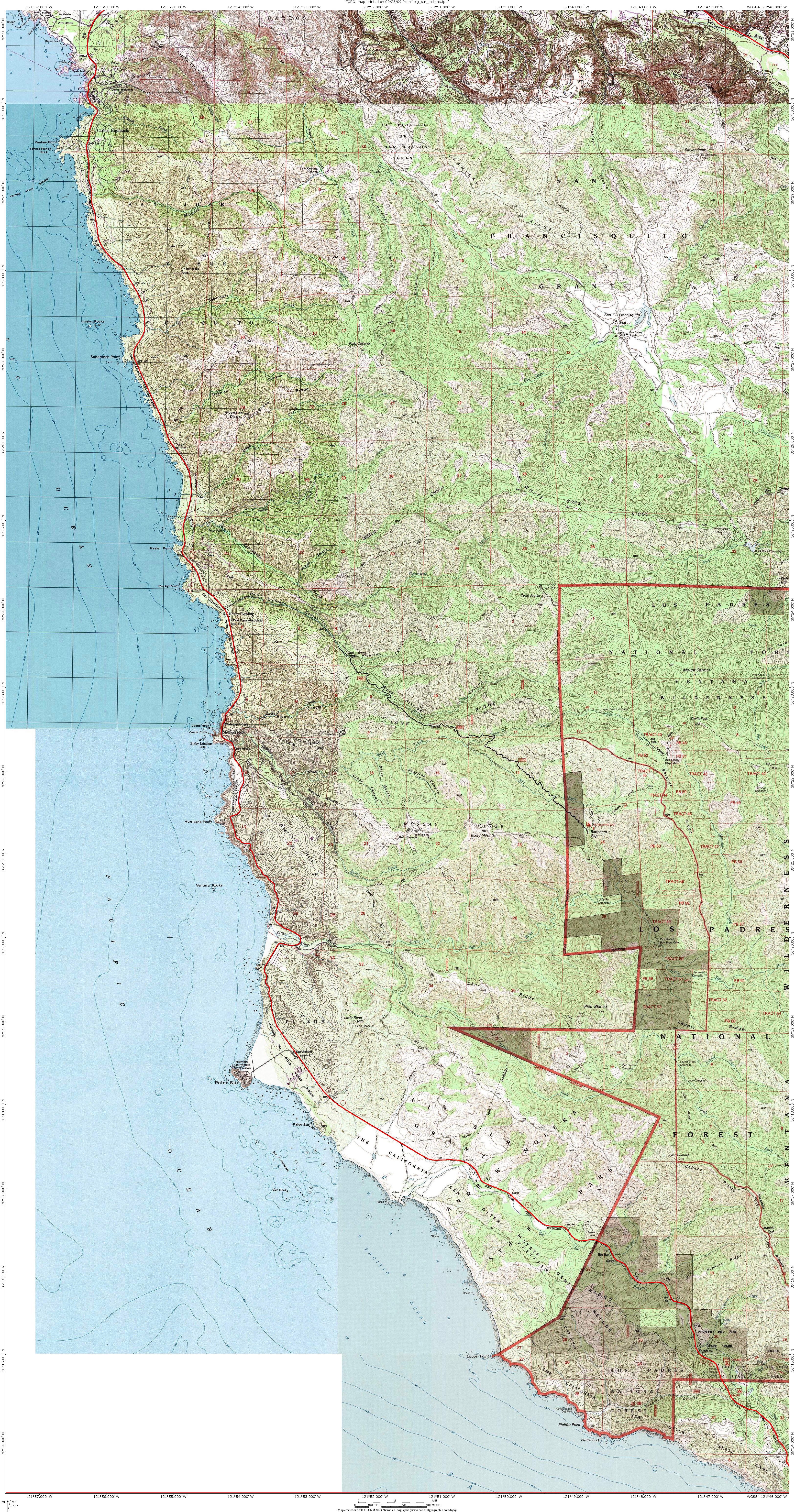
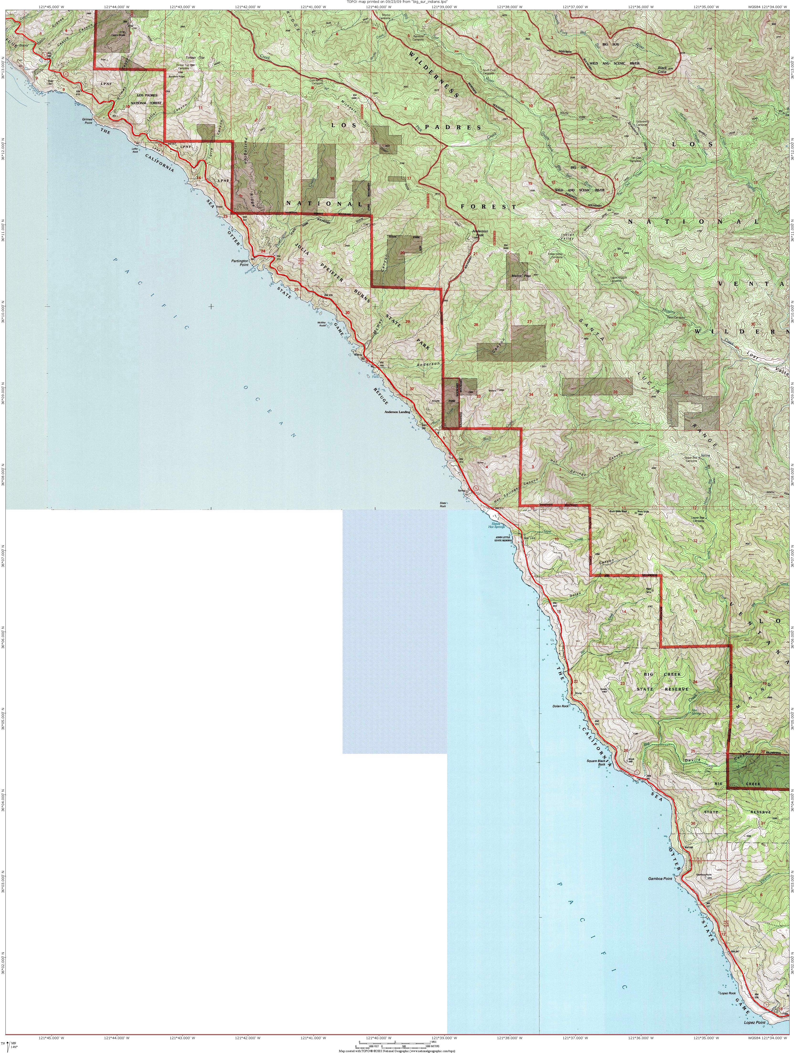
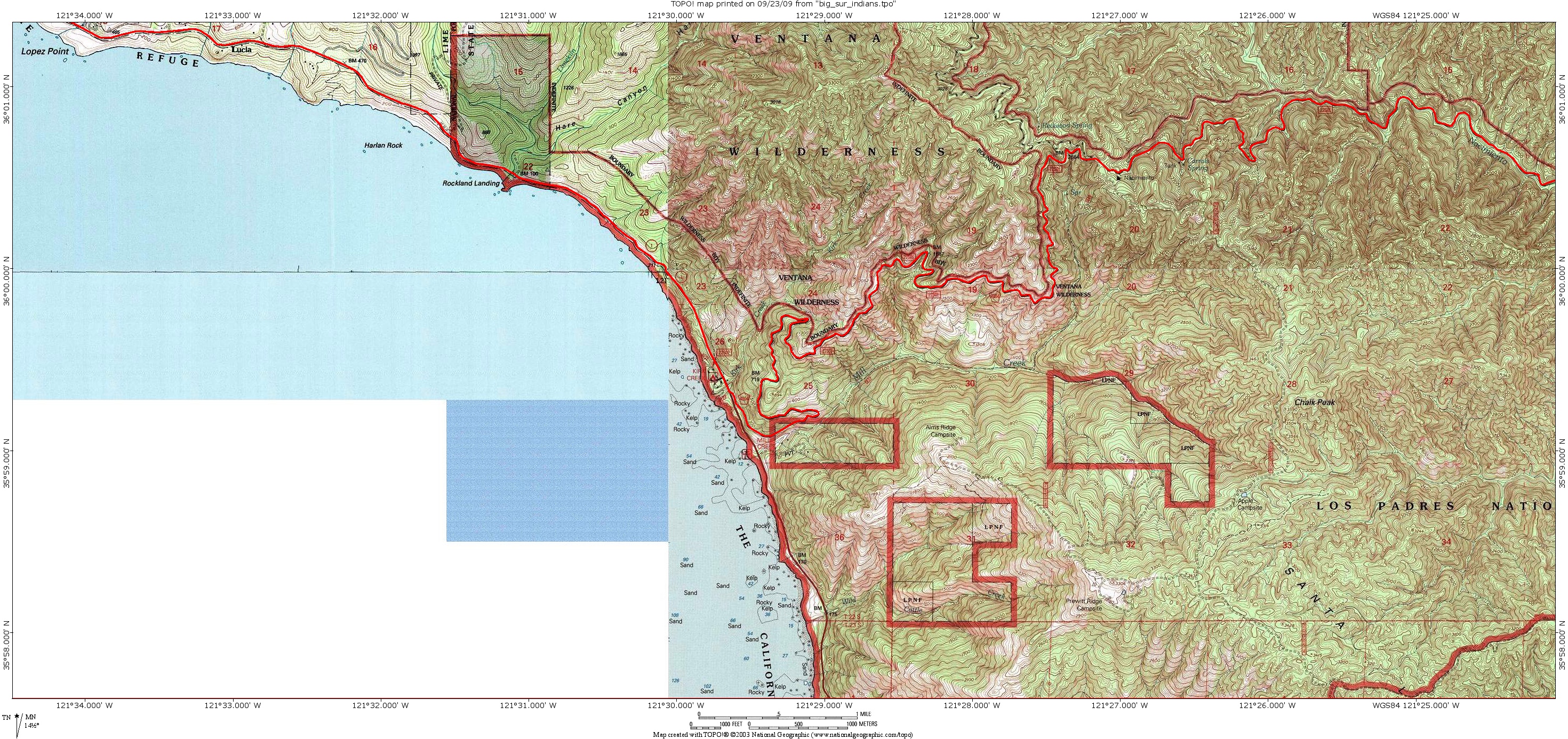
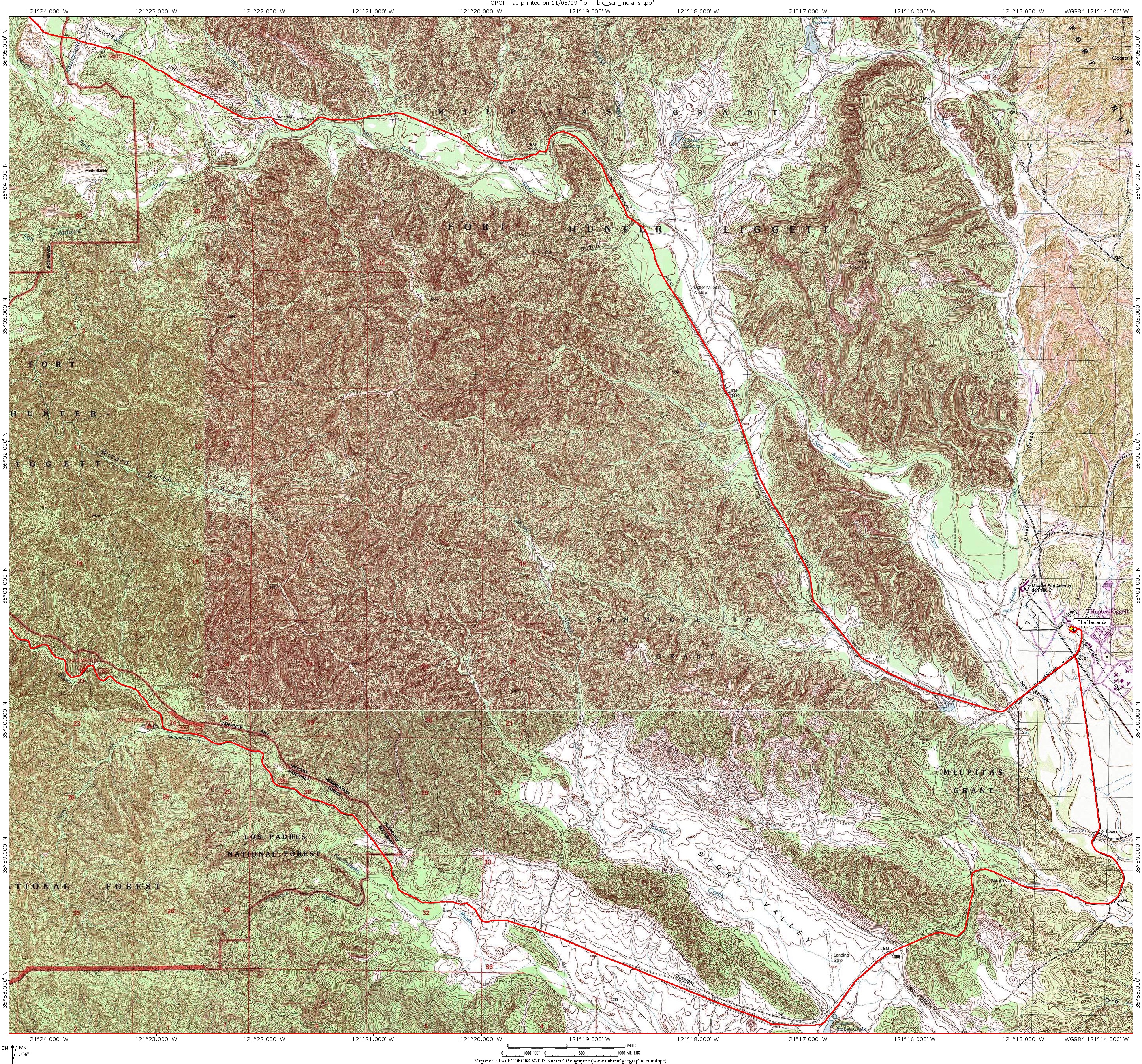
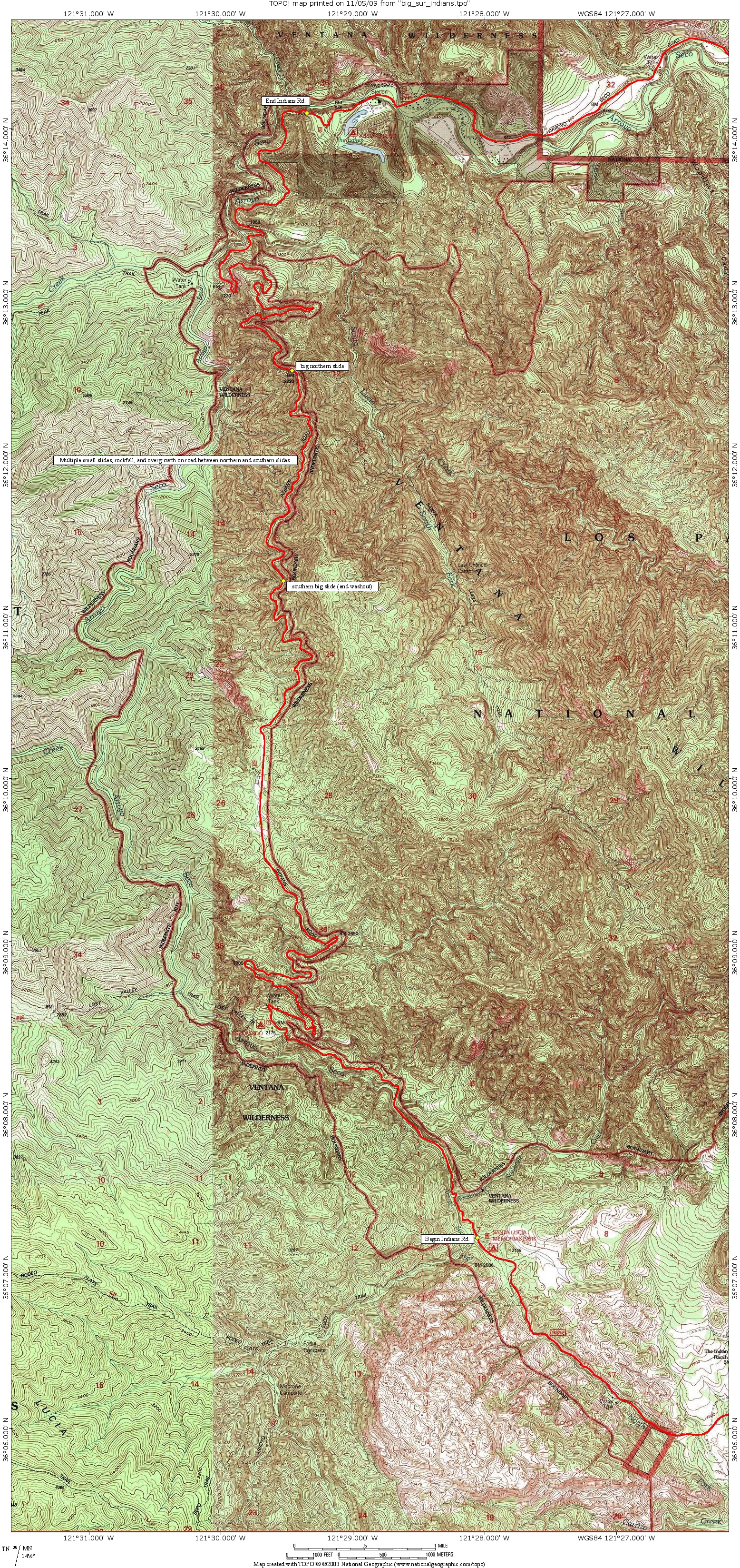
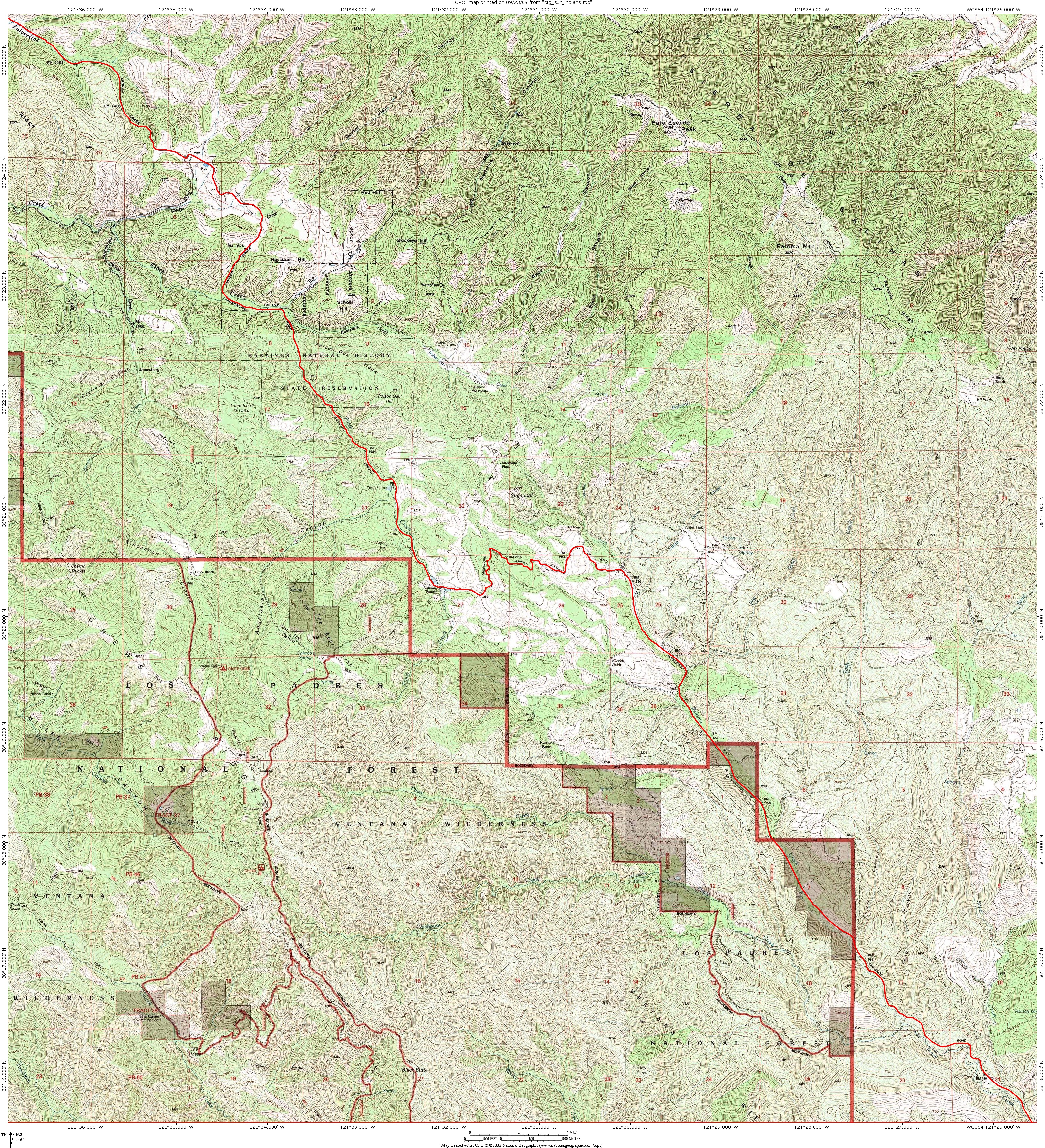
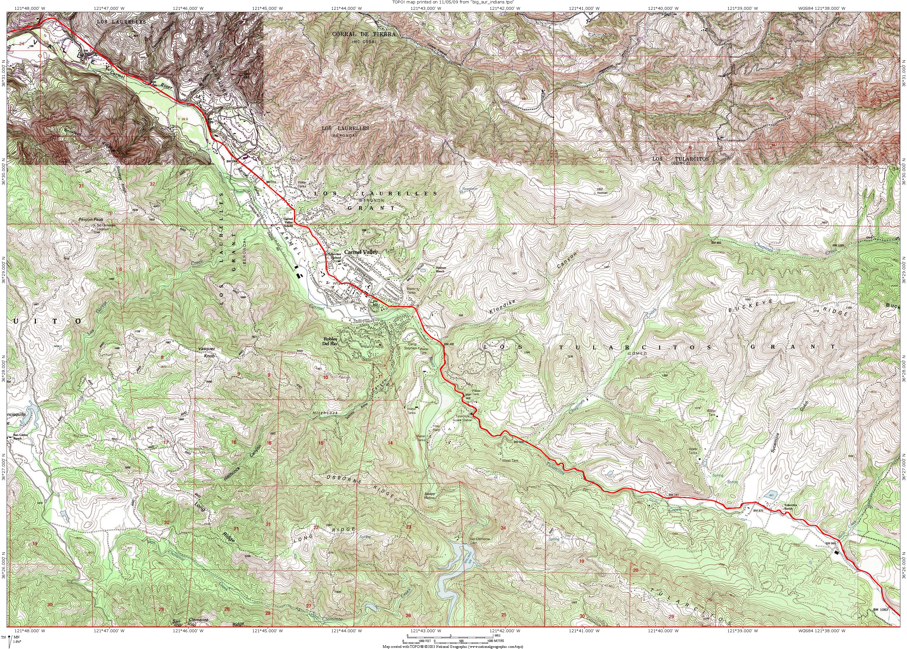
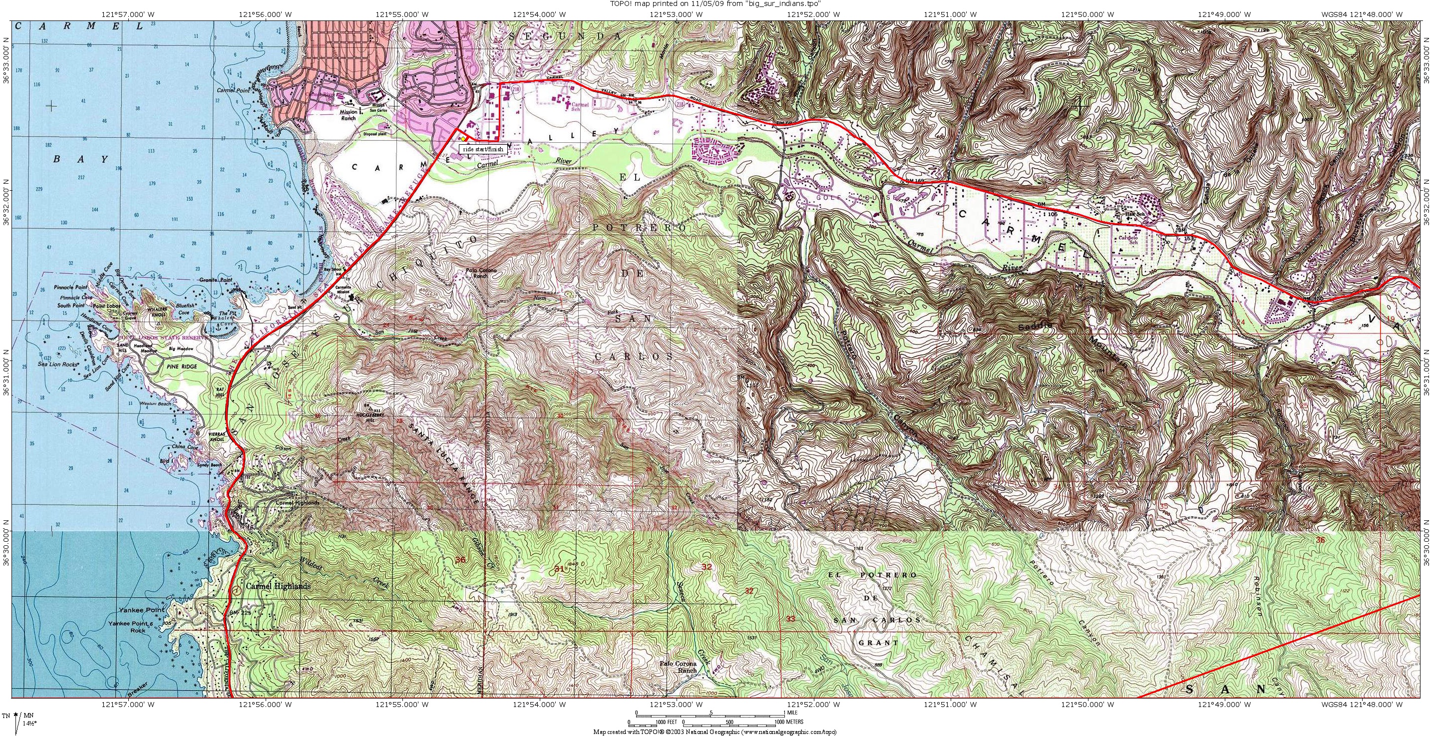