Go back to blog.
Quien Sabe Valley, April 2009
<<
Page 1
2
3
>>
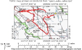
Overview Map
2009/04/19 08:00:00
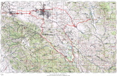
Complete Map
2009/04/19 08:01:00
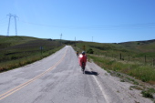
Climbing Cienega Rd. from the north.
2009/04/19 08:42:11
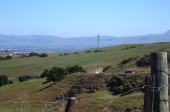
Looking back down Cienega Rd. toward Hollister.
2009/04/19 08:51:34
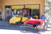
Taking a break at the Paicines Store.
2009/04/19 10:50:59
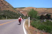
Ron and Andy ride north on CA25 near Paicines.
2009/04/19 11:13:33
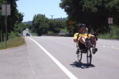
Andy rides past the San Benito County Fairgrounds on CA25
2009/04/19 11:21:41
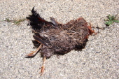
Dead rooster on Quien Sabe Rd.
2009/04/19 11:49:08
Click on a picture to enlarge it.
Generated by
Galerie
2009/April/26