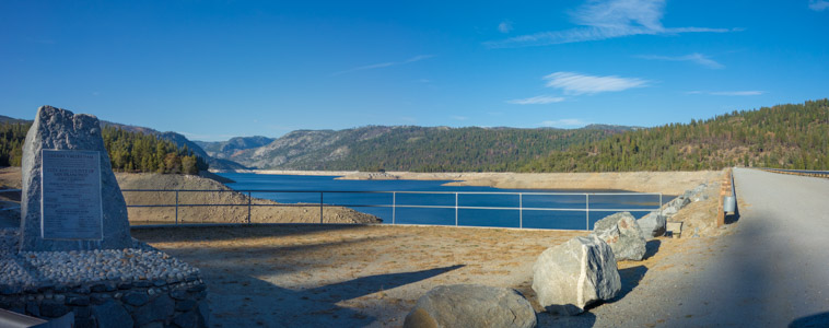
Cherry Lake - 9/2015
Reload page to see different photo.

All web site content except where otherwise noted: ©2025 Bill Bushnell
Background texture courtesy of Iridia's Backgrounds.
Please send comments or questions to the .
Bike Items for Sale - Here's a photo journal of bike parts that I'm trying to clear out of my workshop.
Shipping is $10 or (actual shipping charges + (optional) insurance charges + delivery confirmation fee), whichever is greater. I will try to find cheapest shipping option (e.g. USPS for US Domestic delivery) or will ship according to your carrier of preference.
Some of the parts are new, some are used. If you think my item pricing is off or you're buying multiple items, please make me an offer.
I am selling everything "as is". But, if you buy an item that is dead on arrival, damaged in shipment, or you believe you got a raw deal, please contact me as soon as possible so we can work out a solution. Given the time involved in selling these items I am not making a profit on this and am more interested in seeing components and parts I no longer use but that have remaining useful life to find a home with other bicycle enthusiasts, where they will be used instead of collecting dust in my workshop.
Contact me at the following . It will help if you include the links to photos of the items that interest you. All prices are in US Dollars.
Entire Blog - Display the entire Blog for all years. This is a large file!
| Bike Ridden: | Bridgestone RB-T |
|---|---|
| Distance: | 54.3 miles |
| Cumulative climbing: | 4500 feet |
| Total Time: | 7:05 |
| Riding Time: | 5:20 |
| Avg. Speed (moving): | 11.5 mph |
| Max. Speed: | 35.0 mph |
Chalk Mountain, December 27, 1992 - On Sunday, I drove down to Felton and met Brent and Jude whereupon we rode CA-9 north through Boulder Creek and then CA-236 and Lodge Road to Big Basin. Again the temperature was very cold. It didn’t get above 50F the whole day, and most of the time it was in the low-40’s with sprinkles and wind from the oncoming storm. From Big Basin we rode out Gazos Creek Road to Sandy Point. Near Sandy Point we passed Patrick Goebel and friends riding the other way on their mountain bikes.
After Sandy Point we continued on Whitehouse Canyon Road and then Chalks Road all the way to Chalk Mountain. Using the radio shed as a shelter from the fierce wind, we took a victory picture at the top and then headed down the roller-coaster road, stopping every so often to retrieve a water bottle that didn’t want to stay in its holder on the bumpy descents. The road is made of finely broken shale, and the views are great. From Sandy Point we returned to Felton by climbing Johansen Road to China Grade Road. We took another victory picture at the big log near China Grade Road and Gate 12, though we hardly looked victorious as we were very tired and hungry from all the steep climbing. From China Grade Brent and Jude returned to the Big Basin Park HQ where Jude had parked his truck, and I rode back to Felton alone (and fast as it was only 45 minutes to sunset).
Jude had driven from Felton to Big Basin earlier in the day with his mountain bike and road bike. He then rode his road bike back to Felton to meet us. Then he rode his road bike back to Big Basin and switched to his mountain bike for the dirt part. Jude has much more confidence descending fast on his mountain bike than he has on his Cannondale road bike, even on paved descents. Jude has, perhaps, a little too much confidence descending on his mountain bike as he took a spill on one of the sharp S-curves on CA-236 near the Big Basin Park HQ. Brent rode a mountain bike with very aggressive knobbies on the whole ride (including the paved 16 miles from Felton to Big Basin.)
This is a ride we’ll have to do again from Palo Alto when the days get longer and the weather gets warmer.
| Bike Ridden: | Bridgestone RB-T |
|---|---|
| Distance: | 62.4 miles |
| Cumulative climbing: | 2770 feet |
| Total Time: | 7:05 |
| Riding Time: | 4:41 |
| Avg. Speed (moving): | 13.3 mph |
| Max. Speed: | 34.0 mph |
Mission Peak, December 26, 1992 - On Saturday, Brent Silver and I rode across the Dumbarton Bridge to Fremont. We then hooked up with Alvin Chin’s Western Wheelers “C” ride going up the Alameda Creek path. He had at least 20 people on his ride. The moderately vigorous pace was just about right for us, but he described his ride as an easy spin in the newsletter. Maybe if I advertise my rides as easy spins I’ll get more people.
When we got to Niles Canyon, a cold wind was blowing from Sunol, and frigid fog was licking the grassy tops of the nearby hills. We stopped briefly to eat. The temperature was 42F. We then continued up Mill Creek Road and then up the back side of Mission Peak. The last mile and a half is a very steep dirt road with lots of large, loose gravel for about 1100 feet of climbing. Fortunately, the temperature at the top of the mountain was a warm 65F. The view was fantastic.
We rode down the steep dirt road on the front side of the mountain and then continued home on the flats through Milpitas, San Jose, Santa Clara, Sunnyvale, and Mountain View. Since Brent lives in Sunnyvale, he split off at Central Expressway and Wolfe Road.
| Bike Ridden: | Bridgestone RB-T |
|---|---|
| Distance: | 29 miles |
| Cumulative climbing: | 2300 feet |
Windy Hill with Laura, December 25, 1992 - Laura and I took a Christmas Day ride out to Portola Valley. We rode up Alpine Road, Crazy Pete's Road, and then north on Skyline Blvd. to Windy Hill. We then took the Spring Ridge Trail down to Portola Valley, and than rode home.
| Bike Ridden: | Bridgestone RB-T |
|---|---|
| Distance: | 56.0 miles |
| Cumulative climbing: | 7700 feet |
| Total Time: | 8:00 |
| Riding Time: | 5:17 |
| Avg. Speed (moving): | 10.6 mph |
| Max. Speed: | 32.0 mph |
Quimby, Kincaid, and Mt. Hamilton, December 20, 1992 - “Oh, don’t worry. We’re not a racing club. I don’t think you’ll have any problem on this ride. The weather report calls for rain or showers tomorrow, and it is cloudy outside, but I have a feeling it’ll be a nice day.”, I say to the voice at the other end of the phone.
“Now, I’m somewhat older than you. I just don’t want to slow you down. Well. I think it’ll be a nice day, too. If I show up, I show up. Don’t wait too long for me, though.”, Alex says tentatively.
Alex had called Saturday evening from his home near Lake Merritt in Oakland to find out more about the Mt. Hamilton ride I was leading for the Western Wheelers the next morning.
The morning is clear and cold as I pull into the turnout near the intersection of Mt. Hamilton Road and Alum Rock Ave. at 8:00. Having arrived early, Jude is sitting in his car to keep warm. As we get ready to ride, a dirty white late-60’s model Plymouth Valiant with a slightly smaller tire on the left front wheel rolls up Alum Rock Ave. and pulls into the turnout. The driver waves as he parks his car. When the door opens, out steps a short, white-haired old man with long spindly legs, ruddy cheeks and a slight hunch. There is a gleam in his eye. “Hello.”, I begin. “Are you Alex Zuckermann?”
“Yes. Yes.”, he says. “And you must be Bill Bushnell.” We shake hands. “It’s a beautiful day today. I wasn’t sure last night, but when I got up this morning I knew it would be a great day for a ride up the Mountain!”
“So. Are you going to go straight up Mt. Hamilton Road and meet us at Grant Ranch Park, or will you be riding up Quimby Road with us?”, I ask, wondering if we will be spending a good deal of time waiting for old Alex on the climbs.
“Oh, I wouldn’t think of missing Quimby Road.”, Alex says with an air that precludes further discussion. “I’ve ridden up Mt. Hamilton many times, but I’ve never ridden Quimby Road.”
While we talk, Brent Silver pulls up in his VW Vanagon. He seems somewhat surprised to see us there. The original plan was for us to start up Quimby Road and Brent would ride up Mt. Hamilton Road and join us at Grant Ranch Park. But we are late getting started, so Brent decides to have a go at Quimby Road.
Soon we’re rolling down Alum Rock Ave. toward White Road. We turn left on White Road and continue for another three and a half miles to Quimby Road. We make a quick stop at the gas station on the corner before starting up the long steep climb. Quimby Road begins innocently enough, but after a couple of straight miles it steepens to a relentless climb with grades over 11%. We all stay together near the bottom, but as we climb higher, we begin to separate as each of us finds a comfortable climbing pace. The view from Quimby is fantastic as we climb out of the valley. I stop once to take a picture of the road as it soars into the sky. This is the best time of year to climb Quimby; summertime would be too hot.
I reach the top first, but Alex is not far behind. A curious dog near the top manages to get Alex to sprint up the final hill to the summit. Brent follows a minute later, and then Jude arrives. When we arrive at Grant Ranch Park, the water is turned off and the bathroom doors are locked. Fortunately, I’m carrying enough water to see us to the summit.
We continue up Mt. Hamilton Road at a moderate pace. After the Smith Creek crossing, Alex and I ride together up the long final grade to the summit. The climb isn’t steep, but it is long. Alex watches his heartrate monitor. I notice that the county has begun gouging the road to install recessed reflectors along the center line of the roadway, presumably so they won’t get sheared off by the occasional snowplow. It looks as if one of the roadway crew was still practicing with the gouger as some of the gouges are deep and sudden. As we climb the final 400 feet to the summit, patches of snow and ice lie on either side of the roadway. In some places the roadway is icy, but not dangerously so. Only in the last eighth of a mile as the road hugs the north slope of the mountain does ice completely cover the roadway. Fortunately, there is sand and dirt on the ice, so traction is possible.
We stop in the summit parking lot and eat lunch. The temperature is a cool 42F, but the air is still, and the sun is warm. Looking north and west we can see low, dark stratus clouds, but from San Jose south and east, the air is crystal clear. I guess we’re going to miss any rain today. Looking east, we see the snow-capped peaks of the Sierra Nevada Mountains.
We begin the descent, slowly at first past the ice on the road, and then more quickly. Mt. Hamilton Road is usually good practice for cornering skills as the road has many sharp corners, but now the corners are strewn with gravel and rocks, and I find myself nearing the limit of traction more than once.
When we reach Kincaid Road, we turn right. Kincaid Road branches north from Mt. Hamilton Road about a mile up from Smith Creek or about five miles down from the summit. Part of the old stage road from San Jose to Livermore before the road to the observatory and over the Mountain was built, Kincaid Road passes through oak-studded meadows and crosses a few deep, remote canyon streams. I notice that the east sides of the mountain ranges are covered with conifers and the west sides are covered with oaks and grass.
As we ride past a herd of cattle grazing near the road, they get up en masse and galumph away from the road as we ride by. I’ve never seen cattle act so skittish around bicycles before. I guess not many bicyclists come down Kincaid Road.
Kincaid Road, an out-and-back ride, doesn’t look like much on a map, but there’s alot of up and down over its paved 7-mile length. The top part is wide and rough as it descends and then rises over a small hill before starting down a steeper hill to the bridge crossing Isabel Creek some three miles from Mt. Hamilton Road. Before the road reaches Isabel Creek, it narrows considerably, and the surface becomes smoother, though the potholes more frequent. The bridge over the creek is a slippery all-steel affair with a see-through metal mesh for a roadway. We stop on the far side and peel off some of our warm clothes for the ascent ahead.
Alex charges ahead without stopping. While we pack away our clothes, one of the residents walks down his driveway toward us.
We say, “Hello.”
And he says looking up at the sky, “Looks like you guys are gonna get wet.”
“Well, I think we’ll get home before it rains.”, I reply.
A low bank of clouds begins to drift over the surrounding mountains. The temperature warms, and it feels like we might get some rain. While I catch up with Alex, I get hit by a few spits. After climbing for a while, the road descends gradually to the Long Branch of Isabel Creek. On the other side of the creek, the road ascends several steep switchbacks before descending to a locked gate at Mt. Day Road 6 miles from Mt. Hamilton Road. Is this the end of the road? Petersen’s “Roads to Ride” profiles Kincaid Road only to this point.
After regrouping, Jude, Alex and I decide to climb over the gate and continue a little further. There is no indication that the continuing road is private, and evidence that the road is still public. Several Santa Clara County road construction horses lie by the road, and mileage markers stand along the shoulder. Brent decides to turn around and head back.
As we continue up the road, a couple of “Bronco Blazers” pass us going the other way. No one challenges us, so it must be O.K. to continue. The road passes through a meadow and fords Bonita Creek before ascending another set of steep switchbacks. Along this section we enjoy a picture-perfect view of the white domes of Lick Observatory framed by the steep hillsides on either side. After a mile and a half we reach another locked gate.
“Well, I don’t know about you guys, but according to my map, the pavement ends just around the corner up there, and the road is probably private past this gate even though there are no ‘Keep Out’ signs or other evidence to indicate such.”, I say.
We take an “end of Kincaid Road” group picture and head back the way we came. When we reach the first gate at Mt. Day Road, a truck is pulling through. Once again, Alex gets ahead of us and rides through the gate. I ride up to the driver’s window and introduce myself.
“How far up the road can we ride?”, I ask the woman behind the wheel.
“It’s a county road up to the second gate up there. After that, it’s private.”, she says. “This part used to be private, but the county took it over several years ago. They kept the gate locked because of the fire danger in summer. Sometimes these guys come up here in their four-wheel-drive vehicles. They cut the lock and drive through. There are lots of roads up in the surrounding hills, but unfortunately, most of them cross private property.”, she seemed glad to talk about living in the mountains.
“Is it possible to ride up to Mt. Day?”, I ask.
“Well, this road right here goes up. You continue until you reach a cyclone fence and then you go left up to the mountain. I used to ride my horse up there, but now you’d have to get permission from four landowners along the road, and the guys that live up there aren’t likely to give it. I’ve been shot at, and one of the guys shot my mule that had wandered over onto his property. I tried to get the DA to press charges, but I didn’t have enough evidence. They probably wouldn’t shoot you if you were in a group, but they probably wouldn’t take to having bicyclists ride up their road,” she says.
“If you talk to the old timers, they’ll tell you they used to go all over the mountains when they were kids and no one minded, but now you get alot of screwed-up engineers from the valley buying land and living up here with their guns. They shoot first and ask questions later. One guy used to work for UC Santa Cruz up at the observatory. He’s pretty screwed up.” She gestures by twirling her finger at the side of her head.
“One time a couple of guys came up here with their pit bulls to go boar-hunting. The guy that owns the land came down with his gun and ordered them off, ‘This is ma’ lan’, naw git off!’ When they balked he shot one of the dogs. ‘Naw git!’ They took off fast after that.”
“If you stay on the county road, you won’t get bothered. We sometimes get joggers and bicyclists, and we don’t mind if you jump this gate down here.”
“Well, thanks for the advice, and the information. I don’t think I want to cross someone who’s ready to shoot me.”, I say, “G’bye.”
Jude and I continue riding back to Mt. Hamilton Road. Jude says he’s going to take the climb easy, but I try to catch up to Alex who has gone leaping ahead. About a half mile from Mt. Hamilton Road, I see him spinning easily up the road by the meadow with the cattle. I pour on the steam. As he turns to the left he looks back and sees me catching up. He spins faster. A minute later he lets out a yell as he reaches Mt. Hamilton Road, and I’m still a couple hundred yards behind. When I finally catch up, Alex is still panting hard.
“Did you used to race when you were younger?”, I ask, pointing my finger at him. “I saw you look back and then speed up when you saw me!”
A few minutes later Jude hovers into view looking very relaxed.
“Let’s get going. It’s getting late now, and it’ll take us about forty-five minutes or so to get back to the car.”, I say.
The ride down to the car passes uneventfully.
“Well, that was a good ride. More climbing than I expected. And, Alex, I didn’t think you’d be able to keep up.”, I say.
“It was just a great ride. I probably overdid it a little bit going up Mt. Hamilton, but I feel great.”, Alex says.
“If you don’t mind my asking, just how old are you, Alex?”, I ask.
“Seventy-one. And I feel like thirty-eight.”, he answers with a smile.
| Bike Ridden: | Bridgestone RB-T |
|---|---|
| Distance: | 51 miles |
| Cumulative climbing: | 5500 feet |
Swanton Loop, December 13, 1992 - Jude Katsch and I rode a loop from Felton over to the coast to Swanton, then back via the UCSC campus.
| Bike Ridden: | Bridgestone RB-T |
|---|---|
| Distance: | 47.2 miles |
| Cumulative climbing: | 4540 feet |
| Total Time: | 7:13 |
| Riding Time: | 4:22 |
| Avg. Speed (moving): | 10.8 mph |
| Max. Speed: | 30.5 mph |
Montebello and Russian Ridge, December 5, 1992 - Jude and I meet at my house at 0900 shortly before setting off for the starting point at Gunn High School in Palo Alto. When we get to Gunn (five minutes late), we meet a new rider, Paul Liu a graduate student in economics at Stanford. After waiting five minutes or so, we start south on Foothill Expressway, riding slowly at first. The air is cold, and we are still warming up. At Homestead Road, we meet up with another rider. This other rider manages to keep pace with us all the way to the picnic area at Stevens Creek Park. When we stop we learn his name: Rich Feldman. Rich might join us on some future rides.
After filling our water bottles, we start up Montebello Road. This is a long climb; by the time we reached the gate, it is cold. At the gate we meet up with Brent Silver and the four of us continue up to the top of Black Mountain. We stop briefly at the top and then start down the Indian Creek Trail. Even with my 35mm tires, the washboard surface of the road so thoroughly shakes me that I have trouble seeing clearly at times. When we reach the bottom of the Indian Creek Trail, I discover that I have left open one of the side pockets on my rack pack, the side pocket containing my wallet, keys, and spare change. I check the pocket, and my wallet is still there. Whew! But, the keys and quite a bit of spare change are missing. Jude decides to wait at the bottom, while Paul, Brent, and I reluctantly begin riding back up the steep trail searching for my keys. Sprinkled along the way, we find several quarters and a couple of dimes. Paul finds my pencil, but the keys are nowhere. At the top, Brent decides to return home, so Paul and I get to ride down the rough trail twice.
When we reach the bottom, Jude is gone. The storm clouds are gathering more thickly, and the temperature has dropped to 48F. Jude is riding home to Felton, so he must have decided not to wait any longer. Paul and I continue up the Stevens Canyon Trail. Looking carefully, we see two fresh, tracks from a bicycle equipped with narrow slick tires. This must have been Jude’s bike.
When we reach Page Mill Road, we continue to Skyline and then head up the trail to Borel Hill. Paul and I stop and eat a snack just over the brow of the summit, out of the wind. After about 10 minutes we continue down the trail and turned left, down the backside of Borel Hill. This is a scenic road that winds its way from meadow to forest and eventually reaches the Mindego Hill Road. To the right the road continues to Mindego Hill, and to the left the road leaves the Open Space Preserve and joins Alpine Road about 3/4-mile up a fairly steep hill.
“Do you want to risk riding up to Alpine Road? It’s not very far, but there’s always a small chance someone will come along and shoo us back.”, I asked Paul.
“Yeah, I don’t mind.”, he replied.
On group rides, I wouldn’t do a short cut like this unless everyone on the ride agreed to the risk.
The risk, of course, is that the owner of the land will happen along during the 10 or 15 minutes we’re on his road. Well, luck must have been with us because as we were about halfway up the road, a Toyota Tercel comes slowly down in front of us. The driver pulls alongside us.
“Did you see a sign back there?!”, he yells indignantly.
“Well ...”, I begin.
“This is a private road. You’ll have to turn around. Now go on, turn around.”, he orders us.
“Can’t we just ride up to Alpine Rd? It’s only a quarter mile from here.”, I ask as politely as possible.
“No. We’ve had too much trouble with people leaving the gate open, and we’ve got cattle here that can get out, and if I let you go through, there’ll be hordes of bicyclists riding through here. You’ll have to go back and around the way you came.”, he answers.
He seems to think that we bicyclists are scum of the Earth. It’s too bad the road isn’t open to Alpine as this would make a nice loop. A cattle grate and/or a sprung gate would meet the owner’s stated complaints, unless of course he just doesn’t like bicyclists.
So, we turn around and ride back down to the trail that goes to Borel Hill. As the owner drives around a corner out of sight, we are tempted to retrace our tracks back up the road. It’s only 2/3 of a mile to Alpine. And, since there are no houses or other developments nearby, it seems petty of him to close it off to passers-through.
“But, what if he comes back to check up on us?”, we wonder.
“I’ll bet he’d be pretty pissed if he caught us on his road again.”, I say.
So, not wanting further trouble, we ride out the way we came in. The hill is tougher riding up than it looked when we rode down.
When we reach Skyline we continue back to Page Mill Road and then head down Page Mill Road to Alpine Road. The last dirt road of the day is before us. We start down the reasonably smooth surface. The last time I rode Alpine Road, the surface was so washboarded that my wrists and hands were sore by the time I reached the bottom. It looks as if the road has been improved somewhat since my last trip on it.
About a third of the way down, we pass a tall, wiry fellow digging a drainage ditch in the roadway. What’s this guy up to? He doesn’t look like a county road maintenance crew. We pass, but then I remember something.
“Paul. I think I know who that might be. Let’s turn around and find out.”, I say.
So we ride back up to the guy just as he finishes digging the ditch.
“Ahem. Excuse me. Would you happen to be Jobst Brandt?”, I venture.
“Yes. And who might you be?”, Jobst answers.
So we chat about why he is working on the road, about rides in Pescadero Creek County Park, and about the recent net flame war on anodized wheel rims. After looking over my bike, Jobst warns me to beware of getting sticks caught in the front wheel as they could catch the fender stay, and bending it jam the front fender into the tire, flipping me over the handlebars faster than I could think.
I appreciate that Jobst has taken upon himself the task of keeping east Alpine Road fit for bicycle passage. Thanks, Jobst.
Time is getting on, and Paul is a bit underdressed for the cool weather, so we say goodbye and continue down the hill. When we reach the bottom, we have to ride up a short steep trail that bypasses the gate. I’m not brave enough yet to ride it on my bike with slick tires, but Paul decides to take the risk, and he almost slips off into the ditch some five feet below.
When we get to Joaquin, we think about riding it up and then zipping down Los Trancos Woods Road, but we decide to head straight down Alpine. After coming to a complete stop at the stop sign marking the intersection of Alpine and Portola Rds, we quickly continue down Alpine toward Stanford University, averaging about 25 mph. And, after stopping briefly at Paul’s apartment, I continue home.
| Bike Ridden: | Bridgestone RB-T |
|---|---|
| Distance: | 67.8 miles |
| Cumulative climbing: | 5710 feet |
| Total Time: | 8:03 |
| Riding Time: | 5:15 |
| Avg. Speed (moving): | 12.9 mph |
| Max. Speed: | 41.5 mph |
Berkeley Hills, November 21, 1992 - Jude, Paul, and I carpool to Chris’s house in Berkeley for a ride in the Berkeley hills and the Orinda area. At Chris’s house, we meet Jennifer who has driven this morning from Sacramento to join us for the day’s adventure.
We start the ride by zig-zagging up the hills, trying to warm up before starting the major climb. The air is cold and damp. Finally we head up Euclid. At Marin, Jennifer and I decide to challenge (or punish) ourselves and ride the three city blocks at >20% grade up to Grizzly Peak Blvd. This is very difficult because neither of us has warmed up enough. When we get to the top we wait for a few minutes for the rest of the group to join us.
We continue up past Centennial Drive to the overlook right below Grizzly Peak. We stop to enjoy the view and to take a few pictures. Big Game preparations are underway at the Cal Berkeley stadium below. After a few minutes we continue down, but when we get to South Park Drive, we discover that the road is closed! Moreover there is a special sign of a bicycle with a slash through it. This is a disappointment because South Park Drive is one of the most enjoyable descents in the Bay Area. I want to take Fish Ranch Road to CA-24 to Orinda, but I am outvoted by those who prefer to stay off of the freeway. We take Lomas Cantadas to El Toyonal down to Orinda Village. This road is very steep, curvy, and the corners are poorly-banked and sprinkled with gravel. Since I am recovering from an unfortunate spill earlier in the week, I ride cautiously. The descent seems to go on and on.
When we get to Camino Pablo we turn left and head north toward Richmond on our ride around the reservoirs. Chris and Paul race to be first while the rest of us are strung out behind. Next time we ride here, we’ll practice our paceline skills. We regroup at Castro Ranch Road and head northeast. At Alhambra Valley Road we turn right and head east. Then at Bear Creek Road we turn right again and begin a southward journey. After riding up the seemingly endless “mama” bear and the somewhat shorter “papa” bear, (from the north) we cruise back down to Camino Pablo. With a slight headwind, I manage a max speed of 39.0 mph, but some of us get into the low 40’s on this descent. At Camino Pablo we turn left and head into Orinda for a rest and a snack.
After eating lunches and snacks we start up Moraga Way toward Moraga. Chris says he isn’t feeling well, so he continues home when we turn left on Glorietta Road heading toward Lafayette. The rest of us continue to Acalanes Road and then to Upper Happy Valley Road. We turn right on Happy Valley Road and then left on Mt. Diablo Blvd. just past the Lafayette BART station. A mile later we turn right on Moraga Road. This road isn’t too much fun. The lanes are narrow, and traffic is heavy with wide, impatiently-driven American and German cars and buses and trucks belching fumes while passing very close.
We finally reach Moraga, and as we pass onto Canyon Road, the traffic dwindles to a trickle. I am half-hoping that we’ll meet up with Chris since he came by here earlier, but I guess he got impatient and continued without us. At Pinehurst I decide to lead the group up the right-hand path to Skyline. Pinehurst rises slowly through a deep canyon before starting a twisty, sometimes steep final climb one mile before Skyline Blvd. The road isn’t as steep and dangerous as it seemed when I rode down it last year. We regroup at the top and head south on Skyline through Joaquin Miller Park and then down Joaquin Miller Road. This descent almost makes up for missing South Park Drive. It’s almost as steep, but since it’s a four-lane road it seems safer somehow. This is one of the few roads where bicyclists might feel more comfortable riding in the left lane to pass slower auto and bus traffic. We all reach speeds in the low- to mid- 40’s. If the winds are right, one can get up to 50, but we have a pre-storm headwind today.
At the bottom we continue north along the CA-13 frontage road, Mountain Blvd. At Snake Road, I figure we have just enough time for one more climb to Skyline before heading back to Chris’s house. We start up Snake Road and continue up Shepherd Canyon Road. Near the top, we decide to press on rather than follow the easier but longer bike route to the top. The road steepens considerably, and while Petersen’s Roads to Ride rates the average grade at only 9%, it seems more in the mid-teens to me. And that “stinger” at the very top looks about 18%.
At the top we turn left and head north toward Berkeley. As we pass over the Caldicott Tunnel, we can see construction in progress on the hills below following the Oakland Hills fire last year. When we reach Claremont Road we stop briefly, and I warn people to take care on the descent. The road has a few surprises for the unwary: hairpin turns near the top that are steeper and less well-banked than they appear, an unexpected rut running across the otherwise smooth road about a third-mile from the top, and generally lousy pavement conditions on the bottom half of the descent. Just after I finish my lecture of caution, two helmetless teenagers whip by us down the hill in a mad pedaling frenzy.
As we near the bottom, crowds of people dressed in red are walking up the roadway, and cars are parked on the verge. The Big Game is over, and Stanford has won again. Since Jennifer wants to see some of the University, I decide to lead us back to Chris’s house via Piedmont. The most smog-filled segment of riding I’ve done to date was between the parked, idling buses lining the streets on our return route. The air is thick with diesel fumes, and we make our way carefully down the polluted corridor of metal. Emergency vehicles with sirens blaring and lights flashing push their way through the crowd to get to a hapless bystander injured in the chaos. We are in Berkeley.
We turn left at Bancroft and coast down the hill past the center of all chaos, as it were, to Oxford and then on to Chris’s house a mile beyond.
Following hot though necessarily brief showers for all, we walk the two and a half blocks to Fatapple’s for a hearty meal and lively conversation. Over dinner we argue every controversy: abortion, guns, Libertarianism, environmentalism, conservatism, liberalism, Bush, Perot, Clinton, Boxer, Hirshensohn, Democrats, Republicans, income tax, social security tax, flat taxes, slanted taxes, upside-down taxes, drugs, animal rights, people rights, vegetarianism, etc. Maybe the ride wasn’t long enough!
| Bike Ridden: | Bridgestone RB-T |
|---|---|
| Distance: | 68 miles |
| Cumulative climbing: | 6200 feet |
Go Directly To Jail, November 14, 1992 - Jude Katsch, Paul Kern, Richard Mlynarik and I rode from Palo Alto over to Pescadero Creek County Park, down Camp Pomponio Road (the road to the jail), and then took Bridge Trail across Pescadero Creek to Old Haul Road. We came out through Portola State Park, and when we got to Skyline Blvd, we rode south to Saratoga Gap before heading down CA9 and returning home. Only one photo was taken on this ride of the group at the Saratoga Gap Fire Station next to the old drinking fountain.
| Bike Ridden: | Bridgestone RB-T |
|---|---|
| Distance: | 76.0 miles |
| Cumulative climbing: | 4690 feet |
| Total Time: | 9:21 |
| Riding Time: | 5:14 |
| Avg. Speed (moving): | 14.5 mph |
| Max. Speed: | 39.5 mph |
Twin Peaks and San Bruno Mountain, October 31, 1992 - Three of us started in Palo Alto (Brent, Jules, and me). We rode through sleepy East Palo Alto at 0720 (Normally, this isn’t a safe route with all the random shootings, etc., but things were quiet enough at this hour.) and out across the Dumbarton Bridge. Brent flatted on the east side of the bridge, so we stopped and lost about 15-20 minutes fixing his flat. We continued quickly across the salt flats against a weak headwind into Newark. Jules was full of energy, and as he was leading, he kept pulling away from us. I was barely able to hold onto the rear, and Brent was dropped several times. About a half-hour later we arrived at the Union City BART, and after we managed to get the ticket-dispensing machine not to vomit out our crumpled dollar bills, we rushed up the elevator to the platform just before the San Francisco-bound train arrived.
The ride to San Francisco was uneventful. Brent patched the tube he flatted on earlier, and as we traveled through Oakland, the train filled up. If you have an Avocet bike computer, remove it from the mount while taking your bike on BART, especially if you place your bike in front of the sideways seats in the center-side of the car near the doors. It seems that the magnetic fields generated by the train motors can be detected by the coil pickup of the computer. I accumulated 10 miles of distance on my computer and my average speed went up to 22.6 with a max of 102.0 mph!
We exited at the Embarcadero station and took the elevators to the street. Frank was there to meet us, and he was slightly peeved that the times I had given him were read off an old train schedule.
We continued straight up Market Street. Traffic was light (for San Francisco), but there were still buses and cars and trolley tracks to watch for. When we got to 17th street, we started up some steep hills to get to Twin Peaks. Twin Peaks is not very high, about 900 feet above sea level, but the view from the top is magnificent. If you’ve been to San Francisco, you may have seen the big three-legged red and white antenna tower (Sutro Tower) on Mt. Sutro. Twin Peaks is the slightly higher peak a quarter mile to the southest of Mt. Sutro, very near the geographical center of the City.
We stopped at the top, enjoyed the view, and BS’ed about the coming election. The time was 10:15a, but not too early for hordes of tourists in large, double-decker buses. After I took a couple of pictures, we started down the southwest side of the peak to Portola Ave.
We continued down Portola Street all the way to Junipero Serra Blvd and then continued briefly onto I-280 (legal for a short stretch) before exiting at John Daly Blvd. near the Daly City BART station. We continued our way through Daly City, and found our way to Guadalupe Canyon Parkway. We rode up the long hill (~500 feet) to the San Bruno Mountain Park entrance. I arrived first, and a minute later Jules arrived. After five minutes Frank and Brent came into view, but they missed the park entranced. I tried yelling and waving frantically, but they must have been having an interesting conversation because they continued past the park entrance and down the other side of the mountain! There wasn’t much we could do but follow them down to the bottom on the other side at Brisbane. We found them waiting at the bottom of the hill. Embarrassment was written on their faces; they knew they had gone too far.
So, back we rode, up the other side of the hill. After stopping briefly again at the park entrance, we started up Radio Road to the radio towers atop San Bruno Mountain. After eating lunch and more election BS, we started down. The sky was becoming increasingly cloudy. Parts of the City to the north were obscured by rain. Uh oh. Maybe we’re going to get wet this ride.
Fortunately, rain was not to happen for us. By the time we returned to Daly City, the clouds had cleared and the temperature had warmed. We rode back to the BART station, and Frank left us. Frank lives in Berkeley, and he didn’t want to ride all the way down to Palo Alto and then across to Union City at the end of the day.
Now there were three of us. We rode west on John Daly Blvd. down and then up the long hill to Skyline Blvd. At Skyline Blvd we began our long southward journey. We rode on Skyline stopping only for lights and for me to write down the major road intersections in my book. When Skyline reaches I-280, bicycles are not permitted to continue, even though we’d only be on the shoulder and wouldn’t have to cross any lanes of traffic. We had to backtrack a little ways and take the foot/bike path. The path is nice except for all the people walking two and three abreast and the dogs pulling this way and that on their leashes. The path ends at Larkspur Ave. 1.5 miles later. We returned to Skyline Blvd, now paralleling I-280. At Hillcrest Ave. we stopped at the Chevron station to top off our water bottles and to allow Brent time to change his tire which had gone flat again. (!) From here we can either take the 5-mile Sawyer Camp Trail with its 15 mph speed limit (5 mph at the beginning and end), or we can take I-280 for 0.8 miles and return to Skyline Blvd. We chose the latter.
We continued on Skyline to Hayne Road, crossed under I-280 (to the west side of the freeway) and continued south to CA-92 and Canada Road. From here the route is much more familiar, and we had fun burning off the excess calories still left in our legs by sprinting south on Canada Road. We reached Palo Alto at 1630, with enough time to spare before dark.
| Bike Ridden: | Bridgestone RB-T |
|---|---|
| Distance: | 55 miles |
| Cumulative climbing: | 4600 feet |
Mt. Tamalpais, October 18, 1992 - Chris Hull, Brent Silver, Jude Katsch, and I met at the south end of the Golden Gate Bridge. We rode north across the bridge and through southern Marin County to Fairfax where we then climbed Fairfax-Bolinas Road to Ridgecrest, then took Ridgecrest to the summit picnic area for the East Peak of Mt. Tamalpais. We descended Ridgecrest, Pan-Toll, and Panoramic Highway to Mill Valley and Sausalito and returned to San Francisco.
| Bike Ridden: | Bridgestone RB-T |
|---|---|
| Distance: | 78 miles |
| Cumulative climbing: | 4900 feet |
East Bay Ride, October 11, 1992 - Chris Hull and I rode from his place in Berkeley. We started off by heading over to Alhambra Valley Road, then over Pig Farm Hill to Walnut Creek, then south to Danville and San Ramon. We returned up Dublin Canyon Road, Redwood Road, and then back to Berkeley through Montclair and Rockridge.
| Bike Ridden: | Bridgestone RB-T |
|---|---|
| Distance: | 78 miles |
| Cumulative climbing: | 6700 feet |
Old Haul Road, October 4, 1992 - Jude Katsch, David Casseres, Bryan Beck and I rode out to Memorial Park and Old Haul Road where Jude promptly got a flat. We returned on Camp Pomponio Road, west Alpine Road, Skyline, and CA9.
| Bike Ridden: | Bridgestone RB-T |
|---|---|
| Distance: | 18.6 miles |
| Cumulative climbing: | 3320 feet |
| Total Time: | 3:20 |
| Riding Time: | 2:01 |
| Avg. Speed (moving): | 9.2 mph |
| Max. Speed: | 43.0 mph |
Sonora Pass west, September 21, 1992 - O.K. So we wimped out again. Jude Katsch and I had planned to ride both sides of Sonora Pass, but we didn’t have time to do this and drive from Hope Valley and drive back to the Bay Area. But, I think we chose the more difficult side of Sonora Pass, the side everyone always seems to talk about when you ask them what their hardest ride was. Some of the purists may object to the fact that we didn’t start our ride in Sonora. I make no apologies. The highway from Sonora to Kennedy Meadow, while worth riding sometime, is really not very distinguished. It is also more crowded with traffic and logging trucks. CA- 9 from Saratoga to Santa Cruz is similar. The interesting section of CA-108 runs from Kennedy Meadow on the west to Leavitt Meadow on the east side of the Sierra Crest. Given our limited time, I wanted to ride the most noteworthy section, and that meant saving the east side of Sonora Pass for another trip.
After driving over from the east side of Sonora Pass, we park the car near the lone telephone at the junction of Kennedy Meadow Road and CA-108. The top of the pass was cool and comfortable, but at Kennedy Meadow some 3400 feet lower, the air is hot and dry. (My Avocet 50 compresses the readings once again. Sonora Pass actually lies at about 9620 feet above sea level.) We drink as much water as we can before starting out. Unfortunately, we’ll be riding up the steepest, hottest section of road at the noon hour. We’re fresh, but we’re not warmed up, so this will be hard.
We pass the yellow road sign warning of steep and windy road ahead, and not more than 100 yards of flat road later, we begin the steep climb. To the left, is a steep hillside covered with light-colored rock and shrubs and to the right is Kennedy Meadow and Deadman Creek. This part of the climb averages about a 10% grade, but it feels worse than that.
This first part is hard work, and the sunlight bouncing off the light-colored rock makes us sweat buckets. Just before we reach the point where the road cuts through a large rock boulder (I believe this is what some people call the “Rock Window”.), Jude calls out that he’s overheating and wants to stop. I pull off at the turnout just below the rock.
“Jude, why don’t you push on a little further. There’s a vista point just a little ways up the hill.”, I yell out.
“O.K.”, says Jude.
After a minute or two, Jude gets on his bike and continues on to the vista point. After snapping a picture of him riding through the Rock Window, I continue and join him at the vista.
From the vista, the road continues not quite as steeply as before. But it’s still hot, and there’s little shade. About a mile beyond the vista the road makes two short switchbacks. At the second switchback there’s another vista. I stop and wait for Jude. We’ve gone only 2 miles, but we’ve climbed over 1000 feet. Meanwhile some hunters are standing by the road taking a break from their drive.
“You bicycled up this road?!”, one of them asks incredulously. “You’re not going up to the top are you?!”
“Yeah, we only started at Kennedy Meadow, so we’re going up to the pass and then down. It shouldn’t be that hard.”, I reply.
“Man, that’s hard work! Good luck!”, he says.
When Jude catches up, we rest for a couple of minutes, take a couple pictures, and then continue riding. The road levels off about a mile and a half above the second switchback, and then it drops down a long straight hill, the only downgrade on the climb. We’ve reached Chipmunk Flat. The downhill feels good, but we both know that we have to make up the altitude somewhere along the way.
From Chipmunk Flat, the road rises gradually through a forest and then opens up into a landscape of alpine meadows, rock, and an occasional tree. This is the most beautiful section of the climb. A crumbly rock wall of white rock stands to our left, and a gracefully upswept talus slope rises to the right. I stop to wait for Jude and to eat some food. (Hey, it’s lunchtime!) I don’t eat much because I know we have some climbing to do still.
After rising up a short, straight, steep hill, the road levels off then becomes steep again. After a couple of switchbacks at about 8700 feet, the road makes a sharp uphill turn to the left and begins climbing to the northeast. This is the second steep extended upgrade on the climb. There is no shade, but the air is quite a bit cooler here than it was near the bottom. CalTrans is working on the road, but the flagman waves me through.
Once past the road crews, I feel the road level off a bit. I’m still climbing, but it’s not that difficult. The air is cool, and clear. I ride slowly to allow Jude to catch up. We both continue the ride, and after a couple easy miles we reach the pass together.
“Well. Do you want to go down the east side for a little ways?”, I ask Jude, half seriously.
“No. I’m almost out of water. Besides we don’t have time.”, he replies.
Just then a pickup truck hauling a horse trailer comes up over the pass at a snail’s pace. The smell of hot machinery hits our nostrils as it lumbers by. The horses in the trailer aren’t too happy as they’re kicking the inside of the trailer.
We return down the west side for a quarter mile and then turn up the road to the Sonora Pass Trailhead picnic area where we eat more food and finish up our water.
After a fifteen minutes we start down. The descent is not terribly interesting. It’s steep, and I reach my maximum speed going down the upper steep section just before the sharp turn at 8700 feet. Since I descend faster than Jude, I stop occasionally to wait for him, to take an interesting picture and to let my rims cool. At the vista point near the bottom, we catch up with the trailer hauling the kicking horses. After what seems like all too short a descent, we reach the bottom.
“That’s it? Gee, I wish we had time to go down and up the east side. Some parts were difficult, but it wasn’t all that bad. I think there are several climbs close to home that are more difficult, like Alba Road, Jamison Creek Road or Bohlman Road. What do you think?”, I say.
“Yeah, I really don’t feel all that bad.”, Jude replies.
“Well, remember, we haven’t even ridden 20 miles yet, so we’re still fresh. If we had started in Sonora, we would be more tired for sure.”, I add.
As a final note, I suggest that anyone wishing to ride this bring plenty of water. I started out with 76 oz., and I used it all up by the time I reached the bottom at the end of the ride. There is no water between Kennedy Meadow and Leavitt Meadow unless you don’t mind drinking from the streams.
| Bike Ridden: | Bridgestone RB-T |
|---|---|
| Distance: | 55.2 miles |
| Cumulative climbing: | 6450 feet |
| Total Time: | 8:17 |
| Riding Time: | 5:12 |
| Avg. Speed (moving): | 10.6 mph |
| Max. Speed: | 43.5 mph |
Ebbetts Pass, September 20, 1992 - After eating breakfast and bringing ourselves outside into the 40° F air, Jude Katsch and I drive down to Markleeville and beyond to the CA-89/CA-4 junction for the start of our ride. By the time we reach CA-4, the air has warmed considerably, though I still wear a sweater and leg-warmers. While we prepare our bikes for the ride, a couple of bicyclists come coasting down CA-89 from Monitor Pass. Apparently, they’re sagging themselves up the hill so they can coast down. That sounds like fun, but I don’t imagine they get much exercise doing that. Besides, you really can’t say you’ve ridden a hill until you’ve gone up and down under your own power.
“We saw a big black bear ambling across the road just up there.”, one of them says as he approaches us at the bottom.
“Well, we probably won’t see him since we’re heading up CA-4.”, I reply.
We start pedaling slowly south on CA-4 alongside the East Fork Carson River. The road rises very slowly as it meanders through the canyon. This is a good warmup. We stop to peel some clothing at the turnoff for Wolf Creek Rd at Centerville Flat. After Wolf Creek Road the highway veers right and continues up along Silver Creek. We pass a few cabins, and someone is trying to sell an historic mansion. On the left side of the road is a tiny ruin with a fence around it. A sign reads, “Silver Mountain Historic Site”. Apparently, the surrounding hills used to be mined for silver.
About a mile later we begin our first real climb. The center line disappears, and the road steepens. We climb steeply for about half a mile before reaching the Silver Creek Campground. A working water faucet stands near the entrance on the downhill side of the road. This is our last water stop before we reach Lake Alpine. A sign on the bulletin board inside the campground says that the camp closes on September 21 at 14:00. I guess we’re doing this ride as late in the year as is practical. Even though we haven’t been drinking much water we top off our bottles. I carry two large bottles and one small, and Jude carries two large and two small. This should be enough water for both of us unless it gets really hot.
After stretching for a few minutes we continue up a few long switchbacks. Through the breaks in the trees, the view is magnificent. We can see all the way down Silver Creek valley and the mountains on either side. Beyond the switchbacks the road still continues to rise as it hugs the steep hillside. The road is very narrow here, barely more than a lane wide, and some motorists pass without being able to see if another vehicle is coming downhill from around a blind corner.
As we continue, the road begins to rise in stairstep fashion through alternating groves of bright-yellow and orange aspen and open meadows. There’s even one short downhill before the road passes Kinney Reservoir. Beyond Kinney Reservior, the road rises steeply for 2/3 mile, then levels off briefly at the Pacific Crest Trail access, and then makes one final push to Ebbetts Pass.
At the pass we take a “victory picture” in front of the Historic Sign and eat part of our lunches. The air is comfortable, about 70F, I’d guess. Unfortunately, my thermometer is on top of Monitor Pass where I accidentally left it yesterday, so I don’t know for sure how hot or cold it is here. As a rule I find that without a thermometer, I tend to underestimate the temperature in the Sierras, especially if it’s hot.
After resting for a half-hour, we begin the mentally difficult 1700-foot descent from Ebbetts Pass to Hermit Valley down the west side of the pass. Traffic is light and most of the descent can be handled without braking. The road is straight as it descends along the hillside with only one major deviation about halfway down at The Elbow as the road veers into the hillside to cross Elbow Creek.
Having crossed Elbow Creek we continue down the long straight road. I don’t find myself moving too fast even though I don’t use the brakes. Finally in what seems all too short a time, we reach Hermit Valley. We stop at the small campground in search of a water faucet. Unfortunately, there doesn’t appear to be one. The only sign of development is a small brick building housing a foul-smelling pit toilet. We used up most of our water on the ascent from Silver Creek Campground to Ebbetts Pass. Right now we each have about one and a half small water bottle’s worth.
We continue on to Lake Alpine. Immediately after crossing the Mokelumne River the road begins a vicious ascent up the east side of Pacific Grade Summit. The road is very steep in places as it climbs 1000 feet in less than 2 miles. The only respite comes when the road levels off near the turnoff for the Pacific Valley campground. Following the turnoff, the road rises through several very steep switchbacks. For some reason the traffic has decided to pick up, and along with the heat and the steep hill, we have to contend with smog belching from the tailpipes of pickup trucks and campers. Despite the signs at CA-89 and Lake Alpine warning long vehicles away from this road, several campers and camper-trailers roll by. Were it not for the traffic, this would be a beautiful section of road.
After about a half-hour of steep climbing we finally reach the summit. The summit sign is planted next to the green waters of Mosquito Lake. Mosquito Lake is at the head of the North Fork Stanislaus River, but what feeds the lake? Streams drain from both ends, and there isn’t much watershed above the lake to keep it full. The map shows a campground near Mosquito Lake, but after searching for a water faucet, we find only the ubiquitous pit toilet. We continue on.
The west side descent from Pacific Grade Summit is barely a descent for several miles as it parallels the 8000-foot contour, but after rounding Cape Horn (Yes, that’s the name.) it begins a short, fast drop to Lake Alpine. At the east end of the lake just as the centerline of the road returns, there is a working water faucet. We refill our bottles and sit at one of the picnic tables, eating more food and drinking more water. The air is neither too hot nor too cool, but it is dry.
At this point we decide not to continue to Bear Valley, but to return. But before we start back, we ride down the road a little way to take a picture of the cool blue lake.
As we start back I feel strangely invigorated. Maybe it’s because I’m properly hydrated or because I’ve eaten, but I think it’s the “horse returning to the stable” syndrome—I know that each pedal stroke brings me closer to rather than farther from the end of the ride.
We climb quickly up from Lake Alpine to Cape Horn and on to Mosquito Lake and Pacific Grade Summit. Then we begin the quick descent to Hermit Valley. Near the end of the first long, steep downhill just before the first switchback, there’s a fun whoop-de-do. I manage to get up to about 40 mph as I sail over the hump. It feels as if I weigh about half as much at the apex. But as soon as my full weight is over the wheels, I slam on the brakes for the right-hand switchback 50 feet ahead. I stop a couple times to take pictures on the way down and to let the rims cool a bit. This descent requires braking.
After blasting across the bridge at the bottom we continue without stopping and start the long climb back up to Ebbetts Pass. As we climb we notice that people have driven their campers into the turnouts and set up camp among the trees.
I wonder why we haven’t seen any other bicyclists on the road? The only place we saw bicyclists was at the bottom of Monitor Pass where we started the ride and at Lake Alpine where a couple were taking a lazy ride along the lake. One reason might be because we’ve come up during hunting season. In the distance across Hermit Valley we hear the occasional sharp report of a gun. It seems that deer season has come again to the Sierras, and there is no lack of hunters willing to shoot deer. I notice for the first time that the people in the pickup trucks and campers driving by are wearing orange vests or bright red caps. Guns are displayed prominently on racks across the rear windows. The grizzled, heavyset men in the cabs invariably give us dumbfounded looks as they drive by as if to say, “Look at those crazy bicyclists! You wouldn’t catch me huffing and puffing up these hills!”
Several pickup trucks pass down the hill. In the back of a one I see a dead deer. A yellow tag has been taped to its antlers, and its unblinking eye stares at me as I ride past. Did it die painfully? What do the hunters do with the deer? Eat it? Ribs poked from under the skins of the few living deer we saw earlier venturing along the highway. There couldn’t be much food on most of these deer. Do they stuff its head and mount it like a trophy of great accomplishment on the wall at home? Or do they show off the corpse to their friends and then toss it out with the garbage?
“I don’t like all this hunting going on. What do you think?”, I ask Jude.
“I think hunting is dumb, but I don’t think it should be outlawed. In fact I’m against gun control, even banning assault weapons.”, Jude says, surprising me. “I’m very much a believer in the 2nd amendment right to bear arms. I think it’s important for citizens to have legal access to weapons so the government can’t declare martial law.”
“Oh, come on, Jude. How likely is it that martial law will be declared and that we’ll all be sorry because we don’t each have a gun?”, I ask.
“Well, I don’t like guns personally but I think that people should have the right to own them.”, Jude answers. “Americans have become too complacent while their rights are being taken away right and left. I don’t think it’s too far-fetched for martial law to be declared sometime in the future. I take a libertarian view on this, generally.”
We ride on silently while I ponder what Jude has said. I hate guns, and this discussion about hunting, guns, and martial law has made me even more depressed. Jude doesn’t strike me as the kind of person who’d be pro-gun, and his views surprise me.
I just hope these hunters know enough not to shoot toward the highway. To be fair, I will say that as bicyclists we are treated with courtesy by most of the motor vehicle traffic. These guys do seem to be more polite than the average teenage “Joe” racing up and down the mountain roads near home in the Bay Area.
We continue on for a while before stopping to stretch at the level section along The Elbow. We both get off, stretch, and eat a snack.
“We’re about halfway up to Ebbetts Pass from Hermit Valley. It shouldn’t take us too much longer to reach the summit.”, I say.
“Yeah. I think it’s probably a good thing we turned around at Lake Alpine.
This makes the ride back less urgent.”, Jude says.
We begin climbing again. On the upper half of the climb, the road comes into the open for a few extended stretches. The air is cool, but the sun is hot, and we’re both working hard.
At about a half-mile before the pass Jude says, “Hey Bill, I’ve got to stop and cool off. I’m beginning to overheat.” Jude hates riding when he can’t keep cool. Maybe it’s his dark-colored jersey.
“O.K. How about under this big tree up here?”, I point to the nearest spot of shade alongside the road.
We stop and while Jude cools off, he checks his rear tire. “Uh oh, I think maybe I should add some air. It looks like I’ve got a slow leak.”
I feel the tire, and sure enough it feels like there’s only about 40 psi inside. “Yeah, you’d better pump it up some.”, I say.
Jude starts pumping, but after a few strokes a loud hissing comes from the valve, and soon the tire is flat. “It looks like I’ve just busted the tube.”
Since Jude forgot his spare tube, I take the spare tube out of my tool pouch, and after some struggling with the tightly fitting tire (Continental GPs on Mavic MA rims), Jude’s bike is ready to roll. We reach the pass a few minutes later, and after taking another victory picture in front of the historic sign, we begin the fun descent.
Since it’s late in the day, the sun casts sharp shadows bringing the surrounding peaks and mountains into sharp relief. I stop a couple of times to take pictures of the scenery. Someone has spraypainted in green paint warnings of sharp turns or blind corners just ahead.
When we reach the Silver Creek Campground, the gate has been locked. The faucet near the road is still working, so we stop anyway to top off one water bottle each.
The last seven miles go by swiftly as we continue without stopping until we reach the car at CA-89. The sun has just set behind the walls of the canyon, but the air is still hot when we reach the end.
| Bike Ridden: | Bridgestone RB-T |
|---|---|
| Distance: | 39.1 miles |
| Cumulative climbing: | 4100 feet |
| Total Time: | 4:15 |
| Riding Time: | 3:12 |
| Avg. Speed (moving): | 12.2 mph |
| Max. Speed: | 46.0 mph |
Monitor Pass, September 19, 1992 - Our plan was to ride from Woodfords through Markleeville and over Monitor Pass and back. As you can see from the Route Log, we decided against descending the east side because we both had very little water after the west ascent, and the availability of water at the bottom of the east side was uncertain. We also felt that it would be a good idea not to push ourselves too hard on the first day at altitude. I had been sick the week before and hadn’t done a long ride since the Hekaton Classic on Labor Day weekend.
After checking into our cabin and eating our lunches, Jude Katsch and I drive down Carson Canyon to Woodfords Station, the start of our half-day ride. The air is hot and very dry. But the thermometer reads 83F, so it’s not too hot. A couple of serious-looking bicyclists are just leaving the store.
We start pedaling slowly south on CA-89 past the Woodfords Inn and the Sierra Cafe. A sign by the road says “bike lane”, but the only possible indication that the shoulder is the bike lane is that the shoulder is slightly wider here than on other roads. The air is very dry and before long our mouths are dry. CA-89 between Woodfords and Markleeville is wide and gradual as it rises and falls through low, sparsely-wooded hills and cattle grazing pasture. This is the driest time of year, and everything looks brown and dry. After cresting a long hill, we pass the turnoff for Turtle Rock Park and begin the gradual descent into Markleeville.
Markleeville is a quaint little town about the size of Pescadero, California. With a population of 165, one would never expect it to be the county seat of Alpine County. We stop at Bob’s Shell station to use the restroom. While I wait for Jude, I have the uncomfortable feeling of being watched. I look across the street and sitting on a bench in front of the J. Marklee Toll Station (hotel and cafe) is a grizzled old man staring right at me! Haven’t these people seen bicyclists before? It takes me a minute to realize he is a dummy. Both Jude and I laugh when we realize our mistake. But those eyes do seem to follow us as we start pedaling down the street. Sitting on a bench in front of the General Store on the left side of the street an indian keeps an eye on passersby. We’re not fooled this time, though.
After crossing Markleeville Creek, the road rises over a low hill past some irrigated pasture where cattle graze and then down to Hangman’s Bridge crossing over the East Fork of the Carson River. A mile later we pass the East Fork Resort, a collection of little green cabins and camper hookups in a dusty turnout on the left of the road.
Now the road rises gradually through a steep-walled canyon alongside the East Fork Carson River. The surrounding land reminds me somewhat of the hills behind Mt. Hamilton, only here there are dusty pines instead of oaks. At the CA-4 junction we turn left and begin the long climb to the top of Monitor Pass.
The road rises slowly along Monitor Creek up a deep, hot canyon. We both sweat profusely, and even though the air is dry, sweat drips from under our helmets. At the junction with Morning Star Road, the road becomes much steeper. Now it’s time to shift into low gear. There is a very slight breeze from behind that keeps us from overheating as we pump up the long steep hill. There is no shade anywhere.
As the canyon opens up near the top, Jude says, “Let’s stop up there if there’s shade.” But as the road becomes less steep, Jude says, “Well, I think I can continue. Let’s keep going. I just don’t want to overheat.” We continue riding past the road to Heenan Lake. Someone has spray-painted in green: “There’s more yet.” on the road. A message of encouragement for “Reb” is scrawled in white paint. Higher on the mountain we can see the road winding steeply up to Monitor Pass. Everything is so dry, and the only shade appears to be from some of the now golden-colored aspen trees higher up the hill.
After we cross over the cattle grate at Sagehen Flat, the road levels off and drops for a short distance before making the final climb to the pass. A short distance later we pass Leviathan Road on the left. An off-pavement adventure might take us up Leviathan Road and down Leviathan Creek on the other side of the ridge. Leviathan Road continues all the way to US-395 near Gardnerville.
We are surprised by a guy on a luge with wheels zipping down the road on his back. The view is becoming interesting now. Looking west we can see the Sierra Crest and some of the higher peaks in the area. Many of the aspen trees on the higher slopes have turned a golden yellow.
As we climb, the air becomes cooler. The grade feels like a constant seven or eight percent, and we’re high enough now to pass through a few golden groves of aspen. Before long we reach a cattle grate and then the top of the long hill. But this is a false summit. The “monitor” watchtower on Leviathan Peak can be clearly seen, and the actual pass is a few feet higher on the opposite side of the saddle. We continue down the short hill through the little valley and up into a grove of aspen to the granite stone marking the pass on the other side of the saddle.
“Well, we made it.”, I say. “How do you feel?”
“Yeah, I really don’t feel that bad at all.”, says Jude.
“It’s quite a bit cooler here than it was at the bottom,” I say, “I wonder what the temperature is.” I take my thermometer from my pack and set in on the ground so that it reads the correct temperature.
“Well, seeing that this is our first ride at altitude, and that it’s already 15:30, and that we’re both nearly out of water, I think we should skip the east side today. We can do it next time we come up to the mountains. If we still have time and energy after we get back, we can ride up Carson Canyon or take the little detour on Diamond Valley Road. As it is if we go down and back up the east side, we’ll be get back to the car at least two and maybe three hours later. What do you think?”, I say.
“Yes. I think that’d probably be a good idea. I think I have the energy for it, but I don’t want to wear myself out since we’re riding tomorrow, too. I’ve never ridden two major rides back to back.”, says Jude.
So we head back down the west side. The ride down is fast and fun. I stop a couple of times to take a picture of the view in front of us. Near the cattle grate at Sagehen Flat, the luge-boarder is waiting by the road. I continue without pedaling over the little rise and continue down the steep canyon. A strong hot wind blows up the canyon, yet despite this I still manage a maximum speed of 46.0 mph. I’d probably get over 50 if there were no wind.
When I get to the bottom, I wait for Jude. Jude doesn’t like fast descents, but he says that since he’s only been road riding for a couple of months, he’ll get used to descending faster with time.
“That was fun, wasn’t it?”, I ask Jude.
“Yeah. You know, it doesn’t seem that much warmer at the bottom than it was at the top.”, says Jude.
“Yeah, I wonder what the temperature is?”, I say as I reach into my pack for my thermometer. “Darn! I left my thermometer at the pass! Well, I’m not riding back up for it, that’s for sure! Maybe we can check to see if it’s still there the day after tomorrow when we drive home.”
It turns out that I couldn’t find the thermometer a couple days later when we drove over Monitor Pass, so someone found a nice thermometer lying on a tuft of grass up at Monitor Pass sometime between Saturday afternoon and Monday morning.
We continue back towards Markleeville. After stopping at the General Store to refill our water bottles, we continue to Woodfords. The hill out of Markleeville doesn’t feel as difficult as it looked when we rode down it on our way into town, and before long we’re back at the car.
| Bike Ridden: | Bridgestone RB-T |
|---|---|
| Distance: | 97 miles |
| Cumulative climbing: | 3400 feet |
Hekaton Classic, September 6, 1992 - Chris Hull and I met in San Ramon to ride the "Moderate 100" mile route of the Hekaton Classic. Weather was hot, but the route was fun considering it wasn't too hilly. We had fun practicing pacelining through the Livermore Valley with someone who bore a resemblance to Tom Ritchey. At this time the Pleasanton/Livermore area hadn't been built out as much as it is today, so most of it was still rural.
| Bike Ridden: | Bridgestone RB-T |
|---|---|
| Distance: | 76.2 miles |
| Cumulative climbing: | 5180 feet |
| Total Time: | 9:26 |
| Riding Time: | 5:29 |
| Avg. Speed (moving): | 13.9 mph |
| Max. Speed: | 43.0 mph |
Mt. Madonna and Uvas Road, September 5, 1992 - Starting at the beginning of the Los Gatos Creek Trail at about 0800, there are five of us on today’s ride: Rich McCauley, Jude Katsch, Jim Becker, Scott ?, and me. We ascend the trail to the dam and ride around the backside of Lexington on Alma Bridge Road. Since some of us aren’t crazy about riding on any more dirt, we decide to head up Old Santa Cruz Hwy instead of the more adventurous trip through Aldercroft Heights and beyond.
About 1/2-mile before Summit Road, Scott’s derailleur manages to shift beyond his largest cog and entangle the chain and derailleur in the spokes. One of the most severe cases of “chain suck” I’ve ever witnessed, the jam manages to pull his rear wheel out of the dropouts (bending one of them) and to force it against the backside of the bottom bracket, locking up the wheel. With a skid and an “Oh, SHIT!”, he comes to a stop, and with his shoes locked helplessly to the pedals, he falls to his left and lands in the middle of the road with an undignified thud. Fortunately, we are still climbing, so we aren’t riding very fast. He seems a little shaken, but he has only a minor cut on his knee.
His bike didn’t fare so well. We all pull off the road to a wider turnout on the other side. Jim turns the bike upside down, and surveys the damage. I guess Cannondales don’t have much clearance between the inner chainrings and the chainstays. The paint is chipped and the aluminum gouged where the chain has forced its way through the gap. The chain also managed to wedge itself tightly between the inside of the right crank and the fixed cup. After struggling for a few minutes, Jim manages to free the chain. Since the dropout is bent we adjust the limit screws to keep the derailleur from making a repeat performance. After we get the bike rideable, Scott decides to turn back and take his bike into the shop for a more complete repair. Since he didn’t want to spend all day riding, Jim decides to turn back, too. This is probably a good idea since Scott might have had another mishap on the way down.
So now we are three. At Summit Road we turn left and continue the ride. Since it is still early in the ride, we don’t stop at the Summit Store. We continue on Highland Road up over the big slide of last winter and on to Eureka Canyon Road. We stop at the “four corners” intersection for a snack and then we head down the hill. Eureka Canyon Road is one of the most beautiful in the Santa Cruz Mountains. Traffic is very light in part because of the slide on Highland Way and the “Major DISASTER ahead” signs at either end discouraging through traffic but also because the road doesn’t connect to a very populous section of Santa Cruz County. The road is twisty and descends gradually through a dark, cool redwood forest before coming to Corralitos at the bottom of the hill.
We stop and eat snacks on the lawn across the street from the Corralitos Market and Sausage Company. While we are resting a group of cyclists with the Almaden Cycling club comes by. They are on a three-day excursion to San Juan Bautista and back, and they had just come over from San Jose the way we will be going back.
We chat with a few of the riders. They tell us that we’ll have to ride on a graded gravel road if we take Redwood Retreat Road. We also talk about taking Hicks Road up and over its summit and of maybe trying Loma Almaden Road. They warn us about the Yosemite Sam types up near the top of Loma Almaden who harass anyone trying to pass on the road. One of the Almaden riders told us he knows some people who have managed to get all the way to the top of Mt. Umunhum without being challenged.
After spending about an hour we start up Browns Valley Road and then turn right on Amesti Road, then left on Pioneer Road and right on Green Valley Road, then left on Casserly Road, and then left on (finally) Mt. Madonna Road Mt. Madonna Road from Casserly to Hazel Dell Road ascends gradually, but after Hazel Dell, the road begins a relentless, often shadeless two-mile, 10% grade climb.
Both Jude and Rich stopped a couple of times on the way up. Jude apparently has trouble in heat, and after a morning of cool, comfortable temperatures, the air is now hot and windless. I sweat a great deal on the way up, and I’m sure this contributes somewhat to my feeling dehydrated on the trip back to Los Gatos.
At the top of Mt. Madonna Road, I stop and rest on one of the “root benches” at the foot of the big old redwood tree standing stubbornly in the center of the intersection of Mt. Madonna, Summit, and Pole Line Rds. It appears from here that the entire descent of Mt. Madonna Road on the east side is gravel, and if Redwood Retreat Road is also gravel, that means we’ll have a long way to go on gravel roads, something I don’t think Jude or Rich will be too crazy about.
About ten minutes later, Jude and Rich arrive at the top, and five minutes after that, we start up Pole Line Road. After filling our water bottles at the park facility we continue on Pole Line, stopping briefly so I can get a picture of the white stag at the deer farm, and again so I can ask the ranger for directions to make sure we are heading in the right direction for Hwy 152. After riding down two very steep but short hills, we arrive at Hecker Pass. Traffic is moderate, and the road looks safe enough. We joke about watching out for young teenagers driving Broncos and searching the back seat for cassette tapes before starting down the hill.
This is a fun descent. It’s only 1309 feet at the top and about 380 feet at the bottom, but the descent seems to go on forever and at quite a speed. I guess the breeze blowing over from Watsonville helps. The change in climate from the tall, cool groves of redwoods at Hecker Pass to the hot, dry, semi-arid landscape at Watsonville Road is quite dramatic, too. The sound of mariachi music drifts from the little cafe at the corner. It’s like riding from Washington State to Mexico in 10 minutes!
At Watsonville Road we turn left and head into a parching headwind. This part of the ride is not much fun. The temperature is in the mid- to upper-80s F, but with the strong headwind we’re working very hard to maintain 18 mph.
Knowing that I’ll probably need to stop and get water somewhere along the way, we pull into the parking lot at Uvas Reservoir. Surely there must be a faucet somewhere near the reservoir. We ride up to the picnic area but find no faucets.
I walk up to a family picnicking and ask, “Do you know if there’s any water here?”
With a chuckle, the man gestures grandly toward the reservoir with his arm, “There’s plenty out there, but I don’t know if I’d drink it. I think I’ve got some in the car.”
Without another word, he gets up and walks over to his truck. After searching for a while, he brings out a 51-oz. bottle of Arrowhead mineral water.
“How much do you want for it?”, I offer.
“You can have it.”, he says.
“Oh, thank you very much.”, I return.
This is enough to top off all of our water bottles, necessary for the long ride into the hot wind.
After thanking the man again for the bottled water, we continue on. For the next several miles, Jude and I trade off pulling for each other. Rich doesn’t seem comfortable following too closely, so he breaks his own wind while following some ways back. Somewhere between Oak Glen and Casa Loma Rds., Rich gets ahead of us, and by the time we reach the entrance to Calero Reservoir, I’m starting to get hungry.
“Hey Jude, why don’t we pull into this picnic area and take a break. I need to eat something.”, I say.
Rich is too far ahead to call out to. I hope he doesn’t backtrack for us. We ride down the long driveway past the white brick gate. I stop at the first picnic table, and Jude continues on to the ranger station to get some water. After starting on an energy bar, I decide to join him. Apparently, there’s no running water at the station house, but a bottled water machine dispenses chilled bottled water.
I’m still wrestling with the chewy, taffy-like bar when Jude decides he’d better go on ahead to make sure Rich hasn’t backtracked too far.
“Wait for me at Bailey Road.”, I say.
“O.K.”, he says.
After another 5 minutes of chewing, I finally finish the bar and head back to the road. Bailey Road is not more than a half mile away, and when I reach the intersection, Jude is waiting, but Rich is nowhere. Oh well, I just hope he’s continued on ahead.
We continue riding past the jet ski launching area, and soon we pass Rich heading back.
“What happened to you guys? Did you flat?”, he asks, looking a bit annoyed.
“No, we just stopped for some water and to eat a bit.”, Jude says.
We continue on for another couple of miles until we reach Harry Road at the end of McKean Road. We turn left and ride up to Hicks Road.
“Well, do you guys feel like riding up over Hicks Road?”, I ask.
“No.”
“No.”
“Well, I vote no, too. That headwind has drained me.”
So we turn right and then left on Almaden Expressway. We stop at a shopping center about a mile down the expressway, and Jude and Rich go into the liquor store and each buy a bottle of Gatorade.
After a few minutes, we start again. We opt out of returning over Shannon or Kennedy Roads, we’re that drained. We take Camden to Blossom Hill Rd to get back to Los Gatos. Blossom Hill Road is dreadful to ride, and for about a half mile the road has only two lanes with no shoulder. Along the side of the road long sticky branches of poison oak reach out to brush against unwary cyclists passing by. My mind goes through the unpleasant scenario of a motorist cutting me off, forcing me into the glistening leaves.
It’s a good thing, maybe, that Scott and Jim didn’t continue the ride since Scott said at the beginning that he had to be home by 1530.
| Bike Ridden: | Bridgestone RB-T |
|---|---|
| Distance: | 79 miles |
| Cumulative climbing: | 6800 feet |
Eureka Canyon Road, August 30, 1992 - Chris Hull and I drove up to Lexington Dam to begin our ride. We rode up Black Road to Skyline Blvd, then down Bear Creek Road to Boulder Creek, where we stopped for water and a snack. We then rode into Santa Cruz, stopping this time at the Staff of Life deli before continuing south through Soquel and Aptos to Corralitos for another snack break. We then rode up Eureka Canyon Road and took Highland Way and Summit Road to the Summit Store for another break before descending Morrill Road to Wrights Station, then cutting through the San Jose Water Company land to Aldercroft Heights Road to finish the ride with a circuit on Alma Bridge Road.
| Bike Ridden: | Bridgestone RB-T |
|---|---|
| Distance: | 91 miles |
| Cumulative climbing: | 8600 feet |
Jamison Creek Road, August 23, 1992 - Chris Hull and I did a ride similar to that on August 2. We got up early, rode up CA9 from Saratoga, then descended CA9 toward Big Basin, taking CA236 to China Grade Road, then down to the Boulder Creek Golf and Country Club for a snack before tackling the Jamison Creek Road climb. We then rode Empire Grade Road down into Santa Cruz for lunch at the Saturn Cafe. After lunch we returned through Scotts Valley and up Mountain Charlie Road as we had on the prior ride.
| Bike Ridden: | Bridgestone RB-T |
|---|---|
| Distance: | 100 miles |
| Cumulative climbing: | 6500 feet |
San Francisco, August 15, 1992 - This was the first ride I did with Gardner Cohen. We started from my place in Palo Alto, rode over the Dumbarton Bridge to Union City, then took BART into San Francisco. Once in San Francisco we rode over the Golden Gate Bridge to the Marin Headlands, then south along the coast to Half Moon Bay, after which we turned inland and ascended Tunitas Creek Road and returned to Palo Alto.
| Bike Ridden: | Bridgestone RB-T |
|---|---|
| Distance: | 100 miles |
| Cumulative climbing: | 6900 feet |
Banana Classic, August 9, 1992 - Chris Hull and I were planning to ride this organized ride together, but Chris came down with a cold the day before and backed out. Since I had signed up and already paid my fee, I decided to ride it on my own and with everyone else.
| Bike Ridden: | Bridgestone RB-T |
|---|---|
| Distance: | 106 miles |
| Cumulative climbing: | 7200 feet |
Alba Road, August 2, 1992 - Chris Hull and I left Palo Alto early, rode the flat route to Saratoga, climbed CA9, descended to Boulder Creek and Ben Lomond, then climbed Alba Road. We then descended Empire Grade Road into Santa Cruz for lunch at the Saturn Cafe (at its old location on Mission St.), then returned over the hill on Mtn. Charlie Road.
| Bike Ridden: | Bridgestone RB-T |
|---|---|
| Distance: | 70 miles |
| Cumulative climbing: | 2500 feet |
Dumbarton Bridge, Calaveras Road, and Felter Road, August 1, 1992 - This was the first Western Wheelers ride I ever led. Listed as a "C" ride it started in Palo Alto then went over the Dumbarton Bridge, through Fremont to Milpitas, then up Calaveras and Felter Roads to the top of Sierra Road, then down Sierra Road into San Jose and back to Palo Alto.
| Bike Ridden: | Bridgestone RB-T |
|---|---|
| Distance: | 49 miles |
| Cumulative climbing: | 3000 feet |
Bohlman Road, July 30, 1992 - Chris Hull and I did a late-afternoon ride up Bohlman Road and down Montevina Road. This was the first time either of us had ridden these roads.
| Bike Ridden: | Bridgestone RB-T |
|---|---|
| Distance: | 58.9 miles |
| Cumulative climbing: | 5480 feet |
| Total Time: | 6:50 |
| Riding Time: | 4:27 |
| Avg. Speed (moving): | 13.2 mph |
| Max. Speed: | 49.0 mph |
Tioga Road, July 25, 1992 - Not even 60 miles. Well, I had two reasons for not pushing myself on a longer ride today: One, I overextended myself two days earlier, and I didn’t want a repeat performance of the unpleasant symptoms, and two, since CA-120 or Tioga Road through the Yosemite high country is one of the most scenic roads in the Sierras, I wanted to have time to take pictures and enjoy the scenery. It makes little sense to attempt distance/speed records here. I decided to limit my ride to CA-120 from US-395 to Olmsted Point overlooking Tenaya Lake, Cloud’s Rest and Half Dome as this is the most interesting section.
After sleeping in after the extended happy hour the night before, I finally pull out of the parking lot in front of the condo. I drive from Mammoth Lakes up to Lee Vining before starting the ride. Unfortunately, this means I won’t have much time to warm up as CA-120 begins climbing right from US-395, and then has only a short semi-level stretch before beginning the long upgrade in earnest.
When I arrive at CA-120, the air is already warm. I’m carrying three water bottles today, and I’ve promised myself that I’ll keep drinking water even if I don’t always feel thirsty. After checking over my bike, I ride a tenth of a mile down to the intersection of the two highways before resetting my meter.
The first mile of climbing is hot and windless, but before long the road levels off. On the left there’s a spigot for drinking water. I stop and top off my water bottles. A tenth of a mile later is the Inyo National Forest Ranger Station at Lee Vining. This is the last opportunity for water until I reach the campgrounds near Tioga Pass.
As I continue up from the ranger station, the road rises very gradually for the next mile or so. But suddenly, after passing through a gate, the road begins the long upgrade to Ellery Lake. To the left down the slope is the pretty Lee Vining Creek and meadow. To the right up a long gravel slope is Lee Vining Peak. Ahead I can see some higher peaks: on the left two peaks at the end of the Dana Plateau, and on the right Lee Vining Peak. Mt. Dana is still hidden from view. I stop several times along the way to take some pictures.
The road is smooth and in good condition, and the shoulder is usually wide enough to comfortably accommodate a bicycle. While traffic is somewhat heavy, it is no worse than CA-9 here in the local Santa Cruz Mountains. On the way, the road passes through a large scree slope that looks like it slides constantly. As I ride by I can hear rocks and pebbles falling and sliding.
After about an hour and a half of nearly constant grade, I reach Ellery Lake.
The sign reads an elevation of 9538 feet, so my Avocet 50 is reading low, as usual.
From Ellery Lake to Tioga Pass, the road ascends very gradually. The mountains rising on either side are magnificent: Gaylor Peak and Mt. Conness on the right and Mt. Dana on the left. Traffic seems to be getting heavier as I approach the entrance station. A van full of teenagers passes by; one of them is pumping the bulb of a toy horn.
At the entrance station, about 40 cars wait to enter the park. I pass carefully on the right. As I wave my entrance fee receipt, the ranger waves me through. I’ve made it! Nearly 3000 feet of climbing! (Actually a little more than 3000 feet, but the Avocet isn’t giving me full credit. Tioga Pass lies at 9945 feet.) I rest for a few minutes and enjoy the scenery before continuing on to Tuolumne Meadows.
Unfortunately, CA-120 through Yosemite National Park is very narrow with a 6-inch to non-existent shoulder, and is heavily traveled by cars, trucks, vans, and—worst of all—Winnebago campers. With the clear, warm weather in the Sierras we’ve had for the last week, everyone is crowding into the park.
The road from Tioga Pass down to Tuolumne Meadows is a nearly constant gradual downhill. The road is narrow and traffic is heavy, but I manage to maintain enough speed to keep most of the cars from passing. Before long the great hulk of Lembert Dome comes into view, and after crossing the Tuolumne River, I pull into the parking lot of the store and grill.
Backpackers mill about and car tourists crowd the parking lot searching in vain for an empty parking spot. It would be nice to have a dedicated bicycle path through Yosemite somewhere away from the road that only bicycles are allowed to use.
After refilling my water bottles I continue along the Meadows. At the west end, I stop at the turnout and eat lunch. This turnout is where east-bound visitors first glimpse Tuolumne Meadows, an alpine meadow nearly two miles long and one mile across surrounded by mountains and peaks 2000 to 3000 feet higher.
After eating I continue west on CA-120. The road rises briefly and then begins a long descent before rising again. At the top of the second rise, I stop. An older man and his wife are just getting out of their car.
“How far’r you going today?”, the man asks.
“Just down to Olmsted Point. This is the best part of Tioga Road. I came up from Lee Vining this morning.”, I answer.
“Good luck.”, he says.
“Thanks.”
I get back on my bike and start down the final hill toward Tenaya Lake. Soon the road opens up allowing an impressive view of Pywiak Dome on the left, Tenaya Lake ahead, and Polly Dome on the right. When I reach the lake I continue along the shore and then climb the short grade cut into the granite on the way to Olmsted Point.
At Olmsted Point I take a couple of pictures. Several people are milling about enjoying the view. After watching me strap the camera to the horn of my bike seat and take a self-portrait, an elderly couple approach me and ask me to take their picture.
“Do you mind?”, the man asks as he hands me his well-worn auto-focus camera.
“Not at all. Let’s see, why don’t you two stand over there.”, I say pointing.
“That way I can get you both in between Cloud’s Rest and Half Dome.”, I reply.
Click.
“Do you ride any marathons?”, the man asks.
“No. I like to ride for fun and to enjoy the scenery. I’m only riding about 60 miles today—not really marathon distance.”, I reply.
“That sounds far enough for me!”, the man exclaims.
With that we exchange good-byes and I start back on Tioga Road toward Tenaya Lake. I stop several times on the way back to take pictures at the Lake and to take pictures of rock climbers on Pywiak Dome. The two long hills on the way back to Tuolumne Meadows are not as difficult as I had expected judging from the speed of my earlier descent. Before long I reach the Meadows, and as before I stop at the store to refill my water bottles and use the facilities.
The rock formations are more impressive in the afternoon sun than they had been earlier in the day. I stop to take a picture on the bridge in front of Lembert Dome. If I had had an extra two hours or so, I would have locked the bike and hiked up to the top. The view from the top is worth the short hike. I could see some hikers on the top. It looked as if they were trying to find a shortcut down the steep slab side of the dome. Many years ago, I foolishly tried to walk up the south side of the Dome to find that the slab became steeper and steeper, and was finally too steep for comfort. Fortunately, I managed to retreat by sitting and slowly inching my way down.
Unlike the climb from Tenaya Lake, the climb from Tuolumne Meadows to Tioga Pass is more difficult than I expect. The grade is shallow, but the hill seems interminable, and the Winnebagos seem more frequent and impatient. Too bad I didn’t ride this road during the week! Maybe I’m still tired from two days ago, but I stop several times to take pictures of Mt. Dana, Mt. Gibbs, and Mammoth Peak to break the monotony. On my way up the long hill, I notice a couple of men chopping a long-dead and fallen tree. I seem to remember reading somewhere that one isn’t supposed to collect down wood in this area.
A little more than an hour later, I reach Tioga Pass again. After stretching my muscles and after putting on my new leg warmers and checking over my bike, I begin the long descent down the east side.
After an initial downhill, the road levels off until it gets past Ellery Lake. Now the fun part begins. This reminds me of the east side of Carson Pass, only it’s about four or five times longer. My speed gets up to the mid-40’s and then stays there. A large camper appears ahead moving very slowly down the hill. I can see that there is no oncoming traffic, so I pass. Fortunately, I do not come upon any more traffic until just before the bottom of the grade. I reach my maximum speed while negotiating an inside corner. It’s quite thrilling to manage a corner at 49 mph. Even on a relatively shallow turn, the bike leans quite a bit. I might have broken my previous speed record on Spooner Summit if I had had a favorable wind. Winds were blowing up the east side and up the west side of Tioga Pass, so I had headwinds on all of the downhills.
I continue straight to the car parked at US-395. What took me about two hours to climb required only 23 minutes to descend, but it was fun. When I reach the car, the air is hot and dry, much warmer than at the pass. The thermometer reads 85° F.
Well I made it this time, and while I’m still a bit more tired than I would be normally after a 60-mile ride, I don’t feel at all sick as I was two days earlier. Since I missed seeing June Lake on Thursday, I drive the June Lake Loop on my way back to Mammoth Lakes.
| Bike Ridden: | Bridgestone RB-T |
|---|---|
| Distance: | 53.3 miles |
| Cumulative climbing: | 5160 feet |
| Total Time: | 6:23 |
| Riding Time: | 4:10 |
| Avg. Speed (moving): | 12.8 mph |
| Max. Speed: | 44.5 mph |
Minaret Vista, July 23, 1992 - On short notice, I was invited to join some friends at their rented condo in Mammoth Lakes, CA for the week of July 18 through July 25. Since there are some good riding roads and since the scenery is magnificent in that part of the Sierras, I decided bring my bike along.
The day is crystal clear and cool as I start riding up Minaret Road and head towards Minaret Summit. I intend to ride over to Devil’s Postpile and then out to June Lake and back. This is my first day at 8000 feet, and being a “near-sea-level-dweller”, I huff and puff as my body tries desperately to digest breakfast and to supply oxygen to my legs. As I climb the steady grade toward the Mammoth Ski area, I notice that most of the passing cars have mountain bikes strapped to their roofs. As I near the Ski Lodge, it is clear that a big event is happening on the Mountain today. Hundreds of cars are parked along the road, and in front of the big lawn between the Mammoth Inn and the Ski Lodge, manufacturer and retailer booths displaying large banners have been erected. Apparently, I have arrived in the midst of the NORBA 1992 World Cup Mountain Bike Race.
I continue on to Minaret Summit. From Mammoth Ski Lodge all the way to Red’s Meadow, Minaret Road is closed to the general public. You must walk, ride a bike, take a shuttle bus, or have a reservation at one of the campgrounds along the way. These restrictions mean that the road is relatively free of motorized traffic. After another short hill, a dip, and then another hill, I reach the ranger’s kiosk at the pass. Just before the kiosk I turn right and head up to Minaret Vista. The views of Mt. Ritter, Banner Peak, The Minarets, and the headwaters of the San Joaquin River to the west are magnificent. Minaret Summit lies on the Pacific Crest, so one could argue that this is the southernmost crossing of the Sierra Crest, only Minaret Road doesn’t connect to any other through roads on the west side.
After taking several pictures, I get back on my bike and head down the west side of the ridge. For the upper three miles of the descent the road is narrow and steep, but not too steep. I manage good speed, but I take care not to get careless in the turns. Fortunately, the road descends in two long switchbacks and remains visible far ahead, even while a few points in between are obscured. Since traffic is very light, I use the entire width of the road most of the way down. The air is cool, dry, and smog-free or nearly so. This is fun.
After the corner of the only switchback, the overall grade becomes more gradual and I have to pedal over slight upgrades in places. As I near the turn-off for Devil’s Postpile, I pass the driveways for a couple of campgrounds and Starkweather Lake. An odd name for a place out west, Starkweather Lake sounds like a New England name rather than a Sierra name. Most places in the Sierras are named after miners, prospectors, early settlers, early settlers’ things like “Dirty Sock Springs”, their wives or lovers, or are named after Indians or Indian things.
Finally I turn right and head into the Devil’s Postpile National Monument. The road twists briefly downhill before ending at a picnic area where there is a ranger station and restrooms. After locking my bike to the railing at the ranger station, I take the short, 0.4 mile hike to the Postpile itself.
The Postpile is a volcanic plug thrust up to the surface and cooled to form thousands of hexagonal columns. A sign at the base warns that the monument has become more geologically active in the last 12 years, and that earthquakes can happen any time. Recent earthquakes have caused some of the columns of the monument to peel away and come crashing down. Anyone in the path of a falling column would probably die. Therefore, one should not linger near the base of the monument.
I suspect that the monument is best viewed in the evening, as the morning sun and the accompanying glare make it difficult to view. After a few minutes I walk back to my bike. The picnic tables are more crowded now, and a group of kids have shattered the morning silence playing music on their boom boxes. I look over to glare at them and notice that some are playing Nintendo games, oblivious to the surrounding beauty.
I get back on my bike and climb back up to Minaret Road, turn right, and head to Sotcher Lake. From the road, Sotcher Lake looks like a mosquito bog, but through the trees I can see the larger part of the lake. Because of my ambitious plans, I decide not to stay too long. So, I eat a snack and begin the long return trip up to Minaret Summit.
The air is warmer now, and since I’ve only been at altitude for about 15 hours, I pedal slowly. After about 54 minutes, I reach the ranger hut at the summit. The temperature is 71° F.
“Nice ride, huh?”, says the ranger.
“Yeah. The weather’s great.”, I add.
“Did you ride all the way up from Red’s Meadow?”, he asks.
“No. I just went as far as Sotcher Lake. I’m planning to ride out to June Lake this afternoon.”, I answer.
From here it’s downhill all the way to the turn off for the Mammoth Scenic Loop. I begin coasting downhill toward the Mammoth ski area. When I reach the big lawn in front of the ski lodge, more booths have been set up, and mountain bikers and their friends are lounging around watching people who are also watching people. Loudspeakers blare advertisments and MTV-type music. There doesn’t seem to be an event happening at the moment, but the urgency in the voice over the loudspeaker hints that the excitement is about to begin—a complete contrast to the calm and serenity just a few miles on the other side of Minaret Summit. I decide to eat some of my lunch and watch the activity.
“What race is happening now?”, asks large woman in stretch polyester pants.
“I’m afraid I don’t really know how this event is organized.”, I reply.
“Oh! Well since you have a bike I thought you’d know!”, she says.
Everyone is riding mountain bikes, and I ride a touring bike with skinny slick tires and drop handlebars.
After several minutes of resting, I get back on my bike and start down the hill. More cars have parked along the road; about half of them are small pickup trucks with shells or vans stuffed with all sorts of bicycling paraphernalia. Many picnic from their tailgates. As I pass down the parade route, resting mountain bikers eye me warily. What a sight I must be riding a last-year’s-model touring bike laden with pack and kickstand instead of a fully-suspended composite mountain bike frame with all the latest whiz-bang gizmos and wearing a sloppy oversized sweatshirt instead of a smart fitting peacock-colored jersey emblazoned with the names of manufacturers of the latest and greatest thingamadoodles!
Soon I leave all the commotion and begin the brief gradual downgrade to the Mammoth Scenic Loop turnoff. Three miles later I turn left and pedal up a brief hill at the start of the Mammoth Scenic Loop. The Mammoth Scenic Loop, named so as not to scare off the tourists, isn’t really a loop at all, more like an alternate escape road from the town in case Mammoth Mountain blows its stack. It’s just an alternate route to the Mammoth Ski area connecting Minaret Road to US-395 north of the CA-203 junction. The road begins with a brief uphill and then a long straight downhill followed by another moderately long uphill. Then the road begins a long descent to US-395. As I speed down the final descent, I pass a couple of cyclists riding up looking hot and sweaty. It must be warm.
When I reach the bottom, I feel tired. It doesn’t feel very warm to me, though, so I continue north on US-395. I begin riding up a short hill and then level for a stretch. A headwind blows. After a quick dip, the road begins a long gradual downhill. Near the bottom there is a left turn for a rest area. My water bottles are running low, so I decide to stop.
Now I’m starting to ache all over. I drink alot of water and rest. I’ve found that drinking alot of water helps flush the lactic acid out of my system. I check the thermometer. 89° F! And it feels like 70° F! Something’s wrong. The air must be very dry and I must have lost a lot of fluids.
After resting a few minutes I resume riding north on US-395. Not feeling particularly energetic, I pedal slowly. I think I’ll scratch June Lake and turn around at the approaching summit, aptly named Deadman Summit. The grade is just over a mile long at 6%, but by the time I reach the summit I feel nearly dead. Now I definitely don’t want to head down the other side, and I start to worry about the climb back up the Mammoth Scenic Loop Road.
Managing my most energetic posture, I duly take my picture next to the summit sign and then turn around and head back down toward Mammoth Lakes. Glorious downhill! It feels good not to pedal. Unfortunately, the downhill doesn’t last very long, and soon I find myself pedaling again. Several minutes later I reach the rest area again. This time I rest for about 15 minutes before continuing back to Mammoth Lakes.
As I start riding again, I feel light-headed and slightly dizzy. I’ve been drinking lots of water. I don’t understand why I’m starting to feel sick. The ride back up Mammoth Scenic Loop Road is no fun at all. I spend the entire time watching my altimeter tick off the feet climbed and the odometer tick of the tenths of miles to the end.
Finally I make it back to the condo. I’m thoroughly exhausted, and now I feel chilled. I’m also disappointed. I’ve only ridden just over 50 miles and 5000 feet of climbing! It’s not fair!
After showering I went straight to bed. I learned later that I had probably suffered from a combination of heat exhaustion, salt depletion, and altitude sickness. The six hours immediately following the ride were quite unpleasant with diarrhea, a fever over 101, and a splitting headache. Yes. I guess I had overdone it for my first day at altitude. The dry heat didn’t help either. Since I eat a diet low in salt, I’m going to carry salt tablets with me from now on. I’m also going to look into bringing along electrolyte-replacement energy drinks on long and/or hot, dry rides. A couple weeks earlier I had suffered similar, though less severe, symptoms after riding 112 miles locally on a hot and muggy day.
The next day was an off day. Feeling lazy, I rode the gondola to the top of Mammoth Mountain and ate lunch up there while I enjoyed the view. In the afternoon I took a leisurely trip with my friends out to Convict Lake (Now there’s a wild-west sort of name!) some 10 miles southeast of Mammoth Lakes. I had originally planned to ride through the Yosemite high country, but I put those plans off for the third day. Unfortunately, this meant that I would not get to ride over Sonora Pass and back on my last day as I had originally planned. I did drive home over Sonora Pass just to get a look at the road and take a record of the mileage and altitude between US-395 and Kennedy Meadows, the interesting section of CA-108. Oh well, there’s something left for another visit.
| Bike Ridden: | Bridgestone RB-T |
|---|---|
| Distance: | 112 miles |
| Cumulative climbing: | 5800 feet |
Mt. Diablo, July 12, 1992 - I rode from Palo Alto over the Dumbarton Bridge to Union City BART. I took BART to Walnut Creek where I met Chris Hull, who came over from Berkeley. The two of us rode up North Gate Road to the summit, then down South Gate Road to Danville, where Chris returned to Walnut Creek and I rode south through Pleasanton, Sunol, Milpitas, and then home. I remember being quite tired and bonked at the end of this ride as I don't think I ate enough.
| Bike Ridden: | Bridgestone RB-T |
|---|---|
| Distance: | 82.1 miles |
| Cumulative climbing: | 7870 feet |
| Total Time: | 10:12 |
| Riding Time: | 6:40 |
| Avg. Speed (moving): | 12.3 mph |
| Max. Speed: | 55.0 mph |
Comstock Silver Century, June 28, 1992 - We decided after last week’s Santa Cruz ride that we could probably handle 100 miles and 8000 feet of climbing. So, Chris called his brother in Minden, Nevada, and arranged for us to spend two nights at his home out in the desert.
On our drive up to Carson City, we came over Spooner Summit. Since the route would descend Spooner Summit into Carson Valley, we thought it might be a good idea to get a look at the road ahead of time. The air was hot, windy and dry. There were a few clouds in the sky, but the weather report said only a chance of thunderstorms in the late afternoon/evening for Sunday, the day of the ride.
We parked the car in the lot behind the new Nevada State Supreme Court building, and took a short, 5-mile touring/warm-up ride around town. We rode up Kings Canyon Road until it left town. The AAA map seems to indicate that Kings Canyon Road (NV-512) connects with US-50 at Spooner Summit, but I don’t remember seeing anything but a couple of dirt roads joining US-50 up there. If it’s paved all the way, it would be a good alternate to ascending US-50, a four-lane freeway winding over 2000 feet up the eastern slope of the Sierras.
This was the second annual Comstock Silver Century, sponsored by the Carson City Chamber of Commerce. The 100-mile route went over all of the fun passes north of the region covered by my Sierra Ride last May. Additionally, since the ride is still relatively unknown, there would not be crowds of bicyclists on the roadways, and there would probably be food left at the rest stops after Chris and I fell behind everyone else. Since we were registering late, we had to pay $35 instead of $30. For our money, we got a free pre-ride “carbo-loading” dinner and a little bag of casino coupons, water bottle, and a patch, in addition to the normal food and sag support on the day of the ride.
In my opinion the pre-ride dinner was the low point of the ride: an ice-berg lettuce salad, over-buttered bread (so much so that one could literally wring butter from the bread), soft-drinks, and spaghetti with pre-mixed meat sauce. I passed on the spaghetti since I don’t eat meat. It would have been so easy for them to keep the pasta and sauce separate until serving time.
“Whoa! Look at the chandelier swinging!”, Chris’s brother, Dennis, exclaims, “And you were asking just last night if we often had earthquakes here.”
“I feel dizzy.”, Chris says.
The slow rolling motion continues for a good half minute, interrupting our 0500 preparations for the ride.
“I wonder if it was a big earthquake somewhere distant?”, Dennis asks, “It went on for quite some time.”
“I’ll bet it was in southern California.”, Chris predicts.
It has been windy all night, and there are still gusts blowing this morning. We arrive at the Carson City Community Center just before six o’clock. After checking in and using the facilities, we head off into the sunrise, east on US-50 toward the desert. The wind is at our backs and the riding is easy as we soft-pedal at about 18 mph past the dusty roadside stores, all closed at this hour. We notice that the organizers have set up temporary orange highway signs reading “Special Event Ahead” to warn motorists that bicyclists are ahead, a good idea.
Before long we cross into Lyon County, and shortly thereafter we see a sign for “Kitty Kat Ranch,” one of the legal brothels in Nevada. Apparently, prostitution is legal only in the less populated counties of Nevada, so there is a concentration of them near the borders of more populated adjoining counties.
After about seven miles and a brief gradual downgrade, we reach the turnoff for NV-341 to Virginia City. We turn left and head up into the hills. I stop to stretch, and Chris continues on. Chris must be moving along because I don’t catch up to him until we’re well on our way up the NV-341 truck route into Virginia City. Riders have a choice of either continuing up the long, gradual truck route or of climbing Gold Hill Road (NV-342) that ascends in less than half the distance at a 15% grade. We decide to save our legs and take the truck route since it is officially closed until 0830. Despite this, we still have an occasional pickup truck and Winnebago pass by.
When we reach Virginia City, most of the stores are closed, and the main street is quiet. We stop briefly in front of the Bucket Of Blood Saloon to take pictures before continuing on to the rest stop just north of town. When we get to the rest stop, other riders are milling about stuffing cookies, bananas, PowerBars, etc. into their mouths. Cytomax is the energy drink offered, but I prefer the bottled water. I haven’t tried Cytomax yet, but I figure now is not the time to experiment.
The wind is picking up blowing very strongly now from the south-southwest, and the air is heavy and humid, atypical for Nevada this time of year. There is a large, flat gray cloud covering most of the sky.
“What’s the weather prediction?”, I ask one of the support team.
“Cool and windy with gusts up to 40 mph.”, he answers.
“No rain?”, I ask.
“No. Just a chance of thunderstorms later in the evening. Hey, this is better than 90-degrees under a hot sun!”
Chris and I continue riding up toward Geiger Summit. When we finally reach the pass, the air is cooler and the wind is blowing harder. We each eat a sandwich and take a picture of us standing next to the summit marker. As we prepare to leave, a support truck rolls up. From the open window we hear the radio weatherman confirming the prediction we heard earlier.
“This weather feels more like late November with a winter storm rolling in!”, Chris yells above the wind.
We begin the long descent down from Geiger Summit. For the first part of the descent, the wind is at our backs and our speeds both top out in the mid 40’s, but for the lower two-thirds of the descent we have a headwind with gusts from the side.
Most of the Nevada drivers have so far extended greater courtesy to us bicyclists than I have experienced from California drivers. Maybe people are just more patient out here. The one exception comes while I negotiate a couple of sharp turns heading down from Geiger Summit. A pickup truck driver pulling right up on my rear wheel, suddenly and impatiently swerves across the double-yellow line, passes, and then rudely pulls back into the lane, coming to within a foot of my front wheel.
Soon I reach the rest stop at the bottom. Chris, as usual, has arrived sooner. We both eat half of a PowerBar and a couple of fig bars. For people riding the 100-mile course, now is not the time to eat a big meal. The next 17 miles is a nearly unbroken 4300-foot uphill climb, the ascent to the Mount Rose Summit. The lunch stop is about two miles from the top at the Acorn Cross Country Ski Hut.
While resting, we see a couple of familiar faces: Greg, a bike mechanic at Wheelsmith in Palo Alto, and another Wheelsmith staffer whose name I cannot remember. They started at 7:30, riding the course so far in nearly half our time! They stop briefly and we chat for a few minutes before they take off again.
The air is very warm and humid now. It really feels like rain, but the weatherman is saying just windy? I don’t believe it.
Chris and I begin riding again. After crossing US-395, the road begins a long gradual ascent up the sage-covered desert slope toward the wall of mountains before us. The wind is in our faces now, and the riding is slow and difficult. We manage to ride until the first little downhill near a group of buildings before Chris insists on taking a break. The sky is very dark.
NV-431 is the most direct route between Reno and Incline Village at the north Lake Tahoe shore. Traffic is heavy with more than one large tour bus grinding its way up the highway, belching thick brown and black diesel smoke into our already over-stressed lungs.
After stopping several more times either to allow Chris to catch his breath or to allow either of us to heed the call of nature, we finally reach the lunch stop. The organizers have set out a deli spread with bread, cheese, ham, turkey, peanut butter & jelly, fruits, chips, and other lunch foods. I make myself a cheese sandwich, and Chris makes a peanut butter sandwich. I usually don’t eat dairy products while riding, but I’m very hungry now, and my body is crying out for calories, especially since I didn’t carbo-load as much as I would have liked the night before at the pre-ride dinner. While we sit and eat, the sky alternates between warm sun and dark spitting clouds. The clouds are moving very fast from the southwest to the northeast. If there’s weather coming out of those clouds it will be on the Tahoe side of the mountains.
After nearly an hour of resting we slowly get up and resume the ride. Maybe it wasn’t such a good idea to eat so much with 600+ feet of climbing still before us. Traffic is still heavy, but we manage a steady pace. Soon we reach the summit. The air is dark and the wind blows fiercely over the pass. As I struggle to secure my camera to a highway post to take a picture of me in front of the summit sign, another rider rides up and offers to take the picture. Shortly after putting my camera back into the pack, sprinkles begin falling from the sky. Looking down toward Lake Tahoe, we see nothing but a gray mass of clouds completely obscuring the ground and the Lake. It’s raining down there, for sure. The other riders look ambivalent about continuing.
“Well, Chris,” I say, “Looks like we’re going to get wet on this ride after all!”
“Well then, let’s get going!”, Chris says.
I put on my windbreaker and tighten the hood securely under my helmet and begin the windy and wet descent. About a quarter mile from the top the rain begins. The drops feel like little sharp pebbles striking our faces as we coast down the hill. The air is cool, but not cold. The front must not have passed through yet. We see a couple of other cyclists riding back up the hill toward a tiny kiosk with a roof. They won’t get much shelter there because the wind is blowing the rain sideways! The road is wet, but it isn’t raining too hard. Since I’ve practiced descending wet roads before in the Santa Cruz Mountains, I coast without using my brakes too much. The Tahoe side of NV-431 isn’t very steep, so our maximum speeds are limited to the mid-30’s, and we still have a strong headwind.
After what seems like a very short distance, we reach the turnoff for Country Club Road. A sag vehicle and other riders are waiting at the intersection under a thick tree.
“Did you see a couple of other guys back there?”, one of them asks me.
“Yeah, we saw them heading back toward the summit.”, Chris answers.
“Big mistake! Big mistake!”, another of them says.
“It’s raining enough to make the ride wet, but not so hard that we get completely soaked, and at least it’s not too cold,” I say. “Well, Chris, let’s get going.” I’m a bit disappointed. If it’s going to rain, we should at least have been treated to some thunder and lightning!
We start down Country Club Road and turn left on NV-28 a few minutes later. The rain has turned into a steady drizzle. A couple of other riders ride quickly past. As Chris and I continue south on NV-28, we see in several places, riders huddled out of the rain under the eaves of apartments and houses along the highway. They look miserable, but we wave as we ride by. Soon we see no more riders. Usually we see riders passing us until we are the last on the course. Then, we’re passed only by sag drivers, worried that we might not make it. Fortunately, I brought cycling wear for all weather except maybe for snow.
Chris and I stop briefly along the road to take a picture of Lake Tahoe, looking now like an angry sea with whitecaps enshrouded by gray clouds. One rider passes us by. The guy’s on a hybrid bike with blue anodized everything and knobby tires. He’s wearing only a T-shirt! We learn later that he lives near Stateline, Nevada.
Since our bottles are nearly full, we decide not to stop at the water stop halfway between Incline Village and Spooner Summit. It’s still raining off and on, but as we near the junction with US-50, the rain lets up.
While waiting for Chris at the junction, a sag vehicle comes by and picks up the “Special Event Ahead” sign that warns motorists of bicyclists on the highway. I guess we’re the last riders.
The ride from NV-28 to Spooner Summit is short, and soon we reach the pickup truck with the left-over food at the rest stop. Chris and I both refill our bottles and eat a snack. I take a PowerBar for the road. It’s not raining right now, but it’s quite windy.
The descent from Spooner Summit down to US-395 is the most thrilling descent I’ve done to date, in part because I quite literally threw caution to the wind. Normally this descent wouldn’t be too interesting. US-50, a four-lane undivided highway for this section, descends at an average 6% grade with nice, wide turns for 9 miles until the traffic light at US-395 at the bottom. We noted yesterday the treacherous storm drains every so often along the usually wide shoulder of the highway and noted that without using the accelerator or the brakes, the car coasted at 55 to 60 mph. Yesterday it was hot and sunny with a moderate wind.
Today the weather is stormy with a strong wind blowing down the hill. Chris starts ahead of me, and I begin the descent a minute later. I decide to see how it would go if I neither pedal nor use my brakes the whole way down.
As I get above about 30 mph, occasional side-gusts of wind push me out into the right lane. Also, the shoulder is scored with deep, gashes every couple of feet or so, creating a washboard effect that is very uncomfortable. The ride rules require us to stay to the right, to not impede traffic, and to obey posted speed limits. For this part of the ride there is no way I am going to ride down on the washboard shoulder.
About a mile from the top, a tremendous gust pushes me from behind. I notice my speedometer: 31, 34, 38, 42, 46, ... A quarter mile ahead, I see Chris has stopped by the shoulder. Maybe he’s had another blowout. He’s not looking back or waving his arms for me to stop, and his tires look O.K. I decide to continue. My speedometer has continued to climb. When I pass Chris, it reads 50.5 — no time even to say “Hi”. Just then it starts raining hard, but only for a short distance. I hope it doesn’t hail! I’m worried that these gusts might cause me to lose control and fall off, an unpleasant proposition. I decide to let the wind push me down the hill. My speed increases and tops out at 55.0 before I leave the squall.
Still with a strong tailwind, my speed drops very gradually to the high-40’s. A van with a family passes towing a trailer. Pigtails fly as children in the back seat all turn around and watch in awe or in horror, I’m not sure which, as I struggle to maintain a reasonably straight line through the strong side-gusts.
As I near the bottom, my neck muscles are almost out of energy. A few more seconds and I’ll have to sit up higher or drop my head. The traffic light is just ahead. I go into a tuck for the final drop to the bottom, topping out at 47.5 mph before I apply my brakes and stop to wait for Chris.
The air is warm and humid, but there is no rain. A few minutes later, Chris reaches the bottom.
“You’re crazy! Those side-gusts scared me to death! When I saw you fly by, I started thinking up an obituary for you!”, Chris screamed.
“Well, how fast did you get?”, I ask.
“I got up to 47 on that last little hill. I was too worried about getting another blowout, and those winds could have pushed me over the guard rail. The way I saw it, either I go 25 mph all the way down, or do what you did. That hill made me very nervous.”, Chris says.
If Chris had thrown caution to the wind, he might have achieved 60 mph. As we’re talking, the guy on the hybrid arrives at the bottom. A minute later a couple of sag vehicles come by. One of them, a Volvo, is loaded down with what looks like four or five bicycles on the roof, and the suspension looks like it’s about to bottom out from the weight of the soggy riders inside. The driver of the other van gets out and asks if we’re planning to continue to Genoa.
“You guys are the last on the course. If you’re planning to continue, I’ll go on ahead and tell them to keep the rest stop open.”, he says.
“I think I want to head back. That hill spooked me, and I don’t really feel like riding 9 miles against a strong headwind.”, Chris says.
“I’m up to continuing, but if you really want to head back to Carson City, I’ll go along.”, I say.
“I was planning to complete the whole ride, but if you guys go back now, I will, too. I don’t want to be the only one on the course.”, the guy with the hybrid adds.
So, we decide to cut the ride short by 18 miles or so. The ride to Genoa is mostly flat into a strong headwind while riding south and with a strong tailwind while riding north back to Carson City.
We continue on to the traffic light and turn left on US-395. The official route turns right on Clearview and heads back into Carson City by way of the backroads and past the correctional facility.
We didn’t really complete the ride, but we rode the most exciting parts of the route, so I don’t feel like I missed out on too much. We were tired, but we could still act like human beings afterward. If we had ridden to Genoa and back, we probably would have been exhausted. I think the wind and rain took some energy out of the ride. It was much more like the rides I took last winter than the rides I’ve been doing this summer.
My favorite parts of the ride were the ride on NV-341 through Virginia City and the descent from Spooner Summit. The ride through Virginia City was enjoyable in part because there was so little traffic. The Tahoe segment of the ride would have been more fun without the rain and with less traffic. I’m glad I didn’t do the ride around the lake last Memorial Day weekend; the traffic would have been horrible. NV-28 is narrow with little shoulder, and US-50 from NV-28 to Stateline isn’t much better.
In summary, the 2nd annual Comstock Silver Century was a fun ride. If only the weather had cooperated it would have been as much fun as my Sierra Ride last May. I overheard one of the ride staffers say there were only 350 people on the three routes! I guess few people know about this ride, yet.
| Bike Ridden: | Bridgestone RB-T |
|---|---|
| Distance: | 122.3 miles |
| Cumulative climbing: | 6920 feet |
| Total Time: | 14:14 |
| Riding Time: | 8:36 |
| Avg. Speed (moving): | 14.2 mph |
| Max. Speed: | 41.0 mph |
Santa Cruz, June 20, 1992 - June 20th, the longest day of the year! Or is it the second longest day? Anyway, Chris and I have planned to ride the “Grand Santa Cruz Loop” since we have so much daylight. This ride travels some of the same roads as the Sequoia Century that we rode two weeks ago. Since the ride will be long, we will try to be out the door at 0600. With luck we’ll get out to the coast before it warms up too much and then catch the nice tailwind down to Santa Cruz. We should have time for a nice, long break in Santa Cruz before heading back via what we think is the lazy man’s road back from Santa Cruz: Soquel-San Jose Road. We’ll assess how we feel and how much time we have left before dark before deciding whether to head down via Old Santa Cruz Highway or to head northwest on Summit Road and down via CA-9.
The morning is foggy and cool as we start out, slowly at first. With some 120 miles to go, we don’t want to push things yet. The streets are quiet but not empty. As we cross Alameda de las Pulgas at Sand Hill Road, we see what looks like Chris’s dad driving a late-model Mercedes wagon with a well-dressed lady in the passenger seat. We stare, rudely, trying to figure out if the man in the driver’s seat is Chris’s dad. They stare back, smiling, and wave, wondering why they’re getting so much attention. We smile and wave back.
“That wasn’t your dad, Chris.”, I say. “What would he be doing at 0645 in the morning? And he doesn’t own a Mercedes.”
“But it sure looked like my dad!”, Chris exclaims.
We ride on, still trying to figure out if we actually saw Chris’s dad or his dad’s double.
A little further up the road near Monte Rosa drive we stop to stretch. Another cyclist rides by up the hill. He’s pedaling a little bit awkwardly.
“Good morning!”, he says.
“Hello.”, we reply.
We look at each other, and almost simultaneously exclaim, “Mr. McLeod!” The voice was a dead ringer. Mr. McLeod is the father of some friends both of us knew back in the ‘70s. What’s he doing out here this time of the day? Does he even ride a bike? Let’s see if we can catch up to him and find out if that really is Mr. McLeod.
We continue on faster now, but the bicyclist who we think is Mr. McLeod is too far ahead. We’re catching up to him, but we won’t reach him before we turn off on Portola Road. Now we’ll never know.
We decide to ride up the east side of CA84. Usually we only ride down this way, preferring Old La Honda Road for the ascent, but since it’s still early, we figure it’s safe enough to ascend. There’s almost no traffic, and the hill seems so easy. By the time we reach the clear area with a view about 2/3 of the way up, we have risen above the fog. The view is great with the white/gray fog like a lake formed in a basin ringed with mountains. The inversion layer must be around 800 feet.
We reach Skylonda before any of the stores are open. The greasy smell of bacon and sausages frying at Alice’s Restaurant across the road wafts through the air. We stop for a few minutes near the closed store while Chris eats the second half of his breakfast. The air is sunny and warm. A couple of cyclists riding north on Skyline make the hairpin turn onto CA-84 and head down toward Woodside.
After a short break, we begin the long descent down toward La Honda and San Gregorio. As soon as we’re in the trees, the air is cold. We stop a mile from the top to put on our windbreakers and longs. We continue descending, this time, unlike on the Sequoia Century, we’re unmolested by cranky motorists. Not one car passes us the whole way to La Honda.
We fly right past the store in La Honda, but a few miles later we both start to get warm. The road has leveled off, so we’re working harder now. To offset this, we’ve descended back into the fog, so the air is cooler.
We continue on to the San Gregorio Store, arriving there just after opening. Since we both have plenty of food, we just refill our water bottles. The next water stop is Davenport, or maybe Pigeon Point if the hostel’s open. I call a friend of mine, Len, in Santa Cruz to let him know we’ll be in the area, but he’s not home. Darn! He’s gone up to Lake Tahoe for the weekend. We continue on CA-84 and turn left at CA1. A highway sign reads: Santa Cruz 38 [miles].
Unlike CA84, CA1 is more crowded. Not only is it more crowded but large trucks cruise at high speeds up and down along the narrow road.
“Semi!”, I yell out to Chris. I have a rearview mirror that comes in handy in situations such as these.
“Whoooompf!” The truck passes within a couple of feet and we get blown about a foot to the right and then back.
Maybe we should’ve taken Stage Road. There’s a little more climbing on Stage Road, and it’s a little bit longer, but it’s probably much safer. But, I’ve never ridden all the way down the coast on CA-1, and I want to do it at least once.
Four miles later we pass a fully-loaded touring cyclist. He’s struggling along on a Specialized Rockhopper with semi-slick tires loaded down with packs, water bottles, sleeping bag, bedroll, Kryptonite lock, and other utensils. Later, while we’re stopped at Pescadero Road, he catches up to us.
“How far is it ‘til the next water?”, he asks.
“Oh, the next opportunity that I know of is in Davenport, though there may be water at some of the beaches. I don’t know.”, I answer. “If you need water now, the nearest is a couple of miles inland in Pescadero.” I point down Pescadero Road.
“I don’t need any now, but I might later on.”
“Well, we could spare a little bit, if you need it.”
“Sure. I’d like that.”, he says.
Chris and I both open our bottles, but Chris beats me to it and gives the fellow traveler half of a large bottle.
“How far are you riding today?”, I ask.
“I was planning to ride down to Greyhound Rock, spend a little time there, and then continue on into Santa Cruz. How far is Greyhound Rock?”
“Oh, I think it’s about 17 or 18 miles. I don’t have a map handy.”, I reply.
“O.K. Thanks alot for the water.”, he says riding off.
“Bye.”, we say.
A minute later we pass him for the last time. We’re riding in a two-man pace line. There’s a wind, but it’s blowing from 2 o’clock. There’s supposed to be a northwest wind, not a southwest wind! What’s the matter with the weather? The air isn’t cold, but it’s cool and foggy. The fog should lift by the time we reach Año Nuevo, certainly.
We stop briefly at Gazos Creek Beach and eat a snack. The fog is thicker here than it was in San Gregorio. Thin wisps reach down to the ground in places. A gray-bearded bicyclist pedals by northbound. We wave at each other and continue on.
After pedaling at a comfortable but not lazy pace, we reach the short descent past the county line and the steep cliffs marking the edge of Big Basin State Park. Just beyond the cliffs we reach Waddell Creek State Beach. We pull into the dry dusty parking lot, and resting on the large rocks, we eat the first third of our lunches. A Boy Scout troop and their packs are resting by the outhouses. A double-decker Gray Line tour bus with huge windows top and bottom goes cruising by. Heads all swivel in our direction as the bus hurtles by, eyes and brains attempting to appreciate the scenery in a few fleeting seconds.
After resting for twenty-five minutes or so, we continue on across Waddell Creek and up the short hill on the other side past Big Creek Lumber and past Greyhound Rock Beach. We continue along the coast. The waves crash unheard far below steep sandstone cliffs. The air is cool and thick with fog. Without further stops, we reach Davenport. We stop at the blinking light at the center of town and stretch for a few minutes. Since we have enough water, we continue on toward Santa Cruz, now eleven miles away.
The highway has become more crowded. The beachgoers are starting to drive over the hill, and they seem to be driving up and down the coast searching in vain for a sunny patch of beach. The road surface is rougher now. The local farmers must have driven their metal-treaded machinery along the shoulder, making a washboard of the asphalt surface. When the highway widens for a passing lane, the shoulder becomes very narrow, and what little shoulder left is covered with gravel, glass, and other debris. In places the road is unevenly surfaced making riding more difficult. We pass one mountain bike cyclist pedaling furiously toward Santa Cruz.
At long last, we see a traffic light in the distance. That must be Western Drive, the edge of the city. We reach the intersection and stop to stretch. Then we continue. The traffic is thick, and soon we discover why. The traffic light in front of Safeway cycles too quickly, favoring the local streets over Mission Street (CA1). As bicyclists, we manage to squeeze past in the gutter and ride across the next green. A half mile later, a couple blocks past Bay Street on the left we reach the Saturn Cafe, our resting place for the next hour and a half.
“I’ll have the cream of broccoli soup and a hot cider.”, I order. Since I brought my lunch with me, I’ll eat my sandwich with their soup and cider. That way they’ll be less likely to complain about my bringing in my own food.
“I’ll have a bagel with cream cheese, a hot chocolate, and a mud pie”, Chris orders. I don’t know how Chris can continue riding after eating such a sweet, heavy meal. A mud pie is a pie with ice-cream for filling and a chocolate frosting-like crust. It tastes very good, but it’s very sweet and heavy—not bike riding food, for me anyway.
Since it’s still foggy outside, we relax indoors. The Saturn Cafe is a favorite hang-out with students at UC-Santa Cruz. I used to visit occasionally when I was a student there some years ago. The decor is decidedly non-mainstream with the motif being the planet Saturn and other stars and celestial objects painted on the walls. The chaotic paint jobs in the restrooms is something to see, and the doors are labeled “US” and “THEM”. Despite its off-beat character, I like the place. It’s relaxing and low-key—typical Santa Cruz. I’m glad they managed to reopen back in the summer of 1988 when a fire damaged the rear of the building.
After eating, drinking and refreshing ourselves, we start outside. It’s still foggy, but we’re blinded after sitting for an hour in the dark cafe.
“Bill, why don’t you wait here. I’m going to get a frozen yogurt.”, Chris says as he walks to the awful looking bunker across the street. I stretch for a few minutes while Chris enjoys his goopy dessert.
Finally, about an hour and a half after our arrival, we depart. The traffic on Mission Street is horrible as usual on a weekend. The short section between Walnut and King Street is the worst: one lane with very rough pavement, and gravel on a sloped gutter-drain shoulder. I almost slipped off my bike the last time I had to ride this section. We continue on down the short hill past the clock tower, over the San Lorenzo River, and up Water Street. About a half-mile later we continue on Soquel Drive.
Soquel Drive is a frustrating street to ride a bike on. There are just enough stop signs and ill-timed traffic lights to drive a cyclist nuts. We got caught by just about every single light from Santa Cruz to Soquel. In addition, the traffic department has seen fit to place 3- and 4-way stop signs at the bottom of each little downhill. Finally, after much frustration, we reach the center of Soquel and the turnoff for our road home: Soquel-San Jose Road. The sun is out now, just in time to warm us up on the uphill. We turn left and begin the long ride up to Summit Road.
Soquel-San Jose Road must have been one of the main roads between San Jose and the Santa Cruz area. Old Santa Cruz Highway up from Lexington Reservoir and Soquel-San Jose Road down the other side makes for one of the lowest crossings of the Santa Cruz Mountains, lower than Patchen Pass on CA17. [Old Santa Cruz Highway continues south across Summit Road to CA17. CA17 was built on top of the old highway as far as Glenwood Highway, which was the old highway, which continues into Scotts Valley.]
After a short hill, Soquel-San Jose Road rolls along Soquel Creek past farms and ranches. The road has an adequate shoulder, but traffic is busy. We don’t see any bicyclists, but we see and smell plenty of cars speeding by. As we travel further up the road, the little hills become somewhat larger, though still up and down. When we cross Hester Creek at a right-hand 30mph corner we downshift and begin a long, unbroken climb.
“Darn! My chain has fallen off the rings.” I stop on the narrow shoulder and try to remount the chain. The passing cars don’t seem to be slowing to 30 mph. Chris wants to stop and stretch before the long hill anyway, so I run my bike across the street to the large driveway and join him.
At just the wrong time the road has suddenly become narrow. There’s little shoulder, and traffic seems even heavier than before. Two bicyclists pass by riding quickly up the hill. We start out again and make our way slowly up the hill.
I’ve descended Soquel-San Jose Road once before. The descent was fun, and there wasn’t much traffic. But ascending on a warm summer afternoon is not fun. There isn’t enough shoulder, and traffic is heavy and rude. I seem to remember that the road tops out around 1450 feet and then descends 100 feet or so to the junction with Summit Road. Chris and I are disappointed to learn that I was off by about 100 feet. The road appears to top out at 1550 or so according to our instruments, and then descends very briefly to the junction.
“Where’s the store? You said there was a store up here?”, Chris complains.
“Yes. I said there was a store, but I said it was near the junction. I think it’s just up Summit Road a way. If it isn’t, the next store’s in Saratoga or in Los Gatos if we go that way.”, I reply.
We turn left on Summit Road and a few hundred yards later we reach the entrance to the parking lot of the Summit Store. The Summit Store was closed by the October, 1989 Loma Prieta earthquake and recently reopened last January. We stop in front. Chris goes in to buy a Coke, and I sit down on one of the white plastic chairs near the bulletin board in front of the Loma Prieta Realty office and eat my last sandwich. It looks like a smoker takes his breaks here. There are cigarette butts all over the ground. On one or two of the butts I can make out the word “Marlboro”. A cyclist is sitting nearby in the sun. She looks asleep. I hope she put on her sunscreen! One of the store employees comes out, looks in my direction, then with a look of disappointment, leans against the wall of the store and lights up a cigarette. Chris comes out of the store with his Coke, and we chat idly about whether to ride home via Lexington Reservoir or to continue on to CA9.
“Yeah, it’s about 30 miles and a lot less climbing if we ride down Old Santa Cruz Highway, and about 40 miles if we press on to Highway 9.”, I say.
“I feel pretty good, and we have just enough time. Let’s try for Highway 9.”, Chris says. “Oh, by the way, we can refill our water bottles in the store. The clerk said to use the hose by the produce.”
After about fifteen minutes, we get on our bikes and continue riding northwest on Summit Road. The traffic is just as heavy as it was on Soquel-San Jose Road, and the shoulder is even narrower. After we pass Old Santa Cruz Highway, Summit Road rises in two long, steep hills. This is the worst part. There is a shoulder, but road maintenance crews have let the bushes on either side of the road extend out over the white line! Long lines of tightly-spaced pickup trucks, Mercedeses, and Jaguars and their ill-tempered and impatient drivers swerve to avoid us as they race to their self-important appointments.
After topping out on the second of the two hills, the road plummets down to CA-17. The right turn to the overcrossing is tricky as the pavement is rough and strewn with large gravel. We cross over the freeway and pedal up the short steep hill to the intersection with Mountain Charlie Road. We stop briefly for a break. Chris and I returned from Santa Cruz on Mountain Charlie Road the last time we rode down this way.
After a short break we continue up Summit Road. The road is steep and narrow, but fortunately, there is little traffic. In about half a mile the road levels off and continues past houses and an occasional farm. There are a few Christmas tree farms up here, too. After about two miles, Summit Road reaches a local maximum and then begins a fun descent. It doesn’t descend too far, but the narrow, one-lane road is just curvy enough for the riding to be somewhat challenging. The hairpin turn just before Upper Zayante Road is tricky because it’s covered with loose soil and gravel. From here until nearly home our route is the same as the return route of the Sequoia Century we rode two weeks ago.
At Bear Creek Road we turn left and make our way up the narrow two-lane road. Bear Creek Road is usually busier, but now there are few cars. In about a mile we reach the intersection with Skyline Blvd. We turn right and continue.
The southern end of Skyline Blvd. is much like the northern end of Summit Road. It’s a narrow, twisty, one-lane road with little traffic. About a half-mile from Bear Creek Road and just before the first steep uphill, we are riding along next to a cut in the hillside. I’m riding on the inside with my head near the level ground at the top of the cut just as a dog begins running toward us through the brush growling madly. It probably would be barking if it weren’t running so hard. The sudden noise startles me, and I bolt forward.
“Doing a Jim Bowman?”, Chris says poking fun. Jim Bowman, a friend of ours from the early ‘70s, used to be terrified of any strange loose dog he met.
“Well, there was no fence there. That dog could’ve jumped me if it wanted to!”, I reply defensively, suddenly feeling quite foolish. “Stupid dog!”, I think, angry now, “I feel like giving it a good squirt with my water bottle.”
We ride on without further dog incidents.
At Black Road Skyline Blvd. becomes a boulevard, becoming wider and straighter. We continue riding up toward the Mt. Bielawski summit near Castle Rock. At about a mile from the summit, I stop briefly to commune with nature. For once, Chris has found an opportunity to beat me to the top, so he rides on leaving me to catch up. As I get back on my bike, I notice another cyclist walking up the road. I wonder if he has broken down? I’d better ride back a little way and find out.
“Are you broken down?”, I ask. The poor guy looks uncomfortable as he stiffly clomps up the hill in his cleated shoes. “No,” the cyclist says, “Just resting my muscles. How far is it to the top?”
“Oh, I don’t think it’s more than a mile or so.”, I answer.
With that I turn around and resume pedaling up toward the top. I notice that the walking cyclist has started riding again. Very shortly I pass the place where I had a blowout last winter, and soon I reach the large rocks by the side of the road where Chris is waiting and enjoying the view.
The previously walking cyclist rides up.
“This is very nearly the top. The high point is actually just a little further up the road beyond the next curve.”, I tell him.
“I was walking to give my muscles a rest. I’ve never been this way before, and those short steep ups and downs on Summit Road back there did me in. I think maybe I’ll try to get some lower gears for my bike.”, he replied.
The cyclist has a new Specialized Allez Epic with Shimano 600 components.
“Maybe you could use a triple crank.”, Chris adds.
“I don’t know if that would work with the Shimano 600 stuff.”, I say.
“Say, do you guys have names?”, the cyclist asks.
How impolite of us! I guess we are just tired.
“I’m Bill”, I say.
“and I’m Chris”, Chris says. “I’d shake your hand, but I’ve got grease all over my gloves.”
“Well, I don’t have grease on mine. Nice to meet you.”, I say, shaking the cyclist’s hand. “And your name is...”
“Jeff.”
“Where have you ridden from and where are you riding to?”, I ask Jeff.
“I came up Old Santa Cruz Highway to Summit and I’m planning to head back down Highway 9.”, he replies.
“Have you been down Highway 9 before?”, I ask.
“Oh, yeah. I’ve often ridden up Highway 9 and then back down, but I thought I’d try something different today.”, Jeff says.
“Well, it’s a long way from the top of Old Santa Cruz Highway to Hwy 9. Old Santa Cruz Highway heads south from Los Gatos and Highway 9 heads west from Saratoga. Summit Road and Skyline connect the far points. So you can see that riding that segment of road is much more work than riding between Los Gatos and Saratoga.”, I lecture.
I paused to get a snack out of my pack. I’ve only got five more fig bars. As I begin to eat a couple, I notice Jeff hungrily eyeing the bag.
“Do you want some food?”, I ask.
“Oh, I could really use a fig bar.”, Jeff replies.
I hand him the little bag.
“Take a couple if you like.”, I offer. “I’m sorry they’re all smooshed and hot, but they’ve been riding in my pack all day.”
“Oh, no problem. Thank you very much.”, Jeff says.
“Well, Bill, we’d better get moving. We have just enough time to get home by sunset.”, Chris says.
We leave the large rocks and continue up the short distance to the high point in the road before heading down past the parking lot for Castle Rock and on to Saratoga Gap. Chris and I draft each other down the hill, and Jeff wisely stays further back. It’s always safer not to draft unfamiliar riders. Soon we reach Saratoga Gap, and we pull into the parking lot. Chris wants to put on some more clothing for the trip down. It’s seven o’clock but the air is hot and still. Surely, it will be cooler as we head down the mountain.
“Well, I’m going to head down. See you guys later.”, Jeff says.
“Bye. Have a safe trip down.”, I reply.
Chris starts out ahead of me, and a minute later I start down. I don’t like to descend CA-9 with lots of other riders around. I need the full lane to negotiate the turns, and when other riders are nearby, we all tend to clump together. The riders behind always seem to catch up to the rider(s) in front because of the draft.
The descent starts smoothly, and I manage 38 mph around the two fast 150-degree turns about 1.5 miles from the top (not the more gradual 180-degree turns further down). (This is the most thrilling part of the descent, btw.) At the bottom of the second turn on the straightaway I see Chris standing by his bike at the side of the road waving madly. I apply my brakes and come to a stop.
“What’s the problem? Don’t tell me you had another blowout!”, I exclaim.
“Yup. It blew out on me just after the corner. I’d be lying in the ditch if the tire blew out just 5 seconds earlier. You know I’m getting better at controlling the bike when the tire suddenly blows out.”, Chris says. Chris has had five blowouts on his front tire since he bought his bike last February. The last one occurred while he was descending the CA17 side of Bear Creek Road, a very steep descent. He managed then to bring his bike to a controlled stop.
“O.K. Well, why don’t we cross the road to where there’s some space and fix this.”, I say.
We pull the tire off and examine the tube. Yup. The 8-inch gash is on the inside of the rim. I examine the rim. It’s the damn rubber rim strip. I think it’s sliding to the side and exposing the sharp edge of the recess at each spoke. Taking those turns back there probably rolled the tire just enough to cause the rim strip to slide.
Soon we get the bike reassembled, and we head down. Chris goes on ahead just in case his tire decides to give him more grief. Despite our caution, we both manage a speed in the low-40’s just before the first narrow bridge near the Congress Springs Campground.
When we get to Saratoga, we are surprised to find that the air is just as warm as it was on Skyline. We both shed our sweaters.
“Let’s see if we can get home before sunset.”, I say to Chris. “Do you feel up to a fast trip home?”
“O.K. You lead and I’ll draft.”, Chris replies.
We continue on at a quick pace without further incident. Our return route follows the Sequoia route and continues on Foothill Expressway all the way to Page Mill Road. Then we turn right at Page Mill, and head back to my place.
This was the longest ride for both of us. It wasn’t as difficult as the Sequoia 200k route because there was about 3000 feet less climbing, but I was quite tired at the end, mostly because I hammered home from Saratoga.
| Bike Ridden: | Bridgestone RB-T |
|---|---|
| Distance: | 110.8 miles |
| Cumulative climbing: | 4660 feet |
| Total Time: | 10:37 |
| Riding Time: | 7:14 |
| Avg. Speed (moving): | 15.3 mph |
| Max. Speed: | 43.5 mph |
Del Puerto Canyon, June 15, 1992 - My goal for the day was to explore Del Puerto Canyon Road. I have now ridden the Mt. Hamilton Loop twice, once in each direction, and each time I rode by The Junction, I always wondered what was down the road that seemed to head east into the middle of nowhere. According to the map, Del Puerto Canyon Road heads east from San Antone Junction and ends in the town of Patterson in the San Joaquin Valley. Since I try to avoid “out and back” rides, I planned a loop that would cover this road. A good starting point was the Livermore Public Library. We (Chris and I) would ride out to Tracy on Tesla/Corral Hollow Road, head south to Patterson via CA-33, up Del Puerto Canyon Road, then north on Mines Road back into Livermore. My estimate was 92 miles with about 4200 feet of climbing.
Chris wanted to do a more familiar ride: Start in Berkeley and ride around Mt. Diablo, a ride we’ve done before and one we’ll do again this summer, I’m sure. But he agreed to try this ride since it covered new territory. Because of the relatively short amount of climbing for a ride of this length, we decided we could afford to sleep in a little longer and start in the late morning.
I always seem to underestimate the distance of a ride when I scope it out on the map, and this time was no exception. I made three mistakes: (1) I underestimated the distance, (2) I missed the turnoff for Linne Road near the Tracy Airport that would have saved us 11 miles of riding through the Tracy area, and (3) I assumed the prevailing wind that blew us down to Patterson, saving us time, would be blocked by the mountains on the return trip. One factor in our favor was the temperature. It was between 60°F and 80°F the whole way.
“You’re 20 minutes late!”, Chris says angrily. I was supposed to pick him up at 0920, but I had to stop and fill up the gas tank, and I got stuck in a traffic jam of rubberneckers on I-880. The accident was wholly contained in the opposite lanes.
After picking up Chris at the Hayward BART station, we drive on to Livermore and arrive at the public library on South Livermore Ave. at about 1010. The morning air is bright and clear with just a slight breeze. The forecast is for wind and cool temperatures inland, perfect for riding in the normally dry, hot east bay mountains.
After reassembling our bikes and loading our packs, we start down South Livermore Ave. and continue on Tesla Road. Tesla Road heads east out of Livermore through rolling hills past vineyards and ranches, gradually rising to the summit of Corral Hollow Road at 1600 feet. The grade is gradual until about 1/3-mile from the summit where the road steepens.
We stop at the summit to take some pictures and to eat a snack. There is a nice view looking east down Corral Hollow. We can’t see the San Joaquin Valley from here, but we know it’s all down hill from here to Tracy. For the first few minutes upon arriving at the summit the air is still, but all of a sudden, as if someone had switched on an electric fan, the wind begins blowing continuously. We aren’t far from what some call the most consistently windy place in the state, Altamont Pass and the hills surrounding, a place where electric energy is generated from the wind by hundreds of modern windmills. There are no windmills here, but there’s a good wind blowing.
“You go on ahead. I’ll catch up.”, Chris says.
“O.K. Just be careful on the turns down there. The road is pretty steep.”, I say as I start down the hill. In his book, Roads to Ride, Grant Peterson describes the eastern side of Tesla Road as a fun descent. I agree. It’s quite steep and twisty. Both Chris and I reach our maximum speeds here: 44.0 and 43.5, respectively. There are a few sharp turns with gravel and rocks on the road. Unfortunately, the steep descent only lasts about a mile and a half before the road levels off. But by pedaling we can continue almost as fast because of the strong wind at our backs. We manage an average cruising speed of 25-28 mph with only moderate effort.
In a few minutes we pass the Carnegie Recreation Area on the right. There are a few people sitting on the picnic tables in the middle of the dusty, windswept park. The hills to the right rising up from the creekbed are streaked with tracks from off-road vehicles, though no one seems to be riding there now. We continue on.
A little while later we pass “Site 300” of the Lawrence Livermore Lab on the left. Shortly afterward the road turns to the north and our nice strong tailwind becomes a formidable headwind. Our pace slows to 15 mph as we pedal down the slight downgrade. A few minutes later we pass over I-580. We stop and take some pictures as there is now a good view of the Valley before us. We can even see the foothills of the Sierra on the other side.
“Chris, keep your eyes open for Linne Road on the right. That’s where we want to turn”, I say.
We continue across I-580 and then head due north toward Tracy. The turn should be within two miles of the freeway, but we’ve gone four miles already! We must’ve passed it! I check the map again when we reach Eleventh Street or 205-Business Route in Tracy.
“Darn! That dinky road near the Tracy Airport was our turn. But it wasn’t called ‘Linne Road.’! Shit! The map is wrong!”, I say despairingly. “Now we’ll have another 10 miles of riding to do.”
Well, maybe it’s just as well. Since we’re in Tracy, we might as well stop and get a bite to eat and refill our water bottles. Chris wants to find a store to buy some food, so we head over to a nearby shopping mall and relax on one of the benches.
After we finish eating, I say, “O.K., Chris, let’s get going. We have many of miles to cover before sunset.”
“I want to let my food digest. I don’t like being rushed along like this.”
Chris likes to take long rests on rides, and I like to keep my breaks short enough for me to stretch, eat, and recover a little. The longer I rest, the harder it is for me to start up again afterward. So after resting for a few more minutes we start off again. I decide to stick to the main roads for now so we don’t miss any important turns. We head east on 205-Business. The road is bumpy with raised, tar-filled cracks every ten to fifteen feet. Trucks seem to go this way as there are several greasy-spoon truck stops at the eastern edge of town. After crossing a rail yard over a high overpass (which did register on my Avocet 50,) we continue east for another two and a half miles until we reach CA-33 (Ahern Road.). We turn right and head south.
The wind seems to be blowing a constant 25-30 mph from the west, so it’s nearly a pure side-wind for us. Chris and I are accustomed to drafting each other, and while drafting Chris, I discover that pedaling is easier for both of us if I ride alongside and slightly behind Chris with my front wheel just ahead of his rear wheel.
Three miles later we reach Bird Road. We would have picked up CA-33 here if we had made the turn just past the Tracy Airport. Oh well. CA-33 veers left, heading southeast. Now the wind is nearly a tailwind with a very slight right-side component, and now we’re flying. I just hope Del Puerto Canyon Road isn’t closed or something, or it’ll be a long, hard ride back!
We stop only once before reaching Patterson to take some pictures along the way. We manage to cruise from 20-30 mph, and we reach Patterson in about an hour. We cruise by the little intersections of Vernalis, Solyo, and Westley. CA-33 is smooth and flat as a pancake, but there is often no shoulder, and while the traffic isn’t heavy, it passes by at 65-70 mph. Fortunately, the only semi to pass us passes at one of the railroad crossings, so it wasn’t going too fast. We both speculate that it might be fun to pedal south up the Valley with the wind at our backs as far as we can go, and then get picked up and driven home afterward.
By the time we reach Patterson, Chris is hungry again, and I’m thirsty. Even though we had the wind helping us, it is still a lot of work to pedal 20 miles at that speed without relaxing. I can feel lactic acid buildup in my legs. I need to eat and rehydrate myself. There’s something enervating about riding in the wind, even if it’s blowing in the direction of travel. Maybe it’s the noise or the turbulence. We stop at a little market near the north end of town and rest.
After a lengthy rest I ask the woman behind the counter at the market, “Can you tell me how to get to Del Puerto Canyon Road?”
“You’re going up Del Puerto Canyon Road?”, she says, her eyes widening, “There’s lots of people killed on that road. That road is dangerous!”
“Well, we’ll ride carefully.”, I say reassuringly, “Which street do I turn on to reach Del Puerto Canyon Road?”
“You go down to the car dealer on the right and you turn on Sperry. The street sort of goes to the right, like this.” She makes a carving motion with her hand.
“Is the road paved all the way to the top?”, I ask. Chris would never forgive me if it turned out that we had to risk any distance on an unpaved road in the middle of nowhere. Besides, Chris doesn’t like riding on dirt anyway, and I really wouldn’t want to ride any significant distance on dirt, given that we’ll be racing the sun from here on.
“Yeah. They paved it a few years ago. I think it’s paved all the way to the top.” Her tone wasn’t very reassuring.
“Thank you.”, I say.
“O.K. Chris, let’s get going. Are we all rested up now?”
“Yeah.”, Chris replies.
We continue riding down CA-33 until we reach a Ford dealer on the right. I look in vain for “Sperry”, but the streets are all going every which way. Since the woman at the store was vague about whether Sperry made a shallow or a sharp angle with respect to CA-33, we decide to veer right. Moments later we find ourselves in a roundabout with streets entering and exiting all over the place, but Sperry is nowhere. This is ridiculous! How could we possibly get lost in a small town like Patterson!
“Chris, let’s go over to the town plaza and get a picture while we’re here, at least.”
After taking pictures, we continue south down Del Puerto Street past some older houses. I wonder what houses cost here? Finally we reach Sperry. We turn right and head west out of town.
In exchange for our trip south on the wind, we must fight it now. The wind is blowing strongly from the northwest, and we must climb a shallow grade. As with the tailwind, we find it easier to ride abreast with a headwind coming from 2 o’clock. After what seems an eternity, we reach the I-5 undercrossing.
On the other side of I-5, the grass-covered hills are perfectly smooth and brown like dunes of sand. There’s not a tree in sight. Del Puerto Canyon Road heads northwest paralleling I-5 directly into the wind. We pass a faded, wooden sign that says, “Private Property on both sides of road for next 17 miles.” There’s a county park, Chris Raines Park, about two-thirds of the way up the road. If we’re fortunate, they’ll have water there, but I’m not too hopeful. It’s probably just a few picnic tables scattered in a dusty pit.
The wind is fierce, and our progress is slow. The altimeter reads 450 feet. After a few miles it feels as if we’ve been climbing alot, but the altimeter reads only 470 feet. A few cars pass going up and a few more pass going down. We see a couple bicyclists heading down the road. We wave, but they’re going too fast and the wind is too noisy for us to exchange any words.
Soon the road heads west again and we begin the long, slow climb up Del Puerto Canyon. The lower part of the Canyon is a wide flat plain walled on both sides by steep, grass-covered hillsides. The smooth road is nearly flat, gaining barely 800 feet in 16 miles as it passes occasional ranches. The road has no shoulder, and barbed-wire fences have been constructed right up against the road, leaving no room for pulling off and resting. I suppose the ranchers want to maximize the amount of land their cattle can tramp, chomp, and despoil. For several long stretches, the grass on both sides of the road has been eaten to the ground, allowing the dusty topsoil to blow away. Curiously, every house or ranch along this road displays a real estate “For Sale” sign.
During the brief moments when we aren’t battling a headwind we can hear the happy squeals of young squirrels and see them running back and forth across the road. Sadly, we also see the remains of quite a few who played the dangerous game of tag with the steel cages that hurtle by. On the road ahead a large turkey vulture cruelly tears at the bloody entrails from the remains of one unlucky squirrel. We see one particularly daring young squirrel run out and nearly touch the front tire of car coming down the road toward us. The driver slows and cranes his neck to see out his rear-view mirror hoping or dreading to see a grey and red blotch on the road. The squirrel is lucky. But not two seconds pass when the same squirrel runs out in front of us not more than a foot from our front wheels. Again he (or she) is lucky. These squirrels are like the high-schoolers who race around the crossing gates in hopes of beating the express train through the intersection.
As we continue, Del Puerto Canyon narrows, looking very much like Niles Canyon near Fremont. Steep slopes descend sharply to the narrow, green tree-covered creekbed below. Soon we reach the “Day use Area” for Chris Raines park. There isn’t much here except for the occasional dusty turnout and some trash barrels. The campground is three miles beyond.
Finally we reach the campground area and another “Day Use Area.” We discover what looks like a city park: a big green tree-covered lawn with picnic tables, a playground for children, running water, and restrooms with running water—not what we expected at all. The campground on the other side of the driveway is what we expected, a dusty, dry, desolate patch with a handful of campsites at the foot of the hillside. We decide to eat the rest of our lunch and to relax on the lawn for a half-hour.
After realizing that we’ll be riding for an hour, maybe, in the dark, we reluctantly leave the oasis of the park and continue our trek. The road continues lazily up the canyon, but about three miles from the park, the grade steepens considerably. In about 1.4 miles, the road ascends almost 800 feet, making nearly an 11% grade. This rivals the backside of Mt. Hamilton, which is about 3 times as long. Fortunately, the road hugs the hillside, and the wind is very light.
I get ahead of Chris on this steep section. At about a half mile from the summit, I stop and wait. It’s getting cold up here, and the sun is setting behind the hillside. I see Chris way back walking his bike up the hill! Now he’s riding again, but in zigzags across the road. At last he reaches me.
“I can’t go on any more. I’m bonked! I don’t understand it, but just can’t seem to get any energy. How far is it to the Junction?”, Chris gasps.
“I think it’s just a little further to the top of this and then it’s pretty much all downhill to the Junction.”, I reply. I’m not sure if it’s all downhill from the summit to the Junction, but it sounds more encouraging to Chris if I say it is.
Chris manages somehow to continue. He couldn’t be truly bonked as he had just eaten several fig bars back at the park. I reach the summit before Chris. It’s cold now. I didn’t bring my longs, but I have a sweatshirt and wind breaker. Finally, Chris arrives at the top, Beauregard Summit. The road down to the Junction starts steeply, but soon it levels off as it passes an old ranch along Beauregard Creek. There are a few uphill sections. Chris won’t be happy about this!
Finally we reach the Junction Cafe. Chris goes directly inside and buys some candy and eskimo pies. I make a call home to let everyone know we’re going to be a bit late.
As I step into the warm Cafe, I’m greeted by a hard stare from the graying, portly man behind the counter. This isn’t the same guy I saw last time. Now what’s he thinking? I feel like the stranger who just walked through the swinging saloon doors of a wild west bar. I know I must look like a mess, but anyone who just rode 80 miles is going to look a bit of a mess. I pause, looking around the dimly-lit room. A program on roping cattle is showing through the snowy picture on the little TV perched up in the corner of the room. Someone has prominently displayed several little signs behind the counter that certainly do not convey sympathy for the feminist movement. No, this might not be the best place to be wearing a pro-environment, pro-feminism, pro-gun control, etc. T-shirt.
“May I get you something?”, the proprietor asks.
“Yeah,” I reply, looking in vain for something besides candy. “Let me get my wallet” that I left outside in my bike pack.
I come back in. I notice that it’s really cold outside. I’m sick of fig bars, so I order a pack of M&M’s.
“That’ll be sixty cents.” He rings up the charge.
There is another couple sitting at the counter, and the proprietor continues talking with them. Chris is sitting at the counter enthusiastically biting chunks out of an eskimo pie.
“Do you mind if I take a picture in here?”, I ask the proprietor. Now he must think I’m really nuts. I want to get a picture of the little signs posted behind the counter.
“Sure. Go ahead.”, he replies. Chris knows why I want to take a picture, and he gamely poses for the camera, making sure the signs are visible. I almost wanted to get a picture of the proprietor, too, but that might have been pushing things too far.
“Chris, we should leave here by 1900, O.K.?”
“Alright.”
“Do you think you can make it? We still have about a thousand feet of climbing to do.”
“Yeah, I just need to eat some more food. I think I’ll make it.”
“So how far’r you guys ridin’ today?”, the proprietor asks.
“Oh, we’ll be riding about 110 miles.”, Chris answers.
“Bicyclists! Ack! I can’t imagine ridin’ one of those damn things more than 20 miles! Ha!”
“Well, we’re heading back into Livermore this evening.”, Chris says.
“That’s just a hop, skip, and a jump. Better’n goin’ to San Jose. Ha!” That gets laughs all around. San Jose is 38 miles from the Junction and in between are steep (9%+) climbs totaling over 2800 feet as the road goes up and over the top of Mt. Hamilton.
“Well, we’d better get going.”, I say to Chris. “Good evening.”, I say to the proprietor.
“G’bye.”, he replies.
It’s seven o’clock, and it’s getting quite chilly. Since we still have some significant climbing to do before we top out on Eylar Ridge, I put on my sweatshirt, but save the cap and windbreaker for the ride down Arroyo Mocho.
An advantage to being late is that we won’t have to fight a strong afternoon wind. The wind is a light breeze from the northwest as we leave the little parking lot, pass the fire station and head north on Mines Road, thirty-one miles yet from Livermore.
The last two times I passed through this area was during the middle of the day. This evening, everything is quiet and peaceful. The squirrels have tucked themselves in their holes, and the birds have fallen silent. There are no cars moving on the road.
Again I get ahead of Chris, but I wait up for him at the top of Eylar Ridge. While waiting, I notice the silence. It’s a deafening silence as my ears turn up their “AF-gain” straining to hear the slightest sound, I hear nothing but the hissy ringing of auditory noise. A few minutes later Chris comes up the road. I’ve used up all my film, but Chris snaps a picture of the summit in the fading light with his camera.
It feels cold, probably colder than 60°F, more like 55°F. I put on my windbreaker and wool cap for the first part of the descent.
“Let’s try to get as far as possible before we need the lights.”, I say to Chris. “I’ve got some energy left, so I’ll ride in front and you can draft me.”
Fortunately, the moon is full or nearly so, so we’ll be able to find our way by moonlight if all else fails. We speed down the first part of the descent. As the road levels off, we find ourselves moving more slowly. An occasional cold gust of wind blows in our faces. In 15 minutes, we pass the Arroyo Mocho turnout where the Mt. Hamilton Challenge had their rest stop.
Mines Road seems to go on forever even though it’s all mostly downhill. When we start to descend more steeply into Livermore we can see huge clouds of fog blowing in from the west. We stop to turn on our Vistalites and I turn on my Cateye HL-500, useless as a headlight, but at least it makes us visible to the few oncoming auto drivers.
By the time we reach the bottom of the hill and the intersection with Del Valle Road, it’s dark. Luckily, there are few cars on the road, and those that pass seem to be giving us plenty of room. We speed on into Livermore and reach the Public Library, closed now of course, just after 2100.
After pedaling most of the way down Mines Road, we’re both hungry and somewhat irritable, but the nearby possibilities at the “Hick’ry Pit” across the street don’t seem quite the ticket. It was a hard ride. Even though there wasn’t nearly the climbing of last week’s ride, we must have climbed at least 3000 feet of wind on our trip from Patterson.
It might be interesting to ride from San Jose to Patterson and back. It would be a long, hard, and remote ride, about 132 miles with 11,360 feet of climbing, not a ride to do on a hot day, and probably not a ride to do without taking a pack or having support.
| Bike Ridden: | Bridgestone RB-T |
|---|---|
| Distance: | 121.3 miles |
| Cumulative climbing: | 9870 feet |
| Total Time: | 13:48 |
| Riding Time: | 9:24 |
| Avg. Speed (moving): | 12.9 mph |
| Max. Speed: | 39.0 mph |
Sequoia Century, June 7, 1992 - The Sequoia Century, organized by the Western Wheelers bicycle club, based in Palo Alto, CA, consists this year of four different routes: 50k, 100k, 100mi, and 200k. I wanted to challenge myself. I’d choose either the 100mi or the 200k route. After looking at the route map, I decided on the 200k route. I don’t get down to the Davenport/Bonny Doon area very often, and the 100-mile route, my other choice, covers roads through the Big Basin area that I ride more frequently.
My friend, Chris, has also registered for the ride. So that we get an early start, Chris has spent the night at my place. I’ve set my alarm for 0340. We plan to arrive at Foothill College by 0600, and I need at least an hour to let my large breakfast settle before I start riding. Large breakfast? How about 1.5 cups raw oats and 1/4 cup of “brown rice cream” mixed with 3 cups of water, a banana, four slices of toast, 1 large bowl of dry cereal and 1 or 2 bowls of granola.
As we drive into the Foothill parking lot, we see a seemingly incongruous field of brightly colored creatures amidst the sharply glinting edges of finely tuned and no doubt expensive machinery. We aren’t the only early “birds.” After checking in, receiving our numbers, and inspecting our bikes, we start riding, slowly at first. The sky is clear and a little breezy, and the air is damp.
The ride takes us up Elena Drive to Robleda then down under I- 280 and left on Purissima to Arastradero all the way to Alpine Road. We turn left on Alpine. We ride carefully, aware that the county Sheriff patrols find a lucrative revenue generator in the form of hapless bicyclists who stray to the left of the fog line or fail to come to a complete stop at the T-intersection of Alpine and Portola Roads. We reach the infamous intersection. After determining that the local deputy is not hiding behind a nearby hedge, one of the riders yells, “All clear!”
We ride down Portola Road, continuing left at Sand Hill Road and then keeping right and continuing on CA-84 toward Woodside Town Center. The official route does not take Tripp Road but continues to Kings Mountain Road a half mile later. Tripp Road cuts off about a half a mile. I wonder why the official route doesn’t take it.
When we reach the Old Woodside Store, we take our first stop to stretch and remove some layers of clothing in preparation for the first big climb of the day immediately before us. While we are stopped, some riders pass by, and some riders stop. Before long, there are several riders stopped along the narrow shoulder.
We ride slowly up Kings Mountain Road. The air is warmer and the rays of the sun finally find a path through the low clouds to the east. But, when we pass the Skyline trail crossing, we see thick fingers of fog searching through the trees for ill-prepared cyclists. Expecting cold, damp fog, I brought all my cold-weather clothes. I even brought my bright green wool ski cap that looks ridiculous, but so what. It keeps my head warm.
Chris and I decide to continue all the way up to the top of the hill just north of Skeggs Point and then put on all our cold weather clothing. This is crazy! I don’t remember riding through such wet fog. The roads are soaking wet, and it’s raining under the trees! The redwoods must love this weather. While stopped, I take a picture of us with some other riders in the background riding up the hill through the fog. Chris is tired of waiting for me to put on my cold weather clothing and rides on ahead of me.
The descent down Skyline to Skylonda is fun. There are some good, well-banked turns. But even with all my cold-weather clothing, I’m still cold. The temperature’s not very low, but the dampness cuts through. Fortunately, there isn’t much traffic. Just then two motorcyclists come speeding by, cutting dangerously close to the bicyclists riding down the hill.
About two miles from Skylonda I come upon another slower rider. After looking in my rear view mirror and finding the road clear, I pull to the left and pass. Five seconds or so later, as I’m passing the slower rider, I’m startled by a loud “BEEP!” behind me. It sounds like a motorcycle horn. Since I’m only going a few mph faster than the slower cyclist, it takes me a few seconds to pull past him far enough to pull safely to the right. I don’t like being startled when I’m descending down a hill at 35 mph, so I’m a little bit peeved. The motorcyclist doesn’t pass, but pulls along side and yells something inaudible through his closed full-face helmet. He’s probably mad, but so what. I’m mad, too.
I usually don’t engage strangers in heated exchanges, but my adrenaline is flowing a bit. I yell out, “I have just as much right to the road as you!” He starts off, but then slows down, pulling closer. I now have about three feet of roadway. Again he yells something inaudible. Then he lifts his visor revealing a red, wrinkled face with sharp, black, beady eyes. “What did you say?!! WHAT DID YOU SAY!!!!”, he screams. He seems mighty angry. Worried that this guy might try to run me off the road or worse, I try to temper my response. “I was going the speed limit!”, I blurt out defensively, suddenly realizing that I don’t really know the speed limit along that section of roadway, and that what I just said doesn’t really support my “position” anyway. Of course, judging from the way his friends passed us, the motorcyclist probably doesn’t know the speed limit either! In any case, I don’t think I was going unreasonably slow at the time of the alleged offense.
In a huff, without saying another word, he rudely slaps closed his visor and roars off. “It’s just as well,” I think, “I need more room for maneuvering down around these corners.” Thinking back, it seems almost funny. This guy probably comes up here with his buddies to do some riding on Speedway, er, Skyline while the traffic is light the cops are in bed. When he starts riding down Skyline, he finds the road clogged with hundreds of bicyclists! Anyway, my feeble performance didn’t win bicyclists any points, at least in the eyes of that motorcyclist.
I decide not to stop at Skylonda. While negotiating the sharp turn in front of Alice’s Restaurant, hordes of bicyclists are crowded on either side of the road, and some of them are wandering out into the traffic. I slow way down and work my way through the mass. We’ve finally joined the 100k course, the most crowded route on the Sequoia Century. I find myself in a long line of riders hugging the shoulder. I don’t like to ride so close to bicyclists with whom I’ve never ridden. After we pass Old La Honda Road, most riders continue pedaling down the hill. I fall back, letting gravity do the work.
In a few minutes, I reach Entrada Way. After a couple tenths of a mile, I reach the first official rest stop next to the duck pond, and Chris is waiting. There must be a couple hundred riders at least milling about. I’m chilled from the ride down, and my exchange with the motorcyclist did little to warm me up.
“Well, I see you weren’t too far behind me.”, Chris says.
“No, I could see you up ahead on some of the longer straightaways.”, I replied. Chris has a relatively low frontal surface area to mass ratio, so he descends like a bomb. Years ago, when Chris was in poorer shape, he descended even faster.
I put my cap on and eat a sandwich. There’s lots of food set out for us: muffins, raisin bread with and without cream cheese, and fruit. Since I’ve never done this ride before and didn’t know what to expect, I brought some food in my pack. I say hello to a friend, Jeannine Smith. Jeannine is managing the La Honda rest stop today.
After about 15 minutes of resting, Chris and I continue on. The route sheet indicates a scenic shortcut: Turn left on Laguna, continue up the hill and bear right at Redwood Drive. Redwood Drive is a very narrow one-lane road that passes through a neighborhood nestled within a dense forest on a steep hillside. It ends at Pescadero Rd about a quarter of a mile from CA-84. No other bicyclists seem to be trying this shortcut, probably because the route markers forgot to mark this part of the route.
At Pescadero Road we turn left and continue up Haskins Hill. The road is thick with cyclists, and most of them pass us. “Well,” we think, “They’re only riding 100 kilometers. We need to conserve our energy because we’re riding twice as far!” Even though I’m climbing up a significant hill, I’m still chilled from the ride down to La Honda. After reaching the top, we continue down the west side of Haskins Hill.
Chris’s half-sister lives near the bottom of the hill at Camp Loma Mar. We stop in and see if she’s home. Nope. “She’s probably at church.”, Chris says. We ride on.
The ride down Pescadero Road continues uneventfully. We stop at Butano Cutoff. The orange route marker arrows we sprayed on last Saturday seem to have worn off a bit, though they’re still discernible. Some of the 200k riders seem to be missing the turn. Fortunately, they can turn left at Cloverdale Road a half mile down the road, and most of them seem to be doing just that.
We turn left at Butano Cutoff and then left again at Cloverdale Road in front of Pescadero High School. As expected the weather is foggy and cool, but not cold. Unfortunately, there isn’t much of a breeze. Usually there is a strong wind blowing from the northwest giving a nice tailwind push to cyclists riding south along the coast. I guess it’s still early in the day—1020. The winds usually don’t pick up until the afternoon.
Since I’ve led down Pescadero Road, I let Chris pull me along for a while. Chris doesn’t much like to ride in front, so as soon as a slightly faster rider passes, Chris jumps behind him. The other rider doesn’t seem to know we’re following. As a matter of courtesy and safety, maybe it’s a good idea to ask if it’s O.K. to draft someone in situations such as this.
Just as we get to Canyon Road I hear a “FISSSSsssssSSSSSsssSSSSsssSSS!”. It looks like Chris’s rear tire has engaged a nasty piece of glass. It’s cut right through the Mr. Tuffy liner, too! We stop at the pull-out. Darn! This’ll delay us about 25 minutes.
“Do you have all your tools and a replacement tube?”, I ask.
“Yeah, I have everything.”, Chris says, “I’ll use your Zefal pump, though, if you don’t mind.” Chris has a hard time getting enough pressure in his tires with his Silca frame pump.
Several groups of riders pass us. Some of them shout, “Are you O.K.?” “Yeah, we’re alright—just a flat!”, we shout back.
Before long we’re rolling again. Just as Cloverdale Road narrows, we pass a brilliantly dressed cyclist on a shiny Kestrel struggling up the hill.
“Do you want to draft us?”, I offer.
“No thanks. I’ve just got some cramps in my legs,” he replies.
“...hope you feel better!”
“Thanks.”
Once we reach the top of the hill, we zip down the other side bearing right at Gazos Creek Road. Before reaching CA-1, once or twice we pass what smells like an open sewer. Pheew! I wonder if someone’s dumping raw sewage into the Creek! I learned much later that this awful smell comes from a mushroom farm near Gazos Creek Road and CA-1. The smell is worst during times of mild on-shore breezes.
Shortly we reach Highway 1 and the Pacific Ocean. We turn left and begin our long trek down the coast.
At first we climb a gradual hill and then the highway levels off as we pass Point Año Nuevo on the right. The traffic is heavy as expected, but we make good time with a weak tailwind helping us just a bit. After a couple downs and ups near Waddell Creek and Big Creek Lumber we finally reach the Greyhound Rock rest stop. It’s a little warmer now as the fog has finally cleared.
There are many riders milling about. Some are lying on the ground, others are just relaxing, and yet others are queueing for the outhouse. Chris and I stop and eat some food. The volunteers have spread out some fruit and peanut butter, jelly, and bread. We refill our water bottles and relax for a few minutes.
Back on the road, we stop once for a picture along the cliffs just south of Greyhound Rock. Chris takes the lead. He must have a second wind. I’m feeling tired. I think I was permanently chilled by the cold weather on Kings Mountain earlier in the day. My throat is feeling scratchy, too. Chris manages to catch up to a line of quickly moving riders. I don’t feel like catching up. With the benefit of the draft, Chris and the faster group pull away. I’m not moving slowly, 23 mph, but they’re moving faster. Near Davenport, there’s a nice long downhill. I reach 39.0 mph, Chris tells me he got up to 42.5. At the bottom there’s a narrow bridge, and on the other side the sand dunes are arrayed with hang gliders.
I finally catch up to Chris and the faster group when they slow way down to cross the railroad tracks in front of the Davenport cement plant. We continue through Davenport without stopping and a few minutes later we reach our turnoff: Bonny Doon Road. It seems we did mark the route adequately as all the riders manage the dangerous left turn amidst traffic traveling 60+ mph in both directions.
Once off the coast highway, the air has become still and hot. Bonny Doon Road doesn’t have a shoulder until it gets about 2/3 of the way up the steep grade into Bonny Doon. The traffic is unexpectedly heavy, and cars must cross into the opposing lane of traffic to safely pass. At about a half mile from the coast, Bonny Doon Road begins an unbroken ascent into Bonny Doon at 1300 feet. The grade must be around 10% over much of this section. I’m in my lowest gear (27 inch), and I’m managing at about 4.0 mph. I’ve got to save some energy for Zayante Road.
At last, I’m warming up. But Chris is overheating. He insists on stopping along a steep, shoulderless section.
“Come on Chris, there’s no room to safely rest here. Let’s keep going until we get to an adequate turnout.”
“No. I have to stop now! My heart is already getting up to 170, over my aerobic limit!”
So we pull off into a ditch only 2 feet from the up-bound lane. In a few minutes, Chris manages to get back on his bike and pedal again.
Bonny Doon Road levels off for a few hundred yards as is crosses over a gravel conveyor belt, part of the Davenport cement plant, I assume. The road becomes wider now, and the shoulder is a comfortable 7 feet wide. The road turns a corner only to reveal a long straight uphill that goes on as far as one can see. It reminds me of the long hill on Bear Creek Road near Orinda, only this one is steeper. I remember now that this is the final push before the intersection of Smith Grade Road and our arrival in Bonny Doon. Within sight of Smith Grade Road, I stop and wait for Chris, who has only just rounded the corner at the bottom of the long hill.
“I can’t go on any more. I don’t have any energy!”, Chris says as he gets off his bike and flops to the ground.
“Why don’t you eat a couple of fig bars and relax for a few minutes.”
Poor Chris. I’m afraid he has bonked.
“You were running on afterburners down on the coast trying to keep up with the faster group. You should’ve ridden more conservatively.”, I chide.
“Yeah, but I was feeling good then. I’m very hot and I just can’t pedal anymore. I usually don’t like the colder air, but today I’m having trouble in the heat, and I wish we had cool air here.”
We stop and rest in the shade of the trees. A few minutes later, seeing us stopped by the road, a sag vehicle drives up and offers assistance.
“How are you guys doing?”, the driver asks.
“Oh, we’re O.K. Just a little tired.”, Chris says, “I think I need to eat some simple sugars to get me going.”
“You guys need any water? I’ve got some water here.”
“Thanks, I’ll top off my water bottle.”, I reply.
“I’ve got some Oreo cookies here, too,” the driver says.
“Oh, I’ve got enough water, thanks.”, says Chris, apparently misunderstanding.
“Chris, Oreo cookies!”, I repeat.
“Cookies?”, Chriss face lights up like a Christmas tree, “I could use some of those!”
Chris eats about 10 cookies in 30 seconds.
“Are you guys going to be all right?”, the driver asks.
“Yes, I think we’ll make it. We’ll go slowly but steadily. Thanks for your help.”, Chris says.
Slowly, we begin riding. We pass Smith Grade, then the Bonny Doon Winery tasting room, then the turnoff for Martin Road. We’re on Pine Flat Road now heading gradually up toward Ice Cream Grade. I get ahead of Chris again. At the bus stop in front of the Bonny Doon School, another rider wearing a Walkman on a clean-looking Klein has stopped to catch a breath or two. He passed us very slowly back on Bonny Doon Road. I pull up and stop to wait for Chris.
“How far to Empire Grade?”, he asks.
“Oh, we’ve got another 100 feet or so of climbing up to Ice Cream Grade, and then we have about 150 feet of downhill followed by about 350 feet of uphill. Then it’s all downhill into Felton.”, I reply.
“That’s good. I think I can make that.”
He gets back on his bike and continues slowly up the hill. Chris arrives and we continue riding slowly up Pine Flat Road. In a minute we reach the sharp turnoff for Ice Cream Grade. Ice Cream Grade continues up for a short distance then begins a brief, bumpy descent down to the bottom of a gully before ascending again to Empire Grade.
Where did Ice Cream Grade get its name? Maybe because it’s cool and shady in the canyon?
I overestimated the ascent. It’s only 300 feet of climbing up to Empire Grade, and before long we’re whizzing down the steep, twisty, sometimes roughly surfaced Felton-Empire Grade. This is a good road for practicing descending skills. The upper part of Felton-Empire Grade is smooth and steep, but the middle and lower sections are rougher. Some of the corners are blind and steep. Chris and I pass two other slower, and perhaps wiser, riders. I’ve ridden down Felton-Empire Grade before and have found it preferable to the steeper, bumpier and longer Alba Road to the north.
Just before the traffic light at CA-9, Felton-Empire Grade makes one final dip, as if to test the roadworthiness of our brakes. We cross CA- 9 and continue on busy Graham Hill Road. Graham Hill Road with its narrow shoulder is never fun for bicyclists as it’s one of the two main arteries between Santa Cruz and Felton. It’s especially busy this year because CA- 9 has been closed between Felton and Santa Cruz because of mudslides last winter. However, one can ride the closed section on a bike on the weekend. It’s beautiful. The road rises and then descends through the magnificent redwoods of Henry Cowell Redwoods State Park, and there are no motor vehicles, so it’s quiet. There is a sign at either end of the closed section prohibiting bicycles, but the few workers working on the weekend don’t seem to mind the bicyclists riding through. I wouldn’t want to push through on a weekday, though, when the road-crew is fully staffed. Unfortunately, the Sequoia Century doesn’t pass through that section of road.
About 1/3 mile past CA-9, we turn left at Zayante Road. Zayante Road is a another beautiful Road in the Santa Cruz Mountains, maybe not quite as charming as Mountain Charlie Road, but still pretty. Unfortunately, one must ride past the little community of Zayante to reach the prettier sections of this road as the lower section is surprisingly crowded, and the road has little or no shoulder.
Two miles from Graham Hill Road we turn left on Quail Hollow Road and proceed up the hill to Quail Hollow Ranch, where the Sequoia Century workers have set up a marvelous lunch spread.
Chris is getting tired again. “Are you sure we’re supposed to climb up this hill to get to lunch?”
“Yes. I remember from the route map that we have to detour up Quail Hollow Road to get to the lunch stop”, I reply.
We pass one half of a tandem crew, and I ask her, “Is the lunch stop in this direction.”
“Yes, it’s just around the corner ahead.”
Make that two or three corners, but in a few minutes we reach the entrance to the ranch and ride down the long driveway to the picnic area.
We’ve arrived at the official closing time, but there’s still plenty of food left.
“Are you going to be open for a few minutes longer?”, I ask.
“Sure. We’ll probably be here for another half-hour at least. If you want seconds, though, you might want to take two portions now.”
The lunch consists of whole wheat rolls, three kinds of salads: pasta and peas, wild rice and garbanzo beans, and black beans and corn, and chocolate-walnut cookies and muffins for dessert. Except for being maybe slightly heavy on the protein from the beans, the lunch really tastes good. I was half expecting the horror of a fatty barbeque lunch, but this is great. I grab a few extra cookies for the road. I notice that Chris takes some rolls and cookies but avoids the salads.
Chris wants to rest a while and then decide whether or not to continue. I take the opportunity to snap a few pictures, do a few stretches and relax. We’ve joined the 100-mile route, and we exchange horror stories about how hard our climbs were. Some of the other riders talk about other organized rides they’ve conquered such as the Markleeville Death Ride.
Chris has decided to go for it. Our goal is to arrive back at Foothill before sunset.
With full stomachs, we’re glad that we have a nice gradual descent down Quail Hollow Road. We turn left at the stop sign and begin the long ride up Zayante Road. Chris insists on stopping at the Zayante store for a Diet Coke fix. A few minutes later he comes out with a Diet Coke and an ice cream sandwich. I’d like to get a picture of us in front of the cute little store, but just then a high-rise pickup truck on huge knobby tires rolls in, taking up two spaces and completely blocking the front of the store. We are both surprised when a young woman in naught but a bikini jumps down from the driver’s seat and runs into the store. While we’re stopped at the store, several other riders race by.
We continue up Zayante Road (more properly East Zayante Road). The road rises and falls along Zayante Creek; some sections seem nearly level. But suddenly the road rises very steeply, and for about a mile, we pump up the hill in low gear. A sag vehicle passes us. “Are you O.K.?”, the driver asks. “Yeah, I’m fine. Just taking my time.”, I respond. At the top of the steep grade, East Zayante becomes Upper Zayante Road. I stop and wait for Chris. When Chris arrives another sag vehicle comes up the road. The driver stops and offers us some water. The water stop at Summit Road has apparently been closed down.
“I’ve been instructed to encourage all riders on this part of the course to accept a sag ride to Saratoga Gap.”, he tells us.
I look at the clock. It’s only about 1645. We have about 3.5 hours until sunset, more than enough time to finish. “No. We’d really rather continue. We’ll be O.K.; we’re just slow.”
“O.K. But there may not be another sag vehicle coming by for a while.”, he warns.
We continue on Upper Zayante Road. The road descends about 100 feet before rising abruptly at a very steep hairpin turn. From here, Zayante Road climbs up to Summit Road on long switchbacks. The road is narrow but not as steep as before as it climbs up the forested slope. Near Summit Road we pass some houses, and when we reach the top, a sag vehicle is waiting. He has about a half-gallon of water, enough for the two of us to fill up our bottles. We now hold the dubious honor of being the last riders on the course. Maybe they should give us special jerseys to wear.
Behind the eight-ball again! When Chris and I rode the Mt. Hamilton Challenge last April, we were virtually the last riders back at the starting point. It’s nice to know that we’re being looked after, but it’s also a little bit frustrating to be swept along. I know we can make it back before sunset, but apparently, the organizers of the ride expect people to finish by 1800 or so.
We head north on Summit Road. Summit Road ends at Bear Creek Road. We turn left and continue up shoulderless and busy Bear Creek Road. In a few minutes we reach Skyline Blvd. and turn right. The southern end of Skyline is a narrow, twisty, single-lane road that travels up and down over the small peaks along the ridge, passing by a picturesque Christmas tree farm or two.
I manage to get a ahead of Chris, partly in hopes of speeding him along. It always seems that the sag vehicles pass while we’re resting by the side of the road looking bonked. Of course, they always stop and try to get us to accept a ride, but we politely decline. At the top of one particularly steep hill not far from Black Road, the last sag van comes by. Chris is sitting on the ground in a heap eating a cookie.
“O.K. You can continue, but we’ve got to get your numbers, because if you don’t show up at Saratoga Gap in a reasonable amount of time, someone’s going to come looking for you. O.K.?”, says the driver.
“O.K.”, I reply.
A few minutes later we continue on. At Black Road Skyline broadens and becomes a highway capable of carrying traffic at speeds greater than 20 mph. We manage a decent pace up the gradual ascent to the Mt. Bielawski summit. Again, I get ahead of Chris. Oh well, I’ll just wait for him at the top.
I stop at the big boulders by the side of the road, eat my last sandwich and enjoy the view. Five minutes later Chris pedals slowly up the hill. He stops at the first boulder. He’s about to bonk again.
“Come on up here where there’s a view. I want to get a picture of us at the top of the ride.”
“Can’t you see I’m tired?!”, Chris says crabbily.
So I balance my camera on my saddle and take a timed exposure of myself.
“Do you want a bread roll?”, I offer.
“You have a roll? Sure, I’ll eat it.”, Chris says.
After about seven or eight minutes we start up the final quarter mile to the top and then down to Saratoga Gap eight minutes later.
“Hurray! You guys are the last riders!”, one of the volunteers shouts. “We’ve still got some goodies here!”
He offers us some bran muffins, fruit, and other quick snacks.
“I’m glad you guys didn’t go home at five o’clock.”, I say.
“Naw. We won’t leave until everyone clears the course.”
They clearly want to head home, so we quickly eat our snacks, refill our water bottles, and put on some more clothes for the fast descent down CA-9 into Saratoga.
The descent goes smoothly as the road is unusually clean. I’ve often seen rocks on the road, especially around some of the turns. It looks as if someone came by and swept it clean. There are some other riders not associated with the Sequoia Century riding up CA-9.
When we reach Saratoga-Sunnyvale Road at the bottom, the support trucks from the rest stop pass by. The driver and passengers wave encouragingly.
The remainder of the ride passes uneventfully. We manage to keep our cruising speed between 15 and 20 mph as we zigzag our way on Cupertino streets back to Foothill Blvd. We manage to cruise at 20 mph on the trip up Foothill Expressway to El Monte Road. Usually I can manage more speed, but I don’t want to push anymore.
We roll in to the check-in area just after 2000.
“Here. Take all you want.”, one volunteer offers as she shows us a huge box of chocolate chip cookies and a large pallet of bananas. I take two greedy handfuls and stuff them into my bike bag. I won’t eat them now, but I’ll enjoy them over the next week, I figure.
We both feel good about finishing the ride as we head back to the car, load the bikes up and drive home. This has been the longest and most difficult ride for either of us. But next year, maybe we’ll try the 100-mile route.
| Bike Ridden: | Bridgestone RB-T |
|---|---|
| Distance: | 69.0 miles |
| Cumulative climbing: | 6290 feet |
| Total Time: | 7:36 |
| Riding Time: | 5:36 |
| Avg. Speed (moving): | 12.3 mph |
| Max. Speed: | 46.5 mph |
Bonny Doon to Palo Alto, May 30, 1992 - I wasn’t planning to do this ride at all. On the prior Wednesday night Western Wheelers Bicycle Club members marking routes for the Sequoia Century gathered at Andy Kirk’s house in Los Altos Hills to divide up the task of marking all four routes for the Sequoia Century. Co-worker Hy Tran and I volunteered to mark a portion of the 200k route, a 30-mile segment that runs from Pescadero to Bonny Doon. When we got to our starting point at Pescadero Road and Butano Cutoff, the weather was foggy, cold, and drizzly. We both wimped out and decided to mark the route by car and then do a ride in the Bonny Doon area. Maybe the weather would be warmer there, and we wouldn’t have to haul around orange spray-chalk cans and a big, messy stencil.
Anyway, we were going to ride around the roads in Bonny Doon and head down Empire Grade into Santa Cruz and then come back up the closed section of CA-9 and Felton-Empire Grade. This would be about 35-40 miles, so I could do a longer ride the next day. We started heading up to Pine Flat Road and then down Pine Flat and Bonny Doon Road. When we got to the Bonny Doon Winery building, the temperature had dropped 15°F. (It felt like 15°F, probably more like 8°F or 9°F. We were at the edge of the fog bank.) We decided not to ride Smith Grade Road, so we headed back up Martins Road to Ice Cream Grade and planned then to take Empire Grade all the way into Santa Cruz. “Why”, we wondered, “doesn’t the Sequoia Century take pretty Martins Road instead of busy Pine Flat Road?” When we got to Ice Cream Grade, Hy said he had a sore throat and didn’t feel like riding any more. I don’t blame him. Why ride if it’s not fun? Wanting to do a longer ride, I asked Hy if he’d mind my riding back to Palo Alto. Hy said, “Fine.”
At first I thought I’d head back the most direct way over CA-9, but then I remembered there were some back roads between Bonny Doon and home that I wanted to explore.
“Do you want me to take anything back in the car?”, Hy asks. “Let me see. Would you mind taking my longs and wool cap? I don’t think I’ll need those.”, I reply as the sun begins to shine.
“No problem. What time will you come by to pick them up?”
“Oh, I’ll be by sometime around six. It shouldn’t take me more than about four hours or so.”
Hy drives off. I begin pedaling up Empire Grade toward Pine Flat Road again. “Let me see, what route can I take that minimizes the distance on already-traveled roads?”, I ponder. “I’ve never ridden Jamison Creek Road. Nor have I ridden the lower section of China Grade Road. I think I’ll ride up Empire Grade to Jamison Creek Road and then take China Grade to CA-236 to CA-9 to home.”
The weather is becoming very warm now. By the time I reach Pine Flat Road, it’s downright hot. I remember riding up this way when I was living in Santa Cruz. In the days when 30 miles was a long ride, I used to imperil my bike on the county bus up to Pine Flat Road, wander around Bonny Doon and then zip down Empire Grade. I’d never trust my bike to the bus nowadays. I never had a problem, but one friend’s mountain bike fell off the rack destroying the rear wheel. Fortunately, we had doubly fastened the bike with a cable lock, otherwise we would’ve lost the whole bike. Another time with another friend, the driver started driving off with my friend’s bike unhooked but still on the rack! Anyways, every time we got off the bus at Pine Flat and Empire Grade, the air was always hot and still at the dusty intersection.
I continue on Empire Grade. I pass Alba Road on the right, then the Christmas tree farm on the right and the California Youth Authority camp at the top of the Grade on the left. The road heads down. Very soon I reach Jamison Creek Road. I stop to record the data and mentally prepare for a fast, steep, tricky descent.
The upper two-thirds of Jamison Creek Road is the steepest. The grade must be somewhere around 10%. The curves are tight, but the surface is clean if somewhat bumpy. I worry about letting my rims get too hot, so I try coasting on the straightaways and jamming on the brakes before the turns rather than riding the brakes all the way down. I don’t know if this reduces my chances of a blowout, but it does seem a little more risky in other ways. What if my front brake cable breaks? When the road reaches Jamison Creek, it becomes less steep and can be ridden the rest of the way with minimal braking.
At CA-236 I turn left. Soon I reach the Boulder Creek Country Club. I stop at the little snack bar and refill my water bottles at the drinking fountain. A large woman with a three-legged dog is talking with the proprietor. While it looks beautiful among the redwood trees, somehow a golf course doesn’t seem appropriate. I remember reading several years ago about water shortages in the San Lorenzo River Valley.
I continue riding up CA-236 until I reach China Grade Road. I turn right. China Grade Road continues lazily uphill for a while, passing some houses, a few roads leading to small residential areas, and even a mobile home park. But, shortly after passing the “Entering Big Basin Redwoods State Park” sign, the road crosses the creek and begins a very steep, nearly uninterrupted ascent through a dark redwood forest. This is another one of those hills where I’m glad to have a 27-inch gear. I can spin up the hill, but I’m still working hard.
Before too long, the road levels off somewhat and I reach CA-236. CA-236 describes a rough “C” as it passes through Big Basin State Park. China Grade Road connects the lower part to the upper part of the “C”, like the vertical line in the “cents” symbol.
I stop to take down some notes, and while I’m resting I get an idea: I’ve wanted to try the dirt road that passes from Big Basin State Park down to Pescadero Creek County Park. This would be the perfect opportunity. The only problem is I’ve got slightly narrower tires on my bike than I’m accustomed to using for off-pavement riding. But they’re only slightly narrower. So I plan my route.
Instead of turning right on CA-236 and heading for Waterman Gap, I continue up China Grade. The upper part of China Grade is less steep than the lower part, but I stay in my low gear. The redwood forest has given way to thirsty conifers strewn over a drier shrubbery-covered hillside. Later, I pass through some groves of oak and madrone. The climate is much different. Soon I reach the big boulder and the log at the end of the pavement. To the right, the Gate 12 Road descents sharply. On an previous adventure, I took my friend Chris down Butano Fire Trail which continues straight ahead.
Within the copse of young redwood trees to the right and beyond the intersection, I notice that someone has stored several multi-gallon containers of water. Does someone live up here?
I start down Gate 12 Road. Fifty feet later I reach a gate. A sign reads: “Keep Out, No Trespassing, Owner: Santa Cruz Lumber Company” Another big red sign reads: “No Trespassing, (something) Homeowner’s Association, CA Penal Code Section 602 (k)” Homeowner’s Association! Who lives up here?! I usually don’t like to trespass if there are houses in the area, or if I’m going to have to walk through someone’s flower garden, but on land that is clearly open space, I have fewer qualms. Since I did this ride a hiking easement that parallels the route I took has opened up between Big Basin and Portola State Park. Unfortunately, the trail is for hikers only, and in spite of the existence of perfectly good roads, a new foot trail, separate from the roads, was cut for the entire length of the easement.
I lift my bike over the gate and continue down the moderately steep road. I look at the tire tracks. It seems there are quite a few deeply-treaded tire tracks, probably from a pickup truck. When I was up here last with Chris, I saw a guy driving out the gate in a white pickup truck. He looked at us suspiciously as we rested on the log at the end of China Grade Road. There are also what appear to be fat, mountain bike tire tracks on the road, a pair of bikes, it seems.
On the way down, I pass a road off to the right. “Gate 11” reads the sign on the gate. At the bottom of the hill there’s another fork. To the left, the road goes down into “the hole”, or Butano Creek. The pickup truck tire tracks go that way. I turn right, up the Butano Ridge Trail. This road continues all the way along Butano Ridge and ends at a locked gate on Cloverdale Road near Pescadero High School. The dry, rocky road ascends with high bushes on either side up a cut in the hillside. About a quarter mile later, I reach another fork. The Butano Ridge Trail continues steeply up to the left. I take the road to the right, the Gate 10 Road.
100 feet later I reach another gate. The bars are high, and there doesn’t seem to be a good walk-around as the road is cut steeply through the hillside. I think for a moment and then decide to pass my bike through the largest triangular opening in the middle of the gate. My bike barely fits, but I manage to scratch some paint off my bike rack in the process.
I remember hiking down the Gate 10 Road about seven years ago with my dad. The road descends an easy grade 3 miles and 1400 feet down to Old Haul Road along Pescadero Creek. Jobst Brandt tells me that there used to be a logging railroad on this right-of-way back in the logging days. Though I’m not afraid of riding on dirt, I still prefer pavement, and I wouldn’t mind if the road from China Grade through to Portola State Park were paved but closed to motor traffic.
I begin the long descent. Someone must have recently graded the road because the center portion is packed like hard mud. Since it’s smooth, I ride down the center.
Once or twice, thinking I’ve heard the sound of an approaching motor, I stop a couple of times and listen. Nothing but a slight breeze and birdsong. What shall I do if I really do hear a motor? Shall I run off the road and try to hide in the bushes? That might be difficult with a bike if there are steep slopes on either side. Should I just continue and act like I own the place? That’s probably easier. What if I’m ordered off? What if I have to ride back UP the hill? Maybe I’ll just tell them I started at Portola State Park. I continue. About half way down the hill I hear a “Snap!”. That sounded like something falling off my bike! I look back through my mirror and see a small black object lying in the dirt about 20 yards back. I go back and pick it up. It’s my VistaLite! The darn clip fatigued and broke off. I put the light in my pack and continue. As I continue, I notice a hard rattling sound coming from my headset. Darn! My headset’s getting loose, and I don’t have a wrench with me. I think it’ll be O.K. ‘til I get home.
About a quarter mile from the bottom, the road grade becomes steeper. Apparently the old road washed out in one of the storms back in the early ‘80s and a steeper bypass was built. Soon I reach Old Haul Road.
As I turn left I see another bicyclist coming up Old Haul Road from Pescadero Creek County Park. What’s this?! An attractive young woman about 30 years old comes riding up on a mountain bike all by herself. What’s she doing out here?
“Am I still on Old Haul Road.”, she asks?
Assuming she knows where she’s going, I offer, “Yes. If you continue up Old Haul Road, you get to a sawmill. The folks there don’t like visitors. If you want to avoid being seen, head up the Gate 10 Road, here.”
I point up the hill. She looks at me strangely. I don’t think she knows where she’s going.
“Where are you headed?”, I inquire.
“Portola State Park. I started at Portola State Park, rode down to Memorial Park with my friends and then we were riding back. I got ahead of them. Is this the way to Portola State Park?”
She points up Old Haul Road.
“No. You passed the turnoff to Portola. It’s easy to miss if you’re not paying attention. Did you know you were on private land?”
I try not to sound severe.
“No,” she says, “I don’t remember having to go around a gate, though. There’s a sign that says ‘No Motor Vehicles’, so I assumed it would be O.K. to ride a bike.”
“Well, I’m heading back toward Portola State Park. Why don’t you follow me.”, I suggest.
We ride back down Old Haul Road. At the gate I look at the signs. One says “Keep Out.” The other reads, “No Motor Vehicles”, and then a lot of fine print. Less ambiguous signage and a seven-foot cyclone fence have since been erected across the road here, making it all but impossible to pass with a bike unless one were willing to throw the bike over the fence and climb over or bushwhack around the end of the fence either up- or down-slope. I have also heard reports of the area being patrolled more frequently. We continue on to the Portola State Park access road.
“See. It’s hard to see the sign in the shade.”, I tell her.
We say goodbye. I continue on to Bridge Trail. At Bridge Trail I stop and eat my third sandwich of the day. Several groups of bicyclists come ambling by.
After a few minutes, I start down Bridge Trail. The road heads down and crosses Pescadero Creek. I carefully ride across. Noticing the wide gaps between the wooden planks, I ride a straight line keeping to one plank. I wouldn’t want to catch a wheel in a gap and be thrown from the bridge. On the other side, the road rises steeply for a short distance then rolls up and down until it ends at Camp Pomponio Road.
Camp Pomponio Road is a single-lane paved road that connects Alpine Road to the San Mateo County Jail facility located in the heart of Pescadero Creek County Park.
After walking my bike around the gate, I turn right and start up the hill. The road rises gradually through a dark forest, then begins a steep ascent. This is a steep road! It’s 27-inch gear most of the way. All of the roads that come down to Pescadero Creek from Skyline are steep: Camp Pomponio Road, Portola State Park Road, and Alpine Road. It would be more fun to descend this road on the way to Pescadero. I’d also avoid climbing Haskins Hill, but a look at the topo map shows that there’d be just about as much climbing going this way as there would be taking Alpine Road to Pescadero Road and climbing over Haskins Hill.
On the way up, only one car passes me. After much huffing and puffing, I arrive at Alpine Road, turn right and head up to Skyline. At Skyline, I stop and eat a couple of fig bars. Then I turn left and head north to Skylonda. The ride down CA-84 into Woodside is uneventful. I manage to catch up to a long line of slow-moving cars. At the hairpin to Portola Road, a Blazer has been following too closely and rear-ends an old orange Fort LTD as the driver negotiates the tight turn. “Honk! Honk!”, honks the Blazer. “Some heated words are about to be exchanged.”, I think to myself. They pull off into the inadequate turnout on Portola Road. I pass by and manage to stay ahead of the line of cars behind me.
With a little energy left, I decide to meander home through some of the nearby scenic roads. I head through Portola Valley along the Parade Route. Wanting to avoid the controversial stop sign at Portola and Alpine Rds., I turn left on Westridge and head up the hill. The final descent down to Alpine ought to qualify for the fun descents list, if anyone is keeping track of these things. It’s 390 feet down in about 2/3 mile, and it doesn’t have any nasty turns. I reach my maximum speed for the day on this, and I might break 50 except that I chicken out and apply my brakes at the last right-hand turn.
On my way home, I stop at Hy’s house and pick up my stuff. Since he has a headset wrench he helps me tighten the headset since I’m still learning how to do these things. Thanks, Hy.
Well, the bike’s a bit dusty, but it was a fun ride.
| Bike Ridden: | Bridgestone RB-T |
|---|---|
| Distance: | 80.5 miles |
| Cumulative climbing: | 6670 feet |
| Total Time: | 8:10 |
| Riding Time: | 6:14 |
| Avg. Speed (moving): | 12.9 mph |
| Max. Speed: | 52.5 mph |
Three Sierra Passes, May 23, 1992 - A few weeks ago I posted a message requesting information about places to ride in the South Lake Tahoe area. I received many responses, and I’d like to thank each of the respondents again for giving me helpful suggestions and advice. The ride went very smoothly, and I would highly recommend the route I describe below to anyone up to the challenge of an exciting ride in the Sierras.
The morning is bright and cool, but the weather promises to be in the mid-80’s Fahrenheit.
The air is also very dry, which means I’d better take along plenty of water. I’ve eaten a big breakfast, so I start slowly. This is my first day at altitude, so I’m unsure how my body will handle the thinner air as I start exercising.
Fallen Leaf Road is a narrow single-lane road five miles long that connects the south end of Fallen Leaf Lake, where the Stanford Camp is, to CA-89 near Camp Richardson. After looking at a local street map, I decide that I’d rather avoid the main highways as much as possible, so I cut over Angora Ridge on Tahoe Mountain Road heading into a residential area of South Lake Tahoe and then out to US-50. Crossing over Glen Alpine Creek, I begin my ride. But for all the cars, pickup trucks, Blazers, etc. careening around the blind corners, Fallen Leaf Road with its dips and twists is fun to ride.
The couple hundred-foot ascent up to Angora Ridge gives me my first taste of climbing at altitude on a full stomach. I manage with the slightest suggestion of cramping just as the road widens near the top. The descent down to South Lake Tahoe Blvd. (or Upper Truckee Road) is steep, and I reach 39 mph before I apply my brakes at the bottom. I turn left.
This segment of South Lake Tahoe Blvd. is a shoulderless, four-lane highway with no cars (well, few cars). In a few minutes, I’m at the main intersection of US- 50 and CA-89. From here to Stateline, Nev., US- 50 is a four-lane, car- and camper-choked artery with a token two-foot bike lane relegated to a dangerously crowned, gravel covered shoulder. I proceed carefully.
I pass several people on mountain bikes riding slowly in the lane. There are several stores selling and/or renting mountain bikes. Most of these riders probably never venture off the pavement, yet I see no one riding a road bike. I guess most people assume you ride a mountain bike in the mountains.
I make my first photo stop at El Dorado Beach. I think I’ve found all the places on my bike where I can balance my camera, so when using the timer, I can get myself in most of the pictures. The beach looks longer and wider than Pescadero Beach along the San Mateo County coast here at home.
I continue on to Stateline. At the California/Nevada border, Harvey’s Resort and Harrah’s Tahoe have strategically positioned their high-rise hotels/casinos on either side of the highway like great sentries. Instead of pickup trucks, campers, station wagons filled with families and children, and motels with neon signs and gaudy paint, I see valet parking attendants, white limousines, and overweight ladies in tightly stretched polyester pants bustling from one casino to the other.
Shortly after the state border, I arrive at Kingsbury Grade (NV-207) and my first real climb. I stop to take down the mileage and climbing. Just then I see the first “serious” bicyclist zip past me up the hill. I’m still not functioning 100% at altitude, so I shift down to my 27-inch gear and grind slowly up the hill, trying hard to stay on the very narrow strip of clean pavement between the white line and the gravel-covered shoulder. I pass many houses, a restaurant, The Chart House, that seemed more appropriate for a coastal fishing village than a mountain resort community, and several resort condominiums. Around every corner I think, “This must be the top. I know it’s not far.”, but there always seems to be another long relatively steep section ahead.
Then abruptly I reach Daggett Pass. This is a real pass. On one side, 9% grade up. Not more than 50 yards later, 9% down. I stop for a picture or two. I can see the highway winding all the way down the mountainside below. I can feel warm air blowing up. It’s going to be hot down there.
After a fleeting thought, “Are you sure you want to go all the way down there? You’ll have to pedal all the way back up!”, I decide to go for it. The eastern side of Kingsbury Grade qualifies as a fun descent in my book. Even though the sign says 9% grade, it couldn’t average more than about 6%, and it didn’t feel steeper than about 9% at the maximum. No need to use the brakes on this descent. The curves are wide and sweeping, and except for the first 2/3 mile from the top, the road surface is smooth, clean, and wide. I reach a maximum speed of 40.5 mph. Since I’m not going to set any speed records on this descent, and to give my neck a rest, I stop a few times for a good photo opportunity and to enjoy the view, which is magnificent looking out over Carson Valley. As I descend, I pass several riders going up in a group. They look hot and tired.
I’m glad I decided to ride up the populated (and shorter) side of Kingsbury Grade and down the hot, desolate, desert side. A hot breeze blows from the north and helps me pedal south along NV-206 (Foothill Road). I see some more bicyclists, everyone from an elderly couple moseying along enjoying the scenery, to a bicyclist with aerobars who barely looks up as I wave.
I turn right on Fredricksburg Road. I can hear cattle, horses and cowboys making their respective sounds as I pedal up the hill. Shortly I cross back into California. A bright white line is drawn across the road at an oblique angle, and the pavement suddenly improves. I continue past some ranches and an isolated house or two. I need to make a pit stop. Ah, here’s a nice big tree I can hide behind. Whoops, that’s a cemetery right there, and there are visitors there, too. I’d better find another place to commune with nature.
After gliding down a gradual hill I turn right on Emigrant Trail. Emigrant Trail follows the gradient up a shadeless slope, and since the air is still and hot, I start sweating. I pass a small development on the hot exposed slopes, and someone working on a new home.
Before long, I reach Woodfords Station. Tired and hungry, I stop to eat my lunch. A sign reads: “Ross Perot petitions here”. Another sign reads: “Vote Here.” Two men in flanels and jeans are leaning on the rail chewing beef jerky. I step into the store with two empty water bottles. Before I can say anything, the proprietor offers, “You’re welcome to use the restroom.” I thank him, and go in and fill up my water bottles.
After eating and resting for about 25 minutes, I start the long climb up Carson Canyon. The road is not steep, and the shoulder is comfortably wide. The river is running noisily as I pass over a bridge. There are several people fishing along the banks. I pass two or three campgrounds before the grade levels off at the Hope Valley Cafe. I stop at the cafe. I’m feeling pretty good, so I think I’ll continue up to Carson Pass before heading back over Luther Pass. I decide to top off my water bottles. I step into the store and ask if I can fill up my bottles. The proprietor orders me, “Outside. There’s a faucet out by the gas pumps. Fill up as much as you want.”
Outside I meet a couple riding heavily-laden mountain bikes. “Where are you heading today?”, I ask. “Oh, we’re camping over in Markleeville.”, one of them says. “Where’d you come from?”, I continue, hoping to start a conversation. “South Lake Tahoe.”, he replies. As I take down some notes and fill my water bottles, they speak in hushed tones. “Have a nice ride!”, I offer. “You, too.”, he answers.
I continue up Hwy 88 past a small community of cabins called “Sorensens” and then to Picketts Junction, where CA-88 and CA-89 split. I continue on CA-88 to Carson Pass. The road is level, and Hope Valley is beautiful. I stop several times to take pictures. As I continue up toward the pass, the road rolls up and down a few times. The asphalt is cracked across every 20 feet or so, and the shoulder is at times very narrow. Again, the outer two feet of shoulder is crowned and covered with gravel, making travel hazardous for bicyclists. Fortunately, traffic is light, that is, light compared to a summer weekend in the Santa Cruz Mountains. Since I have a helmet-mounted rear-view mirror, I’m not freaked out everytime a camper or Gambler’s Special tour bus hurtles past.
While the road is not steep, I pedal along in a relatively low gear. As I reach the eastern end of Red Lake, the road levels off and crosses over Red Lake Creek. The road then turns gradually to the left and becomes quite steep. I grind up slowly in my granny gear. I stop at the last vista point before the pass and take a couple of pictures of my perching on the outside of the little wall. A mountain biker passes by, saying something about how he hates the diesels. I continue on and reach the pass in another minute. I stop at the pull-out and take another picture. There are flies everywhere, but they don’t seem to be biting. They don’t look like mosquitos, either. I guess it’s too early for mosquitos. I eat a banana and a sandwich. This is the highest point of my ride.
Well, I have to go down sooner or later, so I put on my black, floppy sweatshirt and 15-year-old bell helmet and start down. Just as I start I see another road biker wearing a green-striped jersey arrive up the eastern side. I could swear I’ve seen him before when I was going down Kingsbury Grade or on Foothill Road. Maybe there are other bikers doing the same or similar ride.
The highways in the Sierras are about as steep as the highways in the local Santa Cruz Mountains, but the curves are wider. This means I don’t need my brakes as often, and I can get up to faster speeds than I can back home. The eastern descent of Carson Pass is such an example. As I start down I watch my speedometer climb gradually to over 50 mph before the level section near the eastern end of Red Lake. The top reading is 52.5 mph! My previous highest speed was 47.5 while descending South Park Drive in Berkeley. I calculate that the grade is only about 7.5%. Maybe the thinner air helps a little.
The trip from Carson Pass back to Picketts Junction takes about a half-hour including one photo stop. At Picketts Junction I turn left and head up Luther Pass. Luther Pass from Hope Valley is only about a 650-foot climb, almost trivial after the previous two passes. Again, the shoulder is only just wide enough for comfortable riding. The traffic is somewhat heavier than on CA-88, but there is enough room for safe passing.
While the grade is moderate, I decide to take it easy and spin up in my low gear. Twenty-four minutes later I reach the pass. Of course I must stop and take a picture of my standing in front of the Luther Pass sign. There’s no view here, so I head down toward Meyers, a 1400-foot, 8-mile descent. As I pass by Grass Lake, a bicyclist with aerobars passes the other way. That’s the same guy I saw down near Minden! I wave. No response this time; he’s too busy hammering along. By the time I reach the bottom of the grade, I’m tired, but I still have to climb back over Tahoe Mountain Road. At US-50 I turn left for a half mile and then right on Upper Truckee Road. Here’s a nice alternate to US-50 for bicyclists. Similar to Pioneer Trail on the eastern side of Lake Valley, Upper Truckee Road winds its way up and down the flanks of Angora Ridge on the western side of Lake Valley. Near Tahoe Mountain Road, Upper Truckee Road changes its name to South Lake Tahoe Blvd, and becomes four lanes as described earlier.
Only a few cars pass on Upper Truckee Road. There’s even a bike lane for the first half mile or so! The climb up Tahoe Mountain Road is steep, but brief, and soon I’m descending to Fallen Leaf Road. Like a horse returning to the stable, I pedal quickly, perhaps dangerously so, as there are lots of clueless motorists, some towing boats, speeding along the narrow, single-lane road. I reach the Stanford Camp at 1730.
It was a good ride: no flats, no accidents, no unfriendly motorists, and great weather. I’m glad I did the loop in the clockwise direction. The climb up Carson Canyon was gradual enough to allow me to enjoy the scenery, and I didn’t have to pedal against the hot winds in the Carson Valley or climb the steep, shadeless Kingsbury Grade under the midday sun.
| Bike Ridden: | Bridgestone RB-T |
|---|---|
| Distance: | 99.6 miles |
| Cumulative climbing: | 7790 feet |
| Total Time: | 9:50 |
| Riding Time: | 7:16 |
| Avg. Speed (moving): | 13.7 mph |
| Max. Speed: | 41.5 mph |
Mt. Hamilton Loop Clockwise, May 16, 1992 - I first rode the “Mt. Hamilton Loop” three weeks ago on the Mt. Hamilton Challenge ride. That ride does the loop in the counter-clockwise direction starting with the ascent on the west side. I very much enjoyed the ride, but I was curious: What would it be like to ride the loop in reverse?
The weather forecast called for inland highs in the 70s (F) and lows in the 40s and 50s. “Great.”, I thought, “The temperature over in San Antonio Valley will be just right for this ride. Last weekend would have been too hot. But if it’s just right in San Antonio Valley, it will be cold on Mt. Hamilton when I arrive in the early evening, especially on the descent. I’d better pack those long pants and wool cap. And since I’m going to be by myself, I’d better take along my bike lock. And since I won’t have sag support, I’d better bring along three water bottles (76 oz.) and a huge lunch. ...” Well, I used everything except the long pants, but it was heavy!
As I unpack my bike from the car and do a few warm-up stretches, the sun shines brightly, and it seems quite warm. But once I start down Alum Rock Ave., I realize the air is still cool and damp. I turn right on McKee and then right on White Road. White Road flows into Piedmont Ave. which takes me all the way into Milpitas and to Calaveras Road at the foot of the ride’s first major climb.
Shifting into the granny gear, I start up. After the first few hundred yards, Calaveras Road becomes less steep. This isn’t so bad. I pass Ed Levin Park and then a picnic area on the right. The road becomes steeper, though, just before the Felter Road continuation. I turn left at the intersection and continue on Calaveras Road. Now it’s steep. Even in the granny gear, I’m huffing and puffing. I check my heart-rate. It’s somewhere around 170, about 88% of my capacity. A more lightly-loaded rider dressed all in blue has been about 100 yards behind me since about Ed Levin Park. About halfway up the short steep grade, I notice in my rearview mirror that he’s stopped.
Finally the road levels off. From here the road goes up, down, and around as it passes Calaveras Reservoir. This road is tricky. Some of the turns are quite sharp and on more than one turn a patch of gravel has collected at the apex, though there is less gravel now than there was last year. I pass several “hammer brigades” hammering in the opposite direction.
I’m making good time. My goal is to be back at the car by 2000. The air is still cool, though as I head north I begin to feel a slight headwind. When I reach the Sunol Valley, the headwind is stronger. I press on and eventually reach the I-680 onramp. I stop. The blue rider who has been tailing me for the last 15 miles finally catches up and whizzes past without a “Hello.” or anything. Must be on a “training ride.” Why stop at the onramp? Well, the only way a bicycle can get on Vallecitos Road heading toward Livermore is to ride a short section of I-680, which is legal, by the way.
I don’t expect to see any bicycles on Vallecitos Road, and my expectations are realized. The road has a good shoulder most of the way, and the traffic, while heavy, is polite. Riding northeast, a tailwind helps me along. About a couple miles from I-680, I can see that the road ascends rather steeply, and the adequate shoulder nearly disappears. This is going to be fun. For some reason the highway department chose to cut the road over a higher range of hills than was necessary. If the road had aimed for the lowest crossing into Livermore, I could have saved myself 200 feet of climbing and a steep, narrow section of busy road could have been avoided.
In exchange for putting my life at risk and making me do extra work, the highway department generously gave me a fun, though brief, descent into Livermore. Along this section I reach my maximum speed. I pass Vineyard Ave. on the left. The Mt. Hamilton Challenge ride could have saved about 6 miles by skipping the trip into Pleasanton. But I guess Vallecitos Road is too dangerous for an organized ride.
I continue down Holmes Street, then right on Main St., then right on South Livermore Ave. I stop at the Livermore Public Library. There is a large group of bicyclists sprawled out on the lawn in front. Many wear jerseys emblazoned with “Valley Spokesmen”. Even some women are wearing them. While I eat my lunch I ask one of the riders from where did he ride. “We rode out from Danville this morning, and we’ll be heading back in a few minutes.”, he says. He asks where I’m headed. “I’m headed to San Jose, the hard way, up over Mt. Hamilton.”, I reply.
Livermore is the last place to refill water bottles and to get food until The Junction, some 35 miles up Mines Road. After eating lunch I head south on South Livermore Ave. which turns into Tesla Road. A short while later, I reach Mines Road. I turn right and head south. A few miles later I reach Del Valle Road. I turn left, continuing on Mines Rd and head up into the now mostly brown yonder.
The first real uphill on Mines Road is quite steep, but it only lasts a couple of miles. Once the road reaches 1600 feet above sea level, it continues up very gradually for about 15 miles. I remember the headwind coming down Mines Road three weeks ago when I rode the Challenge ride. The wind is still there, but now it’s a tailwind, and pedaling is almost as easy as riding on the level. There are several groups of riders and their SAG vehicles heading down Mines Road. It would be nice to have a SAG vehicle on this portion of the ride. One of the riders shouts what sounded like, “...going all the way? ...”, but before I can respond he’s out of range.
I make a quick stop at the large turnout that the Challenge ride referred to as the Arroyo Mocho Rest Stop. Some cattle penned on the other side of the road moo. I didn’t realize cattle could moo so loudly. The surrounding hills echo with their moos. Maybe it’s more of a bellow.
As I continue, the road is very quiet now. An occasional car passes. One car, a late-model, metallic gray Ford Thunderbird with tinted rear windows passes. I manage a glimpse of a young fellow and female passenger with long red fingernails. I remember the fingernails because they were hanging out the side window. I come upon the car parked a few miles further up the road. The occupants are nowhere to be seen, but with barbed wire lining both sides of the road, they can’t go far. I ride on.
I wish I had protective eye-wear. This must be ladybug season. There are thousands of them swarming around. Ladybugs have an annoying habit of grabbing whatever they run into, and soon I have ladybugs clinging all over me. I ride on with squinted eyes and mouth shut.
Mines Road becomes somewhat steeper now. I must be nearing the top of Eylar Ridge. I glance at the altimeter. 2500 feet it reads. The pass is just over 2800 feet. Finally, I reach the top. I’m hungry and tired now. I stop and drink some water. I try to eat a sandwich, but I can only get about half-way through before I start to feel nauseous. What’s going on? Am I dehydrated or what? The temperature feels in the mid-80s F, about the same as three weeks ago. I know I need the Calories, so I eat a couple of fig bars and some more water.
After resting for a few minutes, I head down from the pass. The first downgrade lasts only a couple minutes. I pedal along a dry streambed then climb briefly to another summit before beginning a longer, faster descent. Many cars are parked alongside the road. What are these people doing in the middle of nowhere? Maybe this is the paintball gun area Bruce Hildenbrand told me about? Suddenly, I come upon an accident. There’s a dirt buggy stopped on the road. A boy lies prone on the pavement holding a bloody hand to his head. I slow down. There are several people huddled around, but the situation seems well-enough in hand. I continue.
A short distance later, I pass the Emporium on the left with the old bicycles leaning against the old building’s wall. A few minutes and a short climb later, I reach The Junction. Just then a fire truck comes racing up Del Puerto Canyon Road, siren blaring.
The Junction is an interesting place. There are all sorts of characters hanging about today. When I rode the challenge ride in April, three short, stocky, leather-faced folks were seated at one of the outdoor tables having an animated conversation, replete with expletives. “What language is that?”, I wondered. After listening more carefully, I realized it was English, but I could barely understand it through the thick, deep-south accent.
I step into the dimly lit cafe. I recognize the guy behind the counter, and he seems to recognize me. I produce three empty water bottles with the tops popped open, the way he likes ‘em. “Would you be so kind...”, I begin. “What would you do if I wasn’t here?”, he replies. He takes the bottles and fills them from the tap. While I’m grateful for the availability of water, the taste of Junction Cafe tap water is nothing to write home about. After thanking him, I ask him where the nearest pay phone is. “Down at the end of the driveway.”, he points south. I want to call home and check in so everyone knows I’m still alive.
Down at the pay phone I meet a couple of characters, Doug and his friend, both from Livermore. Doug sets down his insulated beer can and asks about my bike. “Whoa! Look at this!”, he exclaims, “Is this a 10-speed or somethin’?” I give a brief lecture on bike’s components and their use. Doug seems especially interested in the altimeter as I step through all the functions. “Where’d you come from?”, he asks. “Oh, I came from San Jose via Livermore, and I’m heading back over Mt. Hamilton.” “Whoa! that’s a tough hill. How far you ridin’ today?” “I figure it’ll be about 100 miles when I’m done.” “Whoa! I’ve never ridden that far before. I do some ridin’ ‘round the reservoir [Del Valle] on my old bike since I lost my license, but nowhere near 100 miles! Are you in some kind of marathon?” “No”, I assure him, “I’m just on my way home.” They drive off down Del Puerto Canyon Road toward Patterson. Some day I should try that road. I wonder what it’s like?
The pay phone at The Junction is an AT&T phone, and absolutely refuses to connect to the MCI calling-card number. Even the AT&T operator is rude and uncooperative. “I’m sorry there’s nothing I can do.” Fortunately, I carry a small stash of spare change with me. A call to Palo Alto costs $1 for 3 minutes. After calling home, I head south on San Antonio Valley Road. I pass another two bicyclists about a quarter mile from the Junction. “How far to the grocery store?”, one of them asks. I assume they mean the cafe. “Around the next corner!”, I yell back. For the next 18 miles, there are no supplies, and I see no more bicyclists until I get to the top of the mountain.
This is the best part of the ride. There is a slight side-wind, but the road descends gradually. San Antonio Valley is still mostly green. There are some wildflowers, but not as many as there were three weeks ago. The road dips down into curiously-named Upper San Antonio Valley. The grass here is drier and less green. Unfortunately, the road has virtually no shoulder, and barbed-wire fences have been constructed against the edge on both sides. There isn’t much room to stop and rest, but I stop anyway near the gate to Upper San Antonio Valley Road to take a picture. Just then two men wearing army fatigues driving an S-10 Blazer come out the gate. Guns are visible through the tinted rear window. They ask if I need help. I tell them I’m fine, and they drive off. I’m curious. What were these guys up to? I notice a white sign nailed to a fence-post. “Avoid Arrest.”, it warns. Some sort of outdoorsman club, it seems, owns or leases the land. Maybe they like to take home some of the outdoors.
I start up China Grade, the climb out of Upper San Antonio Valley, into a stiff headwind. Fortunately, the headwind is cool, and before long I reach the China Grade Summit. From here the road travels along the Arroyo Bayo. In the rain shadow of Mt. Hamilton, this area is very dry and desolate. A few cars pass going the other way, but there doesn’t seem to be any development within miles. After several miles, I start up the first portion of the climb to the top of the mountain. The road is steep, but finally I reach the pass, a false summit. Now I can see the climb ahead. I rest for a minute and prepare for the final killer climb of the day.
I enjoy the final, brief downgrade to Isabel Creek. The ascent from Isabel Creek to Copernicus Peak is about 2100 feet in 4.4 miles for a grade of approximately 9%. (My altimeter compressed the readings.) The grade is very consistent, letting up for only a brief moment about a mile from the top. I shift into my granny gear and begin the long slow haul. I stop briefly to stretch at the spring that Jobst told me about 0.7 miles up from the cattle grate. I have enough water from the Junction, so I decide not to hazard the water flowing from the pipe. After a couple minutes, I resume my steady cadence up the hill. My heart’s beating just over 150 bpm. Fortunately, the sun has set behind the mountain, and the air is getting cooler as I climb.
As I near the top, I see another bicyclist up ahead slowly riding up the hill. He’s riding an old beat-up mountain bike with a heavy-looking pack slung over his back. I catch up to him gradually. I catch the strong smell of body odor as I draw near. “Where’d you ride from?”, I ask. Silence. I try again, “Where you headed?” Silence. Just then we reach to top. He pedals off without saying a word. I stop to write down a distance/altitude reading in my little book. Odd. I wonder if he’s deaf. He didn’t even look in my direction.
I continue on and stop at the Staff Dining Room building at the corner of the spur road leading to the summit parking lot. A woman is at the window washing dishes. I refill my water bottles at the tap. A sign warns “Water on the mountain is expensive. Use it wisely.” I chat with the woman. “How far’d you come?”, she asks. I tell her where I’ve been and where I’m going. “What kind of food do you eat to prepare for this kind of ride?” “I eat alot of complex carbohydrate, stay away from junk food and fat. I don’t eat meat, dairy products or eggs, either.”, I reply. We talked about the roads in the area. Her 14 year-old son rides his bike down the west side of the mountain and then out Kincaid Road and back. Unfortunately, Kincaid dead-ends. I’ll have to try that one sometime, though it’s too late, and I’m too tired now to explore any more roads today. She tells me about a beggar who claims to be riding his bike to Boston ‘cause he can’t afford the bus fare. I think a minute and then remember the smelly voiceless fellow I passed going up the mountain. “Is he still around!?”, she exclaims, “That’s the same guy. The police found him sleeping in a ditch down the mountain. They brought him up here, and I gave him a sandwich and some money. I guess he’s going to stick around for the food.”
After saying goodbye, I continue up to the summit parking area for a look at the view. Two guys are up there, and I ask one of them to take my picture in front of the observatory building. After resting for a while, I start down the west side. What a relief! The hard part is behind me. I catch up to the two guys who took my picture. They’re heading down in their white VW Rabbit. They try in vain to pull ahead of me, but I can tell that they’re already pushing the limit as I hear their tires squeal around every turn. Finally, they wave me past. “Thank you!”, I shout. This is one road where a bicycle can descend faster than most cars.
Just as I begin the middle descent into Halls Valley, I find my indexing is a little rough. I look down and adjust the little barrel adjuster on the downtube. All of a sudden, I’m off the road and headed into a ditch. For an instant I think, “Well, here’s your opportunity to practice a crash landing. Which way are you going to fall.” I’m only going about 15 miles an hour, and I manage to stay on the bike and bring it to a semi-controlled stop. I look around, suddenly feeling very foolish. Fortunately, no one is in sight. I continue down without incident, taking care to watch where I’m going and to pick gravel-free paths through the turns.
I reach Alum Rock Ave. as the sun prepares to set. Well, I made it by 2000, and with 10 minutes to spare!
| Bike Ridden: | Bridgestone RB-T |
|---|---|
| Distance: | 70.5 miles |
| Cumulative climbing: | 2220 feet |
| Total Time: | 7:00 |
| Riding Time: | 4:26 |
| Avg. Speed (moving): | 15.9 mph |
| Max. Speed: | 42.5 mph |
East Bay and BART, April 19, 1992 - Easter Sunday. This is much the same ride I was going to do with Frank last Friday, but Frank was still sick, and everyone else was out of town or visiting family. So, since the weather is warm and dry, it’s a great day for another ride. Also, since I just got my BART bicycle pass in the mail, I could think of no better way to explore the east bay than to use BART to get me further afield.
The sun is bright and the air is warm as I ride up Middlefield Road to Willow Road and out through east Menlo Park to the Dumbarton Bridge. A slight tail-breeze is blowing and this makes the riding easy. The sign at the base of the bike path on the south side of the bridge indicates that the bike path is closed weekdays until May 10. I ride up and over the bridge. There’s rock, broken glass, and nails scattered everywhere. I’m glad I have Mr. Tuffys in my tires. These things really work for me. They make the wheel a little heavier, but I hate flats. I’d rather haul around the tiny bit of extra weight than change flats all the time. I used to flat every 150 miles or so, but now I haven’t had a flat in over 1500 miles of riding.
On the east side of the Dumbarton, I roll quickly to the Don Edwards San Francisco Bay Wildlife Refuge Center. After stopping briefly to note down my distance and climbing, I continue to Paseo Padre Drive, turn left and continue pedaling through Fremont. I notice that the traffic lights are not particularly sensitive to bicycles along this road, nor are there obvious marks for sensor rings cut into the pavement at any of the intersections. At Decoto Blvd. I turn left and continue another mile or so to the Union City BART station.
After getting my bike inside the station I proceed to the elevator leading to the northbound platform. I step in, the doors close, and nothing happens. The “P” button is lit, but the elevator doesn’t seem to be moving. I press the “C” button, and still the elevator is silent. I look around the car. The two up/down arrows near the door are dark. What’s wrong with this thing? Just as I’m about to despair of being trapped inside an elevator at a BART station, the doors open, and I’m on the platform. I guess the arrow lights were burned out and the elevator must be very slow and quiet.
I try to remember the long list of rules for bicycles on BART. Let’s see, I must ride in the last car, and then only at either end of the car. I look up at the electronic info sign. The station agent must have punched up the “bicycle rules” display as the sign flashes a reminder “BICYCLES RIDE IN LAST CAR. KICKSTANDS MUST BE UP AT ALL TIMES”. “What if I don’t have a kickstand?”, I wonder. In a few minutes the Richmond-bound train arrives and I’m off.
A few minutes before the train reaches the Oakland 12th Street station, the conductor announces that the Concord-bound train will arrive on the same platform and that the next station is the transfer point. I couldn’t remember whether or not the Richmond-bound trains and Concord-bound trains share the same platform at the MacArthur station, the other transfer point, and I didn’t want to hazard another two trips in a BART elevator, so I got off at the 12th Street Station. No one said anything to me at the time, but I had just broken my first BART bicycle rule: “Do not onboard or offboard at 12th or 19th Street Stations.”
25 minutes later the Concord-bound train arrives. It’s late, and the last car is full of bicyclists. Fortunately, there’s enough space for me to squeeze in. Actually, I’m glad bicyclists are using BART. I only wish there were some racks or some other way of securing the bike while in transit. I figure out how to position my bike so I don’t have to hold onto it all the time: Keep the bike in the aisle and lean it against the edge of the seat so that the handlebars prevent forward motion. I can hold onto the bike to prevent rearward motion, which occurs only during acceleration. I chat briefly with a couple bicyclists who are on their way to Rockridge. Without much delay, the train reaches Walnut Creek. Another trip in a silent elevator. This time the arrows are working. When the doors opened I am outside the station gate. I walk over to the station agent’s box, and he promptly waves me through the little fence so I can “process out.”
The air is warm and drier than in Union City, but I am finally rolling under my own power again. I head over to Main Street and through downtown Walnut Creek. In a few minutes I cross under Hwy 680 and am rolling south on Danville Blvd. with a moderate tailwind at my back. In what seems like no time at all I reach Norris Canyon Road my turn off point. I could make the ride trivial by continuing south on San Ramon Valley Blvd. (was Danville Blvd.) until Sunol and then ride through Niles Canyon, or I could continue on up to Calaveras Reservoir, and head home via Milpitas and Mountain View. Since that segment is included on the Mt. Hamilton Challenge ride I’ll be attempting next weekend, I decide to try another route. I turn right on Norris Canyon Road. After about a mile of suburb, the road narrows and passes some rolling grassy hills. About 3/4 mile from the top, the road becomes steeper, but I reach the top in short order. My altimeter reads 920 feet. It’s probably a little bit higher. The Avocet 50 seems to always compress a little bit, especially on days when there’s an inversion layer, and I’ve tried using three of these units. It’s most accurate on cold, clear, windy winter-type days.
The western descent of Norris Canyon Road is a screamer. I didn’t realize it at first, but I got up to 42.5 without pedaling and even while using my brakes before a few possibly tricky corners. (I hadn’t ridden this road before.) I soon reach Crow Canyon Road. Crow Canyon Road is the main road from Castro Valley to San Ramon, running parallel and about a mile to the north of Norris Canyon Road. Being a main road makes Crow Canyon Road very busy, and even though I can almost keep up with traffic, 30 to 35 mph isn’t fast enough for most drivers, so they pass, even before blind curves and across solid yellow lines. At least no one honks. Of the times I’ve ridden in the east bay, I’ve noticed areas where motorists are particularly rude to bicyclists. This is one such place, and another is on Camino Tassajara near Blackhawk.
At East Castro Valley Blvd, I turn left and head up a long hill. This is the only part of my ride where the AAA Peninsula Points map does not indicate my route. I’m looking for Palomares Road. As I ride near I-580, I see a sign on the freeway: “Eden Canyon Road, Palomares Road Next Exit”. Good. The turn off isn’t too far. I continue past Palo Verde Road and a short distance later I reach the freeway offramp. On the other side is Palo Verde Road again. It must be a “crescent.” But where’s Palomares Road? I consult the map in vain. Palo Verde Road doesn’t even appear on the map. Maybe Palomares Road comes into Dublin Blvd. (was East Castro Valley Road) further on. I continue up a short hill. As the road reaches the top, I can see that it is straight for quite a ways, and there doesn’t seem to be any intersection. I must have missed the turnoff. As I head back down the hill to the intersection, some folks with car trouble are standing near the off ramp. I ask them, “Where is Palomares Road?” They don’t seem to know, but the guy says he rides his motorcycle on Palomares Road all the time. He says to go back toward Castro Valley and turn left at the next road. Grr. I hate backtracking. So back down the hill I go. In this direction a sign says, “<— Palomares Road”, but when I reach the turn it’s Palo Verde Road! I guess Palomares Road must come off Palo Verde Road. Well, after about 0.3 miles of Palo Verde Road I reach Palomares Road.
The air is hot, dry, and very still now, but the land is pretty. The north end of Palomares Road rolls through a nice valley with older ranch homes. Fortunately, the “tract mansion” developers of eastern Contra Costa County haven’t gotten ahold of this land, yet. The road rolls up and down, though with a greater emphasis on the up, and after about 3.3 miles, the road begins a long, rather steep ascent. I am hot and tired now, but I struggle on. A long line of about 15 motorcycles pass by. Some of them are very noisy, but at least they’re driving slowly. I don’t mind motorcycles as much as autos except for the noisy ones. I can’t stand the noisy un-mufflered motorcycles.
Soon I reach the pass: 1220 feet on the topo map, but 1150 on the altimeter. The upper part of the south end of Palomares Road passes through a narrow verdant valley, but further down the hill, the descent becomes another screamer as the road winds and whips down Stonybrook Canyon. I don’t get going as fast here as I did on Norris Canyon Road because of the curves, and there is loose rock on some of the turns. Soon I reach CA-84. After fighting the traffic for road/shoulder space for a couple of miles, I reach Mission Blvd.
I turn left and head for the Fremont BART station. I’m not going to take BART anywhere now, but I want to compare the distance from Newark Center to Fremont BART and Newark Center to Union City BART for future reference. It turns out that Union City BART is 0.1 mile closer, though the proper tail winds on some days could make the Fremont BART station easier to get to.
The ride through Fremont and then down Thornton through Newark is uneventful. When I reach the end of Newark, there is a very strong headwind blowing due east. Running low on water, I ride up to the building at the Don Edwards SF Bay Refuge. It is just past 1700, and they’re closed. Fortunately, there’s a tap just outside the door, so I fill up my water bottle.
The ride back over the Dumbarton Bridge is much as it was in the morning except for the fierce headwinds. I can manage about 18-19 mph. As I head over the Willow Rd/US-101 overpass, I hear a cracking sound. I look down and see another large stone hit the pavement. What the ____?! I turn around to see some youths hurling rocks at me. Fortunately, I didn’t get hit. I think about going over and giving them a piece of my mind, but the road is divided, it would be dangerous to make a U-turn, I’m too tired for an argument, and they might be carrying a gun and try to shoot me. You never know these days.
Several weeks ago I had been walking along Woodland Ave. near the Menlo Park/East Palo Alto border and heard the sharp report of gunfire. We reached the next street in time to see an old rattletrap car speeding off in the other direction. Meanwhile a large group of people was gathering outside an apartment building. My walking companion wanted to leave fast, and I thought that might be a good idea, too. A few minutes later we heard sirens.
| Bike Ridden: | Bridgestone RB-T |
|---|---|
| Distance: | 100 miles |
| Cumulative climbing: | 5600 feet |
First Ride to Santa Cruz, May 9, 1992 - Chris Hull and I rode over CA9 and back on Mtn. Charlie and Old Santa Cruz Hwy.
| Bike Ridden: | Bridgestone RB-T |
|---|---|
| Distance: | 108 miles |
| Cumulative climbing: | 7600 feet |
Mt. Hamilton Challenge, April 25, 1992 - Chris Hull and I signed up for the Mt. Hamilton Challenge. This was to be my first ride over 100 miles, and Chris's second. We started the ride by driving over to Milpitas to begin the ride there. Yes, we cheated ourselves out of the flat stuff between Sunnyvale and Milpitas.
| Bike Ridden: | Bridgestone RB-T |
|---|---|
| Distance: | 57.2 miles |
| Cumulative climbing: | 4460 feet |
| Total Time: | 6:00 |
| Riding Time: | 4:18 |
| Avg. Speed (moving): | 13.3 mph |
| Max. Speed: | 37.0 mph |
Purissima Creek Trail, April 17, 1992 - I managed to get the day off from work. My friend Frank and I were going to meet for a ride, but he called at about 0845 and said he had a sore throat and didn’t feel much like riding. Since I didn’t want to waste any of the expensive SPF 45 sunblock I had slathered myself with, I decided to head out on my own and try the Purissima Creek Trail, a ride Frank would most certainly not have enjoyed.
The morning is hot and muggy as I ride out Sand Hill Road and begin my ascent of Old La Honda. As I near Skyline, the roads are all wet, and its even sprinkling a little bit. I reach the top to rest for a minute or two. After a few minutes some other riders reach the top. I talk for a while to one of the riders. Unfortunately, I can’t remember his name. He says he’s a slow climber, but he claims to reach 45 mph while descending the east side of Hwy 84 riding on his aero-bars.
Since it’s wet and foggy on Skyline, I decide to head straight down the west side of Old La Honda and out to San Gregorio. For the last 5 miles to San Gregorio I battle a fierce headwind. After eating lunch at the General Store, I continue up Stage Road and then head north on Hwy 1. After fighting the headwinds for a few miles, I turn off onto Verde Road. Verde Road is a relatively flat and quiet parallel to Hwy 1. After riding a couple more miles on Verde Road, I turn right on Purissima Creek Road and head toward home. Purissima Creek Road is very much like Tunitas Creek Road. According to the AAA Peninsula Points map, Purissima Creek Road does not go through to Skyline Blvd. After about 3.5 miles I reach the parking area for the Purissima Creek Open Space Preserve. Now begins the fun part.
From here up to Skyline, the road is unpaved. I stop at the large map at the trailhead. It seems there is a road up “Grabtown Gulch” to Tunitas Creek Road that I don’t remember from my hiking days.
I start up Purissima Canyon. The road is mostly level with occasional short, steeper rises. There are several bogs I must ride through. Oh well, so much for keeping my tires mud-free. Some of the bogs are deceptively deep. About half a mile from the trailhead, I reach the turn off for Grabtown. What a funny name. Did this name originate from German Grab <-> grave for “Grave-“ town, or was it one of those Old West appellations indicating that this is the place where people “grabbed” or got grabbed?
After another 0.6 miles, I pass the second turn off for Grabtown. I continue straight. The road becomes steeper. I’ve left the mud bogs behind, but now I face a new problem: In places the road is quite steep, but it is also muddy and slippery. My slick tires can’t find much to grab, so I frequently have dud pedal strokes where I pedal, the wheels spin, and I go nowhere. If only Frank were here. He would be in a state. I try to find the optimum distribution of my weight for the most effective traction. The overall grade is steep, about as steep as the upper section of Redwood Gulch Road near Saratoga, for those who are familiar with the area. I huff and puff my way up nearly being thrown off my bike every 50 yards as I cross diagonally-cut drainage ditches. This road might be better in summer, but these drainage ditches are difficult to negotiate on a road bike. Perhaps this is one road where the more laid-back geometry of a mountain bike would come in handy. A couple of mountain bikers come zooming past me down the hill. There is one short section where I cannot get my tires to grip, and I have to walk.
I find I’m concentrating more on maneuvering up the hill than on the beautiful scenery around me. Maybe it’s good that I’m forced off my bike to walk once in a while. Looking around, I see some tall redwood trees and can finally appreciate the stillness and tranquility of the forest.
Finally I reach Skyline. I pause and take stock of the condition of my bike and myself. Of course, the bike is a mess. It’ll be a disassemble, shampoo, and hose-down cleanup. After doing a few stretches, I head south on Skyline past Kings Mountain Road and on to Skylonda. Then I head home. I finally catch a tailwind as a fly down Sand Hill Road and past the Stanford Medical Center.
| Bike Ridden: | Bridgestone RB-T |
|---|---|
| Distance: | 80.2 miles |
| Cumulative climbing: | 7130 feet |
| Total Time: | 10:00 |
| Riding Time: | 6:47 |
| Avg. Speed (moving): | 11.8 mph |
| Max. Speed: | 35.5 mph |
South Butano Fire Trail, April 4, 1992 - On this ride I cajoled my friend, Chris, into trying the off-road portion of this ride. Chris doesn’t much care for riding off-road. He gives the following reasons:
“My neck gets sore.”, “The road’s too bumpy.”, “My bike gets dirtier.”, “I can’t ride as fast on the downhills.”, “I don’t have as much control.”, and “It takes too long.” It was the last reason he repeated to me while we pedaled home from La Honda as the sun was setting.
Fortunately, (for me), Chris rides virtually the same bike as mine, and if I can handle the unpaved road on my RB-T, so can he.
I start the day by riding from Foothill College up to Palo Alto’s Foothills Park with some friends who work at Xerox PARC. They’re going to do a hike and then ride down. I prearrange to meet Chris at the park entrance where we begin our long ride.
The ride up Page Mill is relatively uneventful. At the steepest portion just below Shotgun Bend we pass an older fellow taking a break from the climb. Later up on Skyline he catches up to us. He’s 60 years old and 190 lbs, but he’s doing the Western Wheelers “Climb Page Mill” “D” ride. We tell him that he’s about 10 minutes behind the group. Apparently they’re going north on Skyline to Kings Mtn Road, and then they’re going to do it all over again! They should come on our route. It’s about as long, and more interesting than climbing Page Mill Road twice.
We continue south on Skyline, stopping at the fire station to refill our water bottles and eat half a lunch. The air is clear, cool, and a little breezy. The sun is warm. It’s a great day for a long ride. We continue to Saratoga Gap and then head south toward Boulder Creek. At Waterman Gap, we head straight on CA-236 and continue to China Grade Road.
We turn right, heading uphill. The road is paved and somewhat steep for ¾ mile but then becomes less steep as it winds up through the cleared forest. After reaching the top, the road drops for ¼ mile to the Gate 12 Road junction. The pavement ends. We stop and eat the remainder of our lunch on the big log by the side of the road. On the south side of the road is Big Basin State Park and on the north side is unincorporated San Mateo County.
We haven’t seen other cars since we left CA-236, but while we’re eating, a couple cars of hikers park and hike up the trail behind the log. A pickup truck drives up Gate 12 Road, and another pickup truck comes driving up the road we’re about to head down. After taking too long a break we continue, on dirt now and for the next 10 miles.
The road is packed dirt here. It seems there is frequent auto traffic coming and going to BSA Camp Cutter. In about 2/3 mile we reach the turn-off for Johansen Road. Someday I’ll have to try that one. While we briefly stop, we meet some mountain bikers coming up Johansen Road. They’re amazed when they hear we’re riding our “road” bikes down the Butano Fire Road. They’re going as far as the Olmo Fire Road and then returning to Gazos Creek Road. We continue straight, passing a sign warning “Private Road—No Trespassing”. There are no houses in the area—no signs of development, so we continue anyway. In about ½ mile we reach a three-way fork. The main road goes straight and down, presumably to Camp Cutter. I almost head down before I realize my mistake. The left fork cuts over to Johansen Road, and the middle fork is the Butano Fire Road. After lifting our bikes over a thin cable stretched across the road, we start heading down.
The road, covered with branches and other debris, descends rather steeply here and is not so smooth. Someone has dug small holes in the middle of the road and placed wooden red-tipped sticks in them. I wonder who and why. After going up and down several times, the road levels off and becomes more constant. We pass a couple pull-outs with some old, rusty picnic tables. Who uses these? In about a mile we reach the Roy Linden Memorial Trail and then shortly the junction with the Olmo Road. The Olmo Road goes to either Butano State Park entrance or to Gazos Creek Road just up from Cloverdale Road. The Olmo Road would be a more challenging ride: it has several steep up and down sections. I’ll save it for next time.
We continue mostly down now through a somewhat older forest. Chris is grunting and sighing. “My neck is getting sore.”, he complains, “I can’t maintain traction. How many more uphills are there?” We come to a ½ mile climb which ends at an old abandoned airstrip. It’s an eerie sight. The idea of a runway on top of a mountain so far from civilization strikes me as odd. Jobst tells me that this was used by the CDF for airtankers at one time.
The road is smoother, with a surface of finely chopped rock. It heads down and then briefly up for the last time and then heads down at a nice, gradual grade. We make good time, though we watch carefully for the occasional rut crossing the road. We also take care around some of the turns as we’re riding slicks, not knobbies. At a saddle point with a nice view we fly past a group of mountain bikers. This is getting fun. The road is fairly smooth and straight now with a nearly constant grade. We come upon a couple of hikers, a couple of horseback riders, and a family who have just driven their Jeep Cherokee partway up the road! At about a mile from the bottom at a nice viewspot overlooking Cloverdale Road and the valley beyond, we stop and take a stretch and eat the remainder of our food. Just before we start up again, the group of mountain bikers we passed earlier zips past. We continue down.
Immediately the road becomes very bumpy. It seems as if horseback riders came up here while the road was still muddy. Now it’s like riding on an egg-carton. To complicate matters, we are buffetted by strong, gusty north winds. Finally we reach the bottom, and after passing through the small gate, we’re back on a paved road.
I thought it was a fun trip through the woods. Our wheels are still in true, and our derailleurs are still indexing. A little bit dusty, but no coats of mud. We start up Cloverdale Road. 50 yards later we cross through some water running across the road. The amount of mud on my bike has just doubled. We pedal in a pseudo-paceline into a fierce headwind. Finally we come to Butano Cutoff and Pescadero Road. Now the wind is helping us home.
Tired and hungry we stop at the Loma Mar store. We continue past Memorial Park and stop again to eat our food. Then it’s up Haskins Hill. We’re tired now, but somehow we manage to get over the top and down to La Honda on the other side. Again we have to stop for food. I should’ve brought more food. Chris didn’t even bring a lunch, just a bag of fig bars!
Fortunately, I packed my lights. I didn’t think the ride would take so long. My Gazos Creek ride was longer, but took less time. We pedal now with greater urgency. Luckily the traffic is light, but my Vistalite seems to be helping. Whenever a car comes up from behind, we hear the engine slow for a moment, and then when the driver recognizes what the flashing light is, the car passes carefully.
I thought about taking Old La Honda, but that would’ve been harder and would’ve taken longer. So, since traffic was light we decided to head back the quickest way. The trip down the east side of CA-84 in the dark is something I’ve never done before. There is just enough light to see the road, except when a car passes with its high beams on, or when we pass over a particularly dark section of road.
Finally we got home. This was the most difficult ride I’ve done, but I’ll probably be doing even more challenging rides later this summer.
| Bike Ridden: | Bridgestone RB-T |
|---|---|
| Distance: | 53.9 miles |
| Cumulative climbing: | 5810 feet |
| Total Time: | 6:40 |
| Riding Time: | 4:48 |
| Avg. Speed (moving): | 11.2 mph |
| Max. Speed: | 35.5 mph |
Eagle Rock Road, March 8, 1992 - I had gone on a fast, flat 45-mile ride on Saturday with another friend of mine (Palo Alto -> Fremont -> Milpitas -> San Jose -> Palo Alto), so I didn’t know if I’d feel up to doing a ride the next day. Also, since I have been experiencing some knee pain lately, I decided to drive my bike up to Waterman Gap and meet my other riding companions there. If I got burned out on the first half of the ride, I could head straight back up CA-9.
For those who don’t know, Waterman Gap is at the junction of CA-9 and CA-236 about 8 or 9 miles north of Boulder Creek. CA-236 winds through Big Basin and rejoins CA-9 in the town of Boulder Creek.
Some notes:
While the air was clean and still, the weather was cooler and foggier than two weeks ago when I rode down Gazos Creek Road. The fog seemed to hover over the ridges, while the valleys got all the sun.
Roads through eastern Big Basin Park:
We take a circuitous route riding through Big Basin: At CA-236 & China Grade we headed down China Grade for about 1/4 mile. At this point there is a dirt road that heads up the hill to the right. A sign indicates that the road heads toward Lodge Road. We walk our bikes up past the locked gate and continue for another 1/4 mile or so until a fork. The road we are on continues up, but we head steeply down the road to the right. A sign warns:
“Authorized Vehicles Only”.
The “Authorized...” road is quite steep with the occasional patch of large rocks and makes for tricky descending on a road bike with thin tires. Two riders in the group with 20mm tires opt to walk their bikes down the most treacherous sections. The road looks as if it was paved at one time as the recent rains have exposed occasional patches of pavement.
After about a half mile we reach another locked gate and what appears to be a service yard for the Park. The road is paved now, and after pedaling by the workshops and other buildings we reach Lodge Road. Lodge Road is a quiet paved road that roughly parallels the “lower” part of CA-236 through the park and ends near the Park HQ.
We turn left on Lodge Road, away from the park HQ, and head uphill for a mile and then downhill until we reach CA-236. We bear straight at the junction and head on CA-236 back toward the Park HQ. After about 2/3 mile we reach the pass and the junction of Little Basin Road. So far we’ve been zigzagging through the Park.
Little Basin Road and Eagle Rock Road
We turn left and head up Little Basin Road. The road is paved, but rough. In about 1.5 miles we pass under a sign arched over the road for the HP picnic grounds. A couple tenths of a mile further the pavement ends abruptly. Though the road is dirt, it is smooth and easy to ride.
In another 0.3 miles we come upon a woman with a large but friendly dog. We stopped and chatted for a few minutes. We ask if the steep road cut into the hillside on our left was the road to Eagle Rock. She says, “Yes, it’s very steep, but it’s only a mile long. I’ve walked up it before with my dog.” When the rest of the party realizes we have to either walk or ride up what appears to be 15-20% grade, they say, “No thanks. We’ll see you in Boulder Creek.” I had warned them that the first quarter mile is very steep but that it becomes less so further up. It’s no use. They turn around and head back before I can convince them otherwise. I’m on my own from here.
The sign at the bottom reads “locked gate 1 mile ahead”. Undaunted, I press ahead. The first couple hundred feet isn’t so bad, but around the first turn the grade steepens and the surface becomes a jumble of large stones and bedrock. I find that with my weight over the back wheel, my front wheel lifts off the ground and I can’t steer; with my weight toward the front, I can’t get any traction. Humbled, I dismount and walk for 0.1 miles. I try riding again. This time I can keep going. The grade becomes less severe. It’s steep, but I can manage in my lowest gear (1:1). At the top I reach a locked gate. Fortunately, there is a small gap on the right through which I can pass. In a few feet I reach a “T” in the road. A half mile to the left is Eagle Rock, and about 50 yards to the right is Empire Grade.
Since I’ve been up Eagle Rock back in the days when I was a student at UCSC, I turn right and head up to Empire Grade. I reach another locked gate. This time there is no easy way to get through or around as there is barbed wire on either side. I meet a fellow who has parked his car in front of the gate.
After helping me hoist my bike over the gate, we chat for a while about the roads in the area. He wants to hike up to Eagle Rock. Just as I prepare to leave a local comes by in his old pickup truck. He parks on the road and tells us that the land is private and that we’re not supposed to go up to Eagle Rock. After talking with him a while it seems that the State owns the road to Eagle Rock and since the lookout was trashed by “kids” a while back, “they” don’t want anyone goin’ up there. When the first fellow said he wanted to hike up to the lookout, the local seemed to relent. He said he was told to keep people out of the area, but he didn’t seem to mind if someone wanted to walk up to the tower.
From Empire Grade there is a fairly new sign stating “No Trespassing”. From Eagle Rock Road, there were no such signs. My guess is that only the 50 yards along the state-owned easement from Eagle Rock Road to Empire Grade is technically “forbidden”, though I have been places where locals or others have put “No Trespassing” signs along public rights-of-way, or where such signs are left intact after lands become public. Jobst tells me that Eagle Rock Road is public. Unless there is compelling evidence otherwise, I usually assume a road is open for travel.
The rest of the ride:
Some of you have already ridden the remaining portions of the ride, but I’ll summarize them briefly for those who haven’t.
Empire Grade starts in Santa Cruz as High Street and continues all the way up Ben Lomond Mountain for about 15 miles until it ends abruptly at the Lockheed-Martin Santa Cruz Facility. The road to Eagle Rock joins Empire Grade about 1/4 mile from the Lockheed-Martin plant.
About half way down to Felton-Empire Grade, Alba Road joins up with Empire Grade. I think about joining the rest of the party in Boulder Creek. They are probably eating brunch at the Old Mountain Inn right then. Then I remembered the last time I rode down Alba Road: steep and bumpy, seemingly endless. I could hardly look straight ahead as my neck muscles fatigued. Since I have some food with me, I decide to continue on Empire Grade and head down into Felton.
A few minutes later I pass the “Bonny Doon Airport - Private”. I wonder who flies airplanes into and out of this little airport? At Felton-Empire Grade I head down hill. As I near the bottom, the sun comes out. Felton is bustling with traffic. After riding in relative solitude on Empire Grade, the San Lorenzo River valley seems like El Camino Real. I continue across Hwy 9 for a quarter mile and then turn left on Zayante Road. Zayante Road doesn’t seem to go anywhere in particular, but there is plenty of traffic, and the narrow to non-existent shoulder is frustrating.
After passing through the small woodsy communities of Olympia and Zayante, the road heads steeply uphill until it changes its name to Upper Zayante Road and continues slightly downhill for a while, then steeply uphill again until it reaches Summit Road not far from CA-17.
I turn left on Summit Road and head toward Saratoga Gap. Along the way I stop near the high point of the ride at 3000 feet and eat the rest of my lunch while I enjoy the view of the San Lorenzo River Valley from the large boulders alongside the road. On a clear day one can see the Gabilan Mountains above Salinas and the Santa Lucia Mountains above Monterey.
I half hope to meet up with the rest of my party as our plan was to return via Bear Creek Road and Skyline, but I never see them.
Descending the west side of CA-9 to Waterman Gap, while not quite as thrilling as the east side, is still fun if you’re willing to pedal all the way.
| Bike Ridden: | Bridgestone RB-T |
|---|---|
| Distance: | 81.5 miles |
| Cumulative climbing: | 6520 feet |
| Total Time: | 8:10 |
| Riding Time: | 6:41 |
| Avg. Speed (moving): | 12.2 mph |
| Max. Speed: | 35.5 mph |
Gazos Creek Road, February 22, 1992 - I had gone on a 44-mile ride on Saturday with another friend of mine, so I didn’t know if I’d feel up to doing this long ride the next day. Also, I decided to ride up to Saratoga Gap first and then decide whether or not to attempt the whole loop. A few things I noticed on the ride:
Gazos Creek Road in detail:
The first 3 miles or so is inside Big Basin Redwoods State Park. The park service has put gravel and large-guage broken rock (1-2” diameter) on the road to keep it from turning into a bog. I imagine this would be trickier on thin tires as one rides across sometimes sharp rocks, increasing the likelihood of pinch flats. Fortunately, during most of this section there is a fairly generous shoulder covered with redwood mulch on which riding is much smoother and faster.
Once past the far gate at the western end of Big Basin State Park, the rock disappears. The road surface is now dirt and some sand/gravel. When I was there, the ground was still wet but firm. There were some places where small trees and branches had fallen on the road, but these did not prove to be major obstacles. The road continues like this until Sandy Point, 6.4 miles from Big Basin.
The topo map reads, “Sandy Point Guard Station”, but there doesn’t appear to be anything standing now. All I saw were what looked like the foundations of some buildings. Someone had set up some makeshift benches; there was even an old upholstered sofa sitting up under the trees! What was this station for? Was this another WWII military emplacement in anticipation of a Japanese invasion from the sea or a training camp for the National Guard? Sandy Point seems to be a junction for some other roads in the area. In particular, Johansen road travels steeply up the ridge-line to the east, and the road to Chalk Mountain heads south, the latter stating that there is no through bicycle route. Something to remember: Two thin chains stretch across Johansen Road at the bottom of a steep hill before it reaches the junction with Gazos Creek Road.
From Sandy Point, Gazos Creek Road descends steeply down to Gazos Creek. This is the most technical part of the road, requiring careful negotiation around and over crevasses in the road while descending out of the saddle. This is also the most beautiful section as the road descends down a steep, narrow canyon with Gazos Creek cascading right next to the road. This section is about 2 miles long.
When I was younger, my parents sent me to a summer camp, Chuck Taylor’s Mountain Camp, which used to be at the bottom of the steep descent. I guess Chuck Taylor sold it, because it seems there is a Chinese camp of some sort there now, Villa Cathay. One of the camp activities was a “backpacking” trip where we hiked a ways up the mountain to a clearing about a mile or so up from the main camp. It’s changed now, much more overgrown, but it brought back memories.
The next three miles past Villa Cathay are mostly level. The biggest inconvenience here is the occasional mud bog or two, but these were passable last weekend, and I suspect they will become more passable as things dry out. There was one section along here where I could see and hear rock falling from a cliff right next to the road. It startled me for a moment until I realized that it had probably been doing this since the rains.
At Cloverdale Road Gazos Creek Road becomes paved. Since I rode this in 1992, Gazos Creek Road has now been paved from CA-1 to what used to be Villa Cathay, now a recent addition to lands held by the Peninsula Open Space Trust, just before the steep part along the creek.
All web site content except where otherwise noted: ©2025 Bill Bushnell
Background texture courtesy of Iridia's Backgrounds.
Please send comments or questions to the .