| Loma Prieta, November 2004 | 23/42 | Upper Loma Ridge Road Panorama (3400ft) | |
|
Previous | Next |
|
|
|
|
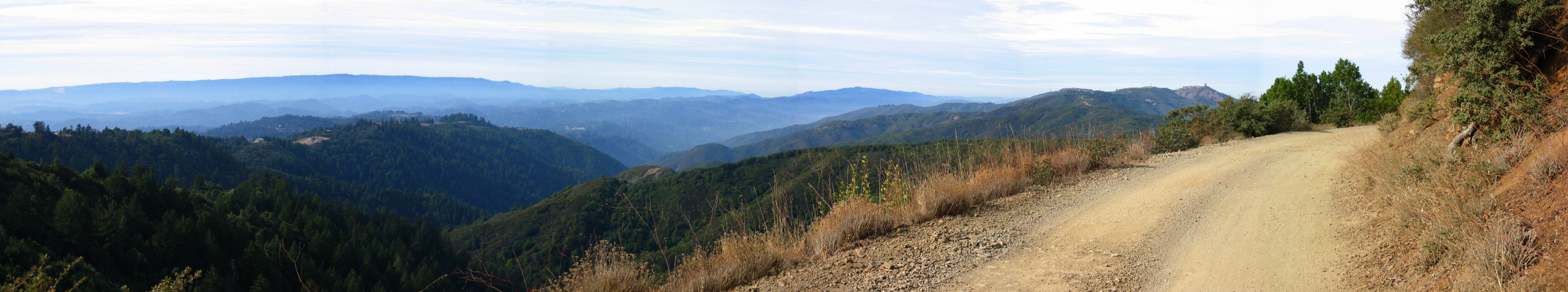
2005/11/24 12:55:00 (l to r): In the distance we can see Ben Lomond Mountain (2600ft). Closer we can see the top of the ridge lower Loma Prieta Ave. ascends. The deep canyon before us is that of Los Gatos Creek. The mountains to the right are the Sierra Azul. To the right we can see Mt. Thayer (3480ft), the weather radar dome (3450ft), and Mt. Umunhum (3490ft). The road in the foreground is Loma Ridge Rd. |
File size: 4108891 bytes |
Upper Loma Ridge Road Panorama (3400ft)
| Load full-size original in new window. |
| Previous | Next |