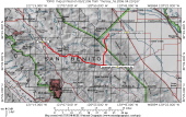
Overview Map
2006/04/23 09:00:00 |
|
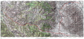
Complete Map
2006/04/23 09:01:00 |
|
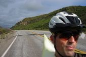
Bill riding east on Panoche Rd. (J1)
2006/04/23 09:12:57 |
|
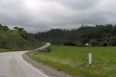
Panoche Rd., eastbound (1280ft)
2006/04/23 09:19:54 |
|
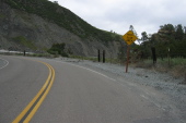
Climbing up the narrows on Tres Pinos Creek (1360ft)
2006/04/23 09:42:37 |
|
Climbing through the narrows on Tres Pinos Creek (1400ft)
2006/04/23 09:43:23 |
|
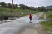
Ron Bobb crosses the ford near Panoche Pass (2040ft)
2006/04/23 10:23:42 |
|
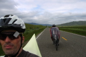
Bill and Ron coast east into Panoche Valley near Llanada
2006/04/23 10:44:58 |
|