Go back to blog.
San Benito, Clear Creek, and Idria, May 27, 2006
<<
Index page 1
2
3
4
5
6
7
8
9
10
>>
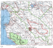
Overview Map
2006/05/27 06:00:00
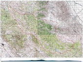
Complete Map
2006/05/27 06:01:00
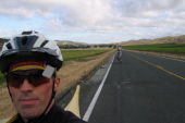
Start of the ride in Paicines. (680ft)
2006/05/27 07:47:37
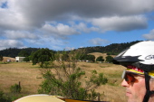
Rolling south on CA25 past the vineyards. (800ft)
2006/05/27 08:04:05
CDF firefighters readying the chopper at the Bear Valley fire station. (1479ft)
2006/05/27 08:45:30
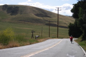
Ron Bobb rides south on CA25 through Bear Valley under an interesting sky. (1450ft)
2006/05/27 08:48:03
Passing an Aeromotor windmill in Bear Valley. (1392ft)
2006/05/27 08:49:36
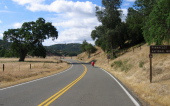
Passing the east entrance to Pinnacles National Monument. (1189ft)
2006/05/27 08:58:30
Click on a picture to enlarge it.
Generated by
Galerie
2011/March/2