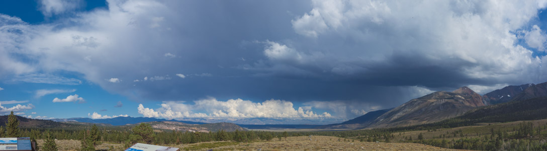
Cloud over Long Valley - 9/2017
Reload page to see different photo.

All web site content except where otherwise noted: ©2025 Bill Bushnell
Background texture courtesy of Iridia's Backgrounds.
Please send comments or questions to the .
Entire Blog - Display the entire Blog for all years. This is a large file!
Low-Key Party, December 11, 2012 - Pat Parseghian organized this year's Low-Key gathering at Sports Basement Sunnyvale. In spite of the free food, empty chairs attest to turnout that wasn't as numerous as in prior years. The photo was taken at the start of the proceedings while Ron Brunner was discussing his video. A few more folks filtered in later during Dan's presentation.
Jack Visits, November 2012 - Over the Thanksgiving holiday I took care of Jack while Laura was out of town. We spent a few days together taking walks, running around the yard, chasing balls and brooms, chewing on toys and rotten pomelos, and sitting in the warm sun. I gave him the run of the back yard, and he seemed to enjoy himself.
These photos and videos are snapshots of his activity over the three-day visit.
| GPS track: | GPX |
|---|---|
| Distance: | 8.1 miles |
| Cumulative climbing: | 2130 feet |
| Total Time: | 2:56:36 |
| Walking Time: | 2:22:59 |
Kennedy Trail, November 17, 2012 - Frank Paysen and I hiked up Kennedy Trail from its trailhead to its junction with Priest Rock Trail. I did a fast-walk in an attempt to log a semi-respectable time on the self-timed Low-Key Hill Climb, but I did not run or jog. I'm not sure I would have been faster running or jogging as my heart rate was about as high as I could take it for an hour's climb, around 145 bpm—max is approximately 160 bpm. Frank was happier walking at a slower pace, so on the climb we kept in touch occasionally with two-way radios.
On the way up I saw a number of cyclists descending, some of them seen at past Low-Key Hill Climbs including Stephen Fong, Han Wen, Clark Foy, Rich Hill, Paul McKenzie, and others.
I probably would not have chosen this day to do this climb but for the fact that I had never been on Kennedy Trail before, either on foot or bike, we had a brief window of good weather, the self-timed Low-Key Hill Climb was going the same day, and I was ready to get some exercise before the next few days of rain set in.
After I got to the top, I found a sunny place to sit next to the trail sign while I waited for Frank. Frank arrived at the top just before I would have started down as I was getting cold in the wind, even with all of my clothes on. While we descended the trail I managed to get a few photos of cyclists (Clark Foy, David Collet, and Carl Nielson) climbing up at this late hour and of the sun setting on clouds over the eastern hills. The air was unusually clear. We used headlamps on the last 1/2-mile of the trail where tree cover attenuated the already dim twilight, rendering muddy spots on the trail invisible.
| GPS track: | GPX |
|---|---|
| Distance: | 9.5 miles |
| Cumulative climbing: | 2810 feet |
| Total Time: | 5:04:55 |
| Walking Time: | 3:33:04 |
Black Mountain, October 18, 2012 - David and Bill Bushnell hiked to the summit of Black Mountain from the Rhus Ridge Trailhead and returned the same way afterward. Along the way we noticed that the Quarry Trail that connects the PG&E Trail in Rancho San Antonio to the Black Mountain Trail in Montebello Open Space was officially open with new trail signs marking the way.
Conditions were hot and stifling (high 80s F) at the trailhead but the temperature dropped as we climbed and the wind speed increased. At the summit of Black Mountain the temperature dropped to about 73F and the wind was blowing steady at about 30mph with gusts to 40mph.
As we hiked back down the trail the wind followed us part way, blowing the tops of the oak trees on the ridge but remaining calm under the trees. As we made the final descent to the trailhead, the wind died, the flies came out, and the air became stifling again.
This was the first fair-weather hike up Black Mountain I can recall where weather was so different at the summit from the trailhead.
| GPS track: | GPX |
|---|---|
| Distance: | 9.7 miles |
| Cumulative climbing: | 1790 feet |
| Total Time: | 5:52:14 |
| Walking Time: | 3:43:55 |
Mount Tamalpais, September 30, 2012 - David and Bill Bushnell began their hike at Pantoll Ranger Station in Mt. Tamalpais State Park. Our goal was to hike a loop through the park and the Marin Water District Land, including the West Peak of Mt. Tamalpais.
After I discovered to my horror that I had forgotten my camera and would be reduced to using my cellphone camera on this day, we started up Old Stage Road and the Easy Grade Trail to the Mountain Theater, where we paused to inspect the outdoor theater with its stone benches.
We continued on Rock Spring Road and the Mountain Top Trail that took us to the shoulder (2460ft) of West Peak where we found a number of old foundations from the old Air Force buildings that had been abandoned.
From West Peak we could see in all directions but east-northeast, where our view was blocked by the true West Peak (2560ft) that we learned later would have required squeezing through or under a chain link fence to get inside the still-active FAA radar station, although it appears from the small hole in the fence that this had been done before.
After exploring some of the old buildings and facilities of the base (e.g. ball court and bowling alley), we descended Arturo Trail steeply to Rifle Camp on the north side of the peak. From Rifle Camp we turned westward, hiking through Potrero Meadow to Potrero Camp, where we stopped to eat a snack.
At Potrero Camp we discovered picnic tables and a coat and hat rack permanently anchored in the ground. The old-time picnickers must have found a use for something so quaint.
After our snack we pressed up Laurel Dell Road past the turnoff for Barth's Retreat and detoured onto Old Stove Trail down to Laurel Dell picnic area. We continued through the picnic area, that was surprisingly crowded with picnickers, on Cataract Trail as far as Cataract Falls. Since water was low in the creek there was nothing to see, although we could hear water splashing around somewhere down in the rocks.
After viewing what would have been the Falls at another time of year, we retraced our steps back to Laurel Dell and then continued up Cataract Trail as far as the cutoff to Laurel Dell Road that we climbed to Ridgecrest Road.
At Ridgecrest Road we crossed to the west side of the ridge that was no cooler on this hot day. We descended briefly on Willow Camp Trail to Coastal Trail that we took, heading southwest toward Pantoll Ranger Station.
Coastal Trail was quite dramatic with its view of the Pacific Ocean far below. The trail was narrow, uncomfortably so for passing hikers going the opposite way, and pock-marked with gopher holes, requiring one's full attention, lest one should stumble and tumble down the hill. The slope of the hillside was quite steep, and the dry grass made the surface slick such that a tumble might send one for some distance before coming to a stop. Might not be the best trail for individuals affected by vertigo.
After a countless number of twists and turns we reached the junction with the Matt Davis Trail that runs between Pantoll and Stinson Beach. We continued toward Pantoll, meeting many groups of hikers on this section. I stopped at a small hill a short distance off the trail to see how many bay area repeaters I could ping (about 70-80 altogether, most of them with 1 watt).
The Matt Davis Trail entered the forest shortly and continued gradually downhill to Pantoll Ranger Station, where the van with its upholstered seats was a welcome sight.
| GPS track: | GPX |
|---|---|
| Distance: | 11.0 miles |
| Cumulative climbing: | 2740 feet |
| Total Time: | 6:06:02 |
| Walking Time: | 3:52:05 |
Big Basin: Chalk Mountain and West Ridge, September 2, 2012 - Bill Bushnell, David Bushnell, and Frank Paysen met at Waddell Creek Beach shortly after 1000. Our plan was for the three of us to drive in one car to the Whitehouse Canyon trailhead for Whitehouse Ridge Trail. We got into Frank's car and began the short shuttle north to Whitehouse Canyon.
When we turned off onto Whitehouse Canyon Road, we were immediately met with a washboard dirt road that we drove slowly for three miles to the trailhead.
At the trailhead we made our final preparations and set off on the steep Whitehouse Ridge Trail toward Chalk Mountain.
The trail did not look well-used, there being many unbroken leaves, twigs, and needles covering the trail, although the trail was easy to follow. We made good time on the first half-mile, climbing steeply on singletrack mostly, but occasionally along an old logging road alignment through a forest of mixed redwood and douglas fir.
At the sign for the lower vista point we detoured the short distance to enjoy the view for a brief moment. After returning to the trail we continued the steep climb up the shady side of the ridge before arriving at a bench where a sign suggested we explore the upper vista point. Since we weren't planning to come this way again for a while we made the best of it by taking these detours to points of interest along the way.
This upper vista point required more walking than the lower, the trail passing by a small view spot but continuing another tenth of a mile down the ridge to a wider view, complete with bench and plaque. We rested here to enjoy the view and to debate whether the rushing noise we could hear from the coast was the sound of distant surf or the sound of automobile tires rolling on tarmac.
After several minutes we rose and plodded back up the ridge to rejoin the main trail. We then continued toward Chalk Mountain Road, but before we reached the road we left the cool forest for a drier manzanita-covered sun-bleached terrain, crushed sandstone shining white and hot in the sun, what no doubt gave Chalk Mountain its name.
In exchange for enduring the sweltering heat we enjoyed an expansive view of Whitehouse Canyon and Old Woman Ridge to the north.
The trail dipped then rose again before joining Chalk Mountain Road. We turned left, uphill and trudged steadily up the hot road toward Chalk Mountain.
At the first junction we detoured to what I call the western summit of Chalk Mountain. I had visited this summit six years ago by bike when two sheet metal sheds were standing. This time only one shed remained, apparently in service of a CDF radio repeater. A relatively new solar array at been erected to keep the system powered at night.
My memory was a bit off as I had recalled a wide open view from this summit unobstructed by sheds. As it turns out my memory was partially correct, as the view is unobstructed south of the shed. This visit found one of the sheds dismantled and lying in a scrap heap next to the CDF shed.
We lingered here long enough to take a panorama photo before heading off to the higher eastern summit of Chalk Mountain, where the view was less good due to the abundant vegetation surrounding the summit.
At the eastern summit we lingered longer, stopping to eat lunch, test ping a variety of near and not-so-near HAM repeaters, and to compose an email--I had 3G service. We also saw one mountain biker ride up to the summit and leave a minute later without saying a word. I'm not even sure he noticed us sitting nearby in the only shady spot with comfortable seating on the summit. We were quiet.
After eating lunch we walked down to the start of Westridge Trail. Westridge Trail runs from Chalk Mountain down the undulating West Ridge of Big Basin State Park, through the Waddell Creek Wilderness Area, eventually connecting to Skyline-to-the-Sea Trail, and to Waddell Creek Beach, where we had left my van.
We initially descended over chalk rock to the south of the summit but shortly entered a cool forest before breaking out into the sun again and continuing down a steep descent on what appeared to be an old overgrown fire road.
The trail was quite steep and we were all hoping that there wasn't too much of this and, more importantly, that we would not be forced to return the same way.
From the summit of Chalk Mountain at 1609ft, we had descended in barely a mile to about 900 feet elevation, a local minimum along the ridge before climbing almost as steep a trail to a summit along the ridge at 1096 feet, then down again before climbing again, sometimes steeply, but often more gradually through a pleasant forest, to 1390 feet.
While climbing through this forest we all three took an impromptu sit-down break on the soft pine and redwood needles covering the verge of the trail, taking care not to sit upon one of the many spider webs woven into the duff.
As we continued the trail climbed past the summit, then down again, sometimes steeply. The trail was often trenched, a condition I had seen more often many years ago due to frequent horse travel. Fewer people ride horseback these days on the longer more remote trails than hike or bike, so trails are less trenched.
As we descended yet again we saw ahead another tall summit along the ridge and not so secretly hoped that we would reach the junction with Clark Connection Trail before we had to surmount it.
Our wish was granted, but only after we had climbed part way back up. We paused briefly at the junction to enjoy the ridge view one last time before plunging down off the east side on Clark Connection Trail toward Waddell Creek.
Clark Connection Trail descended steeply almost without pause. Near the bottom we stopped to rest our descent-weary knees at a convenient log that was just large enough to accommodate our three butts.
After several minutes we continued a short distance to the junction with Skyline-to-the-Sea Trail where we encountered our first humans since the summit of Chalk Mountain.
Our route now took us less than two miles along Skyline-to-the-Sea Trail that for the first mile and a half stubbornly insisted on ascending as it got closer to the sea before abruptly descending to CA1 and the waiting van with its upholstered seats.
We encountered several parties hiking the other way. As they did not appear to be equipped for the 10-mile hike to Big Basin's headquarters, or as the vandalized trail signs indicated, "BIG BASIN HO", we assumed they must be returning to their campsites at one of the campgrounds up Waddell Creek.
When we got to CA1, we could see that every parking place at the beach and alongside the road was taken. The place was packed with beach-goers, hikers, surfers, and kite-surfers.
After we left to drive Frank to the Whitehouse Canyon Trailhead to pick up his car, our parking spot was immediately taken by someone else arriving.
This hike reminded me most of our North Butano Ridge hike last year. Both hikes required car shuttles, although the North Butano car shuttle was so long that it was impractical to hike as one group, forcing us to break into two groups hiking in opposition, meeting only once for lunch at the midway point. Both hikes took seldom-used trails through some of the most remote areas in the Santa Cruz Mountains. The views were better from Chalk Mountain and West Ridge than from North Butano, but both shared the characteristic that one felt far from civilization.
| GPS track: | GPX |
|---|---|
| Distance: | 7.8 miles |
| Cumulative climbing: | 2670 feet |
| Total Time: | 6:50:27 |
| Walking Time: | 2:53:40 |
Pinnacles National Monument, August 26, 2012 - Frank Paysen, Stella Hackell, Ron Bobb, David Bushnell, and Bill Bushnell gathered at the Bear Gulch Day Use trailhead for a day-hike in and around the pinnacles at Pinnacles National Monument.
After getting our gear together and using the restrooms we started up Condor Gulch Trail that ascends directly from the parking area.
The day was forecast to be cool for the season, but this meant it would be warm by Bay Area standards. Temperatures in the mid-80s F were expected, and the sun was getting a head start in Condor Gulch. A slight breeze blowing up-canyon made sure that the apparent wind over our skin was zero.
Half-way up the trail we paused briefly at Observation Point where we had a good view back down the canyon to the parking area. As we continued Frank and Stella got a short distance ahead of us on the trail. At one point when I called for Frank or Stella on our two-way UHF radios a strange-sounding woman replied (who I later learned was Stella), relaying the message to Frank. They had hiked around to the other side of the ridge we were climbing and were out of direct contact.
As we got to the top of the ridge we saw Frank and Stella getting ready to split off on their longer loop. Their plan was to hike down to Old Pinnacles on the High Peaks Trail, then go northwest on Old Pinnacles Trail along North Chalone Creek and through Balconies Caves before passing by Chaparral parking area on the west side of the park and climbing back up to the high peaks area, where we would be waiting for them.
After exchanging photos, me of them, and Frank of us, they headed off down the ridge toward Old Pinnacles. David, Ron, and I continued in the opposite direction up High Peaks Trail where before long we began to pass through pinnacle gardens. At one point I scrambled a short distance off the trail to be photographed near one of the larger pinnacles.
Frank and I did not frequently attempt radio contact, but when we did we found that the VHF frequency worked better when we were not directly line-of-sight separated. We even managed to hold a decent conversation on VHF (quality=5 or 6 at 5 watts) when Frank and Stella were deep in the canyon alongside North Chalone Creek as long as we were both stationary. I suspect that the sparse vegetation and rock formations in the area bounce the radio signals without attenuating them too much or that the 2m band diffracts around the ridge a little better than the 70cm UHF band.
From the high peaks area I was able to raise repeaters on Mt. Toro, in nearby Bear Valley, a few in the Felton/Ben Lomond area, and Loma Prieta, even though I could not see the summit of the latter.
We (Ron, David, and I) continued on High Peaks Trail as it began its more technical section, starting with a climb up two steep stairways cut into the rock (1 and 2) and a low-clearance traverse that led to the high point along the trail where we enjoyed a sweeping view of Bear Valley and points south and east.
This would have been a perfect lunch spot had we been here a couple hours later. Unfortunately, hot sun was beating down and the complete absence of shade or wind made this spot stifling. We pressed on and arrived at another similar spot where a large overhanging rock offered abundant shade.
I suggested we stop for lunch, but Ron believed that the area closer to the high peaks rest room was better, so we continued another couple tenths of a mile where we found a freestanding bench on the ridge baking in the sun. Fortunately a large rock offered some shade on its southeast side, but the shrubbery blocked any view. The rest room was nearby but not unpleasantly close.
We ate lunch here and were entertained by a handsome scrub jay as it picked up several spilled peanuts, eating some, and hiding others in the ground, placing a small stone over each hiding spot as if it had been trained to do so. As the jay collected its nuts it twittered and purred softly, a sound I had not heard a jay make before now.
While David and Ron were still enjoying their luncheon I walked a few steps back to the bench standing in the hot sun and attempted to raise Frank on the radio. The timing was good as he and Stella had only a short time ago emerged from Balconies Cave and were trying to raise me on the radio.
We got a decent signal at first on VHF at 5 watts. But as they came around the bend near the parking lot and were within line of sight--I could actually see them through my binoculars on the trail visible to the right of the parking lot--we switched back to UHF at 1 watt and were able to get full quieting (signal quality=9 or 10).
They would be climbing up Juniper Canyon Trail 1.2 miles under the hot sun. Our plan was for me to meet them where Juniper Canyon Trail meets the lower end of Tunnel Trail, 0.6 miles below the ridge. Meanwhile David and Ron planned to backtrack to the shady spot under the rock but with a nice view on High Peaks Trail and wait for us (Frank, Stella, and me) to join them after traversing High Peaks Trail.
As I hiked down Juniper Canyon Trail from the ridge, the wind died, and the sun beat down fiercely. It felt like an oven, and I was only walking downhill.
I arrived at the trail junction. There wasn't much shade, but I did manage to find a rock to sit upon where the shrubs offered just enough shade for comfort. Frank and Stella had made good time and were not too far down the hill. Within ten minutes of my arrival at the junction I could hear their voices through the air. I tried unsuccessfully to contact David by radio on VHF. Too much mountain in the way, and no good opportunities to get a reflected or refracted signal to them. When Frank and Stella arrived they both looked hot and tired. We rested for another five minutes before starting up Tunnel Trail.
Tunnel Trail enters an interesting area of steep terrain and sharp, jutting pinnacles. At one point the trail passes through a tunnel bored through one of the larger pinnacles, then continues zig-zagging its way up to the junction with High Peaks Trail. This time I was able to successfully contact David to update him on our location and progress.
When we got to High Peaks Trail we retraced the route I had already hiked with David and Ron, up and over the stone stairway, then down again. Before long we were a group of five again. We all paused and ate a second lunch at this shady spot with a nice view on High Peaks Trail before continuing.
When we reached the bench in the sun we paused briefly while some of us used the rest room before commencing our descent toward Bear Gulch. Halfway down to the bottom the trail entered an open area with a sweeping view of pinnacles and a lava flow, including a curious-looking hoodoo.
Frank and Stella descended quickly, getting ahead of us while we stopped to take some photos. Our initial plan was to take Rim Trail to Bear Gulch Reservoir and then return through Bear Gulch Caves, but when we arrived at the junction Frank, Stella, and David had had enough for one day and voted to skip the caves this time and take the shortest way back to the car.
So, we all skipped the caves and continued down to the road, then through the picnic areas and to the car, arriving at about 1800. Unfortunately, the car was still in the sun.
Kumba and Jack, August 25, 2012 - Laura brought the dogs over to romp and play in my back yard for the afternoon. Activities included lying on cool grass, playing with each other, chasing the lure, and getting nails clipped. (Ouch!)
| GPS track: | GPX |
|---|---|
| Distance: | 8.9 miles |
| Cumulative climbing: | 2100 feet |
| Total Time: | 5:05:49 |
| Walking Time: | 3:27:28 |
El Corte de Madera Open Space Preserve, August 15, 2012 - Frank Paysen and I exchanged Skype chats the night before and settled on a loop hike at El Corte de Madera Open Space. Last year we had hiked a loop on the western side of the preserve, so this hike would explore the eastern side.
At first it was to be the two of us, but at the last minute I thought to put out an announcement to my short distribution list of folks who might be available on a Wednesday to do this hike, a good day to go hiking as we were unlikely to run into many or any mountain bikers who are the primary visitors to this preserve.
To my surprise I got two affirmative replies, and David Bushnell and Steve Prothero joined us.
We carpooled to the trailhead and were on the trail before 1100. We took the Gordon Mill Trail from Skyline Blvd. down into the depths of the preserve.
Starting a loop hike with a long descent feels a little like going into debt. But Gorden Mill Trail was pretty and the forest quiet. In fact we did not see any other visitors on any of the trails during our entire visit.
At Virginia Mill Trail we descended a short steep section, then continued to a surprisingly wide bridge over Lawrence Creek before which a sign had been posted warning that the bridge would not support a motor vehicle, nevermind how one would get a motor vehicle onto the bridge from its singletrack approaches.
The bridge was the topographical low point of the day. From here it was uphill back to the car for David and a bit more than that for the rest of us.
Virginia Mill Trail climbed gently to a junction with Lawrence Creek Trail. We turned left and started up a mostly ascending trail. A quick glance at the map did not immediately reveal that the trail climbed almost continuously. I had last ridden my bike on it many years ago, and my memory of it was a trail that was mostly rolling until it crossed the creek again further upstream.
We stopped once for a rest break on the climb, and we stopped again a few tenths of a mile further for a longer lunch break where David who is temporarily on a liquid diet tried a Clif Shot energy gel and liked it.
After lunch we continued uphill, stopping to photograph a pretty spider web, until we reached Blue Blossom Trail. At this point after a brief conference, David decided he wanted to take the most direct way back to the car, so he continued on Lawrence Creek Trail to Bear Gulch Road, then walked the road back to Skyline and to the waiting car.
The rest of us, myself, Frank, and Steve, pressed on down the Blue Blossom Trail that mostly descended back into the canyon. The trail was a pretty meandering singletrack that was neither too steep nor too rough. Some of us considered coming back to try it on a bike someday.
When we got to Springboard Trail we continued straight and slightly downhill to the junction with the Steam Donkey Trail.
We turned right and began our climb back to Skyline with a sharp incline followed by several sharp ascents and descents, a root-bound section, a trenched section, and plenty of steep stuff, mostly uphill. David would not have been happy to climb this tough trail at the end of a hike, so we were thinking it was good that he bailed out when he did.
Eventually we arrived at the gate at Skyline Blvd., and after a short walk back along the road we arrived at the van where David had set up a makeshift encampment to dry out his sweat-soaked shirts, much to the apparent consternation–we were told–of the woman who lived in the nearby house.
| GPS track: | GPX |
|---|---|
| Distance: | 11.8 miles |
| Cumulative climbing: | 2820 feet |
| Total Time: | 6:32:19 |
| Walking Time: | 3:59:34 |
Big Basin Waterfalls, August 12, 2012 - Stella Hackell, Frank Paysen, and Bill Bushnell carpooled to Big Basin State Park and hiked a loop out to Berry Creek and back from the park headquarters to enjoy the waterfalls. The weather was hot for most of the day, a good day to do a waterfall hike.
Since we arrived late we had to park up North Escape Road, adding a few tenths of a mile to our day. We started on Dool Trail, then took Sunset Trail west over several ridges to Berry Creek Falls Trail five miles and two hours later in stifling heat that was relieved only while we were moving. Not a breath of wind to cool us, so we had to keep moving to stay cool. Cool air was not to be found, even low in the canyons.
As we started down Berry Creek Falls Trail we could hear splashing water and many voices. We stopped for lunch below Golden Cascade as a large Filipino family were leaving. While we ate lunch several other parties came by. One of them drew drinking water from the creek (and through a filter) into their water bottles.
After lunch we continued down Berry Creek Falls Trail, past the precipitous brink of Silver Falls, down through the narrow canyon of Berry Creek and past the observation deck for Berry Creek Falls. We saw many park visitors exploring along the creek, bathing, or otherwise relaxing near the flowing water.
The creek still had enough water in it to give a pleasing display at the three waterfalls: Golden Cascade, Silver Falls, and Berry Creek Falls. I had expected only a trickle given the early rain season we had had this year.
When we reached the junction of Berry Creek Falls Trail and Skyline-to-the-Sea Trail, we sat down to discuss our return strategy. After some consideration we decided to split up. Frank wanted to hike back the long way on the ridge, and Bill and Stella preferred to take the shorter route back up the cool canyon. We would remain in contact using our two-way radios.
Frank set off first toward Waddell Beach before turning left onto the Howard King Trail to return over McAbee Mountain. Stella and I lingered near the junction while we had good radio contact with Frank so that we could be sure Frank found the left turn for the Howard King Trail.
It turns out he missed it while he was hiking south on Skyline-to-the-Sea Trail and had to backtrack a hundred yards. Once he was safely on his way up Howard King Trail we knew we'd end up at the same place, eventually. Stella and I then started our hike up the canyon on Skyline-to-the-Sea Trail.
We passed another observation deck for Berry Creek Falls that could be seen through a parting of the trees. We then continued up alongside Waddell Creek (west fork), crossing the creek, climbing up some standstone steps, checking out the view atop of a sandstone cliff, and passing many old growth redwoods.
At one point we chose to branch off the main trail onto Alternate Trail. The longer Alternate Trail crossed Kelly Creek and a few others, one on a bridge that looked ready to give way at any moment.
Before long we were back on the main trail, and shortly after that we began the main climb up to Middle Ridge, the last climb of the day for us.
On our way up to Middle Ridge we passed and were passed by several parties of hikers. We were seldom alone on this part of the hike, unlike the Sunset Trail, where we saw other hikers once every half-hour or so. The dusty surface of the trail gave hint that it was more heavily-traveled than the less-dusty Sunset Trail.
We made sporadic contact with Frank over our two-way radios. At first we tried using a UHF frequency, but once we were no longer separated line-of-sight through the trees we switched to a VHF frequency and had better signal quality, often full-quieting. VHF worked much better when one of us was just out of line-of-sight, around a corner, or over the brow of a ridge. But even VHF and "high" power wasn't enough to overcome conditions where one of us was deep in the canyon or on the opposite side of a ridge.
When Stella and I reached the junction with Middle Ridge Trail we found a comfortable place to sit away from the frequent crowds that gathered at this junction. I hiked a short distance up Howard King Trail to look for a log, rock, or some other comfortable object to sit upon, but when I didn't find anything within a tenth of a mile of the junction I returned and we found a couple of low rocks to sit upon while we waited.
We didn't have to wait long. Frank's route was about a mile and a half longer than ours, with 400 feet more climbing, and Stella and I had lingered in a few spots taking photos. We were able to contact Frank by radio and to assess his progress when we arrived at the junction--he wasn't far away. Ten minutes later he said he could hear our voices through the trees, and then he appeared from around the corner.
We all three rested for a few more minutes then started down the last leg of our hike toward the park headquarters. We reached the car just before 1800, our hike duration approximately 6:30 altogether.
| GPS track: | GPX |
|---|---|
| Distance: | 11.7 miles |
| Cumulative climbing: | 2690 feet |
| Total Time: | 5:45:05 |
| Walking Time: | 4:20:00 |
Huddart Park to Wunderlich Park, August 5, 2012 - Bill Bushnell, Stella Hackell, and Frank Paysen met at the Page Mill Park 'n' Ride, then continued as a caravan to Wunderlich Park where we found the main parking area overflowing onto CA84. I managed to park off the highway on a soft shoulder, then changed my shoes and hopped into Frank and Stella's car where the three of us continued in their car to Huddart Park.
We paid our fee, entered the park, and found the Miwok picnic area empty of people. We parked across from the start of the Archery Fire Road, where we started our hike.
After making our final preparations and visits to the loo we started up Archery Fire Road, the shortest and also steepest climb to the Skyline Trail, about 1.3 miles of steep uphill.
We saw no other hikers on the trail, but we did see other hikers at its junctions with other trails as well as at the Archery Range near the top of our climb. Since this road climbs adjacent to Kings Mountain Road, essentially cutting off the switchbacks of the latter, we saw many cyclists climbing and descending the road.
Not much time passed before our sweaty bodies reached the Skyline Trail junction. We turned left and descended a short distance to cross Kings Mountain Road.
As Squealer Gulch deepened between the trail and Kings Mountain Road, we began a quiet part of the hike, out of earshot of Skyline Blvd. and other traffic noise. At this point the Skyline Trail we were hiking upon (also called the Bay Area Ridge Trail) crosses a corner of Teague Hill Open Space and then runs along a narrow easement between Skyline Blvd. (Caltrans) or private landowners on the uphill side and California Water property around Bear Creek on the downhill side.
Along here we saw the only other hiker (runner, actually) we would see between Huddart and Wunderlich Parks coming from the opposite direction.
The Skyline Trail zigged and zagged a number of times as it rounded a ridge or gully. The trail was well-graded and mostly smooth. There was some evidence of horse passage: random piles of day-old horse poop and on the verge of the trail an occasional hoof depression of the sort that when stepped in by the unwary can cause a twisted ankle.
After the first two miles we were within earshot of Skyline Blvd. for the next three miles, and while we could hear the occasional loud PUTT-PUTT-PUTT of Harleys cruising by above, traffic noise was not soo frequent as to cancel out all of our pleasure.
At one point I stopped at the Clara May Lazarus bench to take a quick break off my feet and to enjoy the silence of the forest. Frank and Stella continued on ahead, although I informed them of my pause over the radio.
A mile later Stella requested we look for a good lunch stop spot. I had just passed a bunch of cut logs by the trail that appeared to offer some seating comfort, so we stopped there for about 20 minutes to eat our luncheons and to study our maps (1, 2). We concluded that we were at about the half-way point on the hike.
After eating we pressed on the trail much as before. But, before long the trail encountered a large unihabited house built in a clearing. It was clear that the builders had cleared some of the trees so that the occupants of the house could enjoy a sweeping view. The trail descended below the property and at the same time passed above another house that also appeared to be unoccupied, given the thick layer of pine needles on its roof and driveway, and its dark windows staring blankly back at us.
The trail climbed briefly before crossing Bear Gulch Road (east), a road similar in profile to Old La Honda Road, that in 1978 had been refurbished at public expense and essentially given (formally abandoned) to the owners of the attached properties by a corrupt San Mateo County Board of Supervisors. Of course the road is closed to public travel now.
After crossing Bear Gulch Road (east) we climbed a short distance further before arriving at the top of Wunderlich Park. We paused for a photo then began our descent of the Alambique Trail that zigs and zags around several ridges and gullies before arriving at The Crossroads where we paused again for an extended break on the comfortable bench that had been conveniently installed.
After our break we continued on the Alambique Trail, then took the Bear Gulch Trail across The Meadows then continued down to the parking lot at the bottom. We saw many other hikers on the last four miles of our hike in Wunderlich Park. It would appear that Wunderlich gets many more visitors than Huddart. I can't help but think that the parking fee at Huddart Park and the lack of one at Wunderlich creates the incentive.
After we got down to my van, we drove back into Huddart Park so that Frank and Stella could pick up their car.
Overall it was a good hike on relatively easy-to-walk trails. The main downside is that it requires a short car-shuttle.
| GPS track: | GPX |
|---|---|
| Distance: | 8.5 miles |
| Cumulative climbing: | 1560 feet |
| Total Time: | 6:37:34 |
| Walking Time: | 3:04:32 |
Henry Cowell State Park, July 29, 2012 - After much back-and-forth email and Skype messaging, Frank Paysen, Stella, and I finally settled on a nice, cool loop hike through the redwoods of Henry Cowell State Park.
Sunday mid-morning we (Frank, Stella, Bill, and David Bushnell) carpooled down to Santa Cruz, then backtracked up CA9 to the Rincon Trailhead where we started our hike.
The hike started with a nice walk through a redwood forest and down into the San Lorenzo River Canyon. Our planned route took us on the Diversion Dam Trail, making a crossing of the San Lorenzo River at its most upstream crossing for trails in the southern end of the park.
When we got to Frisbee Beach, a small spit of sand in the river, we saw that the crossing was a deep green pool that David called "zoo water". At its deepest it looked to be five feet or so. I'd get wet up to my chest, and Stella would have to swim. Scratch that.
Frank and Stella explored on a little bit, looking for an easier crossing upstream on a use trail, and on our way back to the Rincon Trail I detoured a couple of times to the river's edge, looking for an alternate crossing. If we had found such it was not certain there would be an easy path on the opposite shore.
When we got back to Rincon Trail we headed down to the river and came upon a small beach where a couple of families were playing and wading. When I last crossed here in 1988 I recall water only ankle-deep and sand on both sides. The crossing here looked uncomfortably deep in a few spots and mostly rocky on the bottom. We could not distinctly see the trail on the other side, but it looked easier to cross than the zoo-water pool on the Diversion Dam Trail.
I volunteered to go first and explore so that others could judge the depth and then decide whether to continue or not. But, Frank was first out of his shoes and ventured in first. The deepest water was up to Frank's crotch, so this looked do-able. Stella would get a bit more wet. Resigning herself to a "wet pants" hike, she was game to give it a try.
Frank, David, and I crossed downstream from the narrow rock dam that had been erected to create a pool in front of the beach. For some reason Stella decided to cross behind this dam rather than in front of it. Perhaps the bottom looked smoother and easier to walk, or the dam gave her a feeling of security.
Her trip across started O.K., but mid-way she stumbled and found herself going a bit deeper than she expected. After she got wet her manner suggested that she would not be dissuaded from pressing on.
We spent some time drying off on the opposite shore. The radio she was carrying got dunked and had stopped working–Frank removed the battery and put it in a mesh pocket in his pack.
After another ten minutes of assessing our condition and putting on our shoes and socks, we started the steep climb up Rincon Trail, passing the junction of the Diversion Dam Trail about 1/3 of the way up to the top of the ridge.
At Cathedral Redwoods we saw three women on horseback, and not far behind them a couple of women on unicycles.
Our route took us up the Ridge Trail into the drier and sandier terrain surrounding the Observation Deck where we stopped to eat lunch and to enjoy the view in the warm breeze. We shared the one picnic table on the Observation Deck with a couple from Colorado who had ridden mountain bikes up the hill.
After finishing our lunch we hiked down the Powder Mill Trail that could have been named aptly the "Powder Trail" on account of the sandy and dusty trail surface. We continued on the Powder Mill Fire Road until we reached Pipeline Road.
At Pipeline Road we crossed to the Buckeye Trail and continued a steep and surprisingly long zig-zagging descent to the San Lorenzo River at its lowest crossing.
This crossing has two parts: the first is a crossing of a smaller branch of the river. Last time we hiked this way we were able to cross this on the stones and branch that had been placed over the stream. I decided to go barefoot for this first part, but I regretted my decision while hiking through the sharp rocks and horse poop on the short trail to the second part, the longer crossing.
At this point Frank and Stella made preparations to cross, while David caught up to us. I started across first. The water did not look any deeper than it had been two years ago, and indeed it was not. But, the rocks felt sharper and less friendly. Perhaps it was my extra hike in bare feet that exhausted my tolerance for walking barefoot. My delicate feet were being tortured with a thousand points of pain.
David saved himself the trouble of taking off his boots and simply rolled up his pants and strode into the water fully-shod.
Stella gave her sticks to David. She didn't want to use the sticks, but when she got halfway across, she stumbled again, almost but not quite taking another dunking, and decided to accept her sticks back from David.
Frank, who had already crossed, and had not yet put his shoes back on offered to walk part way back out to hand David my sticks as he began to look unsteady without them.
After all of this complicated operation we made it across the second crossing, dressed again, and continued through a lovely forest deep in the river canyon that few visitors see.
At the third crossing David was on the other side before we started to take our shoes off. The third crossing was the easiest of the four.
I had hoped to find the remnants of the Buckeye Trail that heads straight down the canyon to join the Rincon Trail, saving us an extra 400 feet of climbing and descending and an extra mile of distance. But, I only found a use trail that led to the Big Rock Hole trail that climbs the ridge, and a potential fourth crossing of the river. We decided as a group to go with the devil we knew rather than explore the devil we didn't. Also, it was getting late.
So, we hiked back up to the Rincon Trail near Cathedral Redwoods before descending again to the fourth and final crossing, the same as our first crossing. This time everyone made it across in style.
On our way back up Rincon Trail to the trailhead I detoured briefly to explore the southern end of Buckeye Trail. The trail did not go far before either crossing the river or turning into a rough deer trail that required climbing over fallen trees or scrambling directly up steep hillsides. Perhaps it was a good decision not to try to press through from the other side.
At the end of the hike we changed out of our wet shoes and clothes as much as we could before joining heavy traffic heading back over the hill from Santa Cruz.
| GPS track: | GPX |
|---|---|
| Distance: | 10.5 miles |
| Cumulative climbing: | 1850 feet |
| Total Time: | 5:31:22 |
| Walking Time: | 3:30:06 |
Almaden Quicksilver County Park, July 18, 2012 - David and Bill Bushnell hiked a loop at Almaden Quicksilver County Park.
We started at the Mockingbird Hill trailhead with its vast parking lot that I suspect is rarely filled anywhere near capacity.
We started on the Hacienda Trail, hiking up grades that reached over 30% in places. We stopped to enjoy the view at a bench that had been installed at one of the high points on the trail with a clear view of San Jose.
Following our brief rest we continued down then up, then down to the junction with the Capehorn Pass Trail where we turned right and hiked the short connector to the Mine Hill Trail. At the Mine Hill Trail we turned right and continued our climb up.
We saw one cyclist climbing and descending we encountered a park ranger and sheriff's deputy walking downhill in a liesurely manner, an extraordinary sight. They looked fresh as if they hadn't been walking far, yet they were not near a vehicle. This is the first time I've seen a ranger on foot inside a park anywhere. They were out of sight by the time I thought to ask them if something was going on (e.g. missing person search, etc.) in the park.
At the Castillero Trail we turned left and climbed the short hill up to English Camp and its collection of building ruins and historical artifacts. We stopped to read the plaque describing the old school before continuing up to a clearing at a high point where a picnic table had been placed conveniently in the shade.
We stopped here to eat a late lunch and to enjoy the views of Mt. Hamilton toward the northeast and Mt. Umunhum closer by to the west.
After lunch we continued along the Castillero Trail where I noticed a trail leading off to the right and uphill. Perhaps it was a trail to the summit of Mine Hill. We were both curious, so we explored it.
This faint use trail climbed up alongside a drainage ditch for an old quarry that had been cut into the top of Mine Hill. The top of the drainage ditch was a large level area filling the old quarry. The summit of Mine Hill was visible atop the quarry wall, and after a brief examination we found a use trail leading up the wall that we could climb with some effort.
Taking care to avoid a slip we managed to surmount the quarry wall and then walk up to the summit of Mine Hill that had been marked with a screwdriver driven into the ground.
The view from the summit wasn't quite 360 degrees because of vegetation to the west and north, but we did have a sweeping view of Loma Prieta and Mt. Umunhum.
We tried to find an alternate route down that did not involve scaling the quarry wall. First we tried hiking west along the wall until the faint use trail petered out in a thicket of tall Scotch Broom. There did not appear to be any way to avoid a great deal of bushwhacking that way.
We returned to the summit and saw another use trail heading down a different part of the quarry wall that I had not noticed earlier. So, we went that way. The trail got a little steep in slippery toward the bottom and appeared to leave one "cliffed out" about six feet from the bottom, but once I got there I could see that a trail worked its way down without having to do any downclimbing.
To get back to the Castillero Trail we took an indirect service road that made for a comfortable walk. Our adventurous diversion to climb to the summit of Mine Hill (1728ft) was worthwhile. Once back on the Castillero Trail we headed northwest and mostly downhill.
We stopped again for a snack and to enjoy the shade at the picnic table at Bull Run, where again we had a sweeping view of Loma Ridge to the south and west.
Our hike then took us down Mine Hill Road, but not before we detoured again to visit the collapsed Catherine Tunnel and to briefly enjoy a sweeping view of San Jose where a picnic table had been conveniently installed. Seems that all the good view spots in the park, except for the summit of Mine Hill itself, have benches or picnic tables.
We continued down Mine Hill Road at a good clip on an easy downgrade, stopping to examine the workmanship of a funnel web spider and at a bench overlooking Guadalupe Reservoir near the junction with the Randol Trail.
Our hike back to the trailhead would take us mostly on the Randol and New Almaden Trails, trails that appeared on the map to be mostly level, following the contour lines. I had estimated the day's climbing at 1400 feet after an examination of the official park contour map.
As it turns out these trails were anything but level. The Randol Trail was never steep, but it was always climbing or descending, within a contour interval or two. Fortunately, the shade of the trees made these mild climbs more pleasant.
When we arrived at the junction with the Prospect Trail we found another sweeping view of south San Jose and (of course) a picnic table. So, we stopped to rest for a few minutes to enjoy the view and eat a snack before continuing down the Prospect Trail that started level, then plunged steeply down the grassy ridge before it struck the New Almaden Trail.
We turned right and began the final couple miles of our hike, climbing and descending, but never hiking on the level. Although the effort was greater than we expected, even considering we had already hiked eight miles and were getting tired, the New Almaden Trail offered a few interesting things to see: fall colors in the poison oak leaves, many stream crossings, some on new bridges, and a small grove of large manzanita trees that approached (but did not exceed) the size of those we encountered on Middle Ridge in Henry Coe State Park earlier in the summer.
At the crossing of Randol Creek we encountered another picnic table in a glade, this one looking rather sad. We were not far from the trailhead at this point, so we did not stop to sit. Only one side of the table was usable, the opposite bench having been broken.
After one final climb and short descent we arrived back at the trailhead. David was looking forward to sitting on an upholstered seat, and I was happy to be finished with a hike that had been tougher than we expected.
| GPS track: | GPX |
|---|---|
| Distance: | 6.5 miles |
| Cumulative climbing: | 1670 feet |
| Total Time: | 2:40:32 |
| Walking Time: | 2:04:13 |
Huddart Park Loop, June 29, 2012 - David Bushnell and Bill Bushnell hiked a loop at Huddart Park.
We started from the Zwierlein trailhead where the temperature was warm, in the upper 70's F, taking the Cystal Springs Trail to Richards Road, climbing Richards Road through the Toyon Group Campground and beyond to the Summit Springs Trail. We then hiked the Summit Springs Trail to Skyline Trail and then to Chinquapin Trail that we descended into McGarvey Gulch. We switched over to the Dean Trail for the final descent back to the trailhead.
Richards Road climbs the ridge along the northern boundary of Huddart Park and does not bother with switchbacks, climbing up the gradient most of the way. Fortunately most of the climb is in the shade, and today a wind was blowing over the ridge from the coast, keeping us comfortable as we worked.
It took us little more than an hour to reach the Summit Springs Trail that traverses across the head of McGarvey Gulch and climbs further to a high point across the street from Purisima Creek Redwoods Open Space Preserve.
Our descent took us down the Chinquapin Trail that we had never before hiked and the Dean Trail that we had climbed last year. David's favorite trail was the Chinquapin Trail with its good surface, even grade, and shade.
Dean Trail was not quite as nice a descent as the trail had been trenched slightly, probably from more frequent horseback use.
We had planned to take a slightly longer route that had us climbing a short distance on the Dean Trail to the Crystal Springs Trail that we would then descend to the trailhead, but we decided that the shorter route was enough.
On the Chinquapin Trail the forest has a remarkably open understory. Not much undergrowth and clutter, allowing us to appreciate the contours of the hills and to see the larger trees (mostly redwoods, douglas fir, and madrone) some distance from the trail. We were also able to see a buck that stood frozen some distance from us, probably thinking that he was far enough away not to be noticed or to be in any danger.
Overall it was a good hike that had us returning home well before sunset.
| GPS track: | GPX |
|---|---|
| Distance: | 12.9 miles |
| Cumulative climbing: | 2670 feet |
| Total Time: | 8:21:26 |
| Walking Time: | 5:00:49 |
Henry Coe State Park, Western Zone Loop, June 24, 2012 - David Bushnell, Bill Bushnell, and Bill Preucel carpooled to Henry Coe State Park for an adventurous day hike through the Western Zone of Henry Coe.
Since this was our first hike in the park—even though I had ridden my bike to the park HQ several times I had never hiked or ridden past the end of the pavement inside the park—we stopped at the visitor's center to speak with one of the park docents who gave us a thorough description and routes recommendation for our hike.
For a variety of reasons we didn't get started until after 1100. Fortunately, the weather was expected to be no warmer than mid-70's all day we did not worry about the usual heat this time of year, nor were we too concerned with running short of water.
Our route took us first up the monument trail to the top of Pine Ridge. We walked out to Eric's Bench that sits under a large Ponderosa Pine atop the ridge. It was too cool and early in the hike to sit there for long, so we returned to the junction with the Monument Trail where we happened to run into Mike Ahern and his friend, Tanya, who were walking their bikes up Monument Trail (with the blessing of the park ranger) and were starting their own hike/bike adventure on a route similar to ours.
After parting ways with Mike and Tanya we hiked over to the Henry Coe monument, then looked for the spot where we were supposed to be able to see the Sierras in the distance. We didn't find any place with sweeping view, and when we could see past the trees, the Sierras were obscured by haze, so we didn't try too hard to find the spot.
We hiked cross-country back to Hobbs Road and continued north along Pine Ridge, descending gradually, then steeply to Little Coyote Creek. We turned right and proceeded up the Frog Lake Trail to Frog Lake where we heard twittering red-wing blackbirds and an acorn woodpecker working on an old snag standing in the lake, then continued gradually uphill to the top of Middle Ridge just below its high point.
We then turned southeast on Middle Ridge, mostly downhill through now-dry grasslands and oaks. As we descended the ridge we hiked through groves of big-berry manzanita trees that grow to over 20 feet tall. Many of these had burned in a recent fire that had swept the area a few years ago.
As we continued down the ridge the trail passed in and out of burn areas, the burn areas offering views of Blue Ridge to the northeast and of the southern areas of the park to the southwest.
Less than a mile from the junction the trail dipped sharply to a low point on the ridge then climbed back up a couple hundred steep feet before resuming it's gradual downward slope to the southeast.
We stopped for a lunch break at a sunny spot with downed logs that offered moderately comfortable places to sit while we rested.
After lunch we continued down the ridge, soon reaching the junction with the Fish Trail. This was the first decision point: shall we cut the hike short and take the Fish Trail back to the car, or shall we continue down Middle Ridge Trail to Coyote Creek?
We all decided to continue.
The Middle Ridge Trail continued gradually downhill on the ridge, passing from groves of burned manzanita to grassy meadows and oaks, the grass growing six feet tall in places.
As the trail prepared to plunge down the northeast side of the ridge we stopped to get one last view to the southwest, then headed into the shade off the northeast side.
The trail was a harder hike on this lower section, plunging steeply downhill with a loose, slippery surface, then descending pleasantly or even climbing a bit. David hated this roller-coaster of steep-level-up-down trail, but we had little choice short of returning uphill to the Fish Trail, and no one wanted to do that.
Just as David was reaching the end of his patience, we broke out of the trees into a small meadow, beyond which we could see the confluence of two large creeks. Bill P. had walked on ahead out of sight and may already have scouted out the best spot for another lunch break.
When we reached the creeks at the bottom we found Bill P. resting in the shade on the other side of a dry Little Coyote Creek, next to a large stone cairn.
We discussed at some length whether to return to the car by the shortest route on the Poverty Flat Road or to press on to the Creekside Trail to China Hole before climbing back up Pine Ridge.
After a snack of gorp, David felt more like continuing, although Bill P. was worried about how much time it might take. We finally agreed to try the Creekside Trail and to turn around if the trail was less trail and more creek-walk with boulder/talus-hopping.
The trail started easily on the flat flood plain where we startled a family of common mergansers (ducks). Mom quacked loudly while shooing 16+ ducklings away from us down the creek.
The Creekside Trail was narrow, but easy to follow over most of its distance to China Hole. In a couple of spots the trail climbed up above the flood plain and became more like a deer trail: narrow with sharp drop-offs. These obstacles weren't quite enough to force a retreat, but if it had been like that the whole way we might have turned back.
Finally we reached China Hole where we encounted a couple of hikers who had hiked a loop over Mt. Sizer that day and were on their return trip, having come along the footpath through The Narrows and were now planning to take the same route as we on the China Hole Trail.
As time was advancing and we were now on the return trip, we did not stop at China Hole to rest but continued up the trail. David got a second wind, "smelled the barn", and the trail was well-graded and easy to hike compared to Middle Ridge Trail. He got ahead of us on the climb up to Manzanita Point.
When Bill P. and I arrived at Manzanita Point, David was resting, waiting for us in one of the few shady spots under some chamise. At this point I hand him one of the HTs I had been carrying all day for just this occasion, so that he could walk ahead at his own pace and report in to me at each junction rather than wait for us.
David marched ahead, every step taking him closer to a comfy chair, while Bill P. and I walked slowly examining flora and fauna along the way.
We met up with David again at the Manzanita Group Camp area when he was unsure of the route.
We hiked together for a bit, but when Bill P. and I slowed to have a closer look at something along the Forest Trail David continued on ahead.
We regrouped again at the major trail junction of the Fish, Frog Lake, Corral, Springs Trails and Poverty Flat Road at a picnic table under a magnificent valley oak where we had our last snack before the final push back to the car on the Corral Trail.
We finished our hike just as the sun was getting ready to set and had already set on the Corral Trail. On our way out of the park we took a few more photos of the light of dusk on the hills and of the sunset over Anderson Reservoir.
| GPS track: | GPX |
|---|---|
| Distance: | 4.0 miles |
| Cumulative climbing: | 30 feet |
| Total Time: | 4:28:27 |
| Walking Time: | 1:12:32 |
Walk to Dharma's, June 17, 2012 - Laura Bushnell and Bill Bushnell walked to Dharma's Restaurant. David and Kay joined us part way, then returned to the car to drive the rest of the way. Laura and I walked back, while David and Kay drove.
| GPS track: | GPX |
|---|---|
| Distance: | 11.3 miles |
| Cumulative climbing: | 2650 feet |
| Total Time: | 5:43:52 |
| Hiking Time: | 4:13:09 |
Rancho San Antonio Loop, June 13, 2012 - David and Bill Bushnell hiked a loop in Rancho San Antonio Open Space Preserve. Our original plan had been to hike in a cooler area, but a cool weather forecast encouraged us to change our plan to hike in a warmer area. Turns out the weather wasn't at all cool. In fact, it was quite hot.
We started at the Rhus Ridge Trailhead and hiked up the steep Rhus Ridge Trail. When we got to the pass at the top we turned left and hiked the Chamise Trail down the ridge toward Rancho San Antonio. Even with the downhill the air was still, and the sun beating down on the ground created an oven effect.
When we got down to Rogue Valley we sought the shelter of some shade and enjoyed the hike a little more, even though we were climbing uphill slightly.
The route up Black Mountain through Rogue Valley crosses a couple ridges and zig-zags quite a bit. On the climb up to the High Meadow Trail the Rogue Valley Trail zigs east as it climbs the ridge, then the High Meadow Trail zags west again.
At some point we expected some relief from the heat in the form of a breeze, but the breezes never came, at least on the climb. We stopped to rest in the shade a few times, and each time we were beset by flies. David got bitten by horseflies twice.
When we got to the PG&E Bench, the view and the comfort of sitting on something designed to be sat upon compensated for the lack of shade. A very slight breeze helped.
But, we didn't sit long before moving on. The next segment of our hike was on a trail signed only with "Please Bury Human Waste and Toilet Paper". As the trailwork was new I suspect a more appropriate name will be assigned when the trail is officially dedicated.
This trail has existed for many years as a use trail. I recall taking it two or three times in the 1980s. But, back then we had to do some bushwacking: poison oak on the lower section, and scratchy chamise along the ridge. It was a trail to take during the winter months when a jacket could be worn and when the poison oak was dormant.
Unfortunately, on this day there was no relief from the heat, the still air, and the resultant flies that inevitably sought our sweat and flesh. We stopped a few times to rest in the shade to enjoy the view behind us of the Lehigh Quarry tailings, upper Permanente Creek, and San Jose in the distance.
When we reached the Black Mountain Trail we decided to skip the hot, steep out-and-back trail to the summit.
As soon as we started downhill a cool breeze started. Lower down the Black Mountain Trail is mostly on the shady side of the ridge in the afternoon, only poking out into the sun on the flat portion before the plunge down from Rhus Ridge.
When we got to the bottom of Rhus Ridge we decided that this had been the hardest hike we had done this year, mainly due to the hot weather.
| GPS track: | GPX |
|---|---|
| Distance: | 12.1 miles |
| Cumulative climbing: | 2460 feet |
| Total Time: | 6:04 |
Stevens Canyon and Long Ridge, June 6, 2012 - David and Bill Bushnell set off from the Grizzly Flat Trailhead to hike a loop through Stevens Canyon and Long Ridge.
We started down the Grizzly Flat South trail that descends steeply for a mile before joining the lower Grizzly Flat Trail that descends more gradually to Stevens Creek.
A short distance before we got to Stevens Creek we found the faint use trail marked on our map and thought that it might lead us alongside Stevens Creek to the Table Mountain Trail, cutting off about a half-mile of extra hiking.
We followed this trail as far as we could, crossing Stevens Creek twice, before it ended abruptly amongst many fallen trees. While it might have been possible to press on, climbing over fallen trees, pushing through poison oak, and wading through the creek, doing so would have been more arduous than returning to the established trails and hiking the longer distance. So, we turned around and retraced our steps to the Grizzly Flat Trail.
Stevens Canyon is not a straightfoward canyon as it lies atop the San Andreas Fault. The Fault has pushed up hills and created sag ponds or dry depressions in the middle of the canyon and has altered the course of streams flowing down from the ridges on either side. The Canyon Trail actually follows one of these "false canyons" for some distance before returning to the main canyon. It is through one of these false canyons that we hiked while traversing from the Grizzly Flat Trail to the Table Mountain Trail.
We crossed the creek one more time before beginning a long climb to Skyline. The Lower Table Mountain Trail climbs steeply over many roots for the first mile, then the grade becomes more even near its junction with Charcoal Road, about 1/3 of the way to the top.
The Upper Table Mountain Trail starts off level to downhill before beginning its climb, sometimes steeply, up the ridge to the north of Charcoal Ridge.
Near the top we encountered a couple of guys on mountain bikes riding down who immediately dismounted and walked their bikes past us with utmost deference. Maybe they thought I looked like a ranger with my wide-brimmed hat. We exchanged pleasantries.
The trail is off-limits to bikes, but I can understand that bikers would want to ride down this trail and then ride up Charcoal Road as the latter is uphill-only for bikes. One is less likely to get caught riding on Upper Table Mountain Trail than riding down Charcoal Road as the rangers tend to patrol from their trucks and would likely only be found on the roads, not on the trails.
On the other hand I can also see why the trail is off-limits to biking. Many parts are eroded, especially where the trail is steeply graded. Other parts have become "trenched", places where the trail is sloped to a center water channel, making for uncomfortable walking. David complained several times about these sections.
We stopped a few times to rest and to eat a snack on our way up the trail, but we did finally reach the Charcoal Road trailhead. A short distance later we crossed Skyline Blvd. into Long Ridge Open Space Preserve where the vegetation was different: fewer trees and more meadows and open vistas.
We hiked the short distance to the high point in the preserve and rested for several minutes at the bench perched atop the knoll. When we finished we continued down the Hickory Oaks Trail, following signs for Grizzly Flat Parking.
We stopped again at the Leonard L. Schiff* Bench along a busy section of singletrack shared by hikers and bikers where a group of four bikers passed, led by someone who whistled to alert us to his presence and who bore a resemblance to Boris Foelsch.
We continued to the Long Ridge Trail and pressed on, stopping once more to enjoy the view from the Wallace Stegner Bench before continuing into the forest on the dark side of the ridge, eventually winding our way down an increasingly steep grade to the upper reach of Peters Creek and then up the short distance to the Grizzly Flat Trailhead.
*Schiff was one of David's college professors.
| GPS track: | GPX |
|---|---|
| Distance: | 10.5 miles |
| Cumulative climbing: | 2100 feet |
| Total Time: | 5:44 |
Saratoga Gap Loop, May 30, 2012 - Bill Preucel, David Bushnell, and Bill Bushnell hiked a loop starting from Saratoga Gap. We started down through Indian Rock Ranch on the Indian Trail, a paved road that serves the residences in the area. Near the bottom of this road we missed the turnoff for the trail into Castle Rock State Park and continued steeply to the top of a local hill before we realized our error. Upon retracing our steps we found the trail we had missed earlier and resumed the correct course.
We descended to a stream crossing before climbing up to Frog Flat and then to the Castle Rock Trail Camp where we stopped for a break.
After our break we continued south to the Ridge Trail, climbing it to Russell Point where we enjoyed the view of the San Lorenzo River Watershed. We continued up Ridge Trail, then cut over to Saratoga Gap Trail and headed back downhill, enjoying the dramatic view from this rocky trail that winds its way down a steep slope back to the Trail Camp where we stopped again for a shorter break.
The mosquitos had found us and were biting, so we didn't sit for long. Our hike back to Saratoga Gap took us up the Loghry Woods Trail to Skyline Blvd., then along the Skyline Trail that runs parallel to Skyline Blvd., arriving at the parking lot at Saratoga Gap.
The weekday meant that we had the park to ourselves. We saw only one other couple out hiking the entire day. We also heard no motorcycles put-putting on the far ridge along CA9, and the Los Altos Rod and Gun Club was blessedly silent.
| GPS track: | GPX |
|---|---|
| Distance: | 8.6 miles |
| Cumulative climbing: | 1500 feet |
| Total Time: | 3:36 |
Windy Hill Open Space Loop, May 9, 2012 - Bill Bushnell, David Bushnell, and Steve Prothero hiked a loop in Windy Hill Open Space Preserve. We started at the Alpine Road trailhead and hiked up the Hamms Gulch Trail, traversed on the Lost Trail, and descended the Razorback Ridge Trail. On the last mile of the hike we took the Eagle Trail alongside Corte Madera Creek, and hiked down a short section of Alpine Road to avoid extra up and down that we had hiked earlier.
Weather was perfect for hiking: warm at the start, especially in the sun, but cooling as we climbed to the ridge top, then reversing the temperature change on the way down.
We saw several different types of flowering plants, a large fungus, and a couple of interesting animals going about their lives.
| GPS track: | GPX |
|---|---|
| Distance: | 7.5 miles |
| Cumulative climbing: | 1500 feet |
| Total Time: | 3:07 |
Los Trancos Trail, Long Loop, May 2, 2012 - David and Bill Bushnell hiked the long version of the Los Trancos Loop at Foothills Park. Once we got away from the trailhead we saw no one else on the trail that day. It was a perfect day for hiking. Cool enough to stay comfortable on the climbs, yet not too cold for the descents. Flowers were out, probably about as good as we can expect this year with the dry rainy season. Trail was overgrown in many places, forcing us to duck. Poison oak and ticks were also at their peak. Fortunately, we managed to avoid them.
| GPS track: | GPX |
|---|---|
| Distance: | 11.5 miles |
| Cumulative climbing: | 3720 feet |
| Total Time: | 8:06 |
Mount Diablo Northern Circuit, April 22, 2012 - I almost canceled this hike due to a persistent sharp pain in my upper back (that is still present in my right shoulder as I write this), but I'm glad I stuck to the plan.
Four of us, Piaw Na, his wife, Xiaoqin Ma, Bill Preucel, and I, met at my house in Sunnyvale at 0830 and carpooled in Piaw's surprisingly capacious Honda Fit--I could sit comfortably in the rear seat--to Clayton. We parked at the end of Mountaire Parkway near the Donner Canyon Trailhead in Mount Diablo State Park.
After changing shoes, socks, packing water, and making other preparations we descended the short steep use trail to the official trailhead where we took the "photo at the beginning of the hike".
Donner Canyon Road started pleasantly through oak-studded meadows, still green from spring rain. Not many wildflowers could be seen. But before long the road made its first steep upward push, a hint of what lay before us.
At the junction with the Cardinet Oaks Trail, we headed down to Donner Creek, crossing the ford on the stones and log. Xiaoqin wanted to stop for a bite to eat, but Bill P. had already crossed the creek and had continued up the road on the other side. I crossed and arranged with Piaw that we'd meet five switchbacks up the hill, a spot where wildflowers were still offering a nice display of color.
The four of us continued past the junction with the Falls Trail until we reached a gate and the junction with the Olympia Trail that allows a connection within the state park to the Mt. Olympia Road.
The trail was narrow and felt overgrown. Poison oak was abundant but avoidable with care. I was happy to be wearing long pants. In the distance we could hear a helicopter circling over Donner Creek near where we had crossed it earlier. The beating rotor of the helicopter could be heard as it continued to circle the area for the next half hour before it eventually flew off.
Before long we emerged from the underbrush and stopped to enjoy the sweeping view from a rock next to the trail. A short while later we found ourselves walking along an old road right-of-way that was now covered with meadow grass, poppies, but mostly blooming euryops. All of the meadows on the north slope of Mt. Olympia had pleasing wildflower displays.
Where the Olympia Trail joined Mt. Olympia Road we stopped to eat lunch and enjoy the view. I exchanged a couple of Skype messages with Frank, who was still at home recovering from the flu or he would have joined us today. As I tried to send him an "instant photo", my phone crashed and rebooted, and in my rush I did not restart my GPS tracking until later on the hike.
From our lunch spot we continued up Mt. Olympia Road as it entered a broad meadow at the saddle between Mt. Olympia (2946ft) and a lesser, unnamed peak to the west. As we rounded the bend we could see the road steepen considerably as it made the final push for the summit.
The discomfort of climbing the steep road was made more pleasant by the color of the flora and, when we stopped to look back, the view. I also noticed a cumin-like scent, but could not identify which plant was producing it.
We finally arrived at the summit and stopped to take a group photo and to enjoy a snack.
Xiaoqin and Piaw left the summit of Mt. Olympia several minutes before us, heading up the North Peak Trail. Bill P. and I did not catch up to them until just before we reached the North Peak Road, where we were greeted by the "water tank man". My theory is that if the slower hikers are in the front of the group, they go faster.
We knew the distance to North Peak was not long from here, and the road toward the peak did not look difficult yet, so we all four decided to continue up North Peak. The hardest part of the hike had been just out of view, for around the next corner the road pitched upward at a grade that makes one wonder how they got construction vehicles to the summit to build the antennas, transmitter buildings, and other services.
While the summit of North Peak (3557ft) was the highest point on our hike, it was also the least-satisfying summit on account of the large antenna arrays standing within arm's length of the true summit, their guy wires spoiling the panoramic view. Three of us managed to squeeze onto the summit rock for a cramped group photo.
We decided here that Piaw and Xiaoqin would descend the most direct route to the Donner Canyon Trailhead, while Bill P. and I would continue on the Bald Ridge and Eagle Peak Trails. If all went well we expected to meet at the car at the same time. We last saw Piaw and Xiaoqin descending The Wall on North Peak.
From North Peak we could clearly see the observation deck on the summit of Mt. Diablo (3849ft). But, we would not be hiking to the summit today as it would have made the hike too long and we had already visited that summit many times by bicycle.
When we got to Prospectors Gap, the saddle between Mt. Diablo and North Peak, we stopped briefly to check out the plaque on the history of mining at Mt. Diablo, then continued on the Bald Ridge Trail.
On the map the Bald Ridge Trail appears to descend gradually along the slope below Ransome Point, emerging on a tree-less ridge that descends to Murchio Gap. The first part of this trail did nothing but climb and descend steeply. I was beginning to think this was going to be a long, hard day when the trail finally settled into the gradually-descending grade that I had expected.
We stopped several times along Bald Ridge to photograph Bill P.'s favorite flowering ceanothus, clumps of California poppies, more euryops, a few juicy stands of poison oak and poison ivy, a plant one doesn't often see on the west coast, an occasional indian paintbrush, and to take in the sweeping view of the rugged northern slope North Peak, across which we had hiked earlier.
At Murchio Gap we could choose to head more directly down Median Ridge Road or Back Creek Trail, or we could continue on Eagle Peak Trail over the summit of Eagle Peak (2369ft).
I tried calling Piaw several times and got through on the last try. He was descending what he thought was Median Ridge Road at 2000ft elevation. Bill P. and I thought we'd have just enough time to take the longer route over Eagle Peak if we kept moving, but we would look occasionally for two figures in light-colored clothing on the exposed Median Ridge.
So we started off on the Eagle Peak Trail. Out of sight to us earlier was the ridge connecting to Eagle Peak that descends about 400 feet before making the final push to the summit. We stopped and almost turned back, thinking this might take too long after all, but since we had come this far, we decided to press on.
The descent seemed to go on longer than it ought to have, but the climb up to Eagle Peak did not take as long as I expected. We stopped to enjoy the view for a short time. I took a 360-degree panorama. Then we began the long descent to the trailhead.
The trail was narrow and rough in places. The overgrowth was just low enough to be a nuisance for a tall person, but the occasional glimpses of scenery made this inconvenience worthwhile.
At one point Bill P. and I discovered a split in the trail. I took the left branch, and Bill P. the right, but we discovered that they rejoined a short distance later. Bill P.'s branch was the more scenic, mine the more overgrown.
Just before we dropped off the ridge Bill P. discovered a Blainesville (or Coast) horned lizard basking in the sun on the trail. I was able photograph it before it scooted off into the underbrush.
Once off the ridge we continued quickly down to the big meadow near the trailhead, arriving at the car at about 1745. In the distance I could see the car and had thought I could see people moving nearby, but when we got there, Piaw and Xiaoqin were nowhere to be found, and we had never seen them on Median Ridge.
I called Piaw and learned that they had taken a wrong turn, sending them the long way around the Falls Trail and back down Cardinet Oaks Trail, the way we had ascended. They were out of water. I had a few ounces left, but I had no way to get it to them. I estimated that it would take them another 45 minutes, perhaps longer, to finish. They arrived about an hour later, and in spite of their ordeal, they looked pleased to be done.
On our way home we decided to eat and water ourselves sooner rather than later, so we stopped for a hearty dinner at Plearn Thai Palace in Walnut Creek, where we cleaned our plates.
| GPS track: | GPX |
|---|---|
| Distance: | 6.7 miles |
| Cumulative climbing: | 1400 feet |
| Total Time: | 2:40 |
Los Trancos Trail, Short Loop, April 12, 2012 - David and Bill Bushnell hiked the short version of the Los Trancos Trail loop starting and ending at Orchard Glen picnic area.
We started by climbing the Steep Hollow Trail to Trappers Ridge, then continued on the Los Trancos Trail into the Los Trancos Creek watershed. After climbing alongside the creek we stopped briefly for a rest at the bench before beginning the last push to cross Trappers Ridge again near its high point.
Conditions were cool and windy, especially atop the ridge. Dark clouds from the storm bearing down on the bay area could could be seen streaming over Skyline Ridge.
We saw some wildflowers, including Indian Warrior, Indian Paintbrush, Forget-Me-Nots, and others, but not as much variety or density as we saw last year.
| GPS track: | GPX |
|---|---|
| Distance: | 6.1 miles |
| Cumulative climbing: | 1050 feet |
| Total Time: | 2:47 |
| Link to: | Strava |
Foothills Park Northern Circuit, April 9, 2012 - David Bushnell, Bill Bushnell, and Steve Prothero hiked a short circuit at Foothills Park near Los Altos Hills, California. Our route started at the Orchard Glen Trailhead. We hiked a roughly clockwise circuit around the northern side of the park on the Coyote, Panorama, Chamise, and Toyon Trails with detours to Madera Point, Bobcat Point, and around the island in Boronda Lake.
Weather was cool to warm and somewhat humid. While we hiked a pre-storm wind picked up and blew strongly at the exposed points on our route.
The rains this year have been light and late. While the meadows were green, the grass was not at its usual height for the time of year, and the wildflowers were less abundant than they were last year. Bees could be heard buzzing nearby for most of the hike, and at one point a sign on the trail warned of bees that had, fortunately, moved on by the time we passed.
Photo Albums from Trip to Vermont, March/April 2012 - David, Bill, and Laura Bushnell traveled to Pawlet, Vermont by way of Boston, Massachussetts, primarily to visit with David's brother, (and Bill and Laura's Uncle) Rob, who was commencing a terminal phase of illness. We also enjoyed our visit with Uncle Rob's family, some of whom (Bob, Janice, Camille, and Natalie) were present during our visit.
| GPS track: | GPX |
|---|---|
| Distance: | 5.8 miles |
| Cumulative climbing: | 710 feet |
| Total Time: | 2:07 |
| Link to: | Strava |
Arastradero Preserve, March 23, 2012 - David and Bill Bushnell hiked a loop around Arastradero Preserve.
We started from the parking lot and hiked the perimeter of the northern section between Arastradero Road and I-280 before crossing Arastradero Road and hiking up the western side of the preserve on the Meadowlark, Woodland Star, and Bowl Loop Trails. We hiked down the meadow on the Meadowlark and San Juan Bautista De Anza Trails.
The sky started out blue and sunny, but by the end a high layer of gray clouds had rolled in covering the sun and the sky. Wind was strong on the entire hike, but especially on the exposed meadows of the northern section. The meadows were mostly green, although the grass was half as high as it should normally be this time of year. Wildflowers were starting, especially pockets of poppies.
| GPS track: | GPX |
|---|---|
| Distance: | 5.2 miles |
| Cumulative climbing: | 20 feet |
| Total Time: | 1:39 |
| Link to: | Strava |
Palo Alto Baylands, March 18, 2012 - David and Bill Bushnell hiked their usual loop around the Palo Alto Baylands (Renzel Wetlands) starting and end at Byxbee Park at the end of Embarcadero Road.
The day was blustery and showery. We got rained on and hailed on near the start. Winds were blowing fiercely from the northwest, the air was clear, and the sky interesting. We could see much snow on Day Ridge and Mt. Hamilton and some to the south. A hint of snow could be seen on the meadows near the top of Black Mountain.
We saw few birds. Only some seagulls braved the strong winds, and on the water or near the shore of the slough we saw mallards, shovellers, coots, and Canada Geese.
| Distance: | 8 miles |
|---|---|
| Cumulative climbing: | 1600 feet |
Rancho San Antonio, January 5, 2012 - David and Bill Bushnell hiked a loop at Rancho San Antonio Open Space Preserve. We started near the rest rooms and hiked up the road to the Coyote Hill Trail, then continued up the PG&E Trail to its high point at a vista point, where we stopped to enjoy the view for about ten minutes. We continued down the High Meadow Trail to Deer Hollow Farm, and then walked the road back to the parking lot along with everyone else out for a walk that afternoon.
All web site content except where otherwise noted: ©2025 Bill Bushnell
Background texture courtesy of Iridia's Backgrounds.
Please send comments or questions to the .