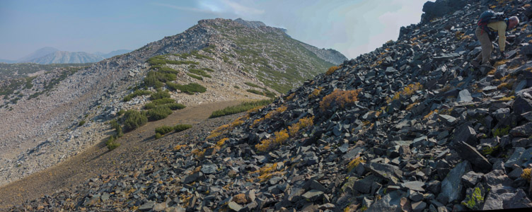
Sherwin Crest from flank of Gray Peak - 9/2021
Reload page to see different photo.

All web site content except where otherwise noted: ©2025 Bill Bushnell
Background texture courtesy of Iridia's Backgrounds.
Please send comments or questions to the .
Entire Blog - Display the entire Blog for all years. This is a large file!
Sanborn Park, December 29, 2011 - David and Bill Bushnell hiked the Skyline Trail at Sanborn Park. We started from the north trailhead on Skyline Blvd. across the road from the Los Gatos Rod and Gun Club, from which echoed the rapid reports of gunfire that sounded like a battle being fought in the forest nearby. We hiked south past the entrance to Castle Rock State Park and continued down to the junction with the Sanborn Trail. We turned around and returned about one mile on the trail before cutting over to Skyline Blvd.
We hiked Skyline Blvd. over the summit and then made a short detour into Castle Rock State Park to see if any apples remained on the trees in an abandoned apple orchard on the southwestern flank of Mt. Bielawksi. We saw a couple of ripe persimmons high on the lone persimmon tree, but the apple trees were bare. They had probably given up all of their fruit earlier in the fall.
We retraced our steps back to Skyline Blvd. and walked along the road past the trailhead parking before cutting over to the Skyline Trail where we detoured again on the Summit Loop Trail.
The Summit Loop Trail descends the north side of the ridge into a cool, shady canyon, at the bottom of which grows another small group of apple trees. These trees being on the cool side of the ridge fruit later in the season. We saw a few apples high on the tree, and a careful inspection in the grass around the base of each tree yielded a couple of apples that had recently fallen from these high branches.
We finished the hike by climbing the Summit Rock side of the canyon and returning to the trailhead as the fog and mist was closing in on the forest.
Distance: 7 miles; Climbing: 800 feet
Beach Walk, December 26, 2011 - David and I met Ron Bobb and Alice Mestemacher at Rio Del Mar Beach near Aptos for a walk north on the beach at low tide. We met up with friends of Ron and Alice: John, Karen, Anna, Jules, and Marianne. We walked north on Seacliff and New Brighton Beaches and continued beneath the Capitola Cliffs to Capitola before returning the same way after sunset.
By the time we arrived back at Rio Del Mar, the beach was quite dark--there was little moonlight, but the walking was easy once we got past the rocks beneath the cliffs.
After our walk we all met at Sawasda Thai in Soquel for a hearty dinner.
Distance: 5.2 miles; Climbing: 0 feet
Wunderlich Park, December 20, 2011 - David and Bill Bushnell hiked the long loop at Wunderlich Park. We started at the trailhead off CA84, hiked up the Alambique Trail to Skyline Blvd. at Bear Gulch Road. We then returned down the Skyline Trail, Alambique Trail, Oak Trail, Meadow Trail, and Alambique Trail.
Temperature started cool at the bottom and got colder as we climbed. At Skyline Blvd. a cold breeze was blowing, and our extremities were chilled. But, the sun felt good where it managed to shine through the trees. The effect on this day, one of the shortest days of the year, was like that of perpetual sunset.
While this was a long hike for this time of year, the trail was an easy walk. Grades were even, about 6% the whole time, and the surface of the trail/road was mostly smooth. Also, no ticks or poison oak.
Distance: 10 miles; Climbing: 1800 feet
Trimming the Redwood Tree, December 5, 2011 - These photos show the trimming of my backyard redwood tree. One can also see the change in the row of Carolina Cherry trees along the back fence.
Kumba Hikes the Los Trancos Trail, November 30, 2011 - David Bushnell, Bill Bushnell, and Kumba hiked the Los Trancos Trail at Foothills Park. We hiked the loop in the clockwise direction that does most of the climbing early in the hike.
49-Mile Drive, November 21, 2011 - Leonard Scoggin and his wife, Lisa, visited the San Francisco area over Thanksgiving week and had a day to do some sight-seeing. After some discussion we decided that I'd drive up to their hotel in San Francisco and the three of us would attempt to drive the 49-mile drive.
We started late, about 1300, but managed to get through most of the route, truncating it toward the end due to the setting sun, although we did stop at the top of Twin Peaks to enjoy the city lights at night.
For dinner we stopped at Loving Hut before I dropped them off at their hotel at 2100.
North Butano Ridge, September 3, 2011 - Stella Hackell and Frank Paysen drove my car to the Hoffman Creek Trailhead (near Memorial Park), while Bill and David Bushnell drove Stella and Frank's car to the China Grade Trailhead (just off the bottom of the map).
We hiked the day in opposite directions, keeping in contact by way of FM radios. We were able to maintain contact over the entire distance through a local repeater on the oppposite ridge, although our signals at times were only just readable.
We met for lunch near the red "1.9 mi" distance label on the Butano Ridge Loop Trail.
Even though the hike spends much time on North Butano Ridge there are few spots with views, and even they are only partial. The most notable characteristic of this hike is its remoteness. It is one of the few places in the Santa Cruz Mountains were no motors or other man-made noises can be heard (aside from the occasional overflying plane).
Distance: 9 miles; Climbing: 800 feet for David and Bill, 2800 feet for Frank and Stella
Black Mountain, August 28, 2011 - Five of us (Bill Bushnell, David Bushnell, Steve Prothero, Stella Hackell, and Frank Paysen) hiked up Black Mountain from the Rhus Ridge trailhead off Moody Road. The day was warm to hot, especially while climbing the steep upper section of the trail. We enjoyed a leisurely lunch break at the summit before hiking back down the way we had come up.
Distance: 9.8 miles; Climbing: 2500 feet
Coal Mine Ridge, August 13, 2011 - Three of us, Bill Bushnell, David Bushnell, and Steve Prothero, set out to hike a circuit at Coal Mine Ridge, a set of trails between Portola Valley and Los Trancos Woods. Our route took us from the "P" at Willowbrook and Alpine up the hill to the south and along the Toyon Trail. We hiked south to the Lake Trail, stopping to take photos at the Lake, a sag pond.
We then hiked north on Old Spanish Trail, then cut off on Sunrise Trail, taking it down to the Buck Meadow Trail. Then we took Buck Meadow Trail to Blue Oak Trail, and returned up Valley Oak St. to Arroyo Trail, that we climbed all the way back to Old Spanish Trail, where we enjoyed a rest on a convenient bench. We then took Coalmine Trail down to Old Spanish Trail again, and returned to the starting point.
Distance: 8.3 miles; Climbing: 1500 feet
Fall Creek Redwoods State Park, August 7, 2011 - We started at the southern end of the park at the Bennett Creek Trailhead, hiking down the Bennett Creek Trail, then up the Fall Creek Trail to the first junction with the Lime Kiln Trail. We turned left and climbed a short distance upstream to the old Lime Kilns. We continued up the Cape Horn Trail past the Powder Magazine to the unmarked junction with the Lost Empire Trail where the major climbing began.
We climbed steeply uphill for some distance before the trail leveled-off, stopping briefly at the Lost Camp, where there was not much to be seen, and pressing upward again to the Big Ben Tree where we stopped for lunch.
After lunch we descended the Big Ben Trail to the north and joined the Fall Creek Trail, where Steve got stung by a yellowjacket. We started to explore the Fall Creek Trail upstream, but fallen trees blocked our way, so we started the long, gradual descent down Fall Creek, passing many old mudslides, sunny glades created when multiple trees fell, babbling springs, and rushing cascades. Fall Creek was running voluminously.
We paused for a while at the Barrel Mill, started to explore an unmarked trail that seemed to climb up to the Ridge Trail north of Fall Creek (where poor Steve got stung again on the back--probably the same yellowjacket that had been trapped in his shirt), and crossed Fall Creek itself several times before reaching the southern end of the park again and the short climb up Bennett Creek Trail to the trailhead.
Distance: 7.6 miles; Climbing: 1800 feet
San Bruno Mountain, July 31, 2011 - Our San Bruno Mountain hike started with dropping Frank Paysen at SFO for his flight to Frankfurt (and then to Berlin). We managed to get him to the curb at the terminal by 1145, giving us enough time to get to the rendezvous point in Brisbane by noon. We arrived at the latter by 1155.
After driving up to the park entrance at the top of Guadalupe Parkway and depositing our money in the slot we pulled into the small parking area at the trailhead for San Bruno Mountain to begin our hike. Today our group consisted of Bill Bushnell, David Bushnell, Cara Coburn, and Dan Connelly.
We started up the Summit Loop Trail, taking the clockwise direction on the loop that would get us to the ridge more directly. About a mile from the bottom we reached the junction with the Ridge Trail where we headed east below the actual summit of San Bruno Mountain, nestled amongst several radio towers.
We continued east on the Ridge Trail, now a rocky and steep fire road, along the undulating ridge, reaching the end of the Southeast Ridge by about 1400. We paused in a slightly wind-sheltered depression on the north side of the ridge to eat lunch and to enjoy a 270 degree view.
One minor objective of the day was to witness the take-off of Frank's plane from SFO, with the hope that we might see each other, us on the ridge, and he at his window, before his plane disappeared into the clouds.
We had done our research. Frank was sitting in seat 59J, second-to-last row, right-side window. His plane was the third United Airlines 747-400 to take off at about that time. I figured it might be possible for him to see us, and with binoculars that I had brought with me, that I might be able to see his face peering through the tiny window.
Unfortunately, our research was incomplete. Had I looked at a map of the area and confirmed something that I should have known if I'd thought about it, that SFO was at least three miles' distant from our perch on the end of the Southeast Ridge of San Bruno Mountain, I would have realized the futility of the exercise. I could not even through my binoculars see the windows of the planes taking off. My last memory of watching planes take off from SFO was during a bike ride several years ago when I rode past the north end of the runway (28R) on McDonnell Rd. Somehow the extra three miles of distance to our present location didn't figure into my memory or planning.
Yet, we did wait while the jumbo jets, one after another took off. The first two flying to Asia and loaded with fuel lifted off more slowly. Frank's plane lifted off more quickly. After his plane had disappeared into the thickening fog, we got up from our wind-protected depression and began the trek back along the ridge.
While we had lunched and enjoyed the view, the fog had begun its steady advance over the peninsula, blocking the sun most of the time, and blowing fiercely through the lower gaps in the ridge. But there were moments of calm, such as when we traversed beneath the summit of the mountain. After we had crossed over to the west side of the ridge we were wholly within the fog.
When we arrived again at the junction with the Summit Loop Trail, Cara decided to head back to the trailhead the same way we had climbed earlier as she wanted to stop by her office nearby before going home. Dan, David, and I turned left and planned to take the long way 'round the Summit Loop back to the trailhead. We crossed the ridge and descended to Bunker Road 59 where we came upon a sign warning that the trail was closed 1 mile ahead. So, we hiked down Radio Rd. to the trailhead, arriving at the same time as Cara.
After getting into the car and out of the wind, I felt like taking a nap. Being in the wind all day was exhausting.
Distance: 7.3 miles; Climbing: 1270 feet
Dan's Strava recording of our route can be seen here.
Castle Rock State Park, July 24, 2011 - David Bushnell, Bill Bushnell, Stella Hackell, and Frank Paysen met at Saratoga Gap for a hike in Castle Rock State Park. We swapped cars. David and Bill drove Stella and Frank's car to the main entrance of Castle Rock State Park while Stella and Frank drove Bill's van to the Beekhuis Trail head on CA9.
Our two parties hiked the route in opposite directions, meeting for lunch roughly in the middle at the Castle Rock Trail Camp where there was a nice picnic table. Along the way we kept in touch with our FM radios, using one of two repeaters in the Ben Lomond or Bonny Doon area when we were not able to communicate directly due to the rough terrain. (If we hadn't made a programming error in our radios we may have been able to use the Castle Rock Ridge repeater that was much closer, although I suspect it was on the southeast side of the ridge--we were on the southwest side.)
Highlights of the hike included the uppermost two miles of the Saratoga Gap Trail that traverses a steep, rocky ridge with many fine views to the south and west.
What had been a relatively crowded trail on the eastern half of the route became quiet and peaceful (except for the distant artillery of the Los Altos Gun Club shooting range)--we saw only one other hiker on the trail after lunch; Stella and Frank reported seeing many on their climb up Saratoga Gap Trail.
Distance: 6.5 miles; Climbing: 600 feet (1800 for Stella and Frank)
Tarwater Loop, July 17, 2011 - Frank Paysen, David Bushnell, and Bill Bushnell headed over the hill to Pescadero Creek County Park for a cool hike in the redwoods. The hike started overcast and damp. With the damp grasses and shrubs overgrowing Coyote Ridge Trail our pants were soon wet below the knees.
We continued down Coyote Ridge through the mixed fir and oak forest. As we got closer to Pescadero Creek the redwoods replaced fir trees. We detoured down to the banks of Pescadero Creek to enjoy lunch by the water.
Our return hike took is up alongside Tarwater Creek where we again detoured to the crossing of the creek to watch the natural oil seep (heavy tar) float on the surface of the creek and spin tarballs in the current.
The last leg of our hike took us up the Tarwater Loop Trail, through the meadow with the abandoned shed, past the last of the spring's wildflowers, mostly Farewell to Spring, and back to the Tarwater Trailhead.
Distance: 6.2 miles; Climbing: 1000 feet
Phleger Estate, July 4, 2011 - We started at the lower picnic area of Huddart Park. Then we hiked up the Dean Trail and the Crystal Springs Trail to Richards Road. After reaching Skyline we took the Lonely Trail into the Phleger Estate, then the Raymundo Trail, and the Miramontes Trail back to Richards Road. We hiked a short distance down Richards Road to Raymundo Road, then hiked back up to the trailhead.
Distance: 9.5 miles; Climbing: 2000 feet
Pescadero Creek Redwoods: Brook Trail Loop, June 26, 2011 - Stella Hackell, Frank Paysen, David Bushnell, and Bill Bushnell carpooled to the Heritage Grove Trailhead and hiked up to the Sierra Club Hiker's Hut and then hiked a modified version of the Brook Trail Loop.
David and Bill hiked the loop mostly as planned, only varying from the trail by taking Towne Fire Road down to Pomponio Trail. Stella and Frank added to the loop by detouring on Bravo Fire Road and Pomponio Trail and later by detouring into Sam McDonald Park and returning to the Heritage Grove on the Heritage Grove Trail.
Distance (David and Bill): 7.5 miles; Climbing: 1700 feet
Distance (Frank and Stella): 10 miles; Climbing: 2200 feet
El Corte de Madera Creek Preserve, June 21, 2011 - Frank Paysen, David Bushnell, and I hiked a loop at El Corte de Madera Creek Open Space Preserve. We tried to hit all of the highlights of the preserve, including the tafoni sandstone formation, Vista Point, search for Resolution wreckage (that we did not find), a giant salamander, and an old growth redwood.
David was not feeling energetic and decided at the end of El Corte de Madera Creek Trail to return to the trailhead by way of the paved roads (less climbing altogether and easier to see the trail surface). He saved himself about 2 miles of hiking and beat us back to the car by 50 minutes.
Temperatures were warm in the shade and hot in the sun, but not so hot as to make the hike an ordeal. We saw three hikers and one mountain biker the entire day.
Distance: 8.5 miles; Climbing: 1800 feet
Fathers Day in Capitola, June 18, 2011 - Actually, the day before Fathers Day. These are photos from a family gathering in Capitola. We walked from Laura's place down to the center of town, sat at the beach for a while to watch people come up and pet Kumba, then climbed up to Grand Ave. to see the view, then back across town for a late lunch/early dinner at Dharma's. We then walked back to Laura's place.
Distance: 5 miles; Climbing: 250 feet
Windy Hill Preserve, June 15, 2011 - David and Bill hiked a loop on the south side of the Windy Hill Open Space Preserve. The day was warm but the hike in the shade. We didn't have many views, but we did see many wildflowers and some wildlife. Everything was still green.
Distance: 8.5 miles; Climbing: 1500 feet
Wildflowers on Los Trancos Trail, June, 2011 - David and I went out over a couple of afternoons a week apart to take our weekly hike on Foothills Park's Los Trancos Trail. In this album I experimented with taking photos of wildflowers. The viewer is invited to fill in the missing names or to make corrections.
Almaden Quicksilver County Park, April 19, 2011 - Frank Paysen and I took a moderate hike through Almaden Quicksilver County Park on a balmy spring day. We hiked up the Deep Gulch Trail, visited the Hidalgo Cemetary, and returned to the trailhead by way of the Castillero and Mine Hill Trails.
Distance: 7.1 miles; Climbing: 1450 feet
All web site content except where otherwise noted: ©2025 Bill Bushnell
Background texture courtesy of Iridia's Backgrounds.
Please send comments or questions to the .