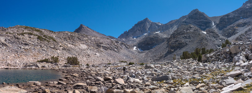
Sierra Crest from Treasure Lakes 3 - 9/2016
Reload page to see different photo.

All web site content except where otherwise noted: ©2026 Bill Bushnell
Background texture courtesy of Iridia's Backgrounds.
Please send comments or questions to the .
A late summer choir concert, forest fires, and the limited availability of a cat-sitter narrowed our window for a week-long trip to the Mountains to the last week in September, plus or minus a day or two. Fortunately, the Garnet Fire that had been spewing smoke into the Mammoth area became fully-contained and mostly snuffed out by the time we left home, so we made our reservation.
Then Frank and Stella's hybrid car began to throw mysterious error codes, perhaps a symptom of something serious, perhaps not. They had only just replaced the small 12-volt battery to clear the error codes that had been haunting them for a couple of weeks prior, but now they were reappearing with a new 12-volt battery installed.
Strangely, the car only threw these codes while Stella was driving, a symptom of which put the car in a "low power" mode. The code could often but not always be cleared by shutting down and restarting the car, similar to rebooting a computing device that was misbehaving. But, this state of affairs did not inspire the confidence required for one to undertake a week-long out-of-town trip in the car.
The upshot of this backstory is that in the last couple of days they or we were faced with the choice of renting a car or traveling in my ultra-reliable 1987 Toyota van with nearly 300k miles on the odometer.
A rental car would cost about $700-$800 for the week, but my van could easily hold the three of us and our stuff at no extra charge, provided I left my bike at home, which I was willing to do.
The choice wasn't too difficult. We piled into my van.
It has no air-conditioning, and with its short wheelbase and truck-like rear leaf-spring suspension, it doesn't offer the smoothest ride. But, we'd only miss the air-conditioning for a few hours while we crossed the Central Valley on the outgoing and incoming trips. The stiff bouncy suspension was dampened significantly once all three of us and our stuff were in the van, though that made the van under-steer to an uncomfortable degree when cornering hard on mountain roads, the squirmy tires likely contributing to that effect.
Speaking for myself, it was nice to have company on the drive that I had been making alone for the last 14 years since Dad stopped joining me on our annual trip to The Mountains. And, we all enjoyed the shortest route over Tioga Pass without paying the Yosemite entry fee since both Stella and Frank have senior passes now. I'll get mine next year—sigh—I suppose that gives away our ages...
I'm happy to report that the van drove predictably and with utter reliability, a welcome improvement from three years ago, if denying the ultimate in luxury and modern comforts.
| GPS track: | GPX |
|---|---|
| Distance: | 5.5 miles |
| Cumulative climbing: | 1680 feet |
| Total Time: | 5:00:02 |
| Hiking Time: | 2:33:10 |
Reversed Peak, September 22, 2025 - All three of us had risen after poor first-night-at-altitude sleeps the night before. In my case it was the occasional gasping just as I was about to drift off to dreamland. It takes me a day for my body to adjust to the decreased oxygen available at 8000 feet (2400 meters) above sea level.
The night before we had discussed our first outing and settled on Reversed Peak. We'd climbed this twice in recent years, each time finding the hike both enjoyable and rewarding given the effort. I regret never having hiked it with Dad in past years as he would have found the effort rewarding.
After breakfast and gathering our gear together for the hike we proceeded out to June Lake where in the past we've parked at the ball park along North Shore Road where toilets are available.
We set off by hiking back up to North Shore Road for a short distance along its shoulder before turning off onto a narrow dirt road that climbed steeply up to the official Reversed Peak Trailhead. My van could probably get up this road if it weren't for the large dips at the steepest part that would probably bottom out something on the undercarriage, but the extra hiking distance was not significant in any case.
Soon we started up the proper trail that entered a short but steep canyon formed by a now dry watercourse.
I got myself into a rhythm or level of effort I thought I could sustain for awhile, but my body was rebelling. I still found myself getting ahead of Frank and Stella, but no more than usual. I waited periodically to check on their progress without calling them by radio to give a report.
Once I saw they were moving I pressed on, making the right turn onto the trail leading to the Peak's summit and started up a mounting series of glacial morraines.
At the top of the last of these I found a nice spot amongst some aspen trees to wait for them to catch up. When they did we all traded notes about how much harder this hike felt than it did two and three years ago.
We continued to the summit mostly together. I had forgotten how from below it appears the trail is nearing the summit, only to discover it was a false summit and that another higher summit appears yet further.
When we did finally arrive at the ridge top and enjoyed a view down to Grant Lake on the other side, we were faced with a choice of getting to the summit through a "tunnel" under a large boulder as we had in past years or of scrambling up some rocks on the north side of the summit. Feeling adventurous and not wanting to stoop low to squeeze myself through the tunnel, I opted to scramble up the rocks today.
I waited for Frank to come around from the other side so that he could get a photo of me from above. But, his vantage point was at some distance from where I was climbing, unless he chose to down-climb part-way to meet me, which he declined to do. So I scrambled up and over some sharp pinnacles before joining both Frank and Stella at the summit.
Frank scrambled up the summit boulder, then after I took a late but long-awaited call from the state's taxing board—just what I wanted to talk about while enjoying a summit stay—we decided to remain at the summit for a while to eat lunch, take photos, and to sign the summit register.
Afterwards we started down. This time Frank suggested a down-climb different from my approach that also avoided the tunnel.
Once we got back on the trail we continued our descent. At the trail junction we decided yet again to head straight back to the trailhead instead of hiking the extra loop through the desert that we'd planned to do at each visit but always found a reason not to do.
Then I received a phone call from Mom on the descent that I took while walking on a more level part of the trail before I started down the canyon near the bottom and then down to the road and back to the van waiting at the ball park parking lot. The route we hiked was enough for our first day.
| GPS track: | GPX |
|---|---|
| Distance: | 1.7 miles |
| Cumulative climbing: | 330 feet |
| Total Time: | 6:59:34 |
| Hiking Time: | 0:32:08 |
The Gong Show Approach, September 23, 2025 - Last year we visited this climbing wall mainly to check it out and to practice using our equipment. It was our second choice after we found another climbing party at Iris Slab nearby.
This year we brought all of our equipment intending to do some climbing on the Lower Tier wall where Frank promised we'd find a few tall (30m) routes in the 5.6-5.7 range, some of which offered walk-up anchors. Our biggest problem was getting to the base of that wall.
We started across Rock Creek the way we had last year on a broken tree trunk that offered many hand holds and felt like the safest option available while we were laden with a pack on our back. We crossed three times, carrying one pack on our back each time across.
Then we started up the use trail to the base of the Gong Show Wall as we had last year.
At the base of the wall we then traversed to the right (north) toward where we knew the Lower Tier to lie. It turns out the Lower Tier wall is actually higher above the creek than the main wall, but we didn't realize this until we were traversing, up steep talus and across a steep scree field.
This was so "not fun" that I almost stopped and suggested we abandon that plan, but I thought perhaps the elusive Lower Tier was just out of sight around the next bend of the hillside. Then Stella made it known that she didn't want to scramble any further, and I quickly agreed with her. Even so I took a few more steps to see if anything was in sight nearby around the next bend, but all I saw was steep scree and a wall that looked to be yet another quarter mile away and higher yet!
So we returned to the base of the Gong Show wall. Frank suggested we find the slab that he and Stella had climbed with Jo two years ago, so we traversed left looking for that route.
We did find a route that looked similar to what Frank remembered. But, he didn't recognize it. Even so here is where we spent the rest of our day.
Except for the bottom ten feet the route did not look exceptionally difficult. It was short, no higher than the gym wall. We could see a couple of bolts low on the route, two anchor bolts on the slab at the top, and maybe one bolt at the edge of the slab, but no other bolts in between. I caught sight of one bolt on an indented face near the bottom of the slab, but it was too far off to the left of the second highest bolt we saw at the base of the slab. Maybe it was intended for a different route. Rope friction would be high if it were used for our route. The guide book made no mention of a route here, so we learned neither its name nor its purported rating. Maybe it was new.
The bottom part of the route looked like the crux, avoidable by traversing above it on a ledge to the left, although none of us tried that.
Frank's plan was to lead the route, set up a top-rope anchor, then let me and Stella each top-rope climb it. The last of us to the top would disassemble the top rope anchor and get lowered off of the two cheap steel quick links that Frank would abandon at the anchor bolts.
The plan sounded reasonable, though to be honest I was fatigued from all the laden scrambling we had done to get to this point. My enthusiasm for climbing was quickly ebbing. The sun was also beating down on us.
We spent quite a bit of time organizing our gear on the uneven ground near the base of the climb and carefully flaking out a 70m rope that was more than twice as long as needed for this short route.
Frank started by using the Stick Clip to place draws at the two lowest bolts so he could top-rope the crux. Then he started climbing while Stella belayed.
After one false start he managed to get up the crux. Although the route looked easier from there, Frank, knowing he was leading at this point, got cold feet for a moment while looking for the safest way to proceed toward the bolt we could see at the edge of the slab. I suggested what looked like a ledge to the left leading to terra firma if he wanted to bail off. But he rallied and stayed on without further ado, continuing up to the anchor bolts where he set up the top-rope anchor.
While being lowered he down-climbed a little bit so that he would come down to the spot where he started climbing.
Then it was my turn.
I started up three times, but each time I got a couple of steps up the crack and found no comfortable place for my right hand, and my toes jammed into the cracks were hurting. This was neither easy nor fun.
Under different circumstances I might have given my go greater effort if I had confidence I could succeed by employing a lieback, pulling with both hands on slopers to the left, and/or smearing my left foot more forcefully on the slab near the bottom. But, as I mentioned earlier I was already tired from the scrambling and didn't feel like pushing (pulling, in this case) myself to try a hard or risky move only to come off in an uncontrolled fashion and lose skin in the process.
I abandoned my attempt. Even traversing up to the ledge to avoid the crux I was no longer in the mood to try.
Then it was Stella's turn to try and then abandon. She got her hands about as high as I did before finding no place to advance them further, though to her credit she got her feet a step or two higher.
At that point Frank knew he had to climb again to retrieve the anchor and at least one of the draws, but on his second go he sent it cleanly and was able to retrieve our equipment (except for the two steel quick links).
After Frank returned to the ground, we retrieved our rope, then we spent some time packing up our gear before slowly and carefully starting down from the Gong Show wall. On the way down we discovered with some frustration the route that Frank and Stella had climbed with Jo in 2023 that we had walked right past earlier in the day. That route did look easier than what we had tried, but now it was too late, and we were tired.
Once back at Rock Creek we had another three crossings to bring both of our packs over the broken tree trunk. Then it was a trivial walk back to the van waiting in the day-use parking lot on the other side of Rock Creek Road.
At least Frank got in a couple of climbs and did a little lead-climbing.
| GPS track: | GPX |
|---|---|
| Distance: | 7.0 miles |
| Cumulative climbing: | 1550 feet |
| Total Time: | 7:09:32 |
| Hiking Time: | 2:54:37 |
Lookout Peak spur, September 24, 2025 - Today we chose to hike, but after yesterday's long day mostly hauling packs over difficult terrain, we wanted to sleep in a little longer. So, we didn't get out of the condo until nearly 1000.
After arriving at Mosquito Flat we did not get lucky and find a parking spot at the upper lot, even though it was a weekday. But we did find one further down the road.
We got started and hiked back to the upper lot, then after stopping at the vault toilets we started up the trail, then onto the trail for Mono Pass.
I knew that the distance to Ruby Lake wasn't too far, about 2.5 miles, from the trailhead, but it felt further than I remember.
Once we got to Ruby Lake we made our way across the Lake's outlet, then up and over a small cliff and down again to the Lake's shore before starting the off-trail portion of our hike.
I led the way through the talus field along the shoreline, staying close to the lake where the terrain was mostly level and the rocks most stable. Some rocks were level, but in a few places only pointy or angled rocks were available to step on. Progress was slow.
Near the southern end of Ruby Lake it felt easiest to start climbing. I probably missed the easiest place to start climbing up the slope to the left near but not quite alongside the stream flowing into Ruby Lake from the south.
At first I started up terraces among white bark pines, but then moved into more open terrain. As I climbed further I ventured closer to the stream, and with the low water this time of year the stones were flatter and easier to walk on. At the top of the stream I climbed onto a large boulder so that Frank and Stella would see where I had gone.
At this point I noticed that we were approaching our agreed turnaround time. I didn't want to turn around here when a low hill southwest of Lookout Peak promised a nice view where we could stop and enjoy lunch.
I radioed Frank and Stella that I was climbing the hill they could see to their left when they got to the top of the stream. Somehow this was all familiar, but I wasn't sure at the time that we had done this in 2018, the year we actually got to the top of Lookout Peak.
When I got to the top of the hill I recognized the flat rock with the horn. This would make an excellent lunch stop. The summit of Lookout Peak would be too far unless we didn't mind arriving back at the car at or near dark. If I had packed my headlamp I might have tried to persuade them to extend our turnaround time so that we could get to the summit again.
Soon Frank and Stella arrived. We took our photos, a group photo, then ate lunch before heading back down. This time we descended mostly the way we had climbed. No sliding down steep scree lying at the angle of repose as in 2018.
The hike down went more quickly as I could see an on-off use trail leading to the shore of Ruby Lake.
On the last few steps down to the lake shore, Stella got her foot wedged in a gap between two rocks and fell, twisting her immobilized foot. After a short period of recovery she felt that the twisting had stopped just short of causing a serious injury. Fortunately, nothing had broken. She could continue unaided, but the mild soft-tissue injury bothered her for the rest of our trip.
Then came the slow talus hop and the crossing of the Lake's outlet. From there we enjoyed an established trail all the way back to the car. The trail descent took longer than I thought it would. We arrived at the car with plenty of time to drive home then prepare and eat dinner at a reasonable hour.
| GPS track: | GPX |
|---|---|
| Distance: | 1.6 miles |
| Cumulative climbing: | 180 feet |
| Total Time: | 2:32:43 |
| Hiking Time: | 0:36:15 |
Horseshoe and Sunshine Slabs, September 25, 2025 - Today was a short day due to forecast rain in the afternoon.
Frank wanted to hike out to Horseshoe Slab and check out the climbs, the prospects for a walk-up top-rope anchor, and perhaps work on setting up a traditional (trad) anchor on which we could practice rappelling.
The right-hand end of Horseshoe Slab has the most accessible walk-up anchors, but when we arrived there, another group had set up camp. We asked if we could walk up to the anchors and check them out. They were agreeable.
The group was on a week-long mountaineering course. Their original plan today had been to climb Crystal Crag, but because of the inclement afternoon weather forecast they altered their plan to do some top-roping on Horseshoe Slab instead.
We watched a couple in their group climb routes that we might try later in the week, then we hiked up to the top of the Slab to set up a trad anchor using cams.
After some trial and error Frank managed to set up a decent-looking trad anchor, making use of a 3/4" crack between two large stones. The only weakness might have been that all cams were wedged into the same crack, and the adjacent stones might not be adequately fixed and stay put under extreme load. Frank pounded on the stones to check. Both stones felt solid, although two days later when Frank stomped with more force on the smaller rear stone I could feel a slight vibration.
Because the other party was climbing below we didn't test this anchor. Instead we disassembled it with the idea that we'd set it up again when we had this part of the Slab to ourselves.
At this point the sky was thickening up, and the weather was starting to change. So, we packed up our stuff and hiked back to the car. But, before we got there I found a use trail that appeared to lead up to Sunshine Slab. I wanted to explore this, so we started up the steep use trail, but Frank and Stella didn't seem interested and turned around before we got there.
I found Sunshine Slab and took a mosaic photo, showing that the slab surface was more varied than Horseshoe Slab. I could see bolts in the rock at various spots. The anchors did not appear as easy to access by walking up, and I didn't try.
After I descended the use trail I found Frank and Stella waiting for me at the bottom, and together we returned to the trailhead. We arrived back at the condo about an hour or two before the rain and thunder started. We spent the rest of the day reading and napping.
| GPS track: | GPX |
|---|---|
| Distance: | 8.0 miles |
| Cumulative climbing: | 2360 feet |
| Total Time: | 5:33:38 |
| Hiking Time: | 3:33:51 |
Mammoth Mountain, September 26, 2025 - Yesterday I tried to talk Frank and Stella into an early wake-up (0400-0500) for the long drive down to South Lake, followed by a climb up Vagabond Peak and perhaps if we were feeling really frisky, Cloudripper. But, that proposal was met with not the slightest hint of enthusiasm. And I'll admit I didn't particularly look forward to an early wake-up and a big day out with the cold, wet weather we had had yesterday and the likely prospect of falling short of our goal for all that trouble.
Then another idea popped into my head. In all the years I had visited Mammoth for hiking, biking, and more recently, climbing, I had never hiked up Mammoth Mountain itself.
We had all taken the gondola to the summit at least once to enjoy the view, so hiking to its summit felt redundant. But, here's a mountain in our backyard that features at least two or three hiking routes to its summit and offers the option of a hot meal at the summit station, followed by a gondola ride down, should we choose. A more European-style trek to be sure, but one that suddenly took on new interest.
I thought we might hike up one route, then take another route down, using one of the town trolleys to shuttle us from one side of the mountain to the other. But, after calling the resort I confirmed that the Bike Park was closed for the season, the bike shuttle from the Main Lodge into The Village was no longer running, the gondola was closed until ski season, and according to the resort's web site even the foot trails leading to the summit were closed.
Of these only the latter was found to be un-true, but we made plans anyways. If trails were in fact CLOSED, then we'd improvise. But closing all foot trails to the summit seemed unlikely. I suspected the resort didin't want a bunch of tired hikers at the summit expecting a hot meal and a gondola ride down, so they left the misleading information on their web site.
We decided to start our hike at Horseshoe Lake/Mammoth Pass Trailhead as that offered what appeared to be the easiest route to the summit. Our plan was a straightforward up-and-down hike without relying on any services from the resort. And, following a sensible-hour wake-up we found ourselves ready to hike just after 0900.
Our route took us toward Mammoth Pass, but then a right turn onto the Mammoth Pass Trail that took us to Dragon's Back Trail. So far no trail closures were evident, although we did see a small orange sign with the words, "Wrong Way", and occasional orange flags or ribbons tied to tree branches. It appeared that some sort of trail maintenance might be in progress, but we saw no unequivocal signs of trail closure, so we pressed on.
At Dragon's Back Trail we again saw more orange flags and ribbons, but no closure signs. This was good news as this trail went to the summit.
We pressed on, climbing now at a steady clip up two long switchbacks. As we climbed we encountered a few descending runners with number tags pinned to their clothing.
They appeared to be part of an event that we would later learn is called, "The Mammoth", a 208-mile ultra-endurance foot race held over four days. All of the runners we encountered were polite and appeared to be in good spirits. They had only just started their race this morning by running up a different trail to the summit and were now descending Dragon's Back Trail toward Mammoth Pass, the way we had come.
Even though uphill hikers generally have the right-of-way on a narrow trail, we did our best to stand aside for the runners since they were on the clock and we weren't. It didn't take long for this process to become tedious as we now found ourselves passing by the bulk of the participants as we progressed up the mostly rocky and narrow trail.
As we neared the tree line the opposite passing runners thinned out, and instead we were treated to howling, cold, gale-force winds blowing over the shoulder of the mountain.
I thought of stopping to put on my rain jacket for warmth, but I didn't want to stop in the wind and possibly lose my hat and/or jacket while I made the wardrobe change. I pressed on up the rocky slope, passing a lone and very cold-looking course photographer who was huddled in a thick down jacket at what must have been the windiest part of the trail.
Not far above the photographer I came upon a small radio shed. We couldn't enter, but the lee side of the building offered relief from the strong wind. I took refuge there and waited for Frank and Stella to join me.
After taking a short break, the three of us continued along the summit ridge to the true summit of Mammoth Mountain where a finish line banner had been erected.
We took our summit photos, then descended to a pair of porta-potties that had been left next to the Summit Lodge. I suspect this was for the benefit of hikers to avoid their using the side of the building, since the Lodge was officially closed.
But the Lodge doors were open. Music was playing from inside, but the interior looked dark. A resort worker walked by, gave me a dark look, and added in a manner intended to preclude my asking about any services within, "Enjoy your trip down."
We walked around to the west side of the lodge to enjoy the magnificent view of the Ritter Range and the Minarets. Mount Ritter and Banner Peak were wreathed in cloud, but the Minarets stood out against the dark blue sky in sharp relief.
After taking our scenery photos we began the hike down. We stopped again on the lee side of the shed for a break from the wind, then continued down the trail.
The course photographer was just packing up as we went by, and as soon as we entered the forested areas, the wind calmed. When the sun came out from behind the clouds, it was actually slightly warm in the protected areas.
We stopped along the ridge to enjoy a nice view into town and to eat a snack. We continued our downward hike, retracing our steps. This time we mostly had the trail to ourselves.
At a small plateau and trail junction we stopped to sit and eat lunch. The log we found wasn't the most comfortable, but it was the best available, and by now we were ready for lunch.
A runner sweeping the course came by while we ate, collecting the orange flags, signs, and ribbons. He continued down the trail branch that we did not take, but I expected we might see him again, and we did.
As we were finishing lunch a few drops of rain struck us, so we packed up and continued down to the Mammoth Pass Trail.
As we started toward Mammoth Pass the event sweeper came by us again, and collected the flags and ribbons along the remainder of our route.
At the Mammoth Pass Trail I proposed to continue across the Pass to McLeod Lake before returning to the van, but Frank and Stella had had enough for the day. I continued by myself to McLeod Lake, but we kept in touch by radio until we rejoined back at the trailhead.
McLeod Lake was pretty and calm, and its beaches wide and clean. Only a few other tourists were at the Lake, but as I hiked down to the Trailhead, I saw a couple of large groups carrying beach chairs, coolers, and floatation devices hiking up.
I arrived at the Trailhead not long after Frank and Stella had arrived back at the van, so they didn't have to wait long for me to complete my detour.
| GPS track: | GPX |
|---|---|
| Distance: | 1.4 miles |
| Cumulative climbing: | 50 feet |
| Total Time: | 6:59:55 |
| Hiking Time: | 0:26:51 |
Horseshoe Slab, September 27, 2025 - Our third drive up to Horseshoe Lake occasioned our second visit to Horseshoe Slab. Although today was Saturday, we hoped to arrive early enough not to find another party camping at the base of the wall we planned to climb.
We shouldered our two packs each of gear and began the short trek out to Horseshoe Slab. Upon arriving at the northern end, we found the area vacant, so we quickly set up camp.
We had planned to set up the rappel anchor again and do our rappels on what I call Route One, which according to our guide book was called Rodeo Rider (5.6). (See first photo in album.) Then we would disassemble the anchor so that Frank could try trad-climbing this route, having the full set of cams available for protection placements.
But upon finding the area vacant, we decided to start climbing straight away so that we could stake our claim to the wall by maintaining a presence at its base.
Frank altered his plan to climb first with the top-rope while looking for adequate placements, then try lead-climbing later, if that looked promising. We put off rappelling until after we had finished climbing the routes. That would also put off any decision about whether to trust our anchor to one common crack in the rock above, something that had troubled me the night before.
Frank found the route more difficult than he expected for a 5.6. He could find no good cam placements in the vertical cracks that ran parallel to the route, finding the cracks too shallow and flared to be useful. So, he just continued top-roping without stopping to try to place cams in the cracks.
Then it was my turn. I got myself to a reasonably comfortable stance about six feet off the ground, but I had trouble moving higher. I came off once briefly when my foot slipped, but I eventually pressed on, mostly by using uncomfortable toe-jams and either tiny crimps or lieback/Gaston moves against the side of the cracks. My mantra to Frank who was belaying was, "Keep it tight, Frank! Tight, tight, tight!" The climb was neither as fun nor as straightforward as I expected.
Then Stella climbed it with about as much ease as I exhibited. She found the toe-jams somewhat painful due to her ankle injury the day before and did not climb again today so that she wouldn't aggravate her injury any further.
Before we moved the anchor Frank wanted to try climbing Route One again. This time we set up the video camera on a rock while I hiked up to the anchor to photograph him from above.
Frank thought the climb was easier on his second go. Perhaps he was adjusting his technique to keep his weight out from the wall so that friction on his feet was maximized, something that he didn't do on his first go.
Then I climbed again with Frank belaying and Stella photographing me from above. I tend to stick my butt out too much as a habit, which in this case on slab is helpful. I generally climbed this route the same way as I did the first time, finding it about as difficult overall on my second go. I came off again a little higher up when I was tried to move off of the foot pocket to the right of the route but couldn't find a place to securely jam my left toe so that it wouldn't slip. But, once I got back on I continued to the top without incident. I found the climbing up the middle portion of the route as strenuous on this go as the first, but the upper part with its larger foot platforms offering rests slightly easier.
Frank then hiked up to the anchor, removed the quad anchor he had placed at the top of Route One, and installed two quick draws at the top of Route Two, moving the rope over in the process.
Frank then climbed Route Two, finding this route, which he believes is rated 5.7, more enjoyable than the first.
Then I climbed it. The route starts at roughly the same spot as Route One but traverses along a diagonal crack that leads up to the left. The crack itself offers a number of jug-like spots where one can get a few fingers into the crack. At first feet smear or find tiny jibs in the rock on the wall below, but with good fingers I had more confidence.
About one-third of the way along the crack I found a couple of good footholds for a rest, then again about two-thirds of the way up. This was fun and felt much less tenuous to me than the first route, which makes me believe the ratings are reversed.
Then I arrived at a junction of cracks where I needed to shift to a different crack ascending diagonally to the right. I had a nice little platform to rest and to consider my next move, so I stood here for a while before mustering the courage to venture onto the new crack.
The hand holds were less good along this crack, but as long as I could jam a toe into the crack, I had reasonably secure footing.
While stepping with care I advanced slowly up this crack, and soon I found myself on another platform before the anchor itself.
I felt good about sending this route and enjoyed climbing it.
After I got lowered, I hiked up to the anchor, removed the two quick draws, installed the quad anchor at the top of Route Three, and moved the rope over to Route Three. This operation took a little bit of doing as I didn't want to accidentally drop the rope down the wall. To get it shifted to the other anchor I had to draw it past a tree on the ledge above the anchors.
I got the quad anchor set up and the rope mid-point set to the carabiners, then I hiked back down to the bottom.
Frank prepared to climb Route Three, which according to the guide book was called "Cow Puncher (5.6)". Awful name.
Frank had some trouble getting started on this route as it wasn't clear where the bottom was. After traversing onto a different ledge to the left, he made progress and got to the top where he re-arranged the lower carabiners on the quad that were hanging off of different strands, causing them to jam into each other awkwardly.
He didn't seem to think the route was that difficult, but when my turn came to climb I decided I had had enough. My fingers were tired, and I could see that this one like the others featured small crimp-like hand holds.
So, Frank and I climbed up to the anchors, and while Frank was setting out the equipment to re-build our rappel anchor, I took down the quad anchor at the top of Route Three.
As I was removing the anchor I noticed that I had failed to lock the gates of the carabiners at the bolts, their red bands indicating an unlocked state glared accusingly, like a bright red mark on a pupil's exam. At first I thought Frank might have unlocked these when rearranging the carabiners at the rope, but when asked he said he hadn't touched the carabiners at the bolts. So, I missed this when setting up the anchor, and Frank missed it when he was re-arranging the other carabiners! In theory my error rendered the anchor no more hazardous than two quick draws, where the carabiners on the bolts are non-locking, but the oversight bothered me.
Frank spent some time trying to set up the anchor on the single crack we had worked on two days prior, but before he got very far he slipped a 0.75 cam into the crack that was just as wide. Since he had fully retracted the cam while inserting it into the crack, he couldn't shrink it further to extract it. (Note to future self: Don't fully retract a cam when placing it into a crack; always leave some margin for removal.)
He worked on it for a while, then asked me to try getting it out. I worked on it for a while, even trying to employ the nut remover to see if I could slide the cam sideways or to use the nut remover as leverage, but nothing seemed to work.
After about 20-25 minutes of frustration and a few choice words, I was ready to give up and abandon it. I thought it might cost us around $30-$50 to replace. (We later learned that the replacement cost would have been about twice what I expected.) Not cheap, but not worth another hour of frustration. I considered what was worse: the cost to replace the cam or the humiliation of having it known we made the rookie error of getting it jammed, then having to abandon it only for some other lucky climber to claim later.
Toward the end of my efforts I noticed that working the cam back and forth was resulting in perceptible movement of its lobes relative to the rock. It occurred to me then that the cam made of soft aluminum was abrading on the hard granite, that if I continued rocking it back and forth, the rock would file down the cam teeth that were preventing its removal. That gave me renewed hope I could retrieve it.
At the end of another five minutes of working it and much to our relief the cam popped out. A couple of teeth on the lobes had been filed down noticeably, but we both thought the cam was still usable. By this time none of us was in the mood to continue setting up a rappel. Stella, who had stopped climbing earlier in the day was waiting patiently below, and the sun was dipping past the ridge leaving our area in a cold shadow. It was time to pack up and head home.
We packed up our gear, loaded the packs onto our backs, and trudged back to the car. The cam-jam at the end excepted, we all had a successful day climbing, our first in the Sierra without a guide.
Around the Condo, September, 2025 - Candid photo(s) taken to show what life was like when we weren't on the trail or on a wall.
Frank and Stella's Mammoth 2025 web pages - For a different perspective see Frank and Stella's web pages of the same holiday.
All web site content except where otherwise noted: ©2026 Bill Bushnell
Background texture courtesy of Iridia's Backgrounds.
Please send comments or questions to the .