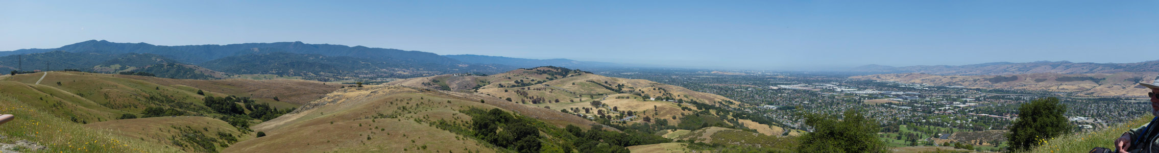
View north from Coyote Peak - 4/2022
Reload page to see different photo.

All web site content except where otherwise noted: ©2026 Bill Bushnell
Background texture courtesy of Iridia's Backgrounds.
Please send comments or questions to the .
| GPS track: | GPX |
|---|---|
| Distance: | 6.7 miles |
| Cumulative climbing: | 1870 feet |
| Total Time: | 7:58:33 |
| Hiking Time: | 3:03:16 |
Lookout Peak, September 16, 2018 - At dinner the night before we discussed where we might like to hike on our first day in the mountains. A few short hikes came to mind, but one that we gravitated toward was Lookout Peak, a summit that had defeated us twice before: the first time due to weather, the second due to a combination of fatigue and loose terrain. Frank had observed on our last visit a possible route to the summit from its "back side", the southwest ridge, and as the peak was only two miles from the trailhead, we decided to give it another go, starting late as usual for our first day.
When we arrived at Mosquito Flat we discovered all the parking spots at the trailhead were occupied, so we had to drive back down the road some distance to find an "overflow" spot along the road. By the time we started our hike it was almost noon.
As expected the trail up into Little Lakes Valley was busy. At the junction with the Ruby Lake Trail and Mono Pass Trail, a pair of backpackers returning over Mono Pass to the trailhead informed us that a group had just started up to Ruby Lake.
We saw the group of four by the lake, but we did not pass them. At the outlet to Ruby Lake we crossed on the old logs, then headed around the southeastern shore until the trail petered out into a talus field. This was as far as we had explored in this direction on our last visit.
To the right lay the dark waters of Ruby Lake, to the left an impressive talus field that sloped with increasing steepness to the summit ridge of Lookout Peak. The talus did not promise an easier path to the summit than loose rock I had experienced on the opposite side of the ridge in 2015. The bottom of the talus field was nearly level with the lake. Our plan was to cross this relatively stable field, aiming for the stream flowing down from Mills Lakes above.
We worked our way across this field. As expected I found the going slow but not difficult. Frank and Stella proceeded without the aid of their hiking sticks and found the going somewhat slower as they had to bend over uncomfortably to use their hands. I waited at the shore for them before starting up toward Mills Lakes.
After Stella arrived I started up rib of rock that offered better footing than climbing amongst the talus. This rib led to a level spot with a nice view of the lake from its southern shore. From here I headed for the dark-colored rock of the stream bed itself, now nearly dry. This rock made for easy and stable footing, so I followed it all the way to the "pass" above. I found a warm spot to wait for Stella and Frank who arrived a few minutes later.
At this point we headed for a high spot on the ridge separating the outflow of Mills Lakes from Little Lakes Valley. From there we enjoyed an excellent view of surrounding peaks and our planned ascent route. As my gaze turned toward the north I was disappointed by what appeared to be an impossible climb up the southeast ridge of Lookout Peak.
We found a sheltered spot to enjoy a sit-down lunch with a view over Ruby Lake. After lunch I thought of abandoning our quest for the summit, but recalling advice from Steve Roper† that a seemingly impossible route when viewed from a distance becomes quite possible when viewed up-close, I suggested we take the easy walk along this ridge toward Lookout Peak and see how far we could climb up its southwest ridge. We had enough time to do at least that much, and I was somewhat motivated not to be defeated yet a third time by this third-rate peak!
As we approached the technical part, we discovered what appeared to be a sheer cliff from a distance had cracks and other crevices hidden from view that allowed one to climb around or through the obstacle. The climbing was Class 3, but it was rather enjoyable, like finding the solution of a puzzle.
After we surmounted one of the lesser pinnacles along the southwest ridge, we found the walking along the ridge to its high point relatively easy. Soon we were gathered at the summit for the obligatory panorama and group photos. But after a few minutes basking in the glow of our accomplishment, our conversation turned to discussion of our descent route.
We could of course return the way we had climbed. That was the devil we knew. Frank thought of descending directly to Long Lake far below the east side, but memories of the loose rock on that side of the peak that had thwarted our attempt in 2015 were in my mind. The idea of slip-sliding over 1000 feet down this side was not appealing, nor did we have any knowledge of impassable cliff bands that might appear after we were most of the way down.
To the northwest Ruby Lake appeared enticingly close, and while the west face was covered mostly with talus, the vertical distance was less than 800 feet. Perhaps slip-sliding that way would be quicker than returning the way we had come. What I had not remembered was that the west face of Lookout Peak was not a "smooth" talus slope, but featured cliff bands on its upper third.
We agreed to aim straight for the trees above the outlet of Ruby Lake, so we started out along a diagonal path across the west face of Lookout Peak. I made decent progress with my sticks, but Frank and Stella preferred to use their hands and their progress was slower. It was reassuring to remain in contact via radio.
I found myself half-way across the face and about one-third of the way down before I saw that I was traversing loose talus above a cliff band below. I advised Frank and Stella of my situation, and they decided to discontinue their traverse and to head straight down a steep but loose chute, although Frank told me he couldn't see the bottom of it. Stella followed him.
Not wanting to climb back to Frank and Stella's position, I decided to press further on across the top of the cliff band. I saw two narrow chutes descend diagonally in the "wrong" direction and thought of exploring those. But they were steep, and I could see that there were taller drops within the chutes that might be difficult to down-climb, not to mention up-climb, should I find the way impassable further below.
I continued carefully across the "forehead" of this cliff until I reached a spot where I could see a viable way to the bottom, but the final bit of traverse to the open chute ahead of me was on a narrow ledge in a cliff wall. At this point I put away my sticks and worked my way across the ledge, shortly finding myself mid-way down a broad chute filled with loose rock.
At this point the descent was slow and tedious. Several times I loosened large boulders or slid a foot or two further than I had planned. But I managed to stay on my feet (and sticks) and soon found myself at the edge of the forest I had seen above.
I found a comfortable rock on which to sit, then connected with Frank and Stella again via radio to check on their progress.
Suffering in their own purgatory they had made progress down the uppermost and steepest part of their chosen chute and had just come into view from my resting spot. They could now see the bottom and knew that they would not be cliffed out, but their progress was slow. They each spent much time glissading (and ruining two pairs of pants: Frank's pair, and Stella's pair), but eventually they found themselves on firmer talus that they could traverse to the outlet of Ruby Lake. I hiked down through the forest and met them near the shore of Ruby Lake as they worked their way through the last of the talus.
At this point the sun had set behind Ruby Ridge, and the temperature dropped about five to eight degrees Celsius. I donned all of my clothes, but I was still slightly chilled. It felt good to start walking again, even if it was mostly downhill.
Our hike back to the trailhead was uneventful, although the evening light on the peaks around the valley was beautiful. We arrived back at the car at the tail-end of twilight, our "half-day" hike having proven longer and more challenging than we had intended.
†Roper, S. Sierra High Route, Traversing Timberline Country. Seattle, Washington: The Mountaineers, 1997.
| GPS track: | GPX |
|---|---|
| Distance: | 2.7 miles |
| Cumulative climbing: | 330 feet |
| Total Time: | 1:21:59 |
| Hiking Time: | 1:00:01 |
Convict Lake, September 17, 2018 - The day after our hike up Lookout Peak we decided to really take a half-day hike. It turned into a quarter-day hike, but it was just what we needed to recover from overdoing it on our first day.
We started out with a short walk to Mammoth Mountaineers and Vons nearby in town. Then we drove out to Convict Lake and enjoyed an easy walk around the lake, circling counter-clockwise, and arriving back at the condo with plenty of time to prepare dinner and get to bed early for an early wake-up the following morning.
| GPS track: | GPX |
|---|---|
| Distance: | 6.0 miles |
| Cumulative climbing: | 2320 feet |
| Total Time: | 7:20:05 |
| Hiking Time: | 3:15:47 |
Tenaya Peak, September 18, 2018 - In 2015 I took a half-day hike on my way home from Mammoth to explore an approach up the west ridge of Tenaya Peak. On that occasion I did not get to the summit, but I saw enough of the route that I felt it was worth exploring further up the ridge on a future date.
At dinner the night before Frank, Stella, and I discussed the next day's outing. In spite of our longer-than-expected adventure on Lookout Peak, we all felt up to try for another "easy" summit goal. And, given my experience having explored part of the route to Tenaya Peak, that summit was a good candidate.
To avoid returning home after sunset we decided to aim for an earlier start, leaving the condo by 0800. In the end we managed to be on the trail by 0900, leaving plenty of time to explore Tenaya Peak, and return to Mammoth by dinnertime.
Instead of taking the Sunrise Trail south from Tenaya Lake as I had done in 2015, we aimed for my descent route on that occasion by starting out on the trail along the southeastern shore of Tenaya Lake. We stopped along the Lake's southern shore to snap a morning group photo from a spot that must have been chosen by the photographer of one of my Mac's desktop background photos. At a point roughly halfway between Tenaya Lake's southern and northern shore, we left the trail and headed up into the forest.
The route climbed easily at first, then presented some challenges such as fallen trees, large boulders, and other obstacles to be gotten over or around. Near the top of this climb we found ourselves on moderate-angle slabs and our first views down to the lake below.
When we arrived at the pass between Tenaya Peak and the unnamed granite dome on its shoulder we continued to the left and up into a forest that eventually ended at the bottom of a moderately steep granite slab. We continued climbing as high as we could at the base of the slab before venturing onto its surface. I was happy that the weather forecast was for clear dry weather all week, or I might have felt uneasy committing myself to returning along a route that involved friction climbing on granite. Most of the surface was rough, but some parts exhibited granite polish that would have been slick when wet, and when wet it might have been difficult to distinguish the polished granite from the rough.
I started up the slab using my sticks, but I discovered I wanted my hands free to grab holds in the rock, so I put my sticks away. (For me Class 2 climbing becomes Class 3 when I need to put away my sticks and use my hands.)
Climbing the angled granite was a little scary at first, but after becoming comfortable with my shoes on high-friction granite, I found that I preferred it to bushwhacking through vegetation or dealing with loose stones or soil on similarly-angled terrain.
At the top of the slab climb the angle became gentler, but we soon found ourselves before a cliff. Fortunately, the cliff was not sheer, and after a short examination we found way to climb via some low ledges to the forest above.
A short distance into the forest we encountered a use trail that we followed to the summit.
When I got to the summit a young man was already perched on the summit block. He had climbed the northwest buttress and was changing out of his rock climbing shoes when I arrived. A few minutes later Frank and Stella appeared.
Frank snapped my photo while I sat on the summit block, but neither of them wished to join me for a group photo there, so after taking the obligatory panorama sequence we descended a short distance to rest and enjoy our lunches and the view out of the wind. After lunch we snapped a group photo.
On our way down, Stella and I explored a short distance down the climber's route across the northwest face of Tenaya Peak. That route started in a field of large talus perched on a cliff. We decided this time to opt for the devil we knew and to leave exploring the climber's route to some future occasion when we could climb it from the bottom.
Before heading down through the forest to the lake shore, we detoured onto the granite dome I had climbed in 2015 to enjoy its view of Tenaya Lake and the nearby domes and peaks.
Our hike down through the forest was our last adventure, presenting us with similar obstacles as our ascending route, although we traversed further east to avoid some of the largest of the boulders we had encountered in the morning.
When we got to the established trail along the lakeshore, we returned to the trailhead and all agreed that the outing had been a success, even if we had spent the entire day hiking a trivial six miles.
| GPS track: | GPX |
|---|---|
| Distance: | 9.5 miles |
| Cumulative climbing: | 1710 feet |
| Total Time: | 7:38:39 |
| Hiking Time: | 4:04:02 |
McCabe Crest, September 19, 2018 - Our goal for the day had been to reach the summit of Shepherd Crest. But that goal depended on our taking advantage of the water taxi service across Saddlebag Lake to cut three miles off the total distance. Although we could hike the distance and do the climb without the aid of the taxi service, we wanted to save our legs for the big hike of the week.
When we arrived at the Saddlebag Resort, we discovered the place had been shuttered since 2016 and was in search of a new owner. Aside from that the lake level was as low as I had ever seen it, well below the bottom of the dam at the south end of the lake.
The morning air was cold as we started out across the dam and onto the klinkers on the western shore. I walked quickly to stay warm, and only when I got to the northwestern end of the lake that was in the sun did I feel warm enough to stop and remove my shell. Stella and Frank came along shortly, but Frank was having a hard time today with walking over the klinkers.
We continued as a group on the trail to the old road leading up to Steelhead Lake. At Steelhead Lake we regrouped, while Frank snapped a photo of Stella and me in front of Shepherd Crest.
From this point we took a well-worn use trail around the west side of Steelhead Lake, between a few small tarns, and headed for a dry streambed that climbed a green slope above Steelhead Lake near one of the old mining operations at its northern shore. At the top of this climb we found ourselves next to Secret Lake.
In 1974 I had taken my first backpacking trip in the Sierras from Saddlebag lake to Upper McCabe Lake. I had recalled our route thus far, but I did not remember gazing up at the impenetrable wall that stood before us now. I could not recall how we had gotten over the headwall.
I gazed up at the route to Shepherd Crest and was disappointed to see more loose rock and scree that had to be climbed. I suspect this is the easiest route to the summit, but after our tiring descent of Lookout Peak earlier in the week I sought a different route over the McCabe Headwall that was on sturdier ground. Besides that I did not recall climbing up a loose chute with a backpack in 1974. This decision may have cost us reaching the summit.
We walked around the back side of Secret Lake and looked for cracks or ledges that might guide us easily to the top of the wall, the southern end of which appeared gentler than its northern end. As Frank and I pressed further up the wall, Stella radioed that she was tired and would find a nice spot to sit near Secret Lake and to await our return.
After taking a false start up a steep crack we found a ledge marked with cairns that led to the top of the headwall.
When Frank and I arrived at the top, we did not explore the west side that descended to Upper McCabe Lake below. The west side of the ridge was windy and cold, and the ridgetop itself did not look easy to traverse should we have thought to press on to the summit of Shepherd Crest from here. So we resigned ourselves to having achieved this lesser goal.
After taking a few photos, we descended about ten feet down the east side to find a sheltered spot from which to enjoy the view and lunch.
After eating lunch we descended the cairn-marked route to meet Stella before starting down a use trail to Steelhead Lake below.
While hiking down the old road to Saddlebag Lake Stella and I stopped for a snack beside Greenstone Lake to wait for Frank. who was slower than usual today. Frank snapped our photo from the trail and continued on without stopping.
We discussed via radio whether to return along the shorter western shore of Saddlebag Lake or to take the longer but easier terrain of the eastern trail. The last time I had hiked the trail on the eastern shore was in 1974 when it was a road still passable to four wheel vehicle. Frank had had a hard time on the klinkers in the morning, so we agreed to return on the eastern shore. In any case the eastern shore still basked in the warm late afternoon sun, while the western shore was already deep in shadow. Not far from the trailhead we encountered a loquacious hiker who had something to say about just about anything that one might discover on a hike around the lake.
| GPS track: | GPX |
|---|---|
| Distance: | 14.5 miles |
| Cumulative climbing: | 2700 feet |
| Total Time: | 11:33:32 |
| Hiking Time: | 6:15:06 |
Ediza Lake, September 21, 2018 - The day after our hike up McCabe Crest we were all too tired even to go out on our bikes, something we would normally do on our day off and before our big hike of the week. It is only the second time I've brought my bike to Mammoth and not ridden it. Whether it was advancing age or that I was only in my second week of recovery following a bout of influenza, I found my energy level lower this year than in previous years. Frank was also slower than usual this year, especially over unsteady terrain. Although Stella seemed to be having a good year, she did not press for us to do any bonus activities and was happy to take a day off.
To be honest I can't remember what we did that day, but it was probably a combination of napping and working on the computer. In any case, taking the day off before our big hike allowed us to rise early and to be on the trail before 0700.
We settled on a hike up Volcanic Ridge. Our plan was to hike out of Agnew Meadows, past Shadow Lake, and then up Volcanic Ridge past Cabin Lake. If we fell short of our goal we'd return by scenic Ediza Lake. If we succeeded we'd decide whether to return via Ediza Lake or via Minaret Lake and the easier trail down to Devil's Postpile. Once at or near the Postpile we'd call one of the Mammoth taxi services for a ride back to Agnew Meadows, to complete the loop without turning our hike into an epic adventure.
As it turns out we found our planned route up Volcanic Ridge a bit too difficult for us, so we settled on the Ediza Lake return. It was still an enjoyable day of adventure.
Our adventure started when we left the established trail to Ediza Lake to head for Cabin Lake. I saw a use trail veering off toward a crossing of Shadow Creek, but Frank insisted that his GPS had us leaving the trail further on. So we hiked a bit further but found no easier crossing. Then Frank discovered he had been following our return route, not our outbound route.
So we retraced our steps 0.3 mile to the use trail I had seen. We made our way across Shadow Creek, relatively easy due to the late season low water level. Then we proceeded to follow a route marked with blazes on the tree trunks. The route roughly followed the outflow from Cabin Lake, climbing gradually at first, then steeply through a forest.
The crux of this climb was to surmount a low headwall that required a move at the limit of my reach. I didn't know how Frank or Stella would manage this unaided. Frank followed me, but after bracing myself I held out a stick for him to grab when he made the hardest move over the rock. Stella chose a different route up a nearby dirt chute and after a false start eschewed my proffered stick in favor of a brute-force method of "running" up the dirt faster than it could slide beneath her feet. Somehow that worked, and soon we were all atop the crux. But we had yet more climbing over steep rock and through the mostly dry streambed before we could stand at the shore of Cabin Lake.
As it happens we only saw a corner of Cabin Lake through a gap in the willow surrounding the lake. Most of the lake we would otherwise have walked beside has been converted into meadow over the years. We passed a campsite with fire ring but saw no recent evidence of occupancy. Then we ventured across the meadow toward Volcanic Ridge, taking care to spread out our paths so as not to over-trample the delicate grass.
Our path chosen on the GPS had us climbing up a steep rocky chute that appeared neither easier nor more difficult than the nearby willow-covered slopes that appeared to be the best alternatives. We got some distance up this chute before it became clear it would be a full Class 3 experience. The summit of Volcanic Ridge is said to be Class 2, and while some Class 3 makes the adventure interesting, too much can waste time while taking unnecessary risk.
While Stella waited atop a rock to the side of the chute, Frank and I found ourselves in a chute of rock, one of which I accidentally loosed only to see it cartwheel a couple hundred feet down, smashing against the rock walls as it fell. Fortunately, no one was below us. The view up did not look promising. Large boulders and other chockstones blocked the way. We might have been able to climb over them, but having let fall a rather large rock just a moment ago, I did not feel that continuing would be safe. So I suggested we call it quits on this route, and neither Frank nor Stella raised an objection to that idea.
So we climbed down the chute and its tailings carefully to the meadow below, then made our way over to Ediza Lake, stopping for a sit-down lunch break one ridge over to the west. It was from here that we could see a much easier approach directly to the summit that appeared all or mostly Class 2. The next time we attempt Volcanic Ridge we will go this way unless we start from Devil's Postpile.
After we enjoyed our lunch we took a group photo in front of Mt. Ritter and Banner Peak. Ediza Lake was out of view behind a low ridge between us and the peaks.
We then hiked over this low ridge, including a short climb down a crack in an otherwise impassable wall, then past a small tarn before starting down the final descent across meadows, through willow, and over a short band of talus to Ediza Lake, which could now be seen fully, like a green jewel tucked into a pocket at the foot of Mt. Ritter.
Once we got down to the shore of Ediza Lake, I set out on a rock some distance from the shore to pump water through my filter. I had drunk about 2 liters so far, and I doubted I could comfortably finish the hike on the 1 liter that remained. The rock I had chosen had just enough real estate for Stella to come out and lend a hand. I've discovered that it takes three hands to pump water through a filter: two to pump and one to hold the outflow at the mouth of the bladder or bottle to be filled.
After pumping water we returned to the established trail and started to head back to Agnew Meadows, stopping once at the outflow of Ediza Lake to enjoy a final view of the surrounding peaks and so that I could pick sharp bits of grass from my socks that were pricking my feet every step.
Some distance below Ediza Lake the trail crosses to the north side of Shadow Creek. The two flattened logs that stood high above the creek to allow easy crossing during high water had been broken in two. In its place further downstream was an "at grade" crossing on stepping stones. These presented no problem this time of year, but with higher water, the stones would be submerged, requiring a hiker to deal with a wet crossing.
The rest of our hike back to Agnew Meadows went uneventfully. We passed several groups of backpackers, most of whom wore unhappy or pained expressions as they labored into the wilderness. The only backpacker who appeared to be enjoying himself was an older guy, probably in his early 60's.
The late afternoon sun cast pleasing shadows on the western wall of the San Joaquin River Canyon as we descended from Shadow Lake.
By the time we had arrived at the trailhead we had had enough hiking for the day and for the week. Overall our total distance for the week was less than in former years. Even though we did not ride our bikes this week, I would assess the trip as a success. At the least we had excellent weather all week long. No getting drenched in showers or pelted by graupel like last year!
Mammoth Miscellaneous, September, 2018 - These are photos from our trip that were incidental to the planned activities.
Frank and Stella's Mammoth 2018 web pages - For a different perspective see Frank and Stella's web pages of the same holiday.
All web site content except where otherwise noted: ©2026 Bill Bushnell
Background texture courtesy of Iridia's Backgrounds.
Please send comments or questions to the .