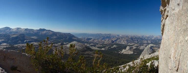
Cathedral Peak Panorama west - 9/2013
Reload page to see different photo.

All web site content except where otherwise noted: ©2026 Bill Bushnell
Background texture courtesy of Iridia's Backgrounds.
Please send comments or questions to the .
On the Drive There, September 6, 2024 - This year my drive to Mammoth was unusually long. During most of September Caltrans had completely closed US-395 between Sonora Junction and Devil's Gate Summit because they were installing wild animal crossings to aid in the latter's migration. A worthy cause, but an inconvenience for me.
I could drive through Yosemite, but the steep $35 fee just for driving through was exorbitant. The official detour was on a route through Nevada's Smith Valley and up the East Walker River Canyon past Bridgeport Reservoir before reconnecting to US-395 south of Bridgeport.
My plan was to take CA-88 across Carson Pass, the same route my tow-truck driver took when he ferried me and my disabled van home from Mammoth in early summer of 2022. I could then stop in Gardnerville, NV to take advantage of lower gas prices when topping off my tank. The entire trip would be about 1-1.5 hours longer than the shortest route through Yosemite, and about 45 minutes longer than my usual route over Sonora Pass. I'd also get to drive some roads I had never driven before and probably have no reason to drive in the future, so there was some novelty factor. I encountered a couple of brief rain showers as I was driving through Wellington in Smith Valley, but otherwise the drive was uneventful.
I left home at 0820, got to Gardnerville, NV around 1230, filled up the tank, but with the exception of two more bathroom breaks along the way, I did not stop until I arrived in Mammoth Lakes around 1600, meeting up with Frank and Stella inside the Vons market in town while we were buying our groceries for the week. The drive was long but not unbearably so. Fortunately, on the eastbound trip I sit on the shady side of the van, so I didn't get too hot.
| GPS track: | GPX |
|---|---|
| Distance: | 1.7 miles |
| Cumulative climbing: | 480 feet |
| Total Time: | 3:41:55 |
| Hiking Time: | 0:33:16 |
Gong Show and Iris, September 7, 2024 - On our first full day in the mountains we got up somewhat late and planned (A) to climb at Iris Slab near Iris Meadow Campground if we could enjoy the place to ourselves. Unfortunately, a party of four youngsters had arrived a few minutes before us, and it didn't feel right for us to horn in on them at the Slab.
Our second plan (B) was to drive up to Mosquito Flat to do a hike into Little Lakes Valley. When we arrived at Mosquito Flat around 1000 we found not only the parking lot full, but just about every spare space to park along or near the road within two miles of the trailhead already occupied. I had never seen this trailhead so crowded in the past, but it had been a long time since I'd been up there on a summer weekend. This place is popular.
Our backup plan (C) was to scout one or more of the sport climbing areas along Upper Rock Creek Road. We drove down to a large parking area across the road from Big Meadow Campground and began a short but non-trivial hike up to The Gong Show wall on the other side of the canyon, this time bringing our climbing gear.
The hike to the climbing area involved a slightly scary crossing of Rock Creek that was flowing swiftly, and then a scramble through a forest and up talus to the base of the wall. A use trail helped guide us, so we didn't get lost along the way, and even better, we appeared to have the place to ourselves, at least for the moment.
While crossing Rock Creek I started to cross a long level log, but I got about 12 feet away from the shore and was suddenly too wobbly-kneed to continue. The single log offered little in the way of sideways support should I start to lose my balance, and the crossing was too long and high above the water for me to plant the ends of my trekking poles into the stream or to risk that I wouldn't lose my balance and fall in at some point before I reached the other side. So, I returned to the broken log Frank had found with lots of spikes that offered decent hand holds but required a bit of scooting to cross safely.
After we arrived at the base of the Gong Show wall Frank laid out the gear, and we spent some time practicing setting cams and nuts and working on our clove hitches until it was in our muscle memory. I'm afraid I spent far too much time learning how to set a girth hitch, thinking it was a clove hitch.
After we had spent time practicing other parties started to arrive, although they were more interested in other parts of the wall. After some discussion I cajoled Frank and Stella into showing me Iris Slab on the way back to the condo. Perhaps the other party had finished for the day.
We hiked down to the creek crossing again at Big Meadow Campground, and while I was waiting for Frank and Stella I saw a young guy carrying a bulky pack across my "fright log" without a care in the world. Sigh.
| GPS track: | GPX |
|---|---|
| Distance: | 0.7 miles |
| Cumulative climbing: | 190 feet |
| Total Time: | 0:43:02 |
| Hiking Time: | 0:17:56 |
At Iris Meadow the other party's car was still parked, but looking across at the slab itself we saw no one climbing on it. So, we started over and then up the short climb to the slab's base. The other party had just finished and were on their way down when we arrived.
We didn't climb here as the day was getting late, and we didn't have time to do any climbing, so we left our climbing equipment in the car. After taking some photos we returned to the car, and then drove back to the condo. For the day we got in two short hikes and some practice setting protection and hitches.
Around the Condo, September 2024 - At the condo we enjoyed our own home-cooked meals every day, and spent time resting before and after our big day on Crystal Crag.
| GPS track: | GPX |
|---|---|
| Distance: | 9.8 miles |
| Cumulative climbing: | 1850 feet |
| Total Time: | 5:49:11 |
| Hiking Time: | 3:39:13 |
North Dome, September 8, 2024 - On our second full day at altitude we decided we had to do a hike of some consequence. We discussed returning to the East Ridge of Mount Conness to continue scouting a route to the summit, but we ended up deferring that plan until our last day when the stress of anticipation and preparation for our mini-mountaineering adventure on Crystal Crag was behind us. It seemed appropriate for us to do a hike on a trail that we hadn't done before that wasn't too difficult but was a classic.
When Frank divulged that he had snagged a Yosemite reservation for the day, I floated the idea of Clouds Rest from Tenaya Lake. Although it is an easy hike, it is rather long with a long drive in addition.
Then I suggested we try the hike to Indian Ridge or North Dome. Frank and Stella had done neither, and it had been many years since Dad and I had made the trek out to North Dome in 1987. We settled on North Dome, with the option to add a short cross-country out-and-back to Basket Dome if we had time and energy.
We got up somewhat early as the drive there and back was long, about 1.5 hours each way. But, with the Yosemite reservation and Frank's Senior Lifetime Pass we breezed through the entrance at Tioga Pass, stopping only long enough for the ranger to gaze briefly at our paperwork.
The Porcupine Creek Trailhead was almost full, but we found a space at the very end. So far, we were having better luck today carrying out our plans.
The trail to North Dome is mostly an easy walk through the forest without much in the way of views. The trail starts as an asphalt road for the first half-mile, then becomes a dusty well-worn trail. We saw several parties along the way, most of whom overtook us two or three times--they must have stopped off the trail at various spots while we mostly kept moving.
As the terrain opened up, becoming broad slabs, we could see North Dome below us. Like Mount Watkins to the east, North Dome is a summit to which one descends from Tioga Road.
At the summit of the Dome we took our usual group photos and panoramas and enjoyed the sweeping view of Yosemite Valley, Half Dome, Mount Starr King, and Clouds Rest nearby. After taking our photos we descended the dome to its low point where it connects to the ridge to the north and found a comfortable log on which to sit and eat our lunches.
After lunch we started off through the forest toward Basket Dome, but the land was uncomfortably sloped and covered in downed trees, most of which featured rough logs covered with spikes where branches had been attached. Many opportunities for scrapes, lacerations, and contusions. The going was slow.
Suddenly Stella announced she had left her trekking poles at our lunch spot, and returning to retrieve them, decided not to continue with us. Meanwhile Frank and I tried to stay high in the forest to avoid additional descending and climbing, but this turned out to be a bad decision as the terrain only became less passable. A better route would have been to descend from our lunch saddle to the east where the terrain was flatter and more open, then climb up to Basket Dome.
I could tell Frank's enthusiasm for the bonus effort was flagging, and to be honest mine was, too. We were all tired today, and the prospect of even a short off-trail exploration and all that entails followed by the uphill half of the hike still to be completed didn't increase our enthusiasm. We finally found ourselves climbing so high on the slope that we arrived back on the official trail near the spot where it makes a sharp hairpin to the south to climb up to the slabs north of North Dome. It was too easy at this point to abandon our quest for Basket Dome.
We started our long, uphill hike back to the trailhead, taking the trail directly up the slabs instead of the switchback we had descended. At the trail junction for Indian Rock we quickly decided we had only enough energy in us to return without doing extra. Indian Rock will be there on our next visit.
On the way back to the trailhead I got ahead of Frank and Stella, so I waited at a comfortable rock where I noticed I had cell service and spent some time catching up on email and messages while I let them get ahead. I didn't see them again until shortly before the trailhead, but the timing worked out. They didn't have to wait for me.
One benefit to skipping the extra destinations was that we arrived back at the trailhead at 1600, and back at the condo in Mammoth at 1730, leaving us time to shower and prepare dinner in a leisurely fashion.
| GPS track: | GPX |
|---|---|
| Distance: | 2.2 miles |
| Cumulative climbing: | 220 feet |
| Total Time: | 1:30:48 |
| Hiking Time: | 0:49:06 |
Horseshoe Slabs, September 9, 2024 - The day before our big day on Crystal Crag, we decided we needed to rest up and take it easy. One idea was to hike around Horseshoe Lake and explore the future climbing possibilities at Horseshoe Slabs. We could also use it as a dress rehearsal to carry our climbing gear as we will on the next day's climb.
I took the phrase "dress rehearsal" literally, and wore everything I would for the climb, which made me look a little silly for a walk around the lake. But, the purpose was to make sure it would all work tomorrow.
At Horseshoe Slabs we saw a couple of parties climbing, but again we didn't climb ourselves. Today was purposely a rest day.
After returning to the condo in the early afternoon I spent a couple hours reading, watching YouTube videos, and napping while toddlers in the condo next door alternately laughed, screamed, and wailed. It felt wrong to make any extraneous exertion that would harm our performance for the next day, and the stress of anticipation was palpable. At one point it felt like we were awaiting an execution.
| GPS track: | GPX |
|---|---|
| Distance: | 4.5 miles |
| Cumulative climbing: | 1210 feet |
| Total Time: | 10:12:16 |
| Hiking Time: | 01:58:09 |
Crystal Crag, September 10, 2024 - This was our Big Day, the day around which all of our other activities in Mammoth had been planned.
At our virtual meeting in late August with our climbing guide, Joann "Jo" Garbarini and her partner Gerry Egbalic, we had agreed all to meet at the Lake George Trailhead at 0700 today. That meant we had to rise sometime between 0400 and 0430 if we wanted to enjoy a leisurely wake-up, something that we all value. They convinced us that the early start gave us options in case of bad afternoon weather or other unforeseen circumstances that might cause delay. With the early start we didn't have to worry about finishing after dark, and in hindsight I have to agree it was a good plan.
We managed to get ourselves ready to go by 0630, and by 0640 we were in the van driving up to the trailhead, arriving a few minutes before 0700 where Jo and Gerry were waiting for us. We were on time!
After re-introducing ourselves we holstered all of our gear and began the short but steep climb to Crystal Lake.
Jo led the way at a pace that allowed us to hold a conversation, and we stopped a couple of times to take photos of our goal for the day. It was good to see Jo again after I missed coming to Mammoth last year, and during our hike up to the Crag I got to know our other guide, Gerry, a little better.
At Crystal Lake the trail descends slightly before crossing the lake's outlet and circling the east side. Shortly after crossing the outlet we started up a use trail to the left that led us eventually to the base of the North Arête, where we would begin our climb proper.
We planned to return to this spot after our descent, since it wasn't far out of the way, so we could leave equipment here that we did not expect to need on the climb itself, such as trekking poles, belay glasses, and anything else we deemed redundant.
Jo and Gerry provided ropes, anchors, slings, and cams we would be using to protect the climb and we each carried a PAS (Personal Anchor System), a few slings and carabiners (that I didn't end up using), a belay device and locking carabiner for the rappel, and a prusik cord for the third hand. I also brought my helmet and climbing shoes. My trail runners that I had used on the hike up from the trailhead I would have to carry as I would want these for the Class 3/4 descent after the technical part of our down-climb.
Jo had climbed this exact route two days earlier and had reported cold wind and no sun on the climb until near the summit. The summit of Crystal Crag stands just above 10,000 ft (3100m), and our climb started only about 400 feet (120m) lower. I wore two layers below the waist, and four layers above: hiking pants and padded leg-warmers that I also use in the gym to prevent knee and shin scrapes, a cold-weather base layer upper, two long-sleeve layers, and a wind shell. One of the long-sleeve layers had a hoodie, and I used it under my helmet to keep my head warm. I wore fingerless gloves on the climb. I was just warm enough not to be uncomfortable on the climb given the amount of waiting in the shade and cold wind at each pitch we would endure.
The plan on the climb was for Jo to lead, then belay Stella and Frank in that order on separate 40m ropes using Jo's protection. Frank would clean Jo's route. Gerry and I would climb as an independent team following Frank. Gerry would lead, and I would clean his route.
Since Gerry used a 60m rope we would climb the route in three pitches, the third being the longest. Part-way up the third pitch I would pass Stella and Frank and arrive at the summit before them. But, in exchange for that I would be last to start climbing each pitch.
Being last to start meant I could watch the others at least start their climbs, and doing so yielded some benefit.
The start of Pitch One enters a chimney that is usually exited to climber's left by stemming with the right foot on the right face of the chimney near its top. The move is not difficult if one recognizes it, but can be baffling otherwise.
Since Stella climbed first she enjoyed no beta and found herself at the overhanging rock at the top of the chimney, unable to move further. Fortunately, Gerry was watching nearby, and he quickly solo'd up to Stella's position and gave her the necessary beta to proceed. Frank found himself in a similar position, but he somehow managed to extract himself from the chimney without stemming. According to Jo this move out of the chimney is the crux of the climb. But my crux awaited further up.
After the chimney extraction maneuver the climbing is mostly easy Class 5 up to the first belay station, meaning that at many spots along the route one could pause to rest and evaluate how best to make the next move or two. I took advantage of these opportunities to catch my breath.
Although Gerry and I hadn't discussed it beforehand, he kept me on a tight belay, which I appreciated. Only once or twice I asked him to give some slack so that I could un-hook the rope from the rock while traversing, but otherwise I has happy to know that should I come off I wouldn't fall far.
Once I arrived at the first belay station, Gerry saw that I was properly clove-hitched to the anchor before preparing to lead Pitch Two. Jo had already continued up to the second belay station, and Stella followed shortly after my arrival. Frank and I briefly compared notes on Pitch One, but otherwise we were more focused on staying comfortable.
Unlike the base of the climb the belay stations did not offer much of a view of the route above. I was unable to glean any beta from what my companions were doing once they got out of sight.
Shortly after Frank started up, Gerry started up Pitch Two, but he took a slightly different route to climber's right of the route Jo, Stella, and Frank took. I wondered if Gerry's route would be more difficult, but I needn't have feared. When I started up Pitch Two I found it the easiest of the three pitches, mostly Class 4. At one point I encountered a huge clamshell jug sticking out from the wall that almost looked too delicate to be pulled on with any force.
The second belay station (between Pitches Two and Three) had more space for us to wait comfortably. Again I waited while Stella started up to climber's right before disappearing into another chimney. Ten minutes later Frank did the same. Again, I could not see what my companions were doing, so I could glean no beta from their efforts.
Before Gerry started Pitch Three he asked me to keep his belay loose enough to be slack the entire time. (I had been letting the rope momentarily go taut before giving slack as he led the first two pitches as I couldn't see him climbing.) As he climbed I watched his pile of rope dwindle until only one loop was left. I radio'd to tell him I was almost out of slack. And he still pulled some of that. His 60m rope was just barely long enough for the third and final pitch to the summit.
When it was my turn to start climbing, I followed the same route into the chimney. At first this was similar to the chimney on Pitch One, but near the top of this chimney as the rock flattened and became more like a dihedral, I was put to the test (between four and six minutes into the first part of the Pitch Three video clip).
I tried to stem as I had on the first chimney, but my right foot slipped off the rock that was more slick than it appeared. My left hand had a good grip, and for a moment most of my weight was on my left arm. Yikes! I tried again with the same result. Then in desperation—I really didn't want to hang-dog on this—I tried lie-backing with both feet to climber's left. Then I slowly crawled my way up, my right side lying against the rock that my right shoe had been unable to grip.
I found sufficient purchase for my feet or I would have come off, and after a few more labored but careful lie-back moves higher the terrain got easier.
Probably I had chosen the wrong approach or hadn't found or maintained an adequate right-foot placement on the slippery rock. If I had lie-backed initially I would have spared myself some difficulty, but I usually don't look for a lie-back as my first choice as that places extra strain on the fingers and arms.
Soon I came into view of Stella and Frank who were waiting together at an anchor on a wide platform near the bottom of the quartz crystal band.
I had some trouble contacting Gerry by radio, and I discovered that I hadn't put my radio into "dual watch" mode. During my desperate moves my radio had come off its clip and was hanging loose on its lanyard, and one of its control buttons had been accidentally pressed, changing the channel. Frank held out his radio for me to speak into, and I was able to get through since Jo and Gerry were together at the summit by this time. I wasn't yet done with Pitch Three.
Through the quartz crystal band every step I took seemed to loosen rock to tumble down the cliffs below. I yelled out "Rock!", but fortunately I don't think any other climbers were on the route today.
The last part of the climb was fairly easy, the hardest move being a short traverse on a narrow, three-inch ledge that was not difficult to execute. Once I arrived at the top I was in the sun! Gerry assigned me a "seat" above both he and Jo who were busy coiling rope, sorting gear, and belaying Stella then Frank to the summit.
Once we were all on the summit we assembled next to The Crystal for a group photo and a brief snack break before starting what Gerry had warned was the hardest part of our adventure: the descent.
Our descent started with a short traverse over large blocks from The Crystal to the top of a mentally challenging Class 4 down-climb.
On this first down-climb we would be descending near vertical terrain to a small dirt patch about 40 feet below. I suppose our down-climbing practice in the gym was preparation for this very spot.
I went first while Gerry belayed me with a Munter hitch. I wondered why he didn't use a standard belay device (ATC, Grigri, or similar) in case I had trouble, and he would have to lower me. (Lowering on a Munter puts extra stress on the rope fibers and shortens the life of the rope.) He did not expect to have to lower me and at worst if I came off he only needed to hold me until I could find the proper hand/foot holds to continue down-climbing. I hoped he hadn't over-estimated my ability.
My main fear was that I could not see far down the wall, whether I had proper hand/foot holds available all the way to the bottom. I would have to trust my guide that this was do-able. This was also the first time I had been belayed on a Munter, but knowing in theory that this was sufficient for my safety I gave it no further thought and concentrated on finding the best holds so that I could down-climb the entire way and render the belay redundant. I didn't want to disappoint my guide.
So, over the lip I went, holds unseen. To my pleasant surprise I discovered that the down-climb was not as difficult as it appeared from above. Good hand and foot holds seemed to appear just as and where they were needed. Occasionally I hesitated before committing myself, and Gerry, who was leaning out over the edge to watch my progress would prompt me to go one way or the other. Some of the steps were quite high, forcing my higher leg into a deep knee bend before my lower foot found a solid placement. I wondered for a moment how Stella might manage these large steps, but I've learned that in such situations she usually finds a different sequence that I might have dismissed as too cramped, better suited to her shorter limbs.
After several minutes of careful down-climbing I found myself on the dirt patch, after which Gerry joined me. He then started to lead me on a route back up to the ridge, to a higher point than we had been previously. It was at the south end of this next summit along the ridge that we would find the rappel station.
The climb back up to the ridge was Class 3 and was not technically difficult.
From the summit near the rappel station I could see the true summit of Crystal Crag, the South Summit across a deep cleft in the ridge. When I first envisioned our climbing this peak I had hoped we would have time to tag the south summit, and it did appear tantalizingly close. But, I was already getting fatigued from what I had done thus far, and at this point saving my energy for the as yet unknown descent was a higher priority.
I looked back toward where we had just been, and I could see Jo, Stella, and Frank at the bottom of the prior down-climb. They would soon join us on the ridge near the rappel station.
It was decided that Gerry would set up his 60m rope and rappel first. From the bottom he would use a Fireman's Belay as a backup to our managing our own rappel. I wanted to set up my prusik (auto-block) as a third hand, but Gerry thought this would be redundant and would take too long. I probably should have made clear to him that this was my first experience rappelling, but I suspect now that at the time he thought I had more experience rappelling than I had.
When it was my turn to start down I held the brake between my legs, but then shifted it to one side. I forgot to turn on my helmet cam, so busy was I concentrating on the essentials of my first rappel. The rappel was not vertical but down a lumpy slab with occasional overhangs that made it difficult to stay facing the wall. To make matters worse, features in the rock looked convenient to help steady me as I descended. But, this was the wrong kind of thinking.
At one spot half-way down I instinctively reached out to grab two nice hand holds on the rock to keep myself from tumbling sideways, and this meant I let go of the brake side of my ATC, a Big No-No when rappelling. Of course I knew not to do this, but my instincts at the moment were wrong. I was still in climbing/scrambling mode, not in rappel mode where my First Rule is always to control the brake side of the rope and to lean back onto the rope and not think of grabbing the wall. I suppose this is why many climbing accidents occur when rappelling, and why it is important to use a third hand especially for the inexperienced rappeller such as myself.
When Gerry saw me do this he barked, "Don't let go of the brake side!" as he pulled his end of the rope taut, keeping my brake "on". My scolding was appropriate, and I briefly felt like an idiot.
The remainder of my rappel was fitful and slightly awkward as I might expect for my first, but I was determined not to tumble sideways, let go of the brake, or make any further rookie errors. I got to the bottom without further incident.
From the base of the rappel it looks like one can climb up to the south summit, but by this point I felt that we could leave that for another occasion. Now we were in the sun and sheltered from the wind, so I peeled down one long sleeve layer and my shell, and I changed out of my climbing shoes and into my trail runners. The remainder of our descent was mostly Class 3 scrambling with perhaps one short Class 4 down-climb at the very bottom.
After I rappelled, Stella joined me, then Frank, then Jo. It seemed to take quite a while for all of us to assemble at the bottom of the rappel, but the waiting was comfortable in the warm sun.
For the Class 3 descent Jo put me and Stella on a Short Rope, while Gerry and Frank descended last. Again I went first.
Most of this descent was the kind of off-trail stuff we've done before, but because some of the spots were across the tops of short cliffs, our guides thought it best that we be roped up in case of a slip. Jo advised us not to let too much slack in the rope between us, which meant we had to down-climb at the same pace.
I had some trouble working out the physics of the situation if I were to have slipped or fallen. Would Stella and Jo be secure enough to arrest it? I didn't want to test the arrangement, so I took great care not to slip since I was the heaviest of the three, and I didn't want to pull Stella off balance, nor Jo, if I had.
At the very bottom of the descent we had to down-climb a narrow cleft in the rock, the only part that might be considered Class 4 due to its verticality. Here Frank and Gerry went first, then I followed, then Stella and Jo. Again there was a large down-step at the bottom, but we all made it down without too much trouble.
From here we had a short walk on a use trail along the base of the crag to return to the base of our climb, where we had stowed some of our gear.
After retrieving our gear we started down the use trail to the maintained trail at the outlet of Crystal Lake, then proceeded down to Lake George, arriving at the parking lot at 1700, giving us plenty of time to put away our gear, say our goodbyes, and get back to the condo for a non-rushed shower and dinner.
Today was the Big Day of our week, and it lived up to that hype. Although I had my doubts at various times, and I even screwed up at one point or two, I survived with only sore muscles and one minor nail injury to my left index finger. The adventure was just the right length to make for a full and fun day, without becoming epic. Our able guides kept us safe and gave us the confidence to succeed, even if there were moments of discomfort. It was all part of the mountaineering experience. I do hope we climb again with Jo and Gerry in the future!
I've included a link to a video of our group experience that Frank edited and assembled from all of our source material, stills and videos. Click on the "V" at the lower right corner to see it in full size on Vimeo's web site.
Although the stress of anticipation of our adventure was gone, the next morning we were too tired for another big hike, so we rose late, took a short walk around town, then returned to the condo to read and nap so that we could be well-rested for our last full day in the mountains.
| GPS track: | GPX |
|---|---|
| Distance: | 6.9 miles |
| Cumulative climbing: | 1880 feet |
| Total Time: | 6:43:32 |
| Hiking Time: | 3:16:55 |
Conness East Ridge, September 12, 2024 - In 2022 we had explored a route to the East Ridge of Mount Conness that went past Alpine Lake, then up into the high basin to the south of the East Ridge. Then our turnaround time came (and went) before we abandoned our efforts. But, the way appeared to be viable as far as we got.
As we descended in 2022 we found a large cairn marking a route out of the hanging valley through a cleft in the cliff on the east side of this basin. From above the route looked too steep and technical for us to want to try descending it, and we were already behind schedule. But, this year we decided to explore this route from below, the idea being that if we could climb it, we could always descend via Alpine Lake as we had in 2022.
We found the spot where the climber's route leaves the well-established use trail, but we quickly got off-route as we climbed. It's always easier to follow a use trail that descends terrain than one that climbs because one can't see the trail from below as easily as from above.
After climbing some distance we saw a couple of women descending quickly on what appeared to be the climber's route, so we managed to get back on-route again.
As the route neared the cleft in the cliff it crossed a high angle slab that looked like it could be dangerous to step upon when wet. Our weather was clear and dry, but I still found a way to avoid most of the slab.
But not far past the slab we encountered our first Class 3 problem: a short but significant bouldering move up a now dry seasonal watercourse. I could see a way to get up this, but the hand holds were not great, and as it turned out the footholds offered poor friction for my old hiking boots.
With more than a modicum of overconfidence after our successful outing on Crystal Crag, I started up, and after a couple of moves I regretted my decision. My right foot slipped off the intended pocket in the rock, and my hands and fingers weren't having much fun keeping me on. I was already up about 7-8 feet above where Frank and Stella stood, so I had to finish this. If I had slipped only pointy, hard rocks awaited me below, not a nice, thick, cushy gym mat. I did finish the short climb, but as soon as I was on stable ground about 10 feet up I got spooked and didn't even have the presence of mind to hike further to evaluate the next technical challenge along the route.
One unwritten rule we have is that when soloing anything we make sure we can descend whatever we can climb and assume there is no easier way available. I had broken that rule, and now I had lost all interest in continuing and wanted to get down now!
Stella explored for an alternate route, but she didn't find one. Frank agreed to spot me as I down-climbed, and this went more easily than I expected. I thought Frank might then want to try climbing it himself, then continue to evaluate the next obstacle, and I offered to spot him if he wished. My old hiking shoes slipping on the rock didn't feel safe, but perhaps his newer shoes would do better. Climbing shoes that we didn't bring would have felt more secure.
Neither Frank nor Stella showed interest in continuing. We had brought neither rope nor other climbing gear, so we would be soloing this and other problems along the way. Yes, maybe we underestimate ourselves, but doing so keeps us out of trouble. Even with gear one of us would have to lead, and setting up and retrieving a rope at each of the problems would consume much time.
I still wanted to try to find a Class 2 path around the cliff band, but I could see that our turnaround time was quickly approaching. I proposed we head down this route a short distance, then make a bee-line for the low spot on the East Ridge where we could enjoy a view into Twenty Lakes Basin while we ate lunch. So I set off in that direction, hoping the new goal could be attained.
We did eventually get to a spot on the East Ridge with a nice view, and we did eat lunch there. We were a little past our turnaround time, but I didn't worry about this as we weren't planning to descend the same route we had hiked thus far but to take a more direct route down the south side of the ridge that we had climbed in 2016 when we first explored this area, which I knew was do-able. We could afford to be a little late at this point.
We ate lunch, took our group photo, then descended at first over terrain that was nearly level before our route sloped down more steeply to the well-worn use trail below. From here it was a short walk back to the dilapidated research hut and then a cross-country mostly uphill hike back to the Saddlebag Lake Trailhead.
By the time we arrived back at the car we were all tired and ready to enjoy relaxing on upholstered seats. The drive back to Mammoth was uneventful, and we arrived at the condo at 1730, still early enough that we had time to shower, eat dinner, and do some packing and organizing in preparation for our move-out the next day.
On the Drive Home, September 13, 2024 - My drive home went similarly to my drive out as I simply reversed my route. I thought of returning through Bakersfield. Although that routing would have been mostly on freeways or divided highways, it was almost 100 miles longer than my planned routing through Gardnerville, and it would be nearly entirely in hot sunny weather, and my van does not have air conditioning.
As it was my drive home was hot. I had clear weather the entire way. Driving west I find myself more often sitting on the hot side of the car with the sun beating through the windows. My lap especially got hot, and there was little I could do to prevent that.
I stopped only three times on the way home: two quick breaks for Number One, and once in Gardnerville for gas, where I noticed with some dismay that the price per gallon had increased by 30 cents in 7 days. I arrived home at 1630, about six-and-a-half hours after I left Mammoth.
Frank and Stella's Mammoth 2024 web pages - For a different perspective see Frank and Stella's web pages of the same holiday.
All web site content except where otherwise noted: ©2026 Bill Bushnell
Background texture courtesy of Iridia's Backgrounds.
Please send comments or questions to the .