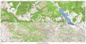
Old Hernandez Rd. to Hernandez Reservoir detail map
2006/05/27 10:50:00 |
|
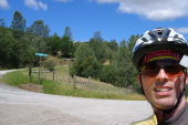
Bill at the south end of Old Hernandez Rd. (1830ft)
2006/05/27 10:52:43 |
|
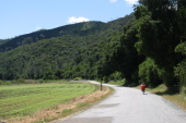
Riding southeast on Coalinga Rd. through the southern San Benito River valley. (1900ft)
2006/05/27 11:12:52 |
|
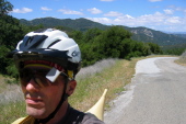
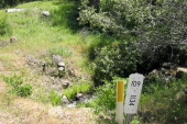
Bill climbs the steep part of Lorenzo Vasquez Canyon. (2660ft)
2006/05/27 11:54:02 |
|
Mile 11.34 marks the outflow of Sweetwater Spring. (2880ft)
2006/05/27 12:12:21 |
|
Laguna Valley Panorama (2880ft)
2006/05/27 12:18:00 |
|
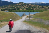
Ron descends to Hernandez Reservoir. (2480ft)
2006/05/27 12:32:50 |
|
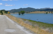
Looking down Hernandez Reservoir. (2410ft)
2006/05/27 12:33:56 |
|