|
|
||
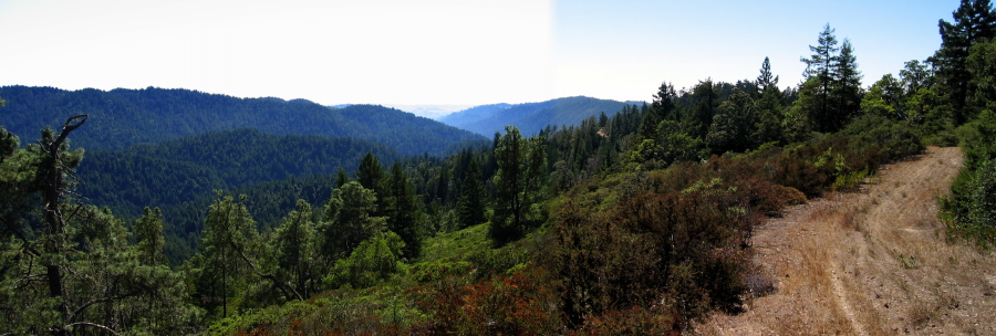
The far ridge is the South Butano Ridge on the northern border of Butano State Park. The far creek is the South Fork Butano Creek. The ridge in the middle is a low ridge separating the South Fork Butano Creek from Butano Creek.
The bottom of the canyon feeds into the coastal plain where Cloverdale Rd. lies.
We turned around here on our hike. The road continues west along a rolling but descending ridge in the direction of Pescadero. The road eventually exits onto Cloverdale Rd., but there are a few other trails leading off the ridge.
File size: 2364462 bytes
Resolution: 4064 x 1377
Page 17 / 30