|
|
||
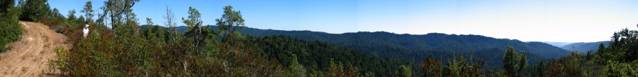
This view is from southeast to southwest across the Butano Creek watershed across to South Butano Ridge and the northern boundary of Butano State Park. The gap in the hills to the right is where Butano Creek flows out to the coastal plain near Cloverdale Rd.
One can see at the left that this section of the Butano Ridge Rd. gets little traffic.
File size: 7172539 bytes
Resolution: 11706 x 1434
Page 16 / 30