| Mt. Diablo LDT, May 2005 | 16/48 | Mt. Diablo Panorama (West) | |
|
Previous | Next |
|
|
|
|
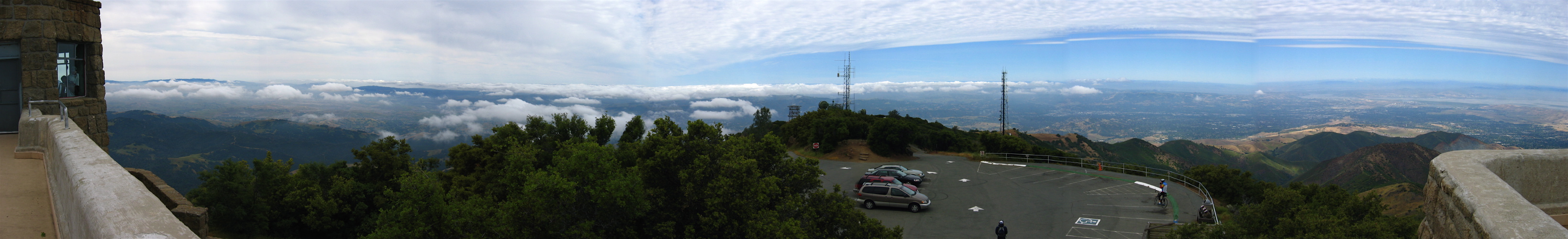
2005/05/28 11:30:00 At the left, one can see part of the observation tower, the Black Hills south of Diablo, patchy fog over the Livermore Valley, the mountains south of Livermore visible above the clouds, and behind the nearest of these mountains one can see the last couple hundred feet of Copernicus Peak (4372ft) and Mt. Hamilton (4210ft) peeking into view. Moving to the right, one can see the San Ramon Valley and fog pushing over Las Trampas Ridge. Further to the right one can see Walnut Creek and Pleasant Hill. CA24 can be seen snaking its way into the hills west of Walnut Creek. At the far right one can see Moses Rock Ridge and lower, Olafson Ridge, descending to Black Point (1791ft) and Mt. Zion (1635ft), partially eaten by a gravel quarry. In front of Mt. Zion one can see Eagle Peak (2369ft, brown colored). Above this one can see Martinez, Concord, and Clayton and the western end of Suisun Bay. And, in the far distance at the top of the haze one can just discern the broad summit of Mount St. Helena (4333ft). |
File size: 4188262 bytes |
Mt. Diablo Panorama (West)
| Load full-size original in new window. |
| Previous | Next |