| Mt. Diablo LDT, May 2005 | 15/48 | Mt. Diablo Panorama (Southeast) | |
|
Previous | Next |
|
|
|
|
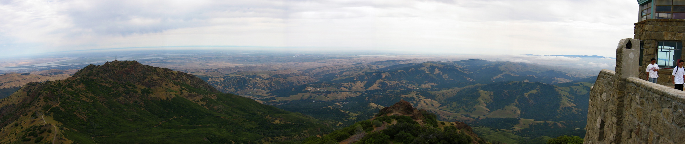
2005/05/28 11:30:00 At the left is the North Peak of Mt. Diablo (3557ft), the Sacramento River Delta is above. To the right is the San Joaquin Valley, and just visible over the low clouds is the snowy Sierra crest. In front of the south face of North Peak is Perkins Canyon. Beyond North Peak is Morgan Territory and Dark Canyon, where Marsh Creek Rd. goes. Moving to the right in the foreground is Devil's Pulpit. In the middle distance is the high point in Morgan Territory (2581ft). To the right one can see fog over Livermore and the more distant ridges of the Diablo Range south of Livermore. |
File size: 2458850 bytes |
Mt. Diablo Panorama (Southeast)
| Load full-size original in new window. |
| Previous | Next |