| First Half of Mr. Bill's, June 2005 | 39/56 | Top of Montevina Rd. (2400ft) | |
|
Previous | Next |
|
|
|
|
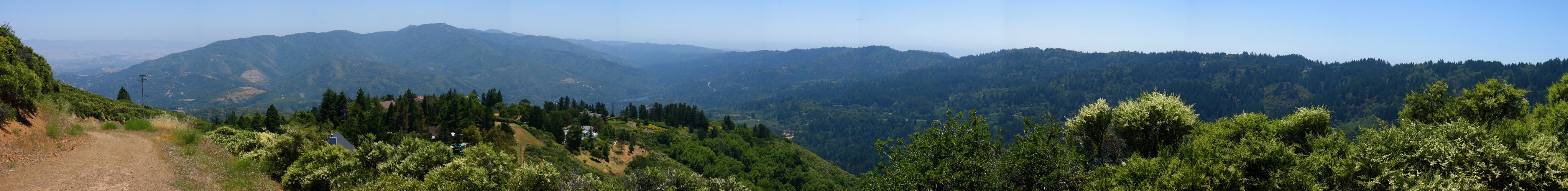
2005/06/4 13:13:24 (l to r): We can see the Santa Clara Valley in the distance, and houses marching up the hillside from Los Gatos into the Sierra Azul, the scar of a partially eaten hill, thanks to the quarry. El Sombroso (3000ft) and Mt. Umunhum (3486ft) and Mt. Thayer (3483ft) are next, and Loma Prieta (3791ft) with its flat top is beyond. The canyon to the right is the Los Gatos Creek Canyon with Lexington Reservoir at the bottom. To the immediate right is Lyndon Canyon. The San Andreas Fault runs through both Lyndon and Los Gatos Creek canyons. One can see the lower reaches of Black Rd. snaking its way up the other side to the top of Skyline Ridge |
File size: 8727001 bytes |
Top of Montevina Rd. (2400ft)
| Load full-size original in new window. |
| Previous | Next |