|
 |
 |
 |
 |
 |
|
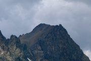
Summit of Mt. Ritter appears to be unoccupied.
2013/09/14 13:44:44 |
|
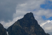
Summit of Banner Peak is similarly unoccupied.
2013/09/14 13:44:49 |
|
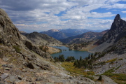
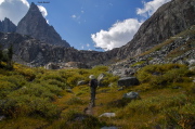
Picture perfect view of Minaret Lake and Riegelhuth Minaret
2013/09/14 13:46:20 |
|
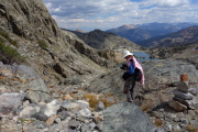
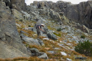
Frank at the top of the Class 3 route from Minaret Lake to Cecile Lake
2013/09/14 13:47:23 |
|
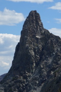
Riegelhuth Minaret from the southern end of Cecile Lake
2013/09/14 13:48:03 |
|
|
|
 |
 |
 |
 |
 |
|
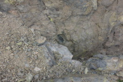
Class 3 chute
2013/09/14 13:51:33 |
|
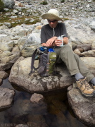
Bill crossly pumps water from a tarn.
2013/09/14 14:10:41 |
|
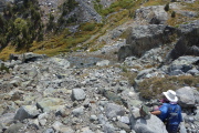
Bill leads the way down to a possible escape route from Cecile Lake.
2013/09/14 14:23:55 |
|
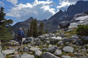
Frank leads the way down the Class 2 route over the top of a broad chute.
2013/09/14 14:29:12 |
|
It looks doable, if loose.
2013/09/14 14:30:56 |
|
|
|
 |
 |
 |
 |
 |
|
Frank reaches the easier lower part of the Class 2 descent.
2013/09/14 14:38:58 |
|
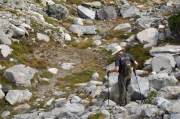
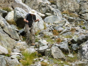
Bill makes his way carefully down the rocky use trail.
2013/09/14 14:39:48 |
|
Bill nears the bottom of the Class 2 route between Cecile and Minaret Lakes.
2013/09/14 14:43:48 |
|
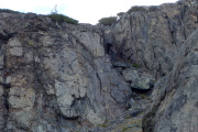
Class 3 route and cliff band we were standing atop earlier
2013/09/14 14:45:35 |
|
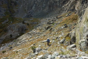
Bill examines the headwall below Cecile Lake.
2013/09/14 14:54:05 |
|
|


