Mike, Steve, and Cheryl.
2010/05/15 11:13:58 |
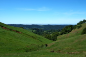
|
View southwest to the coast.
2010/05/15 11:19:55 |
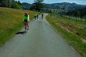
|
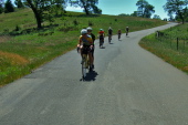
Mike Schnieders descends King Ridge Rd.
2010/05/15 11:21:00 |
|
Nearing the north end of King Ridge Rd.
2010/05/15 11:34:21 |
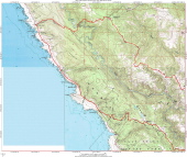
|
Stewarts Point Detail Map.
2010/05/15 11:35:00 |
|
The great Stupa at Odiyan is visible on the far ridge.
2010/05/15 11:36:40 |
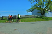
|
Dick and Donna Matthews, Steve Prothero at Tin Barn Rd.
2010/05/15 11:38:31 |
|
Continuing north on Tin Barn Rd. with the "D" group.
2010/05/15 11:52:22 |
|