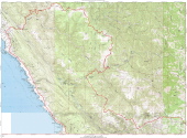
Northern Detail Map.
2009/05/9 12:30:00 |
|
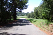
Tin Barn Rd. beckons.
2009/05/9 12:34:25 |
|
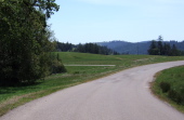
Looking back down Tin Barn Rd. as it winds through a meadow.
2009/05/9 12:35:24 |
|
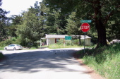
Stewarts Point Rancheria at the corner of Tin Barn and Stewarts Point-Skaggs Springs Rd.
2009/05/9 12:51:13 |
|
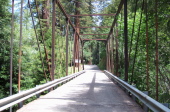
Haupt Creek Bridge on Stewarts Point Skaggs Springs Rd.
2009/05/9 13:13:18 |
|
Crossing Haupt Creek.
2009/05/9 13:13:22 |
|
Annapolis Rd. crosses the Wheatfield Fork of the Gualala River.
2009/05/9 13:15:41 |
|
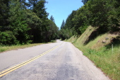
Not much traffic on Annapolis Rd.
2009/05/9 13:21:09 |
|