|
|
||
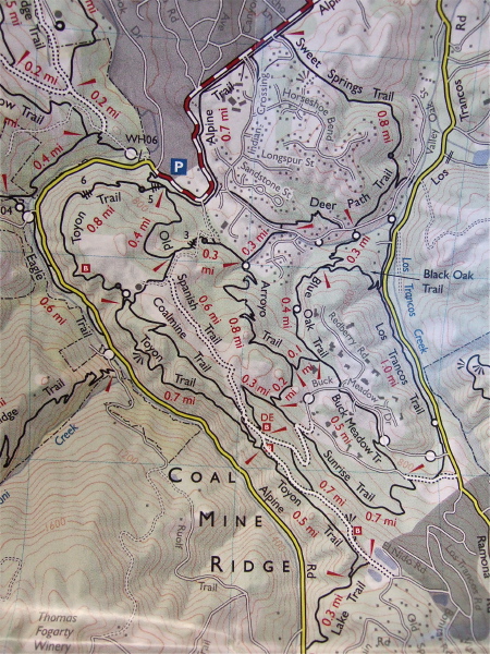
Three of us, Bill Bushnell, David Bushnell, and Steve Prothero, set out to hike a circuit at Coal Mine Ridge, a set of trails between Portola Valley and Los Trancos Woods. Our route took us from the "P" at Willowbrook and Alpine up the hill to the south and along the Toyon Trail. We hiked south to the Lake Trail, stopping to take photos at the Lake, a sag pond.
We then hiked north on Old Spanish Trail, then cut off on Sunrise Trail, taking it down to the Buck Meadow Trail. Then we took Buck Meadow Trail to Blue Oak Trail, and returned up Valley Oak St. to Arroyo Trail, that we climbed all the way back to Old Spanish Trail, where we enjoyed a rest on a convenient bench. We then took Coalmine Trail down to Old Spanish Trail again, and returned to the starting point.
Distance: 8.3 miles
Climbing: 1500 feet
Exposure mode: program (auto)
Metering Mode: matrix
Exposure time: 0.0071 s (1/140)
Aperture: f/2.8
Focal length: 8.0mm (35mm equivalent: 37mm)
ISO: 800
Flash: No
File size: 3994490 bytes
Camera maker: FUJIFILM
Camera model: FinePix F10
Resolution: 2136 x 2848
Page 1 / 10
