|
|
||
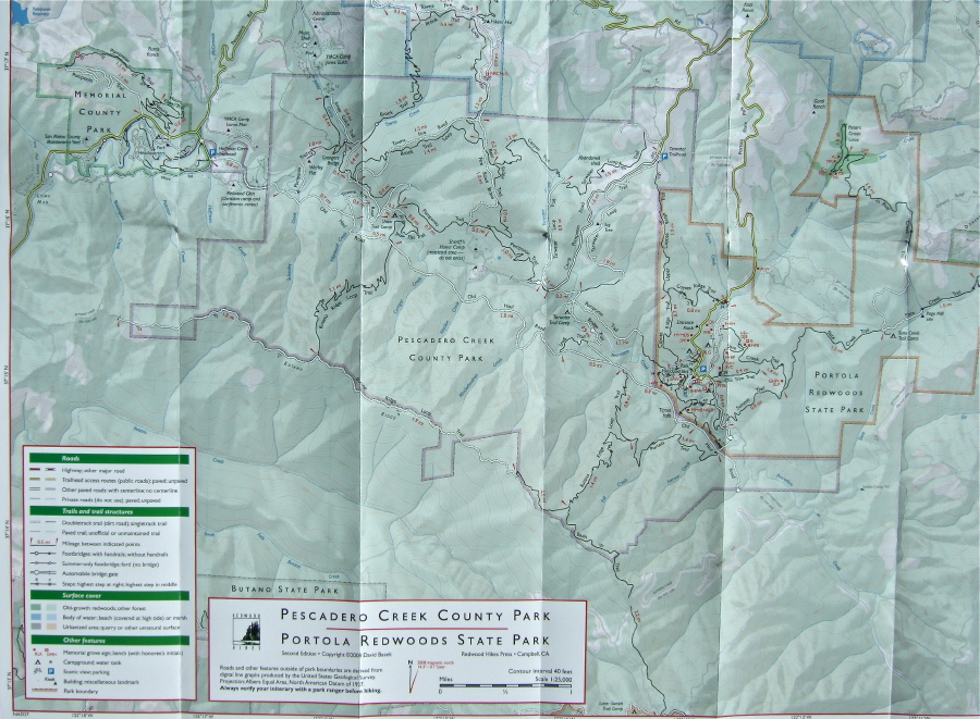
Stella Hackell and Frank Paysen drove my car to the Hoffman Creek Trailhead (near Memorial Park), while Bill and David Bushnell drove Stella and Frank's car to the China Grade Trailhead (just off the bottom of the map). We hiked the day in opposite directions, keeping in contact by way of FM radios.
We met for lunch near the red "1.9 mi" distance label on the Butano Ridge Loop Trail.
Even though the hike spends much time on North Butano Ridge there are few spots with views, and even they are only partial. The most notable characteristic of this hike is its remoteness. It is one of the few places in the Santa Cruz Mountains were no motors or other man-made noises can be heard (aside from the occasional overflying plane).
Distance: 9 miles
Climbing: 800 feet (David and Bill)
2800 feet (Frank and Stella)
Exposure mode: program (auto)
Metering Mode: matrix
Exposure time: 0.0015 s (1/680)
Aperture: f/5.6
Focal length: 8.9mm (35mm equivalent: 42mm)
ISO: 80
Flash: No
File size: 2464079 bytes
Camera maker: FUJIFILM
Camera model: FinePix F10
Resolution: 2832 x 2083
Page 1 / 21